

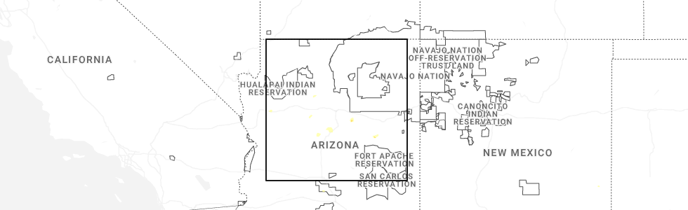
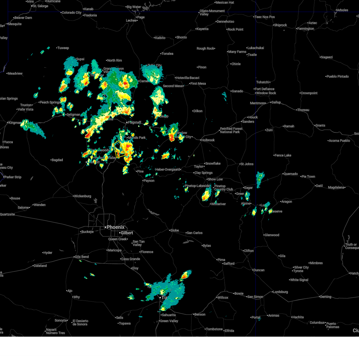
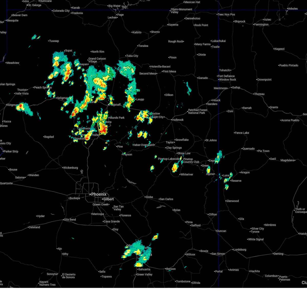
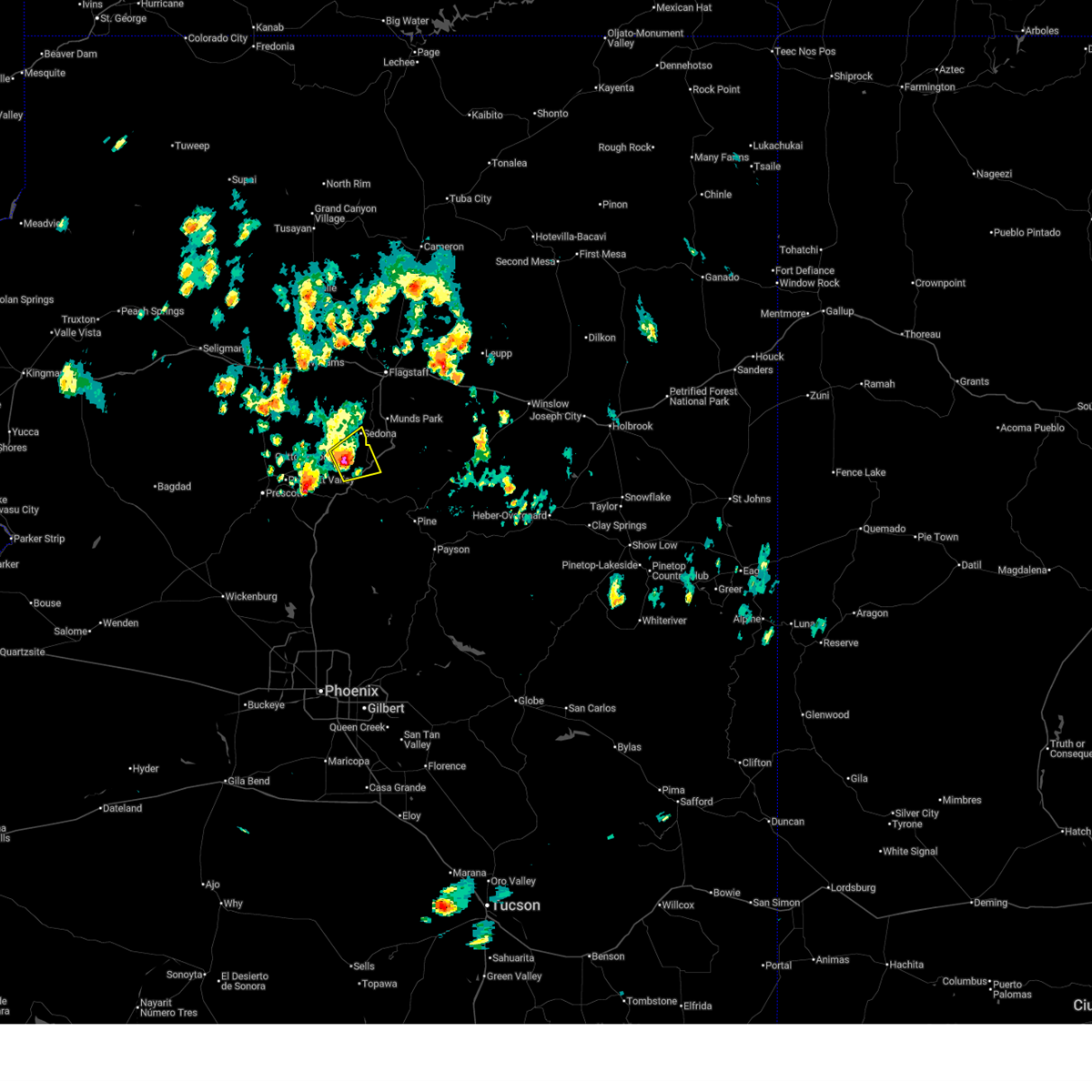
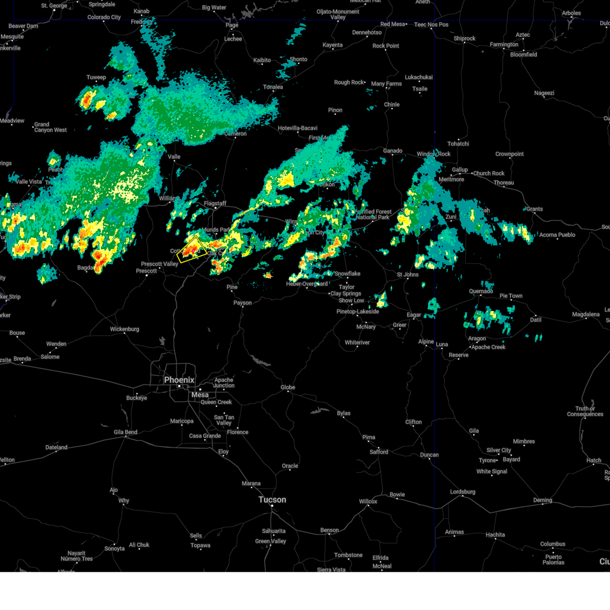
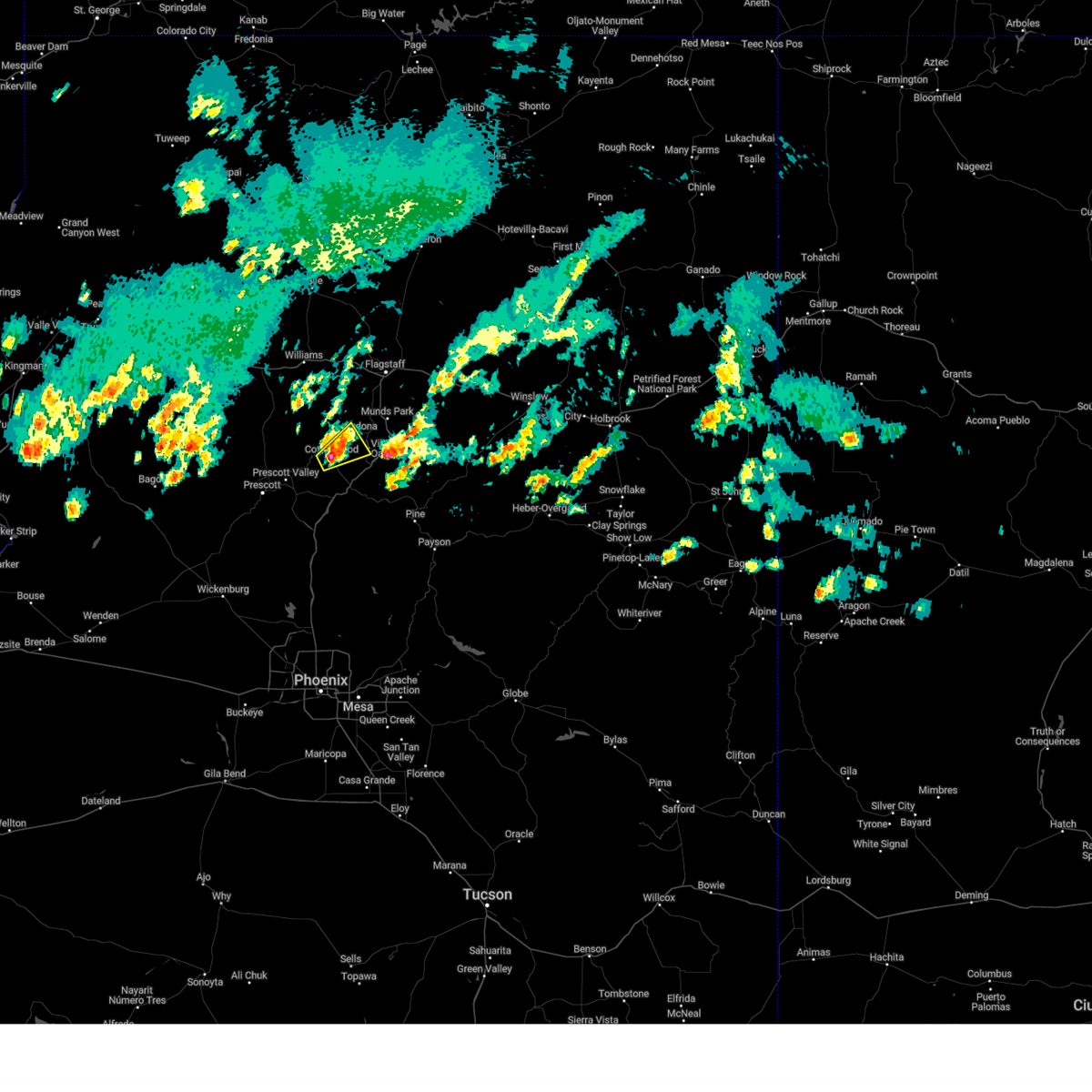
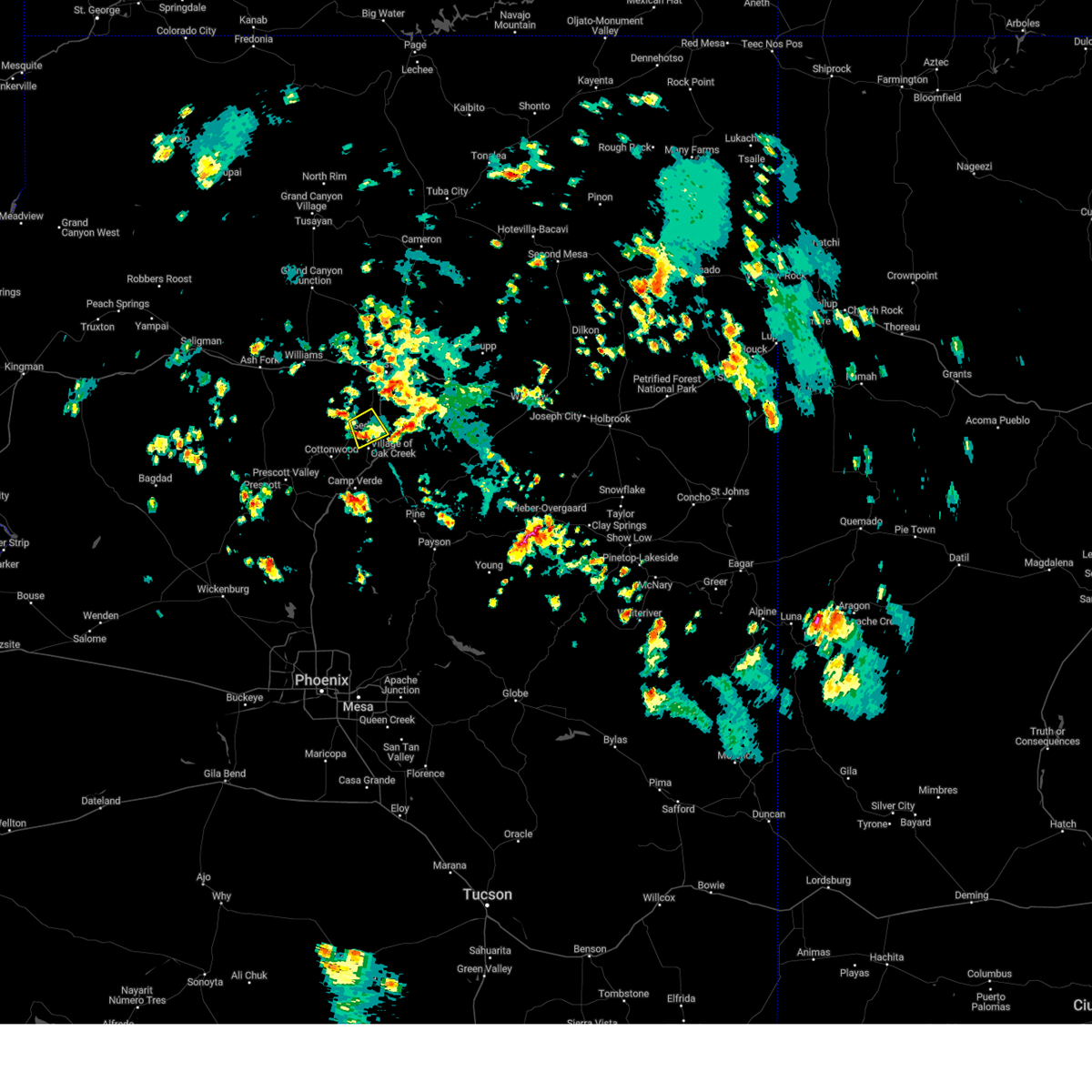
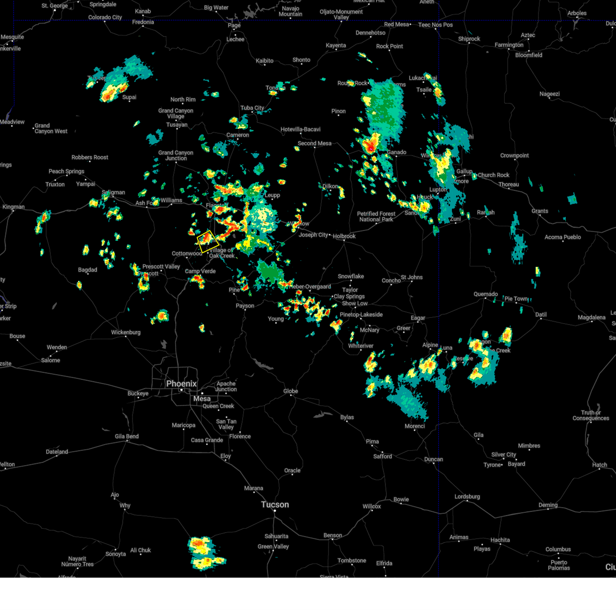
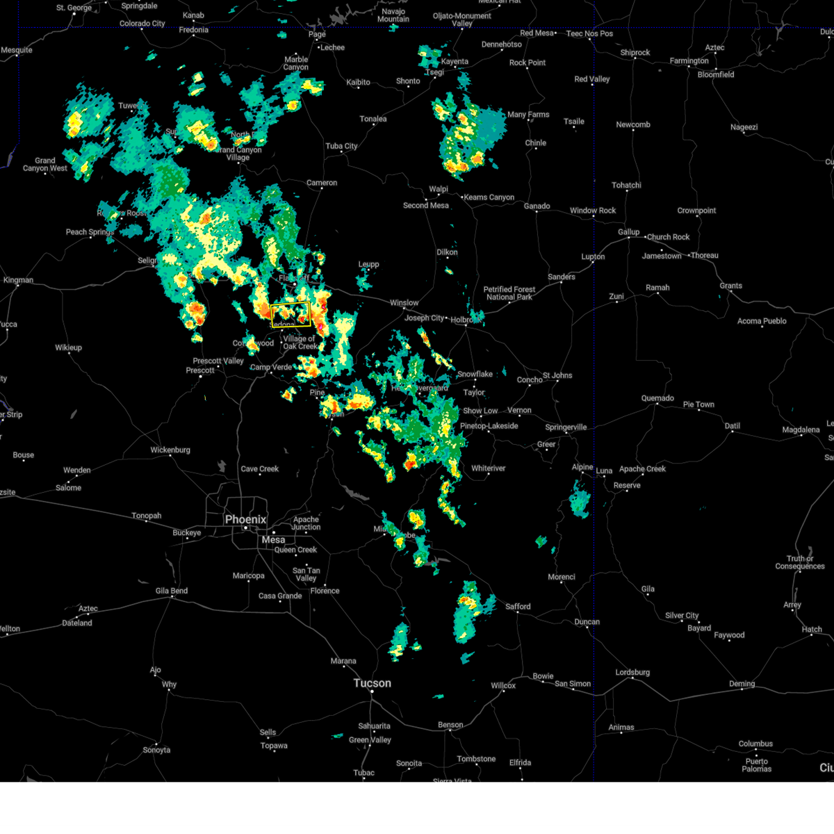
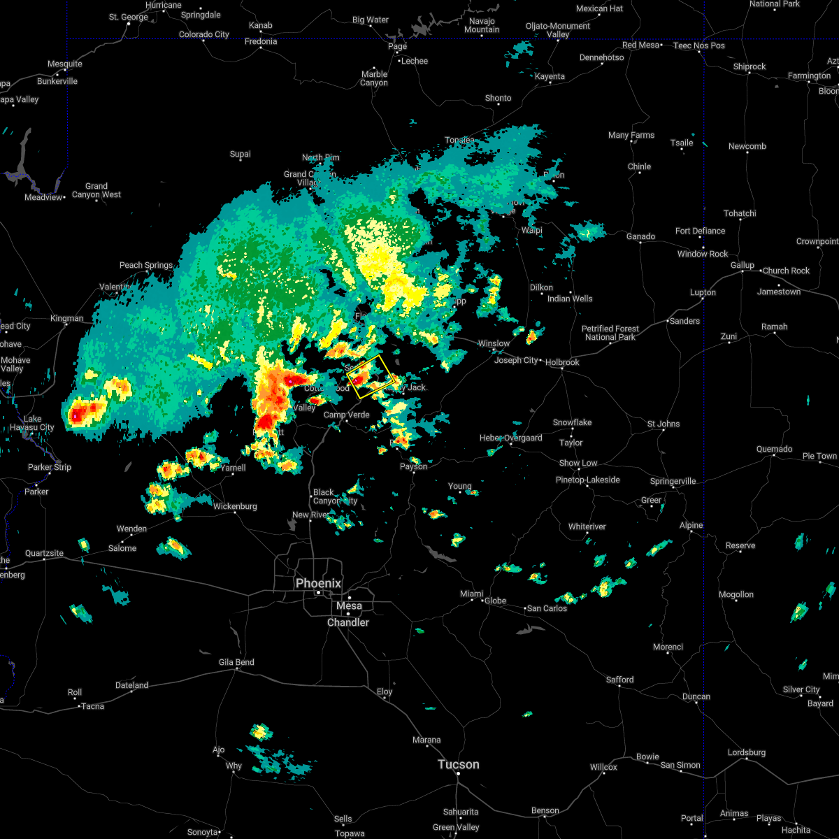
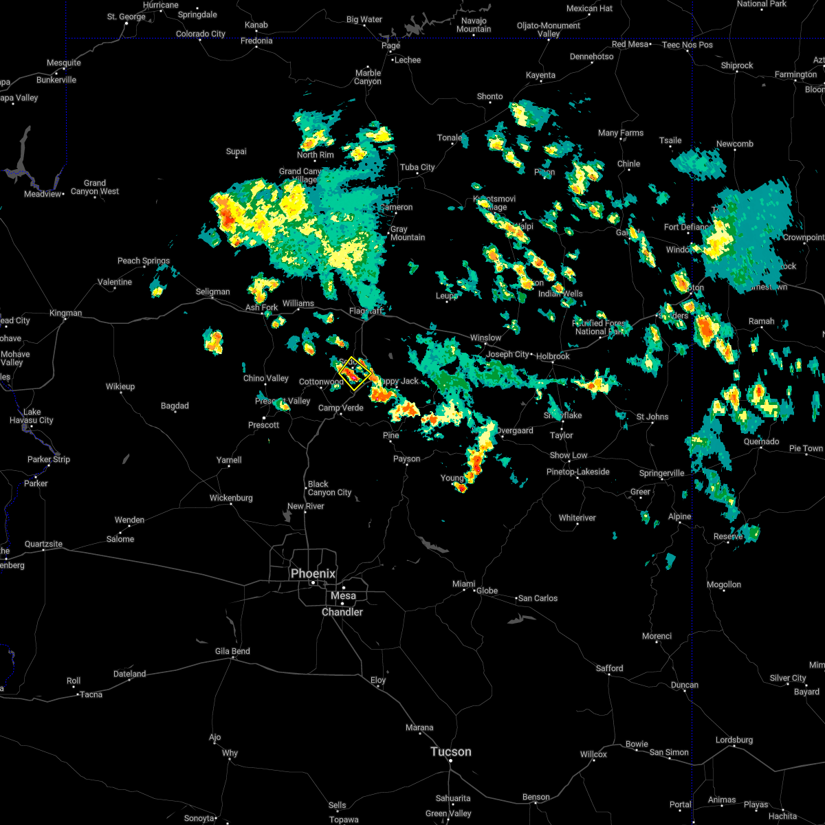
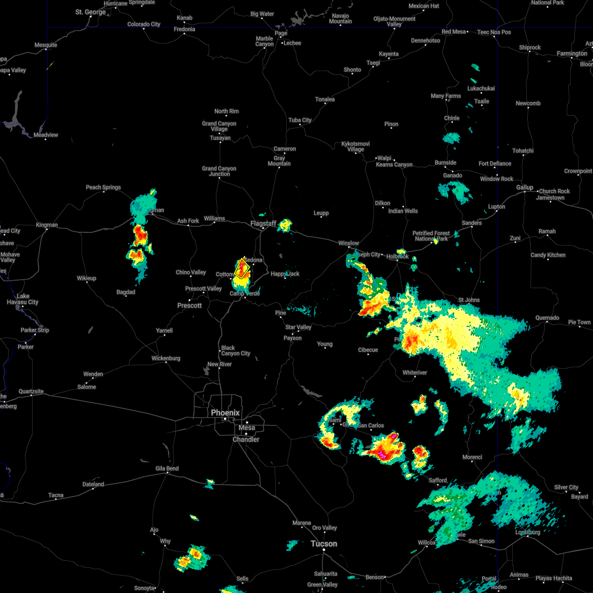
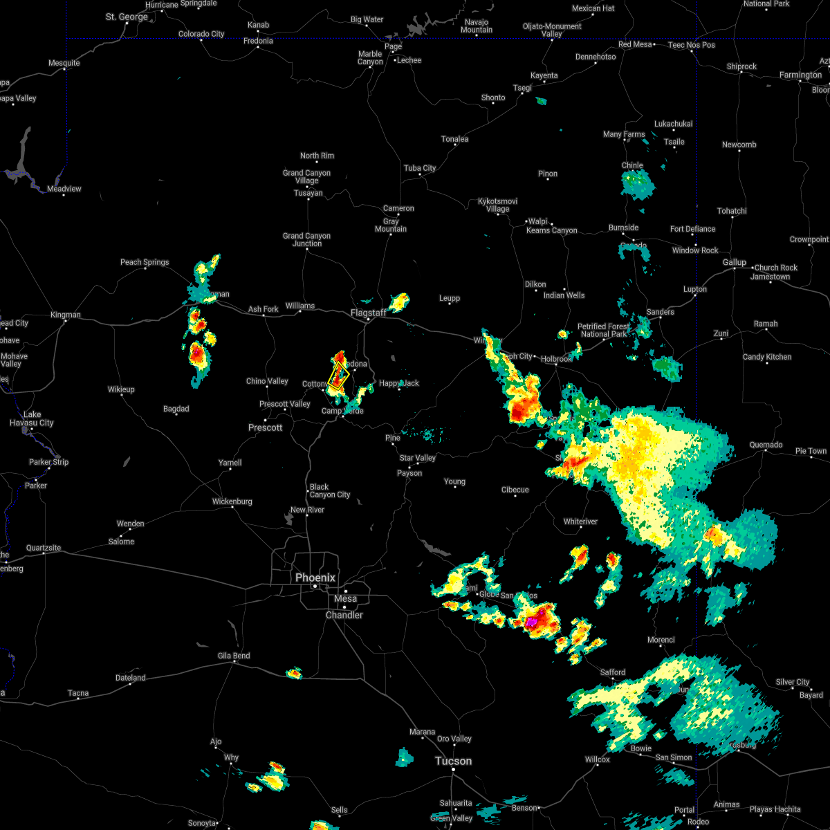
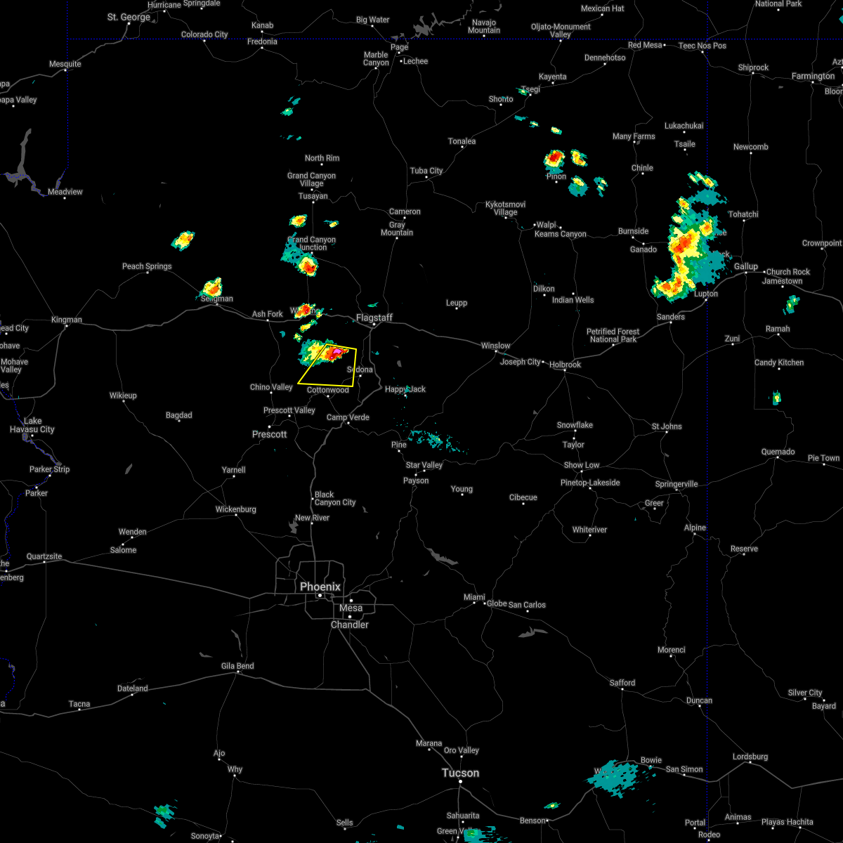
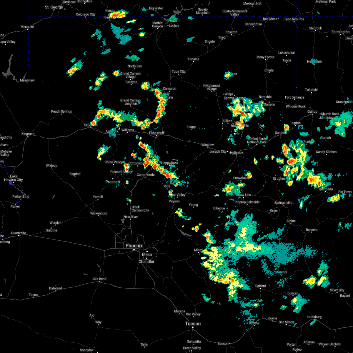
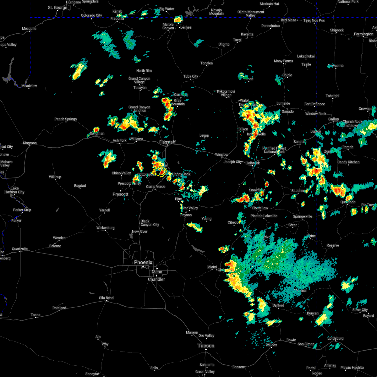
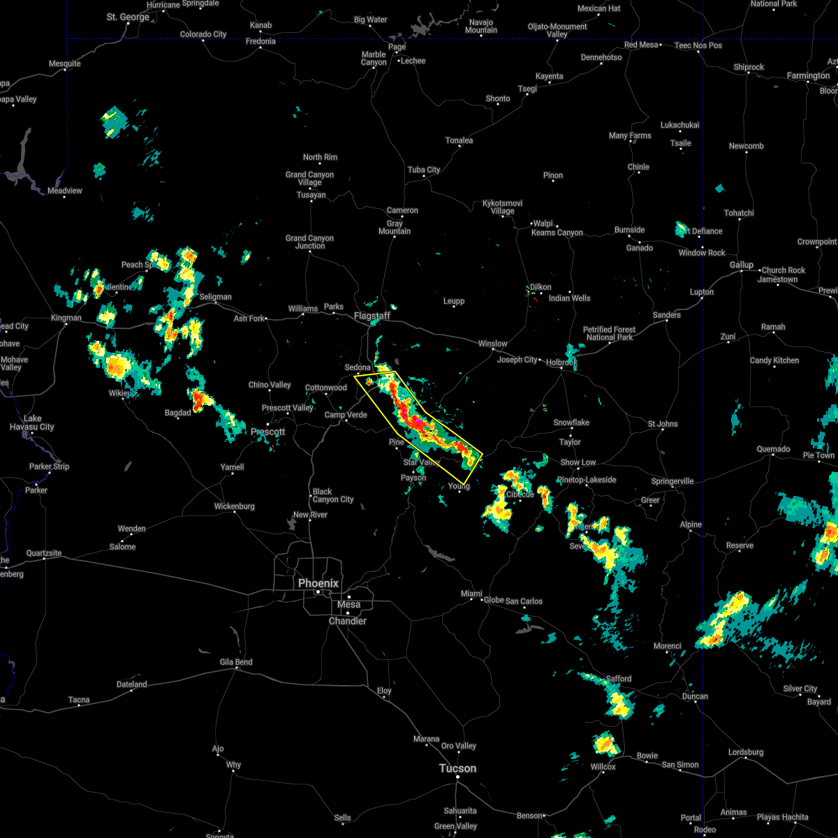
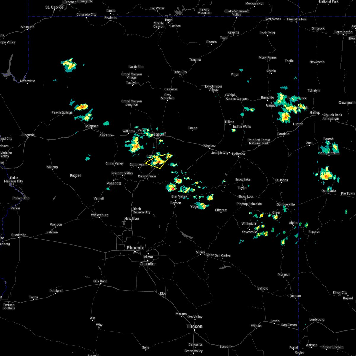
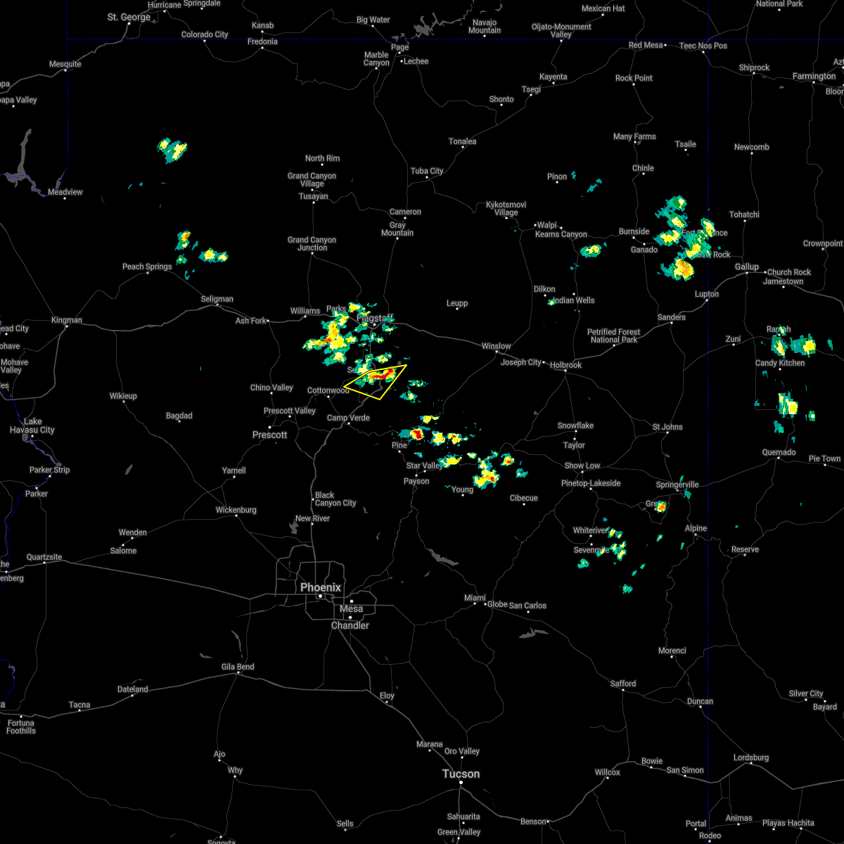
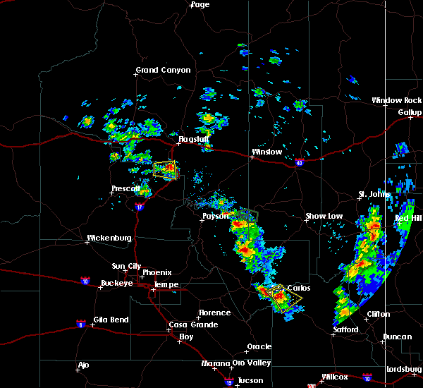
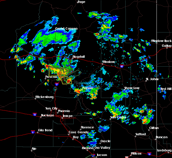
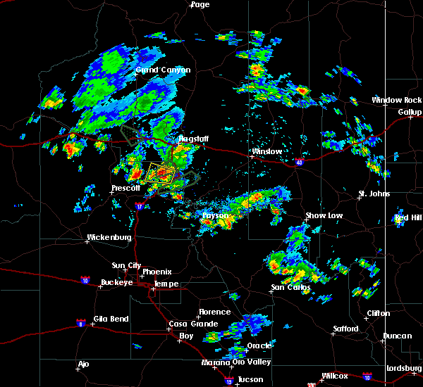
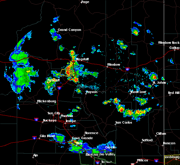
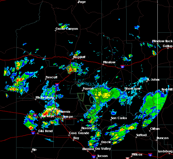
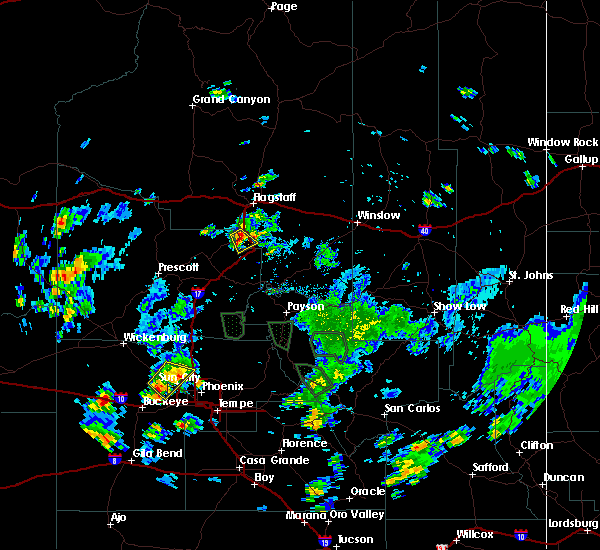
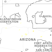
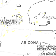
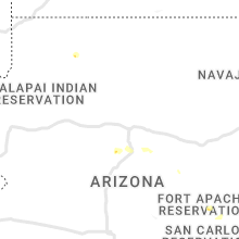
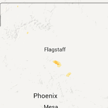
Hail Map for Sedona, AZ
The Sedona, AZ area has had 4 reports of on-the-ground hail by trained spotters, and has been under severe weather warnings 7 times during the past 12 months. Doppler radar has detected hail at or near Sedona, AZ on 41 occasions, including 5 occasions during the past year.
| Name: | Sedona, AZ |
| Where Located: | 25.4 miles SSW of Flagstaff, AZ |
| Map: | Google Map for Sedona, AZ |
| Population: | 10031 |
| Housing Units: | 6367 |
| More Info: | Search Google for Sedona, AZ |
0
The Top Recent Hail Date for Sedona, AZ is Thursday, July 3, 2025 (41st out of 41)
Hail and Wind Damage Spotted near Sedona, AZ
| Date / Time | Report Details |
|---|---|
| 7/3/2025 2:42 PM MST |
 The storm which prompted the warning has weakened below severe limits, and has exited the warned area. therefore, the warning will be allowed to expire. however, small hail, gusty winds, and heavy rain are still possible with this thunderstorm. The storm which prompted the warning has weakened below severe limits, and has exited the warned area. therefore, the warning will be allowed to expire. however, small hail, gusty winds, and heavy rain are still possible with this thunderstorm.
|
| 7/3/2025 2:22 PM MST |
 At 222 pm mst, a severe thunderstorm was located over beaverhead flat, or 9 miles south of sedona, moving east at 10 mph (radar indicated). Hazards include 60 mph wind gusts and quarter size hail. Hail damage to vehicles is expected. expect wind damage to roofs, siding, and trees. locations impacted include, camp verde, sedona, beaverhead flat, village of oak creek, bell rock, cathedral rock, page springs, cornville, lake montezuma, montezuma well, sedona airport, montezuma castle national monument, wet beaver creek day use area, cedar ridge, munds mountain wilderness, red rock state park, rimrock airport, rimrock, mcguireville and lawrence crossing. this includes the following highways, interstate 17 between mile markers 291 and 301. state route 179 between mile markers 299 and 307. State route 89a between mile markers 365 and 372. At 222 pm mst, a severe thunderstorm was located over beaverhead flat, or 9 miles south of sedona, moving east at 10 mph (radar indicated). Hazards include 60 mph wind gusts and quarter size hail. Hail damage to vehicles is expected. expect wind damage to roofs, siding, and trees. locations impacted include, camp verde, sedona, beaverhead flat, village of oak creek, bell rock, cathedral rock, page springs, cornville, lake montezuma, montezuma well, sedona airport, montezuma castle national monument, wet beaver creek day use area, cedar ridge, munds mountain wilderness, red rock state park, rimrock airport, rimrock, mcguireville and lawrence crossing. this includes the following highways, interstate 17 between mile markers 291 and 301. state route 179 between mile markers 299 and 307. State route 89a between mile markers 365 and 372.
|
| 7/3/2025 1:53 PM MST |
 Svrfgz the national weather service in flagstaff has issued a * severe thunderstorm warning for, yavapai county in west central arizona, * until 245 pm mst. * at 153 pm mst, a severe thunderstorm was located over cornville, or 10 miles north of camp verde, moving east at 10 mph (radar indicated). Hazards include 60 mph wind gusts and quarter size hail. Hail damage to vehicles is expected. Expect wind damage to roofs, siding, and trees. Svrfgz the national weather service in flagstaff has issued a * severe thunderstorm warning for, yavapai county in west central arizona, * until 245 pm mst. * at 153 pm mst, a severe thunderstorm was located over cornville, or 10 miles north of camp verde, moving east at 10 mph (radar indicated). Hazards include 60 mph wind gusts and quarter size hail. Hail damage to vehicles is expected. Expect wind damage to roofs, siding, and trees.
|
| 6/3/2025 7:39 PM MST |
 the severe thunderstorm warning has been cancelled and is no longer in effect the severe thunderstorm warning has been cancelled and is no longer in effect
|
| 6/3/2025 7:10 PM MST |
 Svrfgz the national weather service in flagstaff has issued a * severe thunderstorm warning for, east central yavapai county in west central arizona, * until 800 pm mst. * at 709 pm mst, a severe thunderstorm was located over cottonwood, or 12 miles northwest of camp verde, moving northeast at 15 mph (radar indicated). Hazards include quarter size hail. damage to vehicles is expected Svrfgz the national weather service in flagstaff has issued a * severe thunderstorm warning for, east central yavapai county in west central arizona, * until 800 pm mst. * at 709 pm mst, a severe thunderstorm was located over cottonwood, or 12 miles northwest of camp verde, moving northeast at 15 mph (radar indicated). Hazards include quarter size hail. damage to vehicles is expected
|
| 7/25/2024 1:35 PM MST |
 the severe thunderstorm warning has been cancelled and is no longer in effect the severe thunderstorm warning has been cancelled and is no longer in effect
|
| 7/25/2024 1:07 PM MST |
 Svrfgz the national weather service in flagstaff has issued a * severe thunderstorm warning for, yavapai county in west central arizona, coconino county in north central arizona, * until 145 pm mst/245 pm mdt. * at 107 pm mst/207 pm mdt, a severe thunderstorm was located over slide rock state park, or near sedona, moving southeast at 10 mph (radar indicated). Hazards include 60 mph wind gusts and nickel size hail. expect damage to roofs, siding, and trees Svrfgz the national weather service in flagstaff has issued a * severe thunderstorm warning for, yavapai county in west central arizona, coconino county in north central arizona, * until 145 pm mst/245 pm mdt. * at 107 pm mst/207 pm mdt, a severe thunderstorm was located over slide rock state park, or near sedona, moving southeast at 10 mph (radar indicated). Hazards include 60 mph wind gusts and nickel size hail. expect damage to roofs, siding, and trees
|
| 8/12/2023 2:07 PM MST |
 At 206 pm mst, a severe thunderstorm was located over junipine resort, or 7 miles north of sedona, moving east at 25 mph (radar indicated). Hazards include 60 mph wind gusts and quarter size hail. Hail damage to vehicles is expected. Expect wind damage to roofs, siding, and trees. At 206 pm mst, a severe thunderstorm was located over junipine resort, or 7 miles north of sedona, moving east at 25 mph (radar indicated). Hazards include 60 mph wind gusts and quarter size hail. Hail damage to vehicles is expected. Expect wind damage to roofs, siding, and trees.
|
| 7/23/2023 3:15 PM MST | *corrected* sedona airport awos measured a 52 knot (60 mph) wind gust at 315 arizona time (mst) as thunderstorm outflow moved throug in yavapai county AZ, 0.5 miles W of Sedona, AZ |
| 7/23/2023 3:15 PM MST | *corrected* sedona airport awos measured a 52 knot (60 mph) wind gust at 315 arizona time (mst) as thunderstorm outflow moved throug in yavapai county AZ, 0.5 miles W of Sedona, AZ |
| 10/3/2022 2:55 PM MST |
 The severe thunderstorm warning for coconino and yavapai counties will expire at 300 pm mst, the storm which prompted the warning has weakened below severe limits, and no longer poses an immediate threat to life or property. therefore, the warning will be allowed to expire. The severe thunderstorm warning for coconino and yavapai counties will expire at 300 pm mst, the storm which prompted the warning has weakened below severe limits, and no longer poses an immediate threat to life or property. therefore, the warning will be allowed to expire.
|
| 10/3/2022 2:38 PM MST |
 The severe thunderstorm warning for coconino and yavapai counties will expire at 245 pm mst, the severe thunderstorm which prompted the warning has weakened. therefore, the warning will be allowed to expire. however heavy rain is still possible with this thunderstorm. The severe thunderstorm warning for coconino and yavapai counties will expire at 245 pm mst, the severe thunderstorm which prompted the warning has weakened. therefore, the warning will be allowed to expire. however heavy rain is still possible with this thunderstorm.
|
| 10/3/2022 2:10 PM MST |
 At 210 pm mst, a severe thunderstorm was located near sedona, moving northeast at 25 mph (radar indicated). Hazards include 60 mph wind gusts and quarter size hail. Hail damage to vehicles is expected. Expect wind damage to roofs, siding, and trees. At 210 pm mst, a severe thunderstorm was located near sedona, moving northeast at 25 mph (radar indicated). Hazards include 60 mph wind gusts and quarter size hail. Hail damage to vehicles is expected. Expect wind damage to roofs, siding, and trees.
|
| 10/3/2022 2:07 PM MST |
 At 207 pm mst, a severe thunderstorm was located near perkinsville, or 14 miles east of chino valley, moving east at 20 mph (radar indicated). Hazards include 60 mph wind gusts and quarter size hail. Hail damage to vehicles is expected. Expect wind damage to roofs, siding, and trees. At 207 pm mst, a severe thunderstorm was located near perkinsville, or 14 miles east of chino valley, moving east at 20 mph (radar indicated). Hazards include 60 mph wind gusts and quarter size hail. Hail damage to vehicles is expected. Expect wind damage to roofs, siding, and trees.
|
| 7/23/2022 4:36 PM MST |
 At 435 pm mst, a severe thunderstorm was located near sedona and oak creek, moving northeast at 15 mph (radar indicated). Hazards include 60 mph wind gusts and nickel size hail. expect damage to roofs, siding, and trees At 435 pm mst, a severe thunderstorm was located near sedona and oak creek, moving northeast at 15 mph (radar indicated). Hazards include 60 mph wind gusts and nickel size hail. expect damage to roofs, siding, and trees
|
| 7/17/2022 4:41 PM MST |
 The severe thunderstorm warning for yavapai county will expire at 445 pm mst, the storm which prompted the warning has weakened below severe limits, and has exited the warned area. therefore, the warning will be allowed to expire. however small hail, gusty winds and heavy rain are still possible with this thunderstorm. The severe thunderstorm warning for yavapai county will expire at 445 pm mst, the storm which prompted the warning has weakened below severe limits, and has exited the warned area. therefore, the warning will be allowed to expire. however small hail, gusty winds and heavy rain are still possible with this thunderstorm.
|
| 7/17/2022 4:01 PM MST |
 At 400 pm mst, a severe thunderstorm was located over montezuma castle national monument, or near camp verde, moving northwest at 15 mph (radar indicated). Hazards include 60 mph wind gusts and quarter size hail. Hail damage to vehicles is expected. Expect wind damage to roofs, siding, and trees. At 400 pm mst, a severe thunderstorm was located over montezuma castle national monument, or near camp verde, moving northwest at 15 mph (radar indicated). Hazards include 60 mph wind gusts and quarter size hail. Hail damage to vehicles is expected. Expect wind damage to roofs, siding, and trees.
|
| 6/23/2022 6:12 PM MST |
 The severe thunderstorm warning for yavapai and coconino counties will expire at 615 pm mst, the storm which prompted the warning has weakened below severe limits, and no longer poses an immediate threat to life or property. therefore, the warning will be allowed to expire. however areas of heavy rain is still possible with thunderstorms in the area. The severe thunderstorm warning for yavapai and coconino counties will expire at 615 pm mst, the storm which prompted the warning has weakened below severe limits, and no longer poses an immediate threat to life or property. therefore, the warning will be allowed to expire. however areas of heavy rain is still possible with thunderstorms in the area.
|
| 6/23/2022 5:48 PM MST |
 At 546 pm mst, a severe thunderstorm was located near munds park, or 8 miles east of sedona, moving northeast at 45 mph (radar indicated). Hazards include 60 mph wind gusts and penny size hail. Expect damage to roofs, siding, and trees. locations impacted include, camp verde, sedona, munds park, mcguireville, village at oak creek, montezuma castle national monument, montezuma well, rimrock, middle verde, lake montezuma, cornville, wet beaver creek campground, red rock state park, v bar v visitors center and manzanita campground. hail threat, radar indicated max hail size, 0. 75 in wind threat, radar indicated max wind gust, 60 mph. At 546 pm mst, a severe thunderstorm was located near munds park, or 8 miles east of sedona, moving northeast at 45 mph (radar indicated). Hazards include 60 mph wind gusts and penny size hail. Expect damage to roofs, siding, and trees. locations impacted include, camp verde, sedona, munds park, mcguireville, village at oak creek, montezuma castle national monument, montezuma well, rimrock, middle verde, lake montezuma, cornville, wet beaver creek campground, red rock state park, v bar v visitors center and manzanita campground. hail threat, radar indicated max hail size, 0. 75 in wind threat, radar indicated max wind gust, 60 mph.
|
| 6/23/2022 5:29 PM MST |
 At 529 pm mst, a severe thunderstorm was located near village at oak creek, or 8 miles south of sedona, moving northeast at 45 mph (radar indicated). Hazards include 60 mph wind gusts and quarter size hail. Hail damage to vehicles is expected. Expect wind damage to roofs, siding, and trees. At 529 pm mst, a severe thunderstorm was located near village at oak creek, or 8 miles south of sedona, moving northeast at 45 mph (radar indicated). Hazards include 60 mph wind gusts and quarter size hail. Hail damage to vehicles is expected. Expect wind damage to roofs, siding, and trees.
|
| 8/16/2021 6:52 PM MST |
 At 651 pm mst, a severe thunderstorm was located over page springs, or near sedona, moving southeast at 5 mph (radar indicated). Hazards include 60 mph wind gusts and quarter size hail. Hail damage to vehicles is expected. expect wind damage to roofs, siding, and trees. locations impacted include, page springs and red rock state park. hail threat, radar indicated max hail size, 1. 00 in wind threat, radar indicated max wind gust, 60 mph. At 651 pm mst, a severe thunderstorm was located over page springs, or near sedona, moving southeast at 5 mph (radar indicated). Hazards include 60 mph wind gusts and quarter size hail. Hail damage to vehicles is expected. expect wind damage to roofs, siding, and trees. locations impacted include, page springs and red rock state park. hail threat, radar indicated max hail size, 1. 00 in wind threat, radar indicated max wind gust, 60 mph.
|
| 8/16/2021 6:33 PM MST |
 At 633 pm mst, a severe thunderstorm was located near page springs, or near sedona, moving southeast at 5 mph (radar indicated). Hazards include 60 mph wind gusts and quarter size hail. Hail damage to vehicles is expected. Expect wind damage to roofs, siding, and trees. At 633 pm mst, a severe thunderstorm was located near page springs, or near sedona, moving southeast at 5 mph (radar indicated). Hazards include 60 mph wind gusts and quarter size hail. Hail damage to vehicles is expected. Expect wind damage to roofs, siding, and trees.
|
| 8/15/2021 1:43 PM MST |
 At 143 pm mst, a severe thunderstorm was located 12 miles northeast of perkinsville, or 13 miles northwest of sedona, moving southwest at 20 mph (radar indicated). Hazards include quarter size hail. damage to vehicles is expected At 143 pm mst, a severe thunderstorm was located 12 miles northeast of perkinsville, or 13 miles northwest of sedona, moving southwest at 20 mph (radar indicated). Hazards include quarter size hail. damage to vehicles is expected
|
| 8/6/2021 2:40 PM MST | Quarter sized hail reported 10.1 miles SW of Sedona, AZ, public report 1.00 inch hail. size estimated based on photo. report via twitter. |
| 7/16/2021 4:07 PM MST |
 The severe thunderstorm warning for yavapai and coconino counties will expire at 415 pm mst, the storm which prompted the warning has weakened below severe limits, and no longer poses an immediate threat to life or property. therefore, the warning will be allowed to expire. The severe thunderstorm warning for yavapai and coconino counties will expire at 415 pm mst, the storm which prompted the warning has weakened below severe limits, and no longer poses an immediate threat to life or property. therefore, the warning will be allowed to expire.
|
| 7/16/2021 3:43 PM MST |
 At 342 pm mst, a severe thunderstorm was located over village at oak creek, or near sedona, and is nearly stationary (radar indicated). Hazards include 45 mph wind gusts and up to quarter size hail. hail damage to vehicles is expected At 342 pm mst, a severe thunderstorm was located over village at oak creek, or near sedona, and is nearly stationary (radar indicated). Hazards include 45 mph wind gusts and up to quarter size hail. hail damage to vehicles is expected
|
| 7/10/2021 5:09 PM MST |
 At 509 pm mst, severe thunderstorms were located along a line extending from 6 miles northwest of stoneman lake to near forest lakes, moving west at 10 mph (radar indicated). Hazards include 70 mph wind gusts and quarter size hail. Hail damage to vehicles is expected. expect considerable tree damage. Wind damage is also likely to mobile homes, roofs, and outbuildings. At 509 pm mst, severe thunderstorms were located along a line extending from 6 miles northwest of stoneman lake to near forest lakes, moving west at 10 mph (radar indicated). Hazards include 70 mph wind gusts and quarter size hail. Hail damage to vehicles is expected. expect considerable tree damage. Wind damage is also likely to mobile homes, roofs, and outbuildings.
|
| 8/18/2020 1:51 PM MST |
 The severe thunderstorm warning for yavapai and coconino counties will expire at 200 pm mst, the storms which prompted the warning have weakened below severe limits, and no longer pose an immediate threat to life or property. therefore, the warning will be allowed to expire. however gusty winds are still possible with these thunderstorms. The severe thunderstorm warning for yavapai and coconino counties will expire at 200 pm mst, the storms which prompted the warning have weakened below severe limits, and no longer pose an immediate threat to life or property. therefore, the warning will be allowed to expire. however gusty winds are still possible with these thunderstorms.
|
| 8/18/2020 1:29 PM MST |
 At 128 pm mst, severe thunderstorms were located along a line extending from near sedona to near dairy springs campground, moving southwest at 25 mph. in addtion, these stroms are impacting a portion of the i-17 just south of munds park (radar indicated). Hazards include 60 mph wind gusts and quarter size hail. Hail damage to vehicles is expected. Expect wind damage to roofs, siding, and trees. At 128 pm mst, severe thunderstorms were located along a line extending from near sedona to near dairy springs campground, moving southwest at 25 mph. in addtion, these stroms are impacting a portion of the i-17 just south of munds park (radar indicated). Hazards include 60 mph wind gusts and quarter size hail. Hail damage to vehicles is expected. Expect wind damage to roofs, siding, and trees.
|
| 8/1/2020 4:24 PM MST |
 At 420 pm mst, national weather service doppler radar indicated that the thunderstorms over north sedona, that was warned for, has moved northeast toward munds park. this storm has weakened slightly, but is still capable of producing 60 mph winds, small hail and brief heavy rain (radar indicated). Hazards include 60 mph wind gusts. Expect damage to roofs, siding, and trees. Locations impacted include, north sedona, junipine resort, slide rock state park, red rock state park and manzanita campground. At 420 pm mst, national weather service doppler radar indicated that the thunderstorms over north sedona, that was warned for, has moved northeast toward munds park. this storm has weakened slightly, but is still capable of producing 60 mph winds, small hail and brief heavy rain (radar indicated). Hazards include 60 mph wind gusts. Expect damage to roofs, siding, and trees. Locations impacted include, north sedona, junipine resort, slide rock state park, red rock state park and manzanita campground.
|
| 8/1/2020 3:59 PM MST |
 The national weather service in flagstaff has issued a * severe thunderstorm warning for. yavapai county in west central arizona. coconino county in north central arizona. until 445 pm mst. At 358 pm mst, a severe thunderstorm was located over sedona,. The national weather service in flagstaff has issued a * severe thunderstorm warning for. yavapai county in west central arizona. coconino county in north central arizona. until 445 pm mst. At 358 pm mst, a severe thunderstorm was located over sedona,.
|
| 8/2/2019 4:07 PM MST |
 At 406 pm mst, a severe thunderstorm was located over village at oak creek, or 7 miles southeast of sedona, moving northwest at 10 mph (radar indicated). Hazards include 60 mph wind gusts and quarter size hail. Hail damage to vehicles is expected. Expect wind damage to roofs, siding, and trees. At 406 pm mst, a severe thunderstorm was located over village at oak creek, or 7 miles southeast of sedona, moving northwest at 10 mph (radar indicated). Hazards include 60 mph wind gusts and quarter size hail. Hail damage to vehicles is expected. Expect wind damage to roofs, siding, and trees.
|
| 9/2/2018 3:33 PM MST |
 At 332 pm mst, a severe thunderstorm was located over sedona, and is nearly stationary (radar indicated). Hazards include 60 mph wind gusts and quarter size hail. Hail damage to vehicles is expected. Expect wind damage to roofs, siding, and trees. At 332 pm mst, a severe thunderstorm was located over sedona, and is nearly stationary (radar indicated). Hazards include 60 mph wind gusts and quarter size hail. Hail damage to vehicles is expected. Expect wind damage to roofs, siding, and trees.
|
| 9/1/2018 5:49 AM MST |
 At 548 am mst, a severe thunderstorm was located over cornville, or 9 miles southwest of sedona, moving northeast at 15 mph (radar indicated). Hazards include quarter size hail. damage to vehicles is expected At 548 am mst, a severe thunderstorm was located over cornville, or 9 miles southwest of sedona, moving northeast at 15 mph (radar indicated). Hazards include quarter size hail. damage to vehicles is expected
|
| 8/13/2018 3:23 PM MST |
 At 321 pm mst, a severe thunderstorm was located near sedona, moving southwest at 15 mph (radar indicated). Hazards include 60 mph wind gusts and quarter size hail. Hail damage to vehicles is expected. Expect wind damage to roofs, siding, and trees. At 321 pm mst, a severe thunderstorm was located near sedona, moving southwest at 15 mph (radar indicated). Hazards include 60 mph wind gusts and quarter size hail. Hail damage to vehicles is expected. Expect wind damage to roofs, siding, and trees.
|
| 8/11/2018 2:50 PM MST | Quarter sized hail reported 5.3 miles NNW of Sedona, AZ, report of quarter to half dollar size hail. |
| 8/8/2018 3:07 PM MST |
 At 306 pm mst, a severe thunderstorm was located 7 miles northwest of page springs, or 8 miles west of sedona, moving southwest at 15 mph. this storm should be affecting the cottonwood area by 350 pm mst (radar indicated). Hazards include 70 mph wind gusts and quarter size hail. Hail damage to vehicles is expected. expect considerable tree damage. Wind damage is also likely to mobile homes, roofs, and outbuildings. At 306 pm mst, a severe thunderstorm was located 7 miles northwest of page springs, or 8 miles west of sedona, moving southwest at 15 mph. this storm should be affecting the cottonwood area by 350 pm mst (radar indicated). Hazards include 70 mph wind gusts and quarter size hail. Hail damage to vehicles is expected. expect considerable tree damage. Wind damage is also likely to mobile homes, roofs, and outbuildings.
|
| 8/8/2018 2:48 PM MST |
 At 248 pm mst, a severe thunderstorm was located 8 miles west of sedona, moving southwest at 15 mph (radar indicated). Hazards include 70 mph wind gusts and quarter size hail. Hail damage to vehicles is expected. expect considerable tree damage. Wind damage is also likely to mobile homes, roofs, and outbuildings. At 248 pm mst, a severe thunderstorm was located 8 miles west of sedona, moving southwest at 15 mph (radar indicated). Hazards include 70 mph wind gusts and quarter size hail. Hail damage to vehicles is expected. expect considerable tree damage. Wind damage is also likely to mobile homes, roofs, and outbuildings.
|
| 7/27/2018 4:40 PM MST |
 At 439 pm mst, a severe thunderstorm was located over sedona, moving southeast at 5 mph (trained weather spotters). Hazards include golf ball size hail and 60 mph wind gusts. People and animals outdoors will be injured. expect hail damage to roofs, siding, windows, and vehicles. Expect wind damage to roofs, siding, and trees. At 439 pm mst, a severe thunderstorm was located over sedona, moving southeast at 5 mph (trained weather spotters). Hazards include golf ball size hail and 60 mph wind gusts. People and animals outdoors will be injured. expect hail damage to roofs, siding, windows, and vehicles. Expect wind damage to roofs, siding, and trees.
|
| 7/27/2018 4:30 PM MST | Quarter sized hail reported 1.8 miles WSW of Sedona, AZ, location estimated. three-quarters of a mile south of the intersection of hwy 179 and hwy 89a. |
| 7/9/2018 5:49 PM MST |
 At 548 pm mst, a severe thunderstorm was located near sedona, moving west at 25 mph (radar indicated). Hazards include 60 mph wind gusts and penny size hail. expect damage to roofs, siding, and trees At 548 pm mst, a severe thunderstorm was located near sedona, moving west at 25 mph (radar indicated). Hazards include 60 mph wind gusts and penny size hail. expect damage to roofs, siding, and trees
|
| 7/9/2018 5:35 PM MST | Awos station sez... sedona airpor in yavapai county AZ, 0.5 miles W of Sedona, AZ |
| 7/23/2017 3:38 PM MST |
 The severe thunderstorm warning for yavapai and coconino counties will expire at 345 pm mst, the storm which prompted the warning has weakened below severe limits, and no longer poses an immediate threat to life or property. therefore the warning will be allowed to expire. however heavy rain continues and a flash flood warning remains in effect for the area at this time. continue to monitor flash flood warnings. to report severe weather, contact your nearest law enforcement agency. they will relay your report to the national weather service flagstaff. The severe thunderstorm warning for yavapai and coconino counties will expire at 345 pm mst, the storm which prompted the warning has weakened below severe limits, and no longer poses an immediate threat to life or property. therefore the warning will be allowed to expire. however heavy rain continues and a flash flood warning remains in effect for the area at this time. continue to monitor flash flood warnings. to report severe weather, contact your nearest law enforcement agency. they will relay your report to the national weather service flagstaff.
|
| 7/23/2017 3:32 PM MST |
 At 331 pm mst, a severe thunderstorm was located over page springs, or near sedona, moving west at 10 mph (radar indicated). Hazards include 60 mph wind gusts and penny size hail. Expect damage to roofs, siding, and trees. locations impacted include, sedona, page springs, village at oak creek, cornville, cottonwood and red rock state park. this includes the following highways, state route 179 near mile marker 303, and between mile markers 305 and 313. State route 89a between mile markers 357 and 374. At 331 pm mst, a severe thunderstorm was located over page springs, or near sedona, moving west at 10 mph (radar indicated). Hazards include 60 mph wind gusts and penny size hail. Expect damage to roofs, siding, and trees. locations impacted include, sedona, page springs, village at oak creek, cornville, cottonwood and red rock state park. this includes the following highways, state route 179 near mile marker 303, and between mile markers 305 and 313. State route 89a between mile markers 357 and 374.
|
| 7/23/2017 2:56 PM MST |
 At 256 pm mst, a severe thunderstorm was located over village at oak creek, or near sedona, moving west at 10 mph (radar indicated). Hazards include 60 mph wind gusts and quarter size hail. Hail damage to vehicles is expected. Expect wind damage to roofs, siding, and trees. At 256 pm mst, a severe thunderstorm was located over village at oak creek, or near sedona, moving west at 10 mph (radar indicated). Hazards include 60 mph wind gusts and quarter size hail. Hail damage to vehicles is expected. Expect wind damage to roofs, siding, and trees.
|
| 7/19/2017 5:26 PM MST |
 At 524 pm mst, a severe thunderstorm was located near page springs, or 8 miles west of sedona, moving west at 45 mph. this storm is exhibiting rotation along the gust front (radar indicated). Hazards include 60 mph wind gusts and nickel size hail. Expect damage to roofs, siding, and trees. locations impacted include, sedona, page springs. this includes the following highways, state route 179 between mile markers 305 and 313. State route 89a between mile markers 361 and 378. At 524 pm mst, a severe thunderstorm was located near page springs, or 8 miles west of sedona, moving west at 45 mph. this storm is exhibiting rotation along the gust front (radar indicated). Hazards include 60 mph wind gusts and nickel size hail. Expect damage to roofs, siding, and trees. locations impacted include, sedona, page springs. this includes the following highways, state route 179 between mile markers 305 and 313. State route 89a between mile markers 361 and 378.
|
| 7/19/2017 5:13 PM MST |
 The national weather service in flagstaff has issued a * severe thunderstorm warning for. yavapai county in west central arizona. coconino county in north central arizona. Until 545 pm mst * at 513 pm mst, a severe thunderstorm was located over sedona,. The national weather service in flagstaff has issued a * severe thunderstorm warning for. yavapai county in west central arizona. coconino county in north central arizona. Until 545 pm mst * at 513 pm mst, a severe thunderstorm was located over sedona,.
|
| 7/19/2017 5:10 PM MST | Quarter sized hail reported 1.7 miles W of Sedona, AZ, public reports quarter size hail. storm total .75 in of rain. |
| 8/27/2015 4:07 PM MST |
 At 405 pm mst, doppler radar indicated a severe thunderstorm capable of producing damaging winds in excess of 60 mph. this storm was 13 miles southeast of sedona, moving southeast at 30 mph. penny size hail may also accompany the damaging winds. locations impacted include, rural areas southeast of sedona. At 405 pm mst, doppler radar indicated a severe thunderstorm capable of producing damaging winds in excess of 60 mph. this storm was 13 miles southeast of sedona, moving southeast at 30 mph. penny size hail may also accompany the damaging winds. locations impacted include, rural areas southeast of sedona.
|
| 8/27/2015 3:49 PM MST |
 At 349 pm mst, doppler radar indicated a severe thunderstorm capable of producing damaging winds in excess of 60 mph. this storm was located over oak creek canyon just north of sedona, and moving southeast at 30 mph. penny size hail may also accompany the damaging winds. At 349 pm mst, doppler radar indicated a severe thunderstorm capable of producing damaging winds in excess of 60 mph. this storm was located over oak creek canyon just north of sedona, and moving southeast at 30 mph. penny size hail may also accompany the damaging winds.
|
| 7/3/2015 6:57 PM MST | The severe thunderstorm warning for east central yavapai county will expire at 700 pm mst, the storm which prompted the warning near cornville has weakened below severe limits, and no longer poses an immediate threat to life or property. therefore the warning will be allowed to expire. however gusty winds and heavy rain are still possible with this thunderstorm. |
| 7/3/2015 6:36 PM MST |
 At 634 pm mst, doppler radar indicated a severe thunderstorm capable of producing damaging winds in excess of 60 mph. this storm was located over cornville, or near cottonwood-verde village, and moving southwest at 15 mph. At 634 pm mst, doppler radar indicated a severe thunderstorm capable of producing damaging winds in excess of 60 mph. this storm was located over cornville, or near cottonwood-verde village, and moving southwest at 15 mph.
|
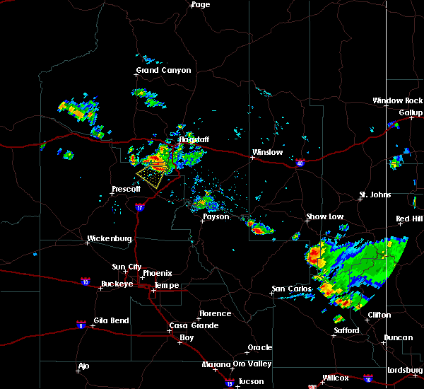
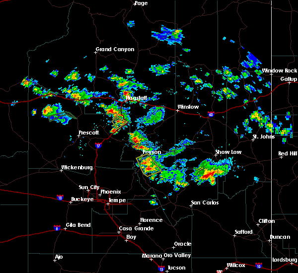
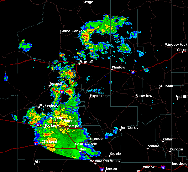
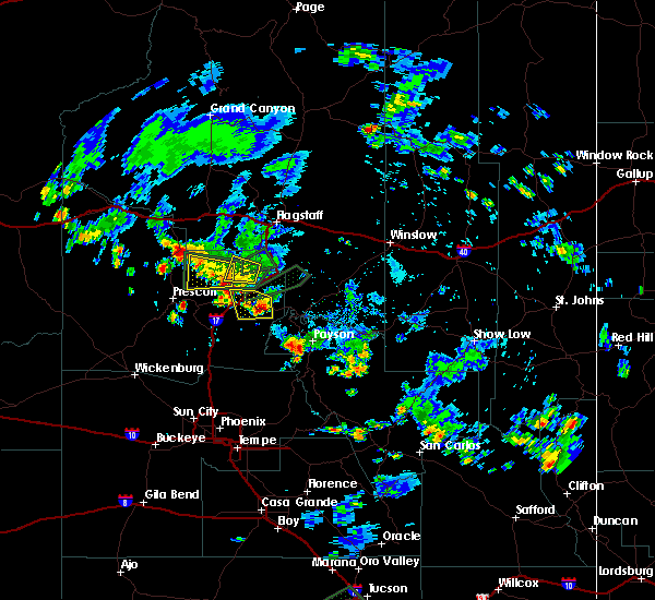
Hail Maps for Sedona, AZ


Connect with Interactive Hail Maps