

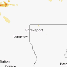
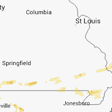
Hail Map for Sunday, August 12, 2012

Number of Impacted Households on 8/12/2012
0
Impacted by 1" or Larger Hail
0
Impacted by 1.75" or Larger Hail
0
Impacted by 2.5" or Larger Hail
Square Miles of Populated Area Impacted on 8/12/2012
0
Impacted by 1" or Larger Hail
0
Impacted by 1.75" or Larger Hail
0
Impacted by 2.5" or Larger Hail


Cities Most Affected by Hail Storms of 8/12/2012
| Hail Size | Demographics of Zip Codes Affected | ||||||
|---|---|---|---|---|---|---|---|
| City | Count | Average | Largest | Pop Density | House Value | Income | Age |
| Porum, OK | 1 | 1.75 | 1.75 | 20 | $37k | $22.0k | 43.9 |
| Valley View, TX | 1 | 1.75 | 1.75 | 43 | $83k | $44.0k | 42.3 |
| Springdale, AR | 1 | 1.75 | 1.75 | 611 | $94k | $43.6k | 34.0 |
| Tishomingo, OK | 1 | 1.75 | 1.75 | 28 | $47k | $24.6k | 37.4 |
Hail and Wind Damage Spotted on 8/12/2012
Filter by Report Type:Hail ReportsWind Reports
California
| Local Time | Report Details |
|---|---|
| 2:20 PM PDT | Sdge east warners sensor recorded 58mph gust during tr in san diego county CA, 49.7 miles NE of San Diego, CA |
| 3:52 PM PDT | Multiple power poles down across the rd. landed on vehicles and trapped passengers in vehs. several vehicles are also stuck btwn the line in riverside county CA, 47.6 miles WSW of Yucca Valley, CA |
| 4:01 PM PDT | Lightning hit a pole and came down across the rd. hazard is on ramona expwy and bernasoni r in riverside county CA, 46.2 miles WSW of Yucca Valley, CA |
| 4:15 PM PDT | West side of perris on olive and ellis streets and just north california highway 74...several small and large tree limbs down. on ellis street just north of ca route 74 in riverside county CA, 54.8 miles WSW of Yucca Valley, CA |
| 4:20 PM PDT | Winds caused a large camper to tip over. wind gust also removed several fence poles from the ground. severe winds lasted for a 10 minute period starting at 1620 pd in san bernardino county CA, 35.3 miles E of Yucca Valley, CA |
| 4:30 PM PDT | Time estimated...west side of perris on olive street and california highway 74... small and large tree limbs down. on ellis street just north of ca route 74...two power in riverside county CA, 51.6 miles WSW of Yucca Valley, CA |
Texas
| Local Time | Report Details |
|---|---|
| 5:03 PM CDT | Quarter sized hail reported near Gainesville, TX, 65.1 miles NNW of Dallas, TX, also reported a large wooden swingset destroyed by thunderstorm winds. |
| 5:15 PM CDT | Roof blown off of a 4-unit apartment complex in wise county TX, 62.6 miles SE of Wichita Falls, TX |
| 5:17 PM CDT | Large branches also dow in cooke county TX, 64.4 miles NNW of Dallas, TX |
| 5:30 PM CDT | Large metal roof blown off of a building in downtown bridgeport in wise county TX, 63.5 miles SE of Wichita Falls, TX |
| 5:32 PM CDT | Estimated 60 mph winds blew a semi-truck onto a pickup on southbound i-35 at exit 491. interstate closed at this tim in cooke county TX, 56.8 miles NNW of Dallas, TX |
| 5:34 PM CDT | Golf Ball sized hail reported near Valley View, TX, 52.6 miles NNW of Dallas, TX |
| 5:35 PM CDT | Quarter sized hail reported near Valley View, TX, 53 miles NNW of Dallas, TX |
| 6:01 PM CDT | Spotter measured 66 mph wind gust out of the northwes in wise county TX, 52.7 miles NW of Dallas, TX |
| 6:08 PM CDT | 20 to 30 trees down just w of krum in denton county TX, 46.7 miles NW of Dallas, TX |
| 6:46 PM CDT | Three inch tree limbs blown down in tarrant county TX, 40.7 miles WNW of Dallas, TX |
| 6:56 PM CDT | Storm damage reported in tarrant county TX, 34 miles W of Dallas, TX |
| 7:00 PM CDT | Marina suffered roof and dock damag in tarrant county TX, 38.3 miles WNW of Dallas, TX |
| 7:00 PM CDT | Fences and powerlines down in tarrant county TX, 34.5 miles W of Dallas, TX |
| 7:01 PM CDT | Observed at kftw airpor in tarrant county TX, 33.7 miles W of Dallas, TX |
| 7:02 PM CDT | Storm damage reported in tarrant county TX, 34 miles W of Dallas, TX |
| 7:08 PM CDT | Measured at knfw in tarrant county TX, 37.6 miles W of Dallas, TX |
| 7:08 PM CDT | Power pole and 10 inch limb both snapped on navy fort worth jrb in tarrant county TX, 35.2 miles W of Dallas, TX |
| 7:10 PM CDT | Street signs down and billboards ripped of in tarrant county TX, 33.1 miles W of Dallas, TX |
| 7:10 PM CDT | Damage to factory building on north main st in tarrant county TX, 31.7 miles W of Dallas, TX |
| 7:11 PM CDT | Measured at wfo fwd in tarrant county TX, 28.8 miles W of Dallas, TX |
| 7:13 PM CDT | At wfo fwd in tarrant county TX, 28.8 miles W of Dallas, TX |
| 7:15 PM CDT | At wfo fwd in tarrant county TX, 28.8 miles W of Dallas, TX |
| 7:47 PM CDT | Roofs blown off of several trailers in johnson county TX, 32.5 miles WSW of Dallas, TX |
| 8:12 PM CDT | Metal buildings damaged 3 miles northwest of venus in johnson county TX, 30.5 miles SW of Dallas, TX |
| 8:15 PM CDT | Wind removed roof from a house in alvarado in johnson county TX, 36 miles SW of Dallas, TX |
| 8:55 PM CDT | Comanche county airport awos observed 60kt gust in comanche county TX, 75.5 miles ESE of Abilene, TX |
| 9:30 PM CDT | Grain warehouse damaged in winter in runnels county TX, 34.8 miles SSW of Abilene, TX |
| 9:32 PM CDT | Tree limbs down in an estimated 60 mph win in runnels county TX, 34.8 miles SSW of Abilene, TX |
| 10:16 PM CDT | Nws employee reported 60 mph winds in wall in tom green county TX, 81.5 miles SSW of Abilene, TX |
| 10:19 PM CDT | Large trees blown down in sulphur springs in hopkins county TX, 73.6 miles ENE of Dallas, TX |
| 10:23 PM CDT | Public reported 60 mph in mile in runnels county TX, 63.9 miles SSW of Abilene, TX |
| 10:47 PM CDT | Nws employee reported 60 mph winds in wall in tom green county TX, 81.5 miles SSW of Abilene, TX |
New Hampshire
| Local Time | Report Details |
|---|---|
| 6:10 PM EDT | Trees and wires down at the meredith new hampton town line...hvy wind and rain...power outages in belknap county NH, 62.3 miles W of Portland, ME |
| 6:12 PM EDT | Black cat island - canoes flipped ove in belknap county NH, 58.8 miles W of Portland, ME |
| 6:40 PM EDT | Several trees dow in carroll county NH, 43.3 miles W of Portland, ME |
Oklahoma
| Local Time | Report Details |
|---|---|
| 6:18 PM CDT | Quarter sized hail reported near Madill, OK, 39.9 miles WSW of Atoka, OK |
| 6:22 PM CDT | Half Dollar sized hail reported near Tishomingo, OK, 34.1 miles WSW of Atoka, OK |
| 7:18 PM CDT | Half Dollar sized hail reported near Atoka, OK, 11 miles SSE of Atoka, OK |
| 7:25 PM CDT | Golf Ball sized hail reported near Tishomingo, OK, 33.2 miles WSW of Atoka, OK |
| 7:25 PM CDT | Reports of multiple trees and power lines down along with structural damage to at least one home. time estimated from rada in bryan county OK, 35.9 miles SSW of Atoka, OK |
| 7:30 PM CDT | Many trees da in bryan county OK, 35.6 miles SSW of Atoka, OK |
| 7:50 PM CDT | Storm damage reported in bryan county OK, 41.2 miles SSW of Atoka, OK |
| 7:50 PM CDT | Up to 10 inch tree limbs d in bryan county OK, 41.2 miles SSW of Atoka, OK |
| 7:50 PM CDT | Half Dollar sized hail reported near Achille, OK, 41.2 miles SSW of Atoka, OK |
| 8:00 PM CDT | Large tree down. time estimate in pushmataha county OK, 27.6 miles E of Atoka, OK |
| 8:07 PM CDT | Small hail also reported...but no damag in bryan county OK, 44.3 miles SSW of Atoka, OK |
| 8:07 PM CDT | No damage reported in bryan county OK, 46.7 miles SSW of Atoka, OK |
| 10:05 PM CDT | Golf Ball sized hail reported near Porum, OK, 43.4 miles W of Fort Smith, AR |
| 10:43 PM CDT | Quarter sized hail reported near Oaks, OK, 59.9 miles NNW of Fort Smith, AR |
Arizona
| Local Time | Report Details |
|---|---|
| 4:28 PM MST | 6 power poles down near county 6th street and ave 18e in yuma county AZ, 17.6 miles ENE of Yuma, AZ |
Arkansas
| Local Time | Report Details |
|---|---|
| 11:23 PM CDT | Half Dollar sized hail reported near Siloam Springs, AR, 55.5 miles N of Fort Smith, AR, half dollar size hail in robinson. |
| 11:26 PM CDT | Golf Ball sized hail reported near Springdale, AR, 55.7 miles N of Fort Smith, AR |
| 11:45 PM CDT | Few large limbs down. 1 large dead tree dow in crawford county AR, 19.9 miles N of Fort Smith, AR |
| 3:04 AM CDT | Trees down in city of conwa in faulkner county AR, 25.6 miles NNW of Little Rock, AR |
| 3:05 AM CDT | Trees down in mayflowe in faulkner county AR, 17.4 miles NNW of Little Rock, AR |
| 3:23 AM CDT | Large branches down in viloni in faulkner county AR, 23.1 miles N of Little Rock, AR |
| 3:24 AM CDT | Trees down at little rock air force base in jacksonvill in pulaski county AR, 13.8 miles NNE of Little Rock, AR |
| 3:25 AM CDT | Several tree limbs down...along with pea size hai in pulaski county AR, 16.2 miles NNE of Little Rock, AR |
| 4:17 AM CDT | Large tree reported dow in pulaski county AR, 8.6 miles WSW of Little Rock, AR |
| 6:03 AM CDT | Powerline reported dow in clay county AR, 89.2 miles SW of Cape Girardeau, MO |
Connect with Interactive Hail Maps