

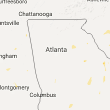
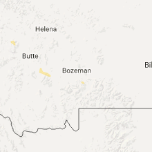
Hail Map for Thursday, August 18, 2016

Number of Impacted Households on 8/18/2016
0
Impacted by 1" or Larger Hail
0
Impacted by 1.75" or Larger Hail
0
Impacted by 2.5" or Larger Hail
Square Miles of Populated Area Impacted on 8/18/2016
0
Impacted by 1" or Larger Hail
0
Impacted by 1.75" or Larger Hail
0
Impacted by 2.5" or Larger Hail


Cities Most Affected by Hail Storms of 8/18/2016
| Hail Size | Demographics of Zip Codes Affected | ||||||
|---|---|---|---|---|---|---|---|
| City | Count | Average | Largest | Pop Density | House Value | Income | Age |
| Bridgeport, NE | 1 | 1.75 | 1.75 | 2 | $50k | $30.3k | 42.9 |
| Howard, SD | 1 | 1.75 | 1.75 | 4 | $33k | $29.8k | 47.6 |
| Mills, NE | 1 | 1.75 | 1.75 | 1 | $72k | $23.4k | 50.2 |
Hail and Wind Damage Spotted on 8/18/2016
Filter by Report Type:Hail ReportsWind Reports
States Impacted
North Dakota, South Dakota, Indiana, Minnesota, South Carolina, Alabama, Georgia, North Carolina, Iowa, Illinois, Wisconsin, Nebraska, MontanaNorth Dakota
| Local Time | Report Details |
|---|---|
| 7:03 AM CDT | Storm damage reported in stutsman county ND, 81.4 miles S of Devils Lake, ND |
| 7:05 AM CDT | Storm damage reported in stutsman county ND, 83.3 miles S of Devils Lake, ND |
| 7:18 AM CDT | A 5 to 10 inch diameter tree was snapped. one shed was tipped over and a second was flattene in barnes county ND, 74.8 miles W of Fargo, ND |
| 7:20 AM CDT | Semi tractor and trailer combination was blown off of interstate 94 near mp17 in barnes county ND, 70.5 miles W of Fargo, ND |
| 7:50 AM CDT | The wind gust was measured at the valley city airpor in barnes county ND, 58.2 miles W of Fargo, ND |
| 7:55 AM CDT | A semi tractor and trailer combination was blown off of interstate 94 just east of valley cit in barnes county ND, 55.9 miles W of Fargo, ND |
| 8:00 AM CDT | Semi carrying anhydrous ammonia rolled on its side in the eastbound lane of interstate 94. time estimated based on radar. location estimated awaiting further report in barnes county ND, 47.8 miles W of Fargo, ND |
| 8:05 AM CDT | Semi carrying anhydrous ammonia rolled on its side in the eastbound lane of interstate 94. time estimated based on rada in barnes county ND, 48.3 miles W of Fargo, ND |
| 8:18 AM CDT | Pea size hail in lamoure county ND, 66.7 miles NNE of Aberdeen, SD |
| 8:40 AM CDT | Quarter sized hail reported near Lisbon, ND, 53.5 miles SW of Fargo, ND |
| 9:02 AM CDT | Peak wind measured at a personal weather station near the sd borde in sargent county ND, 48.2 miles NE of Aberdeen, SD |
| 9:20 AM CDT | Several large 4 to 6 inch diameter tree branches broken down around farmsteads and in shelter belts across tewaukon township. also brief period of dime to nickel sized in sargent county ND, 63.3 miles NE of Aberdeen, SD |
South Dakota
| Local Time | Report Details |
|---|---|
| 7:50 AM CDT | Golf Ball sized hail reported near Howard, SD, 50.4 miles NW of Sioux Falls, SD, largest hail golf ball sized at about 750 pm... but intermittent nickle to quarter sized hail 730 pm to 8 pm. |
| 7:55 PM CDT | Truck and trailer blown over near exit 355 on i-9 in hanson county SD, 47.4 miles W of Sioux Falls, SD |
| 7:57 PM CDT | Quarter sized hail reported near Howard, SD, 55.7 miles NW of Sioux Falls, SD, . |
| 10:29 PM CDT | Quarter sized hail reported near Hayti, SD, 75.6 miles WSW of Montevideo, MN, relayed by kdlt viewer report and picture |
Indiana
| Local Time | Report Details |
|---|---|
| 8:58 AM CDT | 40ft willow tree uprooted... 10-12 foot pear tree snapped and some corn flattened. time estimated based on rada in porter county IN, 41.8 miles ESE of Chicago, IL |
Minnesota
| Local Time | Report Details |
|---|---|
| 1:05 PM CDT | Quarter sized hail reported near Lamberton, MN, 54.4 miles SSE of Montevideo, MN, . |
| 2:05 PM CDT | Quarter sized hail reported near Lamberton, MN, 54.4 miles SSE of Montevideo, MN, . |
| 2:25 PM CDT | Big evergreens snapped off or pushed over. garage wall peeled off. klgr radio relaye in redwood county MN, 55.9 miles SE of Montevideo, MN |
| 2:30 PM CDT | Two box cars blown off track at the co-o in brown county MN, 61.7 miles SE of Montevideo, MN |
| 3:05 PM CDT | Home weather sensor measured wind gust. also had tree damage in the area... with power out as well. spotter also reported some soybeans had been flattened in nearby fie in brown county MN, 78.4 miles SW of Minneapolis, MN |
| 3:20 PM CDT | Branches down and power ou in blue earth county MN, 76.9 miles SW of Minneapolis, MN |
| 3:20 PM CDT | Mesonet station madelia 3 ene /mn045/ road side equipment...still awaiting collateral damage reports for conformation of this even in blue earth county MN, 82.7 miles SW of Minneapolis, MN |
| 3:30 PM CDT | Large tree down in front yard. via social medi in blue earth county MN, 67.5 miles SSW of Minneapolis, MN |
| 4:14 PM CDT | Reported at acq airpor in waseca county MN, 64.3 miles SSW of Minneapolis, MN |
| 4:43 PM CDT | Trees reported down along county line near blooming prairie in dodge county MN, 52 miles N of Mason City, IA |
| 4:55 PM CDT | Large tree uprooted in mower county MN, 38 miles NNE of Mason City, IA |
| 4:58 PM CDT | Large branches down in mower county MN, 38.5 miles NNE of Mason City, IA |
| 5:23 PM CDT | Storm damage reported in dodge county MN, 54.3 miles NNE of Mason City, IA |
| 5:24 PM CDT | Lots of trees blown down in fillmore county MN, 53.7 miles NE of Mason City, IA |
| 5:32 PM CDT | Storm damage reported in olmsted county MN, 59.5 miles NNE of Mason City, IA |
| 5:32 PM CDT | Storm damage reported in olmsted county MN, 59.5 miles NNE of Mason City, IA |
| 5:44 PM CDT | Quarter sized hail reported near Preston, MN, 53.9 miles WSW of La Crosse, WI |
| 5:48 PM CDT | Storm damage reported in olmsted county MN, 60.8 miles NE of Mason City, IA |
| 6:08 PM CDT | Lots of tree damage on secondary roads west of presto in fillmore county MN, 45.5 miles WSW of La Crosse, WI |
| 6:09 PM CDT | Measured at the fillmore county airpor in fillmore county MN, 47.3 miles W of La Crosse, WI |
| 1:55 AM CDT | Large trees down and power lines down in glenco in mcleod county MN, 45.8 miles WSW of Minneapolis, MN |
| 2:10 AM CDT | Storm damage reported in carver county MN, 28.9 miles WSW of Minneapolis, MN |
South Carolina
| Local Time | Report Details |
|---|---|
| 2:45 PM EDT | Social media report and images of trees down near gilbert. time estimated from public and from rada in lexington county SC, 45.4 miles NE of Augusta, GA |
| 3:39 PM EDT | Trees and power line down reported at state farm rd rembert... s in sumter county SC, 69.1 miles NNW of Charleston, SC |
| 3:42 PM EDT | Trees reported down on tb wright rd at us 52 in sumter county SC, 66.7 miles NNW of Charleston, SC |
| 5:00 PM EDT | Trees reported on roadway hicks rd. and hunter's chapel rd. power line also down. time est by rada in bamberg county SC, 52.5 miles W of Charleston, SC |
| 5:00 PM EDT | Trees reported on roadway hicks rd. and hunter's chapel rd. power line also down. time est by rada in bamberg county SC, 52.5 miles W of Charleston, SC |
| 5:00 PM EDT | Trees on roadway ehrhardt rd. and hunter's chapel rd. time est. by rada in bamberg county SC, 52.8 miles W of Charleston, SC |
| 5:00 PM EDT | Tree in roadway berea rd near colleton county lin in bamberg county SC, 51.2 miles W of Charleston, SC |
| 5:04 PM EDT | South carolina highway patrol reported a tree down and in the roadway on buckhead road near berea road. damage associated with thunderstorm outflo in colleton county SC, 48.1 miles W of Charleston, SC |
| 5:20 PM EDT | Tree down at 1080 thomas walters rd. time estimated by rada in berkeley county SC, 16.5 miles NNW of Charleston, SC |
| 5:20 PM EDT | Public reported trees down on moncks corner rd near sc hwy 6. time estimated. in orangeburg county SC, 24 miles NW of Charleston, SC |
| 5:40 PM EDT | Tree down at barnhill and mention roa in georgetown county SC, 50.4 miles NE of Charleston, SC |
| 5:40 PM EDT | Tree down on pineville circle. time estimated by rada in berkeley county SC, 16.7 miles NNW of Charleston, SC |
| 6:40 PM EDT | Dept of highways reported a tree down in the roadway on sc-101 & sweetbriar rd in gray court in laurens county SC, 29.6 miles SE of Greenville, SC |
| 6:41 PM EDT | Law enforcement reported a tree down on fairview rd in laurens in laurens county SC, 41 miles SE of Greenville, SC |
| 6:45 PM EDT | Schp reported a tree down near hickory tavern in laurens county SC, 34.3 miles SE of Greenville, SC |
| 6:48 PM EDT | Sc state highway patrol reported a tree down at the intersection of miles jamison road and greenhurst avenue. time was estimated from radar dat in dorchester county SC, 16.6 miles SSW of Charleston, SC |
Alabama
| Local Time | Report Details |
|---|---|
| 1:50 PM CDT | Forestdale fire and rescue responding to large tree that fell and downed power lines along malinda drive. estimated 40 to 50 mph winds. location approximate. time estim in jefferson county AL, 6.6 miles NW of Birmingham, AL |
| 1:50 PM CDT | Forestdale fire and rescue also responding to downed tree and power pole near the intersection of cottonwood drive and hanchey road in forestdale. estimated 45 to 55 mp in jefferson county AL, 6.6 miles WNW of Birmingham, AL |
| 1:50 PM CDT | Large tree limb fell blocking a portion of roberta road. estimated 40-50 mph winds. location approximate. time estimated by rada in jefferson county AL, 6.1 miles NW of Birmingham, AL |
Georgia
| Local Time | Report Details |
|---|---|
| 3:20 PM EDT | A tree was blown down near mile marker 132 on i-20 blocking part of the roadwa in greene county GA, 69.1 miles W of Augusta, GA |
| 3:32 PM EDT | Trees down and traffic lights down near the pass and clarke pointe near evan in columbia county GA, 8 miles WNW of Augusta, GA |
| 3:55 PM EDT | A tree was blown down onto power lines on wagers mill r in coweta county GA, 36.2 miles SW of Atlanta, GA |
| 10:15 PM EDT | The ema reported three trees down in odum. there were also reports of pwerlines down between highway 27 and state road 3 in wayne county GA, 49.6 miles ENE of Douglas, GA |
North Carolina
| Local Time | Report Details |
|---|---|
| 3:25 PM EDT | Reports of several trees down on highway 17 near pollocksvill in jones county NC, 66.5 miles NE of Wilmington, NC |
| 4:28 PM EDT | Storm damage reported in mainland dare county NC, 74.1 miles SSE of Virginia Beach, VA |
Iowa
| Local Time | Report Details |
|---|---|
| 6:33 PM CDT | Quarter sized hail reported near Nora Springs, IA, 8.8 miles ENE of Mason City, IA, . |
| 6:37 PM CDT | Half Dollar sized hail reported near Nora Springs, IA, 7.8 miles ENE of Mason City, IA, mostly quarter size with a few larger stones. |
Illinois
| Local Time | Report Details |
|---|---|
| 6:48 PM CDT | Large branches downed in livingston county IL, 68.2 miles E of Peoria, IL |
| 7:24 PM CDT | Quarter sized hail reported near Stockton, IL, 60.4 miles SW of Madison, WI, strong winds and torrential rain also reported. |
Wisconsin
| Local Time | Report Details |
|---|---|
| 6:53 PM CDT | Reports of numerous trees and power lines down in the de soto area... especially along highway 35 near rush creek. time estimated from rada in crawford county WI, 31.1 miles S of La Crosse, WI |
| 7:30 PM CDT | Large tree down... blocking roa in grant county WI, 54.1 miles SSE of La Crosse, WI |
| 7:35 PM CDT | Small trees down. time estimated from rada in grant county WI, 63.5 miles S of La Crosse, WI |
| 8:00 PM CDT | Large tree down in nelson dewey state park. time estimated from rada in grant county WI, 62.1 miles NNE of Cedar Rapids, IA |
| 8:08 PM CDT | Report of several pine trees down and a door damaged on a barn. relayed through local media. time estimate in sauk county WI, 35.3 miles WNW of Madison, WI |
| 8:13 PM CDT | Small trees dow in grant county WI, 69 miles NE of Cedar Rapids, IA |
| 10:05 PM CDT | About a dozen trees down in the city... some wires down in rock county WI, 32.9 miles SE of Madison, WI |
Nebraska
| Local Time | Report Details |
|---|---|
| 5:57 PM MDT | Quarter sized hail reported near Bridgeport, NE, 32 miles ESE of Scottsbluff, NE, damage to trailer and house |
| 6:00 PM MDT | Golf Ball sized hail reported near Bridgeport, NE, 32 miles ESE of Scottsbluff, NE, ping pong to golf ball size hail occurred for 5-10 min in bridgeport. |
| 6:00 PM MDT | Quarter sized hail reported near Bridgeport, NE, 32 miles ESE of Scottsbluff, NE, size ranged from nickle to quarter |
| 6:04 PM MDT | Quarter sized hail reported near Bridgeport, NE, 32 miles ESE of Scottsbluff, NE, 1 inch and some a tad bigger. |
| 6:04 PM MDT | Ping Pong Ball sized hail reported near Bridgeport, NE, 31 miles ESE of Scottsbluff, NE |
| 8:39 PM CDT | Golf Ball sized hail reported near Mills, NE, 49.9 miles NW of Oneill, NE, only a few hailstones were to the size of golf balls...winds were estimated at between 30 and 40 mph. |
| 9:15 PM CDT | Quarter sized hail reported near Atkinson, NE, 29.2 miles NNW of Oneill, NE, residents home weather station was reading 32 mph winds at time of the call...which was 925pm cdt. residents was not comfortable estimating winds...but did say a couple |
| 9:55 PM CDT | Storm damage reported in boyd county NE, 24.3 miles N of Oneill, NE |
Montana
| Local Time | Report Details |
|---|---|
| 6:00 PM MDT | Quarter sized hail reported near Missoula, MT, 2.3 miles WSW of Missoula, MT, . |
| 6:03 PM MDT | Power outage reported in the upper miller creek area. in missoula county MT, 5 miles SSW of Missoula, MT |
| 6:10 PM MDT | Maple tree (trunk estimated to be 18 inches in diameter) snapped in half and blocked traffic for a short tim in missoula county MT, 1.1 miles SW of Missoula, MT |
Connect with Interactive Hail Maps