

Hail Map for Wednesday, August 19, 2020

Number of Impacted Households on 8/19/2020
0
Impacted by 1" or Larger Hail
0
Impacted by 1.75" or Larger Hail
0
Impacted by 2.5" or Larger Hail
Square Miles of Populated Area Impacted on 8/19/2020
0
Impacted by 1" or Larger Hail
0
Impacted by 1.75" or Larger Hail
0
Impacted by 2.5" or Larger Hail


Cities Most Affected by Hail Storms of 8/19/2020
| Hail Size | Demographics of Zip Codes Affected | ||||||
|---|---|---|---|---|---|---|---|
| City | Count | Average | Largest | Pop Density | House Value | Income | Age |
Hail and Wind Damage Spotted on 8/19/2020
Filter by Report Type:Hail ReportsWind Reports
States Impacted
Minnesota, New Jersey, Georgia, Alabama, North Carolina, South Carolina, Florida, Virginia, California, Utah, Colorado, MontanaMinnesota
| Local Time | Report Details |
|---|---|
| 7:54 AM CDT | Ping Pong Ball sized hail reported near Mentor, MN, 60.5 miles WNW of Bemidji, MN, relayed by broadcast media. time estimated by radar. |
| 7:21 PM CDT | Half Dollar sized hail reported near Crane Lake, MN, 47.9 miles ESE of International Falls, MN, photos were received via social media showing half dollar sized hail at a resort in crane lake. time estimated by radar. |
| 1:00 AM CDT | Ndawn station at 6 sw kennedy measured 60 mph wind gust. corrects previous ls in kittson county MN, 59.2 miles WSW of Roseau, MN |
| 1:07 AM CDT | Peak wind gust measured by ndawn sensor in kittson county MN, 59.2 miles WSW of Roseau, MN |
| 1:15 AM CDT | Mesonet station mn024 donaldson mn 1 in kittson county MN, 55.5 miles WSW of Roseau, MN |
| 1:45 AM CDT | Corrects previous tstm wnd gst report from 2 ne karlstad. mesonet station kitm5 karlstad mn. time estimated based on rada in kittson county MN, 37.4 miles WSW of Roseau, MN |
| 1:45 AM CDT | Minor damage to house and small branches down in the yard in kittson county MN, 39.6 miles WSW of Roseau, MN |
| 2:06 AM CDT | Mesonet station kitm5 karlstad m in kittson county MN, 37.4 miles WSW of Roseau, MN |
New Jersey
| Local Time | Report Details |
|---|---|
| 9:48 AM EDT | Downed tree on nj-18 southbound at exit 25. all lanes closed. time estimated from rada in monmouth county NJ, 29.7 miles SSW of Brooklyn, NY |
| 9:57 AM EDT | Numerous reports of downed trees and wires on phalanx rd. time estimated from rada in monmouth county NJ, 27.7 miles SSW of Brooklyn, NY |
| 9:58 AM EDT | Tree down on a house on hickory ln. time estimated from rada in monmouth county NJ, 26.6 miles SSW of Brooklyn, NY |
| 9:58 AM EDT | Multiple reports of downed trees and power outages in lincroft... including at least one house heavily damaged by falling trees. time estimated from rada in monmouth county NJ, 26.1 miles SSW of Brooklyn, NY |
| 10:00 AM EDT | Tree and wires down near the intersection of thayer dr and canterbury ln. report via social media with a photo. time estimated from rada in monmouth county NJ, 26.5 miles SSW of Brooklyn, NY |
| 10:07 AM EDT | Corrects previous tstm wnd dmg report from 1 nw eatontown. branches downed and trash/recycling bins scattered. time estimated from rada in monmouth county NJ, 26.7 miles S of Brooklyn, NY |
| 10:16 AM EDT | Large tree limbs blown down. pea sized hail occurring to in monmouth county NJ, 26.4 miles S of Brooklyn, NY |
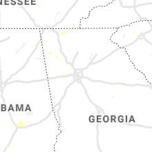
Georgia
| Local Time | Report Details |
|---|---|
| 1:11 PM EDT | A tree was reported down on a power line in the 600 block of lake hills driv in dade county GA, 15.7 miles SW of Chattanooga, TN |
| 4:48 PM EDT | A tree was reported down in a yard along emerald driv in forsyth county GA, 36.9 miles NNE of Atlanta, GA |
| 4:54 PM EDT | Two trees were reported dowm along retreat ridge southeas in bartow county GA, 31.3 miles NW of Atlanta, GA |
| 5:29 PM EDT | A tree and power lines were reported down near the intersection of knox bridge highway and upper sweetwater trai in cherokee county GA, 35.1 miles NNW of Atlanta, GA |
| 5:44 PM EDT | Quarter sized hail reported near Marietta, GA, 18.6 miles NNW of Atlanta, GA, quarter sized hail was reported near the intersection of sandy plains road and scufflegrit road. |
| 6:11 PM EDT | A tree was reported down in the 1800 block of murdock roa in cobb county GA, 17.8 miles NNW of Atlanta, GA |
| 6:13 PM EDT | Quarter sized hail reported near Marietta, GA, 16.5 miles NNW of Atlanta, GA, quarter sized hail was reported near the intersection of old canton road and sewell mill road. |
| 6:20 PM EDT | A tree was reported down in the 3900 block of paper mill road s in cobb county GA, 13.5 miles NNW of Atlanta, GA |
| 7:30 PM EDT | 1 tree dow in seminole county GA, 48.8 miles NW of Tallahassee, FL |
Alabama
| Local Time | Report Details |
|---|---|
| 1:45 PM CDT | One tree down on highway 79 and blocking part of the roadwa in blount county AL, 40.8 miles NNE of Birmingham, AL |
| 1:48 PM CDT | Four trees down along woods roa in blount county AL, 44.6 miles NNE of Birmingham, AL |
| 2:33 PM CDT | Corrects previous tstm wnd dmg report from holly pond. multiple trees were knocked down blocking u.s. highway 278 in holly pond. trees were also down at other locations in cullman county AL, 46.1 miles NNE of Birmingham, AL |
| 2:33 PM CDT | Multiple trees were knocked down blocking u.s. highway 278 in holly pond. trees were also down at other locations in this part of the count in dekalb county AL, 49.2 miles SW of Chattanooga, TN |
| 2:33 PM CDT | Corrects previous tstm wnd dmg report from 2 w holly pond. thunderstorm winds caused damage to a chicken house on cr 1682 just north of cr 165 in cullman county AL, 46.3 miles N of Birmingham, AL |
| 2:33 PM CDT | Corrects previous tstm wnd dmg report from 2 w holly pond. thunderstorm winds caused damage to a chicken house on cr 1682 just north of cr 165 in cullman county AL, 46.3 miles N of Birmingham, AL |
| 5:23 PM CDT | A tree was knocked down on the southbound portion of i-65 just before the tennessee river. time estimated by rada in limestone county AL, 46.1 miles ESE of Florence, AL |
| 5:36 PM CDT | A large flag pole and large tree limbs down in hartsell in morgan county AL, 48.7 miles ESE of Florence, AL |
| 7:00 PM CDT | A few trees were blown down in northern chambers count in chambers county AL, 30.7 miles N of Auburn, AL |
| 7:54 PM CDT | Tree blown onto a fence. pea size hail also reporte in elmore county AL, 53.6 miles W of Auburn, AL |
| 9:17 PM CDT | Sporadic tree damage near wetumpka... including georgia rd and us hwy 231... and s shelby s in elmore county AL, 40.9 miles W of Auburn, AL |
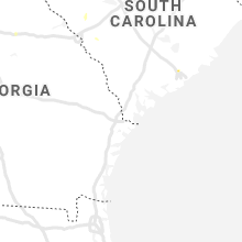
North Carolina
| Local Time | Report Details |
|---|---|
| 3:25 PM EDT | Duke energy reported 72 customers were without power along nix creek church road. time reported coincided with strongest winds on rada in mcdowell county NC, 63.9 miles NNE of Greenville, SC |
| 3:45 PM EDT | Mcdowell county 911 call center reported a tree down in glenwood. time estimated from rada in mcdowell county NC, 64.7 miles NNE of Greenville, SC |
| 3:51 PM EDT | Mcdowell county 911 call center reported a tree down in dysartsville. time estimated from rada in mcdowell county NC, 63.8 miles WNW of Charlotte, NC |
South Carolina
| Local Time | Report Details |
|---|---|
| 3:56 PM EDT | Duke energy reported 29 customers without power in the vicinity of memorial drive extension and lake cunningham. time reported coincided with strongest winds on rada in greenville county SC, 21.4 miles ENE of Greenville, SC |
| 4:07 PM EDT | Quarter sized hail reported near Hanahan, SC, 19.1 miles S of Charleston, SC, hanahan police department reported large hail. |
Florida
| Local Time | Report Details |
|---|---|
| 5:10 PM EDT | Power line dow in wakulla county FL, 18.7 miles SSW of Tallahassee, FL |
| 5:40 PM EDT | Tree limbs down along county road 30 in st. johns county FL, 39.7 miles SSE of Jacksonville, FL |
| 12:46 AM EDT | A cluster of strong thunderstorms moved southeastward and generated a wind gust of 52 knots or 60 mph at vaca ke in middle keys in mon county FL, 53.2 miles ENE of Key West, FL |
Virginia
| Local Time | Report Details |
|---|---|
| 5:50 PM EDT | Southampton county sheriff reported multiple trees down south of highway 58 near newsoms. time estimated via rada in southampton county VA, 61.3 miles W of Virginia Beach, VA |
California
| Local Time | Report Details |
|---|---|
| 3:14 PM PDT | Power pole hanging over highway 138 near 106th st eas in los angeles county CA, 36.6 miles NNE of Los Angeles, CA |
Utah
| Local Time | Report Details |
|---|---|
| 6:15 PM MDT | Apg mesonet site in tooele county UT, 79.1 miles WSW of Salt Lake City, UT |
| 6:25 PM MDT | Salt flats mesonet site in tooele county UT, 76.8 miles WSW of Salt Lake City, UT |
Colorado
| Local Time | Report Details |
|---|---|
| 6:42 PM MDT | Mesonet station co066 sh-86 cedar poin in elbert county CO, 68.8 miles ESE of Denver, CO |
| 6:48 PM MDT | Asos station klic limo in lincoln county CO, 77.3 miles SW of Yuma, CO |
| 6:52 PM MDT | Mesonet station co183 0.75 mi w of co- in washington county CO, 41.1 miles WNW of Yuma, CO |
| 7:14 PM MDT | Asos station kako akro in washington county CO, 26.6 miles W of Yuma, CO |
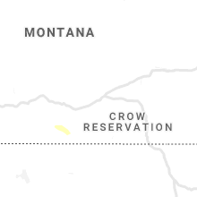
Montana
| Local Time | Report Details |
|---|---|
| 12:03 AM MDT | Mesonet station mtdpc deep creek us-12 (mt dot in meagher county MT, 46.4 miles N of Bozeman, MT |
Connect with Interactive Hail Maps