

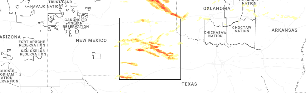
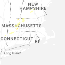
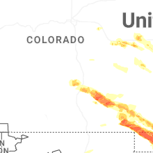
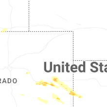
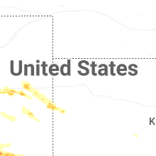
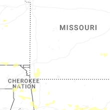
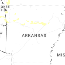
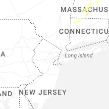
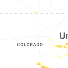
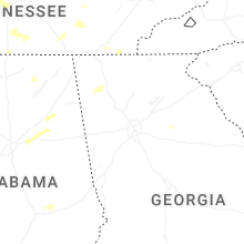
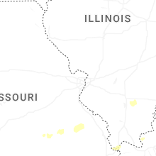
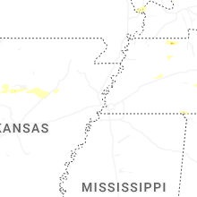
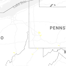
Hail Map for Friday, June 6, 2025
Number of Impacted Households on 6/6/2025
0
Impacted by 1" or Larger Hail
0
Impacted by 1.75" or Larger Hail
0
Impacted by 2.5" or Larger Hail
Square Miles of Populated Area Impacted on 6/6/2025
0
Impacted by 1" or Larger Hail
0
Impacted by 1.75" or Larger Hail
0
Impacted by 2.5" or Larger Hail

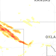
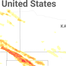

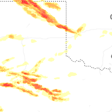


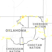

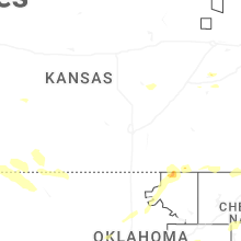
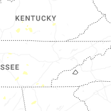
Cities Most Affected by Hail Storms of 6/6/2025
| Hail Size | Demographics of Zip Codes Affected | ||||||
|---|---|---|---|---|---|---|---|
| City | Count | Average | Largest | Pop Density | House Value | Income | Age |
| Hobbs, NM | 7 | 1.82 | 2.00 | 60 | $51k | $28.1k | 30.9 |
| Morton, TX | 3 | 2.33 | 2.75 | 6 | $26k | $26.9k | 35.7 |
| Kim, CO | 3 | 2.33 | 3.00 | 0 | $39k | $31.8k | 52.4 |
| Hammon, OK | 2 | 2.75 | 2.75 | 3 | $31k | $30.0k | 34.8 |
| Texhoma, OK | 2 | 2.68 | 3.60 | 1 | $49k | $38.8k | 36.2 |
| Wilson, TX | 2 | 2.50 | 3.25 | 4 | $36k | $30.3k | 37.5 |
| Goodwell, OK | 2 | 2.38 | 3.00 | 1 | $73k | $34.1k | 22.8 |
| Whiteface, TX | 2 | 2.25 | 2.50 | 0 | $22k | $30.8k | 33.8 |
| Briscoe, TX | 1 | 4.50 | 4.50 | 1 | $50k | $33.8k | 51.6 |
| Boise City, OK | 2 | 2.13 | 2.50 | 0 | $43k | $31.0k | 44.2 |
| Campo, CO | 2 | 2.00 | 2.00 | 0 | $22k | $24.6k | 51.3 |
| Pritchett, CO | 2 | 1.88 | 2.00 | 0 | $27k | $30.9k | 45.7 |
| Lubbock, TX | 2 | 1.88 | 2.00 | 300 | $53k | $29.4k | 30.3 |
| Petersburg, TX | 1 | 2.50 | 2.50 | 2 | $35k | $30.6k | 38.7 |
| Ropesville, TX | 1 | 2.00 | 2.00 | 8 | $49k | $33.2k | 40.4 |
| Paris, TN | 1 | 1.75 | 1.75 | 110 | $76k | $29.3k | 42.2 |
| Guymon, OK | 1 | 1.75 | 1.75 | 21 | $71k | $37.3k | 31.3 |
| Post, TX | 1 | 1.75 | 1.75 | 5 | $39k | $26.8k | 33.1 |
| Lorenzo, TX | 1 | 1.75 | 1.75 | 6 | $37k | $29.1k | 35.4 |
| New Deal, TX | 1 | 1.75 | 1.75 | 1 | $38k | $36.0k | 35.4 |
| Ralls, TX | 1 | 1.75 | 1.75 | 3 | $34k | $24.9k | 35.4 |
| Grand Junction, CO | 1 | 1.75 | 1.75 | 141 | $0k | $0.0k | 48.7 |
| Spearman, TX | 1 | 1.75 | 1.75 | 5 | $48k | $36.0k | 34.9 |
| Levelland, TX | 1 | 1.75 | 1.75 | 39 | $54k | $30.6k | 32.5 |
| Clovis, NM | 1 | 1.75 | 1.75 | 93 | $66k | $28.9k | 31.3 |
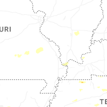
Hail and Wind Damage Spotted on 6/6/2025
Filter by Report Type:Hail ReportsWind Reports
States Impacted
Missouri, Illinois, Arkansas, Oklahoma, Pennsylvania, Kentucky, Tennessee, Virginia, New Hampshire, Vermont, Massachusetts, Colorado, West Virginia, Wyoming, Utah, New York, Connecticut, New Mexico, Alabama, Texas, North Carolina, KansasMissouri
| Local Time | Report Details |
|---|---|
| 7:08 AM CDT | Delayed report of a tree falling on a house in the stella/powell are in mcdonald county MO, 61.7 miles SW of Springfield, MO |
| 7:25 AM CDT | Reports of power poles across the roadway. time based on rada in barry county MO, 52.6 miles SW of Springfield, MO |
| 7:27 AM CDT | Church in town wall blown in. power poles and trees down. time based on rada in barry county MO, 52.6 miles SW of Springfield, MO |
| 7:57 AM CDT | Tree down on roadway. time based on rada in lawrence county MO, 40.1 miles WSW of Springfield, MO |
| 8:27 AM CDT | Delayed report of thunderstorms downing a limb and blocking the roadway near hober in lawrence county MO, 32.5 miles WSW of Springfield, MO |
| 8:40 AM CDT | A delayed report of a tree down at this location. time estimated via rada in lawrence county MO, 25.1 miles W of Springfield, MO |
| 8:53 AM UTC | Tree down partially blocking roadway at western street north of railroad tracks. time estimated via rada in lawrence county MO, 24.9 miles SW of Springfield, MO |
Illinois
| Local Time | Report Details |
|---|---|
| 7:45 AM CDT | Quarter sized hail reported near Dahlgren, IL, 62.6 miles WNW of Evansville, IN |
Arkansas
| Local Time | Report Details |
|---|---|
| 7:46 AM CDT | Significant damage to a home... likely tornado damag in crawford county AR, 5.6 miles NE of Fort Smith, AR |
| 7:57 AM CDT | Storm damage reported in crawford county AR, 19.4 miles NE of Fort Smith, AR |
| 8:00 AM CDT | Storm damage reported in crawford county AR, 13.1 miles ENE of Fort Smith, AR |
| 8:00 AM CDT | Trees dow in crawford county AR, 14.7 miles NE of Fort Smith, AR |
| 8:07 AM CDT | Report of a tree down on hwy 45 and bermuda grass loop near hacket in sebastian county AR, 15.5 miles S of Fort Smith, AR |
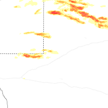
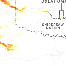
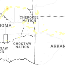
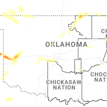
Oklahoma
| Local Time | Report Details |
|---|---|
| 8:11 AM CDT | Report of a tree blocking highway 9 between spiro and stigle in le flore county OK, 20.6 miles WSW of Fort Smith, AR |
| 6:12 PM CDT | Golf Ball sized hail reported near Boise City, OK, 117.7 miles SW of Garden City, KS |
| 7:35 PM CDT | Golf Ball sized hail reported near Texhoma, OK, 100.9 miles N of Amarillo, TX |
| 8:00 PM CDT | Golf Ball sized hail reported near Goodwell, OK, 96 miles N of Amarillo, TX |
| 8:05 PM CDT | Tea Cup sized hail reported near Texhoma, OK, 87.8 miles N of Amarillo, TX |
| 8:06 PM CDT | Tea Cup sized hail reported near Goodwell, OK, 93.7 miles N of Amarillo, TX |
| 9:45 PM CDT | Storm damage reported in beckham county OK, 66.4 miles NNE of Childress, TX |
| 10:23 PM CDT | Tennis Ball sized hail reported near Boise City, OK, 117.7 miles SW of Garden City, KS |
| 10:33 PM CDT | Baseball sized hail reported near Hammon, OK, 55.4 miles S of Woodward, OK |
| 10:34 PM CDT | Baseball sized hail reported near Hammon, OK, 55.6 miles S of Woodward, OK |
| 10:55 PM CDT | Golf Ball sized hail reported near Guymon, OK, 95 miles SSW of Garden City, KS |
| 12:01 AM CDT | Asos station kpwa okla city wile in oklahoma county OK, 8.3 miles WNW of Oklahoma City, OK |
| 12:15 AM CDT | Mesonet station buff buffal in harper county OK, 30.4 miles NNW of Woodward, OK |
| 12:31 AM CDT | Quarter sized hail reported near Elk City, OK, 72.1 miles S of Woodward, OK, report from mping: quarter (1.00 in.). |
| 12:33 AM CDT | Quarter sized hail reported near Elk City, OK, 70.6 miles S of Woodward, OK, report from mping: quarter (1.00 in.). |
| 12:40 AM CDT | Tree downed. individual trapped in tent. time estimated by rada in woodward county OK, 13.4 miles NW of Woodward, OK |
| 12:45 AM CDT | Mesonet station free freedo in woodward county OK, 25 miles NE of Woodward, OK |
| 12:50 AM CDT | Mesonet station mayr may ranc in woods county OK, 44 miles NNE of Woodward, OK |
| 12:55 AM CDT | Mesonet station mayr may ranc in woods county OK, 44 miles NNE of Woodward, OK |
| 1:15 AM CDT | Mesonet station alv2 alv in woods county OK, 42.8 miles ENE of Woodward, OK |
| 1:15 AM CDT | Storm damage reported in woods county OK, 46.7 miles ENE of Woodward, OK |
| 1:25 AM CDT | Mesonet station cher cheroke in alfalfa county OK, 61.8 miles ENE of Woodward, OK |
| 1:25 AM CDT | Asos station kswo stillwate in payne county OK, 54.1 miles NNE of Oklahoma City, OK |
| 1:45 AM CDT | Storm damage reported in alfalfa county OK, 69.4 miles ENE of Woodward, OK |
| 1:50 AM CDT | Mesonet station laho lahom in major county OK, 70.8 miles NNW of Oklahoma City, OK |
| 1:54 AM CDT | Storm damage reported in grant county OK, 73.8 miles SSW of Wichita, KS |
| 1:58 AM CDT | Power outage in garfield county OK, 76.3 miles NNW of Oklahoma City, OK |
| 1:58 AM CDT | Power is ou in grant county OK, 75.3 miles SSW of Wichita, KS |
| 2:03 AM CDT | Awos station kend enid vance af in garfield county OK, 62.6 miles NNW of Oklahoma City, OK |
| 2:05 AM CDT | Mesonet station medf medfor in grant county OK, 65.9 miles SSW of Wichita, KS |
| 2:10 AM CDT | Mesonet station medf medfor in grant county OK, 65.9 miles SSW of Wichita, KS |
| 2:35 AM CDT | Awos station kbkn blackwel in kay county OK, 64.6 miles S of Wichita, KS |
| 2:45 AM CDT | Mesonet station newk newkir in kay county OK, 59.1 miles SSE of Wichita, KS |
| 3:00 AM CDT | Storm damage reported in pawnee county OK, 44.5 miles WNW of Tulsa, OK |
| 6:30 AM CDT | Storm damage reported in latimer county OK, 57.6 miles NE of Atoka, OK |
Pennsylvania
| Local Time | Report Details |
|---|---|
| 10:10 AM EDT | Reports of multiple trees down in the johnstown are in cambria county PA, 57.3 miles E of Pittsburgh, PA |
| 2:25 PM EDT | Tree down on state route 857. tme estimated from rada in fayette county PA, 49.9 miles SSE of Pittsburgh, PA |
Kentucky
| Local Time | Report Details |
|---|---|
| 11:27 AM CDT | Several trees reported down across hardinsbur in breckinridge county KY, 43.1 miles WSW of Louisville, KY |
| 1:00 PM EDT | Corrects previous non-tstm wnd dmg report from 1 se flaherty. tree blown down... blocking coleman road with powerlines dow in meade county KY, 21.6 miles WSW of Louisville, KY |
| 1:02 PM EDT | Tree fell on power line in meade county KY, 21.5 miles SW of Louisville, KY |
| 1:23 PM EDT | Corrects previous tstm wnd dmg report from lebanon junction. tree down around main st. and preston hw in bullitt county KY, 10.9 miles S of Louisville, KY |
| 1:23 PM EDT | Tree down around wilson creek rd/pine tavern r in bullitt county KY, 8.2 miles S of Louisville, KY |
| 1:32 PM EDT | Tree down around main st. and preston hw in bullitt county KY, 10.9 miles S of Louisville, KY |
| 1:07 PM CDT | Reports of multiple trees down along ebenezer r in green county KY, 55.7 miles SSE of Louisville, KY |
| 2:18 PM EDT | Reports of trees dow in taylor county KY, 57.1 miles SSE of Louisville, KY |
| 1:30 PM CDT | 61 mph gust measured at the adair county ky mesonet sit in adair county KY, 63 miles SSE of Louisville, KY |
| 2:37 PM EDT | Report of power lines down around the danville ave and lee d in lincoln county KY, 39.7 miles WSW of Irvine, KY |
| 1:39 PM CDT | Corrects previous non-tstm wnd dmg report from 1 s glens fork. report of tree dow in adair county KY, 72.1 miles SSE of Louisville, KY |
| 2:42 PM EDT | Report tree down blocking gilberts creek r in garrard county KY, 33.1 miles WSW of Irvine, KY |
| 2:50 PM EDT | Large tree limb was blocking one lane of us-12 in casey county KY, 65.6 miles WSW of Irvine, KY |
| 2:52 PM EDT | Large branches snapped at 300 turner ridge rd. time estimated from rada in madison county KY, 25.5 miles W of Irvine, KY |
| 3:03 PM EDT | Rockcastle county dispatch reports downed trees along buffalo hollow road. time estimated via rada in rockcastle county KY, 23.2 miles WSW of Irvine, KY |
| 3:03 PM EDT | Rockcastle county dispatch reports trees down along chestnut grove road. time estimated via rada in rockcastle county KY, 28.6 miles SW of Irvine, KY |
| 3:06 PM EDT | Rockcastle county dispatch reports downed trees along sinking valley springs road. time estimated via rada in rockcastle county KY, 23.4 miles SW of Irvine, KY |
| 3:14 PM EDT | Pulaski county 911 reports downed trees in the 1800 block of ky 192. time estimated via rada in pulaski county KY, 52.1 miles SW of Irvine, KY |
| 3:28 PM EDT | Pulaski county 911 reports trees down along white lily church road. time estimated via rada in pulaski county KY, 51.3 miles SSW of Irvine, KY |
| 3:54 PM EDT | A laurel county deputy reported a downed tree along school street in east bernstadt to the county 911 dispatch. time estimated via rada in laurel county KY, 35.9 miles SSW of Irvine, KY |
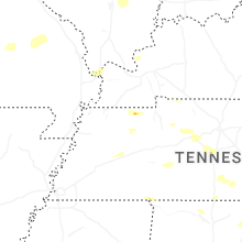
Tennessee
| Local Time | Report Details |
|---|---|
| 1:05 PM CDT | Utility poles down along mcclellan road in northwest jackso in madison county TN, 36.7 miles SW of Mc Kenzie, TN |
| 2:10 PM CDT | Tree and powerlines down on highway 114 along the carroll and henry county lin in carroll county TN, 15.1 miles E of Mc Kenzie, TN |
| 2:18 PM CDT | Tree down across copper spring r in henry county TN, 20.6 miles ENE of Mc Kenzie, TN |
| 2:25 PM CDT | Tree down across old springville r in henry county TN, 23.3 miles ENE of Mc Kenzie, TN |
| 2:36 PM CDT | Several trees down across robertson county. time is estimated on rada in robertson county TN, 22.9 miles NNW of Nashville, TN |
| 3:40 PM CDT | Multiple trees broken in woodmont subdivisio in rutherford county TN, 19 miles SE of Nashville, TN |
| 3:56 PM CDT | Tree fallen on road at the intersection of baker road and melton roa in grundy county TN, 33.3 miles WNW of Chattanooga, TN |
| 4:07 PM CDT | Half Dollar sized hail reported near Cottage Grove, TN, 17.2 miles N of Mc Kenzie, TN |
| 4:18 PM CDT | Golf Ball sized hail reported near Paris, TN, 15.1 miles NNE of Mc Kenzie, TN, golf ball-sized hail near the paris-henry county airport. |
| 5:05 PM CDT | Trees and powerlines down across the palio area... relayed from bledsoe county dispatc in bledsoe county TN, 28.9 miles N of Chattanooga, TN |
| 6:30 PM EDT | Reports of trees and powerlines down in western morristown via social media. winds at wfo mrx were estimated to have reached close to 60 mp in hamblen county TN, 36 miles ENE of Knoxville, TN |
| 6:40 PM EDT | Social media photos of trees down and power outages reported across the count in bradley county TN, 29.5 miles E of Chattanooga, TN |
| 7:00 PM EDT | Social media photo of trees down on davy crockett r in washington county TN, 34.7 miles SW of Bristol, TN |
| 7:05 PM EDT | Trees and powerlines dow in monroe county TN, 38.8 miles SW of Knoxville, TN |
| 7:10 PM EDT | Corrects previous tstm wnd dmg report from 2 nw madisonville. trees and powerlines dow in monroe county TN, 38.8 miles SW of Knoxville, TN |
| 6:44 PM CDT | Reported fairly large tree across holiday hills ln in counce... tn. time estimated on rada in hardin county TN, 35.2 miles WNW of Florence, AL |
| 8:01 PM CDT | Large tree down blocking 3900 buffalo roa in lawrence county TN, 46.3 miles NNE of Florence, AL |
| 9:01 PM CDT | Power flashes and power outages. potential tornado based on video supplied by spotter in maury county TN, 30.3 miles SSW of Nashville, TN |
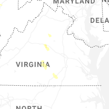
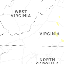
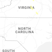
Virginia
| Local Time | Report Details |
|---|---|
| 2:26 PM EDT | A tree was down along tollhouse road near the berlin turnpik in loudoun county VA, 54.7 miles W of Baltimore, MD |
| 2:36 PM EDT | Tree down on allder school roa in loudoun county VA, 58.7 miles W of Baltimore, MD |
| 2:59 PM EDT | Four reports of trees down in the vicinity of oakpar in madison county VA, 65.9 miles NNW of Richmond, VA |
| 2:59 PM EDT | Numerous trees down along meander run rd. heading towards locust dal in madison county VA, 65.2 miles NNW of Richmond, VA |
| 3:03 PM EDT | Multiple trees uproote in madison county VA, 65.3 miles NNW of Richmond, VA |
| 3:20 PM EDT | Multiple trees down along mt. sharon r in orange county VA, 57 miles NNW of Richmond, VA |
| 3:20 PM EDT | Multiple trees down along clarks mountain r in orange county VA, 57.7 miles NNW of Richmond, VA |
| 3:20 PM EDT | Numerous trees were down in the rapidan and locust dale areas. a few trees fell onto houses. damage was reported at the rapidan fire departmen in culpeper county VA, 60.8 miles NNW of Richmond, VA |
| 3:30 PM EDT | Multiple trees down along brick church r in orange county VA, 54.9 miles NNW of Richmond, VA |
| 3:35 PM EDT | A wind gust of 65 knots (75 mph) was measured by the awos at orange county airport (komh in orange county VA, 55.9 miles NNW of Richmond, VA |
| 3:40 PM EDT | Multiple trees down along lahore rd. heading into lahore... and then also along marquis rd. heading north and south out of lahor in orange county VA, 51.3 miles NNW of Richmond, VA |
| 3:49 PM EDT | Multiple trees down along monrovia r in orange county VA, 50 miles NNW of Richmond, VA |
| 4:12 PM EDT | Trees blew down near warrenton... including one onto a house in the 7000 block of skyland driv in fauquier county VA, 71.3 miles WSW of Baltimore, MD |
| 4:15 PM EDT | Trees and wires blew down in the 1700 block of va-20 stony point roa in albemarle county VA, 57.3 miles NW of Richmond, VA |
| 4:55 PM EDT | Multiple reports of trees down in troy. radar estimated tim in fluvanna county VA, 45 miles NW of Richmond, VA |
| 5:00 PM EDT | Reports of trees down on gold mine road. radar estimated tim in fluvanna county VA, 40.4 miles WNW of Richmond, VA |
| 5:05 PM EDT | Tree down in the kents store area of fluvanna. time estimated from rada in fluvanna county VA, 37.4 miles NW of Richmond, VA |
| 5:20 PM EDT | Tree down on cartersville rd near the james rive in goochland county VA, 26.5 miles WNW of Richmond, VA |
| 5:22 PM EDT | Tree down blocking the intersection of anchorage ln. and parishville r in frederick county VA, 82.8 miles ENE of Elkins, WV |
| 5:30 PM EDT | Trees and wires blew down in the 100 block of va-127 bloomery pik in frederick county VA, 87.3 miles ENE of Elkins, WV |
| 5:35 PM EDT | Tree down on venable st. in farmville. time estimate in prince edward county VA, 43 miles WSW of Richmond, VA |
| 5:35 PM EDT | Wires down on lucas dr near farmville. time estimate in cumberland county VA, 41.5 miles WSW of Richmond, VA |
| 5:40 PM EDT | Wires down on busch river dr near farmville. time estimate in prince edward county VA, 41.4 miles WSW of Richmond, VA |
| 5:45 PM EDT | Tree down on poorhouse rd near rice... v in prince edward county VA, 42.5 miles WSW of Richmond, VA |
| 5:50 PM EDT | Tree down on price dr in farmville. time estimated from rada in prince edward county VA, 43 miles WSW of Richmond, VA |
| 5:52 PM EDT | Multiple trees down on green bay road. radar estimated tim in prince edward county VA, 41.2 miles WSW of Richmond, VA |
| 6:00 PM EDT | Tree down on aspen hill rd in rice. time estimated from rada in prince edward county VA, 39.1 miles WSW of Richmond, VA |
| 6:00 PM EDT | Tree down on monroe church rd in rice. time estimated from rada in prince edward county VA, 41 miles WSW of Richmond, VA |
| 6:00 PM EDT | Tree down on hubbard rd. time estimated from rada in prince edward county VA, 37.7 miles WSW of Richmond, VA |
| 6:05 PM EDT | Tree down on giles bridge rd in powhatan county. time estimated from rada in powhatan county VA, 17 miles W of Richmond, VA |
| 6:05 PM EDT | Tree down on miller lake rd. time estimated from rada in prince edward county VA, 40.1 miles WSW of Richmond, VA |
| 6:10 PM EDT | Corrects previous tstm wnd dmg report from 1 nw green bay. multiple trees down in the vicinity of green bay rd and cheatham rd. time estimated from rada in prince edward county VA, 44.6 miles SW of Richmond, VA |
| 6:10 PM EDT | Tree down on green bay rd in green bay... va. time estimated from rada in prince edward county VA, 44.6 miles SW of Richmond, VA |
| 6:15 PM EDT | Several trees blew down in the 600 block of luke road... and on westbound i-66 near mile marker in warren county VA, 87.9 miles WSW of Baltimore, MD |
| 6:23 PM EDT | Power line down on the falls rd. radar estimated tim in nottoway county VA, 38.2 miles SW of Richmond, VA |
| 6:23 PM EDT | Trees blew down near the intersection of dismal hollow road and happy creek road... and at the nearby firehous in warren county VA, 85.9 miles WSW of Baltimore, MD |
| 6:25 PM EDT | Power line down on flat rock rd. radar estimated tim in nottoway county VA, 37.7 miles SW of Richmond, VA |
| 6:30 PM EDT | Trees down at the intersection of doswell and robertson rd. radar estimated tim in nottoway county VA, 39.3 miles SW of Richmond, VA |
| 6:40 PM EDT | Report of a tree that fell on a power line. radar estimated tim in nottoway county VA, 39.4 miles SW of Richmond, VA |
| 6:57 PM EDT | Multiple trees down on i-85. one tree hit a car... but no injuries were reported. time estimated by rada in brunswick county VA, 41.6 miles S of Richmond, VA |
| 7:05 PM EDT | Tree down blocking the road on i-85. time estimated from rada in brunswick county VA, 40.7 miles S of Richmond, VA |
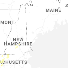
New Hampshire
| Local Time | Report Details |
|---|---|
| 2:54 PM EDT | Ping Pong Ball sized hail reported near Henniker, NH, 86.3 miles WSW of Portland, ME, reported by weather spotter. |
| 2:58 PM EDT | Trees down on nh route 127 near contocook state fores in merrimack county NH, 82.1 miles WSW of Portland, ME |
| 3:10 PM EDT | Half Dollar sized hail reported near Henniker, NH, 82.7 miles WSW of Portland, ME, old hopkinton rd. |
| 3:12 PM EDT | Observed 10 inch diameter tree down on wilson rd near beaman dr in cornish. time estimated by rada in sullivan county NH, 79.1 miles SSE of Burlington, VT |
| 3:15 PM EDT | 2 trees down on nh-12a... partially blocking road. time estimated by rada in sullivan county NH, 81.3 miles SSE of Burlington, VT |
| 3:15 PM EDT | Ping Pong Ball sized hail reported near Henniker, NH, 82.7 miles WSW of Portland, ME, corrects previous hail report from 3 e henniker. old hopkinton rd. |
| 3:30 PM EDT | Numerous reports of smaller trees and branches down on cornish stage rd and across cornish flats. time estimated by rada in sullivan county NH, 81.9 miles SE of Burlington, VT |
| 3:36 PM EDT | Half Dollar sized hail reported near North Sutton, NH, 85.6 miles WSW of Portland, ME, time estimated by radar. |
| 3:50 PM EDT | Quarter sized hail reported near Antrim, NH, 90.5 miles NNW of Providence, RI, time estimated by radar. |
| 4:32 PM EDT | Quarter sized hail reported near Concord, NH, 71.9 miles WSW of Portland, ME, time estimated by radar. |
| 4:50 PM EDT | Half Dollar sized hail reported near Weare, NH, 84.2 miles WSW of Portland, ME, reported by amateur radio... time estimated by radar. |
| 5:06 PM EDT | Half Dollar sized hail reported near Dunbarton, NH, 79.2 miles WSW of Portland, ME, reported by weather spotter. time estimated by radar. |
| 5:06 PM EDT | Reported by weather spotter. a few small trees down across clement hill rd. time estimated by rada in merrimack county NH, 75.6 miles WSW of Portland, ME |
| 5:08 PM EDT | Observed tree partially blocking woodbill road south of bo in merrimack county NH, 75.3 miles WSW of Portland, ME |
| 5:18 PM EDT | Half Dollar sized hail reported near Bow, NH, 74.2 miles WSW of Portland, ME, reported by weather spotter. time estimated by radar. |
| 6:06 PM EDT | Reported by amateur radio... trees down across town... several wires down as well. time estimated by rada in hillsborough county NH, 72.3 miles NNW of Providence, RI |
| 6:42 PM EDT | Tree down on wires on brent street. time estimated by rada in hillsborough county NH, 74.3 miles N of Providence, RI |
Vermont
| Local Time | Report Details |
|---|---|
| 3:20 PM EDT | Power line down into route 5... blocking traffi in windsor county VT, 78 miles SSE of Burlington, VT |
Massachusetts
| Local Time | Report Details |
|---|---|
| 3:38 PM EDT | In charlemont trees and wires blocked north river roa in franklin county MA, 55.4 miles ESE of Schenectady, NY |
| 3:38 PM EDT | Quarter sized hail reported near Colrain, MA, 64.9 miles E of Schenectady, NY, in colrain... a trained spotter reported quarter to half-dollar sized hail. report relayed via amateur radio. |
| 3:50 PM EDT | In leyden... mutiple trees and wires fell onto george lamb road. report relayed via amateur radi in franklin county MA, 67.6 miles E of Schenectady, NY |
| 3:50 PM EDT | In rutland... a tree fell blocking half of east center road. report relayed via amateur radi in worcester county MA, 46.2 miles NW of Providence, RI |
| 4:25 PM EDT | Quarter sized hail reported near Warwick, MA, 75.5 miles NW of Providence, RI, in warick... half-dollar sized hail was reported. |
| 4:47 PM EDT | In conway a tree fell down on wires near shelburne falls road. report was relayed via amateur radi in franklin county MA, 67.3 miles ESE of Schenectady, NY |
| 4:50 PM EDT | In whately a tree fell and was blocking conway road. report relayed via amateur radi in franklin county MA, 71.8 miles ESE of Schenectady, NY |
| 4:50 PM EDT | In south deerfield. trees came down on wires near river road. report relayed via amateur radi in franklin county MA, 70.7 miles ESE of Schenectady, NY |
| 4:55 PM EDT | Corrects previous flash flood report from montague. in montague... a tree was down in the area of sunderland road. report relayed via amateur radi in franklin county MA, 74.5 miles ESE of Schenectady, NY |
| 5:04 PM EDT | Quarter sized hail reported near Huntington, MA, 67.5 miles SE of Schenectady, NY, in huntington the police chief reported quarter sized hail. report relayed via amateur radio. |
| 5:20 PM EDT | Quarter sized hail reported near Florence, MA, 72.4 miles ESE of Schenectady, NY, in northampton there was quarter sized hail in the florence section of town. report relayed via amateur radio. |
| 5:20 PM EDT | Corrects previous flash flood report from northampton. in northhampton... trees and wires were down on spring stree in hampshire county MA, 72.4 miles ESE of Schenectady, NY |
| 5:48 PM EDT | Corrects previous flash flood report from colrain. in colrain... a tree fell and was blocking coombs hill road. report relayed via amateur radi in franklin county MA, 64.9 miles E of Schenectady, NY |
| 6:12 PM EDT | Quarter sized hail reported near Westfield, MA, 72.8 miles WNW of Providence, RI, in westfield quarter sized hail was reported. |
| 6:15 PM EDT | Asos station kbaf westfield-barnes a in hampden county MA, 71.5 miles WNW of Providence, RI |
| 6:20 PM EDT | In westfield a tree fell blocking lockhouse roa in hampden county MA, 72.8 miles WNW of Providence, RI |
| 6:20 PM EDT | Half Dollar sized hail reported near Orange, MA, 70.1 miles NW of Providence, RI |
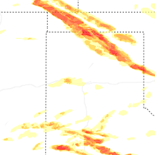
Colorado
| Local Time | Report Details |
|---|---|
| 1:52 PM MDT | Quarter sized hail reported near Colorado Springs, CO, 39.3 miles N of Pueblo, CO |
| 3:00 PM MDT | Tea Cup sized hail reported near Kim, CO, 97.9 miles SE of Pueblo, CO, reported to local media with pictures... then sent to us. |
| 3:00 PM MDT | Hen Egg sized hail reported near Kim, CO, 98.8 miles SE of Pueblo, CO, corrects previous hail report from 1 ssw kim. |
| 3:34 PM MDT | Hen Egg sized hail reported near Pritchett, CO, 112 miles SE of Pueblo, CO |
| 3:49 PM MDT | Quarter sized hail reported near Genoa, CO, 72 miles SW of Yuma, CO, report from mping: quarter (1.00 in.). |
| 3:56 PM MDT | Hen Egg sized hail reported near Campo, CO, 124.2 miles WSW of Garden City, KS |
| 4:01 PM MDT | Hen Egg sized hail reported near Campo, CO, 124.2 miles WSW of Garden City, KS, corrects previous hail report from 16 w campo. |
| 4:28 PM MDT | Half Dollar sized hail reported near Arriba, CO, 68.9 miles SSW of Yuma, CO, report from mping: half dollar (1.25 in.). |
| 4:35 PM MDT | Hen Egg sized hail reported near Kim, CO, 98.8 miles SE of Pueblo, CO |
| 4:57 PM MDT | Quarter sized hail reported near Flagler, CO, 52.2 miles SSW of Yuma, CO, mainly hail around half inch but mentioned that a few larger stones around quarter size occurred... personal weather station also recorded a 46 mph gust. |
| 5:25 PM MDT | Quarter sized hail reported near Fruita, CO, 10.9 miles NW of Grand Junction, CO |
| 5:32 PM MDT | Ping Pong Ball sized hail reported near Grand Junction, CO, 3 miles W of Grand Junction, CO |
| 5:35 PM MDT | Ping Pong Ball sized hail reported near Grand Junction, CO, 5.4 miles WNW of Grand Junction, CO |
| 5:40 PM MDT | Half Dollar sized hail reported near Grand Junction, CO, 3.5 miles N of Grand Junction, CO |
| 5:40 PM MDT | Quarter sized hail reported near Grand Junction, CO, 0.7 miles SSW of Grand Junction, CO |
| 5:41 PM MDT | Quarter sized hail reported near Grand Junction, CO, 2.4 miles SSE of Grand Junction, CO |
| 5:43 PM MDT | Ping Pong Ball sized hail reported near Grand Junction, CO, 3.1 miles WSW of Grand Junction, CO |
| 6:04 PM MDT | Golf Ball sized hail reported near Grand Junction, CO, 4.1 miles W of Grand Junction, CO |
| 6:34 PM MDT | Quarter sized hail reported near Grand Junction, CO, 4.1 miles W of Grand Junction, CO |
| 7:51 PM MDT | Golf Ball sized hail reported near Pritchett, CO, 114 miles ESE of Pueblo, CO |
| 8:06 PM MDT | Quarter sized hail reported near Springfield, CO, 108.2 miles WSW of Garden City, KS, mping report. |
West Virginia
| Local Time | Report Details |
|---|---|
| 4:38 PM EDT | Trees and wires blew down in the 100 block of harley lan in hampshire county WV, 62.7 miles ENE of Elkins, WV |
| 5:10 PM EDT | Trees blew down in the 9700 block of us-50 northwestern turnpik in hampshire county WV, 74.4 miles ENE of Elkins, WV |
| 5:10 PM EDT | Trees and wires blew down in the 100 block of kindred wa in hampshire county WV, 74.5 miles ENE of Elkins, WV |
| 5:13 PM EDT | Trees blew down in the 5700 block of us-50 northwestern turnpik in hampshire county WV, 78.1 miles ENE of Elkins, WV |
| 6:01 PM EDT | Trees blew down in the 4600 block of us-50 northwestern turnpik in hampshire county WV, 78.6 miles ENE of Elkins, WV |
Wyoming
| Local Time | Report Details |
|---|---|
| 2:43 PM MDT | Quarter sized hail reported near Cheyenne, WY, 38.1 miles ESE of Laramie, WY |
| 2:57 PM MDT | Asos station kcys cheyenne airport - cy in laramie county WY, 42.6 miles ESE of Laramie, WY |
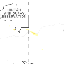
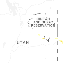
Utah
| Local Time | Report Details |
|---|---|
| 3:20 PM MDT | Quarter sized hail reported near Sunnyside, UT, 22.8 miles E of Price, UT, penny to quarter hail in sunnyside. |
New York
| Local Time | Report Details |
|---|---|
| 5:49 PM EDT | Tree down on deep hollow roa in dutchess county NY, 70.8 miles SSE of Schenectady, NY |
Connecticut
| Local Time | Report Details |
|---|---|
| 5:55 PM EDT | Tree down near kent rd and warren hill rd intersection. time estimated from rada in litchfield county CT, 75.6 miles SSE of Schenectady, NY |
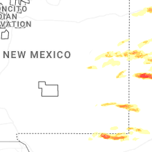
New Mexico
| Local Time | Report Details |
|---|---|
| 4:00 PM MDT | Ping Pong Ball sized hail reported near Crossroads, NM, 69.4 miles E of Roswell, NM, spotter reports ping pong ball sized hail near the lea-roosevelt county lines at approximately 4 pm. |
| 4:39 PM MDT | Quarter sized hail reported near Crossroads, NM, 70.7 miles W of Lubbock, TX |
| 6:14 PM MDT | Quarter sized hail reported near Grenville, NM, 77.3 miles N of Tucumcari, NM, observer at pasamonte ranch reports quarter size hail. |
| 6:36 PM MDT | Golf Ball sized hail reported near Hobbs, NM, 76.7 miles NW of Odessa, TX |
| 6:37 PM MDT | Ping Pong Ball sized hail reported near Hobbs, NM, 74.9 miles NW of Odessa, TX |
| 6:40 PM MDT | Golf Ball sized hail reported near Hobbs, NM, 75.4 miles NW of Odessa, TX, received reports of broken car windows and multiple alarms calls. |
| 6:42 PM MDT | Golf Ball sized hail reported near Hobbs, NM, 74.3 miles NW of Odessa, TX |
| 6:44 PM MDT | Golf Ball sized hail reported near Hobbs, NM, 74.9 miles NW of Odessa, TX, video shows golf ball sized hail near turner and grimes streets in hobbs. |
| 6:49 PM MDT | Hen Egg sized hail reported near Hobbs, NM, 73.5 miles NW of Odessa, TX |
| 6:53 PM MDT | Quarter sized hail reported near Hobbs, NM, 79.2 miles NW of Odessa, TX, report from mping: quarter (1.00 in.). |
| 6:57 PM MDT | Golf Ball sized hail reported near Hobbs, NM, 75.1 miles NW of Odessa, TX, approximately egg sized hail near the intersection of dal paso and st. anne in hobbs. |
| 6:57 PM MDT | Hen Egg sized hail reported near Hobbs, NM, 75.1 miles NW of Odessa, TX, corrects previous hail report from 2 ese hobbs. approximately egg sized hail near the intersection of dal paso and st. anne in hobbs. |
| 10:49 PM MDT | Half Dollar sized hail reported near Clovis, NM, 59.4 miles SSE of Tucumcari, NM |
| 10:50 PM MDT | Half Dollar sized hail reported near Clovis, NM, 59.1 miles SSE of Tucumcari, NM, report from mping: half dollar (1.25 in.). |
| 10:52 PM MDT | Golf Ball sized hail reported near Clovis, NM, 59.3 miles SSE of Tucumcari, NM, report from mping: golf ball (1.75 in.). |
| 10:55 PM MDT | Ping Pong Ball sized hail reported near Clovis, NM, 59.1 miles SSE of Tucumcari, NM, report from mping: ping pong ball (1.50 in.). |
| 11:15 PM MDT | Quarter sized hail reported near Portales, NM, 79.7 miles SSE of Tucumcari, NM, report from mping: quarter (1.00 in.). |
Alabama
| Local Time | Report Details |
|---|---|
| 5:08 PM CDT | Multiple trees down south of interstate 2 in st. clair county AL, 23.5 miles E of Birmingham, AL |
| 5:50 PM CDT | Social media photo of a tree down across waldrop roa in st. clair county AL, 46.1 miles ENE of Birmingham, AL |
| 6:05 PM CDT | Tree down at sutton bridge road and brown avenu in etowah county AL, 54.2 miles NE of Birmingham, AL |
| 6:16 PM CDT | Tree down on bachelors chapel rd and smith r in etowah county AL, 64.1 miles ENE of Birmingham, AL |
Texas
| Local Time | Report Details |
|---|---|
| 5:10 PM CDT | Quarter sized hail reported near Lubbock, TX, 1.9 miles N of Lubbock, TX |
| 5:19 PM CDT | Golf Ball sized hail reported near Lubbock, TX, 3.3 miles WNW of Lubbock, TX |
| 5:20 PM CDT | Half Dollar sized hail reported near Lubbock, TX, 5.7 miles NNE of Lubbock, TX |
| 5:30 PM CDT | Ping Pong Ball sized hail reported near Lubbock, TX, 2.8 miles NE of Lubbock, TX |
| 5:32 PM CDT | Golf Ball sized hail reported near New Deal, TX, 10.2 miles N of Lubbock, TX |
| 5:37 PM CDT | Quarter sized hail reported near Lubbock, TX, 3.3 miles NE of Lubbock, TX, report from mping: quarter (1.00 in.). |
| 5:39 PM CDT | Quarter sized hail reported near Lubbock, TX, 4.9 miles NNE of Lubbock, TX, report from mping: quarter (1.00 in.). |
| 5:42 PM CDT | Hen Egg sized hail reported near Lubbock, TX, 5.7 miles NNE of Lubbock, TX |
| 5:45 PM CDT | Overturned tractor traile in lubbock county TX, 8.3 miles ENE of Lubbock, TX |
| 6:05 PM CDT | Quarter sized hail reported near Morton, TX, 55.7 miles W of Lubbock, TX, report from mping: quarter (1.00 in.). |
| 6:07 PM CDT | Large trees down. blown out window in lubbock county TX, 11 miles ESE of Lubbock, TX |
| 6:10 PM CDT | Baseball sized hail reported near Morton, TX, 55.8 miles W of Lubbock, TX, report from mping: baseball (2.75 in.). |
| 6:13 PM CDT | Golf Ball sized hail reported near Morton, TX, 55.7 miles W of Lubbock, TX, report from mping: golf ball (1.75 in.). |
| 6:17 PM CDT | 3 power poles dow in lubbock county TX, 11.1 miles ESE of Lubbock, TX |
| 6:19 PM CDT | Tennis Ball sized hail reported near Morton, TX, 55.8 miles W of Lubbock, TX, report from mping: tennis ball (2.50 in.). |
| 6:43 PM CDT | Ping Pong Ball sized hail reported near Whiteface, TX, 43.8 miles W of Lubbock, TX, report from mping: ping pong ball (1.50 in.). |
| 6:50 PM CDT | Hen Egg sized hail reported near Whiteface, TX, 43.8 miles W of Lubbock, TX, report from mping: hen egg (2.00 in.). |
| 7:04 PM CDT | Tennis Ball sized hail reported near Whiteface, TX, 44.5 miles WSW of Lubbock, TX, report from mping: tennis ball (2.50 in.). |
| 7:25 PM CDT | Golf Ball sized hail reported near Levelland, TX, 30.3 miles W of Lubbock, TX, intersection of hwy 385 and sandalwood lane. |
| 7:43 PM CDT | Hen Egg sized hail reported near Ropesville, TX, 18.9 miles SW of Lubbock, TX |
| 7:50 PM CDT | Quarter sized hail reported near Wolfforth, TX, 14.7 miles SW of Lubbock, TX |
| 7:53 PM CDT | Quarter sized hail reported near , , 62.9 miles W of Odessa, TX |
| 7:57 PM CDT | West texas mesonet repor in garza county TX, 40.3 miles SSE of Lubbock, TX |
| 8:12 PM CDT | Golf Ball sized hail reported near Wilson, TX, 18.3 miles S of Lubbock, TX |
| 8:32 PM CDT | Tea Cup sized hail reported near Wilson, TX, 18.2 miles S of Lubbock, TX, report from mping: baseball+ (3.25 in.). |
| 8:34 PM CDT | West texas mesonet aler in lynn county TX, 18.3 miles S of Lubbock, TX |
| 8:42 PM CDT | Quarter sized hail reported near New Deal, TX, 9.5 miles N of Lubbock, TX, new deal fire station. |
| 8:47 PM CDT | Ping Pong Ball sized hail reported near Wilson, TX, 20.1 miles SSE of Lubbock, TX, picture from em. |
| 9:05 PM CDT | Mesonet station 48 2e andrew in andrews county TX, 33.5 miles NNW of Odessa, TX |
| 9:15 PM CDT | Awos station ke11 andrew in andrews county TX, 34.4 miles NNW of Odessa, TX |
| 9:22 PM CDT | Golf Ball sized hail reported near Lorenzo, TX, 19.5 miles ENE of Lubbock, TX |
| 9:24 PM CDT | Golf Ball sized hail reported near Post, TX, 39.1 miles SE of Lubbock, TX, picture from social media. |
| 9:35 PM CDT | Golf Ball sized hail reported near Ralls, TX, 28.1 miles ENE of Lubbock, TX |
| 9:36 PM CDT | Storm damage reported in crosby county TX, 28 miles E of Lubbock, TX |
| 9:37 PM CDT | Storm damage reported in stonewall county TX, 56.4 miles NNW of Abilene, TX |
| 10:02 PM CDT | Quarter sized hail reported near Lubbock, TX, 6.1 miles W of Lubbock, TX |
| 10:14 PM CDT | West texas mesonet site recorded 69 mph wind gus in haskell county TX, 49.7 miles N of Abilene, TX |
| 10:17 PM CDT | West texas mesonet recorded a 74 mph wind gust at 1017 p in haskell county TX, 50.4 miles N of Abilene, TX |
| 11:00 PM CDT | Mesonet station 36 paducah 10s in cottle county TX, 38.7 miles SSW of Childress, TX |
| 11:10 PM CDT | Storm damage reported in knox county TX, 66.1 miles WSW of Wichita Falls, TX |
| 11:12 PM CDT | Softball sized hail reported near Briscoe, TX, 72.7 miles SW of Woodward, OK |
| 11:22 PM CDT | West texas meson in lamb county TX, 38.1 miles NNW of Lubbock, TX |
| 11:49 PM CDT | Mesonet station 117 2sse hackberry hackberry/cottle count in cottle county TX, 36.8 miles S of Childress, TX |
| 12:05 AM CDT | Quarter sized hail reported near Stratford, TX, 82.5 miles N of Amarillo, TX |
| 12:11 AM CDT | Golf Ball sized hail reported near Spearman, TX, 74.8 miles NNE of Amarillo, TX |
| 12:15 AM CDT | Perryton awos measured peak wind gust of 75 mph with thunderstorm in ochiltree county TX, 74.2 miles W of Woodward, OK |
| 12:26 AM CDT | Mesonet was hit by an outflow from a storm well to the north to northeas in hutchinson county TX, 48.7 miles NNE of Amarillo, TX |
| 1:05 AM CDT | West texas mesone in motley county TX, 45 miles WSW of Childress, TX |
| 1:09 AM CDT | Also gusted to 64 mph at 110 am. west texas mesone in bailey county TX, 66.3 miles NW of Lubbock, TX |
| 1:23 AM CDT | Miami mesonet began gusting severe at 119 am with a peak gust of 90 mph. severe gusts ended at 130 a in hemphill county TX, 77.6 miles SW of Woodward, OK |
| 1:53 AM CDT | West texas mesone in cottle county TX, 38.1 miles SSW of Childress, TX |
| 1:58 AM CDT | Tennis Ball sized hail reported near Petersburg, TX, 24.9 miles NNE of Lubbock, TX, 2-inch hail measured two hours after storm. estimated between 2.25 and 2.5 inches before melting. time estimated. |
| 2:15 AM CDT | Also gusted to 59 mph at 214 am. west texas mesone in cottle county TX, 36.1 miles S of Childress, TX |
| 3:50 AM CDT | Ping Pong Ball sized hail reported near Vega, TX, 33.8 miles W of Amarillo, TX |
| 3:50 AM CDT | Large tree blown down in front yar in oldham county TX, 33.8 miles W of Amarillo, TX |
| 4:38 AM CDT | Quarter sized hail reported near Wildorado, TX, 20.7 miles W of Amarillo, TX |
North Carolina
| Local Time | Report Details |
|---|---|
| 7:46 PM EDT | Large tree down across the road near the intersection of elkin wildlife road and cc camp roa in surry county NC, 72.9 miles N of Charlotte, NC |
| 8:20 PM EDT | Tree down on a house near green tree drive and franklin roa in forsyth county NC, 65.7 miles NNE of Charlotte, NC |
| 8:30 PM EDT | Tree down on a house near the intersection of west twenty-third street and pittsburg av in forsyth county NC, 70.1 miles NNE of Charlotte, NC |
| 8:36 PM EDT | Tree down on a powerline near the intersection of hurdle mills road and walnut grove church roa in person county NC, 40 miles NW of Raleigh, NC |
| 9:01 PM EDT | Tree down near the intersection of kiger road and jackson roa in orange county NC, 33.9 miles NW of Raleigh, NC |
| 9:10 PM EDT | North iredell rescue squad reported a tree down near the intersection of blackwelder rd and turnersburg hwy (us 21). tclt estimated winds of 27-31 kts. time estimated f in iredell county NC, 45.3 miles N of Charlotte, NC |
| 10:20 PM EDT | North iredell rescue squad reported a tree down near the intersection of upper oak dr and wilkesboro hwy (nc 115). tclt estimated winds of 27-33 kts. time estimated fro in iredell county NC, 41.4 miles N of Charlotte, NC |
| 10:20 PM EDT | North iredell rescue squad reported a tree down at 2636 wilkesboro hwy (nc 115). tclt estimated winds of 27-33 kts. time estimated from rada in iredell county NC, 43.6 miles N of Charlotte, NC |
| 10:20 PM EDT | North iredell rescue squad reported a tree down near the intersection of miller farm rd and doe trail ln. tclt estimated winds of 27-33 kts. time estimated from rada in iredell county NC, 42.2 miles N of Charlotte, NC |
Kansas
| Local Time | Report Details |
|---|---|
| 7:03 PM MDT | Quarter sized hail reported near Weskan, KS, 64.6 miles SW of Colby, KS, report from mping: quarter (1.00 in.). |
| 1:42 AM CDT | Several tree limbs down blocking roadway in harper county KS, 53.2 miles SW of Wichita, KS |
| 1:42 AM CDT | Several limbs blocking roadway in harper county KS, 47 miles SW of Wichita, KS |
| 2:36 AM CDT | Several reports of trees and power lines dow in cowley county KS, 45.6 miles SSE of Wichita, KS |
| 2:37 AM CDT | Storm damage reported in sedgwick county KS, 8.2 miles WNW of Wichita, KS |
| 2:42 AM CDT | Storm damage reported in sedgwick county KS, 7.7 miles WNW of Wichita, KS |
| 2:43 AM CDT | Estimated speed at nws offic in sedgwick county KS, 6 miles WSW of Wichita, KS |
| 2:45 AM CDT | Delayed report. several large tree limbs down along ridge road between central and 29th street nort in sedgwick county KS, 5.4 miles WNW of Wichita, KS |
| 2:49 AM CDT | 4-inch tree limbs reported down along with power outage. received via social medi in sedgwick county KS, 2.2 miles WSW of Wichita, KS |
| 2:49 AM CDT | Storm damage reported in sedgwick county KS, 6.6 miles WSW of Wichita, KS |
| 2:49 AM CDT | Numerous large trees down... several power poles broken off and lines down across the cit in cowley county KS, 45.6 miles SSE of Wichita, KS |
| 2:55 AM CDT | Storm damage reported in sumner county KS, 25.5 miles S of Wichita, KS |
| 3:10 AM CDT | Storm damage reported in cowley county KS, 39.2 miles SSE of Wichita, KS |
Connect with Interactive Hail Maps