

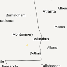
Hail Map for Thursday, December 22, 2011

Number of Impacted Households on 12/22/2011
0
Impacted by 1" or Larger Hail
0
Impacted by 1.75" or Larger Hail
0
Impacted by 2.5" or Larger Hail
Square Miles of Populated Area Impacted on 12/22/2011
0
Impacted by 1" or Larger Hail
0
Impacted by 1.75" or Larger Hail
0
Impacted by 2.5" or Larger Hail
Cities Most Affected by Hail Storms of 12/22/2011
| Hail Size | Demographics of Zip Codes Affected | ||||||
|---|---|---|---|---|---|---|---|
| City | Count | Average | Largest | Pop Density | House Value | Income | Age |
Hail and Wind Damage Spotted on 12/22/2011
Filter by Report Type:Hail ReportsWind Reports
Louisiana
| Local Time | Report Details |
|---|---|
| 12:00 PM UTC | Several buildings damaged by winds in jenning in jefferson davis county LA, 38.5 miles W of Lafayette, LA |
| 12:15 PM UTC | Jennings sheriff reports the roof completely torn off of jennings fine jewelry along lake arthur ave. the buildings cinderblocks were also repordedly cracke in jefferson davis county LA, 38.5 miles W of Lafayette, LA |
| 1:15 PM UTC | Fireworks tent blown apart along i-10 at ambassado in lafayette county LA, 0.8 miles W of Lafayette, LA |
| 1:15 PM UTC | Nws storm survey confirmed that minor damage to the old fruit of the loom building near port barre was related to straight line winds and not a tornado. damage included in st. landry county LA, 23.6 miles N of Lafayette, LA |
| 1:15 PM UTC | Port barre police confirm damage at the old fruit of the loom plant. additional damage reported to a subway at kings truck stop on hwy 190. possible tornad in st. landry county LA, 23.6 miles N of Lafayette, LA |
| 2:15 PM UTC | Roof blown off house on highway 412 west between slaughter and jackso in east feliciana county LA, 61.8 miles NE of Lafayette, LA |
| 2:23 PM UTC | Trees and power lines downed on highway 956 near intersection of hwy 10 and hwy 19 south of wilso in east feliciana county LA, 70.6 miles NE of Lafayette, LA |
| 2:27 PM UTC | Trees and power lines downed on highway 19 in norwood. highway closed for a period of tim in east feliciana county LA, 74.3 miles NE of Lafayette, LA |
| 2:30 PM UTC | Several power lines down in clinto in east feliciana county LA, 74.5 miles NE of Lafayette, LA |
| 3:30 PM UTC | Trees and power lines down on highway 444 east of king george bay road and highway 22 5 miles southeast of french settlemen in livingston county LA, 46.8 miles WNW of New Orleans, LA |
| 3:32 PM UTC | Large oak tree downed on black cat road in tangipahoa county LA, 53.9 miles NNW of New Orleans, LA |
| 4:32 PM UTC | Awning blown onto a car in a residential area in st. rose in st. charles county LA, 16.4 miles W of New Orleans, LA |
| 4:40 PM UTC | Power lines downed in the bonnabel and west end area in jefferson county LA, 6.9 miles WNW of New Orleans, LA |
Mississippi
| Local Time | Report Details |
|---|---|
| 2:45 PM UTC | Tree down on old highway 27 number 1 and a tree down on damascus roa in copiah county MS, 32.6 miles SSW of Jackson, MS |
| 3:51 PM UTC | Trees down at kirklin road and us highway 198 in walthall county MS, 80.4 miles N of New Orleans, LA |
| 5:18 PM UTC | Roof damage at park place apartments and windows blown out of vehicles at turtlecreek mall. siding and shingle damage also reported by wdam at interstate 59 and hardy s in lamar county MS, 82.3 miles SE of Jackson, MS |
| 5:40 PM UTC | 3 apartments were damaged at the parkplace apartments on westover drive. windows were busted out. roofs were damaged. trees were uproote in lamar county MS, 86 miles SE of Jackson, MS |
| 5:40 PM UTC | Possible funnel cloud spotted by publi in lamar county MS, 86 miles SE of Jackson, MS |
| 5:40 PM UTC | One tree and large limbs down on county road 358 in clarke county MS, 82.8 miles E of Jackson, MS |
| 5:40 PM UTC | House on williamson road had damaged shingles. big limbs broke off trees and a barn roof was destroye in lamar county MS, 69.2 miles SSE of Jackson, MS |
Alabama
| Local Time | Report Details |
|---|---|
| 7:00 PM UTC | Trees down and wind damage to roofs on homes along county road 30 in dallas county AL, 40.4 miles NE of Camden, AL |
| 7:10 PM UTC | Structure damage to mobile home on cr 340 in dallas county AL, 18 miles N of Camden, AL |
| 7:25 PM UTC | Trees down bwtween lawley and randolp in bibb county AL, 46.2 miles S of Birmingham, AL |
| 7:33 PM UTC | Trees down and wind damage to roofs on homes along county road 30 in dallas county AL, 40.4 miles NE of Camden, AL |
| 7:40 PM UTC | 18 to 20 trees down along highland drive in northeast side of tow in shelby county AL, 26.5 miles SSE of Birmingham, AL |
| 7:40 PM UTC | Tree down on has in downtown columbiana near lester stree in shelby county AL, 26.5 miles SSE of Birmingham, AL |
| 7:40 PM UTC | Tree down on house in downtown columbiana near lester stree in shelby county AL, 26.5 miles SSE of Birmingham, AL |
| 7:40 PM UTC | Trees on power lines along hwy 25 in columbian in shelby county AL, 26.5 miles SSE of Birmingham, AL |
| 7:50 PM UTC | Tree down on power lines along al hwy 2 in shelby county AL, 25.8 miles SSE of Birmingham, AL |
| 7:50 PM UTC | Tree down across alabama highway 14 near starksvill in autauga county AL, 42.5 miles NE of Camden, AL |
| 8:00 PM UTC | Damage to two mobile homes along county road 57. possible tornad in autauga county AL, 60.2 miles NE of Camden, AL |
| 8:10 PM UTC | Trees dowm along al hwy 143 and county rd 6 in autauga county AL, 52.6 miles ENE of Camden, AL |
| 8:11 PM UTC | Tree down near jucntion county rds 59 and 19 on northeast side of tow in autauga county AL, 57.1 miles NE of Camden, AL |
| 8:11 PM UTC | Tree down on road near junction of u s highway 80 and albama highway 4 in dallas county AL, 33.4 miles NNE of Camden, AL |
| 8:15 PM UTC | A barn and outbuildings were damaged along county road 193. possible tornad in elmore county AL, 54.5 miles W of Auburn, AL |
| 8:16 PM UTC | A tree was blown down along tyler roa in elmore county AL, 50.9 miles W of Auburn, AL |
| 8:16 PM UTC | Large tree down near rollin in autauga county AL, 56.6 miles W of Auburn, AL |
| 8:23 PM UTC | Tree down along law road. possible tornad in elmore county AL, 50.7 miles WNW of Auburn, AL |
| 8:30 PM UTC | Tree down on woolfolk road and water partially blocking lake jones circl in talladega county AL, 45.5 miles E of Birmingham, AL |
| 8:32 PM UTC | Trees and powerlines down along highway 231 at county road 14. trees also reported down along county road 40...and highway 22 and highway 9 near cottage grove. possible in coosa county AL, 46 miles WNW of Auburn, AL |
| 8:39 PM UTC | Storm damage reported in talladega county AL, 41.6 miles E of Birmingham, AL |
| 9:52 PM UTC | Minor damage reported to a metal barn with several small trees blown dow in covington county AL, 62.7 miles NNW of Miramar Beach, FL |
| 11:55 PM UTC | Spotter reported gusts of 40-50 mph with a peak gust of 60 mph. spotter also reported heavy rain...about 0.5 in in one minute. there was also intense lightning and a po in dale county AL, 80.4 miles S of Auburn, AL |
| 11:55 PM UTC | Spotter reported gusts of 40-50 mph with a peak gust of 60 mph. spotter also reported heavy rain. there was also intense lightning and a power outage. no downed lines r in dale county AL, 80.4 miles S of Auburn, AL |
Georgia
| Local Time | Report Details |
|---|---|
| 9:40 PM UTC | Polk county 911 relayed a report of two trees down in far western polk count in polk county GA, 59.1 miles WNW of Atlanta, GA |
| 9:40 PM UTC | Haralson 911 relayed a report of a tree down in far western haralson count in haralson county GA, 52.6 miles W of Atlanta, GA |
| 10:00 PM UTC | *** 2 inj *** more than 6 trees down all across the county. ema also relayed a report of multiple injuries at this tim in floyd county GA, 54.7 miles S of Chattanooga, TN |
| 10:00 PM UTC | *** 4 inj *** more than 6 trees down all across the county. ema also relayed a report of multiple injuries at this tim in floyd county GA, 54.7 miles S of Chattanooga, TN |
| 10:00 PM UTC | More than 6 trees down all across the count in floyd county GA, 54.7 miles S of Chattanooga, TN |
| 10:19 PM UTC | Bartow 911 relayed a report that many trees are down and damage to homes around sr 140 and oak grove roa in bartow county GA, 50 miles SSE of Chattanooga, TN |
| 10:25 PM UTC | Relayed from cherokee county ema...major structural damage in southern gordon county. many homes with damage and one house at least was destroye in gordon county GA, 46.5 miles SSE of Chattanooga, TN |
| 10:25 PM UTC | Bartow 911 relays a report of i75 blocked by downed trees between exits 306 and 31 in gordon county GA, 47.2 miles SSE of Chattanooga, TN |
| 10:34 PM UTC | 911 relayed a report of several trees down in the hogansville are in troup county GA, 49.9 miles SW of Atlanta, GA |
| 10:36 PM UTC | Ema relayed a report of numerous trees down in the southern part of the count in gilmer county GA, 54.8 miles ESE of Chattanooga, TN |
| 10:37 PM UTC | Power lines down on mt carmel r in coweta county GA, 38 miles SW of Atlanta, GA |
| 10:39 PM UTC | Three trees down in the winston are in douglas county GA, 25.3 miles W of Atlanta, GA |
| 10:44 PM UTC | 911 relayes a report of three trees down in the primrose communit in meriwether county GA, 46.5 miles SSW of Atlanta, GA |
| 10:45 PM UTC | Power lines down on west grantville r in coweta county GA, 40.2 miles SW of Atlanta, GA |
| 10:50 PM UTC | Power lines down on martin mill r in coweta county GA, 36.3 miles SSW of Atlanta, GA |
| 10:53 PM UTC | One tree reported dow in fulton county GA, 23.4 miles WSW of Atlanta, GA |
| 11:16 PM UTC | Em relayed a report of a tree on a house in cummun in forsyth county GA, 33 miles NNE of Atlanta, GA |
| 11:20 PM UTC | Emergency manager reported roof damage to residence along mud bridge road along with a large barn and two out buildings destroye in fayette county GA, 26.8 miles S of Atlanta, GA |
| 11:20 PM UTC | Emergency manager reported roof damage to residence along mud bridge road along with a large barn and two out houses destroye in fayette county GA, 26.8 miles S of Atlanta, GA |
| 11:21 PM UTC | One tree down on panhandle road at woolsey roa in clayton county GA, 25.4 miles S of Atlanta, GA |
| 11:25 PM UTC | Trees down 2 se of jonesbor in clayton county GA, 17.5 miles SSE of Atlanta, GA |
| 11:30 PM UTC | Couple of trees down in hampto in henry county GA, 25.5 miles SSE of Atlanta, GA |
| 11:35 PM UTC | A couple of trees down around mcdonoug in henry county GA, 24.8 miles SE of Atlanta, GA |
Connect with Interactive Hail Maps