

Hail Map for Friday, July 13, 2012

Number of Impacted Households on 7/13/2012
0
Impacted by 1" or Larger Hail
0
Impacted by 1.75" or Larger Hail
0
Impacted by 2.5" or Larger Hail
Square Miles of Populated Area Impacted on 7/13/2012
0
Impacted by 1" or Larger Hail
0
Impacted by 1.75" or Larger Hail
0
Impacted by 2.5" or Larger Hail


Cities Most Affected by Hail Storms of 7/13/2012
| Hail Size | Demographics of Zip Codes Affected | ||||||
|---|---|---|---|---|---|---|---|
| City | Count | Average | Largest | Pop Density | House Value | Income | Age |
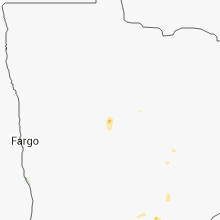
| Whittemore, IA | 1 | 2.00 | 2.00 | 7 | $45k | $34.1k | 39.9 |
| Bancroft, IA | 1 | 1.75 | 1.75 | 10 | $43k | $32.4k | 45.8 |
Hail and Wind Damage Spotted on 7/13/2012
Filter by Report Type:Hail ReportsWind Reports
States Impacted
Kansas, Iowa, Illinois, Minnesota, Texas, Arkansas, Missouri, Oklahoma, Utah, Arizona, Wisconsin, Washington, MontanaKansas
| Local Time | Report Details |
|---|---|
| 8:00 AM CDT | Time estimated in marshall county KS, 35 miles N of Manhattan, KS |
| 8:00 AM CDT | Several one inch tree limbs down. six to eight inch diameter tree snapped. power outages reported in the cit in marshall county KS, 35 miles N of Manhattan, KS |
| 2:40 PM CDT | 10 to 12 inch diameter limbs broken in cherokee county KS, 51.5 miles ESE of Chanute, KS |
| 6:55 PM CDT | Barn at a residence was blown down along with some power lines northeast of anthon in harper county KS, 50.2 miles SW of Wichita, KS |
Iowa
| Local Time | Report Details |
|---|---|
| 2:50 PM CDT | One tree down and one power pole down. rainfall of 1.75 inche in van buren county IA, 15.2 miles N of Kahoka, MO |
| 7:22 PM CDT | Quarter sized hail reported near Swea City, IA, 57.5 miles WNW of Mason City, IA, time estimated from radar. |
| 7:32 PM CDT | Golf Ball sized hail reported near Bancroft, IA, 56 miles WNW of Mason City, IA, ground covered in golf ball size hail stones. time estimated from radar. |
| 7:44 PM CDT | Quarter sized hail reported near Burt, IA, 52.4 miles W of Mason City, IA |
| 8:30 PM CDT | Quarter sized hail reported near Whittemore, IA, 48.4 miles NE of Storm Lake, IA |
| 8:35 PM CDT | Hen Egg sized hail reported near Whittemore, IA, 48.8 miles NE of Storm Lake, IA, hail size estimated from photo sent into kcci website. time estimated from radar. |
| 9:10 PM CDT | Quarter sized hail reported near West Bend, IA, 44.3 miles ENE of Storm Lake, IA |
Illinois
| Local Time | Report Details |
|---|---|
| 3:50 PM CDT | Damage reported at outdoor event near rt 59 and interstate 88. numerous tents flipped with tent legs snapped. construction trailers flipped. delayed repor in dupage county IL, 30.7 miles WSW of Chicago, IL |
Minnesota
| Local Time | Report Details |
|---|---|
| 4:20 PM CDT | Power lines down in hennepin county MN, 20.7 miles NW of Minneapolis, MN |
| 4:21 PM CDT | Ping Pong Ball sized hail reported near Silver Lake, MN, 46.2 miles W of Minneapolis, MN, officer in silver lake reported quater to ping pong ball sized hail. |
| 5:33 PM CDT | Ping Pong Ball sized hail reported near Minneapolis, MN, 5.9 miles SSE of Minneapolis, MN |
| 5:49 PM CDT | Quarter sized hail reported near Faribault, MN, 45 miles S of Minneapolis, MN |
| 5:51 PM CDT | Six inch limbs onto power line. electric service ou in anoka county MN, 7 miles N of Minneapolis, MN |
| 7:32 PM CDT | Quarter sized hail reported near Frost, MN, 47.7 miles NW of Mason City, IA |
| 7:42 PM CDT | Quarter sized hail reported near Wells, MN, 41.9 miles NW of Mason City, IA, significant crop damage reported from large hail. |
| 7:45 PM CDT | Quarter sized hail reported near Bricelyn, MN, 42.6 miles NW of Mason City, IA |
| 8:00 PM CDT | Half Dollar sized hail reported near Alden, MN, 37 miles NNW of Mason City, IA, has been ongoing for 10 minutes. |
| 8:23 PM CDT | Quarter sized hail reported near Albert Lea, MN, 41.2 miles NNW of Mason City, IA |
| 8:24 PM CDT | Storm damage reported in dodge county MN, 54.3 miles NNE of Mason City, IA |
Texas
| Local Time | Report Details |
|---|---|
| 4:30 PM CDT | Delayed report from yesterday. high winds blew down 4 mature trees and snapped numerous limb in travis county TX, 47.6 miles S of Killeen, TX |
| 5:25 PM CDT | 3 inch diameter tree limbs blown down near de zavala at vance jackson in bexar county TX, 11 miles NNW of San Antonio, TX |
| 5:39 PM CDT | Small tree limbs down in bexar county TX, 9.5 miles NNW of San Antonio, TX |
Arkansas
| Local Time | Report Details |
|---|---|
| 4:31 PM CDT | A number of trees were blown dow in pope county AR, 72.4 miles E of Fort Smith, AR |
Missouri
| Local Time | Report Details |
|---|---|
| 5:10 PM CDT | Trees down in webster county MO, 20 miles E of Springfield, MO |
Oklahoma
| Local Time | Report Details |
|---|---|
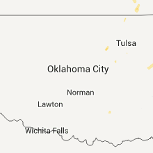
| 5:42 PM CDT | Riverside airpost asos measured 66 mph wind gus in tulsa county OK, 9 miles S of Tulsa, OK |
| 5:50 PM CDT | Several large trees uprooted...multiple limbs downed...25 power poles downed...some broken windows at oru...a few parking lots flooded. all occurred in localized area b in tulsa county OK, 4.3 miles ESE of Tulsa, OK |
| 5:50 PM CDT | Several trees downed at apartment complex located 81st and riverside. wind gusted to 66 mph at nearby riverside airpor in tulsa county OK, 4.3 miles ESE of Tulsa, OK |
Utah
| Local Time | Report Details |
|---|---|
| 5:45 PM MDT | South mountain - 6001 ft in tooele county UT, 34.4 miles SW of Salt Lake City, UT |
| 6:00 PM MDT | Stockton bar - 5161 ft in tooele county UT, 32.7 miles SW of Salt Lake City, UT |
| 6:00 PM MDT | Tooele city - 5135 ft in tooele county UT, 28.1 miles SW of Salt Lake City, UT |
| 6:10 PM MDT | Lake point i-80 - 4301 ft in tooele county UT, 20.6 miles WSW of Salt Lake City, UT |
| 6:11 PM MDT | Great salt lake marina - 4206 ft in salt lake county UT, 17 miles W of Salt Lake City, UT |
Arizona
| Local Time | Report Details |
|---|---|
| 4:50 PM MST | Thunderstorm winds knocked over a concrete utility pole that took out other utility equipment in the area. several traffic signals were briefly knocked ou in mohave county AZ, 33.1 miles NNW of Lake Havasu City, AZ |
Wisconsin
| Local Time | Report Details |
|---|---|
| 7:32 PM CDT | 2 nine inch diameter branches snapped of in pierce county WI, 27 miles ESE of Minneapolis, MN |
Washington
| Local Time | Report Details |
|---|---|
| 8:35 PM PDT | Quarter sized hail reported near Walla Walla, WA, 14 miles E of Walla Walla, WA, thunderstorm dropped mostly 3/4 inch hail with some as large as an inch in diameter. also had heavy rain and 40 mph winds. |
| 8:35 PM PDT | Quarter sized hail reported near Walla Walla, WA, 14.5 miles E of Walla Walla, WA, received mostly nickel sized hail with some stones quarter sized. also had 50 to 60 mph winds and heavy rain. believes that local wheat crop was damaged by the hail. |
Montana
| Local Time | Report Details |
|---|---|
| 11:00 PM MDT | Strong thunderstorm winds during the evening blew down a few trees...including a large spruce. 0.19 inches of rainfal in beaverhead county MT, 46.8 miles ESE of Salmon, ID |
| 1:15 AM MDT | Forest service reported 20 trees down blocking the service road to the dorr skeels campground at around 230 am. time of potential downburst could have been between 100 in lincoln county MT, 70.5 miles W of Whitefish, MT |
Connect with Interactive Hail Maps