

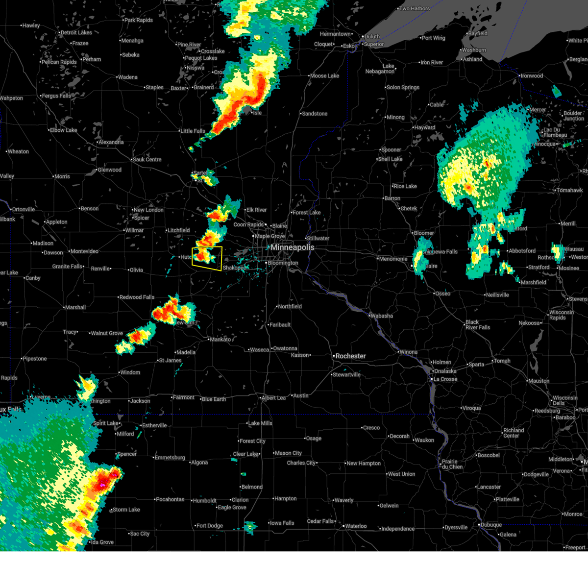
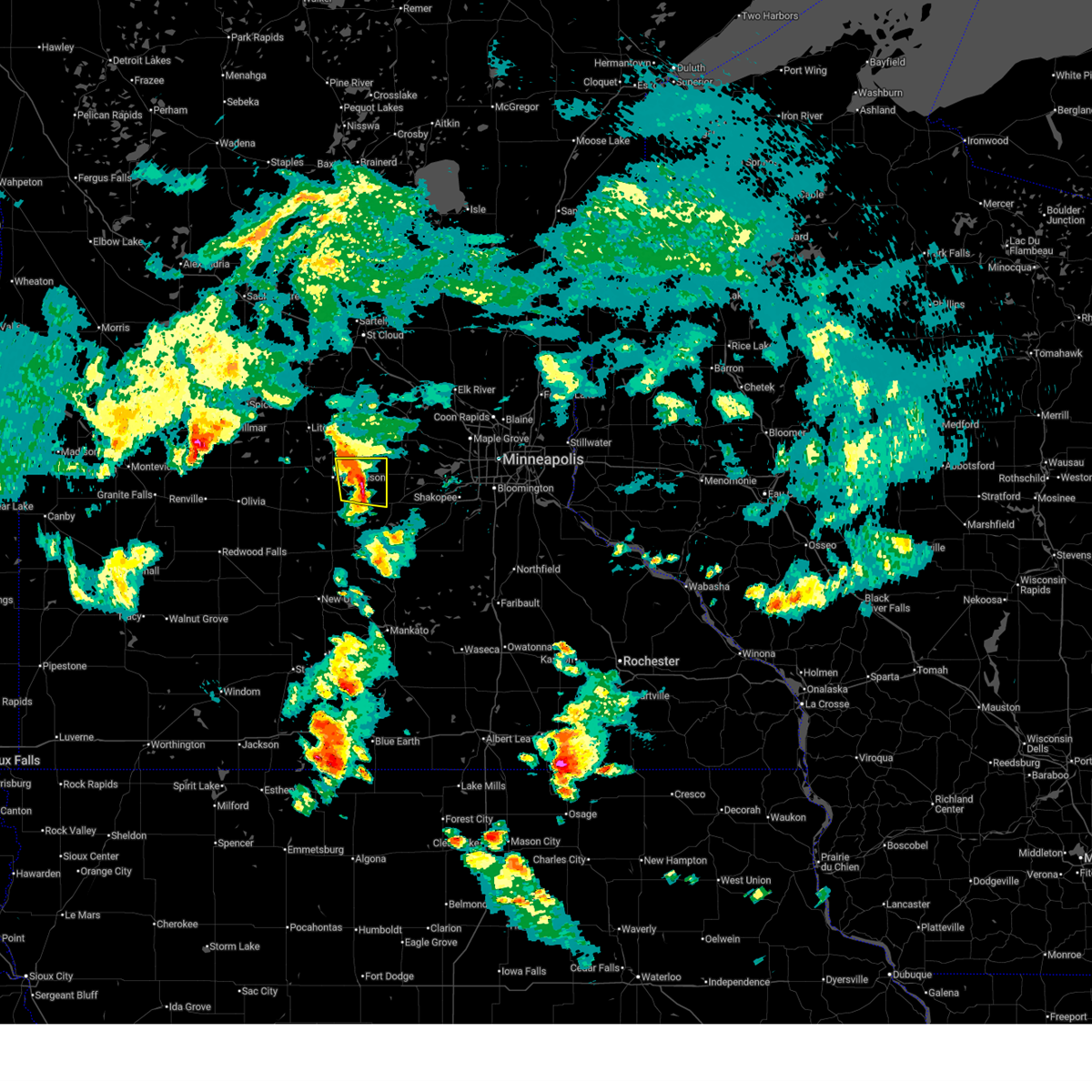
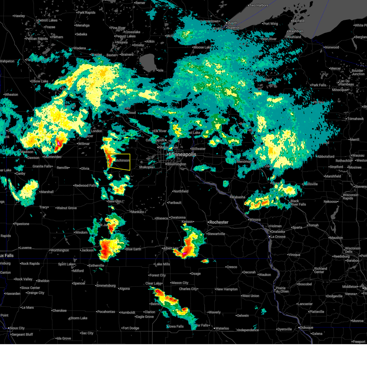
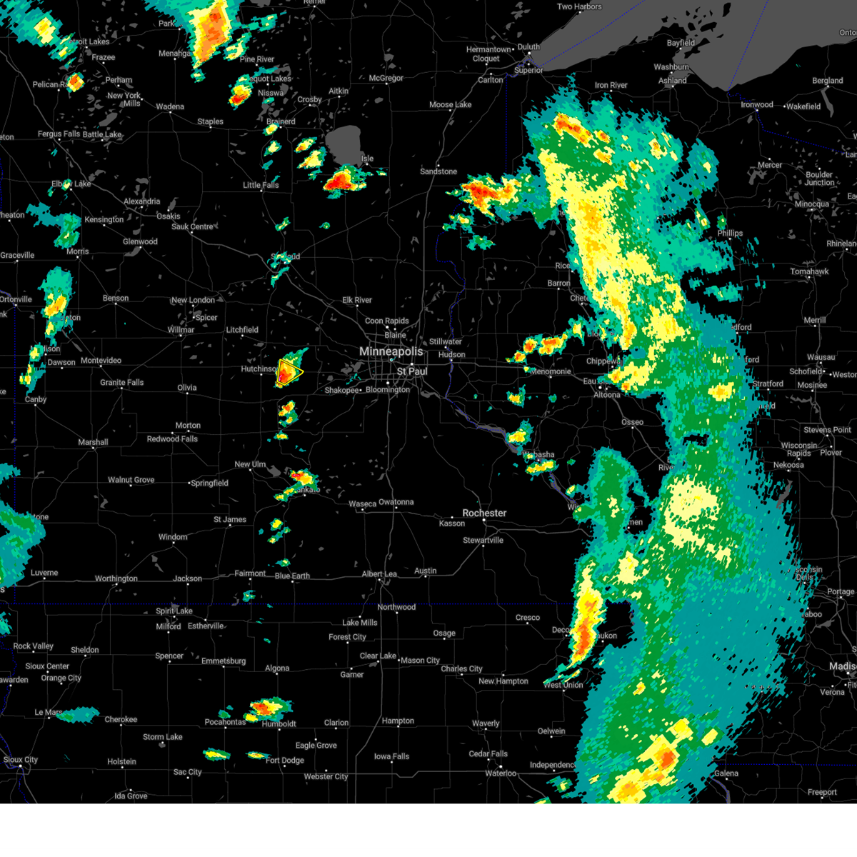
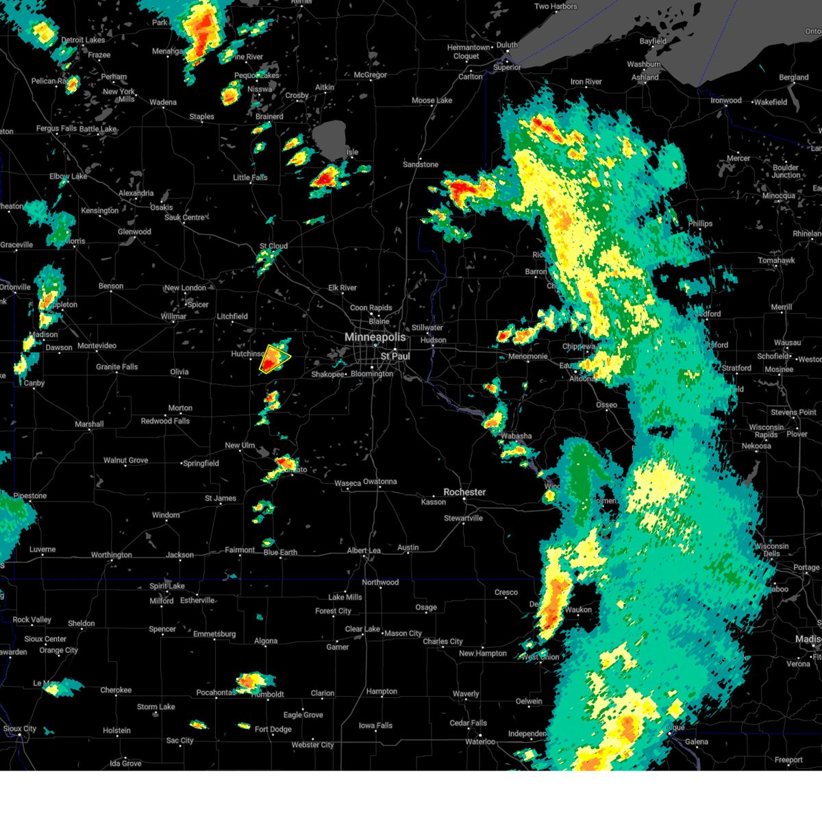
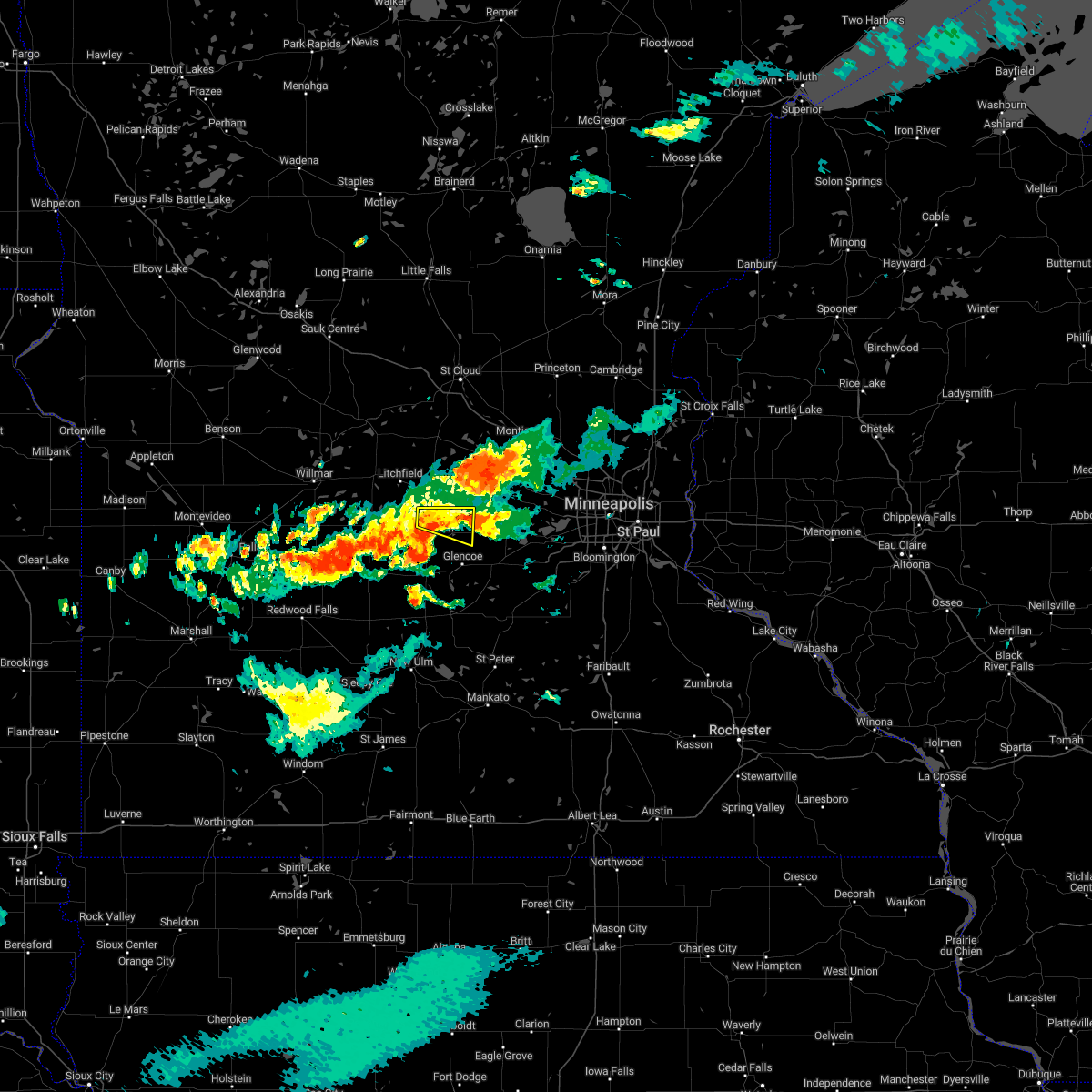
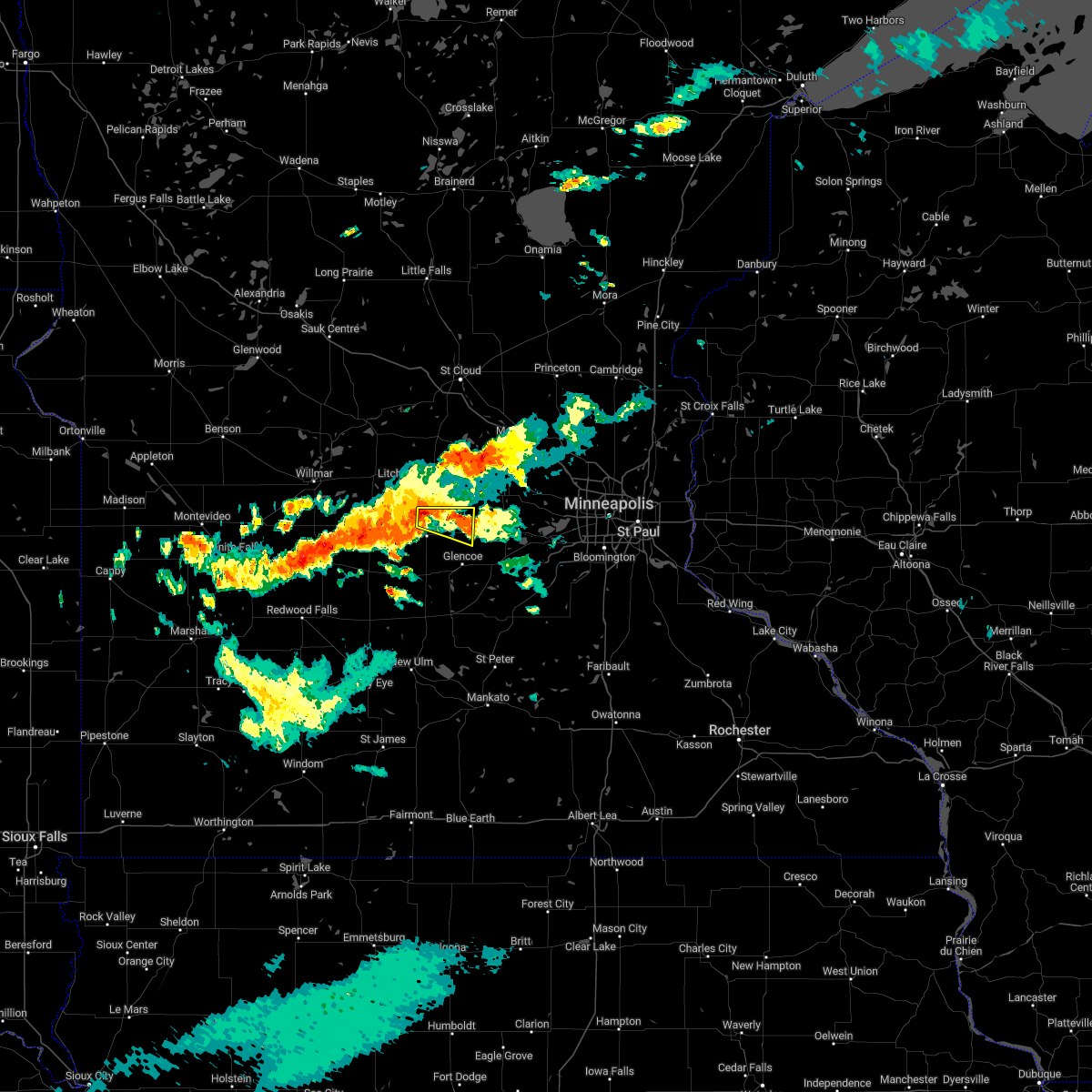
Hail Map for Silver Lake, MN
The Silver Lake, MN area has had 4 reports of on-the-ground hail by trained spotters, and has been under severe weather warnings 9 times during the past 12 months. Doppler radar has detected hail at or near Silver Lake, MN on 67 occasions, including 5 occasions during the past year.
| Name: | Silver Lake, MN |
| Where Located: | 46.2 miles W of Minneapolis, MN |
| Map: | Google Map for Silver Lake, MN |
| Population: | 837 |
| Housing Units: | 379 |
| More Info: | Search Google for Silver Lake, MN |
2
The Top Recent Hail Date for Silver Lake, MN is Thursday, May 15, 2025 (15th out of 67)
Hail and Wind Damage Spotted near Silver Lake, MN
| Date / Time | Report Details |
|---|---|
| 6/16/2025 6:41 PM CDT | The severe thunderstorm warning that was previously in effect has been upgraded to a tornado warning. please refer to that bulletin for the latest information on this dangerous weather situation. a tornado watch remains in effect until 900 pm cdt for portions of central and east central minnesota. |
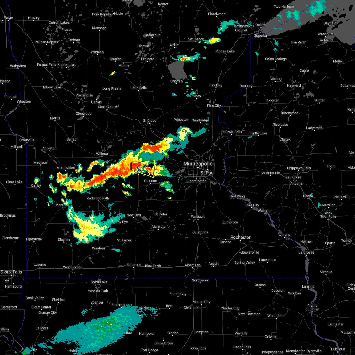
| 6/16/2025 6:02 PM CDT |
 Svrmpx the national weather service in the twin cities has issued a * severe thunderstorm warning for, northeastern mcleod county in central minnesota, northwestern carver county in east central minnesota, * until 645 pm cdt. * at 602 pm cdt, a severe thunderstorm was located over silver lake, or 11 miles east of hutchinson, moving east at 15 mph (radar indicated). Hazards include 60 mph wind gusts and half dollar size hail. Hail damage to vehicles is expected. expect wind damage to roofs, siding, and trees. this severe thunderstorm will be near, silver lake around 605 pm cdt. lester prairie and winsted around 620 pm cdt. mayer and watertown around 640 pm cdt. Other locations impacted by the severe thunderstorm include new germany and hollywood. Svrmpx the national weather service in the twin cities has issued a * severe thunderstorm warning for, northeastern mcleod county in central minnesota, northwestern carver county in east central minnesota, * until 645 pm cdt. * at 602 pm cdt, a severe thunderstorm was located over silver lake, or 11 miles east of hutchinson, moving east at 15 mph (radar indicated). Hazards include 60 mph wind gusts and half dollar size hail. Hail damage to vehicles is expected. expect wind damage to roofs, siding, and trees. this severe thunderstorm will be near, silver lake around 605 pm cdt. lester prairie and winsted around 620 pm cdt. mayer and watertown around 640 pm cdt. Other locations impacted by the severe thunderstorm include new germany and hollywood.
|
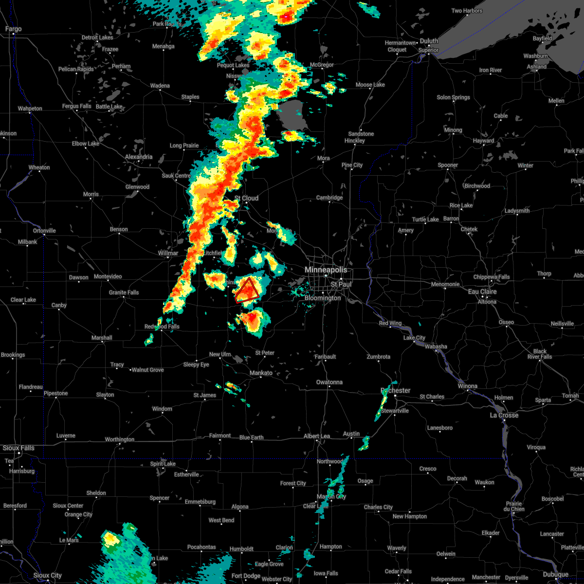
| 6/12/2025 7:30 PM CDT |
 At 730 pm cdt, severe thunderstorms were located along a line from near silver lake to over glencoe, or along a line from 8 miles northeast of hutchinson to 13 miles southeast of hutchinson, moving east at 25 mph. these are destructive storms for silver lake and lester prairie (law enforcement reported at 713 pm, law enforcement reported large trees down in hutchinson. hutchinson airport also recorded a gust of 86 mph). Hazards include 90 mph wind gusts. You are in a life-threatening situation. flying debris may be deadly to those caught without shelter. mobile homes will be heavily damaged or destroyed. homes and businesses will have substantial roof and window damage. expect extensive tree damage and power outages. this severe thunderstorm will be near, silver lake and glencoe around 725 pm cdt. lester prairie around 745 pm cdt. winsted around 755 pm cdt. Other locations impacted by the severe thunderstorm include biscay and plato. At 730 pm cdt, severe thunderstorms were located along a line from near silver lake to over glencoe, or along a line from 8 miles northeast of hutchinson to 13 miles southeast of hutchinson, moving east at 25 mph. these are destructive storms for silver lake and lester prairie (law enforcement reported at 713 pm, law enforcement reported large trees down in hutchinson. hutchinson airport also recorded a gust of 86 mph). Hazards include 90 mph wind gusts. You are in a life-threatening situation. flying debris may be deadly to those caught without shelter. mobile homes will be heavily damaged or destroyed. homes and businesses will have substantial roof and window damage. expect extensive tree damage and power outages. this severe thunderstorm will be near, silver lake and glencoe around 725 pm cdt. lester prairie around 745 pm cdt. winsted around 755 pm cdt. Other locations impacted by the severe thunderstorm include biscay and plato.
|
| 6/12/2025 7:17 PM CDT | At 717 pm cdt, a severe thunderstorm was located near hutchinson, moving east at 25 mph. this is a destructive storm for hutchinson (law enforcement reported at 713 pm, law enforcement reported large trees down in hutchinson. hutchinson airport also recorded a gust of 86 mph). Hazards include 90 mph wind gusts. You are in a life-threatening situation. flying debris may be deadly to those caught without shelter. mobile homes will be heavily damaged or destroyed. homes and businesses will have substantial roof and window damage. expect extensive tree damage and power outages. Locations impacted include, hutchinson, glencoe, winsted, lester prairie, silver lake, plato, biscay and hutchinson airport. |
| 6/12/2025 7:14 PM CDT |
 Svrmpx the national weather service in the twin cities has issued a * severe thunderstorm warning for, mcleod county in central minnesota, * until 800 pm cdt. * at 714 pm cdt, a severe thunderstorm was located over hutchinson, moving east at 25 mph (law enforcement reported. at 713 pm, law enforcement reported large trees down in hutchinson). Hazards include 60 mph wind gusts. expect damage to roofs, siding, and trees Svrmpx the national weather service in the twin cities has issued a * severe thunderstorm warning for, mcleod county in central minnesota, * until 800 pm cdt. * at 714 pm cdt, a severe thunderstorm was located over hutchinson, moving east at 25 mph (law enforcement reported. at 713 pm, law enforcement reported large trees down in hutchinson). Hazards include 60 mph wind gusts. expect damage to roofs, siding, and trees
|
| 8/29/2024 3:26 PM CDT |
 At 326 pm cdt, a severe thunderstorm was located near glencoe, or 18 miles southeast of hutchinson, moving northeast at 45 mph (trained weather spotters). Hazards include 60 mph wind gusts and quarter size hail. Hail damage to vehicles is expected. expect wind damage to roofs, siding, and trees. Locations impacted include, waconia, belle plaine, glencoe, watertown, norwood young america, winsted, gaylord, arlington, mayer, lester prairie, cologne, and silver lake. At 326 pm cdt, a severe thunderstorm was located near glencoe, or 18 miles southeast of hutchinson, moving northeast at 45 mph (trained weather spotters). Hazards include 60 mph wind gusts and quarter size hail. Hail damage to vehicles is expected. expect wind damage to roofs, siding, and trees. Locations impacted include, waconia, belle plaine, glencoe, watertown, norwood young america, winsted, gaylord, arlington, mayer, lester prairie, cologne, and silver lake.
|
| 8/29/2024 3:12 PM CDT |
 Svrmpx the national weather service in the twin cities has issued a * severe thunderstorm warning for, northeastern sibley county in central minnesota, southwestern scott county in east central minnesota, mcleod county in central minnesota, western carver county in east central minnesota, * until 400 pm cdt. * at 311 pm cdt, a severe thunderstorm was located near gaylord, or 21 miles northeast of new ulm, moving northeast at 40 mph. emergency management reported trees down in the city of new ulm (trained weather spotters). Hazards include 60 mph wind gusts and quarter size hail. Hail damage to vehicles is expected. Expect wind damage to roofs, siding, and trees. Svrmpx the national weather service in the twin cities has issued a * severe thunderstorm warning for, northeastern sibley county in central minnesota, southwestern scott county in east central minnesota, mcleod county in central minnesota, western carver county in east central minnesota, * until 400 pm cdt. * at 311 pm cdt, a severe thunderstorm was located near gaylord, or 21 miles northeast of new ulm, moving northeast at 40 mph. emergency management reported trees down in the city of new ulm (trained weather spotters). Hazards include 60 mph wind gusts and quarter size hail. Hail damage to vehicles is expected. Expect wind damage to roofs, siding, and trees.
|
| 8/26/2024 6:22 PM CDT |
 At 622 pm cdt, a severe thunderstorm was located near lester prairie, or 13 miles east of hutchinson, moving east at 20 mph (radar indicated). Hazards include ping pong ball size hail and 60 mph wind gusts. People and animals outdoors will be injured. expect hail damage to roofs, siding, windows, and vehicles. expect wind damage to roofs, siding, and trees. Locations impacted include, waconia, glencoe, watertown, winsted, mayer, lester prairie, silver lake, hollywood, and new germany. At 622 pm cdt, a severe thunderstorm was located near lester prairie, or 13 miles east of hutchinson, moving east at 20 mph (radar indicated). Hazards include ping pong ball size hail and 60 mph wind gusts. People and animals outdoors will be injured. expect hail damage to roofs, siding, windows, and vehicles. expect wind damage to roofs, siding, and trees. Locations impacted include, waconia, glencoe, watertown, winsted, mayer, lester prairie, silver lake, hollywood, and new germany.
|
| 8/26/2024 6:18 PM CDT | Mesonet station mn002 t.h.7 - silver lake - mp 15 in mcleod county MN, 4 miles W of Silver Lake, MN |
| 8/26/2024 6:10 PM CDT |
 Svrmpx the national weather service in the twin cities has issued a * severe thunderstorm warning for, south central wright county in central minnesota, northeastern mcleod county in central minnesota, northwestern carver county in east central minnesota, * until 645 pm cdt. * at 610 pm cdt, a severe thunderstorm was located over lester prairie, or 14 miles east of hutchinson, moving northeast at 25 mph (radar indicated). Hazards include 60 mph wind gusts and quarter size hail. Hail damage to vehicles is expected. Expect wind damage to roofs, siding, and trees. Svrmpx the national weather service in the twin cities has issued a * severe thunderstorm warning for, south central wright county in central minnesota, northeastern mcleod county in central minnesota, northwestern carver county in east central minnesota, * until 645 pm cdt. * at 610 pm cdt, a severe thunderstorm was located over lester prairie, or 14 miles east of hutchinson, moving northeast at 25 mph (radar indicated). Hazards include 60 mph wind gusts and quarter size hail. Hail damage to vehicles is expected. Expect wind damage to roofs, siding, and trees.
|
| 9/29/2023 7:26 PM CDT |
 The severe thunderstorm warning for mcleod county will expire at 730 pm cdt, the storm which prompted the warning has moved out of the area. therefore, the warning will be allowed to expire. however, gusty winds are still possible with this thunderstorm. to report severe weather, contact your nearest law enforcement agency. they will relay your report to the national weather service the twin cities. The severe thunderstorm warning for mcleod county will expire at 730 pm cdt, the storm which prompted the warning has moved out of the area. therefore, the warning will be allowed to expire. however, gusty winds are still possible with this thunderstorm. to report severe weather, contact your nearest law enforcement agency. they will relay your report to the national weather service the twin cities.
|
| 9/29/2023 7:02 PM CDT |
 At 702 pm cdt, a severe thunderstorm was located near silver lake, or near hutchinson, moving east at 35 mph (trained weather spotters). Hazards include 60 mph wind gusts. expect damage to roofs, siding, and trees At 702 pm cdt, a severe thunderstorm was located near silver lake, or near hutchinson, moving east at 35 mph (trained weather spotters). Hazards include 60 mph wind gusts. expect damage to roofs, siding, and trees
|
| 8/11/2023 5:05 PM CDT |
 The severe thunderstorm warning for north central sibley and mcleod counties will expire at 515 pm cdt, the storms which prompted the warning have moved out of the area. therefore, the warning will be allowed to expire. a severe thunderstorm watch remains in effect until 1000 pm cdt for central and east central minnesota. a severe thunderstorm watch also remains in effect until 1000 pm cdt for central minnesota. The severe thunderstorm warning for north central sibley and mcleod counties will expire at 515 pm cdt, the storms which prompted the warning have moved out of the area. therefore, the warning will be allowed to expire. a severe thunderstorm watch remains in effect until 1000 pm cdt for central and east central minnesota. a severe thunderstorm watch also remains in effect until 1000 pm cdt for central minnesota.
|
| 8/11/2023 4:40 PM CDT |
 At 440 pm cdt, severe thunderstorms were located along a line extending from near hutchinson to brownton, moving east at 45 mph (radar indicated). Hazards include tennis ball size hail and 70 mph wind gusts. People and animals outdoors will be injured. expect hail damage to roofs, siding, windows, and vehicles. expect considerable tree damage. wind damage is also likely to mobile homes, roofs, and outbuildings. locations impacted include, glencoe, silver lake, winsted, lester prairie and green isle. thunderstorm damage threat, considerable hail threat, radar indicated max hail size, 2. 50 in wind threat, radar indicated max wind gust, 70 mph. At 440 pm cdt, severe thunderstorms were located along a line extending from near hutchinson to brownton, moving east at 45 mph (radar indicated). Hazards include tennis ball size hail and 70 mph wind gusts. People and animals outdoors will be injured. expect hail damage to roofs, siding, windows, and vehicles. expect considerable tree damage. wind damage is also likely to mobile homes, roofs, and outbuildings. locations impacted include, glencoe, silver lake, winsted, lester prairie and green isle. thunderstorm damage threat, considerable hail threat, radar indicated max hail size, 2. 50 in wind threat, radar indicated max wind gust, 70 mph.
|
| 7/25/2023 11:56 PM CDT |
 At 1156 pm cdt, a severe thunderstorm was located near dassel, or 10 miles north of hutchinson, moving east at 40 mph (radar indicated). Hazards include 60 mph wind gusts and quarter size hail. Hail damage to vehicles is expected. expect wind damage to roofs, siding, and trees. this severe thunderstorm will be near, silver lake around 1215 am cdt. other locations in the path of this severe thunderstorm include winsted and lester prairie. hail threat, radar indicated max hail size, 1. 00 in wind threat, radar indicated max wind gust, 60 mph. At 1156 pm cdt, a severe thunderstorm was located near dassel, or 10 miles north of hutchinson, moving east at 40 mph (radar indicated). Hazards include 60 mph wind gusts and quarter size hail. Hail damage to vehicles is expected. expect wind damage to roofs, siding, and trees. this severe thunderstorm will be near, silver lake around 1215 am cdt. other locations in the path of this severe thunderstorm include winsted and lester prairie. hail threat, radar indicated max hail size, 1. 00 in wind threat, radar indicated max wind gust, 60 mph.
|
| 6/24/2023 8:43 PM CDT |
 At 843 pm cdt, a severe thunderstorm was located over silver lake, or 9 miles east of hutchinson, moving northeast at 10 mph (radar indicated). Hazards include 60 mph wind gusts and quarter size hail. Hail damage to vehicles is expected. expect wind damage to roofs, siding, and trees. locations impacted include, lester prairie. hail threat, radar indicated max hail size, 1. 00 in wind threat, radar indicated max wind gust, 60 mph. At 843 pm cdt, a severe thunderstorm was located over silver lake, or 9 miles east of hutchinson, moving northeast at 10 mph (radar indicated). Hazards include 60 mph wind gusts and quarter size hail. Hail damage to vehicles is expected. expect wind damage to roofs, siding, and trees. locations impacted include, lester prairie. hail threat, radar indicated max hail size, 1. 00 in wind threat, radar indicated max wind gust, 60 mph.
|
| 6/24/2023 8:32 PM CDT |
 At 831 pm cdt, a severe thunderstorm was located near silver lake, or 7 miles east of hutchinson, moving northeast at 10 mph (law enforcement). Hazards include 60 mph wind gusts and quarter size hail. Hail damage to vehicles is expected. expect wind damage to roofs, siding, and trees. this severe thunderstorm will be near, silver lake around 850 pm cdt. other locations in the path of this severe thunderstorm include lester prairie. hail threat, radar indicated max hail size, 1. 00 in wind threat, radar indicated max wind gust, 60 mph. At 831 pm cdt, a severe thunderstorm was located near silver lake, or 7 miles east of hutchinson, moving northeast at 10 mph (law enforcement). Hazards include 60 mph wind gusts and quarter size hail. Hail damage to vehicles is expected. expect wind damage to roofs, siding, and trees. this severe thunderstorm will be near, silver lake around 850 pm cdt. other locations in the path of this severe thunderstorm include lester prairie. hail threat, radar indicated max hail size, 1. 00 in wind threat, radar indicated max wind gust, 60 mph.
|
| 8/2/2022 11:44 PM CDT |
 At 1144 pm cdt, a severe thunderstorm was located over waconia, or 25 miles south of buffalo, moving east at 75 mph (radar indicated). Hazards include 70 mph wind gusts. Expect considerable tree damage. damage is likely to mobile homes, roofs, and outbuildings. this severe storm will be near, chaska and chanhassen around 1150 pm cdt. excelsior around 1155 pm cdt. other locations impacted by this severe thunderstorm include loretto, hollywood, greenwood, shorewood, lake waconia, long lake, plato, new germany, hamburg and glencoe airport. thunderstorm damage threat, considerable hail threat, radar indicated max hail size, <. 75 in wind threat, observed max wind gust, 70 mph. At 1144 pm cdt, a severe thunderstorm was located over waconia, or 25 miles south of buffalo, moving east at 75 mph (radar indicated). Hazards include 70 mph wind gusts. Expect considerable tree damage. damage is likely to mobile homes, roofs, and outbuildings. this severe storm will be near, chaska and chanhassen around 1150 pm cdt. excelsior around 1155 pm cdt. other locations impacted by this severe thunderstorm include loretto, hollywood, greenwood, shorewood, lake waconia, long lake, plato, new germany, hamburg and glencoe airport. thunderstorm damage threat, considerable hail threat, radar indicated max hail size, <. 75 in wind threat, observed max wind gust, 70 mph.
|
| 8/2/2022 11:31 PM CDT |
 At 1131 pm cdt, a severe thunderstorm was located near glencoe, or 16 miles east of hutchinson, moving east at 70 mph. this is a destructive storm for eastern mcleod county (radar indicated). Hazards include 80 mph wind gusts. Flying debris will be dangerous to those caught without shelter. mobile homes will be heavily damaged. expect considerable damage to roofs, windows, and vehicles. extensive tree damage and power outages are likely. this severe thunderstorm will remain over mainly rural areas of north central sibley and central mcleod counties, including the following locations, sumter, biscay, glencoe airport, hutchinson airport, new auburn and lake marion regional park. thunderstorm damage threat, destructive hail threat, radar indicated max hail size, <. 75 in wind threat, observed max wind gust, 80 mph. At 1131 pm cdt, a severe thunderstorm was located near glencoe, or 16 miles east of hutchinson, moving east at 70 mph. this is a destructive storm for eastern mcleod county (radar indicated). Hazards include 80 mph wind gusts. Flying debris will be dangerous to those caught without shelter. mobile homes will be heavily damaged. expect considerable damage to roofs, windows, and vehicles. extensive tree damage and power outages are likely. this severe thunderstorm will remain over mainly rural areas of north central sibley and central mcleod counties, including the following locations, sumter, biscay, glencoe airport, hutchinson airport, new auburn and lake marion regional park. thunderstorm damage threat, destructive hail threat, radar indicated max hail size, <. 75 in wind threat, observed max wind gust, 80 mph.
|
| 8/2/2022 11:27 PM CDT |
 At 1125 pm cdt, a severe thunderstorm was located near glencoe, or 11 miles southeast of hutchinson, moving east at 75 mph. this is a destructive storm for eastern mcleod and carver counties (radar indicated. wind gusts as high as 80 mph have occurred with this storm). Hazards include 80 mph wind gusts. Flying debris will be dangerous to those caught without shelter. mobile homes will be heavily damaged. expect considerable damage to roofs, windows, and vehicles. extensive tree damage and power outages are likely. this severe thunderstorm will be near, lester prairie around 1130 pm cdt. norwood young america around 1135 pm cdt. waconia, watertown, mayer and cologne around 1140 pm cdt. carver and st. bonifacius around 1145 pm cdt. chaska, chanhassen, mound, orono and victoria around 1150 pm cdt. other locations impacted by this severe thunderstorm include loretto, hollywood, greenwood, shorewood, lake waconia, long lake, plato, new germany, hamburg and glencoe airport. thunderstorm damage threat, destructive hail threat, radar indicated max hail size, <. 75 in wind threat, observed max wind gust, 80 mph. At 1125 pm cdt, a severe thunderstorm was located near glencoe, or 11 miles southeast of hutchinson, moving east at 75 mph. this is a destructive storm for eastern mcleod and carver counties (radar indicated. wind gusts as high as 80 mph have occurred with this storm). Hazards include 80 mph wind gusts. Flying debris will be dangerous to those caught without shelter. mobile homes will be heavily damaged. expect considerable damage to roofs, windows, and vehicles. extensive tree damage and power outages are likely. this severe thunderstorm will be near, lester prairie around 1130 pm cdt. norwood young america around 1135 pm cdt. waconia, watertown, mayer and cologne around 1140 pm cdt. carver and st. bonifacius around 1145 pm cdt. chaska, chanhassen, mound, orono and victoria around 1150 pm cdt. other locations impacted by this severe thunderstorm include loretto, hollywood, greenwood, shorewood, lake waconia, long lake, plato, new germany, hamburg and glencoe airport. thunderstorm damage threat, destructive hail threat, radar indicated max hail size, <. 75 in wind threat, observed max wind gust, 80 mph.
|
| 8/2/2022 11:06 PM CDT |
 At 1105 pm cdt, severe thunderstorms were located along a line extending from 8 miles north of bird island to hector to near fairfax, moving east at 70 mph. these are destructive storms for eastern renville and western mcleod counties (radar indicated). Hazards include 80 mph wind gusts. Flying debris will be dangerous to those caught without shelter. mobile homes will be heavily damaged. expect considerable damage to roofs, windows, and vehicles. extensive tree damage and power outages are likely. these severe storms will be near, buffalo lake around 1110 pm cdt. gibbon and stewart around 1115 pm cdt. winthrop and brownton around 1120 pm cdt. gaylord around 1125 pm cdt. hutchinson and glencoe around 1130 pm cdt. silver lake around 1135 pm cdt. other locations impacted by these severe thunderstorms include sumter, biscay, danube, lakeside, thorpe, corvuso, fernando, glencoe airport, hutchinson airport and cedar mills. thunderstorm damage threat, destructive hail threat, radar indicated max hail size, <. 75 in wind threat, observed max wind gust, 80 mph. At 1105 pm cdt, severe thunderstorms were located along a line extending from 8 miles north of bird island to hector to near fairfax, moving east at 70 mph. these are destructive storms for eastern renville and western mcleod counties (radar indicated). Hazards include 80 mph wind gusts. Flying debris will be dangerous to those caught without shelter. mobile homes will be heavily damaged. expect considerable damage to roofs, windows, and vehicles. extensive tree damage and power outages are likely. these severe storms will be near, buffalo lake around 1110 pm cdt. gibbon and stewart around 1115 pm cdt. winthrop and brownton around 1120 pm cdt. gaylord around 1125 pm cdt. hutchinson and glencoe around 1130 pm cdt. silver lake around 1135 pm cdt. other locations impacted by these severe thunderstorms include sumter, biscay, danube, lakeside, thorpe, corvuso, fernando, glencoe airport, hutchinson airport and cedar mills. thunderstorm damage threat, destructive hail threat, radar indicated max hail size, <. 75 in wind threat, observed max wind gust, 80 mph.
|
| 8/2/2022 10:53 PM CDT |
 At 1053 pm cdt, severe thunderstorms were located along a line extending from 5 miles southeast of prinsburg to near bird island to morton, moving east at 70 mph (radar indicated). Hazards include 70 mph wind gusts. Expect considerable tree damage. damage is likely to mobile homes, roofs, and outbuildings. severe thunderstorms will be near, fairfax and hector around 1105 pm cdt. buffalo lake and cosmos around 1110 pm cdt. other locations in the path of these severe thunderstorms include gibbon, stewart, winthrop, brownton, hutchinson, glencoe, gaylord and silver lake. thunderstorm damage threat, considerable hail threat, radar indicated max hail size, <. 75 in wind threat, observed max wind gust, 70 mph. At 1053 pm cdt, severe thunderstorms were located along a line extending from 5 miles southeast of prinsburg to near bird island to morton, moving east at 70 mph (radar indicated). Hazards include 70 mph wind gusts. Expect considerable tree damage. damage is likely to mobile homes, roofs, and outbuildings. severe thunderstorms will be near, fairfax and hector around 1105 pm cdt. buffalo lake and cosmos around 1110 pm cdt. other locations in the path of these severe thunderstorms include gibbon, stewart, winthrop, brownton, hutchinson, glencoe, gaylord and silver lake. thunderstorm damage threat, considerable hail threat, radar indicated max hail size, <. 75 in wind threat, observed max wind gust, 70 mph.
|
| 7/26/2022 8:11 PM CDT |
 The severe thunderstorm warning for southwestern wright, southeastern meeker and northern mcleod counties will expire at 815 pm cdt, the storm which prompted the warning has weakened below severe limits, and no longer poses an immediate threat to life or property. therefore, the warning will be allowed to expire. however small hail and heavy rain are still possible with this thunderstorm. The severe thunderstorm warning for southwestern wright, southeastern meeker and northern mcleod counties will expire at 815 pm cdt, the storm which prompted the warning has weakened below severe limits, and no longer poses an immediate threat to life or property. therefore, the warning will be allowed to expire. however small hail and heavy rain are still possible with this thunderstorm.
|
| 7/26/2022 8:02 PM CDT |
 At 802 pm cdt, a severe thunderstorm was located 6 miles northwest of silver lake, or 7 miles northeast of hutchinson, moving east at 25 mph (radar indicated). Hazards include 60 mph wind gusts and quarter size hail. Hail damage to vehicles is expected. expect wind damage to roofs, siding, and trees. Locations impacted include, silver lake. At 802 pm cdt, a severe thunderstorm was located 6 miles northwest of silver lake, or 7 miles northeast of hutchinson, moving east at 25 mph (radar indicated). Hazards include 60 mph wind gusts and quarter size hail. Hail damage to vehicles is expected. expect wind damage to roofs, siding, and trees. Locations impacted include, silver lake.
|
| 7/26/2022 7:51 PM CDT |
 At 750 pm cdt, a severe thunderstorm was located 6 miles north of hutchinson, moving east at 25 mph (radar indicated). Hazards include 60 mph wind gusts and half dollar size hail. Hail damage to vehicles is expected. Expect wind damage to roofs, siding, and trees. At 750 pm cdt, a severe thunderstorm was located 6 miles north of hutchinson, moving east at 25 mph (radar indicated). Hazards include 60 mph wind gusts and half dollar size hail. Hail damage to vehicles is expected. Expect wind damage to roofs, siding, and trees.
|
| 5/30/2022 6:22 PM CDT |
 The severe thunderstorm warning for central sibley, central mcleod and north central nicollet counties will expire at 630 pm cdt, the storms which prompted the warning have moved out of the area. therefore, the warning will be allowed to expire. a tornado watch remains in effect until 1000 pm cdt for central and south central minnesota. remember, a severe thunderstorm warning still remains in effect for eastern portions of sibley, mcleod, and nicollet counties. The severe thunderstorm warning for central sibley, central mcleod and north central nicollet counties will expire at 630 pm cdt, the storms which prompted the warning have moved out of the area. therefore, the warning will be allowed to expire. a tornado watch remains in effect until 1000 pm cdt for central and south central minnesota. remember, a severe thunderstorm warning still remains in effect for eastern portions of sibley, mcleod, and nicollet counties.
|
| 5/30/2022 6:17 PM CDT |
 At 617 pm cdt, severe thunderstorms were located along a line extending from litchfield to near silver lake to near glencoe, moving northeast at 65 mph (radar indicated). Hazards include 60 mph wind gusts and quarter size hail. Hail damage to vehicles is expected. expect wind damage to roofs, siding, and trees. severe thunderstorms will be near, winsted and howard lake around 625 pm cdt. montrose around 630 pm cdt. other locations in the path of these severe thunderstorms include buffalo, maple lake, monticello and clearwater. hail threat, radar indicated max hail size, 1. 00 in wind threat, radar indicated max wind gust, 60 mph. At 617 pm cdt, severe thunderstorms were located along a line extending from litchfield to near silver lake to near glencoe, moving northeast at 65 mph (radar indicated). Hazards include 60 mph wind gusts and quarter size hail. Hail damage to vehicles is expected. expect wind damage to roofs, siding, and trees. severe thunderstorms will be near, winsted and howard lake around 625 pm cdt. montrose around 630 pm cdt. other locations in the path of these severe thunderstorms include buffalo, maple lake, monticello and clearwater. hail threat, radar indicated max hail size, 1. 00 in wind threat, radar indicated max wind gust, 60 mph.
|
| 5/30/2022 6:12 PM CDT |
 At 611 pm cdt, severe thunderstorms were located along a line extending from near silver lake to near glencoe to 6 miles east of lafayette, moving northeast at 65 mph (public). Hazards include 60 mph wind gusts and quarter size hail. Hail damage to vehicles is expected. expect wind damage to roofs, siding, and trees. Locations impacted include, hutchinson, glencoe, gaylord, silver lake, brownton, courtland, sumter, new auburn, new sweden, biscay, hutchinson airport and lake marion regional park. At 611 pm cdt, severe thunderstorms were located along a line extending from near silver lake to near glencoe to 6 miles east of lafayette, moving northeast at 65 mph (public). Hazards include 60 mph wind gusts and quarter size hail. Hail damage to vehicles is expected. expect wind damage to roofs, siding, and trees. Locations impacted include, hutchinson, glencoe, gaylord, silver lake, brownton, courtland, sumter, new auburn, new sweden, biscay, hutchinson airport and lake marion regional park.
|
| 5/30/2022 5:59 PM CDT |
 At 558 pm cdt, severe thunderstorms were located along a line extending from stewart to winthrop to near new ulm, moving northeast at 60 mph (airport observation. at 545pm a 61 mph wind gust was reported at new ulm). Hazards include 60 mph wind gusts and quarter size hail. Hail damage to vehicles is expected. expect wind damage to roofs, siding, and trees. Locations impacted include, brownton, stewart, hutchinson, silver lake, glencoe and gaylord. At 558 pm cdt, severe thunderstorms were located along a line extending from stewart to winthrop to near new ulm, moving northeast at 60 mph (airport observation. at 545pm a 61 mph wind gust was reported at new ulm). Hazards include 60 mph wind gusts and quarter size hail. Hail damage to vehicles is expected. expect wind damage to roofs, siding, and trees. Locations impacted include, brownton, stewart, hutchinson, silver lake, glencoe and gaylord.
|
| 5/30/2022 5:43 PM CDT |
 At 542 pm cdt, severe thunderstorms were located along a line extending from near fairfax to near new ulm to 6 miles north of st. james, moving northeast at 60 mph (radar indicated). Hazards include 60 mph wind gusts and quarter size hail. Hail damage to vehicles is expected. expect wind damage to roofs, siding, and trees. severe thunderstorms will be near, gibbon and lafayette around 550 pm cdt. winthrop and stewart around 555 pm cdt. new ulm, brownton and courtland around 600 pm cdt. other locations in the path of these severe thunderstorms include hutchinson, glencoe, silver lake and gaylord. hail threat, radar indicated max hail size, 1. 00 in wind threat, radar indicated max wind gust, 60 mph. At 542 pm cdt, severe thunderstorms were located along a line extending from near fairfax to near new ulm to 6 miles north of st. james, moving northeast at 60 mph (radar indicated). Hazards include 60 mph wind gusts and quarter size hail. Hail damage to vehicles is expected. expect wind damage to roofs, siding, and trees. severe thunderstorms will be near, gibbon and lafayette around 550 pm cdt. winthrop and stewart around 555 pm cdt. new ulm, brownton and courtland around 600 pm cdt. other locations in the path of these severe thunderstorms include hutchinson, glencoe, silver lake and gaylord. hail threat, radar indicated max hail size, 1. 00 in wind threat, radar indicated max wind gust, 60 mph.
|
| 5/12/2022 8:18 PM CDT |
 At 816 pm cdt, a gust front was located along a line extending from near ramsey to near eden prairie to 5 miles northeast of new prague, moving east at 50 mph (radar indicated). Hazards include 60 mph wind gusts. Expect damage to roofs, siding, and trees. the gust front will be near, andover, savage, ramsey and anoka around 820 pm cdt. burnsville, edina, ham lake and elko new market around 825 pm cdt. lakeville, richfield, east bethel and msp international airport around 830 pm cdt. bloomington around 835 pm cdt. mendota heights around 840 pm cdt. other locations impacted by these severe thunderstorms include nowthen, robbinsdale, flying cloud airport, cedar, north minneapolis, mall of america, helena, rassat, marystown and plato. thunderstorms with heavy rain will follow the gust front by up to 30 minutes. hail threat, radar indicated max hail size, <. 75 in wind threat, radar indicated max wind gust, 60 mph. At 816 pm cdt, a gust front was located along a line extending from near ramsey to near eden prairie to 5 miles northeast of new prague, moving east at 50 mph (radar indicated). Hazards include 60 mph wind gusts. Expect damage to roofs, siding, and trees. the gust front will be near, andover, savage, ramsey and anoka around 820 pm cdt. burnsville, edina, ham lake and elko new market around 825 pm cdt. lakeville, richfield, east bethel and msp international airport around 830 pm cdt. bloomington around 835 pm cdt. mendota heights around 840 pm cdt. other locations impacted by these severe thunderstorms include nowthen, robbinsdale, flying cloud airport, cedar, north minneapolis, mall of america, helena, rassat, marystown and plato. thunderstorms with heavy rain will follow the gust front by up to 30 minutes. hail threat, radar indicated max hail size, <. 75 in wind threat, radar indicated max wind gust, 60 mph.
|
| 5/12/2022 8:02 PM CDT |
 At 802 pm cdt, severe thunderstorms were located along a line extending from near otsego to near cologne to near belle plaine, moving east at 50 mph (radar indicated). Hazards include 60 mph wind gusts. Expect damage to roofs, siding, and trees. these severe storms will be near, elk river, st. michael, big lake and albertville around 805 pm cdt. chaska, chanhassen and otsego around 810 pm cdt. ramsey, st. francis and excelsior around 815 pm cdt. eden prairie, shakopee, andover, savage and prior lake around 820 pm cdt. burnsville, minnetonka, edina, st. louis park and hopkins around 825 pm cdt. lakeville, richfield, east bethel and msp international airport around 830 pm cdt. hail threat, radar indicated max hail size, <. 75 in wind threat, radar indicated max wind gust, 60 mph. At 802 pm cdt, severe thunderstorms were located along a line extending from near otsego to near cologne to near belle plaine, moving east at 50 mph (radar indicated). Hazards include 60 mph wind gusts. Expect damage to roofs, siding, and trees. these severe storms will be near, elk river, st. michael, big lake and albertville around 805 pm cdt. chaska, chanhassen and otsego around 810 pm cdt. ramsey, st. francis and excelsior around 815 pm cdt. eden prairie, shakopee, andover, savage and prior lake around 820 pm cdt. burnsville, minnetonka, edina, st. louis park and hopkins around 825 pm cdt. lakeville, richfield, east bethel and msp international airport around 830 pm cdt. hail threat, radar indicated max hail size, <. 75 in wind threat, radar indicated max wind gust, 60 mph.
|
| 5/12/2022 7:45 PM CDT |
 At 744 pm cdt, severe thunderstorms were located along a line extending from near montrose to green isle to near le sueur, moving east at 50 mph (radar indicated). Hazards include 60 mph wind gusts. Expect damage to roofs, siding, and trees. severe thunderstorms will be near, buffalo around 750 pm cdt. delano around 755 pm cdt. belle plaine, rockford and cologne around 800 pm cdt. new prague, jordan, medina, independence and maple plain around 805 pm cdt. maple grove, st. michael, otsego, rogers and corcoran around 810 pm cdt. plymouth around 815 pm cdt. minneapolis, brooklyn park, shakopee, brooklyn center and savage around 820 pm cdt. coon rapids, burnsville, fridley, columbia heights and spring lake park around 825 pm cdt. hail threat, radar indicated max hail size, <. 75 in wind threat, radar indicated max wind gust, 60 mph. At 744 pm cdt, severe thunderstorms were located along a line extending from near montrose to green isle to near le sueur, moving east at 50 mph (radar indicated). Hazards include 60 mph wind gusts. Expect damage to roofs, siding, and trees. severe thunderstorms will be near, buffalo around 750 pm cdt. delano around 755 pm cdt. belle plaine, rockford and cologne around 800 pm cdt. new prague, jordan, medina, independence and maple plain around 805 pm cdt. maple grove, st. michael, otsego, rogers and corcoran around 810 pm cdt. plymouth around 815 pm cdt. minneapolis, brooklyn park, shakopee, brooklyn center and savage around 820 pm cdt. coon rapids, burnsville, fridley, columbia heights and spring lake park around 825 pm cdt. hail threat, radar indicated max hail size, <. 75 in wind threat, radar indicated max wind gust, 60 mph.
|
| 5/12/2022 7:23 PM CDT |
 At 723 pm cdt, severe thunderstorms were located along a line extending from near hutchinson to winthrop to lake crystal, moving northeast at 55 mph (radar indicated). Hazards include 70 mph wind gusts. Expect considerable tree damage. damage is likely to mobile homes, roofs, and outbuildings. these severe storms will be near, hutchinson and silver lake around 730 pm cdt. arlington around 735 pm cdt. winsted around 740 pm cdt. st. peter and green isle around 745 pm cdt. thunderstorm damage threat, considerable hail threat, radar indicated max hail size, <. 75 in wind threat, radar indicated max wind gust, 70 mph. At 723 pm cdt, severe thunderstorms were located along a line extending from near hutchinson to winthrop to lake crystal, moving northeast at 55 mph (radar indicated). Hazards include 70 mph wind gusts. Expect considerable tree damage. damage is likely to mobile homes, roofs, and outbuildings. these severe storms will be near, hutchinson and silver lake around 730 pm cdt. arlington around 735 pm cdt. winsted around 740 pm cdt. st. peter and green isle around 745 pm cdt. thunderstorm damage threat, considerable hail threat, radar indicated max hail size, <. 75 in wind threat, radar indicated max wind gust, 70 mph.
|
| 5/12/2022 6:52 PM CDT |
 At 651 pm cdt, severe thunderstorms were located along a line extending from near bird island to near sleepy eye to near st. james, moving east at 55 mph (radar indicated). Hazards include 70 mph wind gusts. Expect considerable tree damage. damage is likely to mobile homes, roofs, and outbuildings. severe thunderstorms will be near, hector around 700 pm cdt. new ulm and buffalo lake around 705 pm cdt. courtland and lafayette around 715 pm cdt. hutchinson and nicollet around 720 pm cdt. thunderstorm damage threat, considerable hail threat, radar indicated max hail size, <. 75 in wind threat, observed max wind gust, 70 mph. At 651 pm cdt, severe thunderstorms were located along a line extending from near bird island to near sleepy eye to near st. james, moving east at 55 mph (radar indicated). Hazards include 70 mph wind gusts. Expect considerable tree damage. damage is likely to mobile homes, roofs, and outbuildings. severe thunderstorms will be near, hector around 700 pm cdt. new ulm and buffalo lake around 705 pm cdt. courtland and lafayette around 715 pm cdt. hutchinson and nicollet around 720 pm cdt. thunderstorm damage threat, considerable hail threat, radar indicated max hail size, <. 75 in wind threat, observed max wind gust, 70 mph.
|
| 5/11/2022 7:29 PM CDT |
 At 729 pm cdt, a severe thunderstorm capable of producing a tornado was located over arlington, or 22 miles southeast of hutchinson, moving northeast at 45 mph (radar indicated rotation). Hazards include tornado and quarter size hail. Flying debris will be dangerous to those caught without shelter. mobile homes will be damaged or destroyed. damage to roofs, windows, and vehicles will occur. tree damage is likely. Locations impacted include, green isle. At 729 pm cdt, a severe thunderstorm capable of producing a tornado was located over arlington, or 22 miles southeast of hutchinson, moving northeast at 45 mph (radar indicated rotation). Hazards include tornado and quarter size hail. Flying debris will be dangerous to those caught without shelter. mobile homes will be damaged or destroyed. damage to roofs, windows, and vehicles will occur. tree damage is likely. Locations impacted include, green isle.
|
| 5/11/2022 6:59 PM CDT |
 At 658 pm cdt, a confirmed tornado was located near buffalo lake, or 19 miles southwest of hutchinson, moving northeast at 50 mph (weather spotters confirmed tornado earlier with this storm). Hazards include damaging tornado and quarter size hail. Flying debris will be dangerous to those caught without shelter. mobile homes will be damaged or destroyed. damage to roofs, windows, and vehicles will occur. tree damage is likely. the tornado will be near, stewart around 705 pm cdt. Other locations in the path of this tornadic thunderstorm include hutchinson and silver lake. At 658 pm cdt, a confirmed tornado was located near buffalo lake, or 19 miles southwest of hutchinson, moving northeast at 50 mph (weather spotters confirmed tornado earlier with this storm). Hazards include damaging tornado and quarter size hail. Flying debris will be dangerous to those caught without shelter. mobile homes will be damaged or destroyed. damage to roofs, windows, and vehicles will occur. tree damage is likely. the tornado will be near, stewart around 705 pm cdt. Other locations in the path of this tornadic thunderstorm include hutchinson and silver lake.
|
| 5/11/2022 12:56 PM CDT |
 The severe thunderstorm warning for southwestern wright, northeastern mcleod and northwestern carver counties will expire at 100 pm cdt, the storm which prompted the warning has weakened below severe limits, and has exited the warned area. therefore, the warning will be allowed to expire. The severe thunderstorm warning for southwestern wright, northeastern mcleod and northwestern carver counties will expire at 100 pm cdt, the storm which prompted the warning has weakened below severe limits, and has exited the warned area. therefore, the warning will be allowed to expire.
|
| 5/11/2022 12:29 PM CDT |
 At 1229 pm cdt, a severe thunderstorm was located near lester prairie, or 12 miles east of hutchinson, moving northeast at 25 mph (radar indicated). Hazards include 60 mph wind gusts and quarter size hail. Hail damage to vehicles is expected. expect wind damage to roofs, siding, and trees. locations impacted include, lester prairie and winsted. hail threat, radar indicated max hail size, 1. 00 in wind threat, radar indicated max wind gust, 60 mph. At 1229 pm cdt, a severe thunderstorm was located near lester prairie, or 12 miles east of hutchinson, moving northeast at 25 mph (radar indicated). Hazards include 60 mph wind gusts and quarter size hail. Hail damage to vehicles is expected. expect wind damage to roofs, siding, and trees. locations impacted include, lester prairie and winsted. hail threat, radar indicated max hail size, 1. 00 in wind threat, radar indicated max wind gust, 60 mph.
|
| 5/11/2022 12:16 PM CDT |
 At 1216 pm cdt, a severe thunderstorm was located over glencoe, or 11 miles southeast of hutchinson, moving northeast at 25 mph (radar indicated). Hazards include 60 mph wind gusts and quarter size hail. Hail damage to vehicles is expected. expect wind damage to roofs, siding, and trees. this severe thunderstorm will be near, glencoe around 1220 pm cdt. silver lake around 1235 pm cdt. other locations in the path of this severe thunderstorm include lester prairie, winsted and mayer. hail threat, radar indicated max hail size, 1. 00 in wind threat, radar indicated max wind gust, 60 mph. At 1216 pm cdt, a severe thunderstorm was located over glencoe, or 11 miles southeast of hutchinson, moving northeast at 25 mph (radar indicated). Hazards include 60 mph wind gusts and quarter size hail. Hail damage to vehicles is expected. expect wind damage to roofs, siding, and trees. this severe thunderstorm will be near, glencoe around 1220 pm cdt. silver lake around 1235 pm cdt. other locations in the path of this severe thunderstorm include lester prairie, winsted and mayer. hail threat, radar indicated max hail size, 1. 00 in wind threat, radar indicated max wind gust, 60 mph.
|
| 4/12/2022 8:00 PM CDT |
 At 800 pm cdt, a severe thunderstorm was located near brownton, or 7 miles southeast of hutchinson, moving north at 60 mph (radar indicated). Hazards include ping pong ball size hail and 60 mph wind gusts. People and animals outdoors will be injured. expect hail damage to roofs, siding, windows, and vehicles. expect wind damage to roofs, siding, and trees. this severe storm will be near, silver lake around 810 pm cdt. winsted around 815 pm cdt. other locations impacted by this severe thunderstorm include sumter, biscay, hutchinson airport and lake marion regional park. hail threat, radar indicated max hail size, 1. 50 in wind threat, radar indicated max wind gust, 60 mph. At 800 pm cdt, a severe thunderstorm was located near brownton, or 7 miles southeast of hutchinson, moving north at 60 mph (radar indicated). Hazards include ping pong ball size hail and 60 mph wind gusts. People and animals outdoors will be injured. expect hail damage to roofs, siding, windows, and vehicles. expect wind damage to roofs, siding, and trees. this severe storm will be near, silver lake around 810 pm cdt. winsted around 815 pm cdt. other locations impacted by this severe thunderstorm include sumter, biscay, hutchinson airport and lake marion regional park. hail threat, radar indicated max hail size, 1. 50 in wind threat, radar indicated max wind gust, 60 mph.
|
| 4/12/2022 7:50 PM CDT |
 At 750 pm cdt, a severe thunderstorm was located 6 miles southwest of brownton, or 16 miles south of hutchinson, moving north at 50 mph (radar indicated). Hazards include ping pong ball size hail and 60 mph wind gusts. People and animals outdoors will be injured. expect hail damage to roofs, siding, windows, and vehicles. expect wind damage to roofs, siding, and trees. this severe thunderstorm will be near, brownton around 755 pm cdt. hutchinson around 810 pm cdt. silver lake around 815 pm cdt. other locations impacted by this severe thunderstorm include fernando, sumter, biscay, hutchinson airport and lake marion regional park. hail threat, radar indicated max hail size, 1. 50 in wind threat, radar indicated max wind gust, 60 mph. At 750 pm cdt, a severe thunderstorm was located 6 miles southwest of brownton, or 16 miles south of hutchinson, moving north at 50 mph (radar indicated). Hazards include ping pong ball size hail and 60 mph wind gusts. People and animals outdoors will be injured. expect hail damage to roofs, siding, windows, and vehicles. expect wind damage to roofs, siding, and trees. this severe thunderstorm will be near, brownton around 755 pm cdt. hutchinson around 810 pm cdt. silver lake around 815 pm cdt. other locations impacted by this severe thunderstorm include fernando, sumter, biscay, hutchinson airport and lake marion regional park. hail threat, radar indicated max hail size, 1. 50 in wind threat, radar indicated max wind gust, 60 mph.
|
| 9/16/2021 9:07 PM CDT |
 The severe thunderstorm warning for southwestern wright and northern mcleod counties will expire at 915 pm cdt, the storm which prompted the warning has weakened below severe limits, and no longer poses an immediate threat to life or property. therefore, the warning will be allowed to expire. however small hail is still possible with this thunderstorm. a severe thunderstorm watch remains in effect until 200 am cdt for central minnesota. to report severe weather, contact your nearest law enforcement agency. they will relay your report to the national weather service the twin cities. The severe thunderstorm warning for southwestern wright and northern mcleod counties will expire at 915 pm cdt, the storm which prompted the warning has weakened below severe limits, and no longer poses an immediate threat to life or property. therefore, the warning will be allowed to expire. however small hail is still possible with this thunderstorm. a severe thunderstorm watch remains in effect until 200 am cdt for central minnesota. to report severe weather, contact your nearest law enforcement agency. they will relay your report to the national weather service the twin cities.
|
| 9/16/2021 9:00 PM CDT |
 At 858 pm cdt, a severe thunderstorm was located near silver lake, or 7 miles northeast of hutchinson, moving east at 45 mph (radar indicated). Hazards include quarter size hail. Damage to vehicles is expected. locations impacted include, winsted, lester prairie and montrose. hail threat, radar indicated max hail size, 1. 00 in wind threat, radar indicated max wind gust, <50 mph. At 858 pm cdt, a severe thunderstorm was located near silver lake, or 7 miles northeast of hutchinson, moving east at 45 mph (radar indicated). Hazards include quarter size hail. Damage to vehicles is expected. locations impacted include, winsted, lester prairie and montrose. hail threat, radar indicated max hail size, 1. 00 in wind threat, radar indicated max wind gust, <50 mph.
|
| 9/16/2021 8:45 PM CDT |
 At 844 pm cdt, a severe thunderstorm was located near hutchinson, moving east at 55 mph (radar indicated). Hazards include quarter size hail. Damage to vehicles is expected. this severe thunderstorm will be near, silver lake around 855 pm cdt. cokato around 900 pm cdt. other locations in the path of this severe thunderstorm include winsted, howard lake and montrose. hail threat, radar indicated max hail size, 1. 00 in wind threat, radar indicated max wind gust, <50 mph. At 844 pm cdt, a severe thunderstorm was located near hutchinson, moving east at 55 mph (radar indicated). Hazards include quarter size hail. Damage to vehicles is expected. this severe thunderstorm will be near, silver lake around 855 pm cdt. cokato around 900 pm cdt. other locations in the path of this severe thunderstorm include winsted, howard lake and montrose. hail threat, radar indicated max hail size, 1. 00 in wind threat, radar indicated max wind gust, <50 mph.
|
| 8/24/2021 5:59 AM CDT |
 At 559 am cdt, a severe thunderstorm was located near lester prairie, or 14 miles east of hutchinson, moving east at 45 mph (radar indicated). Hazards include 60 mph wind gusts and nickel size hail. Expect damage to roofs, siding, and trees. this severe thunderstorm will be near, mayer around 610 am cdt. norwood young america around 615 am cdt. other locations in the path of this severe thunderstorm include waconia, cologne, chaska and carver. hail threat, radar indicated max hail size, 0. 88 in wind threat, radar indicated max wind gust, 60 mph. At 559 am cdt, a severe thunderstorm was located near lester prairie, or 14 miles east of hutchinson, moving east at 45 mph (radar indicated). Hazards include 60 mph wind gusts and nickel size hail. Expect damage to roofs, siding, and trees. this severe thunderstorm will be near, mayer around 610 am cdt. norwood young america around 615 am cdt. other locations in the path of this severe thunderstorm include waconia, cologne, chaska and carver. hail threat, radar indicated max hail size, 0. 88 in wind threat, radar indicated max wind gust, 60 mph.
|
| 8/24/2021 5:27 AM CDT | At 526 am cdt, a severe thunderstorm was located 6 miles southwest of dassel, or 10 miles north of hutchinson, moving southeast at 45 mph (radar indicated). Hazards include 60 mph wind gusts and quarter size hail. Hail damage to vehicles is expected. expect wind damage to roofs, siding, and trees. this severe thunderstorm will be near, dassel around 530 am cdt. hutchinson around 540 am cdt. silver lake around 545 am cdt. other locations in the path of this severe thunderstorm include winsted and lester prairie. hail threat, radar indicated max hail size, 1. 00 in wind threat, radar indicated max wind gust, 60 mph. |
| 4/5/2021 10:27 PM CDT | Quarter sized hail reported 5.2 miles SSW of Silver Lake, MN |
| 8/28/2020 4:22 AM CDT |
 The severe thunderstorm warning for sibley, southern mcleod, brown, eastern renville and northwestern nicollet counties will expire at 430 am cdt, the storms which prompted the warning have weakened below severe limits, and no longer pose an immediate threat to life or property. therefore, the warning will be allowed to expire. however gusty winds are still possible with these thunderstorms. a severe thunderstorm watch remains in effect until 900 am cdt for south central, central and southwestern minnesota. to report severe weather, contact your nearest law enforcement agency. they will relay your report to the national weather service the twin cities. The severe thunderstorm warning for sibley, southern mcleod, brown, eastern renville and northwestern nicollet counties will expire at 430 am cdt, the storms which prompted the warning have weakened below severe limits, and no longer pose an immediate threat to life or property. therefore, the warning will be allowed to expire. however gusty winds are still possible with these thunderstorms. a severe thunderstorm watch remains in effect until 900 am cdt for south central, central and southwestern minnesota. to report severe weather, contact your nearest law enforcement agency. they will relay your report to the national weather service the twin cities.
|
| 8/28/2020 4:10 AM CDT |
 At 410 am cdt, severe thunderstorms were located along a line extending from near cosmos to near gibbon to springfield, moving east at 45 mph (radar indicated). Hazards include 60 mph wind gusts and quarter size hail. Hail damage to vehicles is expected. expect wind damage to roofs, siding, and trees. these severe storms will be near, gibbon around 415 am cdt. winthrop around 425 am cdt. hutchinson and sleepy eye around 430 am cdt. gaylord around 435 am cdt. arlington around 440 am cdt. new ulm around 445 am cdt. Other locations impacted by these severe thunderstorms include klossner, essig, new ulm airport, cobden, hutchinson airport, sumter, biscay, st george, lakeside and fernando. At 410 am cdt, severe thunderstorms were located along a line extending from near cosmos to near gibbon to springfield, moving east at 45 mph (radar indicated). Hazards include 60 mph wind gusts and quarter size hail. Hail damage to vehicles is expected. expect wind damage to roofs, siding, and trees. these severe storms will be near, gibbon around 415 am cdt. winthrop around 425 am cdt. hutchinson and sleepy eye around 430 am cdt. gaylord around 435 am cdt. arlington around 440 am cdt. new ulm around 445 am cdt. Other locations impacted by these severe thunderstorms include klossner, essig, new ulm airport, cobden, hutchinson airport, sumter, biscay, st george, lakeside and fernando.
|
| 8/28/2020 3:44 AM CDT |
 At 343 am cdt, severe thunderstorms were located along a line extending from 7 miles north of olivia to morton to near walnut grove, moving east at 50 mph (radar indicated). Hazards include 60 mph wind gusts and quarter size hail. Hail damage to vehicles is expected. expect wind damage to roofs, siding, and trees. severe thunderstorms will be near, franklin and morton around 350 am cdt. fairfax around 400 am cdt. springfield and gibbon around 410 am cdt. winthrop around 420 am cdt. hutchinson and sleepy eye around 425 am cdt. gaylord and arlington around 430 am cdt. other locations impacted by these severe thunderstorms include bechyn, klossner, essig, clements, revere, redwood falls airport, new ulm airport, cobden, hutchinson airport and sanborn. This includes jackpot junction casino. At 343 am cdt, severe thunderstorms were located along a line extending from 7 miles north of olivia to morton to near walnut grove, moving east at 50 mph (radar indicated). Hazards include 60 mph wind gusts and quarter size hail. Hail damage to vehicles is expected. expect wind damage to roofs, siding, and trees. severe thunderstorms will be near, franklin and morton around 350 am cdt. fairfax around 400 am cdt. springfield and gibbon around 410 am cdt. winthrop around 420 am cdt. hutchinson and sleepy eye around 425 am cdt. gaylord and arlington around 430 am cdt. other locations impacted by these severe thunderstorms include bechyn, klossner, essig, clements, revere, redwood falls airport, new ulm airport, cobden, hutchinson airport and sanborn. This includes jackpot junction casino.
|
| 8/24/2020 4:24 AM CDT |
 The severe thunderstorm warning for mcleod county will expire at 430 am cdt, the storms which prompted the warning have weakened below severe limits, and no longer pose an immediate threat to life or property. therefore, the warning will be allowed to expire. however gusty winds are still possible with these thunderstorms. The severe thunderstorm warning for mcleod county will expire at 430 am cdt, the storms which prompted the warning have weakened below severe limits, and no longer pose an immediate threat to life or property. therefore, the warning will be allowed to expire. however gusty winds are still possible with these thunderstorms.
|
| 8/24/2020 4:20 AM CDT |
 At 420 am cdt, severe thunderstorms were located along a line extending from silver lake to near glencoe to near brownton, moving southeast at 45 mph (radar indicated). Hazards include 60 mph wind gusts and quarter size hail. Hail damage to vehicles is expected. expect wind damage to roofs, siding, and trees. these severe storms will be near, glencoe around 425 am cdt. lester prairie around 430 am cdt. Other locations impacted by these severe thunderstorms include plato, biscay, glencoe airport, hutchinson airport and lake marion regional park. At 420 am cdt, severe thunderstorms were located along a line extending from silver lake to near glencoe to near brownton, moving southeast at 45 mph (radar indicated). Hazards include 60 mph wind gusts and quarter size hail. Hail damage to vehicles is expected. expect wind damage to roofs, siding, and trees. these severe storms will be near, glencoe around 425 am cdt. lester prairie around 430 am cdt. Other locations impacted by these severe thunderstorms include plato, biscay, glencoe airport, hutchinson airport and lake marion regional park.
|
| 8/24/2020 3:52 AM CDT |
 At 351 am cdt, severe thunderstorms were located along a line extending from near litchfield to near cosmos to 6 miles north of hector, moving east at 45 mph (radar indicated). Hazards include 60 mph wind gusts and quarter size hail. Hail damage to vehicles is expected. expect wind damage to roofs, siding, and trees. severe thunderstorms will be near, dassel around 400 am cdt. hutchinson and cokato around 410 am cdt. howard lake and silver lake around 420 am cdt. glencoe and winsted around 425 am cdt. lester prairie around 430 am cdt. Other locations impacted by these severe thunderstorms include greenleaf, darwin, biscay, plato, smith lake and lake marion regional park. At 351 am cdt, severe thunderstorms were located along a line extending from near litchfield to near cosmos to 6 miles north of hector, moving east at 45 mph (radar indicated). Hazards include 60 mph wind gusts and quarter size hail. Hail damage to vehicles is expected. expect wind damage to roofs, siding, and trees. severe thunderstorms will be near, dassel around 400 am cdt. hutchinson and cokato around 410 am cdt. howard lake and silver lake around 420 am cdt. glencoe and winsted around 425 am cdt. lester prairie around 430 am cdt. Other locations impacted by these severe thunderstorms include greenleaf, darwin, biscay, plato, smith lake and lake marion regional park.
|
| 8/14/2020 5:59 PM CDT |
 At 558 pm cdt, a confirmed tornado was located near glencoe, or 9 miles southeast of hutchinson, moving northeast at 30 mph (radar confirmed tornado). Hazards include damaging tornado and quarter size hail. Flying debris will be dangerous to those caught without shelter. mobile homes will be damaged or destroyed. damage to roofs, windows, and vehicles will occur. tree damage is likely. This tornadic thunderstorm will remain over mainly rural areas of northeastern mcleod county. At 558 pm cdt, a confirmed tornado was located near glencoe, or 9 miles southeast of hutchinson, moving northeast at 30 mph (radar confirmed tornado). Hazards include damaging tornado and quarter size hail. Flying debris will be dangerous to those caught without shelter. mobile homes will be damaged or destroyed. damage to roofs, windows, and vehicles will occur. tree damage is likely. This tornadic thunderstorm will remain over mainly rural areas of northeastern mcleod county.
|
| 8/14/2020 5:47 PM CDT |
 At 547 pm cdt, a confirmed tornado was located near brownton, or 7 miles southeast of hutchinson, moving northeast at 30 mph (weather spotters confirmed tornado). Hazards include damaging tornado and quarter size hail. Flying debris will be dangerous to those caught without shelter. mobile homes will be damaged or destroyed. damage to roofs, windows, and vehicles will occur. tree damage is likely. this tornado will be near, glencoe around 600 pm cdt. silver lake around 605 pm cdt. Other locations impacted by this tornadic thunderstorm include plato and biscay. At 547 pm cdt, a confirmed tornado was located near brownton, or 7 miles southeast of hutchinson, moving northeast at 30 mph (weather spotters confirmed tornado). Hazards include damaging tornado and quarter size hail. Flying debris will be dangerous to those caught without shelter. mobile homes will be damaged or destroyed. damage to roofs, windows, and vehicles will occur. tree damage is likely. this tornado will be near, glencoe around 600 pm cdt. silver lake around 605 pm cdt. Other locations impacted by this tornadic thunderstorm include plato and biscay.
|
| 8/14/2020 5:43 PM CDT |
 At 543 pm cdt, a severe thunderstorm capable of producing a tornado was located over brownton, or 8 miles south of hutchinson, moving northeast at 30 mph (radar indicated rotation). Hazards include tornado and quarter size hail. Flying debris will be dangerous to those caught without shelter. mobile homes will be damaged or destroyed. damage to roofs, windows, and vehicles will occur. tree damage is likely. this dangerous storm will be near, glencoe around 600 pm cdt. silver lake around 605 pm cdt. Other locations impacted by this tornadic thunderstorm include sumter, plato, biscay and lake marion regional park. At 543 pm cdt, a severe thunderstorm capable of producing a tornado was located over brownton, or 8 miles south of hutchinson, moving northeast at 30 mph (radar indicated rotation). Hazards include tornado and quarter size hail. Flying debris will be dangerous to those caught without shelter. mobile homes will be damaged or destroyed. damage to roofs, windows, and vehicles will occur. tree damage is likely. this dangerous storm will be near, glencoe around 600 pm cdt. silver lake around 605 pm cdt. Other locations impacted by this tornadic thunderstorm include sumter, plato, biscay and lake marion regional park.
|
| 8/14/2020 5:38 PM CDT |
 At 538 pm cdt, a severe thunderstorm was located near hutchinson, moving northeast at 30 mph (radar indicated). Hazards include two inch hail and 60 mph wind gusts. People and animals outdoors will be injured. expect hail damage to roofs, siding, windows, and vehicles. expect wind damage to roofs, siding, and trees. this severe storm will be near, silver lake around 550 pm cdt. cokato and winsted around 605 pm cdt. Other locations impacted by this severe thunderstorm include sumter, biscay, hutchinson airport and lake marion regional park. At 538 pm cdt, a severe thunderstorm was located near hutchinson, moving northeast at 30 mph (radar indicated). Hazards include two inch hail and 60 mph wind gusts. People and animals outdoors will be injured. expect hail damage to roofs, siding, windows, and vehicles. expect wind damage to roofs, siding, and trees. this severe storm will be near, silver lake around 550 pm cdt. cokato and winsted around 605 pm cdt. Other locations impacted by this severe thunderstorm include sumter, biscay, hutchinson airport and lake marion regional park.
|
| 8/14/2020 5:29 PM CDT |
 At 528 pm cdt, a severe thunderstorm was located near hutchinson, moving northeast at 40 mph (radar indicated). Hazards include 60 mph wind gusts and quarter size hail. Hail damage to vehicles is expected. expect wind damage to roofs, siding, and trees. this severe thunderstorm will be near, silver lake around 545 pm cdt. cokato and winsted around 555 pm cdt. Other locations impacted by this severe thunderstorm include sumter, biscay, hutchinson airport and lake marion regional park. At 528 pm cdt, a severe thunderstorm was located near hutchinson, moving northeast at 40 mph (radar indicated). Hazards include 60 mph wind gusts and quarter size hail. Hail damage to vehicles is expected. expect wind damage to roofs, siding, and trees. this severe thunderstorm will be near, silver lake around 545 pm cdt. cokato and winsted around 555 pm cdt. Other locations impacted by this severe thunderstorm include sumter, biscay, hutchinson airport and lake marion regional park.
|
| 8/14/2020 5:25 PM CDT | Large branches down blocking road on county road 2. time estimated based on rada in mcleod county MN, 0.9 miles N of Silver Lake, MN |
| 8/8/2020 2:57 PM CDT |
 At 257 pm cdt, severe thunderstorms were located along a line extending from near silver lake to 6 miles west of henderson to 8 miles northwest of st. peter, moving east at 50 mph (trained weather spotters). Hazards include 60 mph wind gusts. Expect damage to roofs, siding, and trees. locations impacted include, hutchinson, st. Peter, glencoe, le sueur, norwood young america, winsted, gaylord, arlington, lester prairie, winthrop, henderson and silver lake. At 257 pm cdt, severe thunderstorms were located along a line extending from near silver lake to 6 miles west of henderson to 8 miles northwest of st. peter, moving east at 50 mph (trained weather spotters). Hazards include 60 mph wind gusts. Expect damage to roofs, siding, and trees. locations impacted include, hutchinson, st. Peter, glencoe, le sueur, norwood young america, winsted, gaylord, arlington, lester prairie, winthrop, henderson and silver lake.
|
| 8/8/2020 2:28 PM CDT |
 At 227 pm cdt, severe thunderstorms were located along a line extending from near cosmos to gibbon to 9 miles west of lafayette, moving east at 50 mph. these thunderstorms have a history of producing widespread wind damage (trained weather spotters). Hazards include 70 mph wind gusts. Expect considerable tree damage. Damage is likely to mobile homes, roofs, and outbuildings. At 227 pm cdt, severe thunderstorms were located along a line extending from near cosmos to gibbon to 9 miles west of lafayette, moving east at 50 mph. these thunderstorms have a history of producing widespread wind damage (trained weather spotters). Hazards include 70 mph wind gusts. Expect considerable tree damage. Damage is likely to mobile homes, roofs, and outbuildings.
|
| 9/2/2019 10:06 PM CDT |
 At 1006 pm cdt, severe thunderstorms were located along a line extending from near isanti to medina to near norwood young america, moving east at 60 mph (radar indicated). Hazards include 60 mph wind gusts and quarter size hail. Hail damage to vehicles is expected. expect wind damage to roofs, siding, and trees. locations impacted include, minneapolis, st. Paul, buffalo, bloomington, brooklyn park, plymouth, maple grove, coon rapids, eden prairie, blaine, minnetonka and edina. At 1006 pm cdt, severe thunderstorms were located along a line extending from near isanti to medina to near norwood young america, moving east at 60 mph (radar indicated). Hazards include 60 mph wind gusts and quarter size hail. Hail damage to vehicles is expected. expect wind damage to roofs, siding, and trees. locations impacted include, minneapolis, st. Paul, buffalo, bloomington, brooklyn park, plymouth, maple grove, coon rapids, eden prairie, blaine, minnetonka and edina.
|
| 9/2/2019 9:46 PM CDT |
 At 946 pm cdt, severe thunderstorms were located along a line extending from near zimmerman to near montrose to near glencoe, moving east at 60 mph (radar indicated). Hazards include 60 mph wind gusts and quarter size hail. Hail damage to vehicles is expected. Expect wind damage to roofs, siding, and trees. At 946 pm cdt, severe thunderstorms were located along a line extending from near zimmerman to near montrose to near glencoe, moving east at 60 mph (radar indicated). Hazards include 60 mph wind gusts and quarter size hail. Hail damage to vehicles is expected. Expect wind damage to roofs, siding, and trees.
|
| 7/28/2019 3:42 PM CDT |
 At 342 pm cdt, a confirmed tornado was located over silver lake, or 11 miles east of hutchinson, moving northeast at 30 mph (weather spotters confirmed tornado). Hazards include damaging tornado. Flying debris will be dangerous to those caught without shelter. mobile homes will be damaged or destroyed. damage to roofs, windows, and vehicles will occur. tree damage is likely. This tornado will be near, winsted around 355 pm cdt. At 342 pm cdt, a confirmed tornado was located over silver lake, or 11 miles east of hutchinson, moving northeast at 30 mph (weather spotters confirmed tornado). Hazards include damaging tornado. Flying debris will be dangerous to those caught without shelter. mobile homes will be damaged or destroyed. damage to roofs, windows, and vehicles will occur. tree damage is likely. This tornado will be near, winsted around 355 pm cdt.
|
| 7/28/2019 3:34 PM CDT |
 At 333 pm cdt, a confirmed tornado was located over silver lake, or 8 miles east of hutchinson, moving northeast at 30 mph (weather spotters confirmed tornado). Hazards include damaging tornado. Flying debris will be dangerous to those caught without shelter. mobile homes will be damaged or destroyed. damage to roofs, windows, and vehicles will occur. tree damage is likely. this tornado will be near, lester prairie around 350 pm cdt. Winsted around 355 pm cdt. At 333 pm cdt, a confirmed tornado was located over silver lake, or 8 miles east of hutchinson, moving northeast at 30 mph (weather spotters confirmed tornado). Hazards include damaging tornado. Flying debris will be dangerous to those caught without shelter. mobile homes will be damaged or destroyed. damage to roofs, windows, and vehicles will occur. tree damage is likely. this tornado will be near, lester prairie around 350 pm cdt. Winsted around 355 pm cdt.
|
| 7/28/2019 3:24 PM CDT |
 At 324 pm cdt, a confirmed tornado was located near silver lake, moving northeast at 30 mph (weather spotters confirmed tornado). Hazards include damaging tornado. Flying debris will be dangerous to those caught without shelter. mobile homes will be damaged or destroyed. damage to roofs, windows, and vehicles will occur. tree damage is likely. this tornado will be near, silver lake around 335 pm cdt. lester prairie around 345 pm cdt. winsted around 350 pm cdt. Other locations impacted by this tornadic thunderstorm include biscay. At 324 pm cdt, a confirmed tornado was located near silver lake, moving northeast at 30 mph (weather spotters confirmed tornado). Hazards include damaging tornado. Flying debris will be dangerous to those caught without shelter. mobile homes will be damaged or destroyed. damage to roofs, windows, and vehicles will occur. tree damage is likely. this tornado will be near, silver lake around 335 pm cdt. lester prairie around 345 pm cdt. winsted around 350 pm cdt. Other locations impacted by this tornadic thunderstorm include biscay.
|
| 7/28/2019 3:19 PM CDT |
 At 318 pm cdt, a confirmed tornado was located near hutchinson, moving northeast at 25 mph (weather spotters confirmed tornado). Hazards include damaging tornado. Flying debris will be dangerous to those caught without shelter. mobile homes will be damaged or destroyed. damage to roofs, windows, and vehicles will occur. tree damage is likely. the tornado will be near, silver lake around 335 pm cdt. lester prairie around 350 pm cdt. winsted around 355 pm cdt. Other locations impacted by this tornadic thunderstorm include biscay. At 318 pm cdt, a confirmed tornado was located near hutchinson, moving northeast at 25 mph (weather spotters confirmed tornado). Hazards include damaging tornado. Flying debris will be dangerous to those caught without shelter. mobile homes will be damaged or destroyed. damage to roofs, windows, and vehicles will occur. tree damage is likely. the tornado will be near, silver lake around 335 pm cdt. lester prairie around 350 pm cdt. winsted around 355 pm cdt. Other locations impacted by this tornadic thunderstorm include biscay.
|
| 6/30/2019 11:41 PM CDT |
 At 1140 pm cdt, severe thunderstorms were located along a line extending from near lester prairie to near norwood young america to near green isle to 6 miles west of henderson, moving east at 55 mph (radar indicated). Hazards include 60 mph wind gusts. Expect damage to roofs, siding, and trees. these severe storms will be near, mayer around 1145 pm cdt. watertown and cologne around 1150 pm cdt. waconia and carver around 1155 pm cdt. Chaska, chanhassen and victoria around 1200 am cdt. At 1140 pm cdt, severe thunderstorms were located along a line extending from near lester prairie to near norwood young america to near green isle to 6 miles west of henderson, moving east at 55 mph (radar indicated). Hazards include 60 mph wind gusts. Expect damage to roofs, siding, and trees. these severe storms will be near, mayer around 1145 pm cdt. watertown and cologne around 1150 pm cdt. waconia and carver around 1155 pm cdt. Chaska, chanhassen and victoria around 1200 am cdt.
|
| 6/30/2019 11:29 PM CDT |
 The national weather service in the twin cities has issued a * severe thunderstorm warning for. sibley county in central minnesota. eastern mcleod county in central minnesota. carver county in east central minnesota. Until 1215 am cdt. The national weather service in the twin cities has issued a * severe thunderstorm warning for. sibley county in central minnesota. eastern mcleod county in central minnesota. carver county in east central minnesota. Until 1215 am cdt.
|
| 6/27/2019 8:53 AM CDT |
 At 853 am cdt, a severe thunderstorm was located near brownton, or near hutchinson, moving northeast at 50 mph (radar indicated). Hazards include 60 mph wind gusts and nickel size hail. expect damage to roofs, siding, and trees At 853 am cdt, a severe thunderstorm was located near brownton, or near hutchinson, moving northeast at 50 mph (radar indicated). Hazards include 60 mph wind gusts and nickel size hail. expect damage to roofs, siding, and trees
|
| 6/4/2019 3:48 PM CDT | Golf Ball sized hail reported 0.5 miles ENE of Silver Lake, MN |
| 6/4/2019 3:34 PM CDT |
 The national weather service in the twin cities has issued a * severe thunderstorm warning for. eastern sibley county in central minnesota. mcleod county in central minnesota. southwestern carver county in east central minnesota. East central renville county in central minnesota. The national weather service in the twin cities has issued a * severe thunderstorm warning for. eastern sibley county in central minnesota. mcleod county in central minnesota. southwestern carver county in east central minnesota. East central renville county in central minnesota.
|
| 6/4/2019 2:55 PM CDT |
 At 255 pm cdt, a severe thunderstorm was located 7 miles southwest of litchfield, or 14 miles northwest of hutchinson, moving southeast at 35 mph (radar indicated). Hazards include 60 mph wind gusts and half dollar size hail. Hail damage to vehicles is expected. Expect wind damage to roofs, siding, and trees. At 255 pm cdt, a severe thunderstorm was located 7 miles southwest of litchfield, or 14 miles northwest of hutchinson, moving southeast at 35 mph (radar indicated). Hazards include 60 mph wind gusts and half dollar size hail. Hail damage to vehicles is expected. Expect wind damage to roofs, siding, and trees.
|
| 6/6/2018 4:38 AM CDT |
 The severe thunderstorm warning for southwestern wright, southeastern meeker, northwestern sibley, mcleod and northeastern renville counties will expire at 445 am cdt, the storms which prompted the warning have weakened below severe limits, and no longer pose an immediate threat to life or property. therefore the warning will be allowed to expire. however wind gusts to 45mph are still possible with these thunderstorms. a severe thunderstorm watch remains in effect until 600 am cdt for central minnesota. The severe thunderstorm warning for southwestern wright, southeastern meeker, northwestern sibley, mcleod and northeastern renville counties will expire at 445 am cdt, the storms which prompted the warning have weakened below severe limits, and no longer pose an immediate threat to life or property. therefore the warning will be allowed to expire. however wind gusts to 45mph are still possible with these thunderstorms. a severe thunderstorm watch remains in effect until 600 am cdt for central minnesota.
|
| 6/6/2018 4:24 AM CDT |
 At 423 am cdt, severe thunderstorms were located along a line extending from near cokato to near silver lake to near fernando, moving east at 55 mph (radar indicated). Hazards include 60 mph wind gusts and penny size hail. Expect damage to roofs, siding, and trees. these severe storms will be near, howard lake around 430 am cdt. winsted and lester prairie around 435 am cdt. arlington around 440 am cdt. Other locations impacted by these severe thunderstorms include smith lake, sumter, greenleaf, darwin, biscay, lakeside, fernando and plato. At 423 am cdt, severe thunderstorms were located along a line extending from near cokato to near silver lake to near fernando, moving east at 55 mph (radar indicated). Hazards include 60 mph wind gusts and penny size hail. Expect damage to roofs, siding, and trees. these severe storms will be near, howard lake around 430 am cdt. winsted and lester prairie around 435 am cdt. arlington around 440 am cdt. Other locations impacted by these severe thunderstorms include smith lake, sumter, greenleaf, darwin, biscay, lakeside, fernando and plato.
|
| 6/6/2018 3:57 AM CDT |
 At 356 am cdt, severe thunderstorms were located along a line extending from near grove city to near cosmos to near franklin, moving east at 55 mph (radar indicated). Hazards include 60 mph wind gusts and penny size hail. Expect damage to roofs, siding, and trees. severe thunderstorms will be near, cosmos around 400 am cdt. litchfield around 405 am cdt. dassel around 415 am cdt. hutchinson, cokato and stewart around 420 am cdt. silver lake and brownton around 425 am cdt. Other locations impacted by these severe thunderstorms include strout, corvuso, smith lake, sumter, greenleaf, darwin, biscay and lakeside. At 356 am cdt, severe thunderstorms were located along a line extending from near grove city to near cosmos to near franklin, moving east at 55 mph (radar indicated). Hazards include 60 mph wind gusts and penny size hail. Expect damage to roofs, siding, and trees. severe thunderstorms will be near, cosmos around 400 am cdt. litchfield around 405 am cdt. dassel around 415 am cdt. hutchinson, cokato and stewart around 420 am cdt. silver lake and brownton around 425 am cdt. Other locations impacted by these severe thunderstorms include strout, corvuso, smith lake, sumter, greenleaf, darwin, biscay and lakeside.
|
| 5/29/2018 4:03 PM CDT |
 At 403 pm cdt, a severe thunderstorm was located over winsted, or 14 miles east of hutchinson, moving north at 45 mph (radar indicated). Hazards include 60 mph wind gusts and nickel size hail. Expect damage to roofs, siding, and trees. This severe thunderstorm will remain over mainly rural areas of northeastern mcleod county, including the following locations: sumter, biscay and glencoe airport. At 403 pm cdt, a severe thunderstorm was located over winsted, or 14 miles east of hutchinson, moving north at 45 mph (radar indicated). Hazards include 60 mph wind gusts and nickel size hail. Expect damage to roofs, siding, and trees. This severe thunderstorm will remain over mainly rural areas of northeastern mcleod county, including the following locations: sumter, biscay and glencoe airport.
|
| 5/29/2018 3:43 PM CDT |
 At 343 pm cdt, a severe thunderstorm was located over sumter, or 12 miles southeast of hutchinson, moving north at 50 mph (radar indicated). Hazards include 60 mph wind gusts and nickel size hail. Expect damage to roofs, siding, and trees. this severe thunderstorm will be near, lester prairie and silver lake around 355 pm cdt. winsted around 400 pm cdt. other locations impacted by this severe thunderstorm include sumter, biscay and glencoe airport. this includes u. s. Highway 212 between mile markers 110 and 125. At 343 pm cdt, a severe thunderstorm was located over sumter, or 12 miles southeast of hutchinson, moving north at 50 mph (radar indicated). Hazards include 60 mph wind gusts and nickel size hail. Expect damage to roofs, siding, and trees. this severe thunderstorm will be near, lester prairie and silver lake around 355 pm cdt. winsted around 400 pm cdt. other locations impacted by this severe thunderstorm include sumter, biscay and glencoe airport. this includes u. s. Highway 212 between mile markers 110 and 125.
|
| 9/20/2017 2:02 AM CDT |
 At 202 am cdt, severe thunderstorms were located along a line extending from near cokato to glencoe to near gaylord, moving east at 50 mph (radar indicated). Hazards include 60 mph wind gusts and penny size hail. Expect damage to roofs, siding, and trees. these severe storms will be near, winsted around 205 am cdt. lester prairie around 210 am cdt. Other locations impacted by these severe thunderstorms include sumter, biscay, fernando, plato, new auburn and lake marion regional park. At 202 am cdt, severe thunderstorms were located along a line extending from near cokato to glencoe to near gaylord, moving east at 50 mph (radar indicated). Hazards include 60 mph wind gusts and penny size hail. Expect damage to roofs, siding, and trees. these severe storms will be near, winsted around 205 am cdt. lester prairie around 210 am cdt. Other locations impacted by these severe thunderstorms include sumter, biscay, fernando, plato, new auburn and lake marion regional park.
|
| 9/20/2017 1:41 AM CDT |
 At 140 am cdt, severe thunderstorms were located along a line extending from cedar mills to near stewart to st george, moving east at 50 mph (radar indicated). Hazards include 60 mph wind gusts and penny size hail. Expect damage to roofs, siding, and trees. severe thunderstorms will be near, hutchinson around 145 am cdt. brownton around 150 am cdt. glencoe around 200 am cdt. winsted around 205 am cdt. lester prairie around 210 am cdt. Other locations impacted by these severe thunderstorms include sumter, biscay, lakeside, fernando, plato, new auburn and lake marion regional park. At 140 am cdt, severe thunderstorms were located along a line extending from cedar mills to near stewart to st george, moving east at 50 mph (radar indicated). Hazards include 60 mph wind gusts and penny size hail. Expect damage to roofs, siding, and trees. severe thunderstorms will be near, hutchinson around 145 am cdt. brownton around 150 am cdt. glencoe around 200 am cdt. winsted around 205 am cdt. lester prairie around 210 am cdt. Other locations impacted by these severe thunderstorms include sumter, biscay, lakeside, fernando, plato, new auburn and lake marion regional park.
|
| 8/16/2017 8:14 PM CDT |
 At 814 pm cdt, a severe thunderstorm capable of producing a tornado was located over lester prairie, or 14 miles east of hutchinson, moving northwest at 25 mph (radar indicated rotation). Hazards include tornado. Flying debris will be dangerous to those caught without shelter. mobile homes will be damaged or destroyed. damage to roofs, windows, and vehicles will occur. tree damage is likely. This dangerous storm will be near, silver lake around 825 pm cdt. At 814 pm cdt, a severe thunderstorm capable of producing a tornado was located over lester prairie, or 14 miles east of hutchinson, moving northwest at 25 mph (radar indicated rotation). Hazards include tornado. Flying debris will be dangerous to those caught without shelter. mobile homes will be damaged or destroyed. damage to roofs, windows, and vehicles will occur. tree damage is likely. This dangerous storm will be near, silver lake around 825 pm cdt.
|
| 8/16/2017 7:59 PM CDT |
 At 758 pm cdt, a severe thunderstorm capable of producing a tornado was located near new germany, or 19 miles east of hutchinson, moving northwest at 35 mph (radar indicated rotation). Hazards include tornado. Flying debris will be dangerous to those caught without shelter. mobile homes will be damaged or destroyed. damage to roofs, windows, and vehicles will occur. tree damage is likely. this dangerous storm will be near, lester prairie around 805 pm cdt. winsted around 815 pm cdt. Other locations impacted by this tornadic thunderstorm include hollywood and new germany. At 758 pm cdt, a severe thunderstorm capable of producing a tornado was located near new germany, or 19 miles east of hutchinson, moving northwest at 35 mph (radar indicated rotation). Hazards include tornado. Flying debris will be dangerous to those caught without shelter. mobile homes will be damaged or destroyed. damage to roofs, windows, and vehicles will occur. tree damage is likely. this dangerous storm will be near, lester prairie around 805 pm cdt. winsted around 815 pm cdt. Other locations impacted by this tornadic thunderstorm include hollywood and new germany.
|
| 7/9/2017 8:15 PM CDT |
 At 815 pm cdt, a severe thunderstorm was located near biscay, or near hutchinson, moving east at 40 mph (public). Hazards include ping pong ball size hail and 60 mph wind gusts. People and animals outdoors will be injured. expect hail damage to roofs, siding, windows, and vehicles. expect wind damage to roofs, siding, and trees. this severe storm will be near, silver lake around 820 pm cdt. glencoe and lester prairie around 830 pm cdt. other locations impacted by this severe thunderstorm include sumter, greenleaf, biscay, lakeside, plato, glencoe airport, hutchinson airport, cedar mills and lake marion regional park. A tornado watch remains in effect until 100 am cdt for central and east central minnesota. At 815 pm cdt, a severe thunderstorm was located near biscay, or near hutchinson, moving east at 40 mph (public). Hazards include ping pong ball size hail and 60 mph wind gusts. People and animals outdoors will be injured. expect hail damage to roofs, siding, windows, and vehicles. expect wind damage to roofs, siding, and trees. this severe storm will be near, silver lake around 820 pm cdt. glencoe and lester prairie around 830 pm cdt. other locations impacted by this severe thunderstorm include sumter, greenleaf, biscay, lakeside, plato, glencoe airport, hutchinson airport, cedar mills and lake marion regional park. A tornado watch remains in effect until 100 am cdt for central and east central minnesota.
|
| 7/9/2017 7:51 PM CDT |
 At 751 pm cdt, a severe thunderstorm was located over cedar mills, or near hutchinson, moving east at 35 mph (radar indicated). Hazards include ping pong ball size hail and 60 mph wind gusts. People and animals outdoors will be injured. expect hail damage to roofs, siding, windows, and vehicles. expect wind damage to roofs, siding, and trees. this severe thunderstorm will be near, hutchinson around 805 pm cdt. silver lake around 815 pm cdt. glencoe around 825 pm cdt. lester prairie around 830 pm cdt. other locations impacted by this severe thunderstorm include sumter, greenleaf, biscay, lakeside, strout, corvuso, plato, glencoe airport, hutchinson airport and cedar mills. this includes u. s. highway 212 between mile markers 106 and 126. A tornado watch remains in effect until 100 am cdt for central and east central minnesota. At 751 pm cdt, a severe thunderstorm was located over cedar mills, or near hutchinson, moving east at 35 mph (radar indicated). Hazards include ping pong ball size hail and 60 mph wind gusts. People and animals outdoors will be injured. expect hail damage to roofs, siding, windows, and vehicles. expect wind damage to roofs, siding, and trees. this severe thunderstorm will be near, hutchinson around 805 pm cdt. silver lake around 815 pm cdt. glencoe around 825 pm cdt. lester prairie around 830 pm cdt. other locations impacted by this severe thunderstorm include sumter, greenleaf, biscay, lakeside, strout, corvuso, plato, glencoe airport, hutchinson airport and cedar mills. this includes u. s. highway 212 between mile markers 106 and 126. A tornado watch remains in effect until 100 am cdt for central and east central minnesota.
|
| 7/5/2017 12:06 AM CDT | Tree limbs larger than 12" in diameter down 2 miles south of silver lake. time estimated from rada in mcleod county MN, 1.6 miles N of Silver Lake, MN |
| 6/11/2017 8:02 AM CDT |
 At 801 am cdt, severe thunderstorms were located along a line extending from near maple lake to norwood young america, moving east at 60 mph (radar indicated). Hazards include 70 mph wind gusts and quarter size hail. Hail damage to vehicles is expected. expect considerable tree damage. wind damage is also likely to mobile homes, roofs, and outbuildings. These severe thunderstorms will remain over mainly rural areas of southwestern wright, northeastern meeker, northern sibley and mcleod counties, including the following locations: sumter, biscay, french lake, south haven, fernando, plato, glencoe airport, hutchinson airport, smith lake and new auburn. At 801 am cdt, severe thunderstorms were located along a line extending from near maple lake to norwood young america, moving east at 60 mph (radar indicated). Hazards include 70 mph wind gusts and quarter size hail. Hail damage to vehicles is expected. expect considerable tree damage. wind damage is also likely to mobile homes, roofs, and outbuildings. These severe thunderstorms will remain over mainly rural areas of southwestern wright, northeastern meeker, northern sibley and mcleod counties, including the following locations: sumter, biscay, french lake, south haven, fernando, plato, glencoe airport, hutchinson airport, smith lake and new auburn.
|
| 6/11/2017 7:21 AM CDT |
 At 721 am cdt, severe thunderstorms were located along a line extending from atwater to 6 miles southwest of hector, moving east at 60 mph (radar indicated). Hazards include 70 mph wind gusts and quarter size hail. Hail damage to vehicles is expected. expect considerable tree damage. wind damage is also likely to mobile homes, roofs, and outbuildings. severe thunderstorms will be near, litchfield and stewart around 735 am cdt. dassel and brownton around 745 am cdt. glencoe and annandale around 755 am cdt. green isle around 800 am cdt. other locations impacted by these severe thunderstorms include litchfield airport, south haven, glencoe airport, hutchinson airport, smith lake, sumter, greenleaf, darwin, biscay and french lake. this includes the following highways, u. s. highway 12 between mile markers 99 and 126. u. s. Highway 212 between mile markers 102 and 126. At 721 am cdt, severe thunderstorms were located along a line extending from atwater to 6 miles southwest of hector, moving east at 60 mph (radar indicated). Hazards include 70 mph wind gusts and quarter size hail. Hail damage to vehicles is expected. expect considerable tree damage. wind damage is also likely to mobile homes, roofs, and outbuildings. severe thunderstorms will be near, litchfield and stewart around 735 am cdt. dassel and brownton around 745 am cdt. glencoe and annandale around 755 am cdt. green isle around 800 am cdt. other locations impacted by these severe thunderstorms include litchfield airport, south haven, glencoe airport, hutchinson airport, smith lake, sumter, greenleaf, darwin, biscay and french lake. this includes the following highways, u. s. highway 12 between mile markers 99 and 126. u. s. Highway 212 between mile markers 102 and 126.
|
| 6/2/2017 6:54 PM CDT |
 At 654 pm cdt, a severe thunderstorm was located over biscay, or near hutchinson, moving east at 10 mph (radar indicated). Hazards include half dollar size hail. Damage to vehicles is expected. this severe storm will be near, silver lake around 715 pm cdt. Other locations impacted by this severe thunderstorm include biscay. At 654 pm cdt, a severe thunderstorm was located over biscay, or near hutchinson, moving east at 10 mph (radar indicated). Hazards include half dollar size hail. Damage to vehicles is expected. this severe storm will be near, silver lake around 715 pm cdt. Other locations impacted by this severe thunderstorm include biscay.
|
| 6/2/2017 6:30 PM CDT |
 At 630 pm cdt, a severe thunderstorm was located over hutchinson airport, or over hutchinson, moving east at 10 mph (radar indicated). Hazards include half dollar size hail. Damage to vehicles is expected. this severe thunderstorm will be near, silver lake around 730 pm cdt. Other locations impacted by this severe thunderstorm include biscay and hutchinson airport. At 630 pm cdt, a severe thunderstorm was located over hutchinson airport, or over hutchinson, moving east at 10 mph (radar indicated). Hazards include half dollar size hail. Damage to vehicles is expected. this severe thunderstorm will be near, silver lake around 730 pm cdt. Other locations impacted by this severe thunderstorm include biscay and hutchinson airport.
|
| 8/28/2016 8:13 AM CDT |
 The severe thunderstorm warning for western mcleod and eastern renville counties will expire at 815 am cdt. the storm which prompted the warning has weakened below severe limits. and no longer pose an immediate threat to life or property. therefore the warning will be allowed to expire. However small hail and gusty winds are still possible with this thunderstorm. The severe thunderstorm warning for western mcleod and eastern renville counties will expire at 815 am cdt. the storm which prompted the warning has weakened below severe limits. and no longer pose an immediate threat to life or property. therefore the warning will be allowed to expire. However small hail and gusty winds are still possible with this thunderstorm.
|
| 8/28/2016 8:04 AM CDT |
 At 803 am cdt, a severe thunderstorm was located near lake marion regional park, or near hutchinson, moving east at 20 mph (radar indicated). Hazards include quarter size hail. Damage to vehicles is expected. Locations impacted include, hutchinson, silver lake, brownton, sumter, lakeside, biscay, lake marion regional park and hutchinson airport. At 803 am cdt, a severe thunderstorm was located near lake marion regional park, or near hutchinson, moving east at 20 mph (radar indicated). Hazards include quarter size hail. Damage to vehicles is expected. Locations impacted include, hutchinson, silver lake, brownton, sumter, lakeside, biscay, lake marion regional park and hutchinson airport.
|
| 8/28/2016 7:32 AM CDT |
 At 732 am cdt, a severe thunderstorm was located near lakeside, or 14 miles west of hutchinson, moving east at 30 mph (radar indicated). Hazards include quarter size hail. damage to vehicles is expected At 732 am cdt, a severe thunderstorm was located near lakeside, or 14 miles west of hutchinson, moving east at 30 mph (radar indicated). Hazards include quarter size hail. damage to vehicles is expected
|
| 7/23/2016 2:41 PM CDT |
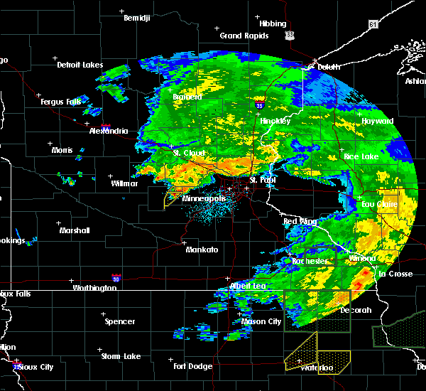 The severe thunderstorm warning for northeastern mcleod county will expire at 245 pm cdt, the storm which prompted the warning has moved out of the area. therefore the warning will be allowed to expire. The severe thunderstorm warning for northeastern mcleod county will expire at 245 pm cdt, the storm which prompted the warning has moved out of the area. therefore the warning will be allowed to expire.
|
| 7/23/2016 2:37 PM CDT |
 At 237 pm cdt, a severe thunderstorm was located near glencoe, or 11 miles east of hutchinson, moving southeast at 25 mph (radar indicated). Hazards include 60 mph wind gusts and quarter size hail. Hail damage to vehicles is expected. expect wind damage to roofs, siding, and trees. This severe thunderstorm will remain over mainly rural areas of southeastern mcleod county, including the following locations: sumter. At 237 pm cdt, a severe thunderstorm was located near glencoe, or 11 miles east of hutchinson, moving southeast at 25 mph (radar indicated). Hazards include 60 mph wind gusts and quarter size hail. Hail damage to vehicles is expected. expect wind damage to roofs, siding, and trees. This severe thunderstorm will remain over mainly rural areas of southeastern mcleod county, including the following locations: sumter.
|
| 7/23/2016 2:36 PM CDT |
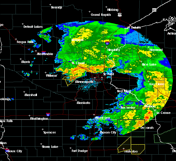 At 236 pm cdt, a severe thunderstorm was located near silver lake, or 12 miles east of hutchinson, moving southeast at 25 mph (radar indicated). Hazards include 60 mph wind gusts and nickel size hail. Expect damage to roofs. siding. and trees. Locations impacted include, silver lake. At 236 pm cdt, a severe thunderstorm was located near silver lake, or 12 miles east of hutchinson, moving southeast at 25 mph (radar indicated). Hazards include 60 mph wind gusts and nickel size hail. Expect damage to roofs. siding. and trees. Locations impacted include, silver lake.
|
| 7/23/2016 2:29 PM CDT |
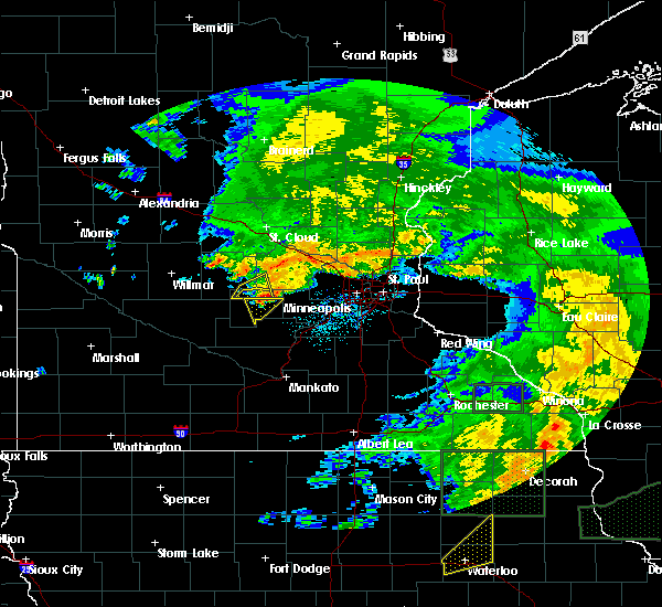 At 228 pm cdt, a severe thunderstorm was located near biscay, or 8 miles east of hutchinson, moving east at 25 mph (radar indicated). Hazards include 60 mph wind gusts and quarter size hail. Hail damage to vehicles is expected. expect wind damage to roofs, siding, and trees. this severe storm will be near, glencoe around 240 pm cdt. lester prairie around 245 pm cdt. Other locations impacted by this severe thunderstorm include biscay and sumter. At 228 pm cdt, a severe thunderstorm was located near biscay, or 8 miles east of hutchinson, moving east at 25 mph (radar indicated). Hazards include 60 mph wind gusts and quarter size hail. Hail damage to vehicles is expected. expect wind damage to roofs, siding, and trees. this severe storm will be near, glencoe around 240 pm cdt. lester prairie around 245 pm cdt. Other locations impacted by this severe thunderstorm include biscay and sumter.
|
| 7/23/2016 2:18 PM CDT |
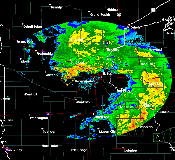 At 218 pm cdt, a severe thunderstorm was located near cokato, or 12 miles northeast of hutchinson, moving east at 30 mph (radar indicated). Hazards include 60 mph wind gusts and quarter size hail. Hail damage to vehicles is expected. expect wind damage to roofs, siding, and trees. This severe thunderstorm will remain over mainly rural areas of northern mcleod county. At 218 pm cdt, a severe thunderstorm was located near cokato, or 12 miles northeast of hutchinson, moving east at 30 mph (radar indicated). Hazards include 60 mph wind gusts and quarter size hail. Hail damage to vehicles is expected. expect wind damage to roofs, siding, and trees. This severe thunderstorm will remain over mainly rural areas of northern mcleod county.
|
| 7/23/2016 2:08 PM CDT |
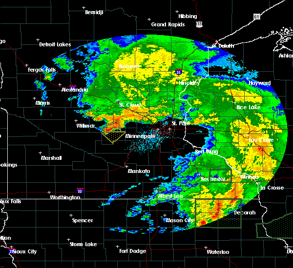 At 208 pm cdt, a severe thunderstorm was located near dassel, or 9 miles north of hutchinson, moving east at 30 mph (radar indicated). Hazards include 60 mph wind gusts and quarter size hail. Hail damage to vehicles is expected. expect wind damage to roofs, siding, and trees. This severe storm will be near, cokato around 225 pm cdt. At 208 pm cdt, a severe thunderstorm was located near dassel, or 9 miles north of hutchinson, moving east at 30 mph (radar indicated). Hazards include 60 mph wind gusts and quarter size hail. Hail damage to vehicles is expected. expect wind damage to roofs, siding, and trees. This severe storm will be near, cokato around 225 pm cdt.
|
| 7/23/2016 2:01 PM CDT |
 At 201 pm cdt, a severe thunderstorm was located near hutchinson airport, or near hutchinson, moving southeast at 25 mph (radar indicated). Hazards include 60 mph wind gusts and quarter size hail. Hail damage to vehicles is expected. expect wind damage to roofs, siding, and trees. this severe thunderstorm will be near, hutchinson around 215 pm cdt. silver lake around 230 pm cdt. glencoe and lester prairie around 245 pm cdt. other locations impacted by this severe thunderstorm include lake marion regional park, sumter, biscay and hutchinson airport. this includes u. s. Highway 212 between mile markers 110 and 120. At 201 pm cdt, a severe thunderstorm was located near hutchinson airport, or near hutchinson, moving southeast at 25 mph (radar indicated). Hazards include 60 mph wind gusts and quarter size hail. Hail damage to vehicles is expected. expect wind damage to roofs, siding, and trees. this severe thunderstorm will be near, hutchinson around 215 pm cdt. silver lake around 230 pm cdt. glencoe and lester prairie around 245 pm cdt. other locations impacted by this severe thunderstorm include lake marion regional park, sumter, biscay and hutchinson airport. this includes u. s. Highway 212 between mile markers 110 and 120.
|
| 7/23/2016 1:46 PM CDT |
 At 146 pm cdt, a severe thunderstorm was located over greenleaf, or 11 miles northwest of hutchinson, moving east at 30 mph (radar indicated). Hazards include ping pong ball size hail and 60 mph wind gusts. People and animals outdoors will be injured. expect hail damage to roofs, siding, windows, and vehicles. expect wind damage to roofs, siding, and trees. this severe thunderstorm will be near, dassel around 210 pm cdt. cokato around 225 pm cdt. other locations impacted by this severe thunderstorm include greenleaf, darwin, cedar mills and strout. this includes u. s. Highway 12 between mile markers 107 and 120. At 146 pm cdt, a severe thunderstorm was located over greenleaf, or 11 miles northwest of hutchinson, moving east at 30 mph (radar indicated). Hazards include ping pong ball size hail and 60 mph wind gusts. People and animals outdoors will be injured. expect hail damage to roofs, siding, windows, and vehicles. expect wind damage to roofs, siding, and trees. this severe thunderstorm will be near, dassel around 210 pm cdt. cokato around 225 pm cdt. other locations impacted by this severe thunderstorm include greenleaf, darwin, cedar mills and strout. this includes u. s. Highway 12 between mile markers 107 and 120.
|
| 7/5/2016 6:22 PM CDT |
 At 621 pm cdt, a severe thunderstorm was located over glencoe airport, or 18 miles southeast of hutchinson, moving east at 40 mph (public). Hazards include golf ball size hail and 60 mph wind gusts. People and animals outdoors will be injured. expect hail damage to roofs, siding, windows, and vehicles. expect wind damage to roofs, siding, and trees. locations impacted include, hutchinson, glencoe, gaylord, arlington, lester prairie, silver lake, brownton, sumter, new auburn, plato, biscay and lake marion regional park. A tornado watch remains in effect until 900 pm cdt for central minnesota. At 621 pm cdt, a severe thunderstorm was located over glencoe airport, or 18 miles southeast of hutchinson, moving east at 40 mph (public). Hazards include golf ball size hail and 60 mph wind gusts. People and animals outdoors will be injured. expect hail damage to roofs, siding, windows, and vehicles. expect wind damage to roofs, siding, and trees. locations impacted include, hutchinson, glencoe, gaylord, arlington, lester prairie, silver lake, brownton, sumter, new auburn, plato, biscay and lake marion regional park. A tornado watch remains in effect until 900 pm cdt for central minnesota.
|
| 7/5/2016 6:18 PM CDT |
 At 617 pm cdt, a severe thunderstorm was located over glencoe airport, or 16 miles southeast of hutchinson, moving east at 45 mph (public reported quarter size hail near glencoe). Hazards include 60 mph wind gusts and quarter size hail. Hail damage to vehicles is expected. expect wind damage to roofs, siding, and trees. this severe thunderstorm will remain over mainly rural areas of mcleod and north central sibley counties, including the following locations: new auburn, lake marion regional park, sumter, glencoe airport, biscay and plato. A tornado watch remains in effect until 900 pm cdt for central minnesota. At 617 pm cdt, a severe thunderstorm was located over glencoe airport, or 16 miles southeast of hutchinson, moving east at 45 mph (public reported quarter size hail near glencoe). Hazards include 60 mph wind gusts and quarter size hail. Hail damage to vehicles is expected. expect wind damage to roofs, siding, and trees. this severe thunderstorm will remain over mainly rural areas of mcleod and north central sibley counties, including the following locations: new auburn, lake marion regional park, sumter, glencoe airport, biscay and plato. A tornado watch remains in effect until 900 pm cdt for central minnesota.
|
| 7/5/2016 6:00 PM CDT |
 At 559 pm cdt, a severe thunderstorm was located over sumter, or 9 miles southeast of hutchinson, moving east at 35 mph (radar indicated). Hazards include golf ball size hail and 60 mph wind gusts. People and animals outdoors will be injured. expect hail damage to roofs, siding, windows, and vehicles. expect wind damage to roofs, siding, and trees. this severe storm will be near, glencoe around 610 pm cdt. arlington around 620 pm cdt. other locations impacted by this severe thunderstorm include lake marion regional park, sumter, biscay, new auburn, glencoe airport, hutchinson airport and plato. A tornado watch remains in effect until 900 pm cdt for central minnesota. At 559 pm cdt, a severe thunderstorm was located over sumter, or 9 miles southeast of hutchinson, moving east at 35 mph (radar indicated). Hazards include golf ball size hail and 60 mph wind gusts. People and animals outdoors will be injured. expect hail damage to roofs, siding, windows, and vehicles. expect wind damage to roofs, siding, and trees. this severe storm will be near, glencoe around 610 pm cdt. arlington around 620 pm cdt. other locations impacted by this severe thunderstorm include lake marion regional park, sumter, biscay, new auburn, glencoe airport, hutchinson airport and plato. A tornado watch remains in effect until 900 pm cdt for central minnesota.
|
| 7/5/2016 5:37 PM CDT |
 At 537 pm cdt, a severe thunderstorm was located over lakeside, or 7 miles southwest of hutchinson, moving southeast at 45 mph (radar indicated). Hazards include golf ball size hail and 60 mph wind gusts. People and animals outdoors will be injured. expect hail damage to roofs, siding, windows, and vehicles. expect wind damage to roofs, siding, and trees. this severe thunderstorm will be near, hutchinson and stewart around 545 pm cdt. brownton around 550 pm cdt. glencoe around 600 pm cdt. arlington around 615 pm cdt. other locations impacted by this severe thunderstorm include lake marion regional park, sumter, cedar mills, biscay, corvuso, new auburn, glencoe airport, lakeside, hutchinson airport and plato. this includes u. s. highway 212 between mile markers 94 and 127. A tornado watch remains in effect until 900 pm cdt for central minnesota. At 537 pm cdt, a severe thunderstorm was located over lakeside, or 7 miles southwest of hutchinson, moving southeast at 45 mph (radar indicated). Hazards include golf ball size hail and 60 mph wind gusts. People and animals outdoors will be injured. expect hail damage to roofs, siding, windows, and vehicles. expect wind damage to roofs, siding, and trees. this severe thunderstorm will be near, hutchinson and stewart around 545 pm cdt. brownton around 550 pm cdt. glencoe around 600 pm cdt. arlington around 615 pm cdt. other locations impacted by this severe thunderstorm include lake marion regional park, sumter, cedar mills, biscay, corvuso, new auburn, glencoe airport, lakeside, hutchinson airport and plato. this includes u. s. highway 212 between mile markers 94 and 127. A tornado watch remains in effect until 900 pm cdt for central minnesota.
|
| 6/19/2016 11:01 PM CDT |
 At 1101 pm cdt, a severe thunderstorm was located over silver lake, or near hutchinson, moving east at 45 mph (radar indicated). Hazards include 60 mph wind gusts and half dollar size hail. Hail damage to vehicles is expected. expect wind damage to roofs, siding, and trees. This severe thunderstorm will remain over mainly rural areas of north central mcleod county. At 1101 pm cdt, a severe thunderstorm was located over silver lake, or near hutchinson, moving east at 45 mph (radar indicated). Hazards include 60 mph wind gusts and half dollar size hail. Hail damage to vehicles is expected. expect wind damage to roofs, siding, and trees. This severe thunderstorm will remain over mainly rural areas of north central mcleod county.
|
| 6/19/2016 10:54 PM CDT |
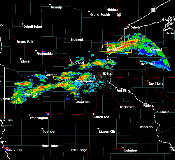 At 1053 pm cdt, a severe thunderstorm was located over hutchinson, moving east at 45 mph (radar indicated). Hazards include 60 mph wind gusts and half dollar size hail. Hail damage to vehicles is expected. expect wind damage to roofs, siding, and trees. this severe storm will be near, silver lake around 1105 pm cdt. Other locations impacted by this severe thunderstorm include biscay and hutchinson airport. At 1053 pm cdt, a severe thunderstorm was located over hutchinson, moving east at 45 mph (radar indicated). Hazards include 60 mph wind gusts and half dollar size hail. Hail damage to vehicles is expected. expect wind damage to roofs, siding, and trees. this severe storm will be near, silver lake around 1105 pm cdt. Other locations impacted by this severe thunderstorm include biscay and hutchinson airport.
|
| 6/19/2016 10:36 PM CDT |
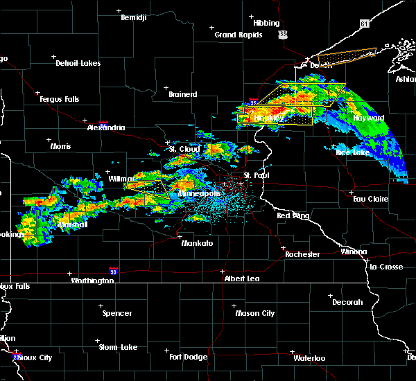 At 1036 pm cdt, a severe thunderstorm was located over cosmos, or 13 miles west of hutchinson, moving east at 45 mph (radar indicated). Hazards include half dollar size hail. Damage to vehicles is expected. this severe thunderstorm will be near, hutchinson around 1055 pm cdt. glencoe around 1110 pm cdt. other locations impacted by this severe thunderstorm include cedar mills, biscay, hutchinson airport and corvuso. this includes u. s. Highway 212 between mile markers 118 and 120. At 1036 pm cdt, a severe thunderstorm was located over cosmos, or 13 miles west of hutchinson, moving east at 45 mph (radar indicated). Hazards include half dollar size hail. Damage to vehicles is expected. this severe thunderstorm will be near, hutchinson around 1055 pm cdt. glencoe around 1110 pm cdt. other locations impacted by this severe thunderstorm include cedar mills, biscay, hutchinson airport and corvuso. this includes u. s. Highway 212 between mile markers 118 and 120.
|
| 7/24/2015 1:30 AM CDT |
 At 130 am cdt, severe thunderstorms were located along a line extending from near dassel to silver lake, moving east at 40 mph (radar indicated). Hazards include 60 mph wind gusts and quarter size hail. Hail damage to vehicles is expected. expect wind damage to roofs, siding and trees. severe thunderstorms will be near, cokato around 135 am cdt. winsted and lester prairie around 140 am cdt. howard lake around 145 am cdt. mayer around 150 am cdt. watertown and montrose around 155 am cdt. buffalo and delano around 200 am cdt. rockford around 205 am cdt. minnetrista and independence around 210 am cdt. other locations impacted by these severe thunderstorms include buffalo airport, smith lake, rassat, hollywood, new germany and waverly. this includes u. s. Highway 12 between mile markers 115 and 140. At 130 am cdt, severe thunderstorms were located along a line extending from near dassel to silver lake, moving east at 40 mph (radar indicated). Hazards include 60 mph wind gusts and quarter size hail. Hail damage to vehicles is expected. expect wind damage to roofs, siding and trees. severe thunderstorms will be near, cokato around 135 am cdt. winsted and lester prairie around 140 am cdt. howard lake around 145 am cdt. mayer around 150 am cdt. watertown and montrose around 155 am cdt. buffalo and delano around 200 am cdt. rockford around 205 am cdt. minnetrista and independence around 210 am cdt. other locations impacted by these severe thunderstorms include buffalo airport, smith lake, rassat, hollywood, new germany and waverly. this includes u. s. Highway 12 between mile markers 115 and 140.
|
| 7/17/2015 11:44 PM CDT |
 At 1144 pm cdt, severe thunderstorms were located along a line extending from silver lake to near new auburn to near evan, moving east at 45 mph (radar indicated). Hazards include 60 mph wind gusts and penny size hail. Expect damage to roofs. siding and trees. severe thunderstorms will be near, winsted, gaylord and silver lake around 1150 pm cdt. arlington and lester prairie around 1155 pm cdt. green isle around 1200 am cdt. new ulm, watertown, norwood young america and mayer around 1205 am cdt. waconia, henderson and lafayette around 1210 am cdt. belle plaine and cologne around 1215 am cdt. chaska, chanhassen, victoria and courtland around 1220 am cdt. jordan and carver around 1225 am cdt. other locations impacted by these severe thunderstorms include norseland, marystown, klossner, st benedict, new germany, new rome, essig, evan, hamburg and lake waconia. this includes the following highways, u. s. highway 14 between mile markers 93 and 125. u. s. highway 169 between mile markers 58 and 116. u. s. Highway 212 between mile markers 110 and 154. At 1144 pm cdt, severe thunderstorms were located along a line extending from silver lake to near new auburn to near evan, moving east at 45 mph (radar indicated). Hazards include 60 mph wind gusts and penny size hail. Expect damage to roofs. siding and trees. severe thunderstorms will be near, winsted, gaylord and silver lake around 1150 pm cdt. arlington and lester prairie around 1155 pm cdt. green isle around 1200 am cdt. new ulm, watertown, norwood young america and mayer around 1205 am cdt. waconia, henderson and lafayette around 1210 am cdt. belle plaine and cologne around 1215 am cdt. chaska, chanhassen, victoria and courtland around 1220 am cdt. jordan and carver around 1225 am cdt. other locations impacted by these severe thunderstorms include norseland, marystown, klossner, st benedict, new germany, new rome, essig, evan, hamburg and lake waconia. this includes the following highways, u. s. highway 14 between mile markers 93 and 125. u. s. highway 169 between mile markers 58 and 116. u. s. Highway 212 between mile markers 110 and 154.
|
| 7/17/2015 11:31 PM CDT |
 At 1131 pm cdt, severe thunderstorms were located along a line extending from st nicholas to near kimball to near lakeside, moving east at 35 mph (radar indicated). Hazards include 60 mph wind gusts. Expect damage to roofs. siding and trees. these severe storms will be near, hutchinson, annandale and kimball around 1145 pm cdt. silver lake around 1155 pm cdt. maple lake, clearwater and lester prairie around 1200 am cdt. other locations impacted by these severe thunderstorms include greenleaf, fairhaven, forest city, waverly, darwin, st augusta, rassat, smith lake, luxemburg and south haven. this includes the following highways, interstate 94 in minnesota between mile markers 173 and 182. u. s. Highway 12 between mile markers 96 and 129. At 1131 pm cdt, severe thunderstorms were located along a line extending from st nicholas to near kimball to near lakeside, moving east at 35 mph (radar indicated). Hazards include 60 mph wind gusts. Expect damage to roofs. siding and trees. these severe storms will be near, hutchinson, annandale and kimball around 1145 pm cdt. silver lake around 1155 pm cdt. maple lake, clearwater and lester prairie around 1200 am cdt. other locations impacted by these severe thunderstorms include greenleaf, fairhaven, forest city, waverly, darwin, st augusta, rassat, smith lake, luxemburg and south haven. this includes the following highways, interstate 94 in minnesota between mile markers 173 and 182. u. s. Highway 12 between mile markers 96 and 129.
|
| 7/17/2015 11:09 PM CDT |
 At 1108 pm cdt, severe thunderstorms were located along a line extending from near roscoe to near eden valley to near cosmos, moving east at 40 mph (radar indicated). Hazards include 60 mph wind gusts. Expect damage to roofs. siding and trees. severe thunderstorms will be near, eden valley around 1115 pm cdt. richmond and watkins around 1120 pm cdt. cold spring and kimball around 1130 pm cdt. rockville around 1135 pm cdt. hutchinson and annandale around 1140 pm cdt. silver lake around 1150 pm cdt. maple lake around 1155 pm cdt. clearwater and lester prairie around 1200 am cdt. other locations impacted by these severe thunderstorms include greenleaf, fairhaven, forest city, waverly, darwin, st augusta, rassat, smith lake, luxemburg and south haven. this includes the following highways, interstate 94 in minnesota between mile markers 173 and 182. u. s. Highway 12 between mile markers 93 and 129. At 1108 pm cdt, severe thunderstorms were located along a line extending from near roscoe to near eden valley to near cosmos, moving east at 40 mph (radar indicated). Hazards include 60 mph wind gusts. Expect damage to roofs. siding and trees. severe thunderstorms will be near, eden valley around 1115 pm cdt. richmond and watkins around 1120 pm cdt. cold spring and kimball around 1130 pm cdt. rockville around 1135 pm cdt. hutchinson and annandale around 1140 pm cdt. silver lake around 1150 pm cdt. maple lake around 1155 pm cdt. clearwater and lester prairie around 1200 am cdt. other locations impacted by these severe thunderstorms include greenleaf, fairhaven, forest city, waverly, darwin, st augusta, rassat, smith lake, luxemburg and south haven. this includes the following highways, interstate 94 in minnesota between mile markers 173 and 182. u. s. Highway 12 between mile markers 93 and 129.
|
| 9/19/2013 9:45 AM CDT | Several large tree limbs down in silver lake...with some corn fields flattened by strong winds outside of tow in mcleod county MN, 3.5 miles SE of Silver Lake, MN |
| 7/13/2012 4:21 PM CDT | Ping Pong Ball sized hail reported 0.2 miles N of Silver Lake, MN, officer in silver lake reported quater to ping pong ball sized hail. |
| 1/1/0001 12:00 AM | Ping Pong Ball sized hail reported 3.5 miles SE of Silver Lake, MN, quarter to ping-pong size hail reported near 220th st. |
| 1/1/0001 12:00 AM | Big trees down. 24 inch tree split of in mcleod county MN, 3.5 miles SE of Silver Lake, MN |
Hail Maps for Silver Lake, MN


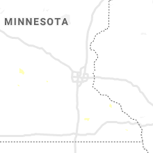


Connect with Interactive Hail Maps