

Hail Map for Thursday, July 16, 2020

Number of Impacted Households on 7/16/2020
0
Impacted by 1" or Larger Hail
0
Impacted by 1.75" or Larger Hail
0
Impacted by 2.5" or Larger Hail
Square Miles of Populated Area Impacted on 7/16/2020
0
Impacted by 1" or Larger Hail
0
Impacted by 1.75" or Larger Hail
0
Impacted by 2.5" or Larger Hail


Cities Most Affected by Hail Storms of 7/16/2020
| Hail Size | Demographics of Zip Codes Affected | ||||||
|---|---|---|---|---|---|---|---|
| City | Count | Average | Largest | Pop Density | House Value | Income | Age |
| Julesburg, CO | 1 | 2.00 | 2.00 | 6 | $62k | $28.8k | 48.8 |
Hail and Wind Damage Spotted on 7/16/2020
Filter by Report Type:Hail ReportsWind Reports
States Impacted
New York, Pennsylvania, Maryland, Colorado, Arkansas, West Virginia, Minnesota, California, MissouriNew York
| Local Time | Report Details |
|---|---|
| 12:41 PM EDT | Multiple trees and wires down and a utility pole on east av in monroe county NY, 54.4 miles ENE of Buffalo, NY |
| 4:16 PM EDT | Multiple trees dow in erie county NY, 25.1 miles SSW of Buffalo, NY |
| 4:16 PM EDT | Multiple trees dow in chautauqua county NY, 24.8 miles SSW of Buffalo, NY |
| 4:50 PM EDT | Barn destroyed... trees uprooted... damage to house and shop lift remove in chautauqua county NY, 49.3 miles SW of Buffalo, NY |
| 5:25 PM EDT | Tree and wires down on gowanda state r in cattaraugus county NY, 29.5 miles S of Buffalo, NY |
| 5:58 PM EDT | Wires down on boston st r in erie county NY, 20.2 miles SSE of Buffalo, NY |
| 6:32 PM EDT | Trees and wires dow in cattaraugus county NY, 44 miles S of Buffalo, NY |
| 7:26 PM EDT | Trees and wires down on rt 24 in cattaraugus county NY, 48.8 miles S of Buffalo, NY |
| 7:28 PM EDT | Porch roof blown off of the hous in cattaraugus county NY, 50.3 miles S of Buffalo, NY |
| 7:30 PM EDT | Tree down on a hous in cattaraugus county NY, 47.3 miles S of Buffalo, NY |
| 7:50 PM EDT | Trees and wires dow in cattaraugus county NY, 58.4 miles SSE of Buffalo, NY |
| 7:53 PM EDT | Trees and wires dow in cattaraugus county NY, 50.7 miles S of Buffalo, NY |
| 8:01 PM EDT | Trees and wires dow in cattaraugus county NY, 55.3 miles SSE of Buffalo, NY |
Pennsylvania
| Local Time | Report Details |
|---|---|
| 3:15 PM EDT | Tree down on singer hill road near killiwatt s in cambria county PA, 59 miles E of Pittsburgh, PA |
| 3:17 PM EDT | Trees and powerlines down blocking route 51 near montour sports comple in allegheny county PA, 9.4 miles WNW of Pittsburgh, PA |
| 3:18 PM EDT | Tree down on a residence in southmon in cambria county PA, 56.9 miles E of Pittsburgh, PA |
| 3:27 PM EDT | Report of tree down on 279 n near bellevue exi in allegheny county PA, 5.9 miles NNW of Pittsburgh, PA |
| 3:30 PM EDT | Tree down on house. no injuries reported. time estimated based on rada in allegheny county PA, 7.5 miles NNW of Pittsburgh, PA |
| 3:48 PM EDT | Tree downed on road. time estimated based on rada in butler county PA, 17.6 miles NNE of Pittsburgh, PA |
| 4:00 PM EDT | Trees down in cabo in butler county PA, 25.2 miles NNE of Pittsburgh, PA |
| 4:00 PM EDT | Treed downed on roadwa in butler county PA, 24.6 miles NNE of Pittsburgh, PA |
| 4:00 PM EDT | Tree downed on wire with wires on fire along north pike roa in butler county PA, 25 miles NNE of Pittsburgh, PA |
| 4:02 PM EDT | Tree downed on wire causing fir in butler county PA, 26.1 miles NNE of Pittsburgh, PA |
| 4:15 PM EDT | Downed tree. location and time estimated based on rada in armstrong county PA, 33.8 miles NE of Pittsburgh, PA |
Maryland
| Local Time | Report Details |
|---|---|
| 3:54 PM EDT | Tree down in the 200 block of miller road in mineral county WV, 75.5 miles NE of Elkins, WV |
| 5:05 PM EDT | Ping Pong Ball sized hail reported near Oldtown, MD, 78.1 miles NE of Elkins, WV |
Colorado
| Local Time | Report Details |
|---|---|
| 2:31 PM MDT | Storm damage reported in las animas county CO, 70.9 miles SSE of Pueblo, CO |
| 2:31 PM MDT | Storm damage reported in las animas county CO, 70.8 miles SSE of Pueblo, CO |
| 3:37 PM MDT | Corrects previous tstm wnd gst report from 2 e rifle. asos station kril garfield county rgnl a in garfield county CO, 54.9 miles NE of Grand Junction, CO |
| 6:26 PM MDT | Ping Pong Ball sized hail reported near Holyoke, CO, 38.9 miles NE of Yuma, CO |
| 6:38 PM MDT | Quarter sized hail reported near Idalia, CO, 37.2 miles SSE of Yuma, CO, spotter reported quarter size hail. |
| 6:59 PM MDT | Hen Egg sized hail reported near Julesburg, CO, 57.1 miles NE of Yuma, CO |
| 7:05 PM MDT | Ping Pong Ball sized hail reported near Julesburg, CO, 63.8 miles NNE of Yuma, CO |
| 7:10 PM MDT | Quarter sized hail reported near Julesburg, CO, 65.1 miles NNE of Yuma, CO |
Arkansas
| Local Time | Report Details |
|---|---|
| 3:34 PM CDT | Tree limbs and debris on i-55 near jericho (looking towards west memphis)... between miles 5 and 6. also one power pole snapped in hal in crittenden county AR, 14.1 miles NW of Memphis, TN |
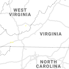
West Virginia
| Local Time | Report Details |
|---|---|
| 5:31 PM EDT | Radar estimated time-trees down along lost word road near lost world caverns in lewisburg... w in greenbrier county WV, 47.6 miles NW of Roanoke, VA |
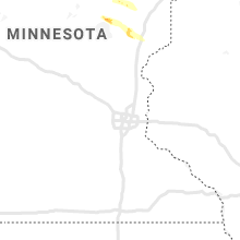
Minnesota
| Local Time | Report Details |
|---|---|
| 5:05 PM CDT | A dock was blown into farm island lake. time estimated by rada in aitkin county MN, 82.6 miles WSW of Duluth, MN |
| 5:05 PM CDT | Multiple docks were blown into farm island lake... along with a few 8-12 inch diameter trees either uprooted or snapped. time estimated by rada in aitkin county MN, 84.1 miles WSW of Duluth, MN |
| 6:25 PM CDT | Quarter sized hail reported near Duluth, MN, 13.4 miles NNW of Duluth, MN, mainly dime to nickel size hail... with a few quarter size. |
California
| Local Time | Report Details |
|---|---|
| 4:05 PM PDT | Quarter sized hail reported near South Lake Tahoe, CA, 46.6 miles SSW of Reno, NV, 1 inch hail reported 1 mile south of lake tahoe airport. |
Missouri
| Local Time | Report Details |
|---|---|
| 10:36 PM CDT | Two trees down near intersection of fr1020 and fr2040 southwest of monett causing power outage in the area. time estimated by rada in barry county MO, 47 miles WSW of Springfield, MO |
| 11:00 PM CDT | Tree down blocking the roadway lawrence 1070/south of lawrence 2180. time estimated from rada in lawrence county MO, 37.8 miles WSW of Springfield, MO |
| 11:00 PM CDT | A large walnut tree is blocking the roadway on lawrence 2190... 1/2 mile west of highway h - monett/freistatt area. report relayed by dispatch. time estimate in lawrence county MO, 37.6 miles WSW of Springfield, MO |
| 11:10 PM CDT | Tree down over roadwa in barry county MO, 51 miles WSW of Springfield, MO |
Connect with Interactive Hail Maps