

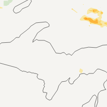
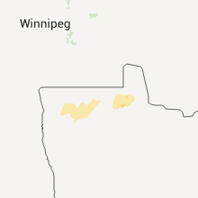
Hail Map for Wednesday, July 20, 2011

Number of Impacted Households on 7/20/2011
0
Impacted by 1" or Larger Hail
0
Impacted by 1.75" or Larger Hail
0
Impacted by 2.5" or Larger Hail
Square Miles of Populated Area Impacted on 7/20/2011
0
Impacted by 1" or Larger Hail
0
Impacted by 1.75" or Larger Hail
0
Impacted by 2.5" or Larger Hail


Cities Most Affected by Hail Storms of 7/20/2011
| Hail Size | Demographics of Zip Codes Affected | ||||||
|---|---|---|---|---|---|---|---|
| City | Count | Average | Largest | Pop Density | House Value | Income | Age |
| New Castle, IN | 1 | 1.75 | 1.75 | 191 | $81k | $36.6k | 41.3 |
Hail and Wind Damage Spotted on 7/20/2011
Filter by Report Type:Hail ReportsWind Reports
States Impacted
North Dakota, Minnesota, Virginia, Ohio, North Carolina, Kentucky, Indiana, Georgia, South Carolina, Arizona, Alabama, Maine, Kansas, PennsylvaniaNorth Dakota
| Local Time | Report Details |
|---|---|
| 12:00 PM UTC | 60 ft. pine tree uprooted. shingle damage. 1 ft diameter oak tree snapped at trun in pembina county ND, 66.6 miles WSW of Roseau, MN |
| 1:35 PM UTC | Storm damage reported in cavalier county ND, 58.9 miles NE of Devils Lake, ND |
Minnesota
| Local Time | Report Details |
|---|---|
| 12:22 PM UTC | Storm damage reported in marshall county MN, 57.7 miles WSW of Roseau, MN |
| 12:27 PM UTC | Measured wind gust at the stephen ndaw in marshall county MN, 49.6 miles WSW of Roseau, MN |
| 12:30 PM UTC | Large tree down in marshall county MN, 48.3 miles SW of Roseau, MN |
| 12:30 PM UTC | County highway department building severely damaged. equipment in building also damaged. time approximat in kittson county MN, 38.9 miles WSW of Roseau, MN |
| 12:30 PM UTC | Nws survey team concludes straight line winds estimated at 85 to 95 mph hit the town of karlstad. the kittson county garage and shed was damaged along with many tree in kittson county MN, 38.9 miles WSW of Roseau, MN |
| 12:30 PM UTC | Grain bin tipped ove in marshall county MN, 53.8 miles WSW of Roseau, MN |
| 12:38 PM UTC | Storm damage reported in kittson county MN, 38.9 miles WSW of Roseau, MN |
| 12:40 PM UTC | 6 inch diameter tree sections broken off 3 to 4 feet up on trunk in kittson county MN, 38.9 miles WSW of Roseau, MN |
| 12:40 PM UTC | Large trees...greater than a foot in diameter...blown dow in roseau county MN, 8.8 miles SSE of Roseau, MN |
| 12:48 PM UTC | 6 to 8 inch diameter trees felled in roseau county MN, 21.3 miles WSW of Roseau, MN |
| 12:58 PM UTC | Measured wind gust at greenbush ndaw in roseau county MN, 27.9 miles WSW of Roseau, MN |
| 1:00 PM UTC | Extensive tree and house damage in greenbush. time approximat in roseau county MN, 21.3 miles WSW of Roseau, MN |
| 1:00 PM UTC | Trees blown down on cars in town. empty grain bin rolle in roseau county MN, 21.3 miles WSW of Roseau, MN |
| 1:07 PM UTC | Extensive tree and house damage in greenbush. time approximat in roseau county MN, 21.3 miles WSW of Roseau, MN |
| 1:10 PM UTC | Storm damage reported in roseau county MN, 1.7 miles SSE of Roseau, MN |
| 1:10 PM UTC | 2.5 to 3 foot diameter trees down in badger. time approximated using radar imager in roseau county MN, 12.3 miles WSW of Roseau, MN |
| 1:15 PM UTC | Numerous trees of 4 inch diameter down in tow in roseau county MN, 0.5 miles NE of Roseau, MN |
| 1:19 PM UTC | 4 inch diameter trees down in roseau county MN, 0.5 miles NE of Roseau, MN |
| 1:25 PM UTC | 6 to 8 inch diameter trees down in town. estimated wind gusts of 30 to 35 mp in roseau county MN, 0.5 miles NE of Roseau, MN |
| 1:25 PM UTC | 6 to 8 inch diameter trees down in town. estimated wind gusts of 60 to 65 mp in roseau county MN, 0.5 miles NE of Roseau, MN |
| 1:34 PM UTC | 4 to 6 inch diameter tree limbs broken off during stor in roseau county MN, 12.3 miles WSW of Roseau, MN |
| 1:40 PM UTC | Large trees...greater than a foot in diameter...blown dow in roseau county MN, 8.8 miles SSE of Roseau, MN |
| 1:45 PM UTC | Dime size hail accompanied wind in roseau county MN, 1.8 miles NNE of Roseau, MN |
| 3:00 PM UTC | 2.5 to 3 foot diameter trees down in badger. time approximated using radar imager in roseau county MN, 12.3 miles WSW of Roseau, MN |
Virginia
| Local Time | Report Details |
|---|---|
| 7:05 PM UTC | Power lines reported down along highway 17...just east of the dismal swamp in city of chesapeake county VA, 15.6 miles SSW of Virginia Beach, VA |
Ohio
| Local Time | Report Details |
|---|---|
| 8:00 PM UTC | A few medium size branches down in franklin county OH, 8 miles NE of Columbus, OH |
| 8:43 PM UTC | Numerous trees down from pickerington to lancaster in fairfield county OH, 17.5 miles SE of Columbus, OH |
| 9:28 PM UTC | Quarter sized hail reported near New Richmond, OH, 15.8 miles SE of Cincinnati, OH |
| 9:35 PM UTC | Trees and wires down in several locations...including sr56...sr374 and chieftain drive. time estimate in hocking county OH, 44.5 miles SSE of Columbus, OH |
| 10:20 PM UTC | Numerous trees down. time estimated from rada in darke county OH, 62.6 miles SSE of Fort Wayne, IN |
| 10:40 PM UTC | Damage to in darke county OH, 62.6 miles SSE of Fort Wayne, IN |
| 11:10 PM UTC | Roof off of barn. time estimated from rada in darke county OH, 59.8 miles NNW of Cincinnati, OH |
North Carolina
| Local Time | Report Details |
|---|---|
| 8:00 PM UTC | Tree down across highway 17 near morgans corner in pasquotank county NC, 28.5 miles SSW of Virginia Beach, VA |
| 9:00 PM UTC | Two large trees down on rte 305 in bertie county NC, 69.2 miles SW of Virginia Beach, VA |
Kentucky
| Local Time | Report Details |
|---|---|
| 8:03 PM UTC | Reported at louisville international airport in jefferson county KY, 16.1 miles N of Louisville, KY |
| 9:35 PM UTC | Quarter sized hail reported near Melbourne, KY, 12.8 miles SE of Cincinnati, OH, also 45 to 50 mph winds |
| 10:35 AM UTC | Large limbs and one tree was down along or near kentucky highway 11 in floyd county KY, 62.3 miles E of Irvine, KY |
Indiana
| Local Time | Report Details |
|---|---|
| 8:15 PM UTC | Dry outflow from storm blew off screen door and blew down a couple utility poles in lawrence county IN, 60.9 miles SSW of Indianapolis, IN |
| 8:23 PM UTC | Trees were blown down on trunden lane...one tree crashed into a home in lawrence county IN, 63.8 miles SSW of Indianapolis, IN |
| 10:10 PM UTC | Tree down across county road 375 west with estimated 18 to 24-inch diameter in henry county IN, 37.2 miles E of Indianapolis, IN |
| 10:10 PM UTC | Quarter sized hail reported near Spiceland, IN, 37.2 miles E of Indianapolis, IN, dime and quarter size hail fell on county road 375 west |
| 10:10 PM UTC | Golf Ball sized hail reported near New Castle, IN, 43.3 miles ENE of Indianapolis, IN, dime and golfball size hail fell at the 123 mile marker on interstate 70 |
Georgia
| Local Time | Report Details |
|---|---|
| 8:25 PM UTC | 1 power line down in jones county GA, 74.4 miles SE of Atlanta, GA |
South Carolina
| Local Time | Report Details |
|---|---|
| 10:00 PM UTC | Spotter reported 3 or 4 small trees split in half of rutherford street in east blacksbur in cherokee county SC, 38.2 miles W of Charlotte, NC |
Arizona
| Local Time | Report Details |
|---|---|
| 11:10 PM UTC | Several large tree limbs down and power outage in neighborhood in cochise county AZ, 42.2 miles WNW of Douglas, AZ |
Alabama
| Local Time | Report Details |
|---|---|
| 12:12 AM UTC | Several trees were blown down in and around oneonta. one garage/barn had a large portion of its tin roof remove in blount county AL, 35 miles NE of Birmingham, AL |
Maine
| Local Time | Report Details |
|---|---|
| 12:48 AM UTC | Tree down in knowles corner in aroostook county ME, 47.2 miles SSW of Caribou, ME |
| 1:07 AM UTC | Tree down on power line in aroostook county ME, 56.6 miles S of Caribou, ME |
Kansas
| Local Time | Report Details |
|---|---|
| 6:04 AM UTC | Storm damage reported in greeley county KS, 58.9 miles NW of Garden City, KS |
Pennsylvania
| Local Time | Report Details |
|---|---|
| 7:08 AM UTC | Trees down on state route 3001 at two different places. high tension wires also down due to the trees on the in susquehanna county PA, 26.7 miles NW of Scranton, PA |
Connect with Interactive Hail Maps