

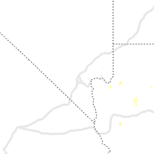
Hail Map for Friday, July 24, 2020

Number of Impacted Households on 7/24/2020
0
Impacted by 1" or Larger Hail
0
Impacted by 1.75" or Larger Hail
0
Impacted by 2.5" or Larger Hail
Square Miles of Populated Area Impacted on 7/24/2020
0
Impacted by 1" or Larger Hail
0
Impacted by 1.75" or Larger Hail
0
Impacted by 2.5" or Larger Hail


Cities Most Affected by Hail Storms of 7/24/2020
| Hail Size | Demographics of Zip Codes Affected | ||||||
|---|---|---|---|---|---|---|---|
| City | Count | Average | Largest | Pop Density | House Value | Income | Age |
| Driscoll, ND | 1 | 1.75 | 1.75 | 1 | $44k | $22.1k | 44.5 |
Hail and Wind Damage Spotted on 7/24/2020
Filter by Report Type:Hail ReportsWind Reports
States Impacted
South Carolina, Tennessee, Kentucky, Virginia, North Carolina, Massachusetts, Maryland, South Dakota, North Dakota, Nebraska, New Mexico, Pennsylvania, Minnesota, MontanaSouth Carolina
| Local Time | Report Details |
|---|---|
| 1:45 PM EDT | Amateur radio reported a tree blown down on north little river r in oconee county SC, 24.1 miles WNW of Greenville, SC |
| 2:12 PM EDT | Nws employee reported a tree down on power lines along highway 14 between woodruff rd and roper mountain rd and another tree down a little farther north along highway 1 in greenville county SC, 19.3 miles E of Greenville, SC |
| 2:14 PM EDT | Broadcast media reported a tree and power lines blown down on roper mountain rd near anderson ridge r in greenville county SC, 22.2 miles E of Greenville, SC |
| 3:42 PM EDT | Lancaster co dispatch reported trees down at fork hill rd and rob neal rd. time estimate in lancaster county SC, 45.6 miles SSE of Charlotte, NC |
| 4:30 PM EDT | Mcconnells fire dept reported one tree down on lowrys r in york county SC, 35 miles SW of Charlotte, NC |
| 4:45 PM EDT | Highway patrol reported trees in roadway longtown road at clemson road. time estimated from rada in richland county SC, 74.8 miles S of Charlotte, NC |
| 4:45 PM EDT | Corrects previous non-tstm wnd dmg report from 5 sse blythewood. highway patrol reported trees in roadway at longreen parkway and heather green d in richland county SC, 74.2 miles S of Charlotte, NC |
Tennessee
| Local Time | Report Details |
|---|---|
| 1:25 PM CDT | Several trees blown down on nancy shawl road near highway 351 in dickson county TN, 37.1 miles W of Nashville, TN |
| 4:19 PM EDT | Several trees dow in campbell county TN, 34.3 miles N of Knoxville, TN |
| 4:30 PM EDT | Several trees dow in knox county TN, 13.8 miles N of Knoxville, TN |
| 4:37 PM EDT | Several trees down with high wind in claiborne county TN, 47.2 miles NNE of Knoxville, TN |
| 4:49 PM EDT | Several trees down across the are in union county TN, 20.4 miles NNE of Knoxville, TN |
| 5:03 PM EDT | Several trees down and hail up to penny siz in polk county TN, 56.3 miles E of Chattanooga, TN |
| 5:05 PM EDT | Several trees down across the are in hancock county TN, 55 miles W of Bristol, TN |
| 5:13 PM EDT | Several trees and power lines dow in knox county TN, 11.8 miles NNE of Knoxville, TN |
| 5:29 PM EDT | A few trees dow in claiborne county TN, 43 miles NE of Knoxville, TN |
| 5:30 PM EDT | Several trees dow in hancock county TN, 52.8 miles W of Bristol, TN |
| 5:54 PM EDT | Several trees down across the are in hamblen county TN, 44.8 miles ENE of Knoxville, TN |
| 6:38 PM EDT | Several trees dow in monroe county TN, 39.3 miles SSW of Knoxville, TN |
| 7:11 PM EDT | A few trees dow in sullivan county TN, 1.8 miles SW of Bristol, TN |
| 8:30 PM EDT | Several trees down across the are in rhea county TN, 42.6 miles NNE of Chattanooga, TN |
Kentucky
| Local Time | Report Details |
|---|---|
| 2:55 PM EDT | Report of tree down on ky 49 within liberty city limit in casey county KY, 59.2 miles WSW of Irvine, KY |
| 2:57 PM EDT | Report of tree and power line down just north of the intersection of hwy 127 and short town r in casey county KY, 54.5 miles WSW of Irvine, KY |
| 2:57 PM EDT | Delayed report. report of tree down on e ky 70 near calvary ridge rd. time estimated from rada in casey county KY, 53.3 miles WSW of Irvine, KY |
| 5:11 PM EDT | Corrects previous tstm wnd dmg report from 1 se baileys switch. a tree was reported down near the intersection of california hollow and us 25e. time of the event is est in knox county KY, 55.4 miles S of Irvine, KY |
| 5:22 PM EDT | A tree was reported to have been blown down. the time of the event is estimated from rada in leslie county KY, 58.7 miles SE of Irvine, KY |
| 5:25 PM EDT | A tree was reported to have been blown down near flat lick. the time of the event is radar estimate in knox county KY, 59.9 miles N of Knoxville, TN |
| 6:11 PM EDT | A tree was reported down near the intersection of california hollow and us 25e. time of the event is estimated from rada in knox county KY, 55.4 miles S of Irvine, KY |
Virginia
| Local Time | Report Details |
|---|---|
| 3:37 PM EDT | A large tree was blown down blocking the roadway near the intersection of va-687 opal road and va-651 lees mill roa in fauquier county VA, 78.2 miles N of Richmond, VA |
| 4:08 PM EDT | Trees down near the intersection of va-663 stevensburg road and va-666 greens corner roa in culpeper county VA, 68 miles NNW of Richmond, VA |
| 4:35 PM EDT | Multiple trees down near the intersection of va-3 germanna highway and va-647 batna road/revercomb roa in culpeper county VA, 64 miles N of Richmond, VA |
| 6:00 PM EDT | Several trees down just northeast of fort blackmor in scott county VA, 23.7 miles NW of Bristol, TN |
| 6:21 PM EDT | Tree down near the intersection of va-609 scuffletown road and va-644 ridge road/blue hill driv in orange county VA, 61 miles NNW of Richmond, VA |
| 6:29 PM EDT | The city of lynchburg 911 center reported a power line was blown down by thunderstorm winds near the intersection of rivermont avenue and ves roa in city of lynchburg county VA, 42.9 miles ENE of Roanoke, VA |
| 6:29 PM EDT | The city of lynchburg 911 center reported a power line was blown down by thunderstorm winds near the intersection of rivermont avenue and ves roa in city of lynchburg county VA, 42.9 miles ENE of Roanoke, VA |
| 7:00 PM EDT | A few trees dow in washington county VA, 4.3 miles WNW of Bristol, TN |
| 7:32 PM EDT | The henry county 911 center reported a tree was blown down by thunderstorm winds near the intersection of windy ridge road and dyer store roa in henry county VA, 34.3 miles S of Roanoke, VA |
| 8:30 PM EDT | The charlotte county 911 center reported two trees were blown down by thunderstorm winds in the community of pheni in charlotte county VA, 67 miles E of Roanoke, VA |
| 8:52 PM EDT | The charlotte county 911 center reported two trees were blown down by thunderstorm winds in the community of charlotte court hous in charlotte county VA, 62.3 miles WSW of Richmond, VA |
North Carolina
| Local Time | Report Details |
|---|---|
| 4:55 PM EDT | Tree down at olive branch rd and cappadocia church r in anson county NC, 34.1 miles ESE of Charlotte, NC |
| 5:38 PM EDT | One tree down at 15/501 and arch mclean r in scotland county NC, 76.8 miles SW of Raleigh, NC |
| 7:00 PM EDT | Three trees down along spies r in moore county NC, 60.2 miles WSW of Raleigh, NC |
| 7:20 PM EDT | 3 trees and several large branches down in vicinity of old apex rd and howland av in wake county NC, 8.8 miles W of Raleigh, NC |
Massachusetts
| Local Time | Report Details |
|---|---|
| 5:20 PM EDT | Tree down on moore ave in frankli in norfolk county MA, 18.4 miles N of Providence, RI |
Maryland
| Local Time | Report Details |
|---|---|
| 6:16 PM EDT | Trees and wires down in the parkville area... including along old harford roa in baltimore county MD, 7.8 miles NNE of Baltimore, MD |
South Dakota
| Local Time | Report Details |
|---|---|
| 4:19 PM MDT | Storm damage reported in jackson county SD, 49.4 miles SW of Pierre, SD |
| 8:20 PM CDT | Brief burst of wind before settling back to 30 to 40 mp in brule county SD, 68 miles SE of Pierre, SD |
| 11:54 PM CDT | Personal weather statio in brown county SD, 32.6 miles NNW of Aberdeen, SD |
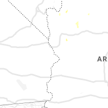
North Dakota
| Local Time | Report Details |
|---|---|
| 6:15 PM CDT | Golf Ball sized hail reported near Driscoll, ND, 35.9 miles ENE of Bismarck, ND, hail up to golfball size began at 615 pm and lasted until 630 pm. |
| 8:35 PM CDT | Quarter sized hail reported near Tolna, ND, 26 miles SSE of Devils Lake, ND |
| 9:35 PM CDT | Peak wind at the cooperstown airport /ks32 in griggs county ND, 58.6 miles SE of Devils Lake, ND |
| 10:22 PM CDT | Peak wind measured at the grand forks international airport /kgfk in grand forks county ND, 76.6 miles NNW of Fargo, ND |
| 10:30 PM CDT | Large tree branches and limbs broken dow in grand forks county ND, 70.5 miles N of Fargo, ND |
| 10:31 PM CDT | Peak wind measured at the rwis station along interstate 2 in grand forks county ND, 77.1 miles NNW of Fargo, ND |
| 10:32 PM CDT | Light pole blown down along south 48th street... at 32nd av in grand forks county ND, 72.3 miles NNW of Fargo, ND |
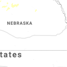
Nebraska
| Local Time | Report Details |
|---|---|
| 5:18 PM MDT | Quarter sized hail reported near Oshkosh, NE, 76.1 miles ESE of Scottsbluff, NE |
| 9:11 PM MDT | 64 mph wind gust on imperial asos in chase county NE, 62.6 miles SW of North Platte, NE |
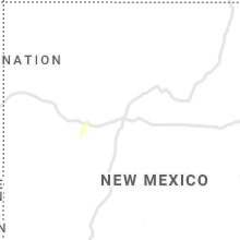
New Mexico
| Local Time | Report Details |
|---|---|
| 5:20 PM MDT | Kcao aso in union county NM, 94.3 miles NNE of Tucumcari, NM |
| 7:33 PM MDT | Asos station krow roswell air cente in chaves county NM, 6.7 miles SSE of Roswell, NM |
| 7:42 PM MDT | Power poles down at 2406 e hobson r in chaves county NM, 5.5 miles SSE of Roswell, NM |
| 7:43 PM MDT | Entire tree down near roswell pd at richardson ave and 2nd s in chaves county NM, 0.4 miles SSE of Roswell, NM |
| 7:45 PM MDT | Trees down at richardson & college blv in chaves county NM, 1.1 miles N of Roswell, NM |
| 7:50 PM MDT | Tree fire caused by arcing power line in chaves county NM, 1.7 miles N of Roswell, NM |
Pennsylvania
| Local Time | Report Details |
|---|---|
| 9:42 PM EDT | Trees down on wires reported at the intersection of mcdowell rd and hollowell church r in franklin county PA, 64.9 miles WNW of Baltimore, MD |
Minnesota
| Local Time | Report Details |
|---|---|
| 10:30 PM CDT | Peak wind measured at the rwis station along highway 2... near mallor in polk county MN, 70.2 miles N of Fargo, ND |
| 10:50 PM CDT | A large tree branch broken dow in marshall county MN, 64 miles SW of Roseau, MN |
| 11:25 PM CDT | Measured wind gust at raws station kitm5. time estimated based on rada in kittson county MN, 38.9 miles WSW of Roseau, MN |
| 11:35 PM CDT | Tree blown down at a rural homestea in marshall county MN, 39.8 miles SSW of Roseau, MN |
| 2:15 AM CDT | Personal weather station measured wind gust to 62.6 mph in wilkin county MN, 26.4 miles SE of Fargo, ND |
| 3:05 AM CDT | Initial reports from dead lake indicate numerous trees uprooted and damage to dock lift. relayed from broadcast media via social media in otter tail county MN, 58.8 miles ESE of Fargo, ND |
| 3:05 AM CDT | Initial reports from dead lake indicate numerous trees uprooted and damage to dock lift. relayed from broadcast media via social media in otter tail county MN, 55.4 miles ESE of Fargo, ND |
| 3:15 AM CDT | Initial reports indicate possible mobile home blown over on lake lake road. relayed through social medi in otter tail county MN, 63.1 miles ESE of Fargo, ND |
Montana
| Local Time | Report Details |
|---|---|
| 1:00 AM MDT | Malta south dot site observed thunderstorm wind gus in phillips county MT, 75 miles ESE of Havre, MT |
Connect with Interactive Hail Maps