

Hail Map for Thursday, July 23, 2020

Number of Impacted Households on 7/23/2020
0
Impacted by 1" or Larger Hail
0
Impacted by 1.75" or Larger Hail
0
Impacted by 2.5" or Larger Hail
Square Miles of Populated Area Impacted on 7/23/2020
0
Impacted by 1" or Larger Hail
0
Impacted by 1.75" or Larger Hail
0
Impacted by 2.5" or Larger Hail


Cities Most Affected by Hail Storms of 7/23/2020
| Hail Size | Demographics of Zip Codes Affected | ||||||
|---|---|---|---|---|---|---|---|
| City | Count | Average | Largest | Pop Density | House Value | Income | Age |
| Reva, SD | 2 | 2.00 | 2.25 | 0 | $10k | $31.3k | 47.1 |
| Buffalo, SD | 1 | 1.75 | 1.75 | 0 | $50k | $25.3k | 43.2 |
Hail and Wind Damage Spotted on 7/23/2020
Filter by Report Type:Hail ReportsWind Reports
States Impacted
Tennessee, North Dakota, New Hampshire, North Carolina, Massachusetts, New York, Kentucky, Missouri, Connecticut, Virginia, Maryland, Pennsylvania, Montana, South Dakota, Idaho, Utah, Oregon, New Jersey, Nevada, District of Columbia, DelawareTennessee
| Local Time | Report Details |
|---|---|
| 12:50 PM EDT | One tree down across poole road in sale creek tn. time estimate in hamilton county TN, 27.3 miles NNE of Chattanooga, TN |
| 3:20 PM EDT | A few trees down along piney flats roa in sullivan county TN, 13.9 miles SSW of Bristol, TN |
| 3:30 PM EDT | A few trees dow in claiborne county TN, 45.1 miles NNE of Knoxville, TN |
| 4:35 PM EDT | Several trees dow in cocke county TN, 42.2 miles E of Knoxville, TN |
| 4:50 PM EDT | A few trees dow in cocke county TN, 47.9 miles E of Knoxville, TN |
| 4:54 PM EDT | Several trees dow in hawkins county TN, 37.2 miles WSW of Bristol, TN |
| 5:00 PM EDT | Report came from home weather statio in hawkins county TN, 27.6 miles W of Bristol, TN |
| 5:16 PM EDT | Trees dow in hawkins county TN, 27.6 miles W of Bristol, TN |
| 5:53 PM EDT | Several trees down across the are in washington county TN, 29.6 miles SSW of Bristol, TN |
| 5:56 PM EDT | Several trees dow in unicoi county TN, 28.8 miles S of Bristol, TN |
| 4:58 PM CDT | A few trees were blown down along ray sircy lane and rawls creek roa in smith county TN, 40.4 miles E of Nashville, TN |
North Dakota
| Local Time | Report Details |
|---|---|
| 12:06 PM CDT | Several large tree branches down along 43rd avenue ne. report and picture relayed through broadcast media. time estimated from rada in rolette county ND, 70.9 miles NW of Devils Lake, ND |
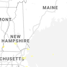
New Hampshire
| Local Time | Report Details |
|---|---|
| 1:31 PM EDT | Large limbs down on center road. time estimated from rada in hillsborough county NH, 76.1 miles NNW of Providence, RI |
| 5:35 PM EDT | Half Dollar sized hail reported near Weare, NH, 83.3 miles WSW of Portland, ME |
| 5:46 PM EDT | Ping Pong Ball sized hail reported near Bow, NH, 73.2 miles WSW of Portland, ME, hail between 1.25-1.5in report. time estimated from radar. |
| 5:54 PM EDT | Ping Pong Ball sized hail reported near Bow, NH, 72.8 miles WSW of Portland, ME, hail between 1.3-1.6in. tree limbs down as well. time estimated from radar. |
| 6:02 PM EDT | Trees down on north road west of candia. time estimated from rada in rockingham county NH, 66.8 miles SW of Portland, ME |
| 6:05 PM EDT | Ping Pong Ball sized hail reported near Hooksett, NH, 72.5 miles SW of Portland, ME, hail up to 1.5in for 5 mins. time estimated from radar. |
| 6:09 PM EDT | Downed trees. 0.75in hail as well. time estimated from rada in rockingham county NH, 71.4 miles SW of Portland, ME |
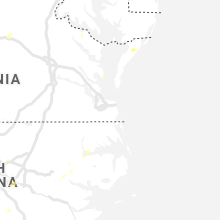
North Carolina
| Local Time | Report Details |
|---|---|
| 2:01 PM EDT | Multiple trees down... including one on a house in winston-salem on queen street. time estimated to be between 2pm to 245p in forsyth county NC, 67.8 miles NNE of Charlotte, NC |
| 2:15 PM EDT | Corrects previous tstm wnd dmg report from 1 s winston-salem. multiple trees down... including one on a house in winston-salem on queen street. time estimated to be bet in forsyth county NC, 67.8 miles NNE of Charlotte, NC |
| 2:28 PM EDT | 911 call center reported trees down on smokey creek roa in burke county NC, 59 miles NW of Charlotte, NC |
| 2:30 PM EDT | County 911 call center reported trees and power lines down on foothills airport roa in burke county NC, 59.9 miles NW of Charlotte, NC |
| 2:43 PM EDT | Trees and powerlines down on shepard school r in wake county NC, 19.9 miles ENE of Raleigh, NC |
| 2:45 PM EDT | Several trees down 3miles east of walkerstow in forsyth county NC, 76.5 miles S of Roanoke, VA |
| 2:45 PM EDT | Tree down at vick rd and pleasant grove church r in nash county NC, 36.9 miles ENE of Raleigh, NC |
| 2:47 PM EDT | Storm spotter reported north of zebulo in wake county NC, 19.2 miles ENE of Raleigh, NC |
| 2:47 PM EDT | Storm spotter reported north of zebulo in wake county NC, 19.2 miles ENE of Raleigh, NC |
| 2:47 PM EDT | Trrees and powerliens down on hwy 96 and riley hill rd... zebulo in wake county NC, 18 miles ENE of Raleigh, NC |
| 3:10 PM EDT | Power line down at pippin rd and zebulon r in wake county NC, 18.1 miles ENE of Raleigh, NC |
| 3:31 PM EDT | Tree down at 2200 block of shepard school r in wake county NC, 19.9 miles ENE of Raleigh, NC |
| 3:33 PM EDT | Powerlines down on sykes ave and east wendover av in guilford county NC, 65.5 miles WNW of Raleigh, NC |
| 4:17 PM EDT | Multiple trees and power lines down at exum and oak s in nash county NC, 24.9 miles E of Raleigh, NC |
| 4:19 PM EDT | Tree down at dortches rd and red oa in nash county NC, 45.7 miles ENE of Raleigh, NC |
| 4:56 PM EDT | Lightning struck house on barnsdale ridge rd... kernersvill in forsyth county NC, 72.4 miles NNE of Charlotte, NC |
Massachusetts
| Local Time | Report Details |
|---|---|
| 2:11 PM EDT | Tree and wires down... hamilton street at lincoln avenu in essex county MA, 48.9 miles NNE of Providence, RI |
| 2:40 PM EDT | Harris street and surrounding streets have several trees and large limbs dow in hampshire county MA, 64.9 miles WNW of Providence, RI |
| 2:52 PM EDT | One large tree and one large tree branch down on wires on george hannum road. tree down blocking bay road. large tree down on wires on hamilton stree in hampshire county MA, 59.4 miles WNW of Providence, RI |
| 2:52 PM EDT | One large tree and one large tree branch down on wires on george hannum road. tree down blocking bay road. large tree down on wires on hamilton stree in hampshire county MA, 59.4 miles WNW of Providence, RI |
| 3:10 PM EDT | Tree down on wires on chandler road. tree down on wires on greenwood roa in essex county MA, 59.4 miles NNE of Providence, RI |
| 3:10 PM EDT | Tree down blocking lowell road in middlesex county MA, 54.4 miles NNE of Providence, RI |
| 3:15 PM EDT | Tree down on pleasant valley road in essex county MA, 64.8 miles SSW of Portland, ME |
| 3:15 PM EDT | Tree down on essex street and partially blocking the roa in essex county MA, 58.7 miles NNE of Providence, RI |
| 3:37 PM EDT | Tree down on mountain roa in worcester county MA, 49.2 miles NNW of Providence, RI |
| 4:28 PM EDT | Multiple trees and wires down on highland street. one tree was on the side of a house. one utility pole snappe in worcester county MA, 28.3 miles WNW of Providence, RI |
| 4:28 PM EDT | Multiple trees and wires down on highland street. one tree was on the side of a house. one utility pole snappe in worcester county MA, 28.3 miles WNW of Providence, RI |
| 4:28 PM EDT | Tree down on state route 30 at ash street. tree down on a car on route 30 at high meadow roa in middlesex county MA, 38.4 miles N of Providence, RI |
| 4:32 PM EDT | Two trees down on flaxfield road. one tree down on a house on flaxfield roa in worcester county MA, 30.9 miles WNW of Providence, RI |
| 4:35 PM EDT | Tree down on west hartford avenu in worcester county MA, 20.2 miles NNW of Providence, RI |
| 4:35 PM EDT | Large tree down on wires blocking one lane of central stree in middlesex county MA, 26 miles N of Providence, RI |
| 4:39 PM EDT | Tree down on wires on ripley stree in middlesex county MA, 40.1 miles NNE of Providence, RI |
| 4:39 PM EDT | Tree down on burke lane by mclean stree in norfolk county MA, 33.5 miles N of Providence, RI |
| 4:40 PM EDT | Large tree down on a house on southwick road. two wires dow in middlesex county MA, 36.4 miles NNE of Providence, RI |
| 4:45 PM EDT | Large tree down and blocking pound street in norfolk county MA, 25.9 miles NNE of Providence, RI |
| 4:45 PM EDT | Large tree down and blocking pound street in norfolk county MA, 25.9 miles NNE of Providence, RI |
| 4:50 PM EDT | Power lines down at milton avenue and rockwell stree in suffolk county MA, 38.5 miles NNE of Providence, RI |
| 4:50 PM EDT | Tree down and blocking fellsway eas in middlesex county MA, 45.6 miles NNE of Providence, RI |
| 5:50 PM EDT | Trees down in berkshire county MA, 48.9 miles SE of Schenectady, NY |
New York
| Local Time | Report Details |
|---|---|
| 2:13 PM EDT | Tree down in ithaca in tompkins county NY, 45.8 miles SSW of Syracuse, NY |
| 2:44 PM EDT | Tree down in newark valley in tioga county NY, 57.3 miles S of Syracuse, NY |
| 2:59 PM EDT | Trees down in owego in tioga county NY, 56.8 miles NNW of Scranton, PA |
| 3:10 PM EDT | Trees down in apalachin in tioga county NY, 52.6 miles NNW of Scranton, PA |
| 3:16 PM EDT | Tree on wires in broome county NY, 55.3 miles NNW of Scranton, PA |
| 3:20 PM EDT | Power line down on mills av in broome county NY, 51.9 miles NNW of Scranton, PA |
| 3:22 PM EDT | Tree down across the road in broome county NY, 52.4 miles NNW of Scranton, PA |
| 3:23 PM EDT | Wires down on road on canterberry drive in tioga county NY, 52.7 miles NNW of Scranton, PA |
| 3:26 PM EDT | Wires down sparking on truck on hazel av in broome county NY, 51.9 miles NNW of Scranton, PA |
| 3:36 PM EDT | Pole and wires down on clinton s in broome county NY, 49.3 miles NNW of Scranton, PA |
| 3:36 PM EDT | Tree down across route 79 in broome county NY, 53.2 miles SSE of Syracuse, NY |
| 3:36 PM EDT | Tree down on wires in broome county NY, 50.4 miles NNW of Scranton, PA |
| 3:46 PM EDT | Tree down near mccarther park in broome county NY, 49.3 miles NNW of Scranton, PA |
| 4:47 PM EDT | Tree down across perry city rd in tompkins county NY, 45.5 miles SSW of Syracuse, NY |
| 6:12 PM EDT | Downed tree and wires on county route 10 in columbia county NY, 47.1 miles S of Schenectady, NY |
| 6:31 PM EDT | Tree and power lines down in columbia county NY, 50.4 miles S of Schenectady, NY |
| 6:37 PM EDT | Downed tree and wires on black bridge road in columbia county NY, 51.3 miles S of Schenectady, NY |
| 6:43 PM EDT | Downed tree and wires in columbia county NY, 51.8 miles S of Schenectady, NY |
| 6:49 PM EDT | Downed tree and wires in columbia county NY, 53.1 miles S of Schenectady, NY |
| 7:14 PM EDT | Numerous downed trees and wires on jackson corners road in columbia county NY, 55.6 miles S of Schenectady, NY |
Kentucky
| Local Time | Report Details |
|---|---|
| 2:26 PM EDT | Tree down across road. relayed by local media. time estimated from rada in laurel county KY, 43.8 miles S of Irvine, KY |
Missouri
| Local Time | Report Details |
|---|---|
| 1:50 PM CDT | Several trees as well as power lines blown down around town. also... a couple of buildings sustained damag in ste. genevieve county MO, 46.1 miles S of Saint Louis, MO |
Connecticut
| Local Time | Report Details |
|---|---|
| 3:10 PM EDT | Twelve trees down on southbridge circle... several on home in tolland county CT, 49.9 miles W of Providence, RI |
| 4:15 PM EDT | Cable wires down on west stree in hartford county CT, 64.8 miles W of Providence, RI |
| 4:38 PM EDT | Three trees down on grandview terrace near the rockville line. tree down on grove stree in tolland county CT, 55.1 miles W of Providence, RI |
| 6:56 PM EDT | Tree branch blocking road in litchfield county CT, 73.7 miles SE of Schenectady, NY |
| 7:07 PM EDT | Downed trees and wires in litchfield county CT, 67.4 miles SSE of Schenectady, NY |
| 10:13 PM EDT | Trees down in the near turkey hill in orange... ct. time estimated by rada in new haven county CT, 62.9 miles NE of Brooklyn, NY |
Virginia
| Local Time | Report Details |
|---|---|
| 3:30 PM EDT | The henry county 911 center reported a tree was blown down by thunderstorm winds across pine valley drive near the intersection with bassett heights roa in henry county VA, 35.3 miles S of Roanoke, VA |
| 3:48 PM EDT | Henry county 911 reported a tree was blown down by thunderstorm winds across cox road in the 2200 bloc in henry county VA, 48.4 miles S of Roanoke, VA |
| 4:20 PM EDT | Several trees down along side and blocking the east bound lane of us 58 approximately 3 miles east of jonesville... virgini in lee county VA, 47.6 miles W of Bristol, TN |
| 5:00 PM EDT | 2 trees down on berry road in bloxom. time estimated by rada in accomack county VA, 46.2 miles SW of Ocean City, MD |
| 5:25 PM EDT | Tree downed at lee st. time is approximate and based on radar estimat in king william county VA, 46.8 miles E of Richmond, VA |
| 5:39 PM EDT | The botetourt county 911 center reported a tree was blown down by thunderstorm winds along jennings creek roa in botetourt county VA, 24.6 miles NE of Roanoke, VA |
| 6:24 PM EDT | Several trees blown down in the north garden are in albemarle county VA, 59.6 miles WNW of Richmond, VA |
| 6:38 PM EDT | Several trees down near scottsvill in albemarle county VA, 53.2 miles WNW of Richmond, VA |
| 6:40 PM EDT | Several trees down southeast of the city of charlottesvill in albemarle county VA, 53 miles NW of Richmond, VA |
| 7:05 PM EDT | The buckingham county 911 center reported 3 trees were blown down by thunderstorm winds around the dillwyn communit in buckingham county VA, 44.5 miles W of Richmond, VA |
| 9:01 PM EDT | Tree down on wires in the 10600 block of belmont boulevar in fairfax county VA, 53.6 miles SW of Baltimore, MD |
| 9:43 PM EDT | Tree damage reported in southeastern prince william county... including near the intersection of edgewood drive and northgate drive and in the woodbridge are in prince william county VA, 60.9 miles SW of Baltimore, MD |
Maryland
| Local Time | Report Details |
|---|---|
| 3:57 PM EDT | Tree damage reported near old town... including on md-51 oldtown road southeast near crabtree lan in allegany county MD, 82.4 miles ENE of Elkins, WV |
| 9:00 PM EDT | Several trees down in the oxon hill are in prince georges county MD, 39.5 miles SSW of Baltimore, MD |
| 9:10 PM EDT | Storm damage reported in prince georges county MD, 36.6 miles SSW of Baltimore, MD |
| 9:23 PM EDT | Several trees down in the bladensburg are in prince georges county MD, 29.7 miles SW of Baltimore, MD |
| 10:32 PM EDT | Wind-blown debris on state highway 273 at harrisville road with lane restrictions in place. time estimated from rada in cecil county MD, 40 miles NE of Baltimore, MD |
| 11:07 PM EDT | Downed wires near grove neck road in earleville. time estimated from rada in cecil county MD, 35.1 miles ENE of Baltimore, MD |
Pennsylvania
| Local Time | Report Details |
|---|---|
| 4:00 PM EDT | Tree down on road along with powerlines on 266 pine street in susquehanna county PA, 38.2 miles N of Scranton, PA |
| 4:03 PM EDT | Wires down near interesection of dubois street and steam hollow roa in susquehanna county PA, 38.3 miles N of Scranton, PA |
| 4:11 PM EDT | Tree down blocking a portion of 227 i-8 in susquehanna county PA, 36.1 miles N of Scranton, PA |
| 4:11 PM EDT | Tree down blocking a portion of 227 i-8 in susquehanna county PA, 36.1 miles N of Scranton, PA |
| 4:14 PM EDT | Trees down near irish hill road and flynn roa in susquehanna county PA, 37.3 miles NNW of Scranton, PA |
| 4:17 PM EDT | Tree down on road in susquehanna county PA, 32.4 miles N of Scranton, PA |
| 4:17 PM EDT | 10 trees down in a yard in susquehanna county PA, 38.2 miles N of Scranton, PA |
| 4:50 PM EDT | Tree and wires down blocking creek roa in susquehanna county PA, 24.9 miles N of Scranton, PA |
| 4:56 PM EDT | Tree down on 374 near i81 in susquehanna county PA, 17.9 miles N of Scranton, PA |
| 11:07 PM EDT | Downed tree on u.s. highway 1 near the route 896 interchange. time estimated from rada in chester county PA, 52.2 miles NE of Baltimore, MD |
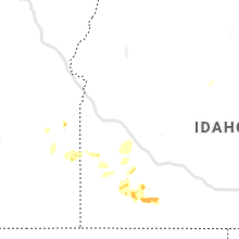
Montana
| Local Time | Report Details |
|---|---|
| 3:38 PM MDT | 61 mph wind gust on bozeman pas in gallatin county MT, 11.3 miles E of Bozeman, MT |
| 3:40 PM MDT | Part of a tree and a power line are in the street at the 200 block of central ave south of white sulphur springs. time was estimated based off of highest wind gust at t in meagher county MT, 60.5 miles N of Bozeman, MT |
| 4:00 PM MDT | Storm damage reported in fallon county MT, 80.7 miles E of Miles City, MT |
| 4:25 PM MDT | Ping Pong Ball sized hail reported near Wibaux, MT, 81 miles ENE of Miles City, MT, largest stones ping pong... most were closer to quarters. strong winds... estimates around 50 mph... plus 0.25 inches of rain. |
| 4:30 PM MDT | Ping Pong Ball sized hail reported near Wibaux, MT, 81 miles ENE of Miles City, MT, corrects previous hail report from 5 w carlyle. largest stones ping pong... most were closer to quarters. strong winds... estimates around 50 mph... plus 0.25 inches of |
| 4:40 PM MDT | Storm damage reported in sweet grass county MT, 51.7 miles E of Bozeman, MT |
| 5:04 PM MDT | Storm damage reported in wheatland county MT, 86.4 miles NW of Billings, MT |
| 5:35 PM MDT | 60 mph wind gust at brenner raws. time of event is estimate in beaverhead county MT, 36.1 miles ESE of Salmon, ID |
| 5:49 PM MDT | Awos station k1dm... delt in fergus county MT, 70.3 miles E of Great Falls, MT |
| 7:15 PM MDT | Sheridan county asst. des coordinator reports 65-70 mph winds currentl in sheridan county MT, 60.9 miles NW of Williston, ND |
| 7:15 PM MDT | Shingles being torn off roof in plentywood and being thrown into backyar in sheridan county MT, 61.7 miles NW of Williston, ND |
| 7:20 PM MDT | Emergency prep coordinator at local hospital reports small outbuildings taken down by winds... along with small trees and some power lines throughout tow in sheridan county MT, 61.1 miles NW of Williston, ND |
| 7:20 PM MDT | Mesonet station ggwpw 1.8 e plentywood (ggwwfo). time estimated from rada in sheridan county MT, 60.9 miles NW of Williston, ND |
| 7:30 PM MDT | Trained spotter reported 3 large spruce trees 65 to 70 feet tall and 1 cottonwood blown down by thunderstorm winds. wind estimated at 75mph in sheridan county MT, 61.2 miles NW of Williston, ND |
South Dakota
| Local Time | Report Details |
|---|---|
| 3:42 PM MDT | Storm damage reported in harding county SD, 106 miles N of Rapid City, SD |
| 4:12 PM MDT | Wind gusts with second storm in harding county SD, 106 miles N of Rapid City, SD |
| 4:20 PM MDT | Golf Ball sized hail reported near Buffalo, SD, 105.6 miles N of Rapid City, SD, a lot of small hail. |
| 4:40 PM MDT | Hen Egg sized hail reported near Reva, SD, 91.2 miles N of Rapid City, SD |
| 4:55 PM MDT | Golf Ball sized hail reported near Reva, SD, 93 miles N of Rapid City, SD |
| 5:28 PM MDT | Quarter sized hail reported near Prairie City, SD, 101.4 miles N of Rapid City, SD |
Idaho
| Local Time | Report Details |
|---|---|
| 4:53 PM MDT | Two trees down on the golf course. observations in the area were near 50mph and time is estimated from those ob in cassia county ID, 36.3 miles E of Twin Falls, ID |
| 5:02 PM MDT | Mesonet station tt086 juniper butt in owyhee county ID, 48.1 miles WSW of Twin Falls, ID |
| 5:55 PM MDT | Storm damage reported in owyhee county ID, 37.5 miles WNW of Twin Falls, ID |
| 6:30 PM MDT | Tree downed by strong winds from outflows. shingle damage also noted. time estimated based on nearby observation in lincoln county ID, 32.3 miles N of Twin Falls, ID |
| 6:35 PM MDT | Mesonet station ric richfiel in lincoln county ID, 38.8 miles NNE of Twin Falls, ID |
| 6:55 PM MDT | 3 healthy trees fell as a result of the thunderstorm outflow wind in blaine county ID, 63.3 miles N of Twin Falls, ID |
| 6:55 PM MDT | Multiple reports of large trees down on 5th and 8th street in bellevue as well as tendoy street just north of bellevu in blaine county ID, 63.4 miles N of Twin Falls, ID |
| 7:47 PM MDT | Awos station ksun hailey airpor in blaine county ID, 65.9 miles N of Twin Falls, ID |
Utah
| Local Time | Report Details |
|---|---|
| 4:57 PM MDT | Asos station kvel vernal rgnl airpor in uintah county UT, 79.9 miles SSW of Rock Springs, WY |
| 5:45 PM MDT | Apparent microburst from a small shower. semi truck overturned on i-80. high profile vehicle restrictions put in place on i-8 in tooele county UT, 83 miles W of Salt Lake City, UT |
Oregon
| Local Time | Report Details |
|---|---|
| 5:00 PM MDT | Numerous tree branches down and garbage cans knocked ove in malheur county OR, 88.5 miles SE of Burns, OR |
New Jersey
| Local Time | Report Details |
|---|---|
| 7:33 PM EDT | Several reports of tree limbs and wires down in edison. time estimated from rada in middlesex county NJ, 23.4 miles WSW of Brooklyn, NY |
| 7:40 PM EDT | Several reports of wires down in the area of sweetmans lane and millstone road. time estimated from rada in monmouth county NJ, 40 miles SW of Brooklyn, NY |
| 7:40 PM EDT | Downed wires on county road 526 in imlaystown. time estimated from rada in monmouth county NJ, 44.3 miles SW of Brooklyn, NY |
| 7:40 PM EDT | Wires down near the intersection of trenton lakewood road and red valley road. time estimated from rada in monmouth county NJ, 43.1 miles SSW of Brooklyn, NY |
| 8:07 PM EDT | Several reports of wires down in the holmdel area. time estimated from rada in monmouth county NJ, 26.1 miles SSW of Brooklyn, NY |
| 8:10 PM EDT | Reports of trees and wires down in the area. time estimated from rada in monmouth county NJ, 25.8 miles SSW of Brooklyn, NY |
| 8:15 PM EDT | Power out in the are in monmouth county NJ, 24 miles S of Brooklyn, NY |
| 8:26 PM EDT | Several reports of wires down and widespread power outages in the area. time estimated from rada in monmouth county NJ, 23.1 miles S of Brooklyn, NY |
| 8:28 PM EDT | Reports of wires down and numerous power outages in the sea bright and rumson areas. time estimated from rada in monmouth county NJ, 23 miles S of Brooklyn, NY |
| 12:35 AM EDT | Wires down in the old bridge area. time estimated from rada in middlesex county NJ, 27.9 miles SW of Brooklyn, NY |
| 12:40 AM EDT | Wires down near texas road in spring valley. time estimated from rada in monmouth county NJ, 27.6 miles SW of Brooklyn, NY |
| 12:40 AM EDT | Several reports of wires down in middletown. time estimated from rada in monmouth county NJ, 20.8 miles SSW of Brooklyn, NY |
| 12:44 AM EDT | Several reports of wires down in madison park. time estimated from rada in middlesex county NJ, 23.7 miles SW of Brooklyn, NY |
| 12:49 AM EDT | Downed wires in laurence harbor. time estimated from rada in middlesex county NJ, 21.1 miles SW of Brooklyn, NY |
| 12:49 AM EDT | Downed utility near jackson street in keyport. time estimated from rada in monmouth county NJ, 20.9 miles SSW of Brooklyn, NY |
| 12:49 AM EDT | Downed power pole and wires on u.s. highway 9 near the state highway 35 interchange. time estimated from rada in middlesex county NJ, 21.5 miles SW of Brooklyn, NY |
| 1:50 AM EDT | Downed tree near stony brook way. time estimated from rada in middlesex county NJ, 31.5 miles WSW of Brooklyn, NY |
| 2:17 AM EDT | Reports of wires down in the bound brook and south bound brook areas. time estimated from rada in somerset county NJ, 29.8 miles WSW of Brooklyn, NY |
| 2:18 AM EDT | Corrects previous tstm wnd dmg report from south bound brook. reports of wires down in the bound brook and south bound brook areas. time estimated from rada in somerset county NJ, 29.8 miles WSW of Brooklyn, NY |
| 2:18 AM EDT | Downed power pole and power lines on heather drive near jfk boulevard in somerset. time estimated from rada in somerset county NJ, 30.7 miles WSW of Brooklyn, NY |
| 2:31 AM EDT | Several reports of utility poles and wires down in the new brunswick and society hill areas. time estimated from rada in middlesex county NJ, 25.9 miles WSW of Brooklyn, NY |
Nevada
| Local Time | Report Details |
|---|---|
| 4:55 PM PDT | Mesonet station lmrnv 3.4 se elko (nv dot in elko county NV, 3.5 miles SE of Elko, NV |
District of Columbia
| Local Time | Report Details |
|---|---|
| 9:15 PM EDT | Several trees down mainly in the se/ne parts of d in district of columb county DC, 33.7 miles SW of Baltimore, MD |
Delaware
| Local Time | Report Details |
|---|---|
| 10:32 PM EDT | Several reports of power lines down in the stanton and marshallton areas. time estimated from rada in new castle county DE, 59.2 miles ENE of Baltimore, MD |
| 11:41 PM EDT | Several reports of downed tree limbs and wires between glasgow and woodshade. time estimated from rada in new castle county DE, 55.5 miles ENE of Baltimore, MD |
Connect with Interactive Hail Maps