

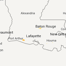
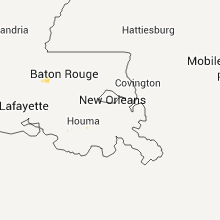
Hail Map for Tuesday, May 12, 2015

Number of Impacted Households on 5/12/2015
0
Impacted by 1" or Larger Hail
0
Impacted by 1.75" or Larger Hail
0
Impacted by 2.5" or Larger Hail
Square Miles of Populated Area Impacted on 5/12/2015
0
Impacted by 1" or Larger Hail
0
Impacted by 1.75" or Larger Hail
0
Impacted by 2.5" or Larger Hail


Cities Most Affected by Hail Storms of 5/12/2015
| Hail Size | Demographics of Zip Codes Affected | ||||||
|---|---|---|---|---|---|---|---|
| City | Count | Average | Largest | Pop Density | House Value | Income | Age |
Hail and Wind Damage Spotted on 5/12/2015
Filter by Report Type:Hail ReportsWind Reports
Texas
| Local Time | Report Details |
|---|---|
| 8:24 AM CDT | Power out in port lavaca. gust at port lavaca t-coon at 824 a in calhoun county TX, 73.6 miles NE of Corpus Christi, TX |
| 8:24 AM CDT | Port lavaca gust to 50 knots in victoria county TX, 62.6 miles NNE of Corpus Christi, TX |
| 8:24 AM CDT | Port lavaca tcoon site measured gust of 50 kts in calhoun county TX, 75.6 miles NE of Corpus Christi, TX |
| 9:18 AM CDT | Port lavaca tcoon site measured gust of 52.1 kts in calhoun county TX, 75.6 miles NE of Corpus Christi, TX |
Florida
| Local Time | Report Details |
|---|---|
| 3:40 PM EDT | Cape coral police reported several trees and power lines down in cape coral and south cape coral areas. damage occured between 340 pm and 355 p in lee county FL, 32.7 miles NNW of Naples, FL |
| 6:00 PM EDT | Ktpf awos reported wind gust of 52 knots/59 mph around 600 pm ed in hillsborough county FL, 30.3 miles NNE of Bradenton, FL |
| 6:32 PM EDT | Quarter sized hail reported near Tampa, FL, 38.9 miles N of Bradenton, FL, public reported one inch diameter hail at gunn hwy and anderson rd at 632 pm edt. |
| 7:42 PM EDT | Sumter county sheriffs office reported at least 2 downed trees in east rural nobleton along cr 64 in sumter county FL, 52.8 miles W of Orlando, FL |
Maine
| Local Time | Report Details |
|---|---|
| 4:12 PM EDT | Large tree down through roof of hom in york county ME, 14.3 miles SW of Portland, ME |
Georgia
| Local Time | Report Details |
|---|---|
| 4:15 PM EDT | Received call from emergency manager of 2-3 trees down just off of highway 80 around 338 and 1st stree in laurens county GA, 72.4 miles N of Douglas, GA |
| 4:15 PM EDT | Received call from emergency manager of 2-3 trees down just off of highway 80 around 338 and 1st strre in laurens county GA, 72.4 miles N of Douglas, GA |
North Carolina
| Local Time | Report Details |
|---|---|
| 5:12 PM EDT | Quarter sized hail reported near Roanoke Rapids, NC, 70.7 miles NE of Raleigh, NC |
| 5:15 PM EDT | Trees down on hamilton st and henry st. radar estimated time in halifax county NC, 72 miles NE of Raleigh, NC |
| 5:35 PM EDT | Trees down on firetower rd in northampton county NC, 77.4 miles S of Richmond, VA |
Louisiana
| Local Time | Report Details |
|---|---|
| 4:35 PM CDT | A few trees down on jack torres roa in pointe coupee county LA, 35.9 miles ENE of Lafayette, LA |
| 4:35 PM CDT | A few trees down on highway 97 in pointe coupee county LA, 35.5 miles NE of Lafayette, LA |
South Carolina
| Local Time | Report Details |
|---|---|
| 7:03 PM EDT | Tree knocked down onto bailey mill road near the intersection with calf pen bay roa in jasper county SC, 31.1 miles N of Savannah, GA |
| 7:10 PM EDT | 3 trees down along highway 321. time estimated based on rada in jasper county SC, 26.2 miles N of Savannah, GA |
| 7:45 PM EDT | Thunderstorm winds blew a tree down onto rugrack road about one-quarter of a mile from highway 116. time was estimated from radar dat in beaufort county SC, 31.5 miles NE of Savannah, GA |
Utah
| Local Time | Report Details |
|---|---|
| 7:00 PM MDT | Several tree limbs down due to microburst winds...some appearing to be 2 to 3 inches in diamete in salt lake county UT, 4.6 miles ESE of Salt Lake City, UT |
Connect with Interactive Hail Maps