

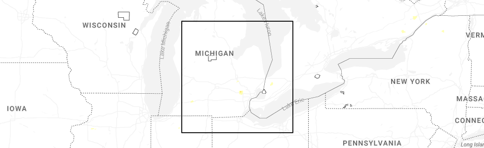
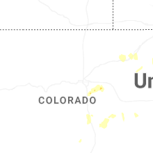
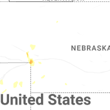
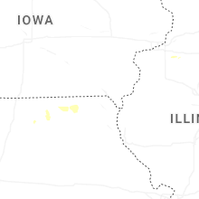
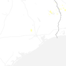
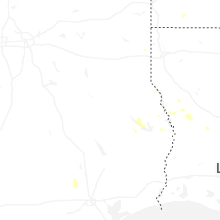
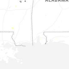
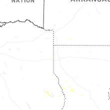
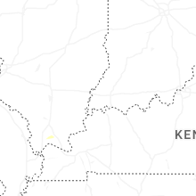
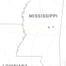
Hail Map for Tuesday, June 24, 2025
Number of Impacted Households on 6/24/2025
0
Impacted by 1" or Larger Hail
0
Impacted by 1.75" or Larger Hail
0
Impacted by 2.5" or Larger Hail
Square Miles of Populated Area Impacted on 6/24/2025
0
Impacted by 1" or Larger Hail
0
Impacted by 1.75" or Larger Hail
0
Impacted by 2.5" or Larger Hail

Cities Most Affected by Hail Storms of 6/24/2025
| Hail Size | Demographics of Zip Codes Affected | ||||||
|---|---|---|---|---|---|---|---|
| City | Count | Average | Largest | Pop Density | House Value | Income | Age |
Hail and Wind Damage Spotted on 6/24/2025
Filter by Report Type:Hail ReportsWind Reports
States Impacted
Missouri, Michigan, New York, Colorado, North Carolina, Indiana, New Hampshire, Kansas, Maine, Ohio, Tennessee, Nebraska, FloridaMissouri
| Local Time | Report Details |
|---|---|
| 10:45 AM CDT | Numerous roads closed in the albany area and throughout gentry county from floodin in gentry county MO, 80.3 miles N of Kansas City, MO |
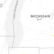
Michigan
| Local Time | Report Details |
|---|---|
| 2:09 PM EDT | A few 3 inch branches down and dot sign rolled. time estimated via rada in ingham county MI, 48.5 miles WSW of Flint, MI |
| 3:00 PM EDT | Two large spruce trees uprooted. photos sent via social medi in oakland county MI, 39.1 miles SSE of Flint, MI |
| 3:09 PM EDT | Quarter sized hail reported near Wixom, MI, 33.3 miles SSE of Flint, MI, quarter sized hail reported via mping. |
| 3:22 PM EDT | 3 to 4 inch limb on power line at intersection of woodward and long lake rd...corrected tim in oakland county MI, 37.1 miles SE of Flint, MI |
| 3:24 PM EDT | Large uprooted tree approximately 1 to 1.5 feet in diameter...corrected tim in oakland county MI, 37.1 miles SE of Flint, MI |
| 3:24 PM EDT | Broadcast media reports multiple tree limbs down in ferndal in oakland county MI, 47.4 miles SE of Flint, MI |
| 3:30 PM EDT | Broadcast media reports numerous trees down along 7 mile between middlebelt and beech in livonia/redfor in wayne county MI, 43.8 miles SSE of Flint, MI |
| 3:34 PM EDT | Tree reported down at mark sawyers family park in sterling height in macomb county MI, 47.5 miles SE of Flint, MI |
| 3:39 PM EDT | Roof torn off mobile home near clinton river rd and hayes r in macomb county MI, 47.4 miles SE of Flint, MI |
| 3:43 PM EDT | 3 to 4 inch limb on power line at intersection of woodward and long lake r in oakland county MI, 37.1 miles SE of Flint, MI |
| 3:45 PM EDT | Large uprooted tree approximately 1 to 1.5 feet in diamete in oakland county MI, 37.1 miles SE of Flint, MI |
| 5:23 PM EDT | Social media photo of large uprooted tree on house 1 mile sse of henderso in shiawassee county MI, 25.5 miles W of Flint, MI |
| 5:48 PM EDT | Tree reported down across railroad tracks near potter rd crossin in genesee county MI, 9.7 miles WNW of Flint, MI |
| 6:51 PM EDT | Numerous trees and power lines down around mayville... millington... and fostori in tuscola county MI, 28.4 miles NE of Flint, MI |
New York
| Local Time | Report Details |
|---|---|
| 3:21 PM EDT | Tree down into power lines on county road 28 near heuvelton road west of lisbo in st. lawrence county NY, 7.1 miles ENE of Ogdensburg, NY |
| 3:55 PM EDT | Tree down into baghdad road at around 569 near eben/west potsda in st. lawrence county NY, 22.9 miles E of Ogdensburg, NY |
| 5:12 PM EDT | Tree down onto mud pond road in peasleeville ny in clinton county NY, 21.4 miles WNW of Burlington, VT |
| 5:15 PM EDT | Tree down onto reservoir road near peru n in clinton county NY, 19.5 miles WNW of Burlington, VT |
| 5:19 PM EDT | Tree down onto hallock hill road near au sable ny in clinton county NY, 19.5 miles WNW of Burlington, VT |
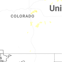
Colorado
| Local Time | Report Details |
|---|---|
| 1:35 PM MDT | Quarter sized hail reported near Parker, CO, 21.5 miles SSE of Denver, CO |
| 1:58 PM MDT | Quarter sized hail reported near Colorado Springs, CO, 44.1 miles N of Pueblo, CO, report from mping: quarter (1.00 in.). |
| 2:10 PM MDT | Storm damage reported in arapahoe county CO, 17.9 miles ESE of Denver, CO |
| 2:15 PM MDT | Storm damage reported in arapahoe county CO, 27.2 miles ESE of Denver, CO |
| 2:20 PM MDT | Storm damage reported in arapahoe county CO, 27.2 miles ESE of Denver, CO |
| 2:25 PM MDT | Storm damage reported in adams county CO, 29.9 miles E of Denver, CO |
| 2:35 PM MDT | Corrects previous tstm wnd gst report from 1 ssw bennet in adams county CO, 29.9 miles E of Denver, CO |
| 3:12 PM MDT | Storm damage reported in weld county CO, 47.4 miles ENE of Denver, CO |
| 3:36 PM MDT | Storm damage reported in morgan county CO, 61.6 miles NE of Denver, CO |
| 3:46 PM MDT | Corrects previous tstm wnd gst report from 2 ne wiggin in morgan county CO, 61.6 miles NE of Denver, CO |
| 4:45 PM MDT | Storm damage reported in pueblo county CO, 20.5 miles NE of Pueblo, CO |
| 4:53 PM MDT | Storm damage reported in logan county CO, 58.8 miles NW of Yuma, CO |
| 6:06 PM MDT | Site brophy on awn reports 57.7 mph wind gus in yuma county CO, 27.5 miles NE of Yuma, CO |
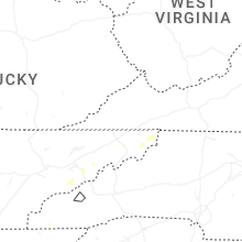
North Carolina
| Local Time | Report Details |
|---|---|
| 4:46 PM EDT | Tree down across parking lo in swain county NC, 46.8 miles SE of Knoxville, TN |
| 4:46 PM EDT | Multiple trees down on hwy 19 near harrahs casin in jackson county NC, 48.2 miles SE of Knoxville, TN |
| 5:30 PM EDT | Tree down on fontana r in swain county NC, 43.7 miles SE of Knoxville, TN |
| 6:34 PM EDT | Trees down on roadwa in buncombe county NC, 51 miles N of Greenville, SC |
| 6:34 PM EDT | Trees down on roadwa in buncombe county NC, 51.7 miles N of Greenville, SC |
| 6:35 PM EDT | Trees down on roadwa in buncombe county NC, 51.7 miles N of Greenville, SC |
Indiana
| Local Time | Report Details |
|---|---|
| 5:50 PM EDT | Broadcast media reported a few trees/limbs down on country road 3 on the northside of wakarusa... in in elkhart county. adjusted report based on radar dat in elkhart county IN, 57.7 miles NW of Fort Wayne, IN |
New Hampshire
| Local Time | Report Details |
|---|---|
| 5:53 PM EDT | Tree down in roa in belknap county NH, 62.4 miles W of Portland, ME |
| 5:56 PM EDT | Tree and wires dow in carroll county NH, 49.3 miles W of Portland, ME |
| 5:59 PM EDT | Tree and wires dow in belknap county NH, 69.5 miles W of Portland, ME |
| 6:04 PM EDT | Tree and wires dow in merrimack county NH, 67.5 miles WSW of Portland, ME |
| 6:08 PM EDT | Observed 2 downed trees on wentworth rd (route 109) and a driveway. time estimated by rada in carroll county NH, 41.4 miles W of Portland, ME |
| 6:09 PM EDT | Tree dow in belknap county NH, 50.6 miles WSW of Portland, ME |
| 6:17 PM EDT | Tree down in the roa in belknap county NH, 56.4 miles WSW of Portland, ME |
| 6:20 PM EDT | Trees down on stage rd and fatima rd near camp fatima. time estimated by rada in belknap county NH, 55.4 miles WSW of Portland, ME |
| 6:34 PM EDT | Tree down on east side drive. time estimated by rada in carroll county NH, 39.2 miles W of Portland, ME |
Kansas
| Local Time | Report Details |
|---|---|
| 5:45 PM CDT | Time estimate based off radar...reports of 6 powerlines down in south rolla along county road j... 3 powerlines down along highway 56... and tree damage to 8-12 inch di in morton county KS, 71.8 miles SW of Garden City, KS |
| 7:57 PM CDT | Trained spotter reports 13 inch tree limb down. time estimated from rada in rawlins county KS, 30.9 miles N of Colby, KS |
Maine
| Local Time | Report Details |
|---|---|
| 6:50 PM EDT | Tree down across the roa in cumberland county ME, 9.8 miles W of Portland, ME |
| 7:02 PM EDT | A tv meteorologist posted a picture of a powerline down on an suv in scarborough. powerline and wires all over the road for at least about 100 yards. time estimated by in cumberland county ME, 5.2 miles SSW of Portland, ME |
| 7:05 PM EDT | Multiple large branches and some trees down in south portlan in cumberland county ME, 2 miles S of Portland, ME |
| 7:10 PM EDT | Tree down on ca in cumberland county ME, 5 miles SSE of Portland, ME |
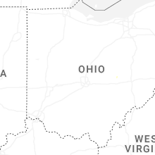
Ohio
| Local Time | Report Details |
|---|---|
| 6:55 PM EDT | One large tree and numerous smaller branches downed at a property on state route 7 in clinton county OH, 41 miles NE of Cincinnati, OH |
| 7:37 PM EDT | Trees reported down at clear creek and starner. time estimated from rada in hocking county OH, 34.1 miles SE of Columbus, OH |
| 8:00 PM EDT | Several large tree limbs blown down in the area of jackson townshi in stark county OH, 42.6 miles SSE of Cleveland, OH |
| 8:03 PM EDT | Trees reported down at voris and bauer. time estimated from rada in hocking county OH, 38.3 miles SE of Columbus, OH |
| 9:00 PM EDT | Emergency management relayed a report of several trees and power lines blown down south of collins. time was estimated by rada in huron county OH, 45.7 miles WSW of Cleveland, OH |
| 9:28 PM EDT | Storm damage reported in erie county OH, 38.5 miles WSW of Cleveland, OH |
| 10:21 PM EDT | Tree fell on a hom in muskingum county OH, 53.8 miles ENE of Columbus, OH |
| 10:43 PM EDT | Large tree down blocking roadway near bainbridge and geauga lake road. time was estimated by rada in geauga county OH, 18.9 miles ESE of Cleveland, OH |
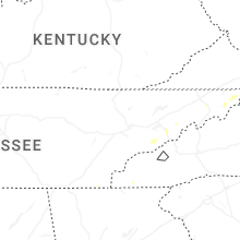
Tennessee
| Local Time | Report Details |
|---|---|
| 7:35 PM EDT | Dispatch reports around 20 to 30 trees down throughout cocke count in cocke county TN, 40.4 miles E of Knoxville, TN |
| 8:22 PM EDT | Dispatch reports around 20 to 30 trees down throughout cocke count in cocke county TN, 46.1 miles E of Knoxville, TN |
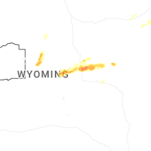
Nebraska
| Local Time | Report Details |
|---|---|
| 5:42 PM MDT | Pws-knebigsp2 in deuel county NE, 69.7 miles W of North Platte, NE |
| 7:38 PM MDT | Site brunswig shop on weatherlink reported 67 mph wind gus in dundy county NE, 43.1 miles E of Yuma, CO |
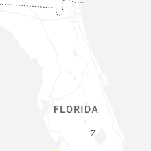
Florida
| Local Time | Report Details |
|---|---|
| 7:33 PM CDT | Trees reported down along i-10 and along highway 81 in walton county. time estimated by rada in walton county FL, 29.7 miles NE of Miramar Beach, FL |
Connect with Interactive Hail Maps