

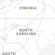
Hail Map for Tuesday, September 12, 2023

Number of Impacted Households on 9/12/2023
0
Impacted by 1" or Larger Hail
0
Impacted by 1.75" or Larger Hail
0
Impacted by 2.5" or Larger Hail
Square Miles of Populated Area Impacted on 9/12/2023
0
Impacted by 1" or Larger Hail
0
Impacted by 1.75" or Larger Hail
0
Impacted by 2.5" or Larger Hail


Cities Most Affected by Hail Storms of 9/12/2023
| Hail Size | Demographics of Zip Codes Affected | ||||||
|---|---|---|---|---|---|---|---|
| City | Count | Average | Largest | Pop Density | House Value | Income | Age |
| Kennesaw, GA | 1 | 1.75 | 1.75 | 1974 | $159k | $70.7k | 36.2 |
| Chandler, AZ | 1 | 1.75 | 1.75 | 2263 | $0k | $0.0k | 33.9 |
Hail and Wind Damage Spotted on 9/12/2023
Filter by Report Type:Hail ReportsWind Reports
States Impacted
West Virginia, South Carolina, Florida, Tennessee, Alabama, Virginia, Georgia, North Carolina, Arizona, MarylandWest Virginia
| Local Time | Report Details |
|---|---|
| 12:38 PM EDT | Tree on power lin in lincoln county WV, 14.8 miles WSW of Charleston, WV |
| 12:54 PM EDT | Kanawha county 911 advised there is a tree down in the 2800 block of trace fork rd in the davis creek area. time estimated from rada in kanawha county WV, 6.5 miles SW of Charleston, WV |
| 1:05 PM EDT | Tree on power lin in kanawha county WV, 3.5 miles S of Charleston, WV |
| 1:06 PM EDT | Tree on power lin in kanawha county WV, 2.8 miles S of Charleston, WV |
| 1:10 PM EDT | Kanawha county metro 911 center received a report of a tree down in the 5400 block of elk river rd n in the clendenin/ falling rock area. one lane is blocked. time esti in kanawha county WV, 9.4 miles ENE of Charleston, WV |
| 1:15 PM EDT | Tree on power lin in kanawha county WV, 9 miles ENE of Charleston, WV |
South Carolina
| Local Time | Report Details |
|---|---|
| 2:30 PM EDT | Multiple trees down around peachtree road... with minor damage to outdoor structure in york county SC, 22.2 miles SSW of Charlotte, NC |
| 2:34 PM EDT | Social media report with photos and video showing garage door to a steel warehouse building blown down. several slabs of granite also damaged on the loading doc in lexington county SC, 62.6 miles ENE of Augusta, GA |
| 2:35 PM EDT | Metal awning blew off and damaged part of the union high school roof. also some large limbs dow in union county SC, 54.6 miles SW of Charlotte, NC |
| 3:16 PM EDT | Powerline down. time estimated from rada in anderson county SC, 22.1 miles S of Greenville, SC |
| 3:45 PM EDT | 911 call center reported numerous trees down across the williamston and belton are in anderson county SC, 17.3 miles SSE of Greenville, SC |
| 4:05 PM EDT | Spotter reports several trees blown down on walkingstick wa in greenville county SC, 19.3 miles ESE of Greenville, SC |
| 5:40 PM EDT | Multiple downed trees at the intersection of whitmire hwy and beattys bridge r in union county SC, 59.9 miles ESE of Greenville, SC |
Florida
| Local Time | Report Details |
|---|---|
| 2:50 PM EDT | Leon county law enforcement reported a tree down on a powerline on sunflower rd and celia rd or c in leon county FL, 8.9 miles S of Tallahassee, FL |
Tennessee
| Local Time | Report Details |
|---|---|
| 3:08 PM EDT | Large limb dow in grainger county TN, 30.2 miles NE of Knoxville, TN |
| 3:51 PM EDT | Several trees dow in hawkins county TN, 45.3 miles NE of Knoxville, TN |
| 4:30 PM EDT | Several trees dow in greene county TN, 43.4 miles SW of Bristol, TN |
| 4:40 PM EDT | Trees down north and northeast of greeneville. time estimated from rada in greene county TN, 38.2 miles SW of Bristol, TN |
| 4:50 PM EDT | Trees down at intersection of old state route 34 and taylor mill road near limestone. time estimated from rada in washington county TN, 34.1 miles SW of Bristol, TN |
| 4:54 PM EDT | Trees down at newt road and washington college station road in the limestone area. time estimated from rada in washington county TN, 32 miles SW of Bristol, TN |
| 5:45 PM EDT | A few trees dow in carter county TN, 20.2 miles S of Bristol, TN |
Alabama
| Local Time | Report Details |
|---|---|
| 2:45 PM CDT | Trees down in the vicinity of recreative natives native plant nursery. apparent downburs in st. clair county AL, 28.5 miles E of Birmingham, AL |
| 5:38 PM CDT | Trees down on hwy 48 near randolph county high school. time estimated by rada in randolph county AL, 48.4 miles N of Auburn, AL |
| 7:55 PM CDT | Corrects previous non-tstm wnd gst report from birmingham international airport. asos station kbhm birmingham airport (kbhm in jefferson county AL, 4.9 miles NE of Birmingham, AL |
| 7:56 PM CDT | Trees down on floyd bradford rd in leeds. time estimated by rada in jefferson county AL, 11.2 miles E of Birmingham, AL |
Virginia
| Local Time | Report Details |
|---|---|
| 3:59 PM EDT | Tree down at intersection of jubal early highway and teaberry loo in franklin county VA, 9.9 miles SSE of Roanoke, VA |
| 5:43 PM EDT | Thunderstorm winds blew down one tree along the 600 block of staunton hill roa in charlotte county VA, 63.7 miles ESE of Roanoke, VA |
| 5:44 PM EDT | Thunderstorm winds blew down one tree along the 8000 block of midway roa in charlotte county VA, 63.3 miles E of Roanoke, VA |
| 5:50 PM EDT | Thunderstorm winds blew down one tree along the 1000 block of coles ferry roa in charlotte county VA, 67.4 miles ESE of Roanoke, VA |
| 5:53 PM EDT | Thunderstorm winds blew down one tree along the 300 block of berkley stree in charlotte county VA, 67 miles E of Roanoke, VA |
| 5:54 PM EDT | Thunderstorm winds blew down one tree along the 300 block of church stree in charlotte county VA, 67 miles E of Roanoke, VA |
| 5:55 PM EDT | Thunderstorm winds blew down one tree near the intersection of rolling hill road and price roa in charlotte county VA, 62.9 miles WSW of Richmond, VA |
| 6:02 PM EDT | Thunderstorm winds blew down one tree along the 1900 block of thomas jefferson highwa in charlotte county VA, 61.8 miles WSW of Richmond, VA |
| 6:26 PM EDT | Thunderstorm winds blew down two trees near the intersection of farmville highway... four locust highway... and kings highwa in charlotte county VA, 54.5 miles SW of Richmond, VA |
| 7:07 PM EDT | Multiple reports of trees down near and north of kenbridge. time estimated via rada in lunenburg county VA, 42.2 miles SW of Richmond, VA |
Georgia
| Local Time | Report Details |
|---|---|
| 5:10 PM EDT | Quarter sized hail reported near Dallas, GA, 27.8 miles NW of Atlanta, GA, quarter-size hail reported at intersection of cedarcrest rd and dallas acworth hwy. |
| 5:15 PM EDT | Quarter sized hail reported near Acworth, GA, 25.2 miles NW of Atlanta, GA, 1 inch hail at the intersection of fairwood dr and fairwood ct. |
| 5:16 PM EDT | Quarter sized hail reported near Acworth, GA, 27.4 miles NW of Atlanta, GA, report of quarter inch hail off of mary wallace way and royal sunset dr. |
| 5:17 PM EDT | Quarter sized hail reported near Acworth, GA, 25.8 miles NW of Atlanta, GA, report of quarter sized hail near mars hill rd and old stilesboro rd nw. |
| 5:17 PM EDT | Ping Pong Ball sized hail reported near Acworth, GA, 25.2 miles NW of Atlanta, GA, golf ball sized hail reported at brookestone country club near brookstone dr nw and burnt hickory rd nw. |
| 5:20 PM EDT | Half Dollar sized hail reported near Acworth, GA, 25.7 miles NW of Atlanta, GA, half dollar-size hail reported at intersection of brookstone dr nw and mclain rd. |
| 5:25 PM EDT | Golf Ball sized hail reported near Kennesaw, GA, 24.3 miles NW of Atlanta, GA, golf ball-size hail reported at intersection of mars hill rd and hadaway rd. |
| 6:28 PM EDT | A couple trees across powerlines in screven... pea size hail reported on highway 84 and highway 203. lightning struck house on spring grove roa in wayne county GA, 49 miles E of Douglas, GA |
North Carolina
| Local Time | Report Details |
|---|---|
| 5:30 PM EDT | Report of trees down at shiloh rd and salisbury hwy in statesville. time estimated from rada in iredell county NC, 37.1 miles N of Charlotte, NC |
| 6:08 PM EDT | Power outages caused by a tree on power lines at w cone blvd and marston r in guilford county NC, 68.6 miles WNW of Raleigh, NC |
| 6:08 PM EDT | Tree down at wilshire dr and shamrock d in guilford county NC, 69.2 miles WNW of Raleigh, NC |
| 6:34 PM EDT | Tree down at cedar knoll circle and abbotts creek circl in forsyth county NC, 73.2 miles NE of Charlotte, NC |
Arizona
| Local Time | Report Details |
|---|---|
| 3:10 PM MST | Multiple reports of power poles down near on maricopa rd west of i-10. traffic signals out leading to significant traffic impact in maricopa county AZ, 14.8 miles SSE of Phoenix, AZ |
| 3:22 PM MST | Golf Ball sized hail reported near Chandler, AZ, 16.3 miles SE of Phoenix, AZ, golf ball sized hail was reported near queen creek road and price road. |
| 7:45 PM MST | Large tree was uproote in maricopa county AZ, 16.7 miles W of Phoenix, AZ |
| 8:20 PM MST | Power lines snapped at the intersection of n 17th st. and e oak s in maricopa county AZ, 2.1 miles NE of Phoenix, AZ |
| 9:00 PM MST | Multiple power poles down and on top of houses along recker rd. between mcdowell and mckellips r in maricopa county AZ, 21.7 miles E of Phoenix, AZ |
| 9:10 PM MST | Multiple large trees either snapped or uproote in maricopa county AZ, 22.9 miles E of Phoenix, AZ |
| 2:03 AM MST | Mesonet station qgta3 guthrie at sometime within 1:03 to 2:03 a in greenlee county AZ, 60.7 miles W of Silver City, NM |
Maryland
| Local Time | Report Details |
|---|---|
| 12:00 AM EDT | Large tree down at the intersection of ebenezer road & meyers l in baltimore county MD, 11.9 miles ENE of Baltimore, MD |
| 12:08 AM EDT | Storm damage reported in baltimore county MD, 10.7 miles ENE of Baltimore, MD |
| 12:21 AM EDT | Tree knocked down onto power pole at 2711 forge hill rd in harford county MD, 26.7 miles NE of Baltimore, MD |
| 12:36 AM EDT | Report of a tree downed on fox meadow road. time estimated via rada in queen anne's county MD, 39.5 miles SE of Baltimore, MD |
Connect with Interactive Hail Maps