

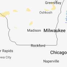
Hail Map for Monday, September 17, 2018

Number of Impacted Households on 9/17/2018
0
Impacted by 1" or Larger Hail
0
Impacted by 1.75" or Larger Hail
0
Impacted by 2.5" or Larger Hail
Square Miles of Populated Area Impacted on 9/17/2018
0
Impacted by 1" or Larger Hail
0
Impacted by 1.75" or Larger Hail
0
Impacted by 2.5" or Larger Hail


Cities Most Affected by Hail Storms of 9/17/2018
| Hail Size | Demographics of Zip Codes Affected | ||||||
|---|---|---|---|---|---|---|---|
| City | Count | Average | Largest | Pop Density | House Value | Income | Age |
| Estelline, SD | 1 | 1.75 | 1.75 | 8 | $50k | $30.5k | 44.5 |
Hail and Wind Damage Spotted on 9/17/2018
Filter by Report Type:Hail ReportsWind Reports
States Impacted
Virginia, Maryland, Minnesota, Iowa, North Carolina, Louisiana, Colorado, New Jersey, Wisconsin, Nebraska, South DakotaVirginia
| Local Time | Report Details |
|---|---|
| 11:30 AM EDT | Numerous trees down along westbound highway 36 in nottoway county VA, 32.9 miles WSW of Richmond, VA |
| 1:30 PM EDT | Trees down on center st in kenbridg in lunenburg county VA, 45 miles SW of Richmond, VA |
| 4:13 PM EDT | Corrects previous tstm wnd dmg report from 2 sse lakeside. trees reported down. report via twitter. corrected tim in city of richmond county VA, 12.6 miles ENE of Richmond, VA |
| 4:35 PM EDT | Large tree down. reported via twitter. time estimated from rada in chesterfield county VA, 11.5 miles SE of Richmond, VA |
| 5:05 PM EDT | Tree down on house. reported via twitter. time estimated from rada in henrico county VA, 7.8 miles NE of Richmond, VA |
| 5:51 PM EDT | Trees reported down. report via twitte in city of richmond county VA, 12.6 miles ENE of Richmond, VA |
Maryland
| Local Time | Report Details |
|---|---|
| 2:50 PM EDT | Barn roof blown off and 2 large trees blown over. time estimated from radar in cecil county MD, 48.6 miles NE of Baltimore, MD |
Minnesota
| Local Time | Report Details |
|---|---|
| 1:59 PM CDT | Em reports widespread trees and power lines dow in rice county MN, 52.4 miles S of Minneapolis, MN |
| 2:05 PM CDT | Widespread trees and power lines dow in rice county MN, 36.1 miles S of Minneapolis, MN |
| 2:10 PM CDT | *** 1 inj *** a shed was blown down leaving one person with minor injuries. time estimate in rice county MN, 35.8 miles S of Minneapolis, MN |
| 2:10 PM CDT | Roof blown off of a trailer home. time estimate in rice county MN, 35.5 miles S of Minneapolis, MN |
| 2:10 PM CDT | Boats and docks blown off the shore. time estimate in rice county MN, 42.6 miles S of Minneapolis, MN |
| 2:10 PM CDT | Pictures on twitter of an uprooted tree and a large branch down off another tree. time estimate in dakota county MN, 24.2 miles SSE of Minneapolis, MN |
| 2:15 PM CDT | Trees and powerlines dow in dakota county MN, 11.1 miles SSE of Minneapolis, MN |
| 2:17 PM CDT | Trees and powerlines dow in dakota county MN, 22.7 miles S of Minneapolis, MN |
| 2:23 PM CDT | Trees and powerlines dow in dakota county MN, 17.8 miles SSE of Minneapolis, MN |
| 2:40 PM CDT | Large tree down. more than a foot in diameter. photo from public relayed... via twitter... by media. time estimate in goodhue county MN, 62 miles SSE of Minneapolis, MN |
| 3:00 PM CDT | Tree fell on power line in town in dodge county MN, 63.5 miles NNE of Mason City, IA |
| 3:12 PM CDT | Tree down in dodge county MN, 65 miles NNE of Mason City, IA |
| 3:15 PM CDT | Wind gust at helipad on top of st marys hospital near downtown rochester in olmsted county MN, 62.8 miles WNW of La Crosse, WI |
| 4:04 PM CDT | Measured at new ulm airpor in brown county MN, 74.2 miles SE of Montevideo, MN |
| 4:18 PM CDT | Roof damage reported to some of the industry building in winona county MN, 28.9 miles NW of La Crosse, WI |
| 4:20 PM CDT | Many trees down in town along with street flooding in winona county MN, 26.1 miles NW of La Crosse, WI |
| 11:53 PM CDT | Quarter sized hail reported near Farmington, MN, 22.3 miles S of Minneapolis, MN |
| 5:16 AM CDT | Half Dollar sized hail reported near Marshall, MN, 36.2 miles S of Montevideo, MN, photo of half dollar sized hail near marshall mn via social media. |
Iowa
| Local Time | Report Details |
|---|---|
| 3:12 PM CDT | Quarter sized hail reported near Forest City, IA, 25 miles WNW of Mason City, IA, also heavy rain and 45 mph winds. |
| 3:15 PM CDT | Power lines down. reported by hancock county sheriff/s dep in hancock county IA, 20.9 miles W of Mason City, IA |
North Carolina
| Local Time | Report Details |
|---|---|
| 4:15 PM EDT | Report of two trees down in the are in person county NC, 40.4 miles NNW of Raleigh, NC |
Louisiana
| Local Time | Report Details |
|---|---|
| 3:58 PM CDT | Quarter sized hail reported near Montegut, LA, 44.2 miles SW of New Orleans, LA, delayed public report through television media of hail up to quarter size. |
Colorado
| Local Time | Report Details |
|---|---|
| 3:09 PM MDT | Asos station cag... craig-moffat county airpor in moffat county CO, 1.8 miles ESE of Craig, CO |
New Jersey
| Local Time | Report Details |
|---|---|
| 5:10 PM EDT | Multiple large trees down on meadowbrook court in union county NJ, 20 miles W of Brooklyn, NY |
Wisconsin
| Local Time | Report Details |
|---|---|
| 5:03 PM CDT | Reports of trees down across approx 30 roads in western and southern parts of jackson county. time estimate in jackson county WI, 33.9 miles NE of La Crosse, WI |
| 6:14 PM CDT | Trees down in wood county WI, 64.9 miles ENE of La Crosse, WI |
| 7:10 PM CDT | Trees down in portage county WI, 62.9 miles W of Green Bay, WI |
| 7:33 PM CDT | Thunderstorm winds downed some signs and damaged lightweight buildings. report received via social medi in outagamie county WI, 30 miles WSW of Green Bay, WI |
| 7:45 PM CDT | Trees down. time estimate in outagamie county WI, 23.4 miles SW of Green Bay, WI |
Nebraska
| Local Time | Report Details |
|---|---|
| 8:25 PM CDT | Half Dollar sized hail reported near Thedford, NE, 59 miles N of North Platte, NE, report with photo via social media. time estimated from radar. |
| 8:28 PM CDT | Quarter sized hail reported near Thedford, NE, 59.1 miles N of North Platte, NE, hail ranged from pea to quarter size. time estimated from radar. |
South Dakota
| Local Time | Report Details |
|---|---|
| 4:12 AM CDT | Peak gust at kmhe to 61 mp in davison county SD, 67.6 miles WNW of Sioux Falls, SD |
| 5:00 AM CDT | Golf Ball sized hail reported near Estelline, SD, 63.6 miles WSW of Montevideo, MN |
Connect with Interactive Hail Maps