

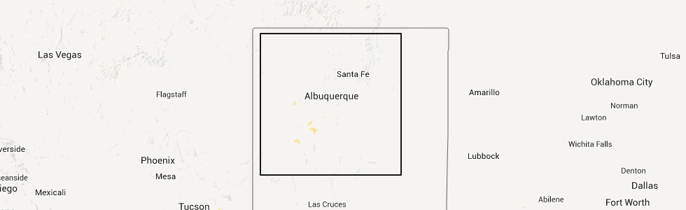
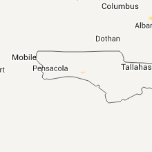
Hail Map for Monday, September 22, 2014
Number of Impacted Households on 9/22/2014
0
Impacted by 1" or Larger Hail
0
Impacted by 1.75" or Larger Hail
0
Impacted by 2.5" or Larger Hail
Square Miles of Populated Area Impacted on 9/22/2014
0
Impacted by 1" or Larger Hail
0
Impacted by 1.75" or Larger Hail
0
Impacted by 2.5" or Larger Hail

Cities Most Affected by Hail Storms of 9/22/2014
| Hail Size | Demographics of Zip Codes Affected | ||||||
|---|---|---|---|---|---|---|---|
| City | Count | Average | Largest | Pop Density | House Value | Income | Age |
Hail and Wind Damage Spotted on 9/22/2014
Filter by Report Type:Hail ReportsWind Reports
Georgia
| Local Time | Report Details |
|---|---|
| 2:28 PM EDT | Emergency manager reported several trees blown down...with one on a house...on scenic route roa in crisp county GA, 68.7 miles WNW of Douglas, GA |
| 3:16 PM EDT | Power pole downed on dorsey clark rd. time estimated by rada in screven county GA, 46.7 miles NW of Savannah, GA |
Florida
| Local Time | Report Details |
|---|---|
| 3:00 PM EDT | Usaf tower 1012 located near the intersection of south street and lane anevue in titusville recorded a 53 knot/61 mph wind gust out of the northwes in brevard county FL, 34.2 miles E of Orlando, FL |
South Carolina
| Local Time | Report Details |
|---|---|
| 4:10 PM EDT | South carolina highway patrol reported that a tree was blown down at the intersection of sidneys and welch creek roads. time was estimated from radar dat in colleton county SC, 37.8 miles WSW of Charleston, SC |
| 4:17 PM EDT | A tree was blown down onto sister ferry road near the mccormick street intersection. time was estimated from radar dat in jasper county SC, 28.3 miles NNE of Savannah, GA |
Colorado
| Local Time | Report Details |
|---|---|
| 5:28 PM MDT | Quarter sized hail reported near Otis, CO, 19.4 miles NNW of Yuma, CO |
Connect with Interactive Hail Maps