

Hail Map for Sunday, September 25, 2016

Number of Impacted Households on 9/25/2016
0
Impacted by 1" or Larger Hail
0
Impacted by 1.75" or Larger Hail
0
Impacted by 2.5" or Larger Hail
Square Miles of Populated Area Impacted on 9/25/2016
0
Impacted by 1" or Larger Hail
0
Impacted by 1.75" or Larger Hail
0
Impacted by 2.5" or Larger Hail


Cities Most Affected by Hail Storms of 9/25/2016
| Hail Size | Demographics of Zip Codes Affected | ||||||
|---|---|---|---|---|---|---|---|
| City | Count | Average | Largest | Pop Density | House Value | Income | Age |
Hail and Wind Damage Spotted on 9/25/2016
Filter by Report Type:Hail ReportsWind Reports
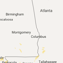
Wisconsin
| Local Time | Report Details |
|---|---|
| 2:55 PM CDT | Multiple trees down...some covering a road near lake koshkonon in jefferson county WI, 29.7 miles ESE of Madison, WI |
| 3:05 PM CDT | Two trees downed by thunderstorm wind gusts near county line roa in rock county WI, 30 miles SE of Madison, WI |
| 3:05 PM CDT | Large tree limbs and branches down by thunderstorm winds near the intersection of hwy 26 and county line roa in rock county WI, 29.4 miles SE of Madison, WI |
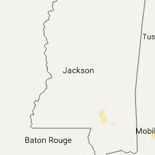
Mississippi
| Local Time | Report Details |
|---|---|
| 5:40 PM CDT | Power line down on eatonville road near jones county line...reported by hattiesburg eoc in forrest county MS, 80.3 miles SE of Jackson, MS |
| 6:10 PM CDT | Scattered trees down in lamar county...reported by lamar so in lamar county MS, 88.9 miles NNE of New Orleans, LA |
Connect with Interactive Hail Maps