

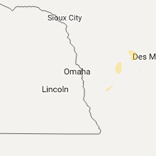
Hail Map for Monday, September 25, 2017

Number of Impacted Households on 9/25/2017
0
Impacted by 1" or Larger Hail
0
Impacted by 1.75" or Larger Hail
0
Impacted by 2.5" or Larger Hail
Square Miles of Populated Area Impacted on 9/25/2017
0
Impacted by 1" or Larger Hail
0
Impacted by 1.75" or Larger Hail
0
Impacted by 2.5" or Larger Hail


Cities Most Affected by Hail Storms of 9/25/2017
| Hail Size | Demographics of Zip Codes Affected | ||||||
|---|---|---|---|---|---|---|---|
| City | Count | Average | Largest | Pop Density | House Value | Income | Age |
Hail and Wind Damage Spotted on 9/25/2017
Filter by Report Type:Hail ReportsWind Reports
Kansas
| Local Time | Report Details |
|---|---|
| 1:32 PM CDT | Storm damage reported in sedgwick county KS, 15.2 miles SW of Wichita, KS |
| 1:45 PM CDT | Storm damage reported in sedgwick county KS, 3.5 miles W of Wichita, KS |
| 1:45 PM CDT | Storm damage reported in sedgwick county KS, 3.5 miles W of Wichita, KS |
Iowa
| Local Time | Report Details |
|---|---|
| 4:21 PM CDT | Public reported... via social media... wind damage in/near iowa falls. this is a delayed report. time and location estimated based on rada in hardin county IA, 43.3 miles S of Mason City, IA |
Texas
| Local Time | Report Details |
|---|---|
| 5:50 PM CDT | A few telephone poles blown down and penny size hai in andrews county TX, 26.9 miles NNW of Odessa, TX |
Connect with Interactive Hail Maps