

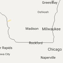
Hail Map for Friday, September 9, 2016

Number of Impacted Households on 9/9/2016
0
Impacted by 1" or Larger Hail
0
Impacted by 1.75" or Larger Hail
0
Impacted by 2.5" or Larger Hail
Square Miles of Populated Area Impacted on 9/9/2016
0
Impacted by 1" or Larger Hail
0
Impacted by 1.75" or Larger Hail
0
Impacted by 2.5" or Larger Hail


Cities Most Affected by Hail Storms of 9/9/2016
| Hail Size | Demographics of Zip Codes Affected | ||||||
|---|---|---|---|---|---|---|---|
| City | Count | Average | Largest | Pop Density | House Value | Income | Age |
| Ashland, KS | 1 | 2.50 | 2.50 | 0 | $37k | $34.7k | 44.3 |
| Mullinville, KS | 1 | 2.50 | 2.50 | 1 | $39k | $36.3k | 39.4 |
Hail and Wind Damage Spotted on 9/9/2016
Filter by Report Type:Hail ReportsWind Reports
Iowa
| Local Time | Report Details |
|---|---|
| 12:45 PM CDT | Half inch hail as well with the win in harrison county IA, 38.2 miles N of Omaha, NE |
Texas
| Local Time | Report Details |
|---|---|
| 1:50 PM CDT | Power lines down on fulton stree in harris county TX, 4.1 miles N of Houston, TX |
Kansas
| Local Time | Report Details |
|---|---|
| 5:45 PM CDT | Tennis Ball sized hail reported near Mullinville, KS, 72.2 miles N of Woodward, OK |
| 6:00 PM CDT | Tennis Ball sized hail reported near Ashland, KS, 56.1 miles NNW of Woodward, OK |
| 6:05 PM CDT | Quarter sized hail reported near Mcpherson, KS, 55.4 miles NNW of Wichita, KS |
| 6:10 PM CDT | Quarter sized hail reported near Ashland, KS, 56.1 miles NNW of Woodward, OK, law enforement also reported street flooding in ashland. |
| 8:00 PM CDT | Numerous 4 inch limbs down in anthon in harper county KS, 53.6 miles SW of Wichita, KS |
| 9:18 PM CDT | Delayed report. two utility poles were downed on cowley college campu in cowley county KS, 45.6 miles SSE of Wichita, KS |
| 9:35 PM CDT | Medium to large tree down... approx 8-10 inches in diameter... via social medi in johnson county KS, 13.8 miles WSW of Kansas City, MO |
| 9:35 PM CDT | Quarter sized hail reported near Shawnee, KS, 14.7 miles WSW of Kansas City, MO, quarter size hail |
| 9:39 PM CDT | Home weather station... via twitte in johnson county KS, 22.5 miles WSW of Kansas City, MO |
| 9:45 PM CDT | Large oak tree split in half... estimated diameter of about 2 feet. time is radar estimate in johnson county KS, 20.9 miles SW of Kansas City, MO |
Illinois
| Local Time | Report Details |
|---|---|
| 6:00 PM CDT | Storm damage reported in washington county IL, 51.8 miles ESE of Saint Louis, MO |
| 7:10 PM CDT | Houses damaged... trees and power lines down on fletcher in danvill in vermilion county IL, 60.8 miles NE of Mattoon, IL |
Missouri
| Local Time | Report Details |
|---|---|
| 6:50 PM CDT | Mulitple powerlines down due to thunderstorm wind in texas county MO, 23.9 miles WSW of Salem, MO |
| 6:51 PM CDT | Tree down on c highway. also numerous power lines dow in texas county MO, 16.2 miles WSW of Salem, MO |
| 7:13 PM CDT | Few trees down in the road on state highway in texas county MO, 28.4 miles SW of Salem, MO |
| 10:13 PM CDT | Tree limbs down throughout are in cass county MO, 22.5 miles S of Kansas City, MO |
| 10:26 PM CDT | Southside of raymore in cass county MO, 22.1 miles SSE of Kansas City, MO |
Oklahoma
| Local Time | Report Details |
|---|---|
| 7:00 PM CDT | Storm damage reported in harper county OK, 29.8 miles NNW of Woodward, OK |
| 7:05 PM CDT | Storm damage reported in harper county OK, 29.8 miles NNW of Woodward, OK |
| 7:15 PM CDT | Found via twitter... kwtv report. time estimated from tweet time and rada in harper county OK, 29.6 miles NNW of Woodward, OK |
| 7:45 PM CDT | Storm damage reported in woodward county OK, 1.6 miles NW of Woodward, OK |
| 8:05 PM CDT | Storm kicked up lots of dus in alfalfa county OK, 61.3 miles ENE of Woodward, OK |
| 9:01 PM CDT | Quarter sized hail reported near Enid, OK, 67.9 miles NNW of Oklahoma City, OK |
| 9:14 PM CDT | Awos station 1 wsw vance air force base /end in garfield county OK, 63.3 miles NNW of Oklahoma City, OK |
| 9:15 PM CDT | 75 mph gust with 62 mph sustained win in garfield county OK, 63.6 miles NNW of Oklahoma City, OK |
| 9:40 PM CDT | Storm damage reported in kay county OK, 60.4 miles SSE of Wichita, KS |
| 9:55 PM CDT | Storm damage reported in noble county OK, 65.3 miles WNW of Tulsa, OK |
| 10:30 PM CDT | Okc emergency manager reports power lines down near nw 48th street and northwest expressway. time estimated by rada in oklahoma county OK, 3.5 miles NNW of Oklahoma City, OK |
| 10:36 PM CDT | Estimated 50 to 55 mph sustained winds up to 60 mph gusts with blowing dus in oklahoma county OK, 23.1 miles NE of Oklahoma City, OK |
| 10:43 PM CDT | Okc emergency manager reports powerlines down near south meridian and i-44. time estimated by rada in cleveland county OK, 8.9 miles SSW of Oklahoma City, OK |
| 10:55 PM CDT | Storm damage reported in grady county OK, 27.8 miles WSW of Oklahoma City, OK |
Connect with Interactive Hail Maps