

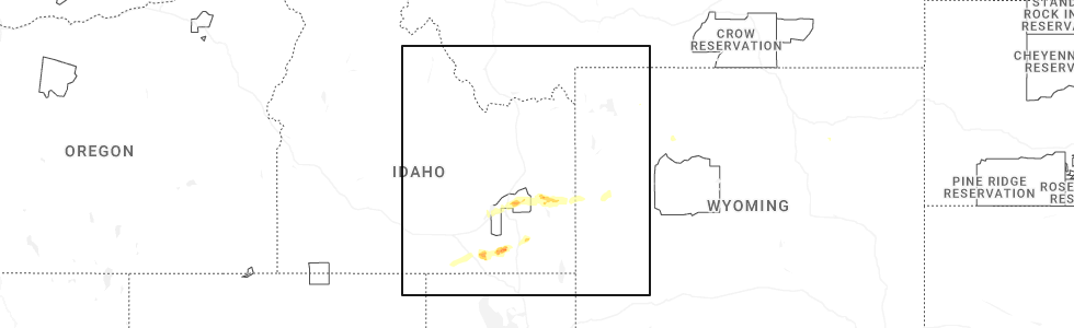
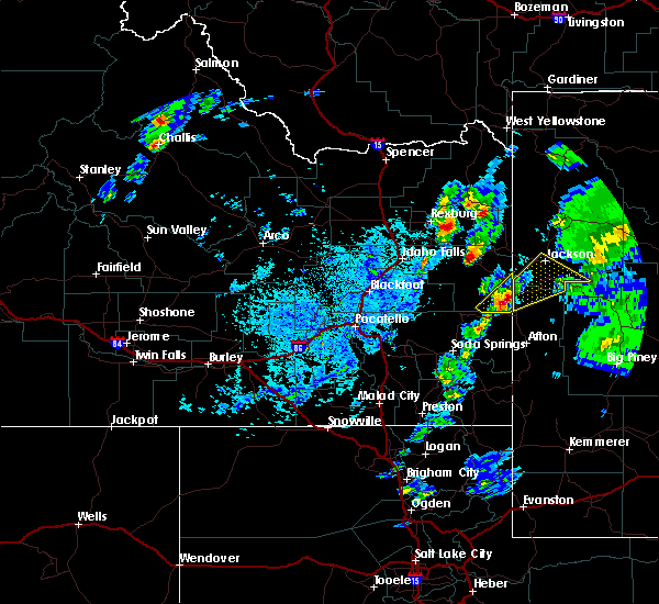
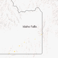
Hail Map for Alpine Northeast, WY
The Alpine Northeast, WY area has had 0 reports of on-the-ground hail by trained spotters, and has been under severe weather warnings 5 times during the past 12 months. Doppler radar has detected hail at or near Alpine Northeast, WY on 10 occasions, including 2 occasions during the past year.
| Name: | Alpine Northeast, WY |
| Where Located: | 55.7 miles ESE of Idaho Falls, ID |
| Map: | Google Map for Alpine Northeast, WY |
| Population: | 196 |
| Housing Units: | 136 |
| More Info: | Search Google for Alpine Northeast, WY |
0
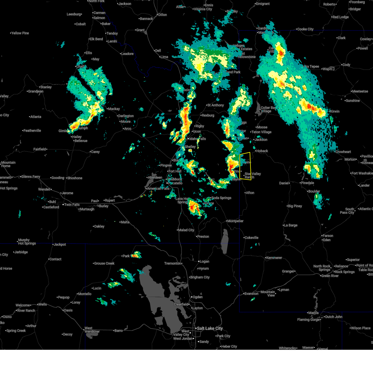
The Top Recent Hail Date for Alpine Northeast, WY is Wednesday, June 11, 2025 (10th out of 10)
Hail and Wind Damage Spotted near Alpine Northeast, WY
| Date / Time | Report Details |
|---|---|
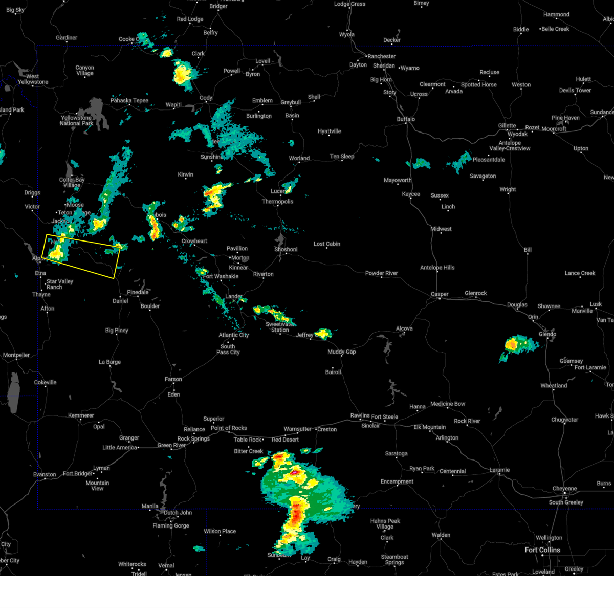
| 6/11/2025 4:20 PM MDT |
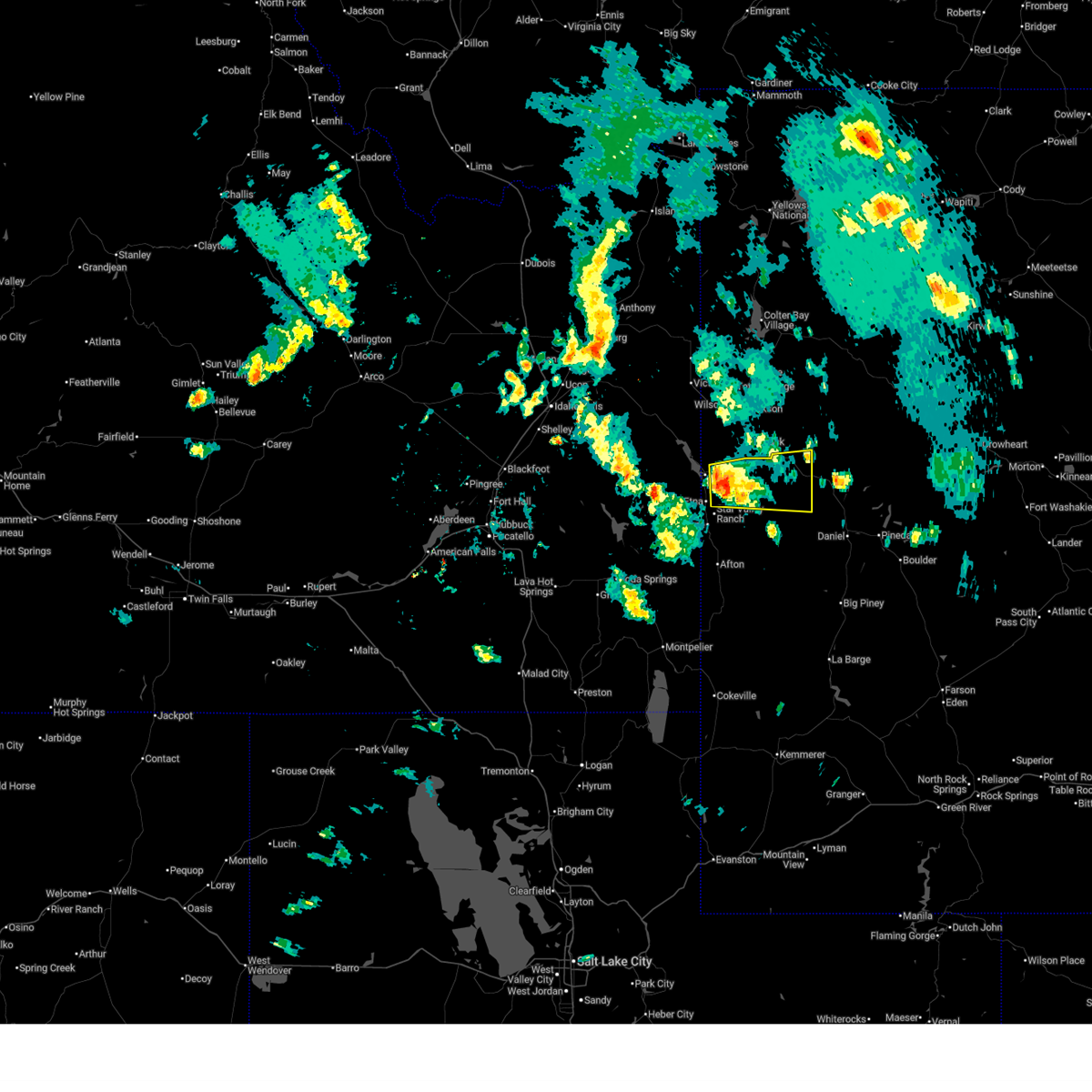 At 420 pm mdt, a severe thunderstorm was located near stewart peak, which is 10 miles east of alpine, moving east at 45 mph (radar indicated). Hazards include quarter size hail. Damage to vehicles is expected. Locations impacted include, star valley ranch, bondurant, and stewart peak. At 420 pm mdt, a severe thunderstorm was located near stewart peak, which is 10 miles east of alpine, moving east at 45 mph (radar indicated). Hazards include quarter size hail. Damage to vehicles is expected. Locations impacted include, star valley ranch, bondurant, and stewart peak.
|
| 6/11/2025 4:14 PM MDT |
 Svrriw the national weather service in riverton has issued a * severe thunderstorm warning for, northwestern sublette county in west central wyoming, northwestern lincoln county in west central wyoming, * until 500 pm mdt. * at 413 pm mdt, a severe thunderstorm was located over stewart peak, which is near alpine, moving east at 45 mph (radar indicated). Hazards include quarter size hail. damage to vehicles is expected Svrriw the national weather service in riverton has issued a * severe thunderstorm warning for, northwestern sublette county in west central wyoming, northwestern lincoln county in west central wyoming, * until 500 pm mdt. * at 413 pm mdt, a severe thunderstorm was located over stewart peak, which is near alpine, moving east at 45 mph (radar indicated). Hazards include quarter size hail. damage to vehicles is expected
|
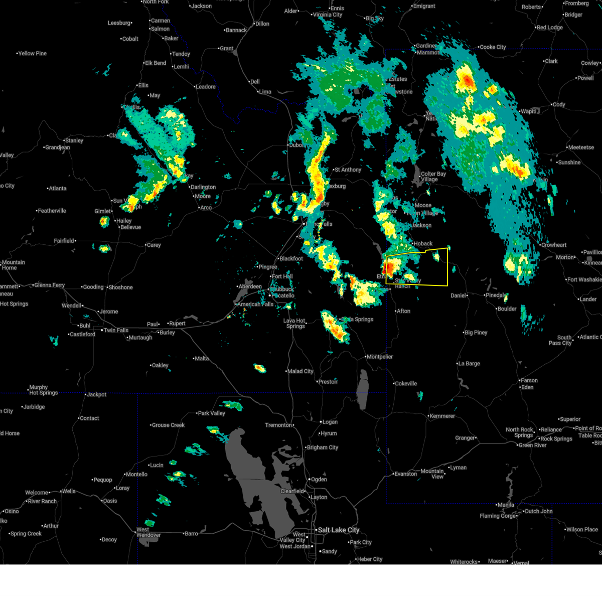
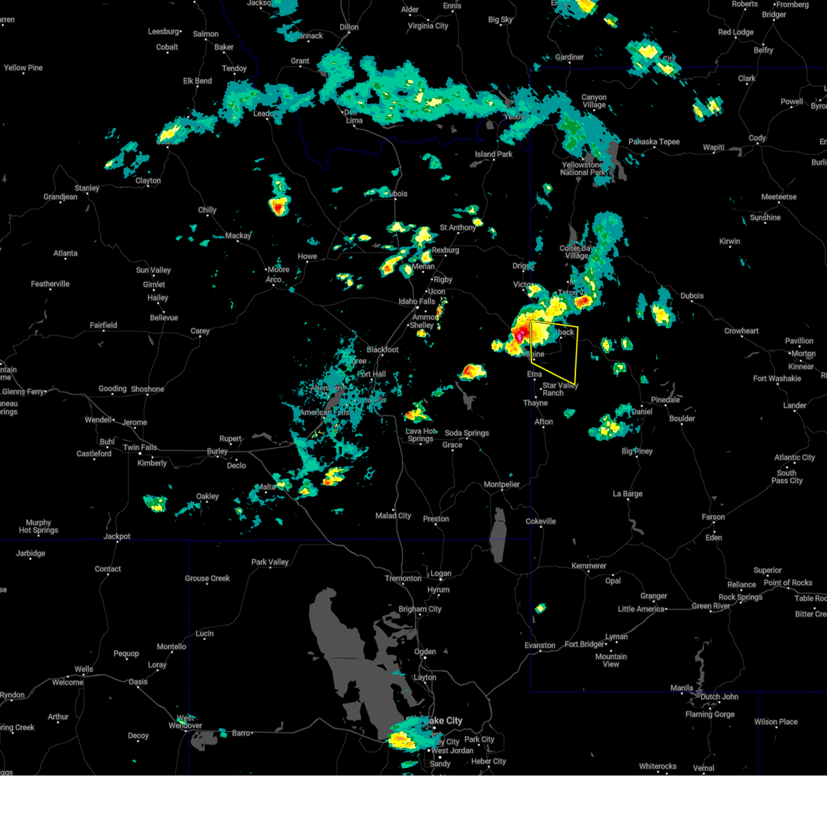
| 6/11/2025 3:56 PM MDT |
 Svrriw the national weather service in riverton has issued a * severe thunderstorm warning for, northwestern lincoln county in west central wyoming, * until 415 pm mdt. * at 355 pm mdt, a severe thunderstorm was located 9 miles northwest of freedom, which is 10 miles northeast of wayan, moving east at 35 mph (radar indicated). Hazards include quarter size hail. Damage to vehicles is expected. This severe thunderstorm will remain over mainly rural areas of northwestern lincoln county, including the following locations, alpine airport and etna. Svrriw the national weather service in riverton has issued a * severe thunderstorm warning for, northwestern lincoln county in west central wyoming, * until 415 pm mdt. * at 355 pm mdt, a severe thunderstorm was located 9 miles northwest of freedom, which is 10 miles northeast of wayan, moving east at 35 mph (radar indicated). Hazards include quarter size hail. Damage to vehicles is expected. This severe thunderstorm will remain over mainly rural areas of northwestern lincoln county, including the following locations, alpine airport and etna.
|
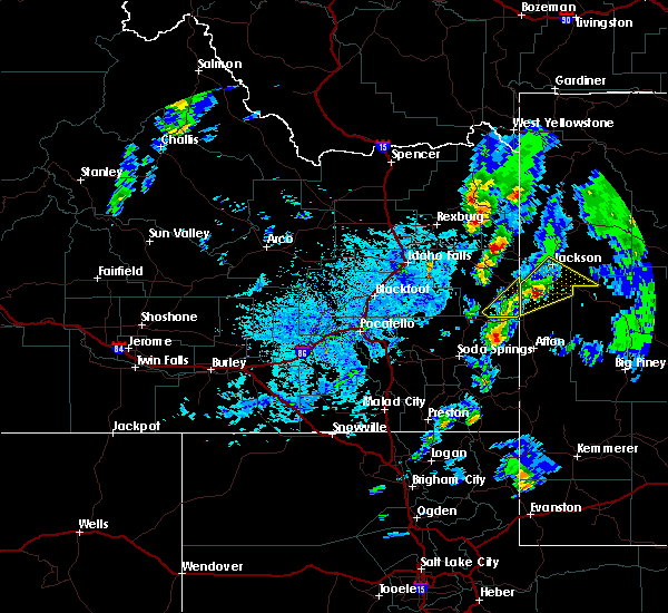
| 8/10/2024 2:09 PM MDT |
 Svrriw the national weather service in riverton has issued a * severe thunderstorm warning for, northwestern sublette county in west central wyoming, north central lincoln county in west central wyoming, southwestern teton county in northwestern wyoming, * until 245 pm mdt. * at 208 pm mdt, a severe thunderstorm was located near hoback, which is 13 miles northeast of alpine, moving east at 35 mph (radar indicated). Hazards include ping pong ball size hail. People and animals outdoors will be injured. Expect damage to roofs, siding, windows, and vehicles. Svrriw the national weather service in riverton has issued a * severe thunderstorm warning for, northwestern sublette county in west central wyoming, north central lincoln county in west central wyoming, southwestern teton county in northwestern wyoming, * until 245 pm mdt. * at 208 pm mdt, a severe thunderstorm was located near hoback, which is 13 miles northeast of alpine, moving east at 35 mph (radar indicated). Hazards include ping pong ball size hail. People and animals outdoors will be injured. Expect damage to roofs, siding, windows, and vehicles.
|
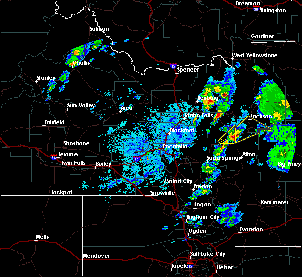
| 8/10/2024 1:47 PM MDT |
 Svrriw the national weather service in riverton has issued a * severe thunderstorm warning for, northwestern lincoln county in west central wyoming, southwestern teton county in northwestern wyoming, * until 215 pm mdt. * at 147 pm mdt, a severe thunderstorm was located near palisades reservoir, moving east at 30 mph (radar indicated). Hazards include 60 mph wind gusts and quarter size hail. Hail damage to vehicles is expected. expect wind damage to roofs, siding, and trees. This severe thunderstorm will remain over mainly rural areas of northwestern lincoln and southwestern teton counties, including the following locations, alpine airport. Svrriw the national weather service in riverton has issued a * severe thunderstorm warning for, northwestern lincoln county in west central wyoming, southwestern teton county in northwestern wyoming, * until 215 pm mdt. * at 147 pm mdt, a severe thunderstorm was located near palisades reservoir, moving east at 30 mph (radar indicated). Hazards include 60 mph wind gusts and quarter size hail. Hail damage to vehicles is expected. expect wind damage to roofs, siding, and trees. This severe thunderstorm will remain over mainly rural areas of northwestern lincoln and southwestern teton counties, including the following locations, alpine airport.
|
| 8/7/2016 1:58 PM MDT | The severe thunderstorm warning for southwestern teton and northwestern lincoln counties will expire at 200 pm mdt, the storm which prompted the warning has moved out of the area. therefore, the warning will be allowed to expire. however small hail is still possible in the northern star valley as another strong storms moves in. |
| 8/7/2016 1:43 PM MDT |
 At 143 pm mdt, a severe thunderstorm was located 8 miles southwest of hoback, or 9 miles northeast of alpine, moving northeast at 35 mph (radar indicated). Hazards include 60 mph wind gusts and quarter size hail. Hail damage to vehicles is expected. expect wind damage to roofs, siding, and trees. This severe storm will be near, hoback and rafter j ranch around 200 pm mdt. At 143 pm mdt, a severe thunderstorm was located 8 miles southwest of hoback, or 9 miles northeast of alpine, moving northeast at 35 mph (radar indicated). Hazards include 60 mph wind gusts and quarter size hail. Hail damage to vehicles is expected. expect wind damage to roofs, siding, and trees. This severe storm will be near, hoback and rafter j ranch around 200 pm mdt.
|
| 8/7/2016 1:30 PM MDT |
 At 129 pm mdt, a severe thunderstorm was located over alpine, moving northeast at 30 mph (radar indicated). Hazards include ping pong ball size hail and 60 mph wind gusts. People and animals outdoors will be injured. expect hail damage to roofs, siding, windows, and vehicles. expect wind damage to roofs, siding, and trees. This severe storm will be near, hoback around 200 pm mdt. At 129 pm mdt, a severe thunderstorm was located over alpine, moving northeast at 30 mph (radar indicated). Hazards include ping pong ball size hail and 60 mph wind gusts. People and animals outdoors will be injured. expect hail damage to roofs, siding, windows, and vehicles. expect wind damage to roofs, siding, and trees. This severe storm will be near, hoback around 200 pm mdt.
|
| 8/7/2016 1:19 PM MDT |
 At 118 pm mdt, a severe thunderstorm was located near alpine, moving northeast at 35 mph (radar indicated). Hazards include 60 mph wind gusts and half dollar size hail. Hail damage to vehicles is expected. expect wind damage to roofs, siding, and trees. This severe thunderstorm will be near, hoback around 155 pm mdt. At 118 pm mdt, a severe thunderstorm was located near alpine, moving northeast at 35 mph (radar indicated). Hazards include 60 mph wind gusts and half dollar size hail. Hail damage to vehicles is expected. expect wind damage to roofs, siding, and trees. This severe thunderstorm will be near, hoback around 155 pm mdt.
|
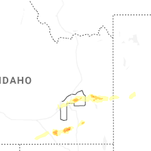
Hail Maps for Alpine Northeast, WY


Connect with Interactive Hail Maps