

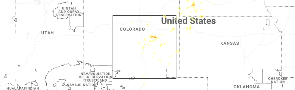
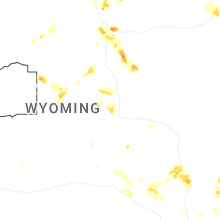
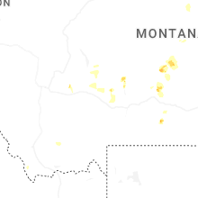
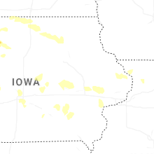
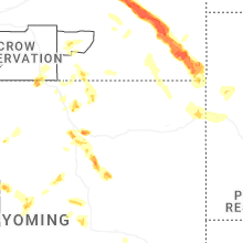
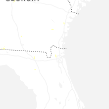
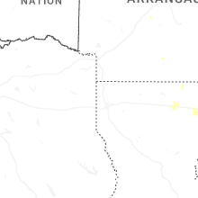
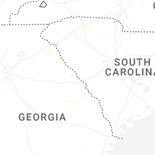
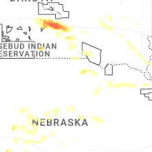
Hail Map for Tuesday, July 29, 2025
Number of Impacted Households on 7/29/2025
0
Impacted by 1" or Larger Hail
0
Impacted by 1.75" or Larger Hail
0
Impacted by 2.5" or Larger Hail
Square Miles of Populated Area Impacted on 7/29/2025
0
Impacted by 1" or Larger Hail
0
Impacted by 1.75" or Larger Hail
0
Impacted by 2.5" or Larger Hail

Cities Most Affected by Hail Storms of 7/29/2025
| Hail Size | Demographics of Zip Codes Affected | ||||||
|---|---|---|---|---|---|---|---|
| City | Count | Average | Largest | Pop Density | House Value | Income | Age |
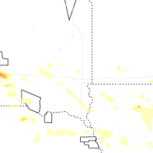
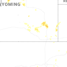
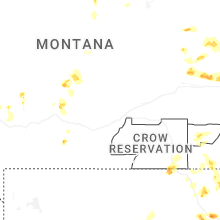
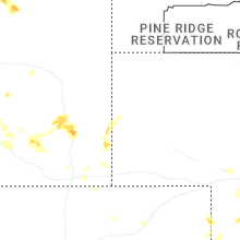
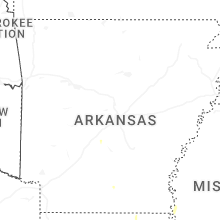
| Miles City, MT | 3 | 1.83 | 2.00 | 3 | $63k | $29.9k | 41.9 |
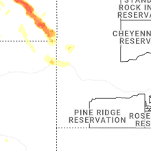
| Rush, CO | 2 | 2.38 | 2.75 | 1 | $105k | $34.3k | 43.5 |
Hail and Wind Damage Spotted on 7/29/2025
Filter by Report Type:Hail ReportsWind Reports
States Impacted
Utah, Georgia, Montana, South Carolina, Florida, Louisiana, Colorado, Alabama, Mississippi, South Dakota, Kansas, Missouri, North Carolina, Wyoming, Minnesota, Nebraska, Nevada, Iowa, IdahoUtah
| Local Time | Report Details |
|---|---|
| 8:20 AM MDT | Grantsville south (pc104) mesonet sensor recorded wind gust of 62 mph as high-based showers moved through the are in tooele county UT, 34 miles WSW of Salt Lake City, UT |
| 10:40 AM MDT | Radar (pc492) mesonet sensor recorded wind gust of 64 mph as high-based showers moved through the are in box elder county UT, 45 miles NW of Salt Lake City, UT |
| 2:45 PM MDT | Mesonet station ucl17 orangeville - agrime in emery county UT, 29.7 miles SSW of Price, UT |
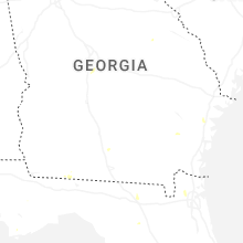
Georgia
| Local Time | Report Details |
|---|---|
| 2:13 PM EDT | Quarter sized hail reported near Thomasville, GA, 21.7 miles NNE of Tallahassee, FL, nickel to quarter size hail estimated. started around 155 pm. |
Montana
| Local Time | Report Details |
|---|---|
| 12:26 PM MDT | Quarter sized hail reported near Belt, MT, 27.7 miles SSE of Great Falls, MT, facebook report of 1 inch hail in tiger butte. |
| 4:33 PM MDT | Hen Egg sized hail reported near Miles City, MT, 11.7 miles SW of Miles City, MT, report from mping: hen egg (2.00 in.). |
| 4:35 PM MDT | Half Dollar sized hail reported near Wilsall, MT, 28 miles NE of Bozeman, MT |
| 5:05 PM MDT | Estimated 3 to 4 inch diameter tree limbs broke in custer county MT, 15.3 miles NE of Miles City, MT |
| 5:42 PM MDT | Golf Ball sized hail reported near Miles City, MT, 26.5 miles SSE of Miles City, MT, report from mping: golf ball (1.75 in.). |
| 5:49 PM MDT | Golf Ball sized hail reported near Miles City, MT, 36.8 miles SE of Miles City, MT |
| 8:00 PM MDT | Mesonet station mteka baker mt-7 mp 14. in fallon county MT, 71.2 miles ESE of Miles City, MT |
| 8:00 PM MDT | Mesonet station mtekl 12.1 s ridgeway (mt dot in carter county MT, 86.7 miles NE of Gillette, WY |
| 8:45 PM MDT | Mesonet station mtalz 2.3 e alzada (mt dot in carter county MT, 74.2 miles NE of Gillette, WY |
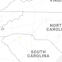
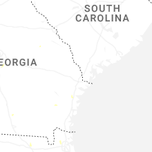
South Carolina
| Local Time | Report Details |
|---|---|
| 3:23 PM EDT | Emergency manager reported one tree down on wood road blocking both lanes. tree is also on power lines. time estimated by rada in colleton county SC, 46.8 miles SW of Charleston, SC |
| 3:44 PM EDT | Emergency manager reported one tree down blocking both lanes at white hall road and pynes community road. time estimated by rada in colleton county SC, 49.5 miles NNE of Savannah, GA |
| 4:15 PM EDT | Multiple trees and power lines down around glendale community. time estimate in spartanburg county SC, 44 miles E of Greenville, SC |
| 4:18 PM EDT | Two trees down along pine ridge rd. time estimate in spartanburg county SC, 42 miles E of Greenville, SC |
| 4:30 PM EDT | Several trees and power lines down near intersection of old canaan rd and martin family rd. a brush fire also was started by a downed power line. time estimate in spartanburg county SC, 38.8 miles E of Greenville, SC |
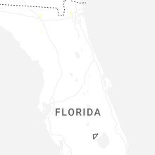
Florida
| Local Time | Report Details |
|---|---|
| 4:18 PM EDT | Photos of snapped palm tree along rockland dr in jacksonville... fl. time est off radar and kheg reported wind gust of 30mph at 4:15p in duval county FL, 8.2 miles W of Jacksonville, FL |
| 3:50 PM CDT | Tree reported down on mt tabor roa in jackson county FL, 57.6 miles WNW of Tallahassee, FL |
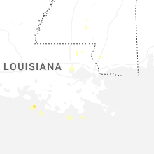
Louisiana
| Local Time | Report Details |
|---|---|
| 3:22 PM CDT | A 70 mph wind gust was measured at the monroe regional airpor in ouachita county LA, 19 miles SSW of Bastrop, LA |
| 3:22 PM CDT | Tree down on courtney street. time estimated by rada in ouachita county LA, 20.3 miles SW of Bastrop, LA |
| 3:22 PM CDT | Tree down on columbia avenue. time estimated by rada in ouachita county LA, 20.2 miles SSW of Bastrop, LA |
| 3:22 PM CDT | Tree down near the intersection of louisville avenue and 4th street. time estimated by rada in ouachita county LA, 22 miles SSW of Bastrop, LA |
| 3:24 PM CDT | A picture was posted to social media of a 6 ft wooden privacy fence that was blown over adjacent to a home off of lamy lane in monro in ouachita county LA, 19.6 miles SSW of Bastrop, LA |
| 3:54 PM CDT | Tree down along highway 837. time estimated by rada in ouachita county LA, 30.7 miles WSW of Bastrop, LA |
| 3:56 PM CDT | Tree down in calhoun along highway 151. time estimated by rada in ouachita county LA, 31.5 miles SW of Bastrop, LA |
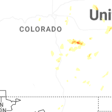
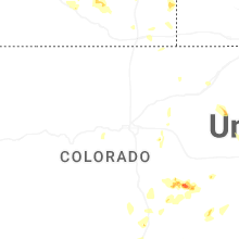
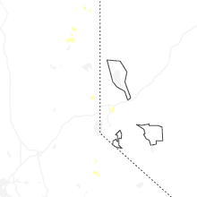
Colorado
| Local Time | Report Details |
|---|---|
| 2:57 PM MDT | Quarter sized hail reported near Wray, CO, 29.3 miles ESE of Yuma, CO, spotter reported hail ranging from pea to quarter in size. not much of it fell. |
| 3:25 PM MDT | Ping Pong Ball sized hail reported near Ramah, CO, 58.9 miles NE of Pueblo, CO, report from mping: ping pong ball (1.50 in.). |
| 3:36 PM MDT | Hen Egg sized hail reported near Rush, CO, 56.5 miles NE of Pueblo, CO, report from mping: hen egg (2.00 in.). |
| 3:41 PM MDT | Baseball sized hail reported near Rush, CO, 55.4 miles NE of Pueblo, CO, report from mping: baseball (2.75 in.). |
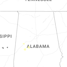
Alabama
| Local Time | Report Details |
|---|---|
| 4:13 PM CDT | Dale county reported a few trees down around the count in dale county AL, 78.5 miles S of Auburn, AL |
| 4:25 PM CDT | Tree down on grandview l in geneva county AL, 54 miles NNE of Miramar Beach, FL |
| 4:35 PM CDT | A few trees were downed in the northern part of coffee count in coffee county AL, 79.2 miles SSW of Auburn, AL |
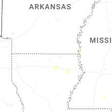
Mississippi
| Local Time | Report Details |
|---|---|
| 4:20 PM CDT | Trees snapped and uproote in pearl river county MS, 54.2 miles NE of New Orleans, LA |
| 4:23 PM CDT | Significant shingle loss to one house... an outbuilding completed destroyed... and multiple pecan trees down... some over 36 inches in diamete in pearl river county MS, 54.4 miles NNE of New Orleans, LA |
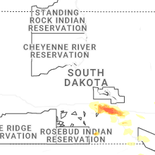
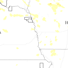
South Dakota
| Local Time | Report Details |
|---|---|
| 4:30 PM CDT | Mesonet station kbms2 kennebec 6sse (sd mesonet in lyman county SD, 45.9 miles SE of Pierre, SD |
| 4:45 PM CDT | Storm damage reported in tripp county SD, 62.5 miles SSE of Pierre, SD |
| 4:45 PM CDT | Reported that winds caused trees to be tipped over and blown into the hous in lyman county SD, 55.2 miles SE of Pierre, SD |
| 5:05 PM CDT | Wind driven hail stripped siding. 2 barn doors blown off. cattle blown through fence and out on roa in lyman county SD, 57.6 miles SE of Pierre, SD |
| 5:10 PM CDT | Storm damage reported in lyman county SD, 60.7 miles SE of Pierre, SD |
| 5:10 PM CDT | Several trees blown over. very strong winds tore off part of roof of hous in brule county SD, 67.6 miles SE of Pierre, SD |
| 5:42 PM CDT | Mesonet station 154 sd rwis platte-winner bridg in charles mix county SD, 68.7 miles NNW of Oneill, NE |
| 5:46 PM CDT | Public mesonet wind observatio in charles mix county SD, 60.7 miles NNW of Oneill, NE |
| 6:08 PM CDT | Strong winds. large healthy tree branch down... estimated 8-9 inches in diameter. time estimated via rada in charles mix county SD, 72 miles N of Oneill, NE |
| 6:18 PM CDT | Mesonet station 214 sd rwis plankinto in aurora county SD, 86.5 miles N of Oneill, NE |
| 6:23 PM CDT | Mesonet station 214 sd rwis plankinto in aurora county SD, 86.5 miles N of Oneill, NE |
| 6:46 PM CDT | Asos station kmhe mitchell municipal airpor in davison county SD, 67.4 miles WNW of Sioux Falls, SD |
| 6:52 PM CDT | Mesonet station 304 sd rwis corsic in douglas county SD, 64.8 miles N of Oneill, NE |
| 6:58 PM CDT | Reported via mobile mesonet on in davison county SD, 70.8 miles W of Sioux Falls, SD |
| 7:01 PM CDT | Personal weather statio in hanson county SD, 57.6 miles WNW of Sioux Falls, SD |
| 7:14 PM CDT | Mesonet station 26 sd rwis trip in hutchinson county SD, 63.5 miles NNE of Oneill, NE |
| 7:15 PM CDT | Mesonet station 213 sd rwis alexandri in hanson county SD, 49.8 miles W of Sioux Falls, SD |
| 7:20 PM CDT | Mesonet station 26 sd rwis trip in hutchinson county SD, 63.5 miles NNE of Oneill, NE |
| 7:32 PM CDT | Personal weather syste in bon homme county SD, 53.6 miles NE of Oneill, NE |
| 7:35 PM CDT | Storm damage reported in mccook county SD, 39.1 miles W of Sioux Falls, SD |
| 7:45 PM CDT | Mesonet station 163 sd rwis freema in hutchinson county SD, 39.2 miles WSW of Sioux Falls, SD |
| 7:45 PM CDT | Personal weather statio in hutchinson county SD, 36.9 miles W of Sioux Falls, SD |
| 7:49 PM CDT | Personal weather statio in hutchinson county SD, 35.6 miles WSW of Sioux Falls, SD |
| 7:50 PM CDT | Mesonet station 322 sd rwis stanley corne in mccook county SD, 33.1 miles W of Sioux Falls, SD |
| 8:00 PM CDT | Personal weather statio in turner county SD, 26.3 miles WSW of Sioux Falls, SD |
| 8:05 PM CDT | Personal weather statio in turner county SD, 29.3 miles W of Sioux Falls, SD |
| 8:06 PM CDT | First severe gust at 806 pm... peak of 69 mph at 816 pm. hurley sdsu mesonet sit in turner county SD, 31 miles SW of Sioux Falls, SD |
| 8:30 PM CDT | Mesonet station 310 sd rwis parke in turner county SD, 21.3 miles SW of Sioux Falls, SD |
| 8:33 PM CDT | Personal weather statio in minnehaha county SD, 5.2 miles ESE of Sioux Falls, SD |
| 8:48 PM CDT | Mesonet station 320 sd rwis iren in turner county SD, 36.6 miles SSW of Sioux Falls, SD |
| 8:51 PM CDT | Mesonet station 16 sd rwis beresfor in union county SD, 35.1 miles S of Sioux Falls, SD |
| 8:51 PM CDT | Mesonet station bfms2 beresford 7 wsw (sd mesonet in clay county SD, 35.9 miles SSW of Sioux Falls, SD |
| 8:52 PM CDT | Awos station kvmr vermillio in clay county SD, 54.5 miles S of Sioux Falls, SD |
| 8:54 PM CDT | Personal weather statio in lincoln county SD, 31.6 miles S of Sioux Falls, SD |
| 8:55 PM CDT | Mesonet station 197 sd rwis gayvill in yankton county SD, 52.1 miles SSW of Sioux Falls, SD |
| 8:57 PM CDT | Personal weather statio in lincoln county SD, 31.5 miles S of Sioux Falls, SD |
| 8:57 PM CDT | Personal weather statio in clay county SD, 48.2 miles S of Sioux Falls, SD |
| 9:05 PM CDT | Mesonet station 16 sd rwis beresfor in union county SD, 35.1 miles S of Sioux Falls, SD |
| 9:33 PM CDT | Personal weather statio in union county SD, 70.4 miles W of Storm Lake, IA |
| 9:35 PM CDT | Mesonet station 53 sd rwis north sioux cit in union county SD, 68 miles W of Storm Lake, IA |
| 10:06 PM MDT | Storm damage reported in lawrence county SD, 42.5 miles NW of Rapid City, SD |
| 10:10 PM MDT | Half Dollar sized hail reported near Spearfish, SD, 40.1 miles NW of Rapid City, SD |
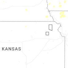
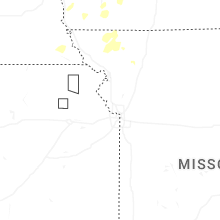
Kansas
| Local Time | Report Details |
|---|---|
| 4:40 PM CDT | Spotter reported a green tree limb down with picture of a 2-3 inch lim in rawlins county KS, 28.5 miles N of Colby, KS |
| 4:45 PM CDT | Caller reported two cottonwood trees down on atwood lake... in opposite directions. time estimated from rada in rawlins county KS, 29.2 miles N of Colby, KS |
Missouri
| Local Time | Report Details |
|---|---|
| 5:12 PM CDT | Two trees down near clearwater lake. time estimated from rada in wayne county MO, 55.2 miles SE of Salem, MO |
| 5:39 PM CDT | Photos show that the canopy at mr. fuel travel center had large sections of blown off... with several trees in the surrounding vicinity snapped or uproote in jefferson county MO, 25.9 miles SSW of Saint Louis, MO |
| 6:08 PM CDT | 3 trees down at highway d and jason avenu in carter county MO, 51.4 miles SE of Salem, MO |
| 6:20 PM CDT | Trees and power lines down near intersection of hwy c and hwy 6 in carter county MO, 53.6 miles SSE of Salem, MO |
| 7:41 PM CDT | Dock flipped over and multiple trees snappe in stone county MO, 43.1 miles SSW of Springfield, MO |
North Carolina
| Local Time | Report Details |
|---|---|
| 6:25 PM EDT | A tree was blown down by thunderstorm winds near the intersection of siloam road and turkey ford roa in surry county NC, 72.4 miles SSW of Roanoke, VA |
| 6:48 PM EDT | Power line is down on a tree. time is estimated from rada in surry county NC, 74.8 miles SW of Roanoke, VA |
| 7:12 PM EDT | A large tree was blown down by thunderstorm winds near the intersection of nc highway 268 and greenwood circl in surry county NC, 73 miles N of Charlotte, NC |
Wyoming
| Local Time | Report Details |
|---|---|
| 5:25 PM MDT | Ping Pong Ball sized hail reported near Buffalo, WY, 59.5 miles W of Gillette, WY, corrects previous hail report from 8 s buffalo. photo from social media. time estimated from radar. |
| 5:42 PM MDT | Ping Pong Ball sized hail reported near Buffalo, WY, 59.5 miles W of Gillette, WY, photo from social media. time estimated from radar. |
| 6:14 PM MDT | Reported at casper / natrona county intl airpor in natrona county WY, 7.9 miles WNW of Casper, WY |
| 6:30 PM MDT | Quarter sized hail reported near Lysite, WY, 38.1 miles ENE of Riverton, WY, time estimated from radar. |
| 9:50 PM MDT | Herrick lane wydot sensor along interstate 80 gusted 61 mp in albany county WY, 13.5 miles WNW of Laramie, WY |
| 10:15 PM MDT | Quarter sized hail reported near Bosler, WY, 21.8 miles NNE of Laramie, WY, picture from social media measuring 1 inch hail. |
| 10:18 PM MDT | Quarter sized hail reported near Bosler, WY, 22.8 miles N of Laramie, WY, report from mping: quarter (1.00 in.). |
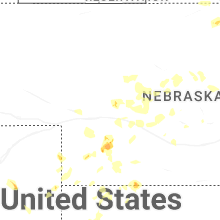
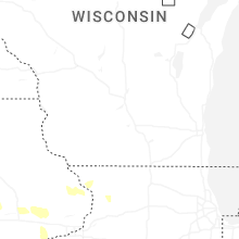
Minnesota
| Local Time | Report Details |
|---|---|
| 7:45 PM CDT | Quarter sized hail reported near Heron Lake, MN, 68.3 miles ENE of Sioux Falls, SD |
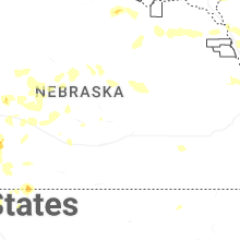
Nebraska
| Local Time | Report Details |
|---|---|
| 8:10 PM CDT | Storm damage reported in knox county NE, 40.3 miles E of Oneill, NE |
| 8:46 PM CDT | Unofficial personal weather statio in buffalo county NE, 45.7 miles WSW of Grand Island, NE |
| 8:48 PM CDT | Storm damage reported in pierce county NE, 59.5 miles ESE of Oneill, NE |
| 8:52 PM CDT | Estimated 60 to 65 mph winds along hwy 9 in sherman county NE, 46.2 miles WNW of Grand Island, NE |
| 8:53 PM CDT | A few separate reports of large branches down in town from estimated 65 mph winds. one branch was struck by a vehicle just south of town on highway 58 but no injurie in sherman county NE, 41 miles NW of Grand Island, NE |
| 9:00 PM CDT | Ne highway 12 blocked by several large trees down in newcastl in dixon county NE, 62.2 miles S of Sioux Falls, SD |
| 9:03 PM CDT | 1.5 inch branches down in carrol in wayne county NE, 75.7 miles E of Oneill, NE |
| 9:15 PM CDT | Personal weather statio in dixon county NE, 66 miles S of Sioux Falls, SD |
| 9:37 PM CDT | Personal weather statio in dixon county NE, 65.9 miles S of Sioux Falls, SD |
| 10:26 PM CDT | Personal weather statio in cuming county NE, 57.7 miles NW of Omaha, NE |
| 11:23 PM CDT | Personal weather statio in washington county NE, 17.2 miles NNW of Omaha, NE |
| 11:55 PM CDT | Corrects previous tstm wnd dmg report from 2 wsw omaha. delayed report: multiple trees downe in douglas county NE, 5.8 miles W of Omaha, NE |
| 11:56 PM CDT | Storm damage reported in lancaster county NE, 51.3 miles WSW of Omaha, NE |
| 12:18 AM CDT | Personal weather statio in lancaster county NE, 43.6 miles SW of Omaha, NE |
| 12:55 AM CDT | 6-8 inch diameter tree branches down and blocking roads in murra in cass county NE, 23.5 miles S of Omaha, NE |
Nevada
| Local Time | Report Details |
|---|---|
| 6:25 PM PDT | Quarter sized hail reported near Reno, NV, 9 miles SSE of Reno, NV, delayed report. public reported 1 inch hail verified with a photo. |
| 7:00 PM PDT | Quarter sized hail reported near Reno, NV, 8.1 miles SSE of Reno, NV, trained weather spotter at the intersection of veterans pkwy and piper peak lane in reno reported a few hailstones one inch in diameter. |
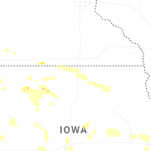
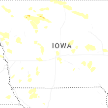
Iowa
| Local Time | Report Details |
|---|---|
| 9:25 PM CDT | Personal weather statio in plymouth county IA, 40.2 miles WNW of Storm Lake, IA |
| 9:42 PM CDT | Personal weather statio in plymouth county IA, 61.1 miles S of Sioux Falls, SD |
| 9:59 PM CDT | Personal weather statio in woodbury county IA, 62.5 miles W of Storm Lake, IA |
| 10:01 PM CDT | Asos station ksux sioux gateway airpor in woodbury county IA, 63 miles WSW of Storm Lake, IA |
| 12:20 AM CDT | Measured using a handheld anemometer. had consistent 45-55 mph gusts and one gust of 70 mp in shelby county IA, 44.4 miles NE of Omaha, NE |
| 12:42 AM CDT | Measured at marshalltown airpor in marshall county IA, 50.8 miles NE of Des Moines, IA |
| 1:10 AM CDT | Personal weather statio in tama county IA, 49.8 miles WNW of Cedar Rapids, IA |
| 1:27 AM CDT | Personal weather statio in greene county IA, 52 miles WNW of Des Moines, IA |
| 1:43 AM CDT | Personal weather statio in black hawk county IA, 49.3 miles NW of Cedar Rapids, IA |
| 1:50 AM CDT | Iowa dot rwi in black hawk county IA, 46.7 miles NW of Cedar Rapids, IA |
| 1:58 AM CDT | Personal weather statio in black hawk county IA, 42.5 miles NW of Cedar Rapids, IA |
| 3:13 AM CDT | Tree downed a power lin in jones county IA, 29.9 miles ENE of Cedar Rapids, IA |
| 3:27 AM CDT | Storm damage reported in cedar county IA, 39.7 miles ESE of Cedar Rapids, IA |
| 3:39 AM CDT | Personal weather statio in jackson county IA, 52.1 miles E of Cedar Rapids, IA |
Idaho
| Local Time | Report Details |
|---|---|
| 8:50 PM MDT | Mesonet station lof inl specific manufacturin in butte county ID, 42.8 miles NW of Idaho Falls, ID |
Connect with Interactive Hail Maps