

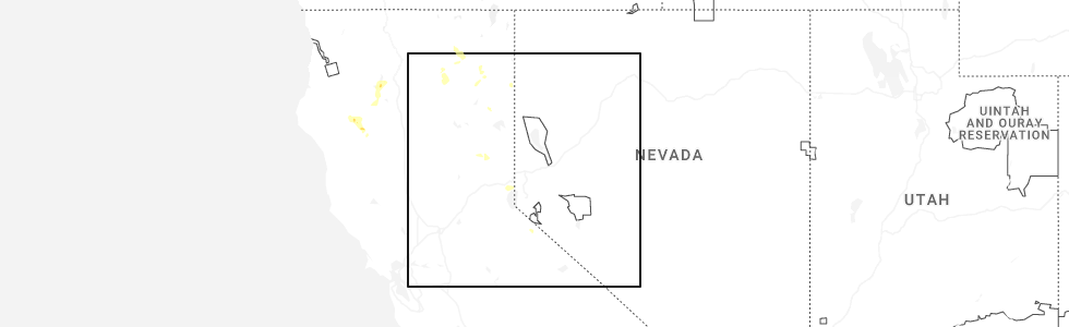
Hail Map for C-Road, CA
The C-Road, CA area has had 0 reports of on-the-ground hail by trained spotters, and has been under severe weather warnings 3 times during the past 12 months. Doppler radar has detected hail at or near C-Road, CA on 8 occasions, including 1 occasion during the past year.
| Name: | C-Road, CA |
| Where Located: | 43.7 miles WNW of Reno, NV |
| Map: | Google Map for C-Road, CA |
| Population: | 150 |
| Housing Units: | 102 |
| More Info: | Search Google for C-Road, CA |
5
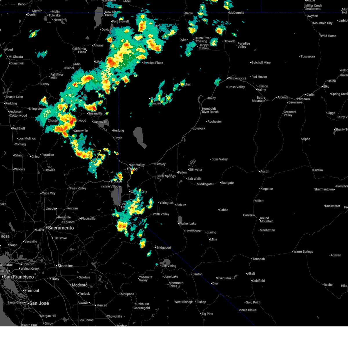
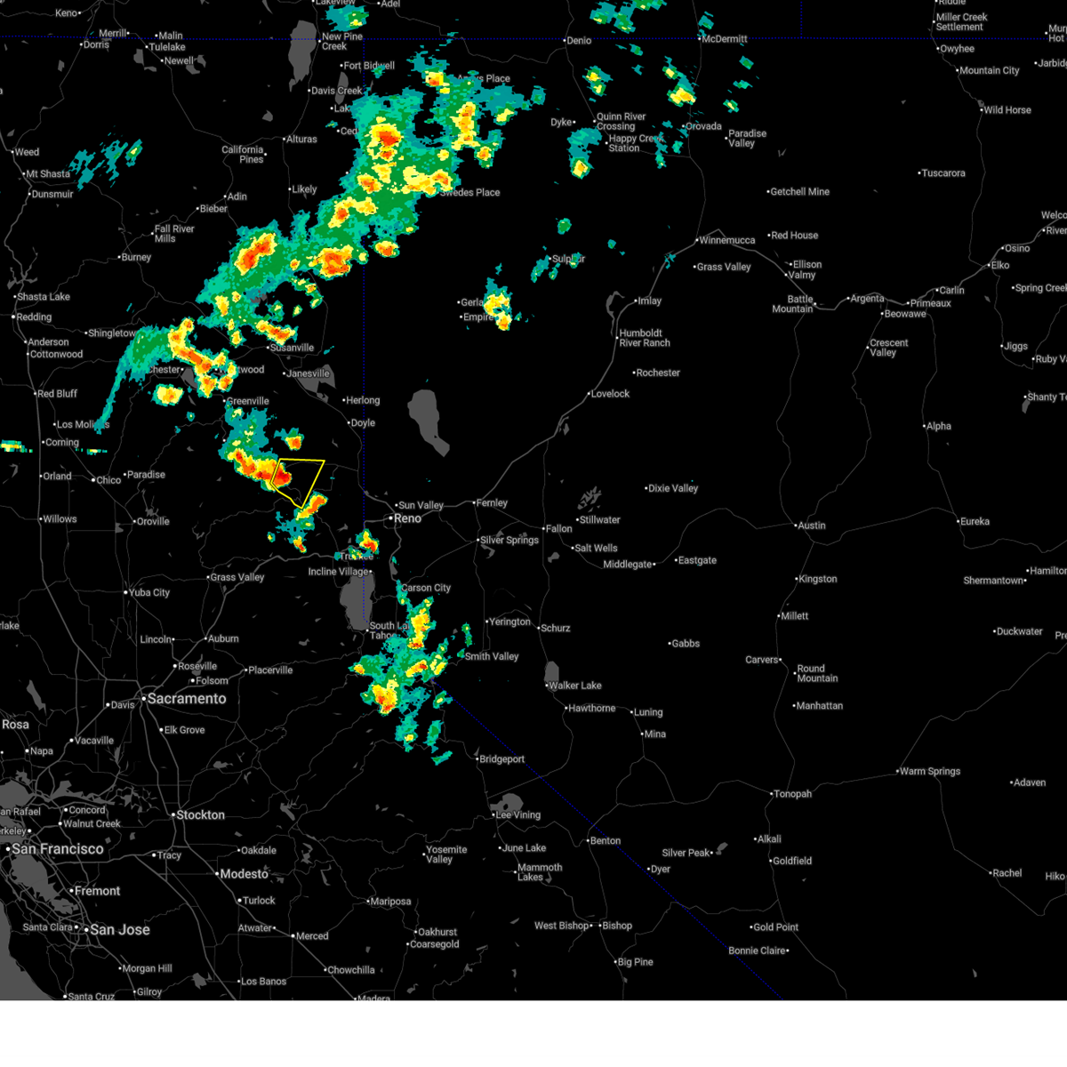
The Top Recent Hail Date for C-Road, CA is Friday, July 25, 2025 (1st out of 8)
Hail and Wind Damage Spotted near C-Road, CA
| Date / Time | Report Details |
|---|---|
| 7/25/2025 2:56 PM PDT |
 The storm which prompted the warning has weakened below severe limits, and no longer poses an immediate threat to life or property. therefore, the warning will be allowed to expire. however, small hail, gusty winds and heavy rain are still possible with this thunderstorm. The storm which prompted the warning has weakened below severe limits, and no longer poses an immediate threat to life or property. therefore, the warning will be allowed to expire. however, small hail, gusty winds and heavy rain are still possible with this thunderstorm.
|
| 7/25/2025 2:51 PM PDT |
 At 250 pm pdt, a severe thunderstorm was located near whitehawk, or 7 miles southeast of blairsden, moving east at 10 mph (radar indicated). Hazards include quarter size hail. Damage to vehicles is expected. Locations impacted include, blairsden, beckwourth, graeagle, iron horse, delleker, valley ranch, whitehawk, clio, c-road, mohawk vista, lake davis, portola, and ca 89 at sierra-plumas co line. At 250 pm pdt, a severe thunderstorm was located near whitehawk, or 7 miles southeast of blairsden, moving east at 10 mph (radar indicated). Hazards include quarter size hail. Damage to vehicles is expected. Locations impacted include, blairsden, beckwourth, graeagle, iron horse, delleker, valley ranch, whitehawk, clio, c-road, mohawk vista, lake davis, portola, and ca 89 at sierra-plumas co line.
|
| 7/25/2025 2:35 PM PDT |
 Svrrev the national weather service in reno has issued a * severe thunderstorm warning for, plumas county in northern california, sierra county in northern california, * until 300 pm pdt. * at 235 pm pdt, a severe thunderstorm was located over whitehawk, or near blairsden, moving east at 10 mph (radar indicated). Hazards include quarter size hail. damage to vehicles is expected Svrrev the national weather service in reno has issued a * severe thunderstorm warning for, plumas county in northern california, sierra county in northern california, * until 300 pm pdt. * at 235 pm pdt, a severe thunderstorm was located over whitehawk, or near blairsden, moving east at 10 mph (radar indicated). Hazards include quarter size hail. damage to vehicles is expected
|
Hail Maps for C-Road, CA


Connect with Interactive Hail Maps