

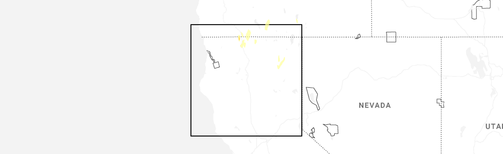
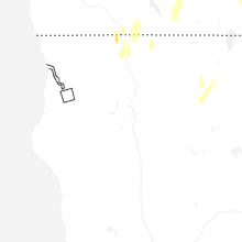
Hail Map for Canby, CA
The Canby, CA area has had 0 reports of on-the-ground hail by trained spotters, and has been under severe weather warnings 1 time during the past 12 months. Doppler radar has detected hail at or near Canby, CA on 1 occasion, including 1 occasion during the past year.
| Name: | Canby, CA |
| Where Located: | 58.5 miles SSW of Lakeview, OR |
| Map: | Google Map for Canby, CA |
| Population: | 315 |
| Housing Units: | 76 |
| More Info: | Search Google for Canby, CA |
0
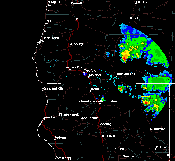
The Top Recent Hail Date for Canby, CA is Thursday, July 3, 2025 (1st out of 1)
Hail and Wind Damage Spotted near Canby, CA
| Date / Time | Report Details |
|---|---|
| 7/3/2025 5:12 PM PDT |
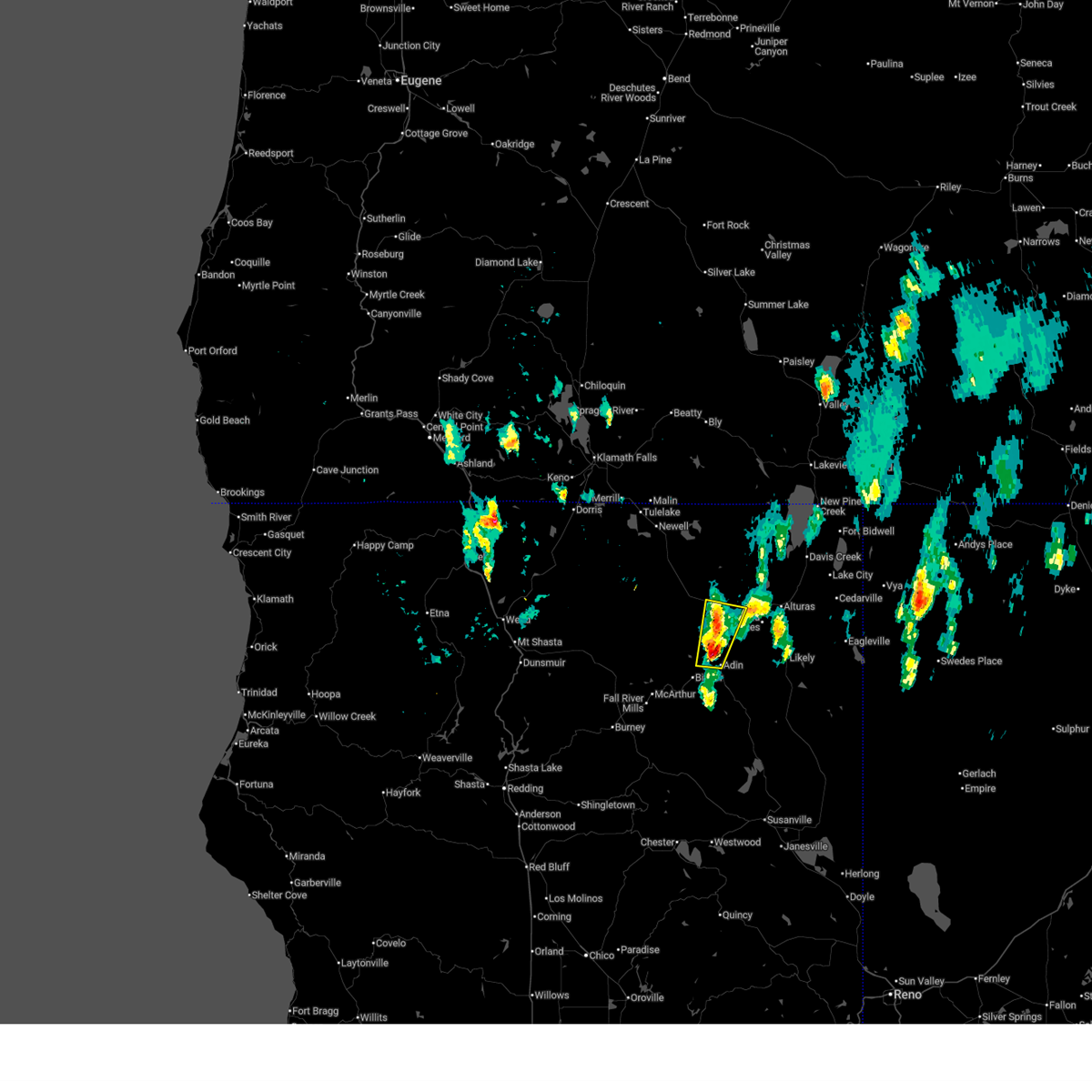 Svrmfr the national weather service in medford has issued a * severe thunderstorm warning for, south central modoc county in northern california, * until 545 pm pdt. * at 512 pm pdt, a severe thunderstorm was located near lower rush creek campground, or 14 miles northeast of bieber, moving north at 30 mph (radar indicated). Hazards include 60 mph wind gusts and quarter size hail. Hail damage to vehicles is expected. Expect wind damage to roofs, siding, and trees. Svrmfr the national weather service in medford has issued a * severe thunderstorm warning for, south central modoc county in northern california, * until 545 pm pdt. * at 512 pm pdt, a severe thunderstorm was located near lower rush creek campground, or 14 miles northeast of bieber, moving north at 30 mph (radar indicated). Hazards include 60 mph wind gusts and quarter size hail. Hail damage to vehicles is expected. Expect wind damage to roofs, siding, and trees.
|
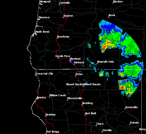
| 6/26/2023 6:10 PM PDT |
 The severe thunderstorm warning for south central modoc county will expire at 615 pm pdt, the storm which prompted the warning has weakened below severe limits. therefore, the warning will be allowed to expire. however small hail and gusty winds are still possible with this thunderstorm. to report severe weather, contact your nearest law enforcement agency. they will relay your report to the national weather service medford. The severe thunderstorm warning for south central modoc county will expire at 615 pm pdt, the storm which prompted the warning has weakened below severe limits. therefore, the warning will be allowed to expire. however small hail and gusty winds are still possible with this thunderstorm. to report severe weather, contact your nearest law enforcement agency. they will relay your report to the national weather service medford.
|
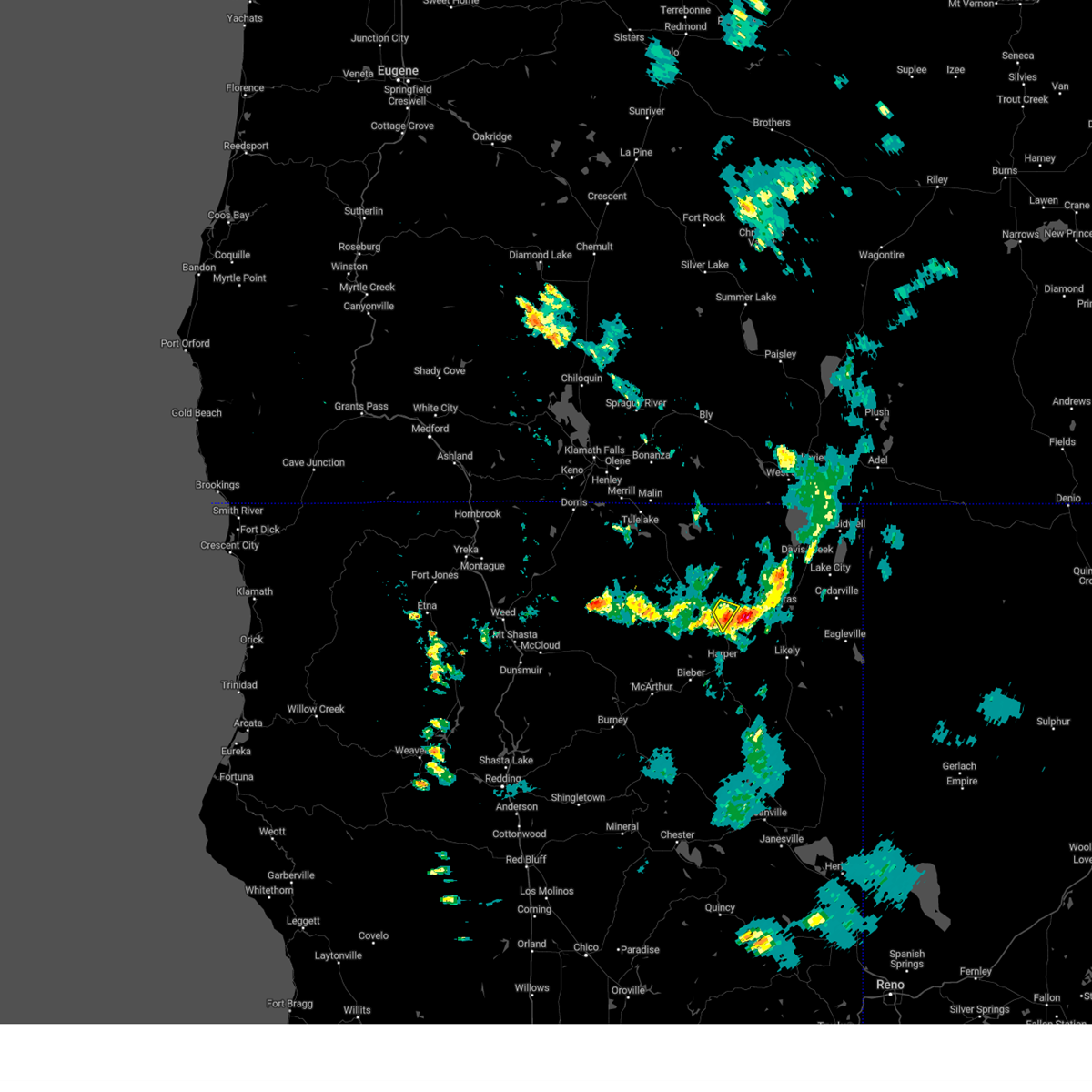
| 6/26/2023 5:55 PM PDT |
 At 554 pm pdt, a severe thunderstorm was located over canby, or 18 miles west of alturas, moving southeast at 10 mph (radar indicated). Hazards include 60 mph wind gusts and quarter size hail. Hail damage to vehicles is expected. expect wind damage to roofs, siding, and trees. locations impacted include, howards gulch campground and canby. hail threat, radar indicated max hail size, 1. 00 in wind threat, radar indicated max wind gust, 60 mph. At 554 pm pdt, a severe thunderstorm was located over canby, or 18 miles west of alturas, moving southeast at 10 mph (radar indicated). Hazards include 60 mph wind gusts and quarter size hail. Hail damage to vehicles is expected. expect wind damage to roofs, siding, and trees. locations impacted include, howards gulch campground and canby. hail threat, radar indicated max hail size, 1. 00 in wind threat, radar indicated max wind gust, 60 mph.
|
| 6/26/2023 5:41 PM PDT |
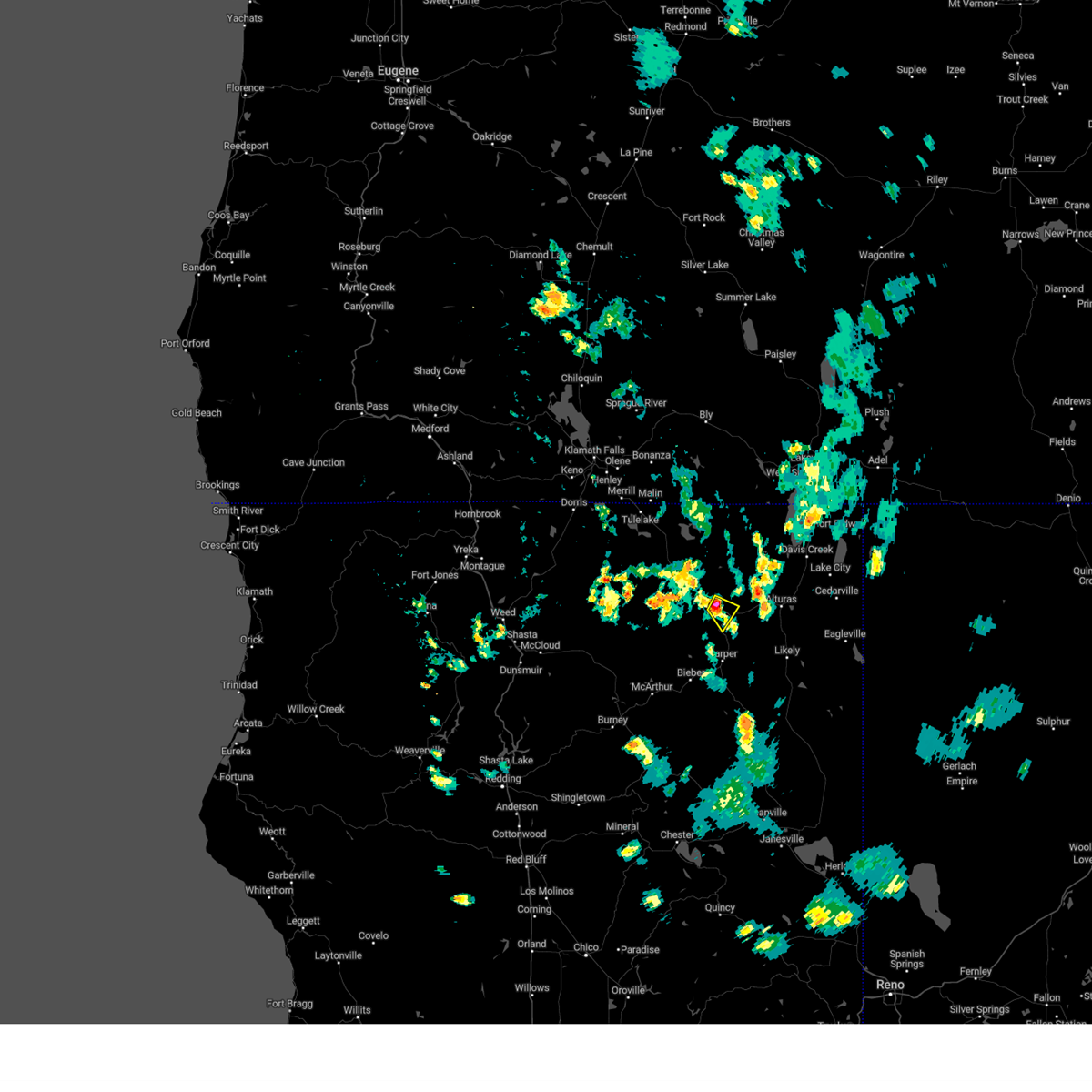 At 541 pm pdt, a severe thunderstorm was located over howards gulch campground, or 20 miles west of alturas, moving southeast at 10 mph (radar indicated). Hazards include 60 mph wind gusts and quarter size hail. Hail damage to vehicles is expected. Expect wind damage to roofs, siding, and trees. At 541 pm pdt, a severe thunderstorm was located over howards gulch campground, or 20 miles west of alturas, moving southeast at 10 mph (radar indicated). Hazards include 60 mph wind gusts and quarter size hail. Hail damage to vehicles is expected. Expect wind damage to roofs, siding, and trees.
|
| 7/24/2017 5:36 PM PDT |
 At 534 pm pdt, a severe thunderstorm was located near lower rush creek campground, or 16 miles southwest of alturas, moving north at 20 mph (radar indicated). Hazards include 60 mph wind gusts and quarter size hail. Hail damage to vehicles is expected. Expect wind damage to roofs, siding, and trees. At 534 pm pdt, a severe thunderstorm was located near lower rush creek campground, or 16 miles southwest of alturas, moving north at 20 mph (radar indicated). Hazards include 60 mph wind gusts and quarter size hail. Hail damage to vehicles is expected. Expect wind damage to roofs, siding, and trees.
|
| 7/24/2017 5:23 PM PDT |
 At 522 pm pdt, a severe thunderstorm was located 7 miles east of lower rush creek campground, or 19 miles southwest of alturas, moving north at 20 mph (radar indicated). Hazards include 60 mph wind gusts and quarter size hail. Hail damage to vehicles is expected. Expect wind damage to roofs, siding, and trees. At 522 pm pdt, a severe thunderstorm was located 7 miles east of lower rush creek campground, or 19 miles southwest of alturas, moving north at 20 mph (radar indicated). Hazards include 60 mph wind gusts and quarter size hail. Hail damage to vehicles is expected. Expect wind damage to roofs, siding, and trees.
|
Hail Maps for Canby, CA
Connect with Interactive Hail Maps