

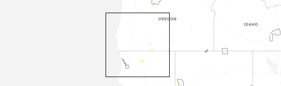
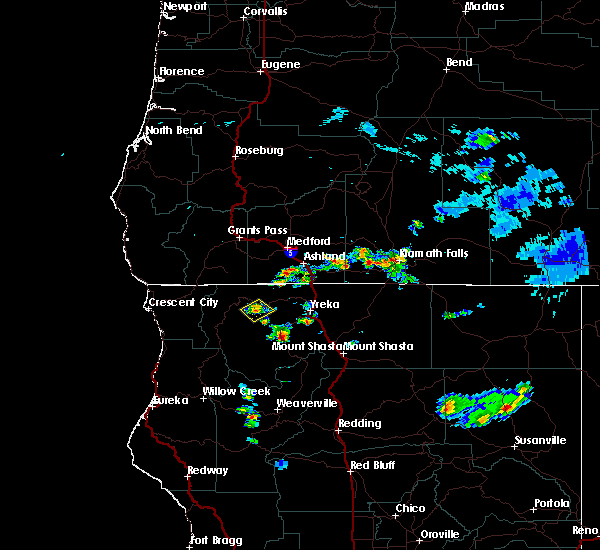
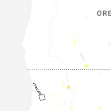
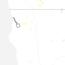
Hail Map for Etna, CA
The Etna, CA area has had 1 report of on-the-ground hail by trained spotters, and has been under severe weather warnings 4 times during the past 12 months. Doppler radar has detected hail at or near Etna, CA on 6 occasions, including 2 occasions during the past year.
| Name: | Etna, CA |
| Where Located: | 59.7 miles S of Medford, OR |
| Map: | Google Map for Etna, CA |
| Population: | 737 |
| Housing Units: | 359 |
| More Info: | Search Google for Etna, CA |
0
The Top Recent Hail Date for Etna, CA is Tuesday, July 1, 2025 (6th out of 6)
Hail and Wind Damage Spotted near Etna, CA
| Date / Time | Report Details |
|---|---|
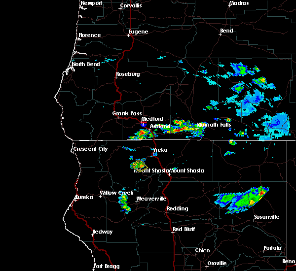
| 7/1/2025 4:41 PM PDT | the severe thunderstorm warning has been cancelled and is no longer in effect |
| 7/1/2025 4:30 PM PDT |
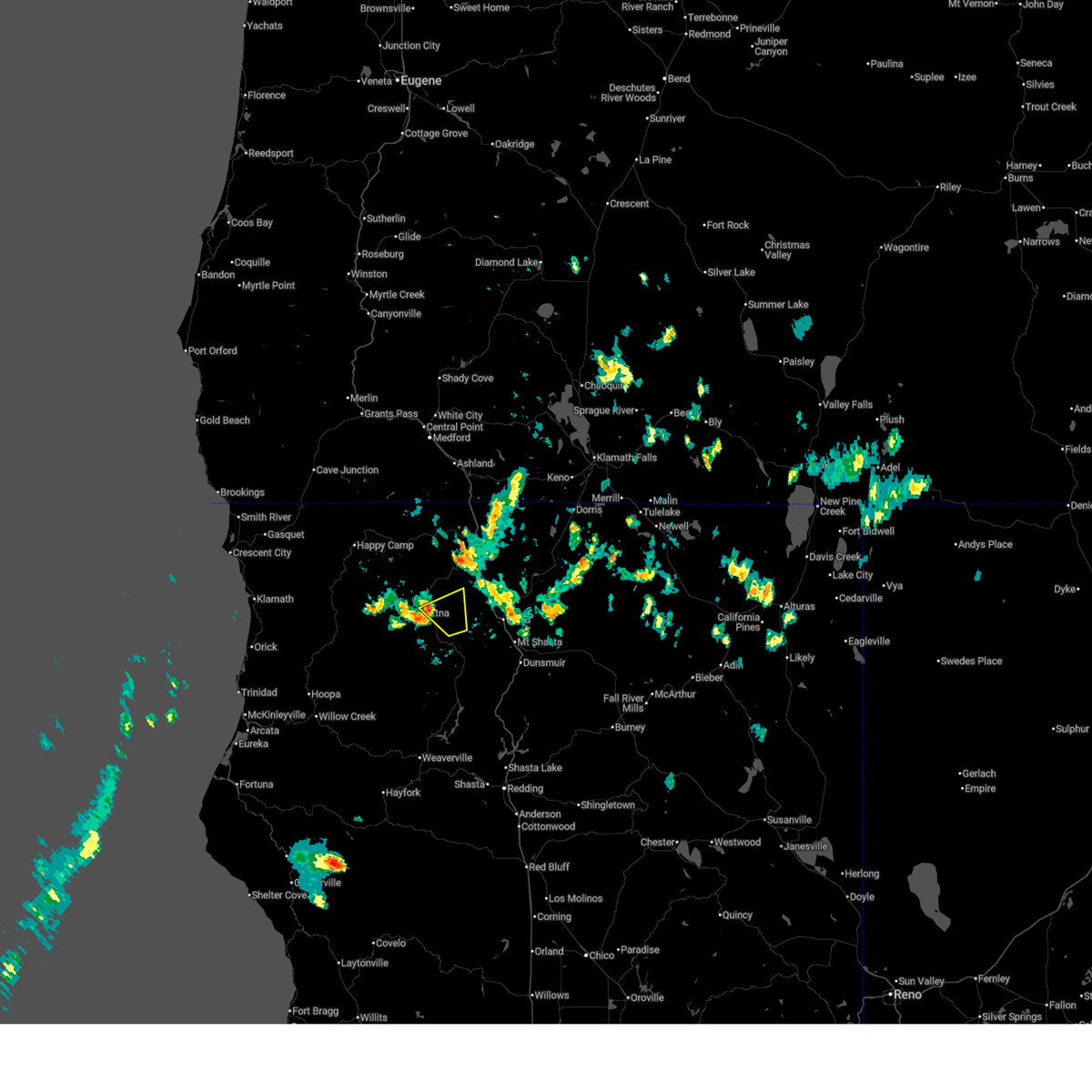
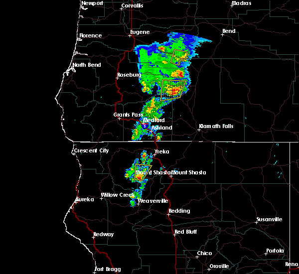
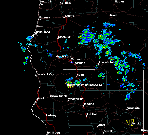
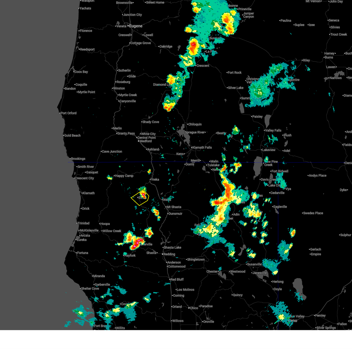 Svrmfr the national weather service in medford has issued a * severe thunderstorm warning for, central siskiyou county in northern california, * until 530 pm pdt. * at 430 pm pdt, a severe thunderstorm was located near etna, or 17 miles southwest of yreka, moving southwest at 10 mph (radar indicated). Hazards include 60 mph wind gusts and quarter size hail. Hail damage to vehicles is expected. Expect wind damage to roofs, siding, and trees. Svrmfr the national weather service in medford has issued a * severe thunderstorm warning for, central siskiyou county in northern california, * until 530 pm pdt. * at 430 pm pdt, a severe thunderstorm was located near etna, or 17 miles southwest of yreka, moving southwest at 10 mph (radar indicated). Hazards include 60 mph wind gusts and quarter size hail. Hail damage to vehicles is expected. Expect wind damage to roofs, siding, and trees.
|
| 6/30/2025 5:25 PM PDT |
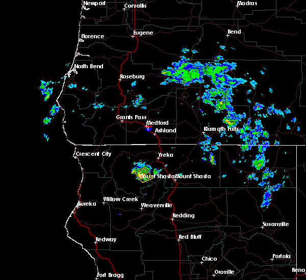
 The storm which prompted the warning has weakened below severe limits, and no longer poses an immediate threat to life or property. therefore, the warning will be allowed to expire. however small hail up to nickle size and gusty winds to around 40 mph are still possible with this thunderstorm. The storm which prompted the warning has weakened below severe limits, and no longer poses an immediate threat to life or property. therefore, the warning will be allowed to expire. however small hail up to nickle size and gusty winds to around 40 mph are still possible with this thunderstorm.
|
| 6/30/2025 4:44 PM PDT |
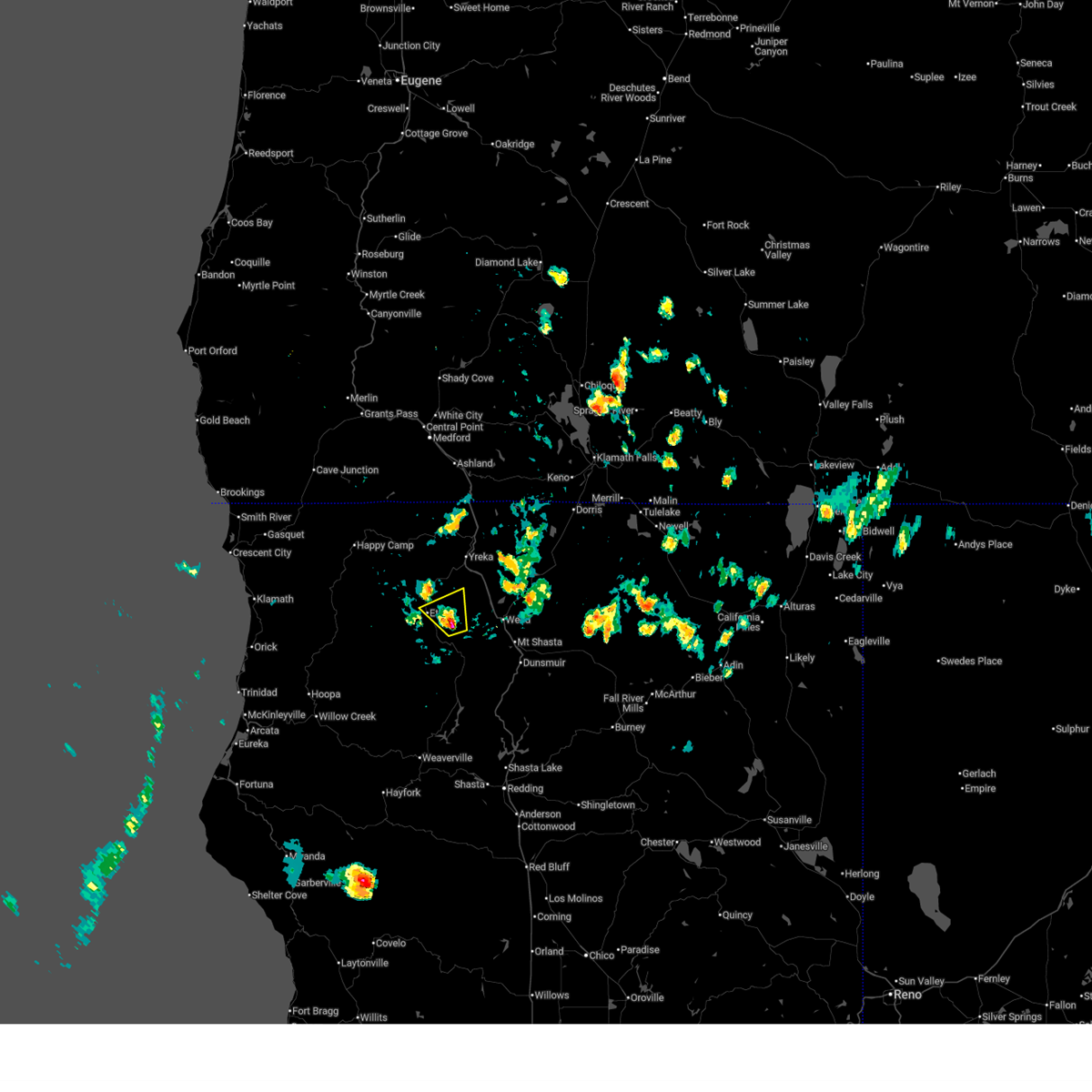 Svrmfr the national weather service in medford has issued a * severe thunderstorm warning for, central siskiyou county in northern california, * until 530 pm pdt. * at 444 pm pdt, a severe thunderstorm was located 8 miles northeast of callahan, or 21 miles west of mount shasta, and is nearly stationary (radar indicated). Hazards include 60 mph wind gusts and quarter size hail. Hail damage to vehicles is expected. Expect wind damage to roofs, siding, and trees. Svrmfr the national weather service in medford has issued a * severe thunderstorm warning for, central siskiyou county in northern california, * until 530 pm pdt. * at 444 pm pdt, a severe thunderstorm was located 8 miles northeast of callahan, or 21 miles west of mount shasta, and is nearly stationary (radar indicated). Hazards include 60 mph wind gusts and quarter size hail. Hail damage to vehicles is expected. Expect wind damage to roofs, siding, and trees.
|
| 8/17/2024 1:20 PM PDT | Public shares picture of a mature tree down in back yard. this tree did not appear to be alive or healthy. no injuries or other property damage associasted with the tre in siskiyou county CA, 0.3 miles WSW of Etna, CA |
| 5/28/2020 9:26 PM PDT | Barn roof blew off and into roadway. eller ln/eastside r in siskiyou county CA, 5.1 miles SSW of Etna, CA |
| 5/4/2017 8:09 PM PDT |
 At 808 pm pdt, a severe thunderstorm was located near callahan, or 23 miles northwest of trinity center, moving north at 25 mph (radar indicated). Hazards include 60 mph wind gusts and quarter size hail. Hail damage to vehicles is possible. Wind damage to roofs, siding, and trees is also possible. At 808 pm pdt, a severe thunderstorm was located near callahan, or 23 miles northwest of trinity center, moving north at 25 mph (radar indicated). Hazards include 60 mph wind gusts and quarter size hail. Hail damage to vehicles is possible. Wind damage to roofs, siding, and trees is also possible.
|
| 5/4/2017 6:17 PM PDT | Quarter sized hail reported 4.3 miles S of Etna, CA, spotter reported hail about the size of nickels. |
| 8/1/2015 6:26 PM PDT |
 The severe thunderstorm warning for central siskiyou county will expire at 630 pm pdt, the severe thunderstorm which prompted the warning has weakened. therefore the warning will be allowed to expire. The severe thunderstorm warning for central siskiyou county will expire at 630 pm pdt, the severe thunderstorm which prompted the warning has weakened. therefore the warning will be allowed to expire.
|
| 8/1/2015 5:56 PM PDT |
 At 555 pm pdt, doppler radar indicated a severe thunderstorm capable of producing quarter size hail. this storm was located near callahan, or 27 miles north of trinity center, and moving northwest at 10 mph. At 555 pm pdt, doppler radar indicated a severe thunderstorm capable of producing quarter size hail. this storm was located near callahan, or 27 miles north of trinity center, and moving northwest at 10 mph.
|
| 7/5/2015 4:37 PM PDT |
 The severe thunderstorm warning for central siskiyou county will expire at 445 pm pdt, the severe thunderstorm which prompted the warning has weakened. therefore the warning will be allowed to expire. The severe thunderstorm warning for central siskiyou county will expire at 445 pm pdt, the severe thunderstorm which prompted the warning has weakened. therefore the warning will be allowed to expire.
|
| 7/5/2015 4:12 PM PDT |
 At 412 pm pdt, doppler radar indicated a severe thunderstorm capable of producing quarter size hail. this storm was located over etna, or 22 miles southwest of yreka. this storm was nearly stationary. At 412 pm pdt, doppler radar indicated a severe thunderstorm capable of producing quarter size hail. this storm was located over etna, or 22 miles southwest of yreka. this storm was nearly stationary.
|
Hail Maps for Etna, CA


Connect with Interactive Hail Maps