

Hail Map for Indian Falls, CA
The Indian Falls, CA area has had 0 reports of on-the-ground hail by trained spotters, and has been under severe weather warnings 1 time during the past 12 months. Doppler radar has detected hail at or near Indian Falls, CA on 3 occasions, including 1 occasion during the past year.
| Name: | Indian Falls, CA |
| Where Located: | 71.9 miles WNW of Reno, NV |
| Map: | Google Map for Indian Falls, CA |
| Population: | 54 |
| Housing Units: | 33 |
| More Info: | Search Google for Indian Falls, CA |
0
The Top Recent Hail Date for Indian Falls, CA is Monday, June 9, 2025 (3rd out of 3)
Hail and Wind Damage Spotted near Indian Falls, CA
| Date / Time | Report Details |
|---|---|
| 7/25/2025 3:27 PM PDT |
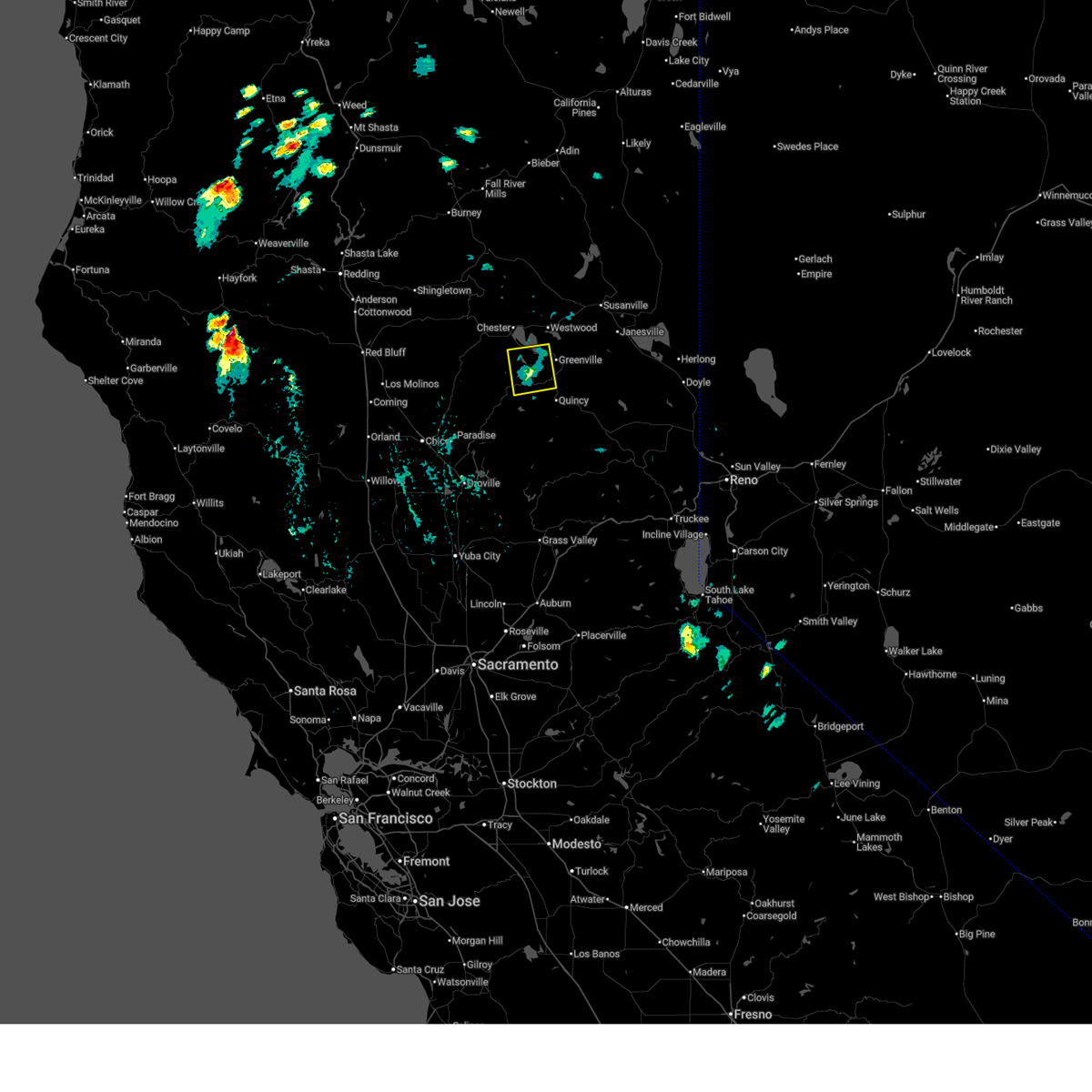 Svrsto the national weather service in sacramento has issued a * severe thunderstorm warning for, central plumas county in northern california, * until 400 pm pdt. * at 327 pm pdt, a severe thunderstorm was located over seneca, or 12 miles northwest of quincy, and is nearly stationary (radar indicated). Hazards include ping pong ball size hail. People and animals outdoors will be injured. Expect damage to roofs, siding, windows, and vehicles. Svrsto the national weather service in sacramento has issued a * severe thunderstorm warning for, central plumas county in northern california, * until 400 pm pdt. * at 327 pm pdt, a severe thunderstorm was located over seneca, or 12 miles northwest of quincy, and is nearly stationary (radar indicated). Hazards include ping pong ball size hail. People and animals outdoors will be injured. Expect damage to roofs, siding, windows, and vehicles.
|
| 6/11/2023 6:30 PM PDT |
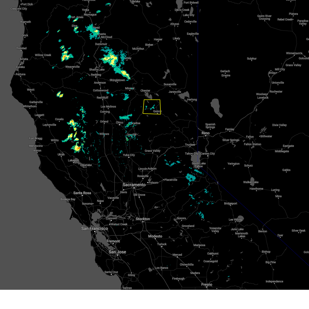 At 630 pm pdt, a severe thunderstorm was located over twain, or 8 miles northwest of quincy, and is nearly stationary (radar indicated). Hazards include half dollar size hail. damage to vehicles is expected At 630 pm pdt, a severe thunderstorm was located over twain, or 8 miles northwest of quincy, and is nearly stationary (radar indicated). Hazards include half dollar size hail. damage to vehicles is expected
|
| 6/5/2016 6:27 PM PDT |
 At 626 pm pdt, doppler radar indicated a severe thunderstorm capable of producing quarter size hail and damaging winds in excess of 60 mph. this storm was located over canyondam, or 9 miles southeast of chester, and moving southwest at 10 mph. At 626 pm pdt, doppler radar indicated a severe thunderstorm capable of producing quarter size hail and damaging winds in excess of 60 mph. this storm was located over canyondam, or 9 miles southeast of chester, and moving southwest at 10 mph.
|
Hail Maps for Indian Falls, CA

Connect with Interactive Hail Maps