

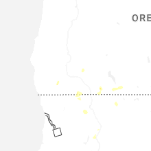
Hail Map for Shady Cove, OR
The Shady Cove, OR area has had 0 reports of on-the-ground hail by trained spotters, and has been under severe weather warnings 2 times during the past 12 months. Doppler radar has detected hail at or near Shady Cove, OR on 5 occasions, including 1 occasion during the past year.
| Name: | Shady Cove, OR |
| Where Located: | 20 miles N of Medford, OR |
| Map: | Google Map for Shady Cove, OR |
| Population: | 2904 |
| Housing Units: | 1459 |
| More Info: | Search Google for Shady Cove, OR |
2
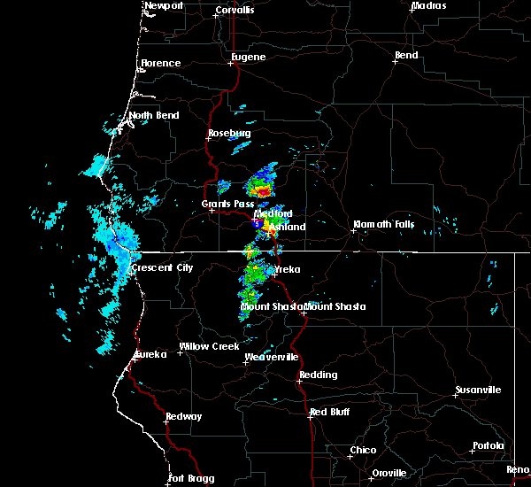
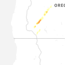
The Top Recent Hail Date for Shady Cove, OR is Thursday, July 31, 2025 (2nd out of 5)

Hail and Wind Damage Spotted near Shady Cove, OR
| Date / Time | Report Details |
|---|---|
| 7/31/2025 4:32 PM PDT |
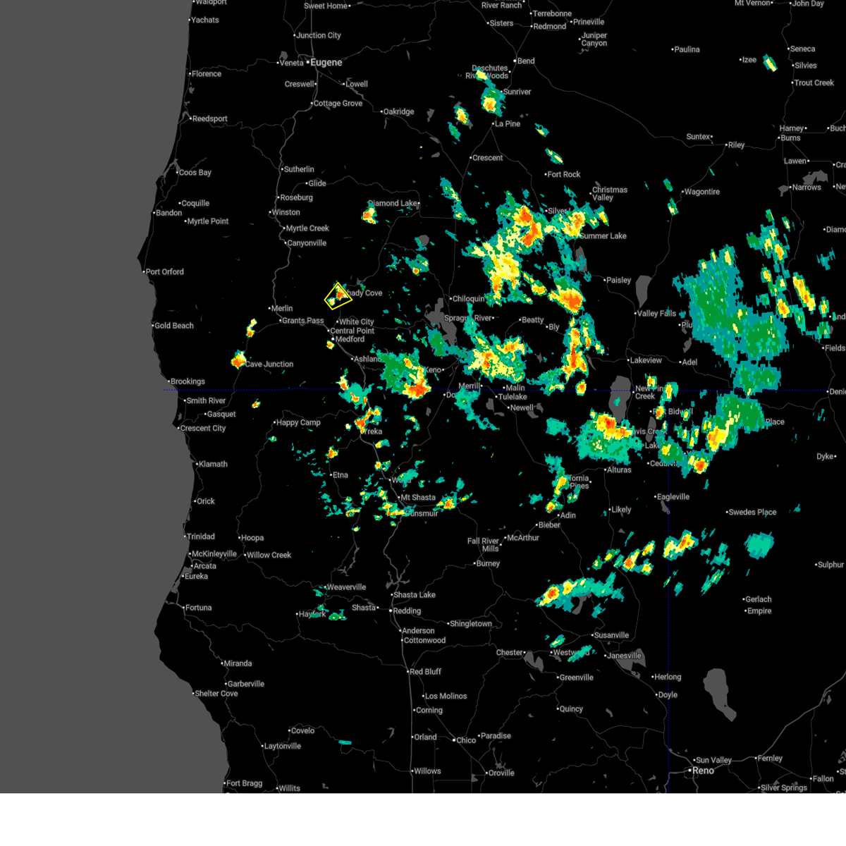
 the severe thunderstorm warning has been cancelled and is no longer in effect the severe thunderstorm warning has been cancelled and is no longer in effect
|
| 7/31/2025 3:59 PM PDT |
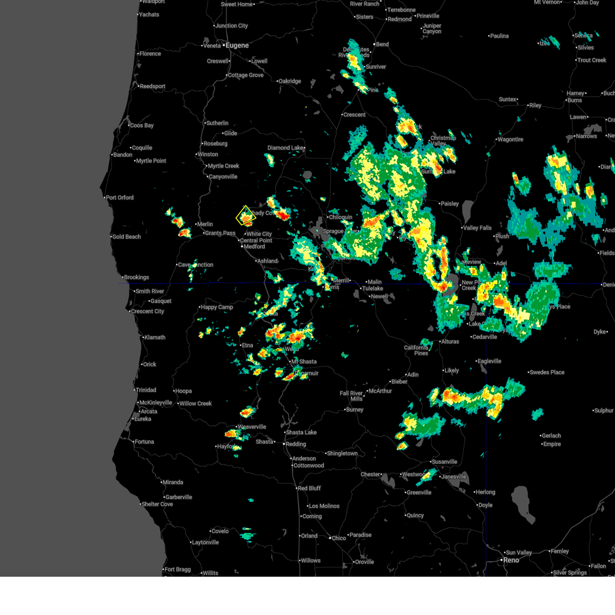
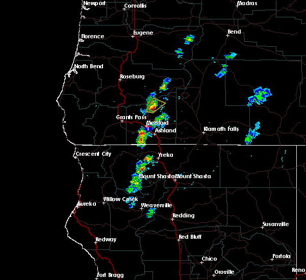
 Svrmfr the national weather service in medford has issued a * severe thunderstorm warning for, central jackson county in southwestern oregon, * until 445 pm pdt. * at 359 pm pdt, a severe thunderstorm was located over shady cove, or 17 miles north of medford, moving northeast at 5 mph (radar indicated). Hazards include 60 mph wind gusts and quarter size hail. Hail damage to vehicles is expected. Expect wind damage to roofs, siding, and trees. Svrmfr the national weather service in medford has issued a * severe thunderstorm warning for, central jackson county in southwestern oregon, * until 445 pm pdt. * at 359 pm pdt, a severe thunderstorm was located over shady cove, or 17 miles north of medford, moving northeast at 5 mph (radar indicated). Hazards include 60 mph wind gusts and quarter size hail. Hail damage to vehicles is expected. Expect wind damage to roofs, siding, and trees.
|
| 8/17/2024 1:20 PM PDT | Facebook post contains image of a downed tree. narrow trunk... maybe 4-6 inches. at least 20 feet tal in jackson county OR, 0.2 miles E of Shady Cove, OR |
| 6/11/2020 6:23 PM PDT |
 At 623 pm pdt, a severe thunderstorm was located over rogue elk park, or 22 miles north of medford, moving north at 35 mph (radar indicated). Hazards include 60 mph wind gusts and quarter size hail. Hail damage to vehicles is expected. Expect wind damage to roofs, siding, and trees. At 623 pm pdt, a severe thunderstorm was located over rogue elk park, or 22 miles north of medford, moving north at 35 mph (radar indicated). Hazards include 60 mph wind gusts and quarter size hail. Hail damage to vehicles is expected. Expect wind damage to roofs, siding, and trees.
|
| 5/4/2017 6:15 PM PDT |
 At 614 pm pdt, a severe thunderstorm was located over rogue elk park near trail, or 22 miles north of medford, moving northeast at 20 mph (radar indicated). Hazards include 60 mph wind gusts and quarter size hail. Hail damage to vehicles is possible. Wind damage to roofs, siding, and trees is possible. At 614 pm pdt, a severe thunderstorm was located over rogue elk park near trail, or 22 miles north of medford, moving northeast at 20 mph (radar indicated). Hazards include 60 mph wind gusts and quarter size hail. Hail damage to vehicles is possible. Wind damage to roofs, siding, and trees is possible.
|
Hail Maps for Shady Cove, OR


Connect with Interactive Hail Maps