

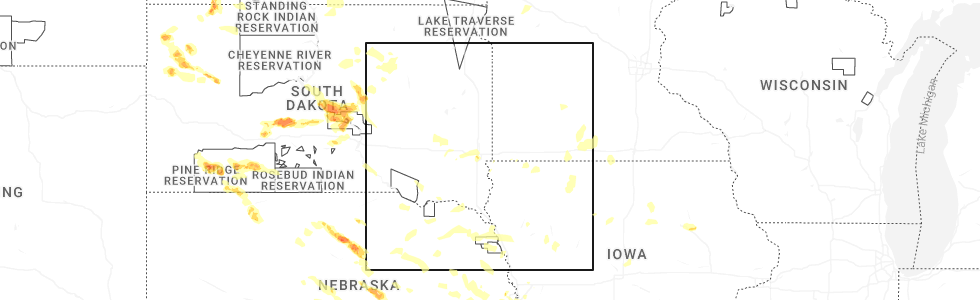
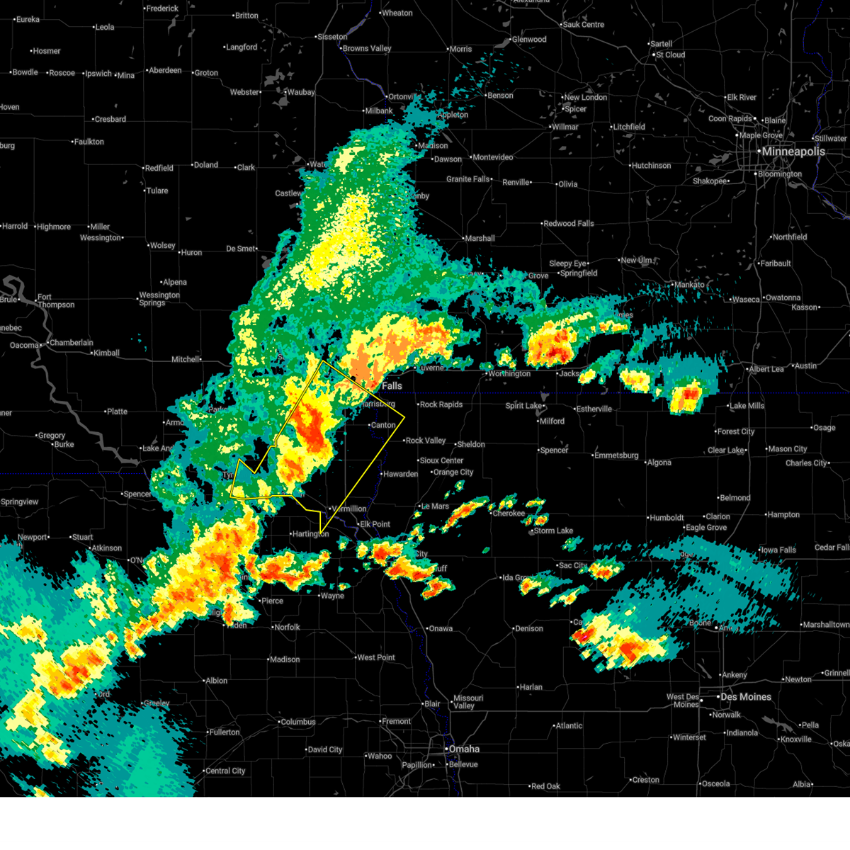
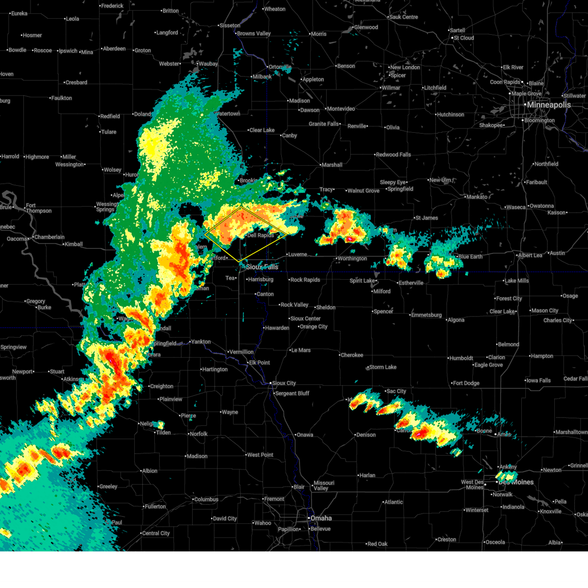
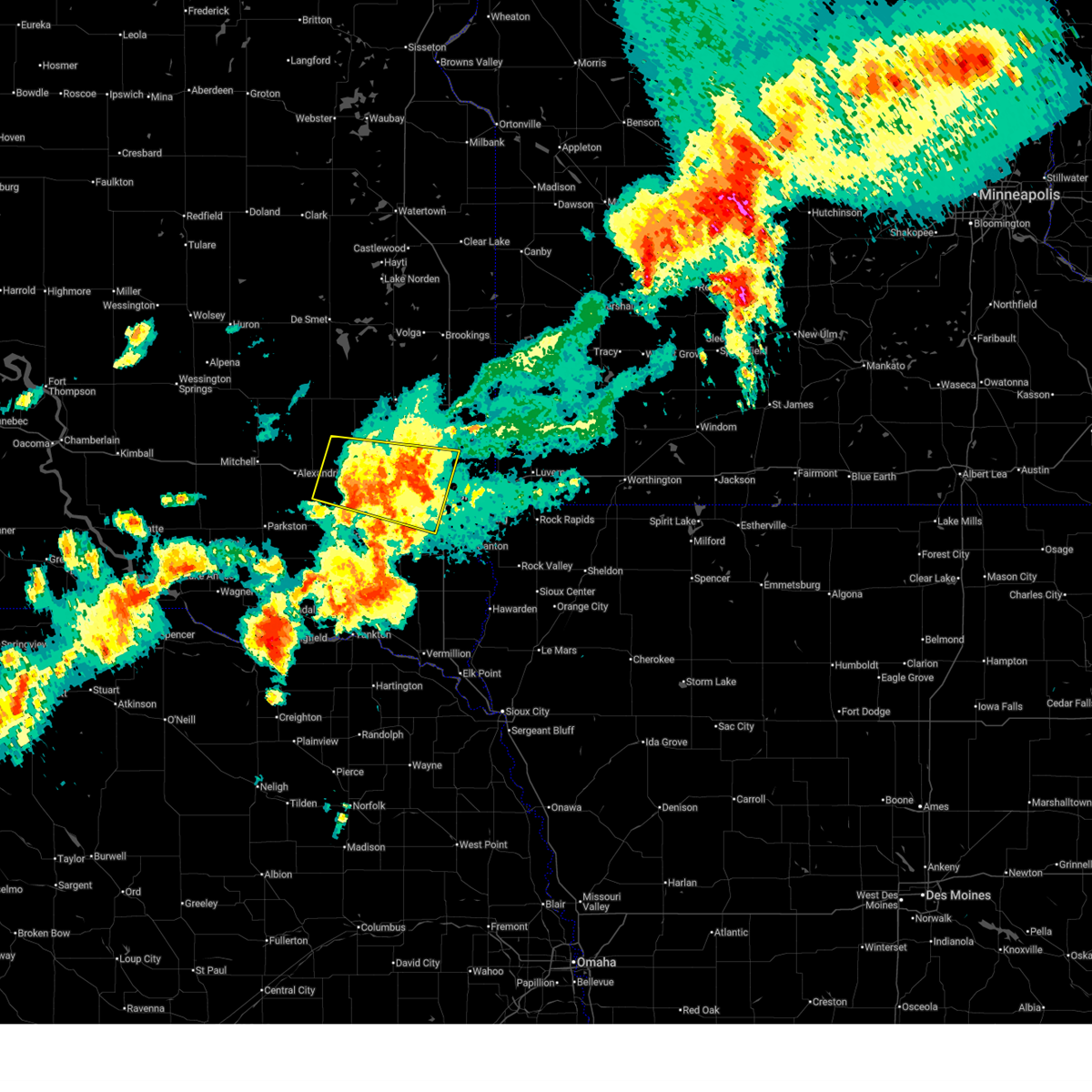
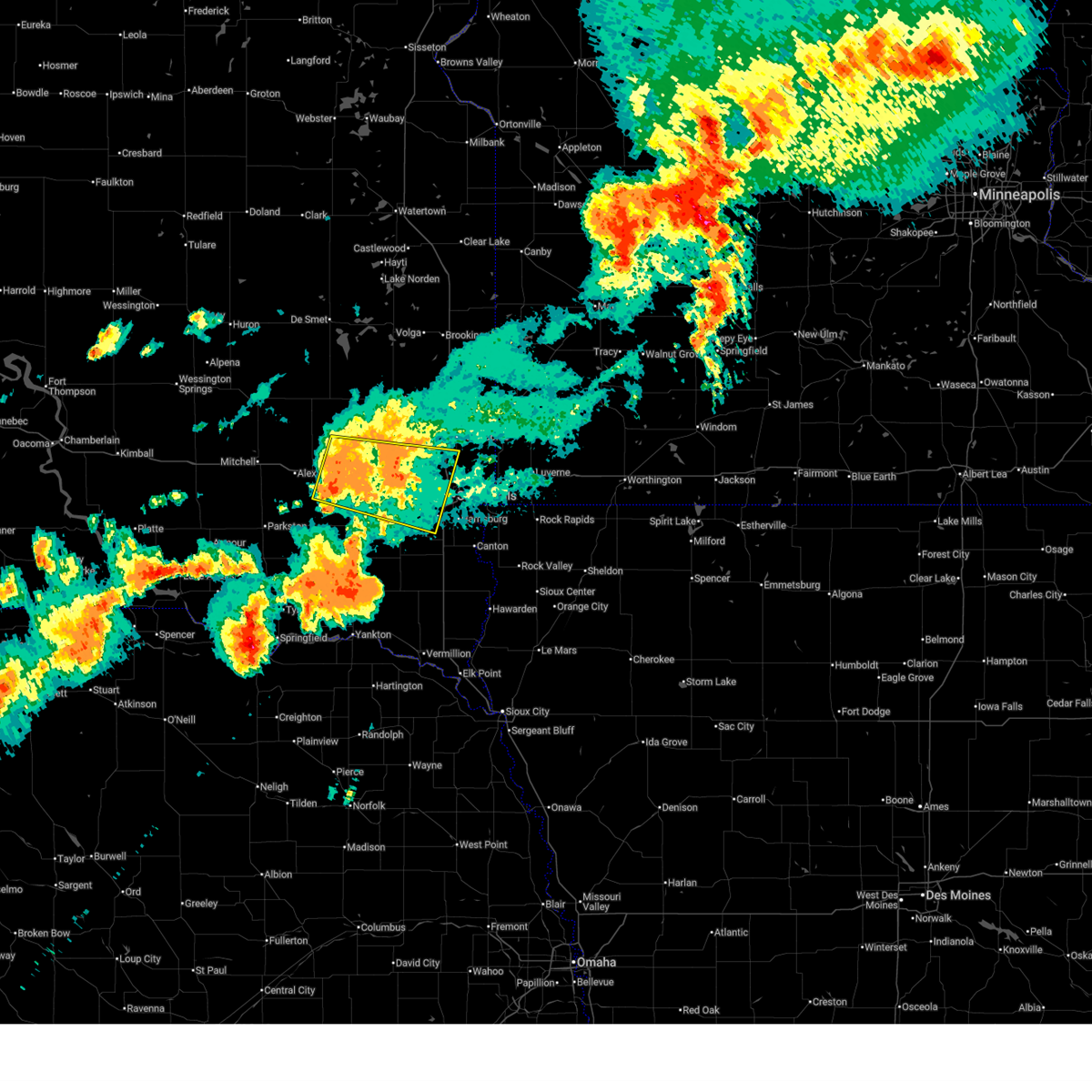
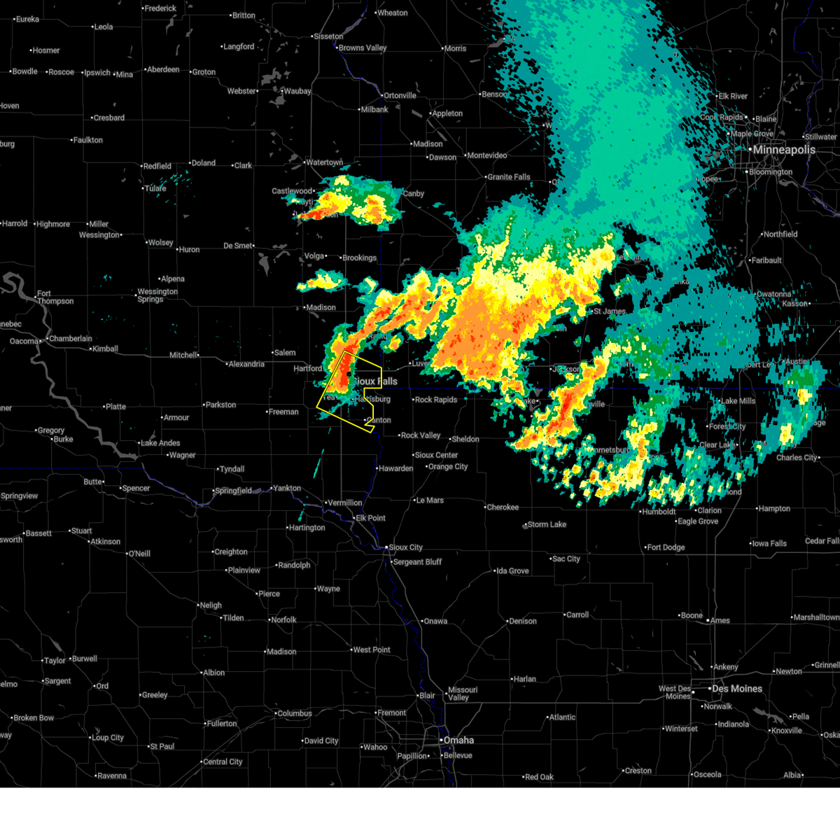
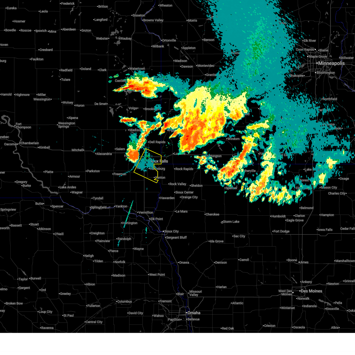
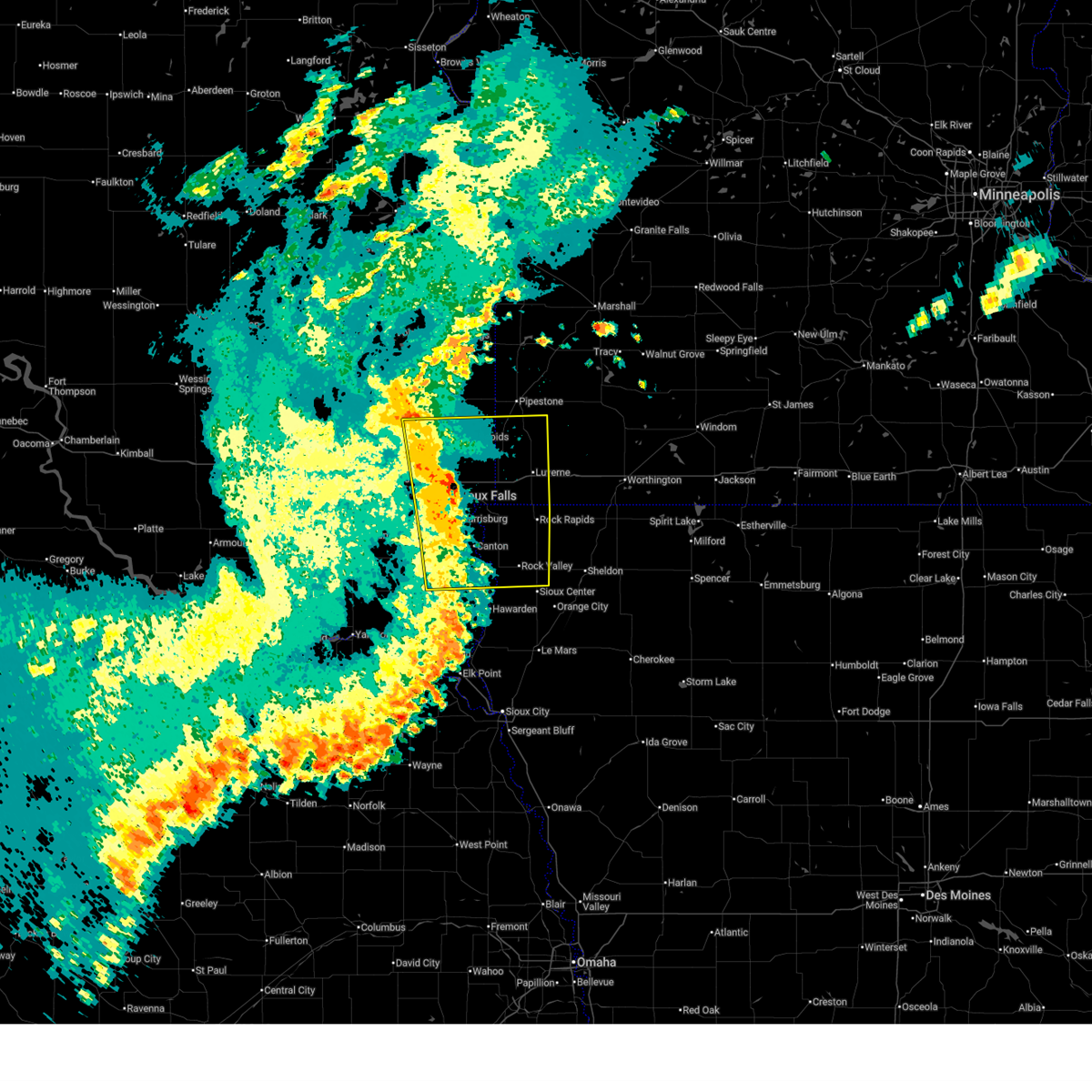
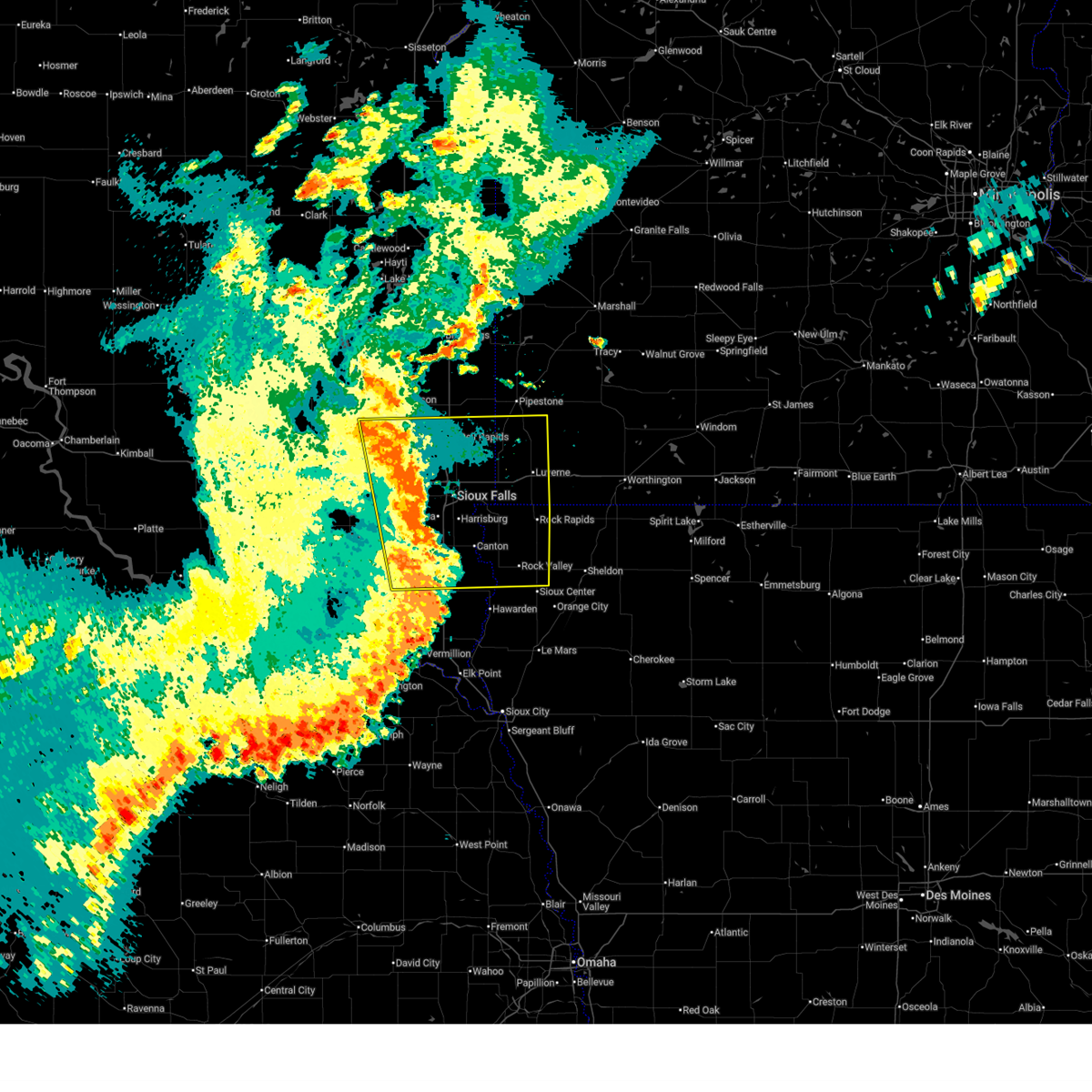
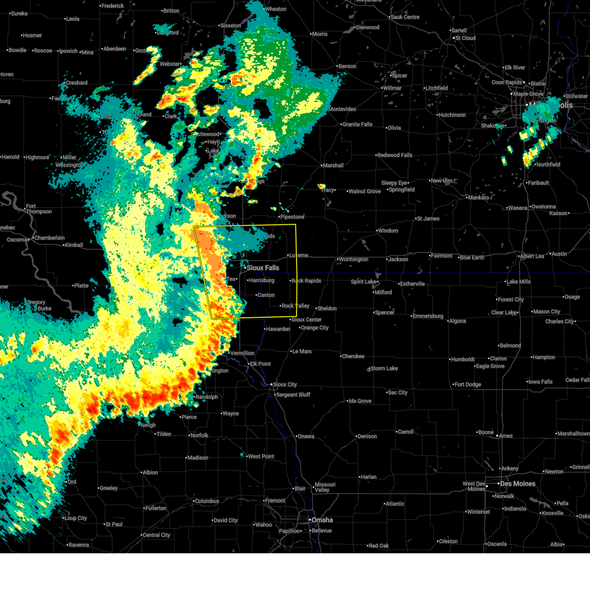
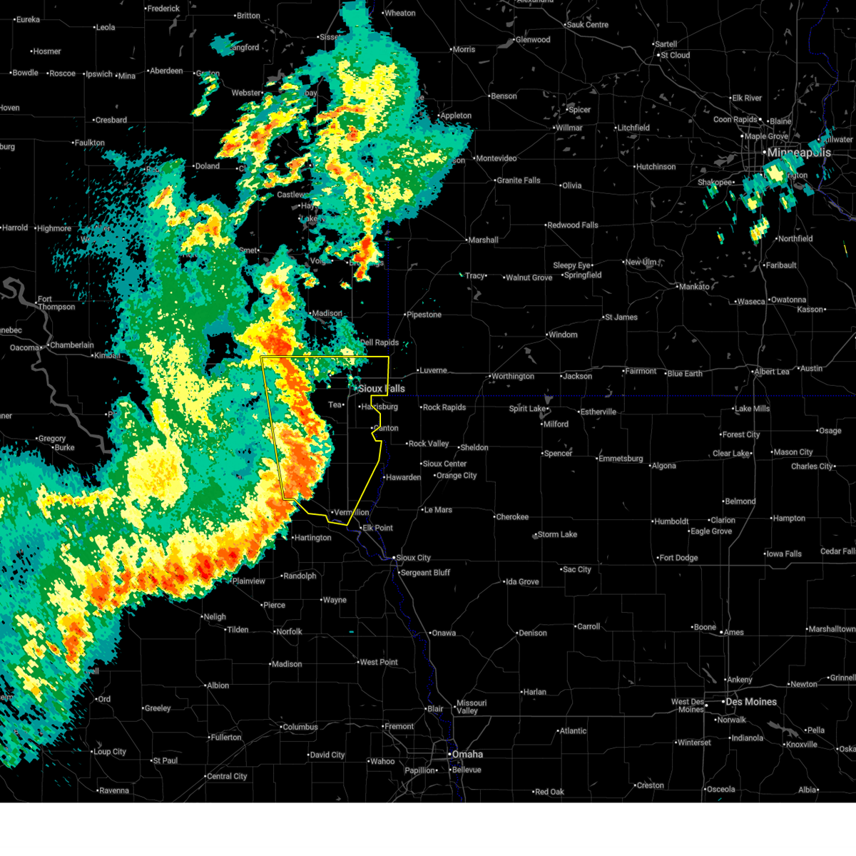
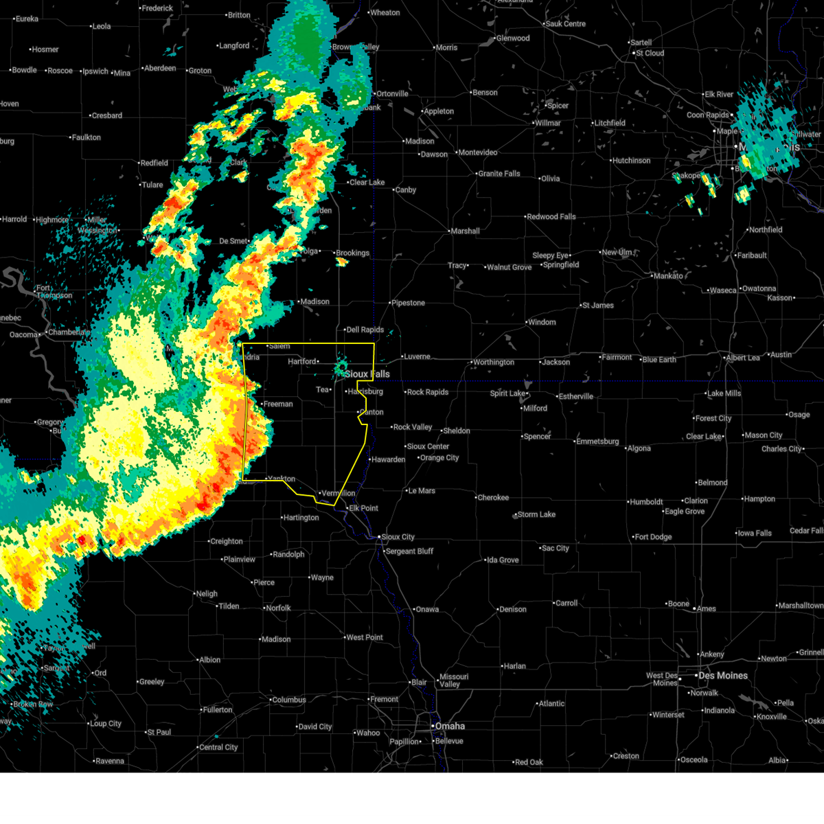
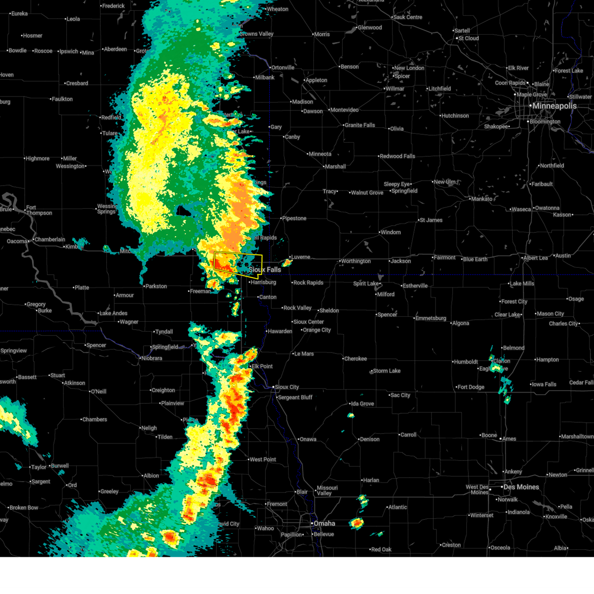
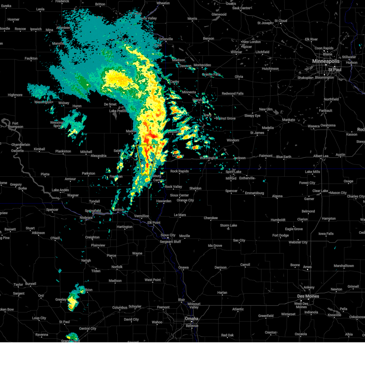
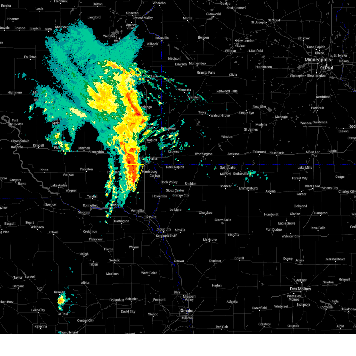
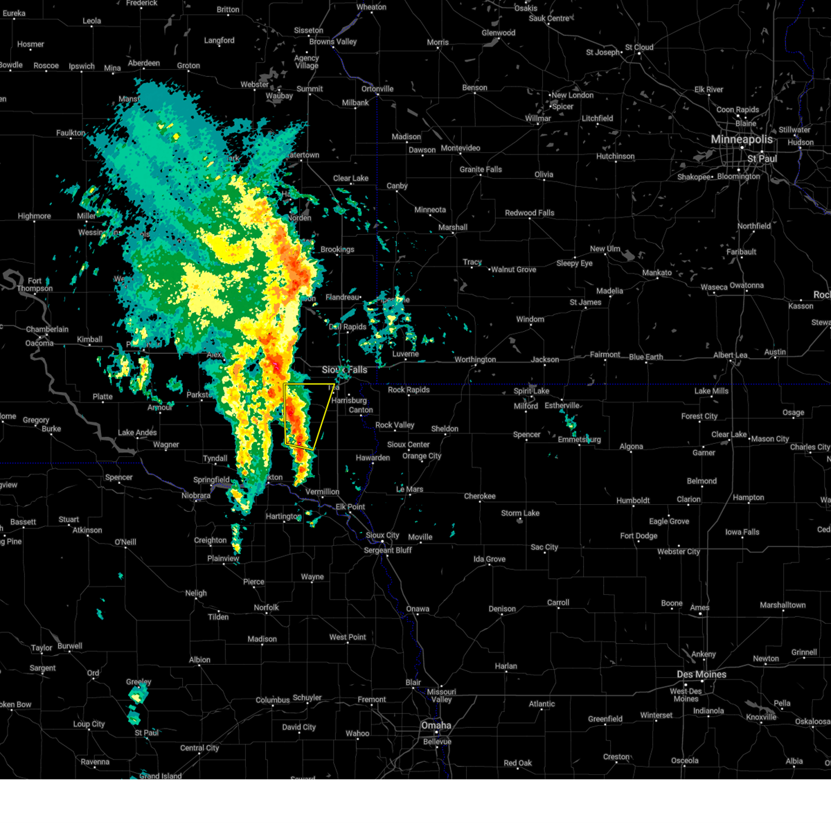
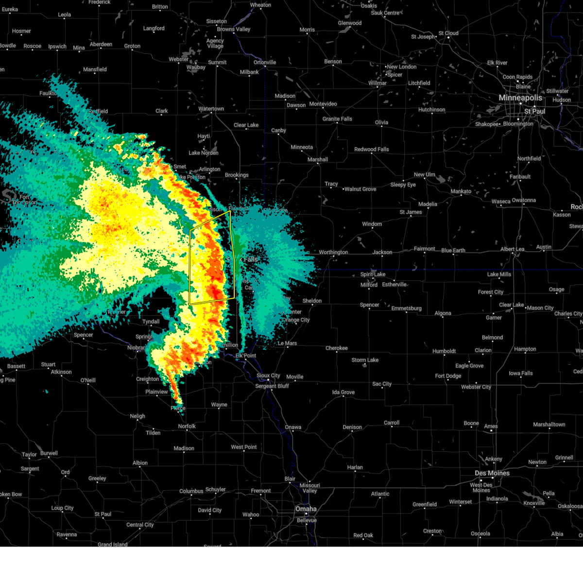
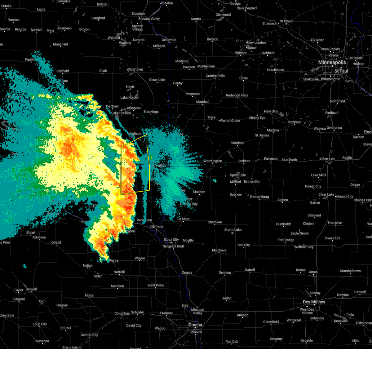
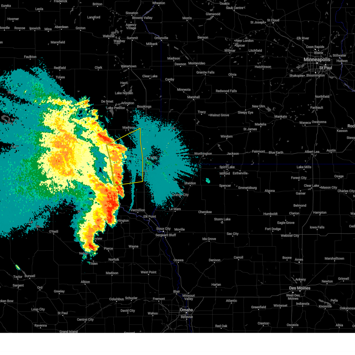
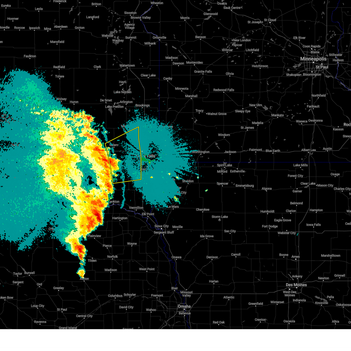
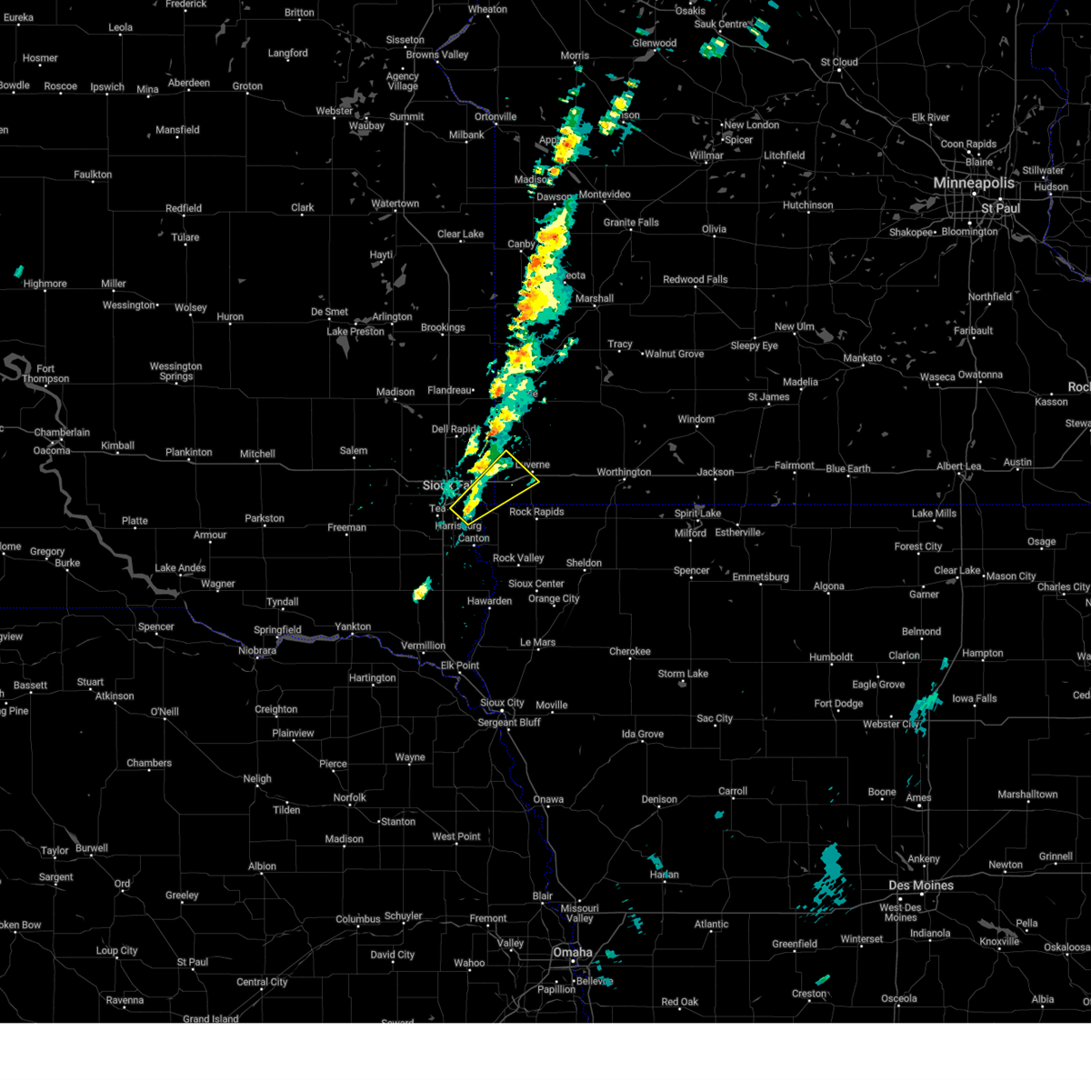
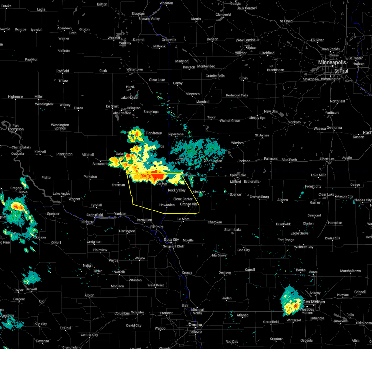
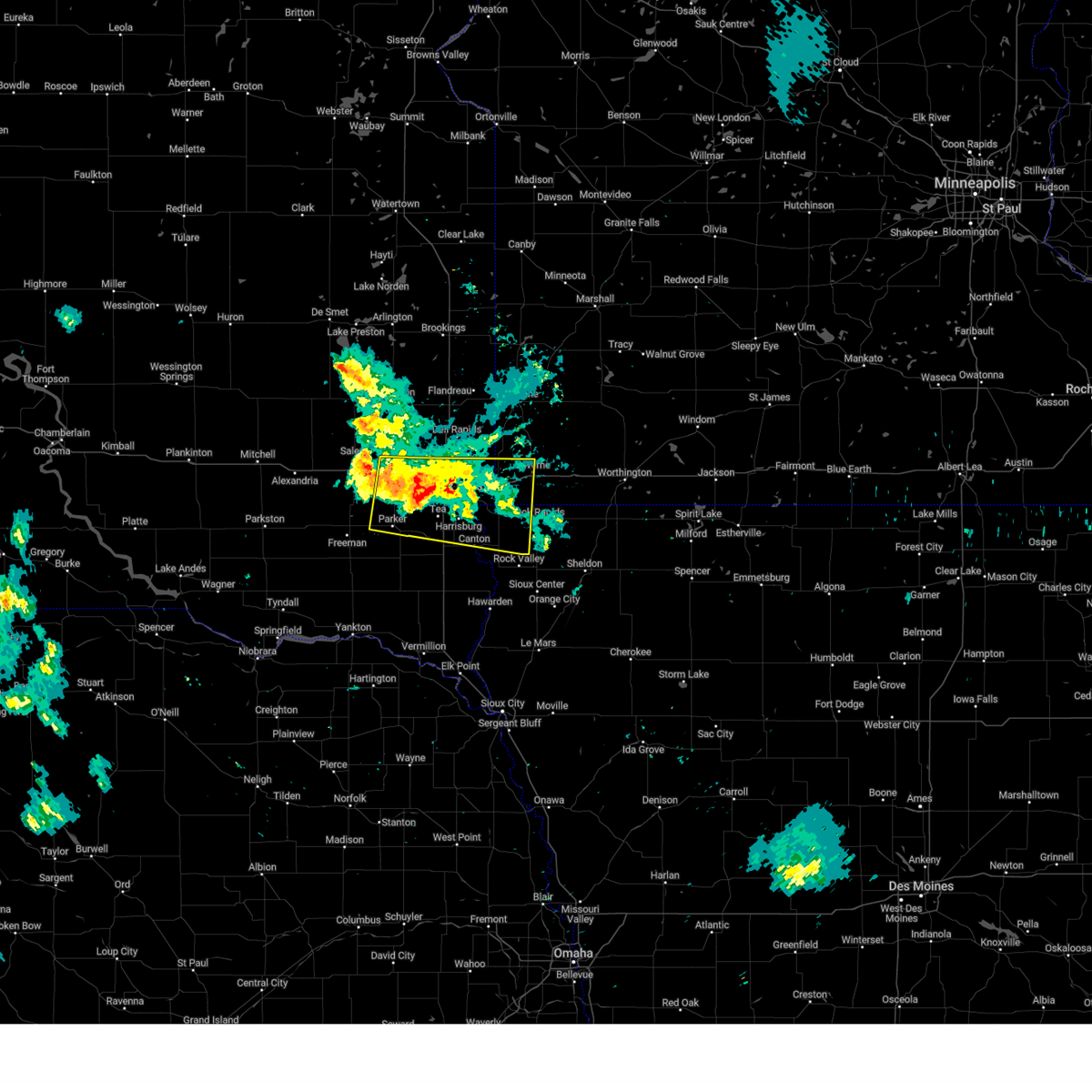
Hail Map for Sioux Falls, SD
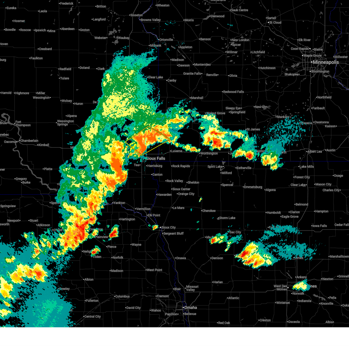
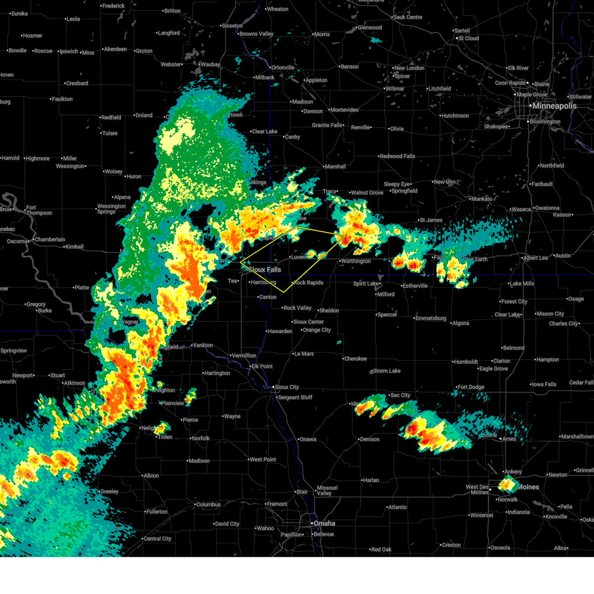
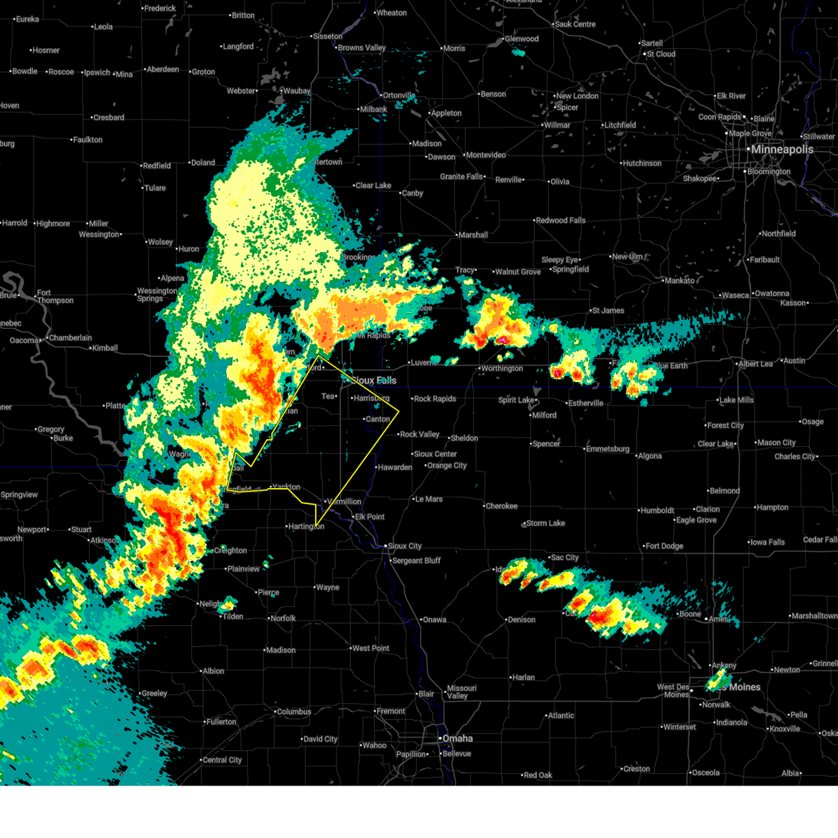
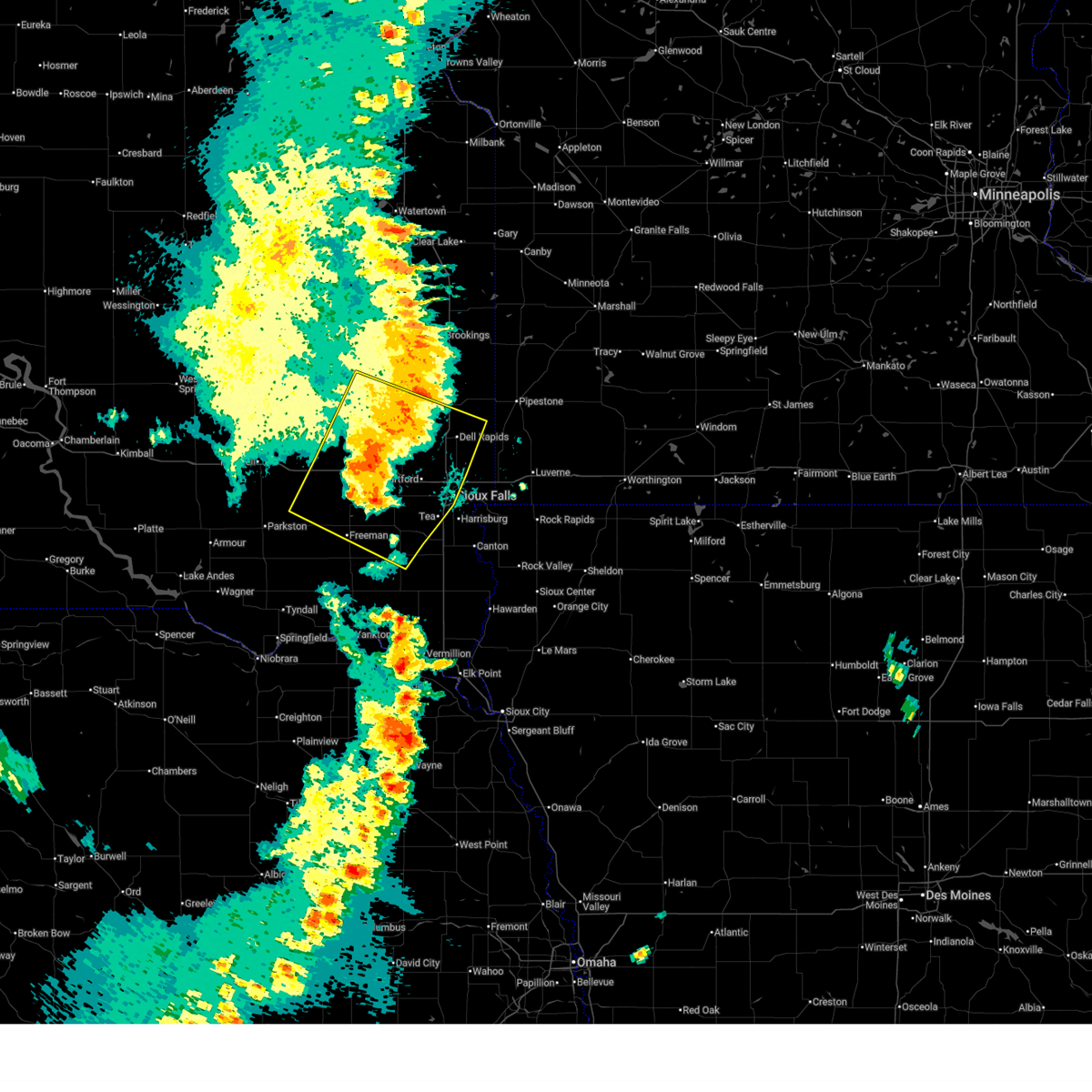
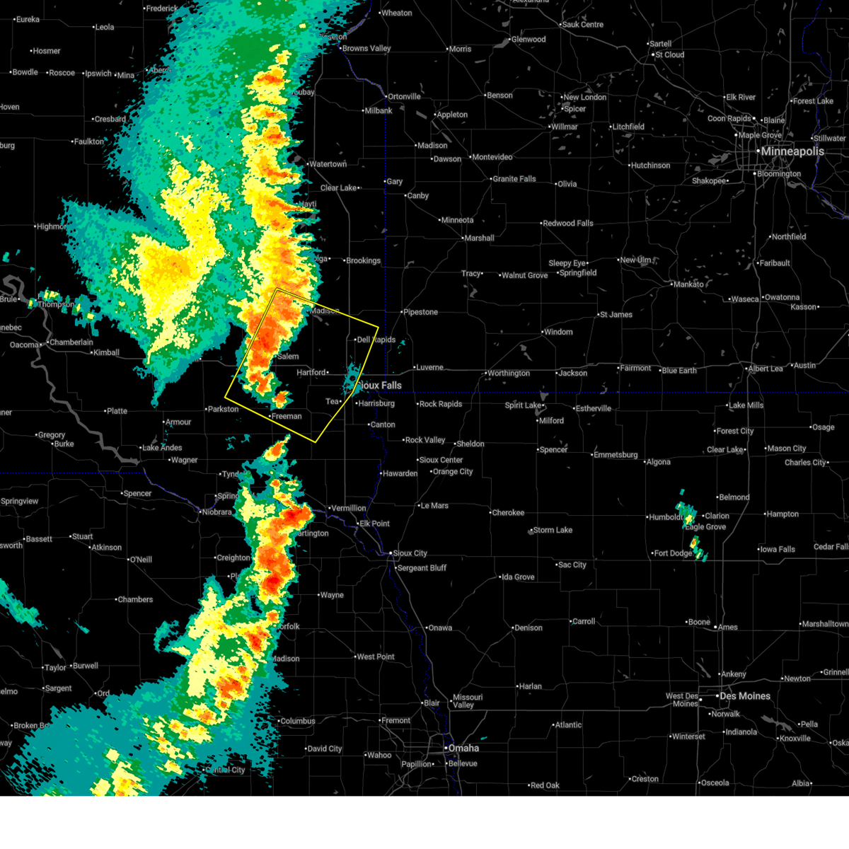
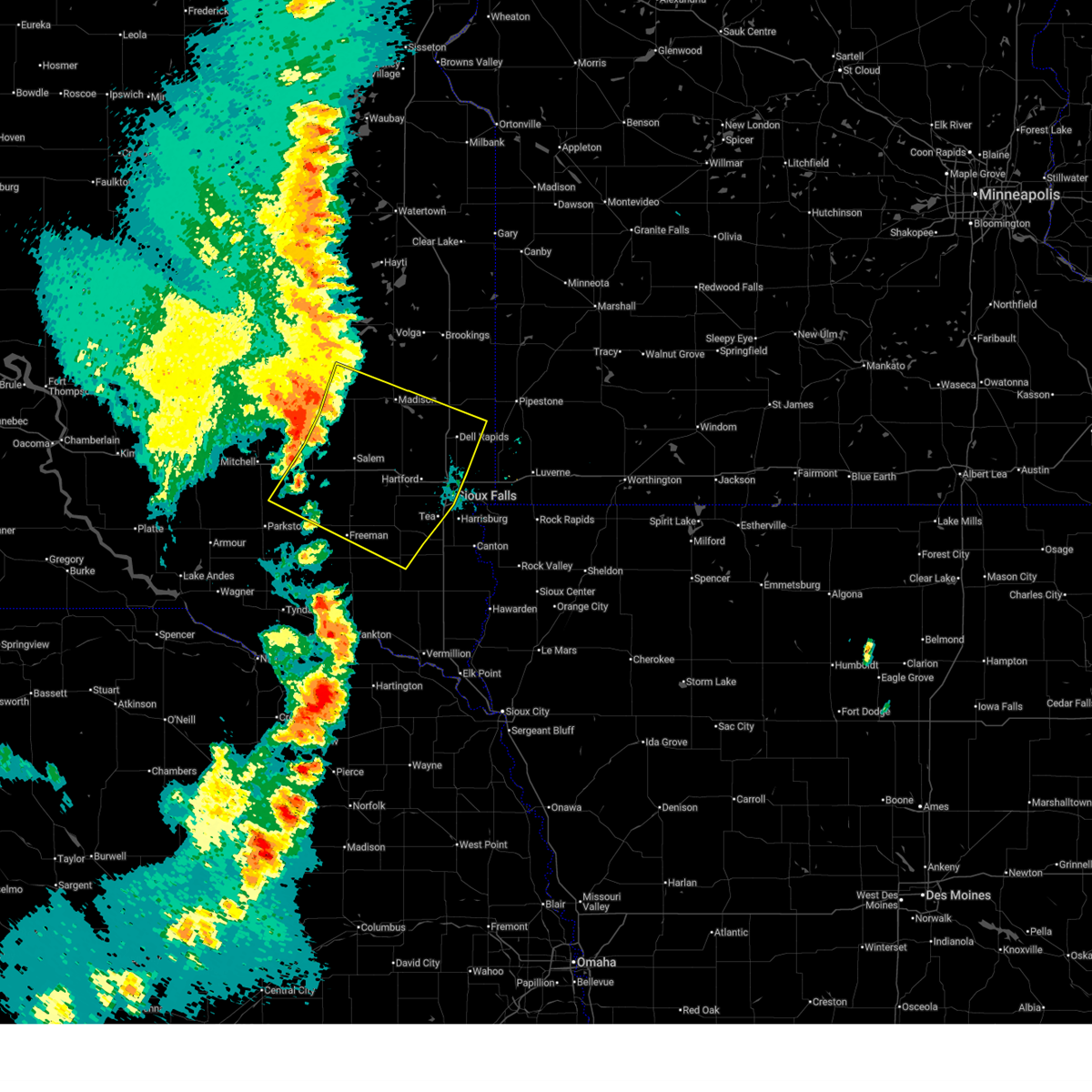
The Sioux Falls, SD area has had 69 reports of on-the-ground hail by trained spotters, and has been under severe weather warnings 49 times during the past 12 months. Doppler radar has detected hail at or near Sioux Falls, SD on 47 occasions, including 5 occasions during the past year.
| Name: | Sioux Falls, SD |
| Where Located: | 1 miles SE of Sioux Falls, SD |
| Map: | Google Map for Sioux Falls, SD |
| Population: | 153888 |
| Housing Units: | 66283 |
| More Info: | Search Google for Sioux Falls, SD |
1
The Top Recent Hail Date for Sioux Falls, SD is Wednesday, July 9, 2025 (7th out of 47)
Hail and Wind Damage Spotted near Sioux Falls, SD
| Date / Time | Report Details |
|---|---|
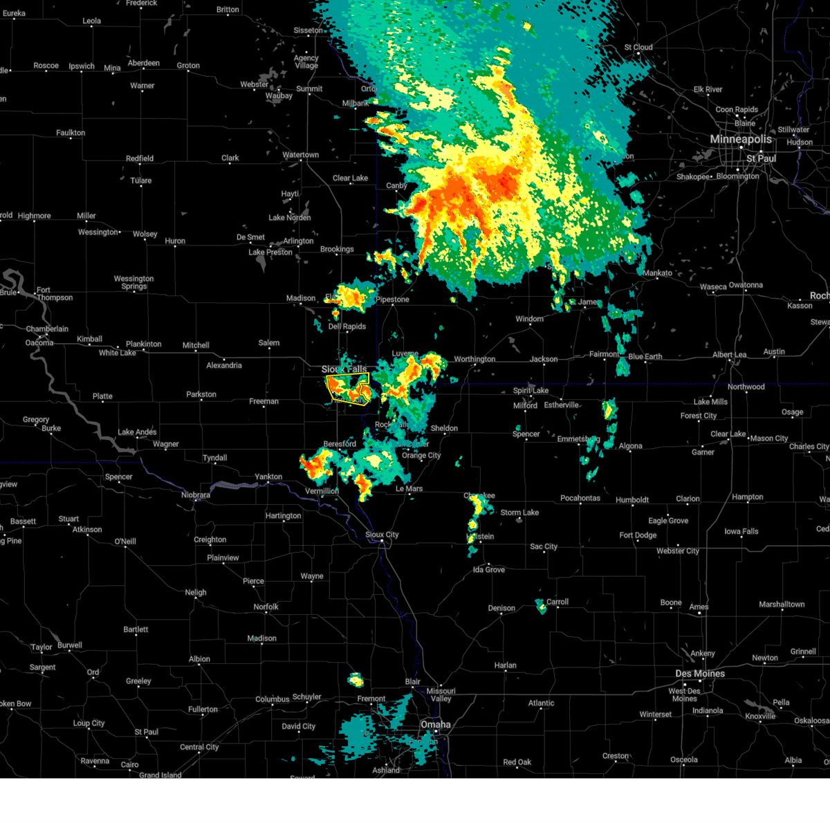
| 7/29/2025 9:02 PM CDT |
 At 902 pm cdt, severe thunderstorms were located along a line extending from 6 miles southwest of fulda to near vermillion, moving southeast at 35 mph (at 8:48 pm cdt an rwis located 4 miles east of irene reported a wind gust of 60 mph). Hazards include 60 mph wind gusts. Expect damage to roofs, siding, and trees. these severe storms will be near, rock rapids, adrian, ellsworth, and rushmore around 905 pm cdt. george around 910 pm cdt. Worthington and little rock around 915 pm cdt. At 902 pm cdt, severe thunderstorms were located along a line extending from 6 miles southwest of fulda to near vermillion, moving southeast at 35 mph (at 8:48 pm cdt an rwis located 4 miles east of irene reported a wind gust of 60 mph). Hazards include 60 mph wind gusts. Expect damage to roofs, siding, and trees. these severe storms will be near, rock rapids, adrian, ellsworth, and rushmore around 905 pm cdt. george around 910 pm cdt. Worthington and little rock around 915 pm cdt.
|
| 7/29/2025 8:56 PM CDT |
 Svrfsd the national weather service in sioux falls has issued a * severe thunderstorm warning for, lyon county in northwestern iowa, northern sioux county in northwestern iowa, northwestern osceola county in northwestern iowa, nobles county in southwestern minnesota, rock county in southwestern minnesota, southeastern pipestone county in southwestern minnesota, southwestern murray county in southwestern minnesota, southeastern yankton county in southeastern south dakota, clay county in southeastern south dakota, southeastern minnehaha county in southeastern south dakota, central lincoln county in southeastern south dakota, southeastern turner county in southeastern south dakota, northwestern union county in southeastern south dakota, * until 945 pm cdt. * at 856 pm cdt, severe thunderstorms were located along a line extending from 6 miles northeast of wilmont to near meckling, moving southeast at 35 mph (radar indicated). Hazards include 60 mph wind gusts. Expect damage to roofs, siding, and trees. severe thunderstorms will be near, rock rapids, adrian, ellsworth, and wilmont around 900 pm cdt. rushmore around 905 pm cdt. george around 910 pm cdt. Worthington and little rock around 915 pm cdt. Svrfsd the national weather service in sioux falls has issued a * severe thunderstorm warning for, lyon county in northwestern iowa, northern sioux county in northwestern iowa, northwestern osceola county in northwestern iowa, nobles county in southwestern minnesota, rock county in southwestern minnesota, southeastern pipestone county in southwestern minnesota, southwestern murray county in southwestern minnesota, southeastern yankton county in southeastern south dakota, clay county in southeastern south dakota, southeastern minnehaha county in southeastern south dakota, central lincoln county in southeastern south dakota, southeastern turner county in southeastern south dakota, northwestern union county in southeastern south dakota, * until 945 pm cdt. * at 856 pm cdt, severe thunderstorms were located along a line extending from 6 miles northeast of wilmont to near meckling, moving southeast at 35 mph (radar indicated). Hazards include 60 mph wind gusts. Expect damage to roofs, siding, and trees. severe thunderstorms will be near, rock rapids, adrian, ellsworth, and wilmont around 900 pm cdt. rushmore around 905 pm cdt. george around 910 pm cdt. Worthington and little rock around 915 pm cdt.
|
| 7/29/2025 8:43 PM CDT |
 At 843 pm cdt, severe thunderstorms were located along a line extending from near ellsworth to near worthing, moving south at 30 mph (radar indicated). Hazards include 70 mph wind gusts. Expect considerable tree damage. damage is likely to mobile homes, roofs, and outbuildings. Locations impacted include, rock rapids, ellsworth and lester. At 843 pm cdt, severe thunderstorms were located along a line extending from near ellsworth to near worthing, moving south at 30 mph (radar indicated). Hazards include 70 mph wind gusts. Expect considerable tree damage. damage is likely to mobile homes, roofs, and outbuildings. Locations impacted include, rock rapids, ellsworth and lester.
|
| 7/29/2025 8:37 PM CDT |
 At 837 pm cdt, severe thunderstorms were located along a line extending from near lake alvin state recreation area to 6 miles west of coleridge, moving southeast at 40 mph (at 8:26 pm cdt a mobile mesonet reported a gust of 68 mph 1 mile north of viborg). Hazards include 70 mph wind gusts. Expect considerable tree damage. damage is likely to mobile homes, roofs, and outbuildings. Locations impacted include, sioux falls, yankton, vermillion, canton, beresford, parker, lewis and clark state recreation area, harrisburg, tea, hartford, lennox, wall lake, centerville, worthing, inwood, alcester, viborg, tabor, irene, and hurley. At 837 pm cdt, severe thunderstorms were located along a line extending from near lake alvin state recreation area to 6 miles west of coleridge, moving southeast at 40 mph (at 8:26 pm cdt a mobile mesonet reported a gust of 68 mph 1 mile north of viborg). Hazards include 70 mph wind gusts. Expect considerable tree damage. damage is likely to mobile homes, roofs, and outbuildings. Locations impacted include, sioux falls, yankton, vermillion, canton, beresford, parker, lewis and clark state recreation area, harrisburg, tea, hartford, lennox, wall lake, centerville, worthing, inwood, alcester, viborg, tabor, irene, and hurley.
|
| 7/29/2025 8:33 PM CDT | Personal weather statio in minnehaha county SD, 4.2 miles WNW of Sioux Falls, SD |
| 7/29/2025 8:15 PM CDT |
 At 814 pm cdt, severe thunderstorms were located along a line extending from near renner to near sherman, moving east at 30 mph (radar indicated). Hazards include 60 mph wind gusts. Expect damage to roofs, siding, and trees. Locations impacted include, garretson, sherman and renner. At 814 pm cdt, severe thunderstorms were located along a line extending from near renner to near sherman, moving east at 30 mph (radar indicated). Hazards include 60 mph wind gusts. Expect damage to roofs, siding, and trees. Locations impacted include, garretson, sherman and renner.
|
| 7/29/2025 8:15 PM CDT |
 the severe thunderstorm warning has been cancelled and is no longer in effect the severe thunderstorm warning has been cancelled and is no longer in effect
|
| 7/29/2025 8:13 PM CDT |
 At 813 pm cdt, severe thunderstorms were located along a line extending from near ellis to near bloomfield, moving east at 40 mph (at 8:00 pm cdt a personal weather station reported a wind gust of 69 mph just west of parker). Hazards include 70 mph wind gusts. Expect considerable tree damage. damage is likely to mobile homes, roofs, and outbuildings. Locations impacted include, sioux falls, harrisburg, tea, lennox, centerville, worthing, wakonda, mission hill, volin, davis, lake alvin state recreation area, canton, meckling, beresford, vermillion, newton hills state park, inwood, maskell, fairview, union grove state park, alcester and alvord. At 813 pm cdt, severe thunderstorms were located along a line extending from near ellis to near bloomfield, moving east at 40 mph (at 8:00 pm cdt a personal weather station reported a wind gust of 69 mph just west of parker). Hazards include 70 mph wind gusts. Expect considerable tree damage. damage is likely to mobile homes, roofs, and outbuildings. Locations impacted include, sioux falls, harrisburg, tea, lennox, centerville, worthing, wakonda, mission hill, volin, davis, lake alvin state recreation area, canton, meckling, beresford, vermillion, newton hills state park, inwood, maskell, fairview, union grove state park, alcester and alvord.
|
| 7/29/2025 8:05 PM CDT |
 Svrfsd the national weather service in sioux falls has issued a * severe thunderstorm warning for, northwestern lyon county in northwestern iowa, rock county in southwestern minnesota, western nobles county in southwestern minnesota, southeastern pipestone county in southwestern minnesota, southwestern murray county in southwestern minnesota, southeastern minnehaha county in southeastern south dakota, * until 900 pm cdt. * at 805 pm cdt, severe thunderstorms were located along a line extending from near hardwick to near ellis, moving south at 30 mph (radar indicated). Hazards include 70 mph wind gusts. Expect considerable tree damage. damage is likely to mobile homes, roofs, and outbuildings. severe thunderstorms will be near, sioux falls, brandon, valley springs, beaver creek, hardwick, blue mounds state park, and corson around 810 pm cdt. luverne and rowena around 815 pm cdt. larchwood and hills around 825 pm cdt. Other locations in the path of these severe thunderstorms include lester, ellsworth and rock rapids. Svrfsd the national weather service in sioux falls has issued a * severe thunderstorm warning for, northwestern lyon county in northwestern iowa, rock county in southwestern minnesota, western nobles county in southwestern minnesota, southeastern pipestone county in southwestern minnesota, southwestern murray county in southwestern minnesota, southeastern minnehaha county in southeastern south dakota, * until 900 pm cdt. * at 805 pm cdt, severe thunderstorms were located along a line extending from near hardwick to near ellis, moving south at 30 mph (radar indicated). Hazards include 70 mph wind gusts. Expect considerable tree damage. damage is likely to mobile homes, roofs, and outbuildings. severe thunderstorms will be near, sioux falls, brandon, valley springs, beaver creek, hardwick, blue mounds state park, and corson around 810 pm cdt. luverne and rowena around 815 pm cdt. larchwood and hills around 825 pm cdt. Other locations in the path of these severe thunderstorms include lester, ellsworth and rock rapids.
|
| 7/29/2025 7:56 PM CDT |
 Svrfsd the national weather service in sioux falls has issued a * severe thunderstorm warning for, southwestern lyon county in northwestern iowa, northwestern sioux county in northwestern iowa, northwestern dixon county in northeastern nebraska, clay county in southeastern south dakota, southwestern minnehaha county in southeastern south dakota, lincoln county in southeastern south dakota, southeastern bon homme county in southeastern south dakota, yankton county in southeastern south dakota, turner county in southeastern south dakota, northwestern union county in southeastern south dakota, * until 900 pm cdt. * at 756 pm cdt, severe thunderstorms were located along a line extending from near hartford to 9 miles north of bloomfield, moving southeast at 40 mph (radar indicated). Hazards include 70 mph wind gusts. Expect considerable tree damage. damage is likely to mobile homes, roofs, and outbuildings. severe thunderstorms will be near, sioux falls, yankton, parker, lewis and clark state recreation area, hartford, wall lake, hurley, chancellor, and mayfield around 800 pm cdt. tea, lennox, viborg, irene, mission hill, and davis around 805 pm cdt. wakonda and volin around 810 pm cdt. harrisburg, centerville, and worthing around 815 pm cdt. Other locations in the path of these severe thunderstorms include lake alvin state recreation area, meckling, canton, beresford, vermillion and newton hills state park. Svrfsd the national weather service in sioux falls has issued a * severe thunderstorm warning for, southwestern lyon county in northwestern iowa, northwestern sioux county in northwestern iowa, northwestern dixon county in northeastern nebraska, clay county in southeastern south dakota, southwestern minnehaha county in southeastern south dakota, lincoln county in southeastern south dakota, southeastern bon homme county in southeastern south dakota, yankton county in southeastern south dakota, turner county in southeastern south dakota, northwestern union county in southeastern south dakota, * until 900 pm cdt. * at 756 pm cdt, severe thunderstorms were located along a line extending from near hartford to 9 miles north of bloomfield, moving southeast at 40 mph (radar indicated). Hazards include 70 mph wind gusts. Expect considerable tree damage. damage is likely to mobile homes, roofs, and outbuildings. severe thunderstorms will be near, sioux falls, yankton, parker, lewis and clark state recreation area, hartford, wall lake, hurley, chancellor, and mayfield around 800 pm cdt. tea, lennox, viborg, irene, mission hill, and davis around 805 pm cdt. wakonda and volin around 810 pm cdt. harrisburg, centerville, and worthing around 815 pm cdt. Other locations in the path of these severe thunderstorms include lake alvin state recreation area, meckling, canton, beresford, vermillion and newton hills state park.
|
| 7/29/2025 7:45 PM CDT |
 Svrfsd the national weather service in sioux falls has issued a * severe thunderstorm warning for, northwestern rock county in southwestern minnesota, southwestern pipestone county in southwestern minnesota, southern moody county in east central south dakota, southeastern lake county in east central south dakota, northern minnehaha county in southeastern south dakota, northeastern mccook county in southeastern south dakota, * until 830 pm cdt. * at 745 pm cdt, severe thunderstorms were located along a line extending from near lyons to near dell rapids, moving southeast at 25 mph (radar indicated). Hazards include 60 mph wind gusts. Expect damage to roofs, siding, and trees. severe thunderstorms will be near, crooks, baltic, and lyons around 750 pm cdt. Sioux falls, garretson, sherman, and renner around 755 pm cdt. Svrfsd the national weather service in sioux falls has issued a * severe thunderstorm warning for, northwestern rock county in southwestern minnesota, southwestern pipestone county in southwestern minnesota, southern moody county in east central south dakota, southeastern lake county in east central south dakota, northern minnehaha county in southeastern south dakota, northeastern mccook county in southeastern south dakota, * until 830 pm cdt. * at 745 pm cdt, severe thunderstorms were located along a line extending from near lyons to near dell rapids, moving southeast at 25 mph (radar indicated). Hazards include 60 mph wind gusts. Expect damage to roofs, siding, and trees. severe thunderstorms will be near, crooks, baltic, and lyons around 750 pm cdt. Sioux falls, garretson, sherman, and renner around 755 pm cdt.
|
| 7/28/2025 9:15 PM CDT |
 At 914 pm cdt, a severe thunderstorm was located near inwood, or near canton, moving southeast at 40 mph. this is a destructive storm for rowena, to harrisburg, to worthing, south dakota! (radar indicated). Hazards include 80 mph wind gusts and penny size hail. Flying debris will be dangerous to those caught without shelter. mobile homes will be heavily damaged. expect considerable damage to roofs, windows, and vehicles. extensive tree damage and power outages are likely. this severe storm will be near, inwood, alvord, and fairview around 920 pm cdt. Other locations in the path of this severe thunderstorm include rock valley. At 914 pm cdt, a severe thunderstorm was located near inwood, or near canton, moving southeast at 40 mph. this is a destructive storm for rowena, to harrisburg, to worthing, south dakota! (radar indicated). Hazards include 80 mph wind gusts and penny size hail. Flying debris will be dangerous to those caught without shelter. mobile homes will be heavily damaged. expect considerable damage to roofs, windows, and vehicles. extensive tree damage and power outages are likely. this severe storm will be near, inwood, alvord, and fairview around 920 pm cdt. Other locations in the path of this severe thunderstorm include rock valley.
|
| 7/28/2025 9:15 PM CDT |
 the severe thunderstorm warning has been cancelled and is no longer in effect the severe thunderstorm warning has been cancelled and is no longer in effect
|
| 7/28/2025 9:00 PM CDT |
 At 859 pm cdt, a severe thunderstorm was located over lake alvin state recreation area, or 8 miles southeast of sioux falls, moving east at 40 mph (public. at 855 pm, downed trees were reported on the west side of sioux falls!). Hazards include 70 mph wind gusts and penny size hail. Expect considerable tree damage. damage is likely to mobile homes, roofs, and outbuildings. this severe storm will be near, larchwood, inwood, and lester around 905 pm cdt. Other locations in the path of this severe thunderstorm include alvord and rock rapids. At 859 pm cdt, a severe thunderstorm was located over lake alvin state recreation area, or 8 miles southeast of sioux falls, moving east at 40 mph (public. at 855 pm, downed trees were reported on the west side of sioux falls!). Hazards include 70 mph wind gusts and penny size hail. Expect considerable tree damage. damage is likely to mobile homes, roofs, and outbuildings. this severe storm will be near, larchwood, inwood, and lester around 905 pm cdt. Other locations in the path of this severe thunderstorm include alvord and rock rapids.
|
| 7/28/2025 8:59 PM CDT | Asos station kfsd sioux falls airpor in minnehaha county SD, 3.5 miles SSE of Sioux Falls, SD |
| 7/28/2025 8:51 PM CDT | Personal weather stataio in minnehaha county SD, 5.8 miles E of Sioux Falls, SD |
| 7/28/2025 8:49 PM CDT | Large tree limbs broken down by winds estimated at 65 mp in minnehaha county SD, 5.3 miles E of Sioux Falls, SD |
| 7/28/2025 8:48 PM CDT | Personal weather statio in minnehaha county SD, 5.4 miles ENE of Sioux Falls, SD |
| 7/28/2025 8:46 PM CDT |
 Svrfsd the national weather service in sioux falls has issued a * severe thunderstorm warning for, western lyon county in northwestern iowa, northwestern sioux county in northwestern iowa, southern rock county in southwestern minnesota, southeastern minnehaha county in southeastern south dakota, northern lincoln county in southeastern south dakota, northeastern turner county in southeastern south dakota, * until 930 pm cdt. * at 846 pm cdt, a severe thunderstorm was located over sioux falls, moving east at 40 mph (radar indicated). Hazards include 70 mph wind gusts and penny size hail. Expect considerable tree damage. damage is likely to mobile homes, roofs, and outbuildings. this severe thunderstorm will be near, sioux falls, brandon, harrisburg, lake alvin state recreation area, and rowena around 850 pm cdt. larchwood around 900 pm cdt. lester around 905 pm cdt. Other locations in the path of this severe thunderstorm include inwood, hills, alvord and rock rapids. Svrfsd the national weather service in sioux falls has issued a * severe thunderstorm warning for, western lyon county in northwestern iowa, northwestern sioux county in northwestern iowa, southern rock county in southwestern minnesota, southeastern minnehaha county in southeastern south dakota, northern lincoln county in southeastern south dakota, northeastern turner county in southeastern south dakota, * until 930 pm cdt. * at 846 pm cdt, a severe thunderstorm was located over sioux falls, moving east at 40 mph (radar indicated). Hazards include 70 mph wind gusts and penny size hail. Expect considerable tree damage. damage is likely to mobile homes, roofs, and outbuildings. this severe thunderstorm will be near, sioux falls, brandon, harrisburg, lake alvin state recreation area, and rowena around 850 pm cdt. larchwood around 900 pm cdt. lester around 905 pm cdt. Other locations in the path of this severe thunderstorm include inwood, hills, alvord and rock rapids.
|
| 7/28/2025 8:42 PM CDT |
 the severe thunderstorm warning has been cancelled and is no longer in effect the severe thunderstorm warning has been cancelled and is no longer in effect
|
| 7/28/2025 8:42 PM CDT |
 At 841 pm cdt, a severe thunderstorm was located over humboldt, or near lake vermillion state recreation area, moving east at 30 mph (radar indicated. at 8:29 pm cdt, a 64 mph wind gust was reported 7 miles southwest of humboldt). Hazards include 70 mph wind gusts and penny size hail. Expect considerable tree damage. damage is likely to mobile homes, roofs, and outbuildings. This severe storm will be near, sioux falls, hartford, crooks, wall lake, and ellis around 845 pm cdt. At 841 pm cdt, a severe thunderstorm was located over humboldt, or near lake vermillion state recreation area, moving east at 30 mph (radar indicated. at 8:29 pm cdt, a 64 mph wind gust was reported 7 miles southwest of humboldt). Hazards include 70 mph wind gusts and penny size hail. Expect considerable tree damage. damage is likely to mobile homes, roofs, and outbuildings. This severe storm will be near, sioux falls, hartford, crooks, wall lake, and ellis around 845 pm cdt.
|
| 7/28/2025 8:38 PM CDT |
 At 835 pm cdt, a severe thunderstorm was located near hartford moving east at 30 mph (radar indicated). Hazards include 70 mph wind gusts and penny size hail. Expect considerable tree damage. damage is likely to mobile homes, roofs, and outbuildings. this severe storm will be near, sioux falls at 9:00 pm cdt. Other locations in the path of this severe thunderstorm include humboldt, hartford, wall lake, sioux falls, crooks and ellis. At 835 pm cdt, a severe thunderstorm was located near hartford moving east at 30 mph (radar indicated). Hazards include 70 mph wind gusts and penny size hail. Expect considerable tree damage. damage is likely to mobile homes, roofs, and outbuildings. this severe storm will be near, sioux falls at 9:00 pm cdt. Other locations in the path of this severe thunderstorm include humboldt, hartford, wall lake, sioux falls, crooks and ellis.
|
| 7/28/2025 8:28 PM CDT |
 Svrfsd the national weather service in sioux falls has issued a * severe thunderstorm warning for, western minnehaha county in southeastern south dakota, northwestern lincoln county in southeastern south dakota, mccook county in southeastern south dakota, southeastern hanson county in southeastern south dakota, northern turner county in southeastern south dakota, northeastern hutchinson county in southeastern south dakota, * until 915 pm cdt. * at 828 pm cdt, a severe thunderstorm was located near salem, or 15 miles northwest of lake vermillion state recreation area, moving east at 30 mph (radar indicated). Hazards include 60 mph wind gusts and penny size hail. Expect damage to roofs, siding, and trees. this severe thunderstorm will be near, salem and canistota around 835 pm cdt. montrose around 840 pm cdt. lake vermillion state recreation area around 845 pm cdt. Other locations in the path of this severe thunderstorm include humboldt. Svrfsd the national weather service in sioux falls has issued a * severe thunderstorm warning for, western minnehaha county in southeastern south dakota, northwestern lincoln county in southeastern south dakota, mccook county in southeastern south dakota, southeastern hanson county in southeastern south dakota, northern turner county in southeastern south dakota, northeastern hutchinson county in southeastern south dakota, * until 915 pm cdt. * at 828 pm cdt, a severe thunderstorm was located near salem, or 15 miles northwest of lake vermillion state recreation area, moving east at 30 mph (radar indicated). Hazards include 60 mph wind gusts and penny size hail. Expect damage to roofs, siding, and trees. this severe thunderstorm will be near, salem and canistota around 835 pm cdt. montrose around 840 pm cdt. lake vermillion state recreation area around 845 pm cdt. Other locations in the path of this severe thunderstorm include humboldt.
|
| 7/27/2025 11:55 PM CDT | Corrects previous tstm wnd gst report from 4 se sioux falls. an nws employee estimated up to 60 mph winds between 11:50 pm to 12:00 a in lincoln county SD, 3 miles NW of Sioux Falls, SD |
| 7/27/2025 11:46 PM CDT |
 At 1145 pm cdt, a severe thunderstorm was located over sioux falls, moving southeast at 30 mph (personal weather station just west of sioux falls reported a 59 mph wind gust at around 11:39 pm cdt). Hazards include 70 mph wind gusts. Expect considerable tree damage. damage is likely to mobile homes, roofs, and outbuildings. Locations impacted include, sioux falls, brandon, harrisburg, lake alvin state recreation area and rowena. At 1145 pm cdt, a severe thunderstorm was located over sioux falls, moving southeast at 30 mph (personal weather station just west of sioux falls reported a 59 mph wind gust at around 11:39 pm cdt). Hazards include 70 mph wind gusts. Expect considerable tree damage. damage is likely to mobile homes, roofs, and outbuildings. Locations impacted include, sioux falls, brandon, harrisburg, lake alvin state recreation area and rowena.
|
| 7/27/2025 11:28 PM CDT |
 Svrfsd the national weather service in sioux falls has issued a * severe thunderstorm warning for, northwestern sioux county in northwestern iowa, southeastern minnehaha county in southeastern south dakota, northern lincoln county in southeastern south dakota, eastern turner county in southeastern south dakota, * until 1215 am cdt. * at 1128 pm cdt, a severe thunderstorm was located near hartford, or 9 miles west of sioux falls, moving southeast at 30 mph (radar indicated). Hazards include 70 mph wind gusts. Expect considerable tree damage. damage is likely to mobile homes, roofs, and outbuildings. this severe thunderstorm will be near, sioux falls, tea, crooks, ellis, and renner around 1135 pm cdt. harrisburg around 1140 pm cdt. brandon around 1145 pm cdt. Other locations in the path of this severe thunderstorm include lake alvin state recreation area and rowena. Svrfsd the national weather service in sioux falls has issued a * severe thunderstorm warning for, northwestern sioux county in northwestern iowa, southeastern minnehaha county in southeastern south dakota, northern lincoln county in southeastern south dakota, eastern turner county in southeastern south dakota, * until 1215 am cdt. * at 1128 pm cdt, a severe thunderstorm was located near hartford, or 9 miles west of sioux falls, moving southeast at 30 mph (radar indicated). Hazards include 70 mph wind gusts. Expect considerable tree damage. damage is likely to mobile homes, roofs, and outbuildings. this severe thunderstorm will be near, sioux falls, tea, crooks, ellis, and renner around 1135 pm cdt. harrisburg around 1140 pm cdt. brandon around 1145 pm cdt. Other locations in the path of this severe thunderstorm include lake alvin state recreation area and rowena.
|
| 7/27/2025 11:55 AM CDT | An nws employee estimated up to 60 mph winds between 11:50 pm to 12:00 a in lincoln county SD, 3 miles NW of Sioux Falls, SD |
| 7/23/2025 6:37 PM CDT | Measured by personal weather statio in minnehaha county SD, 2.9 miles NW of Sioux Falls, SD |
| 7/15/2025 9:00 PM CDT |
 the severe thunderstorm warning has been cancelled and is no longer in effect the severe thunderstorm warning has been cancelled and is no longer in effect
|
| 7/15/2025 9:00 PM CDT |
 At 859 pm cdt, severe thunderstorms were located along a line extending from dell rapids to near rowena to near rock valley, moving east at 35 mph (trained weather spotters. at 835 pm, downed trees were reported in hartford, south dakota!). Hazards include 70 mph wind gusts and quarter size hail. Hail damage to vehicles is expected. expect considerable tree damage. wind damage is also likely to mobile homes, roofs, and outbuildings. Locations impacted include, brandon, rock valley, garretson, larchwood, valley springs, hills, doon, lester, trent, alvord, beaver creek, sherman, rock rapids, hull, luverne, jasper, blue mounds state park, hardwick, trosky and edgerton. At 859 pm cdt, severe thunderstorms were located along a line extending from dell rapids to near rowena to near rock valley, moving east at 35 mph (trained weather spotters. at 835 pm, downed trees were reported in hartford, south dakota!). Hazards include 70 mph wind gusts and quarter size hail. Hail damage to vehicles is expected. expect considerable tree damage. wind damage is also likely to mobile homes, roofs, and outbuildings. Locations impacted include, brandon, rock valley, garretson, larchwood, valley springs, hills, doon, lester, trent, alvord, beaver creek, sherman, rock rapids, hull, luverne, jasper, blue mounds state park, hardwick, trosky and edgerton.
|
| 7/15/2025 8:48 PM CDT | Personal weather statio in minnehaha county SD, 5.8 miles SE of Sioux Falls, SD |
| 7/15/2025 8:38 PM CDT |
 At 837 pm cdt, severe thunderstorms were located along a line extending from near colton to near harrisburg to near newton hills state park, moving east at 30 mph (radar indicated). Hazards include 70 mph wind gusts and quarter size hail. Hail damage to vehicles is expected. expect considerable tree damage. wind damage is also likely to mobile homes, roofs, and outbuildings. these severe storms will be near, sioux falls, canton, harrisburg, crooks, colton, hudson, fairview, lake alvin state recreation area, newton hills state park, and ellis around 845 pm cdt. Other locations in the path of these severe thunderstorms include brandon, baltic, inwood, rock valley, dell rapids, rowena, larchwood, corson, valley springs, alvord, hull, garretson, hills, doon, lester, palisades state park, sherman and beaver creek. At 837 pm cdt, severe thunderstorms were located along a line extending from near colton to near harrisburg to near newton hills state park, moving east at 30 mph (radar indicated). Hazards include 70 mph wind gusts and quarter size hail. Hail damage to vehicles is expected. expect considerable tree damage. wind damage is also likely to mobile homes, roofs, and outbuildings. these severe storms will be near, sioux falls, canton, harrisburg, crooks, colton, hudson, fairview, lake alvin state recreation area, newton hills state park, and ellis around 845 pm cdt. Other locations in the path of these severe thunderstorms include brandon, baltic, inwood, rock valley, dell rapids, rowena, larchwood, corson, valley springs, alvord, hull, garretson, hills, doon, lester, palisades state park, sherman and beaver creek.
|
| 7/15/2025 8:29 PM CDT |
 Svrfsd the national weather service in sioux falls has issued a * severe thunderstorm warning for, lyon county in northwestern iowa, northwestern sioux county in northwestern iowa, rock county in southwestern minnesota, southern pipestone county in southwestern minnesota, southern moody county in east central south dakota, southern lake county in east central south dakota, minnehaha county in southeastern south dakota, lincoln county in southeastern south dakota, eastern mccook county in southeastern south dakota, turner county in southeastern south dakota, * until 930 pm cdt. * at 828 pm cdt, severe thunderstorms were located along a line extending from near montrose to near lennox to near beresford, moving east at 30 mph (radar indicated). Hazards include 60 mph wind gusts and quarter size hail. Hail damage to vehicles is expected. expect wind damage to roofs, siding, and trees. severe thunderstorms will be near, sioux falls, canton, harrisburg, tea, hartford, worthing, colton, newton hills state park, and ellis around 835 pm cdt. crooks and lyons around 840 pm cdt. hudson, fairview, and lake alvin state recreation area around 845 pm cdt. Other locations in the path of these severe thunderstorms include renner, brandon, baltic, inwood, rock valley, corson, dell rapids, rowena, larchwood, valley springs, alvord and palisades state park. Svrfsd the national weather service in sioux falls has issued a * severe thunderstorm warning for, lyon county in northwestern iowa, northwestern sioux county in northwestern iowa, rock county in southwestern minnesota, southern pipestone county in southwestern minnesota, southern moody county in east central south dakota, southern lake county in east central south dakota, minnehaha county in southeastern south dakota, lincoln county in southeastern south dakota, eastern mccook county in southeastern south dakota, turner county in southeastern south dakota, * until 930 pm cdt. * at 828 pm cdt, severe thunderstorms were located along a line extending from near montrose to near lennox to near beresford, moving east at 30 mph (radar indicated). Hazards include 60 mph wind gusts and quarter size hail. Hail damage to vehicles is expected. expect wind damage to roofs, siding, and trees. severe thunderstorms will be near, sioux falls, canton, harrisburg, tea, hartford, worthing, colton, newton hills state park, and ellis around 835 pm cdt. crooks and lyons around 840 pm cdt. hudson, fairview, and lake alvin state recreation area around 845 pm cdt. Other locations in the path of these severe thunderstorms include renner, brandon, baltic, inwood, rock valley, corson, dell rapids, rowena, larchwood, valley springs, alvord and palisades state park.
|
| 7/15/2025 8:16 PM CDT |
 At 816 pm cdt, severe thunderstorms were located along a line extending from montrose to near lennox to near centerville to wynot, moving northeast at 35 mph (radar indicated). Hazards include 60 mph wind gusts and quarter size hail. Hail damage to vehicles is expected. expect wind damage to roofs, siding, and trees. Locations impacted include, sioux falls, vermillion, canton, beresford, parker, lake vermillion state recreation area, brandon, harrisburg, tea, hartford, lennox, salem, freeman, crooks, garretson, wall lake, centerville, worthing, alcester, and marion. At 816 pm cdt, severe thunderstorms were located along a line extending from montrose to near lennox to near centerville to wynot, moving northeast at 35 mph (radar indicated). Hazards include 60 mph wind gusts and quarter size hail. Hail damage to vehicles is expected. expect wind damage to roofs, siding, and trees. Locations impacted include, sioux falls, vermillion, canton, beresford, parker, lake vermillion state recreation area, brandon, harrisburg, tea, hartford, lennox, salem, freeman, crooks, garretson, wall lake, centerville, worthing, alcester, and marion.
|
| 7/15/2025 7:58 PM CDT | At 758 pm cdt, severe thunderstorms were located along a line extending from near canistota to parker to near centerville to fordyce, moving east at 40 mph (radar indicated). Hazards include 60 mph wind gusts and quarter size hail. Hail damage to vehicles is expected. expect wind damage to roofs, siding, and trees. Locations impacted include, parker, lake vermillion state recreation area, centerville, canistota, montrose, chancellor, meckling, davis, beresford, lennox, humboldt, vermillion, tea, wall lake, sioux falls, hartford, worthing, union grove state park, harrisburg, alcester, ellis, canton, crooks and newton hills state park. |
| 7/15/2025 7:37 PM CDT |
 Svrfsd the national weather service in sioux falls has issued a * severe thunderstorm warning for, clay county in southeastern south dakota, minnehaha county in southeastern south dakota, lincoln county in southeastern south dakota, mccook county in southeastern south dakota, yankton county in southeastern south dakota, turner county in southeastern south dakota, northwestern union county in southeastern south dakota, eastern hutchinson county in southeastern south dakota, * until 830 pm cdt. * at 737 pm cdt, severe thunderstorms were located along a line extending from near emery to near freeman to mayfield to near crofton, moving east at 30 mph (radar indicated). Hazards include 70 mph wind gusts and quarter size hail. Hail damage to vehicles is expected. expect considerable tree damage. wind damage is also likely to mobile homes, roofs, and outbuildings. severe thunderstorms will be near, yankton, marion, bridgewater, mayfield, mission hill, and dolton around 740 pm cdt. irene around 745 pm cdt. parker, salem, canistota, volin, and monroe around 750 pm cdt. lake vermillion state recreation area, viborg, hurley, and wakonda around 755 pm cdt. Other locations in the path of these severe thunderstorms include centerville, montrose, chancellor, davis, humboldt, meckling, lennox, wall lake and tea. Svrfsd the national weather service in sioux falls has issued a * severe thunderstorm warning for, clay county in southeastern south dakota, minnehaha county in southeastern south dakota, lincoln county in southeastern south dakota, mccook county in southeastern south dakota, yankton county in southeastern south dakota, turner county in southeastern south dakota, northwestern union county in southeastern south dakota, eastern hutchinson county in southeastern south dakota, * until 830 pm cdt. * at 737 pm cdt, severe thunderstorms were located along a line extending from near emery to near freeman to mayfield to near crofton, moving east at 30 mph (radar indicated). Hazards include 70 mph wind gusts and quarter size hail. Hail damage to vehicles is expected. expect considerable tree damage. wind damage is also likely to mobile homes, roofs, and outbuildings. severe thunderstorms will be near, yankton, marion, bridgewater, mayfield, mission hill, and dolton around 740 pm cdt. irene around 745 pm cdt. parker, salem, canistota, volin, and monroe around 750 pm cdt. lake vermillion state recreation area, viborg, hurley, and wakonda around 755 pm cdt. Other locations in the path of these severe thunderstorms include centerville, montrose, chancellor, davis, humboldt, meckling, lennox, wall lake and tea.
|
| 7/10/2025 1:27 AM CDT |
 The storm which prompted the warning has weakened below severe limits, and no longer poses an immediate threat to life or property. therefore, the warning will be allowed to expire. however, small hail and heavy rain are still possible with this thunderstorm. to report severe weather, contact your nearest law enforcement agency. they will relay your report to the national weather service sioux falls. The storm which prompted the warning has weakened below severe limits, and no longer poses an immediate threat to life or property. therefore, the warning will be allowed to expire. however, small hail and heavy rain are still possible with this thunderstorm. to report severe weather, contact your nearest law enforcement agency. they will relay your report to the national weather service sioux falls.
|
| 7/10/2025 1:16 AM CDT |
 At 116 am cdt, a severe thunderstorm was located over brandon, or 8 miles east of sioux falls, moving east at 35 mph (public). Hazards include 60 mph wind gusts and quarter size hail. Hail damage to vehicles is expected. expect wind damage to roofs, siding, and trees. Locations impacted include, brandon and rowena. At 116 am cdt, a severe thunderstorm was located over brandon, or 8 miles east of sioux falls, moving east at 35 mph (public). Hazards include 60 mph wind gusts and quarter size hail. Hail damage to vehicles is expected. expect wind damage to roofs, siding, and trees. Locations impacted include, brandon and rowena.
|
| 7/10/2025 1:04 AM CDT | Quarter sized hail reported 3.8 miles E of Sioux Falls, SD, report from mping: quarter (1.00 in.). |
| 7/10/2025 12:49 AM CDT | Quarter sized hail reported 5.9 miles E of Sioux Falls, SD, report from mping: quarter (1.00 in.). |
| 7/10/2025 12:46 AM CDT |
 At 1245 am cdt, a severe thunderstorm was located over hartford, or 10 miles northwest of sioux falls, moving east at 35 mph (public. at 1242 am, quarter sized hail was reported 5 miles west of sioux falls). Hazards include 60 mph wind gusts and half dollar size hail. Hail damage to vehicles is expected. expect wind damage to roofs, siding, and trees. this severe storm will be near, sioux falls, crooks, ellis, and renner around 1250 am cdt. brandon around 1255 am cdt. Other locations in the path of this severe thunderstorm include corson and rowena. At 1245 am cdt, a severe thunderstorm was located over hartford, or 10 miles northwest of sioux falls, moving east at 35 mph (public. at 1242 am, quarter sized hail was reported 5 miles west of sioux falls). Hazards include 60 mph wind gusts and half dollar size hail. Hail damage to vehicles is expected. expect wind damage to roofs, siding, and trees. this severe storm will be near, sioux falls, crooks, ellis, and renner around 1250 am cdt. brandon around 1255 am cdt. Other locations in the path of this severe thunderstorm include corson and rowena.
|
| 7/10/2025 12:42 AM CDT | Quarter sized hail reported 6.3 miles E of Sioux Falls, SD, report from mping: quarter (1.00 in.). |
| 7/10/2025 12:37 AM CDT |
 Svrfsd the national weather service in sioux falls has issued a * severe thunderstorm warning for, southern minnehaha county in southeastern south dakota, north central lincoln county in southeastern south dakota, * until 130 am cdt. * at 1237 am cdt, a severe thunderstorm was located near hartford, or 8 miles east of lake vermillion state recreation area, moving east at 35 mph (radar indicated). Hazards include 60 mph wind gusts and quarter size hail. Hail damage to vehicles is expected. expect wind damage to roofs, siding, and trees. this severe thunderstorm will be near, sioux falls, hartford, crooks, wall lake, and ellis around 1245 am cdt. renner around 1250 am cdt. Other locations in the path of this severe thunderstorm include brandon, corson and rowena. Svrfsd the national weather service in sioux falls has issued a * severe thunderstorm warning for, southern minnehaha county in southeastern south dakota, north central lincoln county in southeastern south dakota, * until 130 am cdt. * at 1237 am cdt, a severe thunderstorm was located near hartford, or 8 miles east of lake vermillion state recreation area, moving east at 35 mph (radar indicated). Hazards include 60 mph wind gusts and quarter size hail. Hail damage to vehicles is expected. expect wind damage to roofs, siding, and trees. this severe thunderstorm will be near, sioux falls, hartford, crooks, wall lake, and ellis around 1245 am cdt. renner around 1250 am cdt. Other locations in the path of this severe thunderstorm include brandon, corson and rowena.
|
| 7/10/2025 12:21 AM CDT |
 The storms which prompted the warning have weakened below severe limits, and no longer pose an immediate threat to life or property. therefore, the warning will be allowed to expire. however, gusty winds and heavy rain are still possible with these thunderstorms. a severe thunderstorm watch remains in effect until 100 am cdt for southeastern and east central south dakota. to report severe weather, contact your nearest law enforcement agency. they will relay your report to the national weather service sioux falls. The storms which prompted the warning have weakened below severe limits, and no longer pose an immediate threat to life or property. therefore, the warning will be allowed to expire. however, gusty winds and heavy rain are still possible with these thunderstorms. a severe thunderstorm watch remains in effect until 100 am cdt for southeastern and east central south dakota. to report severe weather, contact your nearest law enforcement agency. they will relay your report to the national weather service sioux falls.
|
| 7/10/2025 12:04 AM CDT |
 At 1204 am cdt, severe thunderstorms were located along a line extending from near madison to near montrose to lake vermillion state recreation area to dolton, moving southeast at 40 mph (radar indicated). Hazards include 60 mph wind gusts and nickel size hail. Expect damage to roofs, siding, and trees. Locations impacted include, lake vermillion state recreation area, hartford, marion, colton, humboldt, monroe, chester, parker, wall lake, lyons, crooks, sioux falls, baltic, chancellor, ellis, dell rapids, tea, hurley, renner, lennox and davis. At 1204 am cdt, severe thunderstorms were located along a line extending from near madison to near montrose to lake vermillion state recreation area to dolton, moving southeast at 40 mph (radar indicated). Hazards include 60 mph wind gusts and nickel size hail. Expect damage to roofs, siding, and trees. Locations impacted include, lake vermillion state recreation area, hartford, marion, colton, humboldt, monroe, chester, parker, wall lake, lyons, crooks, sioux falls, baltic, chancellor, ellis, dell rapids, tea, hurley, renner, lennox and davis.
|
| 7/9/2025 11:31 PM CDT |
 Svrfsd the national weather service in sioux falls has issued a * severe thunderstorm warning for, southwestern moody county in east central south dakota, lake county in east central south dakota, minnehaha county in southeastern south dakota, northwestern lincoln county in southeastern south dakota, eastern miner county in east central south dakota, mccook county in southeastern south dakota, southeastern hanson county in southeastern south dakota, turner county in southeastern south dakota, northeastern hutchinson county in southeastern south dakota, * until 1230 am cdt. * at 1131 pm cdt, severe thunderstorms were located along a line extending from near winfred to canova to near spencer in mccook county to near alexandria, moving southeast at 40 mph (radar indicated). Hazards include 60 mph wind gusts and penny size hail. Expect damage to roofs, siding, and trees. severe thunderstorms will be near, salem, emery, and winfred around 1135 pm cdt. bridgewater around 1140 pm cdt. madison, lake herman state park, and orland around 1145 pm cdt. canistota, montrose, and dolton around 1150 pm cdt. Other locations in the path of these severe thunderstorms include lake vermillion state recreation area, humboldt, monroe, marion, colton, chester, hartford and lyons. Svrfsd the national weather service in sioux falls has issued a * severe thunderstorm warning for, southwestern moody county in east central south dakota, lake county in east central south dakota, minnehaha county in southeastern south dakota, northwestern lincoln county in southeastern south dakota, eastern miner county in east central south dakota, mccook county in southeastern south dakota, southeastern hanson county in southeastern south dakota, turner county in southeastern south dakota, northeastern hutchinson county in southeastern south dakota, * until 1230 am cdt. * at 1131 pm cdt, severe thunderstorms were located along a line extending from near winfred to canova to near spencer in mccook county to near alexandria, moving southeast at 40 mph (radar indicated). Hazards include 60 mph wind gusts and penny size hail. Expect damage to roofs, siding, and trees. severe thunderstorms will be near, salem, emery, and winfred around 1135 pm cdt. bridgewater around 1140 pm cdt. madison, lake herman state park, and orland around 1145 pm cdt. canistota, montrose, and dolton around 1150 pm cdt. Other locations in the path of these severe thunderstorms include lake vermillion state recreation area, humboldt, monroe, marion, colton, chester, hartford and lyons.
|
| 5/19/2025 1:35 PM CDT |
 The storms which prompted the warning have weakened below severe limits, and no longer pose an immediate threat to life or property. therefore, the warning will be allowed to expire. however, small hail and heavy rain are still possible with these thunderstorms. The storms which prompted the warning have weakened below severe limits, and no longer pose an immediate threat to life or property. therefore, the warning will be allowed to expire. however, small hail and heavy rain are still possible with these thunderstorms.
|
| 5/19/2025 1:21 PM CDT |
 the severe thunderstorm warning has been cancelled and is no longer in effect the severe thunderstorm warning has been cancelled and is no longer in effect
|
| 5/19/2025 1:21 PM CDT |
 At 120 pm cdt, severe thunderstorms were located along a line extending from lyons to tea, moving north at 40 mph (radar indicated). Hazards include 60 mph wind gusts and quarter size hail. Hail damage to vehicles is expected. expect wind damage to roofs, siding, and trees. Locations impacted include, sioux falls, hartford, crooks, baltic, ellis, dell rapids, renner and lyons. At 120 pm cdt, severe thunderstorms were located along a line extending from lyons to tea, moving north at 40 mph (radar indicated). Hazards include 60 mph wind gusts and quarter size hail. Hail damage to vehicles is expected. expect wind damage to roofs, siding, and trees. Locations impacted include, sioux falls, hartford, crooks, baltic, ellis, dell rapids, renner and lyons.
|
| 5/19/2025 1:00 PM CDT |
 Svrfsd the national weather service in sioux falls has issued a * severe thunderstorm warning for, central minnehaha county in southeastern south dakota, northwestern lincoln county in southeastern south dakota, northeastern turner county in southeastern south dakota, * until 145 pm cdt. * at 1259 pm cdt, a severe thunderstorm was located near tea, or 10 miles east of parker, moving north at 35 mph (radar indicated). Hazards include 60 mph wind gusts and half dollar size hail. Hail damage to vehicles is expected. expect wind damage to roofs, siding, and trees. this severe thunderstorm will be near, sioux falls, tea, hartford, wall lake, and ellis around 105 pm cdt. crooks around 110 pm cdt. Other locations in the path of this severe thunderstorm include renner, lyons, baltic, colton and dell rapids. Svrfsd the national weather service in sioux falls has issued a * severe thunderstorm warning for, central minnehaha county in southeastern south dakota, northwestern lincoln county in southeastern south dakota, northeastern turner county in southeastern south dakota, * until 145 pm cdt. * at 1259 pm cdt, a severe thunderstorm was located near tea, or 10 miles east of parker, moving north at 35 mph (radar indicated). Hazards include 60 mph wind gusts and half dollar size hail. Hail damage to vehicles is expected. expect wind damage to roofs, siding, and trees. this severe thunderstorm will be near, sioux falls, tea, hartford, wall lake, and ellis around 105 pm cdt. crooks around 110 pm cdt. Other locations in the path of this severe thunderstorm include renner, lyons, baltic, colton and dell rapids.
|
| 5/19/2025 12:45 PM CDT |
 At 1242 pm cdt, severe thunderstorms were located along a line extending from northwest of chancellor to near davis, moving north at 50 mph (radar indicated). Hazards include 60 mph wind gusts and quarter size hail. Hail damage to vehicles is expected. expect wind damage to roofs, siding, and trees. Locations impacted include, lennox, chancellor and tea. At 1242 pm cdt, severe thunderstorms were located along a line extending from northwest of chancellor to near davis, moving north at 50 mph (radar indicated). Hazards include 60 mph wind gusts and quarter size hail. Hail damage to vehicles is expected. expect wind damage to roofs, siding, and trees. Locations impacted include, lennox, chancellor and tea.
|
| 5/19/2025 12:45 PM CDT |
 the severe thunderstorm warning has been cancelled and is no longer in effect the severe thunderstorm warning has been cancelled and is no longer in effect
|
| 5/19/2025 12:16 PM CDT |
 Svrfsd the national weather service in sioux falls has issued a * severe thunderstorm warning for, northwestern lincoln county in southeastern south dakota, northeastern yankton county in southeastern south dakota, turner county in southeastern south dakota, * until 100 pm cdt. * at 1216 pm cdt, a severe thunderstorm was located over viborg, or 14 miles south of parker, moving north at 40 mph (radar indicated). Hazards include 60 mph wind gusts and half dollar size hail. Hail damage to vehicles is expected. expect wind damage to roofs, siding, and trees. this severe thunderstorm will be near, hurley and davis around 1220 pm cdt. parker and chancellor around 1225 pm cdt. Lennox around 1235 pm cdt. Svrfsd the national weather service in sioux falls has issued a * severe thunderstorm warning for, northwestern lincoln county in southeastern south dakota, northeastern yankton county in southeastern south dakota, turner county in southeastern south dakota, * until 100 pm cdt. * at 1216 pm cdt, a severe thunderstorm was located over viborg, or 14 miles south of parker, moving north at 40 mph (radar indicated). Hazards include 60 mph wind gusts and half dollar size hail. Hail damage to vehicles is expected. expect wind damage to roofs, siding, and trees. this severe thunderstorm will be near, hurley and davis around 1220 pm cdt. parker and chancellor around 1225 pm cdt. Lennox around 1235 pm cdt.
|
| 5/15/2025 2:14 AM CDT |
 The storms which prompted the warning have weakened below severe limits, and no longer pose an immediate threat to life or property. therefore, the warning will be allowed to expire. however, gusty winds and heavy rain are still possible with these thunderstorms. a severe thunderstorm watch remains in effect until 300 am cdt for southeastern south dakota. a severe thunderstorm watch also remains in effect until 900 am cdt for southeastern and east central south dakota. to report severe weather, contact your nearest law enforcement agency. they will relay your report to the national weather service sioux falls. The storms which prompted the warning have weakened below severe limits, and no longer pose an immediate threat to life or property. therefore, the warning will be allowed to expire. however, gusty winds and heavy rain are still possible with these thunderstorms. a severe thunderstorm watch remains in effect until 300 am cdt for southeastern south dakota. a severe thunderstorm watch also remains in effect until 900 am cdt for southeastern and east central south dakota. to report severe weather, contact your nearest law enforcement agency. they will relay your report to the national weather service sioux falls.
|
| 5/15/2025 1:58 AM CDT |
 At 156 am cdt, severe thunderstorms were located along a line extending from orland to near humboldt to near wall lake to near chancellor, moving northeast at 30 mph (trained weather spotters. at 125 am, a 65 mph wind gust was recorded at an sddot site 3 miles southeast of parker). Hazards include 70 mph wind gusts. Expect considerable tree damage. damage is likely to mobile homes, roofs, and outbuildings. these severe storms will be near, hartford, wall lake, colton, and chancellor around 200 am cdt. Other locations in the path of these severe thunderstorms include sioux falls, lennox, lyons, tea, wentworth, chester and ellis. At 156 am cdt, severe thunderstorms were located along a line extending from orland to near humboldt to near wall lake to near chancellor, moving northeast at 30 mph (trained weather spotters. at 125 am, a 65 mph wind gust was recorded at an sddot site 3 miles southeast of parker). Hazards include 70 mph wind gusts. Expect considerable tree damage. damage is likely to mobile homes, roofs, and outbuildings. these severe storms will be near, hartford, wall lake, colton, and chancellor around 200 am cdt. Other locations in the path of these severe thunderstorms include sioux falls, lennox, lyons, tea, wentworth, chester and ellis.
|
| 5/15/2025 1:58 AM CDT |
 the severe thunderstorm warning has been cancelled and is no longer in effect the severe thunderstorm warning has been cancelled and is no longer in effect
|
| 5/15/2025 1:41 AM CDT |
 At 139 am cdt, severe thunderstorms were located along a line extending from 7 miles southwest of orland to near montrose to parker to near hurley, moving northeast at 30 mph (trained weather spotters. at 125 am, an sddot site 3 miles southeast of parker recoreded a 65 mph wind gust). Hazards include 70 mph wind gusts. Expect considerable tree damage. damage is likely to mobile homes, roofs, and outbuildings. Locations impacted include, parker, humboldt, montrose, hurley, orland, chancellor, hartford, wall lake, colton, sioux falls, lennox, lyons, tea, wentworth, chester and ellis. At 139 am cdt, severe thunderstorms were located along a line extending from 7 miles southwest of orland to near montrose to parker to near hurley, moving northeast at 30 mph (trained weather spotters. at 125 am, an sddot site 3 miles southeast of parker recoreded a 65 mph wind gust). Hazards include 70 mph wind gusts. Expect considerable tree damage. damage is likely to mobile homes, roofs, and outbuildings. Locations impacted include, parker, humboldt, montrose, hurley, orland, chancellor, hartford, wall lake, colton, sioux falls, lennox, lyons, tea, wentworth, chester and ellis.
|
| 5/15/2025 1:18 AM CDT |
 Svrfsd the national weather service in sioux falls has issued a * severe thunderstorm warning for, extreme west central moody county in east central south dakota, southeastern lake county in east central south dakota, western minnehaha county in southeastern south dakota, northwestern lincoln county in southeastern south dakota, mccook county in southeastern south dakota, turner county in southeastern south dakota, northeastern hutchinson county in southeastern south dakota, * until 215 am cdt. * at 117 am cdt, severe thunderstorms were located along a line extending from 6 miles northeast of spencer in mccook county to near canistota to near freeman to 8 miles north of mayfield, moving northeast at 30 mph (radar indicated). Hazards include 70 mph wind gusts. Expect considerable tree damage. damage is likely to mobile homes, roofs, and outbuildings. severe thunderstorms will be near, parker, lake vermillion state recreation area, salem, marion, canistota, and monroe around 125 am cdt. montrose around 130 am cdt. Other locations in the path of these severe thunderstorms include humboldt, hurley, orland, hartford, chancellor, wall lake and colton. Svrfsd the national weather service in sioux falls has issued a * severe thunderstorm warning for, extreme west central moody county in east central south dakota, southeastern lake county in east central south dakota, western minnehaha county in southeastern south dakota, northwestern lincoln county in southeastern south dakota, mccook county in southeastern south dakota, turner county in southeastern south dakota, northeastern hutchinson county in southeastern south dakota, * until 215 am cdt. * at 117 am cdt, severe thunderstorms were located along a line extending from 6 miles northeast of spencer in mccook county to near canistota to near freeman to 8 miles north of mayfield, moving northeast at 30 mph (radar indicated). Hazards include 70 mph wind gusts. Expect considerable tree damage. damage is likely to mobile homes, roofs, and outbuildings. severe thunderstorms will be near, parker, lake vermillion state recreation area, salem, marion, canistota, and monroe around 125 am cdt. montrose around 130 am cdt. Other locations in the path of these severe thunderstorms include humboldt, hurley, orland, hartford, chancellor, wall lake and colton.
|
| 4/28/2025 1:07 PM CDT |
 the severe thunderstorm warning has been cancelled and is no longer in effect the severe thunderstorm warning has been cancelled and is no longer in effect
|
| 4/28/2025 1:07 PM CDT |
 At 106 pm cdt, a severe thunderstorm was located over valley springs, or 12 miles east of sioux falls, moving northeast at 45 mph (radar indicated). Hazards include 60 mph wind gusts and half dollar size hail. Hail damage to vehicles is expected. expect wind damage to roofs, siding, and trees. this severe storm will be near, beaver creek and valley springs around 110 pm cdt. Luverne around 115 pm cdt. At 106 pm cdt, a severe thunderstorm was located over valley springs, or 12 miles east of sioux falls, moving northeast at 45 mph (radar indicated). Hazards include 60 mph wind gusts and half dollar size hail. Hail damage to vehicles is expected. expect wind damage to roofs, siding, and trees. this severe storm will be near, beaver creek and valley springs around 110 pm cdt. Luverne around 115 pm cdt.
|
| 4/28/2025 12:56 PM CDT |
 Svrfsd the national weather service in sioux falls has issued a * severe thunderstorm warning for, northwestern lyon county in northwestern iowa, southwestern rock county in southwestern minnesota, southeastern minnehaha county in southeastern south dakota, north central lincoln county in southeastern south dakota, * until 130 pm cdt. * at 1256 pm cdt, a severe thunderstorm was located over rowena, or 7 miles southeast of sioux falls, moving northeast at 50 mph (radar indicated). Hazards include 60 mph wind gusts and quarter size hail. Hail damage to vehicles is expected. expect wind damage to roofs, siding, and trees. this severe thunderstorm will be near, brandon, sioux falls, hills, corson, valley springs, and rowena around 100 pm cdt. beaver creek around 105 pm cdt. Luverne around 115 pm cdt. Svrfsd the national weather service in sioux falls has issued a * severe thunderstorm warning for, northwestern lyon county in northwestern iowa, southwestern rock county in southwestern minnesota, southeastern minnehaha county in southeastern south dakota, north central lincoln county in southeastern south dakota, * until 130 pm cdt. * at 1256 pm cdt, a severe thunderstorm was located over rowena, or 7 miles southeast of sioux falls, moving northeast at 50 mph (radar indicated). Hazards include 60 mph wind gusts and quarter size hail. Hail damage to vehicles is expected. expect wind damage to roofs, siding, and trees. this severe thunderstorm will be near, brandon, sioux falls, hills, corson, valley springs, and rowena around 100 pm cdt. beaver creek around 105 pm cdt. Luverne around 115 pm cdt.
|
| 7/30/2024 5:09 AM CDT |
 Svrfsd the national weather service in sioux falls has issued a * severe thunderstorm warning for, western lyon county in northwestern iowa, sioux county in northwestern iowa, northern clay county in southeastern south dakota, lincoln county in southeastern south dakota, turner county in southeastern south dakota, northern union county in southeastern south dakota, * until 600 am cdt. * at 509 am cdt, severe thunderstorms were located along a line extending from near doon to worthing to parker, moving southeast at 35 mph (radar indicated). Hazards include 60 mph wind gusts and quarter size hail. Hail damage to vehicles is expected. expect wind damage to roofs, siding, and trees. severe thunderstorms will be near, canton, rock valley, hull, doon, hurley, davis, fairview, and newton hills state park around 515 am cdt. hudson around 525 am cdt. Other locations in the path of these severe thunderstorms include sioux center, viborg, beresford, centerville, orange city, hawarden, alcester, alton, ireton and maurice. Svrfsd the national weather service in sioux falls has issued a * severe thunderstorm warning for, western lyon county in northwestern iowa, sioux county in northwestern iowa, northern clay county in southeastern south dakota, lincoln county in southeastern south dakota, turner county in southeastern south dakota, northern union county in southeastern south dakota, * until 600 am cdt. * at 509 am cdt, severe thunderstorms were located along a line extending from near doon to worthing to parker, moving southeast at 35 mph (radar indicated). Hazards include 60 mph wind gusts and quarter size hail. Hail damage to vehicles is expected. expect wind damage to roofs, siding, and trees. severe thunderstorms will be near, canton, rock valley, hull, doon, hurley, davis, fairview, and newton hills state park around 515 am cdt. hudson around 525 am cdt. Other locations in the path of these severe thunderstorms include sioux center, viborg, beresford, centerville, orange city, hawarden, alcester, alton, ireton and maurice.
|
| 7/30/2024 4:36 AM CDT |
 Svrfsd the national weather service in sioux falls has issued a * severe thunderstorm warning for, western lyon county in northwestern iowa, southwestern rock county in southwestern minnesota, minnehaha county in southeastern south dakota, northern lincoln county in southeastern south dakota, southeastern mccook county in southeastern south dakota, northeastern turner county in southeastern south dakota, * until 515 am cdt. * at 436 am cdt, a severe thunderstorm was located over hartford, or 10 miles west of sioux falls, moving southeast at 15 mph (radar indicated). Hazards include 60 mph wind gusts and quarter size hail. Hail damage to vehicles is expected. Expect wind damage to roofs, siding, and trees. Svrfsd the national weather service in sioux falls has issued a * severe thunderstorm warning for, western lyon county in northwestern iowa, southwestern rock county in southwestern minnesota, minnehaha county in southeastern south dakota, northern lincoln county in southeastern south dakota, southeastern mccook county in southeastern south dakota, northeastern turner county in southeastern south dakota, * until 515 am cdt. * at 436 am cdt, a severe thunderstorm was located over hartford, or 10 miles west of sioux falls, moving southeast at 15 mph (radar indicated). Hazards include 60 mph wind gusts and quarter size hail. Hail damage to vehicles is expected. Expect wind damage to roofs, siding, and trees.
|
| 5/6/2024 8:10 PM CDT |
 Torfsd the national weather service in sioux falls has issued a * tornado warning for, northwestern lyon county in northwestern iowa, northwestern rock county in southwestern minnesota, eastern minnehaha county in southeastern south dakota, * until 845 pm cdt. * at 810 pm cdt, a severe thunderstorm capable of producing a tornado was located over rowena, or 10 miles east of sioux falls, moving northeast at 55 mph (radar indicated rotation). Hazards include tornado. Flying debris will be dangerous to those caught without shelter. mobile homes will be damaged or destroyed. damage to roofs, windows, and vehicles will occur. tree damage is likely. this dangerous storm will be near, brandon, garretson, valley springs, beaver creek, palisades state park, and corson around 815 pm cdt. sherman around 820 pm cdt. jasper around 825 pm cdt. Hardwick around 830 pm cdt. Torfsd the national weather service in sioux falls has issued a * tornado warning for, northwestern lyon county in northwestern iowa, northwestern rock county in southwestern minnesota, eastern minnehaha county in southeastern south dakota, * until 845 pm cdt. * at 810 pm cdt, a severe thunderstorm capable of producing a tornado was located over rowena, or 10 miles east of sioux falls, moving northeast at 55 mph (radar indicated rotation). Hazards include tornado. Flying debris will be dangerous to those caught without shelter. mobile homes will be damaged or destroyed. damage to roofs, windows, and vehicles will occur. tree damage is likely. this dangerous storm will be near, brandon, garretson, valley springs, beaver creek, palisades state park, and corson around 815 pm cdt. sherman around 820 pm cdt. jasper around 825 pm cdt. Hardwick around 830 pm cdt.
|
| 8/10/2023 9:55 PM CDT |
 The severe thunderstorm warning for southeastern minnehaha and northern lincoln counties will expire at 1000 pm cdt, the storm which prompted the warning has weakened below severe limits, and no longer poses an immediate threat to life or property. therefore, the warning will be allowed to expire. however, heavy rain is still possible with this thunderstorm. to report severe weather, contact your nearest law enforcement agency. they will relay your report to the national weather service sioux falls. The severe thunderstorm warning for southeastern minnehaha and northern lincoln counties will expire at 1000 pm cdt, the storm which prompted the warning has weakened below severe limits, and no longer poses an immediate threat to life or property. therefore, the warning will be allowed to expire. however, heavy rain is still possible with this thunderstorm. to report severe weather, contact your nearest law enforcement agency. they will relay your report to the national weather service sioux falls.
|
| 8/10/2023 9:50 PM CDT |
 At 950 pm cdt, a severe thunderstorm was located over harrisburg, or near sioux falls, moving east at 30 mph (radar indicated). Hazards include 60 mph wind gusts. Expect damage to roofs, siding, and trees. locations impacted include, sioux falls, harrisburg, lake alvin state recreation area and rowena. hail threat, radar indicated max hail size, <. 75 in wind threat, radar indicated max wind gust, 60 mph. At 950 pm cdt, a severe thunderstorm was located over harrisburg, or near sioux falls, moving east at 30 mph (radar indicated). Hazards include 60 mph wind gusts. Expect damage to roofs, siding, and trees. locations impacted include, sioux falls, harrisburg, lake alvin state recreation area and rowena. hail threat, radar indicated max hail size, <. 75 in wind threat, radar indicated max wind gust, 60 mph.
|
| 8/10/2023 9:46 PM CDT |
 At 946 pm cdt, a severe thunderstorm was located near tea, or near sioux falls, moving east at 30 mph (radar indicated). Hazards include 60 mph wind gusts. Expect damage to roofs, siding, and trees. this severe thunderstorm will be near, sioux falls, harrisburg, and lake alvin state recreation area around 950 pm cdt. rowena around 955 pm cdt. hail threat, radar indicated max hail size, <. 75 in wind threat, radar indicated max wind gust, 60 mph. At 946 pm cdt, a severe thunderstorm was located near tea, or near sioux falls, moving east at 30 mph (radar indicated). Hazards include 60 mph wind gusts. Expect damage to roofs, siding, and trees. this severe thunderstorm will be near, sioux falls, harrisburg, and lake alvin state recreation area around 950 pm cdt. rowena around 955 pm cdt. hail threat, radar indicated max hail size, <. 75 in wind threat, radar indicated max wind gust, 60 mph.
|
| 8/10/2023 9:29 PM CDT |
 At 929 pm cdt, a severe thunderstorm was located near tea, or 11 miles east of parker, moving east at 30 mph (radar indicated). Hazards include quarter size hail. Damage to vehicles is expected. this severe thunderstorm will be near, sioux falls, harrisburg, and tea around 935 pm cdt. hail threat, radar indicated max hail size, 1. 00 in wind threat, radar indicated max wind gust, <50 mph. At 929 pm cdt, a severe thunderstorm was located near tea, or 11 miles east of parker, moving east at 30 mph (radar indicated). Hazards include quarter size hail. Damage to vehicles is expected. this severe thunderstorm will be near, sioux falls, harrisburg, and tea around 935 pm cdt. hail threat, radar indicated max hail size, 1. 00 in wind threat, radar indicated max wind gust, <50 mph.
|
| 7/12/2023 4:41 AM CDT |
 The severe thunderstorm warning for western lyon, northwestern sioux, minnehaha, lincoln, eastern mccook and turner counties will expire at 445 am cdt, the storms which prompted the warning have moved out of the area. therefore, the warning will be allowed to expire. however gusty winds and heavy rain are still possible with these thunderstorms. a severe thunderstorm watch remains in effect until 900 am cdt for northwestern iowa, and southeastern south dakota. remember, a severe thunderstorm warning still remains in effect for southeastern minnehaha and lincoln counties until 5 am cdt. The severe thunderstorm warning for western lyon, northwestern sioux, minnehaha, lincoln, eastern mccook and turner counties will expire at 445 am cdt, the storms which prompted the warning have moved out of the area. therefore, the warning will be allowed to expire. however gusty winds and heavy rain are still possible with these thunderstorms. a severe thunderstorm watch remains in effect until 900 am cdt for northwestern iowa, and southeastern south dakota. remember, a severe thunderstorm warning still remains in effect for southeastern minnehaha and lincoln counties until 5 am cdt.
|
| 7/12/2023 4:21 AM CDT |
 At 421 am cdt, severe thunderstorms were located along a line extending from near sherman to near rowena to near beresford, moving east at 60 mph (radar indicated). Hazards include 70 mph wind gusts. Expect considerable tree damage. damage is likely to mobile homes, roofs, and outbuildings. severe thunderstorms will be near, garretson, valley springs, sherman and rowena around 425 am cdt. canton, larchwood and beaver creek around 430 am cdt. luverne, inwood, hills, lester, fairview, blue mounds state park and newton hills state park around 435 am cdt. hudson and alvord around 440 am cdt. other locations in the path of these severe thunderstorms include rock rapids, rock valley, doon, adrian, ellsworth, sioux center, hull, george, boyden, rushmore, maurice, worthington, orange city, sibley, alton, little rock and matlock. thunderstorm damage threat, considerable hail threat, radar indicated max hail size, <. 75 in wind threat, observed max wind gust, 70 mph. At 421 am cdt, severe thunderstorms were located along a line extending from near sherman to near rowena to near beresford, moving east at 60 mph (radar indicated). Hazards include 70 mph wind gusts. Expect considerable tree damage. damage is likely to mobile homes, roofs, and outbuildings. severe thunderstorms will be near, garretson, valley springs, sherman and rowena around 425 am cdt. canton, larchwood and beaver creek around 430 am cdt. luverne, inwood, hills, lester, fairview, blue mounds state park and newton hills state park around 435 am cdt. hudson and alvord around 440 am cdt. other locations in the path of these severe thunderstorms include rock rapids, rock valley, doon, adrian, ellsworth, sioux center, hull, george, boyden, rushmore, maurice, worthington, orange city, sibley, alton, little rock and matlock. thunderstorm damage threat, considerable hail threat, radar indicated max hail size, <. 75 in wind threat, observed max wind gust, 70 mph.
|
| 7/12/2023 4:16 AM CDT |
 At 415 am cdt, severe thunderstorms were located along a line extending from near renner to near lennox to near viborg, moving southeast at 50 mph (radar indicated). Hazards include 70 mph wind gusts. Expect considerable tree damage. damage is likely to mobile homes, roofs, and outbuildings. locations impacted include, brandon, harrisburg, worthing, corson, palisades state park, rowena, lake alvin state recreation area, valley springs, canton, newton hills state park and fairview. winds to 72 mph were measured at joe foss field at 413 am cdt. thunderstorm damage threat, considerable hail threat, radar indicated max hail size, <. 75 in wind threat, observed max wind gust, 70 mph. At 415 am cdt, severe thunderstorms were located along a line extending from near renner to near lennox to near viborg, moving southeast at 50 mph (radar indicated). Hazards include 70 mph wind gusts. Expect considerable tree damage. damage is likely to mobile homes, roofs, and outbuildings. locations impacted include, brandon, harrisburg, worthing, corson, palisades state park, rowena, lake alvin state recreation area, valley springs, canton, newton hills state park and fairview. winds to 72 mph were measured at joe foss field at 413 am cdt. thunderstorm damage threat, considerable hail threat, radar indicated max hail size, <. 75 in wind threat, observed max wind gust, 70 mph.
|
| 7/12/2023 4:13 AM CDT | Asos station kfsd sioux falls airpor in minnehaha county SD, 3.5 miles SSE of Sioux Falls, SD |
| 7/12/2023 3:58 AM CDT |
 At 358 am cdt, severe thunderstorms were located along a line extending from near colton to near parker to 10 miles north of mayfield, moving southeast at 50 mph (radar indicated). Hazards include 70 mph wind gusts. Expect considerable tree damage. damage is likely to mobile homes, roofs, and outbuildings. severe thunderstorms will be near, wall lake and chancellor around 405 am cdt. tea, viborg, hurley and lyons around 410 am cdt. sioux falls, lennox, crooks, davis and ellis around 415 am cdt. other locations in the path of these severe thunderstorms include harrisburg, worthing, renner, brandon, corson, palisades state park, canton, valley springs, newton hills state park, rowena, lake alvin state recreation area and fairview. thunderstorm damage threat, considerable hail threat, radar indicated max hail size, <. 75 in wind threat, observed max wind gust, 70 mph. At 358 am cdt, severe thunderstorms were located along a line extending from near colton to near parker to 10 miles north of mayfield, moving southeast at 50 mph (radar indicated). Hazards include 70 mph wind gusts. Expect considerable tree damage. damage is likely to mobile homes, roofs, and outbuildings. severe thunderstorms will be near, wall lake and chancellor around 405 am cdt. tea, viborg, hurley and lyons around 410 am cdt. sioux falls, lennox, crooks, davis and ellis around 415 am cdt. other locations in the path of these severe thunderstorms include harrisburg, worthing, renner, brandon, corson, palisades state park, canton, valley springs, newton hills state park, rowena, lake alvin state recreation area and fairview. thunderstorm damage threat, considerable hail threat, radar indicated max hail size, <. 75 in wind threat, observed max wind gust, 70 mph.
|
| 6/24/2023 4:45 AM CDT |
 At 445 am cdt, severe thunderstorms were located along a line extending from near baltic to near valley springs to sioux center, moving northeast at 70 mph (radar indicated). Hazards include 60 mph wind gusts. Expect damage to roofs, siding, and trees. severe thunderstorms will be near, rock rapids, hills and beaver creek around 450 am cdt. boyden, egan and sherman around 455 am cdt. sheldon, luverne, flandreau, george, jasper, ellsworth, matlock and blue mounds state park around 500 am cdt. sanborn, ashton, hardwick and trosky around 505 am cdt. other locations in the path of these severe thunderstorms include pipestone, sibley, adrian, edgerton, little rock, leota, rushmore, lismore, pipestone national monument, wilmont, melvin, holland, woodstock, ocheyedan, chandler, lake wilson, ruthton, slayton, round lake, harris and current lake. hail threat, radar indicated max hail size, <. 75 in wind threat, radar indicated max wind gust, 60 mph. At 445 am cdt, severe thunderstorms were located along a line extending from near baltic to near valley springs to sioux center, moving northeast at 70 mph (radar indicated). Hazards include 60 mph wind gusts. Expect damage to roofs, siding, and trees. severe thunderstorms will be near, rock rapids, hills and beaver creek around 450 am cdt. boyden, egan and sherman around 455 am cdt. sheldon, luverne, flandreau, george, jasper, ellsworth, matlock and blue mounds state park around 500 am cdt. sanborn, ashton, hardwick and trosky around 505 am cdt. other locations in the path of these severe thunderstorms include pipestone, sibley, adrian, edgerton, little rock, leota, rushmore, lismore, pipestone national monument, wilmont, melvin, holland, woodstock, ocheyedan, chandler, lake wilson, ruthton, slayton, round lake, harris and current lake. hail threat, radar indicated max hail size, <. 75 in wind threat, radar indicated max wind gust, 60 mph.
|
| 6/24/2023 4:44 AM CDT | Personal weather statio in minnehaha county SD, 9.5 miles SSE of Sioux Falls, SD |
| 6/24/2023 4:41 AM CDT | Asos station kfsd sioux falls airpor in minnehaha county SD, 3.5 miles SSE of Sioux Falls, SD |
| 6/24/2023 4:34 AM CDT |
 At 432 am cdt, severe thunderstorms were located along a line extending from hartford to near harrisburg to near ireton, moving northeast at 55 mph (radar indicated). Hazards include 70 mph wind gusts. Expect considerable tree damage. damage is likely to mobile homes, roofs, and outbuildings. locations impacted include, inwood, maurice, rowena, renner, brandon, baltic, larchwood, alvord, corson, sioux center, rock valley, valley springs, hills, lester, garretson, doon, beaver creek and palisades state park. thunderstorm damage threat, considerable hail threat, radar indicated max hail size, <. 75 in wind threat, radar indicated max wind gust, 70 mph. At 432 am cdt, severe thunderstorms were located along a line extending from hartford to near harrisburg to near ireton, moving northeast at 55 mph (radar indicated). Hazards include 70 mph wind gusts. Expect considerable tree damage. damage is likely to mobile homes, roofs, and outbuildings. locations impacted include, inwood, maurice, rowena, renner, brandon, baltic, larchwood, alvord, corson, sioux center, rock valley, valley springs, hills, lester, garretson, doon, beaver creek and palisades state park. thunderstorm damage threat, considerable hail threat, radar indicated max hail size, <. 75 in wind threat, radar indicated max wind gust, 70 mph.
|
| 6/24/2023 4:03 AM CDT |
 At 403 am cdt, severe thunderstorms were located along a line extending from near monroe to davis to near vermillion, moving northeast at 70 mph (radar indicated). Hazards include 60 mph wind gusts. Expect damage to roofs, siding, and trees. severe thunderstorms will be near, lennox and chancellor around 410 am cdt. tea, akron, wall lake and worthing around 415 am cdt. canton, harrisburg, hartford, alcester, ellis and newton hills state park around 420 am cdt. other locations in the path of these severe thunderstorms include sioux falls, hawarden, crooks, inwood, craig, lake alvin state recreation area, renner, brandon, baltic, larchwood, ireton, hudson, alvord, struble, fairview, rowena, corson, valley springs, hills, lester, maurice, palisades state park, sioux center, rock valley, garretson, beaver creek and doon. hail threat, radar indicated max hail size, <. 75 in wind threat, radar indicated max wind gust, 60 mph. At 403 am cdt, severe thunderstorms were located along a line extending from near monroe to davis to near vermillion, moving northeast at 70 mph (radar indicated). Hazards include 60 mph wind gusts. Expect damage to roofs, siding, and trees. severe thunderstorms will be near, lennox and chancellor around 410 am cdt. tea, akron, wall lake and worthing around 415 am cdt. canton, harrisburg, hartford, alcester, ellis and newton hills state park around 420 am cdt. other locations in the path of these severe thunderstorms include sioux falls, hawarden, crooks, inwood, craig, lake alvin state recreation area, renner, brandon, baltic, larchwood, ireton, hudson, alvord, struble, fairview, rowena, corson, valley springs, hills, lester, maurice, palisades state park, sioux center, rock valley, garretson, beaver creek and doon. hail threat, radar indicated max hail size, <. 75 in wind threat, radar indicated max wind gust, 60 mph.
|
| 8/3/2022 12:07 AM CDT |
 The severe thunderstorm warning for northwestern lyon, eastern minnehaha and northeastern lincoln counties will expire at 1215 am cdt, the storm which prompted the warning has weakened below severe limits, and no longer poses an immediate threat to life or property. therefore, the warning will be allowed to expire. however gusty winds are still possible with this thunderstorm. to report severe weather, contact your nearest law enforcement agency. they will relay your report to the national weather service sioux falls. The severe thunderstorm warning for northwestern lyon, eastern minnehaha and northeastern lincoln counties will expire at 1215 am cdt, the storm which prompted the warning has weakened below severe limits, and no longer poses an immediate threat to life or property. therefore, the warning will be allowed to expire. however gusty winds are still possible with this thunderstorm. to report severe weather, contact your nearest law enforcement agency. they will relay your report to the national weather service sioux falls.
|
| 8/3/2022 12:01 AM CDT |
 At 1200 am cdt, a severe thunderstorm was located over palisades state park, or 13 miles northeast of sioux falls, moving east at 50 mph (radar indicated). Hazards include 60 mph wind gusts. Expect damage to roofs, siding, and trees. this severe thunderstorm will remain over mainly rural areas of northwestern lyon, eastern minnehaha and northeastern lincoln counties. hail threat, radar indicated max hail size, <. 75 in wind threat, radar indicated max wind gust, 60 mph. At 1200 am cdt, a severe thunderstorm was located over palisades state park, or 13 miles northeast of sioux falls, moving east at 50 mph (radar indicated). Hazards include 60 mph wind gusts. Expect damage to roofs, siding, and trees. this severe thunderstorm will remain over mainly rural areas of northwestern lyon, eastern minnehaha and northeastern lincoln counties. hail threat, radar indicated max hail size, <. 75 in wind threat, radar indicated max wind gust, 60 mph.
|
| 8/2/2022 11:41 PM CDT |
 At 1141 pm cdt, a severe thunderstorm was located over ellis, or near sioux falls, moving east at 40 mph (radar indicated). Hazards include 60 mph wind gusts and quarter size hail. Hail damage to vehicles is expected. expect wind damage to roofs, siding, and trees. this severe thunderstorm will be near, sioux falls around 1145 pm cdt. harrisburg, crooks and renner around 1150 pm cdt. baltic around 1155 pm cdt. brandon, corson and rowena around 1200 am cdt. other locations in the path of this severe thunderstorm include palisades state park, garretson and valley springs. hail threat, radar indicated max hail size, 1. 00 in wind threat, radar indicated max wind gust, 60 mph. At 1141 pm cdt, a severe thunderstorm was located over ellis, or near sioux falls, moving east at 40 mph (radar indicated). Hazards include 60 mph wind gusts and quarter size hail. Hail damage to vehicles is expected. expect wind damage to roofs, siding, and trees. this severe thunderstorm will be near, sioux falls around 1145 pm cdt. harrisburg, crooks and renner around 1150 pm cdt. baltic around 1155 pm cdt. brandon, corson and rowena around 1200 am cdt. other locations in the path of this severe thunderstorm include palisades state park, garretson and valley springs. hail threat, radar indicated max hail size, 1. 00 in wind threat, radar indicated max wind gust, 60 mph.
|
| 8/2/2022 8:55 PM CDT |
 At 854 pm cdt, severe thunderstorms were located along a line extending from near orland to canistota to near clayton, moving east at 60 mph (radar indicated). Hazards include 60 mph wind gusts. strong gusts are also occurring with the outflow ahead of the rainfall and lightning. Expect damage to roofs, siding, and trees. severe thunderstorms will be near, lake vermillion state recreation area, colton, montrose and monroe around 900 pm cdt. humboldt and lyons around 905 pm cdt. hartford and wall lake around 910 pm cdt. baltic and dell rapids around 915 pm cdt. sioux falls, parker, crooks and ellis around 920 pm cdt. harrisburg, garretson, hurley, sherman and renner around 925 pm cdt. brandon, tea, lennox, worthing, valley springs, chancellor, corson, rowena, palisades state park and lake alvin state recreation area around 930 pm cdt. hail threat, radar indicated max hail size, <. 75 in wind threat, radar indicated max wind gust, 60 mph. At 854 pm cdt, severe thunderstorms were located along a line extending from near orland to canistota to near clayton, moving east at 60 mph (radar indicated). Hazards include 60 mph wind gusts. strong gusts are also occurring with the outflow ahead of the rainfall and lightning. Expect damage to roofs, siding, and trees. severe thunderstorms will be near, lake vermillion state recreation area, colton, montrose and monroe around 900 pm cdt. humboldt and lyons around 905 pm cdt. hartford and wall lake around 910 pm cdt. baltic and dell rapids around 915 pm cdt. sioux falls, parker, crooks and ellis around 920 pm cdt. harrisburg, garretson, hurley, sherman and renner around 925 pm cdt. brandon, tea, lennox, worthing, valley springs, chancellor, corson, rowena, palisades state park and lake alvin state recreation area around 930 pm cdt. hail threat, radar indicated max hail size, <. 75 in wind threat, radar indicated max wind gust, 60 mph.
|
| 7/22/2022 2:13 AM CDT |
 At 212 am cdt, severe thunderstorms were located along a line extending from near sioux falls to fairview, moving east at 30 mph (radar indicated). Hazards include quarter size hail. Damage to vehicles is expected. these severe storms will be near, canton, hudson and fairview around 215 am cdt. other locations in the path of these severe thunderstorms include lake alvin state recreation area, inwood, brandon, rowena, rock valley, corson, sioux center, larchwood, alvord and valley springs. hail threat, radar indicated max hail size, 1. 00 in wind threat, radar indicated max wind gust, <50 mph. At 212 am cdt, severe thunderstorms were located along a line extending from near sioux falls to fairview, moving east at 30 mph (radar indicated). Hazards include quarter size hail. Damage to vehicles is expected. these severe storms will be near, canton, hudson and fairview around 215 am cdt. other locations in the path of these severe thunderstorms include lake alvin state recreation area, inwood, brandon, rowena, rock valley, corson, sioux center, larchwood, alvord and valley springs. hail threat, radar indicated max hail size, 1. 00 in wind threat, radar indicated max wind gust, <50 mph.
|
| 7/22/2022 1:57 AM CDT |
 At 156 am cdt, severe thunderstorms were located along a line extending from tea to 6 miles west of newton hills state park, moving east at 35 mph (radar indicated). Hazards include quarter size hail. Damage to vehicles is expected. severe thunderstorms will be near, canton, harrisburg and newton hills state park around 210 am cdt. brandon and fairview around 215 am cdt. other locations in the path of these severe thunderstorms include hudson, lake alvin state recreation area, rowena, corson, rock valley, valley springs, larchwood, inwood, sioux center and alvord. hail threat, radar indicated max hail size, 1. 00 in wind threat, radar indicated max wind gust, <50 mph. At 156 am cdt, severe thunderstorms were located along a line extending from tea to 6 miles west of newton hills state park, moving east at 35 mph (radar indicated). Hazards include quarter size hail. Damage to vehicles is expected. severe thunderstorms will be near, canton, harrisburg and newton hills state park around 210 am cdt. brandon and fairview around 215 am cdt. other locations in the path of these severe thunderstorms include hudson, lake alvin state recreation area, rowena, corson, rock valley, valley springs, larchwood, inwood, sioux center and alvord. hail threat, radar indicated max hail size, 1. 00 in wind threat, radar indicated max wind gust, <50 mph.
|
| 7/22/2022 1:29 AM CDT |
 At 129 am cdt, a severe thunderstorm was located near wall lake, or 8 miles northeast of parker, moving east at 35 mph (radar indicated). Hazards include 60 mph wind gusts and quarter size hail. Hail damage to vehicles is expected. expect wind damage to roofs, siding, and trees. this severe thunderstorm will be near, wall lake around 135 am cdt. ellis around 145 am cdt. other locations in the path of this severe thunderstorm include sioux falls, tea, canton, brandon, harrisburg, lake alvin state recreation area and rowena. hail threat, radar indicated max hail size, 1. 00 in wind threat, radar indicated max wind gust, 60 mph. At 129 am cdt, a severe thunderstorm was located near wall lake, or 8 miles northeast of parker, moving east at 35 mph (radar indicated). Hazards include 60 mph wind gusts and quarter size hail. Hail damage to vehicles is expected. expect wind damage to roofs, siding, and trees. this severe thunderstorm will be near, wall lake around 135 am cdt. ellis around 145 am cdt. other locations in the path of this severe thunderstorm include sioux falls, tea, canton, brandon, harrisburg, lake alvin state recreation area and rowena. hail threat, radar indicated max hail size, 1. 00 in wind threat, radar indicated max wind gust, 60 mph.
|
| 7/5/2022 5:00 PM CDT |
 At 458 pm cdt, severe thunderstorms were located along a line extending from 6 miles east of wilmont to near ocheyedan to near paullina, moving east at 45 mph. these are destructive storms for beaver creek, garretson, and luverne (radar indicated. at 442 pm cdt, a 73 mph wind gust was reported 1 mile west of beaver creek). Hazards include 80 mph wind gusts and quarter size hail. Flying debris will be dangerous to those caught without shelter. mobile homes will be heavily damaged. expect considerable damage to roofs, windows, and vehicles. extensive tree damage and power outages are likely. these severe storms will be near, round lake and harris around 505 pm cdt. hartley around 510 pm cdt. brewster around 515 pm cdt. other locations impacted by these severe thunderstorms include kenneth, moneta, calumet, kinbrae, dundee, steen, magnolia and bigelow. thunderstorm damage threat, destructive hail threat, radar indicated max hail size, 1. 00 in wind threat, radar indicated max wind gust, 80 mph. At 458 pm cdt, severe thunderstorms were located along a line extending from 6 miles east of wilmont to near ocheyedan to near paullina, moving east at 45 mph. these are destructive storms for beaver creek, garretson, and luverne (radar indicated. at 442 pm cdt, a 73 mph wind gust was reported 1 mile west of beaver creek). Hazards include 80 mph wind gusts and quarter size hail. Flying debris will be dangerous to those caught without shelter. mobile homes will be heavily damaged. expect considerable damage to roofs, windows, and vehicles. extensive tree damage and power outages are likely. these severe storms will be near, round lake and harris around 505 pm cdt. hartley around 510 pm cdt. brewster around 515 pm cdt. other locations impacted by these severe thunderstorms include kenneth, moneta, calumet, kinbrae, dundee, steen, magnolia and bigelow. thunderstorm damage threat, destructive hail threat, radar indicated max hail size, 1. 00 in wind threat, radar indicated max wind gust, 80 mph.
|
| 7/5/2022 4:36 PM CDT |
 At 434 pm cdt, severe thunderstorms were located along a line extending from leota to near sibley to near hospers, moving east at 45 mph. these are destructive storms for sioux falls, brandon, and harrisburg (radar indicated). Hazards include 80 mph wind gusts and quarter size hail. at 433 pm, an 80 mph gust was reported at sioux falls airport. Flying debris will be dangerous to those caught without shelter. mobile homes will be heavily damaged. expect considerable damage to roofs, windows, and vehicles. extensive tree damage and power outages are likely. these severe storms will be near, sibley and ashton around 440 pm cdt. rushmore, melvin and archer around 450 pm cdt. sanborn, paullina, ocheyedan and round lake around 455 pm cdt. primghar and harris around 500 pm cdt. worthington around 505 pm cdt. hartley, sutherland and brewster around 510 pm cdt. other locations impacted by these severe thunderstorms include kenneth, moneta, calumet, kinbrae, dundee, steen, magnolia and bigelow. thunderstorm damage threat, destructive hail threat, radar indicated max hail size, 1. 00 in wind threat, radar indicated max wind gust, 80 mph. At 434 pm cdt, severe thunderstorms were located along a line extending from leota to near sibley to near hospers, moving east at 45 mph. these are destructive storms for sioux falls, brandon, and harrisburg (radar indicated). Hazards include 80 mph wind gusts and quarter size hail. at 433 pm, an 80 mph gust was reported at sioux falls airport. Flying debris will be dangerous to those caught without shelter. mobile homes will be heavily damaged. expect considerable damage to roofs, windows, and vehicles. extensive tree damage and power outages are likely. these severe storms will be near, sibley and ashton around 440 pm cdt. rushmore, melvin and archer around 450 pm cdt. sanborn, paullina, ocheyedan and round lake around 455 pm cdt. primghar and harris around 500 pm cdt. worthington around 505 pm cdt. hartley, sutherland and brewster around 510 pm cdt. other locations impacted by these severe thunderstorms include kenneth, moneta, calumet, kinbrae, dundee, steen, magnolia and bigelow. thunderstorm damage threat, destructive hail threat, radar indicated max hail size, 1. 00 in wind threat, radar indicated max wind gust, 80 mph.
|
| 7/5/2022 4:33 PM CDT | Asos station kfsd sioux falls airpor in minnehaha county SD, 3.5 miles SSE of Sioux Falls, SD |
| 7/5/2022 4:10 PM CDT |
 At 409 pm cdt, severe thunderstorms were located along a line extending from near jasper to near rock rapids to near hudson, moving east at 45 mph (radar indicated). Hazards include 70 mph wind gusts and quarter size hail. Hail damage to vehicles is expected. expect considerable tree damage. wind damage is also likely to mobile homes, roofs, and outbuildings. severe thunderstorms will be near, rock rapids, hull and doon around 415 pm cdt. george and ellsworth around 420 pm cdt. boyden, maurice and matlock around 425 pm cdt. orange city and little rock around 430 pm cdt. sheldon, sibley, alton, ashton and leota around 435 pm cdt. adrian, hospers and lismore around 440 pm cdt. sanborn, wilmont and granville around 445 pm cdt. ocheyedan, rushmore, melvin and archer around 450 pm cdt. other locations impacted by these severe thunderstorms include kenneth, moneta, calumet, kinbrae, dundee, steen, magnolia and bigelow. thunderstorm damage threat, considerable hail threat, radar indicated max hail size, 1. 00 in wind threat, radar indicated max wind gust, 70 mph. At 409 pm cdt, severe thunderstorms were located along a line extending from near jasper to near rock rapids to near hudson, moving east at 45 mph (radar indicated). Hazards include 70 mph wind gusts and quarter size hail. Hail damage to vehicles is expected. expect considerable tree damage. wind damage is also likely to mobile homes, roofs, and outbuildings. severe thunderstorms will be near, rock rapids, hull and doon around 415 pm cdt. george and ellsworth around 420 pm cdt. boyden, maurice and matlock around 425 pm cdt. orange city and little rock around 430 pm cdt. sheldon, sibley, alton, ashton and leota around 435 pm cdt. adrian, hospers and lismore around 440 pm cdt. sanborn, wilmont and granville around 445 pm cdt. ocheyedan, rushmore, melvin and archer around 450 pm cdt. other locations impacted by these severe thunderstorms include kenneth, moneta, calumet, kinbrae, dundee, steen, magnolia and bigelow. thunderstorm damage threat, considerable hail threat, radar indicated max hail size, 1. 00 in wind threat, radar indicated max wind gust, 70 mph.
|
| 7/5/2022 3:54 PM CDT |
 At 352 pm cdt, severe thunderstorms were located along a line extending from near renner to canton to 7 miles southwest of beresford, moving east at 50 mph. these are destructive storms for sioux falls, brandon, garretson, and harrisburg (emergency management. at 351 pm, a 70 mph wind gust was reported in hartford. at 353 pm, an 85 mph wind gust was reported near wall lake). Hazards include 80 mph wind gusts and half dollar size hail. Flying debris will be dangerous to those caught without shelter. mobile homes will be heavily damaged. expect considerable damage to roofs, windows, and vehicles. extensive tree damage and power outages are likely. these severe storms will be near, canton and newton hills state park around 355 pm cdt. Other locations in the path of these severe thunderstorms include inwood, fairview, valley springs, hudson, alvord, rock rapids, rock valley, larchwood, doon, beaver creek, luverne, hull, hills, lester, hardwick and blue mounds state park. At 352 pm cdt, severe thunderstorms were located along a line extending from near renner to canton to 7 miles southwest of beresford, moving east at 50 mph. these are destructive storms for sioux falls, brandon, garretson, and harrisburg (emergency management. at 351 pm, a 70 mph wind gust was reported in hartford. at 353 pm, an 85 mph wind gust was reported near wall lake). Hazards include 80 mph wind gusts and half dollar size hail. Flying debris will be dangerous to those caught without shelter. mobile homes will be heavily damaged. expect considerable damage to roofs, windows, and vehicles. extensive tree damage and power outages are likely. these severe storms will be near, canton and newton hills state park around 355 pm cdt. Other locations in the path of these severe thunderstorms include inwood, fairview, valley springs, hudson, alvord, rock rapids, rock valley, larchwood, doon, beaver creek, luverne, hull, hills, lester, hardwick and blue mounds state park.
|
| 7/5/2022 3:45 PM CDT |
 At 344 pm cdt, severe thunderstorms were located along a line extending from near baltic to near worthing to near centerville, moving east at 50 mph. these are destructive storms for sioux falls, hartford, and dell rapids (emergency management. at 344 pm, an 80 mph wind gust was reported south of humboldt. at 346 pm, quarter size hail was also reported on the west side of sioux falls). Hazards include 80 mph wind gusts and ping pong ball size hail. Flying debris will be dangerous to those caught without shelter. mobile homes will be heavily damaged. expect considerable damage to roofs, windows, and vehicles. extensive tree damage and power outages are likely. these severe storms will be near, lake alvin state recreation area around 350 pm cdt. canton, beresford and newton hills state park around 355 pm cdt. Other locations in the path of these severe thunderstorms include brandon, garretson, inwood, sherman, fairview, palisades state park, corson, valley springs, hudson, alvord, rowena, rock valley, larchwood, doon, beaver creek, luverne, rock rapids, hull, hills, lester, hardwick and blue mounds state park. At 344 pm cdt, severe thunderstorms were located along a line extending from near baltic to near worthing to near centerville, moving east at 50 mph. these are destructive storms for sioux falls, hartford, and dell rapids (emergency management. at 344 pm, an 80 mph wind gust was reported south of humboldt. at 346 pm, quarter size hail was also reported on the west side of sioux falls). Hazards include 80 mph wind gusts and ping pong ball size hail. Flying debris will be dangerous to those caught without shelter. mobile homes will be heavily damaged. expect considerable damage to roofs, windows, and vehicles. extensive tree damage and power outages are likely. these severe storms will be near, lake alvin state recreation area around 350 pm cdt. canton, beresford and newton hills state park around 355 pm cdt. Other locations in the path of these severe thunderstorms include brandon, garretson, inwood, sherman, fairview, palisades state park, corson, valley springs, hudson, alvord, rowena, rock valley, larchwood, doon, beaver creek, luverne, rock rapids, hull, hills, lester, hardwick and blue mounds state park.
|
| 7/5/2022 3:35 PM CDT | Quarter sized hail reported 4.1 miles NE of Sioux Falls, SD |
| 7/5/2022 3:23 PM CDT |
 At 322 pm cdt, severe thunderstorms were located along a line extending from near colton to near chancellor to near mayfield, moving east at 50 mph. these are destructive storms for sioux falls, crooks, colton, and baltic (emergency management). Hazards include 80 mph wind gusts and half dollar size hail. Flying debris will be dangerous to those caught without shelter. mobile homes will be heavily damaged. expect considerable damage to roofs, windows, and vehicles. extensive tree damage and power outages are likely. these severe storms will be near, tea, lennox and davis around 330 pm cdt. harrisburg and worthing around 335 pm cdt. Other locations in the path of these severe thunderstorms include baltic, centerville, dell rapids, lake alvin state recreation area, ellis, sioux falls, crooks, renner, canton, beresford, newton hills state park, brandon, garretson, inwood, sherman, fairview, palisades state park, corson, hudson, alvord, rowena, rock valley and valley springs. At 322 pm cdt, severe thunderstorms were located along a line extending from near colton to near chancellor to near mayfield, moving east at 50 mph. these are destructive storms for sioux falls, crooks, colton, and baltic (emergency management). Hazards include 80 mph wind gusts and half dollar size hail. Flying debris will be dangerous to those caught without shelter. mobile homes will be heavily damaged. expect considerable damage to roofs, windows, and vehicles. extensive tree damage and power outages are likely. these severe storms will be near, tea, lennox and davis around 330 pm cdt. harrisburg and worthing around 335 pm cdt. Other locations in the path of these severe thunderstorms include baltic, centerville, dell rapids, lake alvin state recreation area, ellis, sioux falls, crooks, renner, canton, beresford, newton hills state park, brandon, garretson, inwood, sherman, fairview, palisades state park, corson, hudson, alvord, rowena, rock valley and valley springs.
|
| 7/5/2022 3:19 PM CDT |
 At 319 pm cdt, severe thunderstorms were located along a line extending from 7 miles west of colton to near chancellor to near mayfield, moving east at 50 mph (radar indicated). Hazards include 70 mph wind gusts and ping pong ball size hail. People and animals outdoors will be injured. expect hail damage to roofs, siding, windows, and vehicles. expect considerable tree damage. wind damage is also likely to mobile homes, roofs, and outbuildings. severe thunderstorms will be near, tea, lennox, chancellor and davis around 325 pm cdt. viborg around 330 pm cdt. harrisburg, centerville, worthing and lyons around 335 pm cdt. Other locations in the path of these severe thunderstorms include sioux falls, crooks, baltic, dell rapids, lake alvin state recreation area, ellis, renner, canton, beresford, brandon, newton hills state park, garretson, inwood, sherman, fairview, palisades state park, corson, rowena, valley springs, hudson and alvord. At 319 pm cdt, severe thunderstorms were located along a line extending from 7 miles west of colton to near chancellor to near mayfield, moving east at 50 mph (radar indicated). Hazards include 70 mph wind gusts and ping pong ball size hail. People and animals outdoors will be injured. expect hail damage to roofs, siding, windows, and vehicles. expect considerable tree damage. wind damage is also likely to mobile homes, roofs, and outbuildings. severe thunderstorms will be near, tea, lennox, chancellor and davis around 325 pm cdt. viborg around 330 pm cdt. harrisburg, centerville, worthing and lyons around 335 pm cdt. Other locations in the path of these severe thunderstorms include sioux falls, crooks, baltic, dell rapids, lake alvin state recreation area, ellis, renner, canton, beresford, brandon, newton hills state park, garretson, inwood, sherman, fairview, palisades state park, corson, rowena, valley springs, hudson and alvord.
|
| 7/5/2022 3:15 PM CDT |
 At 314 pm cdt, severe thunderstorms were located along a line extending from 6 miles north of montrose to near wall lake to near mayfield, moving east at 50 mph (radar indicated). Hazards include 70 mph wind gusts and half dollar size hail. Hail damage to vehicles is expected. expect considerable tree damage. wind damage is also likely to mobile homes, roofs, and outbuildings. these severe storms will be near, wall lake, hurley and chancellor around 320 pm cdt. colton, davis and ellis around 325 pm cdt. tea, hartford, lennox and viborg around 330 pm cdt. Other locations impacted by these severe thunderstorms include olivet. At 314 pm cdt, severe thunderstorms were located along a line extending from 6 miles north of montrose to near wall lake to near mayfield, moving east at 50 mph (radar indicated). Hazards include 70 mph wind gusts and half dollar size hail. Hail damage to vehicles is expected. expect considerable tree damage. wind damage is also likely to mobile homes, roofs, and outbuildings. these severe storms will be near, wall lake, hurley and chancellor around 320 pm cdt. colton, davis and ellis around 325 pm cdt. tea, hartford, lennox and viborg around 330 pm cdt. Other locations impacted by these severe thunderstorms include olivet.
|
| 7/5/2022 3:01 PM CDT |
 At 258 pm cdt, severe thunderstorms were located along a line extending from 6 miles southeast of canova to near canistota to near menno, moving east at 50 mph (radar indicated. at 257 pm cdt, quarter size hail was reported ). Hazards include 70 mph wind gusts and quarter size hail. Hail damage to vehicles is expected. expect considerable tree damage. wind damage is also likely to mobile homes, roofs, and outbuildings. these severe storms will be near, lake vermillion state recreation area, marion and monroe around 305 pm cdt. parker and humboldt around 310 pm cdt. hartford, wall lake and montrose around 315 pm cdt. chancellor around 320 pm cdt. tea, lennox, colton and ellis around 325 pm cdt. worthing, viborg, hurley and lyons around 330 pm cdt. sioux falls, brandon, harrisburg, crooks, davis and dell rapids around 335 pm cdt. baltic, lake alvin state recreation area and renner around 340 pm cdt. other locations impacted by these severe thunderstorms include olivet. thunderstorm damage threat, considerable hail threat, radar indicated max hail size, 1. 00 in wind threat, radar indicated max wind gust, 70 mph. At 258 pm cdt, severe thunderstorms were located along a line extending from 6 miles southeast of canova to near canistota to near menno, moving east at 50 mph (radar indicated. at 257 pm cdt, quarter size hail was reported ). Hazards include 70 mph wind gusts and quarter size hail. Hail damage to vehicles is expected. expect considerable tree damage. wind damage is also likely to mobile homes, roofs, and outbuildings. these severe storms will be near, lake vermillion state recreation area, marion and monroe around 305 pm cdt. parker and humboldt around 310 pm cdt. hartford, wall lake and montrose around 315 pm cdt. chancellor around 320 pm cdt. tea, lennox, colton and ellis around 325 pm cdt. worthing, viborg, hurley and lyons around 330 pm cdt. sioux falls, brandon, harrisburg, crooks, davis and dell rapids around 335 pm cdt. baltic, lake alvin state recreation area and renner around 340 pm cdt. other locations impacted by these severe thunderstorms include olivet. thunderstorm damage threat, considerable hail threat, radar indicated max hail size, 1. 00 in wind threat, radar indicated max wind gust, 70 mph.
|
| 7/5/2022 2:25 PM CDT |
 At 224 pm cdt, severe thunderstorms were located along a line extending from near fedora to near ethan to near armour, moving east at 50 mph (radar indicated). Hazards include 70 mph wind gusts and quarter size hail. Hail damage to vehicles is expected. expect considerable tree damage. wind damage is also likely to mobile homes, roofs, and outbuildings. severe thunderstorms will be near, alexandria, milltown and fulton around 230 pm cdt. emery and farmer around 235 pm cdt. spencer in mccook county and clayton around 240 pm cdt. bridgewater around 245 pm cdt. tripp around 250 pm cdt. salem, freeman, canistota, kaylor and dolton around 255 pm cdt. marion around 300 pm cdt. montrose and monroe around 305 pm cdt. other locations impacted by these severe thunderstorms include olivet. thunderstorm damage threat, considerable hail threat, radar indicated max hail size, 1. 00 in wind threat, radar indicated max wind gust, 70 mph. At 224 pm cdt, severe thunderstorms were located along a line extending from near fedora to near ethan to near armour, moving east at 50 mph (radar indicated). Hazards include 70 mph wind gusts and quarter size hail. Hail damage to vehicles is expected. expect considerable tree damage. wind damage is also likely to mobile homes, roofs, and outbuildings. severe thunderstorms will be near, alexandria, milltown and fulton around 230 pm cdt. emery and farmer around 235 pm cdt. spencer in mccook county and clayton around 240 pm cdt. bridgewater around 245 pm cdt. tripp around 250 pm cdt. salem, freeman, canistota, kaylor and dolton around 255 pm cdt. marion around 300 pm cdt. montrose and monroe around 305 pm cdt. other locations impacted by these severe thunderstorms include olivet. thunderstorm damage threat, considerable hail threat, radar indicated max hail size, 1. 00 in wind threat, radar indicated max wind gust, 70 mph.
|
| 6/20/2022 8:56 PM CDT |
 The severe thunderstorm warning for western rock and southeastern minnehaha counties will expire at 900 pm cdt, the storms which prompted the warning have moved out of the area. therefore, the warning will be allowed to expire. The severe thunderstorm warning for western rock and southeastern minnehaha counties will expire at 900 pm cdt, the storms which prompted the warning have moved out of the area. therefore, the warning will be allowed to expire.
|
| 6/20/2022 8:30 PM CDT |
 At 829 pm cdt, severe thunderstorms were located along a line extending from near garretson to near corson to near sioux falls, moving northeast at 40 mph (radar indicated). Hazards include 70 mph wind gusts. Expect considerable tree damage. damage is likely to mobile homes, roofs, and outbuildings. severe thunderstorms will be near, valley springs around 845 pm cdt. other locations in the path of these severe thunderstorms include beaver creek, luverne, hardwick and blue mounds state park. thunderstorm damage threat, considerable hail threat, radar indicated max hail size, <. 75 in wind threat, radar indicated max wind gust, 70 mph. At 829 pm cdt, severe thunderstorms were located along a line extending from near garretson to near corson to near sioux falls, moving northeast at 40 mph (radar indicated). Hazards include 70 mph wind gusts. Expect considerable tree damage. damage is likely to mobile homes, roofs, and outbuildings. severe thunderstorms will be near, valley springs around 845 pm cdt. other locations in the path of these severe thunderstorms include beaver creek, luverne, hardwick and blue mounds state park. thunderstorm damage threat, considerable hail threat, radar indicated max hail size, <. 75 in wind threat, radar indicated max wind gust, 70 mph.
|
| 6/20/2022 8:23 PM CDT | Portion of the roof of a hangar was remove in minnehaha county SD, 3.9 miles SSE of Sioux Falls, SD |
| 6/20/2022 8:23 PM CDT |
 At 822 pm cdt, a severe thunderstorm was located near palisades state park, or 13 miles northeast of sioux falls, moving northeast at 50 mph. this is a destructive storm for sioux falls (trained weather spotters. at 821 pm, an 82 mph wind gust was recorded near the sioux falls airport). Hazards include 80 mph wind gusts and penny size hail. Flying debris will be dangerous to those caught without shelter. mobile homes will be heavily damaged. expect considerable damage to roofs, windows, and vehicles. extensive tree damage and power outages are likely. locations impacted include, sioux falls, brandon, tea, hartford, crooks, baltic, ellis, renner, lyons and corson. thunderstorm damage threat, destructive hail threat, radar indicated max hail size, 0. 75 in wind threat, radar indicated max wind gust, 80 mph. At 822 pm cdt, a severe thunderstorm was located near palisades state park, or 13 miles northeast of sioux falls, moving northeast at 50 mph. this is a destructive storm for sioux falls (trained weather spotters. at 821 pm, an 82 mph wind gust was recorded near the sioux falls airport). Hazards include 80 mph wind gusts and penny size hail. Flying debris will be dangerous to those caught without shelter. mobile homes will be heavily damaged. expect considerable damage to roofs, windows, and vehicles. extensive tree damage and power outages are likely. locations impacted include, sioux falls, brandon, tea, hartford, crooks, baltic, ellis, renner, lyons and corson. thunderstorm damage threat, destructive hail threat, radar indicated max hail size, 0. 75 in wind threat, radar indicated max wind gust, 80 mph.
|
| 6/20/2022 8:21 PM CDT | Asos station kfsd sioux falls airpor in minnehaha county SD, 3.5 miles SSE of Sioux Falls, SD |
| 6/20/2022 8:14 PM CDT | Quarter sized hail reported 6.3 miles E of Sioux Falls, SD, report from mping: quarter (1.00 in.). |
| 6/20/2022 8:14 PM CDT |
 At 814 pm cdt, a severe thunderstorm was located over renner, or 10 miles north of sioux falls, moving northeast at 50 mph (radar indicated). Hazards include 70 mph wind gusts and penny size hail. Expect considerable tree damage. damage is likely to mobile homes, roofs, and outbuildings. this severe thunderstorm will remain over mainly rural areas of central minnehaha and northwestern lincoln counties. thunderstorm damage threat, considerable hail threat, radar indicated max hail size, 0. 75 in wind threat, radar indicated max wind gust, 70 mph. At 814 pm cdt, a severe thunderstorm was located over renner, or 10 miles north of sioux falls, moving northeast at 50 mph (radar indicated). Hazards include 70 mph wind gusts and penny size hail. Expect considerable tree damage. damage is likely to mobile homes, roofs, and outbuildings. this severe thunderstorm will remain over mainly rural areas of central minnehaha and northwestern lincoln counties. thunderstorm damage threat, considerable hail threat, radar indicated max hail size, 0. 75 in wind threat, radar indicated max wind gust, 70 mph.
|
| 6/20/2022 8:02 PM CDT |
 At 801 pm cdt, a severe thunderstorm was located over crooks, or 8 miles northwest of sioux falls, moving northeast at 40 mph (radar indicated). Hazards include 70 mph wind gusts and half dollar size hail. Hail damage to vehicles is expected. expect considerable tree damage. wind damage is also likely to mobile homes, roofs, and outbuildings. this severe storm will be near, crooks and lyons around 805 pm cdt. renner around 810 pm cdt. other locations in the path of this severe thunderstorm include brandon, corson, baltic and dell rapids. thunderstorm damage threat, considerable hail threat, radar indicated max hail size, 1. 25 in wind threat, radar indicated max wind gust, 70 mph. At 801 pm cdt, a severe thunderstorm was located over crooks, or 8 miles northwest of sioux falls, moving northeast at 40 mph (radar indicated). Hazards include 70 mph wind gusts and half dollar size hail. Hail damage to vehicles is expected. expect considerable tree damage. wind damage is also likely to mobile homes, roofs, and outbuildings. this severe storm will be near, crooks and lyons around 805 pm cdt. renner around 810 pm cdt. other locations in the path of this severe thunderstorm include brandon, corson, baltic and dell rapids. thunderstorm damage threat, considerable hail threat, radar indicated max hail size, 1. 25 in wind threat, radar indicated max wind gust, 70 mph.
|
| 6/20/2022 7:56 PM CDT |
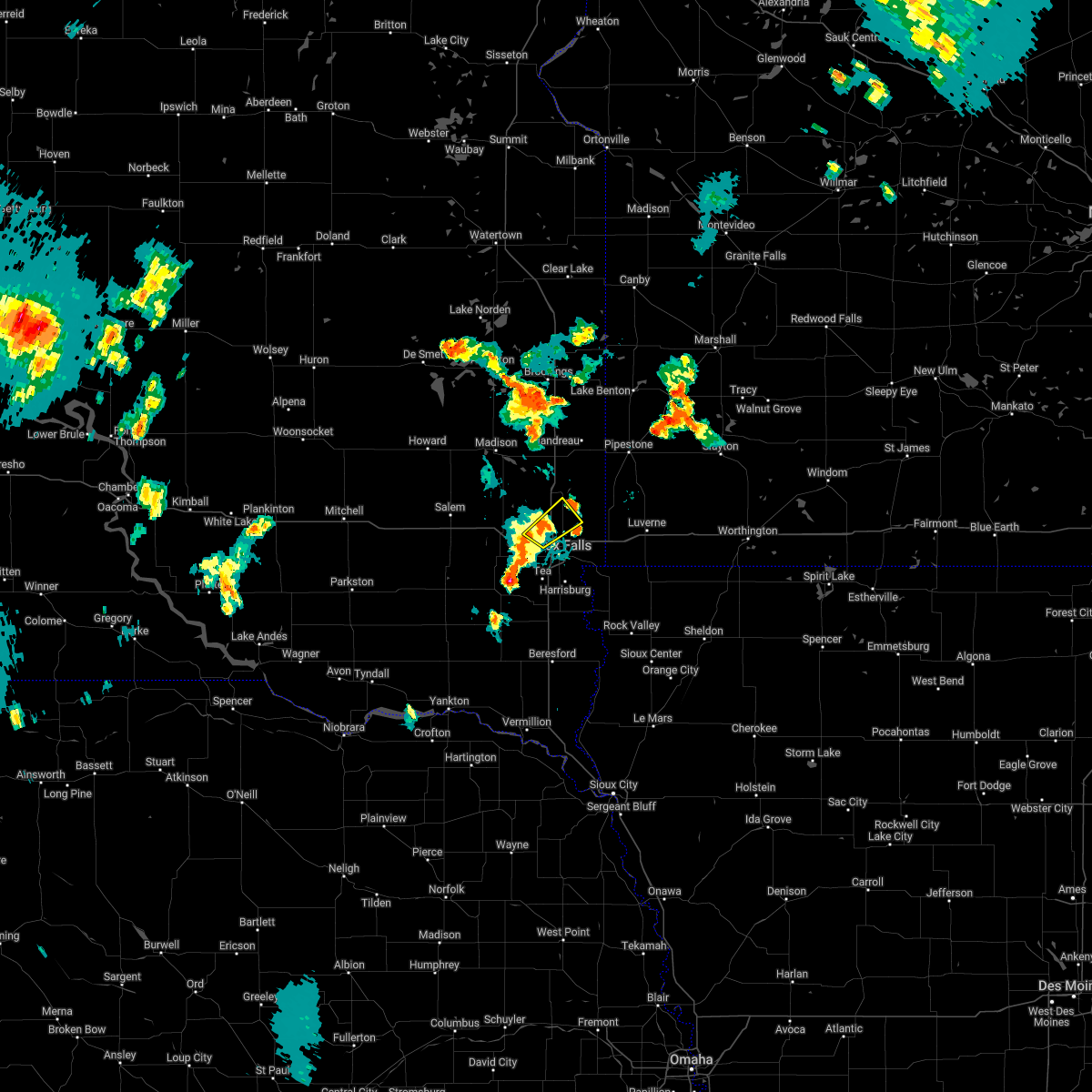 At 755 pm cdt, a severe thunderstorm was located over crooks, or 8 miles northwest of sioux falls, moving northeast at 40 mph. this is a destructive storm for crooks (radar indicated. at 754 pm, 63 mph wind gust was recorded near crooks). Hazards include 80 mph wind gusts. Flying debris will be dangerous to those caught without shelter. mobile homes will be heavily damaged. expect considerable damage to roofs, windows, and vehicles. extensive tree damage and power outages are likely. this severe storm will be near, renner around 800 pm cdt. other locations in the path of this severe thunderstorm include baltic. thunderstorm damage threat, destructive hail threat, radar indicated max hail size, <. 75 in wind threat, radar indicated max wind gust, 80 mph. At 755 pm cdt, a severe thunderstorm was located over crooks, or 8 miles northwest of sioux falls, moving northeast at 40 mph. this is a destructive storm for crooks (radar indicated. at 754 pm, 63 mph wind gust was recorded near crooks). Hazards include 80 mph wind gusts. Flying debris will be dangerous to those caught without shelter. mobile homes will be heavily damaged. expect considerable damage to roofs, windows, and vehicles. extensive tree damage and power outages are likely. this severe storm will be near, renner around 800 pm cdt. other locations in the path of this severe thunderstorm include baltic. thunderstorm damage threat, destructive hail threat, radar indicated max hail size, <. 75 in wind threat, radar indicated max wind gust, 80 mph.
|
| 6/20/2022 7:52 PM CDT |
 At 752 pm cdt, a severe thunderstorm was located over hartford, or 10 miles west of sioux falls, moving northeast at 40 mph (radar indicated). Hazards include 70 mph wind gusts and quarter size hail. Hail damage to vehicles is expected. expect considerable tree damage. wind damage is also likely to mobile homes, roofs, and outbuildings. this severe thunderstorm will be near, sioux falls and crooks around 805 pm cdt. renner and lyons around 810 pm cdt. other locations in the path of this severe thunderstorm include brandon, baltic, corson and dell rapids. thunderstorm damage threat, considerable hail threat, radar indicated max hail size, 1. 00 in wind threat, radar indicated max wind gust, 70 mph. At 752 pm cdt, a severe thunderstorm was located over hartford, or 10 miles west of sioux falls, moving northeast at 40 mph (radar indicated). Hazards include 70 mph wind gusts and quarter size hail. Hail damage to vehicles is expected. expect considerable tree damage. wind damage is also likely to mobile homes, roofs, and outbuildings. this severe thunderstorm will be near, sioux falls and crooks around 805 pm cdt. renner and lyons around 810 pm cdt. other locations in the path of this severe thunderstorm include brandon, baltic, corson and dell rapids. thunderstorm damage threat, considerable hail threat, radar indicated max hail size, 1. 00 in wind threat, radar indicated max wind gust, 70 mph.
|
| 6/20/2022 7:46 PM CDT |
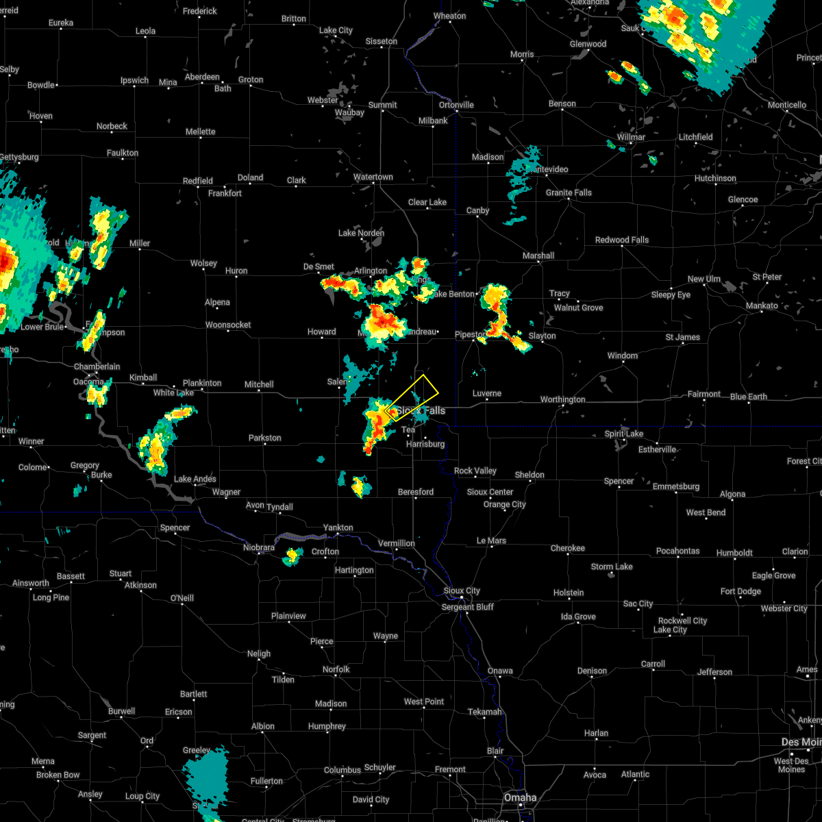 At 745 pm cdt, a severe thunderstorm was located over hartford, or 10 miles west of sioux falls, moving northeast at 40 mph. this is a destructive storm for crooks and hartford (radar indicated). Hazards include 80 mph wind gusts. Flying debris will be dangerous to those caught without shelter. mobile homes will be heavily damaged. expect considerable damage to roofs, windows, and vehicles. extensive tree damage and power outages are likely. this severe thunderstorm will be near, sioux falls, crooks and renner around 800 pm cdt. other locations in the path of this severe thunderstorm include baltic. thunderstorm damage threat, destructive hail threat, radar indicated max hail size, <. 75 in wind threat, radar indicated max wind gust, 80 mph. At 745 pm cdt, a severe thunderstorm was located over hartford, or 10 miles west of sioux falls, moving northeast at 40 mph. this is a destructive storm for crooks and hartford (radar indicated). Hazards include 80 mph wind gusts. Flying debris will be dangerous to those caught without shelter. mobile homes will be heavily damaged. expect considerable damage to roofs, windows, and vehicles. extensive tree damage and power outages are likely. this severe thunderstorm will be near, sioux falls, crooks and renner around 800 pm cdt. other locations in the path of this severe thunderstorm include baltic. thunderstorm damage threat, destructive hail threat, radar indicated max hail size, <. 75 in wind threat, radar indicated max wind gust, 80 mph.
|
| 6/20/2022 7:44 PM CDT | Reported by personal weather statio in minnehaha county SD, 9.8 miles E of Sioux Falls, SD |
| 6/20/2022 7:41 PM CDT |
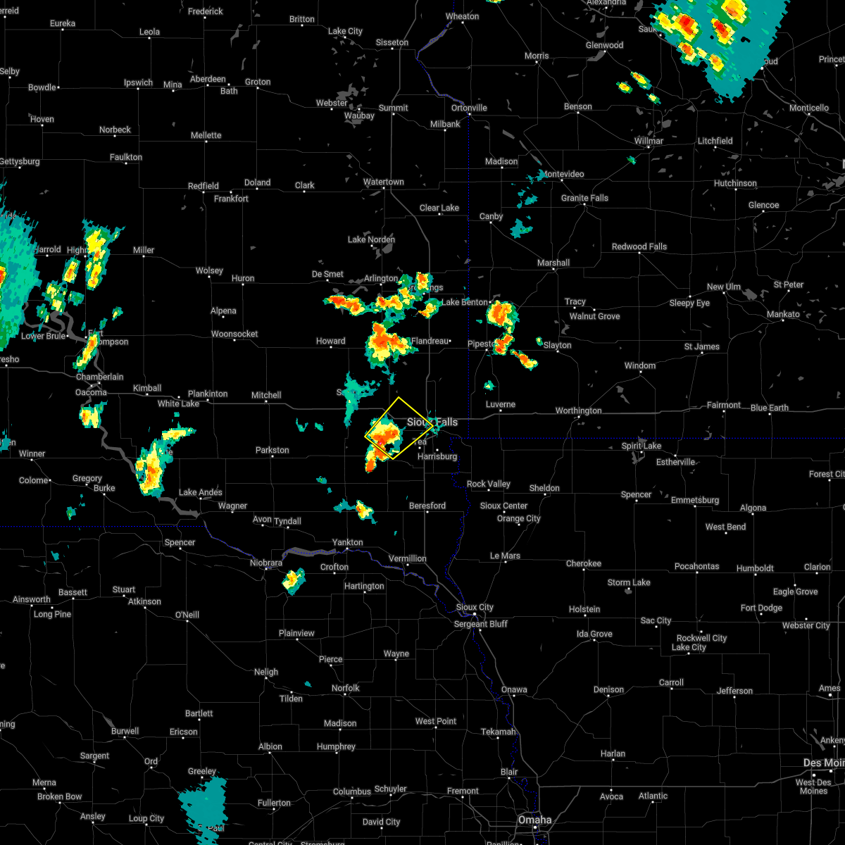 At 741 pm cdt, a severe thunderstorm was located over wall lake, or 10 miles east of lake vermillion state recreation area, moving northeast at 40 mph (radar indicated). Hazards include 70 mph wind gusts. Expect considerable tree damage. damage is likely to mobile homes, roofs, and outbuildings. locations impacted include, sioux falls, hartford, wall lake, humboldt, monroe and ellis. thunderstorm damage threat, considerable hail threat, radar indicated max hail size, <. 75 in wind threat, radar indicated max wind gust, 70 mph. At 741 pm cdt, a severe thunderstorm was located over wall lake, or 10 miles east of lake vermillion state recreation area, moving northeast at 40 mph (radar indicated). Hazards include 70 mph wind gusts. Expect considerable tree damage. damage is likely to mobile homes, roofs, and outbuildings. locations impacted include, sioux falls, hartford, wall lake, humboldt, monroe and ellis. thunderstorm damage threat, considerable hail threat, radar indicated max hail size, <. 75 in wind threat, radar indicated max wind gust, 70 mph.
|
| 6/20/2022 7:34 PM CDT |
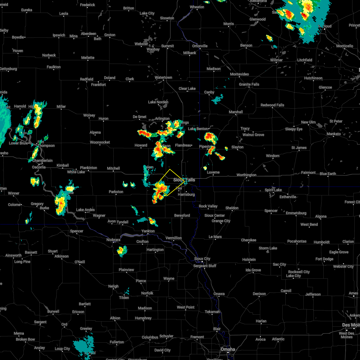 At 734 pm cdt, a severe thunderstorm was located near monroe, or near parker, moving northeast at 25 mph (radar indicated). Hazards include 60 mph wind gusts. expect damage to roofs, siding, and trees At 734 pm cdt, a severe thunderstorm was located near monroe, or near parker, moving northeast at 25 mph (radar indicated). Hazards include 60 mph wind gusts. expect damage to roofs, siding, and trees
|
| 5/30/2022 7:13 PM CDT |
 The severe thunderstorm warning for northwestern lyon, southwestern rock, southeastern minnehaha, northern lincoln and east central turner counties will expire at 715 pm cdt, the storm which prompted the warning has weakened below severe limits, and no longer poses an immediate threat to life or property. therefore, the warning will be allowed to expire. however gusty winds of 50 to 55 mph are still possible with this area of weakening showers moving toward luverne and garretson. The severe thunderstorm warning for northwestern lyon, southwestern rock, southeastern minnehaha, northern lincoln and east central turner counties will expire at 715 pm cdt, the storm which prompted the warning has weakened below severe limits, and no longer poses an immediate threat to life or property. therefore, the warning will be allowed to expire. however gusty winds of 50 to 55 mph are still possible with this area of weakening showers moving toward luverne and garretson.
|
| 5/30/2022 6:46 PM CDT |
 At 646 pm cdt, a severe thunderstorm was located near worthing, or 13 miles west of canton, moving northeast at 75 mph (radar indicated). Hazards include 60 mph wind gusts. Expect damage to roofs, siding, and trees. this severe thunderstorm will be near, worthing around 650 pm cdt. harrisburg and tea around 655 pm cdt. lake alvin state recreation area around 700 pm cdt. sioux falls, brandon, larchwood, rowena and renner around 705 pm cdt. valley springs, hills and corson around 710 pm cdt. hail threat, radar indicated max hail size, <. 75 in wind threat, radar indicated max wind gust, 60 mph. At 646 pm cdt, a severe thunderstorm was located near worthing, or 13 miles west of canton, moving northeast at 75 mph (radar indicated). Hazards include 60 mph wind gusts. Expect damage to roofs, siding, and trees. this severe thunderstorm will be near, worthing around 650 pm cdt. harrisburg and tea around 655 pm cdt. lake alvin state recreation area around 700 pm cdt. sioux falls, brandon, larchwood, rowena and renner around 705 pm cdt. valley springs, hills and corson around 710 pm cdt. hail threat, radar indicated max hail size, <. 75 in wind threat, radar indicated max wind gust, 60 mph.
|
| 5/30/2022 6:12 PM CDT |
 The severe thunderstorm warning for southern lake, minnehaha, northwestern lincoln, eastern mccook and northeastern turner counties will expire at 615 pm cdt, the storms which prompted the warning have moved out of the area. therefore, the warning will be allowed to expire. however gusty winds are still possible with these thunderstorms. The severe thunderstorm warning for southern lake, minnehaha, northwestern lincoln, eastern mccook and northeastern turner counties will expire at 615 pm cdt, the storms which prompted the warning have moved out of the area. therefore, the warning will be allowed to expire. however gusty winds are still possible with these thunderstorms.
|
| 5/30/2022 5:51 PM CDT |
 At 551 pm cdt, severe thunderstorms were located along a line extending from humboldt to near hartford to near wall lake, moving northeast at 65 mph (radar indicated). Hazards include 60 mph wind gusts. Expect damage to roofs, siding, and trees. severe thunderstorms will be near, ellis around 555 pm cdt. sioux falls, crooks and lyons around 600 pm cdt. baltic, colton and renner around 605 pm cdt. dell rapids and palisades state park around 610 pm cdt. other locations in the path of these severe thunderstorms include garretson and sherman. hail threat, radar indicated max hail size, <. 75 in wind threat, radar indicated max wind gust, 60 mph. At 551 pm cdt, severe thunderstorms were located along a line extending from humboldt to near hartford to near wall lake, moving northeast at 65 mph (radar indicated). Hazards include 60 mph wind gusts. Expect damage to roofs, siding, and trees. severe thunderstorms will be near, ellis around 555 pm cdt. sioux falls, crooks and lyons around 600 pm cdt. baltic, colton and renner around 605 pm cdt. dell rapids and palisades state park around 610 pm cdt. other locations in the path of these severe thunderstorms include garretson and sherman. hail threat, radar indicated max hail size, <. 75 in wind threat, radar indicated max wind gust, 60 mph.
|
| 5/30/2022 3:10 PM CDT |
 The severe thunderstorm warning for northwestern lyon, southeastern minnehaha and northeastern lincoln counties will expire at 315 pm cdt, the storm which prompted the warning has moved out of the area. therefore, the warning will be allowed to expire. however gusty winds are still possible with this thunderstorm. a tornado watch remains in effect until 600 pm cdt for northwestern iowa, southwestern minnesota, and southeastern south dakota. remember, a severe thunderstorm warning still remains in effect for far eastern minnehaha county. The severe thunderstorm warning for northwestern lyon, southeastern minnehaha and northeastern lincoln counties will expire at 315 pm cdt, the storm which prompted the warning has moved out of the area. therefore, the warning will be allowed to expire. however gusty winds are still possible with this thunderstorm. a tornado watch remains in effect until 600 pm cdt for northwestern iowa, southwestern minnesota, and southeastern south dakota. remember, a severe thunderstorm warning still remains in effect for far eastern minnehaha county.
|
| 5/30/2022 3:05 PM CDT | Quarter sized hail reported 4.8 miles W of Sioux Falls, SD, corrects previous hail report from 4 wnw rowena. |
| 5/30/2022 3:01 PM CDT |
 At 301 pm cdt, a severe thunderstorm was located over brandon, or 8 miles east of sioux falls, moving east at 45 mph (radar indicated). Hazards include 70 mph wind gusts and half dollar size hail. Hail damage to vehicles is expected. expect considerable tree damage. wind damage is also likely to mobile homes, roofs, and outbuildings. locations impacted include, brandon, palisades state park, garretson, valley springs and sherman. thunderstorm damage threat, considerable hail threat, radar indicated max hail size, 1. 25 in wind threat, radar indicated max wind gust, 70 mph. At 301 pm cdt, a severe thunderstorm was located over brandon, or 8 miles east of sioux falls, moving east at 45 mph (radar indicated). Hazards include 70 mph wind gusts and half dollar size hail. Hail damage to vehicles is expected. expect considerable tree damage. wind damage is also likely to mobile homes, roofs, and outbuildings. locations impacted include, brandon, palisades state park, garretson, valley springs and sherman. thunderstorm damage threat, considerable hail threat, radar indicated max hail size, 1. 25 in wind threat, radar indicated max wind gust, 70 mph.
|
| 5/30/2022 2:53 PM CDT | Quarter sized hail reported 3.8 miles S of Sioux Falls, SD |
| 5/30/2022 2:50 PM CDT | Quarter sized hail reported 3.7 miles ENE of Sioux Falls, SD, reported quarter size hail. |
| 5/30/2022 2:50 PM CDT | Mesonet station sfss2 sioux falls (sd mesonet in minnehaha county SD, 3.3 miles NE of Sioux Falls, SD |
| 5/30/2022 2:45 PM CDT | Ping Pong Ball sized hail reported 5 miles NE of Sioux Falls, SD, 1.0 to 1.5 inch diameter hail. |
| 5/30/2022 2:45 PM CDT | Hen Egg sized hail reported 3.3 miles ENE of Sioux Falls, SD, picture via social media. |
| 5/30/2022 2:44 PM CDT |
 At 244 pm cdt, a severe thunderstorm was located over tea, or 9 miles southwest of sioux falls, moving northeast at 45 mph (radar indicated). Hazards include 60 mph wind gusts and half dollar size hail. Hail damage to vehicles is expected. expect wind damage to roofs, siding, and trees. this severe thunderstorm will be near, harrisburg around 250 pm cdt. ellis and lake alvin state recreation area around 255 pm cdt. rowena around 300 pm cdt. other locations in the path of this severe thunderstorm include sioux falls, brandon, crooks, renner, valley springs, corson, garretson, sherman and palisades state park. hail threat, radar indicated max hail size, 1. 25 in wind threat, radar indicated max wind gust, 60 mph. At 244 pm cdt, a severe thunderstorm was located over tea, or 9 miles southwest of sioux falls, moving northeast at 45 mph (radar indicated). Hazards include 60 mph wind gusts and half dollar size hail. Hail damage to vehicles is expected. expect wind damage to roofs, siding, and trees. this severe thunderstorm will be near, harrisburg around 250 pm cdt. ellis and lake alvin state recreation area around 255 pm cdt. rowena around 300 pm cdt. other locations in the path of this severe thunderstorm include sioux falls, brandon, crooks, renner, valley springs, corson, garretson, sherman and palisades state park. hail threat, radar indicated max hail size, 1. 25 in wind threat, radar indicated max wind gust, 60 mph.
|
| 5/30/2022 2:04 AM CDT |
 At 204 am cdt, severe thunderstorms were located along a line extending from near renner to rowena, moving east at 50 mph (radar indicated). Hazards include 70 mph wind gusts and half dollar size hail. Hail damage to vehicles is expected. expect considerable tree damage. wind damage is also likely to mobile homes, roofs, and outbuildings. locations impacted include, valley springs, palisades state park and garretson. thunderstorm damage threat, considerable hail threat, radar indicated max hail size, 1. 25 in wind threat, radar indicated max wind gust, 70 mph. At 204 am cdt, severe thunderstorms were located along a line extending from near renner to rowena, moving east at 50 mph (radar indicated). Hazards include 70 mph wind gusts and half dollar size hail. Hail damage to vehicles is expected. expect considerable tree damage. wind damage is also likely to mobile homes, roofs, and outbuildings. locations impacted include, valley springs, palisades state park and garretson. thunderstorm damage threat, considerable hail threat, radar indicated max hail size, 1. 25 in wind threat, radar indicated max wind gust, 70 mph.
|
| 5/30/2022 2:03 AM CDT |
 At 201 am cdt, severe thunderstorms were located along a line extending from 8 miles south of aurora to near brandon, moving east at 60 mph (instrumentation. at 2:00 am, the asos in sioux falls, south dakota recorded a wind gust of 69 mph). Hazards include 70 mph wind gusts and nickel size hail. Expect considerable tree damage. damage is likely to mobile homes, roofs, and outbuildings. these severe storms will be near, brandon, flandreau, corson, rowena and palisades state park around 205 am cdt. garretson, valley springs and sherman around 210 am cdt. hills, beaver creek and ward around 215 am cdt. other locations in the path of these severe thunderstorms include pipestone, hardwick, pipestone national monument, luverne, holland, blue mounds state park, ellsworth, ruthton, woodstock, adrian, lake wilson, lismore, rushmore, wilmont and current lake. thunderstorm damage threat, considerable hail threat, radar indicated max hail size, 0. 88 in wind threat, observed max wind gust, 70 mph. At 201 am cdt, severe thunderstorms were located along a line extending from 8 miles south of aurora to near brandon, moving east at 60 mph (instrumentation. at 2:00 am, the asos in sioux falls, south dakota recorded a wind gust of 69 mph). Hazards include 70 mph wind gusts and nickel size hail. Expect considerable tree damage. damage is likely to mobile homes, roofs, and outbuildings. these severe storms will be near, brandon, flandreau, corson, rowena and palisades state park around 205 am cdt. garretson, valley springs and sherman around 210 am cdt. hills, beaver creek and ward around 215 am cdt. other locations in the path of these severe thunderstorms include pipestone, hardwick, pipestone national monument, luverne, holland, blue mounds state park, ellsworth, ruthton, woodstock, adrian, lake wilson, lismore, rushmore, wilmont and current lake. thunderstorm damage threat, considerable hail threat, radar indicated max hail size, 0. 88 in wind threat, observed max wind gust, 70 mph.
|
| 5/30/2022 1:58 AM CDT |
 At 158 am cdt, severe thunderstorms were located along a line extending from 8 miles south of aurora to near brandon, moving east at 60 mph (radar indicated). Hazards include 70 mph wind gusts and nickel size hail. Expect considerable tree damage. damage is likely to mobile homes, roofs, and outbuildings. severe thunderstorms will be near, garretson and palisades state park around 205 am cdt. valley springs, sherman and ward around 210 am cdt. hills, beaver creek and pipestone national monument around 215 am cdt. other locations in the path of these severe thunderstorms include luverne, pipestone, hardwick, blue mounds state park, holland, woodstock, ellsworth, ruthton, adrian, lake wilson, lismore, current lake, rushmore and wilmont. thunderstorm damage threat, considerable hail threat, radar indicated max hail size, 0. 88 in wind threat, observed max wind gust, 70 mph. At 158 am cdt, severe thunderstorms were located along a line extending from 8 miles south of aurora to near brandon, moving east at 60 mph (radar indicated). Hazards include 70 mph wind gusts and nickel size hail. Expect considerable tree damage. damage is likely to mobile homes, roofs, and outbuildings. severe thunderstorms will be near, garretson and palisades state park around 205 am cdt. valley springs, sherman and ward around 210 am cdt. hills, beaver creek and pipestone national monument around 215 am cdt. other locations in the path of these severe thunderstorms include luverne, pipestone, hardwick, blue mounds state park, holland, woodstock, ellsworth, ruthton, adrian, lake wilson, lismore, current lake, rushmore and wilmont. thunderstorm damage threat, considerable hail threat, radar indicated max hail size, 0. 88 in wind threat, observed max wind gust, 70 mph.
|
| 5/30/2022 1:43 AM CDT |
 At 143 am cdt, a severe thunderstorm was located over wall lake, or 9 miles west of sioux falls, moving northeast at 40 mph (radar indicated). Hazards include 60 mph wind gusts and half dollar size hail. Hail damage to vehicles is expected. expect wind damage to roofs, siding, and trees. locations impacted include, sioux falls. hail threat, radar indicated max hail size, 1. 25 in wind threat, radar indicated max wind gust, 60 mph. At 143 am cdt, a severe thunderstorm was located over wall lake, or 9 miles west of sioux falls, moving northeast at 40 mph (radar indicated). Hazards include 60 mph wind gusts and half dollar size hail. Hail damage to vehicles is expected. expect wind damage to roofs, siding, and trees. locations impacted include, sioux falls. hail threat, radar indicated max hail size, 1. 25 in wind threat, radar indicated max wind gust, 60 mph.
|
| 5/30/2022 1:41 AM CDT |
 At 141 am cdt, severe thunderstorms were located along a line extending from hartford to near tea, moving east at 50 mph (radar indicated). Hazards include 60 mph wind gusts and half dollar size hail. Hail damage to vehicles is expected. expect wind damage to roofs, siding, and trees. severe thunderstorms will be near, tea around 145 am cdt. sioux falls and ellis around 150 am cdt. harrisburg, crooks and renner around 155 am cdt. lake alvin state recreation area around 200 am cdt. brandon, rowena and corson around 205 am cdt. garretson, valley springs and palisades state park around 210 am cdt. hail threat, radar indicated max hail size, 1. 25 in wind threat, radar indicated max wind gust, 60 mph. At 141 am cdt, severe thunderstorms were located along a line extending from hartford to near tea, moving east at 50 mph (radar indicated). Hazards include 60 mph wind gusts and half dollar size hail. Hail damage to vehicles is expected. expect wind damage to roofs, siding, and trees. severe thunderstorms will be near, tea around 145 am cdt. sioux falls and ellis around 150 am cdt. harrisburg, crooks and renner around 155 am cdt. lake alvin state recreation area around 200 am cdt. brandon, rowena and corson around 205 am cdt. garretson, valley springs and palisades state park around 210 am cdt. hail threat, radar indicated max hail size, 1. 25 in wind threat, radar indicated max wind gust, 60 mph.
|
| 5/30/2022 1:23 AM CDT |
 At 122 am cdt, a severe thunderstorm was located near hurley, or near parker, moving northeast at 40 mph (radar indicated). Hazards include half dollar size hail. Damage to vehicles is expected. this severe thunderstorm will be near, lennox and chancellor around 130 am cdt. tea around 145 am cdt. sioux falls around 200 am cdt. hail threat, radar indicated max hail size, 1. 25 in wind threat, radar indicated max wind gust, <50 mph. At 122 am cdt, a severe thunderstorm was located near hurley, or near parker, moving northeast at 40 mph (radar indicated). Hazards include half dollar size hail. Damage to vehicles is expected. this severe thunderstorm will be near, lennox and chancellor around 130 am cdt. tea around 145 am cdt. sioux falls around 200 am cdt. hail threat, radar indicated max hail size, 1. 25 in wind threat, radar indicated max wind gust, <50 mph.
|
| 5/29/2022 4:17 AM CDT | Tennis Ball sized hail reported 1 miles SSW of Sioux Falls, SD, report via social media. |
| 5/29/2022 4:01 AM CDT | At 400 am cdt, severe thunderstorms were located along a line extending from near sioux falls to near harrisburg to 6 miles south of worthing, moving east at 40 mph (radar indicated). Hazards include two inch hail and 70 mph wind gusts. People and animals outdoors will be injured. expect hail damage to roofs, siding, windows, and vehicles. expect considerable tree damage. wind damage is also likely to mobile homes, roofs, and outbuildings. at 359 am cdt, golf ball sized hail was reported in west sioux falls. these severe storms will be near, sioux falls, harrisburg and renner around 405 am cdt. lake alvin state recreation area around 410 am cdt. brandon, corson, rowena and newton hills state park around 415 am cdt. other locations in the path of these severe thunderstorms include canton, palisades state park, garretson and valley springs. thunderstorm damage threat, considerable hail threat, radar indicated max hail size, 2. 00 in wind threat, radar indicated max wind gust, 70 mph. |
| 5/29/2022 3:55 AM CDT | Hen Egg sized hail reported 4.9 miles ENE of Sioux Falls, SD |
| 5/29/2022 3:55 AM CDT |
 At 355 am cdt, severe thunderstorms were located along a line extending from ellis to near tea to 7 miles south of worthing, moving east at 40 mph (radar indicated). Hazards include golf ball size hail and 70 mph wind gusts. People and animals outdoors will be injured. expect hail damage to roofs, siding, windows, and vehicles. expect considerable tree damage. wind damage is also likely to mobile homes, roofs, and outbuildings. these severe storms will be near, sioux falls, harrisburg and crooks around 400 am cdt. other locations in the path of these severe thunderstorms include renner, brandon, lake alvin state recreation area, corson, rowena, newton hills state park, canton, valley springs, palisades state park and garretson. thunderstorm damage threat, considerable hail threat, radar indicated max hail size, 1. 75 in wind threat, radar indicated max wind gust, 70 mph. At 355 am cdt, severe thunderstorms were located along a line extending from ellis to near tea to 7 miles south of worthing, moving east at 40 mph (radar indicated). Hazards include golf ball size hail and 70 mph wind gusts. People and animals outdoors will be injured. expect hail damage to roofs, siding, windows, and vehicles. expect considerable tree damage. wind damage is also likely to mobile homes, roofs, and outbuildings. these severe storms will be near, sioux falls, harrisburg and crooks around 400 am cdt. other locations in the path of these severe thunderstorms include renner, brandon, lake alvin state recreation area, corson, rowena, newton hills state park, canton, valley springs, palisades state park and garretson. thunderstorm damage threat, considerable hail threat, radar indicated max hail size, 1. 75 in wind threat, radar indicated max wind gust, 70 mph.
|
| 5/29/2022 3:48 AM CDT |
 At 347 am cdt, severe thunderstorms were located along a line extending from wall lake to hurley, moving northeast at 45 mph (radar indicated). Hazards include golf ball size hail and 60 mph wind gusts. People and animals outdoors will be injured. expect hail damage to roofs, siding, windows, and vehicles. expect wind damage to roofs, siding, and trees. these severe storms will be near, hartford, wall lake and ellis around 355 am cdt. other locations in the path of these severe thunderstorms include sioux falls and crooks. thunderstorm damage threat, considerable hail threat, radar indicated max hail size, 1. 75 in wind threat, radar indicated max wind gust, 60 mph. At 347 am cdt, severe thunderstorms were located along a line extending from wall lake to hurley, moving northeast at 45 mph (radar indicated). Hazards include golf ball size hail and 60 mph wind gusts. People and animals outdoors will be injured. expect hail damage to roofs, siding, windows, and vehicles. expect wind damage to roofs, siding, and trees. these severe storms will be near, hartford, wall lake and ellis around 355 am cdt. other locations in the path of these severe thunderstorms include sioux falls and crooks. thunderstorm damage threat, considerable hail threat, radar indicated max hail size, 1. 75 in wind threat, radar indicated max wind gust, 60 mph.
|
| 5/29/2022 3:43 AM CDT |
 At 343 am cdt, a severe thunderstorm was located near wall lake, or 10 miles northeast of parker, moving northeast at 35 mph (radar indicated). Hazards include golf ball size hail and 70 mph wind gusts. People and animals outdoors will be injured. expect hail damage to roofs, siding, windows, and vehicles. expect considerable tree damage. wind damage is also likely to mobile homes, roofs, and outbuildings. this severe thunderstorm will be near, worthing around 350 am cdt. tea and hartford around 355 am cdt. ellis around 400 am cdt. other locations in the path of this severe thunderstorm include harrisburg, sioux falls, crooks, renner, lake alvin state recreation area, brandon, rowena, corson, garretson, valley springs and palisades state park. thunderstorm damage threat, considerable hail threat, radar indicated max hail size, 1. 75 in wind threat, radar indicated max wind gust, 70 mph. At 343 am cdt, a severe thunderstorm was located near wall lake, or 10 miles northeast of parker, moving northeast at 35 mph (radar indicated). Hazards include golf ball size hail and 70 mph wind gusts. People and animals outdoors will be injured. expect hail damage to roofs, siding, windows, and vehicles. expect considerable tree damage. wind damage is also likely to mobile homes, roofs, and outbuildings. this severe thunderstorm will be near, worthing around 350 am cdt. tea and hartford around 355 am cdt. ellis around 400 am cdt. other locations in the path of this severe thunderstorm include harrisburg, sioux falls, crooks, renner, lake alvin state recreation area, brandon, rowena, corson, garretson, valley springs and palisades state park. thunderstorm damage threat, considerable hail threat, radar indicated max hail size, 1. 75 in wind threat, radar indicated max wind gust, 70 mph.
|
| 5/29/2022 3:40 AM CDT |
 At 339 am cdt, a severe thunderstorm was located near wall lake, or 8 miles northeast of parker, moving northeast at 35 mph (radar indicated). Hazards include golf ball size hail and 60 mph wind gusts. People and animals outdoors will be injured. expect hail damage to roofs, siding, windows, and vehicles. expect wind damage to roofs, siding, and trees. this severe storm will be near, wall lake around 345 am cdt. other locations in the path of this severe thunderstorm include hartford, ellis, sioux falls and crooks. thunderstorm damage threat, considerable hail threat, radar indicated max hail size, 1. 75 in wind threat, radar indicated max wind gust, 60 mph. At 339 am cdt, a severe thunderstorm was located near wall lake, or 8 miles northeast of parker, moving northeast at 35 mph (radar indicated). Hazards include golf ball size hail and 60 mph wind gusts. People and animals outdoors will be injured. expect hail damage to roofs, siding, windows, and vehicles. expect wind damage to roofs, siding, and trees. this severe storm will be near, wall lake around 345 am cdt. other locations in the path of this severe thunderstorm include hartford, ellis, sioux falls and crooks. thunderstorm damage threat, considerable hail threat, radar indicated max hail size, 1. 75 in wind threat, radar indicated max wind gust, 60 mph.
|
| 5/29/2022 3:27 AM CDT |
 At 326 am cdt, a cluster of severe thunderstorms was located over parker southwest toward mayfield, moving northeast at 30 mph (radar indicated). Hazards include ping pong ball size hail and 60 mph wind gusts. People and animals outdoors will be injured. expect hail damage to roofs, siding, windows, and vehicles. expect wind damage to roofs, siding, and trees. this severe thunderstorm will be near, chancellor and monroe around 330 am cdt. canistota around 340 am cdt. other locations in the path of this severe thunderstorm include lake vermillion state recreation area, wall lake, humboldt, montrose, ellis, hartford, sioux falls, crooks and lyons. hail threat, radar indicated max hail size, 1. 50 in wind threat, radar indicated max wind gust, 60 mph. At 326 am cdt, a cluster of severe thunderstorms was located over parker southwest toward mayfield, moving northeast at 30 mph (radar indicated). Hazards include ping pong ball size hail and 60 mph wind gusts. People and animals outdoors will be injured. expect hail damage to roofs, siding, windows, and vehicles. expect wind damage to roofs, siding, and trees. this severe thunderstorm will be near, chancellor and monroe around 330 am cdt. canistota around 340 am cdt. other locations in the path of this severe thunderstorm include lake vermillion state recreation area, wall lake, humboldt, montrose, ellis, hartford, sioux falls, crooks and lyons. hail threat, radar indicated max hail size, 1. 50 in wind threat, radar indicated max wind gust, 60 mph.
|
| 5/12/2022 8:09 PM CDT |
 At 808 pm cdt, severe thunderstorms were located along a line extending from garretson to near george, moving northeast at 60 mph (radar indicated. at 8:03 pm cdt, a 60 mph wind gust was reported at beaver creek). Hazards include 70 mph wind gusts and half dollar size hail. Hail damage to vehicles is expected. expect considerable tree damage. wind damage is also likely to mobile homes, roofs, and outbuildings. locations impacted include, luverne, jasper, ellsworth, little rock, blue mounds state park, sibley and hardwick. thunderstorm damage threat, considerable hail threat, radar indicated max hail size, 1. 25 in wind threat, radar indicated max wind gust, 70 mph. At 808 pm cdt, severe thunderstorms were located along a line extending from garretson to near george, moving northeast at 60 mph (radar indicated. at 8:03 pm cdt, a 60 mph wind gust was reported at beaver creek). Hazards include 70 mph wind gusts and half dollar size hail. Hail damage to vehicles is expected. expect considerable tree damage. wind damage is also likely to mobile homes, roofs, and outbuildings. locations impacted include, luverne, jasper, ellsworth, little rock, blue mounds state park, sibley and hardwick. thunderstorm damage threat, considerable hail threat, radar indicated max hail size, 1. 25 in wind threat, radar indicated max wind gust, 70 mph.
|
| 5/12/2022 7:46 PM CDT |
 At 746 pm cdt, severe thunderstorms were located along a line extending from near tea to 6 miles south of rock valley, moving northeast at 60 mph (radar indicated). Hazards include 70 mph wind gusts and half dollar size hail. Hail damage to vehicles is expected. expect considerable tree damage. wind damage is also likely to mobile homes, roofs, and outbuildings. severe thunderstorms will be near, inwood around 750 pm cdt. rock valley around 755 pm cdt. brandon, larchwood, doon, alvord, corson and rowena around 800 pm cdt. rock rapids, valley springs, hills and palisades state park around 805 pm cdt. other locations in the path of these severe thunderstorms include garretson, george, beaver creek, sherman, ellsworth, luverne, sibley, jasper, little rock, blue mounds state park and hardwick. thunderstorm damage threat, considerable hail threat, radar indicated max hail size, 1. 25 in wind threat, radar indicated max wind gust, 70 mph. At 746 pm cdt, severe thunderstorms were located along a line extending from near tea to 6 miles south of rock valley, moving northeast at 60 mph (radar indicated). Hazards include 70 mph wind gusts and half dollar size hail. Hail damage to vehicles is expected. expect considerable tree damage. wind damage is also likely to mobile homes, roofs, and outbuildings. severe thunderstorms will be near, inwood around 750 pm cdt. rock valley around 755 pm cdt. brandon, larchwood, doon, alvord, corson and rowena around 800 pm cdt. rock rapids, valley springs, hills and palisades state park around 805 pm cdt. other locations in the path of these severe thunderstorms include garretson, george, beaver creek, sherman, ellsworth, luverne, sibley, jasper, little rock, blue mounds state park and hardwick. thunderstorm damage threat, considerable hail threat, radar indicated max hail size, 1. 25 in wind threat, radar indicated max wind gust, 70 mph.
|
| 5/12/2022 7:17 PM CDT |
 At 717 pm cdt, severe thunderstorms were located along a line extending from near mayfield to near vermillion, moving northeast at 55 mph (radar indicated). Hazards include 70 mph wind gusts and ping pong ball size hail. People and animals outdoors will be injured. expect hail damage to roofs, siding, windows, and vehicles. expect considerable tree damage. wind damage is also likely to mobile homes, roofs, and outbuildings. severe thunderstorms will be near, centerville, viborg and union grove state park around 730 pm cdt. hurley and davis around 735 pm cdt. other locations in the path of these severe thunderstorms include beresford, alcester, hawarden, lennox, chancellor, worthing, tea, hudson, fairview, newton hills state park, sioux falls, canton, harrisburg, rock valley, inwood and lake alvin state recreation area. thunderstorm damage threat, considerable hail threat, radar indicated max hail size, 1. 50 in wind threat, radar indicated max wind gust, 70 mph. At 717 pm cdt, severe thunderstorms were located along a line extending from near mayfield to near vermillion, moving northeast at 55 mph (radar indicated). Hazards include 70 mph wind gusts and ping pong ball size hail. People and animals outdoors will be injured. expect hail damage to roofs, siding, windows, and vehicles. expect considerable tree damage. wind damage is also likely to mobile homes, roofs, and outbuildings. severe thunderstorms will be near, centerville, viborg and union grove state park around 730 pm cdt. hurley and davis around 735 pm cdt. other locations in the path of these severe thunderstorms include beresford, alcester, hawarden, lennox, chancellor, worthing, tea, hudson, fairview, newton hills state park, sioux falls, canton, harrisburg, rock valley, inwood and lake alvin state recreation area. thunderstorm damage threat, considerable hail threat, radar indicated max hail size, 1. 50 in wind threat, radar indicated max wind gust, 70 mph.
|
| 5/12/2022 5:37 PM CDT |
 At 536 pm cdt, severe thunderstorms were located along a line extending from near lake vermillion state recreation area to 6 miles south of worthing to 6 miles southeast of martinsburg, moving northeast at 55 mph (radar indicated). Hazards include 70 mph wind gusts. Expect considerable tree damage. damage is likely to mobile homes, roofs, and outbuildings. severe thunderstorms will be near, lake vermillion state recreation area, lennox, wall lake, worthing, canistota, humboldt, montrose, hudson and newton hills state park around 540 pm cdt. canton, tea, hartford, fairview and ellis around 545 pm cdt. sioux falls, harrisburg, crooks, inwood, lake alvin state recreation area, lyons and renner around 550 pm cdt. colton around 555 pm cdt. brandon, akron, baltic, larchwood, valley springs, merrill, hills, colman, beaver creek and lester around 600 pm cdt. other locations impacted by these severe thunderstorms include brunsville, westfield and chatsworth. thunderstorm damage threat, considerable hail threat, radar indicated max hail size, <. 75 in wind threat, radar indicated max wind gust, 70 mph. At 536 pm cdt, severe thunderstorms were located along a line extending from near lake vermillion state recreation area to 6 miles south of worthing to 6 miles southeast of martinsburg, moving northeast at 55 mph (radar indicated). Hazards include 70 mph wind gusts. Expect considerable tree damage. damage is likely to mobile homes, roofs, and outbuildings. severe thunderstorms will be near, lake vermillion state recreation area, lennox, wall lake, worthing, canistota, humboldt, montrose, hudson and newton hills state park around 540 pm cdt. canton, tea, hartford, fairview and ellis around 545 pm cdt. sioux falls, harrisburg, crooks, inwood, lake alvin state recreation area, lyons and renner around 550 pm cdt. colton around 555 pm cdt. brandon, akron, baltic, larchwood, valley springs, merrill, hills, colman, beaver creek and lester around 600 pm cdt. other locations impacted by these severe thunderstorms include brunsville, westfield and chatsworth. thunderstorm damage threat, considerable hail threat, radar indicated max hail size, <. 75 in wind threat, radar indicated max wind gust, 70 mph.
|
| 5/12/2022 5:12 PM CDT | Report from mping: 3-inch tree limbs broken; power poles broke in minnehaha county SD, 1.7 miles NE of Sioux Falls, SD |
| 5/12/2022 5:02 PM CDT | Mesonet station sfss2 sioux falls (sd mesonet in minnehaha county SD, 3.3 miles NE of Sioux Falls, SD |
| 5/12/2022 5:02 PM CDT | Tree down on hous in minnehaha county SD, 0.5 miles NNE of Sioux Falls, SD |
| 5/12/2022 4:58 PM CDT |
 At 458 pm cdt, severe thunderstorms were located along a line extending from 6 miles north of fulton to near hartford to worthing, moving east at 85 mph. these are destructive storms for alexandria, sioux falls, colton, lennox, larchwood, and surrounding areas (radar indicated). Hazards include 90 mph wind gusts. You are in a life-threatening situation. flying debris may be deadly to those caught without shelter. mobile homes will be heavily damaged or destroyed. homes and businesses will have substantial roof and window damage. expect extensive tree damage and power outages. these severe storms will be near, sioux falls, canton, harrisburg, tea, hartford, crooks, wall lake, worthing, ellis and lake alvin state recreation area around 505 pm cdt. larchwood, howard and renner around 510 pm cdt. brandon, salem, lester, winfred, corson, rowena and palisades state park around 515 pm cdt. lake herman state park, valley springs, hills, montrose, beaver creek and orland around 520 pm cdt. madison, luverne and humboldt around 525 pm cdt. colton, wentworth and chester around 530 pm cdt. colman and lyons around 535 pm cdt. baltic, egan, trent and dell rapids around 540 pm cdt. Other locations impacted by these severe thunderstorms include steen. At 458 pm cdt, severe thunderstorms were located along a line extending from 6 miles north of fulton to near hartford to worthing, moving east at 85 mph. these are destructive storms for alexandria, sioux falls, colton, lennox, larchwood, and surrounding areas (radar indicated). Hazards include 90 mph wind gusts. You are in a life-threatening situation. flying debris may be deadly to those caught without shelter. mobile homes will be heavily damaged or destroyed. homes and businesses will have substantial roof and window damage. expect extensive tree damage and power outages. these severe storms will be near, sioux falls, canton, harrisburg, tea, hartford, crooks, wall lake, worthing, ellis and lake alvin state recreation area around 505 pm cdt. larchwood, howard and renner around 510 pm cdt. brandon, salem, lester, winfred, corson, rowena and palisades state park around 515 pm cdt. lake herman state park, valley springs, hills, montrose, beaver creek and orland around 520 pm cdt. madison, luverne and humboldt around 525 pm cdt. colton, wentworth and chester around 530 pm cdt. colman and lyons around 535 pm cdt. baltic, egan, trent and dell rapids around 540 pm cdt. Other locations impacted by these severe thunderstorms include steen.
|
| 5/12/2022 4:40 PM CDT |
 At 438 pm cdt, severe thunderstorms were located along a line extending from 6 miles west of dimock to 8 miles southeast of freeman to near wakonda, moving northeast at 85 mph. these are destructive storms for alexandria, lake vermillion state park, sioux falls, lennox, larchwood, and surrounding areas (radar indicated). Hazards include 80 mph wind gusts. Flying debris will be dangerous to those caught without shelter. mobile homes will be heavily damaged. expect considerable damage to roofs, windows, and vehicles. extensive tree damage and power outages are likely. severe thunderstorms will be near, beresford, parker, centerville, marion, hurley and dolton around 445 pm cdt. canistota, alexandria, chancellor, monroe and davis around 450 pm cdt. lake vermillion state recreation area, lennox, wall lake, worthing, fulton and farmer around 455 pm cdt. canton, tea, hartford, humboldt, montrose, spencer in mccook county and ellis around 500 pm cdt. sioux falls, harrisburg, crooks, colton, canova, fedora, roswell, lyons, lake alvin state recreation area and renner around 505 pm cdt. brandon, baltic, larchwood, howard, lester, chester, vilas, rowena, corson and dell rapids around 510 pm cdt. valley springs, hills, beaver creek, trent, wentworth, carthage, winfred and palisades state park around 515 pm cdt. luverne, garretson, colman, egan and sherman around 520 pm cdt. Other locations impacted by these severe thunderstorms include steen. At 438 pm cdt, severe thunderstorms were located along a line extending from 6 miles west of dimock to 8 miles southeast of freeman to near wakonda, moving northeast at 85 mph. these are destructive storms for alexandria, lake vermillion state park, sioux falls, lennox, larchwood, and surrounding areas (radar indicated). Hazards include 80 mph wind gusts. Flying debris will be dangerous to those caught without shelter. mobile homes will be heavily damaged. expect considerable damage to roofs, windows, and vehicles. extensive tree damage and power outages are likely. severe thunderstorms will be near, beresford, parker, centerville, marion, hurley and dolton around 445 pm cdt. canistota, alexandria, chancellor, monroe and davis around 450 pm cdt. lake vermillion state recreation area, lennox, wall lake, worthing, fulton and farmer around 455 pm cdt. canton, tea, hartford, humboldt, montrose, spencer in mccook county and ellis around 500 pm cdt. sioux falls, harrisburg, crooks, colton, canova, fedora, roswell, lyons, lake alvin state recreation area and renner around 505 pm cdt. brandon, baltic, larchwood, howard, lester, chester, vilas, rowena, corson and dell rapids around 510 pm cdt. valley springs, hills, beaver creek, trent, wentworth, carthage, winfred and palisades state park around 515 pm cdt. luverne, garretson, colman, egan and sherman around 520 pm cdt. Other locations impacted by these severe thunderstorms include steen.
|
| 4/23/2022 5:29 AM CDT |
 At 528 am cdt, a severe thunderstorm was located over rowena, or 8 miles east of sioux falls, moving northeast at 60 mph (radar indicated). Hazards include 60 mph wind gusts and half dollar size hail. Hail damage to vehicles is expected. expect wind damage to roofs, siding, and trees. this severe thunderstorm will be near, valley springs around 535 am cdt. beaver creek and palisades state park around 540 am cdt. garretson and sherman around 545 am cdt. jasper and hardwick around 555 am cdt. edgerton and trosky around 600 am cdt. pipestone and pipestone national monument around 605 am cdt. woodstock around 610 am cdt. holland around 615 am cdt. other locations impacted by this severe thunderstorm include hatfield, ihlen and northeastern flandreau santee sioux tribal nation. hail threat, radar indicated max hail size, 1. 25 in wind threat, radar indicated max wind gust, 60 mph. At 528 am cdt, a severe thunderstorm was located over rowena, or 8 miles east of sioux falls, moving northeast at 60 mph (radar indicated). Hazards include 60 mph wind gusts and half dollar size hail. Hail damage to vehicles is expected. expect wind damage to roofs, siding, and trees. this severe thunderstorm will be near, valley springs around 535 am cdt. beaver creek and palisades state park around 540 am cdt. garretson and sherman around 545 am cdt. jasper and hardwick around 555 am cdt. edgerton and trosky around 600 am cdt. pipestone and pipestone national monument around 605 am cdt. woodstock around 610 am cdt. holland around 615 am cdt. other locations impacted by this severe thunderstorm include hatfield, ihlen and northeastern flandreau santee sioux tribal nation. hail threat, radar indicated max hail size, 1. 25 in wind threat, radar indicated max wind gust, 60 mph.
|
| 4/23/2022 5:14 AM CDT |
 At 513 am cdt, a severe thunderstorm was located near worthing, or near canton, moving northeast at 70 mph (radar indicated). Hazards include 60 mph wind gusts and half dollar size hail. Hail damage to vehicles is expected. expect wind damage to roofs, siding, and trees. locations impacted include, lake alvin state recreation area, brandon, larchwood, rowena, valley springs and corson. hail threat, radar indicated max hail size, 1. 25 in wind threat, radar indicated max wind gust, 60 mph. At 513 am cdt, a severe thunderstorm was located near worthing, or near canton, moving northeast at 70 mph (radar indicated). Hazards include 60 mph wind gusts and half dollar size hail. Hail damage to vehicles is expected. expect wind damage to roofs, siding, and trees. locations impacted include, lake alvin state recreation area, brandon, larchwood, rowena, valley springs and corson. hail threat, radar indicated max hail size, 1. 25 in wind threat, radar indicated max wind gust, 60 mph.
|
| 4/23/2022 5:04 AM CDT |
 At 504 am cdt, a severe thunderstorm was located near beresford, moving northeast at 70 mph (radar indicated). Hazards include 60 mph wind gusts and quarter size hail. Hail damage to vehicles is expected. expect wind damage to roofs, siding, and trees. this severe thunderstorm will be near, canton and worthing around 515 am cdt. harrisburg around 520 am cdt. lake alvin state recreation area around 525 am cdt. sioux falls, brandon, larchwood, valley springs, rowena and corson around 530 am cdt. hail threat, radar indicated max hail size, 1. 00 in wind threat, radar indicated max wind gust, 60 mph. At 504 am cdt, a severe thunderstorm was located near beresford, moving northeast at 70 mph (radar indicated). Hazards include 60 mph wind gusts and quarter size hail. Hail damage to vehicles is expected. expect wind damage to roofs, siding, and trees. this severe thunderstorm will be near, canton and worthing around 515 am cdt. harrisburg around 520 am cdt. lake alvin state recreation area around 525 am cdt. sioux falls, brandon, larchwood, valley springs, rowena and corson around 530 am cdt. hail threat, radar indicated max hail size, 1. 00 in wind threat, radar indicated max wind gust, 60 mph.
|
| 4/12/2022 7:29 PM CDT |
 At 728 pm cdt, a severe thunderstorm was located near wall lake, or 9 miles east of lake vermillion state recreation area, moving northeast at 35 mph (radar indicated). Hazards include 60 mph wind gusts and quarter size hail. Hail damage to vehicles is expected. expect wind damage to roofs, siding, and trees. this severe thunderstorm will be near, hartford around 735 pm cdt. other locations in the path of this severe thunderstorm include sioux falls, crooks, baltic and brandon. hail threat, radar indicated max hail size, 1. 00 in wind threat, radar indicated max wind gust, 60 mph. At 728 pm cdt, a severe thunderstorm was located near wall lake, or 9 miles east of lake vermillion state recreation area, moving northeast at 35 mph (radar indicated). Hazards include 60 mph wind gusts and quarter size hail. Hail damage to vehicles is expected. expect wind damage to roofs, siding, and trees. this severe thunderstorm will be near, hartford around 735 pm cdt. other locations in the path of this severe thunderstorm include sioux falls, crooks, baltic and brandon. hail threat, radar indicated max hail size, 1. 00 in wind threat, radar indicated max wind gust, 60 mph.
|
| 4/12/2022 6:26 PM CDT |
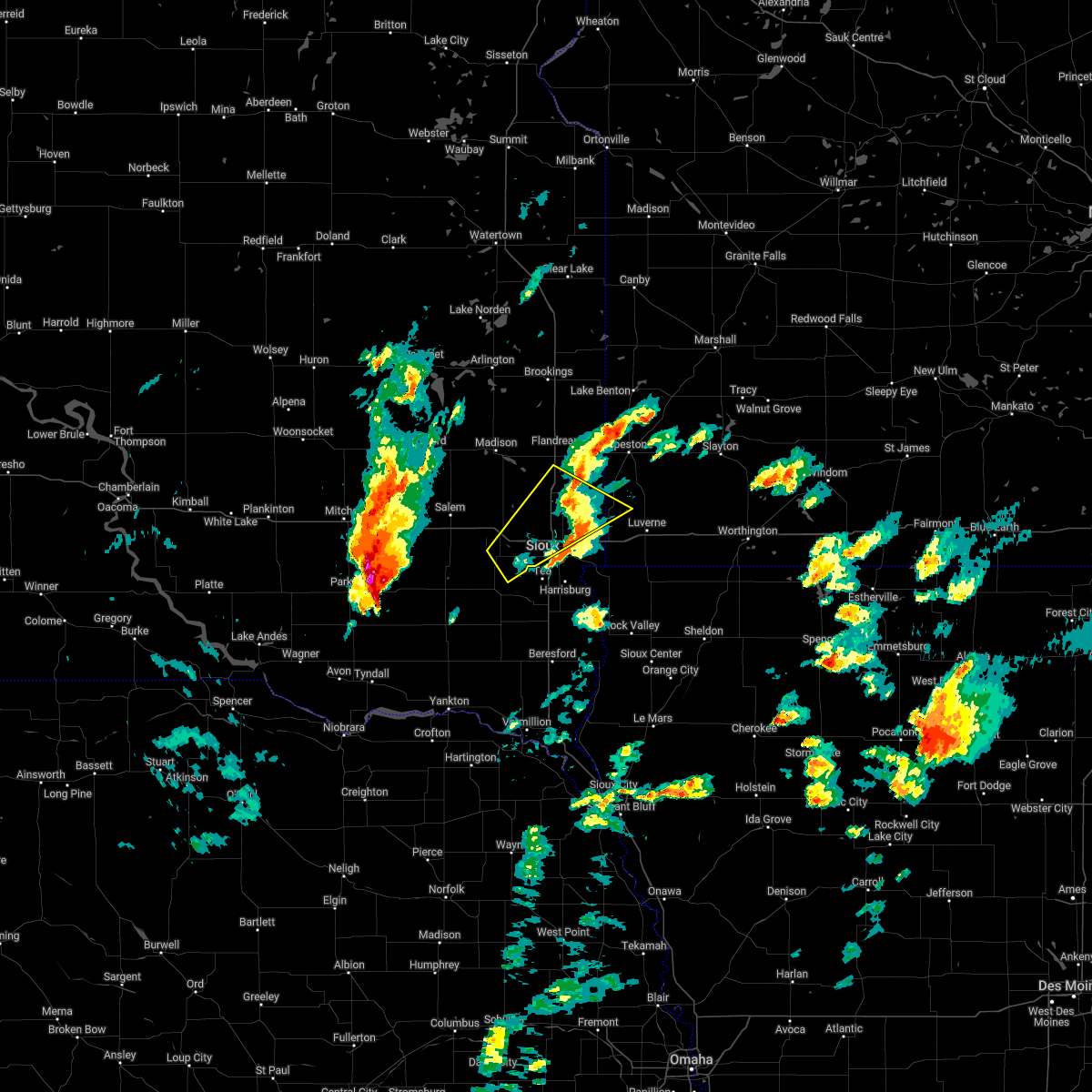 The severe thunderstorm warning for northwestern rock, south central moody, minnehaha, eastern mccook and northeastern turner counties will expire at 630 pm cdt, the storm which prompted the warning has weakened below severe limits, and no longer poses an immediate threat to life or property. therefore, the warning will be allowed to expire. however small hail is still possible with this thunderstorm. a tornado watch remains in effect until 1000 pm cdt for southeastern south dakota. a severe thunderstorm watch remains in effect until midnight cdt for southwestern minnesota, and southeastern and east central south dakota. The severe thunderstorm warning for northwestern rock, south central moody, minnehaha, eastern mccook and northeastern turner counties will expire at 630 pm cdt, the storm which prompted the warning has weakened below severe limits, and no longer poses an immediate threat to life or property. therefore, the warning will be allowed to expire. however small hail is still possible with this thunderstorm. a tornado watch remains in effect until 1000 pm cdt for southeastern south dakota. a severe thunderstorm watch remains in effect until midnight cdt for southwestern minnesota, and southeastern and east central south dakota.
|
| 4/12/2022 6:26 PM CDT |
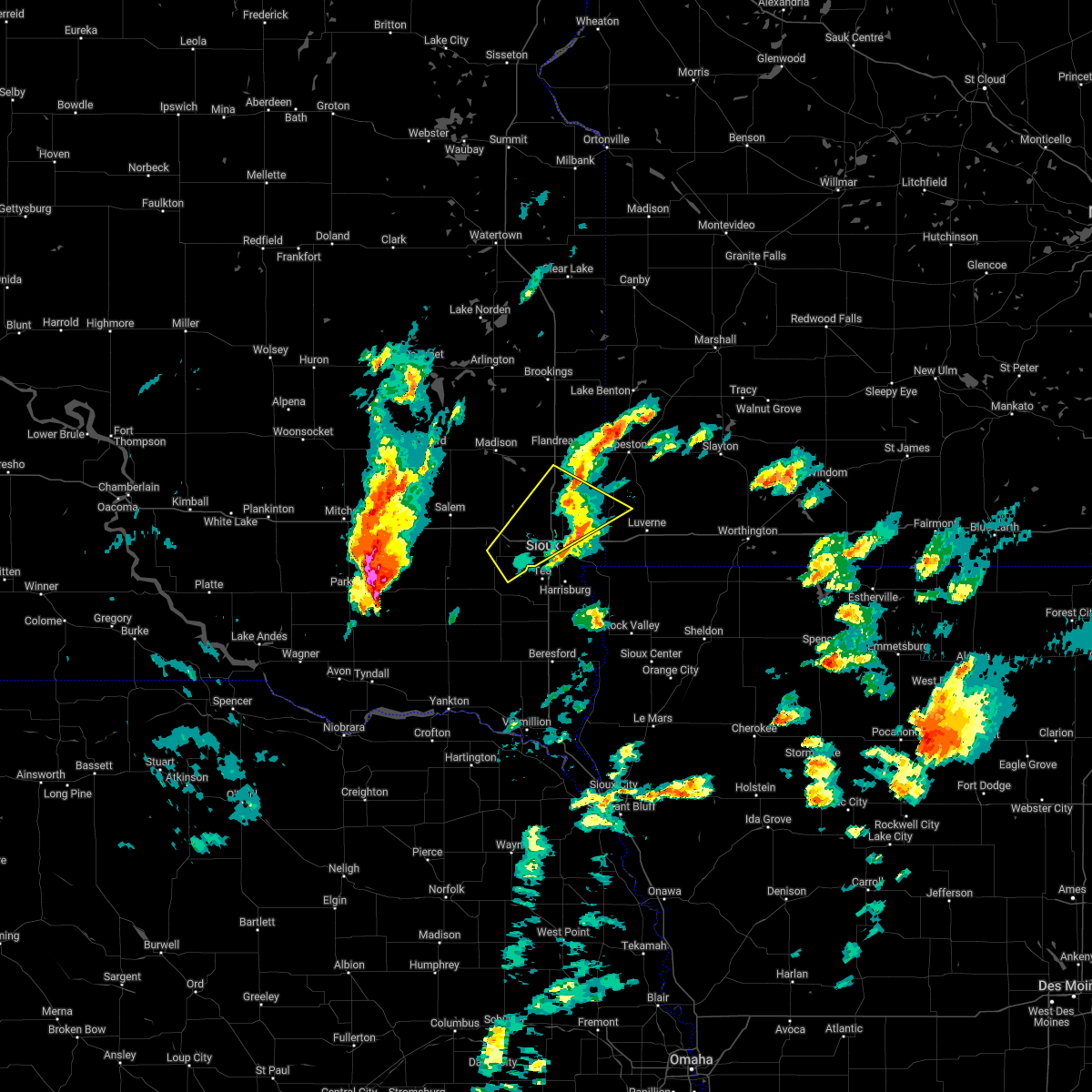 The severe thunderstorm warning for northwestern rock, south central moody, minnehaha, eastern mccook and northeastern turner counties will expire at 630 pm cdt, the storm which prompted the warning has weakened below severe limits, and no longer poses an immediate threat to life or property. therefore, the warning will be allowed to expire. however small hail is still possible with this thunderstorm. a tornado watch remains in effect until 1000 pm cdt for southeastern south dakota. a severe thunderstorm watch remains in effect until midnight cdt for southwestern minnesota, and southeastern and east central south dakota. The severe thunderstorm warning for northwestern rock, south central moody, minnehaha, eastern mccook and northeastern turner counties will expire at 630 pm cdt, the storm which prompted the warning has weakened below severe limits, and no longer poses an immediate threat to life or property. therefore, the warning will be allowed to expire. however small hail is still possible with this thunderstorm. a tornado watch remains in effect until 1000 pm cdt for southeastern south dakota. a severe thunderstorm watch remains in effect until midnight cdt for southwestern minnesota, and southeastern and east central south dakota.
|
| 4/12/2022 5:54 PM CDT |
 At 554 pm cdt, a severe thunderstorm was located over lennox, or 11 miles east of parker, moving northeast at 55 mph (radar indicated). Hazards include 60 mph wind gusts and half dollar size hail. Hail damage to vehicles is expected. expect wind damage to roofs, siding, and trees. this severe thunderstorm will be near, harrisburg around 605 pm cdt. sioux falls and lake alvin state recreation area around 610 pm cdt. other locations in the path of this severe thunderstorm include rowena, brandon, valley springs, beaver creek and luverne. hail threat, radar indicated max hail size, 1. 25 in wind threat, radar indicated max wind gust, 60 mph. At 554 pm cdt, a severe thunderstorm was located over lennox, or 11 miles east of parker, moving northeast at 55 mph (radar indicated). Hazards include 60 mph wind gusts and half dollar size hail. Hail damage to vehicles is expected. expect wind damage to roofs, siding, and trees. this severe thunderstorm will be near, harrisburg around 605 pm cdt. sioux falls and lake alvin state recreation area around 610 pm cdt. other locations in the path of this severe thunderstorm include rowena, brandon, valley springs, beaver creek and luverne. hail threat, radar indicated max hail size, 1. 25 in wind threat, radar indicated max wind gust, 60 mph.
|
| 4/12/2022 5:51 PM CDT |
 At 551 pm cdt, a severe thunderstorm was located over hartford, or 10 miles west of sioux falls, moving northeast at 35 mph (radar indicated). Hazards include 60 mph wind gusts and half dollar size hail. Hail damage to vehicles is expected. expect wind damage to roofs, siding, and trees. this severe thunderstorm will be near, sioux falls and crooks around 605 pm cdt. other locations in the path of this severe thunderstorm include baltic, dell rapids, palisades state park, garretson and sherman. hail threat, radar indicated max hail size, 1. 25 in wind threat, radar indicated max wind gust, 60 mph. At 551 pm cdt, a severe thunderstorm was located over hartford, or 10 miles west of sioux falls, moving northeast at 35 mph (radar indicated). Hazards include 60 mph wind gusts and half dollar size hail. Hail damage to vehicles is expected. expect wind damage to roofs, siding, and trees. this severe thunderstorm will be near, sioux falls and crooks around 605 pm cdt. other locations in the path of this severe thunderstorm include baltic, dell rapids, palisades state park, garretson and sherman. hail threat, radar indicated max hail size, 1. 25 in wind threat, radar indicated max wind gust, 60 mph.
|
| 4/12/2022 5:51 PM CDT |
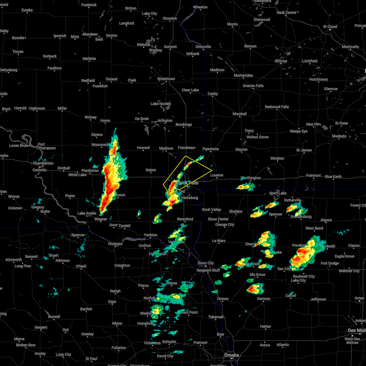 At 551 pm cdt, a severe thunderstorm was located over hartford, or 10 miles west of sioux falls, moving northeast at 35 mph (radar indicated). Hazards include 60 mph wind gusts and half dollar size hail. Hail damage to vehicles is expected. expect wind damage to roofs, siding, and trees. this severe thunderstorm will be near, sioux falls and crooks around 605 pm cdt. other locations in the path of this severe thunderstorm include baltic, dell rapids, palisades state park, garretson and sherman. hail threat, radar indicated max hail size, 1. 25 in wind threat, radar indicated max wind gust, 60 mph. At 551 pm cdt, a severe thunderstorm was located over hartford, or 10 miles west of sioux falls, moving northeast at 35 mph (radar indicated). Hazards include 60 mph wind gusts and half dollar size hail. Hail damage to vehicles is expected. expect wind damage to roofs, siding, and trees. this severe thunderstorm will be near, sioux falls and crooks around 605 pm cdt. other locations in the path of this severe thunderstorm include baltic, dell rapids, palisades state park, garretson and sherman. hail threat, radar indicated max hail size, 1. 25 in wind threat, radar indicated max wind gust, 60 mph.
|
| 9/17/2021 12:10 AM CDT |
 At 1210 am cdt, severe thunderstorms were located along a line extending from 6 miles south of aurora to near colman to near hartford, moving east at 55 mph (radar indicated). Hazards include 70 mph wind gusts. the strongest gusts are occurring ahead of the main line of storms. Expect considerable tree damage. damage is likely to mobile homes, roofs, and outbuildings. severe thunderstorms will be near, aurora around 1215 am cdt. baltic, egan and trent around 1220 am cdt. elkton and ward around 1225 am cdt. brandon, jasper and palisades state park around 1230 am cdt. garretson, lake benton and sherman around 1235 am cdt. pipestone, beaver creek, trosky and pipestone national monument around 1240 am cdt. tyler and holland around 1245 am cdt. other locations impacted by these severe thunderstorms include ihlen and flandreau santee sioux tribal nation. thunderstorm damage threat, considerable hail threat, radar indicated max hail size, <. 75 in wind threat, radar indicated max wind gust, 70 mph. At 1210 am cdt, severe thunderstorms were located along a line extending from 6 miles south of aurora to near colman to near hartford, moving east at 55 mph (radar indicated). Hazards include 70 mph wind gusts. the strongest gusts are occurring ahead of the main line of storms. Expect considerable tree damage. damage is likely to mobile homes, roofs, and outbuildings. severe thunderstorms will be near, aurora around 1215 am cdt. baltic, egan and trent around 1220 am cdt. elkton and ward around 1225 am cdt. brandon, jasper and palisades state park around 1230 am cdt. garretson, lake benton and sherman around 1235 am cdt. pipestone, beaver creek, trosky and pipestone national monument around 1240 am cdt. tyler and holland around 1245 am cdt. other locations impacted by these severe thunderstorms include ihlen and flandreau santee sioux tribal nation. thunderstorm damage threat, considerable hail threat, radar indicated max hail size, <. 75 in wind threat, radar indicated max wind gust, 70 mph.
|
| 8/28/2021 8:00 PM CDT |
 At 800 pm cdt, a severe thunderstorm was located near humboldt, or 9 miles northeast of lake vermillion state recreation area, moving northeast at 50 mph (trained weather spotters. at 755 pm quarter sized hail was reported near humboldt). Hazards include 60 mph wind gusts and half dollar size hail. Hail damage to vehicles is expected. expect wind damage to roofs, siding, and trees. locations impacted include, crooks, colton, dell rapids, baltic, trent and egan. hail threat, radar indicated max hail size, 1. 25 in wind threat, radar indicated max wind gust, 60 mph. At 800 pm cdt, a severe thunderstorm was located near humboldt, or 9 miles northeast of lake vermillion state recreation area, moving northeast at 50 mph (trained weather spotters. at 755 pm quarter sized hail was reported near humboldt). Hazards include 60 mph wind gusts and half dollar size hail. Hail damage to vehicles is expected. expect wind damage to roofs, siding, and trees. locations impacted include, crooks, colton, dell rapids, baltic, trent and egan. hail threat, radar indicated max hail size, 1. 25 in wind threat, radar indicated max wind gust, 60 mph.
|
| 8/28/2021 7:48 PM CDT |
 At 748 pm cdt, a severe thunderstorm was located over lake vermillion state recreation area, moving northeast at 50 mph (radar indicated). Hazards include 60 mph wind gusts and half dollar size hail. Hail damage to vehicles is expected. expect wind damage to roofs, siding, and trees. this severe thunderstorm will be near, hartford around 800 pm cdt. crooks around 805 pm cdt. colton around 810 pm cdt. baltic around 815 pm cdt. dell rapids around 820 pm cdt. trent around 825 pm cdt. hail threat, radar indicated max hail size, 1. 25 in wind threat, radar indicated max wind gust, 60 mph. At 748 pm cdt, a severe thunderstorm was located over lake vermillion state recreation area, moving northeast at 50 mph (radar indicated). Hazards include 60 mph wind gusts and half dollar size hail. Hail damage to vehicles is expected. expect wind damage to roofs, siding, and trees. this severe thunderstorm will be near, hartford around 800 pm cdt. crooks around 805 pm cdt. colton around 810 pm cdt. baltic around 815 pm cdt. dell rapids around 820 pm cdt. trent around 825 pm cdt. hail threat, radar indicated max hail size, 1. 25 in wind threat, radar indicated max wind gust, 60 mph.
|
| 8/28/2021 7:06 PM CDT |
 At 705 pm cdt, a severe thunderstorm was located near rowena, or near sioux falls, moving northeast at 40 mph (radar indicated). Hazards include 60 mph wind gusts and half dollar size hail. Hail damage to vehicles is expected. expect wind damage to roofs, siding, and trees. locations impacted include, brandon, valley springs, garretson, beaver creek, palisades state park, sherman and hardwick. hail threat, radar indicated max hail size, 1. 25 in wind threat, radar indicated max wind gust, 60 mph. At 705 pm cdt, a severe thunderstorm was located near rowena, or near sioux falls, moving northeast at 40 mph (radar indicated). Hazards include 60 mph wind gusts and half dollar size hail. Hail damage to vehicles is expected. expect wind damage to roofs, siding, and trees. locations impacted include, brandon, valley springs, garretson, beaver creek, palisades state park, sherman and hardwick. hail threat, radar indicated max hail size, 1. 25 in wind threat, radar indicated max wind gust, 60 mph.
|
| 8/28/2021 6:56 PM CDT |
 At 656 pm cdt, a severe thunderstorm was located near canton, moving northeast at 25 mph (radar indicated). Hazards include golf ball size hail and 60 mph wind gusts. People and animals outdoors will be injured. expect hail damage to roofs, siding, windows, and vehicles. expect wind damage to roofs, siding, and trees. locations impacted include, canton, inwood, lake alvin state recreation area, larchwood and lester. thunderstorm damage threat, considerable hail threat, radar indicated max hail size, 1. 75 in wind threat, radar indicated max wind gust, 60 mph. At 656 pm cdt, a severe thunderstorm was located near canton, moving northeast at 25 mph (radar indicated). Hazards include golf ball size hail and 60 mph wind gusts. People and animals outdoors will be injured. expect hail damage to roofs, siding, windows, and vehicles. expect wind damage to roofs, siding, and trees. locations impacted include, canton, inwood, lake alvin state recreation area, larchwood and lester. thunderstorm damage threat, considerable hail threat, radar indicated max hail size, 1. 75 in wind threat, radar indicated max wind gust, 60 mph.
|
| 8/28/2021 6:53 PM CDT |
 At 653 pm cdt, a severe thunderstorm was located over harrisburg, or 7 miles south of sioux falls, moving northeast at 40 mph (radar indicated). Hazards include 60 mph wind gusts and half dollar size hail. Hail damage to vehicles is expected. expect wind damage to roofs, siding, and trees. this severe thunderstorm will be near, sioux falls and rowena around 705 pm cdt. other locations in the path of this severe thunderstorm include brandon, valley springs, palisades state park, garretson and sherman. hail threat, radar indicated max hail size, 1. 25 in wind threat, radar indicated max wind gust, 60 mph. At 653 pm cdt, a severe thunderstorm was located over harrisburg, or 7 miles south of sioux falls, moving northeast at 40 mph (radar indicated). Hazards include 60 mph wind gusts and half dollar size hail. Hail damage to vehicles is expected. expect wind damage to roofs, siding, and trees. this severe thunderstorm will be near, sioux falls and rowena around 705 pm cdt. other locations in the path of this severe thunderstorm include brandon, valley springs, palisades state park, garretson and sherman. hail threat, radar indicated max hail size, 1. 25 in wind threat, radar indicated max wind gust, 60 mph.
|
| 8/28/2021 6:44 PM CDT |
 At 643 pm cdt, a severe thunderstorm was located just south of worthing, or 7 miles west of canton, moving northeast at 25 mph (radar indicated). Hazards include 60 mph wind gusts and half dollar size hail. Hail damage to vehicles is expected. expect wind damage to roofs, siding, and trees. this severe thunderstorm will be near, newton hills state park around 655 pm cdt. other locations in the path of this severe thunderstorm include canton, lake alvin state recreation area, inwood, larchwood and lester. hail threat, radar indicated max hail size, 1. 25 in wind threat, radar indicated max wind gust, 60 mph. At 643 pm cdt, a severe thunderstorm was located just south of worthing, or 7 miles west of canton, moving northeast at 25 mph (radar indicated). Hazards include 60 mph wind gusts and half dollar size hail. Hail damage to vehicles is expected. expect wind damage to roofs, siding, and trees. this severe thunderstorm will be near, newton hills state park around 655 pm cdt. other locations in the path of this severe thunderstorm include canton, lake alvin state recreation area, inwood, larchwood and lester. hail threat, radar indicated max hail size, 1. 25 in wind threat, radar indicated max wind gust, 60 mph.
|
| 8/28/2021 5:41 PM CDT |
 The severe thunderstorm warning for lyon, southern rock, southwestern nobles, southeastern minnehaha and northeastern lincoln counties will expire at 545 pm cdt, the storms which prompted the warning have moved out of the area. therefore, the warning will be allowed to expire. however gusty winds are still possible with these thunderstorms. a tornado watch remains in effect until 900 pm cdt for southwestern minnesota. a severe thunderstorm watch remains in effect until 900 pm cdt for northwestern iowa, and southeastern south dakota. The severe thunderstorm warning for lyon, southern rock, southwestern nobles, southeastern minnehaha and northeastern lincoln counties will expire at 545 pm cdt, the storms which prompted the warning have moved out of the area. therefore, the warning will be allowed to expire. however gusty winds are still possible with these thunderstorms. a tornado watch remains in effect until 900 pm cdt for southwestern minnesota. a severe thunderstorm watch remains in effect until 900 pm cdt for northwestern iowa, and southeastern south dakota.
|
| 8/28/2021 5:18 PM CDT |
 At 518 pm cdt, severe thunderstorms were located along a line extending from near lester to near inwood, moving east at 50 mph (radar indicated). Hazards include 70 mph wind gusts and half dollar size hail. Hail damage to vehicles is expected. expect considerable tree damage. wind damage is also likely to mobile homes, roofs, and outbuildings. these severe storms will be near, rock rapids around 530 pm cdt. ellsworth around 535 pm cdt. george around 540 pm cdt. other locations impacted by these severe thunderstorms include steen. thunderstorm damage threat, considerable hail threat, radar indicated max hail size, 1. 25 in wind threat, radar indicated max wind gust, 70 mph. At 518 pm cdt, severe thunderstorms were located along a line extending from near lester to near inwood, moving east at 50 mph (radar indicated). Hazards include 70 mph wind gusts and half dollar size hail. Hail damage to vehicles is expected. expect considerable tree damage. wind damage is also likely to mobile homes, roofs, and outbuildings. these severe storms will be near, rock rapids around 530 pm cdt. ellsworth around 535 pm cdt. george around 540 pm cdt. other locations impacted by these severe thunderstorms include steen. thunderstorm damage threat, considerable hail threat, radar indicated max hail size, 1. 25 in wind threat, radar indicated max wind gust, 70 mph.
|
| 8/28/2021 5:03 PM CDT |
 At 503 pm cdt, severe thunderstorms were located along a line extending from garretson to brandon, moving east at 25 mph (radar indicated). Hazards include 60 mph wind gusts and quarter size hail. Hail damage to vehicles is expected. expect wind damage to roofs, siding, and trees. locations impacted include, valley springs. hail threat, radar indicated max hail size, 1. 00 in wind threat, radar indicated max wind gust, 60 mph. At 503 pm cdt, severe thunderstorms were located along a line extending from garretson to brandon, moving east at 25 mph (radar indicated). Hazards include 60 mph wind gusts and quarter size hail. Hail damage to vehicles is expected. expect wind damage to roofs, siding, and trees. locations impacted include, valley springs. hail threat, radar indicated max hail size, 1. 00 in wind threat, radar indicated max wind gust, 60 mph.
|
| 8/28/2021 5:00 PM CDT |
 At 500 pm cdt, severe thunderstorms were located along a line extending from near lake alvin state recreation area to near newton hills state park, moving east at 40 mph (radar indicated). Hazards include 70 mph wind gusts and ping pong ball size hail. People and animals outdoors will be injured. expect hail damage to roofs, siding, windows, and vehicles. expect considerable tree damage. wind damage is also likely to mobile homes, roofs, and outbuildings. severe thunderstorms will be near, larchwood around 510 pm cdt. lester and fairview around 515 pm cdt. inwood around 520 pm cdt. rock rapids around 525 pm cdt. rock valley and alvord around 530 pm cdt. doon around 535 pm cdt. hull and ellsworth around 540 pm cdt. george and boyden around 545 pm cdt. other locations impacted by these severe thunderstorms include steen. thunderstorm damage threat, considerable hail threat, radar indicated max hail size, 1. 50 in wind threat, radar indicated max wind gust, 70 mph. At 500 pm cdt, severe thunderstorms were located along a line extending from near lake alvin state recreation area to near newton hills state park, moving east at 40 mph (radar indicated). Hazards include 70 mph wind gusts and ping pong ball size hail. People and animals outdoors will be injured. expect hail damage to roofs, siding, windows, and vehicles. expect considerable tree damage. wind damage is also likely to mobile homes, roofs, and outbuildings. severe thunderstorms will be near, larchwood around 510 pm cdt. lester and fairview around 515 pm cdt. inwood around 520 pm cdt. rock rapids around 525 pm cdt. rock valley and alvord around 530 pm cdt. doon around 535 pm cdt. hull and ellsworth around 540 pm cdt. george and boyden around 545 pm cdt. other locations impacted by these severe thunderstorms include steen. thunderstorm damage threat, considerable hail threat, radar indicated max hail size, 1. 50 in wind threat, radar indicated max wind gust, 70 mph.
|
| 8/28/2021 4:54 PM CDT |
 At 454 pm cdt, severe thunderstorms were located along a line extending from hills to inwood, moving east at 50 mph (radar indicated). Hazards include 70 mph wind gusts and ping pong ball size hail. People and animals outdoors will be injured. expect hail damage to roofs, siding, windows, and vehicles. expect considerable tree damage. wind damage is also likely to mobile homes, roofs, and outbuildings. Locations impacted include, doon and rock rapids. At 454 pm cdt, severe thunderstorms were located along a line extending from hills to inwood, moving east at 50 mph (radar indicated). Hazards include 70 mph wind gusts and ping pong ball size hail. People and animals outdoors will be injured. expect hail damage to roofs, siding, windows, and vehicles. expect considerable tree damage. wind damage is also likely to mobile homes, roofs, and outbuildings. Locations impacted include, doon and rock rapids.
|
| 8/28/2021 4:45 PM CDT |
 At 444 pm cdt, a severe thunderstorm capable of producing a tornado was located over lake alvin state recreation area, or 7 miles southeast of sioux falls, moving east at 40 mph (radar indicated rotation). Hazards include tornado and quarter size hail. Flying debris will be dangerous to those caught without shelter. mobile homes will be damaged or destroyed. damage to roofs, windows, and vehicles will occur. tree damage is likely. this dangerous storm will be near, rowena around 455 pm cdt. larchwood and valley springs around 500 pm cdt. Other locations in the path of this tornadic thunderstorm include hills, lester and beaver creek. At 444 pm cdt, a severe thunderstorm capable of producing a tornado was located over lake alvin state recreation area, or 7 miles southeast of sioux falls, moving east at 40 mph (radar indicated rotation). Hazards include tornado and quarter size hail. Flying debris will be dangerous to those caught without shelter. mobile homes will be damaged or destroyed. damage to roofs, windows, and vehicles will occur. tree damage is likely. this dangerous storm will be near, rowena around 455 pm cdt. larchwood and valley springs around 500 pm cdt. Other locations in the path of this tornadic thunderstorm include hills, lester and beaver creek.
|
| 8/28/2021 4:33 PM CDT |
 At 432 pm cdt, severe thunderstorms were located along a line extending from near crooks to near tea, moving east at 25 mph (radar indicated). Hazards include 60 mph wind gusts and quarter size hail. Hail damage to vehicles is expected. Expect wind damage to roofs, siding, and trees. At 432 pm cdt, severe thunderstorms were located along a line extending from near crooks to near tea, moving east at 25 mph (radar indicated). Hazards include 60 mph wind gusts and quarter size hail. Hail damage to vehicles is expected. Expect wind damage to roofs, siding, and trees.
|
| 8/28/2021 4:27 PM CDT |
 At 426 pm cdt, severe thunderstorms were located along a line extending from tea to 6 miles southwest of worthing, moving east at 50 mph (at 4:19 pm, emergency management reported quarter-sized hail and winds gusting up to 70 mph in hurley). Hazards include two inch hail and 70 mph wind gusts. People and animals outdoors will be injured. expect hail damage to roofs, siding, windows, and vehicles. expect considerable tree damage. wind damage is also likely to mobile homes, roofs, and outbuildings. these severe storms will be near, harrisburg and worthing around 435 pm cdt. lake alvin state recreation area around 440 pm cdt. canton and newton hills state park around 445 pm cdt. larchwood and fairview around 450 pm cdt. inwood and lester around 455 pm cdt. Rock rapids, rock valley, doon and alvord around 500 pm cdt. At 426 pm cdt, severe thunderstorms were located along a line extending from tea to 6 miles southwest of worthing, moving east at 50 mph (at 4:19 pm, emergency management reported quarter-sized hail and winds gusting up to 70 mph in hurley). Hazards include two inch hail and 70 mph wind gusts. People and animals outdoors will be injured. expect hail damage to roofs, siding, windows, and vehicles. expect considerable tree damage. wind damage is also likely to mobile homes, roofs, and outbuildings. these severe storms will be near, harrisburg and worthing around 435 pm cdt. lake alvin state recreation area around 440 pm cdt. canton and newton hills state park around 445 pm cdt. larchwood and fairview around 450 pm cdt. inwood and lester around 455 pm cdt. Rock rapids, rock valley, doon and alvord around 500 pm cdt.
|
| 8/28/2021 4:23 PM CDT |
 At 422 pm cdt, severe thunderstorms were located along a line extending from near tea to near davis, moving east at 50 mph (radar indicated). Hazards include two inch hail and 70 mph wind gusts. People and animals outdoors will be injured. expect hail damage to roofs, siding, windows, and vehicles. expect considerable tree damage. wind damage is also likely to mobile homes, roofs, and outbuildings. severe thunderstorms will be near, worthing around 430 pm cdt. harrisburg around 435 pm cdt. lake alvin state recreation area around 440 pm cdt. canton and newton hills state park around 445 pm cdt. larchwood, inwood and fairview around 450 pm cdt. lester around 455 pm cdt. Rock rapids, rock valley, doon and alvord around 500 pm cdt. At 422 pm cdt, severe thunderstorms were located along a line extending from near tea to near davis, moving east at 50 mph (radar indicated). Hazards include two inch hail and 70 mph wind gusts. People and animals outdoors will be injured. expect hail damage to roofs, siding, windows, and vehicles. expect considerable tree damage. wind damage is also likely to mobile homes, roofs, and outbuildings. severe thunderstorms will be near, worthing around 430 pm cdt. harrisburg around 435 pm cdt. lake alvin state recreation area around 440 pm cdt. canton and newton hills state park around 445 pm cdt. larchwood, inwood and fairview around 450 pm cdt. lester around 455 pm cdt. Rock rapids, rock valley, doon and alvord around 500 pm cdt.
|
| 8/6/2021 12:13 AM CDT |
 At 1212 am cdt, a severe thunderstorm was located near northern sioux falls, moving southeast at 20 mph (radar indicated). Hazards include half dollar size hail. Damage to vehicles is expected. this severe storm will be near, brandon around 1220 am cdt. hail threat, radar indicated max hail size, 1. 25 in wind threat, radar indicated max wind gust, <50 mph. At 1212 am cdt, a severe thunderstorm was located near northern sioux falls, moving southeast at 20 mph (radar indicated). Hazards include half dollar size hail. Damage to vehicles is expected. this severe storm will be near, brandon around 1220 am cdt. hail threat, radar indicated max hail size, 1. 25 in wind threat, radar indicated max wind gust, <50 mph.
|
| 8/5/2021 11:56 PM CDT |
 At 1155 pm cdt, a severe thunderstorm was located over crooks, or 7 miles north of sioux falls, moving southeast at 25 mph (radar indicated). Hazards include ping pong ball size hail. People and animals outdoors will be injured. expect damage to roofs, siding, windows, and vehicles. this severe storm will be near, sioux falls around 1200 am cdt. brandon around 1220 am cdt. hail threat, radar indicated max hail size, 1. 50 in wind threat, radar indicated max wind gust, <50 mph. At 1155 pm cdt, a severe thunderstorm was located over crooks, or 7 miles north of sioux falls, moving southeast at 25 mph (radar indicated). Hazards include ping pong ball size hail. People and animals outdoors will be injured. expect damage to roofs, siding, windows, and vehicles. this severe storm will be near, sioux falls around 1200 am cdt. brandon around 1220 am cdt. hail threat, radar indicated max hail size, 1. 50 in wind threat, radar indicated max wind gust, <50 mph.
|
| 8/5/2021 11:40 PM CDT |
 At 1140 pm cdt, a severe thunderstorm was located near crooks, or 13 miles northwest of sioux falls, moving east at 20 mph (radar indicated). Hazards include half dollar size hail. Damage to vehicles is expected. this severe thunderstorm will be near, crooks around 1155 pm cdt. other locations in the path of this severe thunderstorm include sioux falls, brandon, garretson and palisades state park. hail threat, radar indicated max hail size, 1. 25 in wind threat, radar indicated max wind gust, <50 mph. At 1140 pm cdt, a severe thunderstorm was located near crooks, or 13 miles northwest of sioux falls, moving east at 20 mph (radar indicated). Hazards include half dollar size hail. Damage to vehicles is expected. this severe thunderstorm will be near, crooks around 1155 pm cdt. other locations in the path of this severe thunderstorm include sioux falls, brandon, garretson and palisades state park. hail threat, radar indicated max hail size, 1. 25 in wind threat, radar indicated max wind gust, <50 mph.
|
| 8/5/2021 10:37 PM CDT |
 The severe thunderstorm warning for southwestern lyon, lincoln and eastern turner counties will expire at 1045 pm cdt, the storm which prompted the warning has moved out of the area. therefore, the warning will be allowed to expire. however small hail, gusty winds and heavy rain are still possible with this thunderstorm. remember, a severe thunderstorm warning still remains in effect for lincoln county until 4:15 pm. The severe thunderstorm warning for southwestern lyon, lincoln and eastern turner counties will expire at 1045 pm cdt, the storm which prompted the warning has moved out of the area. therefore, the warning will be allowed to expire. however small hail, gusty winds and heavy rain are still possible with this thunderstorm. remember, a severe thunderstorm warning still remains in effect for lincoln county until 4:15 pm.
|
| 8/5/2021 10:21 PM CDT |
 At 1021 pm cdt, a severe thunderstorm was located over worthing, or 10 miles west of canton, moving southeast at 35 mph (radar indicated). Hazards include quarter size hail. Damage to vehicles is expected. this severe thunderstorm will remain over mainly rural areas of southwestern lyon, lincoln and eastern turner counties. hail threat, radar indicated max hail size, 1. 00 in wind threat, radar indicated max wind gust, <50 mph. At 1021 pm cdt, a severe thunderstorm was located over worthing, or 10 miles west of canton, moving southeast at 35 mph (radar indicated). Hazards include quarter size hail. Damage to vehicles is expected. this severe thunderstorm will remain over mainly rural areas of southwestern lyon, lincoln and eastern turner counties. hail threat, radar indicated max hail size, 1. 00 in wind threat, radar indicated max wind gust, <50 mph.
|
| 8/5/2021 10:04 PM CDT |
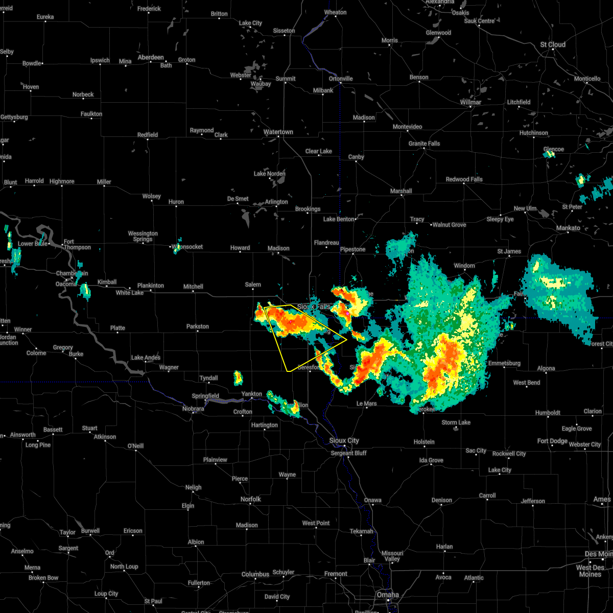 At 1003 pm cdt, a severe thunderstorm was located near tea, or 11 miles southwest of sioux falls, moving southeast at 35 mph (radar indicated). Hazards include quarter size hail. Damage to vehicles is expected. this severe thunderstorm will be near, lennox around 1015 pm cdt. other locations in the path of this severe thunderstorm include worthing. hail threat, radar indicated max hail size, 1. 00 in wind threat, radar indicated max wind gust, <50 mph. At 1003 pm cdt, a severe thunderstorm was located near tea, or 11 miles southwest of sioux falls, moving southeast at 35 mph (radar indicated). Hazards include quarter size hail. Damage to vehicles is expected. this severe thunderstorm will be near, lennox around 1015 pm cdt. other locations in the path of this severe thunderstorm include worthing. hail threat, radar indicated max hail size, 1. 00 in wind threat, radar indicated max wind gust, <50 mph.
|
| 8/5/2021 9:15 PM CDT |
 At 915 pm cdt, doppler radar indicated a severe thunderstorm capable of producing half dollar size hail and destructive winds in excess of 70 mph. this storm was located over lake alvin state recreation area, or 8 miles southeast of sioux falls, moving south at 30 mph. At 915 pm cdt, doppler radar indicated a severe thunderstorm capable of producing half dollar size hail and destructive winds in excess of 70 mph. this storm was located over lake alvin state recreation area, or 8 miles southeast of sioux falls, moving south at 30 mph.
|
| 8/5/2021 9:10 PM CDT | Hen Egg sized hail reported 4.8 miles W of Sioux Falls, SD |
| 8/5/2021 9:08 PM CDT | Quarter sized hail reported 4.8 miles W of Sioux Falls, SD |
| 8/5/2021 9:04 PM CDT | Tennis Ball sized hail reported 7.2 miles S of Sioux Falls, SD, report via social media. |
| 8/5/2021 8:57 PM CDT |
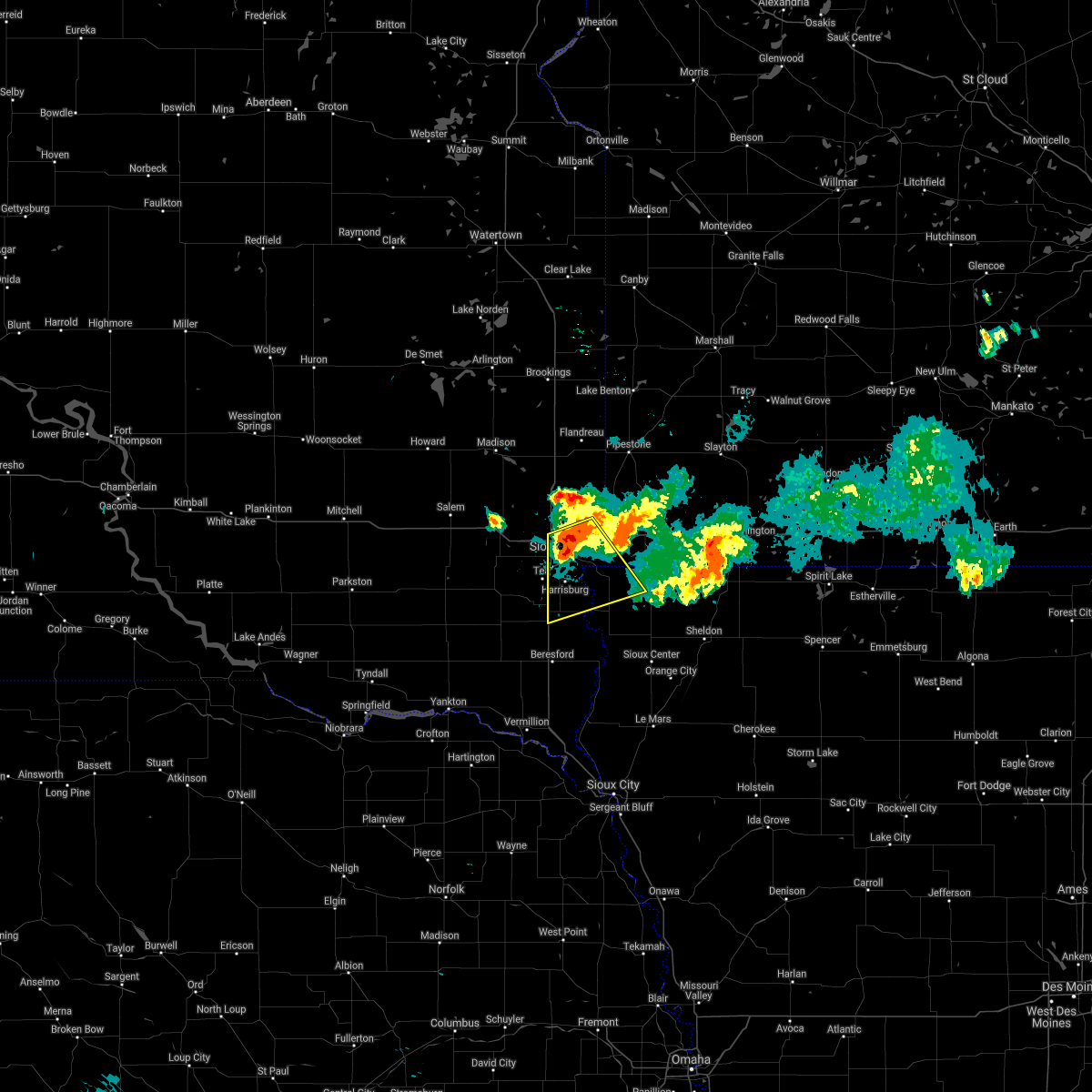 At 857 pm cdt, a severe thunderstorm was located near brandon, or near sioux falls, moving south at 30 mph (radar indicated). Hazards include 70 mph wind gusts and ping pong ball size hail. People and animals outdoors will be injured. expect hail damage to roofs, siding, windows, and vehicles. expect considerable tree damage. wind damage is also likely to mobile homes, roofs, and outbuildings. other locations in the path of this severe thunderstorm include lake alvin state recreation area and canton. thunderstorm damage threat, considerable hail threat, radar indicated max hail size, 1. 50 in wind threat, radar indicated max wind gust, 70 mph. At 857 pm cdt, a severe thunderstorm was located near brandon, or near sioux falls, moving south at 30 mph (radar indicated). Hazards include 70 mph wind gusts and ping pong ball size hail. People and animals outdoors will be injured. expect hail damage to roofs, siding, windows, and vehicles. expect considerable tree damage. wind damage is also likely to mobile homes, roofs, and outbuildings. other locations in the path of this severe thunderstorm include lake alvin state recreation area and canton. thunderstorm damage threat, considerable hail threat, radar indicated max hail size, 1. 50 in wind threat, radar indicated max wind gust, 70 mph.
|
| 8/5/2021 8:24 PM CDT |
 At 824 pm cdt, a severe thunderstorm was located near dell rapids, or 18 miles north of sioux falls, moving south at 20 mph (radar indicated). Hazards include golf ball size hail and 70 mph wind gusts. People and animals outdoors will be injured. expect hail damage to roofs, siding, windows, and vehicles. expect considerable tree damage. wind damage is also likely to mobile homes, roofs, and outbuildings. this severe thunderstorm will be near, baltic around 835 pm cdt. other locations in the path of this severe thunderstorm include crooks, sioux falls and brandon. thunderstorm damage threat, considerable hail threat, radar indicated max hail size, 1. 75 in wind threat, radar indicated max wind gust, 70 mph. At 824 pm cdt, a severe thunderstorm was located near dell rapids, or 18 miles north of sioux falls, moving south at 20 mph (radar indicated). Hazards include golf ball size hail and 70 mph wind gusts. People and animals outdoors will be injured. expect hail damage to roofs, siding, windows, and vehicles. expect considerable tree damage. wind damage is also likely to mobile homes, roofs, and outbuildings. this severe thunderstorm will be near, baltic around 835 pm cdt. other locations in the path of this severe thunderstorm include crooks, sioux falls and brandon. thunderstorm damage threat, considerable hail threat, radar indicated max hail size, 1. 75 in wind threat, radar indicated max wind gust, 70 mph.
|
| 7/9/2021 2:21 AM CDT | Quarter sized hail reported 5.9 miles E of Sioux Falls, SD, mostly dime/nickel sized hail... a few quarters. |
| 7/5/2021 7:18 PM CDT | Report from mping: 3-inch tree limbs broken; power poles broke in minnehaha county SD, 1.8 miles N of Sioux Falls, SD |
| 7/5/2021 7:16 PM CDT |
 At 716 pm cdt, severe thunderstorms were located along a line extending from near trosky to 7 miles south of luverne to near alvord, moving east at 35 mph (radar indicated). Hazards include 70 mph wind gusts and penny size hail. Expect considerable tree damage. damage is likely to mobile homes, roofs, and outbuildings. severe thunderstorms will be near, rock rapids around 720 pm cdt. ellsworth around 730 pm cdt. george around 735 pm cdt. adrian and leota around 740 pm cdt. little rock and lismore around 745 pm cdt. rushmore around 750 pm cdt. sibley, ashton and wilmont around 755 pm cdt. Other locations impacted by these severe thunderstorms include kenneth, steen, magnolia and bigelow. At 716 pm cdt, severe thunderstorms were located along a line extending from near trosky to 7 miles south of luverne to near alvord, moving east at 35 mph (radar indicated). Hazards include 70 mph wind gusts and penny size hail. Expect considerable tree damage. damage is likely to mobile homes, roofs, and outbuildings. severe thunderstorms will be near, rock rapids around 720 pm cdt. ellsworth around 730 pm cdt. george around 735 pm cdt. adrian and leota around 740 pm cdt. little rock and lismore around 745 pm cdt. rushmore around 750 pm cdt. sibley, ashton and wilmont around 755 pm cdt. Other locations impacted by these severe thunderstorms include kenneth, steen, magnolia and bigelow.
|
| 7/5/2021 7:11 PM CDT | Report from mping: 1-inch tree limbs broken; shingles blown of in minnehaha county SD, 1.8 miles N of Sioux Falls, SD |
| 7/5/2021 6:57 PM CDT | Report from mping: 1-inch tree limbs broken; shingles blown of in minnehaha county SD, 0.8 miles WSW of Sioux Falls, SD |
| 7/5/2021 6:57 PM CDT | Report from mping: 1-inch tree limbs broken; shingles blown of in minnehaha county SD, 1 miles SSE of Sioux Falls, SD |
| 7/5/2021 6:56 PM CDT | Trailer tipped over near i-90 mile marker 401 by wind gusts. no injuries reporte in minnehaha county SD, 5.3 miles SSW of Sioux Falls, SD |
| 7/5/2021 6:54 PM CDT | Storm damage reported in minnehaha county SD, 3.8 miles E of Sioux Falls, SD |
| 7/5/2021 6:52 PM CDT |
 At 651 pm cdt, severe thunderstorms were located along a line extending from near dell rapids to near brandon to valley springs to near harrisburg, moving east at 40 mph (radar indicated). Hazards include 70 mph wind gusts and penny size hail. Expect considerable tree damage. damage is likely to mobile homes, roofs, and outbuildings. these severe storms will be near, garretson, valley springs and palisades state park around 655 pm cdt. hills and beaver creek around 700 pm cdt. sherman around 705 pm cdt. larchwood, inwood and jasper around 710 pm cdt. luverne, lester and blue mounds state park around 715 pm cdt. alvord around 720 pm cdt. rock rapids and hardwick around 725 pm cdt. Other locations impacted by these severe thunderstorms include magnolia, kenneth and steen. At 651 pm cdt, severe thunderstorms were located along a line extending from near dell rapids to near brandon to valley springs to near harrisburg, moving east at 40 mph (radar indicated). Hazards include 70 mph wind gusts and penny size hail. Expect considerable tree damage. damage is likely to mobile homes, roofs, and outbuildings. these severe storms will be near, garretson, valley springs and palisades state park around 655 pm cdt. hills and beaver creek around 700 pm cdt. sherman around 705 pm cdt. larchwood, inwood and jasper around 710 pm cdt. luverne, lester and blue mounds state park around 715 pm cdt. alvord around 720 pm cdt. rock rapids and hardwick around 725 pm cdt. Other locations impacted by these severe thunderstorms include magnolia, kenneth and steen.
|
| 7/5/2021 6:40 PM CDT | Report from mping: 1-inch tree limbs broken; shingles blown of in minnehaha county SD, 6.3 miles E of Sioux Falls, SD |
| 7/5/2021 6:37 PM CDT |
 At 637 pm cdt, severe thunderstorms were located along a line extending from near dell rapids to near sioux falls to near brandon to near lennox, moving east at 40 mph (radar indicated). Hazards include 60 mph wind gusts and penny size hail. Expect damage to roofs, siding, and trees. severe thunderstorms will be near, brandon and rowena around 645 pm cdt. lake alvin state recreation area and palisades state park around 650 pm cdt. canton and valley springs around 655 pm cdt. garretson, hills, beaver creek and sherman around 700 pm cdt. larchwood, inwood and jasper around 705 pm cdt. luverne and lester around 710 pm cdt. rock rapids, hardwick, alvord and blue mounds state park around 715 pm cdt. Other locations impacted by these severe thunderstorms include magnolia, kenneth and steen. At 637 pm cdt, severe thunderstorms were located along a line extending from near dell rapids to near sioux falls to near brandon to near lennox, moving east at 40 mph (radar indicated). Hazards include 60 mph wind gusts and penny size hail. Expect damage to roofs, siding, and trees. severe thunderstorms will be near, brandon and rowena around 645 pm cdt. lake alvin state recreation area and palisades state park around 650 pm cdt. canton and valley springs around 655 pm cdt. garretson, hills, beaver creek and sherman around 700 pm cdt. larchwood, inwood and jasper around 705 pm cdt. luverne and lester around 710 pm cdt. rock rapids, hardwick, alvord and blue mounds state park around 715 pm cdt. Other locations impacted by these severe thunderstorms include magnolia, kenneth and steen.
|
| 4/5/2021 9:38 PM CDT |
 At 937 pm cdt, a severe thunderstorm was located near lake alvin state recreation area, or 11 miles north of canton, moving east at 30 mph (public). Hazards include 60 mph wind gusts and quarter size hail. Hail damage to vehicles is expected. expect wind damage to roofs, siding, and trees. This severe storm will be near, larchwood and valley springs around 950 pm cdt. At 937 pm cdt, a severe thunderstorm was located near lake alvin state recreation area, or 11 miles north of canton, moving east at 30 mph (public). Hazards include 60 mph wind gusts and quarter size hail. Hail damage to vehicles is expected. expect wind damage to roofs, siding, and trees. This severe storm will be near, larchwood and valley springs around 950 pm cdt.
|
| 4/5/2021 9:27 PM CDT |
 At 927 pm cdt, a severe thunderstorm was located over lake alvin state recreation area, or 7 miles southeast of sioux falls, moving northeast at 30 mph (public. at 920 pm, there were two reports of quarter sized hail on the south side of sioux falls, near 85th st. and louise ave). Hazards include quarter size hail. Damage to vehicles is expected. this severe thunderstorm will be near, rowena around 940 pm cdt. larchwood around 945 pm cdt. Valley springs around 950 pm cdt. At 927 pm cdt, a severe thunderstorm was located over lake alvin state recreation area, or 7 miles southeast of sioux falls, moving northeast at 30 mph (public. at 920 pm, there were two reports of quarter sized hail on the south side of sioux falls, near 85th st. and louise ave). Hazards include quarter size hail. Damage to vehicles is expected. this severe thunderstorm will be near, rowena around 940 pm cdt. larchwood around 945 pm cdt. Valley springs around 950 pm cdt.
|
| 4/5/2021 9:23 PM CDT |
 At 922 pm cdt, a severe thunderstorm was located over harrisburg, or near sioux falls, moving northeast at 30 mph (public. at 913 pm, quarter sized hail was reported 1 mile northeast of tea). Hazards include quarter size hail. Damage to vehicles is expected. This severe storm will be near, lake alvin state recreation area around 930 pm cdt. At 922 pm cdt, a severe thunderstorm was located over harrisburg, or near sioux falls, moving northeast at 30 mph (public. at 913 pm, quarter sized hail was reported 1 mile northeast of tea). Hazards include quarter size hail. Damage to vehicles is expected. This severe storm will be near, lake alvin state recreation area around 930 pm cdt.
|
| 4/5/2021 9:20 PM CDT | Quarter sized hail reported 4.5 miles NNE of Sioux Falls, SD, report received via mping. |
| 4/5/2021 9:20 PM CDT | Quarter sized hail reported 5.9 miles NNE of Sioux Falls, SD, report received via social media. |
| 4/5/2021 9:14 PM CDT |
 At 914 pm cdt, a severe thunderstorm was located over tea, or near sioux falls, moving northeast at 30 mph (radar indicated). Hazards include half dollar size hail. Damage to vehicles is expected. this severe storm will be near, harrisburg around 925 pm cdt. Lake alvin state recreation area around 930 pm cdt. At 914 pm cdt, a severe thunderstorm was located over tea, or near sioux falls, moving northeast at 30 mph (radar indicated). Hazards include half dollar size hail. Damage to vehicles is expected. this severe storm will be near, harrisburg around 925 pm cdt. Lake alvin state recreation area around 930 pm cdt.
|
| 4/5/2021 9:04 PM CDT |
 At 904 pm cdt, a severe thunderstorm was located near tea, or 10 miles southwest of sioux falls, moving northeast at 30 mph (radar indicated). Hazards include quarter size hail. Damage to vehicles is expected. this severe thunderstorm will be near, tea around 910 pm cdt. harrisburg around 925 pm cdt. Sioux falls and lake alvin state recreation area around 930 pm cdt. At 904 pm cdt, a severe thunderstorm was located near tea, or 10 miles southwest of sioux falls, moving northeast at 30 mph (radar indicated). Hazards include quarter size hail. Damage to vehicles is expected. this severe thunderstorm will be near, tea around 910 pm cdt. harrisburg around 925 pm cdt. Sioux falls and lake alvin state recreation area around 930 pm cdt.
|
| 4/5/2021 8:55 PM CDT |
 At 855 pm cdt, a severe thunderstorm was located over brandon, or 7 miles northeast of sioux falls, moving northeast at 35 mph (trained weather spotters). Hazards include quarter size hail. Damage to vehicles is expected. this severe storm will be near, valley springs and palisades state park around 905 pm cdt. garretson around 910 pm cdt. Sherman around 915 pm cdt. At 855 pm cdt, a severe thunderstorm was located over brandon, or 7 miles northeast of sioux falls, moving northeast at 35 mph (trained weather spotters). Hazards include quarter size hail. Damage to vehicles is expected. this severe storm will be near, valley springs and palisades state park around 905 pm cdt. garretson around 910 pm cdt. Sherman around 915 pm cdt.
|
| 4/5/2021 8:48 PM CDT |
 At 846 pm cdt, a severe thunderstorm was located over sioux falls, moving northeast at 35 mph (trained weather spotters. quarter sized hail was falling at the national weather service office, 2 miles north of sioux falls). Hazards include quarter size hail. Damage to vehicles is expected. this severe storm will be near, rowena around 855 pm cdt. brandon around 900 pm cdt. valley springs and palisades state park around 905 pm cdt. garretson around 910 pm cdt. Sherman around 915 pm cdt. At 846 pm cdt, a severe thunderstorm was located over sioux falls, moving northeast at 35 mph (trained weather spotters. quarter sized hail was falling at the national weather service office, 2 miles north of sioux falls). Hazards include quarter size hail. Damage to vehicles is expected. this severe storm will be near, rowena around 855 pm cdt. brandon around 900 pm cdt. valley springs and palisades state park around 905 pm cdt. garretson around 910 pm cdt. Sherman around 915 pm cdt.
|
| 4/5/2021 8:44 PM CDT | Quarter sized hail reported 3.8 miles S of Sioux Falls, SD, hail still falling. |
| 4/5/2021 8:44 PM CDT |
 At 844 pm cdt, a severe thunderstorm was located over sioux falls, moving northeast at 35 mph (radar indicated). Hazards include quarter size hail. Damage to vehicles is expected. this severe thunderstorm will be near, rowena around 855 pm cdt. brandon around 900 pm cdt. palisades state park around 905 pm cdt. garretson and valley springs around 910 pm cdt. Sherman around 915 pm cdt. At 844 pm cdt, a severe thunderstorm was located over sioux falls, moving northeast at 35 mph (radar indicated). Hazards include quarter size hail. Damage to vehicles is expected. this severe thunderstorm will be near, rowena around 855 pm cdt. brandon around 900 pm cdt. palisades state park around 905 pm cdt. garretson and valley springs around 910 pm cdt. Sherman around 915 pm cdt.
|
| 4/5/2021 8:43 PM CDT | Half Dollar sized hail reported 3.8 miles S of Sioux Falls, SD, corrects previous hail report from 3 n sioux falls. hail still falling. |
| 10/11/2020 5:01 PM CDT |
 At 500 pm cdt, severe thunderstorms were located along a line extending from near tea to near worthing, moving northeast at 45 mph (radar indicated). Hazards include 60 mph wind gusts and quarter size hail. Hail damage to vehicles is expected. expect wind damage to roofs, siding, and trees. severe thunderstorms will be near, sioux falls around 510 pm cdt. harrisburg around 515 pm cdt. brandon and lake alvin state recreation area around 520 pm cdt. rowena and palisades state park around 525 pm cdt. garretson around 530 pm cdt. Valley springs and sherman around 535 pm cdt. At 500 pm cdt, severe thunderstorms were located along a line extending from near tea to near worthing, moving northeast at 45 mph (radar indicated). Hazards include 60 mph wind gusts and quarter size hail. Hail damage to vehicles is expected. expect wind damage to roofs, siding, and trees. severe thunderstorms will be near, sioux falls around 510 pm cdt. harrisburg around 515 pm cdt. brandon and lake alvin state recreation area around 520 pm cdt. rowena and palisades state park around 525 pm cdt. garretson around 530 pm cdt. Valley springs and sherman around 535 pm cdt.
|
| 8/10/2020 5:07 AM CDT |
 The severe thunderstorm warning for minnehaha county will expire at 515 am cdt, the storms which prompted the warning have weakened below severe limits, and no longer pose an immediate threat to life or property. therefore, the warning will be allowed to expire. however small hail, gusty winds and heavy rain are still possible with these thunderstorms. The severe thunderstorm warning for minnehaha county will expire at 515 am cdt, the storms which prompted the warning have weakened below severe limits, and no longer pose an immediate threat to life or property. therefore, the warning will be allowed to expire. however small hail, gusty winds and heavy rain are still possible with these thunderstorms.
|
| 8/10/2020 4:43 AM CDT |
 At 442 am cdt, severe thunderstorms were located along a line extending from near montrose to humboldt to near lake vermillion state recreation area, moving east at 45 mph (radar indicated). Hazards include 60 mph wind gusts. Expect damage to roofs, siding, and trees. these severe storms will be near, hartford around 450 am cdt. wall lake and colton around 455 am cdt. crooks around 500 am cdt. sioux falls, dell rapids and baltic around 510 am cdt. Brandon, garretson and palisades state park around 520 am cdt. At 442 am cdt, severe thunderstorms were located along a line extending from near montrose to humboldt to near lake vermillion state recreation area, moving east at 45 mph (radar indicated). Hazards include 60 mph wind gusts. Expect damage to roofs, siding, and trees. these severe storms will be near, hartford around 450 am cdt. wall lake and colton around 455 am cdt. crooks around 500 am cdt. sioux falls, dell rapids and baltic around 510 am cdt. Brandon, garretson and palisades state park around 520 am cdt.
|
| 8/10/2020 4:27 AM CDT |
 At 427 am cdt, severe thunderstorms were located along a line extending from near salem to near canistota to near dolton, moving east at 45 mph (radar indicated). Hazards include 60 mph wind gusts. Expect damage to roofs, siding, and trees. severe thunderstorms will be near, montrose around 435 am cdt. humboldt around 440 am cdt. wall lake around 450 am cdt. hartford and colton around 455 am cdt. crooks around 500 am cdt. sioux falls and baltic around 505 am cdt. dell rapids around 510 am cdt. Brandon, garretson and palisades state park around 515 am cdt. At 427 am cdt, severe thunderstorms were located along a line extending from near salem to near canistota to near dolton, moving east at 45 mph (radar indicated). Hazards include 60 mph wind gusts. Expect damage to roofs, siding, and trees. severe thunderstorms will be near, montrose around 435 am cdt. humboldt around 440 am cdt. wall lake around 450 am cdt. hartford and colton around 455 am cdt. crooks around 500 am cdt. sioux falls and baltic around 505 am cdt. dell rapids around 510 am cdt. Brandon, garretson and palisades state park around 515 am cdt.
|
| 8/9/2020 1:52 AM CDT |
 The severe thunderstorm warning for east central sanborn, miner, mccook, yankton, northeastern hanson, southwestern brookings, eastern hutchinson, southeastern kingsbury, southwestern moody, northern clay, lake, western minnehaha, western lincoln, turner and northwestern union counties will expire at 200 am cdt, the storms which prompted the warning have weakened below severe limits, and no longer pose an immediate threat to life or property. therefore, the warning will be allowed to expire. however gusty winds are still possible with these thunderstorms. a severe thunderstorm watch remains in effect until 500 am cdt for southeastern and east central south dakota. The severe thunderstorm warning for east central sanborn, miner, mccook, yankton, northeastern hanson, southwestern brookings, eastern hutchinson, southeastern kingsbury, southwestern moody, northern clay, lake, western minnehaha, western lincoln, turner and northwestern union counties will expire at 200 am cdt, the storms which prompted the warning have weakened below severe limits, and no longer pose an immediate threat to life or property. therefore, the warning will be allowed to expire. however gusty winds are still possible with these thunderstorms. a severe thunderstorm watch remains in effect until 500 am cdt for southeastern and east central south dakota.
|
| 8/9/2020 1:37 AM CDT |
 At 137 am cdt, severe thunderstorms were located along a line extending from 7 miles east of carthage to near montrose to near volin, moving northeast at 55 mph (radar indicated). Hazards include 70 mph wind gusts and penny size hail. Expect considerable tree damage. damage is likely to mobile homes, roofs, and outbuildings. these severe storms will be near, humboldt around 145 am cdt. oldham around 150 am cdt. colton around 155 am cdt. beresford and chester around 200 am cdt. dell rapids and baltic around 205 am cdt. worthing around 210 am cdt. other locations impacted by these severe thunderstorms include gayville and st. Helena boat dock. At 137 am cdt, severe thunderstorms were located along a line extending from 7 miles east of carthage to near montrose to near volin, moving northeast at 55 mph (radar indicated). Hazards include 70 mph wind gusts and penny size hail. Expect considerable tree damage. damage is likely to mobile homes, roofs, and outbuildings. these severe storms will be near, humboldt around 145 am cdt. oldham around 150 am cdt. colton around 155 am cdt. beresford and chester around 200 am cdt. dell rapids and baltic around 205 am cdt. worthing around 210 am cdt. other locations impacted by these severe thunderstorms include gayville and st. Helena boat dock.
|
| 8/9/2020 1:20 AM CDT |
 At 119 am cdt, severe thunderstorms were located along a line extending from near fedora to near bridgewater to near yankton, moving northeast at 55 mph (radar indicated). Hazards include 70 mph wind gusts and penny size hail. Expect considerable tree damage. damage is likely to mobile homes, roofs, and outbuildings. severe thunderstorms will be near, dolton and roswell around 125 am cdt. canistota around 130 am cdt. lake vermillion state recreation area, mayfield and volin around 135 am cdt. montrose, irene and wakonda around 140 am cdt. humboldt around 145 am cdt. centerville, viborg and oldham around 150 am cdt. colton around 155 am cdt. beresford, dell rapids, baltic and chester around 200 am cdt. other locations impacted by these severe thunderstorms include gayville and st. Helena boat dock. At 119 am cdt, severe thunderstorms were located along a line extending from near fedora to near bridgewater to near yankton, moving northeast at 55 mph (radar indicated). Hazards include 70 mph wind gusts and penny size hail. Expect considerable tree damage. damage is likely to mobile homes, roofs, and outbuildings. severe thunderstorms will be near, dolton and roswell around 125 am cdt. canistota around 130 am cdt. lake vermillion state recreation area, mayfield and volin around 135 am cdt. montrose, irene and wakonda around 140 am cdt. humboldt around 145 am cdt. centerville, viborg and oldham around 150 am cdt. colton around 155 am cdt. beresford, dell rapids, baltic and chester around 200 am cdt. other locations impacted by these severe thunderstorms include gayville and st. Helena boat dock.
|
| 6/9/2020 9:35 PM CDT | Report from mping: 1-inch tree limbs broken; shingles blown of in minnehaha county SD, 1.8 miles N of Sioux Falls, SD |
| 6/9/2020 7:13 PM CDT |
 The severe thunderstorm warning for northwestern lyon, southeastern minnehaha, northwestern lincoln and northeastern turner counties will expire at 715 pm cdt, the storms which prompted the warning have weakened below severe limits, and no longer pose an immediate threat to life or property. therefore, the warning will be allowed to expire. however gusty winds are still possible with these thunderstorms. The severe thunderstorm warning for northwestern lyon, southeastern minnehaha, northwestern lincoln and northeastern turner counties will expire at 715 pm cdt, the storms which prompted the warning have weakened below severe limits, and no longer pose an immediate threat to life or property. therefore, the warning will be allowed to expire. however gusty winds are still possible with these thunderstorms.
|
| 6/9/2020 6:53 PM CDT |
 At 653 pm cdt, severe thunderstorms were located along a line extending from wall lake to lake alvin state recreation area, moving northeast at 20 mph (radar indicated). Hazards include 70 mph wind gusts. Expect considerable tree damage. damage is likely to mobile homes, roofs, and outbuildings. these severe storms will be near, lake alvin state recreation area around 700 pm cdt. rowena around 705 pm cdt. brandon around 720 pm cdt. Sioux falls around 730 pm cdt. At 653 pm cdt, severe thunderstorms were located along a line extending from wall lake to lake alvin state recreation area, moving northeast at 20 mph (radar indicated). Hazards include 70 mph wind gusts. Expect considerable tree damage. damage is likely to mobile homes, roofs, and outbuildings. these severe storms will be near, lake alvin state recreation area around 700 pm cdt. rowena around 705 pm cdt. brandon around 720 pm cdt. Sioux falls around 730 pm cdt.
|
| 6/9/2020 6:36 PM CDT |
 At 636 pm cdt, severe thunderstorms were located along a line extending from near parker to near harrisburg, moving northeast at 20 mph (radar indicated). Hazards include 70 mph wind gusts. Expect considerable tree damage. damage is likely to mobile homes, roofs, and outbuildings. severe thunderstorms will be near, harrisburg around 645 pm cdt. lake alvin state recreation area around 650 pm cdt. tea around 700 pm cdt. rowena around 705 pm cdt. Sioux falls and brandon around 715 pm cdt. At 636 pm cdt, severe thunderstorms were located along a line extending from near parker to near harrisburg, moving northeast at 20 mph (radar indicated). Hazards include 70 mph wind gusts. Expect considerable tree damage. damage is likely to mobile homes, roofs, and outbuildings. severe thunderstorms will be near, harrisburg around 645 pm cdt. lake alvin state recreation area around 650 pm cdt. tea around 700 pm cdt. rowena around 705 pm cdt. Sioux falls and brandon around 715 pm cdt.
|
| 9/10/2019 11:52 PM CDT |
 At 1151 pm cdt, severe thunderstorms were located along a line extending from 6 miles southeast of baltic to lake alvin state recreation area to near newton hills state park, moving east at 50 mph. these are very dangerous storms (radar indicated). Hazards include 90 mph wind gusts and quarter size hail. You are in a life-threatening situation. flying debris may be deadly to those caught without shelter. mobile homes will be heavily damaged or destroyed. homes and businesses will have substantial roof and window damage. expect extensive tree damage and power outages. these severe storms will be near, brandon and rowena around 1155 pm cdt. Garretson, larchwood, inwood, valley springs, hills, lester, sherman, fairview and palisades state park around 1200 am cdt. At 1151 pm cdt, severe thunderstorms were located along a line extending from 6 miles southeast of baltic to lake alvin state recreation area to near newton hills state park, moving east at 50 mph. these are very dangerous storms (radar indicated). Hazards include 90 mph wind gusts and quarter size hail. You are in a life-threatening situation. flying debris may be deadly to those caught without shelter. mobile homes will be heavily damaged or destroyed. homes and businesses will have substantial roof and window damage. expect extensive tree damage and power outages. these severe storms will be near, brandon and rowena around 1155 pm cdt. Garretson, larchwood, inwood, valley springs, hills, lester, sherman, fairview and palisades state park around 1200 am cdt.
|
| 9/10/2019 11:49 PM CDT |
 At 1148 pm cdt, a confirmed tornado was located near rowena, or 10 miles east of sioux falls, moving east at 40 mph (weather spotters confirmed tornado). Hazards include damaging tornado and quarter size hail. Flying debris will be dangerous to those caught without shelter. mobile homes will be damaged or destroyed. damage to roofs, windows, and vehicles will occur. tree damage is likely. This tornado will be near, hills and beaver creek around 1200 am cdt. At 1148 pm cdt, a confirmed tornado was located near rowena, or 10 miles east of sioux falls, moving east at 40 mph (weather spotters confirmed tornado). Hazards include damaging tornado and quarter size hail. Flying debris will be dangerous to those caught without shelter. mobile homes will be damaged or destroyed. damage to roofs, windows, and vehicles will occur. tree damage is likely. This tornado will be near, hills and beaver creek around 1200 am cdt.
|
| 9/10/2019 11:47 PM CDT | Tree limbs dow in minnehaha county SD, 2.6 miles NNW of Sioux Falls, SD |
| 9/10/2019 11:45 PM CDT | Structural collapse with people trapped insid in minnehaha county SD, 2.8 miles E of Sioux Falls, SD |
| 9/10/2019 11:43 PM CDT |
 At 1141 pm cdt, a confirmed tornado was reported by spotters 2 miles east of i29 along the minnehaha/lincoln county line. the tornado is moving east 40 mph (radar confirmed tornado). Hazards include damaging tornado and quarter size hail. Flying debris will be dangerous to those caught without shelter. mobile homes will be damaged or destroyed. damage to roofs, windows, and vehicles will occur. tree damage is likely. this tornado will be near, larchwood and valley springs around 1150 pm cdt. Hills and beaver creek around 1200 am cdt. At 1141 pm cdt, a confirmed tornado was reported by spotters 2 miles east of i29 along the minnehaha/lincoln county line. the tornado is moving east 40 mph (radar confirmed tornado). Hazards include damaging tornado and quarter size hail. Flying debris will be dangerous to those caught without shelter. mobile homes will be damaged or destroyed. damage to roofs, windows, and vehicles will occur. tree damage is likely. this tornado will be near, larchwood and valley springs around 1150 pm cdt. Hills and beaver creek around 1200 am cdt.
|
| 9/10/2019 11:32 PM CDT | Storm damage reported in minnehaha county SD, 6.5 miles ENE of Sioux Falls, SD |
| 9/10/2019 11:31 PM CDT | 60 to 70 mph winds.. in minnehaha county SD, 2.6 miles NNW of Sioux Falls, SD |
| 9/10/2019 11:31 PM CDT | Trees uprooted or snapped; roof blown of in minnehaha county SD, 0.4 miles SW of Sioux Falls, SD |
| 9/10/2019 11:30 PM CDT | Recorded by sdsu mesone in lincoln county SD, 2.6 miles NNW of Sioux Falls, SD |
| 9/10/2019 11:28 PM CDT | Limb damage on medium sized ash tree... would estimate 70 mph win in lincoln county SD, 3.2 miles N of Sioux Falls, SD |
| 9/10/2019 11:27 PM CDT |
 At 1113 pm cdt, severe thunderstorms were located along a line extending from hartford to near tea to near davis, moving east at 50 mph. these are very dangerous storms (radar indicated). Hazards include 80 mph wind gusts and quarter size hail. Flying debris will be dangerous to those caught without shelter. mobile homes will be heavily damaged. expect considerable damage to roofs, windows, and vehicles. extensive tree damage and power outages are likely. severe thunderstorms will be near, crooks and worthing around 1120 pm cdt. sioux falls, harrisburg and baltic around 1125 pm cdt. lake alvin state recreation area around 1130 pm cdt. canton, brandon, newton hills state park and rowena around 1135 pm cdt. garretson, larchwood, valley springs, sherman, fairview and palisades state park around 1140 pm cdt. Inwood, hills, beaver creek and lester around 1145 pm cdt. At 1113 pm cdt, severe thunderstorms were located along a line extending from hartford to near tea to near davis, moving east at 50 mph. these are very dangerous storms (radar indicated). Hazards include 80 mph wind gusts and quarter size hail. Flying debris will be dangerous to those caught without shelter. mobile homes will be heavily damaged. expect considerable damage to roofs, windows, and vehicles. extensive tree damage and power outages are likely. severe thunderstorms will be near, crooks and worthing around 1120 pm cdt. sioux falls, harrisburg and baltic around 1125 pm cdt. lake alvin state recreation area around 1130 pm cdt. canton, brandon, newton hills state park and rowena around 1135 pm cdt. garretson, larchwood, valley springs, sherman, fairview and palisades state park around 1140 pm cdt. Inwood, hills, beaver creek and lester around 1145 pm cdt.
|
| 9/10/2019 11:27 PM CDT |
 The national weather service in sioux falls has issued a * tornado warning for. northwestern lyon county in northwestern iowa. southwestern rock county in southwestern minnesota. southeastern minnehaha county in southeastern south dakota. North central lincoln county in southeastern south dakota. The national weather service in sioux falls has issued a * tornado warning for. northwestern lyon county in northwestern iowa. southwestern rock county in southwestern minnesota. southeastern minnehaha county in southeastern south dakota. North central lincoln county in southeastern south dakota.
|
| 9/10/2019 11:27 PM CDT |
 At 1127 pm cdt, a severe thunderstorm capable of producing a tornado was located over sioux falls, moving east at 40 mph (radar indicated rotation). Hazards include tornado and quarter size hail. Flying debris will be dangerous to those caught without shelter. mobile homes will be damaged or destroyed. damage to roofs, windows, and vehicles will occur. tree damage is likely. this dangerous storm will be near, sioux falls around 1130 pm cdt. brandon and rowena around 1145 pm cdt. larchwood around 1150 pm cdt. valley springs around 1155 pm cdt. Hills and beaver creek around 1200 am cdt. At 1127 pm cdt, a severe thunderstorm capable of producing a tornado was located over sioux falls, moving east at 40 mph (radar indicated rotation). Hazards include tornado and quarter size hail. Flying debris will be dangerous to those caught without shelter. mobile homes will be damaged or destroyed. damage to roofs, windows, and vehicles will occur. tree damage is likely. this dangerous storm will be near, sioux falls around 1130 pm cdt. brandon and rowena around 1145 pm cdt. larchwood around 1150 pm cdt. valley springs around 1155 pm cdt. Hills and beaver creek around 1200 am cdt.
|
| 9/10/2019 11:27 PM CDT |
 At 1127 pm cdt, severe thunderstorms were located along a line extending from near crooks to harrisburg to 7 miles south of worthing, moving east at 50 mph. these are very dangerous storms (radar indicated). Hazards include 90 mph wind gusts and quarter size hail. You are in a life-threatening situation. flying debris may be deadly to those caught without shelter. mobile homes will be heavily damaged or destroyed. homes and businesses will have substantial roof and window damage. expect extensive tree damage and power outages. these severe storms will be near, lake alvin state recreation area around 1130 pm cdt. brandon, newton hills state park and rowena around 1135 pm cdt. canton, garretson, larchwood, valley springs, fairview and palisades state park around 1140 pm cdt. inwood, hills, lester and sherman around 1145 pm cdt. Beaver creek around 1150 pm cdt. At 1127 pm cdt, severe thunderstorms were located along a line extending from near crooks to harrisburg to 7 miles south of worthing, moving east at 50 mph. these are very dangerous storms (radar indicated). Hazards include 90 mph wind gusts and quarter size hail. You are in a life-threatening situation. flying debris may be deadly to those caught without shelter. mobile homes will be heavily damaged or destroyed. homes and businesses will have substantial roof and window damage. expect extensive tree damage and power outages. these severe storms will be near, lake alvin state recreation area around 1130 pm cdt. brandon, newton hills state park and rowena around 1135 pm cdt. canton, garretson, larchwood, valley springs, fairview and palisades state park around 1140 pm cdt. inwood, hills, lester and sherman around 1145 pm cdt. Beaver creek around 1150 pm cdt.
|
| 9/10/2019 11:23 PM CDT | Report from mping: 1-inch tree limbs broken; shingles blown of in lincoln county SD, 4.2 miles NE of Sioux Falls, SD |
| 9/10/2019 11:20 PM CDT |
 A severe thunderstorm warning remains in effect until 1130 pm cdt for southwestern minnehaha. western lincoln and eastern turner counties. At 1119 pm cdt, severe thunderstorms were located along a line extending from 6 miles north of humboldt to lennox to near irene, moving east at 40 mph. A severe thunderstorm warning remains in effect until 1130 pm cdt for southwestern minnehaha. western lincoln and eastern turner counties. At 1119 pm cdt, severe thunderstorms were located along a line extending from 6 miles north of humboldt to lennox to near irene, moving east at 40 mph.
|
| 9/10/2019 11:17 PM CDT | Steel barn blown down debris blown long distance multiple spruce trees down other damage south of houses east side of roa in lincoln county SD, 8.7 miles ENE of Sioux Falls, SD |
| 9/10/2019 11:17 PM CDT |
 At 1116 pm cdt, a severe thunderstorm capable of producing a tornado was located near tea, or 11 miles southwest of sioux falls, moving east at 45 mph (radar indicated rotation). Hazards include tornado. Flying debris will be dangerous to those caught without shelter. mobile homes will be damaged or destroyed. damage to roofs, windows, and vehicles will occur. tree damage is likely. This dangerous storm will be near, harrisburg and lake alvin state recreation area around 1130 pm cdt. At 1116 pm cdt, a severe thunderstorm capable of producing a tornado was located near tea, or 11 miles southwest of sioux falls, moving east at 45 mph (radar indicated rotation). Hazards include tornado. Flying debris will be dangerous to those caught without shelter. mobile homes will be damaged or destroyed. damage to roofs, windows, and vehicles will occur. tree damage is likely. This dangerous storm will be near, harrisburg and lake alvin state recreation area around 1130 pm cdt.
|
| 9/10/2019 11:13 PM CDT |
 At 1113 pm cdt, severe thunderstorms were located along a line extending from hartford to near tea to near davis, moving east at 50 mph. these are very dangerous storms (radar indicated). Hazards include 80 mph wind gusts and quarter size hail. Flying debris will be dangerous to those caught without shelter. mobile homes will be heavily damaged. expect considerable damage to roofs, windows, and vehicles. extensive tree damage and power outages are likely. severe thunderstorms will be near, crooks and worthing around 1120 pm cdt. sioux falls, harrisburg and baltic around 1125 pm cdt. lake alvin state recreation area around 1130 pm cdt. canton, brandon, newton hills state park and rowena around 1135 pm cdt. garretson, larchwood, valley springs, sherman, fairview and palisades state park around 1140 pm cdt. Inwood, hills, beaver creek and lester around 1145 pm cdt. At 1113 pm cdt, severe thunderstorms were located along a line extending from hartford to near tea to near davis, moving east at 50 mph. these are very dangerous storms (radar indicated). Hazards include 80 mph wind gusts and quarter size hail. Flying debris will be dangerous to those caught without shelter. mobile homes will be heavily damaged. expect considerable damage to roofs, windows, and vehicles. extensive tree damage and power outages are likely. severe thunderstorms will be near, crooks and worthing around 1120 pm cdt. sioux falls, harrisburg and baltic around 1125 pm cdt. lake alvin state recreation area around 1130 pm cdt. canton, brandon, newton hills state park and rowena around 1135 pm cdt. garretson, larchwood, valley springs, sherman, fairview and palisades state park around 1140 pm cdt. Inwood, hills, beaver creek and lester around 1145 pm cdt.
|
| 9/10/2019 11:04 PM CDT |
 At 1103 pm cdt, a severe thunderstorm capable of producing a tornado was located over chancellor, or near parker, moving east at 45 mph (radar indicated rotation). Hazards include tornado. Flying debris will be dangerous to those caught without shelter. mobile homes will be damaged or destroyed. damage to roofs, windows, and vehicles will occur. tree damage is likely. this dangerous storm will be near, tea and lennox around 1115 pm cdt. worthing around 1120 pm cdt. harrisburg around 1125 pm cdt. Canton and lake alvin state recreation area around 1130 pm cdt. At 1103 pm cdt, a severe thunderstorm capable of producing a tornado was located over chancellor, or near parker, moving east at 45 mph (radar indicated rotation). Hazards include tornado. Flying debris will be dangerous to those caught without shelter. mobile homes will be damaged or destroyed. damage to roofs, windows, and vehicles will occur. tree damage is likely. this dangerous storm will be near, tea and lennox around 1115 pm cdt. worthing around 1120 pm cdt. harrisburg around 1125 pm cdt. Canton and lake alvin state recreation area around 1130 pm cdt.
|
| 9/10/2019 10:57 PM CDT |
 A severe thunderstorm warning remains in effect until 1130 pm cdt for southwestern minnehaha. western lincoln. southern mccook. northern yankton. turner and eastern hutchinson counties. At 1056 pm cdt, severe thunderstorms were located along a line extending from salem to near parker to near mayfield, moving east at 60 mph. A severe thunderstorm warning remains in effect until 1130 pm cdt for southwestern minnehaha. western lincoln. southern mccook. northern yankton. turner and eastern hutchinson counties. At 1056 pm cdt, severe thunderstorms were located along a line extending from salem to near parker to near mayfield, moving east at 60 mph.
|
| 9/10/2019 10:47 PM CDT |
 At 1047 pm cdt, severe thunderstorms were located along a line extending from near spencer in mccook county to near freeman to 7 miles north of utica, moving east at 40 mph (radar indicated). Hazards include 70 mph wind gusts. Expect considerable tree damage. damage is likely to mobile homes, roofs, and outbuildings. severe thunderstorms will be near, marion around 1055 pm cdt. parker and mayfield around 1105 pm cdt. montrose and hurley around 1110 pm cdt. irene, chancellor and davis around 1115 pm cdt. viborg and humboldt around 1120 pm cdt. lennox around 1125 pm cdt. Hartford, centerville and worthing around 1130 pm cdt. At 1047 pm cdt, severe thunderstorms were located along a line extending from near spencer in mccook county to near freeman to 7 miles north of utica, moving east at 40 mph (radar indicated). Hazards include 70 mph wind gusts. Expect considerable tree damage. damage is likely to mobile homes, roofs, and outbuildings. severe thunderstorms will be near, marion around 1055 pm cdt. parker and mayfield around 1105 pm cdt. montrose and hurley around 1110 pm cdt. irene, chancellor and davis around 1115 pm cdt. viborg and humboldt around 1120 pm cdt. lennox around 1125 pm cdt. Hartford, centerville and worthing around 1130 pm cdt.
|
| 8/17/2019 9:43 PM CDT |
 At 917 pm cdt, severe thunderstorms were located along a line extending from 8 miles southwest of oldham to near salem to 7 miles south of milltown, moving east at 50 mph (radar indicated). Hazards include 70 mph wind gusts and quarter size hail. Hail damage to vehicles is expected. expect considerable tree damage. wind damage is also likely to mobile homes, roofs, and outbuildings. severe thunderstorms will be near, salem and canistota around 925 pm cdt. montrose around 930 pm cdt. lake vermillion state recreation area and ramona around 935 pm cdt. freeman and humboldt around 940 pm cdt. wall lake and nunda around 945 pm cdt. hartford around 950 pm cdt. crooks around 955 pm cdt. Sioux falls and parker around 1000 pm cdt. At 917 pm cdt, severe thunderstorms were located along a line extending from 8 miles southwest of oldham to near salem to 7 miles south of milltown, moving east at 50 mph (radar indicated). Hazards include 70 mph wind gusts and quarter size hail. Hail damage to vehicles is expected. expect considerable tree damage. wind damage is also likely to mobile homes, roofs, and outbuildings. severe thunderstorms will be near, salem and canistota around 925 pm cdt. montrose around 930 pm cdt. lake vermillion state recreation area and ramona around 935 pm cdt. freeman and humboldt around 940 pm cdt. wall lake and nunda around 945 pm cdt. hartford around 950 pm cdt. crooks around 955 pm cdt. Sioux falls and parker around 1000 pm cdt.
|
| 8/17/2019 9:18 PM CDT |
 At 917 pm cdt, severe thunderstorms were located along a line extending from 8 miles southwest of oldham to near salem to 7 miles south of milltown, moving east at 50 mph (radar indicated). Hazards include 70 mph wind gusts and quarter size hail. Hail damage to vehicles is expected. expect considerable tree damage. wind damage is also likely to mobile homes, roofs, and outbuildings. severe thunderstorms will be near, salem and canistota around 925 pm cdt. montrose around 930 pm cdt. lake vermillion state recreation area and ramona around 935 pm cdt. freeman and humboldt around 940 pm cdt. wall lake and nunda around 945 pm cdt. hartford around 950 pm cdt. crooks around 955 pm cdt. Sioux falls and parker around 1000 pm cdt. At 917 pm cdt, severe thunderstorms were located along a line extending from 8 miles southwest of oldham to near salem to 7 miles south of milltown, moving east at 50 mph (radar indicated). Hazards include 70 mph wind gusts and quarter size hail. Hail damage to vehicles is expected. expect considerable tree damage. wind damage is also likely to mobile homes, roofs, and outbuildings. severe thunderstorms will be near, salem and canistota around 925 pm cdt. montrose around 930 pm cdt. lake vermillion state recreation area and ramona around 935 pm cdt. freeman and humboldt around 940 pm cdt. wall lake and nunda around 945 pm cdt. hartford around 950 pm cdt. crooks around 955 pm cdt. Sioux falls and parker around 1000 pm cdt.
|
| 8/15/2019 8:41 PM CDT |
 The severe thunderstorm warning for northwestern lyon, rock, west central nobles, south central pipestone and southeastern minnehaha counties will expire at 845 pm cdt, the storms which prompted the warning have weakened below severe limits, and no longer pose an immediate threat to life or property. therefore, the warning will be allowed to expire. however small hail and gusty winds are still possible with these thunderstorms. The severe thunderstorm warning for northwestern lyon, rock, west central nobles, south central pipestone and southeastern minnehaha counties will expire at 845 pm cdt, the storms which prompted the warning have weakened below severe limits, and no longer pose an immediate threat to life or property. therefore, the warning will be allowed to expire. however small hail and gusty winds are still possible with these thunderstorms.
|
| 8/15/2019 8:41 PM CDT |
 The severe thunderstorm warning for northwestern lyon. rock. west central nobles. south central pipestone and southeastern minnehaha counties will expire at 845 pm cdt. the storms which prompted the warning have weakened below severe limits, and no longer pose an immediate threat to life or property. therefore, the warning will be allowed to expire. However small hail. The severe thunderstorm warning for northwestern lyon. rock. west central nobles. south central pipestone and southeastern minnehaha counties will expire at 845 pm cdt. the storms which prompted the warning have weakened below severe limits, and no longer pose an immediate threat to life or property. therefore, the warning will be allowed to expire. However small hail.
|
| 8/15/2019 8:28 PM CDT | Quarter sized hail reported 1.8 miles WNW of Sioux Falls, SD |
| 8/15/2019 8:19 PM CDT |
 At 819 pm cdt, severe thunderstorms were located along a line extending from hardwick to brandon, moving southeast at 40 mph (radar indicated). Hazards include 60 mph wind gusts and half dollar size hail. Hail damage to vehicles is expected. expect wind damage to roofs, siding, and trees. these severe storms will be near, luverne, hardwick and blue mounds state park around 825 pm cdt. hills and beaver creek around 835 pm cdt. lismore around 840 pm cdt. Other locations impacted by these severe thunderstorms include kenneth and magnolia. At 819 pm cdt, severe thunderstorms were located along a line extending from hardwick to brandon, moving southeast at 40 mph (radar indicated). Hazards include 60 mph wind gusts and half dollar size hail. Hail damage to vehicles is expected. expect wind damage to roofs, siding, and trees. these severe storms will be near, luverne, hardwick and blue mounds state park around 825 pm cdt. hills and beaver creek around 835 pm cdt. lismore around 840 pm cdt. Other locations impacted by these severe thunderstorms include kenneth and magnolia.
|
| 8/15/2019 8:04 PM CDT | Quarter sized hail reported 6.1 miles SSW of Sioux Falls, SD |
| 8/15/2019 7:52 PM CDT |
 At 752 pm cdt, severe thunderstorms were located along a line extending from near trent to near hartford, moving southeast at 40 mph (radar indicated). Hazards include 60 mph wind gusts and half dollar size hail. Hail damage to vehicles is expected. expect wind damage to roofs, siding, and trees. severe thunderstorms will be near, sioux falls, jasper and sherman around 805 pm cdt. brandon around 815 pm cdt. hardwick around 820 pm cdt. luverne, valley springs, blue mounds state park and rowena around 825 pm cdt. beaver creek around 830 pm cdt. larchwood and hills around 835 pm cdt. lismore around 840 pm cdt. Other locations impacted by these severe thunderstorms include kenneth and magnolia. At 752 pm cdt, severe thunderstorms were located along a line extending from near trent to near hartford, moving southeast at 40 mph (radar indicated). Hazards include 60 mph wind gusts and half dollar size hail. Hail damage to vehicles is expected. expect wind damage to roofs, siding, and trees. severe thunderstorms will be near, sioux falls, jasper and sherman around 805 pm cdt. brandon around 815 pm cdt. hardwick around 820 pm cdt. luverne, valley springs, blue mounds state park and rowena around 825 pm cdt. beaver creek around 830 pm cdt. larchwood and hills around 835 pm cdt. lismore around 840 pm cdt. Other locations impacted by these severe thunderstorms include kenneth and magnolia.
|
| 7/28/2019 8:58 PM CDT |
 The severe thunderstorm warning for southeastern davison, western minnehaha, northwestern lincoln, southern mccook, southern hanson, turner and eastern hutchinson counties will expire at 900 pm cdt, the storms which prompted the warning have weakened below severe limits, and no longer pose an immediate threat to life or property. therefore, the warning will be allowed to expire. a severe thunderstorm watch remains in effect until midnight cdt for northwestern iowa, and southeastern south dakota. remember, a severe thunderstorm warning still remains in effect for portions of minnehaha county until 915 pm cdt. The severe thunderstorm warning for southeastern davison, western minnehaha, northwestern lincoln, southern mccook, southern hanson, turner and eastern hutchinson counties will expire at 900 pm cdt, the storms which prompted the warning have weakened below severe limits, and no longer pose an immediate threat to life or property. therefore, the warning will be allowed to expire. a severe thunderstorm watch remains in effect until midnight cdt for northwestern iowa, and southeastern south dakota. remember, a severe thunderstorm warning still remains in effect for portions of minnehaha county until 915 pm cdt.
|
| 7/28/2019 8:57 PM CDT |
 At 856 pm cdt, severe thunderstorms were located along a line extending from 8 miles northwest of jasper to garretson to rowena, moving east at 45 mph (radar indicated). Hazards include 60 mph wind gusts and penny size hail. Expect damage to roofs, siding, and trees. these severe storms will be near, valley springs around 900 pm cdt. pipestone, larchwood, hills, jasper, beaver creek and pipestone national monument around 905 pm cdt. lester and trosky around 910 pm cdt. luverne, edgerton, hardwick and blue mounds state park around 915 pm cdt. Other locations impacted by these severe thunderstorms include hatfield, steen and ihlen. At 856 pm cdt, severe thunderstorms were located along a line extending from 8 miles northwest of jasper to garretson to rowena, moving east at 45 mph (radar indicated). Hazards include 60 mph wind gusts and penny size hail. Expect damage to roofs, siding, and trees. these severe storms will be near, valley springs around 900 pm cdt. pipestone, larchwood, hills, jasper, beaver creek and pipestone national monument around 905 pm cdt. lester and trosky around 910 pm cdt. luverne, edgerton, hardwick and blue mounds state park around 915 pm cdt. Other locations impacted by these severe thunderstorms include hatfield, steen and ihlen.
|
| 7/28/2019 8:38 PM CDT |
 At 838 pm cdt, severe thunderstorms were located along a line extending from near colman to baltic to near sioux falls, moving east at 45 mph (radar indicated). Hazards include 70 mph wind gusts and penny size hail. Expect considerable tree damage. damage is likely to mobile homes, roofs, and outbuildings. severe thunderstorms will be near, brandon around 850 pm cdt. garretson, sherman, rowena and palisades state park around 855 pm cdt. valley springs around 900 pm cdt. pipestone, larchwood, hills, jasper, beaver creek and pipestone national monument around 905 pm cdt. lester, hardwick and trosky around 910 pm cdt. luverne, edgerton and blue mounds state park around 915 pm cdt. Other locations impacted by these severe thunderstorms include hatfield, steen and ihlen. At 838 pm cdt, severe thunderstorms were located along a line extending from near colman to baltic to near sioux falls, moving east at 45 mph (radar indicated). Hazards include 70 mph wind gusts and penny size hail. Expect considerable tree damage. damage is likely to mobile homes, roofs, and outbuildings. severe thunderstorms will be near, brandon around 850 pm cdt. garretson, sherman, rowena and palisades state park around 855 pm cdt. valley springs around 900 pm cdt. pipestone, larchwood, hills, jasper, beaver creek and pipestone national monument around 905 pm cdt. lester, hardwick and trosky around 910 pm cdt. luverne, edgerton and blue mounds state park around 915 pm cdt. Other locations impacted by these severe thunderstorms include hatfield, steen and ihlen.
|
| 7/28/2019 8:34 PM CDT |
 At 832 pm cdt, severe thunderstorms were located along a line extending from near chester to near colton to near crooks, moving southeast at 50 mph (trained weather spotters. at 8:20 pm cdt, 3 to 4 inch broken branches were reported in madison). Hazards include 60 mph wind gusts and quarter size hail. Hail damage to vehicles is expected. expect wind damage to roofs, siding, and trees. these severe storms will be near, sioux falls and crooks around 835 pm cdt. baltic around 840 pm cdt. Dell rapids around 845 pm cdt. At 832 pm cdt, severe thunderstorms were located along a line extending from near chester to near colton to near crooks, moving southeast at 50 mph (trained weather spotters. at 8:20 pm cdt, 3 to 4 inch broken branches were reported in madison). Hazards include 60 mph wind gusts and quarter size hail. Hail damage to vehicles is expected. expect wind damage to roofs, siding, and trees. these severe storms will be near, sioux falls and crooks around 835 pm cdt. baltic around 840 pm cdt. Dell rapids around 845 pm cdt.
|
| 7/28/2019 8:21 PM CDT |
 At 821 pm cdt, severe thunderstorms were located along a line extending from near montrose to near dolton to near ethan, moving southeast at 45 mph (radar indicated). Hazards include 60 mph wind gusts and half dollar size hail. Hail damage to vehicles is expected. expect wind damage to roofs, siding, and trees. severe thunderstorms will be near, marion, humboldt, montrose, monroe and dolton around 825 pm cdt. parker, hartford and milltown around 835 pm cdt. wall lake and clayton around 840 pm cdt. sioux falls, hurley and chancellor around 845 pm cdt. tea, viborg and davis around 850 pm cdt. freeman around 855 pm cdt. Harrisburg, menno and lake alvin state recreation area around 900 pm cdt. At 821 pm cdt, severe thunderstorms were located along a line extending from near montrose to near dolton to near ethan, moving southeast at 45 mph (radar indicated). Hazards include 60 mph wind gusts and half dollar size hail. Hail damage to vehicles is expected. expect wind damage to roofs, siding, and trees. severe thunderstorms will be near, marion, humboldt, montrose, monroe and dolton around 825 pm cdt. parker, hartford and milltown around 835 pm cdt. wall lake and clayton around 840 pm cdt. sioux falls, hurley and chancellor around 845 pm cdt. tea, viborg and davis around 850 pm cdt. freeman around 855 pm cdt. Harrisburg, menno and lake alvin state recreation area around 900 pm cdt.
|
| 7/28/2019 8:05 PM CDT |
 At 804 pm cdt, severe thunderstorms were located along a line extending from near ramona to near lake herman state park to 6 miles south of orland, moving southeast at 50 mph (radar indicated). Hazards include 60 mph wind gusts and penny size hail. Expect damage to roofs, siding, and trees. severe thunderstorms will be near, hartford and wentworth around 825 pm cdt. crooks and colton around 830 pm cdt. sioux falls, colman and chester around 835 pm cdt. baltic around 840 pm cdt. Dell rapids around 845 pm cdt. At 804 pm cdt, severe thunderstorms were located along a line extending from near ramona to near lake herman state park to 6 miles south of orland, moving southeast at 50 mph (radar indicated). Hazards include 60 mph wind gusts and penny size hail. Expect damage to roofs, siding, and trees. severe thunderstorms will be near, hartford and wentworth around 825 pm cdt. crooks and colton around 830 pm cdt. sioux falls, colman and chester around 835 pm cdt. baltic around 840 pm cdt. Dell rapids around 845 pm cdt.
|
| 7/20/2019 8:39 AM CDT |
 At 839 am cdt, severe thunderstorms were located along a line extending from near rock rapids to near beresford, moving east at 50 mph (radar indicated). Hazards include 70 mph wind gusts. Expect considerable tree damage. damage is likely to mobile homes, roofs, and outbuildings. severe thunderstorms will be near, rock rapids around 845 am cdt. hawarden, george and hudson around 855 am cdt. little rock around 900 am cdt. ireton around 905 am cdt. sioux center and sibley around 910 am cdt. Other locations impacted by these severe thunderstorms include bigelow. At 839 am cdt, severe thunderstorms were located along a line extending from near rock rapids to near beresford, moving east at 50 mph (radar indicated). Hazards include 70 mph wind gusts. Expect considerable tree damage. damage is likely to mobile homes, roofs, and outbuildings. severe thunderstorms will be near, rock rapids around 845 am cdt. hawarden, george and hudson around 855 am cdt. little rock around 900 am cdt. ireton around 905 am cdt. sioux center and sibley around 910 am cdt. Other locations impacted by these severe thunderstorms include bigelow.
|
| 7/20/2019 8:32 AM CDT |
 At 832 am cdt, a severe thunderstorm was located over lake alvin state recreation area, or 8 miles north of canton, moving east at 45 mph (radar indicated). Hazards include 70 mph wind gusts. Expect considerable tree damage. damage is likely to mobile homes, roofs, and outbuildings. this severe storm will be near, larchwood and inwood around 840 am cdt. lester and alvord around 845 am cdt. Other locations impacted by this severe thunderstorm include steen. At 832 am cdt, a severe thunderstorm was located over lake alvin state recreation area, or 8 miles north of canton, moving east at 45 mph (radar indicated). Hazards include 70 mph wind gusts. Expect considerable tree damage. damage is likely to mobile homes, roofs, and outbuildings. this severe storm will be near, larchwood and inwood around 840 am cdt. lester and alvord around 845 am cdt. Other locations impacted by this severe thunderstorm include steen.
|
| 7/20/2019 8:28 AM CDT |
 At 828 am cdt, severe thunderstorms were located along a line extending from near tyler to near edgerton to rowena, moving east at 60 mph (radar indicated). Hazards include 70 mph wind gusts. Expect considerable tree damage. damage is likely to mobile homes, roofs, and outbuildings. severe thunderstorms will be near, leota, russell, chandler, lake wilson, woodstock and camden state park around 835 am cdt. balaton around 840 am cdt. slayton around 845 am cdt. tracy around 850 am cdt. fulda and ellsworth around 855 am cdt. westbrook and rushmore around 905 am cdt. storden around 910 am cdt. jeffers around 915 am cdt. Other locations impacted by these severe thunderstorms include ihlen, lynd, dundee, steen, magnolia, bigelow, hatfield, kenneth, avoca and hadley. At 828 am cdt, severe thunderstorms were located along a line extending from near tyler to near edgerton to rowena, moving east at 60 mph (radar indicated). Hazards include 70 mph wind gusts. Expect considerable tree damage. damage is likely to mobile homes, roofs, and outbuildings. severe thunderstorms will be near, leota, russell, chandler, lake wilson, woodstock and camden state park around 835 am cdt. balaton around 840 am cdt. slayton around 845 am cdt. tracy around 850 am cdt. fulda and ellsworth around 855 am cdt. westbrook and rushmore around 905 am cdt. storden around 910 am cdt. jeffers around 915 am cdt. Other locations impacted by these severe thunderstorms include ihlen, lynd, dundee, steen, magnolia, bigelow, hatfield, kenneth, avoca and hadley.
|
| 7/20/2019 8:20 AM CDT | Wind split a large maple tre in minnehaha county SD, 2.9 miles WSW of Sioux Falls, SD |
| 7/20/2019 8:18 AM CDT |
 At 818 am cdt, severe thunderstorms were located along a line extending from ivanhoe to pipestone to sioux falls, moving east at 65 mph (radar indicated. at 816 am cdt, automated equipment at the sioux falls airport reported a wind gust of 66 mph). Hazards include 70 mph wind gusts. Expect considerable tree damage. damage is likely to mobile homes, roofs, and outbuildings. these severe storms will be near, holland, woodstock and arco around 825 am cdt. marshall, valley springs, hills, ghent, lake wilson and camden state park around 830 am cdt. Other locations impacted by these severe thunderstorms include hatfield, lynd and ihlen. At 818 am cdt, severe thunderstorms were located along a line extending from ivanhoe to pipestone to sioux falls, moving east at 65 mph (radar indicated. at 816 am cdt, automated equipment at the sioux falls airport reported a wind gust of 66 mph). Hazards include 70 mph wind gusts. Expect considerable tree damage. damage is likely to mobile homes, roofs, and outbuildings. these severe storms will be near, holland, woodstock and arco around 825 am cdt. marshall, valley springs, hills, ghent, lake wilson and camden state park around 830 am cdt. Other locations impacted by these severe thunderstorms include hatfield, lynd and ihlen.
|
| 7/20/2019 8:16 AM CDT | Asos station kfsd sioux falls airpor in minnehaha county SD, 3.5 miles SSE of Sioux Falls, SD |
| 7/20/2019 8:15 AM CDT |
 At 815 am cdt, a severe thunderstorm was located over tea, or 9 miles southwest of sioux falls, moving east at 45 mph (radar indicated). Hazards include 70 mph wind gusts. Expect considerable tree damage. damage is likely to mobile homes, roofs, and outbuildings. this severe thunderstorm will be near, harrisburg around 825 am cdt. lake alvin state recreation area around 830 am cdt. rowena around 835 am cdt. larchwood around 840 am cdt. inwood, lester and alvord around 845 am cdt. Other locations impacted by this severe thunderstorm include steen. At 815 am cdt, a severe thunderstorm was located over tea, or 9 miles southwest of sioux falls, moving east at 45 mph (radar indicated). Hazards include 70 mph wind gusts. Expect considerable tree damage. damage is likely to mobile homes, roofs, and outbuildings. this severe thunderstorm will be near, harrisburg around 825 am cdt. lake alvin state recreation area around 830 am cdt. rowena around 835 am cdt. larchwood around 840 am cdt. inwood, lester and alvord around 845 am cdt. Other locations impacted by this severe thunderstorm include steen.
|
| 7/20/2019 8:10 AM CDT |
 At 810 am cdt, severe thunderstorms were located along a line extending from near hendricks to 6 miles west of pipestone national monument to near wall lake, moving east at 65 mph (radar indicated. at 807 am cdt, automated equipment at the sioux falls airport reported a wind gust of 58 mph). Hazards include 70 mph wind gusts. Expect considerable tree damage. damage is likely to mobile homes, roofs, and outbuildings. these severe storms will be near, pipestone, ivanhoe and pipestone national monument around 815 am cdt. holland and arco around 820 am cdt. brandon, woodstock and rowena around 825 am cdt. marshall, minneota, valley springs, hills, ghent, lake wilson and camden state park around 830 am cdt. Other locations impacted by these severe thunderstorms include ihlen, hatfield, bushnell and lynd. At 810 am cdt, severe thunderstorms were located along a line extending from near hendricks to 6 miles west of pipestone national monument to near wall lake, moving east at 65 mph (radar indicated. at 807 am cdt, automated equipment at the sioux falls airport reported a wind gust of 58 mph). Hazards include 70 mph wind gusts. Expect considerable tree damage. damage is likely to mobile homes, roofs, and outbuildings. these severe storms will be near, pipestone, ivanhoe and pipestone national monument around 815 am cdt. holland and arco around 820 am cdt. brandon, woodstock and rowena around 825 am cdt. marshall, minneota, valley springs, hills, ghent, lake wilson and camden state park around 830 am cdt. Other locations impacted by these severe thunderstorms include ihlen, hatfield, bushnell and lynd.
|
| 7/20/2019 8:07 AM CDT | Asos station kfsd joe foss fiel in minnehaha county SD, 3.5 miles SSE of Sioux Falls, SD |
| 7/20/2019 8:02 AM CDT |
 At 802 am cdt, severe thunderstorms were located along a line extending from near hendricks to flandreau to near wall lake, moving east at 55 mph (radar indicated). Hazards include 70 mph wind gusts. Expect considerable tree damage. damage is likely to mobile homes, roofs, and outbuildings. these severe storms will be near, flandreau and egan around 805 am cdt. hendricks around 810 am cdt. ivanhoe around 815 am cdt. sioux falls, pipestone, arco and pipestone national monument around 820 am cdt. holland around 825 am cdt. brandon, valley springs, ghent, lake wilson, woodstock and rowena around 830 am cdt. Other locations impacted by these severe thunderstorms include ihlen, hatfield, bushnell and lynd. At 802 am cdt, severe thunderstorms were located along a line extending from near hendricks to flandreau to near wall lake, moving east at 55 mph (radar indicated). Hazards include 70 mph wind gusts. Expect considerable tree damage. damage is likely to mobile homes, roofs, and outbuildings. these severe storms will be near, flandreau and egan around 805 am cdt. hendricks around 810 am cdt. ivanhoe around 815 am cdt. sioux falls, pipestone, arco and pipestone national monument around 820 am cdt. holland around 825 am cdt. brandon, valley springs, ghent, lake wilson, woodstock and rowena around 830 am cdt. Other locations impacted by these severe thunderstorms include ihlen, hatfield, bushnell and lynd.
|
| 7/20/2019 7:47 AM CDT |
 At 745 am cdt, severe thunderstorms were located along a line extending from near toronto to near colman to near canistota, moving east at 65 mph (radar indicated. at 733 am cdt, automated equipment at brookings airport reported a measured wind gust of 75 mph). Hazards include 70 mph wind gusts and penny size hail. Expect considerable tree damage. damage is likely to mobile homes, roofs, and outbuildings. these severe storms will be near, colman and white around 750 am cdt. egan around 755 am cdt. flandreau, hendricks and humboldt around 800 am cdt. hartford, wall lake and ivanhoe around 805 am cdt. sioux falls, pipestone, crooks and pipestone national monument around 810 am cdt. holland and taunton around 815 am cdt. brandon, minneota, ghent, woodstock and rowena around 820 am cdt. marshall, valley springs and lake wilson around 825 am cdt. Other locations impacted by these severe thunderstorms include ihlen, hatfield, bushnell and lynd. At 745 am cdt, severe thunderstorms were located along a line extending from near toronto to near colman to near canistota, moving east at 65 mph (radar indicated. at 733 am cdt, automated equipment at brookings airport reported a measured wind gust of 75 mph). Hazards include 70 mph wind gusts and penny size hail. Expect considerable tree damage. damage is likely to mobile homes, roofs, and outbuildings. these severe storms will be near, colman and white around 750 am cdt. egan around 755 am cdt. flandreau, hendricks and humboldt around 800 am cdt. hartford, wall lake and ivanhoe around 805 am cdt. sioux falls, pipestone, crooks and pipestone national monument around 810 am cdt. holland and taunton around 815 am cdt. brandon, minneota, ghent, woodstock and rowena around 820 am cdt. marshall, valley springs and lake wilson around 825 am cdt. Other locations impacted by these severe thunderstorms include ihlen, hatfield, bushnell and lynd.
|
| 7/20/2019 7:41 AM CDT |
 At 740 am cdt, severe thunderstorms were located along a line extending from 7 miles southeast of estelline to near wentworth to near bridgewater, moving east at 65 mph (radar indicated). Hazards include 70 mph wind gusts and penny size hail. Expect considerable tree damage. damage is likely to mobile homes, roofs, and outbuildings. severe thunderstorms will be near, white around 745 am cdt. lake vermillion state recreation area and colman around 750 am cdt. flandreau, hendricks, humboldt, egan and trent around 755 am cdt. wall lake around 800 am cdt. hartford, ivanhoe and arco around 805 am cdt. sioux falls, pipestone and pipestone national monument around 810 am cdt. minneota, holland and trosky around 815 am cdt. brandon, edgerton, ghent, woodstock, rowena and camden state park around 820 am cdt. Other locations impacted by these severe thunderstorms include ihlen, hatfield, bushnell and lynd. At 740 am cdt, severe thunderstorms were located along a line extending from 7 miles southeast of estelline to near wentworth to near bridgewater, moving east at 65 mph (radar indicated). Hazards include 70 mph wind gusts and penny size hail. Expect considerable tree damage. damage is likely to mobile homes, roofs, and outbuildings. severe thunderstorms will be near, white around 745 am cdt. lake vermillion state recreation area and colman around 750 am cdt. flandreau, hendricks, humboldt, egan and trent around 755 am cdt. wall lake around 800 am cdt. hartford, ivanhoe and arco around 805 am cdt. sioux falls, pipestone and pipestone national monument around 810 am cdt. minneota, holland and trosky around 815 am cdt. brandon, edgerton, ghent, woodstock, rowena and camden state park around 820 am cdt. Other locations impacted by these severe thunderstorms include ihlen, hatfield, bushnell and lynd.
|
| 7/18/2019 5:19 PM CDT |
 At 518 pm cdt, a severe thunderstorm capable of producing a tornado was located over crooks, or 10 miles northwest of sioux falls, moving east at 15 mph (weather spotters reported a funnel cloud). Hazards include tornado. Flying debris will be dangerous to those caught without shelter. mobile homes will be damaged or destroyed. damage to roofs, windows, and vehicles will occur. tree damage is likely. this dangerous storm will be near, crooks around 525 pm cdt. sioux falls around 530 pm cdt. Baltic around 545 pm cdt. At 518 pm cdt, a severe thunderstorm capable of producing a tornado was located over crooks, or 10 miles northwest of sioux falls, moving east at 15 mph (weather spotters reported a funnel cloud). Hazards include tornado. Flying debris will be dangerous to those caught without shelter. mobile homes will be damaged or destroyed. damage to roofs, windows, and vehicles will occur. tree damage is likely. this dangerous storm will be near, crooks around 525 pm cdt. sioux falls around 530 pm cdt. Baltic around 545 pm cdt.
|
| 7/18/2019 5:16 PM CDT |
 At 516 pm cdt, a severe thunderstorm capable of producing a tornado was located over crooks, or 10 miles northwest of sioux falls, moving east at 15 mph (radar indicated rotation). Hazards include tornado. Flying debris will be dangerous to those caught without shelter. mobile homes will be damaged or destroyed. damage to roofs, windows, and vehicles will occur. tree damage is likely. this dangerous storm will be near, crooks around 525 pm cdt. sioux falls around 530 pm cdt. Baltic around 545 pm cdt. At 516 pm cdt, a severe thunderstorm capable of producing a tornado was located over crooks, or 10 miles northwest of sioux falls, moving east at 15 mph (radar indicated rotation). Hazards include tornado. Flying debris will be dangerous to those caught without shelter. mobile homes will be damaged or destroyed. damage to roofs, windows, and vehicles will occur. tree damage is likely. this dangerous storm will be near, crooks around 525 pm cdt. sioux falls around 530 pm cdt. Baltic around 545 pm cdt.
|
| 7/17/2019 7:01 AM CDT |
 At 700 am cdt, severe thunderstorms were located along a line extending from harrisburg to near union grove state park, moving east at 40 mph (trained weather spotters). Hazards include 70 mph wind gusts and quarter size hail. Hail damage to vehicles is expected. expect considerable tree damage. wind damage is also likely to mobile homes, roofs, and outbuildings. these severe storms will be near, lake alvin state recreation area around 705 am cdt. Other locations impacted by these severe thunderstorms include gayville. At 700 am cdt, severe thunderstorms were located along a line extending from harrisburg to near union grove state park, moving east at 40 mph (trained weather spotters). Hazards include 70 mph wind gusts and quarter size hail. Hail damage to vehicles is expected. expect considerable tree damage. wind damage is also likely to mobile homes, roofs, and outbuildings. these severe storms will be near, lake alvin state recreation area around 705 am cdt. Other locations impacted by these severe thunderstorms include gayville.
|
| 7/17/2019 6:17 AM CDT |
 At 616 am cdt, severe thunderstorms were located along a line extending from monroe to yankton, moving east at 40 mph. these are very dangerous storms (trained weather spotters). Hazards include 80 mph wind gusts and quarter size hail. Flying debris will be dangerous to those caught without shelter. mobile homes will be heavily damaged. expect considerable damage to roofs, windows, and vehicles. extensive tree damage and power outages are likely. severe thunderstorms will be near, parker around 625 am cdt. volin around 630 am cdt. chancellor around 635 am cdt. meckling around 640 am cdt. tea around 645 am cdt. vermillion around 650 am cdt. harrisburg around 655 am cdt. union grove state park around 700 am cdt. other locations impacted by these severe thunderstorms include gayville and st. Helena boat dock. At 616 am cdt, severe thunderstorms were located along a line extending from monroe to yankton, moving east at 40 mph. these are very dangerous storms (trained weather spotters). Hazards include 80 mph wind gusts and quarter size hail. Flying debris will be dangerous to those caught without shelter. mobile homes will be heavily damaged. expect considerable damage to roofs, windows, and vehicles. extensive tree damage and power outages are likely. severe thunderstorms will be near, parker around 625 am cdt. volin around 630 am cdt. chancellor around 635 am cdt. meckling around 640 am cdt. tea around 645 am cdt. vermillion around 650 am cdt. harrisburg around 655 am cdt. union grove state park around 700 am cdt. other locations impacted by these severe thunderstorms include gayville and st. Helena boat dock.
|
| 7/1/2019 4:52 PM CDT |
 At 451 pm cdt, a severe thunderstorms was located near beaver creek. a second severe thunderstorm was located near rowena. both storms are moving northeast at 20 mph (radar indicated). Hazards include half dollar size hail. Damage to vehicles is expected. severe thunderstorms will be near, sherman around 455 pm cdt. hills around 505 pm cdt. luverne, beaver creek, hardwick and blue mounds state park around 515 pm cdt. Other locations impacted by these severe thunderstorms include steen. At 451 pm cdt, a severe thunderstorms was located near beaver creek. a second severe thunderstorm was located near rowena. both storms are moving northeast at 20 mph (radar indicated). Hazards include half dollar size hail. Damage to vehicles is expected. severe thunderstorms will be near, sherman around 455 pm cdt. hills around 505 pm cdt. luverne, beaver creek, hardwick and blue mounds state park around 515 pm cdt. Other locations impacted by these severe thunderstorms include steen.
|
| 6/11/2019 5:56 PM CDT |
 The severe thunderstorm warning for northwestern lyon, southwestern minnehaha and northwestern lincoln counties will expire at 600 pm cdt, the storm which prompted the warning has weakened below severe limits, and no longer poses an immediate threat to life or property. therefore, the warning will be allowed to expire. however small hail and heavy rain are still possible with this thunderstorm. The severe thunderstorm warning for northwestern lyon, southwestern minnehaha and northwestern lincoln counties will expire at 600 pm cdt, the storm which prompted the warning has weakened below severe limits, and no longer poses an immediate threat to life or property. therefore, the warning will be allowed to expire. however small hail and heavy rain are still possible with this thunderstorm.
|
| 6/11/2019 5:50 PM CDT |
 At 550 pm cdt, a severe thunderstorm was located over crooks, or 9 miles northwest of sioux falls, moving southeast at 30 mph (radar indicated). Hazards include 60 mph wind gusts and nickel size hail. Expect damage to roofs, siding, and trees. This severe storm will be near, sioux falls around 600 pm cdt. At 550 pm cdt, a severe thunderstorm was located over crooks, or 9 miles northwest of sioux falls, moving southeast at 30 mph (radar indicated). Hazards include 60 mph wind gusts and nickel size hail. Expect damage to roofs, siding, and trees. This severe storm will be near, sioux falls around 600 pm cdt.
|
| 6/11/2019 5:36 PM CDT |
 At 535 pm cdt, a severe thunderstorm was located near crooks, or 8 miles northwest of sioux falls, moving southeast at 35 mph (radar indicated). Hazards include 60 mph wind gusts and quarter size hail. Hail damage to vehicles is expected. expect wind damage to roofs, siding, and trees. this severe thunderstorm will be near, sioux falls around 540 pm cdt. tea around 555 pm cdt. Harrisburg, lake alvin state recreation area and rowena around 600 pm cdt. At 535 pm cdt, a severe thunderstorm was located near crooks, or 8 miles northwest of sioux falls, moving southeast at 35 mph (radar indicated). Hazards include 60 mph wind gusts and quarter size hail. Hail damage to vehicles is expected. expect wind damage to roofs, siding, and trees. this severe thunderstorm will be near, sioux falls around 540 pm cdt. tea around 555 pm cdt. Harrisburg, lake alvin state recreation area and rowena around 600 pm cdt.
|
| 6/11/2019 5:36 PM CDT |
 The national weather service in sioux falls has issued a * severe thunderstorm warning for. northwestern lyon county in northwestern iowa. southern minnehaha county in southeastern south dakota. northwestern lincoln county in southeastern south dakota. Until 600 pm cdt. The national weather service in sioux falls has issued a * severe thunderstorm warning for. northwestern lyon county in northwestern iowa. southern minnehaha county in southeastern south dakota. northwestern lincoln county in southeastern south dakota. Until 600 pm cdt.
|
| 9/20/2018 3:50 PM CDT |
 At 349 pm cdt, a severe thunderstorm was located over rowena, or 9 miles east of sioux falls, moving northeast at 50 mph (radar indicated). Hazards include 60 mph wind gusts and penny size hail. Expect damage to roofs, siding, and trees. this severe storm will be near, valley springs around 355 pm cdt. hills around 400 pm cdt. beaver creek around 405 pm cdt. luverne, hardwick and blue mounds state park around 415 pm cdt. A tornado watch remains in effect until 1100 pm cdt for southwestern minnesota. At 349 pm cdt, a severe thunderstorm was located over rowena, or 9 miles east of sioux falls, moving northeast at 50 mph (radar indicated). Hazards include 60 mph wind gusts and penny size hail. Expect damage to roofs, siding, and trees. this severe storm will be near, valley springs around 355 pm cdt. hills around 400 pm cdt. beaver creek around 405 pm cdt. luverne, hardwick and blue mounds state park around 415 pm cdt. A tornado watch remains in effect until 1100 pm cdt for southwestern minnesota.
|
| 9/20/2018 3:32 PM CDT |
 At 331 pm cdt, a severe thunderstorm was located near worthing, or 11 miles south of sioux falls, moving northeast at 60 mph (radar indicated). Hazards include 60 mph wind gusts and penny size hail. Expect damage to roofs, siding, and trees. this severe thunderstorm will be near, southeast sioux falls around 340 pm cdt. harrisburg and lake alvin state recreation area around 340 pm cdt. rowena around 345 pm cdt. brandon and larchwood around 350 pm cdt. valley springs and hills around 355 pm cdt. beaver creek around 400 pm cdt. Luverne, hardwick and blue mounds state park around 410 pm cdt. At 331 pm cdt, a severe thunderstorm was located near worthing, or 11 miles south of sioux falls, moving northeast at 60 mph (radar indicated). Hazards include 60 mph wind gusts and penny size hail. Expect damage to roofs, siding, and trees. this severe thunderstorm will be near, southeast sioux falls around 340 pm cdt. harrisburg and lake alvin state recreation area around 340 pm cdt. rowena around 345 pm cdt. brandon and larchwood around 350 pm cdt. valley springs and hills around 355 pm cdt. beaver creek around 400 pm cdt. Luverne, hardwick and blue mounds state park around 410 pm cdt.
|
| 8/28/2018 2:25 AM CDT |
 At 225 am cdt, a severe thunderstorm was located near brandon, or near sioux falls, moving east at 50 mph (trained weather spotters). Hazards include 60 mph wind gusts and half dollar size hail. Hail damage to vehicles is expected. expect wind damage to roofs, siding, and trees. this severe thunderstorm will be near, valley springs around 235 am cdt. hills around 240 am cdt. beaver creek around 245 am cdt. luverne around 250 am cdt. Other locations impacted by this severe thunderstorm include magnolia and steen. At 225 am cdt, a severe thunderstorm was located near brandon, or near sioux falls, moving east at 50 mph (trained weather spotters). Hazards include 60 mph wind gusts and half dollar size hail. Hail damage to vehicles is expected. expect wind damage to roofs, siding, and trees. this severe thunderstorm will be near, valley springs around 235 am cdt. hills around 240 am cdt. beaver creek around 245 am cdt. luverne around 250 am cdt. Other locations impacted by this severe thunderstorm include magnolia and steen.
|
| 8/28/2018 2:21 AM CDT |
 At 219 am cdt, a severe thunderstorm was located over sioux falls, moving east at 45 mph (public. at 219 am cdt quarter sized hail was reported in central sioux falls). Hazards include 60 mph wind gusts and half dollar size hail. Hail damage to vehicles is expected. expect wind damage to roofs, siding, and trees. This severe thunderstorm will remain over sioux falls and mainly rural areas of south central minnehaha county. At 219 am cdt, a severe thunderstorm was located over sioux falls, moving east at 45 mph (public. at 219 am cdt quarter sized hail was reported in central sioux falls). Hazards include 60 mph wind gusts and half dollar size hail. Hail damage to vehicles is expected. expect wind damage to roofs, siding, and trees. This severe thunderstorm will remain over sioux falls and mainly rural areas of south central minnehaha county.
|
| 8/28/2018 2:20 AM CDT | Half Dollar sized hail reported 0.8 miles WSW of Sioux Falls, SD |
| 8/28/2018 2:20 AM CDT | Ping Pong Ball sized hail reported 1 miles SSW of Sioux Falls, SD |
| 8/28/2018 2:19 AM CDT | Quarter sized hail reported 2 miles ESE of Sioux Falls, SD, the duration of the hail event was 3 minutes. |
| 8/28/2018 2:15 AM CDT | Ping Pong Ball sized hail reported 5.3 miles E of Sioux Falls, SD |
| 8/28/2018 2:14 AM CDT | Quarter sized hail reported 5.8 miles E of Sioux Falls, SD |
| 8/28/2018 2:12 AM CDT | Golf Ball sized hail reported 7.9 miles E of Sioux Falls, SD |
| 8/28/2018 2:08 AM CDT |
 At 206 am cdt, a severe thunderstorm was located over wall lake, or 11 miles west of sioux falls, moving east at 45 mph (radar indicated). Hazards include golf ball size hail and 60 mph wind gusts. People and animals outdoors will be injured. expect hail damage to roofs, siding, windows, and vehicles. expect wind damage to roofs, siding, and trees. this severe storm will be near, the west side of sioux falls at 215 am cdt. Sioux falls around 220 am cdt the east side of sioux falls at 225 am cdt. At 206 am cdt, a severe thunderstorm was located over wall lake, or 11 miles west of sioux falls, moving east at 45 mph (radar indicated). Hazards include golf ball size hail and 60 mph wind gusts. People and animals outdoors will be injured. expect hail damage to roofs, siding, windows, and vehicles. expect wind damage to roofs, siding, and trees. this severe storm will be near, the west side of sioux falls at 215 am cdt. Sioux falls around 220 am cdt the east side of sioux falls at 225 am cdt.
|
| 8/28/2018 2:02 AM CDT |
 At 201 am cdt, a severe thunderstorm was located near wall lake, or 8 miles northeast of parker, moving east at 50 mph (radar indicated). Hazards include 60 mph wind gusts and half dollar size hail. Hail damage to vehicles is expected. expect wind damage to roofs, siding, and trees. this severe storm will be near, wall lake around 205 am cdt. tea around 215 am cdt. west side of sioux falls around 215 am cdt. sioux falls and harrisburg around 220 am cdt. Lake alvin state recreation area around 225 am cdt. At 201 am cdt, a severe thunderstorm was located near wall lake, or 8 miles northeast of parker, moving east at 50 mph (radar indicated). Hazards include 60 mph wind gusts and half dollar size hail. Hail damage to vehicles is expected. expect wind damage to roofs, siding, and trees. this severe storm will be near, wall lake around 205 am cdt. tea around 215 am cdt. west side of sioux falls around 215 am cdt. sioux falls and harrisburg around 220 am cdt. Lake alvin state recreation area around 225 am cdt.
|
| 8/28/2018 1:43 AM CDT |
 At 143 am cdt, a severe thunderstorm was located over dolton, or 10 miles southwest of lake vermillion state recreation area, moving east at 45 mph (radar indicated). Hazards include 60 mph wind gusts and half dollar size hail. Hail damage to vehicles is expected. expect wind damage to roofs, siding, and trees. this severe thunderstorm will be near, monroe around 150 am cdt. hartford and wall lake around 210 am cdt. tea around 215 am cdt. sioux falls and harrisburg around 225 am cdt. Lake alvin state recreation area around 230 am cdt. At 143 am cdt, a severe thunderstorm was located over dolton, or 10 miles southwest of lake vermillion state recreation area, moving east at 45 mph (radar indicated). Hazards include 60 mph wind gusts and half dollar size hail. Hail damage to vehicles is expected. expect wind damage to roofs, siding, and trees. this severe thunderstorm will be near, monroe around 150 am cdt. hartford and wall lake around 210 am cdt. tea around 215 am cdt. sioux falls and harrisburg around 225 am cdt. Lake alvin state recreation area around 230 am cdt.
|
| 8/5/2018 2:28 AM CDT |
 At 228 am cdt, severe thunderstorms were located along a line extending from near hills to near alvord to inwood to 7 miles south of worthing, moving southeast at 20 mph. these are very dangerous storms (radar indicated). Hazards include 80 mph wind gusts and penny size hail. Flying debris will be dangerous to those caught without shelter. mobile homes will be heavily damaged. expect considerable damage to roofs, windows, and vehicles. extensive tree damage and power outages are likely. these severe storms will be near, inwood, alvord and fairview around 235 am cdt. rock rapids, rock valley, doon, hudson and newton hills state park around 245 am cdt. Other locations impacted by these severe thunderstorms include steen. At 228 am cdt, severe thunderstorms were located along a line extending from near hills to near alvord to inwood to 7 miles south of worthing, moving southeast at 20 mph. these are very dangerous storms (radar indicated). Hazards include 80 mph wind gusts and penny size hail. Flying debris will be dangerous to those caught without shelter. mobile homes will be heavily damaged. expect considerable damage to roofs, windows, and vehicles. extensive tree damage and power outages are likely. these severe storms will be near, inwood, alvord and fairview around 235 am cdt. rock rapids, rock valley, doon, hudson and newton hills state park around 245 am cdt. Other locations impacted by these severe thunderstorms include steen.
|
| 8/5/2018 2:14 AM CDT |
 At 213 am cdt, severe thunderstorms were located along a line extending from near beaver creek to near larchwood to near canton to near worthing, moving southeast at 35 mph. these are very dangerous storms (radar indicated). Hazards include 80 mph wind gusts and penny size hail. Flying debris will be dangerous to those caught without shelter. mobile homes will be heavily damaged. expect considerable damage to roofs, windows, and vehicles. extensive tree damage and power outages are likely. these severe storms will be near, luverne, inwood, lester and fairview around 220 am cdt. alvord around 225 am cdt. rock rapids, rock valley and doon around 235 am cdt. hudson around 245 am cdt. Other locations impacted by these severe thunderstorms include steen. At 213 am cdt, severe thunderstorms were located along a line extending from near beaver creek to near larchwood to near canton to near worthing, moving southeast at 35 mph. these are very dangerous storms (radar indicated). Hazards include 80 mph wind gusts and penny size hail. Flying debris will be dangerous to those caught without shelter. mobile homes will be heavily damaged. expect considerable damage to roofs, windows, and vehicles. extensive tree damage and power outages are likely. these severe storms will be near, luverne, inwood, lester and fairview around 220 am cdt. alvord around 225 am cdt. rock rapids, rock valley and doon around 235 am cdt. hudson around 245 am cdt. Other locations impacted by these severe thunderstorms include steen.
|
| 8/5/2018 2:14 AM CDT |
 At 154 am cdt, severe thunderstorms were located along a line extending from palisades state park to near rowena to harrisburg to chancellor, moving southeast at 20 mph (radar indicated). Hazards include 70 mph wind gusts and penny size hail. Expect considerable tree damage. damage is likely to mobile homes, roofs, and outbuildings. severe thunderstorms will be near, harrisburg, worthing and rowena around 200 am cdt. lake alvin state recreation area around 205 am cdt. valley springs around 215 am cdt. larchwood and beaver creek around 220 am cdt. canton around 230 am cdt. hills and newton hills state park around 235 am cdt. inwood around 240 am cdt. rock rapids, doon, hudson, lester, alvord and fairview around 245 am cdt. Other locations impacted by these severe thunderstorms include steen. At 154 am cdt, severe thunderstorms were located along a line extending from palisades state park to near rowena to harrisburg to chancellor, moving southeast at 20 mph (radar indicated). Hazards include 70 mph wind gusts and penny size hail. Expect considerable tree damage. damage is likely to mobile homes, roofs, and outbuildings. severe thunderstorms will be near, harrisburg, worthing and rowena around 200 am cdt. lake alvin state recreation area around 205 am cdt. valley springs around 215 am cdt. larchwood and beaver creek around 220 am cdt. canton around 230 am cdt. hills and newton hills state park around 235 am cdt. inwood around 240 am cdt. rock rapids, doon, hudson, lester, alvord and fairview around 245 am cdt. Other locations impacted by these severe thunderstorms include steen.
|
| 8/5/2018 2:01 AM CDT | Quarter sized hail reported 1.9 miles NNW of Sioux Falls, SD, dime to quarter size hail. report via social media. |
| 8/5/2018 1:59 AM CDT | Fence and tree damage also note in minnehaha county SD, 4.4 miles WSW of Sioux Falls, SD |
| 8/5/2018 1:56 AM CDT | Golf Ball sized hail reported 1.8 miles WNW of Sioux Falls, SD |
| 8/5/2018 1:55 AM CDT | Golf Ball sized hail reported 1.3 miles WSW of Sioux Falls, SD, peak wind of 68 mph recorded with anemometer. |
| 8/5/2018 1:55 AM CDT | Recorded with anemomete in minnehaha county SD, 1.3 miles WSW of Sioux Falls, SD |
| 8/5/2018 1:54 AM CDT |
 At 154 am cdt, severe thunderstorms were located along a line extending from palisades state park to near rowena to harrisburg to chancellor, moving southeast at 20 mph (radar indicated). Hazards include 70 mph wind gusts and penny size hail. Expect considerable tree damage. damage is likely to mobile homes, roofs, and outbuildings. severe thunderstorms will be near, harrisburg, worthing and rowena around 200 am cdt. lake alvin state recreation area around 205 am cdt. valley springs around 215 am cdt. larchwood and beaver creek around 220 am cdt. canton around 230 am cdt. hills and newton hills state park around 235 am cdt. inwood around 240 am cdt. rock rapids, doon, hudson, lester, alvord and fairview around 245 am cdt. Other locations impacted by these severe thunderstorms include steen. At 154 am cdt, severe thunderstorms were located along a line extending from palisades state park to near rowena to harrisburg to chancellor, moving southeast at 20 mph (radar indicated). Hazards include 70 mph wind gusts and penny size hail. Expect considerable tree damage. damage is likely to mobile homes, roofs, and outbuildings. severe thunderstorms will be near, harrisburg, worthing and rowena around 200 am cdt. lake alvin state recreation area around 205 am cdt. valley springs around 215 am cdt. larchwood and beaver creek around 220 am cdt. canton around 230 am cdt. hills and newton hills state park around 235 am cdt. inwood around 240 am cdt. rock rapids, doon, hudson, lester, alvord and fairview around 245 am cdt. Other locations impacted by these severe thunderstorms include steen.
|
| 8/5/2018 1:47 AM CDT | Via social media. trees down and power out at cherry rock par in minnehaha county SD, 0.8 miles WSW of Sioux Falls, SD |
| 8/5/2018 1:46 AM CDT | Light pole knocked over in downtown sioux falls. time estimated from rada in minnehaha county SD, 0.8 miles ESE of Sioux Falls, SD |
| 8/5/2018 1:31 AM CDT |
 At 131 am cdt, a severe thunderstorm was located near crooks, or 12 miles northwest of sioux falls, moving northeast at 15 mph (radar indicated). Hazards include 60 mph wind gusts and penny size hail. Expect damage to roofs, siding, and trees. This severe storm will be near, dell rapids and baltic around 200 am cdt. At 131 am cdt, a severe thunderstorm was located near crooks, or 12 miles northwest of sioux falls, moving northeast at 15 mph (radar indicated). Hazards include 60 mph wind gusts and penny size hail. Expect damage to roofs, siding, and trees. This severe storm will be near, dell rapids and baltic around 200 am cdt.
|
| 8/5/2018 1:20 AM CDT |
 At 119 am cdt, a severe thunderstorm was located near hartford, or 11 miles northwest of sioux falls, moving northeast at 15 mph (radar indicated). Hazards include 60 mph wind gusts and quarter size hail. Hail damage to vehicles is expected. expect wind damage to roofs, siding, and trees. this severe thunderstorm will be near, crooks around 130 am cdt. sioux falls around 135 am cdt. colton around 140 am cdt. Dell rapids and baltic around 200 am cdt. At 119 am cdt, a severe thunderstorm was located near hartford, or 11 miles northwest of sioux falls, moving northeast at 15 mph (radar indicated). Hazards include 60 mph wind gusts and quarter size hail. Hail damage to vehicles is expected. expect wind damage to roofs, siding, and trees. this severe thunderstorm will be near, crooks around 130 am cdt. sioux falls around 135 am cdt. colton around 140 am cdt. Dell rapids and baltic around 200 am cdt.
|
| 6/1/2018 10:11 PM CDT |
 The severe thunderstorm warning for northwestern lyon, southwestern rock, minnehaha, northern lincoln, southeastern mccook and northeastern turner counties will expire at 1015 pm cdt, the storm which prompted the warning has weakened below severe limits, and no longer poses an immediate threat to life or property. therefore, the warning will be allowed to expire. the strong wind signature which was evident earlier south of montrose has weakened some as it crossed the sioux falls metro, but winds gusting to around 50 mph will be common as it moves eastward into southwest minnesota along i 90 and extreme northwest iowa. The severe thunderstorm warning for northwestern lyon, southwestern rock, minnehaha, northern lincoln, southeastern mccook and northeastern turner counties will expire at 1015 pm cdt, the storm which prompted the warning has weakened below severe limits, and no longer poses an immediate threat to life or property. therefore, the warning will be allowed to expire. the strong wind signature which was evident earlier south of montrose has weakened some as it crossed the sioux falls metro, but winds gusting to around 50 mph will be common as it moves eastward into southwest minnesota along i 90 and extreme northwest iowa.
|
| 6/1/2018 9:55 PM CDT |
 At 954 pm cdt, a severe thunderstorm was located near sioux falls, moving east at 40 mph (radar indicated). Hazards include 60 mph wind gusts. Expect damage to roofs, siding, and trees. this severe storm will be near, sioux falls around 1000 pm cdt. brandon, valley springs, palisades state park and rowena around 1015 pm cdt. Numerous observations of winds near 50 mph have been received. At 954 pm cdt, a severe thunderstorm was located near sioux falls, moving east at 40 mph (radar indicated). Hazards include 60 mph wind gusts. Expect damage to roofs, siding, and trees. this severe storm will be near, sioux falls around 1000 pm cdt. brandon, valley springs, palisades state park and rowena around 1015 pm cdt. Numerous observations of winds near 50 mph have been received.
|
| 6/1/2018 9:34 PM CDT |
 At 933 pm cdt, a severe thunderstorm was located over wall lake, or 10 miles southeast of lake vermillion state recreation area, moving east at 50 mph (radar indicated). Hazards include 60 mph wind gusts. Expect damage to roofs, siding, and trees. this severe thunderstorm will be near, tea around 945 pm cdt. sioux falls and harrisburg around 950 pm cdt. lake alvin state recreation area around 955 pm cdt. brandon and rowena around 1000 pm cdt. larchwood and valley springs around 1005 pm cdt. A half mile north of parker, a 63 mph wind gust was reported by storm chasers. At 933 pm cdt, a severe thunderstorm was located over wall lake, or 10 miles southeast of lake vermillion state recreation area, moving east at 50 mph (radar indicated). Hazards include 60 mph wind gusts. Expect damage to roofs, siding, and trees. this severe thunderstorm will be near, tea around 945 pm cdt. sioux falls and harrisburg around 950 pm cdt. lake alvin state recreation area around 955 pm cdt. brandon and rowena around 1000 pm cdt. larchwood and valley springs around 1005 pm cdt. A half mile north of parker, a 63 mph wind gust was reported by storm chasers.
|
| 9/19/2017 11:51 PM CDT |
 At 1150 pm cdt, a severe thunderstorm was located near beaver creek, or 9 miles west of luverne, moving east at 50 mph (radar indicated). Hazards include 70 mph wind gusts. Expect considerable tree damage. damage is likely to mobile homes, roofs, and outbuildings. this severe storm will be near, luverne and blue mounds state park around 1205 am cdt. Other locations impacted by this severe thunderstorm include magnolia, kenneth and steen. At 1150 pm cdt, a severe thunderstorm was located near beaver creek, or 9 miles west of luverne, moving east at 50 mph (radar indicated). Hazards include 70 mph wind gusts. Expect considerable tree damage. damage is likely to mobile homes, roofs, and outbuildings. this severe storm will be near, luverne and blue mounds state park around 1205 am cdt. Other locations impacted by this severe thunderstorm include magnolia, kenneth and steen.
|
| 9/19/2017 11:38 PM CDT | Storm damage reported in minnehaha county SD, 3.5 miles SSE of Sioux Falls, SD |
| 9/19/2017 11:29 PM CDT |
 At 1129 pm cdt, a severe thunderstorm was located near sioux falls, moving east at 50 mph (radar indicated). Hazards include 70 mph wind gusts. Expect considerable tree damage. damage is likely to mobile homes, roofs, and outbuildings. this severe thunderstorm will be near, brandon and rowena around 1140 pm cdt. garretson, valley springs and palisades state park around 1145 pm cdt. beaver creek around 1155 pm cdt. luverne, hardwick and blue mounds state park around 1205 am cdt. Other locations impacted by this severe thunderstorm include magnolia, kenneth and steen. At 1129 pm cdt, a severe thunderstorm was located near sioux falls, moving east at 50 mph (radar indicated). Hazards include 70 mph wind gusts. Expect considerable tree damage. damage is likely to mobile homes, roofs, and outbuildings. this severe thunderstorm will be near, brandon and rowena around 1140 pm cdt. garretson, valley springs and palisades state park around 1145 pm cdt. beaver creek around 1155 pm cdt. luverne, hardwick and blue mounds state park around 1205 am cdt. Other locations impacted by this severe thunderstorm include magnolia, kenneth and steen.
|
| 9/19/2017 11:27 PM CDT | Observed at sioux falls airpor in minnehaha county SD, 3.3 miles SSE of Sioux Falls, SD |
| 8/21/2017 11:32 AM CDT |
 At 1132 am cdt, a severe thunderstorm was located near wall lake, or 9 miles west of sioux falls, moving northeast at 20 mph (radar indicated). Hazards include quarter size hail. Damage to vehicles is expected. This severe storm will be near, sioux falls around 1145 am cdt. At 1132 am cdt, a severe thunderstorm was located near wall lake, or 9 miles west of sioux falls, moving northeast at 20 mph (radar indicated). Hazards include quarter size hail. Damage to vehicles is expected. This severe storm will be near, sioux falls around 1145 am cdt.
|
| 8/21/2017 11:06 AM CDT |
 At 1106 am cdt, a severe thunderstorm was located near wall lake, or 7 miles northeast of parker, moving northeast at 20 mph (radar indicated). Hazards include quarter size hail. Damage to vehicles is expected. this severe thunderstorm will be near, wall lake around 1120 am cdt. hartford around 1135 am cdt. Sioux falls and crooks around 1145 am cdt. At 1106 am cdt, a severe thunderstorm was located near wall lake, or 7 miles northeast of parker, moving northeast at 20 mph (radar indicated). Hazards include quarter size hail. Damage to vehicles is expected. this severe thunderstorm will be near, wall lake around 1120 am cdt. hartford around 1135 am cdt. Sioux falls and crooks around 1145 am cdt.
|
| 8/1/2017 4:10 PM CDT |
 At 409 pm cdt, a severe thunderstorm was located over harrisburg, or 7 miles south of sioux falls, moving south at 15 mph (radar indicated). Hazards include 60 mph wind gusts and quarter size hail. Hail damage to vehicles is expected. expect wind damage to roofs, siding, and trees. this severe storm will be near, lake alvin state recreation area around 415 pm cdt. worthing around 430 pm cdt. Over the past 5 to 10 minutes several spots in south sioux falls towards harrisburg have reported quarter sized hail. At 409 pm cdt, a severe thunderstorm was located over harrisburg, or 7 miles south of sioux falls, moving south at 15 mph (radar indicated). Hazards include 60 mph wind gusts and quarter size hail. Hail damage to vehicles is expected. expect wind damage to roofs, siding, and trees. this severe storm will be near, lake alvin state recreation area around 415 pm cdt. worthing around 430 pm cdt. Over the past 5 to 10 minutes several spots in south sioux falls towards harrisburg have reported quarter sized hail.
|
| 8/1/2017 4:05 PM CDT | Quarter sized hail reported 3.2 miles N of Sioux Falls, SD |
| 8/1/2017 4:04 PM CDT | Half Dollar sized hail reported 3.2 miles NNE of Sioux Falls, SD, report via social media. |
| 8/1/2017 3:59 PM CDT |
 At 359 pm cdt, a severe thunderstorm was located over harrisburg, or near sioux falls, moving south at 15 mph (radar indicated). Hazards include 60 mph wind gusts and quarter size hail. Hail damage to vehicles is expected. expect wind damage to roofs, siding, and trees. this severe thunderstorm will be near, harrisburg around 405 pm cdt. lake alvin state recreation area around 415 pm cdt. Worthing around 430 pm cdt. At 359 pm cdt, a severe thunderstorm was located over harrisburg, or near sioux falls, moving south at 15 mph (radar indicated). Hazards include 60 mph wind gusts and quarter size hail. Hail damage to vehicles is expected. expect wind damage to roofs, siding, and trees. this severe thunderstorm will be near, harrisburg around 405 pm cdt. lake alvin state recreation area around 415 pm cdt. Worthing around 430 pm cdt.
|
| 6/27/2017 11:32 PM CDT | Quarter sized hail reported 3.3 miles W of Sioux Falls, SD |
| 6/27/2017 11:28 PM CDT | Quarter sized hail reported 3.9 miles N of Sioux Falls, SD |
| 6/27/2017 11:25 PM CDT | Quarter sized hail reported 2.1 miles ENE of Sioux Falls, SD |
| 6/27/2017 11:18 PM CDT | Quarter sized hail reported 1.8 miles WNW of Sioux Falls, SD |
| 6/27/2017 6:31 PM CDT |
 At 1130 pm cdt, a severe thunderstorm was located over lennox, or 12 miles east of parker, moving east at 30 mph (trained weather spotters. at 1128 pm cdt quarter sized hail was reported in lennox). Hazards include 60 mph wind gusts and quarter size hail. Hail damage to vehicles is expected. expect wind damage to roofs, siding, and trees. this severe storm will be near, tea and worthing around 1140 pm cdt. harrisburg around 1155 pm cdt. Lake alvin state recreation area around 1200 am cdt. At 1130 pm cdt, a severe thunderstorm was located over lennox, or 12 miles east of parker, moving east at 30 mph (trained weather spotters. at 1128 pm cdt quarter sized hail was reported in lennox). Hazards include 60 mph wind gusts and quarter size hail. Hail damage to vehicles is expected. expect wind damage to roofs, siding, and trees. this severe storm will be near, tea and worthing around 1140 pm cdt. harrisburg around 1155 pm cdt. Lake alvin state recreation area around 1200 am cdt.
|
| 6/27/2017 6:22 PM CDT |
 At 1122 pm cdt, a severe thunderstorm was located over chancellor, or 9 miles east of parker, moving east at 25 mph (radar indicated). Hazards include ping pong ball size hail and 60 mph wind gusts. People and animals outdoors will be injured. expect hail damage to roofs, siding, windows, and vehicles. expect wind damage to roofs, siding, and trees. this severe thunderstorm will be near, tea and worthing around 1140 pm cdt. harrisburg around 1155 pm cdt. Lake alvin state recreation area around 1205 am cdt. At 1122 pm cdt, a severe thunderstorm was located over chancellor, or 9 miles east of parker, moving east at 25 mph (radar indicated). Hazards include ping pong ball size hail and 60 mph wind gusts. People and animals outdoors will be injured. expect hail damage to roofs, siding, windows, and vehicles. expect wind damage to roofs, siding, and trees. this severe thunderstorm will be near, tea and worthing around 1140 pm cdt. harrisburg around 1155 pm cdt. Lake alvin state recreation area around 1205 am cdt.
|
| 6/27/2017 6:11 PM CDT |
 At 1110 pm cdt, a severe thunderstorm was located near harrisburg, or near sioux falls, moving east at 25 mph (trained weather spotters. at 1105 pm cdt ping pong hail was reported in tea). Hazards include ping pong ball size hail and 60 mph wind gusts. People and animals outdoors will be injured. expect hail damage to roofs, siding, windows, and vehicles. expect wind damage to roofs, siding, and trees. this severe storm will be near, harrisburg around 1115 pm cdt. lake alvin state recreation area around 1125 pm cdt. rowena around 1135 pm cdt. Larchwood and valley springs around 1145 pm cdt. At 1110 pm cdt, a severe thunderstorm was located near harrisburg, or near sioux falls, moving east at 25 mph (trained weather spotters. at 1105 pm cdt ping pong hail was reported in tea). Hazards include ping pong ball size hail and 60 mph wind gusts. People and animals outdoors will be injured. expect hail damage to roofs, siding, windows, and vehicles. expect wind damage to roofs, siding, and trees. this severe storm will be near, harrisburg around 1115 pm cdt. lake alvin state recreation area around 1125 pm cdt. rowena around 1135 pm cdt. Larchwood and valley springs around 1145 pm cdt.
|
| 6/27/2017 6:02 PM CDT |
 At 1102 pm cdt, a severe thunderstorm was located over tea, or 7 miles southwest of sioux falls, moving east at 25 mph (radar indicated). Hazards include 60 mph wind gusts and half dollar size hail. Hail damage to vehicles is expected. expect wind damage to roofs, siding, and trees. this severe thunderstorm will be near, harrisburg around 1115 pm cdt. lake alvin state recreation area around 1125 pm cdt. rowena around 1135 pm cdt. Larchwood and valley springs around 1145 pm cdt. At 1102 pm cdt, a severe thunderstorm was located over tea, or 7 miles southwest of sioux falls, moving east at 25 mph (radar indicated). Hazards include 60 mph wind gusts and half dollar size hail. Hail damage to vehicles is expected. expect wind damage to roofs, siding, and trees. this severe thunderstorm will be near, harrisburg around 1115 pm cdt. lake alvin state recreation area around 1125 pm cdt. rowena around 1135 pm cdt. Larchwood and valley springs around 1145 pm cdt.
|
| 6/13/2017 9:36 PM CDT |
 At 936 pm cdt, severe thunderstorms were located along a line extending from near sherman to near newton hills state park, moving northeast at 50 mph (radar indicated). Hazards include 70 mph wind gusts and nickel size hail. Expect considerable tree damage. damage is likely to mobile homes, roofs, and outbuildings. these severe storms will be near, garretson around 940 pm cdt. rock valley and hardwick around 950 pm cdt. doon and alvord around 955 pm cdt. rock rapids and lester around 1000 pm cdt. other locations impacted by these severe thunderstorms include magnolia, kenneth and steen. A tornado watch remains in effect until 200 am cdt for northwestern iowa, southwestern minnesota, and southeastern south dakota. At 936 pm cdt, severe thunderstorms were located along a line extending from near sherman to near newton hills state park, moving northeast at 50 mph (radar indicated). Hazards include 70 mph wind gusts and nickel size hail. Expect considerable tree damage. damage is likely to mobile homes, roofs, and outbuildings. these severe storms will be near, garretson around 940 pm cdt. rock valley and hardwick around 950 pm cdt. doon and alvord around 955 pm cdt. rock rapids and lester around 1000 pm cdt. other locations impacted by these severe thunderstorms include magnolia, kenneth and steen. A tornado watch remains in effect until 200 am cdt for northwestern iowa, southwestern minnesota, and southeastern south dakota.
|
| 6/13/2017 9:27 PM CDT |
 At 926 pm cdt, a severe thunderstorm was located near lake alvin state recreation area, or 7 miles north of canton, moving east at 35 mph (radar indicated). Hazards include 70 mph wind gusts and nickel size hail. Expect considerable tree damage. damage is likely to mobile homes, roofs, and outbuildings. this severe storm will be near, inwood around 935 pm cdt. larchwood around 940 pm cdt. hills, lester and alvord around 945 pm cdt. rock rapids around 1000 pm cdt. other locations impacted by this severe thunderstorm include magnolia, kenneth and steen. at 925 pm cdt, the strongest winds were likely near lake alvin and heading towards hudson and fairview. A tornado watch remains in effect until 200 am cdt for northwestern iowa, southwestern minnesota, and southeastern south dakota. At 926 pm cdt, a severe thunderstorm was located near lake alvin state recreation area, or 7 miles north of canton, moving east at 35 mph (radar indicated). Hazards include 70 mph wind gusts and nickel size hail. Expect considerable tree damage. damage is likely to mobile homes, roofs, and outbuildings. this severe storm will be near, inwood around 935 pm cdt. larchwood around 940 pm cdt. hills, lester and alvord around 945 pm cdt. rock rapids around 1000 pm cdt. other locations impacted by this severe thunderstorm include magnolia, kenneth and steen. at 925 pm cdt, the strongest winds were likely near lake alvin and heading towards hudson and fairview. A tornado watch remains in effect until 200 am cdt for northwestern iowa, southwestern minnesota, and southeastern south dakota.
|
| 6/13/2017 9:21 PM CDT | Quarter sized hail reported 4.7 miles NE of Sioux Falls, SD, hail just ended. |
| 6/13/2017 9:15 PM CDT | Large tree uproote in minnehaha county SD, 3.3 miles ENE of Sioux Falls, SD |
| 6/13/2017 9:13 PM CDT | Estimated at nws offic in minnehaha county SD, 3.8 miles S of Sioux Falls, SD |
| 6/13/2017 9:13 PM CDT |
 At 913 pm cdt, a severe thunderstorm was located near harrisburg, or near sioux falls, moving northeast at 55 mph (radar indicated). Hazards include 70 mph wind gusts and nickel size hail. Expect considerable tree damage. damage is likely to mobile homes, roofs, and outbuildings. this severe thunderstorm will be near, rowena around 920 pm cdt. brandon and larchwood around 925 pm cdt. valley springs and hills around 930 pm cdt. beaver creek around 935 pm cdt. luverne and blue mounds state park around 945 pm cdt. hardwick around 950 pm cdt. other locations impacted by this severe thunderstorm include magnolia, kenneth and steen. A tornado watch remains in effect until 200 am cdt for northwestern iowa, southwestern minnesota, and southeastern south dakota. At 913 pm cdt, a severe thunderstorm was located near harrisburg, or near sioux falls, moving northeast at 55 mph (radar indicated). Hazards include 70 mph wind gusts and nickel size hail. Expect considerable tree damage. damage is likely to mobile homes, roofs, and outbuildings. this severe thunderstorm will be near, rowena around 920 pm cdt. brandon and larchwood around 925 pm cdt. valley springs and hills around 930 pm cdt. beaver creek around 935 pm cdt. luverne and blue mounds state park around 945 pm cdt. hardwick around 950 pm cdt. other locations impacted by this severe thunderstorm include magnolia, kenneth and steen. A tornado watch remains in effect until 200 am cdt for northwestern iowa, southwestern minnesota, and southeastern south dakota.
|
| 6/13/2017 9:10 PM CDT | Roof torn off of mobile hom in minnehaha county SD, 3.8 miles E of Sioux Falls, SD |
| 6/13/2017 9:07 PM CDT | Quarter sized hail reported 8.8 miles E of Sioux Falls, SD |
| 6/13/2017 8:49 PM CDT |
 At 848 pm cdt, severe thunderstorms were located along a line extending from near baltic to near crooks to near lennox, moving northeast at 50 mph (trained weather spotters. at 840 pm 60 mph winds and nickel size hail were reported near hartford). Hazards include 70 mph wind gusts and half dollar size hail. Hail damage to vehicles is expected. expect considerable tree damage. wind damage is also likely to mobile homes, roofs, and outbuildings. these severe storms will be near, baltic around 855 pm cdt. palisades state park and lake alvin state recreation area around 905 pm cdt. garretson, sherman and rowena around 910 pm cdt. brandon, larchwood and valley springs around 915 pm cdt. A tornado watch remains in effect until 200 am cdt for northwestern iowa, southwestern minnesota, and southeastern and east central south dakota. At 848 pm cdt, severe thunderstorms were located along a line extending from near baltic to near crooks to near lennox, moving northeast at 50 mph (trained weather spotters. at 840 pm 60 mph winds and nickel size hail were reported near hartford). Hazards include 70 mph wind gusts and half dollar size hail. Hail damage to vehicles is expected. expect considerable tree damage. wind damage is also likely to mobile homes, roofs, and outbuildings. these severe storms will be near, baltic around 855 pm cdt. palisades state park and lake alvin state recreation area around 905 pm cdt. garretson, sherman and rowena around 910 pm cdt. brandon, larchwood and valley springs around 915 pm cdt. A tornado watch remains in effect until 200 am cdt for northwestern iowa, southwestern minnesota, and southeastern and east central south dakota.
|
| 6/13/2017 8:41 PM CDT |
 At 840 pm cdt, a severe thunderstorm was located over parker, moving northeast at 60 mph. this storm has had a history of producing quarter size hail (radar indicated). Hazards include 70 mph wind gusts and half dollar size hail. Hail damage to vehicles is expected. expect considerable tree damage. wind damage is also likely to mobile homes, roofs, and outbuildings. this severe thunderstorm will be near, wall lake around 850 pm cdt. tea around 855 pm cdt. harrisburg around 900 pm cdt. sioux falls around 905 pm cdt. brandon and rowena around 910 pm cdt. garretson, valley springs, sherman and palisades state park around 915 pm cdt. A tornado watch remains in effect until 200 am cdt for northwestern iowa, southwestern minnesota, and southeastern and east central south dakota. At 840 pm cdt, a severe thunderstorm was located over parker, moving northeast at 60 mph. this storm has had a history of producing quarter size hail (radar indicated). Hazards include 70 mph wind gusts and half dollar size hail. Hail damage to vehicles is expected. expect considerable tree damage. wind damage is also likely to mobile homes, roofs, and outbuildings. this severe thunderstorm will be near, wall lake around 850 pm cdt. tea around 855 pm cdt. harrisburg around 900 pm cdt. sioux falls around 905 pm cdt. brandon and rowena around 910 pm cdt. garretson, valley springs, sherman and palisades state park around 915 pm cdt. A tornado watch remains in effect until 200 am cdt for northwestern iowa, southwestern minnesota, and southeastern and east central south dakota.
|
| 6/13/2017 8:27 PM CDT |
 At 827 pm cdt, a severe thunderstorm was located near hurley, or 9 miles southwest of parker, moving northeast at 55 mph (radar indicated). Hazards include two inch hail and 60 mph wind gusts. People and animals outdoors will be injured. expect hail damage to roofs, siding, windows, and vehicles. expect wind damage to roofs, siding, and trees. this severe storm will be near, parker around 835 pm cdt. chancellor around 840 pm cdt. tea, lennox and wall lake around 845 pm cdt. A tornado watch remains in effect until 200 am cdt for southeastern south dakota. At 827 pm cdt, a severe thunderstorm was located near hurley, or 9 miles southwest of parker, moving northeast at 55 mph (radar indicated). Hazards include two inch hail and 60 mph wind gusts. People and animals outdoors will be injured. expect hail damage to roofs, siding, windows, and vehicles. expect wind damage to roofs, siding, and trees. this severe storm will be near, parker around 835 pm cdt. chancellor around 840 pm cdt. tea, lennox and wall lake around 845 pm cdt. A tornado watch remains in effect until 200 am cdt for southeastern south dakota.
|
| 6/13/2017 8:23 PM CDT |
 At 823 pm cdt, a severe thunderstorm was located near hurley, or near parker, moving northeast at 65 mph (radar indicated). Hazards include tennis ball size hail and 60 mph wind gusts. People and animals outdoors will be injured. expect hail damage to roofs, siding, windows, and vehicles. expect wind damage to roofs, siding, and trees. this severe storm will be near, chancellor around 830 pm cdt. lennox around 835 pm cdt. tea and wall lake around 840 pm cdt. a tornado watch remains in effect until 1000 pm cdt for southeastern south dakota. A tornado watch also remains in effect until 200 am cdt for southeastern south dakota. At 823 pm cdt, a severe thunderstorm was located near hurley, or near parker, moving northeast at 65 mph (radar indicated). Hazards include tennis ball size hail and 60 mph wind gusts. People and animals outdoors will be injured. expect hail damage to roofs, siding, windows, and vehicles. expect wind damage to roofs, siding, and trees. this severe storm will be near, chancellor around 830 pm cdt. lennox around 835 pm cdt. tea and wall lake around 840 pm cdt. a tornado watch remains in effect until 1000 pm cdt for southeastern south dakota. A tornado watch also remains in effect until 200 am cdt for southeastern south dakota.
|
| 6/13/2017 8:23 PM CDT |
 At 823 pm cdt, a severe thunderstorm was located near wall lake, or 7 miles southeast of lake vermillion state recreation area, moving northeast at 25 mph (radar indicated). Hazards include 60 mph wind gusts and half dollar size hail. Hail damage to vehicles is expected. expect wind damage to roofs, siding, and trees. this severe thunderstorm will be near, wall lake around 830 pm cdt. hartford around 840 pm cdt. sioux falls and crooks around 855 pm cdt. a tornado watch remains in effect until 1000 pm cdt for southeastern south dakota. A tornado watch also remains in effect until 200 am cdt for southeastern south dakota. At 823 pm cdt, a severe thunderstorm was located near wall lake, or 7 miles southeast of lake vermillion state recreation area, moving northeast at 25 mph (radar indicated). Hazards include 60 mph wind gusts and half dollar size hail. Hail damage to vehicles is expected. expect wind damage to roofs, siding, and trees. this severe thunderstorm will be near, wall lake around 830 pm cdt. hartford around 840 pm cdt. sioux falls and crooks around 855 pm cdt. a tornado watch remains in effect until 1000 pm cdt for southeastern south dakota. A tornado watch also remains in effect until 200 am cdt for southeastern south dakota.
|
| 6/13/2017 8:16 PM CDT |
 At 816 pm cdt, a severe thunderstorm was located 10 miles north of mayfield, or 13 miles southwest of parker, moving northeast at 65 mph (radar indicated). Hazards include ping pong ball size hail and 60 mph wind gusts. People and animals outdoors will be injured. expect hail damage to roofs, siding, windows, and vehicles. expect wind damage to roofs, siding, and trees. this severe thunderstorm will be near, hurley around 825 pm cdt. parker and davis around 830 pm cdt. lennox and chancellor around 835 pm cdt. tea and wall lake around 840 pm cdt. a tornado watch remains in effect until 1000 pm cdt for southeastern south dakota. A tornado watch also remains in effect until 200 am cdt for southeastern south dakota. At 816 pm cdt, a severe thunderstorm was located 10 miles north of mayfield, or 13 miles southwest of parker, moving northeast at 65 mph (radar indicated). Hazards include ping pong ball size hail and 60 mph wind gusts. People and animals outdoors will be injured. expect hail damage to roofs, siding, windows, and vehicles. expect wind damage to roofs, siding, and trees. this severe thunderstorm will be near, hurley around 825 pm cdt. parker and davis around 830 pm cdt. lennox and chancellor around 835 pm cdt. tea and wall lake around 840 pm cdt. a tornado watch remains in effect until 1000 pm cdt for southeastern south dakota. A tornado watch also remains in effect until 200 am cdt for southeastern south dakota.
|
| 6/12/2017 11:40 AM CDT |
 The severe thunderstorm warning for northwestern lyon, southwestern rock, southeastern minnehaha and northern lincoln counties will expire at 1145 am cdt, the storm which prompted the warning has weakened below severe limits, and no longer poses an immediate threat to life or property. therefore the warning will be allowed to expire. however pea size hail and heavy rain are still possible with this thunderstorm. The severe thunderstorm warning for northwestern lyon, southwestern rock, southeastern minnehaha and northern lincoln counties will expire at 1145 am cdt, the storm which prompted the warning has weakened below severe limits, and no longer poses an immediate threat to life or property. therefore the warning will be allowed to expire. however pea size hail and heavy rain are still possible with this thunderstorm.
|
| 6/12/2017 11:09 AM CDT |
 At 1109 am cdt, a severe thunderstorm was located over harrisburg, or near sioux falls, moving northeast at 20 mph (radar indicated). Hazards include half dollar size hail. Damage to vehicles is expected. this severe thunderstorm will be near, sioux falls and rowena around 1130 am cdt. brandon and valley springs around 1145 am cdt. Other locations impacted by this severe thunderstorm include steen. At 1109 am cdt, a severe thunderstorm was located over harrisburg, or near sioux falls, moving northeast at 20 mph (radar indicated). Hazards include half dollar size hail. Damage to vehicles is expected. this severe thunderstorm will be near, sioux falls and rowena around 1130 am cdt. brandon and valley springs around 1145 am cdt. Other locations impacted by this severe thunderstorm include steen.
|
| 6/12/2017 11:05 AM CDT |
 At 1105 am cdt, a severe thunderstorm was located near tea, or near sioux falls, moving north at 30 mph (radar indicated). Hazards include half dollar size hail. Damage to vehicles is expected. This severe storm will be near, sioux falls around 1115 am cdt. At 1105 am cdt, a severe thunderstorm was located near tea, or near sioux falls, moving north at 30 mph (radar indicated). Hazards include half dollar size hail. Damage to vehicles is expected. This severe storm will be near, sioux falls around 1115 am cdt.
|
| 6/12/2017 10:49 AM CDT |
 At 1049 am cdt, a severe thunderstorm was located near lennox, or 13 miles west of canton, moving north at 30 mph (radar indicated). Hazards include half dollar size hail. Damage to vehicles is expected. this severe thunderstorm will be near, tea around 1100 am cdt. harrisburg around 1105 am cdt. Sioux falls around 1115 am cdt. At 1049 am cdt, a severe thunderstorm was located near lennox, or 13 miles west of canton, moving north at 30 mph (radar indicated). Hazards include half dollar size hail. Damage to vehicles is expected. this severe thunderstorm will be near, tea around 1100 am cdt. harrisburg around 1105 am cdt. Sioux falls around 1115 am cdt.
|
| 6/12/2017 10:25 AM CDT |
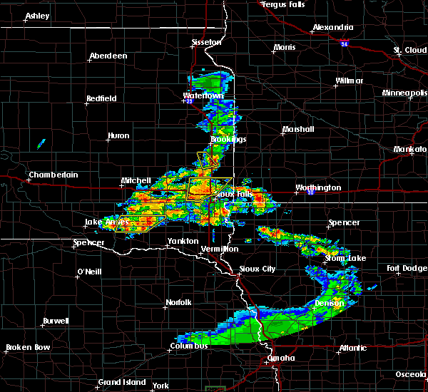 At 1025 am cdt, a severe thunderstorm was located over crooks, or 8 miles northwest of sioux falls, moving northeast at 15 mph (radar indicated). Hazards include half dollar size hail. Damage to vehicles is expected. this severe thunderstorm will be near, baltic around 1055 am cdt. Dell rapids around 1100 am cdt. At 1025 am cdt, a severe thunderstorm was located over crooks, or 8 miles northwest of sioux falls, moving northeast at 15 mph (radar indicated). Hazards include half dollar size hail. Damage to vehicles is expected. this severe thunderstorm will be near, baltic around 1055 am cdt. Dell rapids around 1100 am cdt.
|
| 5/17/2017 2:47 PM CDT |
 At 247 pm cdt, a severe thunderstorm was located near sioux falls, moving north at 45 mph (radar indicated). Hazards include 60 mph wind gusts and penny size hail. Expect damage to roofs, siding, and trees. This severe storm will be near, crooks around 255 pm cdt. At 247 pm cdt, a severe thunderstorm was located near sioux falls, moving north at 45 mph (radar indicated). Hazards include 60 mph wind gusts and penny size hail. Expect damage to roofs, siding, and trees. This severe storm will be near, crooks around 255 pm cdt.
|
| 5/17/2017 2:34 PM CDT |
 At 234 pm cdt, a severe thunderstorm was located over harrisburg, or near sioux falls, moving north at 35 mph (radar indicated). Hazards include 60 mph wind gusts and penny size hail. Expect damage to roofs, siding, and trees. this severe thunderstorm will be near, rowena around 240 pm cdt. sioux falls and brandon around 255 pm cdt. Crooks around 300 pm cdt. At 234 pm cdt, a severe thunderstorm was located over harrisburg, or near sioux falls, moving north at 35 mph (radar indicated). Hazards include 60 mph wind gusts and penny size hail. Expect damage to roofs, siding, and trees. this severe thunderstorm will be near, rowena around 240 pm cdt. sioux falls and brandon around 255 pm cdt. Crooks around 300 pm cdt.
|
| 7/17/2016 12:37 AM CDT |
 At 1236 am cdt, a severe thunderstorm was located over valley springs, or 12 miles east of sioux falls, moving east at 50 mph (radar indicated). Hazards include 70 mph wind gusts. Expect considerable tree damage. damage is likely to mobile homes, roofs, and outbuildings. this severe thunderstorm will be near, hills and beaver creek around 1245 am cdt. luverne around 1255 am cdt. ellsworth around 100 am cdt. Other locations impacted by this severe thunderstorm include magnolia and steen. At 1236 am cdt, a severe thunderstorm was located over valley springs, or 12 miles east of sioux falls, moving east at 50 mph (radar indicated). Hazards include 70 mph wind gusts. Expect considerable tree damage. damage is likely to mobile homes, roofs, and outbuildings. this severe thunderstorm will be near, hills and beaver creek around 1245 am cdt. luverne around 1255 am cdt. ellsworth around 100 am cdt. Other locations impacted by this severe thunderstorm include magnolia and steen.
|
| 7/17/2016 12:28 AM CDT |
 At 1228 am cdt, a severe thunderstorm was located near crooks, or 10 miles northwest of sioux falls, moving east at 35 mph (radar indicated). Hazards include 70 mph wind gusts. Expect considerable tree damage. damage is likely to mobile homes, roofs, and outbuildings. This severe storm will be near, sioux falls and baltic around 1240 am cdt. At 1228 am cdt, a severe thunderstorm was located near crooks, or 10 miles northwest of sioux falls, moving east at 35 mph (radar indicated). Hazards include 70 mph wind gusts. Expect considerable tree damage. damage is likely to mobile homes, roofs, and outbuildings. This severe storm will be near, sioux falls and baltic around 1240 am cdt.
|
| 7/17/2016 12:00 AM CDT |
 At 1200 am cdt, a severe thunderstorm was located over humboldt, or near lake vermillion state recreation area, moving east at 35 mph (radar indicated). Hazards include 60 mph wind gusts. Expect damage to roofs. siding. and trees. this severe thunderstorm will be near, hartford around 1215 am cdt. crooks around 1225 am cdt. sioux falls around 1230 am cdt. Baltic around 1235 am cdt. At 1200 am cdt, a severe thunderstorm was located over humboldt, or near lake vermillion state recreation area, moving east at 35 mph (radar indicated). Hazards include 60 mph wind gusts. Expect damage to roofs. siding. and trees. this severe thunderstorm will be near, hartford around 1215 am cdt. crooks around 1225 am cdt. sioux falls around 1230 am cdt. Baltic around 1235 am cdt.
|
| 6/17/2016 8:17 PM CDT |
 At 816 pm cdt, a severe thunderstorm was located near wall lake, or 7 miles southeast of lake vermillion state recreation area, moving southwest at 30 mph (radar indicated). Hazards include 60 mph wind gusts. Expect damage to roofs. siding. And trees. At 816 pm cdt, a severe thunderstorm was located near wall lake, or 7 miles southeast of lake vermillion state recreation area, moving southwest at 30 mph (radar indicated). Hazards include 60 mph wind gusts. Expect damage to roofs. siding. And trees.
|
| 6/17/2016 7:35 PM CDT | Several trees down around tow in minnehaha county SD, 0.8 miles ESE of Sioux Falls, SD |
| 5/25/2016 4:47 AM CDT | Asos station sioux falls airport /fsd/ in minnehaha county SD, 3.5 miles SSE of Sioux Falls, SD |
| 8/9/2015 6:42 PM CDT |
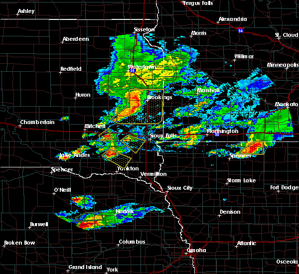 At 642 pm cdt, a severe thunderstorm was located near monroe, or near lake vermillion state recreation area, moving east at 25 mph (radar indicated). Hazards include 60 mph wind gusts and quarter size hail. Hail damage to vehicles is expected. expect wind damage to roofs, siding and trees. this severe storm will be near, parker around 655 pm cdt. wall lake around 710 pm cdt. Chancellor around 715 pm cdt. At 642 pm cdt, a severe thunderstorm was located near monroe, or near lake vermillion state recreation area, moving east at 25 mph (radar indicated). Hazards include 60 mph wind gusts and quarter size hail. Hail damage to vehicles is expected. expect wind damage to roofs, siding and trees. this severe storm will be near, parker around 655 pm cdt. wall lake around 710 pm cdt. Chancellor around 715 pm cdt.
|
| 8/9/2015 6:27 PM CDT |
 At 627 pm cdt, a severe thunderstorm was located over canistota, or near lake vermillion state recreation area, moving southeast at 25 mph (radar indicated). Hazards include 60 mph wind gusts and half dollar size hail. Hail damage to vehicles is expected. expect wind damage to roofs, siding and trees. this severe thunderstorm will be near, lake vermillion state recreation area and marion around 640 pm cdt. monroe around 645 pm cdt. parker around 700 pm cdt. wall lake around 705 pm cdt. Chancellor around 715 pm cdt. At 627 pm cdt, a severe thunderstorm was located over canistota, or near lake vermillion state recreation area, moving southeast at 25 mph (radar indicated). Hazards include 60 mph wind gusts and half dollar size hail. Hail damage to vehicles is expected. expect wind damage to roofs, siding and trees. this severe thunderstorm will be near, lake vermillion state recreation area and marion around 640 pm cdt. monroe around 645 pm cdt. parker around 700 pm cdt. wall lake around 705 pm cdt. Chancellor around 715 pm cdt.
|
| 7/6/2015 1:07 AM CDT |
 At 106 am cdt, a severe thunderstorm capable of producing a tornado was located near hartford, or 9 miles northwest of sioux falls, moving east at 15 mph (radar indicated rotation). Hazards include tornado. Flying debris will be dangerous to those caught without shelter. mobile homes will be damaged or destroyed. damage to roofs, windows and vehicles will occur. tree damage is likely. This dangerous storm will be near, extreme northwest sioux falls near i 90 around 130 am cdt. At 106 am cdt, a severe thunderstorm capable of producing a tornado was located near hartford, or 9 miles northwest of sioux falls, moving east at 15 mph (radar indicated rotation). Hazards include tornado. Flying debris will be dangerous to those caught without shelter. mobile homes will be damaged or destroyed. damage to roofs, windows and vehicles will occur. tree damage is likely. This dangerous storm will be near, extreme northwest sioux falls near i 90 around 130 am cdt.
|
| 7/6/2015 12:54 AM CDT |
 At 1253 am cdt, a severe thunderstorm capable of producing a tornado was located near hartford, or 11 miles east of lake vermillion state recreation area, moving east at 25 mph (radar indicated rotation). Hazards include tornado. Flying debris will be dangerous to those caught without shelter. mobile homes will be damaged or destroyed. damage to roofs, windows and vehicles will occur. tree damage is likely. this dangerous storm will be near, crooks around 110 am cdt. Northern sioux falls around 115 am cdt. At 1253 am cdt, a severe thunderstorm capable of producing a tornado was located near hartford, or 11 miles east of lake vermillion state recreation area, moving east at 25 mph (radar indicated rotation). Hazards include tornado. Flying debris will be dangerous to those caught without shelter. mobile homes will be damaged or destroyed. damage to roofs, windows and vehicles will occur. tree damage is likely. this dangerous storm will be near, crooks around 110 am cdt. Northern sioux falls around 115 am cdt.
|
| 6/22/2015 5:41 AM CDT |
 The severe thunderstorm warning for lyon, northern sioux, osceola, northwestern o`brien, nobles, rock, southeastern minnehaha and central lincoln counties will expire at 545 am cdt, the storms which prompted the warning have moved out of the area. therefore the warning will be allowed to expire. a severe thunderstorm watch remains in effect until 1000 am cdt for northwestern iowa, southwestern minnesota and southeastern south dakota. The severe thunderstorm warning for lyon, northern sioux, osceola, northwestern o`brien, nobles, rock, southeastern minnehaha and central lincoln counties will expire at 545 am cdt, the storms which prompted the warning have moved out of the area. therefore the warning will be allowed to expire. a severe thunderstorm watch remains in effect until 1000 am cdt for northwestern iowa, southwestern minnesota and southeastern south dakota.
|
| 6/22/2015 5:33 AM CDT |
 At 532 am cdt, severe thunderstorms were located along a line extending from 6 miles northeast of rushmore to near sibley to near matlock, moving east at 65 mph (radar indicated). Hazards include 70 mph wind gusts. Expect considerable tree damage. damage is likely to mobile homes, roofs and outbuildings. these severe storms will be near, worthington around 540 am cdt. ocheyedan, brewster and round lake around 545 am cdt. Other locations impacted by these severe thunderstorms include bigelow, magnolia, steen and kenneth. At 532 am cdt, severe thunderstorms were located along a line extending from 6 miles northeast of rushmore to near sibley to near matlock, moving east at 65 mph (radar indicated). Hazards include 70 mph wind gusts. Expect considerable tree damage. damage is likely to mobile homes, roofs and outbuildings. these severe storms will be near, worthington around 540 am cdt. ocheyedan, brewster and round lake around 545 am cdt. Other locations impacted by these severe thunderstorms include bigelow, magnolia, steen and kenneth.
|
| 6/22/2015 5:15 AM CDT |
 At 514 am cdt, severe thunderstorms were located along a line extending from near hardwick to 6 miles west of ellsworth to near inwood, moving east at 70 mph. these are very dangerous storms (radar indicated). Hazards include 80 mph wind gusts. Flying debris will be dangerous to those caught without shelter. mobile homes will be heavily damaged. expect considerable damage to roofs, windows and vehicles. extensive tree damage and power outages are likely. these severe storms will be near, ellsworth, leota and lismore around 520 am cdt. adrian, little rock and wilmont around 525 am cdt. george and rushmore around 530 am cdt. matlock around 535 am cdt. worthington, ocheyedan and ashton around 540 am cdt. sibley, brewster and round lake around 545 am cdt. Other locations impacted by these severe thunderstorms include bigelow, magnolia, steen and kenneth. At 514 am cdt, severe thunderstorms were located along a line extending from near hardwick to 6 miles west of ellsworth to near inwood, moving east at 70 mph. these are very dangerous storms (radar indicated). Hazards include 80 mph wind gusts. Flying debris will be dangerous to those caught without shelter. mobile homes will be heavily damaged. expect considerable damage to roofs, windows and vehicles. extensive tree damage and power outages are likely. these severe storms will be near, ellsworth, leota and lismore around 520 am cdt. adrian, little rock and wilmont around 525 am cdt. george and rushmore around 530 am cdt. matlock around 535 am cdt. worthington, ocheyedan and ashton around 540 am cdt. sibley, brewster and round lake around 545 am cdt. Other locations impacted by these severe thunderstorms include bigelow, magnolia, steen and kenneth.
|
| 6/22/2015 5:06 AM CDT |
 At 506 am cdt, severe thunderstorms were located along a line extending from 6 miles west of hardwick to hills to near canton, moving east at 65 mph. these are very dangerous storms (radar indicated). Hazards include 100 mph wind gusts. You are in a life-threatening situation. flying debris may be deadly to those caught without shelter. mobile homes will be destroyed. expect considerable damage to homes and businesses. expect extensive tree damage and power outages. severe thunderstorms will be near, lester and hardwick around 510 am cdt. luverne, rock rapids and blue mounds state park around 515 am cdt. ellsworth and alvord around 520 am cdt. rock valley, adrian, doon and lismore around 525 am cdt. hull, little rock, rushmore and wilmont around 530 am cdt. sibley, george and boyden around 535 am cdt. worthington and matlock around 540 am cdt. sheldon, ocheyedan, brewster and round lake around 545 am cdt. Other locations impacted by these severe thunderstorms include bigelow, magnolia, steen and kenneth. At 506 am cdt, severe thunderstorms were located along a line extending from 6 miles west of hardwick to hills to near canton, moving east at 65 mph. these are very dangerous storms (radar indicated). Hazards include 100 mph wind gusts. You are in a life-threatening situation. flying debris may be deadly to those caught without shelter. mobile homes will be destroyed. expect considerable damage to homes and businesses. expect extensive tree damage and power outages. severe thunderstorms will be near, lester and hardwick around 510 am cdt. luverne, rock rapids and blue mounds state park around 515 am cdt. ellsworth and alvord around 520 am cdt. rock valley, adrian, doon and lismore around 525 am cdt. hull, little rock, rushmore and wilmont around 530 am cdt. sibley, george and boyden around 535 am cdt. worthington and matlock around 540 am cdt. sheldon, ocheyedan, brewster and round lake around 545 am cdt. Other locations impacted by these severe thunderstorms include bigelow, magnolia, steen and kenneth.
|
| 6/22/2015 5:03 AM CDT |
 At 502 am cdt, severe thunderstorms were located along a line extending from near sherman to valley springs to near harrisburg, moving east at 70 mph. these are very dangerous storms (radar indicated). Hazards include 100 mph wind gusts. You are in a life-threatening situation. flying debris may be deadly to those caught without shelter. mobile homes will be destroyed. expect considerable damage to homes and businesses. expect extensive tree damage and power outages. these severe storms will be near, hills and beaver creek around 505 am cdt. luverne, hardwick and blue mounds state park around 510 am cdt. larchwood and lester around 515 am cdt. The strongest part of this storm is near garretson, moving towards blue mound state park other locations impacted by these severe thunderstorms include steen. At 502 am cdt, severe thunderstorms were located along a line extending from near sherman to valley springs to near harrisburg, moving east at 70 mph. these are very dangerous storms (radar indicated). Hazards include 100 mph wind gusts. You are in a life-threatening situation. flying debris may be deadly to those caught without shelter. mobile homes will be destroyed. expect considerable damage to homes and businesses. expect extensive tree damage and power outages. these severe storms will be near, hills and beaver creek around 505 am cdt. luverne, hardwick and blue mounds state park around 510 am cdt. larchwood and lester around 515 am cdt. The strongest part of this storm is near garretson, moving towards blue mound state park other locations impacted by these severe thunderstorms include steen.
|
| 6/22/2015 4:59 AM CDT | Storm damage reported in minnehaha county SD, 4.8 miles W of Sioux Falls, SD |
| 6/22/2015 4:56 AM CDT | Storm damage reported in minnehaha county SD, 3.3 miles SSE of Sioux Falls, SD |
| 6/22/2015 4:53 AM CDT |
 At 452 am cdt, severe thunderstorms were located along a line extending from near baltic to sioux falls to near chancellor, moving east at 60 mph. these are very dangerous storms (trained weather spotters). Hazards include 80 mph wind gusts on the west side of sioux falls. Flying debris will be dangerous to those caught without shelter. mobile homes will be heavily damaged. expect considerable damage to roofs, windows and vehicles. extensive tree damage and power outages are likely. these severe storms will be near, sioux falls around 455 am cdt. brandon, garretson, sherman, rowena and palisades state park around 500 am cdt. harrisburg and valley springs around 505 am cdt. larchwood, hills, beaver creek and lake alvin state recreation area around 510 am cdt. luverne, lester, hardwick and blue mounds state park around 515 am cdt. Other locations impacted by these severe thunderstorms include steen. At 452 am cdt, severe thunderstorms were located along a line extending from near baltic to sioux falls to near chancellor, moving east at 60 mph. these are very dangerous storms (trained weather spotters). Hazards include 80 mph wind gusts on the west side of sioux falls. Flying debris will be dangerous to those caught without shelter. mobile homes will be heavily damaged. expect considerable damage to roofs, windows and vehicles. extensive tree damage and power outages are likely. these severe storms will be near, sioux falls around 455 am cdt. brandon, garretson, sherman, rowena and palisades state park around 500 am cdt. harrisburg and valley springs around 505 am cdt. larchwood, hills, beaver creek and lake alvin state recreation area around 510 am cdt. luverne, lester, hardwick and blue mounds state park around 515 am cdt. Other locations impacted by these severe thunderstorms include steen.
|
| 6/22/2015 4:48 AM CDT | Car mounted anemometer in minnehaha county SD, 6.3 miles E of Sioux Falls, SD |
| 6/22/2015 4:41 AM CDT |
 At 441 am cdt, severe thunderstorms were located along a line extending from near dell rapids to near crooks to near parker, moving east at 55 mph (radar indicated). Hazards include 70 mph wind gusts. Expect considerable tree damage. damage is likely to mobile homes, roofs and outbuildings. severe thunderstorms will be near, sioux falls, dell rapids, crooks and baltic around 445 am cdt. brandon and tea around 455 am cdt. harrisburg, garretson, jasper, sherman and palisades state park around 500 am cdt. valley springs and lake alvin state recreation area around 505 am cdt. hills, beaver creek, trosky and rowena around 510 am cdt. luverne, edgerton, larchwood, lester, hardwick and blue mounds state park around 515 am cdt. Other locations impacted by these severe thunderstorms include steen. At 441 am cdt, severe thunderstorms were located along a line extending from near dell rapids to near crooks to near parker, moving east at 55 mph (radar indicated). Hazards include 70 mph wind gusts. Expect considerable tree damage. damage is likely to mobile homes, roofs and outbuildings. severe thunderstorms will be near, sioux falls, dell rapids, crooks and baltic around 445 am cdt. brandon and tea around 455 am cdt. harrisburg, garretson, jasper, sherman and palisades state park around 500 am cdt. valley springs and lake alvin state recreation area around 505 am cdt. hills, beaver creek, trosky and rowena around 510 am cdt. luverne, edgerton, larchwood, lester, hardwick and blue mounds state park around 515 am cdt. Other locations impacted by these severe thunderstorms include steen.
|
| 6/22/2015 4:33 AM CDT |
 At 432 am cdt, severe thunderstorms were located along a line extending from 7 miles southwest of chester to humboldt to near monroe, moving southeast at 55 mph. these are very dangerous storms (radar indicated). Hazards include 80 mph wind gusts. Flying debris will be dangerous to those caught without shelter. mobile homes will be heavily damaged. expect considerable damage to roofs, windows and vehicles. extensive tree damage and power outages are likely. these severe storms will be near, hartford and wall lake around 440 am cdt. Sioux falls, crooks, baltic and chancellor around 445 am cdt. At 432 am cdt, severe thunderstorms were located along a line extending from 7 miles southwest of chester to humboldt to near monroe, moving southeast at 55 mph. these are very dangerous storms (radar indicated). Hazards include 80 mph wind gusts. Flying debris will be dangerous to those caught without shelter. mobile homes will be heavily damaged. expect considerable damage to roofs, windows and vehicles. extensive tree damage and power outages are likely. these severe storms will be near, hartford and wall lake around 440 am cdt. Sioux falls, crooks, baltic and chancellor around 445 am cdt.
|
| 6/22/2015 4:25 AM CDT |
 At 423 am cdt, severe thunderstorms were located along a line extending from near orland to montrose to near canistota, moving southeast at 55 mph. these are very dangerous storms (radar indicated a couple of concentrated areas of wind developing north of montrose and acorss southern mc cook counties). Hazards include 80 mph wind gusts. Flying debris will be dangerous to those caught without shelter. mobile homes will be heavily damaged. expect considerable damage to roofs, windows and vehicles. extensive tree damage and power outages are likely. these severe storms will be near, lake vermillion state recreation area around 430 am cdt. humboldt and monroe around 435 am cdt. parker, hartford and colton around 440 am cdt. Sioux falls, crooks, wall lake and chancellor around 445 am cdt. At 423 am cdt, severe thunderstorms were located along a line extending from near orland to montrose to near canistota, moving southeast at 55 mph. these are very dangerous storms (radar indicated a couple of concentrated areas of wind developing north of montrose and acorss southern mc cook counties). Hazards include 80 mph wind gusts. Flying debris will be dangerous to those caught without shelter. mobile homes will be heavily damaged. expect considerable damage to roofs, windows and vehicles. extensive tree damage and power outages are likely. these severe storms will be near, lake vermillion state recreation area around 430 am cdt. humboldt and monroe around 435 am cdt. parker, hartford and colton around 440 am cdt. Sioux falls, crooks, wall lake and chancellor around 445 am cdt.
|
| 6/22/2015 4:21 AM CDT |
 At 420 am cdt, severe thunderstorms were located along a line extending from near orland to near montrose to near salem, moving southeast at 55 mph (radar indicated). Hazards include 60 mph wind gusts. Expect damage to roofs. siding and trees. severe thunderstorms will be near, montrose around 425 am cdt. canistota around 430 am cdt. lake vermillion state recreation area, humboldt and monroe around 435 am cdt. hartford and colton around 440 am cdt. Sioux falls, crooks and wall lake around 445 am cdt. At 420 am cdt, severe thunderstorms were located along a line extending from near orland to near montrose to near salem, moving southeast at 55 mph (radar indicated). Hazards include 60 mph wind gusts. Expect damage to roofs. siding and trees. severe thunderstorms will be near, montrose around 425 am cdt. canistota around 430 am cdt. lake vermillion state recreation area, humboldt and monroe around 435 am cdt. hartford and colton around 440 am cdt. Sioux falls, crooks and wall lake around 445 am cdt.
|
| 6/20/2015 3:40 AM CDT |
 At 340 am cdt, severe thunderstorms were located along a line extending from 6 miles southwest of ivanhoe to near trosky to near larchwood, moving east at 65 mph (radar indicated). Hazards include 60 mph wind gusts. Expect damage to roofs. siding and trees. these severe storms will be near, edgerton and arco around 345 am cdt. tyler, leota and lake wilson around 350 am cdt. rock rapids and chandler around 355 am cdt. ellsworth, russell and camden state park around 400 am cdt. Other locations impacted by these severe thunderstorms include hatfield, magnolia, ihlen, lynd, kenneth, garvin, hadley, iona, steen and avoca. At 340 am cdt, severe thunderstorms were located along a line extending from 6 miles southwest of ivanhoe to near trosky to near larchwood, moving east at 65 mph (radar indicated). Hazards include 60 mph wind gusts. Expect damage to roofs. siding and trees. these severe storms will be near, edgerton and arco around 345 am cdt. tyler, leota and lake wilson around 350 am cdt. rock rapids and chandler around 355 am cdt. ellsworth, russell and camden state park around 400 am cdt. Other locations impacted by these severe thunderstorms include hatfield, magnolia, ihlen, lynd, kenneth, garvin, hadley, iona, steen and avoca.
|
| 6/20/2015 3:32 AM CDT |
 At 332 am cdt, severe thunderstorms were located along a line extending from 8 miles south of hendricks to trosky to near lake alvin state recreation area, moving east at 60 mph (radar indicated). Hazards include 60 mph wind gusts. Expect damage to roofs. siding and trees. these severe storms will be near, edgerton around 340 am cdt. tyler, leota, chandler and arco around 345 am cdt. Other locations impacted by these severe thunderstorms include hatfield, magnolia, ihlen, lynd, kenneth, garvin, hadley, iona, steen and bushnell. At 332 am cdt, severe thunderstorms were located along a line extending from 8 miles south of hendricks to trosky to near lake alvin state recreation area, moving east at 60 mph (radar indicated). Hazards include 60 mph wind gusts. Expect damage to roofs. siding and trees. these severe storms will be near, edgerton around 340 am cdt. tyler, leota, chandler and arco around 345 am cdt. Other locations impacted by these severe thunderstorms include hatfield, magnolia, ihlen, lynd, kenneth, garvin, hadley, iona, steen and bushnell.
|
| 6/20/2015 3:19 AM CDT |
 At 319 am cdt, severe thunderstorms were located along a line extending from near white to near trent to near tea, moving east at 65 mph (radar indicated). Hazards include 70 mph wind gusts. Expect considerable tree damage. damage is likely to mobile homes, roofs and outbuildings. severe thunderstorms will be near, jasper around 325 am cdt. lake alvin state recreation area, pipestone national monument and pipestone national monument around 330 am cdt. trosky and rowena around 335 am cdt. edgerton, larchwood, valley springs, lake benton, ivanhoe, woodstock and arco around 340 am cdt. tyler, hills, leota, lester, chandler and lake wilson around 345 am cdt. rock rapids and russell around 350 am cdt. slayton and camden state park around 355 am cdt. marshall and ellsworth around 400 am cdt. Other locations impacted by these severe thunderstorms include hatfield, magnolia, ihlen, lynd, kenneth, garvin, hadley, iona, steen and bushnell. At 319 am cdt, severe thunderstorms were located along a line extending from near white to near trent to near tea, moving east at 65 mph (radar indicated). Hazards include 70 mph wind gusts. Expect considerable tree damage. damage is likely to mobile homes, roofs and outbuildings. severe thunderstorms will be near, jasper around 325 am cdt. lake alvin state recreation area, pipestone national monument and pipestone national monument around 330 am cdt. trosky and rowena around 335 am cdt. edgerton, larchwood, valley springs, lake benton, ivanhoe, woodstock and arco around 340 am cdt. tyler, hills, leota, lester, chandler and lake wilson around 345 am cdt. rock rapids and russell around 350 am cdt. slayton and camden state park around 355 am cdt. marshall and ellsworth around 400 am cdt. Other locations impacted by these severe thunderstorms include hatfield, magnolia, ihlen, lynd, kenneth, garvin, hadley, iona, steen and bushnell.
|
| 6/20/2015 3:10 AM CDT |
 At 308 am cdt, severe thunderstorms were located along a line extending from near lake thompson state recreation area to chester to near monroe, moving east at 60 mph (weather equipment measured a 66 mph gust in madison). Hazards include 70 mph wind gusts. Expect considerable tree damage. damage is likely to mobile homes, roofs and outbuildings. these severe storms will be near, colman and chester around 315 am cdt. dell rapids and wall lake around 320 am cdt. tea and trent around 325 am cdt. Sinai and nunda around 330 am cdt. At 308 am cdt, severe thunderstorms were located along a line extending from near lake thompson state recreation area to chester to near monroe, moving east at 60 mph (weather equipment measured a 66 mph gust in madison). Hazards include 70 mph wind gusts. Expect considerable tree damage. damage is likely to mobile homes, roofs and outbuildings. these severe storms will be near, colman and chester around 315 am cdt. dell rapids and wall lake around 320 am cdt. tea and trent around 325 am cdt. Sinai and nunda around 330 am cdt.
|
| 6/20/2015 3:03 AM CDT |
 At 302 am cdt, severe thunderstorms were located along a line extending from 6 miles southeast of iroquois to near orland to near bridgewater, and are nearly stationary (radar indicated). Hazards include 60 mph wind gusts. Expect damage to roofs. siding and trees. these severe storms will be near, lake herman state park, canistota and orland around 310 am cdt. madison, lake vermillion state recreation area, marion and monroe around 315 am cdt. wentworth and chester around 320 am cdt. lake preston, humboldt and oldham around 325 am cdt. Dell rapids, hartford, wall lake, arlington, colman, egan, trent and hetland around 330 am cdt. At 302 am cdt, severe thunderstorms were located along a line extending from 6 miles southeast of iroquois to near orland to near bridgewater, and are nearly stationary (radar indicated). Hazards include 60 mph wind gusts. Expect damage to roofs. siding and trees. these severe storms will be near, lake herman state park, canistota and orland around 310 am cdt. madison, lake vermillion state recreation area, marion and monroe around 315 am cdt. wentworth and chester around 320 am cdt. lake preston, humboldt and oldham around 325 am cdt. Dell rapids, hartford, wall lake, arlington, colman, egan, trent and hetland around 330 am cdt.
|
| 6/20/2015 2:57 AM CDT |
 At 256 am cdt, severe thunderstorms were located along a line extending from 6 miles southeast of iroquois to near orland to near bridgewater, moving east at 55 mph (radar indicated). Hazards include 70 mph wind gusts. Expect considerable tree damage. damage is likely to mobile homes, roofs and outbuildings. severe thunderstorms will be near, orland and dolton around 300 am cdt. madison, lake herman state park, marion and canistota around 305 am cdt. lake thompson state recreation area, lake vermillion state recreation area and monroe around 310 am cdt. wentworth and chester around 315 am cdt. lake preston, colman and oldham around 320 am cdt. dell rapids, hartford, wall lake and hetland around 325 am cdt. Sioux falls, tea, arlington, egan, trent and sinai around 330 am cdt. At 256 am cdt, severe thunderstorms were located along a line extending from 6 miles southeast of iroquois to near orland to near bridgewater, moving east at 55 mph (radar indicated). Hazards include 70 mph wind gusts. Expect considerable tree damage. damage is likely to mobile homes, roofs and outbuildings. severe thunderstorms will be near, orland and dolton around 300 am cdt. madison, lake herman state park, marion and canistota around 305 am cdt. lake thompson state recreation area, lake vermillion state recreation area and monroe around 310 am cdt. wentworth and chester around 315 am cdt. lake preston, colman and oldham around 320 am cdt. dell rapids, hartford, wall lake and hetland around 325 am cdt. Sioux falls, tea, arlington, egan, trent and sinai around 330 am cdt.
|
| 8/24/2014 3:04 AM CDT | Storm damage reported in minnehaha county SD, 0.8 miles ESE of Sioux Falls, SD |
| 6/16/2014 3:13 PM CDT | Quarter sized hail reported 2.8 miles W of Sioux Falls, SD |
| 6/16/2014 3:10 PM CDT | Half Dollar sized hail reported 3.2 miles WSW of Sioux Falls, SD |
| 6/16/2014 3:09 PM CDT | Quarter sized hail reported 2.5 miles NW of Sioux Falls, SD |
| 6/16/2014 3:08 PM CDT | Half Dollar sized hail reported 2.3 miles W of Sioux Falls, SD |
| 6/16/2014 3:08 PM CDT | Golf Ball sized hail reported 5.4 miles ENE of Sioux Falls, SD, golf ball hail and severe winds shattered car windows |
| 6/16/2014 3:06 PM CDT | Quarter sized hail reported 2.5 miles SSE of Sioux Falls, SD, observed at joe foss field |
| 6/16/2014 3:05 PM CDT | Quarter sized hail reported 3.2 miles NNW of Sioux Falls, SD |
| 6/16/2014 3:04 PM CDT | Quarter sized hail reported 3.8 miles S of Sioux Falls, SD, a few hailstone up to quarter size. mostly dime to nickel hail. |
| 6/16/2014 2:59 PM CDT | Storm damage reported in minnehaha county SD, 3.8 miles S of Sioux Falls, SD |
| 6/16/2014 2:59 PM CDT | North cliff avenue near russell street in minnehaha county SD, 2.5 miles SSE of Sioux Falls, SD |
| 6/5/2014 3:30 PM CDT | Hen Egg sized hail reported 0.8 miles ESE of Sioux Falls, SD |
| 6/5/2014 3:26 PM CDT | Ping Pong Ball sized hail reported 0.8 miles ESE of Sioux Falls, SD |
| 6/5/2014 3:21 PM CDT | Golf Ball sized hail reported 3.2 miles NNE of Sioux Falls, SD |
| 6/5/2014 3:20 PM CDT | Half Dollar sized hail reported 3.2 miles NNE of Sioux Falls, SD |
| 6/5/2014 3:18 PM CDT | Half Dollar sized hail reported 0.8 miles ESE of Sioux Falls, SD |
| 6/5/2014 3:17 PM CDT | Hen Egg sized hail reported 0.8 miles ESE of Sioux Falls, SD |
| 6/5/2014 3:16 PM CDT | Hen Egg sized hail reported 0.8 miles ESE of Sioux Falls, SD, nws employee reports 2 inch hail near 57th and cliff in sioux falls |
| 6/5/2014 3:14 PM CDT | Quarter sized hail reported 0.8 miles ESE of Sioux Falls, SD |
| 6/5/2014 3:10 PM CDT | Golf Ball sized hail reported 0.8 miles ESE of Sioux Falls, SD, intersection of 1-229 and louise ave |
| 6/5/2014 3:09 PM CDT | Quarter sized hail reported 0.8 miles ESE of Sioux Falls, SD, quarter size hail at 8th and summit in sioux falls |
| 6/5/2014 3:04 PM CDT | Quarter sized hail reported 0.8 miles ESE of Sioux Falls, SD |
| 6/5/2014 3:03 PM CDT | Quarter sized hail reported 0.8 miles ESE of Sioux Falls, SD, quarter size hail at 12th and valley view in western sioux falls |
| 6/1/2014 2:50 PM CDT | Large branch blown off tree by winds estimated at 50 mp in minnehaha county SD, 2.8 miles W of Sioux Falls, SD |
| 8/31/2013 10:25 PM CDT | Golf Ball sized hail reported 0.8 miles ESE of Sioux Falls, SD, downtown sioux falls area |
| 8/31/2013 10:17 PM CDT | Quarter sized hail reported 1.3 miles NE of Sioux Falls, SD |
| 8/31/2013 10:17 PM CDT | 4 inch and larger tree limbs down at 49th and oxbow in minnehaha county SD, 3.3 miles ENE of Sioux Falls, SD |
| 8/31/2013 10:16 PM CDT | Half Dollar sized hail reported 1.3 miles NE of Sioux Falls, SD |
| 8/31/2013 10:16 PM CDT | Golf Ball sized hail reported 1.3 miles NE of Sioux Falls, SD |
| 8/31/2013 10:16 PM CDT | Golf Ball sized hail reported 0.8 miles ESE of Sioux Falls, SD, downtown sioux falls area |
| 8/31/2013 10:15 PM CDT | 5 huge evergreens trees uprooted and fence blown down in lincoln county SD, 2.6 miles NNE of Sioux Falls, SD |
| 8/31/2013 10:10 PM CDT | Quarter sized hail reported 2.8 miles E of Sioux Falls, SD |
| 8/31/2013 10:10 PM CDT | Tennis Ball sized hail reported 1.8 miles E of Sioux Falls, SD |
| 8/31/2013 10:08 PM CDT | Quarter sized hail reported 1.8 miles E of Sioux Falls, SD |
| 8/31/2013 10:08 PM CDT | Quarter sized hail reported 2.8 miles E of Sioux Falls, SD |
| 8/31/2013 10:08 PM CDT | A 20 foot retaining wall collapsed on east portion of empire mal in minnehaha county SD, 3.3 miles ENE of Sioux Falls, SD |
| 8/31/2013 10:08 PM CDT | An 18 inch in diameter tree knocked over near the intersection of louise and 49th streets blocking traffi in minnehaha county SD, 3.3 miles ENE of Sioux Falls, SD |
| 8/31/2013 10:08 PM CDT | Front doors blown in at local target stor in minnehaha county SD, 3.3 miles ENE of Sioux Falls, SD |
| 8/31/2013 10:08 PM CDT | Outdoor canopy style tent destroyed and mangled in the parking lot of the empire mal in minnehaha county SD, 3.3 miles ENE of Sioux Falls, SD |
| 8/31/2013 10:08 PM CDT | Roof damage to the local target store and front door damage to an adjacent retail stor in minnehaha county SD, 3.3 miles ENE of Sioux Falls, SD |
| 8/31/2013 10:08 PM CDT | *** 1 inj *** roof damage to the local target store and front door damage to an adjacent retail store. several cars were damaged in the parking lot by large in minnehaha county SD, 3.3 miles ENE of Sioux Falls, SD |
| 8/31/2013 10:06 PM CDT | Tennis Ball sized hail reported 1.8 miles E of Sioux Falls, SD |
| 1/1/0001 12:00 AM | Metal porch awning reported ripped off in town in minnehaha county SD, 1.3 miles NW of Sioux Falls, SD |
| 1/1/0001 12:00 AM | Roof reported ripped off in town in minnehaha county SD, 1.3 miles NW of Sioux Falls, SD |
| 1/1/0001 12:00 AM | Tree pushed down across roadway by strong wind gusts in minnehaha county SD, 1.3 miles NW of Sioux Falls, SD |
Hail Maps for Sioux Falls, SD
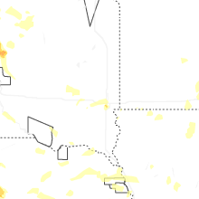
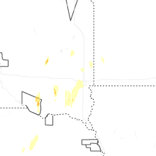
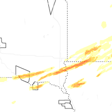


Connect with Interactive Hail Maps