

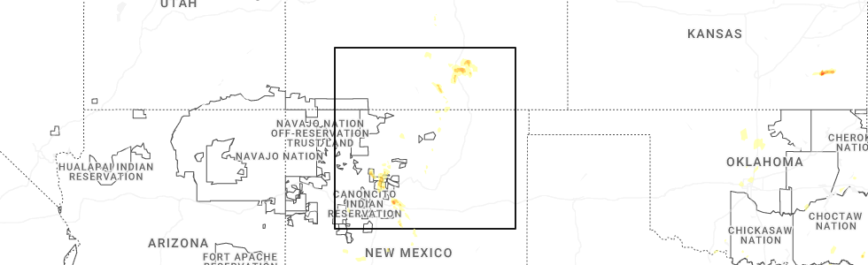
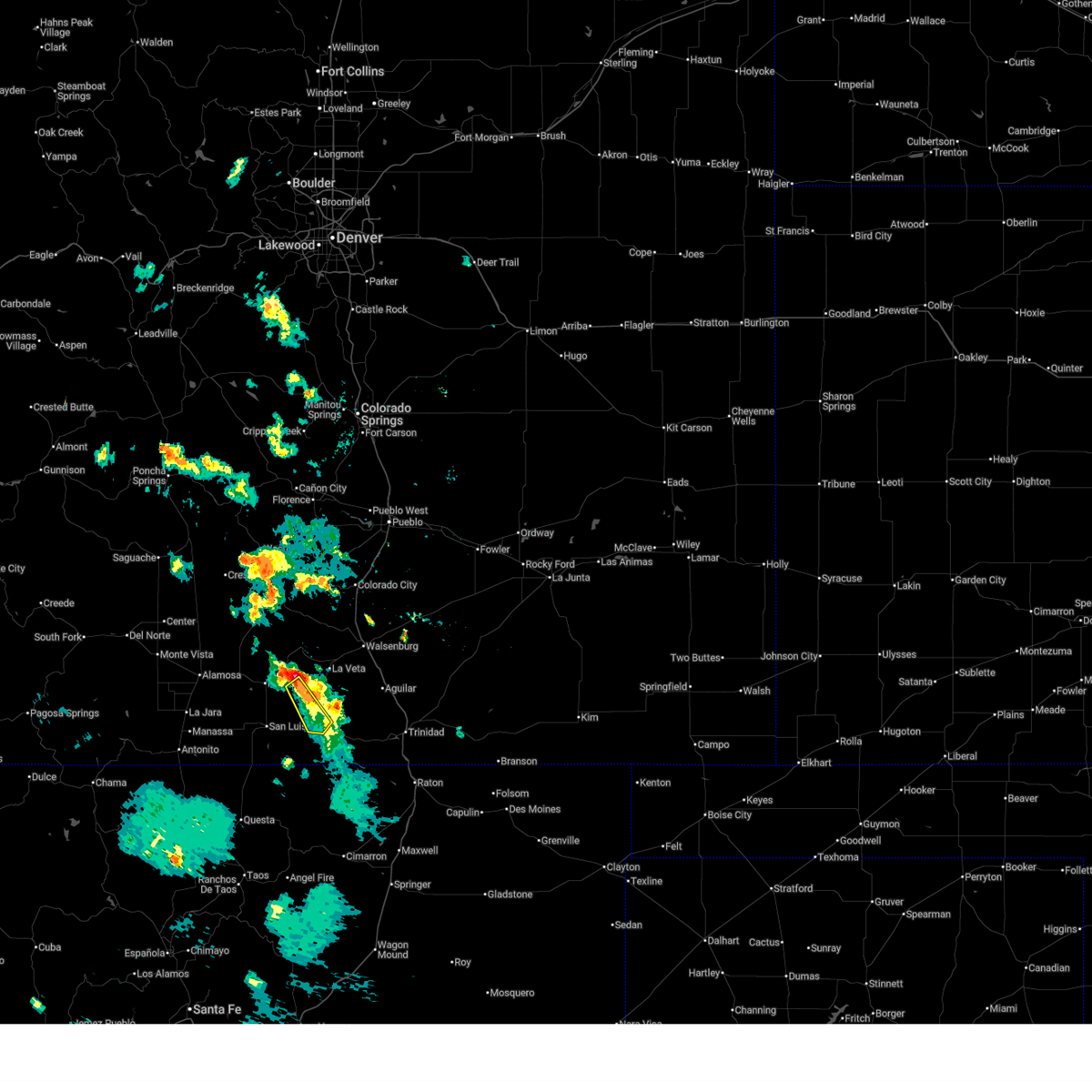
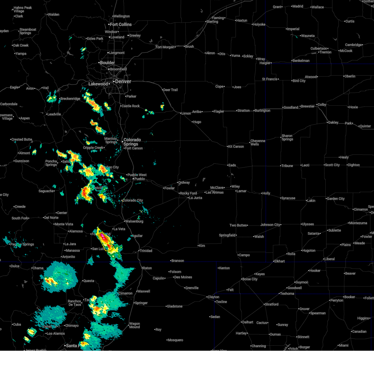
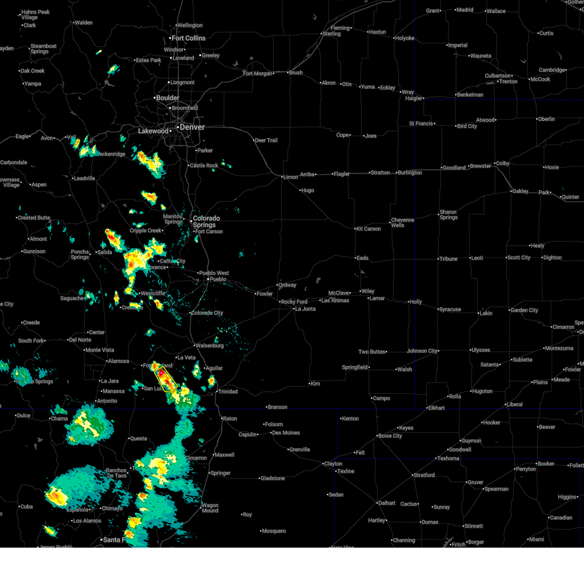
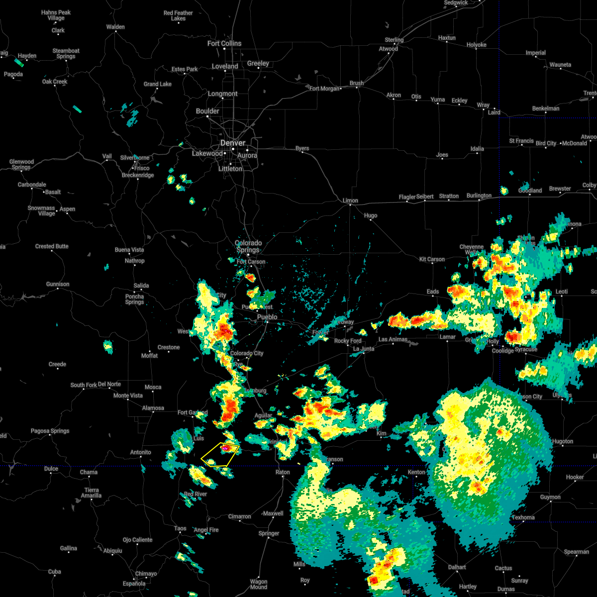
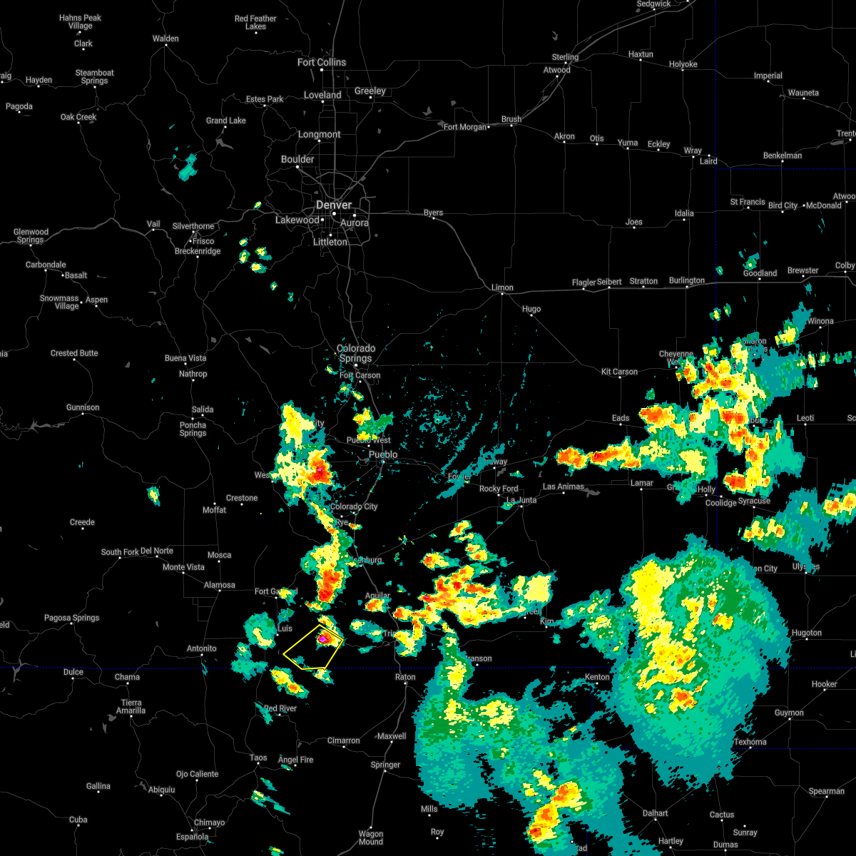
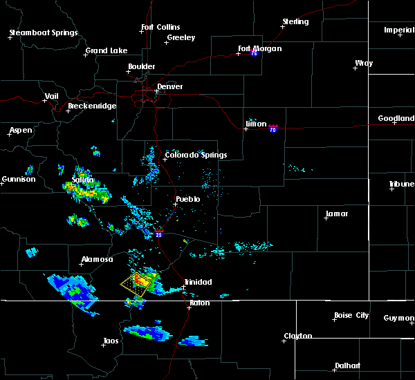
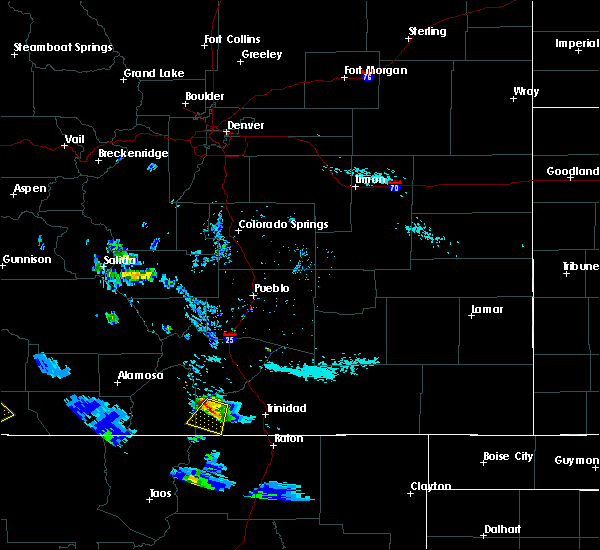
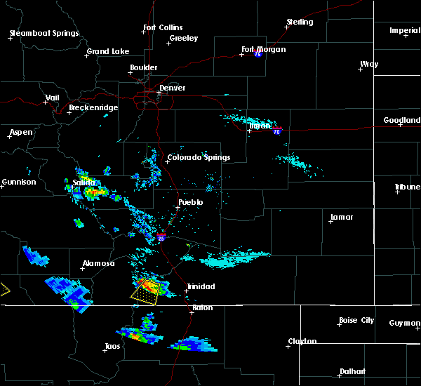
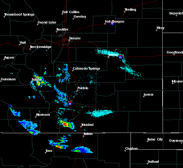
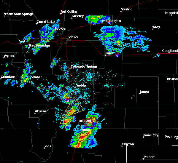
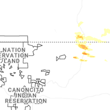
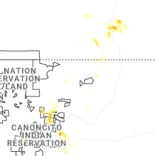
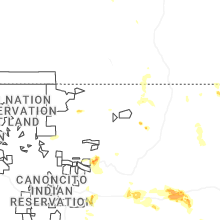
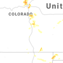
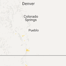
Hail Map for Stonewall Gap, CO
The Stonewall Gap, CO area has had 0 reports of on-the-ground hail by trained spotters, and has been under severe weather warnings 3 times during the past 12 months. Doppler radar has detected hail at or near Stonewall Gap, CO on 32 occasions, including 3 occasions during the past year.
| Name: | Stonewall Gap, CO |
| Where Located: | 59.9 miles NNE of Taos, NM |
| Map: | Google Map for Stonewall Gap, CO |
| Population: | 67 |
| Housing Units: | 111 |
| More Info: | Search Google for Stonewall Gap, CO |
5
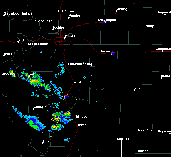
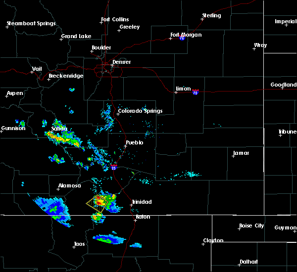
The Top Recent Hail Date for Stonewall Gap, CO is Saturday, July 12, 2025 (2nd out of 32)
Hail and Wind Damage Spotted near Stonewall Gap, CO
| Date / Time | Report Details |
|---|---|
| 7/12/2025 5:26 PM MDT |
 The storm which prompted the warning has weakened below severe limits, and no longer poses an immediate threat to life or property. therefore, the warning will be allowed to expire. however, small hail, gusty winds and heavy rain are still possible with this thunderstorm. The storm which prompted the warning has weakened below severe limits, and no longer poses an immediate threat to life or property. therefore, the warning will be allowed to expire. however, small hail, gusty winds and heavy rain are still possible with this thunderstorm.
|
| 7/12/2025 4:56 PM MDT |
 Svrpub the national weather service in pueblo has issued a * severe thunderstorm warning for, southwestern huerfano county in southeastern colorado, east central costilla county in south central colorado, west central las animas county in southeastern colorado, * until 530 pm mdt. * at 456 pm mdt, a severe thunderstorm was located west of cuchara, or 37 miles west of trinidad, moving southeast at 10 mph (radar indicated). Hazards include 60 mph wind gusts and quarter size hail. Hail damage to vehicles is expected. Expect wind damage to roofs, siding, and trees. Svrpub the national weather service in pueblo has issued a * severe thunderstorm warning for, southwestern huerfano county in southeastern colorado, east central costilla county in south central colorado, west central las animas county in southeastern colorado, * until 530 pm mdt. * at 456 pm mdt, a severe thunderstorm was located west of cuchara, or 37 miles west of trinidad, moving southeast at 10 mph (radar indicated). Hazards include 60 mph wind gusts and quarter size hail. Hail damage to vehicles is expected. Expect wind damage to roofs, siding, and trees.
|
| 7/12/2025 4:31 PM MDT |
 Svrpub the national weather service in pueblo has issued a * severe thunderstorm warning for, southwestern huerfano county in southeastern colorado, east central costilla county in south central colorado, west central las animas county in southeastern colorado, * until 500 pm mdt. * at 431 pm mdt, a severe thunderstorm was located near cuchara, or 38 miles east of san luis valley airport, moving southeast at 15 mph (radar indicated). Hazards include 60 mph wind gusts and quarter size hail. Hail damage to vehicles is expected. expect wind damage to roofs, siding, and trees. This severe thunderstorm will remain over mainly rural areas of southwestern huerfano, east central costilla and west central las animas counties. Svrpub the national weather service in pueblo has issued a * severe thunderstorm warning for, southwestern huerfano county in southeastern colorado, east central costilla county in south central colorado, west central las animas county in southeastern colorado, * until 500 pm mdt. * at 431 pm mdt, a severe thunderstorm was located near cuchara, or 38 miles east of san luis valley airport, moving southeast at 15 mph (radar indicated). Hazards include 60 mph wind gusts and quarter size hail. Hail damage to vehicles is expected. expect wind damage to roofs, siding, and trees. This severe thunderstorm will remain over mainly rural areas of southwestern huerfano, east central costilla and west central las animas counties.
|
| 7/6/2021 5:01 PM MDT |
 At 501 pm mdt, a severe thunderstorm was located near stonewall, or 21 miles south of indian creek on the southeastern spring burn scar, moving southwest at 25 mph (radar indicated). Hazards include 60 mph wind gusts and quarter size hail. Hail damage to vehicles is expected. expect wind damage to roofs, siding, and trees. Locations impacted include, stonewall. At 501 pm mdt, a severe thunderstorm was located near stonewall, or 21 miles south of indian creek on the southeastern spring burn scar, moving southwest at 25 mph (radar indicated). Hazards include 60 mph wind gusts and quarter size hail. Hail damage to vehicles is expected. expect wind damage to roofs, siding, and trees. Locations impacted include, stonewall.
|
| 7/6/2021 4:52 PM MDT |
 At 452 pm mdt, a severe thunderstorm was located near stonewall, or 19 miles south of indian creek on the southeastern spring burn scar, moving southwest at 25 mph (radar indicated). Hazards include 60 mph wind gusts and half dollar size hail. Hail damage to vehicles is expected. Expect wind damage to roofs, siding, and trees. At 452 pm mdt, a severe thunderstorm was located near stonewall, or 19 miles south of indian creek on the southeastern spring burn scar, moving southwest at 25 mph (radar indicated). Hazards include 60 mph wind gusts and half dollar size hail. Hail damage to vehicles is expected. Expect wind damage to roofs, siding, and trees.
|
| 6/6/2020 2:58 PM MDT |
 The severe thunderstorm warning for southeastern huerfano and southwestern las animas counties will expire at 300 pm mdt, the storm which prompted the warning has weakened below severe limits, and no longer poses an immediate threat to life or property. therefore, the warning will be allowed to expire. however gusty winds are still possible with this thunderstorm. a severe thunderstorm watch remains in effect until 800 pm mdt for southeastern colorado. The severe thunderstorm warning for southeastern huerfano and southwestern las animas counties will expire at 300 pm mdt, the storm which prompted the warning has weakened below severe limits, and no longer poses an immediate threat to life or property. therefore, the warning will be allowed to expire. however gusty winds are still possible with this thunderstorm. a severe thunderstorm watch remains in effect until 800 pm mdt for southeastern colorado.
|
| 6/6/2020 2:45 PM MDT |
 At 244 pm mdt, a severe thunderstorm was located near segundo, or 19 miles west of trinidad, moving northeast at 50 mph (radar indicated). Hazards include 70 mph wind gusts. Expect considerable tree damage. damage is likely to mobile homes, roofs, and outbuildings. Locations impacted include, walsenburg, aguilar, gulnare, boncarbo, stonewall, segundo and weston. At 244 pm mdt, a severe thunderstorm was located near segundo, or 19 miles west of trinidad, moving northeast at 50 mph (radar indicated). Hazards include 70 mph wind gusts. Expect considerable tree damage. damage is likely to mobile homes, roofs, and outbuildings. Locations impacted include, walsenburg, aguilar, gulnare, boncarbo, stonewall, segundo and weston.
|
| 6/6/2020 2:28 PM MDT |
 At 228 pm mdt, a severe thunderstorm was located 7 miles southeast of stonewall, or 25 miles west of trinidad, moving northeast at 60 mph (radar indicated). Hazards include 70 mph wind gusts. Expect considerable tree damage. Damage is likely to mobile homes, roofs, and outbuildings. At 228 pm mdt, a severe thunderstorm was located 7 miles southeast of stonewall, or 25 miles west of trinidad, moving northeast at 60 mph (radar indicated). Hazards include 70 mph wind gusts. Expect considerable tree damage. Damage is likely to mobile homes, roofs, and outbuildings.
|
| 8/8/2018 2:36 PM MDT |
 The severe thunderstorm warning for southwestern las animas county will expire at 245 pm mdt, the storm which prompted the warning has weakened below severe limits, and no longer poses an immediate threat to life or property. therefore, the warning will be allowed to expire. however gusty winds are still possible with this thunderstorm. The severe thunderstorm warning for southwestern las animas county will expire at 245 pm mdt, the storm which prompted the warning has weakened below severe limits, and no longer poses an immediate threat to life or property. therefore, the warning will be allowed to expire. however gusty winds are still possible with this thunderstorm.
|
| 8/8/2018 2:25 PM MDT |
 At 224 pm mdt, a severe thunderstorm was located near segundo, or 18 miles west of trinidad, moving south at 15 mph (radar indicated). Hazards include 60 mph wind gusts and half dollar size hail. Hail damage to vehicles is expected. Expect wind damage to roofs, siding, and trees. At 224 pm mdt, a severe thunderstorm was located near segundo, or 18 miles west of trinidad, moving south at 15 mph (radar indicated). Hazards include 60 mph wind gusts and half dollar size hail. Hail damage to vehicles is expected. Expect wind damage to roofs, siding, and trees.
|
| 6/30/2017 6:29 PM MDT |
 At 629 pm mdt, a severe thunderstorm was located near stonewall, or 25 miles west of trinidad, moving east at 20 mph (radar indicated). Hazards include 60 mph wind gusts and half dollar size hail. Hail damage to vehicles is expected. Expect wind damage to roofs, siding, and trees. At 629 pm mdt, a severe thunderstorm was located near stonewall, or 25 miles west of trinidad, moving east at 20 mph (radar indicated). Hazards include 60 mph wind gusts and half dollar size hail. Hail damage to vehicles is expected. Expect wind damage to roofs, siding, and trees.
|
| 8/20/2016 5:42 PM MDT |
 At 542 pm mdt, a severe thunderstorm was located near stonewall, or 33 miles west of trinidad, moving south at 5 mph (radar indicated). Hazards include 60 mph wind gusts and quarter size hail. Hail damage to vehicles is expected. expect wind damage to roofs, siding, and trees. This severe thunderstorm will remain over mainly rural areas of southeastern costilla and western las animas counties. At 542 pm mdt, a severe thunderstorm was located near stonewall, or 33 miles west of trinidad, moving south at 5 mph (radar indicated). Hazards include 60 mph wind gusts and quarter size hail. Hail damage to vehicles is expected. expect wind damage to roofs, siding, and trees. This severe thunderstorm will remain over mainly rural areas of southeastern costilla and western las animas counties.
|
| 8/20/2016 5:17 PM MDT |
 At 517 pm mdt, a severe thunderstorm was located 7 miles northwest of stonewall, or 33 miles west of trinidad, and is nearly stationary (radar indicated). Hazards include 60 mph wind gusts and half dollar size hail. Hail damage to vehicles is expected. Expect wind damage to roofs, siding, and trees. At 517 pm mdt, a severe thunderstorm was located 7 miles northwest of stonewall, or 33 miles west of trinidad, and is nearly stationary (radar indicated). Hazards include 60 mph wind gusts and half dollar size hail. Hail damage to vehicles is expected. Expect wind damage to roofs, siding, and trees.
|
| 8/20/2016 5:00 PM MDT |
 At 459 pm mdt, a severe thunderstorm was located 8 miles northwest of stonewall, or 34 miles west of trinidad, moving southwest at 10 mph (radar indicated). Hazards include 60 mph wind gusts and quarter size hail. Hail damage to vehicles is expected. expect wind damage to roofs, siding, and trees. Locations impacted include, stonewall. At 459 pm mdt, a severe thunderstorm was located 8 miles northwest of stonewall, or 34 miles west of trinidad, moving southwest at 10 mph (radar indicated). Hazards include 60 mph wind gusts and quarter size hail. Hail damage to vehicles is expected. expect wind damage to roofs, siding, and trees. Locations impacted include, stonewall.
|
| 8/20/2016 4:40 PM MDT |
 At 440 pm mdt, a severe thunderstorm was located 7 miles southwest of cuchara pass, or 34 miles west of trinidad, moving southwest at 15 mph (radar indicated). Hazards include 60 mph wind gusts and half dollar size hail. Hail damage to vehicles is expected. Expect wind damage to roofs, siding, and trees. At 440 pm mdt, a severe thunderstorm was located 7 miles southwest of cuchara pass, or 34 miles west of trinidad, moving southwest at 15 mph (radar indicated). Hazards include 60 mph wind gusts and half dollar size hail. Hail damage to vehicles is expected. Expect wind damage to roofs, siding, and trees.
|
| 8/20/2016 4:34 PM MDT |
 At 434 pm mdt, a severe thunderstorm was located near stonewall, or 27 miles west of trinidad, moving southwest at 5 mph (radar indicated). Hazards include 60 mph wind gusts and quarter size hail. Hail damage to vehicles is expected. expect wind damage to roofs, siding, and trees. Locations impacted include, stonewall. At 434 pm mdt, a severe thunderstorm was located near stonewall, or 27 miles west of trinidad, moving southwest at 5 mph (radar indicated). Hazards include 60 mph wind gusts and quarter size hail. Hail damage to vehicles is expected. expect wind damage to roofs, siding, and trees. Locations impacted include, stonewall.
|
| 8/20/2016 4:20 PM MDT |
 At 420 pm mdt, a severe thunderstorm was located near stonewall, or 27 miles west of trinidad, moving south at 10 mph (radar indicated). Hazards include 60 mph wind gusts and quarter size hail. Hail damage to vehicles is expected. Expect wind damage to roofs, siding, and trees. At 420 pm mdt, a severe thunderstorm was located near stonewall, or 27 miles west of trinidad, moving south at 10 mph (radar indicated). Hazards include 60 mph wind gusts and quarter size hail. Hail damage to vehicles is expected. Expect wind damage to roofs, siding, and trees.
|
| 6/13/2016 1:48 PM MDT |
 At 148 pm mdt, a severe thunderstorm was located near stonewall, or 23 miles west of trinidad, moving northeast at 20 mph (radar indicated). Hazards include 60 mph wind gusts and quarter size hail. Hail damage to vehicles is expected. Expect wind damage to roofs, siding, and trees. At 148 pm mdt, a severe thunderstorm was located near stonewall, or 23 miles west of trinidad, moving northeast at 20 mph (radar indicated). Hazards include 60 mph wind gusts and quarter size hail. Hail damage to vehicles is expected. Expect wind damage to roofs, siding, and trees.
|
Hail Maps for Stonewall Gap, CO


Connect with Interactive Hail Maps