

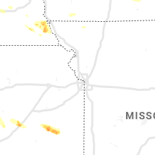
Hail Map for Friday, August 19, 2022

Number of Impacted Households on 8/19/2022
0
Impacted by 1" or Larger Hail
0
Impacted by 1.75" or Larger Hail
0
Impacted by 2.5" or Larger Hail
Square Miles of Populated Area Impacted on 8/19/2022
0
Impacted by 1" or Larger Hail
0
Impacted by 1.75" or Larger Hail
0
Impacted by 2.5" or Larger Hail


Cities Most Affected by Hail Storms of 8/19/2022
| Hail Size | Demographics of Zip Codes Affected | ||||||
|---|---|---|---|---|---|---|---|
| City | Count | Average | Largest | Pop Density | House Value | Income | Age |
| West Des Moines, IA | 6 | 2.08 | 3.00 | 1788 | $160k | $54.4k | 32.7 |
| Clive, IA | 1 | 2.00 | 2.00 | 2141 | $181k | $74.7k | 37.9 |
Hail and Wind Damage Spotted on 8/19/2022
Filter by Report Type:Hail ReportsWind Reports
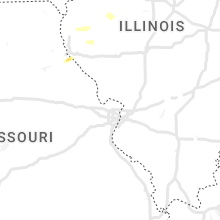
Iowa
| Local Time | Report Details |
|---|---|
| 2:33 PM CDT | Quarter sized hail reported near West Des Moines, IA, 9.1 miles W of Des Moines, IA, report from mping: quarter (1.00 in.). |
| 2:40 PM CDT | Hen Egg sized hail reported near Clive, IA, 6.6 miles WNW of Des Moines, IA, 1.5 to 2 inch hail in clive. |
| 2:40 PM CDT | Golf Ball sized hail reported near West Des Moines, IA, 9.1 miles W of Des Moines, IA, breaking car windshields. |
| 2:40 PM CDT | Ping Pong Ball sized hail reported near West Des Moines, IA, 7.5 miles W of Des Moines, IA, woi5 storm team reports ping pong ball hail at studio. |
| 2:43 PM CDT | Golf Ball sized hail reported near West Des Moines, IA, 7 miles W of Des Moines, IA, dime up to golf-ball sized hail. |
| 2:45 PM CDT | Tea Cup sized hail reported near West Des Moines, IA, 7.5 miles W of Des Moines, IA, 3 inch hail stone measured at woi in west des moines. |
| 2:45 PM CDT | Ping Pong Ball sized hail reported near West Des Moines, IA, 7.1 miles W of Des Moines, IA, ping pong ball hail in west des moines. time estimated from radar. report from social media. |
| 2:45 PM CDT | Hen Egg sized hail reported near West Des Moines, IA, 6.5 miles W of Des Moines, IA, egg sized hail reported in west des moines. time estimated by radar. |
| 2:46 PM CDT | Hen Egg sized hail reported near West Des Moines, IA, 7 miles W of Des Moines, IA, two inch diameter hail reported near valley high school. time estimated from radar. report from social media. |
| 2:47 PM CDT | Quarter sized hail reported near Windsor Heights, IA, 5.1 miles WNW of Des Moines, IA, report from mping: quarter (1.00 in.). |
| 2:50 PM CDT | Half Dollar sized hail reported near Des Moines, IA, 4.1 miles WNW of Des Moines, IA, report from mping: half dollar (1.25 in.). |
| 2:50 PM CDT | Hen Egg sized hail reported near West Des Moines, IA, 7 miles W of Des Moines, IA, hail at least 1.5 to 2 inches with plenty of cars damaged at valley west mall. time estimated from radar. |
| 2:56 PM CDT | Quarter sized hail reported near Des Moines, IA, 1 miles SW of Des Moines, IA, report from mping: quarter (1.00 in.). |
| 3:10 PM CDT | Quarter sized hail reported near Des Moines, IA, 1.3 miles E of Des Moines, IA, quarter size hail reported. time estimated from radar. |
| 3:10 PM CDT | Quarter sized hail reported near Steamboat Rock, IA, 51.4 miles S of Mason City, IA, report relayed by broadcast media. time estimated from radar. |
| 3:50 PM CDT | Ping Pong Ball sized hail reported near Holland, IA, 55.2 miles SSE of Mason City, IA, ping pong ball sized hail north of grundy center. time estimated from radar. report from social media. |
| 3:56 PM CDT | Quarter sized hail reported near Holland, IA, 55 miles SSE of Mason City, IA, pea and quarter sized hail falling north of holland. |
| 5:03 PM CDT | Quarter sized hail reported near Urbana, IA, 19.9 miles NNW of Cedar Rapids, IA, delayed report. |
| 6:21 PM CDT | Quarter sized hail reported near Oelwein, IA, 50.1 miles NNW of Cedar Rapids, IA |
| 7:00 PM CDT | Delayed report via amateur radio. trees down blocking the road on the north side of conesvill in muscatine county IA, 43.2 miles SSE of Cedar Rapids, IA |
| 7:03 PM CDT | Ping Pong Ball sized hail reported near Conesville, IA, 44.4 miles SSE of Cedar Rapids, IA, reported relayed be ares from fire chief. time shortly after 7pm. |
| 7:07 PM CDT | Quarter sized hail reported near Muscatine, IA, 50.7 miles SSE of Cedar Rapids, IA, report from mping: quarter (1.00 in.). |
| 7:24 PM CDT | Quarter sized hail reported near Conesville, IA, 44.4 miles SSE of Cedar Rapids, IA, via amatuer radio. occurring right now. |
| 7:33 PM CDT | Quarter sized hail reported near Ollie, IA, 58.1 miles NNW of Kahoka, MO, hail falling the past 10 minutes with most stones pea to nickel size. |
| 8:45 PM CDT | Wind gust estimated by morley fire chie in jones county IA, 22.5 miles E of Cedar Rapids, IA |
| 8:46 PM CDT | Tree down on fletcher. time estimated from rada in muscatine county IA, 49.5 miles SE of Cedar Rapids, IA |
West Virginia
| Local Time | Report Details |
|---|---|
| 3:55 PM EDT | Mcdowell county 911 advised there is a tree down in the town of war. time estimated by rada in mcdowell county WV, 57 miles NNE of Bristol, TN |
| 4:01 PM EDT | Mcdowell county 911 advised there is a tree down in the town of welch. time estimated by rada in mcdowell county WV, 63.5 miles S of Charleston, WV |
Georgia
| Local Time | Report Details |
|---|---|
| 4:03 PM EDT | Tree down on outbuilding near the 1000 block of mountain loop roa in gordon county GA, 35.4 miles SSE of Chattanooga, TN |
| 4:27 PM EDT | Multiple trees down between 1200 and 1300 blocks of hill city roa in gordon county GA, 35.2 miles SSE of Chattanooga, TN |
| 5:40 PM EDT | Quarter sized hail reported near Statesboro, GA, 48.2 miles NW of Savannah, GA, quarter size hail reported at red fern plantation lodge... ga. |
| 5:45 PM EDT | Large tree down in the road near eagle road and hwy 7 in bulloch county GA, 48.2 miles NW of Savannah, GA |
| 5:50 PM EDT | Trained spotter reported multiple trees snapped off and uprooted at the intersection of rough rider and clito roads. some trees blocked this intersection. time of event in bulloch county GA, 42.8 miles NW of Savannah, GA |
| 5:50 PM EDT | Trained spotter reported power poles snapped off at the intersection of georgia highway 24 and clito road. time of event was estimated from radar dat in bulloch county GA, 43.7 miles NW of Savannah, GA |
| 6:00 PM EDT | Funnel cloud reported and trees down at plantation point drive and zettwell road. penny to nickel size hail reporte in bulloch county GA, 43.3 miles NW of Savannah, GA |
| 6:20 PM EDT | Tree down across the road.20 in effingham county GA, 24.9 miles NW of Savannah, GA |
Nebraska
| Local Time | Report Details |
|---|---|
| 3:20 PM CDT | Half Dollar sized hail reported near Omaha, NE, 7.8 miles NW of Omaha, NE |
| 3:38 PM CDT | Quarter sized hail reported near Auburn, NE, 60.3 miles S of Omaha, NE, several trees down and one uprooted. |
| 3:45 PM CDT | Several large branches down and nickel size hai in nemaha county NE, 59.6 miles S of Omaha, NE |
| 5:55 PM CDT | Half Dollar sized hail reported near Sterling, NE, 61 miles SSW of Omaha, NE, quarter to half dollar size hail. time estimated. |
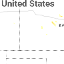
Kansas
| Local Time | Report Details |
|---|---|
| 3:54 PM CDT | Backyard mesonet weather statio in lincoln county KS, 71.6 miles E of Hays, KS |
| 8:15 PM CDT | El dorado airpor in butler county KS, 29.5 miles ENE of Wichita, KS |
Florida
| Local Time | Report Details |
|---|---|
| 5:50 PM EDT | Florida power and light reported fallen trees damage utility equipment on the south side of daytona north. the time of damage was based on rada in flagler county FL, 61.5 miles N of Orlando, FL |
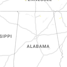
Alabama
| Local Time | Report Details |
|---|---|
| 6:05 PM CDT | At least one tall tree and several large tree limbs were knocked down at the monte sano campground. time given by nearby measured wind gus in madison county AL, 66.4 miles E of Florence, AL |
Idaho
| Local Time | Report Details |
|---|---|
| 5:42 PM MDT | Wind gusts estimated 40mph. lots of lightning. caused loss of power to the entire communit in caribou county ID, 65.7 miles SSE of Idaho Falls, ID |
| 7:45 PM MDT | Mesonet station rov 9 ssw mud lak in jefferson county ID, 29.1 miles WNW of Idaho Falls, ID |
| 7:50 PM MDT | Mesonet station nrf inl naval reactors facilit in butte county ID, 44.9 miles WNW of Idaho Falls, ID |
Kentucky
| Local Time | Report Details |
|---|---|
| 10:00 PM EDT | Trees were down all along highway 119 in and around tanyard hill. the road was blocked in place in bell county KY, 59.6 miles NNE of Knoxville, TN |
Connect with Interactive Hail Maps