

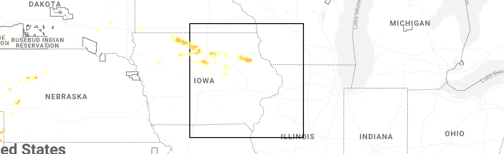
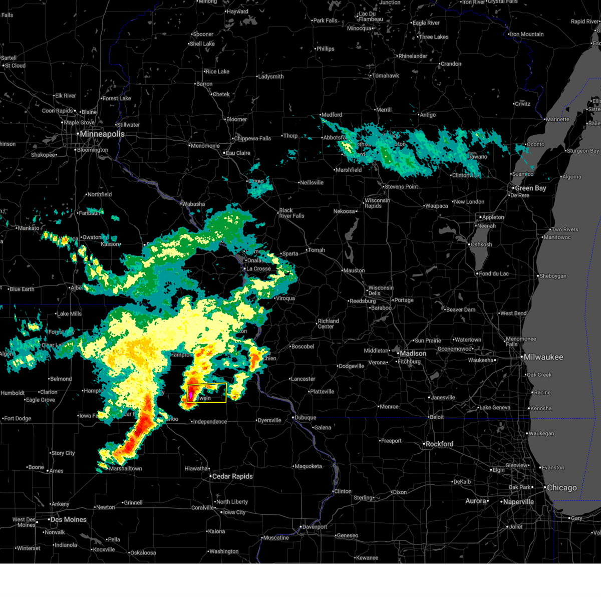
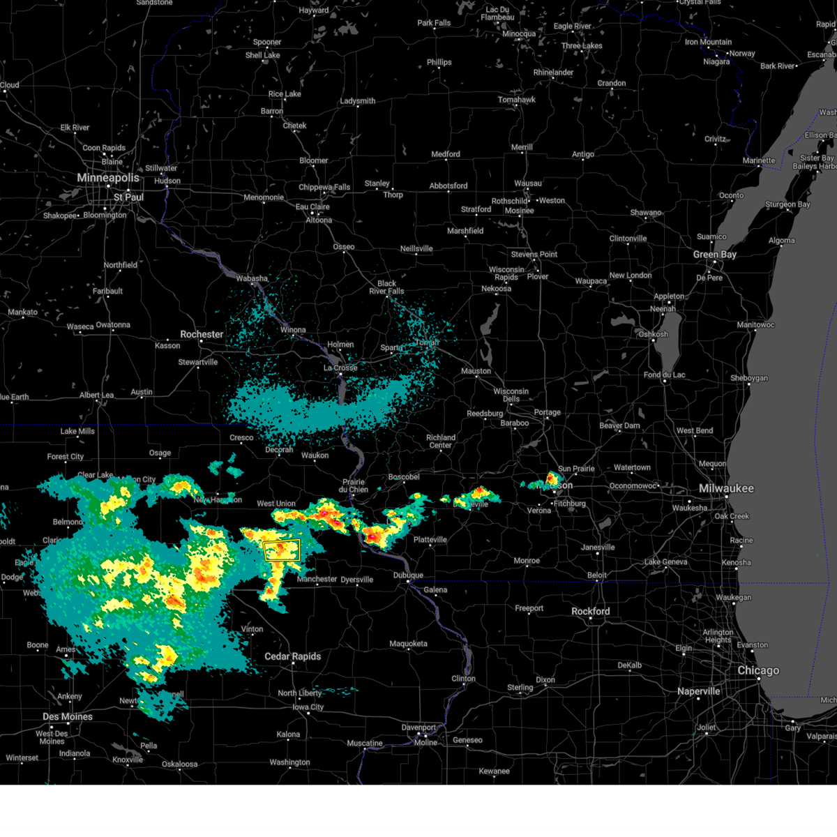
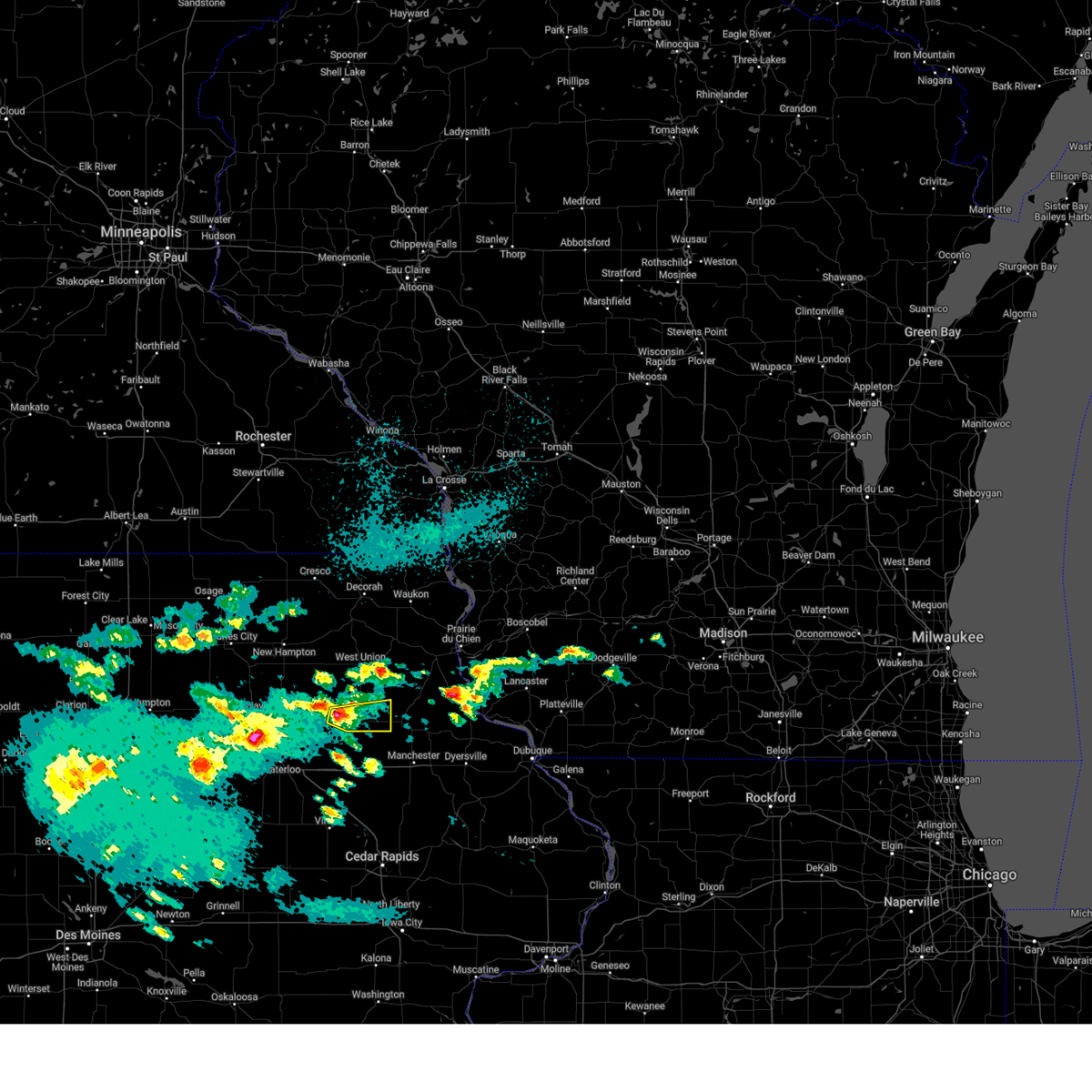
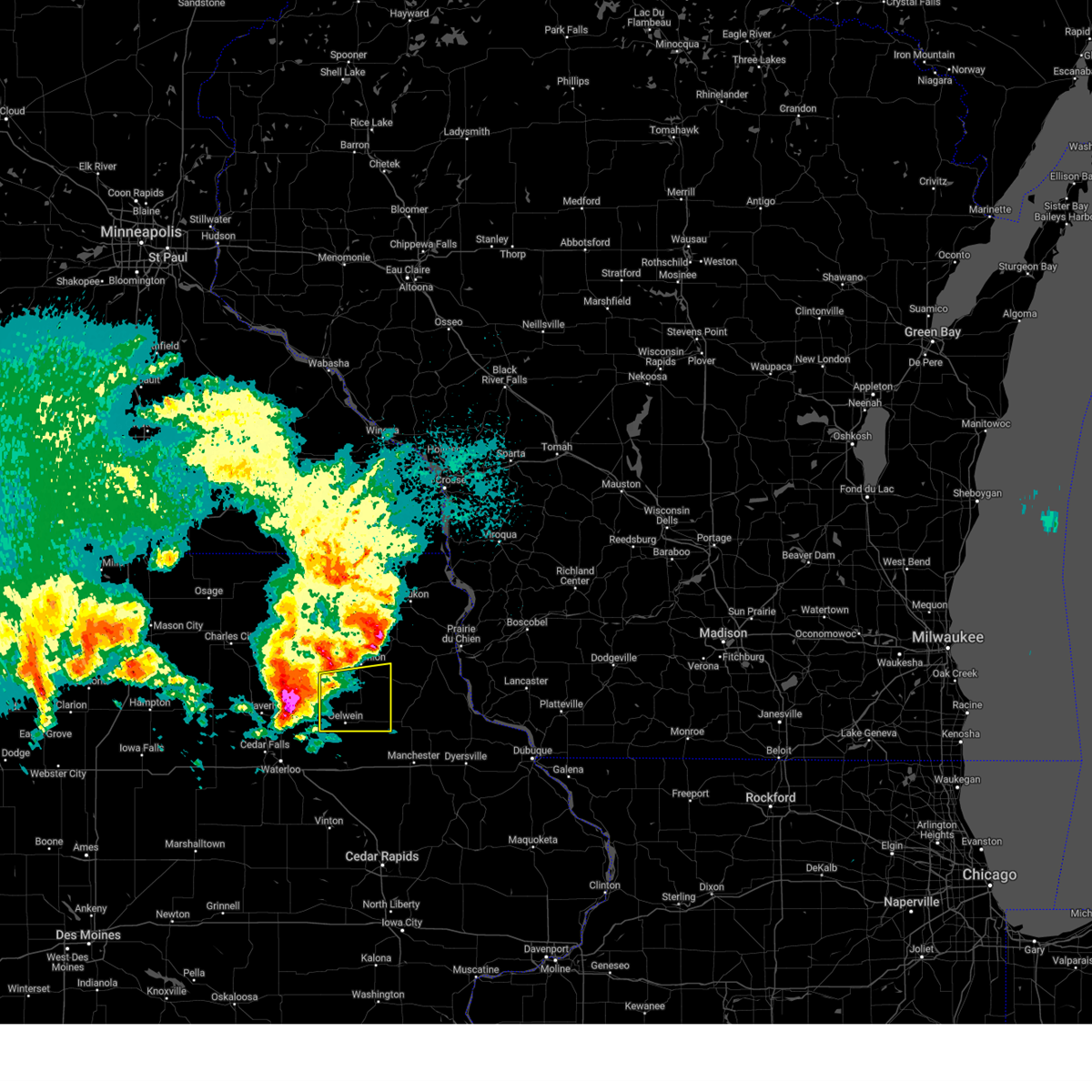
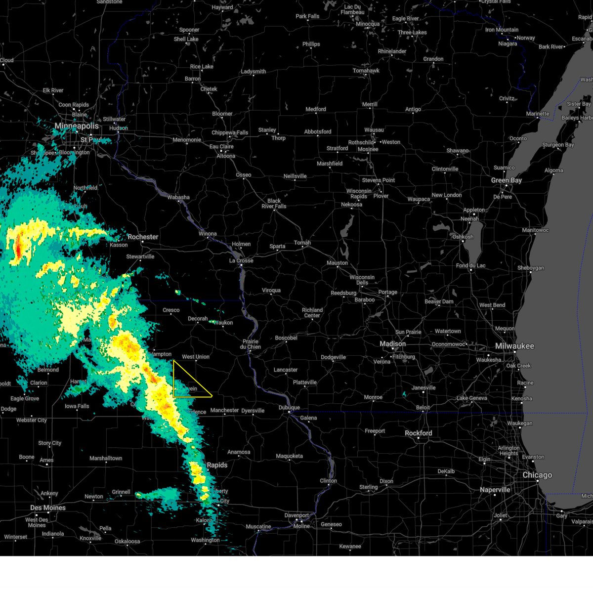
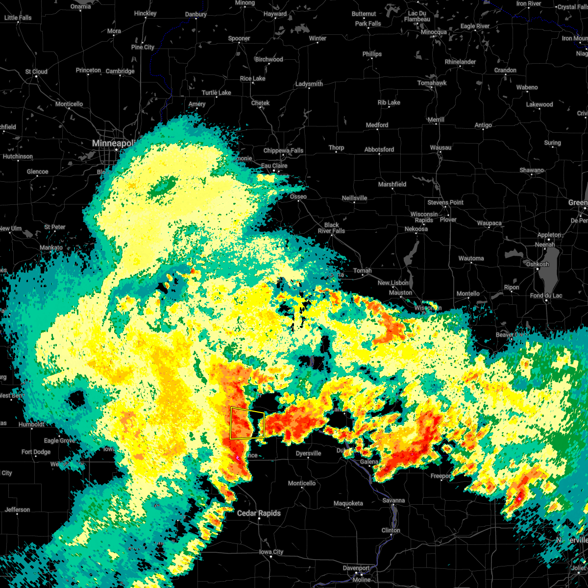
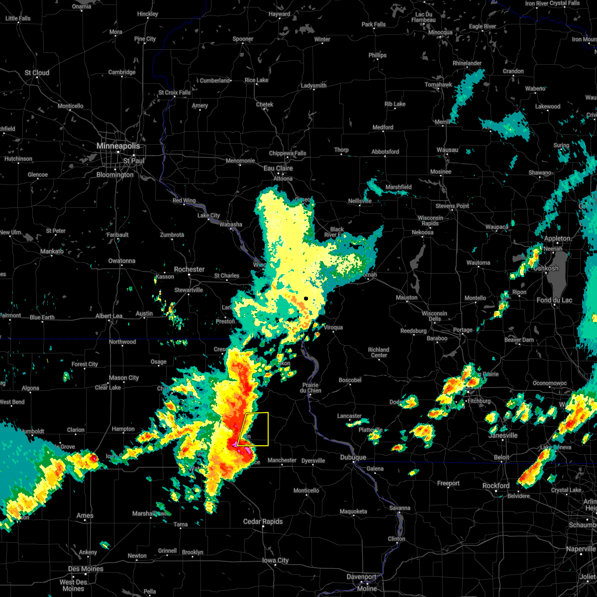
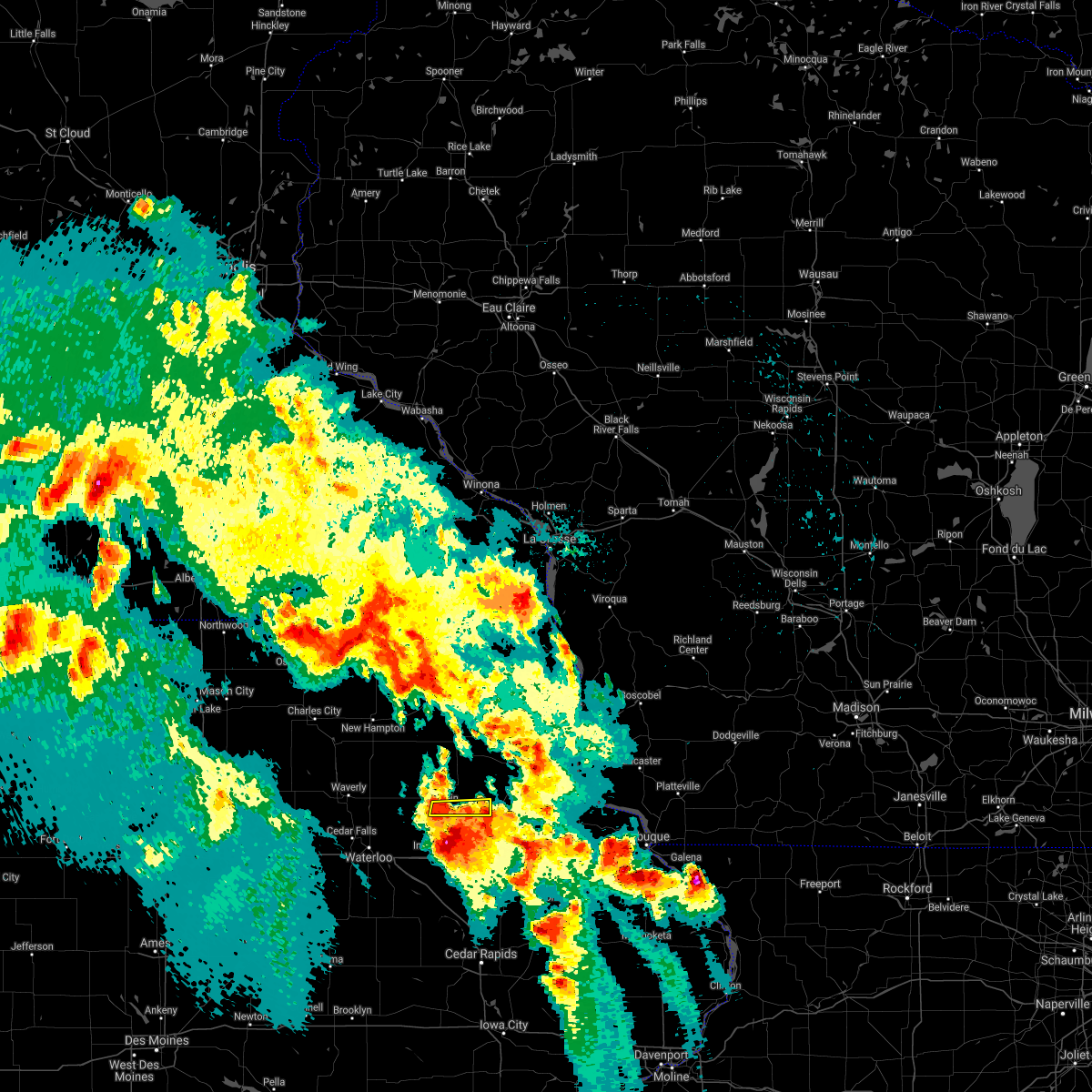
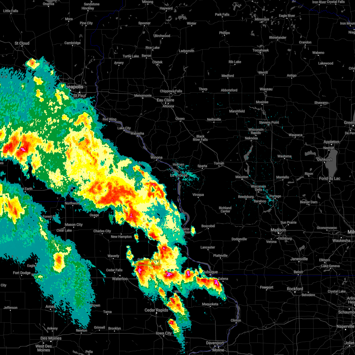
Hail Map for Oelwein, IA
The Oelwein, IA area has had 7 reports of on-the-ground hail by trained spotters, and has been under severe weather warnings 11 times during the past 12 months. Doppler radar has detected hail at or near Oelwein, IA on 63 occasions, including 6 occasions during the past year.
| Name: | Oelwein, IA |
| Where Located: | 49.3 miles NNW of Cedar Rapids, IA |
| Map: | Google Map for Oelwein, IA |
| Population: | 6415 |
| Housing Units: | 3058 |
| More Info: | Search Google for Oelwein, IA |
3
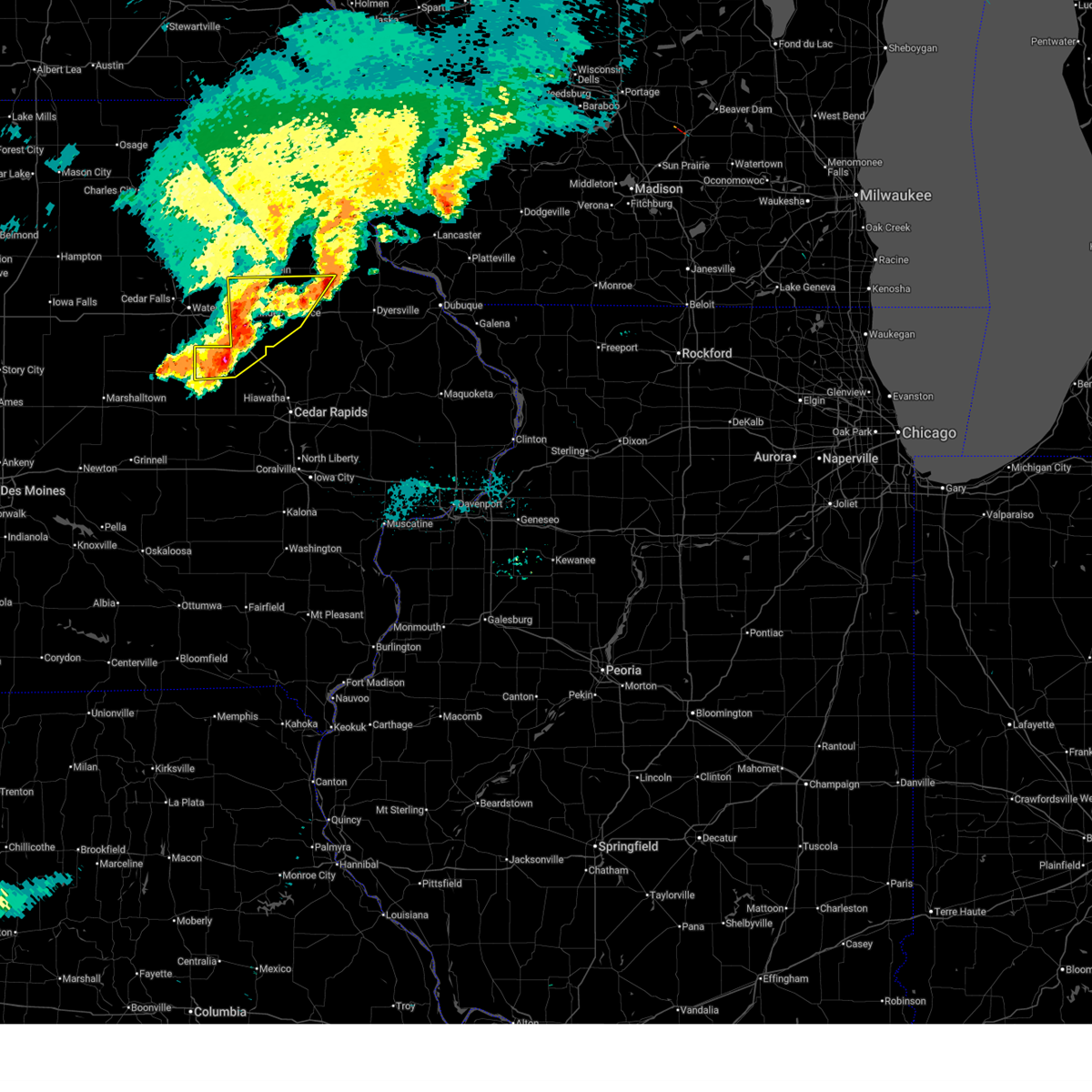
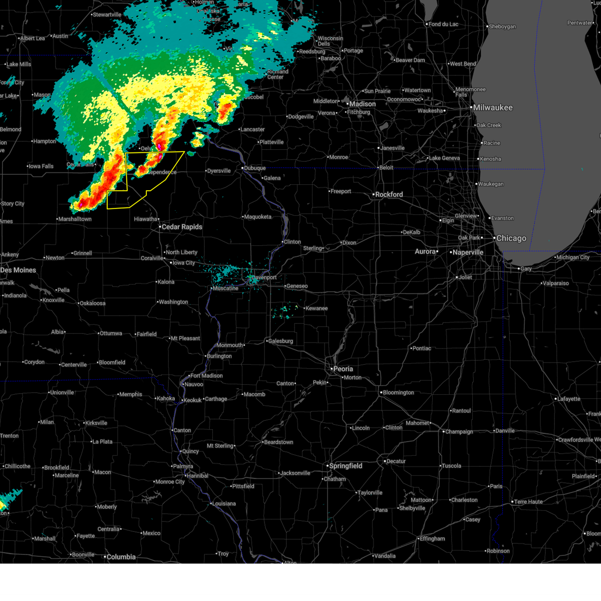
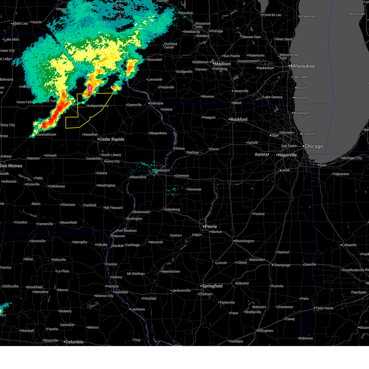
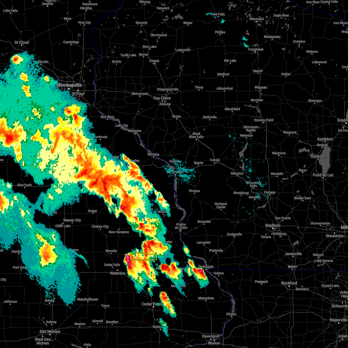
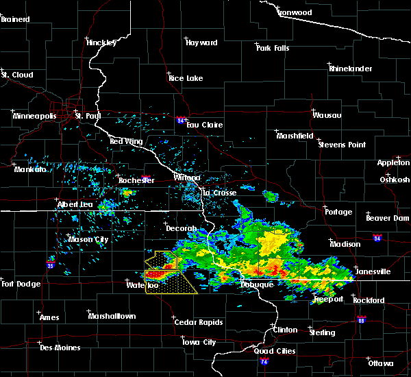
The Top Recent Hail Date for Oelwein, IA is Wednesday, June 11, 2025 (2nd out of 63)
Hail and Wind Damage Spotted near Oelwein, IA
| Date / Time | Report Details |
|---|---|
| 6/11/2025 8:24 PM CDT |
 At 822 pm cdt, severe thunderstorms were located along a line extending from camp c.s. klaus to vinton, moving east at 40 mph (radar indicated. a 66 mph wind gust was measured at the vinton airport around 815 pm). Hazards include 70 mph wind gusts and quarter size hail. Hail damage to vehicles is expected. expect considerable tree damage. wind damage is also likely to mobile homes, roofs, and outbuildings. locations impacted include, independence, vinton, jesup, urbana, dysart, fairbank, edgewood, winthrop, hazleton, quasqueton, lamont, garrison, brandon, rowley, aurora, dundee, mount auburn, masonville, stanley, and wapsipinicon golf course. This includes interstate 380 between mile markers 43 and 55. At 822 pm cdt, severe thunderstorms were located along a line extending from camp c.s. klaus to vinton, moving east at 40 mph (radar indicated. a 66 mph wind gust was measured at the vinton airport around 815 pm). Hazards include 70 mph wind gusts and quarter size hail. Hail damage to vehicles is expected. expect considerable tree damage. wind damage is also likely to mobile homes, roofs, and outbuildings. locations impacted include, independence, vinton, jesup, urbana, dysart, fairbank, edgewood, winthrop, hazleton, quasqueton, lamont, garrison, brandon, rowley, aurora, dundee, mount auburn, masonville, stanley, and wapsipinicon golf course. This includes interstate 380 between mile markers 43 and 55.
|
| 6/11/2025 7:54 PM CDT |
 At 753 pm cdt, severe thunderstorms were located along a line extending from joy springs county park to near dysart, moving east at 50 mph (trained weather spotters). Hazards include 60 mph wind gusts and quarter size hail. Hail damage to vehicles is expected. expect wind damage to roofs, siding, and trees. locations impacted include, independence, vinton, jesup, urbana, dysart, fairbank, edgewood, winthrop, hazleton, quasqueton, lamont, garrison, brandon, rowley, aurora, dundee, mount auburn, masonville, stanley, and wapsipinicon golf course. This includes interstate 380 between mile markers 43 and 55. At 753 pm cdt, severe thunderstorms were located along a line extending from joy springs county park to near dysart, moving east at 50 mph (trained weather spotters). Hazards include 60 mph wind gusts and quarter size hail. Hail damage to vehicles is expected. expect wind damage to roofs, siding, and trees. locations impacted include, independence, vinton, jesup, urbana, dysart, fairbank, edgewood, winthrop, hazleton, quasqueton, lamont, garrison, brandon, rowley, aurora, dundee, mount auburn, masonville, stanley, and wapsipinicon golf course. This includes interstate 380 between mile markers 43 and 55.
|
| 6/11/2025 7:39 PM CDT |
 Svrdvn the national weather service in the quad cities has issued a * severe thunderstorm warning for, buchanan county in northeastern iowa, northern benton county in east central iowa, northwestern delaware county in northeastern iowa, * until 900 pm cdt. * at 739 pm cdt, severe thunderstorms were located along a line extending from near fairbank to near traer, moving east at 40 mph (radar indicated). Hazards include 60 mph wind gusts and quarter size hail. Hail damage to vehicles is expected. Expect wind damage to roofs, siding, and trees. Svrdvn the national weather service in the quad cities has issued a * severe thunderstorm warning for, buchanan county in northeastern iowa, northern benton county in east central iowa, northwestern delaware county in northeastern iowa, * until 900 pm cdt. * at 739 pm cdt, severe thunderstorms were located along a line extending from near fairbank to near traer, moving east at 40 mph (radar indicated). Hazards include 60 mph wind gusts and quarter size hail. Hail damage to vehicles is expected. Expect wind damage to roofs, siding, and trees.
|
| 6/11/2025 7:36 PM CDT | Quarter sized hail reported 0.8 miles S of Oelwein, IA, dime to quarter sized hail covering the ground with strong winds. |
| 6/11/2025 7:34 PM CDT |
 Svrarx the national weather service in la crosse has issued a * severe thunderstorm warning for, southwestern clayton county in northeastern iowa, southeastern fayette county in northeastern iowa, * until 815 pm cdt. * at 733 pm cdt, a severe thunderstorm was located near oelwein, moving east at 35 mph (law enforcement reported quarter sized hail in oelwein at 7:30pm). Hazards include quarter size hail. Damage to vehicles is expected. this severe thunderstorm will be near, arlington around 745 pm cdt. strawberry point around 755 pm cdt. Other locations impacted by this severe thunderstorm include thomasville, highways 3 and 187, joy springs county park, county roads 3 and w 45, and saint sebald. Svrarx the national weather service in la crosse has issued a * severe thunderstorm warning for, southwestern clayton county in northeastern iowa, southeastern fayette county in northeastern iowa, * until 815 pm cdt. * at 733 pm cdt, a severe thunderstorm was located near oelwein, moving east at 35 mph (law enforcement reported quarter sized hail in oelwein at 7:30pm). Hazards include quarter size hail. Damage to vehicles is expected. this severe thunderstorm will be near, arlington around 745 pm cdt. strawberry point around 755 pm cdt. Other locations impacted by this severe thunderstorm include thomasville, highways 3 and 187, joy springs county park, county roads 3 and w 45, and saint sebald.
|
| 6/11/2025 7:28 PM CDT | Various sized branches down across southern portions of of the city. time estimated by rada in fayette county IA, 0.1 miles S of Oelwein, IA |
| 4/23/2025 10:21 PM CDT |
 The storm which prompted the warning has weakened below severe limits, and no longer poses an immediate threat to life or property. therefore, the warning will be allowed to expire. The storm which prompted the warning has weakened below severe limits, and no longer poses an immediate threat to life or property. therefore, the warning will be allowed to expire.
|
| 4/23/2025 9:56 PM CDT |
 At 956 pm cdt, a severe thunderstorm was located near oelwein, moving east at 15 mph (radar indicated). Hazards include quarter size hail. Damage to vehicles is expected. this severe storm will be near, arlington around 1020 pm cdt. Other locations impacted by this severe thunderstorm include highways 3 and 187, county road w 45 and 187, county roads 3 and w 45, and county roads 3 and w 33. At 956 pm cdt, a severe thunderstorm was located near oelwein, moving east at 15 mph (radar indicated). Hazards include quarter size hail. Damage to vehicles is expected. this severe storm will be near, arlington around 1020 pm cdt. Other locations impacted by this severe thunderstorm include highways 3 and 187, county road w 45 and 187, county roads 3 and w 45, and county roads 3 and w 33.
|
| 4/23/2025 9:35 PM CDT |
 Svrarx the national weather service in la crosse has issued a * severe thunderstorm warning for, southern fayette county in northeastern iowa, * until 1030 pm cdt. * at 935 pm cdt, a severe thunderstorm was located near oelwein, moving east at 15 mph (radar indicated). Hazards include half dollar size hail. Damage to vehicles is expected. this severe thunderstorm will be near, oelwein around 940 pm cdt. stanley around 1005 pm cdt. arlington around 1020 pm cdt. Other locations impacted by this severe thunderstorm include highways 3 and 187, county road w 33 and 187, county roads 3 and w 13, county road w 45 and 187, county roads 3 and w 45, and county roads 3 and w 33. Svrarx the national weather service in la crosse has issued a * severe thunderstorm warning for, southern fayette county in northeastern iowa, * until 1030 pm cdt. * at 935 pm cdt, a severe thunderstorm was located near oelwein, moving east at 15 mph (radar indicated). Hazards include half dollar size hail. Damage to vehicles is expected. this severe thunderstorm will be near, oelwein around 940 pm cdt. stanley around 1005 pm cdt. arlington around 1020 pm cdt. Other locations impacted by this severe thunderstorm include highways 3 and 187, county road w 33 and 187, county roads 3 and w 13, county road w 45 and 187, county roads 3 and w 45, and county roads 3 and w 33.
|
| 4/18/2025 4:09 AM CDT |
 Svrarx the national weather service in la crosse has issued a * severe thunderstorm warning for, fayette county in northeastern iowa, * until 500 am cdt. * at 409 am cdt, a severe thunderstorm was located near sumner, or 13 miles northwest of oelwein, moving east at 50 mph (radar indicated). Hazards include golf ball size hail. People and animals outdoors will be injured. expect damage to roofs, siding, windows, and vehicles. this severe thunderstorm will be near, maynard around 420 am cdt. fayette around 425 am cdt. Other locations impacted by this severe thunderstorm include highway 93 and county w 14, donnan, highway 93 and county v 68, volga river state park, wadena, brainard, and randalia. Svrarx the national weather service in la crosse has issued a * severe thunderstorm warning for, fayette county in northeastern iowa, * until 500 am cdt. * at 409 am cdt, a severe thunderstorm was located near sumner, or 13 miles northwest of oelwein, moving east at 50 mph (radar indicated). Hazards include golf ball size hail. People and animals outdoors will be injured. expect damage to roofs, siding, windows, and vehicles. this severe thunderstorm will be near, maynard around 420 am cdt. fayette around 425 am cdt. Other locations impacted by this severe thunderstorm include highway 93 and county w 14, donnan, highway 93 and county v 68, volga river state park, wadena, brainard, and randalia.
|
| 3/14/2025 8:05 PM CDT |
 Svrarx the national weather service in la crosse has issued a * severe thunderstorm warning for, southern fayette county in northeastern iowa, * until 845 pm cdt. * at 804 pm cdt, severe thunderstorms were located along a line extending from near tripoli to brandon, moving north at 50 mph (radar indicated). Hazards include 60 mph wind gusts. expect damage to roofs, siding, and trees Svrarx the national weather service in la crosse has issued a * severe thunderstorm warning for, southern fayette county in northeastern iowa, * until 845 pm cdt. * at 804 pm cdt, severe thunderstorms were located along a line extending from near tripoli to brandon, moving north at 50 mph (radar indicated). Hazards include 60 mph wind gusts. expect damage to roofs, siding, and trees
|
| 7/15/2024 5:40 PM CDT | At 539 pm cdt, severe thunderstorms were located along a line extending from near twin bridges park to near fairfax, moving east at 25 mph (radar indicated). Hazards include 70 mph wind gusts and penny size hail. Expect considerable tree damage. damage is likely to mobile homes, roofs, and outbuildings. locations impacted include, cedar rapids, independence, anamosa, vinton, manchester, mechanicsville, marion, hiawatha, mount vernon, dyersville, monticello, robins, belle plaine, jesup, center point, cascade, lisbon, fairfax, solon, and epworth. This includes interstate 380 between mile markers 8 and 55. |
| 7/15/2024 5:20 PM CDT | Svrdvn the national weather service in the quad cities has issued a * severe thunderstorm warning for, buchanan county in northeastern iowa, northwestern cedar county in east central iowa, western dubuque county in northeastern iowa, northern johnson county in east central iowa, benton county in east central iowa, jones county in east central iowa, delaware county in northeastern iowa, linn county in east central iowa, northeastern iowa county in east central iowa, * until 630 pm cdt. * at 520 pm cdt, severe thunderstorms were located along a line extending from edgewood to near norway, moving east at 25 mph (radar indicated). Hazards include 70 mph wind gusts and quarter size hail. Hail damage to vehicles is expected. expect considerable tree damage. Wind damage is also likely to mobile homes, roofs, and outbuildings. |
| 6/22/2024 5:23 PM CDT |
 Torarx the national weather service in la crosse has issued a * tornado warning for, southwestern clayton county in northeastern iowa, southeastern fayette county in northeastern iowa, * until 615 pm cdt. * at 523 pm cdt, a severe thunderstorm capable of producing a tornado was located over stanley, or near oelwein, moving east at 45 mph (radar indicated rotation). Hazards include tornado. Flying debris will be dangerous to those caught without shelter. mobile homes will be damaged or destroyed. damage to roofs, windows, and vehicles will occur. Tree damage is likely. Torarx the national weather service in la crosse has issued a * tornado warning for, southwestern clayton county in northeastern iowa, southeastern fayette county in northeastern iowa, * until 615 pm cdt. * at 523 pm cdt, a severe thunderstorm capable of producing a tornado was located over stanley, or near oelwein, moving east at 45 mph (radar indicated rotation). Hazards include tornado. Flying debris will be dangerous to those caught without shelter. mobile homes will be damaged or destroyed. damage to roofs, windows, and vehicles will occur. Tree damage is likely.
|
| 6/18/2024 11:07 PM CDT |
 The storms which prompted the warning have weakened below severe limits, and no longer pose an immediate threat to life or property. therefore, the warning will be allowed to expire. however, gusty winds are still possible with these thunderstorms. The storms which prompted the warning have weakened below severe limits, and no longer pose an immediate threat to life or property. therefore, the warning will be allowed to expire. however, gusty winds are still possible with these thunderstorms.
|
| 6/18/2024 10:22 PM CDT |
 Svrarx the national weather service in la crosse has issued a * severe thunderstorm warning for, southwestern clayton county in northeastern iowa, fayette county in northeastern iowa, * until 1115 pm cdt. * at 1022 pm cdt, severe thunderstorms were located along a line extending from near fredericksburg to 6 miles east of denver to 6 miles west of la porte city, moving east at 50 mph (radar indicated). Hazards include 60 mph wind gusts. Expect damage to roofs, siding, and trees. severe thunderstorms will be near, fairbank around 1025 pm cdt. oelwein around 1035 pm cdt. maynard and stanley around 1040 pm cdt. fayette around 1045 pm cdt. arlington around 1050 pm cdt. strawberry point and volga around 1100 pm cdt. Edgewood around 1110 pm cdt. Svrarx the national weather service in la crosse has issued a * severe thunderstorm warning for, southwestern clayton county in northeastern iowa, fayette county in northeastern iowa, * until 1115 pm cdt. * at 1022 pm cdt, severe thunderstorms were located along a line extending from near fredericksburg to 6 miles east of denver to 6 miles west of la porte city, moving east at 50 mph (radar indicated). Hazards include 60 mph wind gusts. Expect damage to roofs, siding, and trees. severe thunderstorms will be near, fairbank around 1025 pm cdt. oelwein around 1035 pm cdt. maynard and stanley around 1040 pm cdt. fayette around 1045 pm cdt. arlington around 1050 pm cdt. strawberry point and volga around 1100 pm cdt. Edgewood around 1110 pm cdt.
|
| 5/24/2024 6:54 AM CDT |
 At 654 am cdt, severe thunderstorms were located along a line extending from stanley to lafayette to near swisher, moving east at 40 mph (radar indicated). Hazards include 70 mph wind gusts and quarter size hail. Hail damage to vehicles is expected. expect considerable tree damage. wind damage is also likely to mobile homes, roofs, and outbuildings. locations impacted include, cedar rapids, independence, anamosa, manchester, mechanicsville, stanwood, marion, hiawatha, mount vernon, dyersville, monticello, robins, center point, lisbon, fairfax, ely, atkins, walford, urbana, and central city. This includes interstate 380 between mile markers 12 and 48. At 654 am cdt, severe thunderstorms were located along a line extending from stanley to lafayette to near swisher, moving east at 40 mph (radar indicated). Hazards include 70 mph wind gusts and quarter size hail. Hail damage to vehicles is expected. expect considerable tree damage. wind damage is also likely to mobile homes, roofs, and outbuildings. locations impacted include, cedar rapids, independence, anamosa, manchester, mechanicsville, stanwood, marion, hiawatha, mount vernon, dyersville, monticello, robins, center point, lisbon, fairfax, ely, atkins, walford, urbana, and central city. This includes interstate 380 between mile markers 12 and 48.
|
| 5/24/2024 6:45 AM CDT |
 Svrdvn the national weather service in the quad cities has issued a * severe thunderstorm warning for, buchanan county in northeastern iowa, northwestern cedar county in east central iowa, southwestern dubuque county in northeastern iowa, eastern benton county in east central iowa, jones county in east central iowa, delaware county in northeastern iowa, linn county in east central iowa, * until 745 am cdt. * at 645 am cdt, severe thunderstorms were located along a line extending from hazleton to near center point to near east amana, moving east at 40 mph (radar indicated). Hazards include 60 mph wind gusts and quarter size hail. Hail damage to vehicles is expected. Expect wind damage to roofs, siding, and trees. Svrdvn the national weather service in the quad cities has issued a * severe thunderstorm warning for, buchanan county in northeastern iowa, northwestern cedar county in east central iowa, southwestern dubuque county in northeastern iowa, eastern benton county in east central iowa, jones county in east central iowa, delaware county in northeastern iowa, linn county in east central iowa, * until 745 am cdt. * at 645 am cdt, severe thunderstorms were located along a line extending from hazleton to near center point to near east amana, moving east at 40 mph (radar indicated). Hazards include 60 mph wind gusts and quarter size hail. Hail damage to vehicles is expected. Expect wind damage to roofs, siding, and trees.
|
| 5/24/2024 6:31 AM CDT |
 Svrarx the national weather service in la crosse has issued a * severe thunderstorm warning for, eastern howard county in northeastern iowa, fayette county in northeastern iowa, western winneshiek county in northeastern iowa, northeastern chickasaw county in northeastern iowa, * until 715 am cdt. * at 630 am cdt, severe thunderstorms were located along a line extending from new hampton to near denver, moving east at 45 mph (radar indicated). Hazards include 60 mph wind gusts and quarter size hail. Hail damage to vehicles is expected. expect wind damage to roofs, siding, and trees. severe thunderstorms will be near, waucoma around 645 am cdt. maynard and hawkeye around 650 am cdt. spillville and fort atkinson around 655 am cdt. west union, fayette, and calmar around 700 am cdt. Other locations impacted by these severe thunderstorms include vernon springs county park, donnan, festina, vernon springs, eldorado, lake meyer county park, and county roads v 58 and a 46. Svrarx the national weather service in la crosse has issued a * severe thunderstorm warning for, eastern howard county in northeastern iowa, fayette county in northeastern iowa, western winneshiek county in northeastern iowa, northeastern chickasaw county in northeastern iowa, * until 715 am cdt. * at 630 am cdt, severe thunderstorms were located along a line extending from new hampton to near denver, moving east at 45 mph (radar indicated). Hazards include 60 mph wind gusts and quarter size hail. Hail damage to vehicles is expected. expect wind damage to roofs, siding, and trees. severe thunderstorms will be near, waucoma around 645 am cdt. maynard and hawkeye around 650 am cdt. spillville and fort atkinson around 655 am cdt. west union, fayette, and calmar around 700 am cdt. Other locations impacted by these severe thunderstorms include vernon springs county park, donnan, festina, vernon springs, eldorado, lake meyer county park, and county roads v 58 and a 46.
|
| 5/21/2024 6:23 PM CDT | . in buchanan county IA, 1.9 miles N of Oelwein, IA |
| 5/21/2024 6:14 PM CDT |
 Svrarx the national weather service in la crosse has issued a * severe thunderstorm warning for, fayette county in northeastern iowa, * until 700 pm cdt. * at 614 pm cdt, severe thunderstorms were located along a line extending from near denver to 7 miles southwest of fairbank to near jesup, moving northeast at 70 mph (radar indicated). Hazards include 70 mph wind gusts and penny size hail. Expect considerable tree damage. damage is likely to mobile homes, roofs, and outbuildings. severe thunderstorms will be near, fairbank around 620 pm cdt. oelwein and maynard around 625 pm cdt. fayette, hawkeye, and stanley around 630 pm cdt. west union around 635 pm cdt. Elgin and clermont around 645 pm cdt. Svrarx the national weather service in la crosse has issued a * severe thunderstorm warning for, fayette county in northeastern iowa, * until 700 pm cdt. * at 614 pm cdt, severe thunderstorms were located along a line extending from near denver to 7 miles southwest of fairbank to near jesup, moving northeast at 70 mph (radar indicated). Hazards include 70 mph wind gusts and penny size hail. Expect considerable tree damage. damage is likely to mobile homes, roofs, and outbuildings. severe thunderstorms will be near, fairbank around 620 pm cdt. oelwein and maynard around 625 pm cdt. fayette, hawkeye, and stanley around 630 pm cdt. west union around 635 pm cdt. Elgin and clermont around 645 pm cdt.
|
| 5/21/2024 3:56 AM CDT |
 The storm which prompted the warning has weakened below severe limits, and no longer poses an immediate threat to life or property. therefore, the warning will be allowed to expire. The storm which prompted the warning has weakened below severe limits, and no longer poses an immediate threat to life or property. therefore, the warning will be allowed to expire.
|
| 5/21/2024 3:44 AM CDT |
 At 344 am cdt, a severe thunderstorm was located over maynard, or 9 miles north of oelwein, moving northeast at 40 mph (radar indicated). Hazards include 60 mph wind gusts and penny size hail. Expect damage to roofs, siding, and trees. this severe storm will be near, west union and fayette around 350 am cdt. Other locations impacted by this severe thunderstorm include highway 93 and county w 14, donnan, highway 93 and county v 68, volga river state park, eldorado, wadena, and boyd. At 344 am cdt, a severe thunderstorm was located over maynard, or 9 miles north of oelwein, moving northeast at 40 mph (radar indicated). Hazards include 60 mph wind gusts and penny size hail. Expect damage to roofs, siding, and trees. this severe storm will be near, west union and fayette around 350 am cdt. Other locations impacted by this severe thunderstorm include highway 93 and county w 14, donnan, highway 93 and county v 68, volga river state park, eldorado, wadena, and boyd.
|
| 5/21/2024 3:17 AM CDT |
 Svrarx the national weather service in la crosse has issued a * severe thunderstorm warning for, fayette county in northeastern iowa, southwestern winneshiek county in northeastern iowa, southeastern chickasaw county in northeastern iowa, * until 400 am cdt. * at 316 am cdt, a severe thunderstorm was located over tripoli, or 13 miles east of waverly, moving northeast at 60 mph (radar indicated. at 305 am 70 mph wind was observed at the waterloo airport). Hazards include 70 mph wind gusts and penny size hail. Expect considerable tree damage. damage is likely to mobile homes, roofs, and outbuildings. this severe thunderstorm will be near, hawkeye around 330 am cdt. west union around 335 am cdt. Other locations impacted by this severe thunderstorm include donnan, eldorado, randalia, county roads v 56 and b 33, waucoma campground, jackson junction, and county road w 33 and 187. Svrarx the national weather service in la crosse has issued a * severe thunderstorm warning for, fayette county in northeastern iowa, southwestern winneshiek county in northeastern iowa, southeastern chickasaw county in northeastern iowa, * until 400 am cdt. * at 316 am cdt, a severe thunderstorm was located over tripoli, or 13 miles east of waverly, moving northeast at 60 mph (radar indicated. at 305 am 70 mph wind was observed at the waterloo airport). Hazards include 70 mph wind gusts and penny size hail. Expect considerable tree damage. damage is likely to mobile homes, roofs, and outbuildings. this severe thunderstorm will be near, hawkeye around 330 am cdt. west union around 335 am cdt. Other locations impacted by this severe thunderstorm include donnan, eldorado, randalia, county roads v 56 and b 33, waucoma campground, jackson junction, and county road w 33 and 187.
|
| 4/16/2024 3:19 PM CDT |
 Torarx the national weather service in la crosse has issued a * tornado warning for, southwestern clayton county in northeastern iowa, southern fayette county in northeastern iowa, * until 345 pm cdt. * at 318 pm cdt, a severe thunderstorm capable of producing a tornado was located over aurora, or 9 miles southeast of oelwein, moving north at 55 mph (radar indicated rotation). Hazards include tornado. Flying debris will be dangerous to those caught without shelter. mobile homes will be damaged or destroyed. damage to roofs, windows, and vehicles will occur. tree damage is likely. this dangerous storm will be near, arlington around 325 pm cdt. Other locations impacted by this tornadic thunderstorm include highway 93 and county w 14, donnan, volga river state park, wadena, randalia, highways 3 and 187, and county road w 45 and 187. Torarx the national weather service in la crosse has issued a * tornado warning for, southwestern clayton county in northeastern iowa, southern fayette county in northeastern iowa, * until 345 pm cdt. * at 318 pm cdt, a severe thunderstorm capable of producing a tornado was located over aurora, or 9 miles southeast of oelwein, moving north at 55 mph (radar indicated rotation). Hazards include tornado. Flying debris will be dangerous to those caught without shelter. mobile homes will be damaged or destroyed. damage to roofs, windows, and vehicles will occur. tree damage is likely. this dangerous storm will be near, arlington around 325 pm cdt. Other locations impacted by this tornadic thunderstorm include highway 93 and county w 14, donnan, volga river state park, wadena, randalia, highways 3 and 187, and county road w 45 and 187.
|
| 7/13/2023 11:21 PM CDT |
 The severe thunderstorm warning for southern fayette county will expire at 1130 pm cdt, the storm which prompted the warning has moved out of the area. therefore, the warning will be allowed to expire. The severe thunderstorm warning for southern fayette county will expire at 1130 pm cdt, the storm which prompted the warning has moved out of the area. therefore, the warning will be allowed to expire.
|
| 7/13/2023 11:03 PM CDT |
 At 1102 pm cdt, a severe thunderstorm was located over oelwein, moving southeast at 25 mph (trained weather spotters). Hazards include quarter size hail. Damage to vehicles is expected. this severe storm will be near, stanley around 1110 pm cdt. other locations impacted by this severe thunderstorm include highway 93 and county w 14, donnan, highway 93 and county v 68, randalia, richfield, highways 3 and 187 and county road w 45 and 187. hail threat, observed max hail size, 1. 00 in wind threat, radar indicated max wind gust, <50 mph. At 1102 pm cdt, a severe thunderstorm was located over oelwein, moving southeast at 25 mph (trained weather spotters). Hazards include quarter size hail. Damage to vehicles is expected. this severe storm will be near, stanley around 1110 pm cdt. other locations impacted by this severe thunderstorm include highway 93 and county w 14, donnan, highway 93 and county v 68, randalia, richfield, highways 3 and 187 and county road w 45 and 187. hail threat, observed max hail size, 1. 00 in wind threat, radar indicated max wind gust, <50 mph.
|
| 7/13/2023 10:53 PM CDT | Quarter sized hail reported 0.8 miles S of Oelwein, IA |
| 7/13/2023 10:45 PM CDT |
 At 1045 pm cdt, a severe thunderstorm was located near arlington, or 9 miles northeast of oelwein, moving southeast at 35 mph (radar indicated). Hazards include quarter size hail. Damage to vehicles is expected. this severe storm will be near, arlington around 1050 pm cdt. other locations impacted by this severe thunderstorm include highway 93 and county w 14, donnan, highway 93 and county v 68, randalia, richfield, highways 3 and 187 and county road w 45 and 187. hail threat, radar indicated max hail size, 1. 00 in wind threat, radar indicated max wind gust, <50 mph. At 1045 pm cdt, a severe thunderstorm was located near arlington, or 9 miles northeast of oelwein, moving southeast at 35 mph (radar indicated). Hazards include quarter size hail. Damage to vehicles is expected. this severe storm will be near, arlington around 1050 pm cdt. other locations impacted by this severe thunderstorm include highway 93 and county w 14, donnan, highway 93 and county v 68, randalia, richfield, highways 3 and 187 and county road w 45 and 187. hail threat, radar indicated max hail size, 1. 00 in wind threat, radar indicated max wind gust, <50 mph.
|
| 7/13/2023 10:24 PM CDT |
 At 1024 pm cdt, a severe thunderstorm was located near hawkeye, or 10 miles southwest of west union, moving southeast at 35 mph (radar indicated). Hazards include quarter size hail. Damage to vehicles is expected. this severe thunderstorm will be near, fayette and maynard around 1035 pm cdt. arlington and stanley around 1050 pm cdt. other locations impacted by this severe thunderstorm include highway 93 and county w 14, donnan, highway 93 and county v 68, randalia, richfield, highways 3 and 187 and county road w 45 and 187. hail threat, radar indicated max hail size, 1. 00 in wind threat, radar indicated max wind gust, <50 mph. At 1024 pm cdt, a severe thunderstorm was located near hawkeye, or 10 miles southwest of west union, moving southeast at 35 mph (radar indicated). Hazards include quarter size hail. Damage to vehicles is expected. this severe thunderstorm will be near, fayette and maynard around 1035 pm cdt. arlington and stanley around 1050 pm cdt. other locations impacted by this severe thunderstorm include highway 93 and county w 14, donnan, highway 93 and county v 68, randalia, richfield, highways 3 and 187 and county road w 45 and 187. hail threat, radar indicated max hail size, 1. 00 in wind threat, radar indicated max wind gust, <50 mph.
|
| 6/24/2023 6:01 PM CDT |
 At 600 pm cdt, severe thunderstorms were located along a line extending from near elgin to near arlington to near aurora, moving east at 40 mph (radar indicated). Hazards include 60 mph wind gusts. Expect damage to roofs, siding, and trees. these severe thunderstorms will remain over mainly rural areas of southern fayette county, including the following locations, highway 93 and county w 14, volga river state park, wadena, randalia, highways 3 and 187, county road w 33 and 187 and county road w 45 and 187. hail threat, radar indicated max hail size, <. 75 in wind threat, radar indicated max wind gust, 60 mph. At 600 pm cdt, severe thunderstorms were located along a line extending from near elgin to near arlington to near aurora, moving east at 40 mph (radar indicated). Hazards include 60 mph wind gusts. Expect damage to roofs, siding, and trees. these severe thunderstorms will remain over mainly rural areas of southern fayette county, including the following locations, highway 93 and county w 14, volga river state park, wadena, randalia, highways 3 and 187, county road w 33 and 187 and county road w 45 and 187. hail threat, radar indicated max hail size, <. 75 in wind threat, radar indicated max wind gust, 60 mph.
|
| 6/24/2023 5:50 PM CDT |
 At 550 pm cdt, severe thunderstorms were located along a line extending from fayette to near arlington to stanley, moving east at 40 mph (radar indicated). Hazards include 60 mph wind gusts and penny size hail. Expect damage to roofs, siding, and trees. these severe storms will be near, arlington around 555 pm cdt. hail threat, radar indicated max hail size, 0. 75 in wind threat, radar indicated max wind gust, 60 mph. At 550 pm cdt, severe thunderstorms were located along a line extending from fayette to near arlington to stanley, moving east at 40 mph (radar indicated). Hazards include 60 mph wind gusts and penny size hail. Expect damage to roofs, siding, and trees. these severe storms will be near, arlington around 555 pm cdt. hail threat, radar indicated max hail size, 0. 75 in wind threat, radar indicated max wind gust, 60 mph.
|
| 6/24/2023 5:45 PM CDT |
 At 544 pm cdt, severe thunderstorms were located along a line extending from fayette to near maynard to hazleton, moving east at 40 mph (radar indicated). Hazards include 60 mph wind gusts and quarter size hail. Hail damage to vehicles is expected. expect wind damage to roofs, siding, and trees. these severe storms will be near, arlington around 555 pm cdt. hail threat, radar indicated max hail size, 1. 00 in wind threat, radar indicated max wind gust, 60 mph. At 544 pm cdt, severe thunderstorms were located along a line extending from fayette to near maynard to hazleton, moving east at 40 mph (radar indicated). Hazards include 60 mph wind gusts and quarter size hail. Hail damage to vehicles is expected. expect wind damage to roofs, siding, and trees. these severe storms will be near, arlington around 555 pm cdt. hail threat, radar indicated max hail size, 1. 00 in wind threat, radar indicated max wind gust, 60 mph.
|
| 6/24/2023 5:38 PM CDT | 1 tree down and 1 large branch down near vicinity of 1st st nw... 2nd ave nw... and charles st in fayette county IA, 1 miles SSE of Oelwein, IA |
| 6/24/2023 5:35 PM CDT |
 At 535 pm cdt, severe thunderstorms were located along a line extending from near fayette to near maynard to near fairbank, moving east at 40 mph (radar indicated). Hazards include 60 mph wind gusts and quarter size hail. Hail damage to vehicles is expected. expect wind damage to roofs, siding, and trees. these severe storms will be near, fayette around 540 pm cdt. stanley around 545 pm cdt. other locations in the path of these severe thunderstorms include arlington. hail threat, radar indicated max hail size, 1. 00 in wind threat, radar indicated max wind gust, 60 mph. At 535 pm cdt, severe thunderstorms were located along a line extending from near fayette to near maynard to near fairbank, moving east at 40 mph (radar indicated). Hazards include 60 mph wind gusts and quarter size hail. Hail damage to vehicles is expected. expect wind damage to roofs, siding, and trees. these severe storms will be near, fayette around 540 pm cdt. stanley around 545 pm cdt. other locations in the path of these severe thunderstorms include arlington. hail threat, radar indicated max hail size, 1. 00 in wind threat, radar indicated max wind gust, 60 mph.
|
| 6/24/2023 5:30 PM CDT |
 At 529 pm cdt, severe thunderstorms were located along a line extending from 6 miles northwest of maynard to near oelwein to fairbank, moving east at 40 mph (radar indicated). Hazards include 60 mph wind gusts and quarter size hail. Hail damage to vehicles is expected. expect wind damage to roofs, siding, and trees. locations impacted include, oelwein, maynard, fayette, stanley and arlington. hail threat, radar indicated max hail size, 1. 00 in wind threat, radar indicated max wind gust, 60 mph. At 529 pm cdt, severe thunderstorms were located along a line extending from 6 miles northwest of maynard to near oelwein to fairbank, moving east at 40 mph (radar indicated). Hazards include 60 mph wind gusts and quarter size hail. Hail damage to vehicles is expected. expect wind damage to roofs, siding, and trees. locations impacted include, oelwein, maynard, fayette, stanley and arlington. hail threat, radar indicated max hail size, 1. 00 in wind threat, radar indicated max wind gust, 60 mph.
|
| 6/24/2023 5:16 PM CDT |
 At 515 pm cdt, a severe thunderstorm was located 7 miles northwest of fairbank, or 13 miles west of oelwein, moving east at 40 mph (radar indicated). Hazards include 60 mph wind gusts and quarter size hail. Hail damage to vehicles is expected. expect wind damage to roofs, siding, and trees. this severe thunderstorm will be near, fairbank around 525 pm cdt. oelwein around 535 pm cdt. maynard around 540 pm cdt. fayette around 545 pm cdt. arlington around 555 pm cdt. hail threat, radar indicated max hail size, 1. 00 in wind threat, radar indicated max wind gust, 60 mph. At 515 pm cdt, a severe thunderstorm was located 7 miles northwest of fairbank, or 13 miles west of oelwein, moving east at 40 mph (radar indicated). Hazards include 60 mph wind gusts and quarter size hail. Hail damage to vehicles is expected. expect wind damage to roofs, siding, and trees. this severe thunderstorm will be near, fairbank around 525 pm cdt. oelwein around 535 pm cdt. maynard around 540 pm cdt. fayette around 545 pm cdt. arlington around 555 pm cdt. hail threat, radar indicated max hail size, 1. 00 in wind threat, radar indicated max wind gust, 60 mph.
|
| 8/19/2022 6:21 PM CDT | Quarter sized hail reported 0.8 miles S of Oelwein, IA |
| 7/5/2022 9:07 PM CDT |
 The severe thunderstorm warning for southern fayette county will expire at 915 pm cdt, the storms which prompted the warning have weakened below severe limits, and have exited the warned area. therefore, the warning will be allowed to expire. however heavy rain is still possible with these thunderstorms. a severe thunderstorm watch remains in effect until midnight cdt for northeastern iowa. The severe thunderstorm warning for southern fayette county will expire at 915 pm cdt, the storms which prompted the warning have weakened below severe limits, and have exited the warned area. therefore, the warning will be allowed to expire. however heavy rain is still possible with these thunderstorms. a severe thunderstorm watch remains in effect until midnight cdt for northeastern iowa.
|
| 7/5/2022 9:00 PM CDT |
 At 900 pm cdt, severe thunderstorms were located along a line extending from fayette to near winthrop, moving east at 45 mph (radar indicated). Hazards include 60 mph wind gusts. Expect damage to roofs, siding, and trees. these severe thunderstorms will remain over mainly rural areas of southern fayette county, including the following locations, highway 93 and county w 14, volga river state park, wadena, randalia, highways 3 and 187, county road w 33 and 187 and county roads 3 and w 13. hail threat, radar indicated max hail size, <. 75 in wind threat, radar indicated max wind gust, 60 mph. At 900 pm cdt, severe thunderstorms were located along a line extending from fayette to near winthrop, moving east at 45 mph (radar indicated). Hazards include 60 mph wind gusts. Expect damage to roofs, siding, and trees. these severe thunderstorms will remain over mainly rural areas of southern fayette county, including the following locations, highway 93 and county w 14, volga river state park, wadena, randalia, highways 3 and 187, county road w 33 and 187 and county roads 3 and w 13. hail threat, radar indicated max hail size, <. 75 in wind threat, radar indicated max wind gust, 60 mph.
|
| 7/5/2022 8:08 PM CDT |
 At 807 pm cdt, severe thunderstorms were located along a line extending from nashua to 7 miles south of shell rock, moving east at 40 mph (radar indicated). Hazards include 60 mph wind gusts. Expect damage to roofs, siding, and trees. severe thunderstorms will be near, maynard around 855 pm cdt. fayette around 900 pm cdt. arlington around 910 pm cdt. other locations impacted by these severe thunderstorms include highway 93 and county w 14, highway 93 and county v 68, volga river state park, wadena, randalia, highways 3 and 187 and county road w 45 and 187. hail threat, radar indicated max hail size, <. 75 in wind threat, radar indicated max wind gust, 60 mph. At 807 pm cdt, severe thunderstorms were located along a line extending from nashua to 7 miles south of shell rock, moving east at 40 mph (radar indicated). Hazards include 60 mph wind gusts. Expect damage to roofs, siding, and trees. severe thunderstorms will be near, maynard around 855 pm cdt. fayette around 900 pm cdt. arlington around 910 pm cdt. other locations impacted by these severe thunderstorms include highway 93 and county w 14, highway 93 and county v 68, volga river state park, wadena, randalia, highways 3 and 187 and county road w 45 and 187. hail threat, radar indicated max hail size, <. 75 in wind threat, radar indicated max wind gust, 60 mph.
|
| 7/4/2022 8:39 PM CDT |
 At 839 pm cdt, a severe thunderstorm capable of producing a tornado was located near maynard, or 8 miles northwest of oelwein, moving southeast at 20 mph (radar indicated rotation). Hazards include tornado and quarter size hail. Flying debris will be dangerous to those caught without shelter. mobile homes will be damaged or destroyed. damage to roofs, windows, and vehicles will occur. tree damage is likely. this dangerous storm will be near, maynard around 855 pm cdt. oelwein around 900 pm cdt. Other locations impacted by this tornadic thunderstorm include county road w 33 and 187, westgate and county roads 3 and w 33. At 839 pm cdt, a severe thunderstorm capable of producing a tornado was located near maynard, or 8 miles northwest of oelwein, moving southeast at 20 mph (radar indicated rotation). Hazards include tornado and quarter size hail. Flying debris will be dangerous to those caught without shelter. mobile homes will be damaged or destroyed. damage to roofs, windows, and vehicles will occur. tree damage is likely. this dangerous storm will be near, maynard around 855 pm cdt. oelwein around 900 pm cdt. Other locations impacted by this tornadic thunderstorm include county road w 33 and 187, westgate and county roads 3 and w 33.
|
| 7/4/2022 8:32 PM CDT |
 At 832 pm cdt, a severe thunderstorm capable of producing a tornado was located near sumner, or 10 miles northwest of oelwein, moving southeast at 20 mph (weather spotters reported funnel cloud). Hazards include tornado. Flying debris will be dangerous to those caught without shelter. mobile homes will be damaged or destroyed. damage to roofs, windows, and vehicles will occur. tree damage is likely. this dangerous storm will be near, maynard around 855 pm cdt. oelwein around 900 pm cdt. Other locations impacted by this tornadic thunderstorm include county road w 33 and 187, county roads 3 and w 13, westgate and county roads 3 and w 33. At 832 pm cdt, a severe thunderstorm capable of producing a tornado was located near sumner, or 10 miles northwest of oelwein, moving southeast at 20 mph (weather spotters reported funnel cloud). Hazards include tornado. Flying debris will be dangerous to those caught without shelter. mobile homes will be damaged or destroyed. damage to roofs, windows, and vehicles will occur. tree damage is likely. this dangerous storm will be near, maynard around 855 pm cdt. oelwein around 900 pm cdt. Other locations impacted by this tornadic thunderstorm include county road w 33 and 187, county roads 3 and w 13, westgate and county roads 3 and w 33.
|
| 12/15/2021 7:46 PM CST |
 At 746 pm cst, severe thunderstorms were located along a line extending from near harmony to near decorah to 6 miles south of sumner, moving east at 50 mph (radar indicated). Hazards include 70 mph wind gusts. Expect considerable tree damage. damage is likely to mobile homes, roofs, and outbuildings. Locations impacted include, decorah, oelwein, fayette, arlington, volga, elkader and farmersburg. At 746 pm cst, severe thunderstorms were located along a line extending from near harmony to near decorah to 6 miles south of sumner, moving east at 50 mph (radar indicated). Hazards include 70 mph wind gusts. Expect considerable tree damage. damage is likely to mobile homes, roofs, and outbuildings. Locations impacted include, decorah, oelwein, fayette, arlington, volga, elkader and farmersburg.
|
| 12/15/2021 7:29 PM CST |
 At 729 pm cst, severe thunderstorms were located along a line extending from lime springs to near protivin to near tripoli, moving northeast at 70 mph (radar indicated). Hazards include 70 mph wind gusts. Expect considerable tree damage. damage is likely to mobile homes, roofs, and outbuildings. severe thunderstorms will be near, spillville and ridgeway around 740 pm cst. hawkeye and waucoma around 745 pm cst. Decorah and west union around 750 pm cst. At 729 pm cst, severe thunderstorms were located along a line extending from lime springs to near protivin to near tripoli, moving northeast at 70 mph (radar indicated). Hazards include 70 mph wind gusts. Expect considerable tree damage. damage is likely to mobile homes, roofs, and outbuildings. severe thunderstorms will be near, spillville and ridgeway around 740 pm cst. hawkeye and waucoma around 745 pm cst. Decorah and west union around 750 pm cst.
|
| 8/24/2021 3:10 PM CDT | Many mature trees snapped down the middl in fayette county IA, 0.8 miles S of Oelwein, IA |
| 8/24/2021 3:04 PM CDT | Report from mping: 1-inch tree limbs broken; shingles blown of in fayette county IA, 3.1 miles W of Oelwein, IA |
| 8/24/2021 3:01 PM CDT |
 At 301 pm cdt, severe thunderstorms were located along a line extending from near fayette to aurora, moving east at 35 mph (radar indicated). Hazards include 60 mph wind gusts and quarter size hail. Hail damage to vehicles is expected. expect wind damage to roofs, siding, and trees. locations impacted include, oelwein, fayette, maynard, arlington, stanley, wadena, volga river state park, highways 3 and 187, county road w 45 and 187, county road w 33 and 187, county roads 3 and w 45, county roads 3 and w 33 and albany. hail threat, radar indicated max hail size, 1. 00 in wind threat, radar indicated max wind gust, 60 mph. At 301 pm cdt, severe thunderstorms were located along a line extending from near fayette to aurora, moving east at 35 mph (radar indicated). Hazards include 60 mph wind gusts and quarter size hail. Hail damage to vehicles is expected. expect wind damage to roofs, siding, and trees. locations impacted include, oelwein, fayette, maynard, arlington, stanley, wadena, volga river state park, highways 3 and 187, county road w 45 and 187, county road w 33 and 187, county roads 3 and w 45, county roads 3 and w 33 and albany. hail threat, radar indicated max hail size, 1. 00 in wind threat, radar indicated max wind gust, 60 mph.
|
| 8/24/2021 2:59 PM CDT | Storm damage reported in fayette county IA, 0.8 miles S of Oelwein, IA |
| 8/24/2021 2:53 PM CDT |
 At 252 pm cdt, severe thunderstorms were located along a line extending from near fayette to stanley, moving east at 40 mph (trained weather spotters. multiple trees were reported down just west of oelwein). Hazards include 70 mph wind gusts and ping pong ball size hail. People and animals outdoors will be injured. expect hail damage to roofs, siding, windows, and vehicles. expect considerable tree damage. wind damage is also likely to mobile homes, roofs, and outbuildings. Locations impacted include, oelwein, fayette, fairbank, maynard, arlington, stanley, wadena, westgate, randalia, highway 93 and county w 14, donnan, volga river state park, highways 3 and 187, county road w 45 and 187, county road w 33 and 187, county roads 3 and w 13, county roads 3 and w 45, county roads 3 and w 33 and albany. At 252 pm cdt, severe thunderstorms were located along a line extending from near fayette to stanley, moving east at 40 mph (trained weather spotters. multiple trees were reported down just west of oelwein). Hazards include 70 mph wind gusts and ping pong ball size hail. People and animals outdoors will be injured. expect hail damage to roofs, siding, windows, and vehicles. expect considerable tree damage. wind damage is also likely to mobile homes, roofs, and outbuildings. Locations impacted include, oelwein, fayette, fairbank, maynard, arlington, stanley, wadena, westgate, randalia, highway 93 and county w 14, donnan, volga river state park, highways 3 and 187, county road w 45 and 187, county road w 33 and 187, county roads 3 and w 13, county roads 3 and w 45, county roads 3 and w 33 and albany.
|
| 8/24/2021 2:45 PM CDT |
 At 245 pm cdt, severe thunderstorms were located along a line extending from near fort atkinson to near hazleton, moving east at 35 mph (radar indicated). Hazards include 60 mph wind gusts and quarter size hail. Hail damage to vehicles is expected. expect wind damage to roofs, siding, and trees. locations impacted include, oelwein, west union, fayette, fairbank, elgin, clermont, maynard, hawkeye, arlington, stanley, wadena, westgate, st. lucas, randalia, donnan, eldorado, highways 3 and 187, county road w 33 and 187, county roads 3 and w 45 and montauk historic site. hail threat, radar indicated max hail size, 1. 00 in wind threat, radar indicated max wind gust, 60 mph. At 245 pm cdt, severe thunderstorms were located along a line extending from near fort atkinson to near hazleton, moving east at 35 mph (radar indicated). Hazards include 60 mph wind gusts and quarter size hail. Hail damage to vehicles is expected. expect wind damage to roofs, siding, and trees. locations impacted include, oelwein, west union, fayette, fairbank, elgin, clermont, maynard, hawkeye, arlington, stanley, wadena, westgate, st. lucas, randalia, donnan, eldorado, highways 3 and 187, county road w 33 and 187, county roads 3 and w 45 and montauk historic site. hail threat, radar indicated max hail size, 1. 00 in wind threat, radar indicated max wind gust, 60 mph.
|
| 8/24/2021 2:43 PM CDT | Several uprooted and broken trees mainly across southern end of town. strong winds lasted approx 5 min in fayette county IA, 0.8 miles S of Oelwein, IA |
| 8/24/2021 2:15 PM CDT |
 At 215 pm cdt, severe thunderstorms were located along a line extending from near new hampton to tripoli to near denver, moving east at 35 mph (radar indicated). Hazards include 60 mph wind gusts and penny size hail. expect damage to roofs, siding, and trees At 215 pm cdt, severe thunderstorms were located along a line extending from near new hampton to tripoli to near denver, moving east at 35 mph (radar indicated). Hazards include 60 mph wind gusts and penny size hail. expect damage to roofs, siding, and trees
|
| 8/10/2021 3:22 PM CDT |
 At 320 pm cdt, severe thunderstorms were located along a line extending from near volga to near urbana, moving southeast at 30 mph. trained spotter estimated 60 mph gust at independence high school (trained weather spotters estimated 60 mph gust at independence high school). Hazards include 60 mph wind gusts and quarter size hail. Hail damage to vehicles is expected. expect wind damage to roofs, siding, and trees. locations impacted include, independence, jesup, fairbank, winthrop, hazleton, quasqueton, lamont, brandon, rowley, aurora, stanley, lime creek county park, winthrop golf course, wapsipinicon golf course, fontana county park, littleton, monti, buchanan county fairgrounds, otterville and independence airport. hail threat, radar indicated max hail size, 1. 00 in wind threat, radar indicated max wind gust, 60 mph. At 320 pm cdt, severe thunderstorms were located along a line extending from near volga to near urbana, moving southeast at 30 mph. trained spotter estimated 60 mph gust at independence high school (trained weather spotters estimated 60 mph gust at independence high school). Hazards include 60 mph wind gusts and quarter size hail. Hail damage to vehicles is expected. expect wind damage to roofs, siding, and trees. locations impacted include, independence, jesup, fairbank, winthrop, hazleton, quasqueton, lamont, brandon, rowley, aurora, stanley, lime creek county park, winthrop golf course, wapsipinicon golf course, fontana county park, littleton, monti, buchanan county fairgrounds, otterville and independence airport. hail threat, radar indicated max hail size, 1. 00 in wind threat, radar indicated max wind gust, 60 mph.
|
| 8/10/2021 3:09 PM CDT |
 At 308 pm cdt, severe thunderstorms were located along a line extending from near volga to near vinton, moving east-southeast at 30 mph (radar indicated). Hazards include 60 mph wind gusts and quarter size hail. Hail damage to vehicles is expected. expect wind damage to roofs, siding, and trees. locations impacted include, independence, jesup, fairbank, winthrop, hazleton, quasqueton, lamont, brandon, rowley, aurora, stanley, lime creek county park, winthrop golf course, wapsipinicon golf course, fontana county park, littleton, monti, buchanan county fairgrounds, otterville and independence airport. hail threat, radar indicated max hail size, 1. 00 in wind threat, radar indicated max wind gust, 60 mph. At 308 pm cdt, severe thunderstorms were located along a line extending from near volga to near vinton, moving east-southeast at 30 mph (radar indicated). Hazards include 60 mph wind gusts and quarter size hail. Hail damage to vehicles is expected. expect wind damage to roofs, siding, and trees. locations impacted include, independence, jesup, fairbank, winthrop, hazleton, quasqueton, lamont, brandon, rowley, aurora, stanley, lime creek county park, winthrop golf course, wapsipinicon golf course, fontana county park, littleton, monti, buchanan county fairgrounds, otterville and independence airport. hail threat, radar indicated max hail size, 1. 00 in wind threat, radar indicated max wind gust, 60 mph.
|
| 8/10/2021 3:07 PM CDT |
 At 307 pm cdt, severe thunderstorms were located along a line extending from near ossian to elgin to near arlington, moving east at 40 mph (radar indicated). Hazards include 60 mph wind gusts and quarter size hail. Hail damage to vehicles is expected. expect wind damage to roofs, siding, and trees. locations impacted include, oelwein, west union, elkader, postville, monona, fayette, strawberry point, edgewood, ossian, elgin, clermont, maynard, arlington, farmersburg, volga, stanley, hardin, luana, wadena and castalia. hail threat, radar indicated max hail size, 1. 00 in wind threat, radar indicated max wind gust, 60 mph. At 307 pm cdt, severe thunderstorms were located along a line extending from near ossian to elgin to near arlington, moving east at 40 mph (radar indicated). Hazards include 60 mph wind gusts and quarter size hail. Hail damage to vehicles is expected. expect wind damage to roofs, siding, and trees. locations impacted include, oelwein, west union, elkader, postville, monona, fayette, strawberry point, edgewood, ossian, elgin, clermont, maynard, arlington, farmersburg, volga, stanley, hardin, luana, wadena and castalia. hail threat, radar indicated max hail size, 1. 00 in wind threat, radar indicated max wind gust, 60 mph.
|
| 8/10/2021 2:55 PM CDT |
 At 255 pm cdt, severe thunderstorms were located along a line extending from near fayette to mount auburn, moving southeast at 30 mph (radar indicated). Hazards include 60 mph wind gusts and quarter size hail. Hail damage to vehicles is expected. expect wind damage to roofs, siding, and trees. these severe thunderstorms will remain over mainly rural areas of buchanan county, including the following locations, lime creek county park, monti, buchanan county fairgrounds, winthrop golf course, otterville, wapsipinicon golf course, independence airport, jakway park, fontana county park and fontana park. hail threat, radar indicated max hail size, 1. 00 in wind threat, radar indicated max wind gust, 60 mph. At 255 pm cdt, severe thunderstorms were located along a line extending from near fayette to mount auburn, moving southeast at 30 mph (radar indicated). Hazards include 60 mph wind gusts and quarter size hail. Hail damage to vehicles is expected. expect wind damage to roofs, siding, and trees. these severe thunderstorms will remain over mainly rural areas of buchanan county, including the following locations, lime creek county park, monti, buchanan county fairgrounds, winthrop golf course, otterville, wapsipinicon golf course, independence airport, jakway park, fontana county park and fontana park. hail threat, radar indicated max hail size, 1. 00 in wind threat, radar indicated max wind gust, 60 mph.
|
| 8/10/2021 2:48 PM CDT |
 At 247 pm cdt, severe thunderstorms were located along a line extending from near fort atkinson to fairbank, moving east-northeast at 40 mph (radar indicated). Hazards include 60 mph wind gusts and quarter size hail. Hail damage to vehicles is expected. expect wind damage to roofs, siding, and trees. locations impacted include, oelwein, west union, fayette, fairbank, calmar, maynard, hawkeye, fort atkinson, waucoma, stanley, westgate, st. lucas, randalia, jackson junction, donnan, festina, eldorado, waucoma campground, county road w 33 and 187 and highway 93 and county w 14. hail threat, radar indicated max hail size, 1. 00 in wind threat, radar indicated max wind gust, 60 mph. At 247 pm cdt, severe thunderstorms were located along a line extending from near fort atkinson to fairbank, moving east-northeast at 40 mph (radar indicated). Hazards include 60 mph wind gusts and quarter size hail. Hail damage to vehicles is expected. expect wind damage to roofs, siding, and trees. locations impacted include, oelwein, west union, fayette, fairbank, calmar, maynard, hawkeye, fort atkinson, waucoma, stanley, westgate, st. lucas, randalia, jackson junction, donnan, festina, eldorado, waucoma campground, county road w 33 and 187 and highway 93 and county w 14. hail threat, radar indicated max hail size, 1. 00 in wind threat, radar indicated max wind gust, 60 mph.
|
| 8/10/2021 2:43 PM CDT |
 At 243 pm cdt, severe thunderstorms were located along a line extending from waucoma to near hawkeye to near fairbank, moving east at 35 mph (radar indicated). Hazards include 60 mph wind gusts and quarter size hail. Hail damage to vehicles is expected. Expect wind damage to roofs, siding, and trees. At 243 pm cdt, severe thunderstorms were located along a line extending from waucoma to near hawkeye to near fairbank, moving east at 35 mph (radar indicated). Hazards include 60 mph wind gusts and quarter size hail. Hail damage to vehicles is expected. Expect wind damage to roofs, siding, and trees.
|
| 8/10/2021 2:29 PM CDT |
 At 229 pm cdt, severe thunderstorms were located along a line extending from near lawler to near fairbank, moving northeast at 40 mph (trained weather spotters). Hazards include 60 mph wind gusts and quarter size hail. Hail damage to vehicles is expected. expect wind damage to roofs, siding, and trees. locations impacted include, oelwein, west union, fayette, fairbank, calmar, fredericksburg, maynard, hawkeye, lawler, fort atkinson, waucoma, stanley, westgate, st. lucas, randalia, jackson junction, donnan, festina, eldorado and lake meyer county park. hail threat, observed max hail size, 1. 00 in wind threat, radar indicated max wind gust, 60 mph. At 229 pm cdt, severe thunderstorms were located along a line extending from near lawler to near fairbank, moving northeast at 40 mph (trained weather spotters). Hazards include 60 mph wind gusts and quarter size hail. Hail damage to vehicles is expected. expect wind damage to roofs, siding, and trees. locations impacted include, oelwein, west union, fayette, fairbank, calmar, fredericksburg, maynard, hawkeye, lawler, fort atkinson, waucoma, stanley, westgate, st. lucas, randalia, jackson junction, donnan, festina, eldorado and lake meyer county park. hail threat, observed max hail size, 1. 00 in wind threat, radar indicated max wind gust, 60 mph.
|
| 8/10/2021 2:13 PM CDT |
 At 212 pm cdt, a severe thunderstorm was located near tripoli, or 12 miles south of new hampton, moving northeast at 40 mph (trained weather spotters. at 2:08pm, quarter size hail was reported near frederika). Hazards include 60 mph wind gusts and quarter size hail. Hail damage to vehicles is expected. expect wind damage to roofs, siding, and trees. locations impacted include, oelwein, new hampton, west union, fayette, fairbank, calmar, fredericksburg, maynard, hawkeye, lawler, fort atkinson, waucoma, stanley, jerico, westgate, st. lucas, randalia, jackson junction, donnan and festina. hail threat, observed max hail size, 1. 00 in wind threat, radar indicated max wind gust, 60 mph. At 212 pm cdt, a severe thunderstorm was located near tripoli, or 12 miles south of new hampton, moving northeast at 40 mph (trained weather spotters. at 2:08pm, quarter size hail was reported near frederika). Hazards include 60 mph wind gusts and quarter size hail. Hail damage to vehicles is expected. expect wind damage to roofs, siding, and trees. locations impacted include, oelwein, new hampton, west union, fayette, fairbank, calmar, fredericksburg, maynard, hawkeye, lawler, fort atkinson, waucoma, stanley, jerico, westgate, st. lucas, randalia, jackson junction, donnan and festina. hail threat, observed max hail size, 1. 00 in wind threat, radar indicated max wind gust, 60 mph.
|
| 8/10/2021 2:10 PM CDT |
 At 210 pm cdt, a severe thunderstorm was located near tripoli, or 12 miles northeast of waverly, moving northeast at 40 mph (radar indicated). Hazards include 60 mph wind gusts and quarter size hail. Hail damage to vehicles is expected. Expect wind damage to roofs, siding, and trees. At 210 pm cdt, a severe thunderstorm was located near tripoli, or 12 miles northeast of waverly, moving northeast at 40 mph (radar indicated). Hazards include 60 mph wind gusts and quarter size hail. Hail damage to vehicles is expected. Expect wind damage to roofs, siding, and trees.
|
| 7/14/2021 6:42 PM CDT |
 The tornado warning for southwestern fayette county will expire at 645 pm cdt, the storm which prompted the warning has weakened below severe limits, and no longer appears capable of producing a tornado. therefore, the warning will be allowed to expire. a tornado watch remains in effect until 900 pm cdt for northeastern iowa. The tornado warning for southwestern fayette county will expire at 645 pm cdt, the storm which prompted the warning has weakened below severe limits, and no longer appears capable of producing a tornado. therefore, the warning will be allowed to expire. a tornado watch remains in effect until 900 pm cdt for northeastern iowa.
|
| 7/14/2021 6:23 PM CDT | Reports of building damage around town in fayette county IA, 0.8 miles S of Oelwein, IA |
| 7/14/2021 6:21 PM CDT |
 At 621 pm cdt, a severe thunderstorm capable of producing a tornado was located near fairbank, or near oelwein, moving east at 25 mph (radar indicated rotation). Hazards include tornado and quarter size hail. Flying debris will be dangerous to those caught without shelter. mobile homes will be damaged or destroyed. damage to roofs, windows, and vehicles will occur. tree damage is likely. this dangerous storm will be near, oelwein around 630 pm cdt. maynard around 635 pm cdt. stanley around 645 pm cdt. Other locations impacted by this tornadic thunderstorm include county roads 3 and w 13, westgate and county roads 3 and w 33. At 621 pm cdt, a severe thunderstorm capable of producing a tornado was located near fairbank, or near oelwein, moving east at 25 mph (radar indicated rotation). Hazards include tornado and quarter size hail. Flying debris will be dangerous to those caught without shelter. mobile homes will be damaged or destroyed. damage to roofs, windows, and vehicles will occur. tree damage is likely. this dangerous storm will be near, oelwein around 630 pm cdt. maynard around 635 pm cdt. stanley around 645 pm cdt. Other locations impacted by this tornadic thunderstorm include county roads 3 and w 13, westgate and county roads 3 and w 33.
|
| 7/14/2021 6:00 PM CDT |
 At 559 pm cdt, a severe thunderstorm capable of producing a tornado was located 7 miles east of denver, or 14 miles west of oelwein, moving east at 30 mph (radar indicated rotation). Hazards include tornado and half dollar size hail. Flying debris will be dangerous to those caught without shelter. mobile homes will be damaged or destroyed. damage to roofs, windows, and vehicles will occur. tree damage is likely. this dangerous storm will be near, fairbank around 615 pm cdt. oelwein and maynard around 630 pm cdt. stanley around 640 pm cdt. Other locations impacted by this tornadic thunderstorm include county roads 3 and w 13, westgate and county roads 3 and w 33. At 559 pm cdt, a severe thunderstorm capable of producing a tornado was located 7 miles east of denver, or 14 miles west of oelwein, moving east at 30 mph (radar indicated rotation). Hazards include tornado and half dollar size hail. Flying debris will be dangerous to those caught without shelter. mobile homes will be damaged or destroyed. damage to roofs, windows, and vehicles will occur. tree damage is likely. this dangerous storm will be near, fairbank around 615 pm cdt. oelwein and maynard around 630 pm cdt. stanley around 640 pm cdt. Other locations impacted by this tornadic thunderstorm include county roads 3 and w 13, westgate and county roads 3 and w 33.
|
| 9/6/2020 1:32 AM CDT |
 At 131 am cdt, scattered thunderstorms covered much of the south end of the county. these storms have a history of producing large hail. wind gusts up to 35 mph have also been reported (radar indicated). Hazards include quarter size hail. Damage to vehicles is possible. Locations impacted include, oelwein, stanley, highways 3 and 187, county roads 3 and w 45 and county roads 3 and w 33. At 131 am cdt, scattered thunderstorms covered much of the south end of the county. these storms have a history of producing large hail. wind gusts up to 35 mph have also been reported (radar indicated). Hazards include quarter size hail. Damage to vehicles is possible. Locations impacted include, oelwein, stanley, highways 3 and 187, county roads 3 and w 45 and county roads 3 and w 33.
|
| 9/6/2020 1:16 AM CDT |
 At 116 am cdt, a severe thunderstorm was located over stanley, or near oelwein, moving east at 30 mph (radar indicated). Hazards include quarter size hail. Damage to vehicles is expected. This severe thunderstorm will remain over mainly rural areas of southeastern fayette county, including the following locations, highways 3 and 187, county roads 3 and w 45 and county roads 3 and w 33. At 116 am cdt, a severe thunderstorm was located over stanley, or near oelwein, moving east at 30 mph (radar indicated). Hazards include quarter size hail. Damage to vehicles is expected. This severe thunderstorm will remain over mainly rural areas of southeastern fayette county, including the following locations, highways 3 and 187, county roads 3 and w 45 and county roads 3 and w 33.
|
| 9/6/2020 1:15 AM CDT | Quarter sized hail reported 1 miles SSE of Oelwein, IA |
| 9/6/2020 12:56 AM CDT |
 At 1255 am cdt, a severe thunderstorm was located over fairbank, or 9 miles west of oelwein, moving east at 25 mph (radar indicated). Hazards include half dollar size hail. Damage to vehicles is expected. this severe thunderstorm will be near, fairbank around 105 am cdt. oelwein around 120 am cdt. stanley around 130 am cdt. Other locations impacted by this severe thunderstorm include highways 3 and 187, county roads 3 and w 13, county roads 3 and w 45 and county roads 3 and w 33. At 1255 am cdt, a severe thunderstorm was located over fairbank, or 9 miles west of oelwein, moving east at 25 mph (radar indicated). Hazards include half dollar size hail. Damage to vehicles is expected. this severe thunderstorm will be near, fairbank around 105 am cdt. oelwein around 120 am cdt. stanley around 130 am cdt. Other locations impacted by this severe thunderstorm include highways 3 and 187, county roads 3 and w 13, county roads 3 and w 45 and county roads 3 and w 33.
|
| 7/11/2020 9:33 AM CDT |
 At 932 am cdt, severe thunderstorms were located along a line extending from near arlington to aurora to 6 miles northeast of jesup, moving southeast at 35 mph (law enforcement. this storm has a history of producing quarter sized hail). Hazards include 60 mph wind gusts and quarter size hail. Hail damage to vehicles is expected. expect wind damage to roofs, siding, and trees. These severe thunderstorms will remain over mainly rural areas of southeastern fayette county, including the following locations, highways 3 and 187, county road w 45 and 187, county roads 3 and w 45 and county roads 3 and w 33. At 932 am cdt, severe thunderstorms were located along a line extending from near arlington to aurora to 6 miles northeast of jesup, moving southeast at 35 mph (law enforcement. this storm has a history of producing quarter sized hail). Hazards include 60 mph wind gusts and quarter size hail. Hail damage to vehicles is expected. expect wind damage to roofs, siding, and trees. These severe thunderstorms will remain over mainly rural areas of southeastern fayette county, including the following locations, highways 3 and 187, county road w 45 and 187, county roads 3 and w 45 and county roads 3 and w 33.
|
| 7/11/2020 9:16 AM CDT |
 At 915 am cdt, severe thunderstorms were located along a line extending from near fayette to near maynard to near fairbank, moving southeast at 40 mph (law enforcement. this storm has a history of producing quarter sized hail). Hazards include 60 mph wind gusts and quarter size hail. Hail damage to vehicles is expected. expect wind damage to roofs, siding, and trees. these severe storms will be near, arlington and stanley around 925 am cdt. Other locations impacted by these severe thunderstorms include donnan, volga river state park, wadena, randalia, highways 3 and 187, county road w 45 and 187 and westgate. At 915 am cdt, severe thunderstorms were located along a line extending from near fayette to near maynard to near fairbank, moving southeast at 40 mph (law enforcement. this storm has a history of producing quarter sized hail). Hazards include 60 mph wind gusts and quarter size hail. Hail damage to vehicles is expected. expect wind damage to roofs, siding, and trees. these severe storms will be near, arlington and stanley around 925 am cdt. Other locations impacted by these severe thunderstorms include donnan, volga river state park, wadena, randalia, highways 3 and 187, county road w 45 and 187 and westgate.
|
| 7/11/2020 8:48 AM CDT |
 At 848 am cdt, a severe thunderstorm was located near sumner, or 13 miles west of west union, moving southeast at 35 mph (law enforcement. this storm has a history of producing quarter sized hail). Hazards include 60 mph wind gusts and quarter size hail. Hail damage to vehicles is expected. expect wind damage to roofs, siding, and trees. this severe thunderstorm will be near, fayette and maynard around 915 am cdt. oelwein around 920 am cdt. arlington and stanley around 930 am cdt. Other locations impacted by this severe thunderstorm include highway 93 and county w 14, donnan, highway 93 and county v 68, volga river state park, wadena, randalia and highways 3 and 187. At 848 am cdt, a severe thunderstorm was located near sumner, or 13 miles west of west union, moving southeast at 35 mph (law enforcement. this storm has a history of producing quarter sized hail). Hazards include 60 mph wind gusts and quarter size hail. Hail damage to vehicles is expected. expect wind damage to roofs, siding, and trees. this severe thunderstorm will be near, fayette and maynard around 915 am cdt. oelwein around 920 am cdt. arlington and stanley around 930 am cdt. Other locations impacted by this severe thunderstorm include highway 93 and county w 14, donnan, highway 93 and county v 68, volga river state park, wadena, randalia and highways 3 and 187.
|
| 7/9/2020 2:38 PM CDT |
 The severe thunderstorm warning for fayette county will expire at 245 pm cdt, the storms which prompted the warning have weakened below severe limits, and no longer pose an immediate threat to life or property. therefore, the warning will be allowed to expire. however gusty winds are still possible with these thunderstorms. a severe thunderstorm watch remains in effect until 700 pm cdt for northeastern iowa. The severe thunderstorm warning for fayette county will expire at 245 pm cdt, the storms which prompted the warning have weakened below severe limits, and no longer pose an immediate threat to life or property. therefore, the warning will be allowed to expire. however gusty winds are still possible with these thunderstorms. a severe thunderstorm watch remains in effect until 700 pm cdt for northeastern iowa.
|
| 7/9/2020 2:20 PM CDT |
 At 220 pm cdt, severe thunderstorms were located along a line extending from near sumner to near maynard to oelwein, moving northeast at 15 mph (radar indicated). Hazards include 60 mph wind gusts and penny size hail. Expect damage to roofs, siding, and trees. these severe storms will be near, stanley around 235 pm cdt. maynard around 240 pm cdt. fayette around 245 pm cdt. Other locations impacted by these severe thunderstorms include highway 93 and county w 14, donnan, highway 93 and county v 68, volga river state park, wadena, randalia and highways 3 and 187. At 220 pm cdt, severe thunderstorms were located along a line extending from near sumner to near maynard to oelwein, moving northeast at 15 mph (radar indicated). Hazards include 60 mph wind gusts and penny size hail. Expect damage to roofs, siding, and trees. these severe storms will be near, stanley around 235 pm cdt. maynard around 240 pm cdt. fayette around 245 pm cdt. Other locations impacted by these severe thunderstorms include highway 93 and county w 14, donnan, highway 93 and county v 68, volga river state park, wadena, randalia and highways 3 and 187.
|
| 7/9/2020 1:49 PM CDT |
 At 147 pm cdt, severe thunderstorms were located along a line extending from near waucoma to near hawkeye to near lamont, moving northeast at 35 mph. at 135 pm trees were reported down near oelwein (trained weather spotters). Hazards include 60 mph wind gusts and nickel size hail. Expect damage to roofs, siding, and trees. these severe storms will be near, west union around 155 pm cdt. clermont around 205 pm cdt. Other locations impacted by these severe thunderstorms include donnan, eldorado, randalia, highways 3 and 187, waucoma campground, county road w 33 and 187 and highway 18 and county v 56. At 147 pm cdt, severe thunderstorms were located along a line extending from near waucoma to near hawkeye to near lamont, moving northeast at 35 mph. at 135 pm trees were reported down near oelwein (trained weather spotters). Hazards include 60 mph wind gusts and nickel size hail. Expect damage to roofs, siding, and trees. these severe storms will be near, west union around 155 pm cdt. clermont around 205 pm cdt. Other locations impacted by these severe thunderstorms include donnan, eldorado, randalia, highways 3 and 187, waucoma campground, county road w 33 and 187 and highway 18 and county v 56.
|
| 7/9/2020 1:37 PM CDT |
 At 135 pm cdt, severe thunderstorms were located along a line extending from new hampton to near sumner to west of strawberry point, moving northeast at 30 mph. at 130 pm cdt spotters reported 50 to 60 mph wind gusts near oelwein (trained weather spotters). Hazards include 60 mph wind gusts and nickel size hail. Expect damage to roofs, siding, and trees. these severe storms will be near, new hampton around 140 pm cdt. hawkeye and jerico around 150 pm cdt. west union around 155 pm cdt. protivin and waucoma around 200 pm cdt. Other locations impacted by these severe thunderstorms include donnan, eldorado, randalia, highways 3 and 187, new hampton airport, republic and county roads v 56 and b 33. At 135 pm cdt, severe thunderstorms were located along a line extending from new hampton to near sumner to west of strawberry point, moving northeast at 30 mph. at 130 pm cdt spotters reported 50 to 60 mph wind gusts near oelwein (trained weather spotters). Hazards include 60 mph wind gusts and nickel size hail. Expect damage to roofs, siding, and trees. these severe storms will be near, new hampton around 140 pm cdt. hawkeye and jerico around 150 pm cdt. west union around 155 pm cdt. protivin and waucoma around 200 pm cdt. Other locations impacted by these severe thunderstorms include donnan, eldorado, randalia, highways 3 and 187, new hampton airport, republic and county roads v 56 and b 33.
|
| 7/9/2020 1:35 PM CDT | 5 trees down on west charles st. a few other trees down in tow in fayette county IA, 0.8 miles S of Oelwein, IA |
| 7/9/2020 1:29 PM CDT | Large branches down. estimating 50 to 60 mph wind in fayette county IA, 0.8 miles S of Oelwein, IA |
| 7/9/2020 1:18 PM CDT |
 At 116 pm cdt, severe thunderstorms were located along a line extending from near ionia to near sumner to near lamont, moving north at 25 mph (radar indicated). Hazards include 60 mph wind gusts and nickel size hail. Expect damage to roofs, siding, and trees. severe thunderstorms will be near, ionia around 125 pm cdt. new hampton around 135 pm cdt. hawkeye and arlington around 145 pm cdt. jerico around 155 pm cdt. waucoma around 200 pm cdt. protivin around 205 pm cdt. Other locations impacted by these severe thunderstorms include donnan, eldorado, randalia, highways 3 and 187, new hampton airport, republic and highway 18 and county v 18. At 116 pm cdt, severe thunderstorms were located along a line extending from near ionia to near sumner to near lamont, moving north at 25 mph (radar indicated). Hazards include 60 mph wind gusts and nickel size hail. Expect damage to roofs, siding, and trees. severe thunderstorms will be near, ionia around 125 pm cdt. new hampton around 135 pm cdt. hawkeye and arlington around 145 pm cdt. jerico around 155 pm cdt. waucoma around 200 pm cdt. protivin around 205 pm cdt. Other locations impacted by these severe thunderstorms include donnan, eldorado, randalia, highways 3 and 187, new hampton airport, republic and highway 18 and county v 18.
|
| 3/28/2020 7:06 PM CDT |
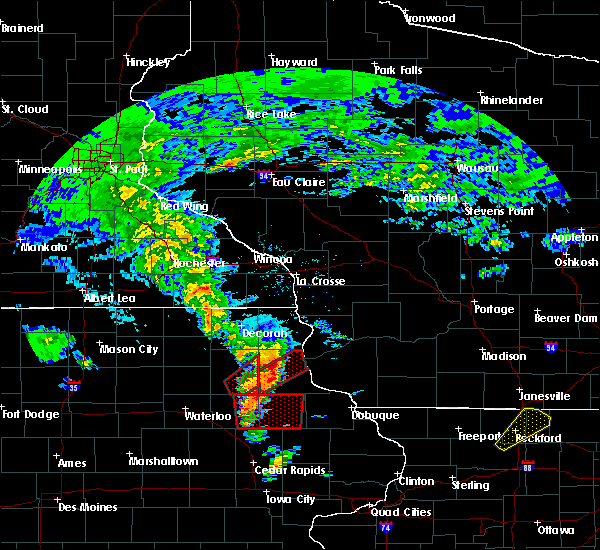 The tornado warning for southeastern fayette county will expire at 715 pm cdt, the storm which prompted the warning has moved out of the area. therefore, the warning will be allowed to expire. to report severe weather, contact your nearest law enforcement agency. they will relay your report to the national weather service la crosse. The tornado warning for southeastern fayette county will expire at 715 pm cdt, the storm which prompted the warning has moved out of the area. therefore, the warning will be allowed to expire. to report severe weather, contact your nearest law enforcement agency. they will relay your report to the national weather service la crosse.
|
| 3/28/2020 6:45 PM CDT |
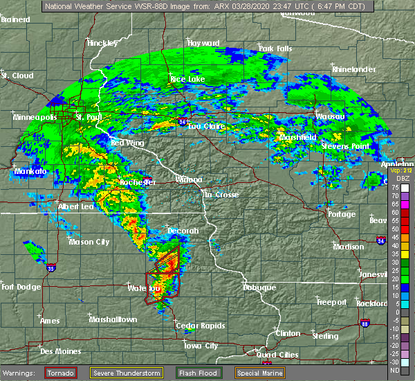 At 645 pm cdt, a severe thunderstorm capable of producing a tornado was located over maynard, or 8 miles northeast of oelwein, moving northeast at 45 mph (radar indicated rotation). Hazards include tornado and quarter size hail. Flying debris will be dangerous to those caught without shelter. mobile homes will be damaged or destroyed. damage to roofs, windows, and vehicles will occur. tree damage is likely. this dangerous storm will be near, fayette and arlington around 650 pm cdt. elgin and clermont around 710 pm cdt. Other locations impacted by this tornadic thunderstorm include volga river state park, wadena, brainard, county road w 33 and 187, county road w 45 and 187, county roads 3 and w 45 and county roads 3 and w 33. At 645 pm cdt, a severe thunderstorm capable of producing a tornado was located over maynard, or 8 miles northeast of oelwein, moving northeast at 45 mph (radar indicated rotation). Hazards include tornado and quarter size hail. Flying debris will be dangerous to those caught without shelter. mobile homes will be damaged or destroyed. damage to roofs, windows, and vehicles will occur. tree damage is likely. this dangerous storm will be near, fayette and arlington around 650 pm cdt. elgin and clermont around 710 pm cdt. Other locations impacted by this tornadic thunderstorm include volga river state park, wadena, brainard, county road w 33 and 187, county road w 45 and 187, county roads 3 and w 45 and county roads 3 and w 33.
|
| 3/28/2020 6:44 PM CDT | Numerous trees down in red gate park area. probable tornado based on spotter report in fayette county IA, 1.7 miles ESE of Oelwein, IA |
| 3/28/2020 6:35 PM CDT |
 At 630 pm cdt, a confirmed tornado was located near oelwein, moving northeast at 50 mph (weather spotters confirmed tornado). Hazards include damaging tornado and quarter size hail. Flying debris will be dangerous to those caught without shelter. mobile homes will be damaged or destroyed. damage to roofs, windows, and vehicles will occur. tree damage is likely. this tornado will be near, fayette and arlington around 645 pm cdt. elgin and clermont around 700 pm cdt. Other locations impacted by this tornadic thunderstorm include volga river state park, wadena, brainard, county road w 45 and 187, county road w 33 and 187, county roads 3 and w 13 and county roads 3 and w 45. At 630 pm cdt, a confirmed tornado was located near oelwein, moving northeast at 50 mph (weather spotters confirmed tornado). Hazards include damaging tornado and quarter size hail. Flying debris will be dangerous to those caught without shelter. mobile homes will be damaged or destroyed. damage to roofs, windows, and vehicles will occur. tree damage is likely. this tornado will be near, fayette and arlington around 645 pm cdt. elgin and clermont around 700 pm cdt. Other locations impacted by this tornadic thunderstorm include volga river state park, wadena, brainard, county road w 45 and 187, county road w 33 and 187, county roads 3 and w 13 and county roads 3 and w 45.
|
| 3/28/2020 6:33 PM CDT | Damage to trees at red gate park on west side of town. possible tornad in fayette county IA, 1.7 miles ESE of Oelwein, IA |
| 3/28/2020 6:30 PM CDT |
 At 630 pm cdt, a severe thunderstorm capable of producing a tornado was located over oelwein, moving northeast at 50 mph (radar indicated rotation). Hazards include tornado and quarter size hail. Flying debris will be dangerous to those caught without shelter. mobile homes will be damaged or destroyed. damage to roofs, windows, and vehicles will occur. tree damage is likely. this dangerous storm will be near, stanley around 635 pm cdt. maynard around 640 pm cdt. fayette and arlington around 650 pm cdt. elgin around 700 pm cdt. clermont around 705 pm cdt. Other locations impacted by this tornadic thunderstorm include volga river state park, wadena, brainard, county road w 45 and 187, county road w 33 and 187, county roads 3 and w 13 and county roads 3 and w 45. At 630 pm cdt, a severe thunderstorm capable of producing a tornado was located over oelwein, moving northeast at 50 mph (radar indicated rotation). Hazards include tornado and quarter size hail. Flying debris will be dangerous to those caught without shelter. mobile homes will be damaged or destroyed. damage to roofs, windows, and vehicles will occur. tree damage is likely. this dangerous storm will be near, stanley around 635 pm cdt. maynard around 640 pm cdt. fayette and arlington around 650 pm cdt. elgin around 700 pm cdt. clermont around 705 pm cdt. Other locations impacted by this tornadic thunderstorm include volga river state park, wadena, brainard, county road w 45 and 187, county road w 33 and 187, county roads 3 and w 13 and county roads 3 and w 45.
|
| 3/28/2020 6:18 PM CDT |
 At 617 pm cdt, a severe thunderstorm was located near jesup, or 7 miles northwest of independence, moving northeast at 50 mph (radar indicated). Hazards include 60 mph wind gusts and quarter size hail. Hail damage to vehicles is expected. expect wind damage to roofs, siding, and trees. this severe thunderstorm will be near, oelwein around 630 pm cdt. stanley around 635 pm cdt. arlington around 645 pm cdt. Other locations impacted by this severe thunderstorm include wadena, highways 3 and 187, county road w 33 and 187, county road w 45 and 187, county roads 3 and w 45 and county roads 3 and w 33. At 617 pm cdt, a severe thunderstorm was located near jesup, or 7 miles northwest of independence, moving northeast at 50 mph (radar indicated). Hazards include 60 mph wind gusts and quarter size hail. Hail damage to vehicles is expected. expect wind damage to roofs, siding, and trees. this severe thunderstorm will be near, oelwein around 630 pm cdt. stanley around 635 pm cdt. arlington around 645 pm cdt. Other locations impacted by this severe thunderstorm include wadena, highways 3 and 187, county road w 33 and 187, county road w 45 and 187, county roads 3 and w 45 and county roads 3 and w 33.
|
| 9/9/2019 7:38 PM CDT |
 The severe thunderstorm warning for fayette county will expire at 745 pm cdt, the storms that prompted the warning will shift east of the area after 745 pm. therefore, the warning will be allowed to expire. however gusty winds are still possible with any thunderstorms. a tornado watch remains in effect until 1000 pm cdt for northeastern iowa. The severe thunderstorm warning for fayette county will expire at 745 pm cdt, the storms that prompted the warning will shift east of the area after 745 pm. therefore, the warning will be allowed to expire. however gusty winds are still possible with any thunderstorms. a tornado watch remains in effect until 1000 pm cdt for northeastern iowa.
|
| 9/9/2019 7:29 PM CDT |
 At 729 pm cdt, severe thunderstorms were located along a line extending from near ossian to near arlington, moving east at 40 mph (winds of 55 mph were reported in waterloo at 655 pm. oelwein recently reported a wind gust near 40 mph). Hazards include 60 mph wind gusts. Expect damage to roofs, siding, and trees. these severe storms will be near, clermont around 735 pm cdt. Other locations impacted by these severe thunderstorms include donnan, eldorado, randalia, highways 3 and 187, county road w 33 and 187, county roads 3 and w 45 and montauk historic site. At 729 pm cdt, severe thunderstorms were located along a line extending from near ossian to near arlington, moving east at 40 mph (winds of 55 mph were reported in waterloo at 655 pm. oelwein recently reported a wind gust near 40 mph). Hazards include 60 mph wind gusts. Expect damage to roofs, siding, and trees. these severe storms will be near, clermont around 735 pm cdt. Other locations impacted by these severe thunderstorms include donnan, eldorado, randalia, highways 3 and 187, county road w 33 and 187, county roads 3 and w 45 and montauk historic site.
|
| 9/9/2019 7:15 PM CDT | Tree limb down across road in fayette county IA, 0.8 miles S of Oelwein, IA |
| 9/9/2019 7:09 PM CDT |
 At 645 pm cdt, severe thunderstorms were located along a line extending from near nashua to near tripoli to near evansdale, moving northeast at 50 mph (radar indicated). Hazards include 60 mph wind gusts and penny size hail. Expect damage to roofs, siding, and trees. severe thunderstorms will be near, fredericksburg around 700 pm cdt. new hampton around 705 pm cdt. oelwein around 710 pm cdt. west union around 720 pm cdt. fayette and arlington around 725 pm cdt. Other locations impacted by these severe thunderstorms include donnan, eldorado, randalia, highways 3 and 187, republic, waucoma campground and county road w 33 and 187. At 645 pm cdt, severe thunderstorms were located along a line extending from near nashua to near tripoli to near evansdale, moving northeast at 50 mph (radar indicated). Hazards include 60 mph wind gusts and penny size hail. Expect damage to roofs, siding, and trees. severe thunderstorms will be near, fredericksburg around 700 pm cdt. new hampton around 705 pm cdt. oelwein around 710 pm cdt. west union around 720 pm cdt. fayette and arlington around 725 pm cdt. Other locations impacted by these severe thunderstorms include donnan, eldorado, randalia, highways 3 and 187, republic, waucoma campground and county road w 33 and 187.
|
| 9/9/2019 6:45 PM CDT |
 At 645 pm cdt, severe thunderstorms were located along a line extending from near nashua to near tripoli to near evansdale, moving northeast at 50 mph (radar indicated). Hazards include 60 mph wind gusts and penny size hail. Expect damage to roofs, siding, and trees. severe thunderstorms will be near, fredericksburg around 700 pm cdt. new hampton around 705 pm cdt. oelwein around 710 pm cdt. west union around 720 pm cdt. fayette and arlington around 725 pm cdt. Other locations impacted by these severe thunderstorms include donnan, eldorado, randalia, highways 3 and 187, republic, waucoma campground and county road w 33 and 187. At 645 pm cdt, severe thunderstorms were located along a line extending from near nashua to near tripoli to near evansdale, moving northeast at 50 mph (radar indicated). Hazards include 60 mph wind gusts and penny size hail. Expect damage to roofs, siding, and trees. severe thunderstorms will be near, fredericksburg around 700 pm cdt. new hampton around 705 pm cdt. oelwein around 710 pm cdt. west union around 720 pm cdt. fayette and arlington around 725 pm cdt. Other locations impacted by these severe thunderstorms include donnan, eldorado, randalia, highways 3 and 187, republic, waucoma campground and county road w 33 and 187.
|
| 6/30/2019 5:18 PM CDT |
 At 518 pm cdt, severe thunderstorms were located along a line extending from near platteville to delaware to near brandon, moving south at 45 mph (trained weather spotters). Hazards include 70 mph wind gusts and quarter size hail. Hail damage to vehicles is expected. expect considerable tree damage. wind damage is also likely to mobile homes, roofs, and outbuildings. locations impacted include, dubuque, independence, manchester, galena, asbury, dyersville, jesup, epworth, east dubuque, farley, peosta, fairbank, edgewood, winthrop, hazleton, earlville, hopkinton, quasqueton, lamont and delhi. This includes interstate 380 between mile markers 50 and 55. At 518 pm cdt, severe thunderstorms were located along a line extending from near platteville to delaware to near brandon, moving south at 45 mph (trained weather spotters). Hazards include 70 mph wind gusts and quarter size hail. Hail damage to vehicles is expected. expect considerable tree damage. wind damage is also likely to mobile homes, roofs, and outbuildings. locations impacted include, dubuque, independence, manchester, galena, asbury, dyersville, jesup, epworth, east dubuque, farley, peosta, fairbank, edgewood, winthrop, hazleton, earlville, hopkinton, quasqueton, lamont and delhi. This includes interstate 380 between mile markers 50 and 55.
|
| 6/30/2019 5:07 PM CDT |
 At 506 pm cdt, severe thunderstorms were located along a line extending from near platteville to edgewood to near jesup, moving southeast at 40 mph (trained weather spotters). Hazards include 70 mph wind gusts and quarter size hail. Hail damage to vehicles is expected. expect considerable tree damage. wind damage is also likely to mobile homes, roofs, and outbuildings. locations impacted include, dubuque, independence, manchester, galena, asbury, dyersville, jesup, epworth, east dubuque, farley, peosta, fairbank, edgewood, winthrop, hazleton, earlville, hopkinton, quasqueton, lamont and delhi. This includes interstate 380 between mile markers 50 and 55. At 506 pm cdt, severe thunderstorms were located along a line extending from near platteville to edgewood to near jesup, moving southeast at 40 mph (trained weather spotters). Hazards include 70 mph wind gusts and quarter size hail. Hail damage to vehicles is expected. expect considerable tree damage. wind damage is also likely to mobile homes, roofs, and outbuildings. locations impacted include, dubuque, independence, manchester, galena, asbury, dyersville, jesup, epworth, east dubuque, farley, peosta, fairbank, edgewood, winthrop, hazleton, earlville, hopkinton, quasqueton, lamont and delhi. This includes interstate 380 between mile markers 50 and 55.
|
| 6/30/2019 5:02 PM CDT |
 At 502 pm cdt, severe thunderstorms were located along a line extending from 7 miles east of lancaster to near edgewood to near jesup, moving southeast at 40 mph (trained weather spotters). Hazards include 60 mph wind gusts and quarter size hail. Hail damage to vehicles is expected. expect wind damage to roofs, siding, and trees. locations impacted include, dubuque, independence, manchester, galena, asbury, dyersville, jesup, epworth, east dubuque, farley, peosta, fairbank, edgewood, winthrop, hazleton, earlville, hopkinton, quasqueton, lamont and delhi. This includes interstate 380 between mile markers 50 and 55. At 502 pm cdt, severe thunderstorms were located along a line extending from 7 miles east of lancaster to near edgewood to near jesup, moving southeast at 40 mph (trained weather spotters). Hazards include 60 mph wind gusts and quarter size hail. Hail damage to vehicles is expected. expect wind damage to roofs, siding, and trees. locations impacted include, dubuque, independence, manchester, galena, asbury, dyersville, jesup, epworth, east dubuque, farley, peosta, fairbank, edgewood, winthrop, hazleton, earlville, hopkinton, quasqueton, lamont and delhi. This includes interstate 380 between mile markers 50 and 55.
|
| 6/30/2019 5:00 PM CDT |
 At 459 pm cdt, severe thunderstorms were located along a line extending from near guttenberg to fairbank, moving south at 45 mph. this line of storms has a history of blowing down trees and powerlines (law enforcement). Hazards include 60 mph wind gusts. Expect damage to roofs, siding, and trees. These severe thunderstorms will remain over mainly rural areas of clayton and southern fayette counties, including the following locations, mederville, randalia, highways 3 and 187, turkey river, bixby state park, highway 13 and county c 24 and fairview. At 459 pm cdt, severe thunderstorms were located along a line extending from near guttenberg to fairbank, moving south at 45 mph. this line of storms has a history of blowing down trees and powerlines (law enforcement). Hazards include 60 mph wind gusts. Expect damage to roofs, siding, and trees. These severe thunderstorms will remain over mainly rural areas of clayton and southern fayette counties, including the following locations, mederville, randalia, highways 3 and 187, turkey river, bixby state park, highway 13 and county c 24 and fairview.
|
| 6/30/2019 4:58 PM CDT |
 At 457 pm cdt, severe thunderstorms were located along a line extending from near lancaster to 7 miles northeast of strawberry point to near hazleton, moving east at 45 mph (trained weather spotter measured a wind gust to 59 mph 4 miles west of stanley). Hazards include 60 mph wind gusts and quarter size hail. Hail damage to vehicles is expected. expect wind damage to roofs, siding, and trees. locations impacted include, dubuque, independence, manchester, galena, asbury, dyersville, jesup, epworth, east dubuque, farley, peosta, fairbank, edgewood, winthrop, hazleton, earlville, hopkinton, quasqueton, lamont and delhi. This includes interstate 380 between mile markers 50 and 55. At 457 pm cdt, severe thunderstorms were located along a line extending from near lancaster to 7 miles northeast of strawberry point to near hazleton, moving east at 45 mph (trained weather spotter measured a wind gust to 59 mph 4 miles west of stanley). Hazards include 60 mph wind gusts and quarter size hail. Hail damage to vehicles is expected. expect wind damage to roofs, siding, and trees. locations impacted include, dubuque, independence, manchester, galena, asbury, dyersville, jesup, epworth, east dubuque, farley, peosta, fairbank, edgewood, winthrop, hazleton, earlville, hopkinton, quasqueton, lamont and delhi. This includes interstate 380 between mile markers 50 and 55.
|
| 6/30/2019 4:54 PM CDT |
 At 453 pm cdt, severe thunderstorms were located along a line extending from near lancaster to 6 miles south of elkader to near hazleton, moving south at 45 mph (radar indicated). Hazards include 60 mph wind gusts and quarter size hail. Hail damage to vehicles is expected. Expect wind damage to roofs, siding, and trees. At 453 pm cdt, severe thunderstorms were located along a line extending from near lancaster to 6 miles south of elkader to near hazleton, moving south at 45 mph (radar indicated). Hazards include 60 mph wind gusts and quarter size hail. Hail damage to vehicles is expected. Expect wind damage to roofs, siding, and trees.
|
| 6/30/2019 4:52 PM CDT | Numerous branches and power lines down... especially on northeast side of tow in fayette county IA, 0.8 miles S of Oelwein, IA |
| 6/30/2019 4:31 PM CDT |
 At 431 pm cdt, severe thunderstorms were located along a line extending from mcgregor to near sumner, moving south at 50 mph (radar indicated). Hazards include 60 mph wind gusts. Expect damage to roofs, siding, and trees. severe thunderstorms will be near, garnavillo around 440 pm cdt. oelwein and guttenberg around 450 pm cdt. fairbank around 455 pm cdt. Other locations impacted by these severe thunderstorms include mederville, randalia, highways 3 and 187, turkey river, bixby state park, highway 13 and county c 24 and fairview. At 431 pm cdt, severe thunderstorms were located along a line extending from mcgregor to near sumner, moving south at 50 mph (radar indicated). Hazards include 60 mph wind gusts. Expect damage to roofs, siding, and trees. severe thunderstorms will be near, garnavillo around 440 pm cdt. oelwein and guttenberg around 450 pm cdt. fairbank around 455 pm cdt. Other locations impacted by these severe thunderstorms include mederville, randalia, highways 3 and 187, turkey river, bixby state park, highway 13 and county c 24 and fairview.
|
| 6/28/2019 6:42 AM CDT |
 At 625 am cdt, severe thunderstorms were located along a line extending from 8 miles west of fennimore to near arlington to near tripoli, moving south at 25 mph (radar indicated). Hazards include 60 mph wind gusts and penny size hail. Expect damage to roofs, siding, and trees. these severe storms will be near, arlington and volga around 630 am cdt. strawberry point around 635 am cdt. Other locations impacted by these severe thunderstorms include mederville, randalia, giard, highways 3 and 187, turkey river, bixby state park and highway 13 and county c 24. At 625 am cdt, severe thunderstorms were located along a line extending from 8 miles west of fennimore to near arlington to near tripoli, moving south at 25 mph (radar indicated). Hazards include 60 mph wind gusts and penny size hail. Expect damage to roofs, siding, and trees. these severe storms will be near, arlington and volga around 630 am cdt. strawberry point around 635 am cdt. Other locations impacted by these severe thunderstorms include mederville, randalia, giard, highways 3 and 187, turkey river, bixby state park and highway 13 and county c 24.
|
| 6/28/2019 6:25 AM CDT |
 At 625 am cdt, severe thunderstorms were located along a line extending from 8 miles west of fennimore to near arlington to near tripoli, moving south at 25 mph (radar indicated). Hazards include 60 mph wind gusts and penny size hail. Expect damage to roofs, siding, and trees. these severe storms will be near, arlington and volga around 630 am cdt. strawberry point around 635 am cdt. Other locations impacted by these severe thunderstorms include mederville, randalia, giard, highways 3 and 187, turkey river, bixby state park and highway 13 and county c 24. At 625 am cdt, severe thunderstorms were located along a line extending from 8 miles west of fennimore to near arlington to near tripoli, moving south at 25 mph (radar indicated). Hazards include 60 mph wind gusts and penny size hail. Expect damage to roofs, siding, and trees. these severe storms will be near, arlington and volga around 630 am cdt. strawberry point around 635 am cdt. Other locations impacted by these severe thunderstorms include mederville, randalia, giard, highways 3 and 187, turkey river, bixby state park and highway 13 and county c 24.
|
| 6/28/2019 6:06 AM CDT |
 At 605 am cdt, severe thunderstorms were located along a line extending from 6 miles west of boscobel to near elgin to near new hampton, moving south at 25 mph (radar indicated). Hazards include 60 mph wind gusts and quarter size hail. Hail damage to vehicles is expected. expect wind damage to roofs, siding, and trees. these severe storms will be near, elgin around 610 am cdt. volga around 625 am cdt. arlington around 635 am cdt. strawberry point around 645 am cdt. Other locations impacted by these severe thunderstorms include mederville, randalia, giard, highways 3 and 187, watson, turkey river and bixby state park. At 605 am cdt, severe thunderstorms were located along a line extending from 6 miles west of boscobel to near elgin to near new hampton, moving south at 25 mph (radar indicated). Hazards include 60 mph wind gusts and quarter size hail. Hail damage to vehicles is expected. expect wind damage to roofs, siding, and trees. these severe storms will be near, elgin around 610 am cdt. volga around 625 am cdt. arlington around 635 am cdt. strawberry point around 645 am cdt. Other locations impacted by these severe thunderstorms include mederville, randalia, giard, highways 3 and 187, watson, turkey river and bixby state park.
|
| 6/28/2019 5:47 AM CDT |
 At 547 am cdt, severe thunderstorms were located along a line extending from 12 miles northwest of boscobel to near clermont to near new hampton, moving south at 20 mph (radar indicated). Hazards include 60 mph wind gusts and quarter size hail. Hail damage to vehicles is expected. expect wind damage to roofs, siding, and trees. severe thunderstorms will be near, postville and clermont around 550 am cdt. elgin around 555 am cdt. fredericksburg around 620 am cdt. elkader around 625 am cdt. volga around 630 am cdt. strawberry point around 645 am cdt. Other locations impacted by these severe thunderstorms include mederville, randalia, giard, highways 3 and 187, watson, turkey river and bixby state park. At 547 am cdt, severe thunderstorms were located along a line extending from 12 miles northwest of boscobel to near clermont to near new hampton, moving south at 20 mph (radar indicated). Hazards include 60 mph wind gusts and quarter size hail. Hail damage to vehicles is expected. expect wind damage to roofs, siding, and trees. severe thunderstorms will be near, postville and clermont around 550 am cdt. elgin around 555 am cdt. fredericksburg around 620 am cdt. elkader around 625 am cdt. volga around 630 am cdt. strawberry point around 645 am cdt. Other locations impacted by these severe thunderstorms include mederville, randalia, giard, highways 3 and 187, watson, turkey river and bixby state park.
|
| 7/13/2018 4:51 PM CDT |
 The national weather service in the quad cities has issued a * severe thunderstorm warning for. buchanan county in northeastern iowa. western delaware county in northeastern iowa. until 530 pm cdt. At 450 pm cdt, a severe thunderstorm was located near hazleton, or. The national weather service in the quad cities has issued a * severe thunderstorm warning for. buchanan county in northeastern iowa. western delaware county in northeastern iowa. until 530 pm cdt. At 450 pm cdt, a severe thunderstorm was located near hazleton, or.
|
| 6/9/2018 7:22 PM CDT |
 The severe thunderstorm warning for fayette county will expire at 730 pm cdt, the storms which prompted the warning continue to move through east and south ends of the county. these storms may still be producing damaging wind as they exit the county so continue to use caution. the warning will be allowed to expire at 730 pm. The severe thunderstorm warning for fayette county will expire at 730 pm cdt, the storms which prompted the warning continue to move through east and south ends of the county. these storms may still be producing damaging wind as they exit the county so continue to use caution. the warning will be allowed to expire at 730 pm.
|
| 6/9/2018 7:07 PM CDT |
 At 706 pm cdt, severe thunderstorms were located along a line extending from near west union to near fayette to near oelwein, moving east at 20 mph (radar indicated). Hazards include 60 mph wind gusts. Expect damage to roofs, siding, and trees. these severe storms will be near, clermont and arlington around 725 pm cdt. elgin and stanley around 730 pm cdt. other locations impacted by these severe thunderstorms include wadena, westgate, st. Lucas, randalia and donnan. At 706 pm cdt, severe thunderstorms were located along a line extending from near west union to near fayette to near oelwein, moving east at 20 mph (radar indicated). Hazards include 60 mph wind gusts. Expect damage to roofs, siding, and trees. these severe storms will be near, clermont and arlington around 725 pm cdt. elgin and stanley around 730 pm cdt. other locations impacted by these severe thunderstorms include wadena, westgate, st. Lucas, randalia and donnan.
|
| 6/9/2018 6:30 PM CDT |
 At 629 pm, severe thunderstorms were located along a line extending from near fort atkinson to near sumner, moving east at 30 mph. these storms will move through the county during the next hour (trained weather spotters). Hazards include 70 mph wind gusts. Expect tree damage. damage is possible to mobile homes, roofs, and outbuildings. these severe storms will be near, maynard around 645 pm cdt. fayette around 700 pm cdt. west union around 705 pm cdt. clermont around 720 pm cdt. elgin around 725 pm cdt. other locations impacted by these severe thunderstorms include wadena, westgate, st. Lucas, randalia and donnan. At 629 pm, severe thunderstorms were located along a line extending from near fort atkinson to near sumner, moving east at 30 mph. these storms will move through the county during the next hour (trained weather spotters). Hazards include 70 mph wind gusts. Expect tree damage. damage is possible to mobile homes, roofs, and outbuildings. these severe storms will be near, maynard around 645 pm cdt. fayette around 700 pm cdt. west union around 705 pm cdt. clermont around 720 pm cdt. elgin around 725 pm cdt. other locations impacted by these severe thunderstorms include wadena, westgate, st. Lucas, randalia and donnan.
|
| 6/9/2018 6:07 PM CDT |
 At 606 pm cdt, a severe thunderstorm was located over fredericksburg, or 8 miles southeast of new hampton, moving east at 25 mph. another cluster of storms was moving in from bremer county as well (emergency management). Hazards include 70 mph wind gusts. Expect considerable tree damage. damage is likely to mobile homes, roofs, and outbuildings. this severe thunderstorm will be near, waucoma around 625 pm cdt. hawkeye around 640 pm cdt. west union and fayette around 655 pm cdt. clermont around 715 pm cdt. elgin around 720 pm cdt. other locations impacted by this severe thunderstorm include wadena, westgate, st. lucas, randalia and donnan. A tornado watch remains in effect until 1000 pm cdt for northeastern iowa. At 606 pm cdt, a severe thunderstorm was located over fredericksburg, or 8 miles southeast of new hampton, moving east at 25 mph. another cluster of storms was moving in from bremer county as well (emergency management). Hazards include 70 mph wind gusts. Expect considerable tree damage. damage is likely to mobile homes, roofs, and outbuildings. this severe thunderstorm will be near, waucoma around 625 pm cdt. hawkeye around 640 pm cdt. west union and fayette around 655 pm cdt. clermont around 715 pm cdt. elgin around 720 pm cdt. other locations impacted by this severe thunderstorm include wadena, westgate, st. lucas, randalia and donnan. A tornado watch remains in effect until 1000 pm cdt for northeastern iowa.
|
| 5/25/2018 8:27 PM CDT |
 At 825 pm cdt, severe thunderstorms were located along a line extending from near sageville to independence, moving southeast at 25 mph (emergency management). Hazards include 60 mph wind gusts and penny size hail. Expect damage to roofs, siding, and trees. Locations impacted include, dubuque, independence, manchester, galena, asbury, dyersville, jesup, cascade, epworth, east dubuque, farley, peosta, fairbank, edgewood, winthrop, hazleton, earlville, hopkinton, quasqueton and lamont. At 825 pm cdt, severe thunderstorms were located along a line extending from near sageville to independence, moving southeast at 25 mph (emergency management). Hazards include 60 mph wind gusts and penny size hail. Expect damage to roofs, siding, and trees. Locations impacted include, dubuque, independence, manchester, galena, asbury, dyersville, jesup, cascade, epworth, east dubuque, farley, peosta, fairbank, edgewood, winthrop, hazleton, earlville, hopkinton, quasqueton and lamont.
|
| 5/25/2018 8:10 PM CDT |
 At 808 pm cdt, severe thunderstorms were located along a line extending from 6 miles west of platteville to 6 miles southwest of independence, moving southeast at 40 mph (radar indicated). Hazards include 60 mph wind gusts and penny size hail. expect damage to roofs, siding, and trees At 808 pm cdt, severe thunderstorms were located along a line extending from 6 miles west of platteville to 6 miles southwest of independence, moving southeast at 40 mph (radar indicated). Hazards include 60 mph wind gusts and penny size hail. expect damage to roofs, siding, and trees
|
| 5/25/2018 8:08 PM CDT |
 At 806 pm cdt, severe thunderstorms were located along a line extending from 6 miles west of muscoda to 6 miles southeast of lancaster to luxemburg to near hazleton, moving southeast at 40 mph (trained weather spotters. a 60 mph wind gust was reported near wauzeka in southern crawford county, and quarter size hail was reported in oelwein). Hazards include 60 mph wind gusts and quarter size hail. Hail damage to vehicles is expected. expect wind damage to roofs, siding, and trees. these severe storms will be near, lancaster and cassville around 810 pm cdt. muscoda around 815 pm cdt. platteville and dickeyville around 820 pm cdt. dubuque and cuba city around 830 pm cdt. hazel green around 835 pm cdt. Other locations impacted by these severe thunderstorms include preston, georgetown, beetown, arthur and montfort. At 806 pm cdt, severe thunderstorms were located along a line extending from 6 miles west of muscoda to 6 miles southeast of lancaster to luxemburg to near hazleton, moving southeast at 40 mph (trained weather spotters. a 60 mph wind gust was reported near wauzeka in southern crawford county, and quarter size hail was reported in oelwein). Hazards include 60 mph wind gusts and quarter size hail. Hail damage to vehicles is expected. expect wind damage to roofs, siding, and trees. these severe storms will be near, lancaster and cassville around 810 pm cdt. muscoda around 815 pm cdt. platteville and dickeyville around 820 pm cdt. dubuque and cuba city around 830 pm cdt. hazel green around 835 pm cdt. Other locations impacted by these severe thunderstorms include preston, georgetown, beetown, arthur and montfort.
|
| 5/25/2018 8:04 PM CDT | Quarter sized hail reported 1 miles SSE of Oelwein, IA, pea to quarter size hail. |
| 5/25/2018 7:57 PM CDT |
 At 755 pm cdt, severe thunderstorms were located along a line extending from near boscobel to near lancaster to near colesburg to fairbank, moving east at 40 mph (radar indicated). Hazards include 60 mph wind gusts and nickel size hail. Expect damage to roofs, siding, and trees. these severe storms will be near, lancaster, guttenberg, fennimore and boscobel around 800 pm cdt. muscoda and cassville around 810 pm cdt. platteville around 815 pm cdt. dubuque and strawberry point around 830 pm cdt. dickeyville and edgewood around 840 pm cdt. hazel green and cuba city around 845 pm cdt. Other locations impacted by these severe thunderstorms include preston, bridgeport, georgetown, beetown and arthur. At 755 pm cdt, severe thunderstorms were located along a line extending from near boscobel to near lancaster to near colesburg to fairbank, moving east at 40 mph (radar indicated). Hazards include 60 mph wind gusts and nickel size hail. Expect damage to roofs, siding, and trees. these severe storms will be near, lancaster, guttenberg, fennimore and boscobel around 800 pm cdt. muscoda and cassville around 810 pm cdt. platteville around 815 pm cdt. dubuque and strawberry point around 830 pm cdt. dickeyville and edgewood around 840 pm cdt. hazel green and cuba city around 845 pm cdt. Other locations impacted by these severe thunderstorms include preston, bridgeport, georgetown, beetown and arthur.
|
| 5/25/2018 7:57 PM CDT |
 At 739 pm cdt, severe thunderstorms were located along a line extending from boscobel to near guttenberg to near strawberry point, moving southeast at 40 mph (trained weather spotters. at 730 pm cdt, tree damage was reported near eastman in western crawford county). Hazards include 70 mph wind gusts and quarter size hail. Hail damage to vehicles is expected. expect considerable tree damage. wind damage is also likely to mobile homes, roofs, and outbuildings. severe thunderstorms will be near, boscobel around 745 pm cdt. cassville, muscoda and fennimore around 755 pm cdt. dickeyville around 825 pm cdt. dubuque around 835 pm cdt. cuba city around 840 pm cdt. hazel green around 845 pm cdt. Other locations impacted by these severe thunderstorms include preston, bridgeport, georgetown, beetown and arthur. At 739 pm cdt, severe thunderstorms were located along a line extending from boscobel to near guttenberg to near strawberry point, moving southeast at 40 mph (trained weather spotters. at 730 pm cdt, tree damage was reported near eastman in western crawford county). Hazards include 70 mph wind gusts and quarter size hail. Hail damage to vehicles is expected. expect considerable tree damage. wind damage is also likely to mobile homes, roofs, and outbuildings. severe thunderstorms will be near, boscobel around 745 pm cdt. cassville, muscoda and fennimore around 755 pm cdt. dickeyville around 825 pm cdt. dubuque around 835 pm cdt. cuba city around 840 pm cdt. hazel green around 845 pm cdt. Other locations impacted by these severe thunderstorms include preston, bridgeport, georgetown, beetown and arthur.
|
| 5/25/2018 7:43 PM CDT |
 At 743 pm cdt, severe thunderstorms were located along a line extending from near guttenberg to fairbank, moving southeast at 30 mph (radar indicated). Hazards include 60 mph wind gusts and penny size hail. Expect damage to roofs, siding, and trees. Locations impacted include, independence, manchester, dyersville, jesup, farley, fairbank, edgewood, winthrop, hazleton, earlville, quasqueton, lamont, delhi, new vienna, colesburg, worthington, holy cross, rowley, greeley and luxemburg. At 743 pm cdt, severe thunderstorms were located along a line extending from near guttenberg to fairbank, moving southeast at 30 mph (radar indicated). Hazards include 60 mph wind gusts and penny size hail. Expect damage to roofs, siding, and trees. Locations impacted include, independence, manchester, dyersville, jesup, farley, fairbank, edgewood, winthrop, hazleton, earlville, quasqueton, lamont, delhi, new vienna, colesburg, worthington, holy cross, rowley, greeley and luxemburg.
|
| 5/25/2018 7:40 PM CDT |
 At 739 pm cdt, severe thunderstorms were located along a line extending from boscobel to near guttenberg to near strawberry point, moving southeast at 40 mph (trained weather spotters. at 730 pm cdt, tree damage was reported near eastman in western crawford county). Hazards include 70 mph wind gusts and quarter size hail. Hail damage to vehicles is expected. expect considerable tree damage. wind damage is also likely to mobile homes, roofs, and outbuildings. severe thunderstorms will be near, boscobel around 745 pm cdt. cassville, muscoda and fennimore around 755 pm cdt. dickeyville around 825 pm cdt. dubuque around 835 pm cdt. cuba city around 840 pm cdt. hazel green around 845 pm cdt. Other locations impacted by these severe thunderstorms include preston, bridgeport, georgetown, beetown and arthur. At 739 pm cdt, severe thunderstorms were located along a line extending from boscobel to near guttenberg to near strawberry point, moving southeast at 40 mph (trained weather spotters. at 730 pm cdt, tree damage was reported near eastman in western crawford county). Hazards include 70 mph wind gusts and quarter size hail. Hail damage to vehicles is expected. expect considerable tree damage. wind damage is also likely to mobile homes, roofs, and outbuildings. severe thunderstorms will be near, boscobel around 745 pm cdt. cassville, muscoda and fennimore around 755 pm cdt. dickeyville around 825 pm cdt. dubuque around 835 pm cdt. cuba city around 840 pm cdt. hazel green around 845 pm cdt. Other locations impacted by these severe thunderstorms include preston, bridgeport, georgetown, beetown and arthur.
|
| 5/25/2018 7:23 PM CDT |
 At 722 pm cdt, severe thunderstorms were located along a line extending from near elkader to near fairbank, moving southeast at 40 mph (radar indicated). Hazards include 60 mph wind gusts and penny size hail. expect damage to roofs, siding, and trees At 722 pm cdt, severe thunderstorms were located along a line extending from near elkader to near fairbank, moving southeast at 40 mph (radar indicated). Hazards include 60 mph wind gusts and penny size hail. expect damage to roofs, siding, and trees
|
| 5/25/2018 7:16 PM CDT |
 At 715 pm cdt, severe thunderstorms were located along a line extending from near maynard to near volga to near clermont, moving southeast at 30 mph (radar indicated). Hazards include 60 mph wind gusts and penny size hail. Expect damage to roofs, siding, and trees. these severe storms will be near, arlington around 725 pm cdt. volga and farmersburg around 730 pm cdt. elkader and strawberry point around 740 pm cdt. garnavillo around 745 pm cdt. other locations impacted by these severe thunderstorms include wadena, westgate, st. Olaf, randalia and donnan. At 715 pm cdt, severe thunderstorms were located along a line extending from near maynard to near volga to near clermont, moving southeast at 30 mph (radar indicated). Hazards include 60 mph wind gusts and penny size hail. Expect damage to roofs, siding, and trees. these severe storms will be near, arlington around 725 pm cdt. volga and farmersburg around 730 pm cdt. elkader and strawberry point around 740 pm cdt. garnavillo around 745 pm cdt. other locations impacted by these severe thunderstorms include wadena, westgate, st. Olaf, randalia and donnan.
|
| 5/25/2018 7:04 PM CDT |
 At 704 pm cdt, severe thunderstorms were located along a line extending from near sumner to near elgin to near postville, moving southeast at 30 mph (radar indicated). Hazards include 60 mph wind gusts and penny size hail. Expect damage to roofs, siding, and trees. these severe storms will be near, elgin around 715 pm cdt. arlington around 720 pm cdt. volga around 725 pm cdt. oelwein and farmersburg around 730 pm cdt. elkader and strawberry point around 740 pm cdt. garnavillo around 745 pm cdt. other locations impacted by these severe thunderstorms include wadena, westgate, st. Olaf, randalia and donnan. At 704 pm cdt, severe thunderstorms were located along a line extending from near sumner to near elgin to near postville, moving southeast at 30 mph (radar indicated). Hazards include 60 mph wind gusts and penny size hail. Expect damage to roofs, siding, and trees. these severe storms will be near, elgin around 715 pm cdt. arlington around 720 pm cdt. volga around 725 pm cdt. oelwein and farmersburg around 730 pm cdt. elkader and strawberry point around 740 pm cdt. garnavillo around 745 pm cdt. other locations impacted by these severe thunderstorms include wadena, westgate, st. Olaf, randalia and donnan.
|
| 5/25/2018 6:55 PM CDT |
 At 655 pm cdt, severe thunderstorms were located along a line extending from near sumner to near west union to near postville, moving southeast at 30 mph (radar indicated). Hazards include 60 mph wind gusts. Expect damage to roofs, siding, and trees. severe thunderstorms will be near, clermont around 705 pm cdt. elgin around 710 pm cdt. fayette around 715 pm cdt. maynard and arlington around 720 pm cdt. volga around 725 pm cdt. oelwein and farmersburg around 730 pm cdt. elkader and strawberry point around 735 pm cdt. garnavillo around 745 pm cdt. other locations impacted by these severe thunderstorms include wadena, westgate, st. Olaf, randalia and donnan. At 655 pm cdt, severe thunderstorms were located along a line extending from near sumner to near west union to near postville, moving southeast at 30 mph (radar indicated). Hazards include 60 mph wind gusts. Expect damage to roofs, siding, and trees. severe thunderstorms will be near, clermont around 705 pm cdt. elgin around 710 pm cdt. fayette around 715 pm cdt. maynard and arlington around 720 pm cdt. volga around 725 pm cdt. oelwein and farmersburg around 730 pm cdt. elkader and strawberry point around 735 pm cdt. garnavillo around 745 pm cdt. other locations impacted by these severe thunderstorms include wadena, westgate, st. Olaf, randalia and donnan.
|
| 7/19/2017 6:29 PM CDT |
 At 629 pm cdt, severe thunderstorms were located along a line extending from 9 miles southwest of boscobel to near holy cross to near lamont, moving southeast at 60 mph (radar indicated). Hazards include 70 mph wind gusts. Expect considerable tree damage. damage is likely to mobile homes, roofs, and outbuildings. Locations impacted include, dubuque, manchester, asbury, dyersville, cascade, epworth, farley, peosta, fairbank, edgewood, hazleton, earlville, hopkinton, lamont, delhi, new vienna, colesburg, worthington, holy cross and greeley. At 629 pm cdt, severe thunderstorms were located along a line extending from 9 miles southwest of boscobel to near holy cross to near lamont, moving southeast at 60 mph (radar indicated). Hazards include 70 mph wind gusts. Expect considerable tree damage. damage is likely to mobile homes, roofs, and outbuildings. Locations impacted include, dubuque, manchester, asbury, dyersville, cascade, epworth, farley, peosta, fairbank, edgewood, hazleton, earlville, hopkinton, lamont, delhi, new vienna, colesburg, worthington, holy cross and greeley.
|
| 7/19/2017 6:27 PM CDT |
 At 626 pm cdt, severe thunderstorms were located along a line extending from near new albin to bloomington to near colesburg, moving east at 70 mph (trained weather spotters. these storms have a history of wind damage with northern fayette county reporting widespread damage. extreme winds were reported in waukon at 620 pm). Hazards include 70 mph wind gusts. Expect considerable tree damage. damage is likely to mobile homes, roofs, and outbuildings. these severe thunderstorms will remain over mainly rural areas of clayton, southeastern fayette and central allamakee counties, including the following locations: waterville, north buena vista, st. Olaf, garber and osterdock. At 626 pm cdt, severe thunderstorms were located along a line extending from near new albin to bloomington to near colesburg, moving east at 70 mph (trained weather spotters. these storms have a history of wind damage with northern fayette county reporting widespread damage. extreme winds were reported in waukon at 620 pm). Hazards include 70 mph wind gusts. Expect considerable tree damage. damage is likely to mobile homes, roofs, and outbuildings. these severe thunderstorms will remain over mainly rural areas of clayton, southeastern fayette and central allamakee counties, including the following locations: waterville, north buena vista, st. Olaf, garber and osterdock.
|
| 7/19/2017 6:22 PM CDT |
 At 621 pm cdt, severe thunderstorms were located along a line extending from 9 miles east of prairie du chien to near guttenberg to near aurora, moving east at 65 mph (radar indicated). Hazards include 70 mph wind gusts. Expect considerable tree damage. damage is likely to mobile homes, roofs, and outbuildings. Locations impacted include, dubuque, manchester, asbury, dyersville, cascade, epworth, farley, peosta, fairbank, edgewood, hazleton, earlville, hopkinton, lamont, delhi, new vienna, colesburg, worthington, holy cross and greeley. At 621 pm cdt, severe thunderstorms were located along a line extending from 9 miles east of prairie du chien to near guttenberg to near aurora, moving east at 65 mph (radar indicated). Hazards include 70 mph wind gusts. Expect considerable tree damage. damage is likely to mobile homes, roofs, and outbuildings. Locations impacted include, dubuque, manchester, asbury, dyersville, cascade, epworth, farley, peosta, fairbank, edgewood, hazleton, earlville, hopkinton, lamont, delhi, new vienna, colesburg, worthington, holy cross and greeley.
|
| 7/19/2017 6:21 PM CDT |
 At 619 pm cdt, severe thunderstorms were located along a line extending from near new albin to 6 miles north of guttenberg to greeley, moving east at 75 mph (trained weather spotters. these storms have a history of wind damage with northern fayette county reporting widespread damage. extreme winds were reported in waukon at 620 pm). Hazards include 70 mph wind gusts. Expect considerable tree damage. damage is likely to mobile homes, roofs, and outbuildings. these severe storms will be near, guttenberg around 625 pm cdt. other locations impacted by these severe thunderstorms include hardin, luana, wadena, westgate and castalia. People attending the allamakee county fair should seek safe shelter immediately!. At 619 pm cdt, severe thunderstorms were located along a line extending from near new albin to 6 miles north of guttenberg to greeley, moving east at 75 mph (trained weather spotters. these storms have a history of wind damage with northern fayette county reporting widespread damage. extreme winds were reported in waukon at 620 pm). Hazards include 70 mph wind gusts. Expect considerable tree damage. damage is likely to mobile homes, roofs, and outbuildings. these severe storms will be near, guttenberg around 625 pm cdt. other locations impacted by these severe thunderstorms include hardin, luana, wadena, westgate and castalia. People attending the allamakee county fair should seek safe shelter immediately!.
|
| 7/19/2017 6:11 PM CDT |
 At 611 pm cdt, severe thunderstorms were located along a line extending from 8 miles west of harpers ferry to near garnavillo to near fairbank, moving east at 70 mph (trained weather spotters). Hazards include 70 mph wind gusts. Expect considerable tree damage. damage is likely to mobile homes, roofs, and outbuildings. Locations impacted include, dubuque, manchester, asbury, dyersville, cascade, epworth, farley, peosta, fairbank, edgewood, hazleton, earlville, hopkinton, lamont, delhi, new vienna, colesburg, worthington, holy cross and greeley. At 611 pm cdt, severe thunderstorms were located along a line extending from 8 miles west of harpers ferry to near garnavillo to near fairbank, moving east at 70 mph (trained weather spotters). Hazards include 70 mph wind gusts. Expect considerable tree damage. damage is likely to mobile homes, roofs, and outbuildings. Locations impacted include, dubuque, manchester, asbury, dyersville, cascade, epworth, farley, peosta, fairbank, edgewood, hazleton, earlville, hopkinton, lamont, delhi, new vienna, colesburg, worthington, holy cross and greeley.
|
| 7/19/2017 6:06 PM CDT |
 At 606 pm cdt, severe thunderstorms were located along a line extending from 7 miles southwest of new albin to near farmersburg to near strawberry point, moving east at 70 mph (trained weather spotters. wind damage and power outages continue to be reported with these storms). Hazards include 70 mph wind gusts. Expect considerable tree damage. damage is likely to mobile homes, roofs, and outbuildings. these severe storms will be near, new albin and garnavillo around 610 pm cdt. lansing, mcgregor and marquette around 615 pm cdt. guttenberg around 625 pm cdt. People attending the allamakee county fair should seek safe shelter immediately!. At 606 pm cdt, severe thunderstorms were located along a line extending from 7 miles southwest of new albin to near farmersburg to near strawberry point, moving east at 70 mph (trained weather spotters. wind damage and power outages continue to be reported with these storms). Hazards include 70 mph wind gusts. Expect considerable tree damage. damage is likely to mobile homes, roofs, and outbuildings. these severe storms will be near, new albin and garnavillo around 610 pm cdt. lansing, mcgregor and marquette around 615 pm cdt. guttenberg around 625 pm cdt. People attending the allamakee county fair should seek safe shelter immediately!.
|
| 7/19/2017 5:59 PM CDT |
 At 559 pm cdt, severe thunderstorms were located along a line extending from near postville to near volga to near fairbank, moving east at 65 mph (trained weather spotters). Hazards include 70 mph wind gusts. Expect considerable tree damage. Damage is likely to mobile homes, roofs, and outbuildings. At 559 pm cdt, severe thunderstorms were located along a line extending from near postville to near volga to near fairbank, moving east at 65 mph (trained weather spotters). Hazards include 70 mph wind gusts. Expect considerable tree damage. Damage is likely to mobile homes, roofs, and outbuildings.
|
| 7/19/2017 5:52 PM CDT |
 At 551 pm cdt, severe thunderstorms were located along a line extending from near mabel to clermont to oelwein, moving east at 70 mph (trained weather spotters. power lines are downed in cresco from these storms. trees were downed in waucoma about 535 pm). Hazards include 70 mph wind gusts. Expect considerable tree damage. damage is likely to mobile homes, roofs, and outbuildings. these severe storms will be near, elgin, clermont and postville around 555 pm cdt. monona and arlington around 600 pm cdt. elkader, waukon around 605 pm garnavillo, mcgregor, new albin and marquette around 610 pm cdt. lansing around 615 pm cdt. guttenberg and harpers ferry around 620 pm cdt. People attending the allamakee county fair should seek safe shelter immediately!. At 551 pm cdt, severe thunderstorms were located along a line extending from near mabel to clermont to oelwein, moving east at 70 mph (trained weather spotters. power lines are downed in cresco from these storms. trees were downed in waucoma about 535 pm). Hazards include 70 mph wind gusts. Expect considerable tree damage. damage is likely to mobile homes, roofs, and outbuildings. these severe storms will be near, elgin, clermont and postville around 555 pm cdt. monona and arlington around 600 pm cdt. elkader, waukon around 605 pm garnavillo, mcgregor, new albin and marquette around 610 pm cdt. lansing around 615 pm cdt. guttenberg and harpers ferry around 620 pm cdt. People attending the allamakee county fair should seek safe shelter immediately!.
|
| 7/19/2017 5:25 PM CDT |
 At 523 pm cdt, severe thunderstorms were located along a line extending from lime springs to jerico to near nashua, moving east at 70 mph (trained weather spotters). Hazards include 70 mph wind gusts. Expect considerable tree damage. damage is likely to mobile homes, roofs, and outbuildings. severe thunderstorms will be near, spillville and waucoma around 535 pm cdt. decorah around 545 pm cdt. west union, fayette around 555 pm cdt. waukon, monona around 600 pm cdt. volga, new albin and strawberry point around 605 pm cdt. lansing, elkader, harpers ferry and marquette around 610 pm cdt. other locations impacted by these severe thunderstorms include hardin, luana, wadena, westgate and castalia. People attending the allamakee county fair should seek safe shelter immediately!. At 523 pm cdt, severe thunderstorms were located along a line extending from lime springs to jerico to near nashua, moving east at 70 mph (trained weather spotters). Hazards include 70 mph wind gusts. Expect considerable tree damage. damage is likely to mobile homes, roofs, and outbuildings. severe thunderstorms will be near, spillville and waucoma around 535 pm cdt. decorah around 545 pm cdt. west union, fayette around 555 pm cdt. waukon, monona around 600 pm cdt. volga, new albin and strawberry point around 605 pm cdt. lansing, elkader, harpers ferry and marquette around 610 pm cdt. other locations impacted by these severe thunderstorms include hardin, luana, wadena, westgate and castalia. People attending the allamakee county fair should seek safe shelter immediately!.
|
| 7/12/2017 5:57 PM CDT |
 At 557 pm cdt, a severe thunderstorm was located over maynard, or 7 miles north of oelwein, moving east at 30 mph (radar indicated). Hazards include quarter size hail. Damage to vehicles is expected. this severe storm will be near, stanley around 600 pm cdt. fayette around 605 pm cdt. arlington around 620 pm cdt. Other locations impacted by this severe thunderstorm include wadena, westgate, randalia, highways 3 and 187 and county road w 33 and 187. At 557 pm cdt, a severe thunderstorm was located over maynard, or 7 miles north of oelwein, moving east at 30 mph (radar indicated). Hazards include quarter size hail. Damage to vehicles is expected. this severe storm will be near, stanley around 600 pm cdt. fayette around 605 pm cdt. arlington around 620 pm cdt. Other locations impacted by this severe thunderstorm include wadena, westgate, randalia, highways 3 and 187 and county road w 33 and 187.
|
| 7/12/2017 5:52 PM CDT |
 At 551 pm cdt, a severe thunderstorm was located over maynard, or near oelwein, moving east at 30 mph (radar indicated). Hazards include quarter size hail. Damage to vehicles is expected. this severe storm will be near, maynard around 555 pm cdt. stanley around 600 pm cdt. fayette around 605 pm cdt. arlington around 615 pm cdt. Other locations impacted by this severe thunderstorm include wadena, westgate, and randalia. At 551 pm cdt, a severe thunderstorm was located over maynard, or near oelwein, moving east at 30 mph (radar indicated). Hazards include quarter size hail. Damage to vehicles is expected. this severe storm will be near, maynard around 555 pm cdt. stanley around 600 pm cdt. fayette around 605 pm cdt. arlington around 615 pm cdt. Other locations impacted by this severe thunderstorm include wadena, westgate, and randalia.
|
| 7/12/2017 5:46 PM CDT |
 At 545 pm cdt, a severe thunderstorm was located near maynard, or 7 miles northwest of oelwein, moving east at 35 mph (radar indicated). Hazards include quarter size hail. Damage to vehicles is expected. this severe thunderstorm will be near, oelwein around 550 pm cdt. maynard around 555 pm cdt. stanley around 600 pm cdt. fayette around 605 pm cdt. arlington around 615 pm cdt. Other locations impacted by this severe thunderstorm include wadena, westgate, randalia, highways 3 and 187 and county road w 33 and 187. At 545 pm cdt, a severe thunderstorm was located near maynard, or 7 miles northwest of oelwein, moving east at 35 mph (radar indicated). Hazards include quarter size hail. Damage to vehicles is expected. this severe thunderstorm will be near, oelwein around 550 pm cdt. maynard around 555 pm cdt. stanley around 600 pm cdt. fayette around 605 pm cdt. arlington around 615 pm cdt. Other locations impacted by this severe thunderstorm include wadena, westgate, randalia, highways 3 and 187 and county road w 33 and 187.
|
| 5/17/2017 6:41 PM CDT |
 At 641 pm cdt, severe thunderstorms were located along a line extending from near maynard to near prairieburg, moving northeast at 45 mph (law enforcement). Hazards include 70 mph wind gusts. these storms have a history of wind damage. Expect considerable tree damage. damage is likely to mobile homes, roofs, and outbuildings. severe thunderstorms will be near, maynard around 645 pm cdt. fayette around 650 pm cdt. hawkeye around 655 pm cdt. west union around 700 pm cdt. elgin around 705 pm cdt. clermont around 710 pm cdt. guttenberg around 735 pm cdt. other locations impacted by these severe thunderstorms include wadena, westgate, st. lucas, north buena vista and st. olaf. A tornado watch remains in effect until 1100 pm cdt for northeastern iowa, and southwestern wisconsin. At 641 pm cdt, severe thunderstorms were located along a line extending from near maynard to near prairieburg, moving northeast at 45 mph (law enforcement). Hazards include 70 mph wind gusts. these storms have a history of wind damage. Expect considerable tree damage. damage is likely to mobile homes, roofs, and outbuildings. severe thunderstorms will be near, maynard around 645 pm cdt. fayette around 650 pm cdt. hawkeye around 655 pm cdt. west union around 700 pm cdt. elgin around 705 pm cdt. clermont around 710 pm cdt. guttenberg around 735 pm cdt. other locations impacted by these severe thunderstorms include wadena, westgate, st. lucas, north buena vista and st. olaf. A tornado watch remains in effect until 1100 pm cdt for northeastern iowa, and southwestern wisconsin.
|
| 5/17/2017 6:22 PM CDT |
 At 622 pm cdt, severe thunderstorms were located along a line extending from 6 miles southeast of jesup to near quasqueton to near alburnett to richmond, moving northeast at 45 mph (trained weather spotters). Hazards include 70 mph wind gusts. Expect considerable tree damage. damage is likely to mobile homes, roofs, and outbuildings. locations impacted include, cedar rapids, iowa city, independence, manchester, west branch, marion, coralville, north liberty, hiawatha, mount vernon, robins, jesup, center point, kalona, lisbon, fairfax, solon, tiffin, ely and atkins. this includes the following highways, interstate 80 in iowa between mile markers 224 and 253. interstate 380 between mile markers 1 and 55. A tornado watch remains in effect until 1100 pm cdt for southeastern, northeastern and east central iowa. At 622 pm cdt, severe thunderstorms were located along a line extending from 6 miles southeast of jesup to near quasqueton to near alburnett to richmond, moving northeast at 45 mph (trained weather spotters). Hazards include 70 mph wind gusts. Expect considerable tree damage. damage is likely to mobile homes, roofs, and outbuildings. locations impacted include, cedar rapids, iowa city, independence, manchester, west branch, marion, coralville, north liberty, hiawatha, mount vernon, robins, jesup, center point, kalona, lisbon, fairfax, solon, tiffin, ely and atkins. this includes the following highways, interstate 80 in iowa between mile markers 224 and 253. interstate 380 between mile markers 1 and 55. A tornado watch remains in effect until 1100 pm cdt for southeastern, northeastern and east central iowa.
|
| 5/17/2017 6:15 PM CDT |
 At 615 pm cdt, severe thunderstorms were located along a line extending from near brandon to near urbana to robins to near wellman, moving northeast at 55 mph (trained weather spotters). Hazards include 70 mph wind gusts and quarter size hail. Hail damage to vehicles is expected. expect considerable tree damage. wind damage is also likely to mobile homes, roofs, and outbuildings. locations impacted include, cedar rapids, iowa city, independence, vinton, manchester, west branch, marion, coralville, north liberty, hiawatha, mount vernon, robins, jesup, center point, kalona, lisbon, fairfax, solon, tiffin and ely. this includes the following highways, interstate 80 in iowa between mile markers 224 and 253. interstate 380 between mile markers 1 and 55. A tornado watch remains in effect until 1100 pm cdt for southeastern, northeastern and east central iowa. At 615 pm cdt, severe thunderstorms were located along a line extending from near brandon to near urbana to robins to near wellman, moving northeast at 55 mph (trained weather spotters). Hazards include 70 mph wind gusts and quarter size hail. Hail damage to vehicles is expected. expect considerable tree damage. wind damage is also likely to mobile homes, roofs, and outbuildings. locations impacted include, cedar rapids, iowa city, independence, vinton, manchester, west branch, marion, coralville, north liberty, hiawatha, mount vernon, robins, jesup, center point, kalona, lisbon, fairfax, solon, tiffin and ely. this includes the following highways, interstate 80 in iowa between mile markers 224 and 253. interstate 380 between mile markers 1 and 55. A tornado watch remains in effect until 1100 pm cdt for southeastern, northeastern and east central iowa.
|
| 5/17/2017 6:10 PM CDT |
 At 610 pm cdt, severe thunderstorms were located along a line extending from near mount auburn to near shellsburg to near hiawatha to near kinross, moving northeast at 55 mph (trained weather spotters). Hazards include 70 mph wind gusts and quarter size hail. Hail damage to vehicles is expected. expect considerable tree damage. wind damage is also likely to mobile homes, roofs, and outbuildings. locations impacted include, cedar rapids, iowa city, independence, vinton, manchester, west branch, marion, coralville, north liberty, hiawatha, mount vernon, robins, jesup, center point, kalona, lisbon, fairfax, solon, tiffin and ely. this includes the following highways, interstate 80 in iowa between mile markers 224 and 253. interstate 380 between mile markers 1 and 55. A tornado watch remains in effect until 1100 pm cdt for southeastern, northeastern and east central iowa. At 610 pm cdt, severe thunderstorms were located along a line extending from near mount auburn to near shellsburg to near hiawatha to near kinross, moving northeast at 55 mph (trained weather spotters). Hazards include 70 mph wind gusts and quarter size hail. Hail damage to vehicles is expected. expect considerable tree damage. wind damage is also likely to mobile homes, roofs, and outbuildings. locations impacted include, cedar rapids, iowa city, independence, vinton, manchester, west branch, marion, coralville, north liberty, hiawatha, mount vernon, robins, jesup, center point, kalona, lisbon, fairfax, solon, tiffin and ely. this includes the following highways, interstate 80 in iowa between mile markers 224 and 253. interstate 380 between mile markers 1 and 55. A tornado watch remains in effect until 1100 pm cdt for southeastern, northeastern and east central iowa.
|
| 5/17/2017 6:04 PM CDT |
 At 604 pm cdt, severe thunderstorms were located along a line extending from near la porte city to near palo to near kinross, moving northeast at 45 mph (trained weather spotters). Hazards include 70 mph wind gusts and quarter size hail. Hail damage to vehicles is expected. expect considerable tree damage. wind damage is also likely to mobile homes, roofs, and outbuildings. locations impacted include, cedar rapids, iowa city, independence, vinton, manchester, west branch, marion, coralville, north liberty, hiawatha, mount vernon, robins, jesup, center point, kalona, lisbon, fairfax, solon, tiffin and ely. this includes the following highways, interstate 80 in iowa between mile markers 224 and 253. interstate 380 between mile markers 1 and 55. A tornado watch remains in effect until 1100 pm cdt for southeastern, northeastern and east central iowa. At 604 pm cdt, severe thunderstorms were located along a line extending from near la porte city to near palo to near kinross, moving northeast at 45 mph (trained weather spotters). Hazards include 70 mph wind gusts and quarter size hail. Hail damage to vehicles is expected. expect considerable tree damage. wind damage is also likely to mobile homes, roofs, and outbuildings. locations impacted include, cedar rapids, iowa city, independence, vinton, manchester, west branch, marion, coralville, north liberty, hiawatha, mount vernon, robins, jesup, center point, kalona, lisbon, fairfax, solon, tiffin and ely. this includes the following highways, interstate 80 in iowa between mile markers 224 and 253. interstate 380 between mile markers 1 and 55. A tornado watch remains in effect until 1100 pm cdt for southeastern, northeastern and east central iowa.
|
| 5/17/2017 5:56 PM CDT |
 At 555 pm cdt, severe thunderstorms were located along a line extending from near dysart to newhall to kinross, moving northeast at 45 mph (trained weather spotters). Hazards include 70 mph wind gusts and quarter size hail. Hail damage to vehicles is expected. expect considerable tree damage. wind damage is also likely to mobile homes, roofs, and outbuildings. locations impacted include, cedar rapids, iowa city, independence, vinton, manchester, west branch, marion, coralville, north liberty, hiawatha, mount vernon, robins, jesup, center point, kalona, lisbon, fairfax, solon, tiffin and ely. this includes the following highways, interstate 80 in iowa between mile markers 224 and 253. interstate 380 between mile markers 1 and 55. A tornado watch remains in effect until 1100 pm cdt for southeastern, northeastern and east central iowa. At 555 pm cdt, severe thunderstorms were located along a line extending from near dysart to newhall to kinross, moving northeast at 45 mph (trained weather spotters). Hazards include 70 mph wind gusts and quarter size hail. Hail damage to vehicles is expected. expect considerable tree damage. wind damage is also likely to mobile homes, roofs, and outbuildings. locations impacted include, cedar rapids, iowa city, independence, vinton, manchester, west branch, marion, coralville, north liberty, hiawatha, mount vernon, robins, jesup, center point, kalona, lisbon, fairfax, solon, tiffin and ely. this includes the following highways, interstate 80 in iowa between mile markers 224 and 253. interstate 380 between mile markers 1 and 55. A tornado watch remains in effect until 1100 pm cdt for southeastern, northeastern and east central iowa.
|
| 5/17/2017 5:50 PM CDT |
 At 550 pm cdt, severe thunderstorms were located along a line extending from near dysart to near norway to near kinross, moving northeast at 40 mph (radar indicated). Hazards include 70 mph wind gusts and quarter size hail. Hail damage to vehicles is expected. expect considerable tree damage. Wind damage is also likely to mobile homes, roofs, and outbuildings. At 550 pm cdt, severe thunderstorms were located along a line extending from near dysart to near norway to near kinross, moving northeast at 40 mph (radar indicated). Hazards include 70 mph wind gusts and quarter size hail. Hail damage to vehicles is expected. expect considerable tree damage. Wind damage is also likely to mobile homes, roofs, and outbuildings.
|
| 5/15/2017 7:43 PM CDT |
 The severe thunderstorm warning for fayette. southwestern allamakee and southeastern winneshiek counties will expire at 745 pm cdt. the storms which prompted the warning have moved out of the area. therefore the warning will be allowed to expire. A severe thunderstorm watch remains in effect until 100 am cdt for. The severe thunderstorm warning for fayette. southwestern allamakee and southeastern winneshiek counties will expire at 745 pm cdt. the storms which prompted the warning have moved out of the area. therefore the warning will be allowed to expire. A severe thunderstorm watch remains in effect until 100 am cdt for.
|
| 5/15/2017 7:33 PM CDT |
 At 732 pm cdt, severe thunderstorms were located along a line extending from near waukon to near farmersburg to near strawberry point, moving east at 35 mph (trained weather spotters). Hazards include 70 mph wind gusts and quarter size hail. Hail damage to vehicles is expected. expect considerable tree damage. wind damage is also likely to mobile homes, roofs, and outbuildings. These severe thunderstorms will remain over mainly rural areas of fayette, southwestern allamakee and southeastern winneshiek counties, including the following locations: hardin, wadena, westgate, castalia and randalia. At 732 pm cdt, severe thunderstorms were located along a line extending from near waukon to near farmersburg to near strawberry point, moving east at 35 mph (trained weather spotters). Hazards include 70 mph wind gusts and quarter size hail. Hail damage to vehicles is expected. expect considerable tree damage. wind damage is also likely to mobile homes, roofs, and outbuildings. These severe thunderstorms will remain over mainly rural areas of fayette, southwestern allamakee and southeastern winneshiek counties, including the following locations: hardin, wadena, westgate, castalia and randalia.
|
| 5/15/2017 7:16 PM CDT |
 At 715 pm cdt, severe thunderstorms were located along a line extending from 6 miles west of waukon to 6 miles west of farmersburg to near arlington, moving east at 70 mph (trained weather spotters). Hazards include two inch hail and 70 mph wind gusts. People and animals outdoors will be injured. expect hail damage to roofs, siding, windows, and vehicles. expect considerable tree damage. wind damage is also likely to mobile homes, roofs, and outbuildings. these severe storms will be near, lansing around 730 pm cdt. other locations impacted by these severe thunderstorms include hardin, wadena, westgate, castalia and st. Lucas. At 715 pm cdt, severe thunderstorms were located along a line extending from 6 miles west of waukon to 6 miles west of farmersburg to near arlington, moving east at 70 mph (trained weather spotters). Hazards include two inch hail and 70 mph wind gusts. People and animals outdoors will be injured. expect hail damage to roofs, siding, windows, and vehicles. expect considerable tree damage. wind damage is also likely to mobile homes, roofs, and outbuildings. these severe storms will be near, lansing around 730 pm cdt. other locations impacted by these severe thunderstorms include hardin, wadena, westgate, castalia and st. Lucas.
|
| 5/15/2017 6:46 PM CDT |
 At 644 pm cdt, severe thunderstorms were located along a line extending from near decorah to near nashua, and are nearly stationary. two inch hail was reported 4 miles south of protivin at 640 pm cdt (trained weather spotters). Hazards include two inch hail and 70 mph wind gusts. People and animals outdoors will be injured. expect hail damage to roofs, siding, windows, and vehicles. expect considerable tree damage. wind damage is also likely to mobile homes, roofs, and outbuildings. these severe storms will be near, decorah around 650 pm cdt. waukon around 705 pm cdt. fredericksburg around 715 pm cdt. lansing around 730 pm cdt. hawkeye around 735 pm cdt. maynard around 740 pm cdt. west union, fayette and arlington around 745 pm cdt. other locations impacted by these severe thunderstorms include hardin, wadena, westgate, castalia and st. Lucas. At 644 pm cdt, severe thunderstorms were located along a line extending from near decorah to near nashua, and are nearly stationary. two inch hail was reported 4 miles south of protivin at 640 pm cdt (trained weather spotters). Hazards include two inch hail and 70 mph wind gusts. People and animals outdoors will be injured. expect hail damage to roofs, siding, windows, and vehicles. expect considerable tree damage. wind damage is also likely to mobile homes, roofs, and outbuildings. these severe storms will be near, decorah around 650 pm cdt. waukon around 705 pm cdt. fredericksburg around 715 pm cdt. lansing around 730 pm cdt. hawkeye around 735 pm cdt. maynard around 740 pm cdt. west union, fayette and arlington around 745 pm cdt. other locations impacted by these severe thunderstorms include hardin, wadena, westgate, castalia and st. Lucas.
|
| 5/15/2017 6:40 PM CDT |
 At 640 pm cdt, severe thunderstorms were located along a line extending from near decorah to near nashua, moving east at 35 mph (radar indicated). Hazards include ping pong ball size hail and 60 mph wind gusts. People and animals outdoors will be injured. expect hail damage to roofs, siding, windows, and vehicles. expect wind damage to roofs, siding, and trees. severe thunderstorms will be near, decorah around 645 pm cdt. waukon around 705 pm cdt. fredericksburg around 710 pm cdt. lansing around 725 pm cdt. hawkeye around 730 pm cdt. maynard around 740 pm cdt. west union, fayette, arlington and elgin around 745 pm cdt. other locations impacted by these severe thunderstorms include hardin, wadena, westgate, castalia and st. Lucas. At 640 pm cdt, severe thunderstorms were located along a line extending from near decorah to near nashua, moving east at 35 mph (radar indicated). Hazards include ping pong ball size hail and 60 mph wind gusts. People and animals outdoors will be injured. expect hail damage to roofs, siding, windows, and vehicles. expect wind damage to roofs, siding, and trees. severe thunderstorms will be near, decorah around 645 pm cdt. waukon around 705 pm cdt. fredericksburg around 710 pm cdt. lansing around 725 pm cdt. hawkeye around 730 pm cdt. maynard around 740 pm cdt. west union, fayette, arlington and elgin around 745 pm cdt. other locations impacted by these severe thunderstorms include hardin, wadena, westgate, castalia and st. Lucas.
|
| 3/23/2017 4:11 PM CDT |
 At 410 pm cdt, a severe thunderstorm was located near strawberry point, or 12 miles north of manchester, moving east at 50 mph (trained weather spotters). Hazards include two inch hail. People and animals outdoors will be injured. expect damage to roofs, siding, windows, and vehicles. this severe storm will be near, edgewood around 415 pm cdt. Other locations impacted by this severe thunderstorm include wadena, garber, elkport, mederville and highways 3 and 187. At 410 pm cdt, a severe thunderstorm was located near strawberry point, or 12 miles north of manchester, moving east at 50 mph (trained weather spotters). Hazards include two inch hail. People and animals outdoors will be injured. expect damage to roofs, siding, windows, and vehicles. this severe storm will be near, edgewood around 415 pm cdt. Other locations impacted by this severe thunderstorm include wadena, garber, elkport, mederville and highways 3 and 187.
|
| 3/23/2017 4:01 PM CDT |
 At 400 pm cdt, a severe thunderstorm was located near lamont, or 13 miles east of oelwein, moving east at 50 mph. trained spotter reported golf ball size hail in oelwein and public reported two inch diameter size hail seven miles south to southwest of westgate (trained weather spotters). Hazards include two inch hail. People and animals outdoors will be injured. expect damage to roofs, siding, windows, and vehicles. this severe storm will be near, strawberry point and volga around 405 pm cdt. edgewood around 415 pm cdt. Other locations impacted by this severe thunderstorm include wadena, garber, elkport, mederville and highways 3 and 187. At 400 pm cdt, a severe thunderstorm was located near lamont, or 13 miles east of oelwein, moving east at 50 mph. trained spotter reported golf ball size hail in oelwein and public reported two inch diameter size hail seven miles south to southwest of westgate (trained weather spotters). Hazards include two inch hail. People and animals outdoors will be injured. expect damage to roofs, siding, windows, and vehicles. this severe storm will be near, strawberry point and volga around 405 pm cdt. edgewood around 415 pm cdt. Other locations impacted by this severe thunderstorm include wadena, garber, elkport, mederville and highways 3 and 187.
|
| 3/23/2017 3:53 PM CDT |
 At 352 pm cdt, a severe thunderstorm was located over stanley, or near oelwein, moving east at 50 mph. amateur radio operator reported quarter size hail in oelwein with this storm (trained weather spotters). Hazards include golf ball size hail. People and animals outdoors will be injured. expect damage to roofs, siding, windows, and vehicles. this severe thunderstorm will be near, arlington around 400 pm cdt. strawberry point and volga around 405 pm cdt. edgewood around 415 pm cdt. Other locations impacted by this severe thunderstorm include wadena, garber, elkport, mederville and highways 3 and 187. At 352 pm cdt, a severe thunderstorm was located over stanley, or near oelwein, moving east at 50 mph. amateur radio operator reported quarter size hail in oelwein with this storm (trained weather spotters). Hazards include golf ball size hail. People and animals outdoors will be injured. expect damage to roofs, siding, windows, and vehicles. this severe thunderstorm will be near, arlington around 400 pm cdt. strawberry point and volga around 405 pm cdt. edgewood around 415 pm cdt. Other locations impacted by this severe thunderstorm include wadena, garber, elkport, mederville and highways 3 and 187.
|
| 3/23/2017 3:50 PM CDT | Quarter sized hail reported 1.3 miles SE of Oelwein, IA, . |
| 3/23/2017 3:50 PM CDT | Golf Ball sized hail reported 0.8 miles S of Oelwein, IA, . |
| 3/23/2017 3:33 PM CDT |
 At 332 pm cdt, a severe thunderstorm was located near fairbank, or 9 miles west of oelwein, moving east at 50 mph (radar indicated). Hazards include golf ball size hail. People and animals outdoors will be injured. expect damage to roofs, siding, windows, and vehicles. this severe thunderstorm will be near, oelwein and maynard around 345 pm cdt. stanley around 350 pm cdt. arlington around 400 pm cdt. Other locations impacted by this severe thunderstorm include westgate, highways 3 and 187, county road w 45 and 187, county road w 33 and 187 and county roads 3 and w 13. At 332 pm cdt, a severe thunderstorm was located near fairbank, or 9 miles west of oelwein, moving east at 50 mph (radar indicated). Hazards include golf ball size hail. People and animals outdoors will be injured. expect damage to roofs, siding, windows, and vehicles. this severe thunderstorm will be near, oelwein and maynard around 345 pm cdt. stanley around 350 pm cdt. arlington around 400 pm cdt. Other locations impacted by this severe thunderstorm include westgate, highways 3 and 187, county road w 45 and 187, county road w 33 and 187 and county roads 3 and w 13.
|
| 3/6/2017 8:35 PM CST | Storm damage reported in buchanan county IA, 2.2 miles NNW of Oelwein, IA |
| 5/30/2016 8:45 PM CDT |
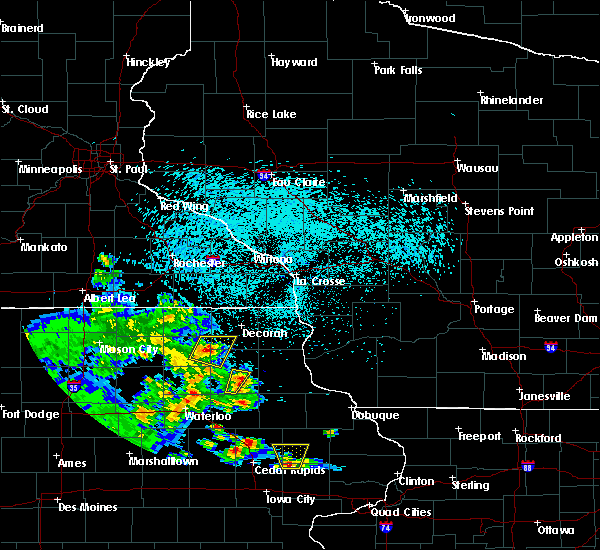 At 844 pm cdt, a severe thunderstorm was located near fayette, or 11 miles south of west union, moving northeast at 15 mph (a 59 mph wind gust was repored in oelwien at 805 pm cdt ). Hazards include 60 mph wind gusts and penny size hail. Expect damage to roofs. siding. and trees. This severe thunderstorm will remain over mainly rural areas of southeastern fayette county, including the following locations: volga river state park, county roads 3 and w 33 and county road w 33 and 187. At 844 pm cdt, a severe thunderstorm was located near fayette, or 11 miles south of west union, moving northeast at 15 mph (a 59 mph wind gust was repored in oelwien at 805 pm cdt ). Hazards include 60 mph wind gusts and penny size hail. Expect damage to roofs. siding. and trees. This severe thunderstorm will remain over mainly rural areas of southeastern fayette county, including the following locations: volga river state park, county roads 3 and w 33 and county road w 33 and 187.
|
| 5/30/2016 8:18 PM CDT |
 At 817 pm cdt, a severe thunderstorm was located over maynard, or near oelwein, moving northeast at 15 mph (a 58 mph wind gust was reported in oelwien at 755 pm cdt). Hazards include 60 mph wind gusts and quarter size hail. Hail damage to vehicles is expected. expect wind damage to roofs, siding, and trees. this severe storm will be near, maynard around 820 pm cdt. fayette around 845 pm cdt. Other locations impacted by this severe thunderstorm include westgate, randalia, highway 93 and county v 68, highway 93 and county w 14 and volga river state park. At 817 pm cdt, a severe thunderstorm was located over maynard, or near oelwein, moving northeast at 15 mph (a 58 mph wind gust was reported in oelwien at 755 pm cdt). Hazards include 60 mph wind gusts and quarter size hail. Hail damage to vehicles is expected. expect wind damage to roofs, siding, and trees. this severe storm will be near, maynard around 820 pm cdt. fayette around 845 pm cdt. Other locations impacted by this severe thunderstorm include westgate, randalia, highway 93 and county v 68, highway 93 and county w 14 and volga river state park.
|
| 5/30/2016 8:05 PM CDT | 51 knots from the wnw reported at olz in fayette county IA, 3.9 miles ESE of Oelwein, IA |
| 5/30/2016 8:04 PM CDT |
 At 803 pm cdt, a severe thunderstorm was located near oelwein, moving northeast at 15 mph (a 58 mph wind gust was reported in oelwein at 755 pm cdt). Hazards include 60 mph wind gusts and quarter size hail. Hail damage to vehicles is expected. expect wind damage to roofs, siding, and trees. this severe storm will be near, maynard around 825 pm cdt. fayette around 855 pm cdt. Other locations impacted by this severe thunderstorm include westgate, randalia, highway 93 and county v 68, highway 93 and county w 14 and volga river state park. At 803 pm cdt, a severe thunderstorm was located near oelwein, moving northeast at 15 mph (a 58 mph wind gust was reported in oelwein at 755 pm cdt). Hazards include 60 mph wind gusts and quarter size hail. Hail damage to vehicles is expected. expect wind damage to roofs, siding, and trees. this severe storm will be near, maynard around 825 pm cdt. fayette around 855 pm cdt. Other locations impacted by this severe thunderstorm include westgate, randalia, highway 93 and county v 68, highway 93 and county w 14 and volga river state park.
|
| 5/30/2016 7:55 PM CDT | Reported at olz in fayette county IA, 3.9 miles ESE of Oelwein, IA |
| 5/30/2016 7:53 PM CDT |
 At 752 pm cdt, a severe thunderstorm was located near fairbank, or near oelwein, moving northeast at 15 mph (radar indicated). Hazards include 60 mph wind gusts and quarter size hail. Hail damage to vehicles is expected. expect wind damage to roofs, siding, and trees. this severe thunderstorm will be near, oelwein around 800 pm cdt. maynard around 830 pm cdt. fayette around 855 pm cdt. Other locations impacted by this severe thunderstorm include westgate, randalia, highway 93 and county v 68, highway 93 and county w 14 and volga river state park. At 752 pm cdt, a severe thunderstorm was located near fairbank, or near oelwein, moving northeast at 15 mph (radar indicated). Hazards include 60 mph wind gusts and quarter size hail. Hail damage to vehicles is expected. expect wind damage to roofs, siding, and trees. this severe thunderstorm will be near, oelwein around 800 pm cdt. maynard around 830 pm cdt. fayette around 855 pm cdt. Other locations impacted by this severe thunderstorm include westgate, randalia, highway 93 and county v 68, highway 93 and county w 14 and volga river state park.
|
| 5/26/2016 5:39 AM CDT |
 At 536 am cdt, severe thunderstorms had moved out of the area but winds continued to gust in the 35 to 55 mph range (trained weather spotters). Hazards include 60 mph wind gusts. Expect damage to roofs. siding. and trees. The warning will be allowed to expire at 545 am. At 536 am cdt, severe thunderstorms had moved out of the area but winds continued to gust in the 35 to 55 mph range (trained weather spotters). Hazards include 60 mph wind gusts. Expect damage to roofs. siding. and trees. The warning will be allowed to expire at 545 am.
|
| 5/26/2016 5:24 AM CDT |
 At 523 am cdt, severe thunderstorms were located along a line extending from 6 miles north of postville to near mcgregor, moving northeast at 70 mph (trained weather spotters reported wind gusts of 40 mph at edgewood and 62 mph at oelwein. both of these were well behind the storms). Hazards include 60 mph wind gusts. Expect damage to roofs. siding. and trees. these severe thunderstorms will remain over mainly rural areas of western clayton and fayette counties, including the following locations: luana, wadena, westgate, st. lucas and st. Olaf. At 523 am cdt, severe thunderstorms were located along a line extending from 6 miles north of postville to near mcgregor, moving northeast at 70 mph (trained weather spotters reported wind gusts of 40 mph at edgewood and 62 mph at oelwein. both of these were well behind the storms). Hazards include 60 mph wind gusts. Expect damage to roofs. siding. and trees. these severe thunderstorms will remain over mainly rural areas of western clayton and fayette counties, including the following locations: luana, wadena, westgate, st. lucas and st. Olaf.
|
| 5/26/2016 5:06 AM CDT |
 At 506 am cdt, severe thunderstorms were located along a line extending from near west union to elkader, moving northeast at 55 mph (airport reported. a gust to 62 mph was recorded at oelwein just before 5 am). Hazards include 60 mph wind gusts. Expect damage to roofs. siding. and trees. these severe storms will be near, elkader around 510 am cdt. farmersburg around 515 am cdt. postville and monona around 520 am cdt. other locations impacted by these severe thunderstorms include luana, wadena, westgate, st. lucas and st. Olaf. At 506 am cdt, severe thunderstorms were located along a line extending from near west union to elkader, moving northeast at 55 mph (airport reported. a gust to 62 mph was recorded at oelwein just before 5 am). Hazards include 60 mph wind gusts. Expect damage to roofs. siding. and trees. these severe storms will be near, elkader around 510 am cdt. farmersburg around 515 am cdt. postville and monona around 520 am cdt. other locations impacted by these severe thunderstorms include luana, wadena, westgate, st. lucas and st. Olaf.
|
| 5/26/2016 5:00 AM CDT | 20 to 30 inch diameter tree down across 46th ave se in oelwei in fayette county IA, 0.8 miles S of Oelwein, IA |
| 5/26/2016 4:55 AM CDT | Storm damage reported in fayette county IA, 3.2 miles ESE of Oelwein, IA |
| 5/26/2016 4:52 AM CDT |
 At 452 am cdt, severe thunderstorms were located along a line extending from hawkeye to near volga, moving northeast at 65 mph (radar indicated). Hazards include 60 mph wind gusts. Expect damage to roofs. siding. and trees. severe thunderstorms will be near, elkader around 500 am cdt. farmersburg around 505 am cdt. postville and monona around 515 am cdt. other locations impacted by these severe thunderstorms include luana, wadena, westgate, st. lucas and st. Olaf. At 452 am cdt, severe thunderstorms were located along a line extending from hawkeye to near volga, moving northeast at 65 mph (radar indicated). Hazards include 60 mph wind gusts. Expect damage to roofs. siding. and trees. severe thunderstorms will be near, elkader around 500 am cdt. farmersburg around 505 am cdt. postville and monona around 515 am cdt. other locations impacted by these severe thunderstorms include luana, wadena, westgate, st. lucas and st. Olaf.
|
| 6/22/2015 8:33 AM CDT |
 At 832 am cdt, severe thunderstorms were located along a line extending from near harpers ferry to stanley, moving southeast at 25 mph. trees were blown down in waukon and oelwein iowa (law enforcement). Hazards include 60 mph wind gusts. Expect damage to roofs. siding and trees. these severe thunderstorms will remain over mainly rural areas of southeastern fayette, clayton and eastern allamakee counties, including the following locations, luana, wadena, waterville, st. Olaf and clayton. At 832 am cdt, severe thunderstorms were located along a line extending from near harpers ferry to stanley, moving southeast at 25 mph. trees were blown down in waukon and oelwein iowa (law enforcement). Hazards include 60 mph wind gusts. Expect damage to roofs. siding and trees. these severe thunderstorms will remain over mainly rural areas of southeastern fayette, clayton and eastern allamakee counties, including the following locations, luana, wadena, waterville, st. Olaf and clayton.
|
| 6/22/2015 8:23 AM CDT | Trees down in fayette county IA, 0.8 miles S of Oelwein, IA |
| 6/22/2015 8:23 AM CDT | Storm damage reported in buchanan county IA, 2.2 miles NNW of Oelwein, IA |
| 6/22/2015 8:19 AM CDT | Multiple trees down around oelwein according to oelwein city police. also some minor street floodin in fayette county IA, 0.8 miles S of Oelwein, IA |
| 6/22/2015 8:10 AM CDT |
 At 810 am cdt, severe thunderstorms were located along a line extending from near harpers ferry to near maynard, moving southeast at 55 mph (radar indicated). Hazards include 60 mph wind gusts. Expect damage to roofs. siding and trees. these severe storms will be near, arlington around 815 am cdt. prairie du chien, stanley and marquette around 820 am cdt. mcgregor around 825 am cdt. Other locations impacted by these severe thunderstorms include hardin, luana, wadena, westgate and waterville. At 810 am cdt, severe thunderstorms were located along a line extending from near harpers ferry to near maynard, moving southeast at 55 mph (radar indicated). Hazards include 60 mph wind gusts. Expect damage to roofs. siding and trees. these severe storms will be near, arlington around 815 am cdt. prairie du chien, stanley and marquette around 820 am cdt. mcgregor around 825 am cdt. Other locations impacted by these severe thunderstorms include hardin, luana, wadena, westgate and waterville.
|
| 6/22/2015 7:58 AM CDT |
 At 758 am cdt, severe thunderstorms were located along a line extending from near lansing to near sumner, moving southeast at 25 mph (radar indicated). Hazards include 60 mph wind gusts. Expect damage to roofs. siding and trees. severe thunderstorms will be near, fayette around 815 am cdt. maynard around 820 am cdt. oelwein and harpers ferry around 835 am cdt. stanley around 845 am cdt. prairie du chien, marquette and mcgregor around 855 am cdt. Other locations impacted by these severe thunderstorms include hardin, luana, wadena, westgate and waterville. At 758 am cdt, severe thunderstorms were located along a line extending from near lansing to near sumner, moving southeast at 25 mph (radar indicated). Hazards include 60 mph wind gusts. Expect damage to roofs. siding and trees. severe thunderstorms will be near, fayette around 815 am cdt. maynard around 820 am cdt. oelwein and harpers ferry around 835 am cdt. stanley around 845 am cdt. prairie du chien, marquette and mcgregor around 855 am cdt. Other locations impacted by these severe thunderstorms include hardin, luana, wadena, westgate and waterville.
|
| 8/31/2014 10:45 PM CDT | Storm damage reported in fayette county IA, 0.8 miles S of Oelwein, IA |
| 7/1/2014 6:00 AM CDT | Wind damage from independence to oelwein yesterday afternoon around 240pm. peak gust here was 52mph but is hindered by trees so estimated winds of over 60mp in buchanan county IA, 2.2 miles NNW of Oelwein, IA |
| 6/30/2014 2:40 PM CDT | Wind gusts of 50 to 60 mp in fayette county IA, 0.8 miles S of Oelwein, IA |
| 6/30/2014 2:35 PM CDT | Kolz g50kts in fayette county IA, 0.8 miles S of Oelwein, IA |
| 5/29/2013 5:05 PM CDT | Relayed report from kwwl...damage hwy 3 just east of oelwein...machines...shed taken down...bin twisted and torn...windowns broken out in fayette county IA, 2.2 miles WSW of Oelwein, IA |
| 5/29/2013 5:00 PM CDT | Storm damage reported in buchanan county IA, 2.2 miles NNW of Oelwein, IA |
| 5/29/2013 5:00 PM CDT | 2 six inch diameter limbs dow in buchanan county IA, 2.2 miles NNW of Oelwein, IA |
| 1/1/0001 12:00 AM | Numerous tree branches 2-3 inches in diameter and a few up to 6 inches in diamter dow in fayette county IA, 0.8 miles S of Oelwein, IA |
| 1/1/0001 12:00 AM | High wind gust estimated between 60 and 70 mp in buchanan county IA, 2.2 miles NNW of Oelwein, IA |
| 1/1/0001 12:00 AM | Tree limbs on power lines and several trees down blocking some city street in fayette county IA, 0.8 miles S of Oelwein, IA |
| 1/1/0001 12:00 AM | Numerous trees and limbs down in excess of 12 inches. roof removed from grain elevato in fayette county IA, 0.8 miles S of Oelwein, IA |
Hail Maps for Oelwein, IA
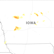


Connect with Interactive Hail Maps