

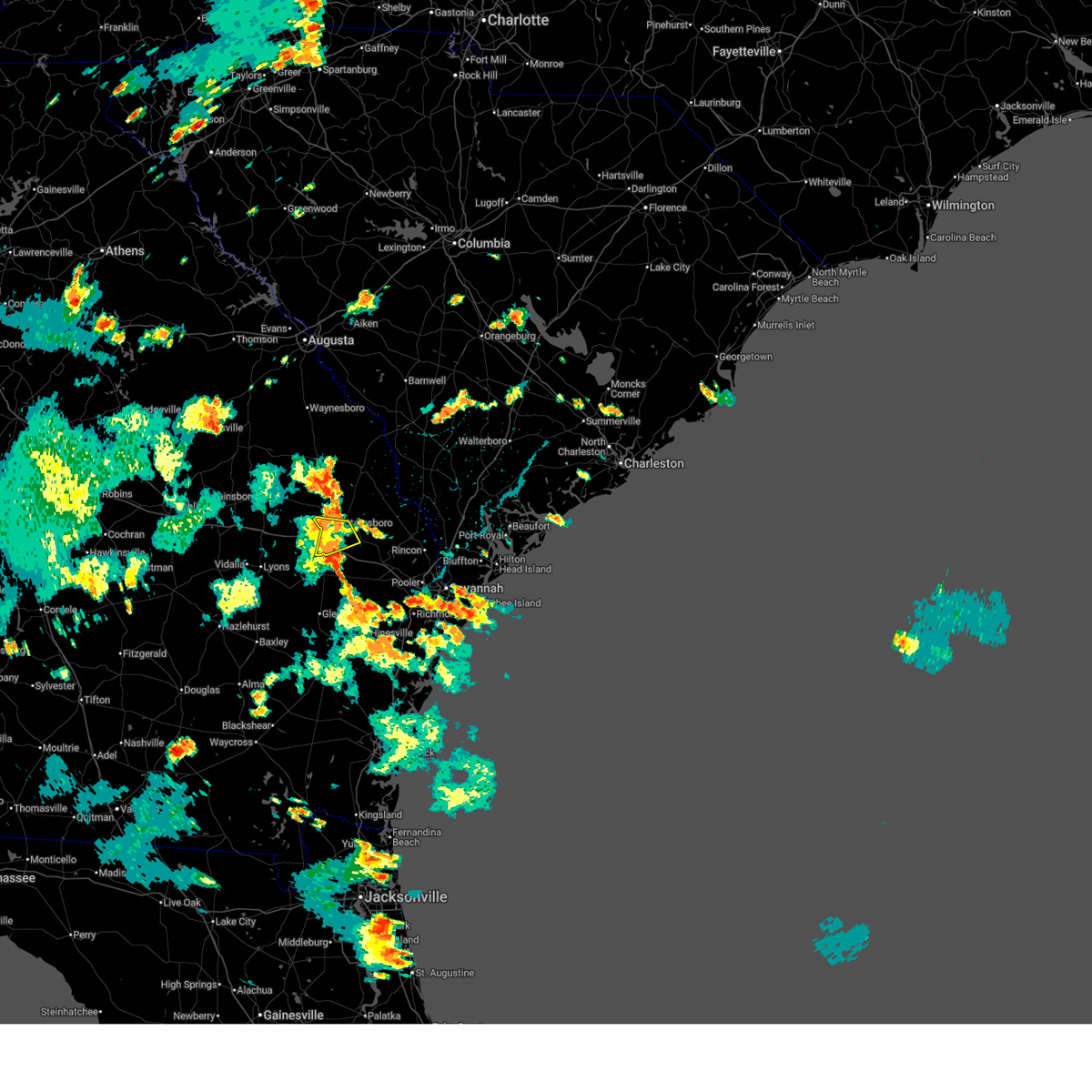
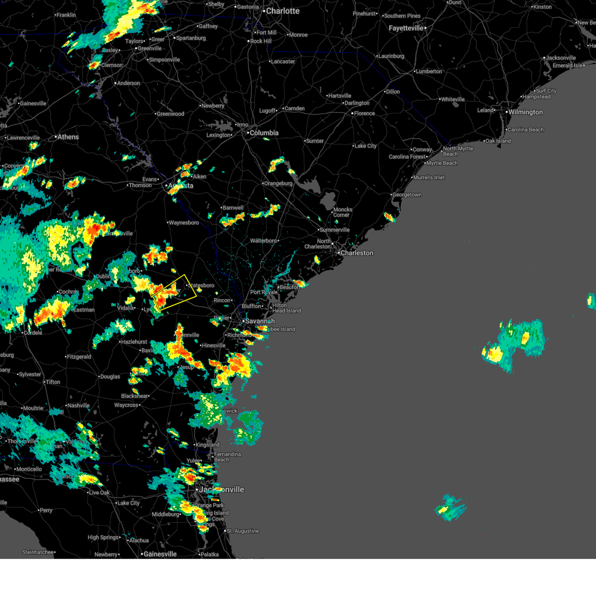
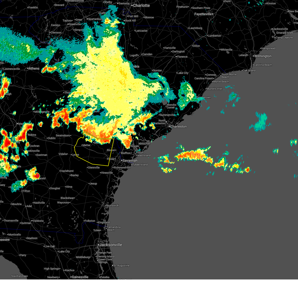
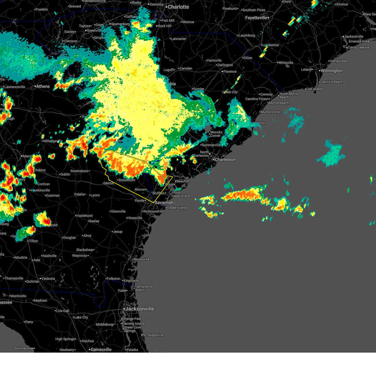
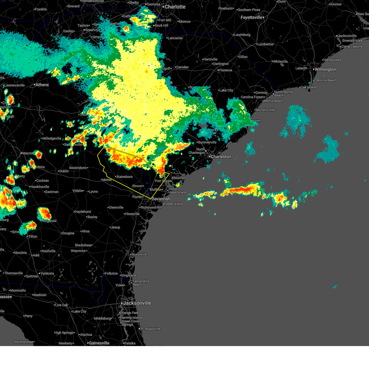
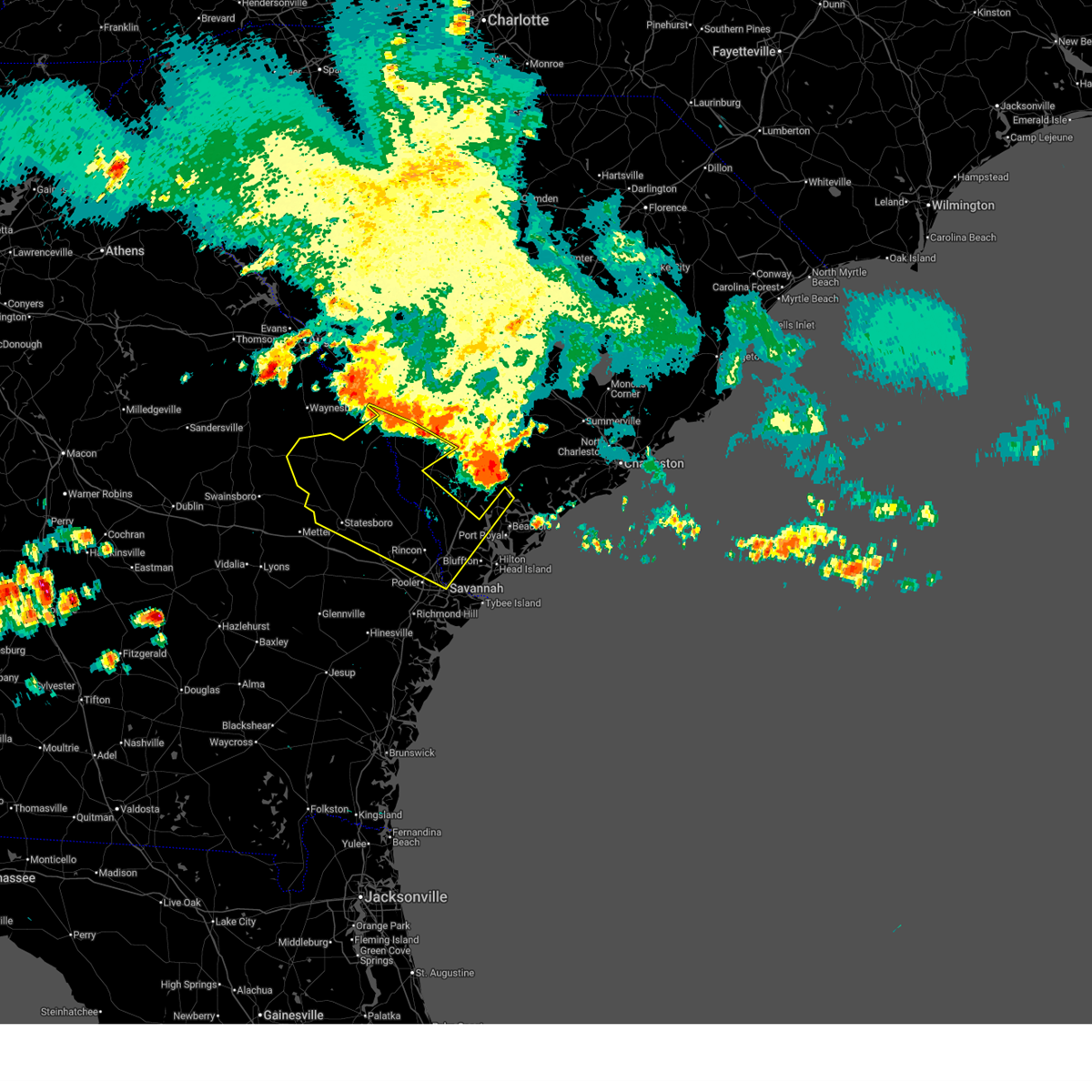
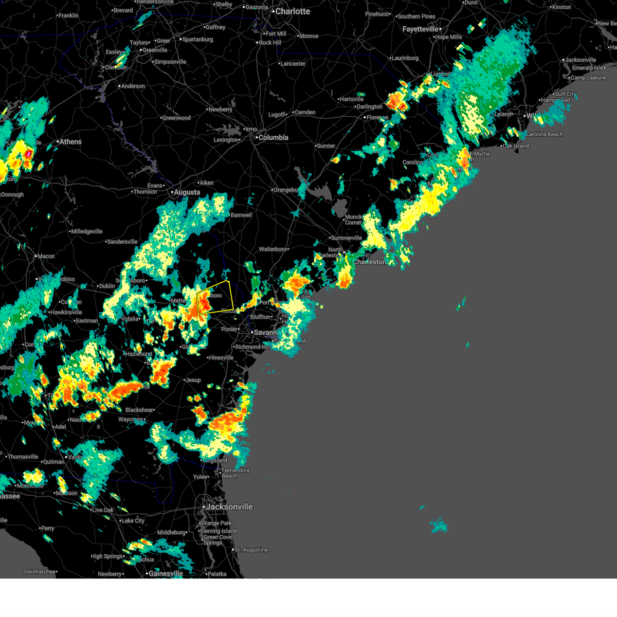
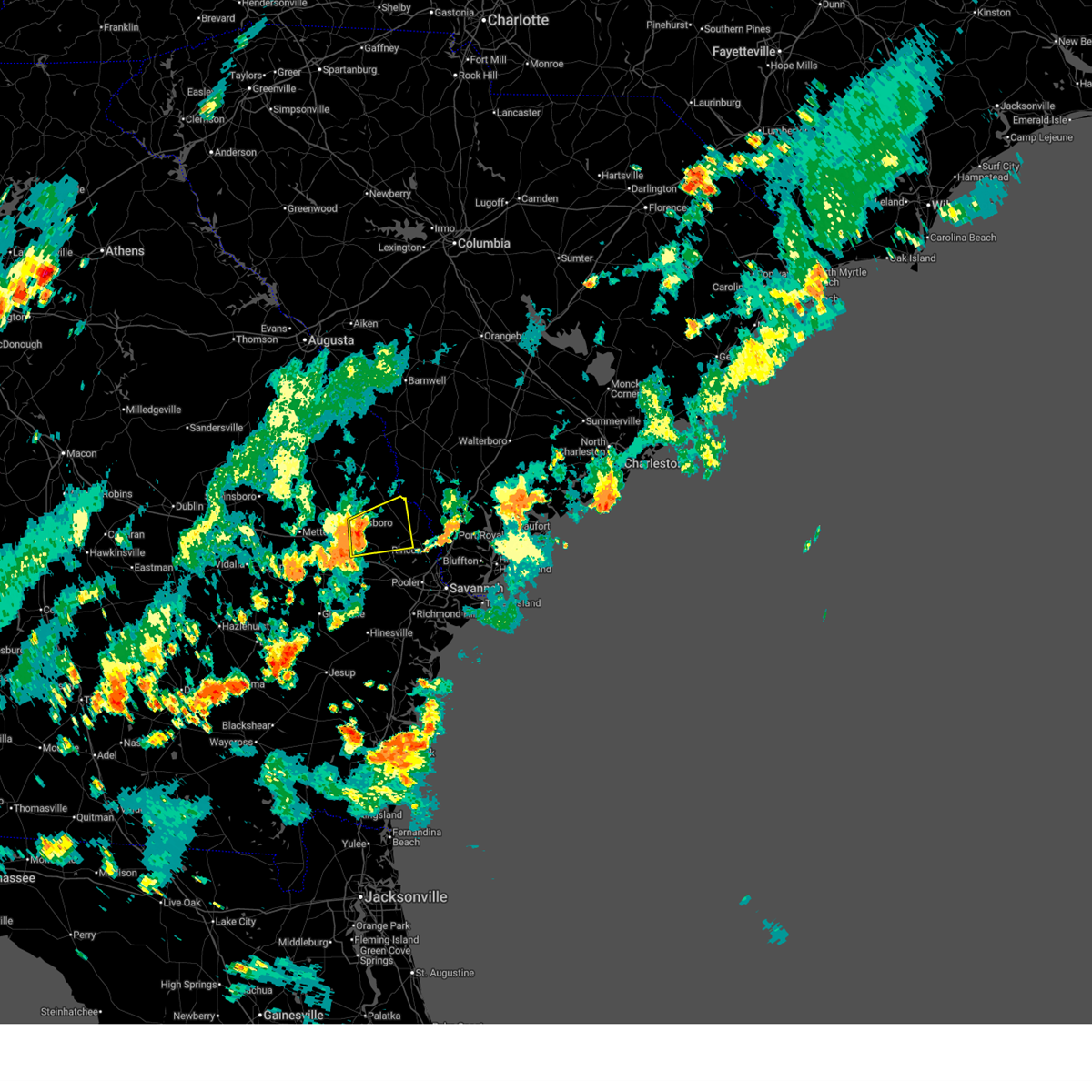
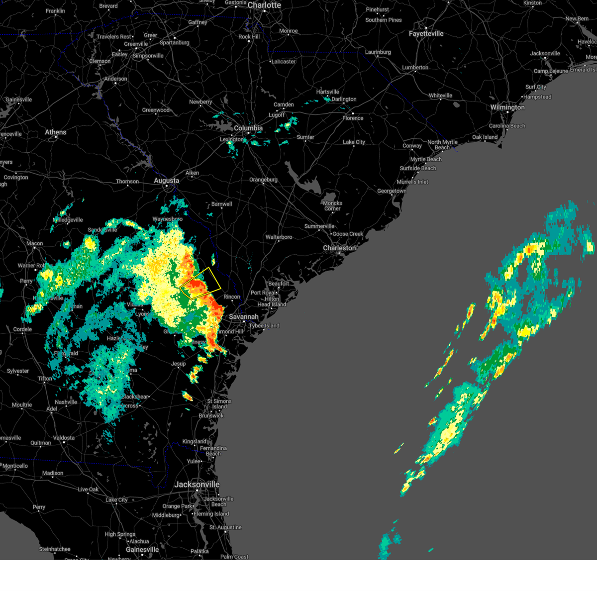
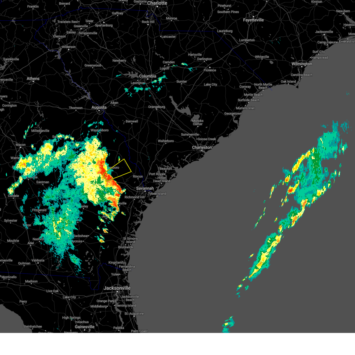
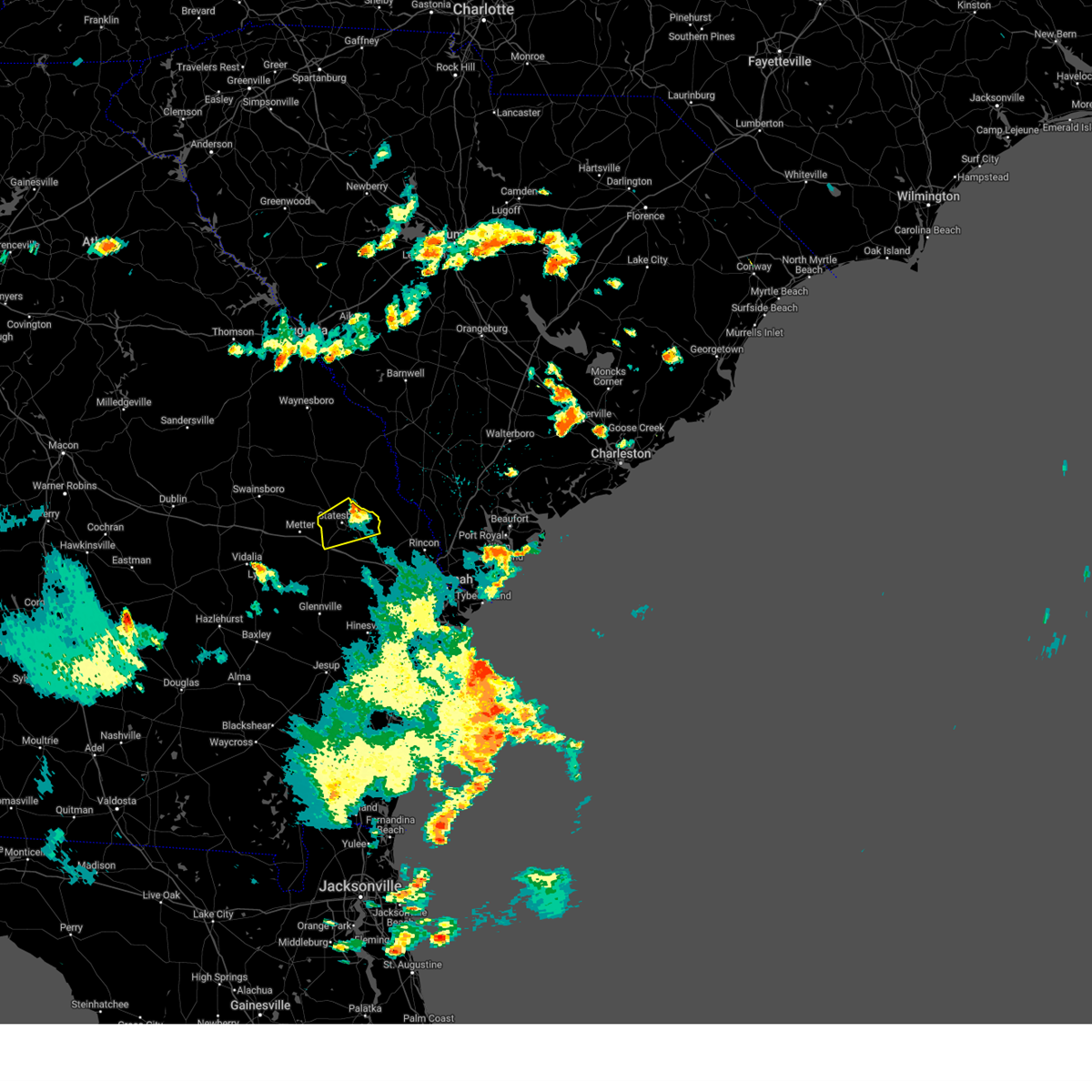
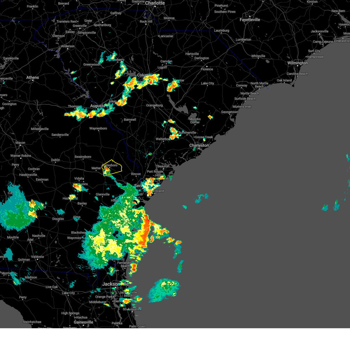
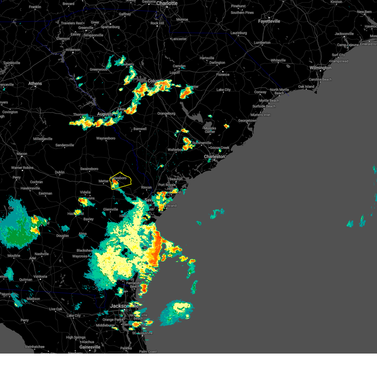
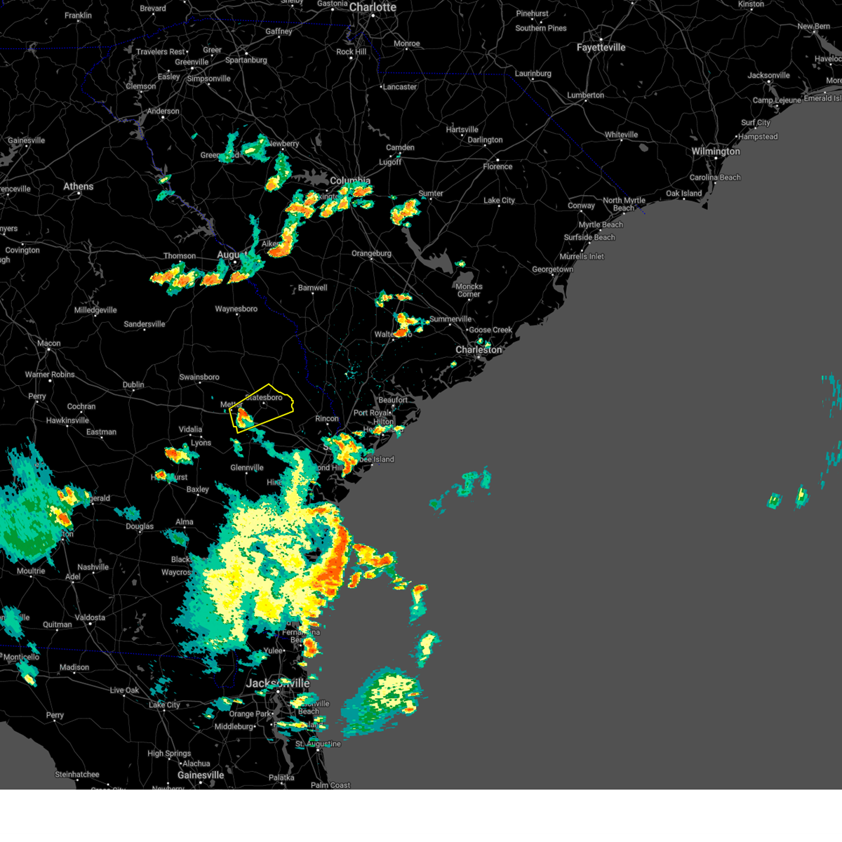
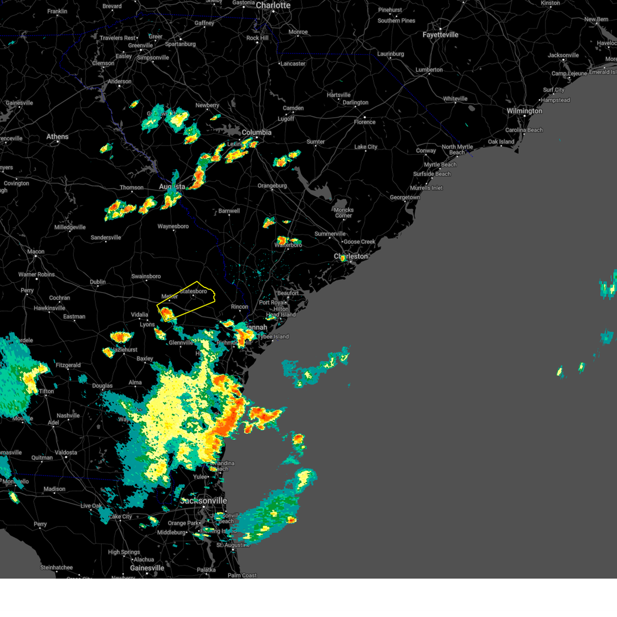
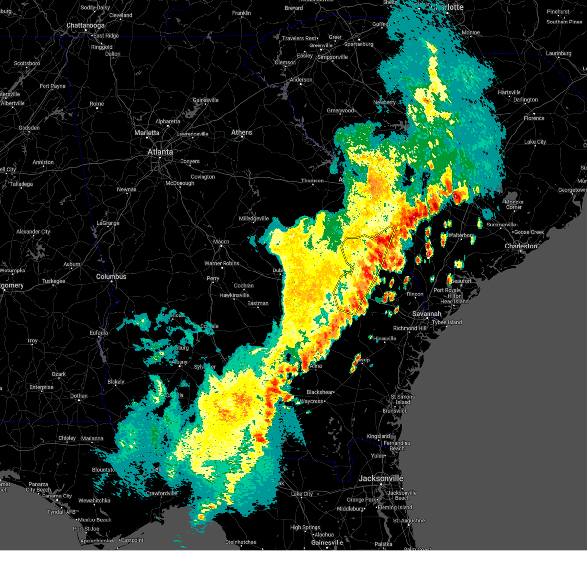
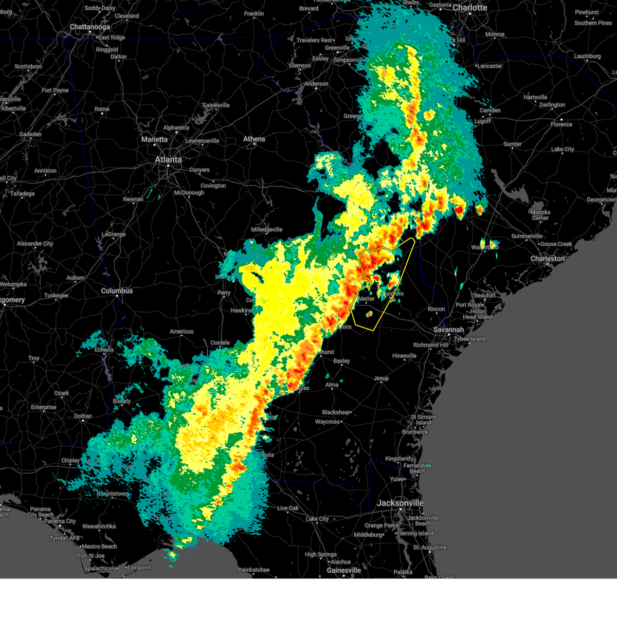
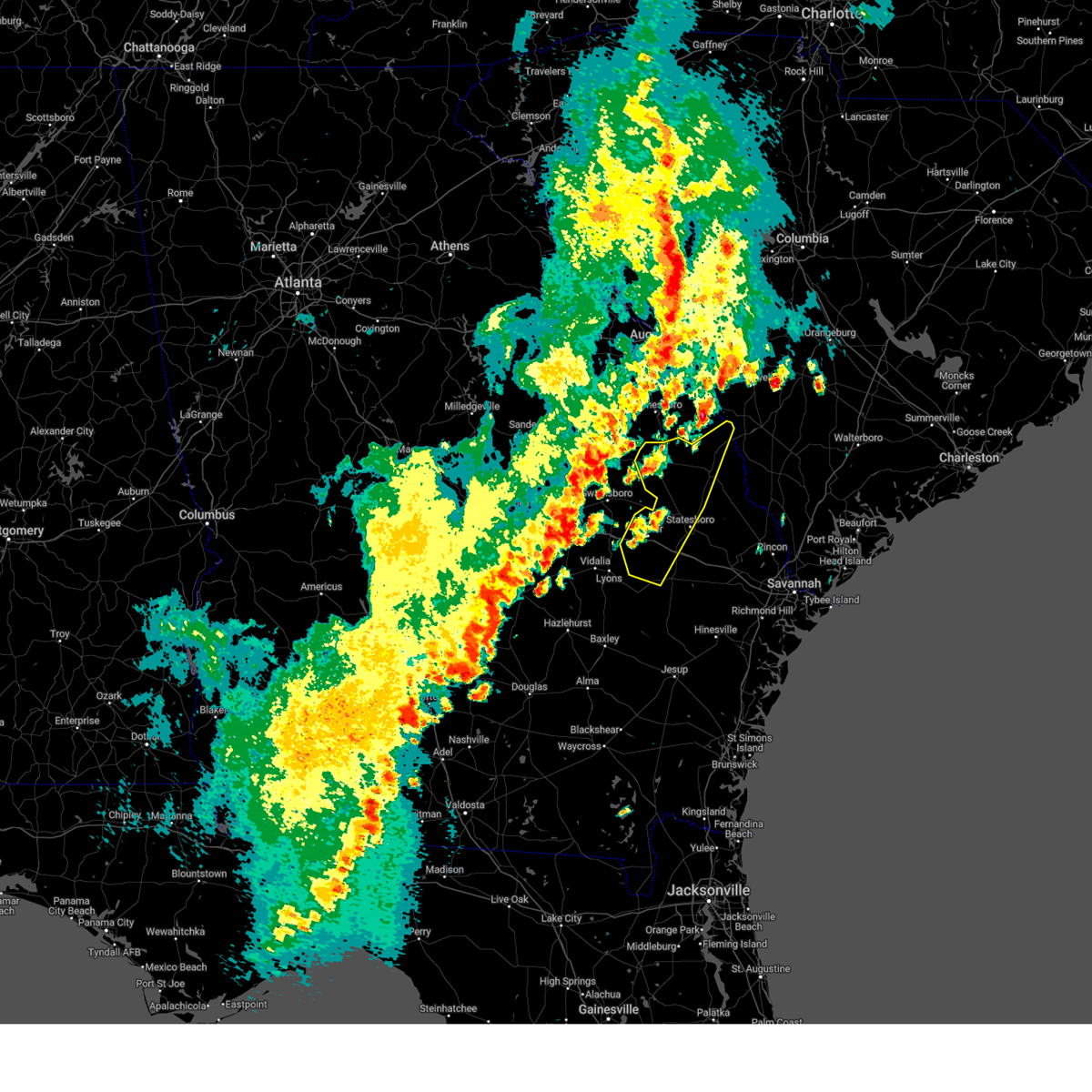
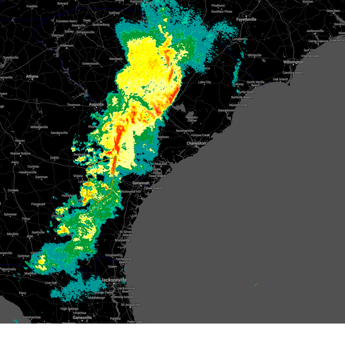
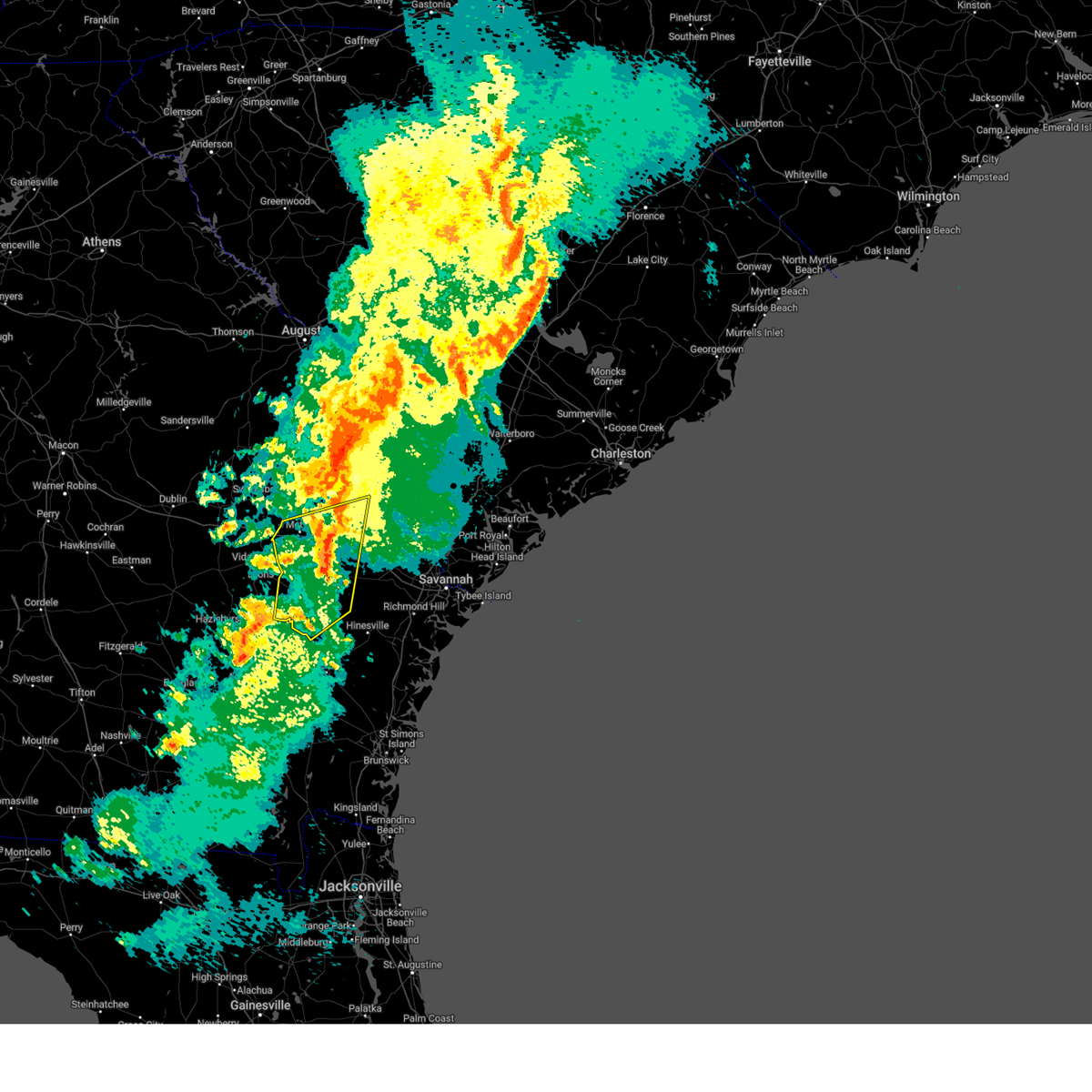
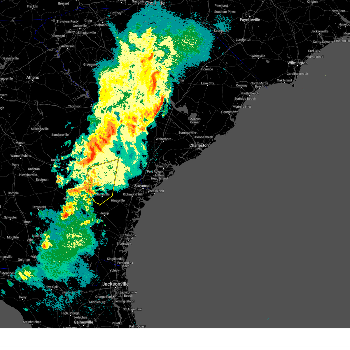
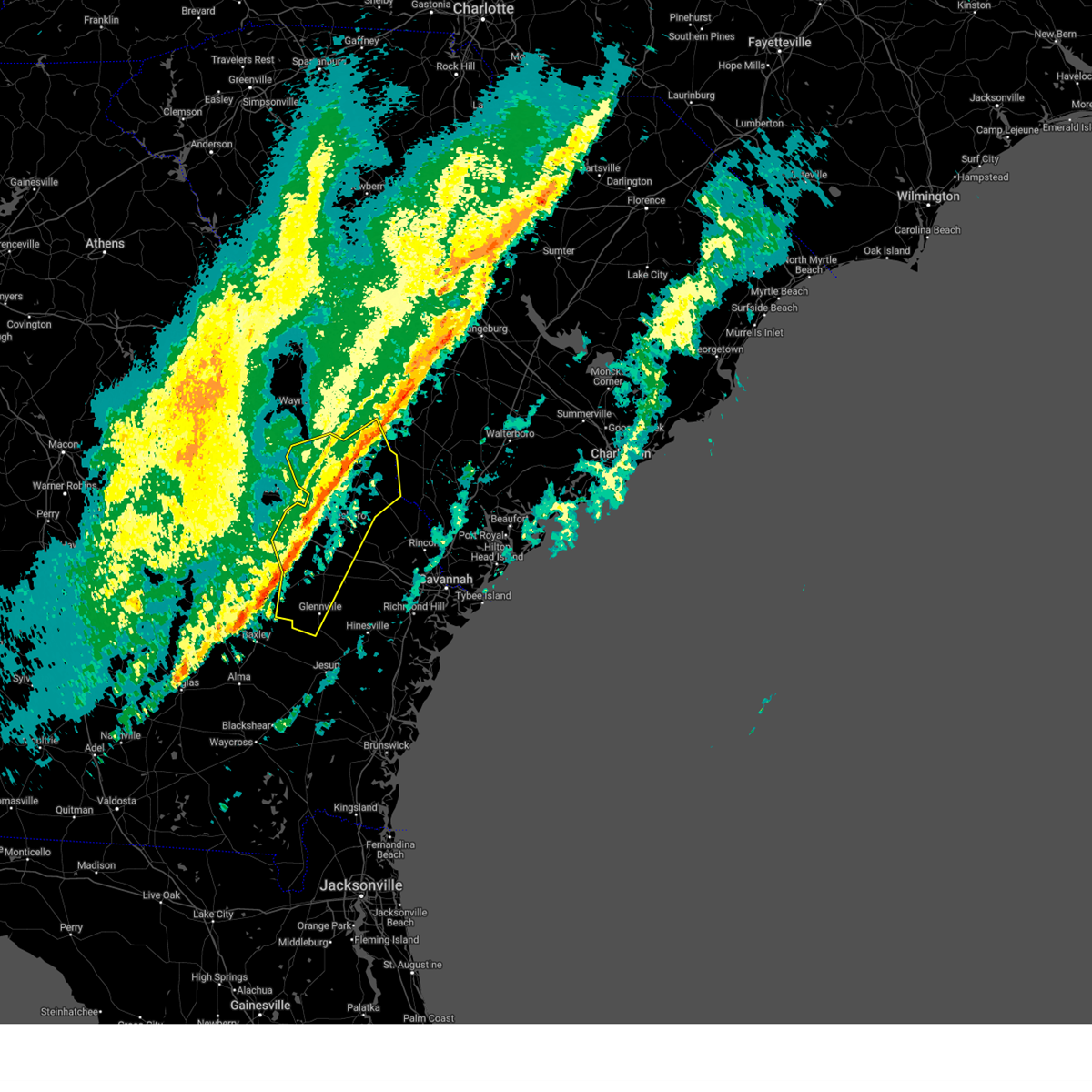
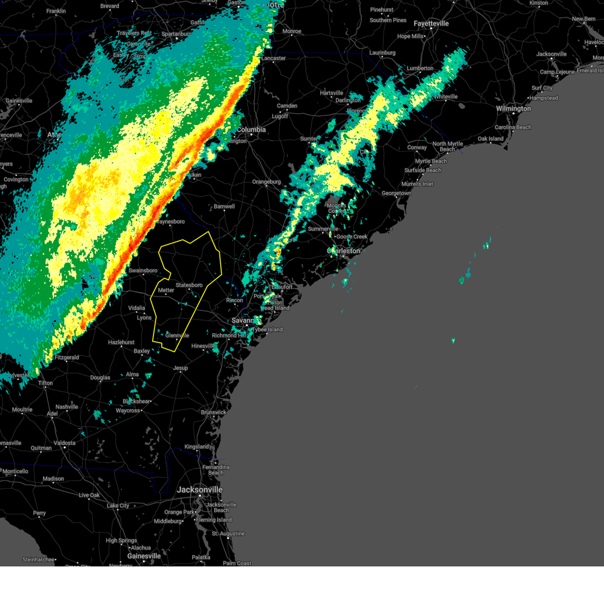
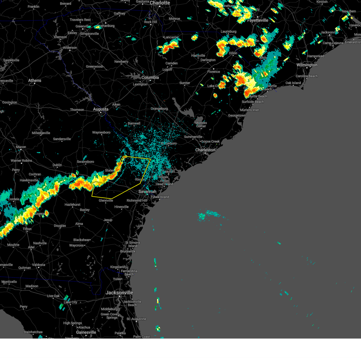
Hail Map for Statesboro, GA
The Statesboro, GA area has had 25 reports of on-the-ground hail by trained spotters, and has been under severe weather warnings 33 times during the past 12 months. Doppler radar has detected hail at or near Statesboro, GA on 69 occasions, including 3 occasions during the past year.
| Name: | Statesboro, GA |
| Where Located: | 46.9 miles WNW of Savannah, GA |
| Map: | Google Map for Statesboro, GA |
| Population: | 28422 |
| Housing Units: | 11602 |
| More Info: | Search Google for Statesboro, GA |
0
The Top Recent Hail Date for Statesboro, GA is Wednesday, July 9, 2025 (69th out of 69)

Hail and Wind Damage Spotted near Statesboro, GA
| Date / Time | Report Details |
|---|---|
| 7/11/2025 5:24 PM EDT | The storm which prompted the warning has moved out of the area. therefore, the warning will be allowed to expire. however, gusty winds are still possible with this thunderstorm. |
| 7/11/2025 5:05 PM EDT |
 At 505 pm edt, a severe thunderstorm was located near register, moving east at 25 mph (radar indicated). Hazards include 60 mph wind gusts and small hail. Expect damage to roofs, siding, and trees. locations impacted include, statesboro, register, georgia southern, jimps, irongate, kennedy pond, westbrooke, somerset, new hope and statesboro mall. This includes i-16 between mile markers 113 and 121. At 505 pm edt, a severe thunderstorm was located near register, moving east at 25 mph (radar indicated). Hazards include 60 mph wind gusts and small hail. Expect damage to roofs, siding, and trees. locations impacted include, statesboro, register, georgia southern, jimps, irongate, kennedy pond, westbrooke, somerset, new hope and statesboro mall. This includes i-16 between mile markers 113 and 121.
|
| 7/11/2025 5:05 PM EDT |
 the severe thunderstorm warning has been cancelled and is no longer in effect the severe thunderstorm warning has been cancelled and is no longer in effect
|
| 7/11/2025 4:31 PM EDT |
 Svrchs the national weather service in charleston has issued a * severe thunderstorm warning for portions of, bulloch county in southeastern georgia, candler county in southeastern georgia, evans county in southeastern georgia, tattnall county in southeastern georgia, * until 530 pm edt. * at 431 pm edt, a severe thunderstorm was located near cobbtown, moving northeast at 15 mph (radar indicated). Hazards include 60 mph wind gusts. expect damage to roofs, siding, and trees Svrchs the national weather service in charleston has issued a * severe thunderstorm warning for portions of, bulloch county in southeastern georgia, candler county in southeastern georgia, evans county in southeastern georgia, tattnall county in southeastern georgia, * until 530 pm edt. * at 431 pm edt, a severe thunderstorm was located near cobbtown, moving northeast at 15 mph (radar indicated). Hazards include 60 mph wind gusts. expect damage to roofs, siding, and trees
|
| 6/25/2025 11:49 PM EDT |
 At 1149 pm edt, severe thunderstorms were located along a line from near stilson to 6 miles west of portal, moving south at 30 mph (emergency management reported. at 1147 pm, emergency management officials reported trees down across portions of bulloch county). Hazards include 60 mph wind gusts and quarter size hail. Hail damage to vehicles is expected. expect wind damage to roofs, siding, and trees. locations impacted include, statesboro, portal, brooklet, springfield, guyton, metter, claxton, hagan, pembroke and lanier. This includes i-16 between mile markers 96 and 149. At 1149 pm edt, severe thunderstorms were located along a line from near stilson to 6 miles west of portal, moving south at 30 mph (emergency management reported. at 1147 pm, emergency management officials reported trees down across portions of bulloch county). Hazards include 60 mph wind gusts and quarter size hail. Hail damage to vehicles is expected. expect wind damage to roofs, siding, and trees. locations impacted include, statesboro, portal, brooklet, springfield, guyton, metter, claxton, hagan, pembroke and lanier. This includes i-16 between mile markers 96 and 149.
|
| 6/25/2025 11:40 PM EDT |
 The severe thunderstorm warning that was previously in effect has been reissued for screven, jenkins, effingham, and bulloch counties and is in effect until 1230 am edt. please refer to that bulletin for the latest severe weather information. a severe thunderstorm watch remains in effect until 400 am edt for portions of southeast georgia and southeast south carolina. The severe thunderstorm warning that was previously in effect has been reissued for screven, jenkins, effingham, and bulloch counties and is in effect until 1230 am edt. please refer to that bulletin for the latest severe weather information. a severe thunderstorm watch remains in effect until 400 am edt for portions of southeast georgia and southeast south carolina.
|
| 6/25/2025 11:37 PM EDT | Tree down on brooklet- leefield rd at clito rd. time estimated from rada in bulloch county GA, 7.7 miles WNW of Statesboro, GA |
| 6/25/2025 11:29 PM EDT | Tree down on old river rd n and highway 301. time estimated from rada in bulloch county GA, 7.9 miles SSW of Statesboro, GA |
| 6/25/2025 11:28 PM EDT |
 Svrchs the national weather service in charleston has issued a * severe thunderstorm warning for portions of, bryan county in southeastern georgia, bulloch county in southeastern georgia, candler county in southeastern georgia, effingham county in southeastern georgia, evans county in southeastern georgia, jenkins county in southeastern georgia, liberty county in southeastern georgia, screven county in southeastern georgia, tattnall county in southeastern georgia, * until 1230 am edt. * at 1128 pm edt, severe thunderstorms were located along a line from over shawnee to near butts, moving south at 30 mph (radar indicated). Hazards include 60 mph wind gusts and small hail. expect damage to roofs, siding, and trees Svrchs the national weather service in charleston has issued a * severe thunderstorm warning for portions of, bryan county in southeastern georgia, bulloch county in southeastern georgia, candler county in southeastern georgia, effingham county in southeastern georgia, evans county in southeastern georgia, jenkins county in southeastern georgia, liberty county in southeastern georgia, screven county in southeastern georgia, tattnall county in southeastern georgia, * until 1230 am edt. * at 1128 pm edt, severe thunderstorms were located along a line from over shawnee to near butts, moving south at 30 mph (radar indicated). Hazards include 60 mph wind gusts and small hail. expect damage to roofs, siding, and trees
|
| 6/25/2025 11:22 PM EDT |
 At 1122 pm edt, severe thunderstorms were located along a line from over old house to over millen, moving southwest at 30 mph (law enforcement reported. at 1020 pm, law enforcement officials reported trees down near sylvania as well as other portions of screven county). Hazards include 60 mph wind gusts and small hail. Expect damage to roofs, siding, and trees. locations impacted include, beaufort, sylvania, ridgeland, millen, springfield, statesboro, bluffton, godley station, savannah international airport and pooler. this includes the following highways, i-95 in georgia between mile markers 106 and 112. I-95 in south carolina between mile markers 2 and 25. At 1122 pm edt, severe thunderstorms were located along a line from over old house to over millen, moving southwest at 30 mph (law enforcement reported. at 1020 pm, law enforcement officials reported trees down near sylvania as well as other portions of screven county). Hazards include 60 mph wind gusts and small hail. Expect damage to roofs, siding, and trees. locations impacted include, beaufort, sylvania, ridgeland, millen, springfield, statesboro, bluffton, godley station, savannah international airport and pooler. this includes the following highways, i-95 in georgia between mile markers 106 and 112. I-95 in south carolina between mile markers 2 and 25.
|
| 6/25/2025 10:49 PM EDT |
 Svrchs the national weather service in charleston has issued a * severe thunderstorm warning for portions of, bulloch county in southeastern georgia, chatham county in southeastern georgia, effingham county in southeastern georgia, jenkins county in southeastern georgia, screven county in southeastern georgia, allendale county in southeastern south carolina, beaufort county in southeastern south carolina, hampton county in southeastern south carolina, jasper county in southeastern south carolina, * until 1145 pm edt. * at 1049 pm edt, severe thunderstorms were located along a line from near sheldon to 12 miles northeast of perkins, moving southwest at 30 mph (radar indicated). Hazards include 60 mph wind gusts and small hail. expect damage to roofs, siding, and trees Svrchs the national weather service in charleston has issued a * severe thunderstorm warning for portions of, bulloch county in southeastern georgia, chatham county in southeastern georgia, effingham county in southeastern georgia, jenkins county in southeastern georgia, screven county in southeastern georgia, allendale county in southeastern south carolina, beaufort county in southeastern south carolina, hampton county in southeastern south carolina, jasper county in southeastern south carolina, * until 1145 pm edt. * at 1049 pm edt, severe thunderstorms were located along a line from near sheldon to 12 miles northeast of perkins, moving southwest at 30 mph (radar indicated). Hazards include 60 mph wind gusts and small hail. expect damage to roofs, siding, and trees
|
| 6/14/2025 4:42 PM EDT |
 At 442 pm edt, a severe thunderstorm was located over brooklet, moving east at 15 mph (radar indicated). Hazards include 60 mph wind gusts and quarter size hail. Hail damage to vehicles is expected. expect wind damage to roofs, siding, and trees. Locations impacted include, springfield, guyton, brooklet, oliver, egypt, leefield, stilson, shawnee, kildare and griffin lake. At 442 pm edt, a severe thunderstorm was located over brooklet, moving east at 15 mph (radar indicated). Hazards include 60 mph wind gusts and quarter size hail. Hail damage to vehicles is expected. expect wind damage to roofs, siding, and trees. Locations impacted include, springfield, guyton, brooklet, oliver, egypt, leefield, stilson, shawnee, kildare and griffin lake.
|
| 6/14/2025 4:36 PM EDT |
 Svrchs the national weather service in charleston has issued a * severe thunderstorm warning for portions of, bulloch county in southeastern georgia, effingham county in southeastern georgia, screven county in southeastern georgia, * until 515 pm edt. * at 436 pm edt, a severe thunderstorm was located over brooklet, moving east at 15 mph (radar indicated). Hazards include 60 mph wind gusts. expect damage to roofs, siding, and trees Svrchs the national weather service in charleston has issued a * severe thunderstorm warning for portions of, bulloch county in southeastern georgia, effingham county in southeastern georgia, screven county in southeastern georgia, * until 515 pm edt. * at 436 pm edt, a severe thunderstorm was located over brooklet, moving east at 15 mph (radar indicated). Hazards include 60 mph wind gusts. expect damage to roofs, siding, and trees
|
| 6/10/2025 8:35 AM EDT |
 At 835 am edt, a severe thunderstorm was located near brooklet, moving northeast at 30 mph (radar indicated). Hazards include 60 mph wind gusts. Expect damage to roofs, siding, and trees. Locations impacted include, statesboro, brooklet, newington, oliver, leefield, egypt, georgia southern, kildare, shawnee and gwinetts crossing. At 835 am edt, a severe thunderstorm was located near brooklet, moving northeast at 30 mph (radar indicated). Hazards include 60 mph wind gusts. Expect damage to roofs, siding, and trees. Locations impacted include, statesboro, brooklet, newington, oliver, leefield, egypt, georgia southern, kildare, shawnee and gwinetts crossing.
|
| 6/10/2025 8:25 AM EDT | Tree down on cypress lake rd at country club r in bulloch county GA, 6 miles NE of Statesboro, GA |
| 6/10/2025 8:23 AM EDT |
 Svrchs the national weather service in charleston has issued a * severe thunderstorm warning for portions of, bulloch county in southeastern georgia, effingham county in southeastern georgia, screven county in southeastern georgia, * until 915 am edt. * at 823 am edt, a severe thunderstorm was located near georgia southern, moving northeast at 30 mph (radar indicated). Hazards include 60 mph wind gusts. expect damage to roofs, siding, and trees Svrchs the national weather service in charleston has issued a * severe thunderstorm warning for portions of, bulloch county in southeastern georgia, effingham county in southeastern georgia, screven county in southeastern georgia, * until 915 am edt. * at 823 am edt, a severe thunderstorm was located near georgia southern, moving northeast at 30 mph (radar indicated). Hazards include 60 mph wind gusts. expect damage to roofs, siding, and trees
|
| 6/9/2025 4:41 PM EDT |
 The severe thunderstorm warning that was previously in effect has been reissued for bulloch county and is in effect until 530 pm edt. please refer to that bulletin for the latest severe weather information. The severe thunderstorm warning that was previously in effect has been reissued for bulloch county and is in effect until 530 pm edt. please refer to that bulletin for the latest severe weather information.
|
| 6/9/2025 4:22 PM EDT |
 the severe thunderstorm warning has been cancelled and is no longer in effect the severe thunderstorm warning has been cancelled and is no longer in effect
|
| 6/9/2025 4:22 PM EDT |
 At 422 pm edt, a severe thunderstorm was located near register, moving northeast at 35 mph (radar indicated). Hazards include 60 mph wind gusts. Expect damage to roofs, siding, and trees. locations impacted include, statesboro, brooklet, register, georgia southern, hopeulikit, leefield, windfield, statesboro mall, mill creek regional park and mill creek park. This includes i-16 between mile markers 116 and 117. At 422 pm edt, a severe thunderstorm was located near register, moving northeast at 35 mph (radar indicated). Hazards include 60 mph wind gusts. Expect damage to roofs, siding, and trees. locations impacted include, statesboro, brooklet, register, georgia southern, hopeulikit, leefield, windfield, statesboro mall, mill creek regional park and mill creek park. This includes i-16 between mile markers 116 and 117.
|
| 6/9/2025 4:13 PM EDT |
 the severe thunderstorm warning has been cancelled and is no longer in effect the severe thunderstorm warning has been cancelled and is no longer in effect
|
| 6/9/2025 4:13 PM EDT |
 At 413 pm edt, a severe thunderstorm was located over pulaski, moving northeast at 35 mph (radar indicated). Hazards include 60 mph wind gusts. Expect damage to roofs, siding, and trees. locations impacted include, statesboro, metter, brooklet, pulaski, register, georgia southern, hopeulikit, leefield, westbrooke and irongate. This includes i-16 between mile markers 105 and 120. At 413 pm edt, a severe thunderstorm was located over pulaski, moving northeast at 35 mph (radar indicated). Hazards include 60 mph wind gusts. Expect damage to roofs, siding, and trees. locations impacted include, statesboro, metter, brooklet, pulaski, register, georgia southern, hopeulikit, leefield, westbrooke and irongate. This includes i-16 between mile markers 105 and 120.
|
| 6/9/2025 3:55 PM EDT |
 Svrchs the national weather service in charleston has issued a * severe thunderstorm warning for portions of, bulloch county in southeastern georgia, candler county in southeastern georgia, evans county in southeastern georgia, tattnall county in southeastern georgia, * until 445 pm edt. * at 355 pm edt, a severe thunderstorm was located over cobbtown, moving northeast at 35 mph (radar indicated). Hazards include 60 mph wind gusts. expect damage to roofs, siding, and trees Svrchs the national weather service in charleston has issued a * severe thunderstorm warning for portions of, bulloch county in southeastern georgia, candler county in southeastern georgia, evans county in southeastern georgia, tattnall county in southeastern georgia, * until 445 pm edt. * at 355 pm edt, a severe thunderstorm was located over cobbtown, moving northeast at 35 mph (radar indicated). Hazards include 60 mph wind gusts. expect damage to roofs, siding, and trees
|
| 5/30/2025 9:04 PM EDT | Ham radio operator relayed tree down on 5 chop road. time estimated by rada in bulloch county GA, 6.5 miles SW of Statesboro, GA |
| 5/30/2025 5:28 PM EDT | Ham radio operator relayed tree down on 5 chop road. time estimated by rada in bulloch county GA, 6.5 miles SW of Statesboro, GA |
| 5/8/2025 2:14 PM EDT | Quarter sized hail reported 10.3 miles NNE of Statesboro, GA, video relayed via social media shows quarter size hail on i-16 by the sinkhole road overpass. time estimated from radar. |
| 3/31/2025 5:01 PM EDT |
 The storms which prompted the warning have weakened below severe limits, and have exited the warned area. therefore, the warning has been allowed to expire. however, gusty winds are still possible with these thunderstorms. a severe thunderstorm watch remains in effect until 900 pm edt for a portion of southeast georgia. The storms which prompted the warning have weakened below severe limits, and have exited the warned area. therefore, the warning has been allowed to expire. however, gusty winds are still possible with these thunderstorms. a severe thunderstorm watch remains in effect until 900 pm edt for a portion of southeast georgia.
|
| 3/31/2025 4:25 PM EDT |
 At 425 pm edt, severe thunderstorms were located along a line from 7 miles northeast of perkins to 12 miles west of gordonia altamaha state park, moving east at 45 mph (radar indicated). Hazards include 60 mph wind gusts and small hail. Expect damage to roofs, siding, and trees. locations impacted include, statesboro, metter, millen, sylvania, butts, portal, collins, cobbtown, hiltonia and pulaski. This includes i-16 between mile markers 96 and 118. At 425 pm edt, severe thunderstorms were located along a line from 7 miles northeast of perkins to 12 miles west of gordonia altamaha state park, moving east at 45 mph (radar indicated). Hazards include 60 mph wind gusts and small hail. Expect damage to roofs, siding, and trees. locations impacted include, statesboro, metter, millen, sylvania, butts, portal, collins, cobbtown, hiltonia and pulaski. This includes i-16 between mile markers 96 and 118.
|
| 3/31/2025 3:59 PM EDT |
 Svrchs the national weather service in charleston has issued a * severe thunderstorm warning for portions of, bulloch county in southeastern georgia, candler county in southeastern georgia, evans county in southeastern georgia, jenkins county in southeastern georgia, screven county in southeastern georgia, tattnall county in southeastern georgia, * until 500 pm edt. * at 359 pm edt, severe thunderstorms were located along a line from 12 miles north of herndon to 30 miles west of gordonia altamaha state park, moving east at 45 mph (radar indicated). Hazards include 60 mph wind gusts. expect damage to roofs, siding, and trees Svrchs the national weather service in charleston has issued a * severe thunderstorm warning for portions of, bulloch county in southeastern georgia, candler county in southeastern georgia, evans county in southeastern georgia, jenkins county in southeastern georgia, screven county in southeastern georgia, tattnall county in southeastern georgia, * until 500 pm edt. * at 359 pm edt, severe thunderstorms were located along a line from 12 miles north of herndon to 30 miles west of gordonia altamaha state park, moving east at 45 mph (radar indicated). Hazards include 60 mph wind gusts. expect damage to roofs, siding, and trees
|
| 3/16/2025 9:10 AM EDT |
 The storms which prompted the warning have moved out of the area. therefore, the warning will be allowed to expire. however, gusty winds are still possible with these thunderstorms. a severe thunderstorm warning still remains in effect for portions of bryan, bulloch, evans, liberty, long, and tattnall counties until 1000 am. a tornado watch remains in effect until 200 pm edt sunday for a portion of southeast georgia. The storms which prompted the warning have moved out of the area. therefore, the warning will be allowed to expire. however, gusty winds are still possible with these thunderstorms. a severe thunderstorm warning still remains in effect for portions of bryan, bulloch, evans, liberty, long, and tattnall counties until 1000 am. a tornado watch remains in effect until 200 pm edt sunday for a portion of southeast georgia.
|
| 3/16/2025 9:02 AM EDT | Ham radio operator reports power lines down and outage to 1200 homes near intersection of clito road and five chop roa in bulloch county GA, 6.2 miles WSW of Statesboro, GA |
| 3/16/2025 8:51 AM EDT |
 At 851 am edt, severe thunderstorms were located along a line from 5 miles south of rocky ford to near glennville, moving northeast at 50 mph (radar indicated). Hazards include 70 mph wind gusts and small hail. Expect considerable tree damage. damage is likely to mobile homes, roofs, and outbuildings. locations impacted include, statesboro, reidsville, metter, glennville, claxton, brooklet, hagan, collins, cobbtown and pulaski. This includes i-16 between mile markers 96 and 130. At 851 am edt, severe thunderstorms were located along a line from 5 miles south of rocky ford to near glennville, moving northeast at 50 mph (radar indicated). Hazards include 70 mph wind gusts and small hail. Expect considerable tree damage. damage is likely to mobile homes, roofs, and outbuildings. locations impacted include, statesboro, reidsville, metter, glennville, claxton, brooklet, hagan, collins, cobbtown and pulaski. This includes i-16 between mile markers 96 and 130.
|
| 3/16/2025 8:32 AM EDT |
 Svrchs the national weather service in charleston has issued a * severe thunderstorm warning for portions of, bryan county in southeastern georgia, bulloch county in southeastern georgia, candler county in southeastern georgia, evans county in southeastern georgia, liberty county in southeastern georgia, long county in southeastern georgia, screven county in southeastern georgia, tattnall county in southeastern georgia, * until 915 am edt. * at 832 am edt, severe thunderstorms were located along a line from near metter to 13 miles southwest of mendes, moving northeast at 50 mph (radar indicated). Hazards include 60 mph wind gusts and small hail. expect damage to roofs, siding, and trees Svrchs the national weather service in charleston has issued a * severe thunderstorm warning for portions of, bryan county in southeastern georgia, bulloch county in southeastern georgia, candler county in southeastern georgia, evans county in southeastern georgia, liberty county in southeastern georgia, long county in southeastern georgia, screven county in southeastern georgia, tattnall county in southeastern georgia, * until 915 am edt. * at 832 am edt, severe thunderstorms were located along a line from near metter to 13 miles southwest of mendes, moving northeast at 50 mph (radar indicated). Hazards include 60 mph wind gusts and small hail. expect damage to roofs, siding, and trees
|
| 2/16/2025 8:18 AM EST |
 The severe thunderstorm warning that was previously in effect has been reissued for tattnall, jenkins, evans, bulloch, screven, and candler counties and is in effect until 915 am est. please refer to that bulletin for the latest severe weather information. a severe thunderstorm watch remains in effect until 100 pm est for a portion of southeast georgia. The severe thunderstorm warning that was previously in effect has been reissued for tattnall, jenkins, evans, bulloch, screven, and candler counties and is in effect until 915 am est. please refer to that bulletin for the latest severe weather information. a severe thunderstorm watch remains in effect until 100 pm est for a portion of southeast georgia.
|
| 2/16/2025 8:14 AM EST |
 Svrchs the national weather service in charleston has issued a * severe thunderstorm warning for portions of, bryan county in southeastern georgia, bulloch county in southeastern georgia, candler county in southeastern georgia, effingham county in southeastern georgia, evans county in southeastern georgia, jenkins county in southeastern georgia, liberty county in southeastern georgia, long county in southeastern georgia, screven county in southeastern georgia, tattnall county in southeastern georgia, allendale county in southeastern south carolina, hampton county in southeastern south carolina, jasper county in southeastern south carolina, * until 915 am est. * at 814 am est, severe thunderstorms were located along a line from near millett to 13 miles southwest of gordonia altamaha state park, moving southeast at 40 mph (radar indicated). Hazards include 60 mph wind gusts. expect damage to roofs, siding, and trees Svrchs the national weather service in charleston has issued a * severe thunderstorm warning for portions of, bryan county in southeastern georgia, bulloch county in southeastern georgia, candler county in southeastern georgia, effingham county in southeastern georgia, evans county in southeastern georgia, jenkins county in southeastern georgia, liberty county in southeastern georgia, long county in southeastern georgia, screven county in southeastern georgia, tattnall county in southeastern georgia, allendale county in southeastern south carolina, hampton county in southeastern south carolina, jasper county in southeastern south carolina, * until 915 am est. * at 814 am est, severe thunderstorms were located along a line from near millett to 13 miles southwest of gordonia altamaha state park, moving southeast at 40 mph (radar indicated). Hazards include 60 mph wind gusts. expect damage to roofs, siding, and trees
|
| 2/16/2025 7:52 AM EST | At 752 am est, severe thunderstorms were located along a line from 9 miles northeast of perkins to 19 miles west of gordonia altamaha state park, moving east at 45 mph (radar indicated). Hazards include 60 mph wind gusts. Expect damage to roofs, siding, and trees. locations impacted include, statesboro, reidsville, metter, glennville, millen, sylvania, claxton, butts, brooklet and hagan. This includes i-16 between mile markers 96 and 128. |
| 2/16/2025 7:19 AM EST |
 Svrchs the national weather service in charleston has issued a * severe thunderstorm warning for portions of, bulloch county in southeastern georgia, candler county in southeastern georgia, evans county in southeastern georgia, jenkins county in southeastern georgia, screven county in southeastern georgia, tattnall county in southeastern georgia, * until 815 am est. * at 719 am est, severe thunderstorms were located along a line from 17 miles northwest of perkins to 35 miles west of aline, moving east at 50 mph (radar indicated). Hazards include 60 mph wind gusts. expect damage to roofs, siding, and trees Svrchs the national weather service in charleston has issued a * severe thunderstorm warning for portions of, bulloch county in southeastern georgia, candler county in southeastern georgia, evans county in southeastern georgia, jenkins county in southeastern georgia, screven county in southeastern georgia, tattnall county in southeastern georgia, * until 815 am est. * at 719 am est, severe thunderstorms were located along a line from 17 miles northwest of perkins to 35 miles west of aline, moving east at 50 mph (radar indicated). Hazards include 60 mph wind gusts. expect damage to roofs, siding, and trees
|
| 8/18/2024 9:22 PM EDT | The storms which prompted the warning have weakened below severe limits, and no longer pose an immediate threat to life or property. therefore, the warning will be allowed to expire. a severe thunderstorm watch remains in effect until 200 am edt for southeastern georgia. |
| 8/18/2024 8:59 PM EDT |
 At 858 pm edt, severe thunderstorms were located along a line extending from near newington to brooklet to near manassas, moving east at 30 mph (radar indicated. at 838 pm edt, screven county dispatch reported a tree down near the intersection of statesboro highway and dover road). Hazards include 60 mph wind gusts. Expect damage to trees and powerlines. locations impacted include: statesboro, reidsville, springfield, claxton, pembroke, rincon, guyton, brooklet, hagan, collins, cobbtown, newington, furman, oliver, and scotia. This warning includes i-16 between mile markers 113 and 144. At 858 pm edt, severe thunderstorms were located along a line extending from near newington to brooklet to near manassas, moving east at 30 mph (radar indicated. at 838 pm edt, screven county dispatch reported a tree down near the intersection of statesboro highway and dover road). Hazards include 60 mph wind gusts. Expect damage to trees and powerlines. locations impacted include: statesboro, reidsville, springfield, claxton, pembroke, rincon, guyton, brooklet, hagan, collins, cobbtown, newington, furman, oliver, and scotia. This warning includes i-16 between mile markers 113 and 144.
|
| 8/18/2024 8:59 PM EDT |
 the severe thunderstorm warning has been cancelled and is no longer in effect the severe thunderstorm warning has been cancelled and is no longer in effect
|
| 8/18/2024 8:45 PM EDT | Tree reported down on clito road at franklin road. time estimated from rada in bulloch county GA, 5.2 miles SW of Statesboro, GA |
| 8/18/2024 8:28 PM EDT | Svrchs the national weather service in charleston has issued a * severe thunderstorm warning for portions of, bryan county in southeastern georgia, screven county in southeastern georgia, evans county in southeastern georgia, liberty county in southeastern georgia, bulloch county in southeastern georgia, candler county in southeastern georgia, effingham county in southeastern georgia, tattnall county in southeastern georgia, hampton county in southeastern south carolina, jasper county in southeastern south carolina, * until 930 pm edt. * at 828 pm edt, severe thunderstorms were located along a line extending from near rocky ford to near hopeulikit to 6 miles north of lyons, moving east at 30 mph (radar indicated). Hazards include 60 mph wind gusts and penny size hail. Expect damage to trees and powerlines. locations impacted include: statesboro, reidsville, metter, sylvania, springfield, claxton, pembroke, rincon, guyton, brooklet, hagan, portal, collins, cobbtown, and newington. This warning includes i-16 between mile markers 99 and 144. |
| 5/25/2024 4:09 PM EDT |
 the severe thunderstorm warning has been cancelled and is no longer in effect the severe thunderstorm warning has been cancelled and is no longer in effect
|
| 5/25/2024 3:46 PM EDT |
 At 345 pm edt, a severe thunderstorm was located over statesboro, moving southeast at 15 mph (trained weather spotters. at 338 pm edt, a spotter reported quarter sized hail in the center of statesboro). Hazards include 60 mph wind gusts and quarter size hail. Minor hail damage to vehicles is possible. expect wind damage to trees and powerlines. locations impacted include: statesboro, brooklet, register, nevils, georgia southern, denmark, leefield, bay, and stilson. This warning includes i-16 between mile markers 120 and 139. At 345 pm edt, a severe thunderstorm was located over statesboro, moving southeast at 15 mph (trained weather spotters. at 338 pm edt, a spotter reported quarter sized hail in the center of statesboro). Hazards include 60 mph wind gusts and quarter size hail. Minor hail damage to vehicles is possible. expect wind damage to trees and powerlines. locations impacted include: statesboro, brooklet, register, nevils, georgia southern, denmark, leefield, bay, and stilson. This warning includes i-16 between mile markers 120 and 139.
|
| 5/25/2024 3:38 PM EDT | Quarter sized hail reported 0.8 miles SE of Statesboro, GA, hail the size of quarters observed in the center of statesboro... ga. |
| 5/25/2024 3:33 PM EDT | Quarter sized hail reported 1.9 miles S of Statesboro, GA, em reported quarter size or slightly larger at the 911 emergency management center. |
| 5/25/2024 3:29 PM EDT |
 Svrchs the national weather service in charleston has issued a * severe thunderstorm warning for portions of, bulloch county in southeastern georgia, * until 430 pm edt. * at 329 pm edt, a severe thunderstorm was located over georgia southern, moving southeast at 20 mph (radar indicated). Hazards include 60 mph wind gusts and quarter size hail. Minor hail damage to vehicles is possible. expect wind damage to trees and powerlines. locations impacted include: statesboro, brooklet, register, nevils, georgia southern, hopeulikit, denmark, leefield, bay, and stilson. This warning includes i-16 between mile markers 120 and 139. Svrchs the national weather service in charleston has issued a * severe thunderstorm warning for portions of, bulloch county in southeastern georgia, * until 430 pm edt. * at 329 pm edt, a severe thunderstorm was located over georgia southern, moving southeast at 20 mph (radar indicated). Hazards include 60 mph wind gusts and quarter size hail. Minor hail damage to vehicles is possible. expect wind damage to trees and powerlines. locations impacted include: statesboro, brooklet, register, nevils, georgia southern, hopeulikit, denmark, leefield, bay, and stilson. This warning includes i-16 between mile markers 120 and 139.
|
| 1/9/2024 1:57 PM EST |
 At 156 pm est, severe thunderstorms were located along a line extending from near georgia southern to near glennville, moving northeast at 65 mph (radar indicated). Hazards include 70 mph wind gusts. Expect considerable tree damage. damage is likely to mobile homes, roofs, and outbuildings. locations impacted include: hinesville, statesboro, richmond hill, pembroke, ludowici, tibet, fort stewart, mcintosh, lanier, walthourville, midway, guyton, brooklet, riceboro, and flemington. this warning includes the following interstates: i-16 between mile markers 121 and 149. I-95 in georgia between mile markers 74 and 93. At 156 pm est, severe thunderstorms were located along a line extending from near georgia southern to near glennville, moving northeast at 65 mph (radar indicated). Hazards include 70 mph wind gusts. Expect considerable tree damage. damage is likely to mobile homes, roofs, and outbuildings. locations impacted include: hinesville, statesboro, richmond hill, pembroke, ludowici, tibet, fort stewart, mcintosh, lanier, walthourville, midway, guyton, brooklet, riceboro, and flemington. this warning includes the following interstates: i-16 between mile markers 121 and 149. I-95 in georgia between mile markers 74 and 93.
|
| 1/9/2024 1:46 PM EST |
 At 146 pm est, severe thunderstorms were located along a line extending from 6 miles east of plant vogtle to near hopeulikit, moving northeast at 60 mph (radar indicated). Hazards include 70 mph wind gusts. Expect considerable tree damage. damage is likely to mobile homes, roofs, and outbuildings. locations impacted include: statesboro, allendale, sylvania, lake warren state park, estill, fairfax, brunson, hiltonia, gifford, newington, oliver, scotia, sycamore, luray, and ulmer. thunderstorm damage threat, considerable hail threat, radar indicated max hail size, <. 75 in wind threat, radar indicated max wind gust, 70 mph. At 146 pm est, severe thunderstorms were located along a line extending from 6 miles east of plant vogtle to near hopeulikit, moving northeast at 60 mph (radar indicated). Hazards include 70 mph wind gusts. Expect considerable tree damage. damage is likely to mobile homes, roofs, and outbuildings. locations impacted include: statesboro, allendale, sylvania, lake warren state park, estill, fairfax, brunson, hiltonia, gifford, newington, oliver, scotia, sycamore, luray, and ulmer. thunderstorm damage threat, considerable hail threat, radar indicated max hail size, <. 75 in wind threat, radar indicated max wind gust, 70 mph.
|
| 1/9/2024 1:29 PM EST |
 At 128 pm est, severe thunderstorms were located along a line extending from near sardis to 6 miles west of mendes, moving northeast at 55 mph (radar indicated). Hazards include 70 mph wind gusts. Expect considerable tree damage. damage is likely to mobile homes, roofs, and outbuildings. locations impacted include: statesboro, reidsville, metter, glennville, millen, sylvania, claxton, butts, hagan, portal, collins, cobbtown, hiltonia, pulaski, and register. This warning includes i-16 between mile markers 98 and 124. At 128 pm est, severe thunderstorms were located along a line extending from near sardis to 6 miles west of mendes, moving northeast at 55 mph (radar indicated). Hazards include 70 mph wind gusts. Expect considerable tree damage. damage is likely to mobile homes, roofs, and outbuildings. locations impacted include: statesboro, reidsville, metter, glennville, millen, sylvania, claxton, butts, hagan, portal, collins, cobbtown, hiltonia, pulaski, and register. This warning includes i-16 between mile markers 98 and 124.
|
| 1/9/2024 1:14 PM EST |
 At 113 pm est, severe thunderstorms were located along a line extending from near herndon to near plant hatch, moving northeast at 45 mph (radar indicated). Hazards include 70 mph wind gusts. Expect considerable tree damage. damage is likely to mobile homes, roofs, and outbuildings. locations impacted include: statesboro, reidsville, metter, glennville, millen, sylvania, claxton, butts, hagan, portal, collins, cobbtown, hiltonia, pulaski, and register. This warning includes i-16 between mile markers 96 and 124. At 113 pm est, severe thunderstorms were located along a line extending from near herndon to near plant hatch, moving northeast at 45 mph (radar indicated). Hazards include 70 mph wind gusts. Expect considerable tree damage. damage is likely to mobile homes, roofs, and outbuildings. locations impacted include: statesboro, reidsville, metter, glennville, millen, sylvania, claxton, butts, hagan, portal, collins, cobbtown, hiltonia, pulaski, and register. This warning includes i-16 between mile markers 96 and 124.
|
| 1/9/2024 12:53 PM EST |
 At 1253 pm est, severe thunderstorms were located along a line extending from near midville to uvalda, moving northeast at 55 mph (radar indicated). Hazards include 70 mph wind gusts. Expect considerable tree damage. damage is likely to mobile homes, roofs, and outbuildings. locations impacted include: statesboro, reidsville, metter, glennville, millen, sylvania, claxton, butts, hagan, portal, collins, cobbtown, hiltonia, pulaski, and register. this warning includes i-16 between mile markers 96 and 124. thunderstorm damage threat, considerable hail threat, radar indicated max hail size, <. 75 in wind threat, radar indicated max wind gust, 70 mph. At 1253 pm est, severe thunderstorms were located along a line extending from near midville to uvalda, moving northeast at 55 mph (radar indicated). Hazards include 70 mph wind gusts. Expect considerable tree damage. damage is likely to mobile homes, roofs, and outbuildings. locations impacted include: statesboro, reidsville, metter, glennville, millen, sylvania, claxton, butts, hagan, portal, collins, cobbtown, hiltonia, pulaski, and register. this warning includes i-16 between mile markers 96 and 124. thunderstorm damage threat, considerable hail threat, radar indicated max hail size, <. 75 in wind threat, radar indicated max wind gust, 70 mph.
|
| 8/30/2023 2:39 PM EDT |
 The tornado warning for portions of bulloch county will expire at 245 pm edt, the storm which prompted the warning has weakened below severe limits, and no longer appears capable of producing a tornado. therefore, the warning will be allowed to expire. a tornado watch remains in effect until 300 pm edt for southeastern georgia. The tornado warning for portions of bulloch county will expire at 245 pm edt, the storm which prompted the warning has weakened below severe limits, and no longer appears capable of producing a tornado. therefore, the warning will be allowed to expire. a tornado watch remains in effect until 300 pm edt for southeastern georgia.
|
| 8/30/2023 2:31 PM EDT |
 At 231 pm edt, a severe thunderstorm capable of producing a tornado was located near statesboro, moving northwest at 20 mph (radar indicated rotation). Hazards include tornado. Flying debris will be dangerous to those caught without shelter. mobile homes will be damaged or destroyed. damage to roofs, windows, and vehicles will occur. tree damage is likely. Locations impacted include: statesboro. At 231 pm edt, a severe thunderstorm capable of producing a tornado was located near statesboro, moving northwest at 20 mph (radar indicated rotation). Hazards include tornado. Flying debris will be dangerous to those caught without shelter. mobile homes will be damaged or destroyed. damage to roofs, windows, and vehicles will occur. tree damage is likely. Locations impacted include: statesboro.
|
| 8/30/2023 2:19 PM EDT |
 At 219 pm edt, a severe thunderstorm capable of producing a tornado was located over brooklet, moving northwest at 20 mph (radar indicated rotation). Hazards include tornado. Flying debris will be dangerous to those caught without shelter. mobile homes will be damaged or destroyed. damage to roofs, windows, and vehicles will occur. tree damage is likely. Locations impacted include: statesboro, brooklet, and leefield. At 219 pm edt, a severe thunderstorm capable of producing a tornado was located over brooklet, moving northwest at 20 mph (radar indicated rotation). Hazards include tornado. Flying debris will be dangerous to those caught without shelter. mobile homes will be damaged or destroyed. damage to roofs, windows, and vehicles will occur. tree damage is likely. Locations impacted include: statesboro, brooklet, and leefield.
|
| 8/15/2023 7:03 PM EDT | The bulloch county 911 call center reported a tree down near the intersection of south mulberry street and east vine street due to thunderstorm outflo in bulloch county GA, 0.8 miles SE of Statesboro, GA |
| 8/15/2023 6:24 PM EDT | The bulloch county 911 call center reported a tree and power lines down near 140 bird lan in bulloch county GA, 3 miles NNE of Statesboro, GA |
| 8/8/2023 8:00 PM EDT |
 At 759 pm edt, a severe thunderstorm was located near stilson, moving east at 50 mph (emergency management. at 725 pm edt the metter airport measured a 64 mph wind gust). Hazards include 70 mph wind gusts. Expect considerable tree damage. damage is likely to mobile homes, roofs, and outbuildings. locations impacted include: statesboro, springfield, rincon, port wentworth, guyton, brooklet, newington, oliver, furman, egypt, stillwell, pineora, leefield, kildare, and ebenezer. this warning includes the following interstates: i-16 between mile markers 123 and 141. i-95 in georgia between mile markers 111 and 112. thunderstorm damage threat, considerable hail threat, radar indicated max hail size, <. 75 in wind threat, observed max wind gust, 70 mph. At 759 pm edt, a severe thunderstorm was located near stilson, moving east at 50 mph (emergency management. at 725 pm edt the metter airport measured a 64 mph wind gust). Hazards include 70 mph wind gusts. Expect considerable tree damage. damage is likely to mobile homes, roofs, and outbuildings. locations impacted include: statesboro, springfield, rincon, port wentworth, guyton, brooklet, newington, oliver, furman, egypt, stillwell, pineora, leefield, kildare, and ebenezer. this warning includes the following interstates: i-16 between mile markers 123 and 141. i-95 in georgia between mile markers 111 and 112. thunderstorm damage threat, considerable hail threat, radar indicated max hail size, <. 75 in wind threat, observed max wind gust, 70 mph.
|
| 8/8/2023 7:36 PM EDT |
 At 735 pm edt, a severe thunderstorm was located near register, moving east at 35 mph (emergency management. the metter fire department chief reported multiple trees down in the metter area). Hazards include 70 mph wind gusts. Expect considerable tree damage. damage is likely to mobile homes, roofs, and outbuildings. locations impacted include: statesboro, springfield, rincon, port wentworth, guyton, brooklet, newington, oliver, furman, scotia, register, egypt, stillwell, pineora, and leefield. this warning includes the following interstates: i-16 between mile markers 117 and 141. i-95 in georgia between mile markers 111 and 112. thunderstorm damage threat, considerable hail threat, radar indicated max hail size, <. 75 in wind threat, radar indicated max wind gust, 70 mph. At 735 pm edt, a severe thunderstorm was located near register, moving east at 35 mph (emergency management. the metter fire department chief reported multiple trees down in the metter area). Hazards include 70 mph wind gusts. Expect considerable tree damage. damage is likely to mobile homes, roofs, and outbuildings. locations impacted include: statesboro, springfield, rincon, port wentworth, guyton, brooklet, newington, oliver, furman, scotia, register, egypt, stillwell, pineora, and leefield. this warning includes the following interstates: i-16 between mile markers 117 and 141. i-95 in georgia between mile markers 111 and 112. thunderstorm damage threat, considerable hail threat, radar indicated max hail size, <. 75 in wind threat, radar indicated max wind gust, 70 mph.
|
| 7/30/2023 7:30 PM EDT | 911 call center reported a tree down near hwy 80 and burkhalter rd. time was estimated via radar dat in bulloch county GA, 3.8 miles WNW of Statesboro, GA |
| 7/30/2023 7:24 PM EDT |
 At 723 pm edt, severe thunderstorms were located along a line extending from near woodcliff to near statesboro, moving east at 25 mph (law enforcement. at 720 pm, trees were reported down between portal and rocky ford). Hazards include 60 mph wind gusts. Expect damage to trees and powerlines. these severe thunderstorms will remain over mainly rural areas of screven and bulloch counties, including the following locations, westchester, statesboro mall, middleground, cooperville, hunters pointe, farmdale, huntington, cameron, mill creek park, and goloid. hail threat, radar indicated max hail size, <. 75 in wind threat, radar indicated max wind gust, 60 mph. At 723 pm edt, severe thunderstorms were located along a line extending from near woodcliff to near statesboro, moving east at 25 mph (law enforcement. at 720 pm, trees were reported down between portal and rocky ford). Hazards include 60 mph wind gusts. Expect damage to trees and powerlines. these severe thunderstorms will remain over mainly rural areas of screven and bulloch counties, including the following locations, westchester, statesboro mall, middleground, cooperville, hunters pointe, farmdale, huntington, cameron, mill creek park, and goloid. hail threat, radar indicated max hail size, <. 75 in wind threat, radar indicated max wind gust, 60 mph.
|
| 7/30/2023 7:22 PM EDT | 911 call center reported a tree down near lakeview rd and middle ground rd. time was estimated via radar dat in bulloch county GA, 9.5 miles S of Statesboro, GA |
| 7/30/2023 7:15 PM EDT |
 At 715 pm edt, severe thunderstorms were located along a line extending from woodcliff to portal, moving east at 25 mph (radar indicated). Hazards include 60 mph wind gusts. Expect damage to trees and powerlines. locations impacted include: statesboro, sylvania, brooklet, portal, rocky ford, altman, dover, scarboro, woodcliff, georgia southern, hopeulikit, captolo, and hunters. hail threat, radar indicated max hail size, <. 75 in wind threat, radar indicated max wind gust, 60 mph. At 715 pm edt, severe thunderstorms were located along a line extending from woodcliff to portal, moving east at 25 mph (radar indicated). Hazards include 60 mph wind gusts. Expect damage to trees and powerlines. locations impacted include: statesboro, sylvania, brooklet, portal, rocky ford, altman, dover, scarboro, woodcliff, georgia southern, hopeulikit, captolo, and hunters. hail threat, radar indicated max hail size, <. 75 in wind threat, radar indicated max wind gust, 60 mph.
|
| 7/30/2023 7:00 PM EDT |
 At 659 pm edt, severe thunderstorms were located along a line extending from near scarboro to near portal, moving east at 25 mph (radar indicated). Hazards include 60 mph wind gusts. Expect damage to trees and powerlines. locations impacted include: statesboro, millen, sylvania, brooklet, portal, rocky ford, altman, dover, scarboro, woodcliff, georgia southern, hopeulikit, captolo, and hunters. hail threat, radar indicated max hail size, <. 75 in wind threat, radar indicated max wind gust, 60 mph. At 659 pm edt, severe thunderstorms were located along a line extending from near scarboro to near portal, moving east at 25 mph (radar indicated). Hazards include 60 mph wind gusts. Expect damage to trees and powerlines. locations impacted include: statesboro, millen, sylvania, brooklet, portal, rocky ford, altman, dover, scarboro, woodcliff, georgia southern, hopeulikit, captolo, and hunters. hail threat, radar indicated max hail size, <. 75 in wind threat, radar indicated max wind gust, 60 mph.
|
| 7/20/2023 10:24 PM EDT |
 The severe thunderstorm warning for portions of screven, bulloch, candler, tattnall, hampton, colleton and allendale counties will expire at 1030 pm edt, the storms which prompted the warning have moved out of the area. therefore, the warning will be allowed to expire. however, gusty winds are still possible with these thunderstorms. a severe thunderstorm watch remains in effect until 100 am edt for southeastern georgia, and southeastern south carolina. to report severe weather, contact your nearest law enforcement agency. they will relay your report to the national weather service charleston. The severe thunderstorm warning for portions of screven, bulloch, candler, tattnall, hampton, colleton and allendale counties will expire at 1030 pm edt, the storms which prompted the warning have moved out of the area. therefore, the warning will be allowed to expire. however, gusty winds are still possible with these thunderstorms. a severe thunderstorm watch remains in effect until 100 am edt for southeastern georgia, and southeastern south carolina. to report severe weather, contact your nearest law enforcement agency. they will relay your report to the national weather service charleston.
|
| 7/20/2023 9:54 PM EDT |
 At 954 pm edt, severe thunderstorms were located along a line extending from 8 miles north of lodge to 6 miles west of estill to near metter, moving southeast at 35 mph (radar indicated). Hazards include 60 mph wind gusts. Expect damage to trees and powerlines. these severe thunderstorms will remain over mainly rural areas of screven, bulloch, candler, tattnall, hampton, colleton and allendale counties, including the following locations, westchester, collins lake, middleground, milbury, cooperville, hunters pointe, farmdale, huntington, nixville, and cameron. this warning includes i-16 between mile markers 96 and 108. hail threat, radar indicated max hail size, <. 75 in wind threat, radar indicated max wind gust, 60 mph. At 954 pm edt, severe thunderstorms were located along a line extending from 8 miles north of lodge to 6 miles west of estill to near metter, moving southeast at 35 mph (radar indicated). Hazards include 60 mph wind gusts. Expect damage to trees and powerlines. these severe thunderstorms will remain over mainly rural areas of screven, bulloch, candler, tattnall, hampton, colleton and allendale counties, including the following locations, westchester, collins lake, middleground, milbury, cooperville, hunters pointe, farmdale, huntington, nixville, and cameron. this warning includes i-16 between mile markers 96 and 108. hail threat, radar indicated max hail size, <. 75 in wind threat, radar indicated max wind gust, 60 mph.
|
| 7/20/2023 9:22 PM EDT |
 At 922 pm edt, severe thunderstorms were located along a line extending from blackville to near hilltonia to near twin city, moving east at 60 mph (radar indicated). Hazards include 60 mph wind gusts. Expect damage to trees and powerlines. locations impacted include: statesboro, metter, allendale, millen, sylvania, hampton, lake warren state park, colleton, butts, varnville, estill, fairfax, portal, brunson, and hiltonia. this warning includes i-16 between mile markers 96 and 108. hail threat, radar indicated max hail size, <. 75 in wind threat, radar indicated max wind gust, 60 mph. At 922 pm edt, severe thunderstorms were located along a line extending from blackville to near hilltonia to near twin city, moving east at 60 mph (radar indicated). Hazards include 60 mph wind gusts. Expect damage to trees and powerlines. locations impacted include: statesboro, metter, allendale, millen, sylvania, hampton, lake warren state park, colleton, butts, varnville, estill, fairfax, portal, brunson, and hiltonia. this warning includes i-16 between mile markers 96 and 108. hail threat, radar indicated max hail size, <. 75 in wind threat, radar indicated max wind gust, 60 mph.
|
| 7/19/2023 7:54 PM EDT |
 At 754 pm edt, severe thunderstorms were located along a line extending from near shirley to near statesboro, moving southeast at 20 mph (radar indicated). Hazards include 60 mph wind gusts. Expect damage to trees and powerlines. these severe thunderstorms will remain over mainly rural areas of screven, bulloch, effingham, hampton and jasper counties, including the following locations, westchester, statesboro mall, middleground, oaky, stafford, cooperville, hunters pointe, huntington, nixville, and cameron. this warning includes i-16 between mile markers 114 and 123. hail threat, radar indicated max hail size, <. 75 in wind threat, radar indicated max wind gust, 60 mph. At 754 pm edt, severe thunderstorms were located along a line extending from near shirley to near statesboro, moving southeast at 20 mph (radar indicated). Hazards include 60 mph wind gusts. Expect damage to trees and powerlines. these severe thunderstorms will remain over mainly rural areas of screven, bulloch, effingham, hampton and jasper counties, including the following locations, westchester, statesboro mall, middleground, oaky, stafford, cooperville, hunters pointe, huntington, nixville, and cameron. this warning includes i-16 between mile markers 114 and 123. hail threat, radar indicated max hail size, <. 75 in wind threat, radar indicated max wind gust, 60 mph.
|
| 7/19/2023 7:30 PM EDT |
 At 730 pm edt, severe thunderstorms were located along a line extending from 8 miles west of luray to near portal, moving southeast at 20 mph (radar indicated). Hazards include 60 mph wind gusts and nickel size hail. Expect damage to trees and powerlines. locations impacted include: statesboro, sylvania, estill, brooklet, portal, newington, pulaski, furman, oliver, scotia, register, rocky ford, luray, egypt, and tarboro. this warning includes i-16 between mile markers 110 and 123. hail threat, radar indicated max hail size, 0. 88 in wind threat, radar indicated max wind gust, 60 mph. At 730 pm edt, severe thunderstorms were located along a line extending from 8 miles west of luray to near portal, moving southeast at 20 mph (radar indicated). Hazards include 60 mph wind gusts and nickel size hail. Expect damage to trees and powerlines. locations impacted include: statesboro, sylvania, estill, brooklet, portal, newington, pulaski, furman, oliver, scotia, register, rocky ford, luray, egypt, and tarboro. this warning includes i-16 between mile markers 110 and 123. hail threat, radar indicated max hail size, 0. 88 in wind threat, radar indicated max wind gust, 60 mph.
|
| 7/19/2023 7:15 PM EDT |
 At 715 pm edt, severe thunderstorms were located along a line extending from 8 miles southeast of burtons ferry landing to near portal, moving southeast at 30 mph (radar indicated). Hazards include 60 mph wind gusts and nickel size hail. Expect damage to trees and powerlines. locations impacted include: statesboro, metter, millen, sylvania, butts, portal, hiltonia, newington, pulaski, register, rocky ford, altman, dover, emmalane, and scarboro. this warning includes i-16 between mile markers 96 and 114. hail threat, radar indicated max hail size, 0. 88 in wind threat, radar indicated max wind gust, 60 mph. At 715 pm edt, severe thunderstorms were located along a line extending from 8 miles southeast of burtons ferry landing to near portal, moving southeast at 30 mph (radar indicated). Hazards include 60 mph wind gusts and nickel size hail. Expect damage to trees and powerlines. locations impacted include: statesboro, metter, millen, sylvania, butts, portal, hiltonia, newington, pulaski, register, rocky ford, altman, dover, emmalane, and scarboro. this warning includes i-16 between mile markers 96 and 114. hail threat, radar indicated max hail size, 0. 88 in wind threat, radar indicated max wind gust, 60 mph.
|
| 7/19/2023 6:55 PM EDT |
 At 654 pm edt, severe thunderstorms were located along a line extending from near burtons ferry landing to twin city, moving southeast at 25 mph (radar indicated). Hazards include 60 mph wind gusts and nickel size hail. Expect damage to trees and powerlines. these severe thunderstorms will remain over mainly rural areas of screven, bulloch, jenkins, candler, tattnall, hampton and allendale counties, including the following locations, westchester, hunters pointe, farmdale, cameron, metter municiple airport, mill creek park, canoe pond, goloid, zeigler, and georgian walk. this warning includes i-16 between mile markers 96 and 114. hail threat, radar indicated max hail size, 0. 88 in wind threat, radar indicated max wind gust, 60 mph. At 654 pm edt, severe thunderstorms were located along a line extending from near burtons ferry landing to twin city, moving southeast at 25 mph (radar indicated). Hazards include 60 mph wind gusts and nickel size hail. Expect damage to trees and powerlines. these severe thunderstorms will remain over mainly rural areas of screven, bulloch, jenkins, candler, tattnall, hampton and allendale counties, including the following locations, westchester, hunters pointe, farmdale, cameron, metter municiple airport, mill creek park, canoe pond, goloid, zeigler, and georgian walk. this warning includes i-16 between mile markers 96 and 114. hail threat, radar indicated max hail size, 0. 88 in wind threat, radar indicated max wind gust, 60 mph.
|
| 7/19/2023 6:32 PM EDT |
 At 632 pm edt, severe thunderstorms were located along a line extending from millhaven to near summertown, moving southeast at 25 mph (radar indicated). Hazards include 60 mph wind gusts and nickel size hail. Expect damage to trees and powerlines. locations impacted include: statesboro, metter, millen, sylvania, butts, portal, hiltonia, newington, pulaski, register, rocky ford, emmalane, millhaven, captolo, and herndon. this warning includes i-16 between mile markers 96 and 114. hail threat, radar indicated max hail size, 0. 88 in wind threat, radar indicated max wind gust, 60 mph. At 632 pm edt, severe thunderstorms were located along a line extending from millhaven to near summertown, moving southeast at 25 mph (radar indicated). Hazards include 60 mph wind gusts and nickel size hail. Expect damage to trees and powerlines. locations impacted include: statesboro, metter, millen, sylvania, butts, portal, hiltonia, newington, pulaski, register, rocky ford, emmalane, millhaven, captolo, and herndon. this warning includes i-16 between mile markers 96 and 114. hail threat, radar indicated max hail size, 0. 88 in wind threat, radar indicated max wind gust, 60 mph.
|
| 6/14/2023 7:44 PM EDT |
 At 744 pm edt, severe thunderstorms were located along a line extending from near dover to georgia southern to near register, moving east at 40 mph (radar indicated). Hazards include 60 mph wind gusts. Expect damage to trees and powerlines. locations impacted include: statesboro, brooklet, pulaski, oliver, register, egypt, shawnee, nevils, georgia southern, denmark, leefield, kildare, and stilson. this warning includes i-16 between mile markers 109 and 129. hail threat, radar indicated max hail size, <. 75 in wind threat, radar indicated max wind gust, 60 mph. At 744 pm edt, severe thunderstorms were located along a line extending from near dover to georgia southern to near register, moving east at 40 mph (radar indicated). Hazards include 60 mph wind gusts. Expect damage to trees and powerlines. locations impacted include: statesboro, brooklet, pulaski, oliver, register, egypt, shawnee, nevils, georgia southern, denmark, leefield, kildare, and stilson. this warning includes i-16 between mile markers 109 and 129. hail threat, radar indicated max hail size, <. 75 in wind threat, radar indicated max wind gust, 60 mph.
|
| 6/14/2023 7:06 PM EDT | 911 call center reported a tree down near the intersection of clito rd and magnolia church rd. time was estimated via radar dat in bulloch county GA, 7.6 miles W of Statesboro, GA |
| 6/14/2023 7:02 PM EDT |
 At 702 pm edt, a severe thunderstorm was located over brooklet, moving southeast at 55 mph (radar indicated). Hazards include 60 mph wind gusts. Expect damage to trees and powerlines. locations impacted include: statesboro, metter, springfield, pembroke, lanier, rincon, guyton, brooklet, pulaski, oliver, register, egypt, eden, stillwell, and pineora. this warning includes i-16 between mile markers 105 and 150. hail threat, radar indicated max hail size, <. 75 in wind threat, radar indicated max wind gust, 60 mph. At 702 pm edt, a severe thunderstorm was located over brooklet, moving southeast at 55 mph (radar indicated). Hazards include 60 mph wind gusts. Expect damage to trees and powerlines. locations impacted include: statesboro, metter, springfield, pembroke, lanier, rincon, guyton, brooklet, pulaski, oliver, register, egypt, eden, stillwell, and pineora. this warning includes i-16 between mile markers 105 and 150. hail threat, radar indicated max hail size, <. 75 in wind threat, radar indicated max wind gust, 60 mph.
|
| 6/14/2023 6:58 PM EDT | A 911 call center reported a tree down along hwy 67 near stambuk lane. time was estimated via radar dat in bulloch county GA, 2.3 miles NNW of Statesboro, GA |
| 6/14/2023 6:54 PM EDT | A 911 call center reported a tree down near the intersection of s college st and w jones ave. time was estimated via radar dat in bulloch county GA, 1.2 miles E of Statesboro, GA |
| 3/25/2023 6:41 PM EDT |
 The severe thunderstorm warning for portions of bryan, evans and bulloch counties will expire at 645 pm edt, the storm which prompted the warning has weakened below severe limits, and no longer poses an immediate threat to life or property. therefore, the warning will be allowed to expire. The severe thunderstorm warning for portions of bryan, evans and bulloch counties will expire at 645 pm edt, the storm which prompted the warning has weakened below severe limits, and no longer poses an immediate threat to life or property. therefore, the warning will be allowed to expire.
|
| 3/25/2023 6:13 PM EDT |
 At 613 pm edt, a severe thunderstorm was located over nevils, moving east at 35 mph (radar indicated). Hazards include 60 mph wind gusts and quarter size hail. Minor hail damage to vehicles is possible. expect wind damage to trees and powerlines. locations impacted include: pembroke, brooklet, daisy, nevils, denmark, bay, groveland and stilson. this warning includes i-16 between mile markers 117 and 136. hail threat, radar indicated max hail size, 1. 00 in wind threat, radar indicated max wind gust, 60 mph. At 613 pm edt, a severe thunderstorm was located over nevils, moving east at 35 mph (radar indicated). Hazards include 60 mph wind gusts and quarter size hail. Minor hail damage to vehicles is possible. expect wind damage to trees and powerlines. locations impacted include: pembroke, brooklet, daisy, nevils, denmark, bay, groveland and stilson. this warning includes i-16 between mile markers 117 and 136. hail threat, radar indicated max hail size, 1. 00 in wind threat, radar indicated max wind gust, 60 mph.
|
| 3/25/2023 5:59 PM EDT |
 At 559 pm edt, a severe thunderstorm was located 7 miles southwest of register, moving east at 25 mph (radar indicated). Hazards include 60 mph wind gusts and quarter size hail. Minor hail damage to vehicles is possible. expect wind damage to trees and powerlines. locations impacted include: statesboro, claxton, pembroke, brooklet, pulaski, register, daisy, nevils, denmark, bay, groveland and stilson. this warning includes i-16 between mile markers 110 and 136. hail threat, radar indicated max hail size, 1. 00 in wind threat, radar indicated max wind gust, 60 mph. At 559 pm edt, a severe thunderstorm was located 7 miles southwest of register, moving east at 25 mph (radar indicated). Hazards include 60 mph wind gusts and quarter size hail. Minor hail damage to vehicles is possible. expect wind damage to trees and powerlines. locations impacted include: statesboro, claxton, pembroke, brooklet, pulaski, register, daisy, nevils, denmark, bay, groveland and stilson. this warning includes i-16 between mile markers 110 and 136. hail threat, radar indicated max hail size, 1. 00 in wind threat, radar indicated max wind gust, 60 mph.
|
| 3/25/2023 5:18 PM EDT |
 At 518 pm edt, a severe thunderstorm was located near oak park, moving east at 45 mph (radar indicated). Hazards include 60 mph wind gusts and quarter size hail. Minor hail damage to vehicles is possible. expect wind damage to trees and powerlines. locations impacted include: statesboro, metter, claxton, hagan, collins, cobbtown, pulaski, register, daisy, bellville, manassas and aline. this warning includes i-16 between mile markers 96 and 120. hail threat, radar indicated max hail size, 1. 00 in wind threat, radar indicated max wind gust, 60 mph. At 518 pm edt, a severe thunderstorm was located near oak park, moving east at 45 mph (radar indicated). Hazards include 60 mph wind gusts and quarter size hail. Minor hail damage to vehicles is possible. expect wind damage to trees and powerlines. locations impacted include: statesboro, metter, claxton, hagan, collins, cobbtown, pulaski, register, daisy, bellville, manassas and aline. this warning includes i-16 between mile markers 96 and 120. hail threat, radar indicated max hail size, 1. 00 in wind threat, radar indicated max wind gust, 60 mph.
|
| 1/12/2023 8:58 PM EST |
 The severe thunderstorm warning for portions of evans, bulloch, jenkins, candler and tattnall counties will expire at 900 pm est, the storm which prompted the warning has weakened below severe limits, and no longer poses an immediate threat to life or property. therefore, the warning will be allowed to expire. The severe thunderstorm warning for portions of evans, bulloch, jenkins, candler and tattnall counties will expire at 900 pm est, the storm which prompted the warning has weakened below severe limits, and no longer poses an immediate threat to life or property. therefore, the warning will be allowed to expire.
|
| 1/12/2023 8:44 PM EST |
 At 844 pm est, a severe thunderstorm was located over pulaski, moving northeast at 60 mph (radar indicated). Hazards include 60 mph wind gusts. Expect damage to trees and powerlines. locations impacted include: statesboro, metter, brooklet, portal, collins, pulaski, register, manassas, scarboro, nevils, georgia southern, hopeulikit, denmark, leefield and stilson. this warning includes i-16 between mile markers 106 and 129. hail threat, radar indicated max hail size, <. 75 in wind threat, radar indicated max wind gust, 60 mph. At 844 pm est, a severe thunderstorm was located over pulaski, moving northeast at 60 mph (radar indicated). Hazards include 60 mph wind gusts. Expect damage to trees and powerlines. locations impacted include: statesboro, metter, brooklet, portal, collins, pulaski, register, manassas, scarboro, nevils, georgia southern, hopeulikit, denmark, leefield and stilson. this warning includes i-16 between mile markers 106 and 129. hail threat, radar indicated max hail size, <. 75 in wind threat, radar indicated max wind gust, 60 mph.
|
| 1/12/2023 8:29 PM EST |
 At 829 pm est, a severe thunderstorm was located near cobbtown, moving northeast at 55 mph (radar indicated). Hazards include 60 mph wind gusts. Expect damage to trees and powerlines. locations impacted include: statesboro, metter, brooklet, portal, collins, cobbtown, pulaski, register, manassas, scarboro, nevils, aline, georgia southern, hopeulikit and denmark. this warning includes i-16 between mile markers 96 and 129. hail threat, radar indicated max hail size, <. 75 in wind threat, radar indicated max wind gust, 60 mph. At 829 pm est, a severe thunderstorm was located near cobbtown, moving northeast at 55 mph (radar indicated). Hazards include 60 mph wind gusts. Expect damage to trees and powerlines. locations impacted include: statesboro, metter, brooklet, portal, collins, cobbtown, pulaski, register, manassas, scarboro, nevils, aline, georgia southern, hopeulikit and denmark. this warning includes i-16 between mile markers 96 and 129. hail threat, radar indicated max hail size, <. 75 in wind threat, radar indicated max wind gust, 60 mph.
|
| 1/12/2023 8:00 PM EST |
 At 759 pm est, a severe thunderstorm was located near vidalia, moving northeast at 75 mph (radar indicated). Hazards include 60 mph wind gusts. Expect damage to trees and powerlines. locations impacted include: statesboro, metter, brooklet, portal, collins, cobbtown, pulaski, register, manassas, scarboro, nevils, aline, georgia southern, hopeulikit and denmark. this warning includes i-16 between mile markers 96 and 129. hail threat, radar indicated max hail size, <. 75 in wind threat, radar indicated max wind gust, 60 mph. At 759 pm est, a severe thunderstorm was located near vidalia, moving northeast at 75 mph (radar indicated). Hazards include 60 mph wind gusts. Expect damage to trees and powerlines. locations impacted include: statesboro, metter, brooklet, portal, collins, cobbtown, pulaski, register, manassas, scarboro, nevils, aline, georgia southern, hopeulikit and denmark. this warning includes i-16 between mile markers 96 and 129. hail threat, radar indicated max hail size, <. 75 in wind threat, radar indicated max wind gust, 60 mph.
|
| 8/19/2022 6:00 PM EDT | Funnel cloud reported and trees down at plantation point drive and zettwell road. penny to nickel size hail reporte in bulloch county GA, 4.7 miles W of Statesboro, GA |
| 8/19/2022 5:59 PM EDT |
 At 559 pm edt, severe thunderstorms were located along a line extending from captolo to near leefield, moving east at 35 mph (public reported quarter sized hail near statesboro). Hazards include 60 mph wind gusts and quarter size hail. Minor hail damage to vehicles is possible. expect wind damage to trees and powerlines. locations impacted include: statesboro, guyton, brooklet, newington, oliver, egypt, marlow, shawnee, dover, pineora, captolo, leefield, kildare, stilson and hunters. hail threat, radar indicated max hail size, 1. 00 in wind threat, radar indicated max wind gust, 60 mph. At 559 pm edt, severe thunderstorms were located along a line extending from captolo to near leefield, moving east at 35 mph (public reported quarter sized hail near statesboro). Hazards include 60 mph wind gusts and quarter size hail. Minor hail damage to vehicles is possible. expect wind damage to trees and powerlines. locations impacted include: statesboro, guyton, brooklet, newington, oliver, egypt, marlow, shawnee, dover, pineora, captolo, leefield, kildare, stilson and hunters. hail threat, radar indicated max hail size, 1. 00 in wind threat, radar indicated max wind gust, 60 mph.
|
| 8/19/2022 5:50 PM EDT | Trained spotter reported multiple trees snapped off and uprooted at the intersection of rough rider and clito roads. some trees blocked this intersection. time of event in bulloch county GA, 6.7 miles WSW of Statesboro, GA |
| 8/19/2022 5:50 PM EDT | Trained spotter reported power poles snapped off at the intersection of georgia highway 24 and clito road. time of event was estimated from radar dat in bulloch county GA, 6.4 miles WSW of Statesboro, GA |
| 8/19/2022 5:45 PM EDT | Large tree down in the road near eagle road and hwy 7 in bulloch county GA, 4.9 miles SSW of Statesboro, GA |
| 8/19/2022 5:40 PM EDT | Quarter sized hail reported 4.1 miles SSW of Statesboro, GA, quarter size hail reported at red fern plantation lodge... ga. |
| 8/19/2022 5:38 PM EDT |
 At 538 pm edt, severe thunderstorms were located along a line extending from near rocky ford to near register, moving east at 35 mph (radar indicated). Hazards include 60 mph wind gusts and quarter size hail. Minor hail damage to vehicles is possible. expect wind damage to trees and powerlines. Locations impacted include: statesboro, guyton, brooklet, newington, oliver, register, rocky ford, egypt, marlow, shawnee, dover, pineora, georgia southern, hopeulikit and captolo. At 538 pm edt, severe thunderstorms were located along a line extending from near rocky ford to near register, moving east at 35 mph (radar indicated). Hazards include 60 mph wind gusts and quarter size hail. Minor hail damage to vehicles is possible. expect wind damage to trees and powerlines. Locations impacted include: statesboro, guyton, brooklet, newington, oliver, register, rocky ford, egypt, marlow, shawnee, dover, pineora, georgia southern, hopeulikit and captolo.
|
| 8/19/2022 5:28 PM EDT |
 At 528 pm edt, a severe thunderstorm was located over hopeulikit, moving southeast at 15 mph (radar indicated). Hazards include 60 mph wind gusts and quarter size hail. Minor hail damage to vehicles is possible. expect wind damage to trees and powerlines. Locations impacted include: statesboro, portal, rocky ford, captolo, dover and hopeulikit. At 528 pm edt, a severe thunderstorm was located over hopeulikit, moving southeast at 15 mph (radar indicated). Hazards include 60 mph wind gusts and quarter size hail. Minor hail damage to vehicles is possible. expect wind damage to trees and powerlines. Locations impacted include: statesboro, portal, rocky ford, captolo, dover and hopeulikit.
|
| 8/19/2022 5:09 PM EDT |
 At 508 pm edt, a severe thunderstorm was located near portal, moving east at 25 mph (radar indicated). Hazards include 60 mph wind gusts and penny size hail. Expect damage to trees and powerlines. Locations impacted include: statesboro, sylvania, butts, portal, rocky ford, woodcliff, altman, hopeulikit, captolo, dover and scarboro. At 508 pm edt, a severe thunderstorm was located near portal, moving east at 25 mph (radar indicated). Hazards include 60 mph wind gusts and penny size hail. Expect damage to trees and powerlines. Locations impacted include: statesboro, sylvania, butts, portal, rocky ford, woodcliff, altman, hopeulikit, captolo, dover and scarboro.
|
| 8/19/2022 4:45 PM EDT |
 At 444 pm edt, severe thunderstorms were located along a line extending from near swainsboro to near garfield, moving east at 30 mph (radar indicated). Hazards include 60 mph wind gusts and penny size hail. Expect damage to trees and powerlines. locations impacted include: statesboro, sylvania, butts, portal, rocky ford, woodcliff, altman, hopeulikit, captolo, dover and scarboro. hail threat, radar indicated max hail size, 0. 75 in wind threat, radar indicated max wind gust, 60 mph. At 444 pm edt, severe thunderstorms were located along a line extending from near swainsboro to near garfield, moving east at 30 mph (radar indicated). Hazards include 60 mph wind gusts and penny size hail. Expect damage to trees and powerlines. locations impacted include: statesboro, sylvania, butts, portal, rocky ford, woodcliff, altman, hopeulikit, captolo, dover and scarboro. hail threat, radar indicated max hail size, 0. 75 in wind threat, radar indicated max wind gust, 60 mph.
|
| 6/17/2022 8:36 PM EDT |
 At 836 pm edt, severe thunderstorms were located along a line extending from near oliver to near aline, moving southeast at 30 mph (radar indicated). Hazards include 60 mph wind gusts and penny size hail. Expect damage to trees and powerlines. locations impacted include: statesboro, reidsville, metter, claxton, pembroke, godley station, lanier, port wentworth, guyton, brooklet, hagan, collins, cobbtown, pulaski and register. this warning includes i-16 between mile markers 96 and 150. hail threat, radar indicated max hail size, 0. 75 in wind threat, radar indicated max wind gust, 60 mph. At 836 pm edt, severe thunderstorms were located along a line extending from near oliver to near aline, moving southeast at 30 mph (radar indicated). Hazards include 60 mph wind gusts and penny size hail. Expect damage to trees and powerlines. locations impacted include: statesboro, reidsville, metter, claxton, pembroke, godley station, lanier, port wentworth, guyton, brooklet, hagan, collins, cobbtown, pulaski and register. this warning includes i-16 between mile markers 96 and 150. hail threat, radar indicated max hail size, 0. 75 in wind threat, radar indicated max wind gust, 60 mph.
|
| 6/14/2022 1:57 PM EDT |
 The severe thunderstorm warning for portions of screven, bulloch and effingham counties will expire at 200 pm edt, the storm which prompted the warning has moved out of the area. therefore, the warning will be allowed to expire. The severe thunderstorm warning for portions of screven, bulloch and effingham counties will expire at 200 pm edt, the storm which prompted the warning has moved out of the area. therefore, the warning will be allowed to expire.
|
| 6/14/2022 1:34 PM EDT | Bulloch county 911 call center reported 2 trees down blocking the roadway west of statesboro... on westside road as well as on pulaski hw in bulloch county GA, 3 miles E of Statesboro, GA |
| 6/14/2022 1:34 PM EDT | Bulloch county 911 call center reported a tree down... blocking the roadway between country club road and west jones av in bulloch county GA, 1.8 miles E of Statesboro, GA |
| 6/14/2022 1:32 PM EDT |
 At 131 pm edt, a severe thunderstorm was located near brooklet, moving south at 10 mph (radar indicated). Hazards include 60 mph wind gusts and penny size hail. Expect damage to trees and powerlines. locations impacted include: statesboro, springfield, rincon, guyton, brooklet, oliver, register, ebenezer, egypt, marlow, shawnee, stillwell, nevils, pineora and georgia southern. this warning includes i-16 between mile markers 119 and 138. hail threat, radar indicated max hail size, 0. 75 in wind threat, radar indicated max wind gust, 60 mph. At 131 pm edt, a severe thunderstorm was located near brooklet, moving south at 10 mph (radar indicated). Hazards include 60 mph wind gusts and penny size hail. Expect damage to trees and powerlines. locations impacted include: statesboro, springfield, rincon, guyton, brooklet, oliver, register, ebenezer, egypt, marlow, shawnee, stillwell, nevils, pineora and georgia southern. this warning includes i-16 between mile markers 119 and 138. hail threat, radar indicated max hail size, 0. 75 in wind threat, radar indicated max wind gust, 60 mph.
|
| 6/14/2022 1:18 PM EDT | Bulloch county 911 call center reported a tree down on power lines along ramble roa in bulloch county GA, 0.7 miles SW of Statesboro, GA |
| 6/14/2022 1:17 PM EDT |
 At 117 pm edt, a severe thunderstorm was located near oliver, moving southeast at 20 mph (radar indicated). Hazards include 60 mph wind gusts and nickel size hail. Expect damage to trees and powerlines. locations impacted include: statesboro, springfield, rincon, guyton, brooklet, newington, oliver, register, egypt, stillwell, pineora, captolo, leefield, kildare and ebenezer. this warning includes i-16 between mile markers 119 and 138. hail threat, radar indicated max hail size, 0. 88 in wind threat, radar indicated max wind gust, 60 mph. At 117 pm edt, a severe thunderstorm was located near oliver, moving southeast at 20 mph (radar indicated). Hazards include 60 mph wind gusts and nickel size hail. Expect damage to trees and powerlines. locations impacted include: statesboro, springfield, rincon, guyton, brooklet, newington, oliver, register, egypt, stillwell, pineora, captolo, leefield, kildare and ebenezer. this warning includes i-16 between mile markers 119 and 138. hail threat, radar indicated max hail size, 0. 88 in wind threat, radar indicated max wind gust, 60 mph.
|
| 6/14/2022 1:06 PM EDT | Bulloch county 911 center reported a tree down on west waters lane blocking the roadwa in bulloch county GA, 7 miles SW of Statesboro, GA |
| 5/24/2022 6:25 PM EDT |
 The severe thunderstorm warning for portions of bulloch and candler counties will expire at 630 pm edt, the storms which prompted the warning have weakened below severe limits, and no longer pose an immediate threat to life or property. therefore, the warning will be allowed to expire. The severe thunderstorm warning for portions of bulloch and candler counties will expire at 630 pm edt, the storms which prompted the warning have weakened below severe limits, and no longer pose an immediate threat to life or property. therefore, the warning will be allowed to expire.
|
| 5/24/2022 6:04 PM EDT |
 At 604 pm edt, severe thunderstorms were located along a line extending from near nevils to 6 miles south of register, moving northwest at 10 mph (radar indicated). Hazards include 60 mph wind gusts and penny size hail. Expect damage to trees and powerlines. locations impacted include: statesboro, metter, brooklet, portal, pulaski, register, nevils, georgia southern, hopeulikit and denmark. this warning includes i-16 between mile markers 105 and 125. hail threat, radar indicated max hail size, 0. 75 in wind threat, radar indicated max wind gust, 60 mph. At 604 pm edt, severe thunderstorms were located along a line extending from near nevils to 6 miles south of register, moving northwest at 10 mph (radar indicated). Hazards include 60 mph wind gusts and penny size hail. Expect damage to trees and powerlines. locations impacted include: statesboro, metter, brooklet, portal, pulaski, register, nevils, georgia southern, hopeulikit and denmark. this warning includes i-16 between mile markers 105 and 125. hail threat, radar indicated max hail size, 0. 75 in wind threat, radar indicated max wind gust, 60 mph.
|
| 5/24/2022 5:48 PM EDT |
 At 548 pm edt, severe thunderstorms were located along a line extending from near denmark to 6 miles south of register, moving northwest at 15 mph (radar indicated). Hazards include 60 mph wind gusts and quarter size hail. Minor hail damage to vehicles is possible. expect wind damage to trees and powerlines. locations impacted include: statesboro, metter, brooklet, portal, pulaski, register, nevils, aline, georgia southern, hopeulikit and denmark. this warning includes i-16 between mile markers 99 and 126. hail threat, radar indicated max hail size, 1. 00 in wind threat, radar indicated max wind gust, 60 mph. At 548 pm edt, severe thunderstorms were located along a line extending from near denmark to 6 miles south of register, moving northwest at 15 mph (radar indicated). Hazards include 60 mph wind gusts and quarter size hail. Minor hail damage to vehicles is possible. expect wind damage to trees and powerlines. locations impacted include: statesboro, metter, brooklet, portal, pulaski, register, nevils, aline, georgia southern, hopeulikit and denmark. this warning includes i-16 between mile markers 99 and 126. hail threat, radar indicated max hail size, 1. 00 in wind threat, radar indicated max wind gust, 60 mph.
|
| 5/24/2022 5:37 PM EDT |
 At 537 pm edt, severe thunderstorms were located along a line extending from near nevils to near claxton, moving northwest at 15 mph (radar indicated). Hazards include 60 mph wind gusts and penny size hail. Expect damage to trees and powerlines. locations impacted include: statesboro, metter, brooklet, hagan, portal, pulaski, register, nevils, aline, georgia southern, hopeulikit and denmark. this warning includes i-16 between mile markers 99 and 126. hail threat, radar indicated max hail size, 0. 75 in wind threat, radar indicated max wind gust, 60 mph. At 537 pm edt, severe thunderstorms were located along a line extending from near nevils to near claxton, moving northwest at 15 mph (radar indicated). Hazards include 60 mph wind gusts and penny size hail. Expect damage to trees and powerlines. locations impacted include: statesboro, metter, brooklet, hagan, portal, pulaski, register, nevils, aline, georgia southern, hopeulikit and denmark. this warning includes i-16 between mile markers 99 and 126. hail threat, radar indicated max hail size, 0. 75 in wind threat, radar indicated max wind gust, 60 mph.
|
| 5/23/2022 5:29 PM EDT |
 At 528 pm edt, severe thunderstorms were located along a line extending from near burtons ferry landing to near donald, moving east at 30 mph (radar indicated). Hazards include 60 mph wind gusts and penny size hail. Expect damage to trees and powerlines. locations impacted include: hinesville, statesboro, glennville, sylvania, claxton, pembroke, ludowici, fort stewart, brooklet, hagan, portal, hiltonia, gumbranch, oliver and register. this warning includes i-16 between mile markers 113 and 135. hail threat, radar indicated max hail size, 0. 75 in wind threat, radar indicated max wind gust, 60 mph. At 528 pm edt, severe thunderstorms were located along a line extending from near burtons ferry landing to near donald, moving east at 30 mph (radar indicated). Hazards include 60 mph wind gusts and penny size hail. Expect damage to trees and powerlines. locations impacted include: hinesville, statesboro, glennville, sylvania, claxton, pembroke, ludowici, fort stewart, brooklet, hagan, portal, hiltonia, gumbranch, oliver and register. this warning includes i-16 between mile markers 113 and 135. hail threat, radar indicated max hail size, 0. 75 in wind threat, radar indicated max wind gust, 60 mph.
|
| 5/23/2022 5:14 PM EDT | Tree down near the intersection of old register way and bohler rimes roa in bulloch county GA, 5.8 miles NNE of Statesboro, GA |
| 5/23/2022 5:08 PM EDT |
 At 506 pm edt, severe thunderstorms were located along a line extending from near sardis to near donald, moving east at 25 mph (radar indicated. downed trees and powerlines were reported along this line in northern candler county). Hazards include 60 mph wind gusts and penny size hail. Expect damage to trees and powerlines. locations impacted include: hinesville, statesboro, reidsville, metter, glennville, millen, sylvania, claxton, pembroke, ludowici, fort stewart, butts, brooklet, hagan and portal. this warning includes i-16 between mile markers 99 and 135. hail threat, radar indicated max hail size, 0. 75 in wind threat, radar indicated max wind gust, 60 mph. At 506 pm edt, severe thunderstorms were located along a line extending from near sardis to near donald, moving east at 25 mph (radar indicated. downed trees and powerlines were reported along this line in northern candler county). Hazards include 60 mph wind gusts and penny size hail. Expect damage to trees and powerlines. locations impacted include: hinesville, statesboro, reidsville, metter, glennville, millen, sylvania, claxton, pembroke, ludowici, fort stewart, butts, brooklet, hagan and portal. this warning includes i-16 between mile markers 99 and 135. hail threat, radar indicated max hail size, 0. 75 in wind threat, radar indicated max wind gust, 60 mph.
|
| 5/23/2022 4:47 PM EDT |
 At 447 pm edt, severe thunderstorms were located along a line extending from near perkins to near surrency, moving east at 15 mph (radar indicated). Hazards include 60 mph wind gusts and penny size hail. Expect damage to trees and powerlines. locations impacted include: hinesville, statesboro, reidsville, metter, glennville, millen, sylvania, claxton, pembroke, ludowici, fort stewart, butts, brooklet, hagan and portal. this warning includes i-16 between mile markers 96 and 135. hail threat, radar indicated max hail size, 0. 75 in wind threat, radar indicated max wind gust, 60 mph. At 447 pm edt, severe thunderstorms were located along a line extending from near perkins to near surrency, moving east at 15 mph (radar indicated). Hazards include 60 mph wind gusts and penny size hail. Expect damage to trees and powerlines. locations impacted include: hinesville, statesboro, reidsville, metter, glennville, millen, sylvania, claxton, pembroke, ludowici, fort stewart, butts, brooklet, hagan and portal. this warning includes i-16 between mile markers 96 and 135. hail threat, radar indicated max hail size, 0. 75 in wind threat, radar indicated max wind gust, 60 mph.
|
| 5/20/2022 7:41 PM EDT |
 At 741 pm edt, severe thunderstorms were located along a line extending from denmark to near nevils to near daisy, moving north at 20 mph (radar indicated). Hazards include 60 mph wind gusts and penny size hail. Expect damage to trees and powerlines. locations impacted include: statesboro, daisy, denmark, nevils, groveland and bay. this warning includes i-16 between mile markers 118 and 134. report damage directly to the charleston national weather service at 888-383-2024 when it is safe to do so. hail threat, radar indicated max hail size, 0. 75 in wind threat, radar indicated max wind gust, 60 mph. At 741 pm edt, severe thunderstorms were located along a line extending from denmark to near nevils to near daisy, moving north at 20 mph (radar indicated). Hazards include 60 mph wind gusts and penny size hail. Expect damage to trees and powerlines. locations impacted include: statesboro, daisy, denmark, nevils, groveland and bay. this warning includes i-16 between mile markers 118 and 134. report damage directly to the charleston national weather service at 888-383-2024 when it is safe to do so. hail threat, radar indicated max hail size, 0. 75 in wind threat, radar indicated max wind gust, 60 mph.
|
| 5/20/2022 7:27 PM EDT |
 At 726 pm edt, severe thunderstorms were located along a line extending from 6 miles west of nevils to near daisy, moving northeast at 25 mph (radar indicated). Hazards include 60 mph wind gusts and nickel size hail. Expect damage to trees and powerlines. locations impacted include: statesboro, daisy, denmark, nevils, groveland and bay. this warning includes i-16 between mile markers 118 and 134. hail threat, radar indicated max hail size, 0. 88 in wind threat, radar indicated max wind gust, 60 mph. At 726 pm edt, severe thunderstorms were located along a line extending from 6 miles west of nevils to near daisy, moving northeast at 25 mph (radar indicated). Hazards include 60 mph wind gusts and nickel size hail. Expect damage to trees and powerlines. locations impacted include: statesboro, daisy, denmark, nevils, groveland and bay. this warning includes i-16 between mile markers 118 and 134. hail threat, radar indicated max hail size, 0. 88 in wind threat, radar indicated max wind gust, 60 mph.
|
| 5/6/2022 4:23 PM EDT |
 The severe thunderstorm warning for portions of bulloch, candler and tattnall counties will expire at 430 pm edt, the storm which prompted the warning has moved out of the area. therefore, the warning will be allowed to expire. remember, a severe thunderstorm warning still remains in effect for a portion of bulloch county until 500 pm edt. The severe thunderstorm warning for portions of bulloch, candler and tattnall counties will expire at 430 pm edt, the storm which prompted the warning has moved out of the area. therefore, the warning will be allowed to expire. remember, a severe thunderstorm warning still remains in effect for a portion of bulloch county until 500 pm edt.
|
| 5/6/2022 4:08 PM EDT |
 At 406 pm edt, a severe thunderstorm was located over portal, moving northeast at 45 mph (law enforcement reported quarter size hail about 3 miles north of metter on state route 23). Hazards include 60 mph wind gusts and quarter size hail. Minor hail damage to vehicles is possible. expect wind damage to trees and powerlines. locations impacted include: statesboro, metter, brooklet, portal, cobbtown, pulaski, register, aline, georgia southern and hopeulikit. this warning includes i-16 between mile markers 96 and 114. hail threat, radar indicated max hail size, 1. 00 in wind threat, radar indicated max wind gust, 60 mph. At 406 pm edt, a severe thunderstorm was located over portal, moving northeast at 45 mph (law enforcement reported quarter size hail about 3 miles north of metter on state route 23). Hazards include 60 mph wind gusts and quarter size hail. Minor hail damage to vehicles is possible. expect wind damage to trees and powerlines. locations impacted include: statesboro, metter, brooklet, portal, cobbtown, pulaski, register, aline, georgia southern and hopeulikit. this warning includes i-16 between mile markers 96 and 114. hail threat, radar indicated max hail size, 1. 00 in wind threat, radar indicated max wind gust, 60 mph.
|
| 5/6/2022 3:56 PM EDT |
 At 356 pm edt, a severe thunderstorm was located near metter, moving northeast at 45 mph (radar indicated). Hazards include 60 mph wind gusts and quarter size hail. Minor hail damage to vehicles is possible. expect wind damage to trees and powerlines. locations impacted include: statesboro, metter, brooklet, portal, cobbtown, pulaski, register, aline, georgia southern and hopeulikit. this warning includes i-16 between mile markers 96 and 114. hail threat, radar indicated max hail size, 1. 00 in wind threat, radar indicated max wind gust, 60 mph. At 356 pm edt, a severe thunderstorm was located near metter, moving northeast at 45 mph (radar indicated). Hazards include 60 mph wind gusts and quarter size hail. Minor hail damage to vehicles is possible. expect wind damage to trees and powerlines. locations impacted include: statesboro, metter, brooklet, portal, cobbtown, pulaski, register, aline, georgia southern and hopeulikit. this warning includes i-16 between mile markers 96 and 114. hail threat, radar indicated max hail size, 1. 00 in wind threat, radar indicated max wind gust, 60 mph.
|
| 5/6/2022 3:35 PM EDT |
 At 334 pm edt, a severe thunderstorm was located near oak park, moving northeast at 45 mph (radar indicated). Hazards include 60 mph wind gusts and quarter size hail. Minor hail damage to vehicles is possible. expect wind damage to trees and powerlines. locations impacted include: statesboro, metter, brooklet, portal, cobbtown, pulaski, register, aline, georgia southern and hopeulikit. this warning includes i-16 between mile markers 96 and 114. hail threat, radar indicated max hail size, 1. 00 in wind threat, radar indicated max wind gust, 60 mph. At 334 pm edt, a severe thunderstorm was located near oak park, moving northeast at 45 mph (radar indicated). Hazards include 60 mph wind gusts and quarter size hail. Minor hail damage to vehicles is possible. expect wind damage to trees and powerlines. locations impacted include: statesboro, metter, brooklet, portal, cobbtown, pulaski, register, aline, georgia southern and hopeulikit. this warning includes i-16 between mile markers 96 and 114. hail threat, radar indicated max hail size, 1. 00 in wind threat, radar indicated max wind gust, 60 mph.
|
| 4/17/2022 7:12 PM EDT |
 At 711 pm edt, a severe thunderstorm was located over hopeulikit, moving east at 15 mph (radar indicated). Hazards include 60 mph wind gusts and nickel size hail. Expect damage to trees and powerlines. locations impacted include: statesboro and hopeulikit. hail threat, radar indicated max hail size, 0. 88 in wind threat, radar indicated max wind gust, 60 mph. At 711 pm edt, a severe thunderstorm was located over hopeulikit, moving east at 15 mph (radar indicated). Hazards include 60 mph wind gusts and nickel size hail. Expect damage to trees and powerlines. locations impacted include: statesboro and hopeulikit. hail threat, radar indicated max hail size, 0. 88 in wind threat, radar indicated max wind gust, 60 mph.
|
| 4/17/2022 7:06 PM EDT | Quarter sized hail reported 4.8 miles SE of Statesboro, GA, the public shared a video of a mixture of nickel to quarter size hail near colfax station road. |
| 4/17/2022 7:01 PM EDT | Quarter sized hail reported 7.1 miles SE of Statesboro, GA, a mixture of nickel and quarter size hail fell near the intersection of highway 80 and 25 in hopeulikit. |
| 4/17/2022 7:00 PM EDT | Quarter sized hail reported 5.7 miles SE of Statesboro, GA, quarter size hail along williams road near p.b. brannen road. |
| 4/17/2022 7:00 PM EDT | Quarter sized hail reported 6.2 miles ESE of Statesboro, GA, a member of the public shared a video of nickel to quarter size hail near atkins smith road and isaac akins road. |
| 4/17/2022 6:56 PM EDT |
 At 655 pm edt, a severe thunderstorm was located over hopeulikit, moving east at 10 mph (radar indicated). Hazards include 60 mph wind gusts and quarter size hail. Minor hail damage to vehicles is possible. expect wind damage to trees and powerlines. locations impacted include: statesboro, portal and hopeulikit. hail threat, radar indicated max hail size, 1. 00 in wind threat, radar indicated max wind gust, 60 mph. At 655 pm edt, a severe thunderstorm was located over hopeulikit, moving east at 10 mph (radar indicated). Hazards include 60 mph wind gusts and quarter size hail. Minor hail damage to vehicles is possible. expect wind damage to trees and powerlines. locations impacted include: statesboro, portal and hopeulikit. hail threat, radar indicated max hail size, 1. 00 in wind threat, radar indicated max wind gust, 60 mph.
|
| 4/6/2022 8:58 PM EDT |
 At 857 pm edt, severe thunderstorms were located along a line extending from near perkins to near portal to 6 miles north of metter to near aline to near collins, moving east at 55 mph (radar indicated). Hazards include 60 mph wind gusts. Expect damage to trees and powerlines. locations impacted include: statesboro, reidsville, metter, glennville, millen, sylvania, claxton, pembroke, butts, brooklet, hagan, portal, collins, cobbtown and hiltonia. this warning includes i-16 between mile markers 96 and 135. hail threat, radar indicated max hail size, <. 75 in wind threat, radar indicated max wind gust, 60 mph. At 857 pm edt, severe thunderstorms were located along a line extending from near perkins to near portal to 6 miles north of metter to near aline to near collins, moving east at 55 mph (radar indicated). Hazards include 60 mph wind gusts. Expect damage to trees and powerlines. locations impacted include: statesboro, reidsville, metter, glennville, millen, sylvania, claxton, pembroke, butts, brooklet, hagan, portal, collins, cobbtown and hiltonia. this warning includes i-16 between mile markers 96 and 135. hail threat, radar indicated max hail size, <. 75 in wind threat, radar indicated max wind gust, 60 mph.
|
| 4/6/2022 8:25 PM EDT |
 At 825 pm edt, severe thunderstorms were located along a line extending from 9 miles southeast of wrightsville to near adrian to 7 miles southwest of soperton to near alamo, moving east at 55 mph (radar indicated). Hazards include 60 mph wind gusts. Expect damage to trees and powerlines. locations impacted include: statesboro, reidsville, metter, glennville, millen, sylvania, claxton, pembroke, butts, brooklet, hagan, portal, collins, cobbtown and hiltonia. this warning includes i-16 between mile markers 96 and 135. hail threat, radar indicated max hail size, <. 75 in wind threat, radar indicated max wind gust, 60 mph. At 825 pm edt, severe thunderstorms were located along a line extending from 9 miles southeast of wrightsville to near adrian to 7 miles southwest of soperton to near alamo, moving east at 55 mph (radar indicated). Hazards include 60 mph wind gusts. Expect damage to trees and powerlines. locations impacted include: statesboro, reidsville, metter, glennville, millen, sylvania, claxton, pembroke, butts, brooklet, hagan, portal, collins, cobbtown and hiltonia. this warning includes i-16 between mile markers 96 and 135. hail threat, radar indicated max hail size, <. 75 in wind threat, radar indicated max wind gust, 60 mph.
|
| 4/5/2022 6:12 PM EDT |
 At 611 pm edt, severe thunderstorms were located along a line extending from 6 miles southeast of burtons ferry landing to near donald, moving northeast at 60 mph (radar indicated). Hazards include 60 mph wind gusts and penny size hail. Expect damage to trees and powerlines. locations impacted include: statesboro, glennville, sylvania, hampton, pembroke, ludowici, lake warren state park, lanier, varnville, estill, fairfax, guyton, brooklet, brunson and hiltonia. this warning includes i-16 between mile markers 119 and 143. hail threat, radar indicated max hail size, 0. 75 in wind threat, radar indicated max wind gust, 60 mph. At 611 pm edt, severe thunderstorms were located along a line extending from 6 miles southeast of burtons ferry landing to near donald, moving northeast at 60 mph (radar indicated). Hazards include 60 mph wind gusts and penny size hail. Expect damage to trees and powerlines. locations impacted include: statesboro, glennville, sylvania, hampton, pembroke, ludowici, lake warren state park, lanier, varnville, estill, fairfax, guyton, brooklet, brunson and hiltonia. this warning includes i-16 between mile markers 119 and 143. hail threat, radar indicated max hail size, 0. 75 in wind threat, radar indicated max wind gust, 60 mph.
|
| 4/5/2022 5:58 PM EDT | Bulloch county 911 center reported numerous trees blown down in statesboro. several trees fell on structures. a metal roof was blown off a building on highway 30 in bulloch county GA, 0.8 miles SE of Statesboro, GA |
| 4/5/2022 5:50 PM EDT |
 At 550 pm edt, severe thunderstorms were located along a line extending from near millen to near reidsville, moving east at 45 mph (radar indicated). Hazards include 60 mph wind gusts and penny size hail. Expect damage to trees and powerlines. locations impacted include: statesboro, reidsville, metter, glennville, millen, claxton, butts, hagan, portal, collins, cobbtown, hiltonia, pulaski, register and rocky ford. this warning includes i-16 between mile markers 96 and 121. hail threat, radar indicated max hail size, 0. 75 in wind threat, radar indicated max wind gust, 60 mph. At 550 pm edt, severe thunderstorms were located along a line extending from near millen to near reidsville, moving east at 45 mph (radar indicated). Hazards include 60 mph wind gusts and penny size hail. Expect damage to trees and powerlines. locations impacted include: statesboro, reidsville, metter, glennville, millen, claxton, butts, hagan, portal, collins, cobbtown, hiltonia, pulaski, register and rocky ford. this warning includes i-16 between mile markers 96 and 121. hail threat, radar indicated max hail size, 0. 75 in wind threat, radar indicated max wind gust, 60 mph.
|
| 4/5/2022 5:28 PM EDT |
 At 527 pm edt, severe thunderstorms were located along a line extending from herndon to 6 miles southwest of baxley, moving east at 45 mph (radar indicated). Hazards include 60 mph wind gusts and penny size hail. Expect damage to trees and powerlines. locations impacted include: statesboro, reidsville, metter, glennville, millen, claxton, butts, hagan, portal, collins, cobbtown, hiltonia, pulaski, register and rocky ford. this warning includes i-16 between mile markers 96 and 121. hail threat, radar indicated max hail size, 0. 75 in wind threat, radar indicated max wind gust, 60 mph. At 527 pm edt, severe thunderstorms were located along a line extending from herndon to 6 miles southwest of baxley, moving east at 45 mph (radar indicated). Hazards include 60 mph wind gusts and penny size hail. Expect damage to trees and powerlines. locations impacted include: statesboro, reidsville, metter, glennville, millen, claxton, butts, hagan, portal, collins, cobbtown, hiltonia, pulaski, register and rocky ford. this warning includes i-16 between mile markers 96 and 121. hail threat, radar indicated max hail size, 0. 75 in wind threat, radar indicated max wind gust, 60 mph.
|
| 3/16/2022 12:30 PM EDT |
 At 1228 pm edt, a severe thunderstorm was located over dover, moving northeast at 50 mph (radar indicated). Hazards include quarter size hail. Minor damage to vehicles is possible. locations impacted include: statesboro, sylvania, rocky ford, woodcliff, altman, georgia southern, hopeulikit, captolo and dover. hail threat, radar indicated max hail size, 1. 00 in wind threat, radar indicated max wind gust, <50 mph. At 1228 pm edt, a severe thunderstorm was located over dover, moving northeast at 50 mph (radar indicated). Hazards include quarter size hail. Minor damage to vehicles is possible. locations impacted include: statesboro, sylvania, rocky ford, woodcliff, altman, georgia southern, hopeulikit, captolo and dover. hail threat, radar indicated max hail size, 1. 00 in wind threat, radar indicated max wind gust, <50 mph.
|
| 3/16/2022 12:13 PM EDT |
 At 1212 pm edt, a severe thunderstorm was located near hopeulikit, moving northeast at 30 mph (radar indicated). Hazards include quarter size hail. Minor damage to vehicles is possible. locations impacted include: statesboro, sylvania, portal, register, rocky ford, woodcliff, altman, georgia southern, hopeulikit, captolo, dover and scarboro. hail threat, radar indicated max hail size, 1. 00 in wind threat, radar indicated max wind gust, <50 mph. At 1212 pm edt, a severe thunderstorm was located near hopeulikit, moving northeast at 30 mph (radar indicated). Hazards include quarter size hail. Minor damage to vehicles is possible. locations impacted include: statesboro, sylvania, portal, register, rocky ford, woodcliff, altman, georgia southern, hopeulikit, captolo, dover and scarboro. hail threat, radar indicated max hail size, 1. 00 in wind threat, radar indicated max wind gust, <50 mph.
|
| 12/30/2021 7:46 PM EST |
 At 746 pm est, a severe thunderstorm capable of producing a tornado was located over register, moving east at 30 mph (radar indicated rotation). Hazards include tornado and quarter size hail. Flying debris will be dangerous to those caught without shelter. mobile homes will be damaged or destroyed. damage to roofs, windows, and vehicles will occur. tree damage is likely. locations impacted include: statesboro, brooklet, register, leefield, stilson and georgia southern. This warning includes i-16 between mile markers 113 and 114. At 746 pm est, a severe thunderstorm capable of producing a tornado was located over register, moving east at 30 mph (radar indicated rotation). Hazards include tornado and quarter size hail. Flying debris will be dangerous to those caught without shelter. mobile homes will be damaged or destroyed. damage to roofs, windows, and vehicles will occur. tree damage is likely. locations impacted include: statesboro, brooklet, register, leefield, stilson and georgia southern. This warning includes i-16 between mile markers 113 and 114.
|
| 12/30/2021 7:30 PM EST |
 At 730 pm est, a severe thunderstorm capable of producing a tornado was located over pulaski, moving east at 40 mph (radar indicated rotation). Hazards include tornado and quarter size hail. Flying debris will be dangerous to those caught without shelter. mobile homes will be damaged or destroyed. damage to roofs, windows, and vehicles will occur. tree damage is likely. locations impacted include: statesboro, metter, brooklet, pulaski, register, georgia southern, leefield and stilson. This warning includes i-16 between mile markers 105 and 114. At 730 pm est, a severe thunderstorm capable of producing a tornado was located over pulaski, moving east at 40 mph (radar indicated rotation). Hazards include tornado and quarter size hail. Flying debris will be dangerous to those caught without shelter. mobile homes will be damaged or destroyed. damage to roofs, windows, and vehicles will occur. tree damage is likely. locations impacted include: statesboro, metter, brooklet, pulaski, register, georgia southern, leefield and stilson. This warning includes i-16 between mile markers 105 and 114.
|
| 8/7/2020 5:09 PM EDT |
 The severe thunderstorm warning for screven, bulloch and effingham counties will expire at 515 pm edt, the storms which prompted the warning have weakened below severe limits, and no longer pose an immediate threat to life or property. therefore the warning will be allowed to expire. however gusty winds are still possible with these thunderstorms. The severe thunderstorm warning for screven, bulloch and effingham counties will expire at 515 pm edt, the storms which prompted the warning have weakened below severe limits, and no longer pose an immediate threat to life or property. therefore the warning will be allowed to expire. however gusty winds are still possible with these thunderstorms.
|
| 8/7/2020 4:34 PM EDT |
 At 434 pm edt, severe thunderstorms were located along a line extending from near shawnee to near nevils, moving northwest at 5 mph (radar indicated). Hazards include 60 mph wind gusts and quarter size hail. Minor hail damage to vehicles is possible. Expect wind damage to trees and powerlines. At 434 pm edt, severe thunderstorms were located along a line extending from near shawnee to near nevils, moving northwest at 5 mph (radar indicated). Hazards include 60 mph wind gusts and quarter size hail. Minor hail damage to vehicles is possible. Expect wind damage to trees and powerlines.
|
| 5/22/2020 10:07 PM EDT |
 At 1006 pm edt, severe thunderstorms were located along a line extending from near leefield to flemington, moving northeast at 45 mph (doppler radar). Hazards include 60 mph wind gusts and half dollar size hail. Minor hail damage to vehicles is possible. expect wind damage to trees and powerlines. locations impacted include, hinesville, statesboro, glennville, pembroke, ludowici, fort stewart, lanier, walthourville, brooklet, flemington, gumbranch, daisy, gum branch, groveland and donald. This warning includes i-16 between mile markers 118 and 148. At 1006 pm edt, severe thunderstorms were located along a line extending from near leefield to flemington, moving northeast at 45 mph (doppler radar). Hazards include 60 mph wind gusts and half dollar size hail. Minor hail damage to vehicles is possible. expect wind damage to trees and powerlines. locations impacted include, hinesville, statesboro, glennville, pembroke, ludowici, fort stewart, lanier, walthourville, brooklet, flemington, gumbranch, daisy, gum branch, groveland and donald. This warning includes i-16 between mile markers 118 and 148.
|
| 5/22/2020 9:46 PM EDT |
 At 945 pm edt, severe thunderstorms were located along a line extending from near nevils to near walthourville, moving northeast at 45 mph (radar indicated). Hazards include 60 mph wind gusts and quarter size hail. Minor hail damage to vehicles is possible. Expect wind damage to trees and powerlines. At 945 pm edt, severe thunderstorms were located along a line extending from near nevils to near walthourville, moving northeast at 45 mph (radar indicated). Hazards include 60 mph wind gusts and quarter size hail. Minor hail damage to vehicles is possible. Expect wind damage to trees and powerlines.
|
| 4/13/2020 6:29 AM EDT |
 At 628 am edt, severe thunderstorms were located along a line extending from near pulaski to 11 miles southwest of mendes, moving east at 65 mph (radar indicated). Hazards include 60 mph wind gusts and penny size hail. expect damage to trees and powerlines At 628 am edt, severe thunderstorms were located along a line extending from near pulaski to 11 miles southwest of mendes, moving east at 65 mph (radar indicated). Hazards include 60 mph wind gusts and penny size hail. expect damage to trees and powerlines
|
| 4/13/2020 6:03 AM EDT |
 At 602 am edt, severe thunderstorms were located along a line extending from near bamberg to near nevils, moving east at 60 mph (radar indicated). Hazards include 60 mph wind gusts and penny size hail. Expect damage to trees and powerlines. locations impacted include, statesboro, reidsville, metter, allendale, springfield, hampton, claxton, lake warren state park, varnville, estill, fairfax, guyton, brooklet, hagan and collins. This warning includes i-16 between mile markers 106 and 139. At 602 am edt, severe thunderstorms were located along a line extending from near bamberg to near nevils, moving east at 60 mph (radar indicated). Hazards include 60 mph wind gusts and penny size hail. Expect damage to trees and powerlines. locations impacted include, statesboro, reidsville, metter, allendale, springfield, hampton, claxton, lake warren state park, varnville, estill, fairfax, guyton, brooklet, hagan and collins. This warning includes i-16 between mile markers 106 and 139.
|
| 4/13/2020 5:33 AM EDT |
 At 532 am edt, severe thunderstorms were located along a line extending from 6 miles west of barnwell to near santa claus, moving east at 60 mph (radar indicated). Hazards include 60 mph wind gusts and penny size hail. expect damage to trees and powerlines At 532 am edt, severe thunderstorms were located along a line extending from 6 miles west of barnwell to near santa claus, moving east at 60 mph (radar indicated). Hazards include 60 mph wind gusts and penny size hail. expect damage to trees and powerlines
|
| 4/13/2020 5:13 AM EDT |
 At 513 am edt, severe thunderstorms were located along a line extending from near perkins to oak park, moving east at 40 mph (radar indicated). Hazards include 60 mph wind gusts. Expect damage to trees and powerlines. locations impacted include, statesboro, metter, millen, sylvania, butts, portal, hiltonia, pulaski, register, rocky ford, perkins, emmalane, millhaven, scarboro and woodcliff. This warning includes i-16 between mile markers 96 and 120. At 513 am edt, severe thunderstorms were located along a line extending from near perkins to oak park, moving east at 40 mph (radar indicated). Hazards include 60 mph wind gusts. Expect damage to trees and powerlines. locations impacted include, statesboro, metter, millen, sylvania, butts, portal, hiltonia, pulaski, register, rocky ford, perkins, emmalane, millhaven, scarboro and woodcliff. This warning includes i-16 between mile markers 96 and 120.
|
| 4/13/2020 4:44 AM EDT |
 At 444 am edt, severe thunderstorms were located along a line extending from 8 miles north of midville to 6 miles southwest of soperton, moving east at 50 mph (radar indicated). Hazards include 60 mph wind gusts. expect damage to trees and powerlines At 444 am edt, severe thunderstorms were located along a line extending from 8 miles north of midville to 6 miles southwest of soperton, moving east at 50 mph (radar indicated). Hazards include 60 mph wind gusts. expect damage to trees and powerlines
|
| 9/9/2019 3:38 PM EDT |
 The severe thunderstorm warning for evans, bulloch and candler counties will expire at 345 pm edt, the storm which prompted the warning has weakened below severe limits, and no longer pose an immediate threat to life or property. therefore the warning will be allowed to expire. however heavy rain and dangerous lightning strikes are still possible with this thunderstorm. The severe thunderstorm warning for evans, bulloch and candler counties will expire at 345 pm edt, the storm which prompted the warning has weakened below severe limits, and no longer pose an immediate threat to life or property. therefore the warning will be allowed to expire. however heavy rain and dangerous lightning strikes are still possible with this thunderstorm.
|
| 9/9/2019 3:27 PM EDT |
 At 326 pm edt, a severe thunderstorm was located near denmark, moving south at 15 mph (radar indicated). Hazards include 60 mph wind gusts and nickel size hail. Expect damage to trees and powerlines. locations impacted include, statesboro, metter, claxton, westside, bay, brooklet, hagan and pulaski. This warning includes i-16 between mile markers 101 and 137. At 326 pm edt, a severe thunderstorm was located near denmark, moving south at 15 mph (radar indicated). Hazards include 60 mph wind gusts and nickel size hail. Expect damage to trees and powerlines. locations impacted include, statesboro, metter, claxton, westside, bay, brooklet, hagan and pulaski. This warning includes i-16 between mile markers 101 and 137.
|
| 9/9/2019 3:06 PM EDT |
 At 306 pm edt, a severe thunderstorm was located 7 miles south of westside, moving south at 10 mph (radar indicated). Hazards include 60 mph wind gusts and quarter size hail. Minor hail damage to vehicles is possible. expect wind damage to trees and powerlines. locations impacted include, statesboro, metter, claxton, westside, bay, brooklet, hagan and pulaski. This warning includes i-16 between mile markers 101 and 137. At 306 pm edt, a severe thunderstorm was located 7 miles south of westside, moving south at 10 mph (radar indicated). Hazards include 60 mph wind gusts and quarter size hail. Minor hail damage to vehicles is possible. expect wind damage to trees and powerlines. locations impacted include, statesboro, metter, claxton, westside, bay, brooklet, hagan and pulaski. This warning includes i-16 between mile markers 101 and 137.
|
| 9/9/2019 2:54 PM EDT |
 At 253 pm edt, a severe thunderstorm was located near middleground, moving east at 5 mph (radar indicated. these thunderstorms have a history of producing quarter size hail and damaging wind gusts). Hazards include 60 mph wind gusts and quarter size hail. Minor hail damage to vehicles is possible. expect wind damage to trees and powerlines. Locations impacted include, statesboro, middleground, georgia southern and hopeulikit. At 253 pm edt, a severe thunderstorm was located near middleground, moving east at 5 mph (radar indicated. these thunderstorms have a history of producing quarter size hail and damaging wind gusts). Hazards include 60 mph wind gusts and quarter size hail. Minor hail damage to vehicles is possible. expect wind damage to trees and powerlines. Locations impacted include, statesboro, middleground, georgia southern and hopeulikit.
|
| 9/9/2019 2:48 PM EDT |
 At 248 pm edt, a severe thunderstorm was located near westside, moving south at 10 mph (radar indicated). Hazards include 60 mph wind gusts and quarter size hail. Minor hail damage to vehicles is possible. Expect wind damage to trees and powerlines. At 248 pm edt, a severe thunderstorm was located near westside, moving south at 10 mph (radar indicated). Hazards include 60 mph wind gusts and quarter size hail. Minor hail damage to vehicles is possible. Expect wind damage to trees and powerlines.
|
| 9/9/2019 2:40 PM EDT | Quarter sized hail reported 4 miles S of Statesboro, GA, report of quarter-sized hail at the intersection of hunters way and lakeview rd. |
| 9/9/2019 2:39 PM EDT | Quarter sized hail reported 3.2 miles S of Statesboro, GA, a member of the public reported approximately quarter-sized hail near the intersection of lakeview and maria sorrell road. |
| 9/9/2019 2:35 PM EDT | Quarter sized hail reported 7 miles SSE of Statesboro, GA, a member of the public reported nickel to quarter-sized hail on akins pond road in the town of hopeulikit. |
| 9/9/2019 2:33 PM EDT |
 At 231 pm edt, a severe thunderstorm was located near statesboro, and is nearly stationary (radar indicated. this thunderstorm has produced quarter size hail and has blown down a tree in the statesboro area). Hazards include 60 mph wind gusts and quarter size hail. Minor hail damage to vehicles is possible. expect wind damage to trees and powerlines. Locations impacted include, statesboro, sylvania, middleground, newington, oliver, rocky ford, altman and georgia southern. At 231 pm edt, a severe thunderstorm was located near statesboro, and is nearly stationary (radar indicated. this thunderstorm has produced quarter size hail and has blown down a tree in the statesboro area). Hazards include 60 mph wind gusts and quarter size hail. Minor hail damage to vehicles is possible. expect wind damage to trees and powerlines. Locations impacted include, statesboro, sylvania, middleground, newington, oliver, rocky ford, altman and georgia southern.
|
| 9/9/2019 2:30 PM EDT | A report of a tree down on the side of the road near the hwy 80/25 spli in bulloch county GA, 7.1 miles SE of Statesboro, GA |
| 9/9/2019 2:30 PM EDT | Quarter sized hail reported 7.1 miles SE of Statesboro, GA, a member of the public reported quarter-sized hail near the hwy 80/25 split. |
| 9/9/2019 2:28 PM EDT |
 At 227 pm edt, a severe thunderstorm was located near middleground, moving east at 5 mph (radar indicated). Hazards include 60 mph wind gusts and quarter size hail. Minor hail damage to vehicles is possible. expect wind damage to trees and powerlines. Locations impacted include, statesboro, sylvania, middleground, newington, oliver, rocky ford, altman and georgia southern. At 227 pm edt, a severe thunderstorm was located near middleground, moving east at 5 mph (radar indicated). Hazards include 60 mph wind gusts and quarter size hail. Minor hail damage to vehicles is possible. expect wind damage to trees and powerlines. Locations impacted include, statesboro, sylvania, middleground, newington, oliver, rocky ford, altman and georgia southern.
|
| 9/9/2019 2:25 PM EDT | Quarter sized hail reported 8.8 miles S of Statesboro, GA, quarter size hail on middle ground road. |
| 9/9/2019 2:10 PM EDT |
 At 210 pm edt, a severe thunderstorm was located over middleground, moving east at 5 mph (radar indicated). Hazards include 60 mph wind gusts and penny size hail. expect damage to trees and powerlines At 210 pm edt, a severe thunderstorm was located over middleground, moving east at 5 mph (radar indicated). Hazards include 60 mph wind gusts and penny size hail. expect damage to trees and powerlines
|
| 8/7/2019 4:57 PM EDT | A member of the public reported large tree limbs down. time was estimated based on rada in bulloch county GA, 8.6 miles ESE of Statesboro, GA |
| 7/18/2019 7:57 PM EDT |
 The severe thunderstorm warning for screven, bulloch and effingham counties will expire at 800 pm edt, the storm which prompted the warning has weakened below severe limits, and no longer pose an immediate threat to life or property. therefore the warning will be allowed to expire. however gusty winds are still possible with this thunderstorm. The severe thunderstorm warning for screven, bulloch and effingham counties will expire at 800 pm edt, the storm which prompted the warning has weakened below severe limits, and no longer pose an immediate threat to life or property. therefore the warning will be allowed to expire. however gusty winds are still possible with this thunderstorm.
|
| 7/18/2019 7:41 PM EDT |
 At 655 pm edt, a severe thunderstorm was located over metter, and is nearly stationary (radar indicated). Hazards include 60 mph wind gusts. expect damage to trees and powerlines At 655 pm edt, a severe thunderstorm was located over metter, and is nearly stationary (radar indicated). Hazards include 60 mph wind gusts. expect damage to trees and powerlines
|
| 7/18/2019 7:23 PM EDT | The bulloch county 911 center reported a tree down on stilson leefield road. time is estimated by radar dat in bulloch county GA, 9.3 miles W of Statesboro, GA |
| 7/18/2019 7:17 PM EDT |
 At 716 pm edt, a severe thunderstorm was located 11 miles east of statesboro, moving east at 30 mph (radar indicated). Hazards include 60 mph wind gusts and quarter size hail. Minor hail damage to vehicles is possible. Expect wind damage to trees and powerlines. At 716 pm edt, a severe thunderstorm was located 11 miles east of statesboro, moving east at 30 mph (radar indicated). Hazards include 60 mph wind gusts and quarter size hail. Minor hail damage to vehicles is possible. Expect wind damage to trees and powerlines.
|
| 7/18/2019 7:01 PM EDT | A tree was reported down on sinkhole road between g w oliver road and hwy 46. time is estimated by rada in bulloch county GA, 7.5 miles NNE of Statesboro, GA |
| 7/18/2019 6:55 PM EDT |
 At 655 pm edt, a severe thunderstorm was located over metter, and is nearly stationary (radar indicated). Hazards include 60 mph wind gusts. expect damage to trees and powerlines At 655 pm edt, a severe thunderstorm was located over metter, and is nearly stationary (radar indicated). Hazards include 60 mph wind gusts. expect damage to trees and powerlines
|
| 6/22/2019 4:26 PM EDT |
 The severe thunderstorm warning for screven, bulloch and effingham counties will expire at 430 pm edt, the storms which prompted the warning have weakened below severe limits, and no longer pose an immediate threat to life or property. therefore the warning will be allowed to expire. however gusty winds are still possible with these thunderstorms. to report severe weather, contact your nearest law enforcement agency. they will relay your report to the national weather service charleston. The severe thunderstorm warning for screven, bulloch and effingham counties will expire at 430 pm edt, the storms which prompted the warning have weakened below severe limits, and no longer pose an immediate threat to life or property. therefore the warning will be allowed to expire. however gusty winds are still possible with these thunderstorms. to report severe weather, contact your nearest law enforcement agency. they will relay your report to the national weather service charleston.
|
| 6/22/2019 4:12 PM EDT |
 At 412 pm edt, severe thunderstorms were located along a line extending from near sylvania to 8 miles southeast of statesboro, moving east at 30 mph (radar indicated). Hazards include 60 mph wind gusts. Expect damage to trees and powerlines. Locations impacted include, statesboro, springfield, guyton, brooklet, newington, oliver, ebenezer and egypt. At 412 pm edt, severe thunderstorms were located along a line extending from near sylvania to 8 miles southeast of statesboro, moving east at 30 mph (radar indicated). Hazards include 60 mph wind gusts. Expect damage to trees and powerlines. Locations impacted include, statesboro, springfield, guyton, brooklet, newington, oliver, ebenezer and egypt.
|
| 6/22/2019 4:01 PM EDT |
 At 401 pm edt, severe thunderstorms were located along a line extending from 6 miles southwest of sylvania to 6 miles south of statesboro, moving east at 30 mph (radar indicated). Hazards include 60 mph wind gusts. expect damage to trees and powerlines At 401 pm edt, severe thunderstorms were located along a line extending from 6 miles southwest of sylvania to 6 miles south of statesboro, moving east at 30 mph (radar indicated). Hazards include 60 mph wind gusts. expect damage to trees and powerlines
|
| 6/22/2019 3:58 PM EDT | The county warning point reports a tree down on lakeview roa in bulloch county GA, 3.3 miles S of Statesboro, GA |
| 6/22/2019 3:23 PM EDT |
 At 323 pm edt, a severe thunderstorm was located 8 miles east of middleground, moving east at 15 mph (radar indicated). Hazards include 60 mph wind gusts. Expect damage to trees and powerlines. Locations impacted include, statesboro, middleground, newington, oliver, egypt, shawnee, captolo and leefield. At 323 pm edt, a severe thunderstorm was located 8 miles east of middleground, moving east at 15 mph (radar indicated). Hazards include 60 mph wind gusts. Expect damage to trees and powerlines. Locations impacted include, statesboro, middleground, newington, oliver, egypt, shawnee, captolo and leefield.
|
| 6/22/2019 3:06 PM EDT |
 At 306 pm edt, a severe thunderstorm was located near middleground, moving east at 20 mph (radar indicated). Hazards include 60 mph wind gusts and quarter size hail. Minor hail damage to vehicles is possible. Expect wind damage to trees and powerlines. At 306 pm edt, a severe thunderstorm was located near middleground, moving east at 20 mph (radar indicated). Hazards include 60 mph wind gusts and quarter size hail. Minor hail damage to vehicles is possible. Expect wind damage to trees and powerlines.
|
| 6/22/2019 6:36 AM EDT |
 The severe thunderstorm warning for bulloch, candler, effingham, beaufort, hampton and jasper counties will expire at 645 am edt, the storms which prompted the warning have moved out of the area. therefore the warning will be allowed to expire. to report severe weather, contact your nearest law enforcement agency. they will relay your report to the national weather service charleston. The severe thunderstorm warning for bulloch, candler, effingham, beaufort, hampton and jasper counties will expire at 645 am edt, the storms which prompted the warning have moved out of the area. therefore the warning will be allowed to expire. to report severe weather, contact your nearest law enforcement agency. they will relay your report to the national weather service charleston.
|
| 6/22/2019 6:10 AM EDT |
 At 610 am edt, severe thunderstorms were located along a line extending from 6 miles southwest of yemassee to near bay, moving east at 45 mph (radar indicated). Hazards include 60 mph wind gusts and quarter size hail. Minor hail damage to vehicles is possible. expect wind damage to trees and powerlines. locations impacted include, statesboro, metter, ridgeland, springfield, yemassee, lake warren state park, westside and bay. this warning includes, i-16 between mile markers 96 and 137. I-95 in south carolina between mile markers 2 and 42. At 610 am edt, severe thunderstorms were located along a line extending from 6 miles southwest of yemassee to near bay, moving east at 45 mph (radar indicated). Hazards include 60 mph wind gusts and quarter size hail. Minor hail damage to vehicles is possible. expect wind damage to trees and powerlines. locations impacted include, statesboro, metter, ridgeland, springfield, yemassee, lake warren state park, westside and bay. this warning includes, i-16 between mile markers 96 and 137. I-95 in south carolina between mile markers 2 and 42.
|
| 6/22/2019 5:40 AM EDT |
 At 540 am edt, severe thunderstorms were located along a line extending from 11 miles southwest of lake warren state park to 6 miles south of westside, moving east at 45 mph (radar indicated). Hazards include 60 mph wind gusts and quarter size hail. Minor hail damage to vehicles is possible. Expect wind damage to trees and powerlines. At 540 am edt, severe thunderstorms were located along a line extending from 11 miles southwest of lake warren state park to 6 miles south of westside, moving east at 45 mph (radar indicated). Hazards include 60 mph wind gusts and quarter size hail. Minor hail damage to vehicles is possible. Expect wind damage to trees and powerlines.
|
| 6/20/2019 7:07 PM EDT |
 At 707 pm edt, severe thunderstorms were located along a line extending from 10 miles northwest of yemassee to 11 miles north of springfield to near metter, moving east at 35 mph (radar indicated). Hazards include 60 mph wind gusts. Expect damage to trees and powerlines. locations impacted include, statesboro, metter, springfield, hampton, yemassee, bay, varnville and guyton. this warning includes, i-16 between mile markers 97 and 128. I-95 in south carolina between mile markers 37 and 41. At 707 pm edt, severe thunderstorms were located along a line extending from 10 miles northwest of yemassee to 11 miles north of springfield to near metter, moving east at 35 mph (radar indicated). Hazards include 60 mph wind gusts. Expect damage to trees and powerlines. locations impacted include, statesboro, metter, springfield, hampton, yemassee, bay, varnville and guyton. this warning includes, i-16 between mile markers 97 and 128. I-95 in south carolina between mile markers 37 and 41.
|
| 6/20/2019 6:45 PM EDT | Bulloch 911 reported a power line down on randy lowery r in bulloch county GA, 2.8 miles SSW of Statesboro, GA |
| 6/20/2019 6:26 PM EDT |
 At 626 pm edt, severe thunderstorms were located along a line extending from 7 miles north of allendale to 9 miles east of sylvania to near westside, moving east at 60 mph (radar indicated). Hazards include 70 mph wind gusts. Expect considerable tree damage. Damage is likely to mobile homes, roofs, and outbuildings. At 626 pm edt, severe thunderstorms were located along a line extending from 7 miles north of allendale to 9 miles east of sylvania to near westside, moving east at 60 mph (radar indicated). Hazards include 70 mph wind gusts. Expect considerable tree damage. Damage is likely to mobile homes, roofs, and outbuildings.
|
| 6/20/2019 6:11 PM EDT |
 At 531 pm edt, severe thunderstorms were located along a line extending from 9 miles northwest of millen to 10 miles northwest of swainsboro, moving east at 45 mph (radar indicated). Hazards include 60 mph wind gusts and penny size hail. expect damage to trees and powerlines At 531 pm edt, severe thunderstorms were located along a line extending from 9 miles northwest of millen to 10 miles northwest of swainsboro, moving east at 45 mph (radar indicated). Hazards include 60 mph wind gusts and penny size hail. expect damage to trees and powerlines
|
| 6/20/2019 5:31 PM EDT |
 At 531 pm edt, severe thunderstorms were located along a line extending from 9 miles northwest of millen to 10 miles northwest of swainsboro, moving east at 45 mph (radar indicated). Hazards include 60 mph wind gusts and penny size hail. expect damage to trees and powerlines At 531 pm edt, severe thunderstorms were located along a line extending from 9 miles northwest of millen to 10 miles northwest of swainsboro, moving east at 45 mph (radar indicated). Hazards include 60 mph wind gusts and penny size hail. expect damage to trees and powerlines
|
| 6/9/2019 2:27 PM EDT |
 The severe thunderstorm warning for evans, bulloch, candler and tattnall counties will expire at 230 pm edt, the storm which prompted the warning has weakened below severe limits, and no longer pose an immediate threat to life or property. therefore the warning will be allowed to expire. however gusty winds are still possible with this thunderstorm. The severe thunderstorm warning for evans, bulloch, candler and tattnall counties will expire at 230 pm edt, the storm which prompted the warning has weakened below severe limits, and no longer pose an immediate threat to life or property. therefore the warning will be allowed to expire. however gusty winds are still possible with this thunderstorm.
|
| 6/9/2019 2:18 PM EDT |
 At 203 pm edt, a severe thunderstorm was located near metter, moving northeast at 25 mph (radar indicated). Hazards include 60 mph wind gusts. Expect damage to trees and powerlines. locations impacted include, statesboro, reidsville, metter, claxton, middleground, westside, hagan and portal. This warning includes i-16 between mile markers 96 and 122. At 203 pm edt, a severe thunderstorm was located near metter, moving northeast at 25 mph (radar indicated). Hazards include 60 mph wind gusts. Expect damage to trees and powerlines. locations impacted include, statesboro, reidsville, metter, claxton, middleground, westside, hagan and portal. This warning includes i-16 between mile markers 96 and 122.
|
| 6/9/2019 2:03 PM EDT |
 At 203 pm edt, a severe thunderstorm was located near metter, moving northeast at 25 mph (radar indicated). Hazards include 60 mph wind gusts. Expect damage to trees and powerlines. locations impacted include, statesboro, reidsville, metter, claxton, middleground, westside, hagan and portal. This warning includes i-16 between mile markers 96 and 122. At 203 pm edt, a severe thunderstorm was located near metter, moving northeast at 25 mph (radar indicated). Hazards include 60 mph wind gusts. Expect damage to trees and powerlines. locations impacted include, statesboro, reidsville, metter, claxton, middleground, westside, hagan and portal. This warning includes i-16 between mile markers 96 and 122.
|
| 6/9/2019 1:47 PM EDT |
 At 147 pm edt, a severe thunderstorm was located 8 miles northeast of lyons, moving northeast at 45 mph (radar indicated). Hazards include 60 mph wind gusts. expect damage to trees and powerlines At 147 pm edt, a severe thunderstorm was located 8 miles northeast of lyons, moving northeast at 45 mph (radar indicated). Hazards include 60 mph wind gusts. expect damage to trees and powerlines
|
| 6/4/2019 3:47 PM EDT |
 At 347 pm edt, a severe thunderstorm was located over westside, moving east at 30 mph (radar indicated). Hazards include 60 mph wind gusts and half dollar size hail. Minor hail damage to vehicles is possible. expect wind damage to trees and powerlines. Locations impacted include, statesboro, middleground, westside, portal, pulaski, register, georgia southern and hopeulikit. At 347 pm edt, a severe thunderstorm was located over westside, moving east at 30 mph (radar indicated). Hazards include 60 mph wind gusts and half dollar size hail. Minor hail damage to vehicles is possible. expect wind damage to trees and powerlines. Locations impacted include, statesboro, middleground, westside, portal, pulaski, register, georgia southern and hopeulikit.
|
| 6/4/2019 3:30 PM EDT |
 At 330 pm edt, a severe thunderstorm was located near metter, moving east at 15 mph (radar indicated). Hazards include 60 mph wind gusts and quarter size hail. Minor hail damage to vehicles is possible. Expect wind damage to trees and powerlines. At 330 pm edt, a severe thunderstorm was located near metter, moving east at 15 mph (radar indicated). Hazards include 60 mph wind gusts and quarter size hail. Minor hail damage to vehicles is possible. Expect wind damage to trees and powerlines.
|
| 5/12/2019 4:20 PM EDT | The bulloch county warning point reported a tree down near the intersection of clito road and franklin roa in bulloch county GA, 5.2 miles SW of Statesboro, GA |
| 5/12/2019 4:19 PM EDT | The bulloch county warning point reported a tree down near the intersection of highway 301 and kyle sorrell roa in bulloch county GA, 4.9 miles SSW of Statesboro, GA |
| 5/12/2019 4:17 PM EDT |
 At 417 pm edt, severe thunderstorms were located along a line extending from 8 miles northwest of westside to near statesboro, moving northeast at 40 mph (radar indicated). Hazards include 60 mph wind gusts. expect damage to trees and powerlines At 417 pm edt, severe thunderstorms were located along a line extending from 8 miles northwest of westside to near statesboro, moving northeast at 40 mph (radar indicated). Hazards include 60 mph wind gusts. expect damage to trees and powerlines
|
| 5/12/2019 4:12 PM EDT |
 At 411 pm edt, severe thunderstorms were located along a line extending from near westside to 6 miles southeast of statesboro, moving northeast at 35 mph (radar indicated). Hazards include 60 mph wind gusts. Expect damage to trees and powerlines. locations impacted include, statesboro, metter, westside, portal, pulaski, register, georgia southern and hopeulikit. This warning includes i-16 between mile markers 107 and 111. At 411 pm edt, severe thunderstorms were located along a line extending from near westside to 6 miles southeast of statesboro, moving northeast at 35 mph (radar indicated). Hazards include 60 mph wind gusts. Expect damage to trees and powerlines. locations impacted include, statesboro, metter, westside, portal, pulaski, register, georgia southern and hopeulikit. This warning includes i-16 between mile markers 107 and 111.
|
| 5/12/2019 4:01 PM EDT |
 A severe thunderstorm warning remains in effect until 445 pm edt for evans. bulloch and candler counties. at 400 pm edt, severe thunderstorms were located along a line extending from near metter to near claxton, moving northeast at 45 mph. hazard. 60 mph wind gusts. A severe thunderstorm warning remains in effect until 445 pm edt for evans. bulloch and candler counties. at 400 pm edt, severe thunderstorms were located along a line extending from near metter to near claxton, moving northeast at 45 mph. hazard. 60 mph wind gusts.
|
| 5/12/2019 3:50 PM EDT |
 At 350 pm edt, severe thunderstorms were located along a line extending from near metter to near claxton, moving northeast at 40 mph (radar indicated). Hazards include 60 mph wind gusts and penny size hail. expect damage to trees and powerlines At 350 pm edt, severe thunderstorms were located along a line extending from near metter to near claxton, moving northeast at 40 mph (radar indicated). Hazards include 60 mph wind gusts and penny size hail. expect damage to trees and powerlines
|
| 5/11/2019 7:01 PM EDT |
 At 701 pm edt, severe thunderstorms were located along a line extending from 6 miles northeast of sylvania to 9 miles east of statesboro, moving east at 50 mph (radar indicated). Hazards include 60 mph wind gusts. Expect damage to trees and powerlines. Locations impacted include, allendale, sylvania, hampton, lake warren state park, estill, fairfax, brooklet and brunson. At 701 pm edt, severe thunderstorms were located along a line extending from 6 miles northeast of sylvania to 9 miles east of statesboro, moving east at 50 mph (radar indicated). Hazards include 60 mph wind gusts. Expect damage to trees and powerlines. Locations impacted include, allendale, sylvania, hampton, lake warren state park, estill, fairfax, brooklet and brunson.
|
| 5/11/2019 6:49 PM EDT |
 At 649 pm edt, severe thunderstorms were located along a line extending from near sylvania to 6 miles south of statesboro, moving east at 50 mph (radar indicated). Hazards include 60 mph wind gusts. expect damage to trees and powerlines At 649 pm edt, severe thunderstorms were located along a line extending from near sylvania to 6 miles south of statesboro, moving east at 50 mph (radar indicated). Hazards include 60 mph wind gusts. expect damage to trees and powerlines
|
| 4/19/2019 12:27 PM EDT |
 At 1225 pm edt, severe thunderstorms were located along a line extending from near bay to 10 miles east of hinesville to near dock junction, moving northeast at 45 mph (radar indicated). Hazards include 60 mph wind gusts. Expect damage to trees and powerlines. locations impacted include, savannah, hinesville, statesboro, pooler, richmond hill, sylvania, springfield and pembroke. this warning includes, i-16 between mile markers 119 and 168. i-516 between mile markers 3 and 9. I-95 in georgia between mile markers 50 and 112. At 1225 pm edt, severe thunderstorms were located along a line extending from near bay to 10 miles east of hinesville to near dock junction, moving northeast at 45 mph (radar indicated). Hazards include 60 mph wind gusts. Expect damage to trees and powerlines. locations impacted include, savannah, hinesville, statesboro, pooler, richmond hill, sylvania, springfield and pembroke. this warning includes, i-16 between mile markers 119 and 168. i-516 between mile markers 3 and 9. I-95 in georgia between mile markers 50 and 112.
|
| 4/19/2019 12:09 PM EDT |
 At 1208 pm edt, severe thunderstorms were located along a line extending from 6 miles west of pembroke to near tibet to 12 miles east of nahunta, moving northeast at 45 mph (radar indicated). Hazards include 60 mph wind gusts. expect damage to trees and powerlines At 1208 pm edt, severe thunderstorms were located along a line extending from 6 miles west of pembroke to near tibet to 12 miles east of nahunta, moving northeast at 45 mph (radar indicated). Hazards include 60 mph wind gusts. expect damage to trees and powerlines
|
| 4/19/2019 11:48 AM EDT |
 At 1148 am edt, severe thunderstorms were located along a line extending from 8 miles southeast of metter to near gardi, moving northeast at 55 mph (radar indicated). Hazards include 60 mph wind gusts. Expect damage to trees and powerlines. locations impacted include, hinesville, statesboro, reidsville, metter, millen, sylvania, claxton and pembroke. This warning includes i-16 between mile markers 96 and 139. At 1148 am edt, severe thunderstorms were located along a line extending from 8 miles southeast of metter to near gardi, moving northeast at 55 mph (radar indicated). Hazards include 60 mph wind gusts. Expect damage to trees and powerlines. locations impacted include, hinesville, statesboro, reidsville, metter, millen, sylvania, claxton and pembroke. This warning includes i-16 between mile markers 96 and 139.
|
| 4/19/2019 11:32 AM EDT |
 At 1131 am edt, severe thunderstorms were located along a line extending from 8 miles north of reidsville to 7 miles southeast of patterson, moving northeast at 50 mph (radar indicated). Hazards include 60 mph wind gusts. Expect damage to trees and powerlines. locations impacted include, hinesville, statesboro, reidsville, metter, millen, sylvania, claxton and pembroke. This warning includes i-16 between mile markers 96 and 139. At 1131 am edt, severe thunderstorms were located along a line extending from 8 miles north of reidsville to 7 miles southeast of patterson, moving northeast at 50 mph (radar indicated). Hazards include 60 mph wind gusts. Expect damage to trees and powerlines. locations impacted include, hinesville, statesboro, reidsville, metter, millen, sylvania, claxton and pembroke. This warning includes i-16 between mile markers 96 and 139.
|
| 4/19/2019 11:14 AM EDT |
 At 1111 am edt, severe thunderstorms were located along a line extending from 9 miles south of lyons to 6 miles south of blackshear, moving northeast at 55 mph (radar indicated). Hazards include 60 mph wind gusts. expect damage to trees and powerlines At 1111 am edt, severe thunderstorms were located along a line extending from 9 miles south of lyons to 6 miles south of blackshear, moving northeast at 55 mph (radar indicated). Hazards include 60 mph wind gusts. expect damage to trees and powerlines
|
| 4/14/2019 4:45 PM EDT |
 At 442 pm edt, a severe thunderstorm was located near bay, moving northeast at 45 mph (radar indicated). Hazards include 60 mph wind gusts and quarter size hail. Minor hail damage to vehicles is possible. expect wind damage to trees and powerlines. at 435 pm: a trained spotter observed dime-sized hail south of nevils, ga. locations impacted include, statesboro, bay, brooklet, nevils, georgia southern, denmark, leefield and stilson. This warning includes i-16 between mile markers 116 and 136. At 442 pm edt, a severe thunderstorm was located near bay, moving northeast at 45 mph (radar indicated). Hazards include 60 mph wind gusts and quarter size hail. Minor hail damage to vehicles is possible. expect wind damage to trees and powerlines. at 435 pm: a trained spotter observed dime-sized hail south of nevils, ga. locations impacted include, statesboro, bay, brooklet, nevils, georgia southern, denmark, leefield and stilson. This warning includes i-16 between mile markers 116 and 136.
|
| 4/14/2019 4:27 PM EDT |
 At 427 pm edt, a severe thunderstorm was located over claxton, moving northeast at 40 mph (radar indicated). Hazards include 60 mph wind gusts. expect damage to trees and powerlines At 427 pm edt, a severe thunderstorm was located over claxton, moving northeast at 40 mph (radar indicated). Hazards include 60 mph wind gusts. expect damage to trees and powerlines
|
| 3/3/2019 3:37 PM EST |
 At 335 pm est, a severe thunderstorm was located over westside, moving northeast at 30 mph (radar indicated). Hazards include 60 mph wind gusts and nickel size hail. also, this thunderstorm is exhibiting rotation and could produce a tornado. a tornado watch is in effect. Expect damage to trees and powerlines. locations impacted include, statesboro, metter, middleground, westside, brooklet, portal, pulaski and register. This warning includes i-16 between mile markers 96 and 110. At 335 pm est, a severe thunderstorm was located over westside, moving northeast at 30 mph (radar indicated). Hazards include 60 mph wind gusts and nickel size hail. also, this thunderstorm is exhibiting rotation and could produce a tornado. a tornado watch is in effect. Expect damage to trees and powerlines. locations impacted include, statesboro, metter, middleground, westside, brooklet, portal, pulaski and register. This warning includes i-16 between mile markers 96 and 110.
|
| 3/3/2019 3:24 PM EST |
 At 324 pm est, a severe thunderstorm was located near metter, moving northeast at 35 mph (radar indicated). Hazards include 60 mph wind gusts. Expect damage to trees and powerlines. locations impacted include, statesboro, metter, middleground, westside, brooklet, portal, pulaski and register. This warning includes i-16 between mile markers 96 and 110. At 324 pm est, a severe thunderstorm was located near metter, moving northeast at 35 mph (radar indicated). Hazards include 60 mph wind gusts. Expect damage to trees and powerlines. locations impacted include, statesboro, metter, middleground, westside, brooklet, portal, pulaski and register. This warning includes i-16 between mile markers 96 and 110.
|
| 3/3/2019 3:02 PM EST |
 At 302 pm est, a severe thunderstorm was located 9 miles west of metter, moving northeast at 30 mph (radar indicated). Hazards include 60 mph wind gusts. expect damage to trees and powerlines At 302 pm est, a severe thunderstorm was located 9 miles west of metter, moving northeast at 30 mph (radar indicated). Hazards include 60 mph wind gusts. expect damage to trees and powerlines
|
| 8/14/2018 8:19 PM EDT |
 At 819 pm edt, severe thunderstorms were located along a line extending from 11 miles southeast of sylvania to 11 miles north of bay, moving east at 40 mph (radar indicated). Hazards include 60 mph wind gusts and quarter size hail. Minor hail damage to vehicles is possible. expect wind damage to trees and powerlines. Locations impacted include, statesboro, brooklet, newington, oliver, egypt, shawnee, captolo and leefield. At 819 pm edt, severe thunderstorms were located along a line extending from 11 miles southeast of sylvania to 11 miles north of bay, moving east at 40 mph (radar indicated). Hazards include 60 mph wind gusts and quarter size hail. Minor hail damage to vehicles is possible. expect wind damage to trees and powerlines. Locations impacted include, statesboro, brooklet, newington, oliver, egypt, shawnee, captolo and leefield.
|
| 8/14/2018 8:02 PM EDT |
 At 802 pm edt, severe thunderstorms were located along a line extending from 10 miles east of middleground to near statesboro, moving southeast at 20 mph (radar indicated). Hazards include 60 mph wind gusts and quarter size hail. Minor hail damage to vehicles is possible. Expect wind damage to trees and powerlines. At 802 pm edt, severe thunderstorms were located along a line extending from 10 miles east of middleground to near statesboro, moving southeast at 20 mph (radar indicated). Hazards include 60 mph wind gusts and quarter size hail. Minor hail damage to vehicles is possible. Expect wind damage to trees and powerlines.
|
| 8/2/2018 4:09 PM EDT | Several trees reported down around statesboro. time estimated based on rada in bulloch county GA, 0.8 miles SE of Statesboro, GA |
| 7/22/2018 6:00 PM EDT |
 At 600 pm edt, severe thunderstorms were located along a line extending from 12 miles northeast of lyons to 8 miles southeast of metter, moving east at 15 mph (radar indicated). Hazards include 60 mph wind gusts and quarter size hail. Minor hail damage to vehicles is possible. expect wind damage to trees and powerlines. locations impacted include, statesboro, metter, claxton, hagan, cobbtown, pulaski, register and daisy. This warning includes i-16 between mile markers 96 and 124. At 600 pm edt, severe thunderstorms were located along a line extending from 12 miles northeast of lyons to 8 miles southeast of metter, moving east at 15 mph (radar indicated). Hazards include 60 mph wind gusts and quarter size hail. Minor hail damage to vehicles is possible. expect wind damage to trees and powerlines. locations impacted include, statesboro, metter, claxton, hagan, cobbtown, pulaski, register and daisy. This warning includes i-16 between mile markers 96 and 124.
|
| 7/22/2018 5:56 PM EDT |
 At 555 pm edt, a severe thunderstorm was located 7 miles southeast of metter, moving east at 15 mph. other severe thunderstorms were located along i-26 west of metter, also moving east at 15 mph (radar indicated). Hazards include 60 mph wind gusts and quarter size hail. Minor hail damage to vehicles is possible. Expect wind damage to trees and powerlines. At 555 pm edt, a severe thunderstorm was located 7 miles southeast of metter, moving east at 15 mph. other severe thunderstorms were located along i-26 west of metter, also moving east at 15 mph (radar indicated). Hazards include 60 mph wind gusts and quarter size hail. Minor hail damage to vehicles is possible. Expect wind damage to trees and powerlines.
|
| 7/3/2018 3:52 PM EDT | Warning point reported tree down on westside road near the bypas in bulloch county GA, 3 miles E of Statesboro, GA |
| 6/25/2018 9:40 PM EDT |
 The severe thunderstorm warning for screven, evans, bulloch, jenkins, candler, effingham, tattnall, hampton, colleton and allendale counties will expire at 945 pm edt, the storms which prompted the warning will have weakened below severe limits by 945 pm and will no longer pose an immediate threat to life or property. therefore the warning will be allowed to expire. however gusty winds and heavy rain are still possible with these thunderstorms. to report severe weather, contact your nearest law enforcement agency. they will relay your report to the national weather service charleston. The severe thunderstorm warning for screven, evans, bulloch, jenkins, candler, effingham, tattnall, hampton, colleton and allendale counties will expire at 945 pm edt, the storms which prompted the warning will have weakened below severe limits by 945 pm and will no longer pose an immediate threat to life or property. therefore the warning will be allowed to expire. however gusty winds and heavy rain are still possible with these thunderstorms. to report severe weather, contact your nearest law enforcement agency. they will relay your report to the national weather service charleston.
|
| 6/25/2018 9:18 PM EDT |
 At 917 pm edt, severe thunderstorms were located along a line extending from near denmark to 7 miles south of lyons, moving east at 30 mph (radar indicated). Hazards include 60 mph wind gusts. Expect damage to trees and powerlines. locations impacted include, statesboro, reidsville, metter, allendale, millen, sylvania, hampton and claxton. this warning includes, i-16 between mile markers 96 and 130. I-95 in south carolina near mile marker 68. At 917 pm edt, severe thunderstorms were located along a line extending from near denmark to 7 miles south of lyons, moving east at 30 mph (radar indicated). Hazards include 60 mph wind gusts. Expect damage to trees and powerlines. locations impacted include, statesboro, reidsville, metter, allendale, millen, sylvania, hampton and claxton. this warning includes, i-16 between mile markers 96 and 130. I-95 in south carolina near mile marker 68.
|
| 6/25/2018 8:52 PM EDT |
 At 851 pm edt, severe thunderstorms were located along a line extending from 12 miles northwest of barnwell to near mount vernon, moving east at 45 mph (law enforcement reports. multiple reports of trees blown down). Hazards include 60 mph wind gusts and penny size hail. expect damage to trees and powerlines At 851 pm edt, severe thunderstorms were located along a line extending from 12 miles northwest of barnwell to near mount vernon, moving east at 45 mph (law enforcement reports. multiple reports of trees blown down). Hazards include 60 mph wind gusts and penny size hail. expect damage to trees and powerlines
|
| 6/25/2018 7:07 PM EDT | Three trees down near highway 80 in statesboro...including near burkhalter road... n parker ave... and cambridge roa in bulloch county GA, 5.5 miles WNW of Statesboro, GA |
| 6/25/2018 6:19 PM EDT |
 At 618 pm edt, a severe thunderstorm was located 8 miles northwest of bay, moving southeast at 10 mph (radar indicated). Hazards include 60 mph wind gusts and quarter size hail. Minor hail damage to vehicles is possible. Expect wind damage to trees and powerlines. At 618 pm edt, a severe thunderstorm was located 8 miles northwest of bay, moving southeast at 10 mph (radar indicated). Hazards include 60 mph wind gusts and quarter size hail. Minor hail damage to vehicles is possible. Expect wind damage to trees and powerlines.
|
| 4/15/2018 1:18 PM EDT |
 At 117 pm edt, a severe thunderstorm was located over statesboro, moving northeast at 50 mph (radar indicated). Hazards include 60 mph wind gusts. expect damage to trees and powerlines At 117 pm edt, a severe thunderstorm was located over statesboro, moving northeast at 50 mph (radar indicated). Hazards include 60 mph wind gusts. expect damage to trees and powerlines
|
| 3/20/2018 5:22 AM EDT |
 The severe thunderstorm warning for screven and bulloch counties will expire at 530 am edt, the storm which prompted the warning has moved out of the area. therefore the warning will be allowed to expire. The severe thunderstorm warning for screven and bulloch counties will expire at 530 am edt, the storm which prompted the warning has moved out of the area. therefore the warning will be allowed to expire.
|
| 3/20/2018 5:02 AM EDT |
 At 502 am edt, a severe thunderstorm was located near sylvania, moving east at 55 mph (radar indicated). Hazards include 60 mph wind gusts and penny size hail. Expect damage to trees and powerlines. Locations impacted include, statesboro, sylvania, middleground, portal, newington, oliver, rocky ford and altman. At 502 am edt, a severe thunderstorm was located near sylvania, moving east at 55 mph (radar indicated). Hazards include 60 mph wind gusts and penny size hail. Expect damage to trees and powerlines. Locations impacted include, statesboro, sylvania, middleground, portal, newington, oliver, rocky ford and altman.
|
| 3/20/2018 4:42 AM EDT |
 At 441 am edt, a severe thunderstorm was located 10 miles southwest of millen, moving east at 55 mph (radar indicated). Hazards include 60 mph wind gusts and penny size hail. expect damage to trees and powerlines At 441 am edt, a severe thunderstorm was located 10 miles southwest of millen, moving east at 55 mph (radar indicated). Hazards include 60 mph wind gusts and penny size hail. expect damage to trees and powerlines
|
| 5/25/2017 12:36 AM EDT |
 The severe thunderstorm warning for bulloch county will expire at 1245 am edt, the storm which prompted the warning has moved out of the area. therefore the warning will be allowed to expire. The severe thunderstorm warning for bulloch county will expire at 1245 am edt, the storm which prompted the warning has moved out of the area. therefore the warning will be allowed to expire.
|
| 5/25/2017 12:22 AM EDT |
 At 1222 am edt, a severe thunderstorm was located near statesboro, moving northeast at 50 mph (radar indicated). Hazards include 60 mph wind gusts and nickel size hail. Expect damage to trees and powerlines. locations impacted include, statesboro, brooklet, leefield and georgia southern. This warning includes i-16 between mile markers 118 and 120. At 1222 am edt, a severe thunderstorm was located near statesboro, moving northeast at 50 mph (radar indicated). Hazards include 60 mph wind gusts and nickel size hail. Expect damage to trees and powerlines. locations impacted include, statesboro, brooklet, leefield and georgia southern. This warning includes i-16 between mile markers 118 and 120.
|
| 5/25/2017 12:14 AM EDT | A tree was reported down and across the road on old register way near the intersection with sinkhole road. report was received over the bulloch county police...fire...a in bulloch county GA, 4.9 miles NNE of Statesboro, GA |
| 5/25/2017 12:07 AM EDT |
 At 1207 am edt, a severe thunderstorm was located near westside, moving northeast at 50 mph (radar indicated). Hazards include 60 mph wind gusts and nickel size hail. Expect damage to trees and powerlines. locations impacted include, statesboro, middleground, westside, brooklet, portal, pulaski, register and georgia southern. This warning includes i-16 between mile markers 106 and 120. At 1207 am edt, a severe thunderstorm was located near westside, moving northeast at 50 mph (radar indicated). Hazards include 60 mph wind gusts and nickel size hail. Expect damage to trees and powerlines. locations impacted include, statesboro, middleground, westside, brooklet, portal, pulaski, register and georgia southern. This warning includes i-16 between mile markers 106 and 120.
|
| 5/24/2017 11:40 PM EDT |
 At 1140 pm edt, a severe thunderstorm was located near lyons, moving northeast at 50 mph (radar indicated). Hazards include 60 mph wind gusts and quarter size hail. Minor hail damage to vehicles is possible. Expect wind damage to trees and powerlines. At 1140 pm edt, a severe thunderstorm was located near lyons, moving northeast at 50 mph (radar indicated). Hazards include 60 mph wind gusts and quarter size hail. Minor hail damage to vehicles is possible. Expect wind damage to trees and powerlines.
|
| 5/23/2017 3:10 PM EDT |
 At 309 pm edt, a severe thunderstorm was located 9 miles south of statesboro, moving east at 30 mph (radar indicated). Hazards include 60 mph wind gusts and penny size hail. Expect damage to trees and powerlines. locations impacted include, statesboro, brooklet, nevils, georgia southern, denmark, leefield and stilson. This warning includes i-16 between mile markers 122 and 128. At 309 pm edt, a severe thunderstorm was located 9 miles south of statesboro, moving east at 30 mph (radar indicated). Hazards include 60 mph wind gusts and penny size hail. Expect damage to trees and powerlines. locations impacted include, statesboro, brooklet, nevils, georgia southern, denmark, leefield and stilson. This warning includes i-16 between mile markers 122 and 128.
|
| 5/23/2017 2:59 PM EDT |
 A severe thunderstorm warning remains in effect until 345 pm edt for evans and bulloch counties. at 257 pm edt, a severe thunderstorm was located 9 miles north of claxton, moving east at 30 mph. hazard. 60 mph wind gusts and penny size hail. source. Radar indicated. A severe thunderstorm warning remains in effect until 345 pm edt for evans and bulloch counties. at 257 pm edt, a severe thunderstorm was located 9 miles north of claxton, moving east at 30 mph. hazard. 60 mph wind gusts and penny size hail. source. Radar indicated.
|
| 5/23/2017 2:42 PM EDT |
 At 241 pm edt, a severe thunderstorm was located 8 miles northwest of claxton, moving east at 30 mph (radar indicated). Hazards include 60 mph wind gusts and penny size hail. Expect damage to trees and powerlines. This thunderstorm is rotating, and an additional tornado warning could be required. At 241 pm edt, a severe thunderstorm was located 8 miles northwest of claxton, moving east at 30 mph (radar indicated). Hazards include 60 mph wind gusts and penny size hail. Expect damage to trees and powerlines. This thunderstorm is rotating, and an additional tornado warning could be required.
|
| 5/13/2017 2:07 PM EDT | Warning point reported 2 trees down and powerlines down at 130 block of gentilly roa in bulloch county GA, 0.9 miles N of Statesboro, GA |
| 5/13/2017 1:51 PM EDT |
 At 150 pm edt, a severe thunderstorm was located 10 miles north of claxton, moving northeast at 30 mph (radar indicated). Hazards include 60 mph wind gusts and penny size hail. expect damage to trees and powerlines At 150 pm edt, a severe thunderstorm was located 10 miles north of claxton, moving northeast at 30 mph (radar indicated). Hazards include 60 mph wind gusts and penny size hail. expect damage to trees and powerlines
|
| 4/5/2017 5:43 PM EDT | Bulloch county 911 reported a tree down at the intersection of harville road and jim waters road in bulloch county GA, 9.9 miles N of Statesboro, GA |
| 4/5/2017 5:40 PM EDT |
 At 540 pm edt, severe thunderstorms were located along a line extending from 10 miles east of millen to 8 miles south of sylvania to near statesboro, moving northeast at 45 mph (radar indicated). Hazards include 60 mph wind gusts and penny size hail. Expect damage to roofs, siding, and trees. locations impacted include, statesboro, sylvania, brooklet, newington, oliver, register, rocky ford and altman. A tornado watch remains in effect until 800 pm edt for southeastern georgia, and southeastern south carolina. At 540 pm edt, severe thunderstorms were located along a line extending from 10 miles east of millen to 8 miles south of sylvania to near statesboro, moving northeast at 45 mph (radar indicated). Hazards include 60 mph wind gusts and penny size hail. Expect damage to roofs, siding, and trees. locations impacted include, statesboro, sylvania, brooklet, newington, oliver, register, rocky ford and altman. A tornado watch remains in effect until 800 pm edt for southeastern georgia, and southeastern south carolina.
|
| 4/5/2017 5:34 PM EDT | Trees down along maria sorrel road...one leaning power pole. roadway not blocke in bulloch county GA, 5.4 miles SSW of Statesboro, GA |
| 4/5/2017 5:34 PM EDT | Bulloch county 911 reported a tree down at the intersection of maria sorrell road and bell road in bulloch county GA, 3.9 miles S of Statesboro, GA |
| 4/5/2017 5:27 PM EDT |
 At 525 pm edt, severe thunderstorms were located along a line extending from near millen to near middleground to near statesboro, moving northeast at 45 mph (radar indicated. at 525 pm edt, a wind gust to 52 mph was reported by the automated weather sensor at the statesboro airport). Hazards include 60 mph wind gusts and penny size hail. expect damage to roofs, siding, and trees At 525 pm edt, severe thunderstorms were located along a line extending from near millen to near middleground to near statesboro, moving northeast at 45 mph (radar indicated. at 525 pm edt, a wind gust to 52 mph was reported by the automated weather sensor at the statesboro airport). Hazards include 60 mph wind gusts and penny size hail. expect damage to roofs, siding, and trees
|
| 4/5/2017 5:24 PM EDT | Bulloch county 911 reported a tree down on w c hodges r in bulloch county GA, 8.1 miles S of Statesboro, GA |
| 4/5/2017 5:23 PM EDT | Bulloch county 911 reported a tree down on red fern lane near statesbor in bulloch county GA, 3.4 miles SSW of Statesboro, GA |
| 4/5/2017 5:21 PM EDT | Bulloch county 911 reported a tree down on garfield stree in bulloch county GA, 2.1 miles ESE of Statesboro, GA |
| 4/5/2017 5:06 PM EDT |
 At 506 pm edt, a severe thunderstorm capable of producing a tornado was located 13 miles northwest of westside, moving east at 35 mph (radar indicated rotation). Hazards include tornado. Flying debris will be dangerous to those caught without shelter. mobile homes will be damaged or destroyed. damage to roofs, windows, and vehicles will occur. tree damage is likely. Locations impacted include, statesboro, middleground, butts, portal, rocky ford, woodcliff, hopeulikit and dover. At 506 pm edt, a severe thunderstorm capable of producing a tornado was located 13 miles northwest of westside, moving east at 35 mph (radar indicated rotation). Hazards include tornado. Flying debris will be dangerous to those caught without shelter. mobile homes will be damaged or destroyed. damage to roofs, windows, and vehicles will occur. tree damage is likely. Locations impacted include, statesboro, middleground, butts, portal, rocky ford, woodcliff, hopeulikit and dover.
|
| 4/5/2017 4:50 PM EDT |
 At 450 pm edt, a severe thunderstorm capable of producing a tornado was located 9 miles east of swainsboro, moving east at 45 mph (radar indicated rotation). Hazards include tornado and quarter size hail. Flying debris will be dangerous to those caught without shelter. mobile homes will be damaged or destroyed. damage to roofs, windows, and vehicles will occur. Tree damage is likely. At 450 pm edt, a severe thunderstorm capable of producing a tornado was located 9 miles east of swainsboro, moving east at 45 mph (radar indicated rotation). Hazards include tornado and quarter size hail. Flying debris will be dangerous to those caught without shelter. mobile homes will be damaged or destroyed. damage to roofs, windows, and vehicles will occur. Tree damage is likely.
|
| 4/5/2017 4:33 PM EDT |
 At 432 pm edt, severe thunderstorms were located along a line extending from 17 miles east of wrightsville to swainsboro to 11 miles north of lyons, moving east at 40 mph. this line of thunderstorms have a history of producing widespread wind damage and tornadoes (radar indicated). Hazards include 70 mph wind gusts and quarter size hail. Hail damage to vehicles is expected. expect considerable tree damage. Wind damage is also likely to mobile homes, roofs, and outbuildings. At 432 pm edt, severe thunderstorms were located along a line extending from 17 miles east of wrightsville to swainsboro to 11 miles north of lyons, moving east at 40 mph. this line of thunderstorms have a history of producing widespread wind damage and tornadoes (radar indicated). Hazards include 70 mph wind gusts and quarter size hail. Hail damage to vehicles is expected. expect considerable tree damage. Wind damage is also likely to mobile homes, roofs, and outbuildings.
|
| 4/3/2017 4:52 PM EDT | Quarter sized hail reported 3.7 miles N of Statesboro, GA, social media picture showed a handful of quarter-sized hail stones. |
| 4/3/2017 4:03 PM EDT |
 At 403 pm edt, a severe thunderstorm was located 8 miles east of statesboro, moving northeast at 35 mph (radar indicated). Hazards include 60 mph wind gusts and quarter size hail. Hail damage to vehicles is expected. expect wind damage to roofs, siding, and trees. locations impacted include, statesboro, brooklet and leefield. A tornado watch remains in effect until 900 pm edt for southeastern georgia. At 403 pm edt, a severe thunderstorm was located 8 miles east of statesboro, moving northeast at 35 mph (radar indicated). Hazards include 60 mph wind gusts and quarter size hail. Hail damage to vehicles is expected. expect wind damage to roofs, siding, and trees. locations impacted include, statesboro, brooklet and leefield. A tornado watch remains in effect until 900 pm edt for southeastern georgia.
|
| 4/3/2017 3:52 PM EDT | Quarter sized hail reported 3.7 miles N of Statesboro, GA, social media picture showed a handful of quarter-sized hail stones. |
| 4/3/2017 3:43 PM EDT | Quarter sized hail reported 8.1 miles NNE of Statesboro, GA, bulloch county 911 reported quarter sized hail near the intersection of highway 46 and sinkhole road. |
| 4/3/2017 3:43 PM EDT |
 At 343 pm edt, a severe thunderstorm was located 8 miles south of statesboro, moving northeast at 40 mph (radar indicated). Hazards include 60 mph wind gusts and quarter size hail. Hail damage to vehicles is expected. Expect wind damage to roofs, siding, and trees. At 343 pm edt, a severe thunderstorm was located 8 miles south of statesboro, moving northeast at 40 mph (radar indicated). Hazards include 60 mph wind gusts and quarter size hail. Hail damage to vehicles is expected. Expect wind damage to roofs, siding, and trees.
|
| 4/3/2017 3:38 PM EDT | Half Dollar sized hail reported 9.2 miles NNE of Statesboro, GA, local media relayed a viewer report of hail the size of quartes or slightly larger near register. |
| 2/9/2017 3:46 AM EST |
 At 345 am est, a severe thunderstorm was located 8 miles southeast of statesboro, moving east at 55 mph (radar indicated). Hazards include 60 mph wind gusts and nickel size hail. Expect damage to roofs, siding, and trees. Locations impacted include, statesboro, bay, guyton, brooklet, georgia southern, denmark, leefield and stilson. At 345 am est, a severe thunderstorm was located 8 miles southeast of statesboro, moving east at 55 mph (radar indicated). Hazards include 60 mph wind gusts and nickel size hail. Expect damage to roofs, siding, and trees. Locations impacted include, statesboro, bay, guyton, brooklet, georgia southern, denmark, leefield and stilson.
|
| 2/9/2017 3:34 AM EST |
 At 333 am est, a severe thunderstorm was located near westside, moving east at 50 mph (radar indicated). Hazards include 60 mph wind gusts and nickel size hail. expect damage to roofs, siding, and trees At 333 am est, a severe thunderstorm was located near westside, moving east at 50 mph (radar indicated). Hazards include 60 mph wind gusts and nickel size hail. expect damage to roofs, siding, and trees
|
| 1/21/2017 2:44 PM EST | Powerline reported down on n zetterower ave at northside drive east. time estimated based on rada in bulloch county GA, 1.3 miles SSE of Statesboro, GA |
| 1/21/2017 2:43 PM EST |
 At 242 pm est, severe thunderstorms were located along a line extending from 15 miles west of allendale to near sylvania to 14 miles north of statesboro to near middleground, moving northeast at 70 mph (radar indicated). Hazards include 60 mph wind gusts and penny size hail. Expect damage to roofs, siding, and trees. locations impacted include, statesboro, reidsville, metter, millen, sylvania, claxton, middleground and westside. A tornado watch remains in effect until 700 pm est for southeastern georgia, and southeastern south carolina. At 242 pm est, severe thunderstorms were located along a line extending from 15 miles west of allendale to near sylvania to 14 miles north of statesboro to near middleground, moving northeast at 70 mph (radar indicated). Hazards include 60 mph wind gusts and penny size hail. Expect damage to roofs, siding, and trees. locations impacted include, statesboro, reidsville, metter, millen, sylvania, claxton, middleground and westside. A tornado watch remains in effect until 700 pm est for southeastern georgia, and southeastern south carolina.
|
| 1/21/2017 2:13 PM EST |
 At 212 pm est, severe thunderstorms were located along a line extending from 7 miles west of millen to 10 miles east of swainsboro to 10 miles west of metter to 6 miles north of lyons, moving northeast at 70 mph (radar indicated). Hazards include 60 mph wind gusts and penny size hail. expect damage to roofs, siding, and trees At 212 pm est, severe thunderstorms were located along a line extending from 7 miles west of millen to 10 miles east of swainsboro to 10 miles west of metter to 6 miles north of lyons, moving northeast at 70 mph (radar indicated). Hazards include 60 mph wind gusts and penny size hail. expect damage to roofs, siding, and trees
|
| 7/16/2016 8:38 PM EDT | Bulloch county warning point reported 4 trees down in and around statesboro. westside road and banks dairy road...rountree street...proctor street and blitch lane...and in bulloch county GA, 1.3 miles ESE of Statesboro, GA |
| 7/15/2016 8:07 PM EDT |
 At 805 pm edt, a severe thunderstorm was located 10 miles east of statesboro, moving northeast at 30 mph. additional severe thunderstorms could affect areas to the northwest near millen (radar indicated). Hazards include 60 mph wind gusts and quarter size hail. Hail damage to vehicles is expected. expect wind damage to roofs, siding, and trees. Locations impacted include, statesboro, millen, sylvania, middleground, butts, brooklet, portal and newington. At 805 pm edt, a severe thunderstorm was located 10 miles east of statesboro, moving northeast at 30 mph. additional severe thunderstorms could affect areas to the northwest near millen (radar indicated). Hazards include 60 mph wind gusts and quarter size hail. Hail damage to vehicles is expected. expect wind damage to roofs, siding, and trees. Locations impacted include, statesboro, millen, sylvania, middleground, butts, brooklet, portal and newington.
|
| 7/15/2016 8:00 PM EDT | The bulloch county warning point reported a tree down on johnson stree in bulloch county GA, 1.3 miles ESE of Statesboro, GA |
| 7/15/2016 7:44 PM EDT |
 At 744 pm edt, a severe thunderstorm was located 9 miles west of bay, moving northeast at 15 mph (radar indicated). Hazards include 60 mph wind gusts and quarter size hail. Hail damage to vehicles is expected. Expect wind damage to roofs, siding, and trees. At 744 pm edt, a severe thunderstorm was located 9 miles west of bay, moving northeast at 15 mph (radar indicated). Hazards include 60 mph wind gusts and quarter size hail. Hail damage to vehicles is expected. Expect wind damage to roofs, siding, and trees.
|
| 7/15/2016 7:33 PM EDT | The bulloch county warning point reported a tree down near the intersection of jim waters road and aden lanier roa in bulloch county GA, 10.1 miles NNE of Statesboro, GA |
| 7/9/2016 2:16 PM EDT | Tree reported down on powerlines near the intersection of burkhalter rd and hwy 67. time estimated based on rada in bulloch county GA, 3 miles N of Statesboro, GA |
| 7/6/2016 5:53 PM EDT |
 The severe thunderstorm warning for bulloch, evans, candler, screven and tattnall counties will expire at 600 pm edt, the storms which prompted the warning have weakened below severe limits, and no longer pose an immediate threat to life or property. therefore the warning will be allowed to expire. however gusty winds are still possible with these thunderstorms. a severe thunderstorm watch remains in effect until 900 pm edt for southeastern georgia. to report severe weather, contact your nearest law enforcement agency. they will relay your report to the national weather service charleston. The severe thunderstorm warning for bulloch, evans, candler, screven and tattnall counties will expire at 600 pm edt, the storms which prompted the warning have weakened below severe limits, and no longer pose an immediate threat to life or property. therefore the warning will be allowed to expire. however gusty winds are still possible with these thunderstorms. a severe thunderstorm watch remains in effect until 900 pm edt for southeastern georgia. to report severe weather, contact your nearest law enforcement agency. they will relay your report to the national weather service charleston.
|
| 7/6/2016 5:36 PM EDT |
 At 535 pm edt, severe thunderstorms were located along a line extending from near statesboro to 6 miles north of reidsville, moving southeast at 30 mph (radar indicated). Hazards include 60 mph wind gusts. Expect damage to roofs. siding. and trees. Locations impacted include, statesboro, reidsville, metter, westside, middleground, portal, collins and cobbtown. At 535 pm edt, severe thunderstorms were located along a line extending from near statesboro to 6 miles north of reidsville, moving southeast at 30 mph (radar indicated). Hazards include 60 mph wind gusts. Expect damage to roofs. siding. and trees. Locations impacted include, statesboro, reidsville, metter, westside, middleground, portal, collins and cobbtown.
|
| 7/6/2016 5:29 PM EDT | Bulloch co warning point reports trees down on cypress lake rd near the intersections of brannen dr and veterans mem pkwy. time estimated from radar in bulloch county GA, 3.3 miles ENE of Statesboro, GA |
| 7/6/2016 5:16 PM EDT |
 At 515 pm edt, severe thunderstorms were located along a line extending from 6 miles northeast of middleground to 10 miles west of metter, moving east at 30 mph. gusty winds of 40 to 50 mph are also occurring well ahead of thunderstorms (radar indicated). Hazards include 60 mph wind gusts. Expect damage to roofs. siding. and trees. Locations impacted include, statesboro, reidsville, metter, westside, middleground, portal, collins and cobbtown. At 515 pm edt, severe thunderstorms were located along a line extending from 6 miles northeast of middleground to 10 miles west of metter, moving east at 30 mph. gusty winds of 40 to 50 mph are also occurring well ahead of thunderstorms (radar indicated). Hazards include 60 mph wind gusts. Expect damage to roofs. siding. and trees. Locations impacted include, statesboro, reidsville, metter, westside, middleground, portal, collins and cobbtown.
|
| 7/6/2016 4:56 PM EDT |
 At 455 pm edt, severe thunderstorms were located along a line extending from 10 miles northwest of westside to near alamo, moving east at 35 mph (radar indicated). Hazards include 60 mph wind gusts. Expect damage to roofs. siding. And trees. At 455 pm edt, severe thunderstorms were located along a line extending from 10 miles northwest of westside to near alamo, moving east at 35 mph (radar indicated). Hazards include 60 mph wind gusts. Expect damage to roofs. siding. And trees.
|
| 6/17/2016 6:09 PM EDT | Bulloch county warning point reports a tree down on hwy 46. time estiamted from radar in bulloch county GA, 7.8 miles NE of Statesboro, GA |
| 6/17/2016 6:00 PM EDT |
 At 559 pm edt, severe thunderstorms were located along a line extending from 6 miles southeast of springfield to 6 miles northwest of lyons, moving south at 35 mph (radar indicated). Hazards include 60 mph wind gusts and penny size hail. Expect damage to roofs. siding. and trees. Locations impacted include, statesboro, reidsville, metter, springfield, claxton, westside, middleground and guyton. At 559 pm edt, severe thunderstorms were located along a line extending from 6 miles southeast of springfield to 6 miles northwest of lyons, moving south at 35 mph (radar indicated). Hazards include 60 mph wind gusts and penny size hail. Expect damage to roofs. siding. and trees. Locations impacted include, statesboro, reidsville, metter, springfield, claxton, westside, middleground and guyton.
|
| 6/17/2016 5:59 PM EDT | Bulloch county warning point reports a tree down near the intersection of hwy 24 and leon newsome rd. time estimated from radar in bulloch county GA, 3.7 miles WSW of Statesboro, GA |
| 6/17/2016 5:50 PM EDT | Bullock county warning point reports a tree down on gw oliver rd. time estimated from radar in bulloch county GA, 10.8 miles NNW of Statesboro, GA |
| 6/17/2016 5:41 PM EDT | Bulloch county warning point reports a tree down on lake view rd just north of clito rd. time estimated by radar in bulloch county GA, 6.8 miles S of Statesboro, GA |
| 6/17/2016 5:30 PM EDT |
 At 529 pm edt, severe thunderstorms were located along a line extending from 10 miles north of springfield to 9 miles northeast of soperton, moving south at 35 mph (radar indicated). Hazards include 60 mph wind gusts and penny size hail. Expect damage to roofs. siding. And trees. At 529 pm edt, severe thunderstorms were located along a line extending from 10 miles north of springfield to 9 miles northeast of soperton, moving south at 35 mph (radar indicated). Hazards include 60 mph wind gusts and penny size hail. Expect damage to roofs. siding. And trees.
|
| 6/17/2016 5:09 PM EDT |
 At 508 pm edt, severe thunderstorms were located along a line extending from 14 miles north of springfield to 15 miles northeast of statesboro to 9 miles northwest of westside, moving southeast at 50 mph (trained weather spotters). Hazards include 60 mph wind gusts and penny size hail. Expect damage to roofs. siding. and trees. Locations impacted include, statesboro, sylvania, springfield, middleground, butts, guyton, brooklet and portal. At 508 pm edt, severe thunderstorms were located along a line extending from 14 miles north of springfield to 15 miles northeast of statesboro to 9 miles northwest of westside, moving southeast at 50 mph (trained weather spotters). Hazards include 60 mph wind gusts and penny size hail. Expect damage to roofs. siding. and trees. Locations impacted include, statesboro, sylvania, springfield, middleground, butts, guyton, brooklet and portal.
|
| 6/17/2016 4:47 PM EDT |
 At 446 pm edt, severe thunderstorms were located along a line extending from 18 miles west of lake warren state park to near sylvania to 11 miles west of millen, moving southeast at 50 mph (trained weather spotters). Hazards include 60 mph wind gusts and penny size hail. Expect damage to roofs. siding. And trees. At 446 pm edt, severe thunderstorms were located along a line extending from 18 miles west of lake warren state park to near sylvania to 11 miles west of millen, moving southeast at 50 mph (trained weather spotters). Hazards include 60 mph wind gusts and penny size hail. Expect damage to roofs. siding. And trees.
|
| 5/3/2016 7:55 PM EDT |
 At 754 pm edt, a severe thunderstorm was located near bay, moving east at 45 mph (law enforcement). Hazards include 60 mph wind gusts and penny size hail. Expect damage to roofs. siding. And trees. At 754 pm edt, a severe thunderstorm was located near bay, moving east at 45 mph (law enforcement). Hazards include 60 mph wind gusts and penny size hail. Expect damage to roofs. siding. And trees.
|
| 3/26/2016 3:38 PM EDT |
 At 338 pm edt, a severe thunderstorm was located 8 miles north of bay, moving east at 25 mph (radar indicated). Hazards include 60 mph wind gusts and nickel size hail. Expect damage to roofs. siding. and trees. Locations impacted include, statesboro, brooklet, stilson, denmark and leefield. At 338 pm edt, a severe thunderstorm was located 8 miles north of bay, moving east at 25 mph (radar indicated). Hazards include 60 mph wind gusts and nickel size hail. Expect damage to roofs. siding. and trees. Locations impacted include, statesboro, brooklet, stilson, denmark and leefield.
|
| 3/26/2016 3:28 PM EDT |
 At 328 pm edt, a severe thunderstorm was located 7 miles northwest of bay, moving east at 15 mph (radar indicated). Hazards include 60 mph wind gusts and quarter size hail. Hail damage to vehicles is expected. expect wind damage to roofs, siding, and trees. Locations impacted include, statesboro, middleground, brooklet, stilson, leefield, denmark, nevils and georgia southern. At 328 pm edt, a severe thunderstorm was located 7 miles northwest of bay, moving east at 15 mph (radar indicated). Hazards include 60 mph wind gusts and quarter size hail. Hail damage to vehicles is expected. expect wind damage to roofs, siding, and trees. Locations impacted include, statesboro, middleground, brooklet, stilson, leefield, denmark, nevils and georgia southern.
|
| 3/26/2016 3:14 PM EDT |
 At 314 pm edt, a severe thunderstorm was located 10 miles northwest of bay, moving northeast at 15 mph (radar indicated). Hazards include 60 mph wind gusts and quarter size hail. Hail damage to vehicles is expected. Expect wind damage to roofs, siding, and trees. At 314 pm edt, a severe thunderstorm was located 10 miles northwest of bay, moving northeast at 15 mph (radar indicated). Hazards include 60 mph wind gusts and quarter size hail. Hail damage to vehicles is expected. Expect wind damage to roofs, siding, and trees.
|
| 11/2/2015 7:31 PM EST |
 At 730 pm est, a severe thunderstorm was located 10 miles east of statesboro, moving northeast at 30 mph (radar indicated). Hazards include 60 mph wind gusts. Expect damage to roofs. siding and trees. Locations impacted include, statesboro, brooklet, newington, oliver, egypt, leefield, kildare and shawnee. At 730 pm est, a severe thunderstorm was located 10 miles east of statesboro, moving northeast at 30 mph (radar indicated). Hazards include 60 mph wind gusts. Expect damage to roofs. siding and trees. Locations impacted include, statesboro, brooklet, newington, oliver, egypt, leefield, kildare and shawnee.
|
| 11/2/2015 7:14 PM EST |
 At 714 pm est, a severe thunderstorm was located near statesboro, moving northeast at 35 mph (radar indicated). Hazards include 60 mph wind gusts. Expect damage to roofs. Siding and trees. At 714 pm est, a severe thunderstorm was located near statesboro, moving northeast at 35 mph (radar indicated). Hazards include 60 mph wind gusts. Expect damage to roofs. Siding and trees.
|
| 11/2/2015 5:49 PM EST |
 At 547 pm est, a severe thunderstorm was located near lyons, moving east northeast at 40 mph (radar indicated). Hazards include 60 mph wind gusts. Expect damage to roofs. Siding and trees. At 547 pm est, a severe thunderstorm was located near lyons, moving east northeast at 40 mph (radar indicated). Hazards include 60 mph wind gusts. Expect damage to roofs. Siding and trees.
|
| 9/5/2015 4:43 PM EDT |
 At 442 pm edt, severe thunderstorms were located along a line extending from near middleground to near statesboro, moving southwest at 20 mph (radar indicated). Hazards include 60 mph wind gusts. Expect damage to roofs. siding and trees. Locations impacted include, statesboro, westside, middleground, portal, pulaski, register, hopeulikit and georgia southern. At 442 pm edt, severe thunderstorms were located along a line extending from near middleground to near statesboro, moving southwest at 20 mph (radar indicated). Hazards include 60 mph wind gusts. Expect damage to roofs. siding and trees. Locations impacted include, statesboro, westside, middleground, portal, pulaski, register, hopeulikit and georgia southern.
|
| 9/5/2015 4:34 PM EDT |
 At 434 pm edt, severe thunderstorms were located along a line extending from middleground to near statesboro, moving southwest at 20 mph (radar indicated). Hazards include 60 mph wind gusts and quarter size hail. Hail damage to vehicles is expected. Expect wind damage to roofs, siding and trees. At 434 pm edt, severe thunderstorms were located along a line extending from middleground to near statesboro, moving southwest at 20 mph (radar indicated). Hazards include 60 mph wind gusts and quarter size hail. Hail damage to vehicles is expected. Expect wind damage to roofs, siding and trees.
|
| 8/18/2015 9:21 PM EDT |
 At 919 pm edt, severe thunderstorms were located along a line extending from near middleground to near statesboro, moving northeast at 25 mph (radar indicated. at 915 pm...trees were reported blown down near brooklet). Hazards include 60 mph wind gusts. Expect damage to roofs. siding and trees. Locations impacted include, statesboro, middleground, brooklet, oliver, egypt, leefield, dover and captolo. At 919 pm edt, severe thunderstorms were located along a line extending from near middleground to near statesboro, moving northeast at 25 mph (radar indicated. at 915 pm...trees were reported blown down near brooklet). Hazards include 60 mph wind gusts. Expect damage to roofs. siding and trees. Locations impacted include, statesboro, middleground, brooklet, oliver, egypt, leefield, dover and captolo.
|
| 8/18/2015 9:17 PM EDT |
 At 917 pm edt, severe thunderstorms were located along a line extending from 6 miles northeast of middleground to near statesboro, moving northeast at 25 mph (radar indicated). Hazards include 60 mph wind gusts. Expect damage to roofs. siding and trees. Locations impacted include, statesboro, middleground, brooklet, oliver, egypt, leefield, dover and captolo. At 917 pm edt, severe thunderstorms were located along a line extending from 6 miles northeast of middleground to near statesboro, moving northeast at 25 mph (radar indicated). Hazards include 60 mph wind gusts. Expect damage to roofs. siding and trees. Locations impacted include, statesboro, middleground, brooklet, oliver, egypt, leefield, dover and captolo.
|
| 8/18/2015 9:15 PM EDT | Public reported two trees down at the 500 block of south well lan in bulloch county GA, 5.5 miles NNW of Statesboro, GA |
| 8/18/2015 9:05 PM EDT | Warning point reported large tree down at the intersection of lakeview road and bernard smith roa in bulloch county GA, 8.1 miles S of Statesboro, GA |
| 8/18/2015 9:05 PM EDT | Public reported 10-15 large pine trees down on middle ground road near mallard pond roa in bulloch county GA, 8.9 miles SSE of Statesboro, GA |
| 8/18/2015 9:05 PM EDT |
 At 904 pm edt, severe thunderstorms were located along a line extending from middleground to 6 miles south of statesboro, moving northeast at 25 mph (radar indicated). Hazards include 60 mph wind gusts. Expect damage to roofs. siding and trees. Locations impacted include, georgia southern, statesboro, middleground, brooklet, oliver, register, egypt, hopeulikit and leefield. At 904 pm edt, severe thunderstorms were located along a line extending from middleground to 6 miles south of statesboro, moving northeast at 25 mph (radar indicated). Hazards include 60 mph wind gusts. Expect damage to roofs. siding and trees. Locations impacted include, georgia southern, statesboro, middleground, brooklet, oliver, register, egypt, hopeulikit and leefield.
|
| 8/18/2015 8:50 PM EDT |
 At 850 pm edt, a severe thunderstorm was located near westside, moving northeast at 25 mph (radar indicated). Hazards include 60 mph wind gusts. Expect damage to roofs. Siding and trees. At 850 pm edt, a severe thunderstorm was located near westside, moving northeast at 25 mph (radar indicated). Hazards include 60 mph wind gusts. Expect damage to roofs. Siding and trees.
|
| 8/6/2015 6:48 PM EDT |
 At 648 pm edt, severe thunderstorms were located along a line extending from 6 miles northeast of sylvania to 15 miles northeast of statesboro to near middleground, moving east at 40 mph (radar indicated). Hazards include 60 mph wind gusts. Expect damage to roofs. siding and trees. Locations impacted include, statesboro, sylvania, newington, oliver, egypt, leefield, hunters and dover. At 648 pm edt, severe thunderstorms were located along a line extending from 6 miles northeast of sylvania to 15 miles northeast of statesboro to near middleground, moving east at 40 mph (radar indicated). Hazards include 60 mph wind gusts. Expect damage to roofs. siding and trees. Locations impacted include, statesboro, sylvania, newington, oliver, egypt, leefield, hunters and dover.
|
| 8/6/2015 6:46 PM EDT |
 At 646 pm edt, a severe thunderstorm was located near middleground, moving east at 45 mph (radar indicated). Hazards include 60 mph wind gusts. Expect damage to roofs. siding and trees. Locations impacted include, statesboro, middleground, rocky ford, hopeulikit and georgia southern. At 646 pm edt, a severe thunderstorm was located near middleground, moving east at 45 mph (radar indicated). Hazards include 60 mph wind gusts. Expect damage to roofs. siding and trees. Locations impacted include, statesboro, middleground, rocky ford, hopeulikit and georgia southern.
|
| 8/6/2015 6:37 PM EDT | Power lines downed onto a structure in the 100 block of montgomery dr. time estimated based on rada in bulloch county GA, 2.6 miles SSE of Statesboro, GA |
| 8/6/2015 6:35 PM EDT |
 At 634 pm edt, severe thunderstorms were located along a line extending from 6 miles northeast of middleground to near metter, moving east at 25 mph (radar indicated). Hazards include 60 mph wind gusts. Expect damage to roofs. siding and trees. Locations impacted include, statesboro, metter, westside, middleground, portal, pulaski, register and rocky ford. At 634 pm edt, severe thunderstorms were located along a line extending from 6 miles northeast of middleground to near metter, moving east at 25 mph (radar indicated). Hazards include 60 mph wind gusts. Expect damage to roofs. siding and trees. Locations impacted include, statesboro, metter, westside, middleground, portal, pulaski, register and rocky ford.
|
| 8/6/2015 6:28 PM EDT |
 At 628 pm edt, severe thunderstorms were located along a line extending from 8 miles east of millen to near middleground to near westside, moving east at 50 mph (radar indicated). Hazards include 60 mph wind gusts. Expect damage to roofs. Siding and trees. At 628 pm edt, severe thunderstorms were located along a line extending from 8 miles east of millen to near middleground to near westside, moving east at 50 mph (radar indicated). Hazards include 60 mph wind gusts. Expect damage to roofs. Siding and trees.
|
| 8/6/2015 6:07 PM EDT |
 At 605 pm edt, severe thunderstorms were located along a line extending from 13 miles east of swainsboro to 6 miles west of metter, moving east at 45 mph (law enforcement. at 6 pm...the emanuel county warning point reported widespread tree and powerlines damage throughout the county). Hazards include 60 mph wind gusts. Expect damage to roofs. siding and trees. Locations impacted include, statesboro, metter, westside, middleground, portal, pulaski, register and rocky ford. At 605 pm edt, severe thunderstorms were located along a line extending from 13 miles east of swainsboro to 6 miles west of metter, moving east at 45 mph (law enforcement. at 6 pm...the emanuel county warning point reported widespread tree and powerlines damage throughout the county). Hazards include 60 mph wind gusts. Expect damage to roofs. siding and trees. Locations impacted include, statesboro, metter, westside, middleground, portal, pulaski, register and rocky ford.
|
| 8/6/2015 6:02 PM EDT |
 At 602 pm edt, severe thunderstorms were located along a line extending from 11 miles east of swainsboro to 8 miles west of metter, moving east at 45 mph (radar indicated). Hazards include 60 mph wind gusts. Expect damage to roofs. Siding and trees. At 602 pm edt, severe thunderstorms were located along a line extending from 11 miles east of swainsboro to 8 miles west of metter, moving east at 45 mph (radar indicated). Hazards include 60 mph wind gusts. Expect damage to roofs. Siding and trees.
|
| 7/4/2015 4:39 PM EDT |
 At 439 pm edt, a severe thunderstorm was located over westside, moving east at 20 mph (radar indicated). Hazards include 60 mph wind gusts. Expect damage to roofs. siding and trees. Locations impacted include, statesboro, westside and middleground. At 439 pm edt, a severe thunderstorm was located over westside, moving east at 20 mph (radar indicated). Hazards include 60 mph wind gusts. Expect damage to roofs. siding and trees. Locations impacted include, statesboro, westside and middleground.
|
| 7/4/2015 4:30 PM EDT |
 At 430 pm edt, a severe thunderstorm was located over westside, moving east at 20 mph (radar indicated). Hazards include 60 mph wind gusts and penny size hail. Expect damage to roofs. siding and trees. Locations impacted include, statesboro, westside and middleground. At 430 pm edt, a severe thunderstorm was located over westside, moving east at 20 mph (radar indicated). Hazards include 60 mph wind gusts and penny size hail. Expect damage to roofs. siding and trees. Locations impacted include, statesboro, westside and middleground.
|
| 7/4/2015 4:23 PM EDT |
 At 423 pm edt, severe thunderstorms were located along a line extending from near middleground to near denmark, moving northeast at 20 mph (radar indicated). Hazards include 60 mph wind gusts and quarter size hail. Hail damage to vehicles is expected. Expect wind damage to roofs, siding and trees. At 423 pm edt, severe thunderstorms were located along a line extending from near middleground to near denmark, moving northeast at 20 mph (radar indicated). Hazards include 60 mph wind gusts and quarter size hail. Hail damage to vehicles is expected. Expect wind damage to roofs, siding and trees.
|
| 7/4/2015 4:17 PM EDT |
 At 417 pm edt, a severe thunderstorm was located near metter, moving east at 20 mph (radar indicated). Hazards include 60 mph wind gusts and penny size hail. Expect damage to roofs. siding and trees. Locations impacted include, statesboro, metter, westside and middleground. At 417 pm edt, a severe thunderstorm was located near metter, moving east at 20 mph (radar indicated). Hazards include 60 mph wind gusts and penny size hail. Expect damage to roofs. siding and trees. Locations impacted include, statesboro, metter, westside and middleground.
|
| 7/4/2015 4:08 PM EDT |
 At 407 pm edt, a severe thunderstorm was located near metter, moving east at 20 mph (radar indicated). Hazards include 60 mph wind gusts and quarter size hail. Hail damage to vehicles is expected. expect wind damage to roofs, siding and trees. locations impacted include, statesboro, metter, westside and middleground. At 407 pm, multiple trees are reported donw in metter with much of the city without power. At 407 pm edt, a severe thunderstorm was located near metter, moving east at 20 mph (radar indicated). Hazards include 60 mph wind gusts and quarter size hail. Hail damage to vehicles is expected. expect wind damage to roofs, siding and trees. locations impacted include, statesboro, metter, westside and middleground. At 407 pm, multiple trees are reported donw in metter with much of the city without power.
|
| 7/4/2015 3:58 PM EDT |
 At 358 pm edt, a severe thunderstorm was located near metter, moving east at 20 mph (radar indicated). Hazards include 60 mph wind gusts and quarter size hail. Hail damage to vehicles is expected. Expect wind damage to roofs, siding and trees. At 358 pm edt, a severe thunderstorm was located near metter, moving east at 20 mph (radar indicated). Hazards include 60 mph wind gusts and quarter size hail. Hail damage to vehicles is expected. Expect wind damage to roofs, siding and trees.
|
| 7/3/2015 2:11 PM EDT |
 The severe thunderstorm warning for bulloch, screven and hampton counties will expire at 215 pm edt, the storms which prompted the warning have moved out of the area. therefore the warning will be allowed to expire. however, another severe thunderstorm warning remains in effect for portions of screven and hampton counties until 3 pm. a severe thunderstorm watch remains in effect until 600 pm edt for southeastern georgia and southeastern south carolina. The severe thunderstorm warning for bulloch, screven and hampton counties will expire at 215 pm edt, the storms which prompted the warning have moved out of the area. therefore the warning will be allowed to expire. however, another severe thunderstorm warning remains in effect for portions of screven and hampton counties until 3 pm. a severe thunderstorm watch remains in effect until 600 pm edt for southeastern georgia and southeastern south carolina.
|
| 7/3/2015 1:54 PM EDT |
 At 153 pm edt, severe thunderstorms were located along a line extending from near almeda intersection to near westside, moving southeast at 30 mph (radar indicated). Hazards include 60 mph wind gusts. Expect damage to roofs. siding and trees. Locations impacted include, statesboro, hampton, yemassee, middleground and lake warren state park. At 153 pm edt, severe thunderstorms were located along a line extending from near almeda intersection to near westside, moving southeast at 30 mph (radar indicated). Hazards include 60 mph wind gusts. Expect damage to roofs. siding and trees. Locations impacted include, statesboro, hampton, yemassee, middleground and lake warren state park.
|
| 7/3/2015 1:43 PM EDT |
 At 142 pm edt, severe thunderstorms were located along a line extending from crocketville to near portal, moving southeast at 30 mph (radar indicated). Hazards include 60 mph wind gusts. Expect damage to roofs. siding and trees. Locations impacted include, statesboro, metter, hampton, yemassee, westside, middleground and lake warren state park. At 142 pm edt, severe thunderstorms were located along a line extending from crocketville to near portal, moving southeast at 30 mph (radar indicated). Hazards include 60 mph wind gusts. Expect damage to roofs. siding and trees. Locations impacted include, statesboro, metter, hampton, yemassee, westside, middleground and lake warren state park.
|
| 7/3/2015 1:32 PM EDT |
 At 132 pm edt, severe thunderstorms were located along a line extending from near crocketville to near twin city, moving southeast at 30 mph (radar indicated). Hazards include 60 mph wind gusts. Expect damage to roofs. Siding and trees. At 132 pm edt, severe thunderstorms were located along a line extending from near crocketville to near twin city, moving southeast at 30 mph (radar indicated). Hazards include 60 mph wind gusts. Expect damage to roofs. Siding and trees.
|
| 7/2/2015 6:25 PM EDT | Numerous large pine trees and limbs down near the east georgia regional medical center in bulloch county GA, 1.6 miles N of Statesboro, GA |
| 7/2/2015 6:25 PM EDT |
 At 625 pm edt, severe thunderstorms were located along a line extending from near sylvania to near register, moving east at 30 mph (radar indicated). Hazards include 60 mph wind gusts. Expect damage to roofs. siding and trees. Locations impacted include, statesboro, middleground and bay. At 625 pm edt, severe thunderstorms were located along a line extending from near sylvania to near register, moving east at 30 mph (radar indicated). Hazards include 60 mph wind gusts. Expect damage to roofs. siding and trees. Locations impacted include, statesboro, middleground and bay.
|
| 7/2/2015 6:09 PM EDT |
 At 609 pm edt, severe thunderstorms were located along a line extending from near woodcliff to near pulaski, moving east at 35 mph (radar indicated). Hazards include 60 mph wind gusts and penny size hail. Expect damage to roofs. siding and trees. Locations impacted include, statesboro, westside, middleground and bay. At 609 pm edt, severe thunderstorms were located along a line extending from near woodcliff to near pulaski, moving east at 35 mph (radar indicated). Hazards include 60 mph wind gusts and penny size hail. Expect damage to roofs. siding and trees. Locations impacted include, statesboro, westside, middleground and bay.
|
| 7/2/2015 5:47 PM EDT |
 At 547 pm edt, severe thunderstorms were located along a line extending from near butts to near collins, moving east at 30 mph (radar indicated). Hazards include 60 mph wind gusts. Expect damage to roofs. Siding and trees. At 547 pm edt, severe thunderstorms were located along a line extending from near butts to near collins, moving east at 30 mph (radar indicated). Hazards include 60 mph wind gusts. Expect damage to roofs. Siding and trees.
|
| 7/1/2015 10:59 PM EDT | Tree down on wood valley circle road in bulloch county GA, 1.7 miles NNW of Statesboro, GA |
| 7/1/2015 10:19 PM EDT |
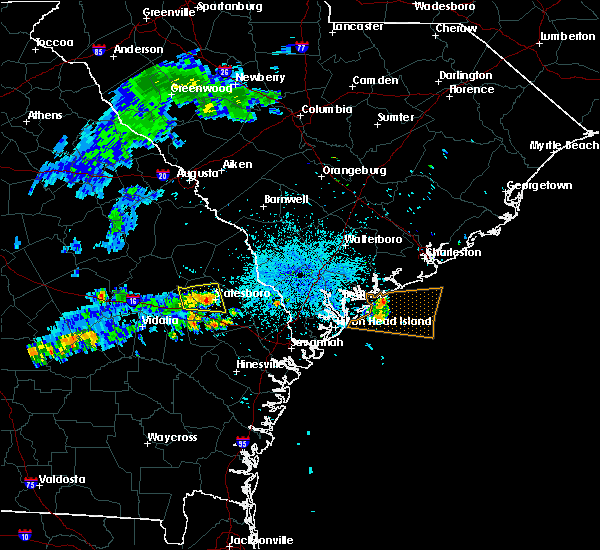 At 1016 pm edt, a severe thunderstorm was located over statesboro, moving east at 35 mph (radar indicated). Hazards include 60 mph wind gusts. Expect damage to roofs. siding and trees. Locations impacted include, statesboro, westside and middleground. At 1016 pm edt, a severe thunderstorm was located over statesboro, moving east at 35 mph (radar indicated). Hazards include 60 mph wind gusts. Expect damage to roofs. siding and trees. Locations impacted include, statesboro, westside and middleground.
|
| 7/1/2015 10:16 PM EDT | Tree down on wood valley circle road in bulloch county GA, 1.7 miles NNW of Statesboro, GA |
| 7/1/2015 10:16 PM EDT | Large tree down at 700 block pine straw ct in bulloch county GA, 2.5 miles S of Statesboro, GA |
| 7/1/2015 10:15 PM EDT | Tree down across road at 700 block of w jones ave in bulloch county GA, 1.8 miles E of Statesboro, GA |
| 7/1/2015 10:07 PM EDT |
 At 1007 pm edt, a severe thunderstorm was located over westside, moving east at 35 mph (radar indicated). Hazards include 60 mph wind gusts. Expect damage to roofs. siding and trees. Locations impacted include, statesboro, metter, westside, hopeulikit, westchester and middleground. At 1007 pm edt, a severe thunderstorm was located over westside, moving east at 35 mph (radar indicated). Hazards include 60 mph wind gusts. Expect damage to roofs. siding and trees. Locations impacted include, statesboro, metter, westside, hopeulikit, westchester and middleground.
|
| 7/1/2015 9:54 PM EDT |
 At 953 pm edt, a severe thunderstorm was located near metter, moving east at 35 mph (radar indicated). Hazards include 60 mph wind gusts. Expect damage to roofs. siding and trees. Locations impacted include, statesboro, metter, westside and middleground. At 953 pm edt, a severe thunderstorm was located near metter, moving east at 35 mph (radar indicated). Hazards include 60 mph wind gusts. Expect damage to roofs. siding and trees. Locations impacted include, statesboro, metter, westside and middleground.
|
| 7/1/2015 9:33 PM EDT |
 At 932 pm edt, a severe thunderstorm was located near stillmore, or 9 miles southeast of swainsboro, moving east at 35 mph (radar indicated). Hazards include 60 mph wind gusts. Expect damage to roofs. Siding and trees. At 932 pm edt, a severe thunderstorm was located near stillmore, or 9 miles southeast of swainsboro, moving east at 35 mph (radar indicated). Hazards include 60 mph wind gusts. Expect damage to roofs. Siding and trees.
|
| 6/30/2015 4:51 PM EDT | Tree down across highway 67 near intersection of emit grove church road in bulloch county GA, 7.3 miles NNW of Statesboro, GA |
| 6/30/2015 4:46 PM EDT | Tree down across highway 67 near intersection of emit grove church road in bulloch county GA, 7.3 miles NNW of Statesboro, GA |
| 6/30/2015 4:45 PM EDT | Two trees down on burkhalter rd...one near the intersection with hwy 67 and one at the intersection with cawana rd in bulloch county GA, 3.2 miles NNW of Statesboro, GA |
| 6/30/2015 4:39 PM EDT |
 At 439 pm edt, severe thunderstorms were located along a line extending from near burtons ferry landing to near register, moving east at 35 mph (radar indicated). Hazards include 60 mph wind gusts. Expect damage to roofs. Siding and trees. At 439 pm edt, severe thunderstorms were located along a line extending from near burtons ferry landing to near register, moving east at 35 mph (radar indicated). Hazards include 60 mph wind gusts. Expect damage to roofs. Siding and trees.
|
| 6/3/2015 3:35 PM EDT | The severe thunderstorm warning for bulloch county will expire at 345 pm edt, the storm which prompted the warning has weakened below severe limits, and no longer pose an immediate threat to life or property. therefore the warning will be allowed to expire. however heavy rain is still possible with this thunderstorm that could cause ponding of water on roadways. |
| 6/3/2015 3:26 PM EDT | Quarter sized hail reported 4.2 miles ENE of Statesboro, GA, public reported quarter size hail and gusty winds along cypress lake rd. |
| 6/3/2015 3:23 PM EDT | At 322 pm edt, a severe thunderstorm was located over register, or near statesboro, moving east at 10 mph (radar indicated. at 312 pm...the media relayed a public report of ping pong ball size hail south of statesboro). Hazards include 60 mph wind gusts and quarter size hail. Hail damage to vehicles is expected. expect wind damage to roofs, siding and trees. Locations impacted include, statesboro. |
| 6/3/2015 3:21 PM EDT | Quarter sized hail reported 3.5 miles NNE of Statesboro, GA, spotter reported quarter size hail and 4 inch branches down along langston chapel rd. |
| 6/3/2015 3:06 PM EDT | At 306 pm edt, a severe thunderstorm was located over register, or 7 miles south of westside, moving east at 10 mph (radar indicated). Hazards include 60 mph wind gusts and quarter size hail. Hail damage to vehicles is expected. Expect wind damage to roofs, siding and trees. |
| 6/1/2015 5:05 PM EDT | Quarter sized hail reported 4.9 miles SE of Statesboro, GA, public reported quarter size hail along hwy 80 outside statesboro. also very gusty winds. |
| 4/25/2015 8:17 PM EDT | At 817 pm edt, a severe thunderstorm was located near register, or 8 miles north of claxton, moving east at 40 mph (radar indicated). Hazards include quarter size hail and 60 mph wind gusts. Hail damage to vehicles is expected. expect wind damage to roofs, siding and trees. locations impacted include, statesboro, reidsville, metter, claxton and westside. 1. 00in. |
| 4/25/2015 8:12 PM EDT | Tree down near intersection of highway 67 and emit grove rd. time estimated from radar in bulloch county GA, 7.3 miles NNW of Statesboro, GA |
| 4/25/2015 8:07 PM EDT | At 806 pm edt, a severe thunderstorm was located over monteith, or 7 miles northeast of pooler, moving east at 35 mph (radar indicated). Hazards include quarter size hail and 60 mph wind gusts. Hail damage to vehicles is expected. Expect wind damage to roofs, siding and trees. |
| 4/25/2015 8:07 PM EDT | At 806 pm edt, a severe thunderstorm was located over monteith, or 7 miles northeast of pooler, moving east at 35 mph (radar indicated). Hazards include quarter size hail and 60 mph wind gusts. Hail damage to vehicles is expected. Expect wind damage to roofs, siding and trees. |
| 4/25/2015 7:57 PM EDT | At 757 pm edt, a severe thunderstorm was located near metter, moving east at 40 mph (radar indicated). Hazards include quarter size hail and 60 mph wind gusts. Hail damage to vehicles is expected. expect wind damage to roofs, siding and trees. locations impacted include, statesboro, reidsville, metter, claxton, westside and middleground. 1. 00in. |
| 4/25/2015 7:47 PM EDT | At 747 pm edt, a severe thunderstorm was located over aline, or near metter, moving east at 35 mph (radar indicated). Hazards include golf ball size hail and 70 mph wind gusts. People and animals outdoors will be injured. expect hail damage to roofs, siding, windows and vehicles. expect considerable tree damage. wind damage is also likely to mobile homes, roofs and outbuildings. locations impacted include, statesboro, reidsville, metter, claxton, westside and middleground. Possible. |
| 4/25/2015 7:27 PM EDT | At 725 pm edt, a severe thunderstorm was located near oak park, or 13 miles north of lyons, moving east at 40 mph (radar indicated). Hazards include quarter size hail and 60 mph wind gusts. Hail damage to vehicles is expected. Expect wind damage to roofs, siding and trees. |
| 4/19/2015 4:03 PM EDT | this alert has expired |
| 4/19/2015 3:50 PM EDT | Several trees and large limbs down in statesboro... west of statesboro... and south of statesbor in bulloch county GA, 0.8 miles SE of Statesboro, GA |
| 4/19/2015 3:43 PM EDT | this alert has expired |
| 4/19/2015 3:38 PM EDT | At 337 pm edt, severe thunderstorms were located along a line extending from near register to near midway, moving northeast at 45 mph. another severe thunderstorm was located 12 miles east of statesboro (radar indicated). Hazards include 60 mph wind gusts. Expect damage to roofs. Siding and trees. |
| 8/20/2014 8:04 PM EDT | Warning point reported tree down at the intersection of five chop road and highway 2 in bulloch county GA, 5 miles WSW of Statesboro, GA |
| 7/15/2014 4:38 PM EDT | Report of trees down in the lakeview are in bulloch county GA, 7.9 miles SSW of Statesboro, GA |
| 7/15/2014 4:29 PM EDT | Tree down in clit in bulloch county GA, 6.8 miles S of Statesboro, GA |
| 6/7/2014 8:30 PM EDT | Warning point reported multiple trees down around statesbor in bulloch county GA, 0.8 miles SE of Statesboro, GA |
| 6/6/2014 7:05 PM EDT | Numerous large trees down and across roads in statesbor in bulloch county GA, 2.4 miles NNE of Statesboro, GA |
| 6/6/2014 7:00 PM EDT | 15 to 20 large trees down along a line from register to statesboro to brookle in bulloch county GA, 2.4 miles NNE of Statesboro, GA |
| 5/25/2014 6:11 PM EDT | Quarter sized hail reported 8.2 miles SE of Statesboro, GA, hail ongoing for 7 minutes |
| 9/2/2013 5:39 PM EDT | Warning point reported power lines down on campu in bulloch county GA, 2.4 miles NNE of Statesboro, GA |
| 6/27/2013 4:42 PM EDT | Tree down on burkhalter roa in bulloch county GA, 3.2 miles NNW of Statesboro, GA |
| 3/18/2013 9:31 PM EDT | Tree fell on house on the 100 block of south roundtree street in bulloch county GA, 1.3 miles ESE of Statesboro, GA |
| 3/18/2013 9:30 PM EDT | Tree down at country club road near iron gate subdivision in bulloch county GA, 4.4 miles ENE of Statesboro, GA |
| 1/30/2013 9:03 PM EST | At least 3 trees down in statesbor in bulloch county GA, 0.8 miles SE of Statesboro, GA |
| 12/17/2012 2:50 PM EST | Bulloch county 911 center reported a tree down on maple street in statesbor in bulloch county GA, 1.8 miles ESE of Statesboro, GA |
| 8/11/2012 1:57 PM EDT | Bulloch county warning point reported a tree down on burkhalter road and golf club road. time estimated by rada in bulloch county GA, 5.8 miles N of Statesboro, GA |
| 5/17/2012 5:20 PM EDT | Dispatch center reported a tree down near intersection of hwy 24 and clito r in bulloch county GA, 6.4 miles WSW of Statesboro, GA |
| 3/24/2012 9:41 PM EDT | A couple of trees reported down along clito roa in bulloch county GA, 5.3 miles S of Statesboro, GA |
| 3/24/2012 9:41 PM EDT | One tree down along stillwater driv in bulloch county GA, 4 miles S of Statesboro, GA |
| 11/16/2011 8:15 PM EST | Quarter sized hail reported 7.1 miles SE of Statesboro, GA, trained spotter reported quarter size hail for 3 minutes. |
| 9/28/2011 1:05 AM EDT | Quarter sized hail reported 3.2 miles S of Statesboro, GA |
| 1/1/0001 12:00 AM | Nws employee reported numerous large tree limbs down near highways 301 and 17. time estimated by rada in bulloch county GA, 9.5 miles S of Statesboro, GA |
| 1/1/0001 12:00 AM | A nws employee reported numerous large tree limbs down near the intersection of highway 301 and state road 17. time estimated by rada in bulloch county GA, 9.5 miles S of Statesboro, GA |
| 1/1/0001 12:00 AM | Several 3 inch diamater magnolia tree limbs down. also received penny size hai in screven county GA, 9.9 miles SSW of Statesboro, GA |
| 1/1/0001 12:00 AM | Bulloch 911 center reports numerous large trees and power lines dow in bulloch county GA, 7.6 miles SSW of Statesboro, GA |
| 1/1/0001 12:00 AM | Bulloch 911 center reports a large tree down on a house on lakeview road. the house sustained enough damage where the occupants are being sheltered by the red cros in bulloch county GA, 6.1 miles S of Statesboro, GA |
| 1/1/0001 12:00 AM | Possible tornado. the tops sheared off large and very tall pine trees. some people reported that the wind was blowing from one direction than abruptly changed and was b in bulloch county GA, 7.3 miles SSE of Statesboro, GA |
| 1/1/0001 12:00 AM | One large tree limb fell into lakeview baptist churc in bulloch county GA, 6.1 miles S of Statesboro, GA |
| 9/25/2011 3:25 PM EDT | Golf Ball sized hail reported 9.2 miles SSE of Statesboro, GA, bulloch 911 center reports considerable hail damage across the northern part of the county. |
| 1/1/0001 12:00 AM | Large tree down on lakeview baptist churc in bulloch county GA, 6.1 miles S of Statesboro, GA |
| 1/1/0001 12:00 AM | A 50 feet tree fell and caused minor damage to a backyard deck. the tree created a large hole in the backyard where the expansive roots came out of the groun in bulloch county GA, 5.2 miles SSE of Statesboro, GA |
| 1/1/0001 12:00 AM | Large tree down over johnson street near west jones avenue. time estimated by rada in bulloch county GA, 1.8 miles E of Statesboro, GA |
| 1/1/0001 12:00 AM | One tree down blocking west jones ave. time estimated by rada in bulloch county GA, 1.2 miles E of Statesboro, GA |
| 1/1/0001 12:00 AM | One tree down blocking oc banks roa in bulloch county GA, 4.8 miles ESE of Statesboro, GA |
| 1/1/0001 12:00 AM | 911 center reported tree down on oc banks roa in bulloch county GA, 4.8 miles ESE of Statesboro, GA |
| 1/1/0001 12:00 AM | 911 center relayed report of trees down on coley boyd roa in bulloch county GA, 3.7 miles NE of Statesboro, GA |
| 1/1/0001 12:00 AM | 911 center relayed report of downed power lines along highway 8 in bulloch county GA, 3.3 miles WNW of Statesboro, GA |
| 1/1/0001 12:00 AM | 911 center relayed report of trees and power lines down on zettwell r in bulloch county GA, 4.7 miles W of Statesboro, GA |
| 1/1/0001 12:00 AM | Report of several large trees down in yard on clito roa in bulloch county GA, 0.8 miles SE of Statesboro, GA |
| 1/1/0001 12:00 AM | Tree down on power lines along north main street and debbie driv in bulloch county GA, 2 miles SSE of Statesboro, GA |
| 1/1/0001 12:00 AM | Roof damage to 2 buldings at the laurel point apartment in bulloch county GA, 0.7 miles SW of Statesboro, GA |
| 1/1/0001 12:00 AM | Multiple reports of trees and powerlines down around the city of statesbor in bulloch county GA, 0.8 miles SE of Statesboro, GA |
| 1/1/0001 12:00 AM | Tree down on a house on south college street in downtown statesbor in bulloch county GA, 0.8 miles SE of Statesboro, GA |
| 1/1/0001 12:00 AM | Quarter sized hail reported 3 miles N of Statesboro, GA |
Hail Maps for Statesboro, GA
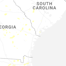
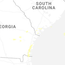
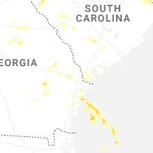


Connect with Interactive Hail Maps