

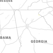
Hail Map for Friday, August 20, 2021

Number of Impacted Households on 8/20/2021
0
Impacted by 1" or Larger Hail
0
Impacted by 1.75" or Larger Hail
0
Impacted by 2.5" or Larger Hail
Square Miles of Populated Area Impacted on 8/20/2021
0
Impacted by 1" or Larger Hail
0
Impacted by 1.75" or Larger Hail
0
Impacted by 2.5" or Larger Hail


Cities Most Affected by Hail Storms of 8/20/2021
| Hail Size | Demographics of Zip Codes Affected | ||||||
|---|---|---|---|---|---|---|---|
| City | Count | Average | Largest | Pop Density | House Value | Income | Age |
Hail and Wind Damage Spotted on 8/20/2021
Filter by Report Type:Hail ReportsWind Reports
States Impacted
Minnesota, Florida, North Carolina, Georgia, Alabama, Texas, Nebraska, Kansas, North Dakota, Missouri, IowaMinnesota
| Local Time | Report Details |
|---|---|
| 1:55 PM CDT | Tin roof panel blown off a she in pennington county MN, 54.1 miles NW of Bemidji, MN |
| 4:46 PM CDT | Mesonet station mn015 alexandria 2ss in douglas county MN, 63.6 miles NNE of Montevideo, MN |
| 4:51 PM CDT | Asos station kaxn alexandria mn aso in douglas county MN, 65.3 miles NNE of Montevideo, MN |
Florida
| Local Time | Report Details |
|---|---|
| 3:20 PM EDT | Pine tree of about 1 foot in diameter down across fl-121 near northeast florida state hospital. time of event estimated with rada in baker county FL, 29.8 miles WSW of Jacksonville, FL |
North Carolina
| Local Time | Report Details |
|---|---|
| 4:03 PM EDT | Multiple trees down near the intersection of nc-42 e and glen laurel r in johnston county NC, 16 miles SE of Raleigh, NC |
| 4:07 PM EDT | One tree was reported down across the roadway near the intersection of loop rd and covered bridge rd. time estimated by rada in johnston county NC, 15.7 miles ESE of Raleigh, NC |
| 5:02 PM EDT | One tree was reported down near the intersection of us highway 301 s and black walnut rd. time estimated by rada in wilson county NC, 32.8 miles ESE of Raleigh, NC |
| 5:11 PM EDT | A tree was reported down near the 700 block of aycock dairy farm rd. time estimated by rada in wayne county NC, 37.8 miles ESE of Raleigh, NC |
| 8:13 PM EDT | A tree fell on power lines near the intersection of payne rd and brevard rd. the power lines fell on the car. time estimated by rada in alamance county NC, 40.1 miles WNW of Raleigh, NC |
| 8:28 PM EDT | A large tree was reported down near the intersection of chestnut ridge church rd and castanea rd. time estimated by rada in orange county NC, 34.4 miles WNW of Raleigh, NC |
| 10:30 PM EDT | Storm damage reported in new hanover county NC, 3.4 miles NNE of Wilmington, NC |
Georgia
| Local Time | Report Details |
|---|---|
| 4:57 PM EDT | Trees down off smith rd in tocco in stephens county GA, 44.5 miles WSW of Greenville, SC |
| 8:15 PM EDT | Tree and powerline reported down on palm st... between capitol st and dowling s in brantley county GA, 48.1 miles ESE of Douglas, GA |
Alabama
| Local Time | Report Details |
|---|---|
| 4:15 PM CDT | Report of tree down just before the intersection of highways 123 and 231 in ariton alabam in dale county AL, 72.1 miles SSW of Auburn, AL |
Texas
| Local Time | Report Details |
|---|---|
| 4:23 PM CDT | A wind gust of 60 mph was measured at the fst asos sit in pecos county TX, 58.9 miles NE of Alpine, TX |
Nebraska
| Local Time | Report Details |
|---|---|
| 4:36 PM CDT | Ping Pong Ball sized hail reported near Davenport, NE, 56.5 miles SSE of Grand Island, NE, corrects time of previous hail report from 6 sse davenport. delayed facebook report of hail to at least ping pong ball size. time estimated from radar. |
| 5:36 PM CDT | Ping Pong Ball sized hail reported near Davenport, NE, 56.5 miles SSE of Grand Island, NE, delayed facebook report of hail to at least ping pong ball size. time estimated from radar. |
| 5:40 PM CDT | Estimated 60-70 mph winds along highway 13 in thayer county NE, 70.4 miles SE of Grand Island, NE |
| 7:05 PM CDT | Multiple trees dow in johnson county NE, 61.2 miles SSW of Omaha, NE |
| 7:10 PM CDT | Multiple 3-4 inch branches dow in johnson county NE, 58.5 miles SSW of Omaha, NE |
| 8:03 PM CDT | Awos station kfnb falls city airpor in richardson county NE, 80.8 miles NE of Manhattan, KS |
Kansas
| Local Time | Report Details |
|---|---|
| 4:39 PM CDT | Late report. 58 mph gust reported 6 miles north of sylvan grov in lincoln county KS, 53.1 miles ENE of Hays, KS |
| 5:26 PM CDT | Quarter sized hail reported near Minneapolis, KS, 67.6 miles W of Manhattan, KS |
| 5:55 PM CDT | Spotter estimated 50-60mph wind gust in ottawa county KS, 53.1 miles W of Manhattan, KS |
| 6:01 PM CDT | Awos station klyo lyons rice co. municipal airp in rice county KS, 66.9 miles NW of Wichita, KS |
| 6:31 PM CDT | Asos station ksln salina regional airpor in saline county KS, 64.7 miles WSW of Manhattan, KS |
| 6:34 PM CDT | Damaged powerlines were reported from the public a long with a picture of the damag in saline county KS, 70.3 miles WSW of Manhattan, KS |
| 6:44 PM CDT | Personal weather station: kksholle in washington county KS, 59 miles NNW of Manhattan, KS |
| 6:54 PM CDT | 1 feet in diameter trees blown down... kdot signs blown dow in dickinson county KS, 38.6 miles WSW of Manhattan, KS |
| 7:04 PM CDT | 6 inch tree limb dow in dickinson county KS, 38.7 miles WSW of Manhattan, KS |
| 7:05 PM CDT | Spotter also reported small tree limbs flying and power is ou in dickinson county KS, 35.2 miles WSW of Manhattan, KS |
| 7:10 PM CDT | Storm damage reported in riley county KS, 19.1 miles NW of Manhattan, KS |
| 7:10 PM CDT | Storm damage reported in marshall county KS, 54.1 miles N of Manhattan, KS |
| 7:10 PM CDT | Dk 214 reported power outages... 2-3 inch limbs dow in dickinson county KS, 39.2 miles WSW of Manhattan, KS |
| 7:20 PM CDT | Social media post showing camper trailers flipped ove in geary county KS, 19 miles WSW of Manhattan, KS |
| 7:23 PM CDT | Corrects previous tstm wnd gst report from 5 se milfor in riley county KS, 14.8 miles WSW of Manhattan, KS |
| 7:23 PM CDT | Corrects previous tstm wnd gst report from 5 se milfor in riley county KS, 14.8 miles WSW of Manhattan, KS |
| 7:25 PM CDT | Storm damage reported in marshall county KS, 50.5 miles NNE of Manhattan, KS |
| 7:25 PM CDT | 2 foot diameter healthy tree down... estimated wind speed 60 to 70 mp in geary county KS, 17.7 miles SW of Manhattan, KS |
| 7:33 PM CDT | Metal roof blown off farm buildin in riley county KS, 4.5 miles NNW of Manhattan, KS |
| 7:35 PM CDT | Measured at mcpherson airpor in mcpherson county KS, 50.3 miles NNW of Wichita, KS |
| 7:39 PM CDT | Storm damage reported in mcpherson county KS, 50.3 miles NNW of Wichita, KS |
| 7:40 PM CDT | Large tree limbs dow in riley county KS, 4.2 miles NW of Manhattan, KS |
| 7:41 PM CDT | 60 to 70 mph reported in northwest mcpherson by nws employe in mcpherson county KS, 51.2 miles NNW of Wichita, KS |
| 7:50 PM CDT | Storm damage reported in mcpherson county KS, 49.1 miles NNW of Wichita, KS |
| 7:50 PM CDT | Mesonet station k5mcp k-61 @ k-153 interchange mcpherso in mcpherson county KS, 49.7 miles NNW of Wichita, KS |
| 7:51 PM CDT | Three utility poles and street signs downed... numerous trees damage in the city. estimated wind speeds were 60 to 70 mp in nemaha county KS, 52.9 miles NNE of Manhattan, KS |
| 8:03 PM CDT | Mesonet station up317 0.8 w canton (upr in mcpherson county KS, 48.1 miles N of Wichita, KS |
| 8:32 PM CDT | Report from mping: trees uprooted or snapped; roof blown of in mcpherson county KS, 48.8 miles NW of Wichita, KS |
| 9:15 PM CDT | Asos station khut hutchinson municipal airpor in reno county KS, 39.4 miles NW of Wichita, KS |
| 9:19 PM CDT | Asos station khut hutchinson municipal airpor in reno county KS, 39.4 miles NW of Wichita, KS |
| 9:40 PM CDT | Storm damage reported in harvey county KS, 24.6 miles NNW of Wichita, KS |
| 10:19 PM CDT | Storm damage reported in douglas county KS, 44 miles W of Kansas City, MO |
| 10:45 PM CDT | Tree down on house in lansin in leavenworth county KS, 19.5 miles WNW of Kansas City, MO |
| 10:55 PM CDT | Tree knocked down onto power lines at 171st and cantrell roa in leavenworth county KS, 21.9 miles WSW of Kansas City, MO |
| 10:57 PM CDT | Two inch branches knocked dow in wyandotte county KS, 9.2 miles WNW of Kansas City, MO |
| 10:57 PM CDT | Three inch branches knocked dow in wyandotte county KS, 9.8 miles WNW of Kansas City, MO |
| 11:06 PM CDT | Report from mping: 1-inch tree limbs broken; shingles blown of in johnson county KS, 8.6 miles SW of Kansas City, MO |
North Dakota
| Local Time | Report Details |
|---|---|
| 5:05 PM CDT | Storm damage reported in traill county ND, 46.3 miles NNW of Fargo, ND |
| 5:05 PM CDT | Spotter estimated wind gust of 70 mph on i-29 south of cummings nd. spotters car oscillating/vibrating and nearby semi struggled to remain uprigh in traill county ND, 45.3 miles NNW of Fargo, ND |
Missouri
| Local Time | Report Details |
|---|---|
| 5:45 PM CDT | Severe thunderstorm wind gusts snapped some tree limbs of in dade county MO, 21.2 miles WNW of Springfield, MO |
| 8:18 PM CDT | Tree down across road in mound city. traffic being reroute in holt county MO, 78.8 miles NNW of Kansas City, MO |
| 8:30 PM CDT | Lots of leaf litter reported on roadwa in holt county MO, 68 miles NNW of Kansas City, MO |
| 10:26 PM CDT | Report from mping: 1-inch tree limbs broken; shingles blown of in jackson county MO, 8.4 miles E of Kansas City, MO |
| 10:58 PM CDT | Report from mping: 1-inch tree limbs broken; shingles blown of in clay county MO, 10.9 miles N of Kansas City, MO |
| 11:09 PM CDT | 1 inch tree limbs broken... 2-3 inch thick branches down. 64 mph measured by automated weather equipmen in clay county MO, 10.8 miles N of Kansas City, MO |
| 11:15 PM CDT | Small to med sized tree limbs down. report via social medi in jackson county MO, 9 miles ESE of Kansas City, MO |
| 11:17 PM CDT | Small tree limbs down in raytown. report via social medi in jackson county MO, 9.2 miles SE of Kansas City, MO |
| 11:19 PM CDT | Report from mping: 1-inch tree limbs broken; shingles blown of in jackson county MO, 9.3 miles ESE of Kansas City, MO |
Iowa
| Local Time | Report Details |
|---|---|
| 6:16 PM CDT | Large tree snapped. also had 6 inch diameter tree branches dow in woodbury county IA, 34.8 miles W of Storm Lake, IA |
| 7:55 PM CDT | 4 in tree branch snapped - 2 branches. also reported ponding of water in city street in humboldt county IA, 50.7 miles E of Storm Lake, IA |
Connect with Interactive Hail Maps