

Hail Map for Wednesday, August 25, 2021

Number of Impacted Households on 8/25/2021
0
Impacted by 1" or Larger Hail
0
Impacted by 1.75" or Larger Hail
0
Impacted by 2.5" or Larger Hail
Square Miles of Populated Area Impacted on 8/25/2021
0
Impacted by 1" or Larger Hail
0
Impacted by 1.75" or Larger Hail
0
Impacted by 2.5" or Larger Hail


Cities Most Affected by Hail Storms of 8/25/2021
| Hail Size | Demographics of Zip Codes Affected | ||||||
|---|---|---|---|---|---|---|---|
| City | Count | Average | Largest | Pop Density | House Value | Income | Age |
| Russell, KS | 1 | 1.75 | 1.75 | 15 | $46k | $30.2k | 45.3 |
| Marienthal, KS | 1 | 1.75 | 1.75 | 2 | $34k | $38.1k | 46.5 |
| Galva, IL | 1 | 1.75 | 1.75 | 42 | $62k | $36.5k | 42.2 |
Hail and Wind Damage Spotted on 8/25/2021
Filter by Report Type:Hail ReportsWind Reports
States Impacted
Kansas, Indiana, Kentucky, Ohio, Florida, Illinois, Virginia, Tennessee, West Virginia, South Dakota, Alabama, North Carolina, Nebraska, South Carolina, Georgia, Mississippi, Utah, Maryland, Montana, North DakotaKansas
| Local Time | Report Details |
|---|---|
| 8:45 AM CDT | 2 to 3 inch tree limbs down. power poles down. estimated winds 40 to 50 mph. time estimated by rada in butler county KS, 19.5 miles E of Wichita, KS |
| 5:20 PM CDT | Corrects previous tstm wnd dmg report from ingalls. damage to a shed and some shingle damage to a few homes. report from social medi in gray county KS, 25 miles ESE of Garden City, KS |
| 7:10 PM CDT | Golf Ball sized hail reported near Marienthal, KS, 53.1 miles SSW of Colby, KS, caller reported golf ball sized hail. |
| 7:50 PM CDT | Caller reported an estimated 75 mph wind gus in logan county KS, 37.4 miles SSW of Colby, KS |
| 7:58 PM CDT | Golf Ball sized hail reported near Russell, KS, 27.1 miles E of Hays, KS, 50 to 60 mph winds too. |
| 8:01 PM CDT | Caller estimated 60 to 70 mph wind in logan county KS, 31.1 miles SW of Colby, KS |
| 8:06 PM CDT | Quarter sized hail reported near Winona, KS, 31.1 miles SW of Colby, KS, caller reported pea to quarter sized hail. |
| 8:15 PM CDT | Caller reported 60 to 70 mph winds. time estimated by rada in logan county KS, 29.9 miles SSW of Colby, KS |
| 8:20 PM CDT | Quarter sized hail reported near Winona, KS, 26.1 miles SSW of Colby, KS, spotter reported quarter sized hail. time estimated by radar. |
| 8:23 PM CDT | Mesonet station up840 9.0 w winona (upr) measured a sustained speed of 53 mph with a gust of 59 mp in logan county KS, 33.1 miles SW of Colby, KS |
| 9:00 PM CDT | Quarter sized hail reported near Colby, KS, 8.5 miles WSW of Colby, KS, off-duty nws employee reported quarter sized hail that lasted for a 10 minute duration. |
| 9:04 PM CDT | Reported via weather underground station kkscolby2 in thomas county KS, 13.7 miles SSW of Colby, KS |
Indiana
| Local Time | Report Details |
|---|---|
| 11:17 AM EDT | Large tree branch was blown dow in hamilton county IN, 12.9 miles NNE of Indianapolis, IN |
| 11:19 AM EDT | Report from mping: 3-inch tree limbs broken; power poles broke in marion county IN, 4.3 miles E of Indianapolis, IN |
| 12:00 PM EDT | Report received through twitter of a partial ceiling collapse in a classroom at avon high school due to heavy rain around noon time. time estimate in hendricks county IN, 12.9 miles W of Indianapolis, IN |
| 12:00 PM EDT | Tree limbs were blown down. some flooding. approximate location and time. reported received from twitte in hendricks county IN, 12.3 miles W of Indianapolis, IN |
| 12:00 PM EDT | A tree was blown down near avon intermediate west and accompanied by dime size hail and torrential rain. report with photo received via facebook. time is approximate in hendricks county IN, 13.3 miles W of Indianapolis, IN |
| 12:05 PM EDT | Blown over fences and trees. fencing blown 30 plus feet. rough approximation of location. time estimate in hendricks county IN, 12.8 miles W of Indianapolis, IN |
| 12:05 PM EDT | Construction signage blown onto east county road 200 north near heathermor neighborhood. time approximate in hendricks county IN, 11.8 miles W of Indianapolis, IN |
| 12:05 PM EDT | Corrects previous tstm wnd dmg report from avon to better document location. between rockville road and 100 north just west of state road 267 a portion of a fence and t in hendricks county IN, 13.3 miles W of Indianapolis, IN |
| 12:10 PM EDT | Report and photos of multiple trees blown down near 10th street and north emerson avenue. some street flooding. time is estimate in marion county IN, 3.8 miles ENE of Indianapolis, IN |
| 12:10 PM EDT | Storms have knocked out the power and blown down many tree branches. time approximated. report received via twitte in marion county IN, 3.6 miles ENE of Indianapolis, IN |
| 12:10 PM EDT | Tree limbs were blown down. location and time estimate in hendricks county IN, 13.6 miles WSW of Indianapolis, IN |
| 12:15 PM EDT | Forwarded report of multiple trees blown down...including onto power lines. time approximate in putnam county IN, 39 miles WSW of Indianapolis, IN |
| 12:20 PM EDT | Tree limbs were knocked down by thunderstorm winds. report received via twitter. time and location estimate in johnson county IN, 19.7 miles SSE of Indianapolis, IN |
| 7:15 PM CDT | Tree down on a house and truck in sherrod forest neighborhood of rensselaer... just west of i-65. time estimated by rada in jasper county IN, 68.3 miles SSE of Chicago, IL |
Kentucky
| Local Time | Report Details |
|---|---|
| 1:45 PM EDT | Large branches down on us 2 in pendleton county KY, 27.6 miles SSE of Cincinnati, OH |
| 3:36 PM EDT | Suspected microburst damage along dover road. one outdoor pavilion demolished. multiple larger branches down and one tree uprooted. one larger building with 14 foot ove in shelby county KY, 31.7 miles NE of Louisville, KY |
Ohio
| Local Time | Report Details |
|---|---|
| 3:40 PM EDT | Quarter sized hail reported near Proctorville, OH, 40.7 miles W of Charleston, WV, also several trees down. |
| 7:02 AM EDT | Limbs blown doown. tree down on fenc in fulton county OH, 59.7 miles ENE of Fort Wayne, IN |
Florida
| Local Time | Report Details |
|---|---|
| 4:08 PM EDT | Broadcast media relayed a video from a viewer showing 50+ mph winds. furthermore... a 6 inch tree was snapped... vinyl fencing was blown out... and a trampoline tosse in lee county FL, 41.4 miles N of Naples, FL |
| 6:27 PM EDT | Emergency manager reported powerlines down in the area of 74th ave and 113th st north. numerous other electrical hazards due to powerlines across pinellas. 5300 custome in pinellas county FL, 27.3 miles NNW of Bradenton, FL |
Illinois
| Local Time | Report Details |
|---|---|
| 3:15 PM CDT | Quarter sized hail reported near Chrisman, IL, 46.4 miles ENE of Mattoon, IL |
| 4:12 PM CDT | Golf Ball sized hail reported near Galva, IL, 41.6 miles NW of Peoria, IL |
| 4:15 PM CDT | Em reports numerous tree limbs down across the county along with powerlines down from the wind. a few houses had shingles removed as well as the storm moved through the in henry county IL, 44.8 miles NW of Peoria, IL |
| 4:27 PM CDT | Storm damage reported in knox county IL, 43 miles NW of Peoria, IL |
| 4:28 PM CDT | Estimated 60 mph wind gust just north of nakom in henry county IL, 45.8 miles NW of Peoria, IL |
| 5:54 PM CDT | Quarter sized hail reported near Oak Brook, IL, 16.6 miles W of Chicago, IL, mostly pea to dime size hail with at least one quarter size hailstone. |
| 5:57 PM CDT | Photo shared on social media shows large portion of roofing material peeled back on a house. time estimated by rada in dupage county IL, 16.4 miles WSW of Chicago, IL |
| 5:59 PM CDT | Quarter sized hail reported near Villa Park, IL, 17.4 miles W of Chicago, IL, picture from social media showing 1 inch hailstone. time estimated by radar. |
| 6:09 PM CDT | Quarter sized hail reported near Peoria, IL, 3.5 miles NNW of Peoria, IL |
| 6:09 PM CDT | Estimated 60 mph winds downed power lines near lake ave & university s in peoria county IL, 3.5 miles NNW of Peoria, IL |
| 6:30 PM CDT | Local em relayed at least 60 mph winds and pea size hail. time estimated by rada in cook county IL, 24.1 miles SW of Chicago, IL |
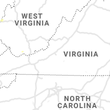
Virginia
| Local Time | Report Details |
|---|---|
| 4:20 PM EDT | Tree down on the 3000 block of watts passage road near the intersection with doctors crossing in albemarle county VA, 58.3 miles NW of Richmond, VA |
| 4:20 PM EDT | Tree down on the 3000 block of watts farm road in albemarle county VA, 59.2 miles NW of Richmond, VA |
| 5:40 PM EDT | Several trees and wires down in the mount solon are in augusta county VA, 57.4 miles SE of Elkins, WV |
| 5:45 PM EDT | Trees and wires down near bridgewater. tree down near the intersection of va-613 jordan hill road and va-729 cambell road. wires down in the 300 block of north main str in rockingham county VA, 57.5 miles SE of Elkins, WV |
| 5:50 PM EDT | Several trees blew down near stringtown and berryville... including two in the 1400 block of va-656 longmarsh road and one in the 200 block of va-654 stringtown roa in clarke county VA, 76.4 miles W of Baltimore, MD |
| 5:55 PM EDT | Trees down near broadway... including near the intersection of va-801 holsinger road and dove lan in rockingham county VA, 61.2 miles ESE of Elkins, WV |
| 5:55 PM EDT | Several trees and wires down near mount sidne in augusta county VA, 65.5 miles SE of Elkins, WV |
| 6:03 PM EDT | Tree down on the 100 block of 1st street in page county VA, 77.5 miles ESE of Elkins, WV |
| 6:03 PM EDT | Tree down on mills creek crossroads near the intersection of rte 638 in page county VA, 75.6 miles ESE of Elkins, WV |
| 6:13 PM EDT | Tree down on mill creek road near the intersection with state rte 639 in page county VA, 76.6 miles ESE of Elkins, WV |
| 6:15 PM EDT | Tree down in the riverheads are in augusta county VA, 67.4 miles NE of Roanoke, VA |
| 6:25 PM EDT | Several trees blew down along va-674 green road near bealeto in fauquier county VA, 75.9 miles N of Richmond, VA |
| 6:45 PM EDT | Tree down on va-653 shreve mill road. branches up to 3 inches in diameter down nearby in brambleto in loudoun county VA, 54 miles WSW of Baltimore, MD |
| 6:45 PM EDT | Trees down on va-734 snickersville turnpik in loudoun county VA, 62.7 miles WSW of Baltimore, MD |
Tennessee
| Local Time | Report Details |
|---|---|
| 4:25 PM EDT | Tree in roadway at fredonia road and blossom roa in knox county TN, 5.2 miles NW of Knoxville, TN |
| 4:28 PM EDT | Tree blocking the road at crosby drive and lonas driv in knox county TN, 3.3 miles W of Knoxville, TN |
| 4:40 PM EDT | Tree down on cumberland avenue at henley stree in knox county TN, 0.1 miles SE of Knoxville, TN |
| 4:45 PM EDT | Tree across the road on dale avenue between the interstate ramps and n 17th street blocking the entire roadwa in knox county TN, 1.1 miles W of Knoxville, TN |
| 4:45 PM EDT | Tree down on glenoaks drive and hutton roa in knox county TN, 4.1 miles NNW of Knoxville, TN |
West Virginia
| Local Time | Report Details |
|---|---|
| 4:34 PM EDT | Multiple reports of trees and powerlines down in the areas of ranson and charles town in jefferson county WV, 67 miles W of Baltimore, MD |
| 6:00 PM EDT | A few trees dow in mcdowell county WV, 64.2 miles S of Charleston, WV |
| 6:23 PM EDT | A few trees dow in mcdowell county WV, 64.2 miles S of Charleston, WV |
South Dakota
| Local Time | Report Details |
|---|---|
| 4:01 PM CDT | Ping Pong Ball sized hail reported near Springfield, SD, 47.2 miles NE of Oneill, NE, spotter reported ongoing heavy rain... strong winds... dime sized hail with occasional ping pong sized hail. |
| 1:20 AM MDT | Storm damage reported in harding county SD, 124 miles ESE of Miles City, MT |
Alabama
| Local Time | Report Details |
|---|---|
| 4:15 PM CDT | Trees and power lines down along liberty rd. time estimate in elmore county AL, 30.8 miles W of Auburn, AL |
| 5:42 PM CDT | Tree fell on power lines and traffic lights are out at the intersection of shug jordan pkwy and wire rd. time estimate in lee county AL, 2 miles SW of Auburn, AL |
| 5:58 PM CDT | Tree down near the intersection of smith rd and hwy 11. time estimate in shelby county AL, 14.6 miles SSE of Birmingham, AL |
North Carolina
| Local Time | Report Details |
|---|---|
| 5:27 PM EDT | 911 call center reported tree down in the road near lowland dairy road and grandhaven driv in gaston county NC, 13.2 miles NW of Charlotte, NC |
| 5:47 PM EDT | 911 call center reported tree down in the road near robinson rd and cedar grove driv in gaston county NC, 19.6 miles W of Charlotte, NC |
| 6:47 PM EDT | Amateur radio reported tree down blocking the road on nc-150 & mccorkle rd. also reported multiple trees down across the count in lincoln county NC, 27.1 miles NW of Charlotte, NC |
Nebraska
| Local Time | Report Details |
|---|---|
| 4:30 PM CDT | Multiple large 10 inch tree limbs blown down. time estimated from rada in cedar county NE, 66.7 miles SSW of Sioux Falls, SD |
South Carolina
| Local Time | Report Details |
|---|---|
| 5:37 PM EDT | Public reported powerlines down near taylors mil in greenville county SC, 19.2 miles ENE of Greenville, SC |
| 6:30 PM EDT | Amateur radio reported multiple trees down on piney rd & piney d in greenville county SC, 8.1 miles ENE of Greenville, SC |
| 6:50 PM EDT | 911 call center reported trees and power lines down on crosswell school rd in pickens county SC, 4.6 miles E of Greenville, SC |
Georgia
| Local Time | Report Details |
|---|---|
| 6:00 PM EDT | Tree fell on a house near the intersection of riley rd and old beulah r in douglas county GA, 16.8 miles W of Atlanta, GA |
| 7:05 PM EDT | Tree down across north helton rd near liberty roa in douglas county GA, 28.8 miles WSW of Atlanta, GA |
| 7:20 PM EDT | Several trees and power lines were downed along bethesda church road between roopville and tyu in carroll county GA, 47.2 miles WSW of Atlanta, GA |
Mississippi
| Local Time | Report Details |
|---|---|
| 6:42 PM CDT | A tree and power line were blown down in georgetown. the tree fell onto a home at the intersection of main street and catching avenue. storm that moved through the regi in copiah county MS, 29.6 miles S of Jackson, MS |
Utah
| Local Time | Report Details |
|---|---|
| 6:15 PM MDT | Measured on a personal weather station in salt lake county UT, 19.3 miles S of Salt Lake City, UT |
| 7:45 PM MDT | Multiple downed trees reported through social media with photos in pleasant grov in utah county UT, 28.1 miles SSE of Salt Lake City, UT |
Maryland
| Local Time | Report Details |
|---|---|
| 9:48 PM EDT | Tree down at the intersectino of national pike and mountain r in allegany county MD, 81.9 miles SSW of State College, PA |
| 10:17 PM EDT | Tree down at the intersectino of national pike and mountain r in washington county MD, 78.3 miles SSW of State College, PA |
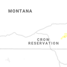
Montana
| Local Time | Report Details |
|---|---|
| 9:55 PM MDT | Quarter sized hail reported near Ashland, MT, 59.9 miles SSW of Miles City, MT |
North Dakota
| Local Time | Report Details |
|---|---|
| 1:40 AM MDT | Storm damage reported in harding county SD, 123.4 miles N of Rapid City, SD |
| 2:06 AM MDT | Asos station khei hettinger airpor in adams county ND, 104.6 miles WSW of Bismarck, ND |
Connect with Interactive Hail Maps