

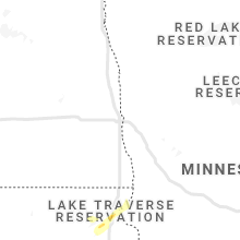
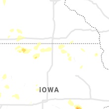
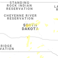
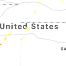
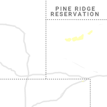
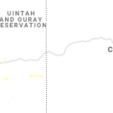
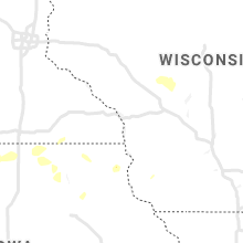
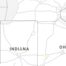
Hail Map for Thursday, August 26, 2021

Number of Impacted Households on 8/26/2021
0
Impacted by 1" or Larger Hail
0
Impacted by 1.75" or Larger Hail
0
Impacted by 2.5" or Larger Hail
Square Miles of Populated Area Impacted on 8/26/2021
0
Impacted by 1" or Larger Hail
0
Impacted by 1.75" or Larger Hail
0
Impacted by 2.5" or Larger Hail


Cities Most Affected by Hail Storms of 8/26/2021
| Hail Size | Demographics of Zip Codes Affected | ||||||
|---|---|---|---|---|---|---|---|
| City | Count | Average | Largest | Pop Density | House Value | Income | Age |
| Rapid City, SD | 3 | 2.42 | 3.00 | 112 | $107k | $44.5k | 40.8 |
| Hill City, SD | 2 | 1.88 | 2.00 | 3 | $97k | $36.2k | 47.3 |
| Sigourney, IA | 1 | 1.75 | 1.75 | 22 | $60k | $34.6k | 46.1 |
Hail and Wind Damage Spotted on 8/26/2021
Filter by Report Type:Hail ReportsWind Reports
States Impacted
South Dakota, Minnesota, Pennsylvania, Virginia, Delaware, Maryland, Ohio, Kentucky, Illinois, West Virginia, District of Columbia, Missouri, North Carolina, Colorado, Indiana, Wyoming, Utah, Tennessee, Kansas, New Jersey, Montana, Nebraska, Georgia, IowaSouth Dakota
| Local Time | Report Details |
|---|---|
| 7:40 AM CDT | Storm damage reported in faulk county SD, 51.7 miles SW of Aberdeen, SD |
| 7:59 AM CDT | Corrects previous non-tstm wnd gst report from 17 w polo. mesonet station 215 jct sd47/sd26 (sddot in hyde county SD, 52.7 miles ENE of Pierre, SD |
| 8:05 AM CDT | Personal weather statio in faulk county SD, 49.1 miles SW of Aberdeen, SD |
| 8:11 AM CDT | Mesonet station 158 miranda (sddot in hand county SD, 45.5 miles SSW of Aberdeen, SD |
| 8:12 AM CDT | Estimated 70 mph wind gust related via social media. time estimated via rada in hand county SD, 57.7 miles SSW of Aberdeen, SD |
| 8:26 AM CDT | Mesonet station 175 mellette (sddot in spink county SD, 20.7 miles S of Aberdeen, SD |
| 8:35 AM CDT | Tree trunk split and broke off of larger tree. multiple small branches down to in spink county SD, 49.7 miles S of Aberdeen, SD |
| 8:40 AM CDT | Several tree branches down near the redfield airport. time estimated via rada in spink county SD, 41.4 miles S of Aberdeen, SD |
| 8:55 AM CDT | 8 power poles down and many of them snapped of in spink county SD, 42.4 miles SSE of Aberdeen, SD |
| 8:57 AM CDT | 4 inch diameter tree snapped and damage to the elevator in town. time estimated from rada in spink county SD, 43 miles SSE of Aberdeen, SD |
| 9:09 AM CDT | Asos station khon huron regional airpor in beadle county SD, 74.9 miles S of Aberdeen, SD |
| 9:22 AM CDT | Multiple trees down in town. one uprooted. powerlines down and power out in parts of tow in clark county SD, 54.5 miles SE of Aberdeen, SD |
| 9:27 AM CDT | Estimated 60 mph winds and a tree branch dow in clark county SD, 54.1 miles SE of Aberdeen, SD |
| 9:31 AM CDT | Mesonet station 143 peever (sddot in roberts county SD, 71.4 miles WNW of Montevideo, MN |
| 9:32 AM CDT | Tree down on a house in willow lake. time estimated via rada in clark county SD, 70.7 miles SE of Aberdeen, SD |
| 9:36 AM CDT | Mesonet station 174 clark (sddot in clark county SD, 59.7 miles SE of Aberdeen, SD |
| 9:40 AM CDT | 60 mph winds at mayfield colon in clark county SD, 69.9 miles SE of Aberdeen, SD |
| 9:50 AM CDT | Spotter reported dark roll clouds... short lived strong winds. reported trees down and a semi rolled over off hwy 14... west of town. still investigating if that was wi in kingsbury county SD, 71.2 miles NW of Sioux Falls, SD |
| 9:54 AM CDT | Pea to dime size hail. estimated wind gusts of 50 to 60 mp in hamlin county SD, 79.1 miles SE of Aberdeen, SD |
| 10:01 AM CDT | Asos station katy watertown muni a in codington county SD, 70.4 miles W of Montevideo, MN |
| 10:02 AM CDT | Multiple trees and branches down across town. also power outages in town. time estimated via radar and other ob in codington county SD, 68.4 miles W of Montevideo, MN |
| 10:02 AM CDT | Personal weather station. time estimated by rada in hamlin county SD, 73 miles WSW of Montevideo, MN |
| 10:04 AM CDT | Storm damage reported in hamlin county SD, 66.3 miles WSW of Montevideo, MN |
| 10:09 AM CDT | Numerous tree branches dow in codington county SD, 68.4 miles W of Montevideo, MN |
| 10:15 AM CDT | Tree fell on car in arlington... spotter also estimated winds to be 50-60 mph. short lived even in kingsbury county SD, 60.3 miles NNW of Sioux Falls, SD |
| 10:22 AM CDT | Soc media report of trees down in the lake sinai are in brookings county SD, 51 miles NNW of Sioux Falls, SD |
| 10:31 AM CDT | Mesonet station 291 4n altamont (sddot in deuel county SD, 47.4 miles W of Montevideo, MN |
| 10:31 AM CDT | Mesonet station 47 brandt (sddot in deuel county SD, 57.8 miles WSW of Montevideo, MN |
| 10:37 AM CDT | Small metal shed destroye in brookings county SD, 50.8 miles N of Sioux Falls, SD |
| 5:29 PM MDT | Quarter sized hail reported near Lead, SD, 35.2 miles WNW of Rapid City, SD |
| 6:20 PM MDT | Hen Egg sized hail reported near Hill City, SD, 28.1 miles WSW of Rapid City, SD |
| 7:00 PM MDT | Golf Ball sized hail reported near Hill City, SD, 19.9 miles WSW of Rapid City, SD |
| 7:30 PM MDT | Hen Egg sized hail reported near Rapid City, SD, 8.4 miles S of Rapid City, SD |
| 7:30 PM MDT | Hen Egg sized hail reported near Rapid City, SD, 8.4 miles S of Rapid City, SD, hundreds of cars and rv's damaged from hail...hail lasted 10 minutes |
| 7:38 PM MDT | Quarter sized hail reported near Rapid City, SD, 4.2 miles S of Rapid City, SD |
| 7:40 PM MDT | Tea Cup sized hail reported near Rapid City, SD, 7.6 miles SSE of Rapid City, SD |
| 7:56 PM MDT | Quarter sized hail reported near Rapid City, SD, 8.8 miles ESE of Rapid City, SD |
| 8:05 PM MDT | Quarter sized hail reported near Rapid City, SD, 14 miles ESE of Rapid City, SD |
| 11:31 PM MDT | Personal weather statio in stanley county SD, 32.2 miles W of Pierre, SD |
| 11:49 PM MDT | Mesonet station 202 hayes (sddot in stanley county SD, 20.8 miles W of Pierre, SD |
| 3:58 AM CDT | Mesonet station 13 vivian (sddot in lyman county SD, 22 miles S of Pierre, SD |
Minnesota
| Local Time | Report Details |
|---|---|
| 10:57 AM CDT | Spotter reports trees down in ivanho in lincoln county MN, 42.9 miles SW of Montevideo, MN |
| 11:10 AM CDT | Tree branch down over power line. time estimated by rada in swift county MN, 22.7 miles NW of Montevideo, MN |
| 11:15 AM CDT | Medium to large rotted tree down... picture via twitte in swift county MN, 26.9 miles NNW of Montevideo, MN |
| 11:15 AM CDT | Large... rotted tree down over sidewalk. picture via twitter. time estimated by rada in freeborn county MN, 35.8 miles NNW of Mason City, IA |
| 11:15 AM CDT | Tree trunk split and large branches down. picture via twitter... time estimated by rada in freeborn county MN, 35.9 miles NNW of Mason City, IA |
| 11:19 AM CDT | Storm damage reported in lyon county MN, 35.1 miles S of Montevideo, MN |
| 11:36 AM CDT | Awos station kbbb benson a in swift county MN, 25.6 miles N of Montevideo, MN |
| 12:52 PM CDT | Branch down over roadway... unknown siz in mcleod county MN, 54.6 miles W of Minneapolis, MN |
| 1:04 PM CDT | Three to four 6 inch branches down in glencoe... one 16 inch diameter branch down on top of house. time estimated by rada in mcleod county MN, 45.8 miles WSW of Minneapolis, MN |
| 1:38 PM CDT | 3 inch branch down in waconia. time estimated by rada in carver county MN, 27.3 miles WSW of Minneapolis, MN |
| 1:53 PM CDT | 12 inch diameter tree snapped at bas in carver county MN, 25.8 miles WSW of Minneapolis, MN |
| 2:00 PM CDT | Storm damage reported in scott county MN, 19.1 miles SW of Minneapolis, MN |
| 2:00 PM CDT | Several 3 inch branches dow in hennepin county MN, 11.2 miles W of Minneapolis, MN |
| 2:00 PM CDT | Facebook picture of 2ft diameter tree snapped near chanhassen library. time estimated by rada in carver county MN, 15.8 miles WSW of Minneapolis, MN |
| 2:06 PM CDT | Report from mping: 1-inch tree limbs broken; shingles blown of in stearns county MN, 71.5 miles NW of Minneapolis, MN |
| 2:10 PM CDT | 3 to 6 inch branch down on county road 19 in tonka bay near city hal in hennepin county MN, 16.5 miles WSW of Minneapolis, MN |
| 2:17 PM CDT | Report from mping: 1-inch tree limbs broken; shingles blown of in hennepin county MN, 11.7 miles SW of Minneapolis, MN |
| 2:20 PM CDT | Storm damage reported in hennepin county MN, 11.7 miles SW of Minneapolis, MN |
| 2:24 PM CDT | 65mph gust recorded on handheld weather senso in scott county MN, 18.9 miles SW of Minneapolis, MN |
| 2:25 PM CDT | Several 1/2 to 1 inch tree branches dow in hennepin county MN, 9.5 miles NW of Minneapolis, MN |
| 2:28 PM CDT | Large tree uprooted in eastern richfield... picture via twitte in hennepin county MN, 6.9 miles S of Minneapolis, MN |
| 2:31 PM CDT | Report from mping: 1-inch tree limbs broken; shingles blown of in dakota county MN, 15.8 miles S of Minneapolis, MN |
Pennsylvania
| Local Time | Report Details |
|---|---|
| 1:23 PM EDT | Trees down in barrett township including on grable road and playhouse road. time estimated from rada in monroe county PA, 26.2 miles SE of Scranton, PA |
| 5:46 PM EDT | Tree down into a house resulting in structural damage on prospect avenue from thunderstorm outflow winds. time estimated from radar and dispatch repor in monroe county PA, 20.5 miles SE of Scranton, PA |
| 5:46 PM EDT | Downed trees and wires near tanglewood drive. time estimated from rada in monroe county PA, 23.7 miles SSE of Scranton, PA |
| 6:25 PM EDT | Downed trees and wires near lake drive. time estimated from rada in carbon county PA, 34.7 miles S of Scranton, PA |
| 6:35 PM EDT | A couple of trees down in franklin township. time estimated from rada in carbon county PA, 36.6 miles S of Scranton, PA |
Virginia
| Local Time | Report Details |
|---|---|
| 1:43 PM EDT | Tree down on route 1 near the intersection with joplin road in prince william county VA, 65 miles SW of Baltimore, MD |
| 1:48 PM EDT | Tree down on northbound us-1 jefferson davis highway near va-637 telegraph roa in stafford county VA, 67.7 miles SW of Baltimore, MD |
| 1:50 PM EDT | Tree down on power lines in the 100 block of va-635 decatur roa in stafford county VA, 68.1 miles NNE of Richmond, VA |
| 2:30 PM EDT | Trees down near the intersection of us-1 jefferson davis highway and shady hill lan in stafford county VA, 63 miles N of Richmond, VA |
| 2:40 PM EDT | Tree down in the 100 block of pine view driv in stafford county VA, 61.3 miles N of Richmond, VA |
| 2:40 PM EDT | Trees down in the 2100 block of va-608 brooke road... and near the intersection of va-608 brooke road and va-628 eskimo hill roa in stafford county VA, 62.5 miles NNE of Richmond, VA |
| 2:40 PM EDT | Tree down on northbound va-627 forbes street near thomas jefferson plac in stafford county VA, 58.7 miles N of Richmond, VA |
| 3:34 PM EDT | Tree down on the 1900 block of south howard street in city of alexandria county VA, 41.8 miles SW of Baltimore, MD |
| 3:43 PM EDT | Multiple trees down near the intersection of 14th street and south pollard street in arlington county VA, 39.7 miles SW of Baltimore, MD |
| 4:05 PM EDT | Two to three dozen reports of trees and wires down in arlingto in arlington county VA, 37.7 miles SW of Baltimore, MD |
| 4:05 PM EDT | Trees down on i-66 custis memorial parkway near mile marker 7 in arlington county VA, 37.3 miles SW of Baltimore, MD |
| 4:17 PM EDT | Trees down on southbound george washington parkway at va-123 dolley madison boulevard/chain bridge roa in fairfax county VA, 37 miles SW of Baltimore, MD |
Delaware
| Local Time | Report Details |
|---|---|
| 2:34 PM EDT | Tree down into power lines. time estimated from rada in sussex county DE, 37.5 miles NW of Ocean City, MD |
| 2:38 PM EDT | Trees down onto power lines on middleford road in seaford. time estimated from rada in sussex county DE, 35 miles NW of Ocean City, MD |
| 2:40 PM EDT | Tree limbs down in laurel due to strong outflow winds from incoming thunderstorm. time based on the report and rada in sussex county DE, 30.1 miles WNW of Ocean City, MD |
Maryland
| Local Time | Report Details |
|---|---|
| 2:40 PM EDT | Tree down on northbound md-382 croom road at river airport roa in prince georges county MD, 42.5 miles S of Baltimore, MD |
| 4:10 PM EDT | Tree and wires down near the intersection of us-1 baltimore avenue and md-410 east-west highwa in prince georges county MD, 28.9 miles SW of Baltimore, MD |
| 4:26 PM EDT | Trees down on westbound macarthur boulevard near persimmon tree roa in montgomery county MD, 37.4 miles SW of Baltimore, MD |
| 5:32 PM EDT | Tree down and large branches down on blenheim road nort in baltimore county MD, 14.3 miles NNE of Baltimore, MD |
| 6:10 PM EDT | Numerous trees down in the flintstone are in allegany county MD, 84.3 miles SSW of State College, PA |
Ohio
| Local Time | Report Details |
|---|---|
| 2:53 PM EDT | Trees reported down in miami township. time estimated from rada in montgomery county OH, 40.5 miles NNE of Cincinnati, OH |
| 2:54 PM EDT | Multiple trees reported down. time estimated from rada in montgomery county OH, 52.1 miles NNE of Cincinnati, OH |
| 3:15 PM EDT | Trees reported down in the city. time estimated from rada in montgomery county OH, 48.1 miles NNE of Cincinnati, OH |
| 3:48 PM EDT | Tree down due to thunderstorm win in miami county OH, 56.7 miles W of Columbus, OH |
| 4:08 PM EDT | Tree down from thunderstorm wind. time estimated from rada in miami county OH, 70.4 miles N of Cincinnati, OH |
| 4:27 PM EDT | Storm damage reported in madison county OH, 24.4 miles W of Columbus, OH |
| 6:40 PM EDT | Power poles reported down. time estimated from rada in adams county OH, 56.4 miles ESE of Cincinnati, OH |
Kentucky
| Local Time | Report Details |
|---|---|
| 3:15 PM EDT | Trees reported down in the city. time estimated from rada in campbell county KY, 2.4 miles E of Cincinnati, OH |
| 7:52 PM EDT | 15 wires down in louisville... the first of which was around 752 p in jefferson county KY, 18.3 miles N of Louisville, KY |
| 8:05 PM EDT | Quarter sized hail reported near Louisville, KY, 16.7 miles N of Louisville, KY, report relayed via twitter. |
| 8:11 PM EDT | Around 12 trees down in louisville and one structure collaps in jefferson county KY, 18.3 miles N of Louisville, KY |
Illinois
| Local Time | Report Details |
|---|---|
| 2:30 PM CDT | Tree blown over. via twitter with pictur in montgomery county IL, 54.4 miles NE of Saint Louis, MO |
| 3:15 PM CDT | Several large trees down around town. time estimated. via social medi in christian county IL, 38.2 miles W of Mattoon, IL |
| 4:37 PM CDT | Several power lines down and snapped tree branche in greene county IL, 57.1 miles N of Saint Louis, MO |
| 5:00 PM CDT | Four power poles downed by thunderstorm wind in adams county IL, 38.1 miles SE of Kahoka, MO |
| 6:00 PM CDT | Multiple power poles leaned over and a few that were snapped. a few trees and several large limbs downed. damage mostly confined to south side of greenvill in bond county IL, 46.1 miles ENE of Saint Louis, MO |
West Virginia
| Local Time | Report Details |
|---|---|
| 3:57 PM EDT | Tree down on house on the 100 block of beagle boot lane in grant county WV, 38.2 miles ENE of Elkins, WV |
| 3:58 PM EDT | 2 trees down along lunice creek highway just se of maysvill in grant county WV, 39.3 miles ENE of Elkins, WV |
| 5:15 PM EDT | Two trees down in keyser... including one onto a hous in mineral county WV, 58.5 miles NE of Elkins, WV |
| 5:30 PM EDT | Tree down along wv-29 sperrys runs roa in hardy county WV, 62.7 miles E of Elkins, WV |
District of Columbia
| Local Time | Report Details |
|---|---|
| 3:57 PM EDT | Large trees down with at least one snapped on 16th street northwest near piney branc in district of columb county DC, 33.5 miles SW of Baltimore, MD |
| 4:00 PM EDT | Trees down on northbound us-29 georgia avenue northwest near jefferson street northwes in district of columb county DC, 32.1 miles SW of Baltimore, MD |
| 4:05 PM EDT | There were about two dozen reports of trees and wires blown down... mainly across northwest d in district of columb county DC, 34.1 miles SW of Baltimore, MD |
| 4:12 PM EDT | Tree on a house in the 4100 block of fordham road northwes in district of columb county DC, 35.8 miles SW of Baltimore, MD |
| 4:20 PM EDT | Large trees down with at least one snapped on 16th street northwest near piney branc in district of columb county DC, 33.5 miles SW of Baltimore, MD |
| 4:20 PM EDT | Tree on a house in the 4100 block of fordham road northwes in district of columb county DC, 35.8 miles SW of Baltimore, MD |
Missouri
| Local Time | Report Details |
|---|---|
| 3:17 PM CDT | Corrects previous tstm wnd dmg report from 2 ese maryland heights. large tree down near 270 and dorsett road. time estimated from rada in st. louis county MO, 14.7 miles WNW of Saint Louis, MO |
| 3:50 PM CDT | Large tree limbs down in tilles par in st. louis county MO, 8.7 miles W of Saint Louis, MO |
| 5:30 PM CDT | Medium sized tree snapped off. via twitter with picture of tre in boone county MO, 7.4 miles N of Columbia, MO |
| 7:45 PM CDT | Power pole dow in moniteau county MO, 26.2 miles SSW of Columbia, MO |
| 3:17 AM CDT | Large tree down near 270 and dorsett road. time estimated from rada in st. louis county MO, 14.7 miles WNW of Saint Louis, MO |
North Carolina
| Local Time | Report Details |
|---|---|
| 4:25 PM EDT | Trees and power lines reported down from a trained spotter. time estimated by rada in forsyth county NC, 74.1 miles S of Roanoke, VA |
| 4:25 PM EDT | Power lines reported down near the 3900 block of grubbs rd. time estimated by rada in forsyth county NC, 73.4 miles S of Roanoke, VA |
| 4:44 PM EDT | Several trees down in and around morganto in burke county NC, 60.3 miles NW of Charlotte, NC |
| 4:44 PM EDT | Tree down on i40 at mm10 in burke county NC, 60 miles NW of Charlotte, NC |
| 4:48 PM EDT | Corrects previous tstm wnd dmg report from 3 n germanton. tree down on north carolina highway 8 near baux mountain are in stokes county NC, 68.3 miles SSW of Roanoke, VA |
| 4:59 PM EDT | Corrects previous tstm wnd dmg report from 2 e germanton. tree down on north carolina highway 65 also known as baux mountain roa in stokes county NC, 70.5 miles SSW of Roanoke, VA |
| 5:16 PM EDT | Tree down on north carolina highway 65 also known as baux mountain roa in stokes county NC, 70.5 miles SSW of Roanoke, VA |
| 5:19 PM EDT | Large tree uprooted on old linville rd. other trees down in a backyard in the are in mcdowell county NC, 53.6 miles SSE of Bristol, TN |
Colorado
| Local Time | Report Details |
|---|---|
| 4:09 PM MDT | Quarter sized hail reported near Seibert, CO, 57 miles S of Yuma, CO, delayed report via social media of pea to quarter size hail with 2.25 inches of rain. time estimated based on radar. |
| 4:40 PM MDT | Asos station kitr burlington co airpor in kit carson county CO, 65.7 miles SSE of Yuma, CO |
| 5:35 PM MDT | The asos in burlington reported a 53 knot (61 mph) northwesterly wind gust at 5:35 pm mdt (2335 utc). a decaying thunderstorm was in vicinity of the asos at the tim in kit carson county CO, 65.7 miles SSE of Yuma, CO |
| 5:53 PM MDT | Mesonet station ts654 calic in moffat county CO, 52.1 miles W of Craig, CO |
Indiana
| Local Time | Report Details |
|---|---|
| 6:22 PM EDT | Corrects previous tstm wnd dmg report from carthage. tree or trees down. time is estimated from radar as well as a report of receiving calls of trees down in the cartha in rush county IN, 30.9 miles E of Indianapolis, IN |
| 6:22 PM EDT | Corrects previous tstm wnd dmg report from 2 w carthage. tree or trees down. time is estimated from radar as well as a report of receiving calls of trees down in the ca in rush county IN, 28.8 miles E of Indianapolis, IN |
| 6:25 PM EDT | Tree or trees down. time is estimated from radar as well as a report of receiving calls of trees down in the carthage area at 35 minutes past the hour. emergency manage in rush county IN, 36.3 miles E of Indianapolis, IN |
Wyoming
| Local Time | Report Details |
|---|---|
| 4:22 PM MDT | Mesonet station wy16 10.5 sw hanna (wydot in carbon county WY, 62.1 miles WNW of Laramie, WY |
| 4:26 PM MDT | Mesonet station wy18 halleck ridge (wydot in carbon county WY, 56.5 miles WNW of Laramie, WY |
| 4:36 PM MDT | Mesonet station wy18 halleck ridge (wydot in carbon county WY, 56.5 miles WNW of Laramie, WY |
| 4:46 PM MDT | Mesonet station wy18 halleck ridge (wydot in carbon county WY, 56.5 miles WNW of Laramie, WY |
| 10:06 PM MDT | Mesonet station kpum pumpkin vine (wydot in albany county WY, 19.1 miles SSE of Laramie, WY |
Utah
| Local Time | Report Details |
|---|---|
| 4:29 PM MDT | Asos station kcny 16 nw moa in grand county UT, 67.6 miles WSW of Grand Junction, CO |
Tennessee
| Local Time | Report Details |
|---|---|
| 6:47 PM EDT | Large tree fell on a truc in hamblen county TN, 39.2 miles ENE of Knoxville, TN |
Kansas
| Local Time | Report Details |
|---|---|
| 5:00 PM MDT | Quarter sized hail reported near Goodland, KS, 29.1 miles WNW of Colby, KS, off duty nws employee reported heavy rain and one one-inch hailstone. |
| 5:04 PM MDT | Dime to penny sized hail falling at location after wind gus in sherman county KS, 29.1 miles WNW of Colby, KS |
| 5:19 PM MDT | Torrential rain and 60 mph wind gusts (estimated) at 5:19 pm md in sherman county KS, 29.1 miles WNW of Colby, KS |
| 5:50 PM MDT | Report of 60 to 70 mph wind gusts with storms moving through the area. time estimated based on rada in sherman county KS, 29.2 miles W of Colby, KS |
| 7:47 PM CDT | Spotter estimated 70mph wind gus in rawlins county KS, 32.2 miles NNW of Colby, KS |
| 8:00 PM CDT | Measured wind gust at the atwood-rawlins city/county airpor in rawlins county KS, 30.6 miles N of Colby, KS |
| 8:04 PM CDT | Mesonet site measured wind gust of 58mp in rawlins county KS, 38.4 miles N of Colby, KS |
New Jersey
| Local Time | Report Details |
|---|---|
| 7:05 PM EDT | Reports of tree limbs and wires down on moravvian avenue and pancoast boulevard in delran twp and near beverly rancocas road in willingboro twp. time estimated from rad in burlington county NJ, 67.8 miles SW of Brooklyn, NY |
Montana
| Local Time | Report Details |
|---|---|
| 5:10 PM MDT | Half Dollar sized hail reported near Winnett, MT, 85.4 miles N of Billings, MT |
| 5:31 PM MDT | Quarter sized hail reported near Winnett, MT, 85.2 miles N of Billings, MT, byz facebook report. |
| 5:50 PM MDT | Quarter sized hail reported near Winnett, MT, 84.5 miles N of Billings, MT, nickel to quarter sized hail on mt-200 2 miles east of winnett. |
| 6:30 PM MDT | Quarter sized hail reported near Mosby, MT, 86.2 miles NNE of Billings, MT, small hail accumulating up to an inch high on the ground. |
Nebraska
| Local Time | Report Details |
|---|---|
| 6:51 PM CDT | Quarter sized hail reported near Hayes Center, NE, 36.8 miles SSW of North Platte, NE |
| 8:13 PM CDT | Report from mping: 1-inch tree limbs broken; shingles blown of in red willow county NE, 60.3 miles NNE of Colby, KS |
| 10:38 PM CDT | Report from approx. 6 w of st. paul. spruce tree 40-50ft tall downed... other tree limbs downed. time estimated from rada in howard county NE, 23.9 miles NNW of Grand Island, NE |
Georgia
| Local Time | Report Details |
|---|---|
| 8:00 PM EDT | Numerous trees down near hwy 96 and old perry roa in houston county GA, 84.4 miles NNW of Douglas, GA |
Iowa
| Local Time | Report Details |
|---|---|
| 8:58 PM CDT | Measured via personal weather statio in poweshiek county IA, 51.6 miles E of Des Moines, IA |
| 9:00 PM CDT | Small tree limbs down. measured by personal weather station. time estimated by rada in poweshiek county IA, 52.2 miles WSW of Cedar Rapids, IA |
| 9:38 PM CDT | Large tree down. via broadcast media. time of the event was estimated using rada in keokuk county IA, 47.2 miles SW of Cedar Rapids, IA |
| 10:20 PM CDT | Sheriff office reports 2 to 3 trees down across roads in delt in keokuk county IA, 56.6 miles SW of Cedar Rapids, IA |
| 10:25 PM CDT | Roof blown off a barn at em property. time estimate in keokuk county IA, 52.4 miles SSW of Cedar Rapids, IA |
| 10:30 PM CDT | Measured by idot rwi in keokuk county IA, 52.5 miles SSW of Cedar Rapids, IA |
| 10:40 PM CDT | Weather station at em residenc in keokuk county IA, 52.4 miles SSW of Cedar Rapids, IA |
| 10:48 PM CDT | Golf Ball sized hail reported near Sigourney, IA, 52.5 miles SSW of Cedar Rapids, IA, . |
| 10:49 PM CDT | Ping Pong Ball sized hail reported near Sigourney, IA, 50.8 miles SSW of Cedar Rapids, IA, mix of hail sizes from pennies to ping pong ball. |
| 11:35 PM CDT | Measured at lake darling state par in washington county IA, 53.9 miles N of Kahoka, MO |
| 11:54 PM CDT | Large trees down. delayed report... time estimated via rada in palo alto county IA, 47.5 miles NNE of Storm Lake, IA |
| 12:03 AM CDT | Large trees reported down. delayed report... time estimated via rada in palo alto county IA, 47.9 miles NNE of Storm Lake, IA |
| 4:00 AM CDT | Quarter sized hail reported near Algona, IA, 44.4 miles W of Mason City, IA |
Connect with Interactive Hail Maps