

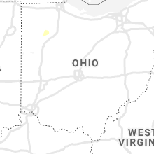
Hail Map for Tuesday, August 24, 2021

Number of Impacted Households on 8/24/2021
0
Impacted by 1" or Larger Hail
0
Impacted by 1.75" or Larger Hail
0
Impacted by 2.5" or Larger Hail
Square Miles of Populated Area Impacted on 8/24/2021
0
Impacted by 1" or Larger Hail
0
Impacted by 1.75" or Larger Hail
0
Impacted by 2.5" or Larger Hail


Cities Most Affected by Hail Storms of 8/24/2021
| Hail Size | Demographics of Zip Codes Affected | ||||||
|---|---|---|---|---|---|---|---|
| City | Count | Average | Largest | Pop Density | House Value | Income | Age |
| Pine River, WI | 2 | 1.75 | 1.75 | 21 | $81k | $39.4k | 47.4 |
| Manchester, IA | 1 | 1.75 | 1.75 | 58 | $81k | $35.4k | 42.8 |
Hail and Wind Damage Spotted on 8/24/2021
Filter by Report Type:Hail ReportsWind Reports
States Impacted
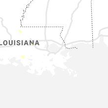
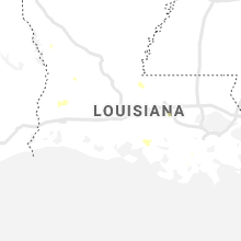
Wisconsin, Minnesota, North Dakota, Iowa, South Carolina, Michigan, Illinois, Indiana, NebraskaWisconsin
| Local Time | Report Details |
|---|---|
| 7:00 AM CDT | 12-18 inch diameter tree snapped... large branches over roadway. picture via wqo in eau claire county WI, 71.6 miles N of La Crosse, WI |
| 7:07 AM CDT | Power lines blown down started a fir in trempealeau county WI, 54.1 miles NNW of La Crosse, WI |
| 8:07 AM CDT | Storm damage reported in wood county WI, 76.8 miles SSW of Rhinelander, WI |
| 8:11 AM CDT | Multiple reports of trees and power lines being blown down in the surrounding are in clark county WI, 73.2 miles SW of Rhinelander, WI |
| 10:19 AM CDT | Golf Ball sized hail reported near Pine River, WI, 55.7 miles WSW of Green Bay, WI, report via social media. time estimated by radar. |
| 12:36 PM CDT | Trees down in the city of manitowo in manitowoc county WI, 34.6 miles SSE of Green Bay, WI |
| 1:48 PM CDT | Golf Ball sized hail reported near Pine River, WI, 55.7 miles WSW of Green Bay, WI, report via social media. time estimated by radar. |
| 2:04 PM CDT | Section of a large tree snapped and fell on house... multiple tree limbs down across town. timing estimated with the gust front on rada in milwaukee county WI, 68.7 miles E of Madison, WI |
| 2:20 PM CDT | Video of tree uprooted from outflow boundary near 24th and layton. mke gusted 47 mph at this tim in milwaukee county WI, 73.7 miles E of Madison, WI |
| 3:59 PM CDT | Some large trees down. time estimated from rada in grant county WI, 68.3 miles WSW of Madison, WI |
| 4:13 PM CDT | Some large trees downed and tin ripped off a shed. time estimated from rada in grant county WI, 62.8 miles WSW of Madison, WI |
| 4:15 PM CDT | Storm damage reported in grant county WI, 68.3 miles WSW of Madison, WI |
| 4:23 PM CDT | Storm damage reported in grant county WI, 65.4 miles SW of Madison, WI |
| 4:50 PM CDT | Some small trees down across roads... estimated 40-50 mph wind in lafayette county WI, 55.1 miles SW of Madison, WI |
Minnesota
| Local Time | Report Details |
|---|---|
| 7:15 AM CDT | Trees reported dow in washington county MN, 16.4 miles ENE of Minneapolis, MN |
| 8:13 AM CDT | Quarter sized hail reported near Lafayette, MN, 66.4 miles WSW of Minneapolis, MN, received photo of quarter sized hail. |
| 8:32 AM CDT | Quarter sized hail reported near Avoca, MN, 61.3 miles ENE of Sioux Falls, SD, corrects previous hail report from avoca. he said it had been hailing about 7 minutes and it was starting to let up. |
| 8:42 AM CDT | Quarter sized hail reported near Avoca, MN, 61.3 miles ENE of Sioux Falls, SD, he said it had been hailing about 7 minutes and it was starting to let up. |
| 9:05 AM CDT | Quarter sized hail reported near Westbrook, MN, 70.4 miles ENE of Sioux Falls, SD, corrects previous hail report from 6 s westbrook. said he was at the intersection of county road 7 and county road 13 and it was actively hailing dime to quarters. he c |
| 9:12 AM CDT | Half Dollar sized hail reported near Fulda, MN, 66.6 miles ENE of Sioux Falls, SD, sent a picture of 1.25 inch hail to the nwsfsd email account. |
| 9:21 AM CDT | Quarter sized hail reported near Westbrook, MN, 70.4 miles ENE of Sioux Falls, SD, said he was at the intersection of county road 7 and county road 13 and it was actively hailing dime to quarters. he called at 0915 on 24aug. |
| 9:32 AM CDT | Quarter sized hail reported near Windom, MN, 77.1 miles SSE of Montevideo, MN, fb report of quarter sized hail 5 miles north of windom. |
North Dakota
| Local Time | Report Details |
|---|---|
| 7:24 AM CDT | Half Dollar sized hail reported near Minot, ND, 7.3 miles S of Minot, ND, facebook report and picture of hail slightly larger than a quarter 7 miles south of minot. |
Iowa
| Local Time | Report Details |
|---|---|
| 10:25 AM CDT | Quarter sized hail reported near Little Rock, IA, 43.4 miles E of Sioux Falls, SD, received quarter sized hail... but said that the accumulation was not deep. |
| 1:21 PM CDT | Storm damage reported in franklin county IA, 29.5 miles S of Mason City, IA |
| 1:42 PM CDT | Estimated 50-60 mph. pea-sized hai in butler county IA, 29.8 miles SSE of Mason City, IA |
| 2:15 PM CDT | Trees down along highway 63 in chickasaw county IA, 45.7 miles ESE of Mason City, IA |
| 2:19 PM CDT | Storm damage reported in black hawk county IA, 54.4 miles NW of Cedar Rapids, IA |
| 2:20 PM CDT | Trees reported down in chickasaw county IA, 50.6 miles ESE of Mason City, IA |
| 2:22 PM CDT | Storm damage reported in black hawk county IA, 54.5 miles NW of Cedar Rapids, IA |
| 2:30 PM CDT | Tree limbs & a few power lines downed. ponding observed on area roadway in black hawk county IA, 49.6 miles NW of Cedar Rapids, IA |
| 2:30 PM CDT | Crops flattened and trees down about 1 mile w of readly in bremer county IA, 57.5 miles NNW of Cedar Rapids, IA |
| 2:30 PM CDT | Semi trailer turned over... bin blown in to field... bin roof blown off... corn damage... branches on houses... roof damage... uprooted trees. time estimated by rada in bremer county IA, 55 miles ESE of Mason City, IA |
| 2:38 PM CDT | Trees down along highway 188. time estimated from rada in bremer county IA, 43.7 miles ESE of Mason City, IA |
| 2:40 PM CDT | Reports of trees downed and semi over-turned in the tripoli are in bremer county IA, 53.5 miles ESE of Mason City, IA |
| 2:41 PM CDT | Pieces of roofing ripped from a confinement building. time estimated from rada in fayette county IA, 48.1 miles NNW of Cedar Rapids, IA |
| 2:43 PM CDT | Several uprooted and broken trees mainly across southern end of town. strong winds lasted approx 5 min in fayette county IA, 50.1 miles NNW of Cedar Rapids, IA |
| 2:44 PM CDT | A tree blew over taking a power line down with i in floyd county IA, 20.4 miles ESE of Mason City, IA |
| 2:48 PM CDT | Early reports of major wind damage in southern fayette c in fayette county IA, 52.3 miles NNW of Cedar Rapids, IA |
| 2:50 PM CDT | Storm damage reported in buchanan county IA, 40.7 miles NNW of Cedar Rapids, IA |
| 2:50 PM CDT | Several trees uprooted south of hazelton near the fontana turnof in buchanan county IA, 44.6 miles NNW of Cedar Rapids, IA |
| 2:50 PM CDT | Several large tree limbs down... time estimated from rada in buchanan county IA, 49.3 miles NNW of Cedar Rapids, IA |
| 2:50 PM CDT | 2 large trees down over the road with power lines. time estimated from rada in buchanan county IA, 45.9 miles NNW of Cedar Rapids, IA |
| 2:52 PM CDT | Storm damage reported in buchanan county IA, 46.1 miles NNW of Cedar Rapids, IA |
| 2:55 PM CDT | Large 8-10 inch diameter branch dow in buchanan county IA, 35.8 miles NNW of Cedar Rapids, IA |
| 2:59 PM CDT | Storm damage reported in fayette county IA, 50.1 miles NNW of Cedar Rapids, IA |
| 3:04 PM CDT | Report from mping: 1-inch tree limbs broken; shingles blown of in fayette county IA, 48.7 miles N of Cedar Rapids, IA |
| 3:10 PM CDT | Many mature trees snapped down the middl in fayette county IA, 50.1 miles NNW of Cedar Rapids, IA |
| 3:19 PM CDT | Em relayed report of a pole barn flattened northwest of manchester. time estimated from rada in delaware county IA, 38.6 miles NNE of Cedar Rapids, IA |
| 3:25 PM CDT | Roof peeled off downtown building. also several trees down in downtown. time estimated from rada in delaware county IA, 36.8 miles NNE of Cedar Rapids, IA |
| 3:26 PM CDT | Golf Ball sized hail reported near Manchester, IA, 39.8 miles NNE of Cedar Rapids, IA, time estimated radar. |
| 3:36 PM CDT | Delayed report. time estimated via radar. large tree limbs broken and heavy wooden pen shifte in story county IA, 41.4 miles N of Des Moines, IA |
| 3:40 PM CDT | Report from mping: trees uprooted or snapped; roof blown of in delaware county IA, 36.2 miles NNE of Cedar Rapids, IA |
| 3:41 PM CDT | Storm damage reported in delaware county IA, 42.3 miles NNE of Cedar Rapids, IA |
| 3:53 PM CDT | Several large trees down in town... time estimated from rada in delaware county IA, 33.2 miles NE of Cedar Rapids, IA |
| 3:58 PM CDT | Quarter sized hail reported near Dyersville, IA, 43.8 miles NE of Cedar Rapids, IA |
| 3:58 PM CDT | Storm damage reported in dubuque county IA, 43.8 miles NE of Cedar Rapids, IA |
| 4:00 PM CDT | Measured at fire statio in dubuque county IA, 44.4 miles NE of Cedar Rapids, IA |
| 4:00 PM CDT | Large pine tree down across road near town... time estimated from rada in dubuque county IA, 40.3 miles NE of Cedar Rapids, IA |
| 4:22 PM CDT | Report from mping: homes/buildings completely destroye in fayette county IA, 48.1 miles NNW of Cedar Rapids, IA |
| 4:28 PM CDT | Officers reported damage to their home including shingles off and trees down. delayed report... time estimated via rada in marshall county IA, 44.7 miles NE of Des Moines, IA |
| 4:33 PM CDT | Quarter sized hail reported near Dubuque, IA, 57 miles ENE of Cedar Rapids, IA, social media report with picture. |
| 4:36 PM CDT | Storm damage reported in dubuque county IA, 57 miles ENE of Cedar Rapids, IA |
| 4:55 PM CDT | Several 2+ inch tree limbs down in tow in jackson county IA, 66.8 miles ENE of Cedar Rapids, IA |
| 5:14 PM CDT | Awos station kcwi clinton arp in clinton county IA, 70.6 miles E of Cedar Rapids, IA |
| 3:53 AM CDT | 3 trees downed blocking northbound lanes on ia-137. time estimated from rada in monroe county IA, 56.9 miles SE of Des Moines, IA |
South Carolina
| Local Time | Report Details |
|---|---|
| 4:02 PM EDT | South carolina highway patrol reported a tree down on hw-641 near the intersection with hw-6 in colleton county SC, 55 miles WSW of Charleston, SC |
| 4:13 PM EDT | South carolina highway patrol reported a tree down on pine grove road near hudson mill roa in colleton county SC, 50 miles WSW of Charleston, SC |
| 5:07 PM EDT | South carolina highway patrol reported a tree down on hw-321 near the intersection with luray highwa in hampton county SC, 51.7 miles N of Savannah, GA |
Michigan
| Local Time | Report Details |
|---|---|
| 5:03 PM EDT | Photos of large tree partially blocking southbound us-131 south of reed city near mile marker 150. public report... relayed via 9 & 10 news. time estimated from rada in osceola county MI, 61.4 miles N of Grand Rapids, MI |
| 5:05 PM EDT | Numerous trees and power lines down countywid in mecosta county MI, 50.3 miles NNE of Grand Rapids, MI |
| 5:15 PM EDT | Numerous trees and power lines down countywid in osceola county MI, 62.1 miles N of Grand Rapids, MI |
| 5:40 PM EDT | Numerous limbs down and power outages along m-91 between greenville and turk lake. time estimated from rada in montcalm county MI, 28.9 miles NE of Grand Rapids, MI |
| 6:17 PM EDT | Storm damage reported in gratiot county MI, 52.7 miles WNW of Flint, MI |
| 6:20 PM EDT | Corrects previous tstm wnd dmg report from beaverton. powerline down on m-18 near beaverton. time estimated from rada in gladwin county MI, 72.1 miles NNW of Flint, MI |
| 6:20 PM EDT | Corrects previous tstm wnd dmg report from beaverton. powerline down on m-18 near beaverton. time estimated from rada in gladwin county MI, 72.1 miles NNW of Flint, MI |
| 6:24 PM EDT | Tree down near intersection of m20 and n geneva rd in midland county MI, 53.9 miles NW of Flint, MI |
| 6:24 PM EDT | Dispatch reports multiple trees and wires down in the city of jerome twp in midland county MI, 60 miles NW of Flint, MI |
| 6:30 PM EDT | Tree down on m-18 north of gladwin. time estimated from rada in gladwin county MI, 76.6 miles SE of Traverse City, MI |
| 6:46 PM EDT | Dispatch reports multiple trees and wires down in the city of midland in midland county MI, 50.8 miles NW of Flint, MI |
| 6:57 PM EDT | Report of tree down on s mountain st and w jenny st. dispatch confirmed multiple additional trees and wires down across bay city in bay county MI, 42.2 miles NNW of Flint, MI |
| 7:10 PM EDT | Report of trees down on youmans and bundy st in saginaw county MI, 29.6 miles NNW of Flint, MI |
| 7:12 PM EDT | Multple reports of trees and wires down across hampton twp in bay county MI, 41.8 miles N of Flint, MI |
| 7:14 PM EDT | Report of a tree down on burt and s 15 st in saginaw county MI, 31.3 miles NNW of Flint, MI |
| 7:16 PM EDT | Report of tree down on easton and new lothrop rd in shiawassee county MI, 16.2 miles WNW of Flint, MI |
| 7:16 PM EDT | Report of tree down on easton and new lothrop rd in shiawassee county MI, 16.2 miles WNW of Flint, MI |
| 7:16 PM EDT | Storm damage reported in ingham county MI, 44.9 miles WSW of Flint, MI |
| 7:55 PM EDT | Report of a tree down blocking traffic on van slyke and w hill road in genesee county MI, 5 miles SSW of Flint, MI |
| 8:15 PM EDT | Multiple 4 inch limbs dow in berrien county MI, 59.1 miles E of Chicago, IL |
| 8:16 PM EDT | Large limbs down... some onto power line in berrien county MI, 46 miles E of Chicago, IL |
| 9:15 PM EDT | Measured wind gust at lake st. clair metropar in macomb county MI, 54.4 miles SE of Flint, MI |
| 9:33 PM EDT | Numerous trees and power lines were blown down in and around algona in st. clair county MI, 64.6 miles ESE of Flint, MI |
Illinois
| Local Time | Report Details |
|---|---|
| 4:58 PM CDT | Large trees down in hanover. time estimated from rada in jo daviess county IL, 72.8 miles SW of Madison, WI |
| 5:15 PM CDT | Storm damage reported in carroll county IL, 79.7 miles SSW of Madison, WI |
| 5:20 PM CDT | Quarter sized hail reported near Elk Grove Village, IL, 20.4 miles WNW of Chicago, IL, public shared photo via social media of hail near quarter size. time estimated by radar. |
| 5:23 PM CDT | Small tree limbs coming dow in carroll county IL, 70.9 miles SSW of Madison, WI |
| 5:32 PM CDT | 4 inch diameter tree branch down in town... another tree approx 1 foot in diameter snapped near base on e franklin st. time estimated from rada in carroll county IL, 70.9 miles SSW of Madison, WI |
| 5:55 PM CDT | Large 3-ft diameter tree downed at ogle county courthouse. time estimated by rada in ogle county IL, 73.4 miles S of Madison, WI |
| 5:55 PM CDT | Multiple 12 to 18 inch diameter branches downed in and west of oregon along il-64. time estimated by rada in ogle county IL, 72 miles S of Madison, WI |
| 6:00 PM CDT | Multiple public reports of tree damage in the vicinity of byron and stillman valley. time estimated by rada in ogle county IL, 65.5 miles S of Madison, WI |
| 6:05 PM CDT | Photo shared to social media shows small branches downed near state and kilburn in rockford. time estimated by rada in winnebago county IL, 57.3 miles SSE of Madison, WI |
| 6:10 PM CDT | Report of measured 60 mph wind gust. relayed via spotternetwor in ogle county IL, 67.9 miles SSE of Madison, WI |
| 6:15 PM CDT | 4-inch diameter tree limb downed east of sandy hollow golf course in rockford. time estimated by rada in winnebago county IL, 60.8 miles SSE of Madison, WI |
| 6:20 PM CDT | Tree branches at least 6-inches in diameter downed in southern rochelle. time estimated by rada in ogle county IL, 74.1 miles W of Chicago, IL |
| 6:28 PM CDT | Public reports small branches downed in rochelle area. report relayed via mpin in ogle county IL, 73.7 miles W of Chicago, IL |
| 6:35 PM CDT | Public report of numerous branches downed in kingston. time estimated by rada in de kalb county IL, 59.4 miles WNW of Chicago, IL |
| 6:40 PM CDT | Photo shared to social media shows multiple branches up to 8-in diameter downed near hillcrest drive and blackhawk road in dekalb. time estimated by rada in de kalb county IL, 58.8 miles W of Chicago, IL |
| 6:40 PM CDT | Photo shared via social media shows tree snapped near the base near northern illinois university in dekalb. time estimated by rada in de kalb county IL, 58.7 miles W of Chicago, IL |
| 6:45 PM CDT | 68 mph wind gust measured by handheld anemometer near dekalb airport. time estimated by rada in de kalb county IL, 56.2 miles W of Chicago, IL |
| 6:45 PM CDT | 2-3 inch diameter tree branches downed in sycamore. time estimated by rada in de kalb county IL, 55 miles W of Chicago, IL |
| 7:36 PM CDT | Two roughly 6 inch diameter tree limbs down on maple avenue. time estimated based on rada in dupage county IL, 20.5 miles WSW of Chicago, IL |
| 8:31 PM CDT | Storm damage reported in peoria county IL, 5.8 miles WSW of Peoria, IL |
| 8:40 PM CDT | Two trees blown dow in fulton county IL, 28.9 miles WSW of Peoria, IL |
| 8:45 PM CDT | Tree limbs and power lines down. time estimate in tazewell county IL, 8.9 miles SSW of Peoria, IL |
Indiana
| Local Time | Report Details |
|---|---|
| 7:00 PM CDT | Corrects previous tstm wnd gst report from 2 wnw pottawattomie par in lmz046 county IN, 38.6 miles ESE of Chicago, IL |
Nebraska
| Local Time | Report Details |
|---|---|
| 12:25 AM CDT | Public report of trees down and power outages in yutan... n in saunders county NE, 23.5 miles W of Omaha, NE |
| 12:47 AM CDT | Report from mping: 3-inch tree limbs broken; power poles broke in sarpy county NE, 16.1 miles WSW of Omaha, NE |
| 12:55 AM CDT | Personal weather station measured a sustained wind speed of 36 mph and a gust of 64 mph from the southwest at 12:55am. several 3 to 6 inch diameter branched dow in douglas county NE, 6.2 miles WNW of Omaha, NE |
| 1:30 AM CDT | Public report of a large tree limb down on a power lin in douglas county NE, 4.9 miles SSW of Omaha, NE |
| 1:30 AM CDT | Public report of a large tree limb down on a power lin in douglas county NE, 4.9 miles SSW of Omaha, NE |
| 1:40 AM CDT | Large tree limb... 8 to 10 inches in diameter... down on a hom in douglas county NE, 1.5 miles W of Omaha, NE |
| 1:44 AM CDT | Report from mping: 1-inch tree limbs broken; shingles blown of in cass county NE, 23 miles S of Omaha, NE |
Connect with Interactive Hail Maps