

Hail Map for Friday, August 25, 2023

Number of Impacted Households on 8/25/2023
0
Impacted by 1" or Larger Hail
0
Impacted by 1.75" or Larger Hail
0
Impacted by 2.5" or Larger Hail
Square Miles of Populated Area Impacted on 8/25/2023
0
Impacted by 1" or Larger Hail
0
Impacted by 1.75" or Larger Hail
0
Impacted by 2.5" or Larger Hail


Cities Most Affected by Hail Storms of 8/25/2023
| Hail Size | Demographics of Zip Codes Affected | ||||||
|---|---|---|---|---|---|---|---|
| City | Count | Average | Largest | Pop Density | House Value | Income | Age |
| Oberlin, KS | 1 | 1.75 | 1.75 | 5 | $49k | $31.7k | 50.5 |
Hail and Wind Damage Spotted on 8/25/2023
Filter by Report Type:Hail ReportsWind Reports
States Impacted
Minnesota, Kentucky, Missouri, Michigan, Illinois, Ohio, Nebraska, Alabama, Oklahoma, Mississippi, Louisiana, Indiana, Kansas, Georgia, Virginia, Florida, New Mexico, Wisconsin, IdahoMinnesota
| Local Time | Report Details |
|---|---|
| 12:09 PM CDT | Corrects time of previous tstm wnd dmg report from esko. report of debris over a ramp at exit 242 along interstate 35. also a report of two large trees about 12 inches in carlton county MN, 13.8 miles WSW of Duluth, MN |
| 12:30 PM CDT | Report of debris over a ramp at exit 242 along interstate 35. also a report of two large trees about 12 inches in diameter down in esk in carlton county MN, 13.8 miles WSW of Duluth, MN |
Kentucky
| Local Time | Report Details |
|---|---|
| 1:55 PM EDT | Menifee county dispatch reported a tree down near the 1400 block of tom stamper rd. time estimated from rada in menifee county KY, 28.5 miles NE of Irvine, KY |
| 2:06 PM EDT | Menifee county dispatch reported a tree down near the 90 block of indian creek rd. time estimated from rada in menifee county KY, 24.8 miles NE of Irvine, KY |
| 4:09 PM EDT | Tree down on 165 off of 19. time estimated from rada in bracken county KY, 38 miles SE of Cincinnati, OH |
| 4:26 PM EDT | Numerous trees down reported south of falmouth. time estimated from rada in pendleton county KY, 34.9 miles SSE of Cincinnati, OH |
| 4:26 PM EDT | Corrects previous tstm wnd dmg report from 4 s falmouth. numerous trees down reported south of falmouth. time estimated from rada in pendleton county KY, 36.2 miles SSE of Cincinnati, OH |
| 4:43 PM EDT | Tree down on camp ernst road. time estimated from rada in boone county KY, 13.7 miles WSW of Cincinnati, OH |
| 4:54 PM EDT | Corrects previous tstm wnd dmg report from 5 wsw union. tree down on big bone church road. time estimated from rada in boone county KY, 18.8 miles SW of Cincinnati, OH |
| 4:54 PM EDT | Corrects previous tstm wnd dmg report from 5 wsw union. tree down on big bone church road. time estimated from rada in boone county KY, 18.8 miles SW of Cincinnati, OH |
| 4:58 PM EDT | Tree down on clarks creek road. time estimated from rada in grant county KY, 31.4 miles SSW of Cincinnati, OH |
| 4:58 PM EDT | Trees down on claxton ridge road. time estimated from rada in owen county KY, 49.3 miles SSW of Cincinnati, OH |
| 5:02 PM EDT | Delayed report of tree down on concord r in nicholas county KY, 40 miles N of Irvine, KY |
| 5:30 PM EDT | Tree down on fork lick road. time estimated from rada in grant county KY, 39.9 miles S of Cincinnati, OH |
| 5:44 PM EDT | Delayed report. report from mping of 1-inch tree limbs broken; shingles blown of in franklin county KY, 53.9 miles ENE of Louisville, KY |
| 5:55 PM EDT | Delayed report of tree down on johnson r in nicholas county KY, 50.1 miles N of Irvine, KY |
| 6:05 PM EDT | Multiple reports of trees down across georgetown and scott county. power outages also reported across the county. time estimated from rada in scott county KY, 47.2 miles NW of Irvine, KY |
| 6:25 PM EDT | Large tree down on crawley lan in fayette county KY, 28.6 miles WNW of Irvine, KY |
| 6:25 PM EDT | Multiple reports of power lines down in lexingto in fayette county KY, 37.1 miles NW of Irvine, KY |
| 6:25 PM EDT | Delayed report of trees down on midway r in woodford county KY, 49.5 miles NW of Irvine, KY |
| 6:40 PM EDT | Ky mesonet site wadd measured 83 mph wind gus in shelby county KY, 32.2 miles ENE of Louisville, KY |
| 7:06 PM EDT | Delayed report of tree down on pisgah pik in woodford county KY, 46.1 miles NW of Irvine, KY |
| 7:10 PM EDT | Delayed report of tree down on johnson r in anderson county KY, 45.1 miles E of Louisville, KY |
| 7:13 PM EDT | Delayed report of tree down on ashby r in anderson county KY, 32.6 miles E of Louisville, KY |
| 7:45 PM EDT | Delayed report. 2 large trees heavily damaged near taylorsville r in jefferson county KY, 19.6 miles NE of Louisville, KY |
| 7:49 PM EDT | Delayed report of large tree down on brashears creek r in spencer county KY, 20.9 miles E of Louisville, KY |
| 8:00 PM EDT | Multiple large trees down on arlington court. reported by private sector meteorologis in jefferson county KY, 16.2 miles NNE of Louisville, KY |
| 8:12 PM EDT | Multiple trees and power lines down in the count in taylor county KY, 48.4 miles SSE of Louisville, KY |
| 8:19 PM EDT | Reported at klo in jefferson county KY, 17 miles N of Louisville, KY |
| 8:53 PM EDT | Delayed report... two trees down on cooper chapel rd at beulah church rd. time estimated from rada in jefferson county KY, 9.9 miles NNE of Louisville, KY |
| 9:02 PM EDT | Delayed report of power lines down near north preston highwa in bullitt county KY, 5.6 miles NNE of Louisville, KY |
| 2:25 AM CDT | Several trees and powerlines down in eastern henderson count in henderson county KY, 12 miles SE of Evansville, IN |
Missouri
| Local Time | Report Details |
|---|---|
| 2:00 PM CDT | Pictures sent in nwschat of tree down and roof damag in oregon county MO, 63.3 miles S of Salem, MO |
| 2:02 PM CDT | Tree limbs dow in oregon county MO, 63.3 miles S of Salem, MO |
| 2:04 PM CDT | Report of shingles being blown off roof of house and some tree limbs dow in oregon county MO, 65.4 miles S of Salem, MO |
| 7:06 PM CDT | Several reports of tree damage in the newberry subdivision. time estimated from rada in jackson county MO, 19.3 miles SE of Kansas City, MO |
| 2:53 AM CDT | Storm damage reported in buchanan county MO, 49.2 miles NNW of Kansas City, MO |
Michigan
| Local Time | Report Details |
|---|---|
| 3:27 PM EDT | Corrects previous tstm wnd dmg report from 4 nnw sands. portion of a maple tree broke off about 10 feet up and was over the road in the feather ridge subdivisio in marquette county MI, 5.3 miles S of Marquette, MI |
| 3:20 PM CDT | Image from social media of damage to tree in hardwood... mi. time estimated via rada in dickinson county MI, 42.6 miles SSW of Marquette, MI |
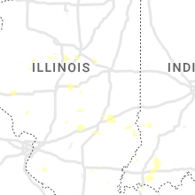
Illinois
| Local Time | Report Details |
|---|---|
| 3:05 PM CDT | Multiple trees reported down near coffeen. location and time estimate in montgomery county IL, 55.3 miles NE of Saint Louis, MO |
| 4:35 PM CDT | Tree limbs and power lines dow in effingham county IL, 39.1 miles SSW of Mattoon, IL |
| 6:20 PM CDT | Trees and power lines downed on garfield s in st. clair county IL, 14.4 miles SE of Saint Louis, MO |
| 6:31 PM CDT | 8 to 12 inch tree limb dow in fulton county IL, 36.2 miles WSW of Peoria, IL |
| 6:52 PM CDT | 30 inch tree limb down near us 136 and curless rd... just west of havan in fulton county IL, 38.5 miles SW of Peoria, IL |
| 7:44 PM CDT | Several broken limbs and a few whole trees snapped in mason city. town currently without powe in mason county IL, 34.4 miles S of Peoria, IL |
| 8:10 PM CDT | 6 in tree branch down near toboggan ave and hackney l in tazewell county IL, 19.5 miles S of Peoria, IL |
| 8:13 PM CDT | Large garage or outbuilding collapse in tazewell county IL, 21 miles SSE of Peoria, IL |
| 8:21 PM CDT | Multiple trees dow in sangamon county IL, 57.6 miles S of Peoria, IL |
| 8:25 PM CDT | Storm damage reported in tazewell county IL, 20.3 miles S of Peoria, IL |
| 8:40 PM CDT | Multiple large trees down... roads blocked in funks grov in mclean county IL, 33.2 miles SE of Peoria, IL |
| 8:52 PM CDT | Multiple tree limbs dow in de witt county IL, 46.4 miles SE of Peoria, IL |
| 8:55 PM CDT | 6 inch tree limbs dow in macon county IL, 41.5 miles NW of Mattoon, IL |
| 9:04 PM CDT | Storm damage reported in macon county IL, 41.3 miles NW of Mattoon, IL |
Ohio
| Local Time | Report Details |
|---|---|
| 4:16 PM EDT | 3-inch tree limbs broke in scioto county OH, 70.7 miles WNW of Charleston, WV |
Nebraska
| Local Time | Report Details |
|---|---|
| 3:22 PM CDT | Estimated 55 to 60 mph winds... heavy rain and sporadic pea size hai in hitchcock county NE, 57.2 miles SSW of North Platte, NE |
| 3:52 PM CDT | Quarter sized hail reported near Curtis, NE, 43.6 miles SSE of North Platte, NE |
| 4:00 PM CDT | Mesonet station knestock in frontier county NE, 50.2 miles SSE of North Platte, NE |
| 4:35 PM CDT | Quarter sized hail reported near Cambridge, NE, 51.5 miles SSE of North Platte, NE, public report of quarter sized hail. |
| 5:14 PM CDT | Quarter sized hail reported near Superior, NE, 57.3 miles SSE of Grand Island, NE |
| 10:55 PM CDT | Via davis weatherlin in thayer county NE, 71.3 miles SSE of Grand Island, NE |
| 10:56 PM CDT | Via davis weatherlin in thayer county NE, 75.8 miles SE of Grand Island, NE |
| 11:00 PM CDT | Via davis weatherlin in thayer county NE, 67 miles SSE of Grand Island, NE |
| 11:15 PM CDT | Emergency management reported a peak wind gust of 68 mp in jefferson county NE, 74.1 miles NNW of Manhattan, KS |
| 12:28 AM CDT | Personal weather stationed measured a peak wind gust of 69 mp in pawnee county NE, 71.8 miles SSW of Omaha, NE |
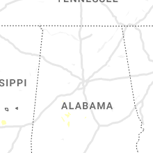
Alabama
| Local Time | Report Details |
|---|---|
| 3:31 PM CDT | Several trees blown down on red oak rd near hwy 13 from an apparent microburs in shelby county AL, 23.1 miles SSW of Birmingham, AL |
Oklahoma
| Local Time | Report Details |
|---|---|
| 3:35 PM CDT | Several tree limbs down on e 86th street north... just east of bird creek. time estimated from rada in tulsa county OK, 9.5 miles NNE of Tulsa, OK |
Mississippi
| Local Time | Report Details |
|---|---|
| 4:00 PM CDT | Report of trees downed on hwy 25 northboun in rankin county MS, 26.4 miles NE of Jackson, MS |
Louisiana
| Local Time | Report Details |
|---|---|
| 4:15 PM CDT | Several trees downed along with powerlines from near many... south and southwest across the parish to west of florien to east of the clare communit in sabine county LA, 71.2 miles E of Lufkin, TX |
| 4:55 PM CDT | Tree down on bellwood street near hwy. 117 in provencal. damaging winds also removed shingles from that area as wel in natchitoches county LA, 67.7 miles SSE of Shreveport, LA |
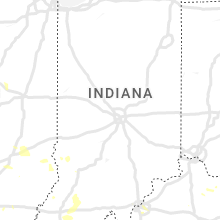
Indiana
| Local Time | Report Details |
|---|---|
| 5:18 PM EDT | Tree down on old 41 at taylor rd... south of oaktow in knox county IN, 61.9 miles N of Evansville, IN |
| 5:38 PM EDT | Tree down on state rd 67 between bicknell and edwardsport. time estimated from rada in knox county IN, 58.3 miles NNE of Evansville, IN |
| 8:28 PM EDT | Delayed report of trees down on perrin lane in jeffersonvill in clark county IN, 21.5 miles N of Louisville, KY |
| 12:17 AM EDT | Sr 340 and us 40 at brazil....55 to 60 mph wind gus in clay county IN, 55.5 miles WSW of Indianapolis, IN |
| 1:25 AM CDT | Trees down across the count in warrick county IN, 23.5 miles ENE of Evansville, IN |
| 2:13 AM CDT | Tree down on a house in newburgh. powerlines down at oak grove rd and 261 in newburg in warrick county IN, 9 miles E of Evansville, IN |
| 2:15 AM CDT | Reports of a few trees and wires down in evansvill in vanderburgh county IN, 4.6 miles E of Evansville, IN |
Kansas
| Local Time | Report Details |
|---|---|
| 5:04 PM CDT | Golf Ball sized hail reported near Oberlin, KS, 38.3 miles NNE of Colby, KS, golf ball sized hail reported 8 wnw of oberlin that lasted for 3 minutes. 1.5 inches of rain has been recorded on a pws. |
| 6:02 PM CDT | Ksu mesonet site southwest of norton... k in norton county KS, 63.8 miles ENE of Colby, KS |
| 6:18 PM CDT | Awos station knrn norton sustained winds at 42 knot in norton county KS, 68.6 miles ENE of Colby, KS |
| 6:30 PM CDT | Asos station khlc hill cit in graham county KS, 43.6 miles NW of Hays, KS |
| 6:30 PM CDT | Mesonet station lcrk1 la cross in rush county KS, 23 miles S of Hays, KS |
| 6:30 PM CDT | Quarter sized hail reported near Plainville, KS, 29 miles N of Hays, KS, on highway 183 between plainville and stockton. |
| 6:30 PM CDT | Quarter sized hail reported near Stockton, KS, 31.7 miles N of Hays, KS, corrects previous hail report from 4 n plainville. on highway 183 between plainville and stockton. |
| 6:49 PM CDT | Storm damage reported in phillips county KS, 76.9 miles N of Hays, KS |
| 6:49 PM CDT | Corrects previous non-tstm wnd gst report from 1 nnw norton. awos station knrn norton. dialed i in norton county KS, 68.6 miles ENE of Colby, KS |
| 6:51 PM CDT | Kansas state mesonet sit in phillips county KS, 60 miles N of Hays, KS |
| 6:56 PM CDT | Storm damage reported in phillips county KS, 60 miles N of Hays, KS |
| 7:01 PM CDT | Heavy rain... measured 59 mph with anemometer... zero visibility. dime size hai in phillips county KS, 62 miles N of Hays, KS |
| 7:18 PM CDT | Storm damage reported in phillips county KS, 61.6 miles N of Hays, KS |
| 8:10 PM CDT | Storm damage reported in russell county KS, 28.2 miles E of Hays, KS |
Georgia
| Local Time | Report Details |
|---|---|
| 6:50 PM EDT | Trees and power lines down with a roof blown off of a buildin in berrien county GA, 31.2 miles SW of Douglas, GA |
| 6:50 PM EDT | Roof blown off pawn shop... trees down in yar in berrien county GA, 31.7 miles SW of Douglas, GA |
Virginia
| Local Time | Report Details |
|---|---|
| 7:33 PM EDT | A large tree branch was reported blocking part of the roadway near reston parkway and fox mill r in fairfax county VA, 47.8 miles WSW of Baltimore, MD |
Florida
| Local Time | Report Details |
|---|---|
| 7:45 PM EDT | Local law enforcement reported trees blocking n. hwy 5 in madison county FL, 51.4 miles E of Tallahassee, FL |
| 7:45 PM EDT | Local law enforcement reported a few trees blocking hwy 15 in madison county FL, 48.9 miles ENE of Tallahassee, FL |
| 7:50 PM EDT | Local law enforcement reported trees blocking the road across us 9 in madison county FL, 56.7 miles E of Tallahassee, FL |
| 8:14 PM EDT | A tree blew down into the westbound lanes of i-10 at mm 241... striking a truc in madison county FL, 36.4 miles E of Tallahassee, FL |
New Mexico
| Local Time | Report Details |
|---|---|
| 6:10 PM MDT | Delayed report... mesonet station nm008 lordsburg playa i10 mp7 (nmdot in hidalgo county NM, 52.4 miles SW of Silver City, NM |
Wisconsin
| Local Time | Report Details |
|---|---|
| 7:30 PM CDT | Half Dollar sized hail reported near Shawano, WI, 34.5 miles WNW of Green Bay, WI, report from mping: half dollar (1.25 in.). |
Idaho
| Local Time | Report Details |
|---|---|
| 7:00 PM MDT | Mesonet station pc371 medicine lodg in clark county ID, 61.3 miles NNW of Idaho Falls, ID |
Connect with Interactive Hail Maps