

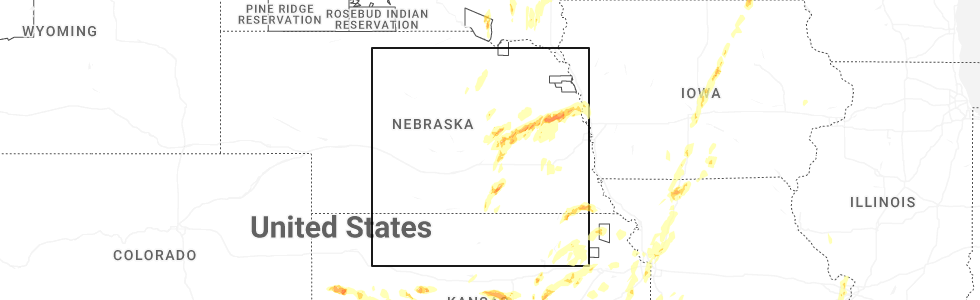
Hail Map for Superior, NE
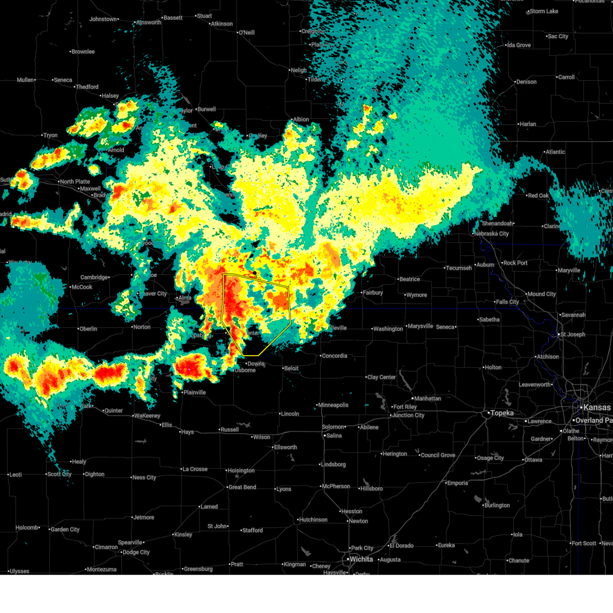
The Superior, NE area has had 24 reports of on-the-ground hail by trained spotters, and has been under severe weather warnings 2 times during the past 12 months. Doppler radar has detected hail at or near Superior, NE on 129 occasions, including 3 occasions during the past year.
| Name: | Superior, NE |
| Where Located: | 63.9 miles SSE of Grand Island, NE |
| Map: | Google Map for Superior, NE |
| Population: | 1957 |
| Housing Units: | 1109 |
| More Info: | Search Google for Superior, NE |
0
The Top Recent Hail Date for Superior, NE is Monday, May 19, 2025 (74th out of 129)
Hail and Wind Damage Spotted near Superior, NE
| Date / Time | Report Details |
|---|---|
| 6/16/2025 11:41 PM CDT |
 Svrgid the national weather service in hastings has issued a * severe thunderstorm warning for, jewell county in north central kansas, eastern smith county in north central kansas, webster county in south central nebraska, eastern franklin county in south central nebraska, southwestern nuckolls county in south central nebraska, * until 1230 am cdt. * at 1140 pm cdt, severe thunderstorms were located along a line extending from near campbell to riverton to 8 miles north of smith center, moving southeast at 30 mph (radar indicated). Hazards include 60 mph wind gusts and penny size hail. Expect damage to roofs, siding, and trees. severe thunderstorms will be near, campbell, riverton, and inavale around 1145 pm cdt. bellaire around 1155 pm cdt. red cloud and lebanon around 1200 am cdt. Other locations in the path of these severe thunderstorms include esbon and cowles. Svrgid the national weather service in hastings has issued a * severe thunderstorm warning for, jewell county in north central kansas, eastern smith county in north central kansas, webster county in south central nebraska, eastern franklin county in south central nebraska, southwestern nuckolls county in south central nebraska, * until 1230 am cdt. * at 1140 pm cdt, severe thunderstorms were located along a line extending from near campbell to riverton to 8 miles north of smith center, moving southeast at 30 mph (radar indicated). Hazards include 60 mph wind gusts and penny size hail. Expect damage to roofs, siding, and trees. severe thunderstorms will be near, campbell, riverton, and inavale around 1145 pm cdt. bellaire around 1155 pm cdt. red cloud and lebanon around 1200 am cdt. Other locations in the path of these severe thunderstorms include esbon and cowles.
|
| 7/6/2024 5:14 PM CDT | Svrgid the national weather service in hastings has issued a * severe thunderstorm warning for, southern clay county in south central nebraska, nuckolls county in south central nebraska, southern fillmore county in south central nebraska, thayer county in south central nebraska, * until 600 pm cdt. * at 514 pm cdt, severe thunderstorms were located along a line extending from 6 miles northwest of ong to near hardy, moving east at 40 mph (radar indicated). Hazards include 60 mph wind gusts and quarter size hail. Hail damage to vehicles is expected. expect wind damage to roofs, siding, and trees. severe thunderstorms will be near, davenport, ruskin, oak, and ong around 520 pm cdt. deshler and shickley around 525 pm cdt. carleton and byron around 530 pm cdt. Other locations in the path of these severe thunderstorms include strang, hebron, bruning, chester, belvidere, ohiowa and hubbell. |
| 6/26/2024 1:20 AM CDT |
 Svrgid the national weather service in hastings has issued a * severe thunderstorm warning for, northeastern jewell county in north central kansas, southeastern nuckolls county in south central nebraska, southeastern fillmore county in south central nebraska, thayer county in south central nebraska, * until 200 am cdt. * at 120 am cdt, severe thunderstorms were located along a line extending from near milligan to near superior, moving southeast at 50 mph (radar indicated). Hazards include 60 mph wind gusts and penny size hail. Expect damage to roofs, siding, and trees. severe thunderstorms will be near, superior, milligan, bruning, hardy, ruskin, ohiowa, and carleton around 125 am cdt. hebron, deshler, and belvidere around 130 am cdt. alexandria and byron around 135 am cdt. chester and gilead around 140 am cdt. Other locations in the path of these severe thunderstorms include hubbell. Svrgid the national weather service in hastings has issued a * severe thunderstorm warning for, northeastern jewell county in north central kansas, southeastern nuckolls county in south central nebraska, southeastern fillmore county in south central nebraska, thayer county in south central nebraska, * until 200 am cdt. * at 120 am cdt, severe thunderstorms were located along a line extending from near milligan to near superior, moving southeast at 50 mph (radar indicated). Hazards include 60 mph wind gusts and penny size hail. Expect damage to roofs, siding, and trees. severe thunderstorms will be near, superior, milligan, bruning, hardy, ruskin, ohiowa, and carleton around 125 am cdt. hebron, deshler, and belvidere around 130 am cdt. alexandria and byron around 135 am cdt. chester and gilead around 140 am cdt. Other locations in the path of these severe thunderstorms include hubbell.
|
| 5/24/2024 1:54 AM CDT |
 The storms which prompted the warning have weakened below severe limits, and have exited the warned area. therefore, the warning will be allowed to expire. however, gusty winds are still possible with these thunderstorms. a severe thunderstorm watch remains in effect until 400 am cdt for south central, central and east central nebraska. The storms which prompted the warning have weakened below severe limits, and have exited the warned area. therefore, the warning will be allowed to expire. however, gusty winds are still possible with these thunderstorms. a severe thunderstorm watch remains in effect until 400 am cdt for south central, central and east central nebraska.
|
| 5/24/2024 1:25 AM CDT |
 the severe thunderstorm warning has been cancelled and is no longer in effect the severe thunderstorm warning has been cancelled and is no longer in effect
|
| 5/24/2024 1:25 AM CDT |
 At 125 am cdt, severe thunderstorms were located along a line extending from near staplehurst to hebron to near lovewell state park, moving east at 55 mph (radar indicated). Hazards include 70 mph wind gusts and quarter size hail. Hail damage to vehicles is expected. expect considerable tree damage. wind damage is also likely to mobile homes, roofs, and outbuildings. these severe storms will be near, hebron, milligan, alexandria, ohiowa, and gilead around 130 am cdt. other locations impacted by these severe thunderstorms include thayer. This includes interstate 80 between mile markers 341 and 364. At 125 am cdt, severe thunderstorms were located along a line extending from near staplehurst to hebron to near lovewell state park, moving east at 55 mph (radar indicated). Hazards include 70 mph wind gusts and quarter size hail. Hail damage to vehicles is expected. expect considerable tree damage. wind damage is also likely to mobile homes, roofs, and outbuildings. these severe storms will be near, hebron, milligan, alexandria, ohiowa, and gilead around 130 am cdt. other locations impacted by these severe thunderstorms include thayer. This includes interstate 80 between mile markers 341 and 364.
|
| 5/24/2024 1:12 AM CDT |
 Svrgid the national weather service in hastings has issued a * severe thunderstorm warning for, clay county in south central nebraska, nuckolls county in south central nebraska, southeastern webster county in south central nebraska, york county in east central nebraska, hamilton county in south central nebraska, fillmore county in south central nebraska, thayer county in south central nebraska, central merrick county in central nebraska, polk county in east central nebraska, * until 200 am cdt. * at 112 am cdt, severe thunderstorms were located along a line extending from near waco to near ruskin to near burr oak, moving east at 55 mph (radar indicated). Hazards include 70 mph wind gusts and quarter size hail. Hail damage to vehicles is expected. expect considerable tree damage. wind damage is also likely to mobile homes, roofs, and outbuildings. severe thunderstorms will be near, hebron, deshler, exeter, bruning, hardy, ohiowa, belvidere, and strang around 120 am cdt. milligan around 125 am cdt. alexandria and gilead around 130 am cdt. This includes interstate 80 between mile markers 325 and 364. Svrgid the national weather service in hastings has issued a * severe thunderstorm warning for, clay county in south central nebraska, nuckolls county in south central nebraska, southeastern webster county in south central nebraska, york county in east central nebraska, hamilton county in south central nebraska, fillmore county in south central nebraska, thayer county in south central nebraska, central merrick county in central nebraska, polk county in east central nebraska, * until 200 am cdt. * at 112 am cdt, severe thunderstorms were located along a line extending from near waco to near ruskin to near burr oak, moving east at 55 mph (radar indicated). Hazards include 70 mph wind gusts and quarter size hail. Hail damage to vehicles is expected. expect considerable tree damage. wind damage is also likely to mobile homes, roofs, and outbuildings. severe thunderstorms will be near, hebron, deshler, exeter, bruning, hardy, ohiowa, belvidere, and strang around 120 am cdt. milligan around 125 am cdt. alexandria and gilead around 130 am cdt. This includes interstate 80 between mile markers 325 and 364.
|
| 5/24/2024 1:06 AM CDT |
 At 105 am cdt, severe thunderstorms were located along a line extending from near osceola to near lushton to davenport to 8 miles south of red cloud, moving east at 60 mph (radar indicated). Hazards include 70 mph wind gusts and quarter size hail. Hail damage to vehicles is expected. expect considerable tree damage. wind damage is also likely to mobile homes, roofs, and outbuildings. these severe storms will be near, york, geneva, fairmont, mccool junction, shickley, davenport, waco, benedict, ruskin, and carleton around 110 am cdt. superior, exeter, bruning, gresham, and belvidere around 115 am cdt. deshler, milligan, hardy, and ohiowa around 120 am cdt. hebron and webber around 125 am cdt. other locations impacted by these severe thunderstorms include thayer. This includes interstate 80 between mile markers 325 and 365. At 105 am cdt, severe thunderstorms were located along a line extending from near osceola to near lushton to davenport to 8 miles south of red cloud, moving east at 60 mph (radar indicated). Hazards include 70 mph wind gusts and quarter size hail. Hail damage to vehicles is expected. expect considerable tree damage. wind damage is also likely to mobile homes, roofs, and outbuildings. these severe storms will be near, york, geneva, fairmont, mccool junction, shickley, davenport, waco, benedict, ruskin, and carleton around 110 am cdt. superior, exeter, bruning, gresham, and belvidere around 115 am cdt. deshler, milligan, hardy, and ohiowa around 120 am cdt. hebron and webber around 125 am cdt. other locations impacted by these severe thunderstorms include thayer. This includes interstate 80 between mile markers 325 and 365.
|
| 5/24/2024 1:06 AM CDT |
 the severe thunderstorm warning has been cancelled and is no longer in effect the severe thunderstorm warning has been cancelled and is no longer in effect
|
| 5/24/2024 12:52 AM CDT |
 At 1251 am cdt, severe thunderstorms were located along a line extending from near hordville to near stockham to near nelson to 8 miles north of bellaire, moving east at 60 mph (radar indicated). Hazards include 70 mph wind gusts and quarter size hail. Hail damage to vehicles is expected. expect considerable tree damage. wind damage is also likely to mobile homes, roofs, and outbuildings. these severe storms will be near, sutton, henderson, edgar, nelson, hampton, bradshaw, guide rock, oak, ong, and saronville around 1255 am cdt. davenport, grafton, and lushton around 100 am cdt. york, mccool junction, shickley, benedict, carleton, and nora around 105 am cdt. geneva, fairmont, strang, and bostwick around 110 am cdt. exeter, bruning, waco, gresham, and ruskin around 115 am cdt. superior, milligan, and ohiowa around 120 am cdt. belvidere around 125 am cdt. other locations impacted by these severe thunderstorms include thayer. This includes interstate 80 between mile markers 293 and 365. At 1251 am cdt, severe thunderstorms were located along a line extending from near hordville to near stockham to near nelson to 8 miles north of bellaire, moving east at 60 mph (radar indicated). Hazards include 70 mph wind gusts and quarter size hail. Hail damage to vehicles is expected. expect considerable tree damage. wind damage is also likely to mobile homes, roofs, and outbuildings. these severe storms will be near, sutton, henderson, edgar, nelson, hampton, bradshaw, guide rock, oak, ong, and saronville around 1255 am cdt. davenport, grafton, and lushton around 100 am cdt. york, mccool junction, shickley, benedict, carleton, and nora around 105 am cdt. geneva, fairmont, strang, and bostwick around 110 am cdt. exeter, bruning, waco, gresham, and ruskin around 115 am cdt. superior, milligan, and ohiowa around 120 am cdt. belvidere around 125 am cdt. other locations impacted by these severe thunderstorms include thayer. This includes interstate 80 between mile markers 293 and 365.
|
| 5/24/2024 12:52 AM CDT |
 the severe thunderstorm warning has been cancelled and is no longer in effect the severe thunderstorm warning has been cancelled and is no longer in effect
|
| 5/24/2024 12:41 AM CDT |
 Svrgid the national weather service in hastings has issued a * severe thunderstorm warning for, northern jewell county in north central kansas, northern smith county in north central kansas, northeastern phillips county in north central kansas, webster county in south central nebraska, adams county in south central nebraska, hamilton county in south central nebraska, eastern buffalo county in south central nebraska, southern polk county in east central nebraska, hall county in south central nebraska, clay county in south central nebraska, franklin county in south central nebraska, nuckolls county in south central nebraska, eastern kearney county in south central nebraska, york county in east central nebraska, fillmore county in south central nebraska, thayer county in south central nebraska, southwestern merrick county in central nebraska, southern howard county in central nebraska, * until 115 am cdt. * at 1237 am cdt, severe thunderstorms were located along a line extending from near chapman to near trumbull to near lawrence to 6 miles north of kensington, moving east at 60 mph (radar indicated). Hazards include 70 mph wind gusts and quarter size hail. Hail damage to vehicles is expected. expect considerable tree damage. wind damage is also likely to mobile homes, roofs, and outbuildings. severe thunderstorms will be near, aurora, red cloud, harvard, fairfield, giltner, glenvil, lawrence, marquette, inland, and deweese around 1240 am cdt. clay center, nelson, and guide rock around 1245 am cdt. sutton, edgar, hampton, saronville, and stockham around 1250 am cdt. henderson, bradshaw, oak, and ong around 1255 am cdt. other locations in the path of these severe thunderstorms include davenport, benedict, grafton, lushton, nora, york, fairmont, mccool junction, shickley, carleton, bostwick, geneva and strang. This includes interstate 80 between mile markers 286 and 365. Svrgid the national weather service in hastings has issued a * severe thunderstorm warning for, northern jewell county in north central kansas, northern smith county in north central kansas, northeastern phillips county in north central kansas, webster county in south central nebraska, adams county in south central nebraska, hamilton county in south central nebraska, eastern buffalo county in south central nebraska, southern polk county in east central nebraska, hall county in south central nebraska, clay county in south central nebraska, franklin county in south central nebraska, nuckolls county in south central nebraska, eastern kearney county in south central nebraska, york county in east central nebraska, fillmore county in south central nebraska, thayer county in south central nebraska, southwestern merrick county in central nebraska, southern howard county in central nebraska, * until 115 am cdt. * at 1237 am cdt, severe thunderstorms were located along a line extending from near chapman to near trumbull to near lawrence to 6 miles north of kensington, moving east at 60 mph (radar indicated). Hazards include 70 mph wind gusts and quarter size hail. Hail damage to vehicles is expected. expect considerable tree damage. wind damage is also likely to mobile homes, roofs, and outbuildings. severe thunderstorms will be near, aurora, red cloud, harvard, fairfield, giltner, glenvil, lawrence, marquette, inland, and deweese around 1240 am cdt. clay center, nelson, and guide rock around 1245 am cdt. sutton, edgar, hampton, saronville, and stockham around 1250 am cdt. henderson, bradshaw, oak, and ong around 1255 am cdt. other locations in the path of these severe thunderstorms include davenport, benedict, grafton, lushton, nora, york, fairmont, mccool junction, shickley, carleton, bostwick, geneva and strang. This includes interstate 80 between mile markers 286 and 365.
|
| 5/6/2024 5:28 PM CDT |
 At 528 pm cdt, severe thunderstorms were located along a line extending from near hordville to hampton to near sutton to 6 miles northwest of shickley to davenport to near nora, moving east at 30 mph (public). Hazards include 60 mph wind gusts and quarter size hail. Hail damage to vehicles is expected. expect wind damage to roofs, siding, and trees. these severe storms will be near, henderson, shickley, polk, bradshaw, hordville, grafton, ruskin, carleton, and lushton around 535 pm cdt. geneva, deshler, and strang around 540 pm cdt. york, fairmont, mccool junction, and bruning around 545 pm cdt. benedict and belvidere around 550 pm cdt. hebron, stromsburg, and ohiowa around 555 pm cdt. exeter and waco around 600 pm cdt. milligan around 605 pm cdt. other locations impacted by these severe thunderstorms include thayer. This includes interstate 80 between mile markers 334 and 365. At 528 pm cdt, severe thunderstorms were located along a line extending from near hordville to hampton to near sutton to 6 miles northwest of shickley to davenport to near nora, moving east at 30 mph (public). Hazards include 60 mph wind gusts and quarter size hail. Hail damage to vehicles is expected. expect wind damage to roofs, siding, and trees. these severe storms will be near, henderson, shickley, polk, bradshaw, hordville, grafton, ruskin, carleton, and lushton around 535 pm cdt. geneva, deshler, and strang around 540 pm cdt. york, fairmont, mccool junction, and bruning around 545 pm cdt. benedict and belvidere around 550 pm cdt. hebron, stromsburg, and ohiowa around 555 pm cdt. exeter and waco around 600 pm cdt. milligan around 605 pm cdt. other locations impacted by these severe thunderstorms include thayer. This includes interstate 80 between mile markers 334 and 365.
|
| 5/6/2024 5:10 PM CDT |
 Svrgid the national weather service in hastings has issued a * severe thunderstorm warning for, eastern clay county in south central nebraska, nuckolls county in south central nebraska, york county in east central nebraska, hamilton county in south central nebraska, fillmore county in south central nebraska, thayer county in south central nebraska, west central merrick county in central nebraska, southwestern polk county in east central nebraska, * until 600 pm cdt. * at 510 pm cdt, severe thunderstorms were located along a line extending from near marquette to aurora to near saronville to 6 miles southeast of clay center to near oak to near superior, moving east at 30 mph (radar indicated). Hazards include 60 mph wind gusts and quarter size hail. Hail damage to vehicles is expected. expect wind damage to roofs, siding, and trees. severe thunderstorms will be near, aurora, superior, sutton, hampton, davenport, marquette, oak, ong, saronville, and stockham around 515 pm cdt. henderson, hordville, and ruskin around 520 pm cdt. shickley around 525 pm cdt. polk, bradshaw, grafton, carleton, and lushton around 530 pm cdt. other locations in the path of these severe thunderstorms include geneva, york, deshler, fairmont, bruning, strang, mccool junction, benedict and belvidere. This includes interstate 80 between mile markers 327 and 365. Svrgid the national weather service in hastings has issued a * severe thunderstorm warning for, eastern clay county in south central nebraska, nuckolls county in south central nebraska, york county in east central nebraska, hamilton county in south central nebraska, fillmore county in south central nebraska, thayer county in south central nebraska, west central merrick county in central nebraska, southwestern polk county in east central nebraska, * until 600 pm cdt. * at 510 pm cdt, severe thunderstorms were located along a line extending from near marquette to aurora to near saronville to 6 miles southeast of clay center to near oak to near superior, moving east at 30 mph (radar indicated). Hazards include 60 mph wind gusts and quarter size hail. Hail damage to vehicles is expected. expect wind damage to roofs, siding, and trees. severe thunderstorms will be near, aurora, superior, sutton, hampton, davenport, marquette, oak, ong, saronville, and stockham around 515 pm cdt. henderson, hordville, and ruskin around 520 pm cdt. shickley around 525 pm cdt. polk, bradshaw, grafton, carleton, and lushton around 530 pm cdt. other locations in the path of these severe thunderstorms include geneva, york, deshler, fairmont, bruning, strang, mccool junction, benedict and belvidere. This includes interstate 80 between mile markers 327 and 365.
|
| 5/4/2024 12:12 AM CDT |
 The storms which prompted the warning have weakened below severe limits, and no longer pose an immediate threat to life or property. therefore, the warning will be allowed to expire. however, small hail and gusty winds are still possible with these thunderstorms. a severe thunderstorm watch remains in effect until 100 am cdt for north central kansas, and south central, central and east central nebraska. The storms which prompted the warning have weakened below severe limits, and no longer pose an immediate threat to life or property. therefore, the warning will be allowed to expire. however, small hail and gusty winds are still possible with these thunderstorms. a severe thunderstorm watch remains in effect until 100 am cdt for north central kansas, and south central, central and east central nebraska.
|
| 5/3/2024 11:31 PM CDT |
 Svrgid the national weather service in hastings has issued a * severe thunderstorm warning for, eastern clay county in south central nebraska, eastern nuckolls county in south central nebraska, york county in east central nebraska, hamilton county in south central nebraska, fillmore county in south central nebraska, thayer county in south central nebraska, southern merrick county in central nebraska, polk county in east central nebraska, * until 1215 am cdt. * at 1131 pm cdt, severe thunderstorms were located along a line extending from near phillips to near saronville to davenport to near bostwick, moving east at 60 mph (radar indicated). Hazards include 60 mph wind gusts and nickel size hail. Expect damage to roofs, siding, and trees. severe thunderstorms will be near, aurora, superior, sutton, henderson, shickley, davenport, ruskin, carleton, oak, and stockham around 1135 pm cdt. geneva, hampton, bruning, grafton, lushton, and strang around 1140 pm cdt. deshler, fairmont, mccool junction, bradshaw, and belvidere around 1145 pm cdt. york, hebron, exeter, and ohiowa around 1150 pm cdt. other locations in the path of these severe thunderstorms include milligan, benedict, waco, alexandria, gresham and gilead. This includes interstate 80 between mile markers 326 and 365. Svrgid the national weather service in hastings has issued a * severe thunderstorm warning for, eastern clay county in south central nebraska, eastern nuckolls county in south central nebraska, york county in east central nebraska, hamilton county in south central nebraska, fillmore county in south central nebraska, thayer county in south central nebraska, southern merrick county in central nebraska, polk county in east central nebraska, * until 1215 am cdt. * at 1131 pm cdt, severe thunderstorms were located along a line extending from near phillips to near saronville to davenport to near bostwick, moving east at 60 mph (radar indicated). Hazards include 60 mph wind gusts and nickel size hail. Expect damage to roofs, siding, and trees. severe thunderstorms will be near, aurora, superior, sutton, henderson, shickley, davenport, ruskin, carleton, oak, and stockham around 1135 pm cdt. geneva, hampton, bruning, grafton, lushton, and strang around 1140 pm cdt. deshler, fairmont, mccool junction, bradshaw, and belvidere around 1145 pm cdt. york, hebron, exeter, and ohiowa around 1150 pm cdt. other locations in the path of these severe thunderstorms include milligan, benedict, waco, alexandria, gresham and gilead. This includes interstate 80 between mile markers 326 and 365.
|
| 5/2/2024 1:22 AM CDT |
 the severe thunderstorm warning has been cancelled and is no longer in effect the severe thunderstorm warning has been cancelled and is no longer in effect
|
| 5/2/2024 1:22 AM CDT |
 At 121 am cdt, severe thunderstorms were located along a line extending from near fairfield to ruskin to near formoso, moving east at 55 mph (automated weather station). Hazards include 60 mph wind gusts. Expect damage to roofs, siding, and trees. These severe storms will be near, deshler, edgar, davenport, formoso, byron, and oak around 125 am cdt. At 121 am cdt, severe thunderstorms were located along a line extending from near fairfield to ruskin to near formoso, moving east at 55 mph (automated weather station). Hazards include 60 mph wind gusts. Expect damage to roofs, siding, and trees. These severe storms will be near, deshler, edgar, davenport, formoso, byron, and oak around 125 am cdt.
|
| 5/2/2024 1:12 AM CDT |
 the severe thunderstorm warning has been cancelled and is no longer in effect the severe thunderstorm warning has been cancelled and is no longer in effect
|
| 5/2/2024 1:12 AM CDT |
 At 112 am cdt, severe thunderstorms were located along a line extending from near deweese to near nora to near jewell, moving east at 50 mph (public). Hazards include 60 mph wind gusts. Expect damage to roofs, siding, and trees. these severe storms will be near, fairfield, hardy, ruskin, formoso, deweese, oak, webber, nora, lovewell state park, and montrose around 115 am cdt. edgar around 120 am cdt. Deshler, davenport, and byron around 125 am cdt. At 112 am cdt, severe thunderstorms were located along a line extending from near deweese to near nora to near jewell, moving east at 50 mph (public). Hazards include 60 mph wind gusts. Expect damage to roofs, siding, and trees. these severe storms will be near, fairfield, hardy, ruskin, formoso, deweese, oak, webber, nora, lovewell state park, and montrose around 115 am cdt. edgar around 120 am cdt. Deshler, davenport, and byron around 125 am cdt.
|
| 5/2/2024 1:03 AM CDT |
 At 102 am cdt, severe thunderstorms were located along a line extending from near lawrence to near nora to near jewell, moving east at 55 mph (automated weather station). Hazards include 60 to 70 mph wind gusts and penny size hail. the most likely area for 70 mph gusts is along the nebraska, kansas state line. Expect considerable tree damage. damage is likely to mobile homes, roofs, and outbuildings. these severe storms will be near, hardy, ruskin, formoso, deweese, oak, randall, and nora around 110 am cdt. deshler, edgar, and byron around 115 am cdt. Davenport around 120 am cdt. At 102 am cdt, severe thunderstorms were located along a line extending from near lawrence to near nora to near jewell, moving east at 55 mph (automated weather station). Hazards include 60 to 70 mph wind gusts and penny size hail. the most likely area for 70 mph gusts is along the nebraska, kansas state line. Expect considerable tree damage. damage is likely to mobile homes, roofs, and outbuildings. these severe storms will be near, hardy, ruskin, formoso, deweese, oak, randall, and nora around 110 am cdt. deshler, edgar, and byron around 115 am cdt. Davenport around 120 am cdt.
|
| 5/2/2024 12:40 AM CDT |
 Svrgid the national weather service in hastings has issued a * severe thunderstorm warning for, jewell county in north central kansas, eastern smith county in north central kansas, southern clay county in south central nebraska, nuckolls county in south central nebraska, webster county in south central nebraska, southeastern adams county in south central nebraska, western thayer county in south central nebraska, * until 130 am cdt. * at 1240 am cdt, severe thunderstorms were located along a line extending from near bladen to near guide rock to 7 miles north of downs, moving east at 55 mph (automated weather station). Hazards include 70 mph wind gusts and penny size hail. Expect considerable tree damage. damage is likely to mobile homes, roofs, and outbuildings. severe thunderstorms will be near, blue hill, guide rock, burr oak, ionia, cowles, and bostwick around 1245 am cdt. superior, mankato, and rosemont around 1250 am cdt. lawrence around 1255 am cdt. nelson, jewell, deweese, webber, nora, lovewell state park, and montrose around 100 am cdt. Other locations in the path of these severe thunderstorms include hardy, ruskin, formoso, edgar, fairfield, oak, deshler, davenport and byron. Svrgid the national weather service in hastings has issued a * severe thunderstorm warning for, jewell county in north central kansas, eastern smith county in north central kansas, southern clay county in south central nebraska, nuckolls county in south central nebraska, webster county in south central nebraska, southeastern adams county in south central nebraska, western thayer county in south central nebraska, * until 130 am cdt. * at 1240 am cdt, severe thunderstorms were located along a line extending from near bladen to near guide rock to 7 miles north of downs, moving east at 55 mph (automated weather station). Hazards include 70 mph wind gusts and penny size hail. Expect considerable tree damage. damage is likely to mobile homes, roofs, and outbuildings. severe thunderstorms will be near, blue hill, guide rock, burr oak, ionia, cowles, and bostwick around 1245 am cdt. superior, mankato, and rosemont around 1250 am cdt. lawrence around 1255 am cdt. nelson, jewell, deweese, webber, nora, lovewell state park, and montrose around 100 am cdt. Other locations in the path of these severe thunderstorms include hardy, ruskin, formoso, edgar, fairfield, oak, deshler, davenport and byron.
|
| 4/16/2024 3:03 AM CDT |
 the severe thunderstorm warning has been cancelled and is no longer in effect the severe thunderstorm warning has been cancelled and is no longer in effect
|
| 4/16/2024 3:03 AM CDT |
 At 302 am cdt, severe thunderstorms were located along a line extending from 6 miles southwest of cairo to near harvard to near deshler, moving northeast at 65 mph (radar indicated). Hazards include 60 mph wind gusts and penny size hail. Expect damage to roofs, siding, and trees. locations impacted include, kearney, hastings, superior, gibbon, ravenna, wood river, shelton, harvard, kenesaw, doniphan, clay center, juniata, deshler, alda, edgar, nelson, fairfield, giltner, pleasanton, and glenvil. this includes interstate 80 between mile markers 277 and 317. Please note that smaller tornado warnings are in effect and embedded within this much larger severe thunderstorm warning. At 302 am cdt, severe thunderstorms were located along a line extending from 6 miles southwest of cairo to near harvard to near deshler, moving northeast at 65 mph (radar indicated). Hazards include 60 mph wind gusts and penny size hail. Expect damage to roofs, siding, and trees. locations impacted include, kearney, hastings, superior, gibbon, ravenna, wood river, shelton, harvard, kenesaw, doniphan, clay center, juniata, deshler, alda, edgar, nelson, fairfield, giltner, pleasanton, and glenvil. this includes interstate 80 between mile markers 277 and 317. Please note that smaller tornado warnings are in effect and embedded within this much larger severe thunderstorm warning.
|
| 4/16/2024 2:56 AM CDT |
 Torgid the national weather service in hastings has issued a * tornado warning for, eastern nuckolls county in south central nebraska, * until 330 am cdt. * at 255 am cdt, a severe thunderstorm capable of producing a tornado was located over nora, or 30 miles northwest of belleville, moving northeast at 50 mph (radar indicated rotation). Hazards include tornado. Flying debris will be dangerous to those caught without shelter. mobile homes will be damaged or destroyed. damage to roofs, windows, and vehicles will occur. tree damage is likely. This dangerous storm will be near, nelson, oak, and nora around 300 am cdt. Torgid the national weather service in hastings has issued a * tornado warning for, eastern nuckolls county in south central nebraska, * until 330 am cdt. * at 255 am cdt, a severe thunderstorm capable of producing a tornado was located over nora, or 30 miles northwest of belleville, moving northeast at 50 mph (radar indicated rotation). Hazards include tornado. Flying debris will be dangerous to those caught without shelter. mobile homes will be damaged or destroyed. damage to roofs, windows, and vehicles will occur. tree damage is likely. This dangerous storm will be near, nelson, oak, and nora around 300 am cdt.
|
| 4/16/2024 2:48 AM CDT | Via davis personal weather station. mesovortex passed directly over this location at the time of the severe gus in nuckolls county NE, 10.9 miles SE of Superior, NE |
| 4/16/2024 2:30 AM CDT |
 Svrgid the national weather service in hastings has issued a * severe thunderstorm warning for, jewell county in north central kansas, clay county in south central nebraska, northeastern franklin county in south central nebraska, nuckolls county in south central nebraska, webster county in south central nebraska, northeastern phelps county in south central nebraska, adams county in south central nebraska, kearney county in south central nebraska, southwestern hamilton county in south central nebraska, buffalo county in south central nebraska, western thayer county in south central nebraska, hall county in south central nebraska, * until 315 am cdt. * at 230 am cdt, severe thunderstorms were located along a line extending from near odessa to near bladen to mankato, moving northeast at 65 mph (radar indicated). Hazards include 60 mph wind gusts and penny size hail. Expect damage to roofs, siding, and trees. severe thunderstorms will be near, kearney, blue hill, roseland, guide rock, holstein, ayr, heartwell, norman, lovewell state park, and rosemont around 235 am cdt. superior, gibbon, kenesaw, juniata, lawrence, and webber around 240 am cdt. hastings, shelton, nelson, glenvil, hardy, deweese, prosser, and nora around 245 am cdt. wood river, edgar, fairfield, ruskin, inland, byron, oak, and hansen around 250 am cdt. other locations in the path of these severe thunderstorms include harvard, doniphan, clay center, deshler, trumbull, alda, giltner, davenport, ong and saronville. This includes interstate 80 between mile markers 257 and 317. Svrgid the national weather service in hastings has issued a * severe thunderstorm warning for, jewell county in north central kansas, clay county in south central nebraska, northeastern franklin county in south central nebraska, nuckolls county in south central nebraska, webster county in south central nebraska, northeastern phelps county in south central nebraska, adams county in south central nebraska, kearney county in south central nebraska, southwestern hamilton county in south central nebraska, buffalo county in south central nebraska, western thayer county in south central nebraska, hall county in south central nebraska, * until 315 am cdt. * at 230 am cdt, severe thunderstorms were located along a line extending from near odessa to near bladen to mankato, moving northeast at 65 mph (radar indicated). Hazards include 60 mph wind gusts and penny size hail. Expect damage to roofs, siding, and trees. severe thunderstorms will be near, kearney, blue hill, roseland, guide rock, holstein, ayr, heartwell, norman, lovewell state park, and rosemont around 235 am cdt. superior, gibbon, kenesaw, juniata, lawrence, and webber around 240 am cdt. hastings, shelton, nelson, glenvil, hardy, deweese, prosser, and nora around 245 am cdt. wood river, edgar, fairfield, ruskin, inland, byron, oak, and hansen around 250 am cdt. other locations in the path of these severe thunderstorms include harvard, doniphan, clay center, deshler, trumbull, alda, giltner, davenport, ong and saronville. This includes interstate 80 between mile markers 257 and 317.
|
| 4/6/2024 4:44 PM CDT |
 the severe thunderstorm warning has been cancelled and is no longer in effect the severe thunderstorm warning has been cancelled and is no longer in effect
|
| 4/6/2024 4:44 PM CDT |
 At 443 pm cdt, severe thunderstorms were located along a line extending from near dannebrog to near giltner to near byron, moving north at 45 mph (radar indicated). Hazards include 70 mph wind gusts. Expect considerable tree damage. damage is likely to mobile homes, roofs, and outbuildings. these severe storms will be near, grand island, deshler, giltner, dannebrog, davenport, phillips, ong, saronville, and st. libory around 450 pm cdt. aurora, st. paul, sutton, carleton, and stockham around 455 pm cdt. shickley and chapman around 500 pm cdt. palmer and marquette around 505 pm cdt. central city and archer around 510 pm cdt. This includes interstate 80 between mile markers 298 and 338. At 443 pm cdt, severe thunderstorms were located along a line extending from near dannebrog to near giltner to near byron, moving north at 45 mph (radar indicated). Hazards include 70 mph wind gusts. Expect considerable tree damage. damage is likely to mobile homes, roofs, and outbuildings. these severe storms will be near, grand island, deshler, giltner, dannebrog, davenport, phillips, ong, saronville, and st. libory around 450 pm cdt. aurora, st. paul, sutton, carleton, and stockham around 455 pm cdt. shickley and chapman around 500 pm cdt. palmer and marquette around 505 pm cdt. central city and archer around 510 pm cdt. This includes interstate 80 between mile markers 298 and 338.
|
| 4/6/2024 4:28 PM CDT |
 Svrgid the national weather service in hastings has issued a * severe thunderstorm warning for, northern jewell county in north central kansas, clay county in south central nebraska, nuckolls county in south central nebraska, webster county in south central nebraska, adams county in south central nebraska, hamilton county in south central nebraska, southwestern fillmore county in south central nebraska, western thayer county in south central nebraska, southwestern merrick county in central nebraska, southeastern howard county in central nebraska, hall county in south central nebraska, * until 515 pm cdt. * at 427 pm cdt, severe thunderstorms were located along a line extending from near wood river to near trumbull to hardy, moving north at 45 mph (radar indicated). Hazards include 70 mph wind gusts. Expect considerable tree damage. damage is likely to mobile homes, roofs, and outbuildings. severe thunderstorms will be near, grand island, doniphan, alda, edgar, fairfield, trumbull, ruskin, inland, oak, and nora around 435 pm cdt. harvard, clay center, and dannebrog around 440 pm cdt. giltner and phillips around 445 pm cdt. other locations in the path of these severe thunderstorms include st. paul, davenport, st. libory, ong, saronville, chapman, aurora, sutton and stockham. This includes interstate 80 between mile markers 298 and 338. Svrgid the national weather service in hastings has issued a * severe thunderstorm warning for, northern jewell county in north central kansas, clay county in south central nebraska, nuckolls county in south central nebraska, webster county in south central nebraska, adams county in south central nebraska, hamilton county in south central nebraska, southwestern fillmore county in south central nebraska, western thayer county in south central nebraska, southwestern merrick county in central nebraska, southeastern howard county in central nebraska, hall county in south central nebraska, * until 515 pm cdt. * at 427 pm cdt, severe thunderstorms were located along a line extending from near wood river to near trumbull to hardy, moving north at 45 mph (radar indicated). Hazards include 70 mph wind gusts. Expect considerable tree damage. damage is likely to mobile homes, roofs, and outbuildings. severe thunderstorms will be near, grand island, doniphan, alda, edgar, fairfield, trumbull, ruskin, inland, oak, and nora around 435 pm cdt. harvard, clay center, and dannebrog around 440 pm cdt. giltner and phillips around 445 pm cdt. other locations in the path of these severe thunderstorms include st. paul, davenport, st. libory, ong, saronville, chapman, aurora, sutton and stockham. This includes interstate 80 between mile markers 298 and 338.
|
| 4/6/2024 4:14 PM CDT |
 At 413 pm cdt, severe thunderstorms were located along a line extending from near kenesaw to near glenvil to near webber, moving north at 45 mph. the strongest portion of this line of storms is moving north along the nuckolls and webster county line (radar indicated). Hazards include 70 mph wind gusts. Expect considerable tree damage. damage is likely to mobile homes, roofs, and outbuildings. these severe storms will be near, hastings, superior, nelson, glenvil, deweese, and prosser around 420 pm cdt. fairfield, inland, and hansen around 425 pm cdt. trumbull and nora around 430 pm cdt. harvard and clay center around 435 pm cdt. Edgar and oak around 440 pm cdt. At 413 pm cdt, severe thunderstorms were located along a line extending from near kenesaw to near glenvil to near webber, moving north at 45 mph. the strongest portion of this line of storms is moving north along the nuckolls and webster county line (radar indicated). Hazards include 70 mph wind gusts. Expect considerable tree damage. damage is likely to mobile homes, roofs, and outbuildings. these severe storms will be near, hastings, superior, nelson, glenvil, deweese, and prosser around 420 pm cdt. fairfield, inland, and hansen around 425 pm cdt. trumbull and nora around 430 pm cdt. harvard and clay center around 435 pm cdt. Edgar and oak around 440 pm cdt.
|
| 4/6/2024 4:14 PM CDT |
 the severe thunderstorm warning has been cancelled and is no longer in effect the severe thunderstorm warning has been cancelled and is no longer in effect
|
| 4/6/2024 4:04 PM CDT |
 At 404 pm cdt, severe thunderstorms were located along a line extending from near kenesaw to near lawrence to near montrose, moving north at 45 mph (radar indicated). Hazards include 70 mph wind gusts. Expect considerable tree damage. damage is likely to mobile homes, roofs, and outbuildings. these severe storms will be near, hastings, superior, kenesaw, juniata, lawrence, prosser, webber, lovewell state park, and bostwick around 410 pm cdt. nelson, glenvil, and deweese around 415 pm cdt. fairfield, trumbull, inland, nora, and hansen around 425 pm cdt. Harvard and clay center around 435 pm cdt. At 404 pm cdt, severe thunderstorms were located along a line extending from near kenesaw to near lawrence to near montrose, moving north at 45 mph (radar indicated). Hazards include 70 mph wind gusts. Expect considerable tree damage. damage is likely to mobile homes, roofs, and outbuildings. these severe storms will be near, hastings, superior, kenesaw, juniata, lawrence, prosser, webber, lovewell state park, and bostwick around 410 pm cdt. nelson, glenvil, and deweese around 415 pm cdt. fairfield, trumbull, inland, nora, and hansen around 425 pm cdt. Harvard and clay center around 435 pm cdt.
|
| 4/6/2024 3:51 PM CDT |
 Svrgid the national weather service in hastings has issued a * severe thunderstorm warning for, mitchell county in north central kansas, jewell county in north central kansas, eastern smith county in north central kansas, clay county in south central nebraska, eastern franklin county in south central nebraska, nuckolls county in south central nebraska, webster county in south central nebraska, adams county in south central nebraska, southeastern kearney county in south central nebraska, * until 430 pm cdt. * at 351 pm cdt, severe thunderstorms were located along a line extending from near holstein to near rosemont to near jewell, moving north at 45 mph (radar indicated). Hazards include 70 mph wind gusts. Expect considerable tree damage. damage is likely to mobile homes, roofs, and outbuildings. severe thunderstorms will be near, blue hill, lawrence, roseland, holstein, montrose, rosemont, and bostwick around 355 pm cdt. ayr around 400 pm cdt. superior, kenesaw, juniata, webber, and lovewell state park around 405 pm cdt. hastings and prosser around 410 pm cdt. Other locations in the path of these severe thunderstorms include nelson, glenvil, deweese, fairfield, inland and hansen. Svrgid the national weather service in hastings has issued a * severe thunderstorm warning for, mitchell county in north central kansas, jewell county in north central kansas, eastern smith county in north central kansas, clay county in south central nebraska, eastern franklin county in south central nebraska, nuckolls county in south central nebraska, webster county in south central nebraska, adams county in south central nebraska, southeastern kearney county in south central nebraska, * until 430 pm cdt. * at 351 pm cdt, severe thunderstorms were located along a line extending from near holstein to near rosemont to near jewell, moving north at 45 mph (radar indicated). Hazards include 70 mph wind gusts. Expect considerable tree damage. damage is likely to mobile homes, roofs, and outbuildings. severe thunderstorms will be near, blue hill, lawrence, roseland, holstein, montrose, rosemont, and bostwick around 355 pm cdt. ayr around 400 pm cdt. superior, kenesaw, juniata, webber, and lovewell state park around 405 pm cdt. hastings and prosser around 410 pm cdt. Other locations in the path of these severe thunderstorms include nelson, glenvil, deweese, fairfield, inland and hansen.
|
| 4/6/2024 3:31 PM CDT |
 At 330 pm cdt, severe thunderstorms were located along a line extending from 7 miles northwest of riverton to near esbon to 6 miles west of beloit, moving north at 45 mph (radar indicated). Hazards include 70 mph wind gusts. Expect considerable tree damage. damage is likely to mobile homes, roofs, and outbuildings. these severe storms will be near, red cloud, burr oak, and inavale around 335 pm cdt. mankato, jewell, and campbell around 340 pm cdt. bladen, guide rock, and cowles around 345 pm cdt. montrose around 355 pm cdt. rosemont and bostwick around 400 pm cdt. Lawrence around 405 pm cdt. At 330 pm cdt, severe thunderstorms were located along a line extending from 7 miles northwest of riverton to near esbon to 6 miles west of beloit, moving north at 45 mph (radar indicated). Hazards include 70 mph wind gusts. Expect considerable tree damage. damage is likely to mobile homes, roofs, and outbuildings. these severe storms will be near, red cloud, burr oak, and inavale around 335 pm cdt. mankato, jewell, and campbell around 340 pm cdt. bladen, guide rock, and cowles around 345 pm cdt. montrose around 355 pm cdt. rosemont and bostwick around 400 pm cdt. Lawrence around 405 pm cdt.
|
| 4/6/2024 3:15 PM CDT |
 Svrgid the national weather service in hastings has issued a * severe thunderstorm warning for, mitchell county in north central kansas, jewell county in north central kansas, smith county in north central kansas, osborne county in north central kansas, eastern franklin county in south central nebraska, nuckolls county in south central nebraska, webster county in south central nebraska, * until 400 pm cdt. * at 315 pm cdt, severe thunderstorms were located along a line extending from 6 miles southeast of franklin to 6 miles west of ionia to victor, moving north at 45 mph (radar indicated). Hazards include 70 mph wind gusts. Expect considerable tree damage. damage is likely to mobile homes, roofs, and outbuildings. severe thunderstorms will be near, glen elder, lebanon, esbon, riverton, and ionia around 320 pm cdt. beloit, burr oak, and inavale around 330 pm cdt. red cloud and campbell around 335 pm cdt. Other locations in the path of these severe thunderstorms include mankato, jewell, bladen, guide rock and cowles. Svrgid the national weather service in hastings has issued a * severe thunderstorm warning for, mitchell county in north central kansas, jewell county in north central kansas, smith county in north central kansas, osborne county in north central kansas, eastern franklin county in south central nebraska, nuckolls county in south central nebraska, webster county in south central nebraska, * until 400 pm cdt. * at 315 pm cdt, severe thunderstorms were located along a line extending from 6 miles southeast of franklin to 6 miles west of ionia to victor, moving north at 45 mph (radar indicated). Hazards include 70 mph wind gusts. Expect considerable tree damage. damage is likely to mobile homes, roofs, and outbuildings. severe thunderstorms will be near, glen elder, lebanon, esbon, riverton, and ionia around 320 pm cdt. beloit, burr oak, and inavale around 330 pm cdt. red cloud and campbell around 335 pm cdt. Other locations in the path of these severe thunderstorms include mankato, jewell, bladen, guide rock and cowles.
|
| 10/3/2023 7:11 PM CDT |
 At 711 pm cdt, severe thunderstorms were located along a line extending from 6 miles southeast of gresham to near deshler, moving east at 45 mph (radar indicated). Hazards include 70 mph wind gusts and quarter size hail. Hail damage to vehicles is expected. expect considerable tree damage. wind damage is also likely to mobile homes, roofs, and outbuildings. these severe storms will be near, hebron, exeter, milligan, bruning, ohiowa, and belvidere around 715 pm cdt. alexandria around 725 pm cdt. gilead around 730 pm cdt. This includes interstate 80 between mile markers 343 and 365. At 711 pm cdt, severe thunderstorms were located along a line extending from 6 miles southeast of gresham to near deshler, moving east at 45 mph (radar indicated). Hazards include 70 mph wind gusts and quarter size hail. Hail damage to vehicles is expected. expect considerable tree damage. wind damage is also likely to mobile homes, roofs, and outbuildings. these severe storms will be near, hebron, exeter, milligan, bruning, ohiowa, and belvidere around 715 pm cdt. alexandria around 725 pm cdt. gilead around 730 pm cdt. This includes interstate 80 between mile markers 343 and 365.
|
| 10/3/2023 6:56 PM CDT |
 At 655 pm cdt, severe thunderstorms were located along a line extending from near waco to near hardy, moving east at 45 mph (radar indicated). Hazards include 70 mph wind gusts and quarter size hail. Hail damage to vehicles is expected. expect considerable tree damage. wind damage is also likely to mobile homes, roofs, and outbuildings. severe thunderstorms will be near, geneva, deshler, exeter, fairmont, waco, carleton, and strang around 700 pm cdt. bruning around 705 pm cdt. hebron, ohiowa, and belvidere around 710 pm cdt. milligan around 715 pm cdt. This includes interstate 80 between mile markers 343 and 365. At 655 pm cdt, severe thunderstorms were located along a line extending from near waco to near hardy, moving east at 45 mph (radar indicated). Hazards include 70 mph wind gusts and quarter size hail. Hail damage to vehicles is expected. expect considerable tree damage. wind damage is also likely to mobile homes, roofs, and outbuildings. severe thunderstorms will be near, geneva, deshler, exeter, fairmont, waco, carleton, and strang around 700 pm cdt. bruning around 705 pm cdt. hebron, ohiowa, and belvidere around 710 pm cdt. milligan around 715 pm cdt. This includes interstate 80 between mile markers 343 and 365.
|
| 10/3/2023 6:41 PM CDT |
 At 641 pm cdt, severe thunderstorms were located along a line extending from near hordville to near lushton to oak, moving northeast at 60 mph (radar indicated). Hazards include 70 mph wind gusts and half dollar size hail. Hail damage to vehicles is expected. expect considerable tree damage. wind damage is also likely to mobile homes, roofs, and outbuildings. these severe storms will be near, york, mccool junction, shickley, polk, davenport, bradshaw, grafton, ong, and lushton around 645 pm cdt. geneva, fairmont, benedict, and carleton around 650 pm cdt. bruning and strang around 655 pm cdt. This includes interstate 80 between mile markers 325 and 356. At 641 pm cdt, severe thunderstorms were located along a line extending from near hordville to near lushton to oak, moving northeast at 60 mph (radar indicated). Hazards include 70 mph wind gusts and half dollar size hail. Hail damage to vehicles is expected. expect considerable tree damage. wind damage is also likely to mobile homes, roofs, and outbuildings. these severe storms will be near, york, mccool junction, shickley, polk, davenport, bradshaw, grafton, ong, and lushton around 645 pm cdt. geneva, fairmont, benedict, and carleton around 650 pm cdt. bruning and strang around 655 pm cdt. This includes interstate 80 between mile markers 325 and 356.
|
| 10/3/2023 6:26 PM CDT |
 At 625 pm cdt, severe thunderstorms were located along a line extending from near phillips to near clay center to near bostwick, moving northeast at 55 mph (radar indicated). Hazards include 70 mph wind gusts and half dollar size hail. Hail damage to vehicles is expected. expect considerable tree damage. wind damage is also likely to mobile homes, roofs, and outbuildings. these severe storms will be near, aurora, sutton, clay center, edgar, nelson, saronville, and stockham around 630 pm cdt. hampton, marquette, and nora around 635 pm cdt. henderson, hordville, oak, and ong around 640 pm cdt. polk, davenport, bradshaw, grafton, and lushton around 645 pm cdt. york, mccool junction, and shickley around 650 pm cdt. geneva, fairmont, benedict, and carleton around 655 pm cdt. strang around 700 pm cdt. This includes interstate 80 between mile markers 318 and 356. At 625 pm cdt, severe thunderstorms were located along a line extending from near phillips to near clay center to near bostwick, moving northeast at 55 mph (radar indicated). Hazards include 70 mph wind gusts and half dollar size hail. Hail damage to vehicles is expected. expect considerable tree damage. wind damage is also likely to mobile homes, roofs, and outbuildings. these severe storms will be near, aurora, sutton, clay center, edgar, nelson, saronville, and stockham around 630 pm cdt. hampton, marquette, and nora around 635 pm cdt. henderson, hordville, oak, and ong around 640 pm cdt. polk, davenport, bradshaw, grafton, and lushton around 645 pm cdt. york, mccool junction, and shickley around 650 pm cdt. geneva, fairmont, benedict, and carleton around 655 pm cdt. strang around 700 pm cdt. This includes interstate 80 between mile markers 318 and 356.
|
| 10/3/2023 6:09 PM CDT |
 At 609 pm cdt, severe thunderstorms were located along a line extending from near doniphan to near glenvil to 7 miles southwest of guide rock, moving northeast at 55 mph (radar indicated). Hazards include 70 mph wind gusts and half dollar size hail. Hail damage to vehicles is expected. expect considerable tree damage. wind damage is also likely to mobile homes, roofs, and outbuildings. severe thunderstorms will be near, fairfield, glenvil, lawrence, guide rock, trumbull, inland, and deweese around 615 pm cdt. harvard, clay center, giltner, phillips, and bostwick around 620 pm cdt. nelson around 625 pm cdt. other locations in the path of these severe thunderstorms include aurora, edgar, saronville, stockham, sutton, hampton, marquette, nora, henderson, hordville, oak, ong, polk, davenport, bradshaw, grafton, lushton, york, mccool junction and shickley. This includes interstate 80 between mile markers 312 and 356. At 609 pm cdt, severe thunderstorms were located along a line extending from near doniphan to near glenvil to 7 miles southwest of guide rock, moving northeast at 55 mph (radar indicated). Hazards include 70 mph wind gusts and half dollar size hail. Hail damage to vehicles is expected. expect considerable tree damage. wind damage is also likely to mobile homes, roofs, and outbuildings. severe thunderstorms will be near, fairfield, glenvil, lawrence, guide rock, trumbull, inland, and deweese around 615 pm cdt. harvard, clay center, giltner, phillips, and bostwick around 620 pm cdt. nelson around 625 pm cdt. other locations in the path of these severe thunderstorms include aurora, edgar, saronville, stockham, sutton, hampton, marquette, nora, henderson, hordville, oak, ong, polk, davenport, bradshaw, grafton, lushton, york, mccool junction and shickley. This includes interstate 80 between mile markers 312 and 356.
|
| 9/22/2023 12:05 AM CDT | Estimated wind gusts of 50 to 60 mph. time estimated from rada in nuckolls county NE, 7 miles SSW of Superior, NE |
| 8/25/2023 5:14 PM CDT | Quarter sized hail reported 6.7 miles S of Superior, NE |
| 8/10/2023 8:47 PM CDT | Ping Pong Ball sized hail reported 6.6 miles SSE of Superior, NE |
| 8/10/2023 8:44 PM CDT |
 At 844 pm cdt, a severe thunderstorm was located near superior, or 27 miles northwest of belleville, moving southeast at 30 mph (radar indicated). Hazards include golf ball size hail. People and animals outdoors will be injured. expect damage to roofs, siding, windows, and vehicles. this severe thunderstorm will be near, hardy and webber around 900 pm cdt. thunderstorm damage threat, considerable hail threat, radar indicated max hail size, 1. 75 in wind threat, radar indicated max wind gust, <50 mph. At 844 pm cdt, a severe thunderstorm was located near superior, or 27 miles northwest of belleville, moving southeast at 30 mph (radar indicated). Hazards include golf ball size hail. People and animals outdoors will be injured. expect damage to roofs, siding, windows, and vehicles. this severe thunderstorm will be near, hardy and webber around 900 pm cdt. thunderstorm damage threat, considerable hail threat, radar indicated max hail size, 1. 75 in wind threat, radar indicated max wind gust, <50 mph.
|
| 8/10/2023 8:36 PM CDT |
 At 834 pm cdt, a severe thunderstorm was located near nora, or 30 miles northwest of belleville, moving southeast at 30 mph (public. at 807 pm cdt ping pong ball size hail was reported in lawrence). Hazards include ping pong ball size hail. People and animals outdoors will be injured. expect damage to roofs, siding, windows, and vehicles. this severe storm will be near, superior around 840 pm cdt. hardy around 855 pm cdt. hail threat, observed max hail size, 1. 50 in wind threat, radar indicated max wind gust, <50 mph. At 834 pm cdt, a severe thunderstorm was located near nora, or 30 miles northwest of belleville, moving southeast at 30 mph (public. at 807 pm cdt ping pong ball size hail was reported in lawrence). Hazards include ping pong ball size hail. People and animals outdoors will be injured. expect damage to roofs, siding, windows, and vehicles. this severe storm will be near, superior around 840 pm cdt. hardy around 855 pm cdt. hail threat, observed max hail size, 1. 50 in wind threat, radar indicated max wind gust, <50 mph.
|
| 8/10/2023 8:35 PM CDT | Tennis Ball sized hail reported 7.4 miles S of Superior, NE, fire department in nuckolls county reports golf ball to tennis ball sized hail near the junction of highways 136 and 14. time estimated based on radar. |
| 8/10/2023 8:11 PM CDT |
 At 811 pm cdt, a severe thunderstorm was located near lawrence, or 27 miles south of hastings, moving southeast at 30 mph (radar indicated). Hazards include two inch hail. People and animals outdoors will be injured. expect damage to roofs, siding, windows, and vehicles. this severe thunderstorm will be near, nelson around 825 pm cdt. other locations in the path of this severe thunderstorm include nora, bostwick, superior, hardy and webber. thunderstorm damage threat, considerable hail threat, radar indicated max hail size, 2. 00 in wind threat, radar indicated max wind gust, <50 mph. At 811 pm cdt, a severe thunderstorm was located near lawrence, or 27 miles south of hastings, moving southeast at 30 mph (radar indicated). Hazards include two inch hail. People and animals outdoors will be injured. expect damage to roofs, siding, windows, and vehicles. this severe thunderstorm will be near, nelson around 825 pm cdt. other locations in the path of this severe thunderstorm include nora, bostwick, superior, hardy and webber. thunderstorm damage threat, considerable hail threat, radar indicated max hail size, 2. 00 in wind threat, radar indicated max wind gust, <50 mph.
|
| 8/5/2023 8:58 PM CDT |
 At 857 pm cdt, a severe thunderstorm was located near guide rock, or 30 miles south of hastings, moving east at 40 mph (radar indicated). Hazards include 60 mph wind gusts and quarter size hail. Hail damage to vehicles is expected. expect wind damage to roofs, siding, and trees. this severe thunderstorm will be near, nelson around 915 pm cdt. other locations in the path of this severe thunderstorm include nora, oak, ruskin and davenport. hail threat, radar indicated max hail size, 1. 00 in wind threat, radar indicated max wind gust, 60 mph. At 857 pm cdt, a severe thunderstorm was located near guide rock, or 30 miles south of hastings, moving east at 40 mph (radar indicated). Hazards include 60 mph wind gusts and quarter size hail. Hail damage to vehicles is expected. expect wind damage to roofs, siding, and trees. this severe thunderstorm will be near, nelson around 915 pm cdt. other locations in the path of this severe thunderstorm include nora, oak, ruskin and davenport. hail threat, radar indicated max hail size, 1. 00 in wind threat, radar indicated max wind gust, 60 mph.
|
| 7/29/2023 6:53 AM CDT |
 At 652 am cdt, severe thunderstorms were located along a line extending from 6 miles south of sutton to nelson to near burr oak, moving east at 45 mph (trained weather spotters). Hazards include 60 mph wind gusts and nickel size hail. Expect damage to roofs, siding, and trees. these severe storms will be near, nora around 700 am cdt. shickley and oak around 705 am cdt. geneva and ruskin around 710 am cdt. webber around 715 am cdt. hail threat, radar indicated max hail size, 0. 88 in wind threat, observed max wind gust, 60 mph. At 652 am cdt, severe thunderstorms were located along a line extending from 6 miles south of sutton to nelson to near burr oak, moving east at 45 mph (trained weather spotters). Hazards include 60 mph wind gusts and nickel size hail. Expect damage to roofs, siding, and trees. these severe storms will be near, nora around 700 am cdt. shickley and oak around 705 am cdt. geneva and ruskin around 710 am cdt. webber around 715 am cdt. hail threat, radar indicated max hail size, 0. 88 in wind threat, observed max wind gust, 60 mph.
|
| 7/29/2023 6:30 AM CDT |
 At 629 am cdt, severe thunderstorms were located along a line extending from near harvard to rosemont to near inavale, moving east at 55 mph (automated weather stations have measured wind gusts of 55 to 60 mph along this line of thunderstorms). Hazards include 60 mph wind gusts and nickel size hail. Expect damage to roofs, siding, and trees. these severe storms will be near, harvard and lawrence around 635 am cdt. clay center and saronville around 640 am cdt. sutton around 645 am cdt. nelson and burr oak around 650 am cdt. oak, ong and nora around 655 am cdt. geneva, mankato, shickley and ruskin around 700 am cdt. webber around 705 am cdt. hail threat, radar indicated max hail size, 0. 88 in wind threat, observed max wind gust, 60 mph. At 629 am cdt, severe thunderstorms were located along a line extending from near harvard to rosemont to near inavale, moving east at 55 mph (automated weather stations have measured wind gusts of 55 to 60 mph along this line of thunderstorms). Hazards include 60 mph wind gusts and nickel size hail. Expect damage to roofs, siding, and trees. these severe storms will be near, harvard and lawrence around 635 am cdt. clay center and saronville around 640 am cdt. sutton around 645 am cdt. nelson and burr oak around 650 am cdt. oak, ong and nora around 655 am cdt. geneva, mankato, shickley and ruskin around 700 am cdt. webber around 705 am cdt. hail threat, radar indicated max hail size, 0. 88 in wind threat, observed max wind gust, 60 mph.
|
| 7/29/2023 6:13 AM CDT |
 At 613 am cdt, severe thunderstorms were located along a line extending from hansen to near franklin, moving southeast at 45 mph (radar indicated). Hazards include 60 mph wind gusts. Expect damage to roofs, siding, and trees. severe thunderstorms will be near, hastings and trumbull around 620 am cdt. inland around 625 am cdt. inavale around 630 am cdt. other locations in the path of these severe thunderstorms include harvard, clay center, saronville, sutton and esbon. hail threat, radar indicated max hail size, <. 75 in wind threat, radar indicated max wind gust, 60 mph. At 613 am cdt, severe thunderstorms were located along a line extending from hansen to near franklin, moving southeast at 45 mph (radar indicated). Hazards include 60 mph wind gusts. Expect damage to roofs, siding, and trees. severe thunderstorms will be near, hastings and trumbull around 620 am cdt. inland around 625 am cdt. inavale around 630 am cdt. other locations in the path of these severe thunderstorms include harvard, clay center, saronville, sutton and esbon. hail threat, radar indicated max hail size, <. 75 in wind threat, radar indicated max wind gust, 60 mph.
|
| 7/28/2023 5:36 PM CDT | Quarter sized hail reported 8.8 miles S of Superior, NE, emt reported 1 inch hail near highway 136 intersection south of nelson. report received via county dispatch. time estimated from radar. |
| 7/28/2023 4:52 PM CDT |
 At 452 pm cdt, a severe thunderstorm was located over superior, or 27 miles northwest of belleville, moving south at 10 mph (radar indicated). Hazards include 60 mph wind gusts and half dollar size hail. Hail damage to vehicles is expected. expect wind damage to roofs, siding, and trees. this severe thunderstorm will be near, superior around 455 pm cdt. other locations in the path of this severe thunderstorm include webber. hail threat, radar indicated max hail size, 1. 25 in wind threat, radar indicated max wind gust, 60 mph. At 452 pm cdt, a severe thunderstorm was located over superior, or 27 miles northwest of belleville, moving south at 10 mph (radar indicated). Hazards include 60 mph wind gusts and half dollar size hail. Hail damage to vehicles is expected. expect wind damage to roofs, siding, and trees. this severe thunderstorm will be near, superior around 455 pm cdt. other locations in the path of this severe thunderstorm include webber. hail threat, radar indicated max hail size, 1. 25 in wind threat, radar indicated max wind gust, 60 mph.
|
| 7/28/2023 4:36 PM CDT | Quarter sized hail reported 8.8 miles S of Superior, NE, corrected time of report. emt reported 1 inch hail near highway 136 intersection south of nelson. report received via county dispatch. time estimated from radar. |
| 7/28/2023 4:17 PM CDT | Half Dollar sized hail reported 7 miles SSW of Superior, NE, a few half dollar size... picture sent of quarters. |
| 7/22/2023 5:22 PM CDT |
 At 522 pm cdt, a severe thunderstorm was located over nora, or 30 miles northwest of belleville, moving south at 30 mph (radar indicated). Hazards include ping pong ball size hail. People and animals outdoors will be injured. expect damage to roofs, siding, windows, and vehicles. this severe storm will be near, ruskin around 530 pm cdt. superior around 540 pm cdt. hail threat, radar indicated max hail size, 1. 50 in wind threat, radar indicated max wind gust, <50 mph. At 522 pm cdt, a severe thunderstorm was located over nora, or 30 miles northwest of belleville, moving south at 30 mph (radar indicated). Hazards include ping pong ball size hail. People and animals outdoors will be injured. expect damage to roofs, siding, windows, and vehicles. this severe storm will be near, ruskin around 530 pm cdt. superior around 540 pm cdt. hail threat, radar indicated max hail size, 1. 50 in wind threat, radar indicated max wind gust, <50 mph.
|
| 7/22/2023 4:57 PM CDT |
 At 457 pm cdt, a severe thunderstorm was located near edgar, or 26 miles southeast of hastings, moving south at 25 mph (radar indicated). Hazards include ping pong ball size hail. People and animals outdoors will be injured. expect damage to roofs, siding, windows, and vehicles. this severe thunderstorm will be near, nelson around 510 pm cdt. oak around 515 pm cdt. other locations in the path of this severe thunderstorm include nora, ruskin and superior. hail threat, radar indicated max hail size, 1. 50 in wind threat, radar indicated max wind gust, <50 mph. At 457 pm cdt, a severe thunderstorm was located near edgar, or 26 miles southeast of hastings, moving south at 25 mph (radar indicated). Hazards include ping pong ball size hail. People and animals outdoors will be injured. expect damage to roofs, siding, windows, and vehicles. this severe thunderstorm will be near, nelson around 510 pm cdt. oak around 515 pm cdt. other locations in the path of this severe thunderstorm include nora, ruskin and superior. hail threat, radar indicated max hail size, 1. 50 in wind threat, radar indicated max wind gust, <50 mph.
|
| 5/7/2023 9:36 PM CDT |
 At 935 pm cdt, a severe thunderstorm was located near hardy, or 20 miles northwest of belleville, moving east at 25 mph. this warning replaces the previous warning in effect for northeastern jewell county (radar indicated). Hazards include 60 mph wind gusts and quarter size hail. Hail damage to vehicles is expected. expect wind damage to roofs, siding, and trees. this severe thunderstorm will be near, hardy around 945 pm cdt. other locations in the path of this severe thunderstorm include byron, chester and hubbell. hail threat, radar indicated max hail size, 1. 00 in wind threat, radar indicated max wind gust, 60 mph. At 935 pm cdt, a severe thunderstorm was located near hardy, or 20 miles northwest of belleville, moving east at 25 mph. this warning replaces the previous warning in effect for northeastern jewell county (radar indicated). Hazards include 60 mph wind gusts and quarter size hail. Hail damage to vehicles is expected. expect wind damage to roofs, siding, and trees. this severe thunderstorm will be near, hardy around 945 pm cdt. other locations in the path of this severe thunderstorm include byron, chester and hubbell. hail threat, radar indicated max hail size, 1. 00 in wind threat, radar indicated max wind gust, 60 mph.
|
| 4/20/2023 1:42 AM CDT |
 The severe thunderstorm warning for northeastern jewell and southeastern nuckolls counties will expire at 145 am cdt, the storms which prompted the warning have moved out of the area. therefore, the warning will be allowed to expire. a severe thunderstorm watch remains in effect until 700 am cdt for north central kansas, and south central nebraska. The severe thunderstorm warning for northeastern jewell and southeastern nuckolls counties will expire at 145 am cdt, the storms which prompted the warning have moved out of the area. therefore, the warning will be allowed to expire. a severe thunderstorm watch remains in effect until 700 am cdt for north central kansas, and south central nebraska.
|
| 4/20/2023 1:37 AM CDT |
 At 137 am cdt, severe thunderstorms were located along a line extending from near superior to near republic to near jamestown, moving east at 35 mph (radar indicated). Hazards include 60 mph wind gusts and quarter size hail. Hail damage to vehicles is expected. expect wind damage to roofs, siding, and trees. these severe storms will be near, hardy around 150 am cdt. hail threat, radar indicated max hail size, 1. 00 in wind threat, radar indicated max wind gust, 60 mph. At 137 am cdt, severe thunderstorms were located along a line extending from near superior to near republic to near jamestown, moving east at 35 mph (radar indicated). Hazards include 60 mph wind gusts and quarter size hail. Hail damage to vehicles is expected. expect wind damage to roofs, siding, and trees. these severe storms will be near, hardy around 150 am cdt. hail threat, radar indicated max hail size, 1. 00 in wind threat, radar indicated max wind gust, 60 mph.
|
| 4/20/2023 1:35 AM CDT | Half Dollar sized hail reported 0.5 miles SSE of Superior, NE, report from mping: half dollar (1.25 in.) time estimated from radar. |
| 4/20/2023 1:11 AM CDT |
 At 111 am cdt, severe thunderstorms were located along a line extending from near guide rock to near mankato to near jewell, moving east at 35 mph (radar indicated). Hazards include 60 mph wind gusts and quarter size hail. Hail damage to vehicles is expected. expect wind damage to roofs, siding, and trees. severe thunderstorms will be near, montrose around 120 am cdt. formoso, randall, webber and lovewell state park around 125 am cdt. bostwick around 130 am cdt. other locations in the path of these severe thunderstorms include superior and hardy. hail threat, radar indicated max hail size, 1. 00 in wind threat, radar indicated max wind gust, 60 mph. At 111 am cdt, severe thunderstorms were located along a line extending from near guide rock to near mankato to near jewell, moving east at 35 mph (radar indicated). Hazards include 60 mph wind gusts and quarter size hail. Hail damage to vehicles is expected. expect wind damage to roofs, siding, and trees. severe thunderstorms will be near, montrose around 120 am cdt. formoso, randall, webber and lovewell state park around 125 am cdt. bostwick around 130 am cdt. other locations in the path of these severe thunderstorms include superior and hardy. hail threat, radar indicated max hail size, 1. 00 in wind threat, radar indicated max wind gust, 60 mph.
|
| 4/14/2023 6:59 PM CDT |
 At 659 pm cdt, severe thunderstorms were located along a line extending from near davenport to near superior, moving northeast at 25 mph (radar indicated). Hazards include quarter size hail. Damage to vehicles is expected. these severe storms will be near, nelson and carleton around 715 pm cdt. oak around 730 pm cdt. davenport around 745 pm cdt. hail threat, radar indicated max hail size, 1. 00 in wind threat, radar indicated max wind gust, <50 mph. At 659 pm cdt, severe thunderstorms were located along a line extending from near davenport to near superior, moving northeast at 25 mph (radar indicated). Hazards include quarter size hail. Damage to vehicles is expected. these severe storms will be near, nelson and carleton around 715 pm cdt. oak around 730 pm cdt. davenport around 745 pm cdt. hail threat, radar indicated max hail size, 1. 00 in wind threat, radar indicated max wind gust, <50 mph.
|
| 4/14/2023 6:34 PM CDT |
 At 634 pm cdt, severe thunderstorms were located along a line extending from nora to near hardy, moving northeast at 25 mph (radar indicated). Hazards include quarter size hail. Damage to vehicles is expected. severe thunderstorms will be near, nora around 640 pm cdt. byron and oak around 650 pm cdt. other locations in the path of these severe thunderstorms include ruskin, davenport, hebron, deshler and carleton. hail threat, radar indicated max hail size, 1. 00 in wind threat, radar indicated max wind gust, <50 mph. At 634 pm cdt, severe thunderstorms were located along a line extending from nora to near hardy, moving northeast at 25 mph (radar indicated). Hazards include quarter size hail. Damage to vehicles is expected. severe thunderstorms will be near, nora around 640 pm cdt. byron and oak around 650 pm cdt. other locations in the path of these severe thunderstorms include ruskin, davenport, hebron, deshler and carleton. hail threat, radar indicated max hail size, 1. 00 in wind threat, radar indicated max wind gust, <50 mph.
|
| 4/14/2023 5:51 PM CDT |
 At 551 pm cdt, a severe thunderstorm was located over bostwick, or 33 miles northwest of belleville, moving northeast at 15 mph (radar indicated). Hazards include quarter size hail. Damage to vehicles is expected. hail threat, radar indicated max hail size, 1. 00 in wind threat, radar indicated max wind gust, <50 mph. At 551 pm cdt, a severe thunderstorm was located over bostwick, or 33 miles northwest of belleville, moving northeast at 15 mph (radar indicated). Hazards include quarter size hail. Damage to vehicles is expected. hail threat, radar indicated max hail size, 1. 00 in wind threat, radar indicated max wind gust, <50 mph.
|
| 4/14/2023 5:34 PM CDT |
 At 533 pm cdt, a severe thunderstorm was located near bostwick, or 32 miles west of belleville, moving northeast at 15 mph (radar indicated). Hazards include quarter size hail. Damage to vehicles is expected. this severe thunderstorm will be near, bostwick around 545 pm cdt. other locations in the path of this severe thunderstorm include superior. hail threat, radar indicated max hail size, 1. 00 in wind threat, radar indicated max wind gust, <50 mph. At 533 pm cdt, a severe thunderstorm was located near bostwick, or 32 miles west of belleville, moving northeast at 15 mph (radar indicated). Hazards include quarter size hail. Damage to vehicles is expected. this severe thunderstorm will be near, bostwick around 545 pm cdt. other locations in the path of this severe thunderstorm include superior. hail threat, radar indicated max hail size, 1. 00 in wind threat, radar indicated max wind gust, <50 mph.
|
| 2/26/2023 6:51 PM CST |
 At 651 pm cst, a severe thunderstorm was located over bostwick, or 31 miles northwest of belleville, moving northeast at 60 mph (radar indicated). Hazards include 60 mph wind gusts and quarter size hail. Hail damage to vehicles is expected. expect wind damage to roofs, siding, and trees. this severe storm will be near, nelson and nora around 705 pm cst. oak around 710 pm cst. hail threat, radar indicated max hail size, 1. 00 in wind threat, radar indicated max wind gust, 60 mph. At 651 pm cst, a severe thunderstorm was located over bostwick, or 31 miles northwest of belleville, moving northeast at 60 mph (radar indicated). Hazards include 60 mph wind gusts and quarter size hail. Hail damage to vehicles is expected. expect wind damage to roofs, siding, and trees. this severe storm will be near, nelson and nora around 705 pm cst. oak around 710 pm cst. hail threat, radar indicated max hail size, 1. 00 in wind threat, radar indicated max wind gust, 60 mph.
|
| 2/26/2023 6:43 PM CST |
 At 642 pm cst, a severe thunderstorm was located near bostwick, or 32 miles west of belleville, moving northeast at 60 mph (radar indicated). Hazards include 60 mph wind gusts and quarter size hail. Hail damage to vehicles is expected. expect wind damage to roofs, siding, and trees. this severe storm will be near, superior around 650 pm cst. nelson and nora around 700 pm cst. oak around 710 pm cst. hail threat, radar indicated max hail size, 1. 00 in wind threat, radar indicated max wind gust, 60 mph. At 642 pm cst, a severe thunderstorm was located near bostwick, or 32 miles west of belleville, moving northeast at 60 mph (radar indicated). Hazards include 60 mph wind gusts and quarter size hail. Hail damage to vehicles is expected. expect wind damage to roofs, siding, and trees. this severe storm will be near, superior around 650 pm cst. nelson and nora around 700 pm cst. oak around 710 pm cst. hail threat, radar indicated max hail size, 1. 00 in wind threat, radar indicated max wind gust, 60 mph.
|
| 2/26/2023 6:29 PM CST |
 At 629 pm cst, a severe thunderstorm was located near esbon, or 25 miles northwest of beloit, moving northeast at 60 mph (radar indicated). Hazards include 60 mph wind gusts and quarter size hail. Hail damage to vehicles is expected. expect wind damage to roofs, siding, and trees. this severe thunderstorm will be near, burr oak around 635 pm cst. other locations in the path of this severe thunderstorm include superior, bostwick, nelson, nora, oak and davenport. hail threat, radar indicated max hail size, 1. 00 in wind threat, radar indicated max wind gust, 60 mph. At 629 pm cst, a severe thunderstorm was located near esbon, or 25 miles northwest of beloit, moving northeast at 60 mph (radar indicated). Hazards include 60 mph wind gusts and quarter size hail. Hail damage to vehicles is expected. expect wind damage to roofs, siding, and trees. this severe thunderstorm will be near, burr oak around 635 pm cst. other locations in the path of this severe thunderstorm include superior, bostwick, nelson, nora, oak and davenport. hail threat, radar indicated max hail size, 1. 00 in wind threat, radar indicated max wind gust, 60 mph.
|
| 7/16/2022 10:27 PM CDT |
 The severe thunderstorm warning for southeastern clay and eastern nuckolls counties will expire at 1030 pm cdt, the storms which prompted the warning have weakened below severe limits, and have exited the warned area. therefore, the warning will be allowed to expire. a severe thunderstorm watch remains in effect until 1100 pm cdt for south central nebraska. The severe thunderstorm warning for southeastern clay and eastern nuckolls counties will expire at 1030 pm cdt, the storms which prompted the warning have weakened below severe limits, and have exited the warned area. therefore, the warning will be allowed to expire. a severe thunderstorm watch remains in effect until 1100 pm cdt for south central nebraska.
|
| 7/16/2022 10:20 PM CDT |
 At 1020 pm cdt, severe thunderstorms were located along a line extending from 6 miles north of ong to near oak to near superior, moving southeast at 45 mph (radar indicated). Hazards include 60 mph wind gusts. Expect damage to roofs, siding, and trees. these severe storms will be near, superior and ruskin around 1025 pm cdt. hardy around 1030 pm cdt. hail threat, radar indicated max hail size, <. 75 in wind threat, radar indicated max wind gust, 60 mph. At 1020 pm cdt, severe thunderstorms were located along a line extending from 6 miles north of ong to near oak to near superior, moving southeast at 45 mph (radar indicated). Hazards include 60 mph wind gusts. Expect damage to roofs, siding, and trees. these severe storms will be near, superior and ruskin around 1025 pm cdt. hardy around 1030 pm cdt. hail threat, radar indicated max hail size, <. 75 in wind threat, radar indicated max wind gust, 60 mph.
|
| 7/16/2022 10:11 PM CDT |
 At 1010 pm cdt, severe thunderstorms were located along a line extending from near ong to nora to near bostwick, moving southeast at 50 mph (mesonet observation of 67 mph at 10:04 pm cdt 1 mile north of nelson). Hazards include 60 mph wind gusts. Expect damage to roofs, siding, and trees. these severe storms will be near, superior and ruskin around 1015 pm cdt. hardy around 1020 pm cdt. hail threat, radar indicated max hail size, <. 75 in wind threat, observed max wind gust, 60 mph. At 1010 pm cdt, severe thunderstorms were located along a line extending from near ong to nora to near bostwick, moving southeast at 50 mph (mesonet observation of 67 mph at 10:04 pm cdt 1 mile north of nelson). Hazards include 60 mph wind gusts. Expect damage to roofs, siding, and trees. these severe storms will be near, superior and ruskin around 1015 pm cdt. hardy around 1020 pm cdt. hail threat, radar indicated max hail size, <. 75 in wind threat, observed max wind gust, 60 mph.
|
| 7/16/2022 9:58 PM CDT |
 At 957 pm cdt, severe thunderstorms were located along a line extending from near saronville to near nelson to near guide rock, moving southeast at 50 mph (radar indicated). Hazards include 60 mph wind gusts. Expect damage to roofs, siding, and trees. these severe storms will be near, oak and nora around 1005 pm cdt. bostwick around 1010 pm cdt. superior and ruskin around 1015 pm cdt. hardy around 1020 pm cdt. hail threat, radar indicated max hail size, <. 75 in wind threat, radar indicated max wind gust, 60 mph. At 957 pm cdt, severe thunderstorms were located along a line extending from near saronville to near nelson to near guide rock, moving southeast at 50 mph (radar indicated). Hazards include 60 mph wind gusts. Expect damage to roofs, siding, and trees. these severe storms will be near, oak and nora around 1005 pm cdt. bostwick around 1010 pm cdt. superior and ruskin around 1015 pm cdt. hardy around 1020 pm cdt. hail threat, radar indicated max hail size, <. 75 in wind threat, radar indicated max wind gust, 60 mph.
|
| 7/16/2022 9:41 PM CDT |
 At 940 pm cdt, severe thunderstorms were located along a line extending from near harvard to near deweese to near blue hill, moving southeast at 50 mph (radar indicated). Hazards include 60 mph wind gusts and penny size hail. Expect damage to roofs, siding, and trees. severe thunderstorms will be near, fairfield, lawrence, deweese and rosemont around 945 pm cdt. red cloud and cowles around 950 pm cdt. nelson and guide rock around 1000 pm cdt. other locations in the path of these severe thunderstorms include edgar, nora, bostwick, superior, ruskin, ong, davenport, hardy and oak. hail threat, radar indicated max hail size, 0. 75 in wind threat, radar indicated max wind gust, 60 mph. At 940 pm cdt, severe thunderstorms were located along a line extending from near harvard to near deweese to near blue hill, moving southeast at 50 mph (radar indicated). Hazards include 60 mph wind gusts and penny size hail. Expect damage to roofs, siding, and trees. severe thunderstorms will be near, fairfield, lawrence, deweese and rosemont around 945 pm cdt. red cloud and cowles around 950 pm cdt. nelson and guide rock around 1000 pm cdt. other locations in the path of these severe thunderstorms include edgar, nora, bostwick, superior, ruskin, ong, davenport, hardy and oak. hail threat, radar indicated max hail size, 0. 75 in wind threat, radar indicated max wind gust, 60 mph.
|
| 6/30/2022 7:09 PM CDT |
 The severe thunderstorm warning for northeastern jewell and southeastern nuckolls counties will expire at 715 pm cdt, the storms which prompted the warning have weakened below severe limits, and no longer pose an immediate threat to life or property. therefore, the warning will be allowed to expire. however gusty winds are still possible with these thunderstorms. The severe thunderstorm warning for northeastern jewell and southeastern nuckolls counties will expire at 715 pm cdt, the storms which prompted the warning have weakened below severe limits, and no longer pose an immediate threat to life or property. therefore, the warning will be allowed to expire. however gusty winds are still possible with these thunderstorms.
|
| 6/30/2022 7:01 PM CDT |
 At 700 pm cdt, severe thunderstorms were located along a line extending from near byron to near superior to near burr oak, moving east at 25 mph (radar indicated). Hazards include 60 mph wind gusts and penny size hail. Expect damage to roofs, siding, and trees. locations impacted include, hardy. hail threat, radar indicated max hail size, 0. 75 in wind threat, radar indicated max wind gust, 60 mph. At 700 pm cdt, severe thunderstorms were located along a line extending from near byron to near superior to near burr oak, moving east at 25 mph (radar indicated). Hazards include 60 mph wind gusts and penny size hail. Expect damage to roofs, siding, and trees. locations impacted include, hardy. hail threat, radar indicated max hail size, 0. 75 in wind threat, radar indicated max wind gust, 60 mph.
|
| 6/30/2022 6:52 PM CDT |
 At 651 pm cdt, severe thunderstorms were located along a line extending from near byron to near superior to near burr oak, moving east at 25 mph (radar indicated). Hazards include 60 mph wind gusts and penny size hail. Expect damage to roofs, siding, and trees. locations impacted include, superior, burr oak, hardy, webber and bostwick. hail threat, radar indicated max hail size, 0. 75 in wind threat, radar indicated max wind gust, 60 mph. At 651 pm cdt, severe thunderstorms were located along a line extending from near byron to near superior to near burr oak, moving east at 25 mph (radar indicated). Hazards include 60 mph wind gusts and penny size hail. Expect damage to roofs, siding, and trees. locations impacted include, superior, burr oak, hardy, webber and bostwick. hail threat, radar indicated max hail size, 0. 75 in wind threat, radar indicated max wind gust, 60 mph.
|
| 6/30/2022 6:43 PM CDT |
 At 642 pm cdt, severe thunderstorms were located along a line extending from near deshler to near superior to near esbon, moving east at 25 mph (radar indicated). Hazards include 60 mph wind gusts and quarter size hail. Hail damage to vehicles is expected. expect wind damage to roofs, siding, and trees. locations impacted include, superior, burr oak, hardy, and webber. hail threat, radar indicated max hail size, 1. 00 in wind threat, radar indicated max wind gust, 60 mph. At 642 pm cdt, severe thunderstorms were located along a line extending from near deshler to near superior to near esbon, moving east at 25 mph (radar indicated). Hazards include 60 mph wind gusts and quarter size hail. Hail damage to vehicles is expected. expect wind damage to roofs, siding, and trees. locations impacted include, superior, burr oak, hardy, and webber. hail threat, radar indicated max hail size, 1. 00 in wind threat, radar indicated max wind gust, 60 mph.
|
| 6/30/2022 6:34 PM CDT |
 At 632 pm cdt, severe thunderstorms were located along a line extending from near ruskin to near bostwick to 6 miles north of lebanon, moving east at 25 mph (radar indicated). Hazards include golf ball size hail and 60 mph wind gusts. People and animals outdoors will be injured. expect hail damage to roofs, siding, windows, and vehicles. expect wind damage to roofs, siding, and trees. locations impacted include, superior and bostwick with the largest hail expected over rural areas located between red cloud and lebanon. thunderstorm damage threat, considerable hail threat, radar indicated max hail size, 1. 75 in wind threat, radar indicated max wind gust, 60 mph. At 632 pm cdt, severe thunderstorms were located along a line extending from near ruskin to near bostwick to 6 miles north of lebanon, moving east at 25 mph (radar indicated). Hazards include golf ball size hail and 60 mph wind gusts. People and animals outdoors will be injured. expect hail damage to roofs, siding, windows, and vehicles. expect wind damage to roofs, siding, and trees. locations impacted include, superior and bostwick with the largest hail expected over rural areas located between red cloud and lebanon. thunderstorm damage threat, considerable hail threat, radar indicated max hail size, 1. 75 in wind threat, radar indicated max wind gust, 60 mph.
|
| 6/30/2022 6:24 PM CDT |
 At 623 pm cdt, severe thunderstorms were located along a line extending from near ruskin to near guide rock to 6 miles north of lebanon, moving east at 25 mph (radar indicated). Hazards include 60 mph wind gusts and quarter size hail. Hail damage to vehicles is expected. expect wind damage to roofs, siding, and trees. severe thunderstorms will be near, nora around 630 pm cdt. ruskin around 635 pm cdt. bostwick around 640 pm cdt. other locations in the path of these severe thunderstorms include deshler, superior, webber, burr oak and hardy. hail threat, radar indicated max hail size, 1. 00 in wind threat, radar indicated max wind gust, 60 mph. At 623 pm cdt, severe thunderstorms were located along a line extending from near ruskin to near guide rock to 6 miles north of lebanon, moving east at 25 mph (radar indicated). Hazards include 60 mph wind gusts and quarter size hail. Hail damage to vehicles is expected. expect wind damage to roofs, siding, and trees. severe thunderstorms will be near, nora around 630 pm cdt. ruskin around 635 pm cdt. bostwick around 640 pm cdt. other locations in the path of these severe thunderstorms include deshler, superior, webber, burr oak and hardy. hail threat, radar indicated max hail size, 1. 00 in wind threat, radar indicated max wind gust, 60 mph.
|
| 6/13/2022 12:23 AM CDT |
 At 1222 am cdt, a severe thunderstorm was located over formoso, or 18 miles west of belleville, moving east at 50 mph (public). Hazards include 60 mph wind gusts and half dollar size hail. Hail damage to vehicles is expected. expect wind damage to roofs, siding, and trees. this severe thunderstorm will remain over mainly rural areas of eastern jewell and southern nuckolls counties. hail threat, radar indicated max hail size, 1. 25 in wind threat, radar indicated max wind gust, 60 mph. At 1222 am cdt, a severe thunderstorm was located over formoso, or 18 miles west of belleville, moving east at 50 mph (public). Hazards include 60 mph wind gusts and half dollar size hail. Hail damage to vehicles is expected. expect wind damage to roofs, siding, and trees. this severe thunderstorm will remain over mainly rural areas of eastern jewell and southern nuckolls counties. hail threat, radar indicated max hail size, 1. 25 in wind threat, radar indicated max wind gust, 60 mph.
|
| 6/13/2022 12:15 AM CDT | Facebook... time estimated from rada in nuckolls county NE, 0.3 miles NE of Superior, NE |
| 6/13/2022 12:12 AM CDT |
 At 1212 am cdt, a severe thunderstorm was located near montrose, or 19 miles north of beloit, moving east at 55 mph (public). Hazards include 60 mph wind gusts and half dollar size hail. Hail damage to vehicles is expected. expect wind damage to roofs, siding, and trees. this severe storm will be near, montrose around 1215 am cdt. formoso and lovewell state park around 1220 am cdt. hail threat, radar indicated max hail size, 1. 25 in wind threat, radar indicated max wind gust, 60 mph. At 1212 am cdt, a severe thunderstorm was located near montrose, or 19 miles north of beloit, moving east at 55 mph (public). Hazards include 60 mph wind gusts and half dollar size hail. Hail damage to vehicles is expected. expect wind damage to roofs, siding, and trees. this severe storm will be near, montrose around 1215 am cdt. formoso and lovewell state park around 1220 am cdt. hail threat, radar indicated max hail size, 1. 25 in wind threat, radar indicated max wind gust, 60 mph.
|
| 6/12/2022 11:54 PM CDT |
 At 1154 pm cdt, a severe thunderstorm was located near portis, or 29 miles west of beloit, moving east at 50 mph (radar indicated). Hazards include 60 mph wind gusts and half dollar size hail. Hail damage to vehicles is expected. expect wind damage to roofs, siding, and trees. this severe thunderstorm will be near, ionia around 1210 am cdt. other locations in the path of this severe thunderstorm include mankato, jewell, montrose, formoso and lovewell state park. hail threat, radar indicated max hail size, 1. 25 in wind threat, radar indicated max wind gust, 60 mph. At 1154 pm cdt, a severe thunderstorm was located near portis, or 29 miles west of beloit, moving east at 50 mph (radar indicated). Hazards include 60 mph wind gusts and half dollar size hail. Hail damage to vehicles is expected. expect wind damage to roofs, siding, and trees. this severe thunderstorm will be near, ionia around 1210 am cdt. other locations in the path of this severe thunderstorm include mankato, jewell, montrose, formoso and lovewell state park. hail threat, radar indicated max hail size, 1. 25 in wind threat, radar indicated max wind gust, 60 mph.
|
| 6/12/2022 11:50 PM CDT |
 At 1149 pm cdt, severe thunderstorms were located along a line extending from 7 miles southwest of guide rock to burr oak to near ionia, moving east at 45 mph (radar indicated). Hazards include 60 mph wind gusts and quarter size hail. Hail damage to vehicles is expected. expect wind damage to roofs, siding, and trees. these severe storms will be near, mankato around 1155 pm cdt. jewell around 1200 am cdt. randall and bostwick around 1205 am cdt. montrose around 1210 am cdt. superior around 1215 am cdt. hail threat, radar indicated max hail size, 1. 00 in wind threat, radar indicated max wind gust, 60 mph. At 1149 pm cdt, severe thunderstorms were located along a line extending from 7 miles southwest of guide rock to burr oak to near ionia, moving east at 45 mph (radar indicated). Hazards include 60 mph wind gusts and quarter size hail. Hail damage to vehicles is expected. expect wind damage to roofs, siding, and trees. these severe storms will be near, mankato around 1155 pm cdt. jewell around 1200 am cdt. randall and bostwick around 1205 am cdt. montrose around 1210 am cdt. superior around 1215 am cdt. hail threat, radar indicated max hail size, 1. 00 in wind threat, radar indicated max wind gust, 60 mph.
|
| 6/12/2022 11:39 PM CDT |
 At 1139 pm cdt, severe thunderstorms were located along a line extending from 8 miles north of lebanon to esbon to near cawker city, moving east at 50 mph (radar indicated). Hazards include ping pong ball size hail and 60 mph wind gusts. People and animals outdoors will be injured. expect hail damage to roofs, siding, windows, and vehicles. expect wind damage to roofs, siding, and trees. these severe storms will be near, glen elder, burr oak and ionia around 1150 pm cdt. mankato and guide rock around 1155 pm cdt. jewell and montrose around 1200 am cdt. bostwick around 1205 am cdt. superior and randall around 1210 am cdt. hail threat, radar indicated max hail size, 1. 50 in wind threat, radar indicated max wind gust, 60 mph. At 1139 pm cdt, severe thunderstorms were located along a line extending from 8 miles north of lebanon to esbon to near cawker city, moving east at 50 mph (radar indicated). Hazards include ping pong ball size hail and 60 mph wind gusts. People and animals outdoors will be injured. expect hail damage to roofs, siding, windows, and vehicles. expect wind damage to roofs, siding, and trees. these severe storms will be near, glen elder, burr oak and ionia around 1150 pm cdt. mankato and guide rock around 1155 pm cdt. jewell and montrose around 1200 am cdt. bostwick around 1205 am cdt. superior and randall around 1210 am cdt. hail threat, radar indicated max hail size, 1. 50 in wind threat, radar indicated max wind gust, 60 mph.
|
| 6/12/2022 11:24 PM CDT |
 At 1124 pm cdt, severe thunderstorms were located along a line extending from 9 miles southeast of franklin to bellaire to osborne, moving east at 55 mph (radar indicated). Hazards include 60 mph wind gusts and quarter size hail. Hail damage to vehicles is expected. expect wind damage to roofs, siding, and trees. severe thunderstorms will be near, lebanon around 1130 pm cdt. downs around 1135 pm cdt. cawker city and esbon around 1140 pm cdt. other locations in the path of these severe thunderstorms include glen elder, burr oak, mankato, beloit, guide rock, randall, bostwick and montrose. hail threat, radar indicated max hail size, 1. 00 in wind threat, radar indicated max wind gust, 60 mph. At 1124 pm cdt, severe thunderstorms were located along a line extending from 9 miles southeast of franklin to bellaire to osborne, moving east at 55 mph (radar indicated). Hazards include 60 mph wind gusts and quarter size hail. Hail damage to vehicles is expected. expect wind damage to roofs, siding, and trees. severe thunderstorms will be near, lebanon around 1130 pm cdt. downs around 1135 pm cdt. cawker city and esbon around 1140 pm cdt. other locations in the path of these severe thunderstorms include glen elder, burr oak, mankato, beloit, guide rock, randall, bostwick and montrose. hail threat, radar indicated max hail size, 1. 00 in wind threat, radar indicated max wind gust, 60 mph.
|
| 6/7/2022 9:55 PM CDT |
 At 953 pm cdt, severe thunderstorms were located along a line extending from near strang to near deshler to near webber, moving east at 40 mph (radar indicated. at 949 pm cdt...a 71 mph wind gust was measured by a mesonet five miles southeast of ruskin). Hazards include 70 mph wind gusts and quarter size hail. Hail damage to vehicles is expected. expect considerable tree damage. wind damage is also likely to mobile homes, roofs, and outbuildings. these severe storms will be near, hebron and ohiowa around 1000 pm cdt. milligan around 1005 pm cdt. byron around 1010 pm cdt. gilead around 1015 pm cdt. thunderstorm damage threat, considerable hail threat, radar indicated max hail size, 1. 00 in wind threat, observed max wind gust, 70 mph. At 953 pm cdt, severe thunderstorms were located along a line extending from near strang to near deshler to near webber, moving east at 40 mph (radar indicated. at 949 pm cdt...a 71 mph wind gust was measured by a mesonet five miles southeast of ruskin). Hazards include 70 mph wind gusts and quarter size hail. Hail damage to vehicles is expected. expect considerable tree damage. wind damage is also likely to mobile homes, roofs, and outbuildings. these severe storms will be near, hebron and ohiowa around 1000 pm cdt. milligan around 1005 pm cdt. byron around 1010 pm cdt. gilead around 1015 pm cdt. thunderstorm damage threat, considerable hail threat, radar indicated max hail size, 1. 00 in wind threat, observed max wind gust, 70 mph.
|
| 6/7/2022 9:38 PM CDT |
 At 936 pm cdt, severe thunderstorms were located along a line extending from near geneva to near ruskin to near bostwick, moving east at 40 mph (radar indicated. also, at 931 pm cdt, a 59 mph gust was measured by a mesonet just north of nelson). Hazards include ping pong ball size hail and 60 mph wind gusts. the main threat for large hail will affect notheastern nuckolls county during the next 15 minutes. People and animals outdoors will be injured. expect hail damage to roofs, siding, windows, and vehicles. expect wind damage to roofs, siding, and trees. these severe storms will be near, shickley and ruskin around 940 pm cdt. geneva around 945 pm cdt. deshler, strang and lovewell state park around 950 pm cdt. hebron and hardy around 955 pm cdt. milligan and ohiowa around 1000 pm cdt. gilead around 1010 pm cdt. hail threat, radar indicated max hail size, 1. 50 in wind threat, observed max wind gust, 60 mph. At 936 pm cdt, severe thunderstorms were located along a line extending from near geneva to near ruskin to near bostwick, moving east at 40 mph (radar indicated. also, at 931 pm cdt, a 59 mph gust was measured by a mesonet just north of nelson). Hazards include ping pong ball size hail and 60 mph wind gusts. the main threat for large hail will affect notheastern nuckolls county during the next 15 minutes. People and animals outdoors will be injured. expect hail damage to roofs, siding, windows, and vehicles. expect wind damage to roofs, siding, and trees. these severe storms will be near, shickley and ruskin around 940 pm cdt. geneva around 945 pm cdt. deshler, strang and lovewell state park around 950 pm cdt. hebron and hardy around 955 pm cdt. milligan and ohiowa around 1000 pm cdt. gilead around 1010 pm cdt. hail threat, radar indicated max hail size, 1. 50 in wind threat, observed max wind gust, 60 mph.
|
| 6/7/2022 9:31 PM CDT | Storm damage reported in nuckolls county NE, 12 miles SE of Superior, NE |
| 6/7/2022 9:27 PM CDT |
 At 925 pm cdt, severe thunderstorms were located along a line extending from near sutton to near oak to near guide rock, moving east at 35 mph (radar indicated). Hazards include ping pong ball size hail and 60 mph wind gusts. the main threat for large hail will pass through the edgar area in the next 15 minutes. People and animals outdoors will be injured. expect hail damage to roofs, siding, windows, and vehicles. expect wind damage to roofs, siding, and trees. severe thunderstorms will be near, oak and nora around 930 pm cdt. davenport around 935 pm cdt. geneva and ruskin around 940 pm cdt. superior, carleton and strang around 945 pm cdt. other locations in the path of these severe thunderstorms include deshler, webber, hebron, milligan, hardy, ohiowa, belvidere, byron and gilead. hail threat, radar indicated max hail size, 1. 50 in wind threat, radar indicated max wind gust, 60 mph. At 925 pm cdt, severe thunderstorms were located along a line extending from near sutton to near oak to near guide rock, moving east at 35 mph (radar indicated). Hazards include ping pong ball size hail and 60 mph wind gusts. the main threat for large hail will pass through the edgar area in the next 15 minutes. People and animals outdoors will be injured. expect hail damage to roofs, siding, windows, and vehicles. expect wind damage to roofs, siding, and trees. severe thunderstorms will be near, oak and nora around 930 pm cdt. davenport around 935 pm cdt. geneva and ruskin around 940 pm cdt. superior, carleton and strang around 945 pm cdt. other locations in the path of these severe thunderstorms include deshler, webber, hebron, milligan, hardy, ohiowa, belvidere, byron and gilead. hail threat, radar indicated max hail size, 1. 50 in wind threat, radar indicated max wind gust, 60 mph.
|
| 5/12/2022 8:49 PM CDT |
 At 848 pm cdt, a severe thunderstorm was located over burr oak, or 29 miles north of beloit, moving northeast at 35 mph (radar indicated). Hazards include 60 mph wind gusts and quarter size hail. Hail damage to vehicles is expected. expect wind damage to roofs, siding, and trees. this severe storm will be near, webber and bostwick around 910 pm cdt. superior around 915 pm cdt. nelson and nora around 930 pm cdt. hail threat, radar indicated max hail size, 1. 00 in wind threat, radar indicated max wind gust, 60 mph. At 848 pm cdt, a severe thunderstorm was located over burr oak, or 29 miles north of beloit, moving northeast at 35 mph (radar indicated). Hazards include 60 mph wind gusts and quarter size hail. Hail damage to vehicles is expected. expect wind damage to roofs, siding, and trees. this severe storm will be near, webber and bostwick around 910 pm cdt. superior around 915 pm cdt. nelson and nora around 930 pm cdt. hail threat, radar indicated max hail size, 1. 00 in wind threat, radar indicated max wind gust, 60 mph.
|
| 5/12/2022 8:37 PM CDT |
 At 837 pm cdt, a severe thunderstorm was located near esbon, or 26 miles northwest of beloit, moving northeast at 50 mph (radar indicated). Hazards include ping pong ball size hail and 60 mph wind gusts. People and animals outdoors will be injured. expect hail damage to roofs, siding, windows, and vehicles. expect wind damage to roofs, siding, and trees. this severe thunderstorm will be near, mankato and burr oak around 845 pm cdt. other locations in the path of this severe thunderstorm include webber, bostwick, superior, nelson, ruskin, oak and nora. hail threat, radar indicated max hail size, 1. 50 in wind threat, radar indicated max wind gust, 60 mph. At 837 pm cdt, a severe thunderstorm was located near esbon, or 26 miles northwest of beloit, moving northeast at 50 mph (radar indicated). Hazards include ping pong ball size hail and 60 mph wind gusts. People and animals outdoors will be injured. expect hail damage to roofs, siding, windows, and vehicles. expect wind damage to roofs, siding, and trees. this severe thunderstorm will be near, mankato and burr oak around 845 pm cdt. other locations in the path of this severe thunderstorm include webber, bostwick, superior, nelson, ruskin, oak and nora. hail threat, radar indicated max hail size, 1. 50 in wind threat, radar indicated max wind gust, 60 mph.
|
| 5/12/2022 5:57 PM CDT |
 The severe thunderstorm warning for jewell and southern nuckolls counties will expire at 600 pm cdt, the storms which prompted the warning have moved out of the area. therefore, the warning will be allowed to expire. a severe thunderstorm watch remains in effect until 900 pm cdt for north central kansas, and south central nebraska. The severe thunderstorm warning for jewell and southern nuckolls counties will expire at 600 pm cdt, the storms which prompted the warning have moved out of the area. therefore, the warning will be allowed to expire. a severe thunderstorm watch remains in effect until 900 pm cdt for north central kansas, and south central nebraska.
|
| 5/12/2022 5:14 PM CDT |
 At 514 pm cdt, severe thunderstorms were located along a line extending from near nelson to 6 miles northeast of mankato to near glen elder, moving northeast at 45 mph (radar indicated). Hazards include ping pong ball size hail and 60 mph wind gusts. People and animals outdoors will be injured. expect hail damage to roofs, siding, windows, and vehicles. expect wind damage to roofs, siding, and trees. severe thunderstorms will be near, nelson, nora and lovewell state park around 520 pm cdt. webber around 525 pm cdt. superior around 530 pm cdt. other locations in the path of these severe thunderstorms include hardy, formoso and ruskin. hail threat, radar indicated max hail size, 1. 50 in wind threat, radar indicated max wind gust, 60 mph. At 514 pm cdt, severe thunderstorms were located along a line extending from near nelson to 6 miles northeast of mankato to near glen elder, moving northeast at 45 mph (radar indicated). Hazards include ping pong ball size hail and 60 mph wind gusts. People and animals outdoors will be injured. expect hail damage to roofs, siding, windows, and vehicles. expect wind damage to roofs, siding, and trees. severe thunderstorms will be near, nelson, nora and lovewell state park around 520 pm cdt. webber around 525 pm cdt. superior around 530 pm cdt. other locations in the path of these severe thunderstorms include hardy, formoso and ruskin. hail threat, radar indicated max hail size, 1. 50 in wind threat, radar indicated max wind gust, 60 mph.
|
| 5/12/2022 5:08 PM CDT |
 At 508 pm cdt, severe thunderstorms were located along a line extending from near oak to near webber to near formoso, moving northeast at 45 mph (radar indicated). Hazards include 60 mph wind gusts and quarter size hail. Hail damage to vehicles is expected. expect wind damage to roofs, siding, and trees. these severe thunderstorms will remain over mainly rural areas of jewell and southwestern nuckolls counties. hail threat, radar indicated max hail size, 1. 00 in wind threat, radar indicated max wind gust, 60 mph. At 508 pm cdt, severe thunderstorms were located along a line extending from near oak to near webber to near formoso, moving northeast at 45 mph (radar indicated). Hazards include 60 mph wind gusts and quarter size hail. Hail damage to vehicles is expected. expect wind damage to roofs, siding, and trees. these severe thunderstorms will remain over mainly rural areas of jewell and southwestern nuckolls counties. hail threat, radar indicated max hail size, 1. 00 in wind threat, radar indicated max wind gust, 60 mph.
|
| 5/12/2022 5:08 PM CDT |
 At 507 pm cdt, severe thunderstorms were located along a line extending from aurora to saronville to near edgar to near bostwick, moving northeast at 65 mph (radar indicated). Hazards include 60 mph wind gusts and half dollar size hail. Hail damage to vehicles is expected. expect wind damage to roofs, siding, and trees. severe thunderstorms will be near, sutton around 515 pm cdt. henderson, lushton and nora around 520 pm cdt. ruskin around 525 pm cdt. other locations in the path of these severe thunderstorms include york, fairmont, grafton, oak, mccool junction, davenport, shickley, carleton, strang and geneva. hail threat, radar indicated max hail size, 1. 25 in wind threat, radar indicated max wind gust, 60 mph. At 507 pm cdt, severe thunderstorms were located along a line extending from aurora to saronville to near edgar to near bostwick, moving northeast at 65 mph (radar indicated). Hazards include 60 mph wind gusts and half dollar size hail. Hail damage to vehicles is expected. expect wind damage to roofs, siding, and trees. severe thunderstorms will be near, sutton around 515 pm cdt. henderson, lushton and nora around 520 pm cdt. ruskin around 525 pm cdt. other locations in the path of these severe thunderstorms include york, fairmont, grafton, oak, mccool junction, davenport, shickley, carleton, strang and geneva. hail threat, radar indicated max hail size, 1. 25 in wind threat, radar indicated max wind gust, 60 mph.
|
| 5/12/2022 5:08 PM CDT |
 At 508 pm cdt, severe thunderstorms were located along a line extending from near oak to near webber to near formoso, moving northeast at 45 mph (radar indicated). Hazards include 60 mph wind gusts and quarter size hail. Hail damage to vehicles is expected. expect wind damage to roofs, siding, and trees. these severe thunderstorms will remain over mainly rural areas of jewell and southwestern nuckolls counties. hail threat, radar indicated max hail size, 1. 00 in wind threat, radar indicated max wind gust, 60 mph. At 508 pm cdt, severe thunderstorms were located along a line extending from near oak to near webber to near formoso, moving northeast at 45 mph (radar indicated). Hazards include 60 mph wind gusts and quarter size hail. Hail damage to vehicles is expected. expect wind damage to roofs, siding, and trees. these severe thunderstorms will remain over mainly rural areas of jewell and southwestern nuckolls counties. hail threat, radar indicated max hail size, 1. 00 in wind threat, radar indicated max wind gust, 60 mph.
|
| 5/12/2022 4:26 PM CDT |
 At 426 pm cdt, severe thunderstorms were located along a line extending from near guide rock to near esbon to near downs, moving northeast at 45 mph (radar indicated). Hazards include 70 mph wind gusts and ping pong ball size hail. People and animals outdoors will be injured. expect hail damage to roofs, siding, windows, and vehicles. expect considerable tree damage. wind damage is also likely to mobile homes, roofs, and outbuildings. severe thunderstorms will be near, guide rock around 435 pm cdt. burr oak, ionia and bostwick around 440 pm cdt. mankato around 445 pm cdt. other locations in the path of these severe thunderstorms include nelson, jewell, randall, webber, lovewell state park, montrose, formoso and hardy. thunderstorm damage threat, considerable hail threat, radar indicated max hail size, 1. 50 in wind threat, radar indicated max wind gust, 70 mph. At 426 pm cdt, severe thunderstorms were located along a line extending from near guide rock to near esbon to near downs, moving northeast at 45 mph (radar indicated). Hazards include 70 mph wind gusts and ping pong ball size hail. People and animals outdoors will be injured. expect hail damage to roofs, siding, windows, and vehicles. expect considerable tree damage. wind damage is also likely to mobile homes, roofs, and outbuildings. severe thunderstorms will be near, guide rock around 435 pm cdt. burr oak, ionia and bostwick around 440 pm cdt. mankato around 445 pm cdt. other locations in the path of these severe thunderstorms include nelson, jewell, randall, webber, lovewell state park, montrose, formoso and hardy. thunderstorm damage threat, considerable hail threat, radar indicated max hail size, 1. 50 in wind threat, radar indicated max wind gust, 70 mph.
|
| 4/29/2022 7:11 PM CDT | Storm damage reported in nuckolls county NE, 2.2 miles SE of Superior, NE |
| 4/29/2022 7:09 PM CDT |
 At 708 pm cdt, severe thunderstorms were located along a line extending from near edgar to near byron, moving northeast at 45 mph (radar indicated). Hazards include ping pong ball size hail and 60 mph wind gusts. People and animals outdoors will be injured. expect hail damage to roofs, siding, windows, and vehicles. expect wind damage to roofs, siding, and trees. severe thunderstorms will be near, chester around 715 pm cdt. shickley around 720 pm cdt. hebron around 725 pm cdt. Other locations in the path of these severe thunderstorms include grafton, geneva, gilead, fairmont, alexandria and exeter. At 708 pm cdt, severe thunderstorms were located along a line extending from near edgar to near byron, moving northeast at 45 mph (radar indicated). Hazards include ping pong ball size hail and 60 mph wind gusts. People and animals outdoors will be injured. expect hail damage to roofs, siding, windows, and vehicles. expect wind damage to roofs, siding, and trees. severe thunderstorms will be near, chester around 715 pm cdt. shickley around 720 pm cdt. hebron around 725 pm cdt. Other locations in the path of these severe thunderstorms include grafton, geneva, gilead, fairmont, alexandria and exeter.
|
| 4/29/2022 7:00 PM CDT | Storm damage reported in nuckolls county NE, 10.9 miles SE of Superior, NE |
| 4/29/2022 7:00 PM CDT |
 At 700 pm cdt, severe thunderstorms were located along a line extending from blue hill to near burr oak, moving northeast at 35 mph (radar indicated). Hazards include ping pong ball size hail and 60 mph wind gusts. People and animals outdoors will be injured. expect hail damage to roofs, siding, windows, and vehicles. expect wind damage to roofs, siding, and trees. these severe storms will be near, rosemont around 705 pm cdt. lawrence around 710 pm cdt. bostwick around 715 pm cdt. superior around 725 pm cdt. hardy around 730 pm cdt. hail threat, radar indicated max hail size, 1. 50 in wind threat, radar indicated max wind gust, 60 mph. At 700 pm cdt, severe thunderstorms were located along a line extending from blue hill to near burr oak, moving northeast at 35 mph (radar indicated). Hazards include ping pong ball size hail and 60 mph wind gusts. People and animals outdoors will be injured. expect hail damage to roofs, siding, windows, and vehicles. expect wind damage to roofs, siding, and trees. these severe storms will be near, rosemont around 705 pm cdt. lawrence around 710 pm cdt. bostwick around 715 pm cdt. superior around 725 pm cdt. hardy around 730 pm cdt. hail threat, radar indicated max hail size, 1. 50 in wind threat, radar indicated max wind gust, 60 mph.
|
| 4/29/2022 6:43 PM CDT |
 At 642 pm cdt, severe thunderstorms were located along a line extending from near bladen to esbon, moving northeast at 35 mph. this warning replaces the previous warning for this location (radar indicated). Hazards include ping pong ball size hail and 60 mph wind gusts. People and animals outdoors will be injured. expect hail damage to roofs, siding, windows, and vehicles. expect wind damage to roofs, siding, and trees. severe thunderstorms will be near, bladen around 650 pm cdt. burr oak around 655 pm cdt. rosemont around 700 pm cdt. other locations in the path of these severe thunderstorms include lawrence, superior, webber, bostwick and lovewell state park. hail threat, radar indicated max hail size, 1. 50 in wind threat, radar indicated max wind gust, 60 mph. At 642 pm cdt, severe thunderstorms were located along a line extending from near bladen to esbon, moving northeast at 35 mph. this warning replaces the previous warning for this location (radar indicated). Hazards include ping pong ball size hail and 60 mph wind gusts. People and animals outdoors will be injured. expect hail damage to roofs, siding, windows, and vehicles. expect wind damage to roofs, siding, and trees. severe thunderstorms will be near, bladen around 650 pm cdt. burr oak around 655 pm cdt. rosemont around 700 pm cdt. other locations in the path of these severe thunderstorms include lawrence, superior, webber, bostwick and lovewell state park. hail threat, radar indicated max hail size, 1. 50 in wind threat, radar indicated max wind gust, 60 mph.
|
| 12/15/2021 2:15 PM CST | Storm damage reported in nuckolls county NE, 2.2 miles SE of Superior, NE |
| 8/22/2021 9:08 PM CDT |
 The severe thunderstorm warning for northern jewell, northeastern smith, western nuckolls and webster counties will expire at 915 pm cdt, the storm which prompted the warning has weakened below severe limits, and no longer poses an immediate threat to life or property. therefore, the warning will be allowed to expire. a severe thunderstorm watch remains in effect until 1000 pm cdt for north central kansas, and south central nebraska. The severe thunderstorm warning for northern jewell, northeastern smith, western nuckolls and webster counties will expire at 915 pm cdt, the storm which prompted the warning has weakened below severe limits, and no longer poses an immediate threat to life or property. therefore, the warning will be allowed to expire. a severe thunderstorm watch remains in effect until 1000 pm cdt for north central kansas, and south central nebraska.
|
| 8/22/2021 8:42 PM CDT |
 At 842 pm cdt, a severe thunderstorm was located 7 miles south of inavale, or 42 miles northeast of phillipsburg, moving east at 35 mph (radar indicated). Hazards include 60 mph wind gusts and quarter size hail. Hail damage to vehicles is expected. expect wind damage to roofs, siding, and trees. this severe storm will be near, red cloud around 850 pm cdt. guide rock around 905 pm cdt. bostwick around 920 pm cdt. superior around 930 pm cdt. hail threat, radar indicated max hail size, 1. 00 in wind threat, radar indicated max wind gust, 60 mph. At 842 pm cdt, a severe thunderstorm was located 7 miles south of inavale, or 42 miles northeast of phillipsburg, moving east at 35 mph (radar indicated). Hazards include 60 mph wind gusts and quarter size hail. Hail damage to vehicles is expected. expect wind damage to roofs, siding, and trees. this severe storm will be near, red cloud around 850 pm cdt. guide rock around 905 pm cdt. bostwick around 920 pm cdt. superior around 930 pm cdt. hail threat, radar indicated max hail size, 1. 00 in wind threat, radar indicated max wind gust, 60 mph.
|
| 8/22/2021 8:31 PM CDT |
 At 831 pm cdt, a severe thunderstorm was located 7 miles south of inavale, or 38 miles northeast of phillipsburg, moving east at 35 mph (radar indicated). Hazards include 60 mph wind gusts and quarter size hail. Hail damage to vehicles is expected. expect wind damage to roofs, siding, and trees. this severe thunderstorm will be near, red cloud around 845 pm cdt. other locations in the path of this severe thunderstorm include guide rock, burr oak, superior and bostwick. hail threat, radar indicated max hail size, 1. 00 in wind threat, radar indicated max wind gust, 60 mph. At 831 pm cdt, a severe thunderstorm was located 7 miles south of inavale, or 38 miles northeast of phillipsburg, moving east at 35 mph (radar indicated). Hazards include 60 mph wind gusts and quarter size hail. Hail damage to vehicles is expected. expect wind damage to roofs, siding, and trees. this severe thunderstorm will be near, red cloud around 845 pm cdt. other locations in the path of this severe thunderstorm include guide rock, burr oak, superior and bostwick. hail threat, radar indicated max hail size, 1. 00 in wind threat, radar indicated max wind gust, 60 mph.
|
| 7/10/2021 12:01 AM CDT |
 At 1201 am cdt, severe thunderstorms were located along a line extending from lincoln to de witt to near mahaska, moving east at 75 mph (radar indicated). Hazards include 70 mph wind gusts and nickel size hail. Expect considerable tree damage. damage is likely to mobile homes, roofs, and outbuildings. these severe thunderstorms will remain over mainly rural areas of eastern nuckolls, southeastern york, southeastern fillmore and thayer counties. This includes interstate 80 between mile markers 362 and 365. At 1201 am cdt, severe thunderstorms were located along a line extending from lincoln to de witt to near mahaska, moving east at 75 mph (radar indicated). Hazards include 70 mph wind gusts and nickel size hail. Expect considerable tree damage. damage is likely to mobile homes, roofs, and outbuildings. these severe thunderstorms will remain over mainly rural areas of eastern nuckolls, southeastern york, southeastern fillmore and thayer counties. This includes interstate 80 between mile markers 362 and 365.
|
| 7/9/2021 11:30 PM CDT |
 At 1129 pm cdt, severe thunderstorms were located along a line extending from near mccool junction to near carleton to near bostwick, moving east at 75 mph (radar indicated). Hazards include 70 mph wind gusts and nickel size hail. Expect considerable tree damage. damage is likely to mobile homes, roofs, and outbuildings. severe thunderstorms will be near, bruning, belvidere and strang around 1135 pm cdt. alexandria and ohiowa around 1140 pm cdt. byron around 1145 pm cdt. other locations in the path of these severe thunderstorms include chester and hubbell. This includes interstate 80 between mile markers 331 and 365. At 1129 pm cdt, severe thunderstorms were located along a line extending from near mccool junction to near carleton to near bostwick, moving east at 75 mph (radar indicated). Hazards include 70 mph wind gusts and nickel size hail. Expect considerable tree damage. damage is likely to mobile homes, roofs, and outbuildings. severe thunderstorms will be near, bruning, belvidere and strang around 1135 pm cdt. alexandria and ohiowa around 1140 pm cdt. byron around 1145 pm cdt. other locations in the path of these severe thunderstorms include chester and hubbell. This includes interstate 80 between mile markers 331 and 365.
|
| 7/9/2021 10:51 PM CDT |
 At 1051 pm cdt, severe thunderstorms were located along a line extending from near stockham to near naponee, moving southeast at 60 mph (radar indicated). Hazards include 70 mph wind gusts and quarter size hail. Hail damage to vehicles is expected. expect considerable tree damage. wind damage is also likely to mobile homes, roofs, and outbuildings. severe thunderstorms will be near, henderson and stockham around 1055 pm cdt. saronville around 1100 pm cdt. sutton and grafton around 1105 pm cdt. other locations in the path of these severe thunderstorms include geneva, shickley, ohiowa, strang, bruning and belvidere. This includes interstate 80 between mile markers 327 and 365. At 1051 pm cdt, severe thunderstorms were located along a line extending from near stockham to near naponee, moving southeast at 60 mph (radar indicated). Hazards include 70 mph wind gusts and quarter size hail. Hail damage to vehicles is expected. expect considerable tree damage. wind damage is also likely to mobile homes, roofs, and outbuildings. severe thunderstorms will be near, henderson and stockham around 1055 pm cdt. saronville around 1100 pm cdt. sutton and grafton around 1105 pm cdt. other locations in the path of these severe thunderstorms include geneva, shickley, ohiowa, strang, bruning and belvidere. This includes interstate 80 between mile markers 327 and 365.
|
| 6/20/2021 12:04 AM CDT |
 At 1203 am cdt, severe thunderstorms were located along a line extending from grafton to near geneva to near ohiowa to near alexandria to near hubbell, moving east at 45 mph (radar indicated). Hazards include 60 mph wind gusts. Expect damage to roofs, siding, and trees. these severe storms will be near, milligan and alexandria around 1210 am cdt. Other locations in the path of these severe thunderstorms include exeter. At 1203 am cdt, severe thunderstorms were located along a line extending from grafton to near geneva to near ohiowa to near alexandria to near hubbell, moving east at 45 mph (radar indicated). Hazards include 60 mph wind gusts. Expect damage to roofs, siding, and trees. these severe storms will be near, milligan and alexandria around 1210 am cdt. Other locations in the path of these severe thunderstorms include exeter.
|
| 6/19/2021 11:52 PM CDT |
 At 1151 pm cdt, severe thunderstorms were located along a line extending from sutton to near shickley to bruning to near hebron to chester, moving east at 45 mph (radar indicated. at 11:40 pm a wind gust of 60 mph was reported 6 ese of clay center). Hazards include 60 mph wind gusts. Expect damage to roofs, siding, and trees. these severe storms will be near, hebron, bruning and belvidere around 1155 pm cdt. Other locations in the path of these severe thunderstorms include geneva, hubbell, gilead, strang, alexandria, fairmont, ohiowa, milligan and exeter. At 1151 pm cdt, severe thunderstorms were located along a line extending from sutton to near shickley to bruning to near hebron to chester, moving east at 45 mph (radar indicated. at 11:40 pm a wind gust of 60 mph was reported 6 ese of clay center). Hazards include 60 mph wind gusts. Expect damage to roofs, siding, and trees. these severe storms will be near, hebron, bruning and belvidere around 1155 pm cdt. Other locations in the path of these severe thunderstorms include geneva, hubbell, gilead, strang, alexandria, fairmont, ohiowa, milligan and exeter.
|
| 6/19/2021 11:38 PM CDT |
 At 1136 pm cdt, severe thunderstorms were located along a line extending from near inland to near ong to davenport to deshler to near republic, moving east at 45 mph (radar indicated). Hazards include 60 mph wind gusts. Expect damage to roofs, siding, and trees. these severe storms will be near, deshler, davenport and byron around 1140 pm cdt. hebron and carleton around 1145 pm cdt. Other locations in the path of these severe thunderstorms include shickley, bruning, chester, belvidere, saronville, hubbell, sutton, gilead, strang, alexandria, milligan, grafton, ohiowa, geneva and fairmont. At 1136 pm cdt, severe thunderstorms were located along a line extending from near inland to near ong to davenport to deshler to near republic, moving east at 45 mph (radar indicated). Hazards include 60 mph wind gusts. Expect damage to roofs, siding, and trees. these severe storms will be near, deshler, davenport and byron around 1140 pm cdt. hebron and carleton around 1145 pm cdt. Other locations in the path of these severe thunderstorms include shickley, bruning, chester, belvidere, saronville, hubbell, sutton, gilead, strang, alexandria, milligan, grafton, ohiowa, geneva and fairmont.
|
| 6/19/2021 11:28 PM CDT |
 At 1127 pm cdt, severe thunderstorms were located along a line extending from kenesaw to near clay center to edgar to oak to near ruskin to near republic to near jamestown, moving east at 45 mph. this warning replaces the previous warning in effect for the warned counties (radar indicated). Hazards include 60 mph wind gusts. Expect damage to roofs, siding, and trees. severe thunderstorms will be near, edgar, davenport, ruskin, byron and oak around 1135 pm cdt. deshler, carleton and ong around 1140 pm cdt. hastings, hebron, shickley and saronville around 1145 pm cdt. Other locations in the path of these severe thunderstorms include sutton, bruning, chester, belvidere, hansen, trumbull, inland, hubbell, strang, alexandria, grafton, gilead, geneva, fairmont, ohiowa and milligan. At 1127 pm cdt, severe thunderstorms were located along a line extending from kenesaw to near clay center to edgar to oak to near ruskin to near republic to near jamestown, moving east at 45 mph. this warning replaces the previous warning in effect for the warned counties (radar indicated). Hazards include 60 mph wind gusts. Expect damage to roofs, siding, and trees. severe thunderstorms will be near, edgar, davenport, ruskin, byron and oak around 1135 pm cdt. deshler, carleton and ong around 1140 pm cdt. hastings, hebron, shickley and saronville around 1145 pm cdt. Other locations in the path of these severe thunderstorms include sutton, bruning, chester, belvidere, hansen, trumbull, inland, hubbell, strang, alexandria, grafton, gilead, geneva, fairmont, ohiowa and milligan.
|
| 6/19/2021 11:22 PM CDT |
 At 1121 pm cdt, severe thunderstorms were located along a line extending from near glenvil to near fairfield to near deweese to nora to near hardy, moving east at 50 mph (radar indicated). Hazards include 60 mph wind gusts. Expect damage to roofs, siding, and trees. these severe storms will be near, edgar, hardy, ruskin, oak and nora around 1125 pm cdt. Other locations in the path of these severe thunderstorms include hastings, clay center, davenport and ong. At 1121 pm cdt, severe thunderstorms were located along a line extending from near glenvil to near fairfield to near deweese to nora to near hardy, moving east at 50 mph (radar indicated). Hazards include 60 mph wind gusts. Expect damage to roofs, siding, and trees. these severe storms will be near, edgar, hardy, ruskin, oak and nora around 1125 pm cdt. Other locations in the path of these severe thunderstorms include hastings, clay center, davenport and ong.
|
| 6/19/2021 11:13 PM CDT |
 At 1112 pm cdt, severe thunderstorms were located along a line extending from near ayr to near lawrence to near nelson to near webber, moving east at 45 mph (radar indicated). Hazards include 70 mph wind gusts. Expect considerable tree damage. damage is likely to mobile homes, roofs, and outbuildings. these severe storms will be near, superior, nelson, webber and lovewell state park around 1120 pm cdt. Other locations in the path of these severe thunderstorms include hastings, fairfield, nora, edgar, hardy, ruskin, inland, oak, clay center, davenport and ong. At 1112 pm cdt, severe thunderstorms were located along a line extending from near ayr to near lawrence to near nelson to near webber, moving east at 45 mph (radar indicated). Hazards include 70 mph wind gusts. Expect considerable tree damage. damage is likely to mobile homes, roofs, and outbuildings. these severe storms will be near, superior, nelson, webber and lovewell state park around 1120 pm cdt. Other locations in the path of these severe thunderstorms include hastings, fairfield, nora, edgar, hardy, ruskin, inland, oak, clay center, davenport and ong.
|
| 6/19/2021 11:04 PM CDT |
 At 1103 pm cdt, severe thunderstorms were located along a line extending from near holstein to near blue hill to near rosemont to 6 miles northeast of guide rock to near burr oak, moving east at 45 mph (radar indicated). Hazards include 70 mph wind gusts. Expect considerable tree damage. damage is likely to mobile homes, roofs, and outbuildings. Locations impacted include, hastings, lawrence, bostwick, superior, nelson, deweese, lovewell state park, webber, nora, fairfield, edgar, hardy, ruskin, oak, glenvil, davenport, inland, clay center and ong. At 1103 pm cdt, severe thunderstorms were located along a line extending from near holstein to near blue hill to near rosemont to 6 miles northeast of guide rock to near burr oak, moving east at 45 mph (radar indicated). Hazards include 70 mph wind gusts. Expect considerable tree damage. damage is likely to mobile homes, roofs, and outbuildings. Locations impacted include, hastings, lawrence, bostwick, superior, nelson, deweese, lovewell state park, webber, nora, fairfield, edgar, hardy, ruskin, oak, glenvil, davenport, inland, clay center and ong.
|
| 6/19/2021 10:45 PM CDT |
 At 1044 pm cdt, severe thunderstorms were located along a line extending from near wilcox to near campbell to 6 miles northeast of inavale to 6 miles south of red cloud to 9 miles west of ionia, moving northeast at 55 mph. these are very dangerous storms (law enforcement. law enforcement reported widespread damage across phillips county. additionsly at 10:35pm 83 mph was reported at smith center, kansas airport). Hazards include 80 mph wind gusts. Flying debris will be dangerous to those caught without shelter. mobile homes will be heavily damaged. expect considerable damage to roofs, windows, and vehicles. extensive tree damage and power outages are likely. severe thunderstorms will be near, red cloud and cowles around 1050 pm cdt. bladen, guide rock and esbon around 1055 pm cdt. blue hill, upland and rosemont around 1100 pm cdt. Other locations in the path of these severe thunderstorms include mankato, lawrence, burr oak, ayr, bostwick, norman, montrose, nelson, holstein, formoso, heartwell, deweese, fairfield, glenvil, roseland, webber, nora, lovewell state park, kenesaw, edgar, inland and oak. At 1044 pm cdt, severe thunderstorms were located along a line extending from near wilcox to near campbell to 6 miles northeast of inavale to 6 miles south of red cloud to 9 miles west of ionia, moving northeast at 55 mph. these are very dangerous storms (law enforcement. law enforcement reported widespread damage across phillips county. additionsly at 10:35pm 83 mph was reported at smith center, kansas airport). Hazards include 80 mph wind gusts. Flying debris will be dangerous to those caught without shelter. mobile homes will be heavily damaged. expect considerable damage to roofs, windows, and vehicles. extensive tree damage and power outages are likely. severe thunderstorms will be near, red cloud and cowles around 1050 pm cdt. bladen, guide rock and esbon around 1055 pm cdt. blue hill, upland and rosemont around 1100 pm cdt. Other locations in the path of these severe thunderstorms include mankato, lawrence, burr oak, ayr, bostwick, norman, montrose, nelson, holstein, formoso, heartwell, deweese, fairfield, glenvil, roseland, webber, nora, lovewell state park, kenesaw, edgar, inland and oak.
|
| 5/8/2021 7:05 PM CDT | Relayed pictures of tree damage in superior. time estimated from rada in nuckolls county NE, 0.5 miles SSE of Superior, NE |
| 5/8/2021 7:03 PM CDT | Storm damage reported in nuckolls county NE, 1.2 miles SSW of Superior, NE |
| 5/2/2021 10:30 PM CDT |
 At 1030 pm cdt, severe thunderstorms were located along a line extending from near bladen to near lebanon to 8 miles south of natoma, moving east at 35 mph (radar indicated). Hazards include 60 mph wind gusts and penny size hail. expect damage to roofs, siding, and trees At 1030 pm cdt, severe thunderstorms were located along a line extending from near bladen to near lebanon to 8 miles south of natoma, moving east at 35 mph (radar indicated). Hazards include 60 mph wind gusts and penny size hail. expect damage to roofs, siding, and trees
|
| 8/14/2020 7:44 PM CDT |
 At 744 pm cdt, a severe thunderstorm was located near lovewell state park, or 25 miles west of belleville, moving south at 30 mph (radar indicated). Hazards include two inch hail and 60 mph wind gusts. People and animals outdoors will be injured. expect hail damage to roofs, siding, windows, and vehicles. Expect wind damage to roofs, siding, and trees. At 744 pm cdt, a severe thunderstorm was located near lovewell state park, or 25 miles west of belleville, moving south at 30 mph (radar indicated). Hazards include two inch hail and 60 mph wind gusts. People and animals outdoors will be injured. expect hail damage to roofs, siding, windows, and vehicles. Expect wind damage to roofs, siding, and trees.
|
| 8/14/2020 7:41 PM CDT | Quarter sized hail reported 0.4 miles WNW of Superior, NE |
| 8/14/2020 7:31 PM CDT |
 At 731 pm cdt, severe thunderstorms were located along a line extending from near ruskin to 9 miles northwest of esbon, moving south at 15 mph (radar indicated). Hazards include tennis ball size hail and 60 mph wind gusts. People and animals outdoors will be injured. expect hail damage to roofs, siding, windows, and vehicles. expect wind damage to roofs, siding, and trees. Locations impacted include, superior, burr oak, hardy, ruskin, esbon, webber, bostwick and lovewell state park. At 731 pm cdt, severe thunderstorms were located along a line extending from near ruskin to 9 miles northwest of esbon, moving south at 15 mph (radar indicated). Hazards include tennis ball size hail and 60 mph wind gusts. People and animals outdoors will be injured. expect hail damage to roofs, siding, windows, and vehicles. expect wind damage to roofs, siding, and trees. Locations impacted include, superior, burr oak, hardy, ruskin, esbon, webber, bostwick and lovewell state park.
|
| 8/14/2020 6:55 PM CDT |
 At 655 pm cdt, severe thunderstorms were located along a line extending from near oak to red cloud, moving south at 15 mph (radar indicated). Hazards include golf ball size hail and 60 mph wind gusts. People and animals outdoors will be injured. expect hail damage to roofs, siding, windows, and vehicles. Expect wind damage to roofs, siding, and trees. At 655 pm cdt, severe thunderstorms were located along a line extending from near oak to red cloud, moving south at 15 mph (radar indicated). Hazards include golf ball size hail and 60 mph wind gusts. People and animals outdoors will be injured. expect hail damage to roofs, siding, windows, and vehicles. Expect wind damage to roofs, siding, and trees.
|
| 8/14/2020 6:47 PM CDT |
 At 647 pm cdt, a severe thunderstorm capable of producing a tornado was located near nelson, or 29 miles southeast of hastings, moving south at 20 mph (radar indicated rotation). Hazards include tornado and golf ball size hail. Flying debris will be dangerous to those caught without shelter. mobile homes will be damaged or destroyed. damage to roofs, windows, and vehicles will occur. tree damage is likely. This dangerous storm will be near, superior around 715 pm cdt. At 647 pm cdt, a severe thunderstorm capable of producing a tornado was located near nelson, or 29 miles southeast of hastings, moving south at 20 mph (radar indicated rotation). Hazards include tornado and golf ball size hail. Flying debris will be dangerous to those caught without shelter. mobile homes will be damaged or destroyed. damage to roofs, windows, and vehicles will occur. tree damage is likely. This dangerous storm will be near, superior around 715 pm cdt.
|
| 8/14/2020 6:41 PM CDT |
 At 640 pm cdt, a severe thunderstorm capable of producing a tornado was located near nelson, or 29 miles southeast of hastings, moving south at 20 mph (radar indicated rotation). Hazards include tornado and golf ball size hail. Flying debris will be dangerous to those caught without shelter. mobile homes will be damaged or destroyed. damage to roofs, windows, and vehicles will occur. tree damage is likely. this dangerous storm will be near, nelson and oak around 650 pm cdt. nora around 700 pm cdt. Superior and hardy around 715 pm cdt. At 640 pm cdt, a severe thunderstorm capable of producing a tornado was located near nelson, or 29 miles southeast of hastings, moving south at 20 mph (radar indicated rotation). Hazards include tornado and golf ball size hail. Flying debris will be dangerous to those caught without shelter. mobile homes will be damaged or destroyed. damage to roofs, windows, and vehicles will occur. tree damage is likely. this dangerous storm will be near, nelson and oak around 650 pm cdt. nora around 700 pm cdt. Superior and hardy around 715 pm cdt.
|
| 8/14/2020 6:32 PM CDT |
 At 632 pm cdt, a severe thunderstorm capable of producing a tornado was located near edgar, or 26 miles southeast of hastings, moving south at 20 mph (radar indicated rotation). Hazards include tornado and hail up to two inches in diameter. Flying debris will be dangerous to those caught without shelter. mobile homes will be damaged or destroyed. damage to roofs, windows, and vehicles will occur. tree damage is likely. this dangerous storm will be near, oak around 645 pm cdt. nelson around 650 pm cdt. Nora around 700 pm cdt. At 632 pm cdt, a severe thunderstorm capable of producing a tornado was located near edgar, or 26 miles southeast of hastings, moving south at 20 mph (radar indicated rotation). Hazards include tornado and hail up to two inches in diameter. Flying debris will be dangerous to those caught without shelter. mobile homes will be damaged or destroyed. damage to roofs, windows, and vehicles will occur. tree damage is likely. this dangerous storm will be near, oak around 645 pm cdt. nelson around 650 pm cdt. Nora around 700 pm cdt.
|
| 8/14/2020 6:27 PM CDT |
 At 627 pm cdt, severe thunderstorms were located along a line extending from near davenport to near edgar to lawrence, moving south at 25 mph (radar indicated). Hazards include two inch hail and 60 mph wind gusts. People and animals outdoors will be injured. expect hail damage to roofs, siding, windows, and vehicles. expect wind damage to roofs, siding, and trees. Locations impacted include, superior, deshler, edgar, nelson, fairfield, shickley, lawrence, davenport, hardy, ruskin, carleton, byron, deweese, oak, ong, nora and bostwick. At 627 pm cdt, severe thunderstorms were located along a line extending from near davenport to near edgar to lawrence, moving south at 25 mph (radar indicated). Hazards include two inch hail and 60 mph wind gusts. People and animals outdoors will be injured. expect hail damage to roofs, siding, windows, and vehicles. expect wind damage to roofs, siding, and trees. Locations impacted include, superior, deshler, edgar, nelson, fairfield, shickley, lawrence, davenport, hardy, ruskin, carleton, byron, deweese, oak, ong, nora and bostwick.
|
| 8/14/2020 6:13 PM CDT |
 At 613 pm cdt, severe thunderstorms were located along a line extending from near shickley to near fairfield to near lawrence, moving south at 25 mph (radar indicated). Hazards include golf ball size hail and 60 mph wind gusts. People and animals outdoors will be injured. expect hail damage to roofs, siding, windows, and vehicles. Expect wind damage to roofs, siding, and trees. At 613 pm cdt, severe thunderstorms were located along a line extending from near shickley to near fairfield to near lawrence, moving south at 25 mph (radar indicated). Hazards include golf ball size hail and 60 mph wind gusts. People and animals outdoors will be injured. expect hail damage to roofs, siding, windows, and vehicles. Expect wind damage to roofs, siding, and trees.
|
| 7/8/2020 11:58 PM CDT |
 The national weather service in hastings has issued a * severe thunderstorm warning for. clay county in south central nebraska. nuckolls county in south central nebraska. york county in east central nebraska. Southeastern hamilton county in south central nebraska. The national weather service in hastings has issued a * severe thunderstorm warning for. clay county in south central nebraska. nuckolls county in south central nebraska. york county in east central nebraska. Southeastern hamilton county in south central nebraska.
|
| 7/8/2020 11:31 PM CDT |
 At 1130 pm cdt, severe thunderstorms were located along a line extending from near ayr to near guide rock to 7 miles northwest of lebanon, moving east at 55 mph (radar indicated). Hazards include 70 mph wind gusts and penny size hail. Expect considerable tree damage. Damage is likely to mobile homes, roofs, and outbuildings. At 1130 pm cdt, severe thunderstorms were located along a line extending from near ayr to near guide rock to 7 miles northwest of lebanon, moving east at 55 mph (radar indicated). Hazards include 70 mph wind gusts and penny size hail. Expect considerable tree damage. Damage is likely to mobile homes, roofs, and outbuildings.
|
| 8/29/2019 9:28 PM CDT |
 The severe thunderstorm warning for northeastern jewell, southeastern nuckolls and southwestern thayer counties will expire at 930 pm cdt, the storm which prompted the warning has moved out of the area. therefore, the warning will be allowed to expire. a severe thunderstorm warning remains in effect for mitchell, jewell, southeastern smith and northeastern osborne counties through 1000 pm cdt. a severe thunderstorm watch remains in effect until 1000 pm cdt for north central kansas, and south central nebraska. to report severe weather, contact your nearest law enforcement agency. they will relay your report to the national weather service hastings. The severe thunderstorm warning for northeastern jewell, southeastern nuckolls and southwestern thayer counties will expire at 930 pm cdt, the storm which prompted the warning has moved out of the area. therefore, the warning will be allowed to expire. a severe thunderstorm warning remains in effect for mitchell, jewell, southeastern smith and northeastern osborne counties through 1000 pm cdt. a severe thunderstorm watch remains in effect until 1000 pm cdt for north central kansas, and south central nebraska. to report severe weather, contact your nearest law enforcement agency. they will relay your report to the national weather service hastings.
|
| 8/29/2019 9:15 PM CDT | Quarter sized hail reported 0.3 miles NE of Superior, NE, not a lot of hail... but a few stones were quarter size. |
| 8/29/2019 9:05 PM CDT |
 The national weather service in hastings has issued a * severe thunderstorm warning for. northeastern jewell county in north central kansas. southeastern nuckolls county in south central nebraska. southwestern thayer county in south central nebraska. Until 930 pm cdt. The national weather service in hastings has issued a * severe thunderstorm warning for. northeastern jewell county in north central kansas. southeastern nuckolls county in south central nebraska. southwestern thayer county in south central nebraska. Until 930 pm cdt.
|
| 8/29/2019 9:05 PM CDT |
 At 905 pm cdt, a severe thunderstorm was located over superior, or 24 miles northwest of belleville, moving southeast at 15 mph (radar indicated). Hazards include 60 mph wind gusts and quarter size hail. Hail damage to vehicles is expected. Expect wind damage to roofs, siding, and trees. At 905 pm cdt, a severe thunderstorm was located over superior, or 24 miles northwest of belleville, moving southeast at 15 mph (radar indicated). Hazards include 60 mph wind gusts and quarter size hail. Hail damage to vehicles is expected. Expect wind damage to roofs, siding, and trees.
|
| 8/7/2019 4:12 AM CDT |
 At 412 am cdt, severe thunderstorms were located along a line extending from near strang to byron, moving southeast at 40 mph (radar indicated). Hazards include 60 mph wind gusts and quarter size hail. Hail damage to vehicles is expected. Expect wind damage to roofs, siding, and trees. At 412 am cdt, severe thunderstorms were located along a line extending from near strang to byron, moving southeast at 40 mph (radar indicated). Hazards include 60 mph wind gusts and quarter size hail. Hail damage to vehicles is expected. Expect wind damage to roofs, siding, and trees.
|
| 8/7/2019 3:59 AM CDT |
 At 359 am cdt, severe thunderstorms were located along a line extending from near carleton to deshler to hardy, moving southeast at 35 mph (radar indicated). Hazards include 70 mph wind gusts and ping pong ball size hail. People and animals outdoors will be injured. expect hail damage to roofs, siding, windows, and vehicles. expect considerable tree damage. wind damage is also likely to mobile homes, roofs, and outbuildings. Locations impacted include, geneva, superior, hebron, sutton, clay center, deshler, fairmont, edgar, nelson, fairfield, shickley, davenport, bruning, chester, hardy, grafton, ruskin, carleton, byron and deweese. At 359 am cdt, severe thunderstorms were located along a line extending from near carleton to deshler to hardy, moving southeast at 35 mph (radar indicated). Hazards include 70 mph wind gusts and ping pong ball size hail. People and animals outdoors will be injured. expect hail damage to roofs, siding, windows, and vehicles. expect considerable tree damage. wind damage is also likely to mobile homes, roofs, and outbuildings. Locations impacted include, geneva, superior, hebron, sutton, clay center, deshler, fairmont, edgar, nelson, fairfield, shickley, davenport, bruning, chester, hardy, grafton, ruskin, carleton, byron and deweese.
|
| 8/7/2019 3:46 AM CDT |
 At 345 am cdt, severe thunderstorms were located along a line extending from near shickley to near oak to near nora, moving southeast at 45 mph (radar indicated. at 341 am cdt, a 71 mph wind gusts was recorded 1 mile north of nelson). Hazards include 70 mph wind gusts and ping pong ball size hail. People and animals outdoors will be injured. expect hail damage to roofs, siding, windows, and vehicles. expect considerable tree damage. wind damage is also likely to mobile homes, roofs, and outbuildings. Locations impacted include, geneva, superior, hebron, sutton, harvard, clay center, deshler, fairmont, edgar, nelson, fairfield, shickley, glenvil, lawrence, davenport, bruning, chester, guide rock, trumbull and hardy. At 345 am cdt, severe thunderstorms were located along a line extending from near shickley to near oak to near nora, moving southeast at 45 mph (radar indicated. at 341 am cdt, a 71 mph wind gusts was recorded 1 mile north of nelson). Hazards include 70 mph wind gusts and ping pong ball size hail. People and animals outdoors will be injured. expect hail damage to roofs, siding, windows, and vehicles. expect considerable tree damage. wind damage is also likely to mobile homes, roofs, and outbuildings. Locations impacted include, geneva, superior, hebron, sutton, harvard, clay center, deshler, fairmont, edgar, nelson, fairfield, shickley, glenvil, lawrence, davenport, bruning, chester, guide rock, trumbull and hardy.
|
| 8/7/2019 3:26 AM CDT |
 At 326 am cdt, severe thunderstorms were located along a line extending from near stockham to clay center to near deweese, moving southeast at 35 mph (radar indicated). Hazards include 70 mph wind gusts and ping pong ball size hail. People and animals outdoors will be injured. expect hail damage to roofs, siding, windows, and vehicles. expect considerable tree damage. Wind damage is also likely to mobile homes, roofs, and outbuildings. At 326 am cdt, severe thunderstorms were located along a line extending from near stockham to clay center to near deweese, moving southeast at 35 mph (radar indicated). Hazards include 70 mph wind gusts and ping pong ball size hail. People and animals outdoors will be injured. expect hail damage to roofs, siding, windows, and vehicles. expect considerable tree damage. Wind damage is also likely to mobile homes, roofs, and outbuildings.
|
| 7/10/2019 5:06 AM CDT |
 At 505 am cdt, severe thunderstorms were located along a line extending from 7 miles southwest of fairbury to near chester to near hardy to near mankato, moving east at 55 mph (radar indicated). Hazards include 60 mph wind gusts and half dollar size hail. Hail damage to vehicles is expected. expect wind damage to roofs, siding, and trees. Locations impacted include, superior, hebron, mankato, deshler, nelson, davenport, chester, alexandria, burr oak, hardy, ruskin, formoso, carleton, byron, hubbell, oak, belvidere, gilead, webber and nora. At 505 am cdt, severe thunderstorms were located along a line extending from 7 miles southwest of fairbury to near chester to near hardy to near mankato, moving east at 55 mph (radar indicated). Hazards include 60 mph wind gusts and half dollar size hail. Hail damage to vehicles is expected. expect wind damage to roofs, siding, and trees. Locations impacted include, superior, hebron, mankato, deshler, nelson, davenport, chester, alexandria, burr oak, hardy, ruskin, formoso, carleton, byron, hubbell, oak, belvidere, gilead, webber and nora.
|
| 7/10/2019 4:58 AM CDT |
 At 457 am cdt, severe thunderstorms were located along a line extending from near gilead to near superior to near burr oak, moving east at 85 mph (radar indicated). Hazards include 60 mph wind gusts and half dollar size hail. Hail damage to vehicles is expected. Expect wind damage to roofs, siding, and trees. At 457 am cdt, severe thunderstorms were located along a line extending from near gilead to near superior to near burr oak, moving east at 85 mph (radar indicated). Hazards include 60 mph wind gusts and half dollar size hail. Hail damage to vehicles is expected. Expect wind damage to roofs, siding, and trees.
|
| 7/10/2019 4:47 AM CDT |
 At 446 am cdt, a severe thunderstorm was located over webber, or 22 miles west of belleville, moving east at 55 mph (radar indicated). Hazards include 60 mph wind gusts and quarter size hail. Hail damage to vehicles is expected. expect wind damage to roofs, siding, and trees. Locations impacted include, superior, burr oak, formoso, webber, lovewell state park and montrose. At 446 am cdt, a severe thunderstorm was located over webber, or 22 miles west of belleville, moving east at 55 mph (radar indicated). Hazards include 60 mph wind gusts and quarter size hail. Hail damage to vehicles is expected. expect wind damage to roofs, siding, and trees. Locations impacted include, superior, burr oak, formoso, webber, lovewell state park and montrose.
|
| 7/10/2019 4:37 AM CDT |
 At 436 am cdt, a severe thunderstorm was located near burr oak, or 32 miles west of belleville, moving east at 55 mph (radar indicated). Hazards include 60 mph wind gusts and quarter size hail. Hail damage to vehicles is expected. expect wind damage to roofs, siding, and trees. Locations impacted include, superior, red cloud, burr oak, formoso, webber, lovewell state park and montrose. At 436 am cdt, a severe thunderstorm was located near burr oak, or 32 miles west of belleville, moving east at 55 mph (radar indicated). Hazards include 60 mph wind gusts and quarter size hail. Hail damage to vehicles is expected. expect wind damage to roofs, siding, and trees. Locations impacted include, superior, red cloud, burr oak, formoso, webber, lovewell state park and montrose.
|
| 7/10/2019 4:29 AM CDT |
 At 428 am cdt, a severe thunderstorm was located 7 miles north of guide rock, or 28 miles south of hastings, moving east at 45 mph (radar indicated). Hazards include 60 mph wind gusts and half dollar size hail. Hail damage to vehicles is expected. expect wind damage to roofs, siding, and trees. Locations impacted include, superior, red cloud, nelson, guide rock, cowles, bostwick and inavale. At 428 am cdt, a severe thunderstorm was located 7 miles north of guide rock, or 28 miles south of hastings, moving east at 45 mph (radar indicated). Hazards include 60 mph wind gusts and half dollar size hail. Hail damage to vehicles is expected. expect wind damage to roofs, siding, and trees. Locations impacted include, superior, red cloud, nelson, guide rock, cowles, bostwick and inavale.
|
| 7/10/2019 4:26 AM CDT |
 At 426 am cdt, severe thunderstorms were located along a line extending from 7 miles northeast of guide rock to near deshler, moving northeast at 25 mph (radar indicated). Hazards include ping pong ball size hail and 60 mph wind gusts. People and animals outdoors will be injured. expect hail damage to roofs, siding, windows, and vehicles. Expect wind damage to roofs, siding, and trees. At 426 am cdt, severe thunderstorms were located along a line extending from 7 miles northeast of guide rock to near deshler, moving northeast at 25 mph (radar indicated). Hazards include ping pong ball size hail and 60 mph wind gusts. People and animals outdoors will be injured. expect hail damage to roofs, siding, windows, and vehicles. Expect wind damage to roofs, siding, and trees.
|
| 7/10/2019 4:13 AM CDT |
 At 412 am cdt, a severe thunderstorm was located near inavale, or 40 miles northeast of phillipsburg, moving east at 50 mph (radar indicated). Hazards include ping pong ball size hail and 60 mph wind gusts. People and animals outdoors will be injured. expect hail damage to roofs, siding, windows, and vehicles. Expect wind damage to roofs, siding, and trees. At 412 am cdt, a severe thunderstorm was located near inavale, or 40 miles northeast of phillipsburg, moving east at 50 mph (radar indicated). Hazards include ping pong ball size hail and 60 mph wind gusts. People and animals outdoors will be injured. expect hail damage to roofs, siding, windows, and vehicles. Expect wind damage to roofs, siding, and trees.
|
| 7/10/2019 3:57 AM CDT |
 The national weather service in hastings has issued a * severe thunderstorm warning for. western nuckolls county in south central nebraska. east central franklin county in south central nebraska. webster county in south central nebraska. Until 445 am cdt. The national weather service in hastings has issued a * severe thunderstorm warning for. western nuckolls county in south central nebraska. east central franklin county in south central nebraska. webster county in south central nebraska. Until 445 am cdt.
|
| 7/5/2019 6:41 PM CDT |
 The severe thunderstorm warning for northeastern jewell and southern nuckolls counties will expire at 645 pm cdt, the storm which prompted the warning has weakened below severe limits, and no longer poses an immediate threat to life or property. therefore, the warning will be allowed to expire. The severe thunderstorm warning for northeastern jewell and southern nuckolls counties will expire at 645 pm cdt, the storm which prompted the warning has weakened below severe limits, and no longer poses an immediate threat to life or property. therefore, the warning will be allowed to expire.
|
| 7/5/2019 6:27 PM CDT |
 At 627 pm cdt, a severe thunderstorm was located over webber, or 24 miles northwest of belleville, moving east at 30 mph (radar indicated). Hazards include 60 mph wind gusts. Expect damage to roofs, siding, and trees. Locations impacted include, superior, hardy, webber, bostwick and lovewell state park. At 627 pm cdt, a severe thunderstorm was located over webber, or 24 miles northwest of belleville, moving east at 30 mph (radar indicated). Hazards include 60 mph wind gusts. Expect damage to roofs, siding, and trees. Locations impacted include, superior, hardy, webber, bostwick and lovewell state park.
|
| 7/5/2019 6:12 PM CDT |
 At 611 pm cdt, a severe thunderstorm was located near bostwick, or 32 miles west of belleville, moving east at 30 mph (radar indicated). Hazards include 60 mph wind gusts and penny size hail. Expect damage to roofs, siding, and trees. Locations impacted include, superior, hardy, webber, bostwick and lovewell state park. At 611 pm cdt, a severe thunderstorm was located near bostwick, or 32 miles west of belleville, moving east at 30 mph (radar indicated). Hazards include 60 mph wind gusts and penny size hail. Expect damage to roofs, siding, and trees. Locations impacted include, superior, hardy, webber, bostwick and lovewell state park.
|
| 7/5/2019 5:56 PM CDT |
 At 556 pm cdt, a severe thunderstorm was located over guide rock, or 36 miles south of hastings, moving east at 30 mph. this warning replaces the previous warning in effect for webster county (radar indicated). Hazards include 60 mph wind gusts and quarter size hail. Hail damage to vehicles is expected. Expect wind damage to roofs, siding, and trees. At 556 pm cdt, a severe thunderstorm was located over guide rock, or 36 miles south of hastings, moving east at 30 mph. this warning replaces the previous warning in effect for webster county (radar indicated). Hazards include 60 mph wind gusts and quarter size hail. Hail damage to vehicles is expected. Expect wind damage to roofs, siding, and trees.
|
| 7/5/2019 4:08 AM CDT |
 The severe thunderstorm warning for eastern clay, nuckolls, western fillmore and western thayer counties will expire at 415 am cdt, the storms which prompted the warning have weakened below severe limits, and no longer pose an immediate threat to life or property. therefore, the warning will be allowed to expire. however gusty winds and heavy rain are still possible with these thunderstorms. a severe thunderstorm watch remains in effect until 500 am cdt for south central nebraska. The severe thunderstorm warning for eastern clay, nuckolls, western fillmore and western thayer counties will expire at 415 am cdt, the storms which prompted the warning have weakened below severe limits, and no longer pose an immediate threat to life or property. therefore, the warning will be allowed to expire. however gusty winds and heavy rain are still possible with these thunderstorms. a severe thunderstorm watch remains in effect until 500 am cdt for south central nebraska.
|
| 7/5/2019 3:55 AM CDT |
 At 355 am cdt, severe thunderstorms were located along a line extending from stockham to near edgar to near bostwick, moving east at 15 mph (radar indicated). Hazards include 60 mph wind gusts. Expect damage to roofs, siding, and trees. Locations impacted include, superior, sutton, edgar, nelson, shickley, davenport, hardy, grafton, ruskin, oak, ong, saronville, nora and bostwick. At 355 am cdt, severe thunderstorms were located along a line extending from stockham to near edgar to near bostwick, moving east at 15 mph (radar indicated). Hazards include 60 mph wind gusts. Expect damage to roofs, siding, and trees. Locations impacted include, superior, sutton, edgar, nelson, shickley, davenport, hardy, grafton, ruskin, oak, ong, saronville, nora and bostwick.
|
| 7/5/2019 3:35 AM CDT |
 At 335 am cdt, severe thunderstorms were located along a line extending from near stockham to near edgar to near bostwick, moving east at 15 mph (radar indicated). Hazards include 60 mph wind gusts. expect damage to roofs, siding, and trees At 335 am cdt, severe thunderstorms were located along a line extending from near stockham to near edgar to near bostwick, moving east at 15 mph (radar indicated). Hazards include 60 mph wind gusts. expect damage to roofs, siding, and trees
|
| 6/25/2019 7:40 PM CDT |
 At 740 pm cdt, severe thunderstorms were located along a line extending from near courtland to near burr oak, moving south at 35 mph (radar indicated). Hazards include two inch hail and 60 mph wind gusts. People and animals outdoors will be injured. expect hail damage to roofs, siding, windows, and vehicles. Expect wind damage to roofs, siding, and trees. At 740 pm cdt, severe thunderstorms were located along a line extending from near courtland to near burr oak, moving south at 35 mph (radar indicated). Hazards include two inch hail and 60 mph wind gusts. People and animals outdoors will be injured. expect hail damage to roofs, siding, windows, and vehicles. Expect wind damage to roofs, siding, and trees.
|
| 6/25/2019 7:30 PM CDT |
 At 730 pm cdt, severe thunderstorms were located along a line extending from byron to near lovewell state park to burr oak, moving southeast at 40 mph (radar indicated). Hazards include two inch hail and 60 mph wind gusts. People and animals outdoors will be injured. expect hail damage to roofs, siding, windows, and vehicles. expect wind damage to roofs, siding, and trees. Locations impacted include, superior, mankato, jewell, chester, burr oak, hardy, ruskin, formoso, byron, randall, webber, lovewell state park, montrose and bostwick. At 730 pm cdt, severe thunderstorms were located along a line extending from byron to near lovewell state park to burr oak, moving southeast at 40 mph (radar indicated). Hazards include two inch hail and 60 mph wind gusts. People and animals outdoors will be injured. expect hail damage to roofs, siding, windows, and vehicles. expect wind damage to roofs, siding, and trees. Locations impacted include, superior, mankato, jewell, chester, burr oak, hardy, ruskin, formoso, byron, randall, webber, lovewell state park, montrose and bostwick.
|
| 6/25/2019 7:19 PM CDT |
 At 719 pm cdt, severe thunderstorms were located along a line extending from near byron to near webber to near burr oak, moving southeast at 40 mph (radar indicated). Hazards include two inch hail and 60 mph wind gusts. People and animals outdoors will be injured. expect hail damage to roofs, siding, windows, and vehicles. expect wind damage to roofs, siding, and trees. Locations impacted include, superior, mankato, jewell, chester, burr oak, hardy, ruskin, formoso, byron, randall, webber, lovewell state park, montrose and bostwick. At 719 pm cdt, severe thunderstorms were located along a line extending from near byron to near webber to near burr oak, moving southeast at 40 mph (radar indicated). Hazards include two inch hail and 60 mph wind gusts. People and animals outdoors will be injured. expect hail damage to roofs, siding, windows, and vehicles. expect wind damage to roofs, siding, and trees. Locations impacted include, superior, mankato, jewell, chester, burr oak, hardy, ruskin, formoso, byron, randall, webber, lovewell state park, montrose and bostwick.
|
| 6/25/2019 7:13 PM CDT | Quarter sized hail reported 0.4 miles WNW of Superior, NE, time estimated from radar. |
| 6/25/2019 7:11 PM CDT | Golf Ball sized hail reported 0.3 miles NE of Superior, NE, relayed by emergency manager. quarter to golf ball hail on west side of superior. |
| 6/25/2019 7:11 PM CDT |
 At 710 pm cdt, severe thunderstorms were located along a line extending from near ruskin to superior to near guide rock, moving southeast at 40 mph (radar indicated). Hazards include two inch hail and 60 mph wind gusts. People and animals outdoors will be injured. expect hail damage to roofs, siding, windows, and vehicles. Expect wind damage to roofs, siding, and trees. At 710 pm cdt, severe thunderstorms were located along a line extending from near ruskin to superior to near guide rock, moving southeast at 40 mph (radar indicated). Hazards include two inch hail and 60 mph wind gusts. People and animals outdoors will be injured. expect hail damage to roofs, siding, windows, and vehicles. Expect wind damage to roofs, siding, and trees.
|
| 6/25/2019 6:51 PM CDT |
 At 638 pm cdt, a severe thunderstorm was located near cowles, or 32 miles south of hastings, moving southeast at 25 mph (radar indicated). Hazards include golf ball size hail and 60 mph wind gusts. People and animals outdoors will be injured. expect hail damage to roofs, siding, windows, and vehicles. Expect wind damage to roofs, siding, and trees. At 638 pm cdt, a severe thunderstorm was located near cowles, or 32 miles south of hastings, moving southeast at 25 mph (radar indicated). Hazards include golf ball size hail and 60 mph wind gusts. People and animals outdoors will be injured. expect hail damage to roofs, siding, windows, and vehicles. Expect wind damage to roofs, siding, and trees.
|
| 6/25/2019 6:47 PM CDT | Spotter network repor in nuckolls county NE, 0.9 miles WNW of Superior, NE |
| 6/25/2019 6:38 PM CDT |
 At 638 pm cdt, a severe thunderstorm was located near cowles, or 32 miles south of hastings, moving southeast at 25 mph (radar indicated). Hazards include golf ball size hail and 60 mph wind gusts. People and animals outdoors will be injured. expect hail damage to roofs, siding, windows, and vehicles. Expect wind damage to roofs, siding, and trees. At 638 pm cdt, a severe thunderstorm was located near cowles, or 32 miles south of hastings, moving southeast at 25 mph (radar indicated). Hazards include golf ball size hail and 60 mph wind gusts. People and animals outdoors will be injured. expect hail damage to roofs, siding, windows, and vehicles. Expect wind damage to roofs, siding, and trees.
|
| 6/25/2019 6:28 PM CDT | Spotter network repor in nuckolls county NE, 8.1 miles S of Superior, NE |
| 6/21/2019 6:07 AM CDT |
 At 606 am cdt, severe thunderstorms were located along a line extending from near geneva to near deshler to near jewell, moving east at 50 mph (trained weather spotters). Hazards include 60 mph wind gusts and penny size hail. Expect damage to roofs, siding, and trees. Locations impacted include, geneva, superior, hebron, mankato, deshler, jewell, shickley, davenport, milligan, bruning, chester, alexandria, burr oak, hardy, ruskin, ohiowa, formoso, carleton, byron and hubbell. At 606 am cdt, severe thunderstorms were located along a line extending from near geneva to near deshler to near jewell, moving east at 50 mph (trained weather spotters). Hazards include 60 mph wind gusts and penny size hail. Expect damage to roofs, siding, and trees. Locations impacted include, geneva, superior, hebron, mankato, deshler, jewell, shickley, davenport, milligan, bruning, chester, alexandria, burr oak, hardy, ruskin, ohiowa, formoso, carleton, byron and hubbell.
|
| 6/21/2019 5:57 AM CDT | Mesonet station knesuper in nuckolls county NE, 1.9 miles S of Superior, NE |
| 6/21/2019 5:55 AM CDT |
 At 554 am cdt, severe thunderstorms were located along a line extending from near fairmont to near nora to near burr oak, moving east at 50 mph (trained weather spotter in burr oak kansas reported wind gusts up to 60 mph at 552 am cdt). Hazards include 60 mph wind gusts and penny size hail. Expect damage to roofs, siding, and trees. Locations impacted include, geneva, superior, hebron, sutton, mankato, deshler, exeter, fairmont, edgar, nelson, jewell, shickley, davenport, milligan, bruning, chester, guide rock, lebanon, alexandria and burr oak. At 554 am cdt, severe thunderstorms were located along a line extending from near fairmont to near nora to near burr oak, moving east at 50 mph (trained weather spotter in burr oak kansas reported wind gusts up to 60 mph at 552 am cdt). Hazards include 60 mph wind gusts and penny size hail. Expect damage to roofs, siding, and trees. Locations impacted include, geneva, superior, hebron, sutton, mankato, deshler, exeter, fairmont, edgar, nelson, jewell, shickley, davenport, milligan, bruning, chester, guide rock, lebanon, alexandria and burr oak.
|
| 6/21/2019 5:43 AM CDT |
 At 543 am cdt, severe thunderstorms were located along a line extending from near grafton to nelson to esbon, moving east at 50 mph (radar indicated). Hazards include 60 mph wind gusts. Expect damage to roofs, siding, and trees. Locations impacted include, geneva, superior, hebron, sutton, mankato, clay center, deshler, exeter, fairmont, edgar, nelson, jewell, fairfield, shickley, lawrence, davenport, milligan, bruning, chester and guide rock. At 543 am cdt, severe thunderstorms were located along a line extending from near grafton to nelson to esbon, moving east at 50 mph (radar indicated). Hazards include 60 mph wind gusts. Expect damage to roofs, siding, and trees. Locations impacted include, geneva, superior, hebron, sutton, mankato, clay center, deshler, exeter, fairmont, edgar, nelson, jewell, fairfield, shickley, lawrence, davenport, milligan, bruning, chester and guide rock.
|
| 6/21/2019 5:30 AM CDT |
 At 530 am cdt, severe thunderstorms were located along a line extending from near stockham to near lawrence to near lebanon, moving east at 50 mph (radar indicated). Hazards include 60 mph wind gusts. expect damage to roofs, siding, and trees At 530 am cdt, severe thunderstorms were located along a line extending from near stockham to near lawrence to near lebanon, moving east at 50 mph (radar indicated). Hazards include 60 mph wind gusts. expect damage to roofs, siding, and trees
|
| 6/15/2019 12:29 AM CDT |
 At 1228 am cdt, severe thunderstorms were located along a line extending from near webber to 6 miles south of bostwick, moving southeast at 10 mph (radar indicated). Hazards include 60 mph wind gusts and quarter size hail. Hail damage to vehicles is expected. Expect wind damage to roofs, siding, and trees. At 1228 am cdt, severe thunderstorms were located along a line extending from near webber to 6 miles south of bostwick, moving southeast at 10 mph (radar indicated). Hazards include 60 mph wind gusts and quarter size hail. Hail damage to vehicles is expected. Expect wind damage to roofs, siding, and trees.
|
| 6/15/2019 12:09 AM CDT |
 At 1150 pm cdt, a severe thunderstorm was located over bostwick, or 34 miles northwest of belleville, moving east at 5 mph (radar indicated). Hazards include 60 mph wind gusts and quarter size hail. Hail damage to vehicles is expected. expect wind damage to roofs, siding, and trees. Locations impacted include, superior, guide rock and bostwick. At 1150 pm cdt, a severe thunderstorm was located over bostwick, or 34 miles northwest of belleville, moving east at 5 mph (radar indicated). Hazards include 60 mph wind gusts and quarter size hail. Hail damage to vehicles is expected. expect wind damage to roofs, siding, and trees. Locations impacted include, superior, guide rock and bostwick.
|
| 6/14/2019 11:51 PM CDT |
 At 1150 pm cdt, a severe thunderstorm was located over bostwick, or 34 miles northwest of belleville, moving east at 5 mph (radar indicated). Hazards include 60 mph wind gusts and quarter size hail. Hail damage to vehicles is expected. expect wind damage to roofs, siding, and trees. Locations impacted include, superior, guide rock and bostwick. At 1150 pm cdt, a severe thunderstorm was located over bostwick, or 34 miles northwest of belleville, moving east at 5 mph (radar indicated). Hazards include 60 mph wind gusts and quarter size hail. Hail damage to vehicles is expected. expect wind damage to roofs, siding, and trees. Locations impacted include, superior, guide rock and bostwick.
|
| 6/14/2019 11:39 PM CDT |
 At 1126 pm cdt, a severe thunderstorm was located near guide rock, or 34 miles south of hastings, moving east at 5 mph (radar indicated). Hazards include 60 mph wind gusts and quarter size hail. Hail damage to vehicles is expected. Expect wind damage to roofs, siding, and trees. At 1126 pm cdt, a severe thunderstorm was located near guide rock, or 34 miles south of hastings, moving east at 5 mph (radar indicated). Hazards include 60 mph wind gusts and quarter size hail. Hail damage to vehicles is expected. Expect wind damage to roofs, siding, and trees.
|
| 6/14/2019 11:26 PM CDT |
 At 1126 pm cdt, a severe thunderstorm was located near guide rock, or 34 miles south of hastings, moving east at 5 mph (radar indicated). Hazards include 60 mph wind gusts and quarter size hail. Hail damage to vehicles is expected. Expect wind damage to roofs, siding, and trees. At 1126 pm cdt, a severe thunderstorm was located near guide rock, or 34 miles south of hastings, moving east at 5 mph (radar indicated). Hazards include 60 mph wind gusts and quarter size hail. Hail damage to vehicles is expected. Expect wind damage to roofs, siding, and trees.
|
| 5/27/2019 10:55 PM CDT |
 At 1055 pm cdt, severe thunderstorms were located along a line extending from near nora to near lovewell state park to near mankato to near ionia, moving east at 35 mph (radar indicated). Hazards include ping pong ball size hail and 60 mph wind gusts. People and animals outdoors will be injured. expect hail damage to roofs, siding, windows, and vehicles. expect wind damage to roofs, siding, and trees. Locations impacted include, superior, hardy, webber and lovewell state park. At 1055 pm cdt, severe thunderstorms were located along a line extending from near nora to near lovewell state park to near mankato to near ionia, moving east at 35 mph (radar indicated). Hazards include ping pong ball size hail and 60 mph wind gusts. People and animals outdoors will be injured. expect hail damage to roofs, siding, windows, and vehicles. expect wind damage to roofs, siding, and trees. Locations impacted include, superior, hardy, webber and lovewell state park.
|
| 5/27/2019 10:55 PM CDT |
 At 1044 pm cdt, severe thunderstorms were located along a line extending from near superior to near formoso to near ionia to 6 miles northeast of cawker city, moving east at 35 mph (radar indicated). Hazards include 60 mph wind gusts and quarter size hail. Hail damage to vehicles is expected. expect wind damage to roofs, siding, and trees. Locations impacted include, superior, mankato, jewell, burr oak, hardy, formoso, ionia, randall, webber, lovewell state park and montrose. At 1044 pm cdt, severe thunderstorms were located along a line extending from near superior to near formoso to near ionia to 6 miles northeast of cawker city, moving east at 35 mph (radar indicated). Hazards include 60 mph wind gusts and quarter size hail. Hail damage to vehicles is expected. expect wind damage to roofs, siding, and trees. Locations impacted include, superior, mankato, jewell, burr oak, hardy, formoso, ionia, randall, webber, lovewell state park and montrose.
|
| 5/27/2019 10:45 PM CDT |
 At 1044 pm cdt, severe thunderstorms were located along a line extending from near superior to near formoso to near ionia to 6 miles northeast of cawker city, moving east at 35 mph (radar indicated). Hazards include 60 mph wind gusts and quarter size hail. Hail damage to vehicles is expected. expect wind damage to roofs, siding, and trees. Locations impacted include, superior, mankato, jewell, burr oak, hardy, formoso, ionia, randall, webber, lovewell state park and montrose. At 1044 pm cdt, severe thunderstorms were located along a line extending from near superior to near formoso to near ionia to 6 miles northeast of cawker city, moving east at 35 mph (radar indicated). Hazards include 60 mph wind gusts and quarter size hail. Hail damage to vehicles is expected. expect wind damage to roofs, siding, and trees. Locations impacted include, superior, mankato, jewell, burr oak, hardy, formoso, ionia, randall, webber, lovewell state park and montrose.
|
| 5/27/2019 10:44 PM CDT | Corrects previous tstm wnd dmg report from superior for time. detached garage flattened. significant amount of tree limbs dow in nuckolls county NE, 0.4 miles WNW of Superior, NE |
| 5/27/2019 10:33 PM CDT |
 At 1033 pm cdt, severe thunderstorms were located along a line extending from bostwick to near montrose to ionia to near cawker city, moving east at 35 mph (radar indicated). Hazards include 60 mph wind gusts and quarter size hail. Hail damage to vehicles is expected. Expect wind damage to roofs, siding, and trees. At 1033 pm cdt, severe thunderstorms were located along a line extending from bostwick to near montrose to ionia to near cawker city, moving east at 35 mph (radar indicated). Hazards include 60 mph wind gusts and quarter size hail. Hail damage to vehicles is expected. Expect wind damage to roofs, siding, and trees.
|
| 5/27/2019 10:44 AM CDT | Detached garage flattened. significant amount of tree limbs dow in nuckolls county NE, 0.4 miles WNW of Superior, NE |
| 5/15/2019 5:08 AM CDT |
 At 508 am cdt, severe thunderstorms were located along a line extending from near hardy to near lovewell state park, moving east at 35 mph (radar indicated). Hazards include half dollar size hail. Damage to vehicles is expected. Locations impacted include, superior, hardy, webber and lovewell state park. At 508 am cdt, severe thunderstorms were located along a line extending from near hardy to near lovewell state park, moving east at 35 mph (radar indicated). Hazards include half dollar size hail. Damage to vehicles is expected. Locations impacted include, superior, hardy, webber and lovewell state park.
|
| 5/15/2019 4:57 AM CDT |
 At 457 am cdt, severe thunderstorms were located along a line extending from bostwick to 7 miles northeast of burr oak, moving east at 30 mph (radar indicated). Hazards include half dollar size hail. Damage to vehicles is expected. Locations impacted include, superior, hardy, webber, bostwick and lovewell state park. At 457 am cdt, severe thunderstorms were located along a line extending from bostwick to 7 miles northeast of burr oak, moving east at 30 mph (radar indicated). Hazards include half dollar size hail. Damage to vehicles is expected. Locations impacted include, superior, hardy, webber, bostwick and lovewell state park.
|
| 5/15/2019 4:57 AM CDT |
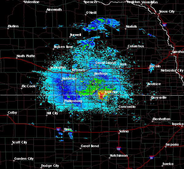 At 457 am cdt, severe thunderstorms were located along a line extending from bostwick to 7 miles northeast of burr oak, moving east at 30 mph (radar indicated). Hazards include half dollar size hail. Damage to vehicles is expected. Locations impacted include, superior, hardy, webber, bostwick and lovewell state park. At 457 am cdt, severe thunderstorms were located along a line extending from bostwick to 7 miles northeast of burr oak, moving east at 30 mph (radar indicated). Hazards include half dollar size hail. Damage to vehicles is expected. Locations impacted include, superior, hardy, webber, bostwick and lovewell state park.
|
| 5/15/2019 4:47 AM CDT |
 At 447 am cdt, severe thunderstorms were located along a line extending from near guide rock to 6 miles northeast of burr oak, moving east at 25 mph (radar indicated). Hazards include quarter size hail. damage to vehicles is expected At 447 am cdt, severe thunderstorms were located along a line extending from near guide rock to 6 miles northeast of burr oak, moving east at 25 mph (radar indicated). Hazards include quarter size hail. damage to vehicles is expected
|
| 5/6/2019 1:39 PM CDT |
 The national weather service in hastings has issued a * severe thunderstorm warning for. southeastern nuckolls county in south central nebraska. thayer county in south central nebraska. until 230 pm cdt. At 139 pm cdt, a severe thunderstorm was located near ruskin, or 22. The national weather service in hastings has issued a * severe thunderstorm warning for. southeastern nuckolls county in south central nebraska. thayer county in south central nebraska. until 230 pm cdt. At 139 pm cdt, a severe thunderstorm was located near ruskin, or 22.
|
| 5/6/2019 1:24 PM CDT |
 A severe thunderstorm warning remains in effect until 145 pm cdt for southern nuckolls county. at 123 pm cdt, a severe thunderstorm was located near superior, or 30 miles northwest of belleville, moving east at 25 mph. hazard. quarter size hail. source. Radar indicated. A severe thunderstorm warning remains in effect until 145 pm cdt for southern nuckolls county. at 123 pm cdt, a severe thunderstorm was located near superior, or 30 miles northwest of belleville, moving east at 25 mph. hazard. quarter size hail. source. Radar indicated.
|
| 5/6/2019 12:55 PM CDT |
 At 1255 pm cdt, a severe thunderstorm was located near guide rock, or 35 miles south of hastings, moving east at 35 mph (radar indicated). Hazards include 60 mph wind gusts and half dollar size hail. Hail damage to vehicles is expected. Expect wind damage to roofs, siding, and trees. At 1255 pm cdt, a severe thunderstorm was located near guide rock, or 35 miles south of hastings, moving east at 35 mph (radar indicated). Hazards include 60 mph wind gusts and half dollar size hail. Hail damage to vehicles is expected. Expect wind damage to roofs, siding, and trees.
|
| 5/5/2019 6:29 PM CDT |
 The national weather service in hastings has issued a * severe thunderstorm warning for. southern clay county in south central nebraska. nuckolls county in south central nebraska. southwestern fillmore county in south central nebraska. Thayer county in south central nebraska. The national weather service in hastings has issued a * severe thunderstorm warning for. southern clay county in south central nebraska. nuckolls county in south central nebraska. southwestern fillmore county in south central nebraska. Thayer county in south central nebraska.
|
| 4/21/2019 8:51 PM CDT |
 At 851 pm cdt, severe thunderstorms were located along a line extending from near red cloud to hunter, moving northeast at 35 mph (radar indicated). Hazards include 70 mph wind gusts and quarter size hail. Hail damage to vehicles is expected. expect considerable tree damage. Wind damage is also likely to mobile homes, roofs, and outbuildings. At 851 pm cdt, severe thunderstorms were located along a line extending from near red cloud to hunter, moving northeast at 35 mph (radar indicated). Hazards include 70 mph wind gusts and quarter size hail. Hail damage to vehicles is expected. expect considerable tree damage. Wind damage is also likely to mobile homes, roofs, and outbuildings.
|
| 3/28/2019 10:00 AM CDT | Quarter sized hail reported 0.4 miles WNW of Superior, NE, public report via twitter of nickle to quarter size hail. |
| 3/28/2019 9:58 AM CDT |
 At 958 am cdt, a severe thunderstorm was located near hardy, or 21 miles northwest of belleville, moving east at 25 mph (radar indicated). Hazards include ping pong ball size hail and 60 mph wind gusts. People and animals outdoors will be injured. expect hail damage to roofs, siding, windows, and vehicles. expect wind damage to roofs, siding, and trees. Locations impacted include, superior, hardy, webber and lovewell state park. At 958 am cdt, a severe thunderstorm was located near hardy, or 21 miles northwest of belleville, moving east at 25 mph (radar indicated). Hazards include ping pong ball size hail and 60 mph wind gusts. People and animals outdoors will be injured. expect hail damage to roofs, siding, windows, and vehicles. expect wind damage to roofs, siding, and trees. Locations impacted include, superior, hardy, webber and lovewell state park.
|
| 3/28/2019 9:45 AM CDT |
 At 944 am cdt, a severe thunderstorm was located over superior, or 27 miles northwest of belleville, moving east at 25 mph (radar indicated). Hazards include ping pong ball size hail and 60 mph wind gusts. People and animals outdoors will be injured. expect hail damage to roofs, siding, windows, and vehicles. Expect wind damage to roofs, siding, and trees. At 944 am cdt, a severe thunderstorm was located over superior, or 27 miles northwest of belleville, moving east at 25 mph (radar indicated). Hazards include ping pong ball size hail and 60 mph wind gusts. People and animals outdoors will be injured. expect hail damage to roofs, siding, windows, and vehicles. Expect wind damage to roofs, siding, and trees.
|
| 3/28/2019 9:38 AM CDT |
 At 937 am cdt, severe thunderstorms were located along a line extending from near nora to near bostwick to 7 miles southwest of guide rock, moving east at 25 mph (radar indicated). Hazards include ping pong ball size hail and 60 mph wind gusts. People and animals outdoors will be injured. expect hail damage to roofs, siding, windows, and vehicles. expect wind damage to roofs, siding, and trees. Locations impacted include, superior, guide rock, burr oak, webber, nora, bostwick and lovewell state park. At 937 am cdt, severe thunderstorms were located along a line extending from near nora to near bostwick to 7 miles southwest of guide rock, moving east at 25 mph (radar indicated). Hazards include ping pong ball size hail and 60 mph wind gusts. People and animals outdoors will be injured. expect hail damage to roofs, siding, windows, and vehicles. expect wind damage to roofs, siding, and trees. Locations impacted include, superior, guide rock, burr oak, webber, nora, bostwick and lovewell state park.
|
| 3/28/2019 9:24 AM CDT |
 At 924 am cdt, severe thunderstorms were located along a line extending from near nora to near bostwick to 8 miles north of esbon, moving east at 30 mph (radar indicated). Hazards include ping pong ball size hail and 60 mph wind gusts. People and animals outdoors will be injured. expect hail damage to roofs, siding, windows, and vehicles. expect wind damage to roofs, siding, and trees. Locations impacted include, superior, red cloud, nelson, guide rock, burr oak, webber, nora, bostwick and lovewell state park. At 924 am cdt, severe thunderstorms were located along a line extending from near nora to near bostwick to 8 miles north of esbon, moving east at 30 mph (radar indicated). Hazards include ping pong ball size hail and 60 mph wind gusts. People and animals outdoors will be injured. expect hail damage to roofs, siding, windows, and vehicles. expect wind damage to roofs, siding, and trees. Locations impacted include, superior, red cloud, nelson, guide rock, burr oak, webber, nora, bostwick and lovewell state park.
|
| 3/28/2019 9:13 AM CDT |
 At 912 am cdt, severe thunderstorms were located along a line extending from near nelson to near red cloud to 9 miles north of bellaire, moving east at 25 mph (radar indicated). Hazards include 60 mph wind gusts and quarter size hail. Hail damage to vehicles is expected. expect wind damage to roofs, siding, and trees. Locations impacted include, superior, red cloud, nelson, guide rock, burr oak, cowles, webber, nora, bostwick, inavale and lovewell state park. At 912 am cdt, severe thunderstorms were located along a line extending from near nelson to near red cloud to 9 miles north of bellaire, moving east at 25 mph (radar indicated). Hazards include 60 mph wind gusts and quarter size hail. Hail damage to vehicles is expected. expect wind damage to roofs, siding, and trees. Locations impacted include, superior, red cloud, nelson, guide rock, burr oak, cowles, webber, nora, bostwick, inavale and lovewell state park.
|
| 3/28/2019 9:00 AM CDT |
 At 859 am cdt, severe thunderstorms were located along a line extending from near lawrence to near red cloud to 9 miles south of riverton, moving east at 25 mph (radar indicated). Hazards include 60 mph wind gusts and quarter size hail. Hail damage to vehicles is expected. Expect wind damage to roofs, siding, and trees. At 859 am cdt, severe thunderstorms were located along a line extending from near lawrence to near red cloud to 9 miles south of riverton, moving east at 25 mph (radar indicated). Hazards include 60 mph wind gusts and quarter size hail. Hail damage to vehicles is expected. Expect wind damage to roofs, siding, and trees.
|
| 9/20/2018 6:29 PM CDT |
 At 628 pm cdt, severe thunderstorms were located along a line extending from lawrence to near nelson to superior, moving east at 35 mph (radar indicated). Hazards include 70 mph wind gusts. Expect considerable tree damage. Damage is likely to mobile homes, roofs, and outbuildings. At 628 pm cdt, severe thunderstorms were located along a line extending from lawrence to near nelson to superior, moving east at 35 mph (radar indicated). Hazards include 70 mph wind gusts. Expect considerable tree damage. Damage is likely to mobile homes, roofs, and outbuildings.
|
| 7/30/2018 2:54 PM CDT |
 At 254 pm cdt, severe thunderstorms were located along a line extending from near superior to near guide rock, moving south at 15 mph (radar indicated). Hazards include 60 mph wind gusts and half dollar size hail. Hail damage to vehicles is expected. expect wind damage to roofs, siding, and trees. Locations impacted include, superior, guide rock and bostwick. At 254 pm cdt, severe thunderstorms were located along a line extending from near superior to near guide rock, moving south at 15 mph (radar indicated). Hazards include 60 mph wind gusts and half dollar size hail. Hail damage to vehicles is expected. expect wind damage to roofs, siding, and trees. Locations impacted include, superior, guide rock and bostwick.
|
| 7/30/2018 2:44 PM CDT |
 At 244 pm cdt, a severe thunderstorm was located over bostwick, or 35 miles northwest of belleville, moving south at 15 mph (radar indicated). Hazards include 60 mph wind gusts and quarter size hail. Hail damage to vehicles is expected. Expect wind damage to roofs, siding, and trees. At 244 pm cdt, a severe thunderstorm was located over bostwick, or 35 miles northwest of belleville, moving south at 15 mph (radar indicated). Hazards include 60 mph wind gusts and quarter size hail. Hail damage to vehicles is expected. Expect wind damage to roofs, siding, and trees.
|
| 6/9/2018 3:22 AM CDT |
 At 321 am cdt, severe thunderstorm outflow winds were located along a line extending from near bostwick to near deshler to near milligan, moving south at 45 mph (radar indicated). Hazards include 60 mph wind gusts. Expect damage to roofs, siding, and trees. Locations impacted include, superior, hebron, mankato, deshler, nelson, chester, alexandria, hardy, ruskin, carleton, byron, oak, belvidere, gilead, webber, nora, lovewell state park and bostwick. At 321 am cdt, severe thunderstorm outflow winds were located along a line extending from near bostwick to near deshler to near milligan, moving south at 45 mph (radar indicated). Hazards include 60 mph wind gusts. Expect damage to roofs, siding, and trees. Locations impacted include, superior, hebron, mankato, deshler, nelson, chester, alexandria, hardy, ruskin, carleton, byron, oak, belvidere, gilead, webber, nora, lovewell state park and bostwick.
|
| 6/9/2018 3:00 AM CDT |
 At 259 am cdt, severe thunderstorm outflow winds were located along a line extending from near lawrence to near davenport to near friend, moving south at 45 mph (radar indicated. in addition, airports at hastings, aurora and york have all gusted to at least 59 mph during the past hour). Hazards include 60 mph wind gusts. expect damage to roofs, siding, and trees At 259 am cdt, severe thunderstorm outflow winds were located along a line extending from near lawrence to near davenport to near friend, moving south at 45 mph (radar indicated. in addition, airports at hastings, aurora and york have all gusted to at least 59 mph during the past hour). Hazards include 60 mph wind gusts. expect damage to roofs, siding, and trees
|
| 5/1/2018 5:39 PM CDT |
 At 536 pm cdt, a severe thunderstorm was located over webber, or 21 miles west of belleville, moving northeast at 45 mph (radar indicated). Hazards include golf ball size hail and 70 mph wind gusts. People and animals outdoors will be injured. expect hail damage to roofs, siding, windows, and vehicles. expect considerable tree damage. wind damage is also likely to mobile homes, roofs, and outbuildings. locations impacted include, superior, mankato, hardy, webber, lovewell state park and montrose. A tornado watch remains in effect until 1000 pm cdt for north central kansas, and south central nebraska. At 536 pm cdt, a severe thunderstorm was located over webber, or 21 miles west of belleville, moving northeast at 45 mph (radar indicated). Hazards include golf ball size hail and 70 mph wind gusts. People and animals outdoors will be injured. expect hail damage to roofs, siding, windows, and vehicles. expect considerable tree damage. wind damage is also likely to mobile homes, roofs, and outbuildings. locations impacted include, superior, mankato, hardy, webber, lovewell state park and montrose. A tornado watch remains in effect until 1000 pm cdt for north central kansas, and south central nebraska.
|
| 5/1/2018 5:33 PM CDT |
 At 533 pm cdt, a severe thunderstorm was located near byron, or 19 miles northwest of belleville, moving east at 40 mph. weak rotation is also noted on radar near hardy (radar indicated). Hazards include 70 mph wind gusts and half dollar size hail. Hail damage to vehicles is expected. expect considerable tree damage. wind damage is also likely to mobile homes, roofs, and outbuildings. locations impacted include, superior, hebron, deshler, chester, alexandria, hardy, ruskin, byron, hubbell, oak, belvidere, gilead and nora. A tornado watch remains in effect until 1000 pm cdt for north central kansas, and south central nebraska. At 533 pm cdt, a severe thunderstorm was located near byron, or 19 miles northwest of belleville, moving east at 40 mph. weak rotation is also noted on radar near hardy (radar indicated). Hazards include 70 mph wind gusts and half dollar size hail. Hail damage to vehicles is expected. expect considerable tree damage. wind damage is also likely to mobile homes, roofs, and outbuildings. locations impacted include, superior, hebron, deshler, chester, alexandria, hardy, ruskin, byron, hubbell, oak, belvidere, gilead and nora. A tornado watch remains in effect until 1000 pm cdt for north central kansas, and south central nebraska.
|
| 5/1/2018 5:25 PM CDT |
 At 525 pm cdt, a severe thunderstorm was located near ruskin, or 20 miles northwest of belleville, moving east at 55 mph (radar indicated). Hazards include 70 mph wind gusts and half dollar size hail. Hail damage to vehicles is expected. expect considerable tree damage. Wind damage is also likely to mobile homes, roofs, and outbuildings. At 525 pm cdt, a severe thunderstorm was located near ruskin, or 20 miles northwest of belleville, moving east at 55 mph (radar indicated). Hazards include 70 mph wind gusts and half dollar size hail. Hail damage to vehicles is expected. expect considerable tree damage. Wind damage is also likely to mobile homes, roofs, and outbuildings.
|
| 5/1/2018 5:23 PM CDT |
 At 523 pm cdt, severe thunderstorms were located along a line extending from near nora to near formoso, moving northeast at 50 mph (radar indicated). Hazards include golf ball size hail and 70 mph wind gusts. People and animals outdoors will be injured. expect hail damage to roofs, siding, windows, and vehicles. expect considerable tree damage. wind damage is also likely to mobile homes, roofs, and outbuildings. locations impacted include, superior, mankato, burr oak, hardy, webber, bostwick, lovewell state park and montrose. A tornado watch remains in effect until 1000 pm cdt for north central kansas, and south central nebraska. At 523 pm cdt, severe thunderstorms were located along a line extending from near nora to near formoso, moving northeast at 50 mph (radar indicated). Hazards include golf ball size hail and 70 mph wind gusts. People and animals outdoors will be injured. expect hail damage to roofs, siding, windows, and vehicles. expect considerable tree damage. wind damage is also likely to mobile homes, roofs, and outbuildings. locations impacted include, superior, mankato, burr oak, hardy, webber, bostwick, lovewell state park and montrose. A tornado watch remains in effect until 1000 pm cdt for north central kansas, and south central nebraska.
|
| 5/1/2018 5:00 PM CDT |
 At 459 pm cdt, a severe thunderstorm capable of producing a tornado was located near burr oak, or 31 miles north of beloit, moving east at 30 mph. there are additional areas of rotation near mankato, also moving east (radar indicated rotation). Hazards include tornado and golf ball size hail. Flying debris will be dangerous to those caught without shelter. mobile homes will be damaged or destroyed. damage to roofs, windows, and vehicles will occur. tree damage is likely. this dangerous storm will be near, bostwick around 510 pm cdt. Superior around 520 pm cdt. At 459 pm cdt, a severe thunderstorm capable of producing a tornado was located near burr oak, or 31 miles north of beloit, moving east at 30 mph. there are additional areas of rotation near mankato, also moving east (radar indicated rotation). Hazards include tornado and golf ball size hail. Flying debris will be dangerous to those caught without shelter. mobile homes will be damaged or destroyed. damage to roofs, windows, and vehicles will occur. tree damage is likely. this dangerous storm will be near, bostwick around 510 pm cdt. Superior around 520 pm cdt.
|
| 5/1/2018 4:53 PM CDT |
 At 452 pm cdt, severe thunderstorms were located along a line extending from near bostwick to near downs, moving east at 30 mph (radar indicated). Hazards include golf ball size hail and 70 mph wind gusts. People and animals outdoors will be injured. expect hail damage to roofs, siding, windows, and vehicles. expect considerable tree damage. Wind damage is also likely to mobile homes, roofs, and outbuildings. At 452 pm cdt, severe thunderstorms were located along a line extending from near bostwick to near downs, moving east at 30 mph (radar indicated). Hazards include golf ball size hail and 70 mph wind gusts. People and animals outdoors will be injured. expect hail damage to roofs, siding, windows, and vehicles. expect considerable tree damage. Wind damage is also likely to mobile homes, roofs, and outbuildings.
|
| 5/1/2018 4:23 PM CDT |
 At 422 pm cdt, severe thunderstorms were located along a line extending from 6 miles southeast of red cloud nebraska to near harlan kansas, moving east at 40 mph (radar indicated). Hazards include golf ball size hail and 60 mph wind gusts. People and animals outdoors will be injured. expect hail damage to roofs, siding, windows, and vehicles. Expect wind damage to roofs, siding, and trees. At 422 pm cdt, severe thunderstorms were located along a line extending from 6 miles southeast of red cloud nebraska to near harlan kansas, moving east at 40 mph (radar indicated). Hazards include golf ball size hail and 60 mph wind gusts. People and animals outdoors will be injured. expect hail damage to roofs, siding, windows, and vehicles. Expect wind damage to roofs, siding, and trees.
|
| 10/6/2017 7:40 PM CDT |
 At 740 pm cdt, a severe thunderstorm was located over bostwick, or 31 miles northwest of belleville, moving northeast at 20 mph (radar indicated). Hazards include 60 mph wind gusts and quarter size hail. Hail damage to vehicles is expected. expect wind damage to roofs, siding, and trees. Locations impacted include, superior, nelson, guide rock, hardy, webber, nora and bostwick. At 740 pm cdt, a severe thunderstorm was located over bostwick, or 31 miles northwest of belleville, moving northeast at 20 mph (radar indicated). Hazards include 60 mph wind gusts and quarter size hail. Hail damage to vehicles is expected. expect wind damage to roofs, siding, and trees. Locations impacted include, superior, nelson, guide rock, hardy, webber, nora and bostwick.
|
| 10/6/2017 7:23 PM CDT |
 At 723 pm cdt, a severe thunderstorm was located near burr oak, or 32 miles west of belleville, moving northeast at 20 mph (radar indicated). Hazards include 60 mph wind gusts and quarter size hail. Hail damage to vehicles is expected. Expect wind damage to roofs, siding, and trees. At 723 pm cdt, a severe thunderstorm was located near burr oak, or 32 miles west of belleville, moving northeast at 20 mph (radar indicated). Hazards include 60 mph wind gusts and quarter size hail. Hail damage to vehicles is expected. Expect wind damage to roofs, siding, and trees.
|
| 10/2/2017 7:17 PM CDT |
 At 717 pm cdt, a severe thunderstorm was located 7 miles north of mankato, or 28 miles west of belleville, moving northeast at 25 mph (radar indicated). Hazards include 60 mph wind gusts and quarter size hail. Hail damage to vehicles is expected. Expect wind damage to roofs, siding, and trees. At 717 pm cdt, a severe thunderstorm was located 7 miles north of mankato, or 28 miles west of belleville, moving northeast at 25 mph (radar indicated). Hazards include 60 mph wind gusts and quarter size hail. Hail damage to vehicles is expected. Expect wind damage to roofs, siding, and trees.
|
| 10/1/2017 9:15 PM CDT |
 At 915 pm cdt, a severe thunderstorm was located over guide rock, or 37 miles south of hastings, moving northeast at 40 mph (radar indicated). Hazards include 60 mph wind gusts and quarter size hail. Hail damage to vehicles is expected. Expect wind damage to roofs, siding, and trees. At 915 pm cdt, a severe thunderstorm was located over guide rock, or 37 miles south of hastings, moving northeast at 40 mph (radar indicated). Hazards include 60 mph wind gusts and quarter size hail. Hail damage to vehicles is expected. Expect wind damage to roofs, siding, and trees.
|
| 8/27/2017 4:32 AM CDT |
 At 431 am cdt, severe thunderstorms were located along a line extending from near shelton to near minden to near holdrege, moving southeast at 65 mph (radar indicated). Hazards include 60 mph wind gusts. these storms have a history of producing high winds. at 419 am, winds of 58 mph were measured in kearney. Expect damage to roofs, siding, and trees. severe thunderstorms will be near, ragan around 445 am cdt. hildreth, campbell and bladen around 450 am cdt. bloomington around 500 am cdt. red cloud, franklin, lawrence, cowles and rosemont around 505 am cdt. riverton around 510 am cdt. Nelson, guide rock and bostwick around 515 am cdt. At 431 am cdt, severe thunderstorms were located along a line extending from near shelton to near minden to near holdrege, moving southeast at 65 mph (radar indicated). Hazards include 60 mph wind gusts. these storms have a history of producing high winds. at 419 am, winds of 58 mph were measured in kearney. Expect damage to roofs, siding, and trees. severe thunderstorms will be near, ragan around 445 am cdt. hildreth, campbell and bladen around 450 am cdt. bloomington around 500 am cdt. red cloud, franklin, lawrence, cowles and rosemont around 505 am cdt. riverton around 510 am cdt. Nelson, guide rock and bostwick around 515 am cdt.
|
| 8/16/2017 4:27 AM CDT |
 At 426 am cdt, severe thunderstorms were located along a line extending from near guide rock to near burr oak to near cawker city to near osborne, moving east at 35 mph (combination of radar and mesonet data). Hazards include 60 to 65 mph wind gusts. expect damage to roofs, siding, and trees At 426 am cdt, severe thunderstorms were located along a line extending from near guide rock to near burr oak to near cawker city to near osborne, moving east at 35 mph (combination of radar and mesonet data). Hazards include 60 to 65 mph wind gusts. expect damage to roofs, siding, and trees
|
| 7/17/2017 8:53 PM CDT |
 At 852 pm cdt, severe thunderstorms were located along a line extending from rosemont to near burr oak, moving east at 25 mph (public. at 839 pm 50 mph wind gusts were reported by a weather station 3 miles southwest of cowles). Hazards include 60 mph wind gusts. Expect damage to roofs, siding, and trees. Locations impacted include, superior, red cloud, mankato, nelson, lawrence, bladen, guide rock, burr oak, esbon, cowles, webber, rosemont, montrose and bostwick. At 852 pm cdt, severe thunderstorms were located along a line extending from rosemont to near burr oak, moving east at 25 mph (public. at 839 pm 50 mph wind gusts were reported by a weather station 3 miles southwest of cowles). Hazards include 60 mph wind gusts. Expect damage to roofs, siding, and trees. Locations impacted include, superior, red cloud, mankato, nelson, lawrence, bladen, guide rock, burr oak, esbon, cowles, webber, rosemont, montrose and bostwick.
|
| 7/17/2017 8:36 PM CDT |
 At 836 pm cdt, severe thunderstorms were located along a line extending from near blue hill to near esbon, moving east at 20 mph (radar indicated). Hazards include 60 mph wind gusts. expect damage to roofs, siding, and trees At 836 pm cdt, severe thunderstorms were located along a line extending from near blue hill to near esbon, moving east at 20 mph (radar indicated). Hazards include 60 mph wind gusts. expect damage to roofs, siding, and trees
|
| 6/29/2017 11:34 PM CDT | Half Dollar sized hail reported 0.3 miles NE of Superior, NE, hail accompanied by 50 mph winds. hail ongoing. |
| 6/29/2017 6:34 PM CDT |
 At 1134 pm cdt, a severe thunderstorm was located over superior, or 27 miles northwest of belleville, moving east at 15 mph (radar indicated). Hazards include golf ball size hail and 60 mph wind gusts. People and animals outdoors will be injured. expect hail damage to roofs, siding, windows, and vehicles. expect wind damage to roofs, siding, and trees. this severe thunderstorm will be near, webber around 1145 pm cdt. Hardy around 1210 am cdt. At 1134 pm cdt, a severe thunderstorm was located over superior, or 27 miles northwest of belleville, moving east at 15 mph (radar indicated). Hazards include golf ball size hail and 60 mph wind gusts. People and animals outdoors will be injured. expect hail damage to roofs, siding, windows, and vehicles. expect wind damage to roofs, siding, and trees. this severe thunderstorm will be near, webber around 1145 pm cdt. Hardy around 1210 am cdt.
|
| 6/28/2017 9:22 PM CDT |
 At 221 am cdt, severe thunderstorms were located along a line extending from near byron to near hardy to near burr oak to near guide rock, moving southeast at 30 mph (radar indicated). Hazards include quarter size hail. Damage to vehicles is expected. Locations impacted include, superior, guide rock, burr oak, hardy, webber, bostwick and lovewell state park. At 221 am cdt, severe thunderstorms were located along a line extending from near byron to near hardy to near burr oak to near guide rock, moving southeast at 30 mph (radar indicated). Hazards include quarter size hail. Damage to vehicles is expected. Locations impacted include, superior, guide rock, burr oak, hardy, webber, bostwick and lovewell state park.
|
| 6/28/2017 8:55 PM CDT |
 At 155 am cdt, severe thunderstorms were located along a line extending from near hardy to bostwick to near guide rock to 7 miles south of inavale, moving east at 30 mph (radar indicated). Hazards include half dollar size hail. damage to vehicles is expected At 155 am cdt, severe thunderstorms were located along a line extending from near hardy to bostwick to near guide rock to 7 miles south of inavale, moving east at 30 mph (radar indicated). Hazards include half dollar size hail. damage to vehicles is expected
|
| 6/28/2017 8:32 PM CDT |
 At 130 am cdt, severe thunderstorms were located along a line extending from near superior to near guide rock, moving east at 30 mph (radar indicated). Hazards include golf ball size hail. People and animals outdoors will be injured. expect damage to roofs, siding, windows, and vehicles. Locations impacted include, superior, guide rock, hardy, ruskin, cowles, webber, nora and bostwick. At 130 am cdt, severe thunderstorms were located along a line extending from near superior to near guide rock, moving east at 30 mph (radar indicated). Hazards include golf ball size hail. People and animals outdoors will be injured. expect damage to roofs, siding, windows, and vehicles. Locations impacted include, superior, guide rock, hardy, ruskin, cowles, webber, nora and bostwick.
|
| 6/28/2017 8:13 PM CDT |
 At 113 am cdt, severe thunderstorms were located along a line extending from near bostwick to red cloud, moving east at 30 mph (radar indicated). Hazards include golf ball size hail. People and animals outdoors will be injured. Expect damage to roofs, siding, windows, and vehicles. At 113 am cdt, severe thunderstorms were located along a line extending from near bostwick to red cloud, moving east at 30 mph (radar indicated). Hazards include golf ball size hail. People and animals outdoors will be injured. Expect damage to roofs, siding, windows, and vehicles.
|
| 6/28/2017 7:34 PM CDT |
 At 1234 am cdt, a severe thunderstorm was located near red cloud, or 33 miles south of hastings, moving east at 20 mph (radar indicated). Hazards include golf ball size hail. People and animals outdoors will be injured. Expect damage to roofs, siding, windows, and vehicles. At 1234 am cdt, a severe thunderstorm was located near red cloud, or 33 miles south of hastings, moving east at 20 mph (radar indicated). Hazards include golf ball size hail. People and animals outdoors will be injured. Expect damage to roofs, siding, windows, and vehicles.
|
| 6/28/2017 6:18 PM CDT |
 At 1118 pm cdt, a severe thunderstorm was located near bostwick, or 30 miles west of belleville, moving northeast at 25 mph (radar indicated). Hazards include quarter size hail. Damage to vehicles is expected. Locations impacted include, superior, webber and bostwick. At 1118 pm cdt, a severe thunderstorm was located near bostwick, or 30 miles west of belleville, moving northeast at 25 mph (radar indicated). Hazards include quarter size hail. Damage to vehicles is expected. Locations impacted include, superior, webber and bostwick.
|
| 6/28/2017 5:53 PM CDT |
 At 1053 pm cdt, a severe thunderstorm was located over burr oak, or 29 miles north of beloit, moving northeast at 25 mph (radar indicated). Hazards include quarter size hail. damage to vehicles is expected At 1053 pm cdt, a severe thunderstorm was located over burr oak, or 29 miles north of beloit, moving northeast at 25 mph (radar indicated). Hazards include quarter size hail. damage to vehicles is expected
|
| 6/20/2017 10:27 PM CDT |
 The severe thunderstorm warning for northeastern jewell and southeastern nuckolls counties will expire at 1030 pm cdt. the storm which prompted the warning has moved out of the area. therefore the warning will be allowed to expire. to report severe weather, contact your nearest law enforcement agency. They will relay your report to the national weather service. The severe thunderstorm warning for northeastern jewell and southeastern nuckolls counties will expire at 1030 pm cdt. the storm which prompted the warning has moved out of the area. therefore the warning will be allowed to expire. to report severe weather, contact your nearest law enforcement agency. They will relay your report to the national weather service.
|
| 6/20/2017 10:14 PM CDT |
 At 1014 pm cdt, a severe thunderstorm was located near hardy, or 21 miles northwest of belleville, moving east at 30 mph (radar indicated). Hazards include half dollar size hail. Damage to vehicles is expected. Locations impacted include, superior, hardy, webber and lovewell state park. At 1014 pm cdt, a severe thunderstorm was located near hardy, or 21 miles northwest of belleville, moving east at 30 mph (radar indicated). Hazards include half dollar size hail. Damage to vehicles is expected. Locations impacted include, superior, hardy, webber and lovewell state park.
|
| 6/20/2017 10:09 PM CDT | Estimated winds in superior of 60 to 70 mph. lot of tree damage and power lines down. much of town without power at time of repor in nuckolls county NE, 0.3 miles NE of Superior, NE |
| 6/20/2017 10:05 PM CDT | Golf Ball sized hail reported 0.4 miles WNW of Superior, NE, time based on radar. |
| 6/20/2017 10:03 PM CDT |
 At 1003 pm cdt, a severe thunderstorm was located near webber, or 27 miles west of belleville, moving east at 30 mph (radar indicated). Hazards include half dollar size hail. Damage to vehicles is expected. torrential rainfall is occurring with this storm, and may lead to flash flooding. do not drive your vehicle through flooded roadways. Locations impacted include, superior, hardy, webber, bostwick and lovewell state park. At 1003 pm cdt, a severe thunderstorm was located near webber, or 27 miles west of belleville, moving east at 30 mph (radar indicated). Hazards include half dollar size hail. Damage to vehicles is expected. torrential rainfall is occurring with this storm, and may lead to flash flooding. do not drive your vehicle through flooded roadways. Locations impacted include, superior, hardy, webber, bostwick and lovewell state park.
|
| 6/20/2017 10:00 PM CDT | Estimated winds in superior of 60 to 70 mph. lots of tree damage and power lines/poles down. tree branches 6 to 10 inches broken. several streets closed due to trees ac in nuckolls county NE, 0.3 miles NE of Superior, NE |
| 6/20/2017 9:44 PM CDT |
 At 943 pm cdt, a severe thunderstorm was located near guide rock, or 37 miles west of belleville, moving east at 30 mph (radar indicated). Hazards include half dollar size hail. damage to vehicles is expected At 943 pm cdt, a severe thunderstorm was located near guide rock, or 37 miles west of belleville, moving east at 30 mph (radar indicated). Hazards include half dollar size hail. damage to vehicles is expected
|
| 6/13/2017 10:17 PM CDT |
 At 1016 pm cdt, a severe thunderstorm was centered between nelson and guide rock, or 30 miles southeast of hastings, moving northeast at 40 mph (radar indicated. in addition, at 1005 pm cdt, a mesonet station measured a 59 mph wind gust 7 miles northeast of guide rock). Hazards include 60 mph wind gusts and half dollar size hail. Hail damage to vehicles is expected. expect wind damage to roofs, siding, and trees. Locations impacted include, superior, clay center, edgar, nelson, fairfield, lawrence, guide rock, hardy, ruskin, deweese, oak, nora, rosemont and bostwick. At 1016 pm cdt, a severe thunderstorm was centered between nelson and guide rock, or 30 miles southeast of hastings, moving northeast at 40 mph (radar indicated. in addition, at 1005 pm cdt, a mesonet station measured a 59 mph wind gust 7 miles northeast of guide rock). Hazards include 60 mph wind gusts and half dollar size hail. Hail damage to vehicles is expected. expect wind damage to roofs, siding, and trees. Locations impacted include, superior, clay center, edgar, nelson, fairfield, lawrence, guide rock, hardy, ruskin, deweese, oak, nora, rosemont and bostwick.
|
| 6/13/2017 10:00 PM CDT |
 At 959 pm cdt, a severe thunderstorm was located near guide rock, or 32 miles south of hastings, moving northeast at 40 mph (radar indicated). Hazards include golf ball size hail and 60 mph wind gusts. People and animals outdoors will be injured. expect hail damage to roofs, siding, windows, and vehicles. Expect wind damage to roofs, siding, and trees. At 959 pm cdt, a severe thunderstorm was located near guide rock, or 32 miles south of hastings, moving northeast at 40 mph (radar indicated). Hazards include golf ball size hail and 60 mph wind gusts. People and animals outdoors will be injured. expect hail damage to roofs, siding, windows, and vehicles. Expect wind damage to roofs, siding, and trees.
|
| 5/16/2017 6:21 PM CDT |
 At 620 pm cdt, severe thunderstorms were located along a line extending from 7 miles southeast of red cloud to nelson, moving northeast at 25 mph (radar indicated). Hazards include 60 mph wind gusts and quarter size hail. Hail damage to vehicles is expected. expect wind damage to roofs, siding, and trees. Locations impacted include, superior, nelson, lawrence, guide rock, oak, cowles, nora, bostwick and rosemont. At 620 pm cdt, severe thunderstorms were located along a line extending from 7 miles southeast of red cloud to nelson, moving northeast at 25 mph (radar indicated). Hazards include 60 mph wind gusts and quarter size hail. Hail damage to vehicles is expected. expect wind damage to roofs, siding, and trees. Locations impacted include, superior, nelson, lawrence, guide rock, oak, cowles, nora, bostwick and rosemont.
|
| 5/16/2017 6:14 PM CDT | Quarter sized hail reported 5.3 miles S of Superior, NE, ongoing. |
| 5/16/2017 5:58 PM CDT |
 At 557 pm cdt, severe thunderstorms were located along a line extending from near red cloud to near bostwick, moving northeast at 40 mph (radar indicated). Hazards include 60 mph wind gusts and quarter size hail. Hail damage to vehicles is expected. Expect wind damage to roofs, siding, and trees. At 557 pm cdt, severe thunderstorms were located along a line extending from near red cloud to near bostwick, moving northeast at 40 mph (radar indicated). Hazards include 60 mph wind gusts and quarter size hail. Hail damage to vehicles is expected. Expect wind damage to roofs, siding, and trees.
|
| 5/16/2017 4:21 PM CDT |
 At 421 pm cdt, a severe thunderstorm was located near nelson, or 33 miles northwest of belleville, moving northeast at 45 mph (radar indicated). Hazards include 60 mph wind gusts and quarter size hail. Hail damage to vehicles is expected. expect wind damage to roofs, siding, and trees. Locations impacted include, superior, nelson, davenport, hardy, ruskin, oak, nora and bostwick. At 421 pm cdt, a severe thunderstorm was located near nelson, or 33 miles northwest of belleville, moving northeast at 45 mph (radar indicated). Hazards include 60 mph wind gusts and quarter size hail. Hail damage to vehicles is expected. expect wind damage to roofs, siding, and trees. Locations impacted include, superior, nelson, davenport, hardy, ruskin, oak, nora and bostwick.
|
| 5/16/2017 4:11 PM CDT |
 At 411 pm cdt, a severe thunderstorm was located over bostwick, or 32 miles northwest of belleville, moving northeast at 40 mph (radar indicated). Hazards include 60 mph wind gusts and quarter size hail. Hail damage to vehicles is expected. Expect wind damage to roofs, siding, and trees. At 411 pm cdt, a severe thunderstorm was located over bostwick, or 32 miles northwest of belleville, moving northeast at 40 mph (radar indicated). Hazards include 60 mph wind gusts and quarter size hail. Hail damage to vehicles is expected. Expect wind damage to roofs, siding, and trees.
|
| 4/18/2017 11:13 PM CDT |
 The severe thunderstorm warning for northeastern jewell and southwestern nuckolls counties will expire at 1115 pm cdt. the storm which prompted the warning has weakened below severe limits, and no longer poses an immediate threat to life or property. therefore, the warning will be allowed to expire. However small hail is still possible with this thunderstorm. The severe thunderstorm warning for northeastern jewell and southwestern nuckolls counties will expire at 1115 pm cdt. the storm which prompted the warning has weakened below severe limits, and no longer poses an immediate threat to life or property. therefore, the warning will be allowed to expire. However small hail is still possible with this thunderstorm.
|
| 4/18/2017 11:03 PM CDT |
 At 1102 pm cdt, a severe thunderstorm was located near bostwick, or 33 miles west of belleville, and is nearly stationary (radar indicated). Hazards include ping pong ball size hail. People and animals outdoors will be injured. expect damage to roofs, siding, windows, and vehicles. Locations impacted include, superior, webber, bostwick and lovewell state park. At 1102 pm cdt, a severe thunderstorm was located near bostwick, or 33 miles west of belleville, and is nearly stationary (radar indicated). Hazards include ping pong ball size hail. People and animals outdoors will be injured. expect damage to roofs, siding, windows, and vehicles. Locations impacted include, superior, webber, bostwick and lovewell state park.
|
| 4/18/2017 10:33 PM CDT |
 At 1033 pm cdt, a severe thunderstorm was located near burr oak, or 33 miles north of beloit, and is nearly stationary (radar indicated). Hazards include 60 mph wind gusts and half dollar size hail. Hail damage to vehicles is expected. Expect wind damage to roofs, siding, and trees. At 1033 pm cdt, a severe thunderstorm was located near burr oak, or 33 miles north of beloit, and is nearly stationary (radar indicated). Hazards include 60 mph wind gusts and half dollar size hail. Hail damage to vehicles is expected. Expect wind damage to roofs, siding, and trees.
|
| 12/25/2016 1:20 PM CST |
 At 119 pm cst, severe thunderstorms were located along a line extending from near giltner to near nora, moving east at 40 mph (radar indicated). Hazards include 60 mph wind gusts and dime to penny size hail. Expect damage to roofs, siding, and trees. Locations impacted include, superior, sutton, harvard, clay center, edgar, nelson, fairfield, hardy, ruskin, deweese, oak, ong, saronville and nora. At 119 pm cst, severe thunderstorms were located along a line extending from near giltner to near nora, moving east at 40 mph (radar indicated). Hazards include 60 mph wind gusts and dime to penny size hail. Expect damage to roofs, siding, and trees. Locations impacted include, superior, sutton, harvard, clay center, edgar, nelson, fairfield, hardy, ruskin, deweese, oak, ong, saronville and nora.
|
| 12/25/2016 12:47 PM CST |
 At 1247 pm cst, severe thunderstorms were located along a line extending from near prosser to near guide rock, moving east at 40 mph (radar indicated). Hazards include 60 mph wind gusts and penny size hail. expect damage to roofs, siding, and trees At 1247 pm cst, severe thunderstorms were located along a line extending from near prosser to near guide rock, moving east at 40 mph (radar indicated). Hazards include 60 mph wind gusts and penny size hail. expect damage to roofs, siding, and trees
|
| 8/11/2016 5:57 PM CDT |
 At 557 pm cdt, a severe thunderstorm was located near bellaire, or 37 miles east of phillipsburg, moving northeast at 30 mph (radar indicated). Hazards include 60 mph wind gusts and quarter size hail. Hail damage to vehicles is expected. Expect wind damage to roofs, siding, and trees. At 557 pm cdt, a severe thunderstorm was located near bellaire, or 37 miles east of phillipsburg, moving northeast at 30 mph (radar indicated). Hazards include 60 mph wind gusts and quarter size hail. Hail damage to vehicles is expected. Expect wind damage to roofs, siding, and trees.
|
| 7/11/2016 8:33 PM CDT |
 At 833 pm cdt, a severe thunderstorm was located over superior, or 37 miles north of beloit, moving east at 10 mph (trained weather spotters). Hazards include quarter size hail. damage to vehicles is expected At 833 pm cdt, a severe thunderstorm was located over superior, or 37 miles north of beloit, moving east at 10 mph (trained weather spotters). Hazards include quarter size hail. damage to vehicles is expected
|
| 7/11/2016 8:32 PM CDT | Quarter sized hail reported 0.3 miles NE of Superior, NE |
| 7/7/2016 1:04 AM CDT |
 At 104 am cdt, severe thunderstorms were located along a line extending from near aurora to saronville to near edgar to near nora to near bostwick, moving east at 45 mph (radar indicated). Hazards include 70 mph wind gusts and quarter size hail. Hail damage to vehicles is expected. expect considerable tree damage. Wind damage is also likely to mobile homes, roofs, and outbuildings. At 104 am cdt, severe thunderstorms were located along a line extending from near aurora to saronville to near edgar to near nora to near bostwick, moving east at 45 mph (radar indicated). Hazards include 70 mph wind gusts and quarter size hail. Hail damage to vehicles is expected. expect considerable tree damage. Wind damage is also likely to mobile homes, roofs, and outbuildings.
|
| 7/7/2016 12:36 AM CDT |
 At 1236 am cdt, severe thunderstorms were located along a line extending from near alda to hastings to 6 miles southwest of glenvil to near cowles to near red cloud, moving east at 55 mph (radar indicated). Hazards include 60 mph wind gusts and half dollar size hail. Hail damage to vehicles is expected. Expect wind damage to roofs, siding, and trees. At 1236 am cdt, severe thunderstorms were located along a line extending from near alda to hastings to 6 miles southwest of glenvil to near cowles to near red cloud, moving east at 55 mph (radar indicated). Hazards include 60 mph wind gusts and half dollar size hail. Hail damage to vehicles is expected. Expect wind damage to roofs, siding, and trees.
|
| 6/28/2016 2:05 AM CDT |
 At 204 am cdt, a severe thunderstorm was located near mankato, or 26 miles north of beloit, moving southeast at 45 mph (radar indicated). Hazards include ping pong ball size hail and 60 mph wind gusts. People and animals outdoors will be injured. expect hail damage to roofs, siding, windows, and vehicles. expect wind damage to roofs, siding, and trees. Locations impacted include, superior, mankato, jewell, burr oak, formoso, randall, webber, montrose, bostwick and lovewell state park. At 204 am cdt, a severe thunderstorm was located near mankato, or 26 miles north of beloit, moving southeast at 45 mph (radar indicated). Hazards include ping pong ball size hail and 60 mph wind gusts. People and animals outdoors will be injured. expect hail damage to roofs, siding, windows, and vehicles. expect wind damage to roofs, siding, and trees. Locations impacted include, superior, mankato, jewell, burr oak, formoso, randall, webber, montrose, bostwick and lovewell state park.
|
| 6/28/2016 1:49 AM CDT |
 At 149 am cdt, a severe thunderstorm was located near bostwick, or 37 miles north of beloit, moving southeast at 45 mph (radar indicated). Hazards include ping pong ball size hail and 60 mph wind gusts. People and animals outdoors will be injured. expect hail damage to roofs, siding, windows, and vehicles. Expect wind damage to roofs, siding, and trees. At 149 am cdt, a severe thunderstorm was located near bostwick, or 37 miles north of beloit, moving southeast at 45 mph (radar indicated). Hazards include ping pong ball size hail and 60 mph wind gusts. People and animals outdoors will be injured. expect hail damage to roofs, siding, windows, and vehicles. Expect wind damage to roofs, siding, and trees.
|
| 5/26/2016 5:23 PM CDT |
 The severe thunderstorm warning for nuckolls, clay, southern hamilton, southern york, fillmore, thayer, webster and adams counties will expire at 530 pm cdt, the storms which prompted the warning have weakened below severe limits, and no longer pose an immediate threat to life or property. therefore the warning will be allowed to expire. however gusty winds are still possible with these thunderstorms. a tornado watch remains in effect until 1000 pm cdt for north central kansas, and southeastern nebraska. The severe thunderstorm warning for nuckolls, clay, southern hamilton, southern york, fillmore, thayer, webster and adams counties will expire at 530 pm cdt, the storms which prompted the warning have weakened below severe limits, and no longer pose an immediate threat to life or property. therefore the warning will be allowed to expire. however gusty winds are still possible with these thunderstorms. a tornado watch remains in effect until 1000 pm cdt for north central kansas, and southeastern nebraska.
|
| 5/26/2016 5:05 PM CDT |
 At 504 pm cdt, severe thunderstorms were located along a line extending from near inavale to near bruning, moving east at 60 mph (radar indicated). Hazards include 60 mph wind gusts and nickel size hail. Expect damage to roofs. siding. and trees. locations impacted include, hastings, york, geneva, superior, hebron, sutton, red cloud, harvard, henderson, blue hill, clay center, juniata, deshler, exeter, fairmont, edgar, nelson, mccool junction, fairfield and shickley. A tornado watch remains in effect until 1000 pm cdt for north central kansas, and southeastern nebraska. At 504 pm cdt, severe thunderstorms were located along a line extending from near inavale to near bruning, moving east at 60 mph (radar indicated). Hazards include 60 mph wind gusts and nickel size hail. Expect damage to roofs. siding. and trees. locations impacted include, hastings, york, geneva, superior, hebron, sutton, red cloud, harvard, henderson, blue hill, clay center, juniata, deshler, exeter, fairmont, edgar, nelson, mccool junction, fairfield and shickley. A tornado watch remains in effect until 1000 pm cdt for north central kansas, and southeastern nebraska.
|
| 5/26/2016 4:50 PM CDT |
 At 449 pm cdt, severe thunderstorms were located along a line extending from 9 miles south of riverton to hebron, moving northeast at 60 mph (radar indicated). Hazards include 60 mph wind gusts and quarter size hail. Hail damage to vehicles is expected. Expect wind damage to roofs, siding, and trees. At 449 pm cdt, severe thunderstorms were located along a line extending from 9 miles south of riverton to hebron, moving northeast at 60 mph (radar indicated). Hazards include 60 mph wind gusts and quarter size hail. Hail damage to vehicles is expected. Expect wind damage to roofs, siding, and trees.
|
| 5/24/2016 12:00 AM CDT | The national weather service in hastings has issued a * severe thunderstorm warning for. northern jewell county in north central kansas. southeastern nuckolls county in south central nebraska. until 1245 am cdt * at 1200 am cdt. a severe thunderstorm was located over burr oak. Or. |
| 5/24/2016 12:00 AM CDT | The national weather service in hastings has issued a * severe thunderstorm warning for. northern jewell county in north central kansas. southeastern nuckolls county in south central nebraska. until 1245 am cdt * at 1200 am cdt. a severe thunderstorm was located over burr oak. Or. |
| 5/23/2016 10:46 PM CDT |
 The severe thunderstorm warning for northeastern jewell county will expire at 1115 pm cdt, the storm which prompted the warning has weakened below severe limits, and no longer pose an immediate threat to life or property. therefore the warning will be allowed to expire. however small hail and heavy rain are still possible with this thunderstorm. The severe thunderstorm warning for northeastern jewell county will expire at 1115 pm cdt, the storm which prompted the warning has weakened below severe limits, and no longer pose an immediate threat to life or property. therefore the warning will be allowed to expire. however small hail and heavy rain are still possible with this thunderstorm.
|
| 5/23/2016 10:46 PM CDT |
 A severe thunderstorm warning remains in effect until 1115 pm cdt for northeastern jewell and southern nuckolls counties. at 1046 pm cdt. a severe thunderstorm was located near webber. or 33 miles north of beloit. moving east at 20 mph. hazard. 60 mph wind gusts and half dollar size hail. source. Radar indicated. A severe thunderstorm warning remains in effect until 1115 pm cdt for northeastern jewell and southern nuckolls counties. at 1046 pm cdt. a severe thunderstorm was located near webber. or 33 miles north of beloit. moving east at 20 mph. hazard. 60 mph wind gusts and half dollar size hail. source. Radar indicated.
|
| 5/23/2016 10:28 PM CDT |
 At 1027 pm cdt, a severe thunderstorm was located near bostwick, or 36 miles north of beloit, moving east at 20 mph. this warning replaces the previous warning in effect for jewell and nuckolls counties (radar indicated). Hazards include two inch hail and 60 mph wind gusts. People and animals outdoors will be injured. expect hail damage to roofs, siding, windows, and vehicles. Expect wind damage to roofs, siding, and trees. At 1027 pm cdt, a severe thunderstorm was located near bostwick, or 36 miles north of beloit, moving east at 20 mph. this warning replaces the previous warning in effect for jewell and nuckolls counties (radar indicated). Hazards include two inch hail and 60 mph wind gusts. People and animals outdoors will be injured. expect hail damage to roofs, siding, windows, and vehicles. Expect wind damage to roofs, siding, and trees.
|
| 5/23/2016 10:10 PM CDT |
 At 1010 pm cdt, a severe thunderstorm was located near guide rock, or 37 miles north of beloit, moving east at 20 mph. this is a very dangerous storm (radar indicated). Hazards include baseball size hail and 60 mph wind gusts. People and animals outdoors will be severely injured. expect shattered windows, extensive damage to roofs, siding, and vehicles. Locations impacted include, superior, red cloud, nelson, guide rock, bostwick and lovewell state park. At 1010 pm cdt, a severe thunderstorm was located near guide rock, or 37 miles north of beloit, moving east at 20 mph. this is a very dangerous storm (radar indicated). Hazards include baseball size hail and 60 mph wind gusts. People and animals outdoors will be severely injured. expect shattered windows, extensive damage to roofs, siding, and vehicles. Locations impacted include, superior, red cloud, nelson, guide rock, bostwick and lovewell state park.
|
| 5/23/2016 10:05 PM CDT | A severe thunderstorm warning remains in effect until 1030 pm cdt for northern jewell. southwestern nuckolls and southeastern webster counties. at 1005 pm cdt. a severe thunderstorm was located near guide rock. or 38 miles north of beloit. moving east at 20 mph. hazard. Two inch hail and 60 mph wind gusts. |
| 5/23/2016 10:05 PM CDT | A severe thunderstorm warning remains in effect until 1030 pm cdt for northern jewell. southwestern nuckolls and southeastern webster counties. at 1005 pm cdt. a severe thunderstorm was located near guide rock. or 38 miles north of beloit. moving east at 20 mph. hazard. Two inch hail and 60 mph wind gusts. |
| 5/9/2016 5:47 PM CDT |
 At 547 pm cdt, a severe thunderstorm was located near montrose, or 25 miles north of beloit, moving northeast at 15 mph (radar indicated). Hazards include 60 mph wind gusts and half dollar size hail. Hail damage to vehicles is expected. Expect wind damage to roofs, siding, and trees. At 547 pm cdt, a severe thunderstorm was located near montrose, or 25 miles north of beloit, moving northeast at 15 mph (radar indicated). Hazards include 60 mph wind gusts and half dollar size hail. Hail damage to vehicles is expected. Expect wind damage to roofs, siding, and trees.
|
| 5/8/2016 10:04 PM CDT |
 At 1004 pm cdt, severe thunderstorms were located along a line extending from near superior to near lovewell state park to near montrose, moving northeast at 25 mph (radar indicated). Hazards include 60 mph wind gusts and quarter size hail. Hail damage to vehicles is expected. Expect wind damage to roofs, siding, and trees. At 1004 pm cdt, severe thunderstorms were located along a line extending from near superior to near lovewell state park to near montrose, moving northeast at 25 mph (radar indicated). Hazards include 60 mph wind gusts and quarter size hail. Hail damage to vehicles is expected. Expect wind damage to roofs, siding, and trees.
|
| 5/8/2016 8:28 PM CDT |
 At 828 pm cdt, a severe thunderstorm was located 8 miles northwest of lebanon, or 38 miles east of phillipsburg, moving northeast at 35 mph (radar indicated). Hazards include 60 mph wind gusts and quarter size hail. Hail damage to vehicles is expected. Expect wind damage to roofs, siding, and trees. At 828 pm cdt, a severe thunderstorm was located 8 miles northwest of lebanon, or 38 miles east of phillipsburg, moving northeast at 35 mph (radar indicated). Hazards include 60 mph wind gusts and quarter size hail. Hail damage to vehicles is expected. Expect wind damage to roofs, siding, and trees.
|
| 4/26/2016 7:16 PM CDT |
 At 714 pm cdt, a broken line of severe thunderstorms was located along a line extending from near deshler to hardy to near jewell, moving northeast at 20 mph (radar indicated. in addition...at 707 pm cdt...the public reported golf ball size hail two miles northeast of hardy). Hazards include golf ball size hail and 60 mph wind gusts. People and animals outdoors will be injured. expect hail damage to roofs, siding, windows, and vehicles. expect wind damage to roofs, siding, and trees. locations impacted include, superior, deshler, jewell, hardy, ruskin, formoso, byron, randall, webber, montrose and lovewell state park. within the warning area, there are currently two main areas of concern for severe weather, one southwest of deshler, and another between jewell and formoso. A tornado watch remains in effect until 900 pm cdt for north central kansas, and south central nebraska. At 714 pm cdt, a broken line of severe thunderstorms was located along a line extending from near deshler to hardy to near jewell, moving northeast at 20 mph (radar indicated. in addition...at 707 pm cdt...the public reported golf ball size hail two miles northeast of hardy). Hazards include golf ball size hail and 60 mph wind gusts. People and animals outdoors will be injured. expect hail damage to roofs, siding, windows, and vehicles. expect wind damage to roofs, siding, and trees. locations impacted include, superior, deshler, jewell, hardy, ruskin, formoso, byron, randall, webber, montrose and lovewell state park. within the warning area, there are currently two main areas of concern for severe weather, one southwest of deshler, and another between jewell and formoso. A tornado watch remains in effect until 900 pm cdt for north central kansas, and south central nebraska.
|
| 4/26/2016 6:59 PM CDT |
 At 658 pm cdt, a broken line of severe thunderstorms were located along a line extending from near carleton to near hardy to near jewell, moving southwest at 15 mph (radar indicated). Hazards include golf ball size hail and 60 mph wind gusts. People and animals outdoors will be injured. expect hail damage to roofs, siding, windows, and vehicles. expect wind damage to roofs, siding, and trees. locations impacted include, superior, mankato, deshler, jewell, davenport, bruning, hardy, ruskin, formoso, carleton, byron, oak, randall, belvidere, webber, nora, montrose and lovewell state park. within the warning area, there are currently three main areas of concern for severe weather, one near carleton, another near hardy, and another near jewell. A tornado watch remains in effect until 900 pm cdt for north central kansas, and south central nebraska. At 658 pm cdt, a broken line of severe thunderstorms were located along a line extending from near carleton to near hardy to near jewell, moving southwest at 15 mph (radar indicated). Hazards include golf ball size hail and 60 mph wind gusts. People and animals outdoors will be injured. expect hail damage to roofs, siding, windows, and vehicles. expect wind damage to roofs, siding, and trees. locations impacted include, superior, mankato, deshler, jewell, davenport, bruning, hardy, ruskin, formoso, carleton, byron, oak, randall, belvidere, webber, nora, montrose and lovewell state park. within the warning area, there are currently three main areas of concern for severe weather, one near carleton, another near hardy, and another near jewell. A tornado watch remains in effect until 900 pm cdt for north central kansas, and south central nebraska.
|
| 4/26/2016 6:46 PM CDT |
 At 645 pm cdt, severe thunderstorms were located along a line extending from near carleton to near ruskin to near hardy to near jewell. individual storms within the line were moving northeast at 40 mph, but the line itself was nearly stationary (radar indicated). Hazards include golf ball size hail and 60 mph wind gusts. People and animals outdoors will be injured. expect hail damage to roofs, siding, windows, and vehicles. Expect wind damage to roofs, siding, and trees. At 645 pm cdt, severe thunderstorms were located along a line extending from near carleton to near ruskin to near hardy to near jewell. individual storms within the line were moving northeast at 40 mph, but the line itself was nearly stationary (radar indicated). Hazards include golf ball size hail and 60 mph wind gusts. People and animals outdoors will be injured. expect hail damage to roofs, siding, windows, and vehicles. Expect wind damage to roofs, siding, and trees.
|
| 4/26/2016 5:14 PM CDT |
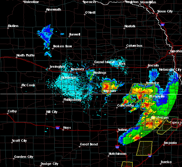 At 513 pm cdt, a severe thunderstorm was located over hardy, or 40 miles north of beloit, moving north at 25 mph. another strong to severe storm was near nora, and is capable of producing quarter size hail (trained weather spotters). Hazards include one to two inch hail and 60 mph wind gusts. People and animals outdoors will be injured. expect hail damage to roofs, siding, windows, and vehicles. expect wind damage to roofs, siding, and trees. locations impacted include, nelson, hardy, ruskin, oak and nora. A tornado watch remains in effect until 900 pm cdt for north central kansas, and south central nebraska. At 513 pm cdt, a severe thunderstorm was located over hardy, or 40 miles north of beloit, moving north at 25 mph. another strong to severe storm was near nora, and is capable of producing quarter size hail (trained weather spotters). Hazards include one to two inch hail and 60 mph wind gusts. People and animals outdoors will be injured. expect hail damage to roofs, siding, windows, and vehicles. expect wind damage to roofs, siding, and trees. locations impacted include, nelson, hardy, ruskin, oak and nora. A tornado watch remains in effect until 900 pm cdt for north central kansas, and south central nebraska.
|
| 4/26/2016 4:58 PM CDT |
 At 458 pm cdt, a severe thunderstorm was located near hardy, or 41 miles north of beloit, moving north at 30 mph (trained weather spotters. hail up to golf ball has been reported between superior and hardy). Hazards include two inch hail and 60 mph wind gusts. People and animals outdoors will be injured. expect hail damage to roofs, siding, windows, and vehicles. Expect wind damage to roofs, siding, and trees. At 458 pm cdt, a severe thunderstorm was located near hardy, or 41 miles north of beloit, moving north at 30 mph (trained weather spotters. hail up to golf ball has been reported between superior and hardy). Hazards include two inch hail and 60 mph wind gusts. People and animals outdoors will be injured. expect hail damage to roofs, siding, windows, and vehicles. Expect wind damage to roofs, siding, and trees.
|
| 4/26/2016 4:54 PM CDT | Golf Ball sized hail reported 1.9 miles W of Superior, NE, half dollar to golf ball size hail ongoing. |
| 4/26/2016 4:53 PM CDT |
 At 451 pm cdt, a severe thunderstorm was centered between superior and hardy, or 38 miles north of beloit, moving north at 25 mph (radar indicated. in addition...at 451 pm cdt...a trained spotter reported golf ball size hail was reported 3 miles east of superior). Hazards include two inch hail and 60 mph wind gusts. People and animals outdoors will be injured. expect hail damage to roofs, siding, windows, and vehicles. expect wind damage to roofs, siding, and trees. locations impacted include, superior, hardy, ruskin, formoso, webber, nora, montrose and lovewell state park. A tornado watch remains in effect until 900 pm cdt for north central kansas, and south central nebraska. At 451 pm cdt, a severe thunderstorm was centered between superior and hardy, or 38 miles north of beloit, moving north at 25 mph (radar indicated. in addition...at 451 pm cdt...a trained spotter reported golf ball size hail was reported 3 miles east of superior). Hazards include two inch hail and 60 mph wind gusts. People and animals outdoors will be injured. expect hail damage to roofs, siding, windows, and vehicles. expect wind damage to roofs, siding, and trees. locations impacted include, superior, hardy, ruskin, formoso, webber, nora, montrose and lovewell state park. A tornado watch remains in effect until 900 pm cdt for north central kansas, and south central nebraska.
|
| 4/26/2016 4:51 PM CDT | Golf Ball sized hail reported 3 miles W of Superior, NE, trained spotter reports hail up to golf ball size. |
| 4/26/2016 4:43 PM CDT |
 At 442 pm cdt, a severe thunderstorm was located near hardy, or 38 miles north of beloit, moving north at 25 mph. another potentially severe storm is located southwest of lovewell state park (radar indicated). Hazards include two inch hail and 60 mph wind gusts. People and animals outdoors will be injured. expect hail damage to roofs, siding, windows, and vehicles. expect wind damage to roofs, siding, and trees. locations impacted include, superior, hardy, ruskin, formoso, webber, nora, montrose and lovewell state park. A tornado watch remains in effect until 900 pm cdt for north central kansas, and portions of south central nebraska. At 442 pm cdt, a severe thunderstorm was located near hardy, or 38 miles north of beloit, moving north at 25 mph. another potentially severe storm is located southwest of lovewell state park (radar indicated). Hazards include two inch hail and 60 mph wind gusts. People and animals outdoors will be injured. expect hail damage to roofs, siding, windows, and vehicles. expect wind damage to roofs, siding, and trees. locations impacted include, superior, hardy, ruskin, formoso, webber, nora, montrose and lovewell state park. A tornado watch remains in effect until 900 pm cdt for north central kansas, and portions of south central nebraska.
|
| 4/26/2016 4:31 PM CDT |
 At 431 pm cdt, a severe thunderstorm was located near hardy, or 34 miles north of beloit, moving northeast at 35 mph (radar indicated). Hazards include ping pong ball size hail and 60 mph wind gusts. People and animals outdoors will be injured. expect hail damage to roofs, siding, windows, and vehicles. Expect wind damage to roofs, siding, and trees. At 431 pm cdt, a severe thunderstorm was located near hardy, or 34 miles north of beloit, moving northeast at 35 mph (radar indicated). Hazards include ping pong ball size hail and 60 mph wind gusts. People and animals outdoors will be injured. expect hail damage to roofs, siding, windows, and vehicles. Expect wind damage to roofs, siding, and trees.
|
| 4/24/2016 6:30 PM CDT |
 At 629 pm cdt, a severe thunderstorm was located near nora, or 38 miles southeast of hastings, moving east at 15 mph (radar indicated). Hazards include golf ball size hail and 60 mph wind gusts. People and animals outdoors will be injured. expect hail damage to roofs, siding, windows, and vehicles. Expect wind damage to roofs, siding, and trees. At 629 pm cdt, a severe thunderstorm was located near nora, or 38 miles southeast of hastings, moving east at 15 mph (radar indicated). Hazards include golf ball size hail and 60 mph wind gusts. People and animals outdoors will be injured. expect hail damage to roofs, siding, windows, and vehicles. Expect wind damage to roofs, siding, and trees.
|
| 4/24/2016 5:54 PM CDT | Half Dollar sized hail reported 0.3 miles NE of Superior, NE, photo rcvd via social media. time est fm radar. |
| 4/24/2016 5:52 PM CDT | Half Dollar sized hail reported 0.3 miles NE of Superior, NE, photo rcvd via social media. |
| 4/24/2016 5:40 PM CDT | Golf Ball sized hail reported 0.9 miles WNW of Superior, NE, photo rcvd via social media. |
| 4/24/2016 5:33 PM CDT |
 At 533 pm cdt, a severe thunderstorm was located over webber, or 32 miles north of beloit, moving northeast at 40 mph (radar indicated). Hazards include 60 mph wind gusts and half dollar size hail. Hail damage to vehicles is expected. Expect wind damage to roofs, siding, and trees. At 533 pm cdt, a severe thunderstorm was located over webber, or 32 miles north of beloit, moving northeast at 40 mph (radar indicated). Hazards include 60 mph wind gusts and half dollar size hail. Hail damage to vehicles is expected. Expect wind damage to roofs, siding, and trees.
|
| 9/10/2015 6:36 PM CDT |
 At 635 pm cdt, a severe thunderstorm was located over ruskin, or 42 miles southeast of hastings, moving southeast at 30 mph (radar indicated). Hazards include 60 mph wind gusts and quarter size hail. Hail damage to vehicles is expected. expect wind damage to roofs, siding and trees. Locations impacted include, superior, deshler, davenport, chester, hardy, ruskin, byron, oak, and nora. At 635 pm cdt, a severe thunderstorm was located over ruskin, or 42 miles southeast of hastings, moving southeast at 30 mph (radar indicated). Hazards include 60 mph wind gusts and quarter size hail. Hail damage to vehicles is expected. expect wind damage to roofs, siding and trees. Locations impacted include, superior, deshler, davenport, chester, hardy, ruskin, byron, oak, and nora.
|
| 9/10/2015 6:16 PM CDT |
 At 616 pm cdt, a severe thunderstorm was located near nelson, or 32 miles southeast of hastings, moving southeast at 30 mph (radar indicated). Hazards include 60 mph wind gusts and quarter size hail. Hail damage to vehicles is expected. Expect wind damage to roofs, siding and trees. At 616 pm cdt, a severe thunderstorm was located near nelson, or 32 miles southeast of hastings, moving southeast at 30 mph (radar indicated). Hazards include 60 mph wind gusts and quarter size hail. Hail damage to vehicles is expected. Expect wind damage to roofs, siding and trees.
|
| 9/10/2015 4:50 PM CDT |
 The severe thunderstorm warning for southern nuckolls county will expire at 500 pm cdt, the storm which prompted the warning has weakened below severe limits, and no longer poses an immediate threat to life or property. therefore the warning will be allowed to expire. however small hail and gusty winds are still possible with this thunderstorm. a severe thunderstorm watch remains in effect until 1000 pm cdt for north central kansas and south central nebraska. The severe thunderstorm warning for southern nuckolls county will expire at 500 pm cdt, the storm which prompted the warning has weakened below severe limits, and no longer poses an immediate threat to life or property. therefore the warning will be allowed to expire. however small hail and gusty winds are still possible with this thunderstorm. a severe thunderstorm watch remains in effect until 1000 pm cdt for north central kansas and south central nebraska.
|
| 9/10/2015 4:44 PM CDT |
 At 444 pm cdt, a severe thunderstorm was located near nora, or 36 miles southeast of hastings, moving southeast at 30 mph (radar indicated). Hazards include 60 mph wind gusts and quarter size hail. Hail damage to vehicles is expected. expect wind damage to roofs, siding and trees. Locations impacted include, superior, nelson, hardy, ruskin and nora. At 444 pm cdt, a severe thunderstorm was located near nora, or 36 miles southeast of hastings, moving southeast at 30 mph (radar indicated). Hazards include 60 mph wind gusts and quarter size hail. Hail damage to vehicles is expected. expect wind damage to roofs, siding and trees. Locations impacted include, superior, nelson, hardy, ruskin and nora.
|
| 9/10/2015 4:18 PM CDT |
 At 417 pm cdt, a severe thunderstorm was located near lawrence, or 26 miles south of hastings, moving southeast at 35 mph (radar indicated). Hazards include 60 mph wind gusts and half dollar size hail. Hail damage to vehicles is expected. Expect wind damage to roofs, siding and trees. At 417 pm cdt, a severe thunderstorm was located near lawrence, or 26 miles south of hastings, moving southeast at 35 mph (radar indicated). Hazards include 60 mph wind gusts and half dollar size hail. Hail damage to vehicles is expected. Expect wind damage to roofs, siding and trees.
|
| 9/10/2015 2:18 PM CDT |
 At 218 pm cdt, a severe thunderstorm was located over nora, or 36 miles southeast of hastings, moving southeast at 30 mph (radar indicated). Hazards include ping pong ball size hail and 60 mph wind gusts. People and animals outdoors will be injured. expect hail damage to roofs, siding, windows and vehicles. expect wind damage to roofs, siding and trees. this severe thunderstorm will be near, ruskin around 230 pm cdt. hardy around 235 pm cdt. deshler around 245 pm cdt. byron around 250 pm cdt. Chester around 300 pm cdt. At 218 pm cdt, a severe thunderstorm was located over nora, or 36 miles southeast of hastings, moving southeast at 30 mph (radar indicated). Hazards include ping pong ball size hail and 60 mph wind gusts. People and animals outdoors will be injured. expect hail damage to roofs, siding, windows and vehicles. expect wind damage to roofs, siding and trees. this severe thunderstorm will be near, ruskin around 230 pm cdt. hardy around 235 pm cdt. deshler around 245 pm cdt. byron around 250 pm cdt. Chester around 300 pm cdt.
|
| 8/8/2015 12:29 AM CDT |
 At 1229 am cdt, severe thunderstorms were located along a line extending from near clay center to near oak to near byron, moving east at 45 mph (trained weather spotters). Hazards include 60 mph wind gusts and penny size hail. Expect damage to roofs. siding and trees. these severe storms will be near, deshler and byron around 1235 am cdt. carleton around 1240 am cdt. hebron and chester around 1245 am cdt. bruning, grafton and belvidere around 1250 am cdt. hubbell around 1255 am cdt. Geneva, fairmont, alexandria and gilead around 100 am cdt. At 1229 am cdt, severe thunderstorms were located along a line extending from near clay center to near oak to near byron, moving east at 45 mph (trained weather spotters). Hazards include 60 mph wind gusts and penny size hail. Expect damage to roofs. siding and trees. these severe storms will be near, deshler and byron around 1235 am cdt. carleton around 1240 am cdt. hebron and chester around 1245 am cdt. bruning, grafton and belvidere around 1250 am cdt. hubbell around 1255 am cdt. Geneva, fairmont, alexandria and gilead around 100 am cdt.
|
| 8/8/2015 12:18 AM CDT |
 At 1217 am cdt, severe thunderstorms were located along a line extending from near inland to near nelson to near superior, moving east at 35 mph (trained weather spotters). Hazards include 60 mph wind gusts and penny size hail. Expect damage to roofs. siding and trees. severe thunderstorms will be near, nora around 1225 am cdt. hardy and oak around 1230 am cdt. davenport and ruskin around 1235 am cdt. byron and saronville around 1240 am cdt. sutton and deshler around 1245 am cdt. carleton around 1250 am cdt. hebron and chester around 1255 am cdt. Geneva, bruning, grafton, hubbell and belvidere around 100 am cdt. At 1217 am cdt, severe thunderstorms were located along a line extending from near inland to near nelson to near superior, moving east at 35 mph (trained weather spotters). Hazards include 60 mph wind gusts and penny size hail. Expect damage to roofs. siding and trees. severe thunderstorms will be near, nora around 1225 am cdt. hardy and oak around 1230 am cdt. davenport and ruskin around 1235 am cdt. byron and saronville around 1240 am cdt. sutton and deshler around 1245 am cdt. carleton around 1250 am cdt. hebron and chester around 1255 am cdt. Geneva, bruning, grafton, hubbell and belvidere around 100 am cdt.
|
| 8/8/2015 12:14 AM CDT | Winds estimated to be between 50 and 60 mp in nuckolls county NE, 1.2 miles S of Superior, NE |
| 6/3/2015 10:52 PM CDT | The severe thunderstorm warning for central nuckolls county will expire at 1100 pm cdt, the storm which prompted the warning has weakened below severe limits, and no longer poses an immediate threat to life or property. therefore the warning will be allowed to expire. however, a separate severe thunderstorm warning remains in effect for the northwestern portions of nuckolls county. a tornado watch remains in effect until 200 am cdt for south central nebraska. |
| 6/3/2015 10:36 PM CDT | At 1036 pm cdt, a severe thunderstorm was located near superior, or 30 miles northwest of belleville, moving north at 15 mph (radar indicated). Hazards include quarter size hail. Damage to vehicles is expected. locations impacted include, superior, nelson, nora and bostwick. A tornado watch remains in effect until 200 am cdt for south central nebraska. |
| 6/3/2015 10:15 PM CDT | At 1015 pm cdt, a severe thunderstorm was located near bostwick, or 29 miles northwest of belleville, moving northeast at 15 mph (radar indicated). Hazards include quarter size hail. damage to vehicles is expected |
| 5/29/2015 6:34 PM CDT | At 634 pm cdt, a severe thunderstorm was located over superior, or 27 miles northwest of belleville, moving east at 25 mph (radar indicated). Hazards include 60 mph wind gusts and quarter size hail. Hail damage to vehicles is expected. Expect wind damage to roofs, siding and trees. |
| 5/29/2015 6:34 PM CDT | At 634 pm cdt, a severe thunderstorm was located over superior, or 27 miles northwest of belleville, moving east at 25 mph (radar indicated). Hazards include 60 mph wind gusts and quarter size hail. Hail damage to vehicles is expected. Expect wind damage to roofs, siding and trees. |
| 5/6/2015 10:27 PM CDT | At 1026 pm cdt, a severe thunderstorm capable of producing a tornado was located near hardy, or 22 miles northwest of belleville, moving northeast at 35 mph (radar indicated rotation). Hazards include tornado. Flying debris will be dangerous to those caught without shelter. mobile homes will be damaged or destroyed. damage to roofs, windows and vehicles will occur. tree damage is likely. this tornadic thunderstorm will remain over mainly rural areas of southeastern nuckolls county. Radar indicated. |
| 5/6/2015 10:15 PM CDT | At 1015 pm cdt, a severe thunderstorm capable of producing a tornado was located near webber, or 25 miles west of belleville, moving northeast at 25 mph (radar indicated rotation). Hazards include tornado. Flying debris will be dangerous to those caught without shelter. mobile homes will be damaged or destroyed. damage to roofs, windows and vehicles will occur. tree damage is likely. this dangerous storm will be near, superior around 1025 pm cdt. hardy around 1035 pm cdt. Radar indicated. |
| 5/6/2015 4:42 PM CDT | At 442 pm cdt, a severe thunderstorm capable of producing a tornado was located over bostwick, or 31 miles northwest of belleville, moving north at 35 mph (radar indicated rotation). Hazards include tornado and quarter size hail. Flying debris will be dangerous to those caught without shelter. mobile homes will be damaged or destroyed. damage to roofs, windows and vehicles will occur. tree damage is likely. this dangerous storm will be near, bostwick around 445 pm cdt. superior around 450 pm cdt. nora around 505 pm cdt. nelson around 510 pm cdt. Radar indicated. |
| 5/6/2015 4:32 PM CDT | At 431 pm cdt, a severe thunderstorm capable of producing a tornado was located near guide rock, or 37 miles west of belleville, moving north at 25 mph (radar indicated rotation). Hazards include tornado and quarter size hail. Flying debris will be dangerous to those caught without shelter. mobile homes will be damaged or destroyed. damage to roofs, windows and vehicles will occur. tree damage is likely. this dangerous storm will be near, guide rock and bostwick around 445 pm cdt. Radar indicated. |
| 5/6/2015 4:32 PM CDT | At 431 pm cdt, a severe thunderstorm capable of producing a tornado was located near guide rock, or 37 miles west of belleville, moving north at 25 mph (radar indicated rotation). Hazards include tornado and quarter size hail. Flying debris will be dangerous to those caught without shelter. mobile homes will be damaged or destroyed. damage to roofs, windows and vehicles will occur. tree damage is likely. this dangerous storm will be near, guide rock and bostwick around 445 pm cdt. Radar indicated. |
| 5/6/2015 4:19 PM CDT | At 418 pm cdt, a severe thunderstorm capable of producing a tornado was located near esbon, or 27 miles northwest of beloit, moving northeast at 30 mph (radar indicated rotation). Hazards include tornado and quarter size hail. Flying debris will be dangerous to those caught without shelter. mobile homes will be damaged or destroyed. damage to roofs, windows and vehicles will occur. tree damage is likely. this dangerous storm will be near, burr oak around 430 pm cdt. guide rock and bostwick around 445 pm cdt. Radar indicated. |
| 5/6/2015 4:19 PM CDT | At 418 pm cdt, a severe thunderstorm capable of producing a tornado was located near esbon, or 27 miles northwest of beloit, moving northeast at 30 mph (radar indicated rotation). Hazards include tornado and quarter size hail. Flying debris will be dangerous to those caught without shelter. mobile homes will be damaged or destroyed. damage to roofs, windows and vehicles will occur. tree damage is likely. this dangerous storm will be near, burr oak around 430 pm cdt. guide rock and bostwick around 445 pm cdt. Radar indicated. |
| 4/1/2015 9:49 PM CDT | A severe thunderstorm warning remains in effect until 1000 pm cdt for western thayer and nuckolls counties. at 948 pm cdt. a severe thunderstorm was located near deshler. or 26 miles north of belleville. moving northeast at 45 mph. hazard. 60 mph wind gusts and quarter size hail. source. radar indicated. at 940 pm. Nickel size hail was reported. |
| 4/1/2015 9:36 PM CDT | The severe thunderstorm warning for northern jewell. southeastern webster and southern nuckolls counties will expire at 945 pm cdt. the storm which prompted the warning has weakened below severe limits. and no longer pose an immediate threat to life or property. therefore the warning will be allowed to expire. A severe thunderstorm watch remains in effect until 100 am cdt for. |
| 4/1/2015 9:36 PM CDT | The severe thunderstorm warning for northern jewell. southeastern webster and southern nuckolls counties will expire at 945 pm cdt. the storm which prompted the warning has weakened below severe limits. and no longer pose an immediate threat to life or property. therefore the warning will be allowed to expire. A severe thunderstorm watch remains in effect until 100 am cdt for. |
| 4/1/2015 9:26 PM CDT | The national weather service in hastings has issued a * severe thunderstorm warning for. northeastern jewell county in north central kansas. western thayer county in south central nebraska. nuckolls county in south central nebraska. Until 1000 pm cdt. |
| 4/1/2015 9:26 PM CDT | The national weather service in hastings has issued a * severe thunderstorm warning for. northeastern jewell county in north central kansas. western thayer county in south central nebraska. nuckolls county in south central nebraska. Until 1000 pm cdt. |
| 4/1/2015 9:09 PM CDT | The national weather service in hastings has issued a * severe thunderstorm warning for. northern jewell county in north central kansas. southeastern webster county in south central nebraska. southern nuckolls county in south central nebraska. Until 945 pm cdt. |
| 4/1/2015 9:09 PM CDT | The national weather service in hastings has issued a * severe thunderstorm warning for. northern jewell county in north central kansas. southeastern webster county in south central nebraska. southern nuckolls county in south central nebraska. Until 945 pm cdt. |
| 4/1/2015 8:48 PM CDT | A severe thunderstorm warning remains in effect until 900 pm cdt for eastern webster. southeastern adams. nuckolls and clay counties. at 846 pm cdt. severe thunderstorms were located along a line extending from fairfield to near nelson to bostwick. Moving east at 40 mph. |
| 4/1/2015 8:38 PM CDT | The national weather service in hastings has issued a * severe thunderstorm warning for. eastern webster county in south central nebraska. southeastern adams county in south central nebraska. nuckolls county in south central nebraska. Clay county in south central nebraska. |
| 4/1/2015 8:38 PM CDT | The national weather service in hastings has issued a * severe thunderstorm warning for. eastern webster county in south central nebraska. southeastern adams county in south central nebraska. nuckolls county in south central nebraska. Clay county in south central nebraska. |
| 4/1/2015 8:38 PM CDT | The national weather service in hastings has issued a * severe thunderstorm warning for. eastern webster county in south central nebraska. southeastern adams county in south central nebraska. nuckolls county in south central nebraska. Clay county in south central nebraska. |
| 8/17/2014 9:45 PM CDT | Winds increased around 945 and were sustained at an estimated 60-70 mph for 30 minute in nuckolls county NE, 0.3 miles NE of Superior, NE |
| 6/14/2014 11:55 PM CDT | Delayed report of some windows blown out in superior and transformers down. time estimated from radar. relayed by medi in nuckolls county NE, 0.3 miles NE of Superior, NE |
| 9/4/2012 7:00 PM CDT | Thunderstorm outflow caused severe wind gusts to blow the roof off a 2-story apartment building in downtown superior. this is an update from original repor in nuckolls county NE, 0.3 miles NE of Superior, NE |
| 9/4/2012 7:00 PM CDT | Thunderstorm outflow caused severe wind gusts to blow the roof off of a hous in nuckolls county NE, 0.3 miles NE of Superior, NE |
| 5/19/2012 5:50 PM CDT | Ping Pong Ball sized hail reported 0.3 miles NE of Superior, NE |
| 5/19/2012 5:44 PM CDT | Quarter sized hail reported 0.3 miles NE of Superior, NE |
| 1/1/0001 12:00 AM | Tree limbs ranging from 3 to 12 inches in diameter broken around tow in nuckolls county NE, 0.3 miles NE of Superior, NE |
| 1/1/0001 12:00 AM | Quarter sized hail reported 0.3 miles NE of Superior, NE, most hail was pea to dime size with an occasional quarter. |
| 1/1/0001 12:00 AM | Wind gusts reported between 60 to 70 mph. tree limbs up to 5 inches in diameter broke in nuckolls county NE, 0.3 miles NE of Superior, NE |
| 1/1/0001 12:00 AM | A metal building on the southwest side of town had part of one wall torn awa in nuckolls county NE, 0.3 miles NE of Superior, NE |
| 1/1/0001 12:00 AM | A trailer home located on 240 road and diamond avenue just inside the jewell county line had roof torn away. part of one of the walls was blown approximately 30 yard in jewell county KS, 2.3 miles N of Superior, NE |
| 1/1/0001 12:00 AM | Storm damage reported in nuckolls county NE, 0.3 miles NE of Superior, NE |
| 1/1/0001 12:00 AM | Storm damage reported in nuckolls county NE, 3 miles W of Superior, NE |
| 1/1/0001 12:00 AM | Storm damage reported in nuckolls county NE, 0.3 miles NE of Superior, NE |
Hail Maps for Superior, NE
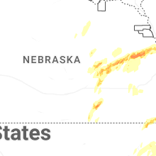


Connect with Interactive Hail Maps