

Hail Map for Curtis, NE
The Curtis, NE area has had 32 reports of on-the-ground hail by trained spotters, and has been under severe weather warnings 20 times during the past 12 months. Doppler radar has detected hail at or near Curtis, NE on 105 occasions, including 7 occasions during the past year.
| Name: | Curtis, NE |
| Where Located: | 37.1 miles SSE of North Platte, NE |
| Map: | Google Map for Curtis, NE |
| Population: | 939 |
| Housing Units: | 426 |
| More Info: | Search Google for Curtis, NE |
3
The Top Recent Hail Date for Curtis, NE is Saturday, July 6, 2024 (4th out of 105)

Hail and Wind Damage Spotted near Curtis, NE
| Date / Time | Report Details |
|---|---|
| 6/16/2025 10:56 PM CDT |
 The storm which prompted the warning has weakened below severe limits, and no longer poses an immediate threat to life or property. therefore, the warning will be allowed to expire. a severe thunderstorm watch remains in effect until midnight cdt for southwestern nebraska. The storm which prompted the warning has weakened below severe limits, and no longer poses an immediate threat to life or property. therefore, the warning will be allowed to expire. a severe thunderstorm watch remains in effect until midnight cdt for southwestern nebraska.
|
| 6/16/2025 10:12 PM CDT |
 Svrlbf the national weather service in north platte has issued a * severe thunderstorm warning for, northwestern frontier county in southwestern nebraska, south central lincoln county in southwestern nebraska, northeastern hayes county in southwestern nebraska, * until 1100 pm cdt. * at 1012 pm cdt, a severe thunderstorm was located over wellfleet, or 14 miles northwest of curtis, moving east at 20 mph (radar indicated). Hazards include ping pong ball size hail and 60 mph wind gusts. People and animals outdoors will be injured. expect hail damage to roofs, siding, windows, and vehicles. Expect wind damage to roofs, siding, and trees. Svrlbf the national weather service in north platte has issued a * severe thunderstorm warning for, northwestern frontier county in southwestern nebraska, south central lincoln county in southwestern nebraska, northeastern hayes county in southwestern nebraska, * until 1100 pm cdt. * at 1012 pm cdt, a severe thunderstorm was located over wellfleet, or 14 miles northwest of curtis, moving east at 20 mph (radar indicated). Hazards include ping pong ball size hail and 60 mph wind gusts. People and animals outdoors will be injured. expect hail damage to roofs, siding, windows, and vehicles. Expect wind damage to roofs, siding, and trees.
|
| 5/14/2025 9:56 PM CDT |
 The storms which prompted the warning have weakened below severe limits, and no longer pose an immediate threat to life or property. therefore, the warning will be allowed to expire. however, gusty winds to around 50 mph are still possible. a severe thunderstorm watch remains in effect until 1100 pm cdt for central and southwestern nebraska. The storms which prompted the warning have weakened below severe limits, and no longer pose an immediate threat to life or property. therefore, the warning will be allowed to expire. however, gusty winds to around 50 mph are still possible. a severe thunderstorm watch remains in effect until 1100 pm cdt for central and southwestern nebraska.
|
| 5/14/2025 9:39 PM CDT |
 At 938 pm cdt, the leading edge of damaging winds were located along a line extending from 8 miles southwest of stapleton to 11 miles northeast of brady to 7 miles southwest of elwood, moving east at 60 mph (radar indicated). Hazards include 70 mph wind gusts. Expect considerable tree damage. damage is likely to mobile homes, roofs, and outbuildings. locations impacted include, north platte, curtis, hayes center, sutherland, hershey, brady, eustis, maxwell, wellfleet, moorefield, stockville, dickens, lake maloney state recreation area, medicine creek reservoir state recreation area, sutherland reservoir state recreation area, north platte airport. this includes the following highways, highway 97 between mile markers 1 and 11. interstate 80 in nebraska between mile markers 158 and 207. Highway 83 between mile markers 27 and 99. At 938 pm cdt, the leading edge of damaging winds were located along a line extending from 8 miles southwest of stapleton to 11 miles northeast of brady to 7 miles southwest of elwood, moving east at 60 mph (radar indicated). Hazards include 70 mph wind gusts. Expect considerable tree damage. damage is likely to mobile homes, roofs, and outbuildings. locations impacted include, north platte, curtis, hayes center, sutherland, hershey, brady, eustis, maxwell, wellfleet, moorefield, stockville, dickens, lake maloney state recreation area, medicine creek reservoir state recreation area, sutherland reservoir state recreation area, north platte airport. this includes the following highways, highway 97 between mile markers 1 and 11. interstate 80 in nebraska between mile markers 158 and 207. Highway 83 between mile markers 27 and 99.
|
| 5/14/2025 9:25 PM CDT |
 At 923 pm cdt, damaging winds were located along a line extending from 13 miles north of north platte to maxwell to near medicine creek reservoir state recreation area, moving east at 60 mph (radar indicated). Hazards include 80 mph wind gusts and blowing dust. Flying debris will be dangerous to those caught without shelter. mobile homes will be heavily damaged. expect considerable damage to roofs, windows, and vehicles. extensive tree damage and power outages are likely. locations impacted include, north platte, curtis, hayes center, sutherland, hershey, brady, eustis, maxwell, wellfleet, moorefield, stockville, dickens, lake maloney state recreation area, medicine creek reservoir state recreation area, sutherland reservoir state recreation area, north platte airport, keith, maywood, cottonwood canyon state wildlife management area, and o'fallons. this includes the following highways, highway 97 between mile markers 1 and 11. interstate 80 in nebraska between mile markers 158 and 207. Highway 83 between mile markers 27 and 99. At 923 pm cdt, damaging winds were located along a line extending from 13 miles north of north platte to maxwell to near medicine creek reservoir state recreation area, moving east at 60 mph (radar indicated). Hazards include 80 mph wind gusts and blowing dust. Flying debris will be dangerous to those caught without shelter. mobile homes will be heavily damaged. expect considerable damage to roofs, windows, and vehicles. extensive tree damage and power outages are likely. locations impacted include, north platte, curtis, hayes center, sutherland, hershey, brady, eustis, maxwell, wellfleet, moorefield, stockville, dickens, lake maloney state recreation area, medicine creek reservoir state recreation area, sutherland reservoir state recreation area, north platte airport, keith, maywood, cottonwood canyon state wildlife management area, and o'fallons. this includes the following highways, highway 97 between mile markers 1 and 11. interstate 80 in nebraska between mile markers 158 and 207. Highway 83 between mile markers 27 and 99.
|
| 5/14/2025 9:08 PM CDT |
 Svrlbf the national weather service in north platte has issued a * severe thunderstorm warning for, frontier county in southwestern nebraska, lincoln county in southwestern nebraska, southwestern custer county in central nebraska, eastern hayes county in southwestern nebraska, * until 1000 pm cdt. * at 906 pm cdt, severe thunderstorms were located along a line extending from 9 miles north of hershey to north platte to 14 miles southwest of stockville, moving east at 55 mph (radar indicated). Hazards include 80 mph wind gusts. Flying debris will be dangerous to those caught without shelter. mobile homes will be heavily damaged. expect considerable damage to roofs, windows, and vehicles. Extensive tree damage and power outages are likely. Svrlbf the national weather service in north platte has issued a * severe thunderstorm warning for, frontier county in southwestern nebraska, lincoln county in southwestern nebraska, southwestern custer county in central nebraska, eastern hayes county in southwestern nebraska, * until 1000 pm cdt. * at 906 pm cdt, severe thunderstorms were located along a line extending from 9 miles north of hershey to north platte to 14 miles southwest of stockville, moving east at 55 mph (radar indicated). Hazards include 80 mph wind gusts. Flying debris will be dangerous to those caught without shelter. mobile homes will be heavily damaged. expect considerable damage to roofs, windows, and vehicles. Extensive tree damage and power outages are likely.
|
| 5/14/2025 7:57 PM MDT |
 At 855 pm cdt/755 pm mdt/, damaging winds were located along a line extending from 14 miles north of sarben to 8 miles west of lake maloney state recreation area to 8 miles west of stockville, moving northeast at 55 mph (radar indicated). Hazards include 80 mph wind gusts. Flying debris will be dangerous to those caught without shelter. mobile homes will be heavily damaged. expect considerable damage to roofs, windows, and vehicles. extensive tree damage and power outages are likely. locations impacted include, north platte, ogallala, imperial, grant, curtis, hayes center, sutherland, hershey, wauneta, paxton, wallace, brule, madrid, elsie, wellfleet, lamar, dickens, lake maloney state recreation area, kingsley dam, and enders. this includes the following highways, highway 61 between mile markers 26 and 107. highway 92 between mile markers 120 and 138. highway 97 between mile markers 1 and 5. interstate 80 in nebraska between mile markers 110 and 184. Highway 83 between mile markers 28 and 90. At 855 pm cdt/755 pm mdt/, damaging winds were located along a line extending from 14 miles north of sarben to 8 miles west of lake maloney state recreation area to 8 miles west of stockville, moving northeast at 55 mph (radar indicated). Hazards include 80 mph wind gusts. Flying debris will be dangerous to those caught without shelter. mobile homes will be heavily damaged. expect considerable damage to roofs, windows, and vehicles. extensive tree damage and power outages are likely. locations impacted include, north platte, ogallala, imperial, grant, curtis, hayes center, sutherland, hershey, wauneta, paxton, wallace, brule, madrid, elsie, wellfleet, lamar, dickens, lake maloney state recreation area, kingsley dam, and enders. this includes the following highways, highway 61 between mile markers 26 and 107. highway 92 between mile markers 120 and 138. highway 97 between mile markers 1 and 5. interstate 80 in nebraska between mile markers 110 and 184. Highway 83 between mile markers 28 and 90.
|
| 5/14/2025 7:28 PM MDT |
 Svrlbf the national weather service in north platte has issued a * severe thunderstorm warning for, western frontier county in southwestern nebraska, perkins county in southwestern nebraska, keith county in southwestern nebraska, chase county in southwestern nebraska, western lincoln county in southwestern nebraska, hayes county in southwestern nebraska, * until 930 pm cdt/830 pm mdt/. * at 827 pm cdt/727 pm mdt/, severe thunderstorms were located along a line extending from roscoe to 7 miles northwest of palisade, moving east at 55 mph (radar indicated). Hazards include 80 mph wind gusts. Flying debris will be dangerous to those caught without shelter. mobile homes will be heavily damaged. expect considerable damage to roofs, windows, and vehicles. Extensive tree damage and power outages are likely. Svrlbf the national weather service in north platte has issued a * severe thunderstorm warning for, western frontier county in southwestern nebraska, perkins county in southwestern nebraska, keith county in southwestern nebraska, chase county in southwestern nebraska, western lincoln county in southwestern nebraska, hayes county in southwestern nebraska, * until 930 pm cdt/830 pm mdt/. * at 827 pm cdt/727 pm mdt/, severe thunderstorms were located along a line extending from roscoe to 7 miles northwest of palisade, moving east at 55 mph (radar indicated). Hazards include 80 mph wind gusts. Flying debris will be dangerous to those caught without shelter. mobile homes will be heavily damaged. expect considerable damage to roofs, windows, and vehicles. Extensive tree damage and power outages are likely.
|
| 8/13/2024 11:19 PM CDT |
 Svrlbf the national weather service in north platte has issued a * severe thunderstorm warning for, frontier county in southwestern nebraska, * until midnight cdt. * at 1119 pm cdt, severe thunderstorms were located along a line extending from near curtis to near stockville to near bartley, moving east at 60 mph (radar indicated). Hazards include 60 mph wind gusts and penny size hail. expect damage to roofs, siding, and trees Svrlbf the national weather service in north platte has issued a * severe thunderstorm warning for, frontier county in southwestern nebraska, * until midnight cdt. * at 1119 pm cdt, severe thunderstorms were located along a line extending from near curtis to near stockville to near bartley, moving east at 60 mph (radar indicated). Hazards include 60 mph wind gusts and penny size hail. expect damage to roofs, siding, and trees
|
| 8/13/2024 10:51 PM CDT |
 The storm which prompted the warning has weakened below severe limits, and no longer poses an immediate threat to life or property. therefore, the warning will be allowed to expire. a severe thunderstorm watch remains in effect until 200 am cdt for southwestern nebraska. The storm which prompted the warning has weakened below severe limits, and no longer poses an immediate threat to life or property. therefore, the warning will be allowed to expire. a severe thunderstorm watch remains in effect until 200 am cdt for southwestern nebraska.
|
| 8/13/2024 10:38 PM CDT |
 At 1037 pm cdt, a severe thunderstorm was located over stockville, or 10 miles southeast of curtis, moving northeast at 20 mph (radar indicated). Hazards include 60 mph wind gusts and nickel size hail. Expect damage to roofs, siding, and trees. Locations impacted include, curtis, moorefield, stockville, orafino, and dancing leaf earth lodge. At 1037 pm cdt, a severe thunderstorm was located over stockville, or 10 miles southeast of curtis, moving northeast at 20 mph (radar indicated). Hazards include 60 mph wind gusts and nickel size hail. Expect damage to roofs, siding, and trees. Locations impacted include, curtis, moorefield, stockville, orafino, and dancing leaf earth lodge.
|
| 8/13/2024 10:22 PM CDT |
 Svrlbf the national weather service in north platte has issued a * severe thunderstorm warning for, central frontier county in southwestern nebraska, * until 1100 pm cdt. * at 1021 pm cdt, a severe thunderstorm was located near stockville, or 12 miles south of curtis, moving northeast at 20 mph (radar indicated). Hazards include 60 mph wind gusts and quarter size hail. Hail damage to vehicles is expected. Expect wind damage to roofs, siding, and trees. Svrlbf the national weather service in north platte has issued a * severe thunderstorm warning for, central frontier county in southwestern nebraska, * until 1100 pm cdt. * at 1021 pm cdt, a severe thunderstorm was located near stockville, or 12 miles south of curtis, moving northeast at 20 mph (radar indicated). Hazards include 60 mph wind gusts and quarter size hail. Hail damage to vehicles is expected. Expect wind damage to roofs, siding, and trees.
|
| 7/6/2024 3:20 PM CDT |
 The storm which prompted the warning has weakened below severe limits, and no longer poses an immediate threat to life or property. therefore, the warning will be allowed to expire. a severe thunderstorm watch remains in effect until 800 pm cdt for southwestern nebraska. The storm which prompted the warning has weakened below severe limits, and no longer poses an immediate threat to life or property. therefore, the warning will be allowed to expire. a severe thunderstorm watch remains in effect until 800 pm cdt for southwestern nebraska.
|
| 7/6/2024 3:07 PM CDT |
 At 307 pm cdt, a severe thunderstorm was located over curtis, moving east at 25 mph (radar indicated). Hazards include two inch hail and 60 mph wind gusts. People and animals outdoors will be injured. expect hail damage to roofs, siding, windows, and vehicles. expect wind damage to roofs, siding, and trees. Locations impacted include, curtis, moorefield, stockville, and dancing leaf earth lodge. At 307 pm cdt, a severe thunderstorm was located over curtis, moving east at 25 mph (radar indicated). Hazards include two inch hail and 60 mph wind gusts. People and animals outdoors will be injured. expect hail damage to roofs, siding, windows, and vehicles. expect wind damage to roofs, siding, and trees. Locations impacted include, curtis, moorefield, stockville, and dancing leaf earth lodge.
|
| 7/6/2024 3:07 PM CDT |
 the severe thunderstorm warning has been cancelled and is no longer in effect the severe thunderstorm warning has been cancelled and is no longer in effect
|
| 7/6/2024 3:00 PM CDT | Golf Ball sized hail reported 0.4 miles WNW of Curtis, NE |
| 7/6/2024 2:54 PM CDT |
 At 253 pm cdt, a severe thunderstorm was located near maywood, moving southeast at 20 mph (radar indicated). Hazards include two inch hail and 60 mph wind gusts. People and animals outdoors will be injured. expect hail damage to roofs, siding, windows, and vehicles. expect wind damage to roofs, siding, and trees. locations impacted include, curtis, moorefield, stockville, maywood, hansen memorial reserve state wildlife management area, and dancing leaf earth lodge. This includes highway 83 between mile markers 41 and 50. At 253 pm cdt, a severe thunderstorm was located near maywood, moving southeast at 20 mph (radar indicated). Hazards include two inch hail and 60 mph wind gusts. People and animals outdoors will be injured. expect hail damage to roofs, siding, windows, and vehicles. expect wind damage to roofs, siding, and trees. locations impacted include, curtis, moorefield, stockville, maywood, hansen memorial reserve state wildlife management area, and dancing leaf earth lodge. This includes highway 83 between mile markers 41 and 50.
|
| 7/6/2024 2:45 PM CDT | Tennis Ball sized hail reported 5.1 miles NW of Curtis, NE, delayed report via social media. |
| 7/6/2024 2:44 PM CDT |
 Svrlbf the national weather service in north platte has issued a * severe thunderstorm warning for, northwestern frontier county in southwestern nebraska, south central lincoln county in southwestern nebraska, * until 330 pm cdt. * at 244 pm cdt, a severe thunderstorm was located about 5 miles west of curtis, moving east at 15 mph (radar indicated). Hazards include 60 mph wind gusts and half dollar size hail. Hail damage to vehicles is expected. Expect wind damage to roofs, siding, and trees. Svrlbf the national weather service in north platte has issued a * severe thunderstorm warning for, northwestern frontier county in southwestern nebraska, south central lincoln county in southwestern nebraska, * until 330 pm cdt. * at 244 pm cdt, a severe thunderstorm was located about 5 miles west of curtis, moving east at 15 mph (radar indicated). Hazards include 60 mph wind gusts and half dollar size hail. Hail damage to vehicles is expected. Expect wind damage to roofs, siding, and trees.
|
| 7/3/2024 6:12 PM CDT |
 At 611 pm cdt, a severe thunderstorm was located near moorefield, or 12 miles northeast of curtis, moving northeast at 15 mph (radar indicated). Hazards include two inch hail. People and animals outdoors will be injured. expect damage to roofs, siding, windows, and vehicles. Locations impacted include, curtis, eustis, moorefield, and hansen memorial reserve state wildlife management area. At 611 pm cdt, a severe thunderstorm was located near moorefield, or 12 miles northeast of curtis, moving northeast at 15 mph (radar indicated). Hazards include two inch hail. People and animals outdoors will be injured. expect damage to roofs, siding, windows, and vehicles. Locations impacted include, curtis, eustis, moorefield, and hansen memorial reserve state wildlife management area.
|
| 7/3/2024 5:59 PM CDT | At 558 pm cdt, a severe thunderstorm was located over moorefield, or 9 miles northeast of curtis, moving northeast at 15 mph (radar indicated). Hazards include half dollar size hail. Damage to vehicles is expected. Locations impacted include, curtis, eustis, moorefield, and hansen memorial reserve state wildlife management area. |
| 7/3/2024 5:40 PM CDT |
 Svrlbf the national weather service in north platte has issued a * severe thunderstorm warning for, northeastern frontier county in southwestern nebraska, southeastern lincoln county in southwestern nebraska, * until 630 pm cdt. * at 539 pm cdt, a severe thunderstorm was located near moorefield, or near curtis, moving northeast at 15 mph (radar indicated). Hazards include half dollar size hail. damage to vehicles is expected Svrlbf the national weather service in north platte has issued a * severe thunderstorm warning for, northeastern frontier county in southwestern nebraska, southeastern lincoln county in southwestern nebraska, * until 630 pm cdt. * at 539 pm cdt, a severe thunderstorm was located near moorefield, or near curtis, moving northeast at 15 mph (radar indicated). Hazards include half dollar size hail. damage to vehicles is expected
|
| 6/14/2024 10:03 PM CDT |
 At 1003 pm cdt, severe thunderstorms were located along a line extending from 7 miles east of wellfleet to 11 miles north of mccook, moving east at 30 mph (public). Hazards include 60 mph wind gusts and nickel size hail. Expect damage to roofs, siding, and trees. locations impacted include, curtis, wellfleet, moorefield, stockville, maywood, quick, hansen memorial reserve state wildlife management area, freedom, dancing leaf earth lodge, bluegill haven campground, and willow view campground. This includes highway 83 between mile markers 27 and 57. At 1003 pm cdt, severe thunderstorms were located along a line extending from 7 miles east of wellfleet to 11 miles north of mccook, moving east at 30 mph (public). Hazards include 60 mph wind gusts and nickel size hail. Expect damage to roofs, siding, and trees. locations impacted include, curtis, wellfleet, moorefield, stockville, maywood, quick, hansen memorial reserve state wildlife management area, freedom, dancing leaf earth lodge, bluegill haven campground, and willow view campground. This includes highway 83 between mile markers 27 and 57.
|
| 6/14/2024 9:30 PM CDT |
 Svrlbf the national weather service in north platte has issued a * severe thunderstorm warning for, frontier county in southwestern nebraska, southeastern lincoln county in southwestern nebraska, eastern hayes county in southwestern nebraska, * until 1015 pm cdt. * at 930 pm cdt, severe thunderstorms were located along a line extending from 9 miles south of dickens to 7 miles northwest of culbertson, moving east at 40 mph (public). Hazards include 60 mph wind gusts and penny size hail. expect damage to roofs, siding, and trees Svrlbf the national weather service in north platte has issued a * severe thunderstorm warning for, frontier county in southwestern nebraska, southeastern lincoln county in southwestern nebraska, eastern hayes county in southwestern nebraska, * until 1015 pm cdt. * at 930 pm cdt, severe thunderstorms were located along a line extending from 9 miles south of dickens to 7 miles northwest of culbertson, moving east at 40 mph (public). Hazards include 60 mph wind gusts and penny size hail. expect damage to roofs, siding, and trees
|
| 6/11/2024 7:11 PM CDT |
 Svrlbf the national weather service in north platte has issued a * severe thunderstorm warning for, northwestern frontier county in southwestern nebraska, south central lincoln county in southwestern nebraska, * until 800 pm cdt. * at 710 pm cdt, a severe thunderstorm was located over wellfleet, or 13 miles northwest of curtis, moving east at 15 mph (radar indicated). Hazards include 60 mph wind gusts and quarter size hail. Hail damage to vehicles is expected. Expect wind damage to roofs, siding, and trees. Svrlbf the national weather service in north platte has issued a * severe thunderstorm warning for, northwestern frontier county in southwestern nebraska, south central lincoln county in southwestern nebraska, * until 800 pm cdt. * at 710 pm cdt, a severe thunderstorm was located over wellfleet, or 13 miles northwest of curtis, moving east at 15 mph (radar indicated). Hazards include 60 mph wind gusts and quarter size hail. Hail damage to vehicles is expected. Expect wind damage to roofs, siding, and trees.
|
| 6/2/2024 8:24 PM CDT |
 The storms which prompted the warning are moving out of the area. therefore, the warning will be allowed to expire. however, gusty winds are still possible with these thunderstorms. a severe thunderstorm watch remains in effect until 1100 pm cdt for southwestern nebraska. The storms which prompted the warning are moving out of the area. therefore, the warning will be allowed to expire. however, gusty winds are still possible with these thunderstorms. a severe thunderstorm watch remains in effect until 1100 pm cdt for southwestern nebraska.
|
| 6/2/2024 8:08 PM CDT |
 the severe thunderstorm warning has been cancelled and is no longer in effect the severe thunderstorm warning has been cancelled and is no longer in effect
|
| 6/2/2024 8:08 PM CDT |
 At 807 pm cdt, severe thunderstorms were located along a line extending from eustis to near medicine creek reservoir state recreation area, moving east at 45 mph (public). Hazards include 70 mph wind gusts and penny size hail. Expect considerable tree damage. damage is likely to mobile homes, roofs, and outbuildings. Locations impacted include, curtis, eustis, moorefield, stockville, medicine creek reservoir state recreation area, orafino, freedom, and dancing leaf earth lodge. At 807 pm cdt, severe thunderstorms were located along a line extending from eustis to near medicine creek reservoir state recreation area, moving east at 45 mph (public). Hazards include 70 mph wind gusts and penny size hail. Expect considerable tree damage. damage is likely to mobile homes, roofs, and outbuildings. Locations impacted include, curtis, eustis, moorefield, stockville, medicine creek reservoir state recreation area, orafino, freedom, and dancing leaf earth lodge.
|
| 6/2/2024 7:56 PM CDT |
 The storm which prompted the warning has moved out of the area. therefore, the warning will be allowed to expire. a severe thunderstorm watch remains in effect until 1100 pm cdt for southwestern nebraska. to report severe weather, contact your nearest law enforcement agency. they will relay your report to the national weather service north platte. remember, a severe thunderstorm warning still remains in effect for eastern lincoln and northern frontier counties. The storm which prompted the warning has moved out of the area. therefore, the warning will be allowed to expire. a severe thunderstorm watch remains in effect until 1100 pm cdt for southwestern nebraska. to report severe weather, contact your nearest law enforcement agency. they will relay your report to the national weather service north platte. remember, a severe thunderstorm warning still remains in effect for eastern lincoln and northern frontier counties.
|
| 6/2/2024 7:47 PM CDT |
 At 747 pm cdt, a severe thunderstorm capable of producing a tornado was located 9 miles northwest of eustis, or 19 miles northeast of curtis, moving east at 70 mph (radar indicated rotation). Hazards include tornado and quarter size hail. Flying debris will be dangerous to those caught without shelter. mobile homes will be damaged or destroyed. damage to roofs, windows, and vehicles will occur. tree damage is likely. This tornadic thunderstorm will remain over mainly rural areas of northeastern frontier and southeastern lincoln counties, including the following locations, hansen memorial reserve state wildlife management area. At 747 pm cdt, a severe thunderstorm capable of producing a tornado was located 9 miles northwest of eustis, or 19 miles northeast of curtis, moving east at 70 mph (radar indicated rotation). Hazards include tornado and quarter size hail. Flying debris will be dangerous to those caught without shelter. mobile homes will be damaged or destroyed. damage to roofs, windows, and vehicles will occur. tree damage is likely. This tornadic thunderstorm will remain over mainly rural areas of northeastern frontier and southeastern lincoln counties, including the following locations, hansen memorial reserve state wildlife management area.
|
| 6/2/2024 7:25 PM CDT |
 Torlbf the national weather service in north platte has issued a * tornado warning for, northern frontier county in southwestern nebraska, southeastern lincoln county in southwestern nebraska, * until 800 pm cdt. * at 724 pm cdt, a severe thunderstorm capable of producing a tornado was located near curtis, moving east at 70 mph (radar indicated rotation). Hazards include tornado and quarter size hail. Flying debris will be dangerous to those caught without shelter. mobile homes will be damaged or destroyed. damage to roofs, windows, and vehicles will occur. tree damage is likely. this dangerous storm will be near, curtis and moorefield around 730 pm cdt. other locations impacted by this tornadic thunderstorm include maywood and hansen memorial reserve state wildlife management area. This includes highway 83 between mile markers 43 and 55. Torlbf the national weather service in north platte has issued a * tornado warning for, northern frontier county in southwestern nebraska, southeastern lincoln county in southwestern nebraska, * until 800 pm cdt. * at 724 pm cdt, a severe thunderstorm capable of producing a tornado was located near curtis, moving east at 70 mph (radar indicated rotation). Hazards include tornado and quarter size hail. Flying debris will be dangerous to those caught without shelter. mobile homes will be damaged or destroyed. damage to roofs, windows, and vehicles will occur. tree damage is likely. this dangerous storm will be near, curtis and moorefield around 730 pm cdt. other locations impacted by this tornadic thunderstorm include maywood and hansen memorial reserve state wildlife management area. This includes highway 83 between mile markers 43 and 55.
|
| 6/2/2024 7:25 PM CDT |
 Svrlbf the national weather service in north platte has issued a * severe thunderstorm warning for, frontier county in southwestern nebraska, eastern hayes county in southwestern nebraska, * until 830 pm cdt. * at 724 pm cdt, severe thunderstorms were located along a line extending from near wellfleet to 11 miles north of culbertson, moving east at 45 mph (radar indicated). Hazards include 70 mph wind gusts and penny size hail. Expect considerable tree damage. Damage is likely to mobile homes, roofs, and outbuildings. Svrlbf the national weather service in north platte has issued a * severe thunderstorm warning for, frontier county in southwestern nebraska, eastern hayes county in southwestern nebraska, * until 830 pm cdt. * at 724 pm cdt, severe thunderstorms were located along a line extending from near wellfleet to 11 miles north of culbertson, moving east at 45 mph (radar indicated). Hazards include 70 mph wind gusts and penny size hail. Expect considerable tree damage. Damage is likely to mobile homes, roofs, and outbuildings.
|
| 6/2/2024 7:24 PM CDT | Golf Ball sized hail reported 0.4 miles WNW of Curtis, NE, picture of golf ball size hail received from social media. time from radar. |
| 6/2/2024 6:52 PM CDT |
 Svrlbf the national weather service in north platte has issued a * severe thunderstorm warning for, western frontier county in southwestern nebraska, hayes county in southwestern nebraska, * until 730 pm cdt. * at 651 pm cdt, severe thunderstorms were located along a line extending from 11 miles south of wallace to near wauneta, moving east at 35 mph. these are destructive storms for hayes and western frontier counties! (radar indicated). Hazards include 80 mph wind gusts. Flying debris will be dangerous to those caught without shelter. mobile homes will be heavily damaged. expect considerable damage to roofs, windows, and vehicles. Extensive tree damage and power outages are likely. Svrlbf the national weather service in north platte has issued a * severe thunderstorm warning for, western frontier county in southwestern nebraska, hayes county in southwestern nebraska, * until 730 pm cdt. * at 651 pm cdt, severe thunderstorms were located along a line extending from 11 miles south of wallace to near wauneta, moving east at 35 mph. these are destructive storms for hayes and western frontier counties! (radar indicated). Hazards include 80 mph wind gusts. Flying debris will be dangerous to those caught without shelter. mobile homes will be heavily damaged. expect considerable damage to roofs, windows, and vehicles. Extensive tree damage and power outages are likely.
|
| 5/23/2024 9:39 PM CDT |
 At 939 pm cdt, a severe thunderstorm was located 11 miles southwest of stockville, or 13 miles south of curtis, moving east at 35 mph (radar indicated). Hazards include 60 mph wind gusts and quarter size hail. Hail damage to vehicles is expected. expect wind damage to roofs, siding, and trees. locations impacted include, curtis, moorefield, stockville, medicine creek reservoir state recreation area, maywood, quick, orafino, bluegill haven campground, willow view campground, freedom, red willow reservoir state recreation area, and dancing leaf earth lodge. This includes highway 83 between mile markers 27 and 51. At 939 pm cdt, a severe thunderstorm was located 11 miles southwest of stockville, or 13 miles south of curtis, moving east at 35 mph (radar indicated). Hazards include 60 mph wind gusts and quarter size hail. Hail damage to vehicles is expected. expect wind damage to roofs, siding, and trees. locations impacted include, curtis, moorefield, stockville, medicine creek reservoir state recreation area, maywood, quick, orafino, bluegill haven campground, willow view campground, freedom, red willow reservoir state recreation area, and dancing leaf earth lodge. This includes highway 83 between mile markers 27 and 51.
|
| 5/23/2024 9:12 PM CDT |
 Svrlbf the national weather service in north platte has issued a * severe thunderstorm warning for, frontier county in southwestern nebraska, * until 1015 pm cdt. * at 912 pm cdt, a severe thunderstorm was located 13 miles east of hayes center, moving east at 35 mph (radar indicated). Hazards include 60 mph wind gusts and quarter size hail. Hail damage to vehicles is expected. Expect wind damage to roofs, siding, and trees. Svrlbf the national weather service in north platte has issued a * severe thunderstorm warning for, frontier county in southwestern nebraska, * until 1015 pm cdt. * at 912 pm cdt, a severe thunderstorm was located 13 miles east of hayes center, moving east at 35 mph (radar indicated). Hazards include 60 mph wind gusts and quarter size hail. Hail damage to vehicles is expected. Expect wind damage to roofs, siding, and trees.
|
| 5/21/2024 2:05 AM CDT |
 Svrlbf the national weather service in north platte has issued a * severe thunderstorm warning for, frontier county in southwestern nebraska, southeastern lincoln county in southwestern nebraska, eastern hayes county in southwestern nebraska, * until 300 am cdt. * at 205 am cdt, severe thunderstorms were located along a line extending from 6 miles southwest of curtis to near stockville to 8 miles west of medicine creek reservoir state recreation area, moving east at 40 mph (radar indicated). Hazards include 60 mph wind gusts and quarter size hail. Hail damage to vehicles is expected. Expect wind damage to roofs, siding, and trees. Svrlbf the national weather service in north platte has issued a * severe thunderstorm warning for, frontier county in southwestern nebraska, southeastern lincoln county in southwestern nebraska, eastern hayes county in southwestern nebraska, * until 300 am cdt. * at 205 am cdt, severe thunderstorms were located along a line extending from 6 miles southwest of curtis to near stockville to 8 miles west of medicine creek reservoir state recreation area, moving east at 40 mph (radar indicated). Hazards include 60 mph wind gusts and quarter size hail. Hail damage to vehicles is expected. Expect wind damage to roofs, siding, and trees.
|
| 5/3/2024 7:39 PM CDT |
 the severe thunderstorm warning has been cancelled and is no longer in effect the severe thunderstorm warning has been cancelled and is no longer in effect
|
| 5/3/2024 7:39 PM CDT |
 At 739 pm cdt, severe thunderstorms were located along a line extending from near brady to 9 miles east of moorefield to 10 miles northwest of indianola, moving east at 40 mph (radar indicated). Hazards include 60 mph wind gusts and quarter size hail. Hail damage to vehicles is expected. expect wind damage to roofs, siding, and trees. locations impacted include, curtis, brady, eustis, moorefield, stockville, medicine creek reservoir state recreation area, quick, hansen memorial reserve state wildlife management area, jeffrey canyon state wildlife management area, willow view campground, freedom, orafino, bluegill haven campground, vroman, red willow reservoir state recreation area, and dancing leaf earth lodge. this includes the following highways, interstate 80 in nebraska between mile markers 192 and 208. Highway 83 between mile markers 27 and 43. At 739 pm cdt, severe thunderstorms were located along a line extending from near brady to 9 miles east of moorefield to 10 miles northwest of indianola, moving east at 40 mph (radar indicated). Hazards include 60 mph wind gusts and quarter size hail. Hail damage to vehicles is expected. expect wind damage to roofs, siding, and trees. locations impacted include, curtis, brady, eustis, moorefield, stockville, medicine creek reservoir state recreation area, quick, hansen memorial reserve state wildlife management area, jeffrey canyon state wildlife management area, willow view campground, freedom, orafino, bluegill haven campground, vroman, red willow reservoir state recreation area, and dancing leaf earth lodge. this includes the following highways, interstate 80 in nebraska between mile markers 192 and 208. Highway 83 between mile markers 27 and 43.
|
| 5/3/2024 7:21 PM CDT |
 Svrlbf the national weather service in north platte has issued a * severe thunderstorm warning for, frontier county in southwestern nebraska, southeastern lincoln county in southwestern nebraska, southeastern hayes county in southwestern nebraska, * until 800 pm cdt. * at 721 pm cdt, severe thunderstorms were located along a line extending from near maxwell to near moorefield to 10 miles northeast of culbertson, moving east at 35 mph (radar indicated). Hazards include 60 mph wind gusts and quarter size hail. Hail damage to vehicles is expected. Expect wind damage to roofs, siding, and trees. Svrlbf the national weather service in north platte has issued a * severe thunderstorm warning for, frontier county in southwestern nebraska, southeastern lincoln county in southwestern nebraska, southeastern hayes county in southwestern nebraska, * until 800 pm cdt. * at 721 pm cdt, severe thunderstorms were located along a line extending from near maxwell to near moorefield to 10 miles northeast of culbertson, moving east at 35 mph (radar indicated). Hazards include 60 mph wind gusts and quarter size hail. Hail damage to vehicles is expected. Expect wind damage to roofs, siding, and trees.
|
| 5/3/2024 7:13 PM CDT |
 At 713 pm cdt, severe thunderstorms were located along a line extending from 6 miles south of brady to moorefield to 10 miles northeast of culbertson, moving east at 45 mph (radar indicated). Hazards include 60 mph wind gusts and quarter size hail. Hail damage to vehicles is expected. expect wind damage to roofs, siding, and trees. locations impacted include, north platte, curtis, hayes center, brady, maxwell, wellfleet, moorefield, stockville, lake maloney state recreation area, north platte airport, keith, maywood, quick, cottonwood canyon state wildlife management area, hansen memorial reserve state wildlife management area, jeffrey canyon state wildlife management area, willow view campground, hayes center state wildlife management area, bluegill haven campground, and vroman. this includes the following highways, interstate 80 in nebraska between mile markers 178 and 208. Highway 83 between mile markers 27 and 81, and near mile marker 87. At 713 pm cdt, severe thunderstorms were located along a line extending from 6 miles south of brady to moorefield to 10 miles northeast of culbertson, moving east at 45 mph (radar indicated). Hazards include 60 mph wind gusts and quarter size hail. Hail damage to vehicles is expected. expect wind damage to roofs, siding, and trees. locations impacted include, north platte, curtis, hayes center, brady, maxwell, wellfleet, moorefield, stockville, lake maloney state recreation area, north platte airport, keith, maywood, quick, cottonwood canyon state wildlife management area, hansen memorial reserve state wildlife management area, jeffrey canyon state wildlife management area, willow view campground, hayes center state wildlife management area, bluegill haven campground, and vroman. this includes the following highways, interstate 80 in nebraska between mile markers 178 and 208. Highway 83 between mile markers 27 and 81, and near mile marker 87.
|
| 5/3/2024 6:49 PM CDT |
 Svrlbf the national weather service in north platte has issued a * severe thunderstorm warning for, frontier county in southwestern nebraska, southeastern lincoln county in southwestern nebraska, eastern hayes county in southwestern nebraska, * until 730 pm cdt. * at 649 pm cdt, severe thunderstorms were located along a line extending from near lake maloney state recreation area to near wellfleet to near palisade, moving east at 45 mph (radar indicated). Hazards include 60 mph wind gusts and quarter size hail. Hail damage to vehicles is expected. Expect wind damage to roofs, siding, and trees. Svrlbf the national weather service in north platte has issued a * severe thunderstorm warning for, frontier county in southwestern nebraska, southeastern lincoln county in southwestern nebraska, eastern hayes county in southwestern nebraska, * until 730 pm cdt. * at 649 pm cdt, severe thunderstorms were located along a line extending from near lake maloney state recreation area to near wellfleet to near palisade, moving east at 45 mph (radar indicated). Hazards include 60 mph wind gusts and quarter size hail. Hail damage to vehicles is expected. Expect wind damage to roofs, siding, and trees.
|
| 5/3/2024 6:41 PM CDT |
 At 641 pm cdt, severe thunderstorms were located along a line extending from near north platte airport to 8 miles south of lake maloney state recreation area to near wellfleet, moving east at 40 mph (radar indicated). Hazards include 60 mph wind gusts and quarter size hail. Hail damage to vehicles is expected. expect wind damage to roofs, siding, and trees. locations impacted include, curtis, brady, wellfleet, moorefield, dickens, lake maloney state recreation area, maywood, cottonwood canyon state wildlife management area, hansen memorial reserve state wildlife management area, jeffrey canyon state wildlife management area, and somerset. this includes the following highways, interstate 80 in nebraska between mile markers 188 and 207. Highway 83 between mile markers 47 and 78. At 641 pm cdt, severe thunderstorms were located along a line extending from near north platte airport to 8 miles south of lake maloney state recreation area to near wellfleet, moving east at 40 mph (radar indicated). Hazards include 60 mph wind gusts and quarter size hail. Hail damage to vehicles is expected. expect wind damage to roofs, siding, and trees. locations impacted include, curtis, brady, wellfleet, moorefield, dickens, lake maloney state recreation area, maywood, cottonwood canyon state wildlife management area, hansen memorial reserve state wildlife management area, jeffrey canyon state wildlife management area, and somerset. this includes the following highways, interstate 80 in nebraska between mile markers 188 and 207. Highway 83 between mile markers 47 and 78.
|
| 5/3/2024 6:17 PM CDT |
 Svrlbf the national weather service in north platte has issued a * severe thunderstorm warning for, northern frontier county in southwestern nebraska, southern lincoln county in southwestern nebraska, northeastern hayes county in southwestern nebraska, * until 700 pm cdt. * at 617 pm cdt, severe thunderstorms were located along a line extending from near hershey to 6 miles north of dickens to 7 miles south of wallace, moving east at 40 mph (radar indicated). Hazards include 60 mph wind gusts and quarter size hail. Hail damage to vehicles is expected. Expect wind damage to roofs, siding, and trees. Svrlbf the national weather service in north platte has issued a * severe thunderstorm warning for, northern frontier county in southwestern nebraska, southern lincoln county in southwestern nebraska, northeastern hayes county in southwestern nebraska, * until 700 pm cdt. * at 617 pm cdt, severe thunderstorms were located along a line extending from near hershey to 6 miles north of dickens to 7 miles south of wallace, moving east at 40 mph (radar indicated). Hazards include 60 mph wind gusts and quarter size hail. Hail damage to vehicles is expected. Expect wind damage to roofs, siding, and trees.
|
| 9/9/2023 6:57 PM CDT |
 The severe thunderstorm warning for northwestern frontier county will expire at 700 pm cdt, the storms which prompted the warning have weakened below severe limits, and no longer pose an immediate threat to life or property. therefore, the warning will be allowed to expire. a severe thunderstorm watch remains in effect until 900 pm cdt for southwestern nebraska. to report severe weather, contact your nearest law enforcement agency. they will relay your report to the national weather service north platte. remember, a severe thunderstorm warning still remains in effect for southwestern frontier county until 745 pm cdt. The severe thunderstorm warning for northwestern frontier county will expire at 700 pm cdt, the storms which prompted the warning have weakened below severe limits, and no longer pose an immediate threat to life or property. therefore, the warning will be allowed to expire. a severe thunderstorm watch remains in effect until 900 pm cdt for southwestern nebraska. to report severe weather, contact your nearest law enforcement agency. they will relay your report to the national weather service north platte. remember, a severe thunderstorm warning still remains in effect for southwestern frontier county until 745 pm cdt.
|
| 9/9/2023 6:46 PM CDT |
 At 646 pm cdt, severe thunderstorms were located along a line extending from 7 miles southeast of moorefield to stockville to near curtis, moving southeast at 20 mph (radar indicated). Hazards include 60 mph wind gusts and quarter size hail. Hail damage to vehicles is expected. expect wind damage to roofs, siding, and trees. locations impacted include, curtis, moorefield, stockville, maywood, and dancing leaf earth lodge. this includes highway 83 between mile markers 41 and 50. hail threat, radar indicated max hail size, 1. 00 in wind threat, radar indicated max wind gust, 60 mph. At 646 pm cdt, severe thunderstorms were located along a line extending from 7 miles southeast of moorefield to stockville to near curtis, moving southeast at 20 mph (radar indicated). Hazards include 60 mph wind gusts and quarter size hail. Hail damage to vehicles is expected. expect wind damage to roofs, siding, and trees. locations impacted include, curtis, moorefield, stockville, maywood, and dancing leaf earth lodge. this includes highway 83 between mile markers 41 and 50. hail threat, radar indicated max hail size, 1. 00 in wind threat, radar indicated max wind gust, 60 mph.
|
| 9/9/2023 6:30 PM CDT | Quarter sized hail reported 0.4 miles WNW of Curtis, NE |
| 9/9/2023 6:29 PM CDT |
 At 629 pm cdt, severe thunderstorms were located along a line extending from near moorefield to curtis, moving southeast at 25 mph (radar indicated). Hazards include 60 mph wind gusts and quarter size hail. Hail damage to vehicles is expected. expect wind damage to roofs, siding, and trees. locations impacted include, curtis, moorefield, stockville, maywood, quick, and dancing leaf earth lodge. this includes highway 83 between mile markers 31 and 50. hail threat, radar indicated max hail size, 1. 00 in wind threat, radar indicated max wind gust, 60 mph. At 629 pm cdt, severe thunderstorms were located along a line extending from near moorefield to curtis, moving southeast at 25 mph (radar indicated). Hazards include 60 mph wind gusts and quarter size hail. Hail damage to vehicles is expected. expect wind damage to roofs, siding, and trees. locations impacted include, curtis, moorefield, stockville, maywood, quick, and dancing leaf earth lodge. this includes highway 83 between mile markers 31 and 50. hail threat, radar indicated max hail size, 1. 00 in wind threat, radar indicated max wind gust, 60 mph.
|
| 9/9/2023 6:11 PM CDT |
 At 611 pm cdt, severe thunderstorms were located along a line extending from near moorefield to 7 miles west of curtis, moving southeast at 25 mph (radar indicated). Hazards include 60 mph wind gusts and quarter size hail. Hail damage to vehicles is expected. Expect wind damage to roofs, siding, and trees. At 611 pm cdt, severe thunderstorms were located along a line extending from near moorefield to 7 miles west of curtis, moving southeast at 25 mph (radar indicated). Hazards include 60 mph wind gusts and quarter size hail. Hail damage to vehicles is expected. Expect wind damage to roofs, siding, and trees.
|
| 8/25/2023 4:06 PM CDT |
 At 405 pm cdt, a severe thunderstorm was located over stockville, or 9 miles southeast of curtis, moving southeast at 10 mph (radar indicated). Hazards include 60 mph wind gusts and half dollar size hail. Hail damage to vehicles is expected. expect wind damage to roofs, siding, and trees. locations impacted include, curtis, stockville and dancing leaf earth lodge. hail threat, radar indicated max hail size, 1. 25 in wind threat, radar indicated max wind gust, 60 mph. At 405 pm cdt, a severe thunderstorm was located over stockville, or 9 miles southeast of curtis, moving southeast at 10 mph (radar indicated). Hazards include 60 mph wind gusts and half dollar size hail. Hail damage to vehicles is expected. expect wind damage to roofs, siding, and trees. locations impacted include, curtis, stockville and dancing leaf earth lodge. hail threat, radar indicated max hail size, 1. 25 in wind threat, radar indicated max wind gust, 60 mph.
|
| 8/25/2023 3:52 PM CDT | Quarter sized hail reported 7.2 miles NW of Curtis, NE |
| 8/25/2023 3:48 PM CDT |
 At 347 pm cdt, a severe thunderstorm was located between stockville and curtis, and is nearly stationary (radar indicated). Hazards include ping pong ball size hail and 60 mph wind gusts. People and animals outdoors will be injured. expect hail damage to roofs, siding, windows, and vehicles. Expect wind damage to roofs, siding, and trees. At 347 pm cdt, a severe thunderstorm was located between stockville and curtis, and is nearly stationary (radar indicated). Hazards include ping pong ball size hail and 60 mph wind gusts. People and animals outdoors will be injured. expect hail damage to roofs, siding, windows, and vehicles. Expect wind damage to roofs, siding, and trees.
|
| 8/4/2023 9:07 PM CDT |
 At 907 pm cdt, severe thunderstorms were located along a line extending from near eustis to 8 miles north of indianola, moving east at 40 mph (radar indicated). Hazards include 70 mph wind gusts and penny size hail. Expect considerable tree damage. damage is likely to mobile homes, roofs, and outbuildings. locations impacted include, curtis, eustis, moorefield, stockville, medicine creek reservoir state recreation area, quick, orafino, freedom, dancing leaf earth lodge and bluegill haven campground. this includes highway 83 between mile markers 29 and 37. thunderstorm damage threat, considerable hail threat, radar indicated max hail size, 0. 75 in wind threat, radar indicated max wind gust, 70 mph. At 907 pm cdt, severe thunderstorms were located along a line extending from near eustis to 8 miles north of indianola, moving east at 40 mph (radar indicated). Hazards include 70 mph wind gusts and penny size hail. Expect considerable tree damage. damage is likely to mobile homes, roofs, and outbuildings. locations impacted include, curtis, eustis, moorefield, stockville, medicine creek reservoir state recreation area, quick, orafino, freedom, dancing leaf earth lodge and bluegill haven campground. this includes highway 83 between mile markers 29 and 37. thunderstorm damage threat, considerable hail threat, radar indicated max hail size, 0. 75 in wind threat, radar indicated max wind gust, 70 mph.
|
| 8/4/2023 8:58 PM CDT |
 At 858 pm cdt, severe thunderstorms were located along a line extending from 7 miles northwest of gothenburg to 8 miles east of moorefield to 10 miles southwest of stockville, moving east at 45 mph (radar indicated). Hazards include 60 mph wind gusts and penny size hail. Expect damage to roofs, siding, and trees. locations impacted include, curtis, brady, eustis, moorefield, stockville, medicine creek reservoir state recreation area, quick, jeffrey canyon state wildlife management area, fre!** weakened. edom, orafino, vroman, dancing leaf earth lodge and bluegill haven campground. this includes the following highways, interstate 80 in nebraska between mile markers 196 and 207. highway 83 between mile markers 29 and 37. hail threat, radar indicated max hail size, 0. 75 in wind threat, radar indicated max wind gust, 60 mph. At 858 pm cdt, severe thunderstorms were located along a line extending from 7 miles northwest of gothenburg to 8 miles east of moorefield to 10 miles southwest of stockville, moving east at 45 mph (radar indicated). Hazards include 60 mph wind gusts and penny size hail. Expect damage to roofs, siding, and trees. locations impacted include, curtis, brady, eustis, moorefield, stockville, medicine creek reservoir state recreation area, quick, jeffrey canyon state wildlife management area, fre!** weakened. edom, orafino, vroman, dancing leaf earth lodge and bluegill haven campground. this includes the following highways, interstate 80 in nebraska between mile markers 196 and 207. highway 83 between mile markers 29 and 37. hail threat, radar indicated max hail size, 0. 75 in wind threat, radar indicated max wind gust, 60 mph.
|
| 8/4/2023 8:45 PM CDT |
 At 845 pm cdt, severe thunderstorms were located along a line extending from brady to moorefield to 16 miles east of hayes center, moving east at 45 mph (radar indicated). Hazards include 70 mph wind gusts and penny size hail. Expect considerable tree damage. damage is likely to mobile homes, roofs, and outbuildings. locations impacted include, curtis, brady, eustis, moorefield, stockville, medicine creek reservoir state recreation area, maywood, quick, cottonwood canyon state wildlife management area, hansen memorial reserve state wildlife management area, jeffrey canyon state wildlife management area, freedom, orafino, vroman, dancing leaf earth lodge and bluegill haven campground. this includes the following highways, interstate 80 in nebraska between mile markers 190 and 207. highway 83 between mile markers 29 and 49. thunderstorm damage threat, considerable hail threat, radar indicated max hail size, 0. 75 in wind threat, radar indicated max wind gust, 70 mph. At 845 pm cdt, severe thunderstorms were located along a line extending from brady to moorefield to 16 miles east of hayes center, moving east at 45 mph (radar indicated). Hazards include 70 mph wind gusts and penny size hail. Expect considerable tree damage. damage is likely to mobile homes, roofs, and outbuildings. locations impacted include, curtis, brady, eustis, moorefield, stockville, medicine creek reservoir state recreation area, maywood, quick, cottonwood canyon state wildlife management area, hansen memorial reserve state wildlife management area, jeffrey canyon state wildlife management area, freedom, orafino, vroman, dancing leaf earth lodge and bluegill haven campground. this includes the following highways, interstate 80 in nebraska between mile markers 190 and 207. highway 83 between mile markers 29 and 49. thunderstorm damage threat, considerable hail threat, radar indicated max hail size, 0. 75 in wind threat, radar indicated max wind gust, 70 mph.
|
| 8/4/2023 8:31 PM CDT |
 At 830 pm cdt, severe thunderstorms were located along a line extending from near maxwell to near curtis to 9 miles northeast of hayes center, moving east at 30 mph. at 826 pm cdt a 74 mph wind gust was reported by the public 10 miles south southeast of north platte (public). Hazards include 70 mph wind gusts and penny size hail. Expect considerable tree damage. damage is likely to mobile homes, roofs, and outbuildings. locations impacted include, curtis, brady, eustis, maxwell, moorefield, stockville, medicine creek reservoir state recreation area, keith, maywood, quick, cottonwood canyon state wildlife management area, hansen memorial reserve state wildlife management area, jeffrey canyon state wildlife management area, freedom, orafino, bluegill haven campground, vroman and dancing leaf earth lodge. this includes the following highways, interstate 80 in nebraska between mile markers 184 and 207. highway 83 between mile markers 29 and 51. thunderstorm damage threat, considerable hail threat, radar indicated max hail size, 0. 75 in wind threat, radar indicated max wind gust, 70 mph. At 830 pm cdt, severe thunderstorms were located along a line extending from near maxwell to near curtis to 9 miles northeast of hayes center, moving east at 30 mph. at 826 pm cdt a 74 mph wind gust was reported by the public 10 miles south southeast of north platte (public). Hazards include 70 mph wind gusts and penny size hail. Expect considerable tree damage. damage is likely to mobile homes, roofs, and outbuildings. locations impacted include, curtis, brady, eustis, maxwell, moorefield, stockville, medicine creek reservoir state recreation area, keith, maywood, quick, cottonwood canyon state wildlife management area, hansen memorial reserve state wildlife management area, jeffrey canyon state wildlife management area, freedom, orafino, bluegill haven campground, vroman and dancing leaf earth lodge. this includes the following highways, interstate 80 in nebraska between mile markers 184 and 207. highway 83 between mile markers 29 and 51. thunderstorm damage threat, considerable hail threat, radar indicated max hail size, 0. 75 in wind threat, radar indicated max wind gust, 70 mph.
|
| 8/4/2023 8:24 PM CDT |
 At 824 pm cdt, severe thunderstorms were located along a line extending from 6 miles east of lake maloney state recreation area to 7 miles northwest of curtis to 7 miles northeast of hayes center, moving east at 35 mph (radar indicated). Hazards include 60 mph wind gusts and penny size hail. expect damage to roofs, siding, and trees At 824 pm cdt, severe thunderstorms were located along a line extending from 6 miles east of lake maloney state recreation area to 7 miles northwest of curtis to 7 miles northeast of hayes center, moving east at 35 mph (radar indicated). Hazards include 60 mph wind gusts and penny size hail. expect damage to roofs, siding, and trees
|
| 7/22/2023 8:26 PM CDT |
 At 826 pm cdt, a severe thunderstorm was located 7 miles south of wellfleet, or 9 miles west of curtis, moving south at 45 mph (radar indicated). Hazards include 70 mph wind gusts and ping pong ball size hail. People and animals outdoors will be injured. expect hail damage to roofs, siding, windows, and vehicles. expect considerable tree damage. Wind damage is also likely to mobile homes, roofs, and outbuildings. At 826 pm cdt, a severe thunderstorm was located 7 miles south of wellfleet, or 9 miles west of curtis, moving south at 45 mph (radar indicated). Hazards include 70 mph wind gusts and ping pong ball size hail. People and animals outdoors will be injured. expect hail damage to roofs, siding, windows, and vehicles. expect considerable tree damage. Wind damage is also likely to mobile homes, roofs, and outbuildings.
|
| 7/22/2023 8:11 PM CDT |
 At 810 pm cdt, a severe thunderstorm was located near wellfleet, or 16 miles northwest of curtis, moving south at 45 mph (public). Hazards include golf ball size hail and 70 mph wind gusts. People and animals outdoors will be injured. expect hail damage to roofs, siding, windows, and vehicles. expect considerable tree damage. wind damage is also likely to mobile homes, roofs, and outbuildings. locations impacted include, curtis, wellfleet, moorefield, stockville, dickens, maywood, marengo, hansen memorial reserve state wildlife management area, somerset and dancing leaf earth lodge. this includes highway 83 between mile markers 41 and 66. thunderstorm damage threat, considerable hail threat, radar indicated max hail size, 1. 75 in wind threat, radar indicated max wind gust, 70 mph. At 810 pm cdt, a severe thunderstorm was located near wellfleet, or 16 miles northwest of curtis, moving south at 45 mph (public). Hazards include golf ball size hail and 70 mph wind gusts. People and animals outdoors will be injured. expect hail damage to roofs, siding, windows, and vehicles. expect considerable tree damage. wind damage is also likely to mobile homes, roofs, and outbuildings. locations impacted include, curtis, wellfleet, moorefield, stockville, dickens, maywood, marengo, hansen memorial reserve state wildlife management area, somerset and dancing leaf earth lodge. this includes highway 83 between mile markers 41 and 66. thunderstorm damage threat, considerable hail threat, radar indicated max hail size, 1. 75 in wind threat, radar indicated max wind gust, 70 mph.
|
| 7/22/2023 7:48 PM CDT |
 At 748 pm cdt, severe thunderstorms were located along a line extending from near north platte to maxwell, moving south at 40 mph (public). Hazards include golf ball size hail and 70 mph wind gusts. People and animals outdoors will be injured. expect hail damage to roofs, siding, windows, and vehicles. expect considerable tree damage. Wind damage is also likely to mobile homes, roofs, and outbuildings. At 748 pm cdt, severe thunderstorms were located along a line extending from near north platte to maxwell, moving south at 40 mph (public). Hazards include golf ball size hail and 70 mph wind gusts. People and animals outdoors will be injured. expect hail damage to roofs, siding, windows, and vehicles. expect considerable tree damage. Wind damage is also likely to mobile homes, roofs, and outbuildings.
|
| 7/14/2023 10:18 AM CDT |
 At 1017 am cdt, severe thunderstorms were located along a line extending from near moorefield to stockville to 13 miles northwest of indianola, moving east at 35 mph (radar indicated). Hazards include half dollar size hail. Damage to vehicles is expected. locations impacted include, curtis, moorefield, stockville, maywood, quick, freedom and dancing leaf earth lodge. this includes highway 83 between mile markers 32 and 51. hail threat, radar indicated max hail size, 1. 25 in wind threat, radar indicated max wind gust, <50 mph. At 1017 am cdt, severe thunderstorms were located along a line extending from near moorefield to stockville to 13 miles northwest of indianola, moving east at 35 mph (radar indicated). Hazards include half dollar size hail. Damage to vehicles is expected. locations impacted include, curtis, moorefield, stockville, maywood, quick, freedom and dancing leaf earth lodge. this includes highway 83 between mile markers 32 and 51. hail threat, radar indicated max hail size, 1. 25 in wind threat, radar indicated max wind gust, <50 mph.
|
| 7/14/2023 10:13 AM CDT | Storm damage reported in frontier county NE, 5.1 miles NW of Curtis, NE |
| 7/14/2023 9:59 AM CDT |
 At 959 am cdt, a severe thunderstorm was located 9 miles south of wellfleet, or 11 miles west of curtis, moving east at 30 mph (radar indicated). Hazards include half dollar size hail. damage to vehicles is expected At 959 am cdt, a severe thunderstorm was located 9 miles south of wellfleet, or 11 miles west of curtis, moving east at 30 mph (radar indicated). Hazards include half dollar size hail. damage to vehicles is expected
|
| 7/13/2023 8:58 PM CDT |
 At 858 pm cdt, severe thunderstorms were located along a line extending from 6 miles southwest of brady to near hayes center, moving southeast at 35 mph (radar indicated). Hazards include 60 mph wind gusts. Expect damage to roofs, siding, and trees. locations impacted include, north platte, curtis, hayes center, wellfleet, moorefield, dickens, lake maloney state recreation area, north platte airport, maywood, cottonwood canyon state wildlife management area, hansen memorial reserve state wildlife management area, hayes center state wildlife management area, marengo and somerset. this includes the following highways, interstate 80 in nebraska between mile markers 176 and 189. highway 83 between mile markers 37 and 83. hail threat, radar indicated max hail size, <. 75 in wind threat, observed max wind gust, 60 mph. At 858 pm cdt, severe thunderstorms were located along a line extending from 6 miles southwest of brady to near hayes center, moving southeast at 35 mph (radar indicated). Hazards include 60 mph wind gusts. Expect damage to roofs, siding, and trees. locations impacted include, north platte, curtis, hayes center, wellfleet, moorefield, dickens, lake maloney state recreation area, north platte airport, maywood, cottonwood canyon state wildlife management area, hansen memorial reserve state wildlife management area, hayes center state wildlife management area, marengo and somerset. this includes the following highways, interstate 80 in nebraska between mile markers 176 and 189. highway 83 between mile markers 37 and 83. hail threat, radar indicated max hail size, <. 75 in wind threat, observed max wind gust, 60 mph.
|
| 7/13/2023 8:40 PM CDT |
 At 840 pm cdt, severe thunderstorms were located along a line extending from near maxwell to 10 miles northwest of hayes center, moving southeast at 40 mph (public). Hazards include 60 mph wind gusts. Expect damage to roofs, siding, and trees. locations impacted include, north platte, curtis, hayes center, wellfleet, moorefield, dickens, lake maloney state recreation area, north platte airport, maywood, cottonwood canyon state wildlife management area, hansen memorial reserve state wildlife management area, hayes center state wildlife management area, marengo and somerset. this includes the following highways, interstate 80 in nebraska between mile markers 176 and 189. highway 83 between mile markers 37 and 83. hail threat, radar indicated max hail size, <. 75 in wind threat, observed max wind gust, 60 mph. At 840 pm cdt, severe thunderstorms were located along a line extending from near maxwell to 10 miles northwest of hayes center, moving southeast at 40 mph (public). Hazards include 60 mph wind gusts. Expect damage to roofs, siding, and trees. locations impacted include, north platte, curtis, hayes center, wellfleet, moorefield, dickens, lake maloney state recreation area, north platte airport, maywood, cottonwood canyon state wildlife management area, hansen memorial reserve state wildlife management area, hayes center state wildlife management area, marengo and somerset. this includes the following highways, interstate 80 in nebraska between mile markers 176 and 189. highway 83 between mile markers 37 and 83. hail threat, radar indicated max hail size, <. 75 in wind threat, observed max wind gust, 60 mph.
|
| 7/13/2023 8:35 PM CDT |
 At 835 pm cdt, severe thunderstorms were located along a line extending from near lake maloney state recreation area to 13 miles south of wallace, moving south at 45 mph (radar indicated). Hazards include 60 mph wind gusts. expect damage to roofs, siding, and trees At 835 pm cdt, severe thunderstorms were located along a line extending from near lake maloney state recreation area to 13 miles south of wallace, moving south at 45 mph (radar indicated). Hazards include 60 mph wind gusts. expect damage to roofs, siding, and trees
|
| 7/10/2023 9:10 PM CDT |
 The severe thunderstorm warning for frontier county will expire at 915 pm cdt, the storms which prompted the warning have weakened below severe limits, and no longer pose an immediate threat to life or property. therefore, the warning will be allowed to expire. however small hail, gusty winds and heavy rain are still possible with these thunderstorms. a severe thunderstorm watch remains in effect until 1000 pm cdt for southwestern nebraska. The severe thunderstorm warning for frontier county will expire at 915 pm cdt, the storms which prompted the warning have weakened below severe limits, and no longer pose an immediate threat to life or property. therefore, the warning will be allowed to expire. however small hail, gusty winds and heavy rain are still possible with these thunderstorms. a severe thunderstorm watch remains in effect until 1000 pm cdt for southwestern nebraska.
|
| 7/10/2023 8:50 PM CDT |
 At 849 pm cdt, severe thunderstorms were located along a line extending from 7 miles west of elwood to 7 miles west of eustis to 6 miles southeast of wellfleet, moving southeast at 40 mph (radar indicated). Hazards include 60 mph wind gusts and quarter size hail. Hail damage to vehicles is expected. expect wind damage to roofs, siding, and trees. locations impacted include, curtis, eustis, moorefield, stockville, medicine creek reservoir state recreation area, maywood, orafino, freedom and dancing leaf earth lodge. this includes highway 83 between mile markers 43 and 51. hail threat, radar indicated max hail size, 1. 00 in wind threat, radar indicated max wind gust, 60 mph. At 849 pm cdt, severe thunderstorms were located along a line extending from 7 miles west of elwood to 7 miles west of eustis to 6 miles southeast of wellfleet, moving southeast at 40 mph (radar indicated). Hazards include 60 mph wind gusts and quarter size hail. Hail damage to vehicles is expected. expect wind damage to roofs, siding, and trees. locations impacted include, curtis, eustis, moorefield, stockville, medicine creek reservoir state recreation area, maywood, orafino, freedom and dancing leaf earth lodge. this includes highway 83 between mile markers 43 and 51. hail threat, radar indicated max hail size, 1. 00 in wind threat, radar indicated max wind gust, 60 mph.
|
| 7/10/2023 8:22 PM CDT |
 At 822 pm cdt, severe thunderstorms were located along a line extending from 8 miles southwest of gothenburg to moorefield to near curtis, moving southeast at 40 mph (radar indicated). Hazards include ping pong ball size hail and 60 mph wind gusts. People and animals outdoors will be injured. expect hail damage to roofs, siding, windows, and vehicles. Expect wind damage to roofs, siding, and trees. At 822 pm cdt, severe thunderstorms were located along a line extending from 8 miles southwest of gothenburg to moorefield to near curtis, moving southeast at 40 mph (radar indicated). Hazards include ping pong ball size hail and 60 mph wind gusts. People and animals outdoors will be injured. expect hail damage to roofs, siding, windows, and vehicles. Expect wind damage to roofs, siding, and trees.
|
| 6/27/2023 4:09 AM CDT |
 The severe thunderstorm warning for western frontier and southeastern hayes counties will expire at 415 am cdt, the storm which prompted the warning has weakened below severe limits, and no longer poses an immediate threat to life or property. therefore, the warning will be allowed to expire. however small hail is still possible with this thunderstorm. The severe thunderstorm warning for western frontier and southeastern hayes counties will expire at 415 am cdt, the storm which prompted the warning has weakened below severe limits, and no longer poses an immediate threat to life or property. therefore, the warning will be allowed to expire. however small hail is still possible with this thunderstorm.
|
| 6/27/2023 3:38 AM CDT |
 At 338 am cdt, a severe thunderstorm was located near hayes center, moving east at 45 mph (radar indicated). Hazards include 60 mph wind gusts and quarter size hail. Hail damage to vehicles is expected. Expect wind damage to roofs, siding, and trees. At 338 am cdt, a severe thunderstorm was located near hayes center, moving east at 45 mph (radar indicated). Hazards include 60 mph wind gusts and quarter size hail. Hail damage to vehicles is expected. Expect wind damage to roofs, siding, and trees.
|
| 5/6/2023 5:42 PM CDT |
 The tornado warning for central frontier county will expire at 545 pm cdt, the storm which prompted the warning remains capable of producing a landspout tornado so a new warning has been issued. The tornado warning for central frontier county will expire at 545 pm cdt, the storm which prompted the warning remains capable of producing a landspout tornado so a new warning has been issued.
|
| 5/6/2023 5:19 PM CDT |
 At 515 pm cdt, a thunderstorm capable of producing a landspout tornado was located 8 miles southwest of curtis, moving east at 30 mph (public confirmed brief landspout tornado). Hazards include landspout tornado and quarter size hail. Expect damage to mobile homes, roofs, and vehicles. a brief landspout tornado is likely near, curtis around 530 pm cdt. stockville around 540 pm cdt. moorefield around 545 pm cdt. other locations impacted by this thunderstorm include orafino, quick, maywood and dancing leaf earth lodge. This includes highway 83 between mile markers 31 and 47. At 515 pm cdt, a thunderstorm capable of producing a landspout tornado was located 8 miles southwest of curtis, moving east at 30 mph (public confirmed brief landspout tornado). Hazards include landspout tornado and quarter size hail. Expect damage to mobile homes, roofs, and vehicles. a brief landspout tornado is likely near, curtis around 530 pm cdt. stockville around 540 pm cdt. moorefield around 545 pm cdt. other locations impacted by this thunderstorm include orafino, quick, maywood and dancing leaf earth lodge. This includes highway 83 between mile markers 31 and 47.
|
| 5/6/2023 5:05 PM CDT |
 At 503 pm cdt, a thunderstorm with a history of producing a brief landspout tornado was located 13 miles east of hayes center, moving east at 30 mph (public confirmed landspout tornado). Hazards include landspout tornado and quarter size hail. Expect damage to mobile homes, roofs, and vehicles. the tornado will be near, curtis around 530 pm cdt. stockville around 540 pm cdt. moorefield around 545 pm cdt. other locations impacted by this tornadic thunderstorm include orafino, quick, maywood and dancing leaf earth lodge. This includes highway 83 between mile markers 31 and 47. At 503 pm cdt, a thunderstorm with a history of producing a brief landspout tornado was located 13 miles east of hayes center, moving east at 30 mph (public confirmed landspout tornado). Hazards include landspout tornado and quarter size hail. Expect damage to mobile homes, roofs, and vehicles. the tornado will be near, curtis around 530 pm cdt. stockville around 540 pm cdt. moorefield around 545 pm cdt. other locations impacted by this tornadic thunderstorm include orafino, quick, maywood and dancing leaf earth lodge. This includes highway 83 between mile markers 31 and 47.
|
| 5/5/2023 10:40 PM CDT |
 At 1040 pm cdt, severe thunderstorms were located along a line extending from near willow island to near eustis to 9 miles south of stockville, moving east at 45 mph (radar indicated). Hazards include 60 mph wind gusts and quarter size hail. Hail damage to vehicles is expected. expect wind damage to roofs, siding, and trees. locations impacted include, curtis, eustis, moorefield, stockville, medicine creek reservoir state recreation area, hansen memorial reserve state wildlife management area, orafino, freedom and dancing leaf earth lodge. hail threat, radar indicated max hail size, 1. 00 in wind threat, radar indicated max wind gust, 60 mph. At 1040 pm cdt, severe thunderstorms were located along a line extending from near willow island to near eustis to 9 miles south of stockville, moving east at 45 mph (radar indicated). Hazards include 60 mph wind gusts and quarter size hail. Hail damage to vehicles is expected. expect wind damage to roofs, siding, and trees. locations impacted include, curtis, eustis, moorefield, stockville, medicine creek reservoir state recreation area, hansen memorial reserve state wildlife management area, orafino, freedom and dancing leaf earth lodge. hail threat, radar indicated max hail size, 1. 00 in wind threat, radar indicated max wind gust, 60 mph.
|
| 5/5/2023 10:14 PM CDT |
 At 1014 pm cdt, severe thunderstorms were located along a line extending from 10 miles north of moorefield to near stockville to 9 miles northwest of mccook, moving east at 25 mph (radar indicated). Hazards include 60 mph wind gusts and half dollar size hail. Hail damage to vehicles is expected. Expect wind damage to roofs, siding, and trees. At 1014 pm cdt, severe thunderstorms were located along a line extending from 10 miles north of moorefield to near stockville to 9 miles northwest of mccook, moving east at 25 mph (radar indicated). Hazards include 60 mph wind gusts and half dollar size hail. Hail damage to vehicles is expected. Expect wind damage to roofs, siding, and trees.
|
| 5/5/2023 9:50 PM CDT |
 At 949 pm cdt, severe thunderstorms were located along a line extending from near wellfleet to 12 miles southwest of curtis to 7 miles north of culbertson, moving east at 50 mph (radar indicated). Hazards include 70 mph wind gusts and half dollar size hail. Hail damage to vehicles is expected. expect considerable tree damage. wind damage is also likely to mobile homes, roofs, and outbuildings. locations impacted include, curtis, hayes center, moorefield, stockville, medicine creek reservoir state recreation area, maywood, quick, willow view campground, freedom, hayes center state wildlife management area, marengo, orafino, bluegill haven campground, red willow reservoir state recreation area and dancing leaf earth lodge. this includes highway 83 between mile markers 27 and 53. thunderstorm damage threat, considerable hail threat, radar indicated max hail size, 1. 25 in wind threat, radar indicated max wind gust, 70 mph. At 949 pm cdt, severe thunderstorms were located along a line extending from near wellfleet to 12 miles southwest of curtis to 7 miles north of culbertson, moving east at 50 mph (radar indicated). Hazards include 70 mph wind gusts and half dollar size hail. Hail damage to vehicles is expected. expect considerable tree damage. wind damage is also likely to mobile homes, roofs, and outbuildings. locations impacted include, curtis, hayes center, moorefield, stockville, medicine creek reservoir state recreation area, maywood, quick, willow view campground, freedom, hayes center state wildlife management area, marengo, orafino, bluegill haven campground, red willow reservoir state recreation area and dancing leaf earth lodge. this includes highway 83 between mile markers 27 and 53. thunderstorm damage threat, considerable hail threat, radar indicated max hail size, 1. 25 in wind threat, radar indicated max wind gust, 70 mph.
|
| 5/5/2023 9:34 PM CDT |
 At 933 pm cdt, severe thunderstorms were located along a line extending from 9 miles southeast of dickens to 8 miles east of hayes center to 8 miles east of palisade, moving southeast at 45 mph (radar indicated). Hazards include 70 mph wind gusts and ping pong ball size hail. People and animals outdoors will be injured. expect hail damage to roofs, siding, windows, and vehicles. expect considerable tree damage. Wind damage is also likely to mobile homes, roofs, and outbuildings. At 933 pm cdt, severe thunderstorms were located along a line extending from 9 miles southeast of dickens to 8 miles east of hayes center to 8 miles east of palisade, moving southeast at 45 mph (radar indicated). Hazards include 70 mph wind gusts and ping pong ball size hail. People and animals outdoors will be injured. expect hail damage to roofs, siding, windows, and vehicles. expect considerable tree damage. Wind damage is also likely to mobile homes, roofs, and outbuildings.
|
| 7/28/2022 12:57 AM CDT |
 At 1257 am cdt, severe thunderstorms were located along a line extending from near elwood to near stockville to 15 miles north of culbertson, moving south at 30 mph (radar indicated). Hazards include 60 mph wind gusts and quarter size hail. Hail damage to vehicles is expected. expect wind damage to roofs, siding, and trees. locations impacted include, curtis, eustis, stockville, medicine creek reservoir state recreation area, quick, orafino, bluegill haven campground, willow view campground, freedom, red willow reservoir state recreation area and dancing leaf earth lodge. this includes highway 83 between mile markers 27 and 45. hail threat, radar indicated max hail size, 1. 00 in wind threat, radar indicated max wind gust, 60 mph. At 1257 am cdt, severe thunderstorms were located along a line extending from near elwood to near stockville to 15 miles north of culbertson, moving south at 30 mph (radar indicated). Hazards include 60 mph wind gusts and quarter size hail. Hail damage to vehicles is expected. expect wind damage to roofs, siding, and trees. locations impacted include, curtis, eustis, stockville, medicine creek reservoir state recreation area, quick, orafino, bluegill haven campground, willow view campground, freedom, red willow reservoir state recreation area and dancing leaf earth lodge. this includes highway 83 between mile markers 27 and 45. hail threat, radar indicated max hail size, 1. 00 in wind threat, radar indicated max wind gust, 60 mph.
|
| 7/28/2022 12:46 AM CDT |
 At 1245 am cdt, severe thunderstorms were located along a line extending from eustis to near stockville to 13 miles east of hayes center, moving south at 35 mph (radar indicated). Hazards include 60 mph wind gusts and quarter size hail. Hail damage to vehicles is expected. expect wind damage to roofs, siding, and trees. locations impacted include, curtis, eustis, moorefield, stockville, medicine creek reservoir state recreation area, maywood, quick, willow view campground, freedom, orafino, bluegill haven campground, red willow reservoir state recreation area and dancing leaf earth lodge. this includes highway 83 between mile markers 27 and 51. hail threat, radar indicated max hail size, 1. 00 in wind threat, radar indicated max wind gust, 60 mph. At 1245 am cdt, severe thunderstorms were located along a line extending from eustis to near stockville to 13 miles east of hayes center, moving south at 35 mph (radar indicated). Hazards include 60 mph wind gusts and quarter size hail. Hail damage to vehicles is expected. expect wind damage to roofs, siding, and trees. locations impacted include, curtis, eustis, moorefield, stockville, medicine creek reservoir state recreation area, maywood, quick, willow view campground, freedom, orafino, bluegill haven campground, red willow reservoir state recreation area and dancing leaf earth lodge. this includes highway 83 between mile markers 27 and 51. hail threat, radar indicated max hail size, 1. 00 in wind threat, radar indicated max wind gust, 60 mph.
|
| 7/28/2022 12:31 AM CDT |
 At 1231 am cdt, severe thunderstorms were located along a line extending from near willow island to near curtis to near wellfleet, moving south at 30 mph (radar indicated). Hazards include 60 mph wind gusts. Expect damage to roofs, siding, and trees. locations impacted include, curtis, eustis, wellfleet, moorefield, stockville, medicine creek reservoir state recreation area, maywood, quick, hansen memorial reserve state wildlife management area, willow view campground, freedom, orafino, bluegill haven campground, red willow reservoir state recreation area, somerset and dancing leaf earth lodge. this includes the following highways, interstate 80 in nebraska near mile marker 208. highway 83 between mile markers 27 and 66. hail threat, radar indicated max hail size, <. 75 in wind threat, radar indicated max wind gust, 60 mph. At 1231 am cdt, severe thunderstorms were located along a line extending from near willow island to near curtis to near wellfleet, moving south at 30 mph (radar indicated). Hazards include 60 mph wind gusts. Expect damage to roofs, siding, and trees. locations impacted include, curtis, eustis, wellfleet, moorefield, stockville, medicine creek reservoir state recreation area, maywood, quick, hansen memorial reserve state wildlife management area, willow view campground, freedom, orafino, bluegill haven campground, red willow reservoir state recreation area, somerset and dancing leaf earth lodge. this includes the following highways, interstate 80 in nebraska near mile marker 208. highway 83 between mile markers 27 and 66. hail threat, radar indicated max hail size, <. 75 in wind threat, radar indicated max wind gust, 60 mph.
|
| 7/28/2022 12:14 AM CDT |
 At 1214 am cdt, severe thunderstorms were located along a line extending from near gothenburg to 9 miles northwest of moorefield to 8 miles east of dickens, moving south at 30 mph (radar indicated). Hazards include 70 mph wind gusts and nickel size hail. Expect considerable tree damage. Damage is likely to mobile homes, roofs, and outbuildings. At 1214 am cdt, severe thunderstorms were located along a line extending from near gothenburg to 9 miles northwest of moorefield to 8 miles east of dickens, moving south at 30 mph (radar indicated). Hazards include 70 mph wind gusts and nickel size hail. Expect considerable tree damage. Damage is likely to mobile homes, roofs, and outbuildings.
|
| 7/3/2022 7:46 PM CDT |
 At 745 pm cdt, a severe thunderstorm was located over moorefield, or 7 miles east of curtis, moving east at 20 mph (radar indicated). Hazards include 60 mph wind gusts and quarter size hail. Hail damage to vehicles is expected. expect wind damage to roofs, siding, and trees. locations impacted include, curtis, moorefield, stockville, maywood, hansen memorial reserve state wildlife management area and dancing leaf earth lodge. This includes highway 83 between mile markers 38 and 48. At 745 pm cdt, a severe thunderstorm was located over moorefield, or 7 miles east of curtis, moving east at 20 mph (radar indicated). Hazards include 60 mph wind gusts and quarter size hail. Hail damage to vehicles is expected. expect wind damage to roofs, siding, and trees. locations impacted include, curtis, moorefield, stockville, maywood, hansen memorial reserve state wildlife management area and dancing leaf earth lodge. This includes highway 83 between mile markers 38 and 48.
|
| 7/3/2022 7:13 PM CDT |
 At 713 pm cdt, a severe thunderstorm was located near curtis, moving northeast at 30 mph (radar indicated). Hazards include 60 mph wind gusts and quarter size hail. Hail damage to vehicles is expected. Expect wind damage to roofs, siding, and trees. At 713 pm cdt, a severe thunderstorm was located near curtis, moving northeast at 30 mph (radar indicated). Hazards include 60 mph wind gusts and quarter size hail. Hail damage to vehicles is expected. Expect wind damage to roofs, siding, and trees.
|
| 6/24/2022 10:19 PM CDT |
 At 1019 pm cdt, severe thunderstorms were located along a line extending from moorefield to 6 miles northwest of medicine creek reservoir state recreation area to 6 miles north of danbury, moving east at 45 mph (radar indicated). Hazards include 60 mph wind gusts and penny size hail. expect damage to roofs, siding, and trees At 1019 pm cdt, severe thunderstorms were located along a line extending from moorefield to 6 miles northwest of medicine creek reservoir state recreation area to 6 miles north of danbury, moving east at 45 mph (radar indicated). Hazards include 60 mph wind gusts and penny size hail. expect damage to roofs, siding, and trees
|
| 6/24/2022 10:16 PM CDT |
 At 1016 pm cdt, severe thunderstorms were located along a line extending from near moorefield to near stockville to near indianola, moving east at 50 mph (radar indicated). Hazards include 60 mph wind gusts and penny size hail. Expect damage to roofs, siding, and trees. locations impacted include, curtis, moorefield, stockville, maywood, quick, hansen memorial reserve state wildlife management area, bluegill haven campground, willow view campground, freedom, red willow reservoir state recreation area and dancing leaf earth lodge. this includes highway 83 between mile markers 27 and 50. hail threat, radar indicated max hail size, 0. 75 in wind threat, radar indicated max wind gust, 60 mph. At 1016 pm cdt, severe thunderstorms were located along a line extending from near moorefield to near stockville to near indianola, moving east at 50 mph (radar indicated). Hazards include 60 mph wind gusts and penny size hail. Expect damage to roofs, siding, and trees. locations impacted include, curtis, moorefield, stockville, maywood, quick, hansen memorial reserve state wildlife management area, bluegill haven campground, willow view campground, freedom, red willow reservoir state recreation area and dancing leaf earth lodge. this includes highway 83 between mile markers 27 and 50. hail threat, radar indicated max hail size, 0. 75 in wind threat, radar indicated max wind gust, 60 mph.
|
| 6/24/2022 9:47 PM CDT |
 At 947 pm cdt, severe thunderstorms were located along a line extending from near wellfleet to 12 miles east of hayes center to near palisade, moving east at 20 mph (radar indicated). Hazards include 70 mph wind gusts and penny size hail. Expect considerable tree damage. Damage is likely to mobile homes, roofs, and outbuildings. At 947 pm cdt, severe thunderstorms were located along a line extending from near wellfleet to 12 miles east of hayes center to near palisade, moving east at 20 mph (radar indicated). Hazards include 70 mph wind gusts and penny size hail. Expect considerable tree damage. Damage is likely to mobile homes, roofs, and outbuildings.
|
| 6/15/2022 12:11 AM CDT |
 The severe thunderstorm warning for frontier county will expire at 1215 am cdt, the storms which prompted the warning are moving out of the area. therefore, the warning will be allowed to expire. however hail and gusty winds are still possible with these thunderstorms. The severe thunderstorm warning for frontier county will expire at 1215 am cdt, the storms which prompted the warning are moving out of the area. therefore, the warning will be allowed to expire. however hail and gusty winds are still possible with these thunderstorms.
|
| 6/14/2022 11:50 PM CDT |
 At 1150 pm cdt, severe thunderstorms were located along a line extending from 8 miles east of moorefield to 6 miles east of medicine creek reservoir state recreation area, moving northeast at 50 mph (radar indicated). Hazards include golf ball size hail and 60 mph wind gusts. People and animals outdoors will be injured. expect hail damage to roofs, siding, windows, and vehicles. expect wind damage to roofs, siding, and trees. locations impacted include, curtis, eustis, moorefield, stockville, medicine creek reservoir state recreation area, quick, orafino, bluegill haven campground, willow view campground, freedom, red willow reservoir state recreation area and dancing leaf earth lodge. this includes highway 83 between mile markers 27 and 37. thunderstorm damage threat, considerable hail threat, radar indicated max hail size, 1. 75 in wind threat, radar indicated max wind gust, 60 mph. At 1150 pm cdt, severe thunderstorms were located along a line extending from 8 miles east of moorefield to 6 miles east of medicine creek reservoir state recreation area, moving northeast at 50 mph (radar indicated). Hazards include golf ball size hail and 60 mph wind gusts. People and animals outdoors will be injured. expect hail damage to roofs, siding, windows, and vehicles. expect wind damage to roofs, siding, and trees. locations impacted include, curtis, eustis, moorefield, stockville, medicine creek reservoir state recreation area, quick, orafino, bluegill haven campground, willow view campground, freedom, red willow reservoir state recreation area and dancing leaf earth lodge. this includes highway 83 between mile markers 27 and 37. thunderstorm damage threat, considerable hail threat, radar indicated max hail size, 1. 75 in wind threat, radar indicated max wind gust, 60 mph.
|
| 6/14/2022 11:29 PM CDT |
 At 1129 pm cdt, severe thunderstorms were extending from 7 miles south of eustis to near stockville to 11 miles northwest of indianola, moving northeast at 40 mph (radar indicated). Hazards include golf ball size hail and 60 mph wind gusts. People and animals outdoors will be injured. expect hail damage to roofs, siding, windows, and vehicles. Expect wind damage to roofs, siding, and trees. At 1129 pm cdt, severe thunderstorms were extending from 7 miles south of eustis to near stockville to 11 miles northwest of indianola, moving northeast at 40 mph (radar indicated). Hazards include golf ball size hail and 60 mph wind gusts. People and animals outdoors will be injured. expect hail damage to roofs, siding, windows, and vehicles. Expect wind damage to roofs, siding, and trees.
|
| 6/9/2022 9:15 PM CDT | Quarter sized hail reported 12.9 miles NNE of Curtis, NE |
| 6/9/2022 8:51 PM CDT | Ping Pong Ball sized hail reported 13.2 miles NNE of Curtis, NE, report via social media. |
| 6/9/2022 8:48 PM CDT |
 At 848 pm cdt, a severe thunderstorm was located 10 miles south of curtis, moving southeast at 30 mph (radar indicated). Hazards include 60 mph wind gusts and half dollar size hail. Hail damage to vehicles is expected. expect wind damage to roofs, siding, and trees. locations impacted include, curtis, stockville, maywood, quick, bluegill haven campground, willow view campground, freedom, red willow reservoir state recreation area and dancing leaf earth lodge. this includes highway 83 between mile markers 27 and 48. hail threat, radar indicated max hail size, 1. 25 in wind threat, radar indicated max wind gust, 60 mph. At 848 pm cdt, a severe thunderstorm was located 10 miles south of curtis, moving southeast at 30 mph (radar indicated). Hazards include 60 mph wind gusts and half dollar size hail. Hail damage to vehicles is expected. expect wind damage to roofs, siding, and trees. locations impacted include, curtis, stockville, maywood, quick, bluegill haven campground, willow view campground, freedom, red willow reservoir state recreation area and dancing leaf earth lodge. this includes highway 83 between mile markers 27 and 48. hail threat, radar indicated max hail size, 1. 25 in wind threat, radar indicated max wind gust, 60 mph.
|
| 6/9/2022 8:29 PM CDT |
 At 828 pm cdt, a severe thunderstorm was located 7 miles west of curtis, moving southeast at 35 mph (public). Hazards include golf ball size hail and 60 mph wind gusts. People and animals outdoors will be injured. expect hail damage to roofs, siding, windows, and vehicles. expect wind damage to roofs, siding, and trees. locations impacted include, curtis, stockville, maywood, quick, marengo, bluegill haven campground, willow view campground, freedom, red willow reservoir state recreation area and dancing leaf earth lodge. This includes highway 83 between mile markers 27 and 51. At 828 pm cdt, a severe thunderstorm was located 7 miles west of curtis, moving southeast at 35 mph (public). Hazards include golf ball size hail and 60 mph wind gusts. People and animals outdoors will be injured. expect hail damage to roofs, siding, windows, and vehicles. expect wind damage to roofs, siding, and trees. locations impacted include, curtis, stockville, maywood, quick, marengo, bluegill haven campground, willow view campground, freedom, red willow reservoir state recreation area and dancing leaf earth lodge. This includes highway 83 between mile markers 27 and 51.
|
| 6/9/2022 8:06 PM CDT |
 At 804 pm cdt, a severe thunderstorm was located near wellfleet, or 19 miles northwest of curtis, moving southeast at 35 mph (public). Hazards include tennis ball size hail and 60 mph wind gusts. People and animals outdoors will be injured. expect hail damage to roofs, siding, windows, and vehicles. Expect wind damage to roofs, siding, and trees. At 804 pm cdt, a severe thunderstorm was located near wellfleet, or 19 miles northwest of curtis, moving southeast at 35 mph (public). Hazards include tennis ball size hail and 60 mph wind gusts. People and animals outdoors will be injured. expect hail damage to roofs, siding, windows, and vehicles. Expect wind damage to roofs, siding, and trees.
|
| 6/9/2022 7:51 PM CDT |
 At 751 pm cdt, severe thunderstorms were located along a line extending from 12 miles north of brady to 8 miles south of maxwell to 8 miles northwest of wellfleet, moving east at 50 mph (radar indicated). Hazards include ping pong ball size hail and 60 mph wind gusts. People and animals outdoors will be injured. expect hail damage to roofs, siding, windows, and vehicles. expect wind damage to roofs, siding, and trees. locations impacted include, north platte, curtis, brady, eustis, wallace, maxwell, oconto, wellfleet, moorefield, stockville, dickens, lake maloney state recreation area, medicine creek reservoir state recreation area, north platte airport, keith, maywood, cottonwood canyon state wildlife management area, lodi, willow view campground and freedom. this includes the following highways, interstate 80 in nebraska between mile markers 177 and 207. highway 83 between mile markers 27 and 86, and between mile markers 88 and 93. hail threat, radar indicated max hail size, 1. 50 in wind threat, radar indicated max wind gust, 60 mph. At 751 pm cdt, severe thunderstorms were located along a line extending from 12 miles north of brady to 8 miles south of maxwell to 8 miles northwest of wellfleet, moving east at 50 mph (radar indicated). Hazards include ping pong ball size hail and 60 mph wind gusts. People and animals outdoors will be injured. expect hail damage to roofs, siding, windows, and vehicles. expect wind damage to roofs, siding, and trees. locations impacted include, north platte, curtis, brady, eustis, wallace, maxwell, oconto, wellfleet, moorefield, stockville, dickens, lake maloney state recreation area, medicine creek reservoir state recreation area, north platte airport, keith, maywood, cottonwood canyon state wildlife management area, lodi, willow view campground and freedom. this includes the following highways, interstate 80 in nebraska between mile markers 177 and 207. highway 83 between mile markers 27 and 86, and between mile markers 88 and 93. hail threat, radar indicated max hail size, 1. 50 in wind threat, radar indicated max wind gust, 60 mph.
|
| 6/9/2022 7:23 PM CDT |
 At 722 pm cdt, severe thunderstorms were located along a line extending from near north platte to 7 miles west of lake maloney state recreation area to near wallace, moving southeast at 35 mph (radar indicated). Hazards include ping pong ball size hail and 60 mph wind gusts. People and animals outdoors will be injured. expect hail damage to roofs, siding, windows, and vehicles. Expect wind damage to roofs, siding, and trees. At 722 pm cdt, severe thunderstorms were located along a line extending from near north platte to 7 miles west of lake maloney state recreation area to near wallace, moving southeast at 35 mph (radar indicated). Hazards include ping pong ball size hail and 60 mph wind gusts. People and animals outdoors will be injured. expect hail damage to roofs, siding, windows, and vehicles. Expect wind damage to roofs, siding, and trees.
|
| 6/5/2022 7:08 PM CDT |
 At 707 pm cdt, severe thunderstorms were located along a line extending from 9 miles southeast of moorefield to 9 miles southwest of stockville, moving southeast at 20 mph (radar indicated). Hazards include ping pong ball size hail and 60 mph wind gusts. People and animals outdoors will be injured. expect hail damage to roofs, siding, windows, and vehicles. expect wind damage to roofs, siding, and trees. locations impacted include, curtis, eustis, moorefield, stockville, medicine creek reservoir state recreation area, orafino, freedom and dancing leaf earth lodge. this includes highway 83 between mile markers 37 and 38. hail threat, radar indicated max hail size, 1. 50 in wind threat, radar indicated max wind gust, 60 mph. At 707 pm cdt, severe thunderstorms were located along a line extending from 9 miles southeast of moorefield to 9 miles southwest of stockville, moving southeast at 20 mph (radar indicated). Hazards include ping pong ball size hail and 60 mph wind gusts. People and animals outdoors will be injured. expect hail damage to roofs, siding, windows, and vehicles. expect wind damage to roofs, siding, and trees. locations impacted include, curtis, eustis, moorefield, stockville, medicine creek reservoir state recreation area, orafino, freedom and dancing leaf earth lodge. this includes highway 83 between mile markers 37 and 38. hail threat, radar indicated max hail size, 1. 50 in wind threat, radar indicated max wind gust, 60 mph.
|
| 6/5/2022 6:50 PM CDT | Quarter sized hail reported 8.1 miles S of Curtis, NE, started as pea size and reached quarter size hail |
| 6/5/2022 6:42 PM CDT |
 At 642 pm cdt, severe thunderstorms were located along a line extending from 9 miles northeast of moorefield to near curtis, moving southeast at 25 mph (radar indicated). Hazards include ping pong ball size hail and 60 mph wind gusts. People and animals outdoors will be injured. expect hail damage to roofs, siding, windows, and vehicles. Expect wind damage to roofs, siding, and trees. At 642 pm cdt, severe thunderstorms were located along a line extending from 9 miles northeast of moorefield to near curtis, moving southeast at 25 mph (radar indicated). Hazards include ping pong ball size hail and 60 mph wind gusts. People and animals outdoors will be injured. expect hail damage to roofs, siding, windows, and vehicles. Expect wind damage to roofs, siding, and trees.
|
| 6/4/2022 7:38 PM CDT |
 The severe thunderstorm warning for frontier county will expire at 745 pm cdt, the storms which prompted the warning remain severe and a new warning has been issued. a severe thunderstorm watch remains in effect until midnight cdt for southwestern nebraska. The severe thunderstorm warning for frontier county will expire at 745 pm cdt, the storms which prompted the warning remain severe and a new warning has been issued. a severe thunderstorm watch remains in effect until midnight cdt for southwestern nebraska.
|
| 6/4/2022 7:17 PM CDT | Tennis Ball sized hail reported 0.4 miles WNW of Curtis, NE, report received via twitter. |
| 6/4/2022 7:15 PM CDT |
 At 715 pm cdt, severe thunderstorms were located along a line extending from near moorefield to medicine creek reservoir state recreation area, moving south at 15 mph (radar indicated). Hazards include ping pong ball size hail and 60 mph wind gusts. People and animals outdoors will be injured. expect hail damage to roofs, siding, windows, and vehicles. expect wind damage to roofs, siding, and trees. locations impacted include, curtis, eustis, moorefield, stockville, medicine creek reservoir state recreation area, orafino, freedom and dancing leaf earth lodge. hail threat, radar indicated max hail size, 1. 50 in wind threat, radar indicated max wind gust, 60 mph. At 715 pm cdt, severe thunderstorms were located along a line extending from near moorefield to medicine creek reservoir state recreation area, moving south at 15 mph (radar indicated). Hazards include ping pong ball size hail and 60 mph wind gusts. People and animals outdoors will be injured. expect hail damage to roofs, siding, windows, and vehicles. expect wind damage to roofs, siding, and trees. locations impacted include, curtis, eustis, moorefield, stockville, medicine creek reservoir state recreation area, orafino, freedom and dancing leaf earth lodge. hail threat, radar indicated max hail size, 1. 50 in wind threat, radar indicated max wind gust, 60 mph.
|
| 6/4/2022 7:03 PM CDT |
 At 703 pm cdt, severe thunderstorms were located along a line extending from 6 miles north of moorefield to 8 miles northeast of medicine creek reservoir state recreation area to near bartley, moving southeast at 20 mph (radar indicated). Hazards include ping pong ball size hail and 60 mph wind gusts. People and animals outdoors will be injured. expect hail damage to roofs, siding, windows, and vehicles. expect wind damage to roofs, siding, and trees. locations impacted include, curtis, eustis, moorefield, stockville, medicine creek reservoir state recreation area, hansen memorial reserve state wildlife management area, orafino, freedom and dancing leaf earth lodge. hail threat, radar indicated max hail size, 1. 50 in wind threat, radar indicated max wind gust, 60 mph. At 703 pm cdt, severe thunderstorms were located along a line extending from 6 miles north of moorefield to 8 miles northeast of medicine creek reservoir state recreation area to near bartley, moving southeast at 20 mph (radar indicated). Hazards include ping pong ball size hail and 60 mph wind gusts. People and animals outdoors will be injured. expect hail damage to roofs, siding, windows, and vehicles. expect wind damage to roofs, siding, and trees. locations impacted include, curtis, eustis, moorefield, stockville, medicine creek reservoir state recreation area, hansen memorial reserve state wildlife management area, orafino, freedom and dancing leaf earth lodge. hail threat, radar indicated max hail size, 1. 50 in wind threat, radar indicated max wind gust, 60 mph.
|
| 6/4/2022 6:49 PM CDT | Hen Egg sized hail reported 8.1 miles S of Curtis, NE |
| 6/4/2022 6:43 PM CDT |
 At 643 pm cdt, severe thunderstorms were located along a line extending from 10 miles north of moorefield to 7 miles east of stockville to 7 miles northwest of bartley, moving southeast at 20 mph (radar indicated). Hazards include ping pong ball size hail and 60 mph wind gusts. People and animals outdoors will be injured. expect hail damage to roofs, siding, windows, and vehicles. Expect wind damage to roofs, siding, and trees. At 643 pm cdt, severe thunderstorms were located along a line extending from 10 miles north of moorefield to 7 miles east of stockville to 7 miles northwest of bartley, moving southeast at 20 mph (radar indicated). Hazards include ping pong ball size hail and 60 mph wind gusts. People and animals outdoors will be injured. expect hail damage to roofs, siding, windows, and vehicles. Expect wind damage to roofs, siding, and trees.
|
| 5/7/2022 11:57 PM CDT |
 The severe thunderstorm warning for central frontier county will expire at midnight cdt, the storm which prompted the warning has weakened below severe limits, and no longer poses an immediate threat to life or property. therefore, the warning will be allowed to expire. however small hail and gusty winds are still possible with this thunderstorm. The severe thunderstorm warning for central frontier county will expire at midnight cdt, the storm which prompted the warning has weakened below severe limits, and no longer poses an immediate threat to life or property. therefore, the warning will be allowed to expire. however small hail and gusty winds are still possible with this thunderstorm.
|
| 5/7/2022 11:45 PM CDT |
 At 1144 pm cdt, a severe thunderstorm was located near stockville, or 12 miles south of curtis, moving east at 50 mph (radar indicated). Hazards include ping pong ball size hail and 60 mph wind gusts. People and animals outdoors will be injured. expect hail damage to roofs, siding, windows, and vehicles. expect wind damage to roofs, siding, and trees. locations impacted include, curtis, stockville, medicine creek reservoir state recreation area, orafino, freedom and dancing leaf earth lodge. hail threat, radar indicated max hail size, 1. 50 in wind threat, radar indicated max wind gust, 60 mph. At 1144 pm cdt, a severe thunderstorm was located near stockville, or 12 miles south of curtis, moving east at 50 mph (radar indicated). Hazards include ping pong ball size hail and 60 mph wind gusts. People and animals outdoors will be injured. expect hail damage to roofs, siding, windows, and vehicles. expect wind damage to roofs, siding, and trees. locations impacted include, curtis, stockville, medicine creek reservoir state recreation area, orafino, freedom and dancing leaf earth lodge. hail threat, radar indicated max hail size, 1. 50 in wind threat, radar indicated max wind gust, 60 mph.
|
| 5/7/2022 11:33 PM CDT |
 At 1132 pm cdt, a severe thunderstorm was located 10 miles southwest of curtis, moving east at 40 mph (radar indicated). Hazards include two inch hail and 60 mph wind gusts. People and animals outdoors will be injured. expect hail damage to roofs, siding, windows, and vehicles. expect wind damage to roofs, siding, and trees. locations impacted include, curtis, stockville, medicine creek reservoir state recreation area, quick, orafino, bluegill haven campground, willow view campground, freedom, red willow reservoir state recreation area and dancing leaf earth lodge. this includes highway 83 between mile markers 27 and 44. thunderstorm damage threat, considerable hail threat, radar indicated max hail size, 2. 00 in wind threat, radar indicated max wind gust, 60 mph. At 1132 pm cdt, a severe thunderstorm was located 10 miles southwest of curtis, moving east at 40 mph (radar indicated). Hazards include two inch hail and 60 mph wind gusts. People and animals outdoors will be injured. expect hail damage to roofs, siding, windows, and vehicles. expect wind damage to roofs, siding, and trees. locations impacted include, curtis, stockville, medicine creek reservoir state recreation area, quick, orafino, bluegill haven campground, willow view campground, freedom, red willow reservoir state recreation area and dancing leaf earth lodge. this includes highway 83 between mile markers 27 and 44. thunderstorm damage threat, considerable hail threat, radar indicated max hail size, 2. 00 in wind threat, radar indicated max wind gust, 60 mph.
|
| 5/7/2022 11:20 PM CDT | At 1120 pm cdt, a severe thunderstorm was located 14 miles east of hayes center, moving east at 35 mph (radar indicated). Hazards include ping pong ball size hail and 60 mph wind gusts. People and animals outdoors will be injured. expect hail damage to roofs, siding, windows, and vehicles. Expect wind damage to roofs, siding, and trees. |
| 8/28/2021 7:49 PM CDT |
 At 749 pm cdt, a severe thunderstorm was located near curtis, moving northeast at 10 mph (radar indicated). Hazards include ping pong ball size hail and 60 mph wind gusts. People and animals outdoors will be injured. expect hail damage to roofs, siding, windows, and vehicles. expect wind damage to roofs, siding, and trees. locations impacted include, curtis, moorefield, stockville, maywood and dancing leaf earth lodge. this includes highway 83 between mile markers 36 and 47. hail threat, radar indicated max hail size, 1. 50 in wind threat, radar indicated max wind gust, 60 mph. At 749 pm cdt, a severe thunderstorm was located near curtis, moving northeast at 10 mph (radar indicated). Hazards include ping pong ball size hail and 60 mph wind gusts. People and animals outdoors will be injured. expect hail damage to roofs, siding, windows, and vehicles. expect wind damage to roofs, siding, and trees. locations impacted include, curtis, moorefield, stockville, maywood and dancing leaf earth lodge. this includes highway 83 between mile markers 36 and 47. hail threat, radar indicated max hail size, 1. 50 in wind threat, radar indicated max wind gust, 60 mph.
|
| 8/28/2021 7:31 PM CDT |
 At 731 pm cdt, a severe thunderstorm was located near curtis, moving east at 10 mph (radar indicated). Hazards include 60 mph wind gusts and quarter size hail. Hail damage to vehicles is expected. Expect wind damage to roofs, siding, and trees. At 731 pm cdt, a severe thunderstorm was located near curtis, moving east at 10 mph (radar indicated). Hazards include 60 mph wind gusts and quarter size hail. Hail damage to vehicles is expected. Expect wind damage to roofs, siding, and trees.
|
| 8/19/2021 10:11 PM CDT |
 At 1011 pm cdt/911 pm mdt/, severe thunderstorms were located along a line extending from near lake maloney state recreation area to 6 miles southwest of wellfleet to near palisade, moving east at 35 mph (radar indicated). Hazards include 70 mph wind gusts and penny size hail. Expect considerable tree damage. damage is likely to mobile homes, roofs, and outbuildings. locations impacted include, hayes center, wauneta, wallace, wellfleet, dickens, maywood, hamlet, quick, cottonwood canyon state wildlife management area, hansen memorial reserve state wildlife management area, hayes center state wildlife management area, marengo, bluegill haven campground and somerset. this includes highway 83 between mile markers 32 and 76. thunderstorm damage threat, considerable hail threat, radar indicated max hail size, 0. 75 in wind threat, observed max wind gust, 70 mph. At 1011 pm cdt/911 pm mdt/, severe thunderstorms were located along a line extending from near lake maloney state recreation area to 6 miles southwest of wellfleet to near palisade, moving east at 35 mph (radar indicated). Hazards include 70 mph wind gusts and penny size hail. Expect considerable tree damage. damage is likely to mobile homes, roofs, and outbuildings. locations impacted include, hayes center, wauneta, wallace, wellfleet, dickens, maywood, hamlet, quick, cottonwood canyon state wildlife management area, hansen memorial reserve state wildlife management area, hayes center state wildlife management area, marengo, bluegill haven campground and somerset. this includes highway 83 between mile markers 32 and 76. thunderstorm damage threat, considerable hail threat, radar indicated max hail size, 0. 75 in wind threat, observed max wind gust, 70 mph.
|
| 8/19/2021 9:40 PM CDT |
 At 939 pm cdt/839 pm mdt/, severe thunderstorms were located along a line extending from 9 miles south of sutherland reservoir state recreation area to wallace to near wauneta, moving east at 40 mph (radar indicated). Hazards include 70 mph wind gusts and penny size hail. Expect considerable tree damage. Damage is likely to mobile homes, roofs, and outbuildings. At 939 pm cdt/839 pm mdt/, severe thunderstorms were located along a line extending from 9 miles south of sutherland reservoir state recreation area to wallace to near wauneta, moving east at 40 mph (radar indicated). Hazards include 70 mph wind gusts and penny size hail. Expect considerable tree damage. Damage is likely to mobile homes, roofs, and outbuildings.
|
| 6/19/2021 9:09 PM CDT |
 At 908 pm cdt, severe thunderstorms were located along a line extending from 13 miles east of hayes center to near indianola, moving northeast at 35 mph (radar indicated). Hazards include 60 mph wind gusts. expect damage to roofs, siding, and trees At 908 pm cdt, severe thunderstorms were located along a line extending from 13 miles east of hayes center to near indianola, moving northeast at 35 mph (radar indicated). Hazards include 60 mph wind gusts. expect damage to roofs, siding, and trees
|
| 5/26/2021 5:40 PM CDT |
 At 540 pm cdt, a severe thunderstorm was located near moorefield, or 9 miles east of curtis, moving northeast at 30 mph (radar indicated). Hazards include 60 mph wind gusts and quarter size hail. Hail damage to vehicles is expected. expect wind damage to roofs, siding, and trees. Locations impacted include, curtis, eustis, moorefield, stockville and dancing leaf earth lodge. At 540 pm cdt, a severe thunderstorm was located near moorefield, or 9 miles east of curtis, moving northeast at 30 mph (radar indicated). Hazards include 60 mph wind gusts and quarter size hail. Hail damage to vehicles is expected. expect wind damage to roofs, siding, and trees. Locations impacted include, curtis, eustis, moorefield, stockville and dancing leaf earth lodge.
|
| 5/26/2021 5:24 PM CDT |
 At 524 pm cdt, a severe thunderstorm was located near curtis, moving northeast at 30 mph (radar indicated). Hazards include 60 mph wind gusts and quarter size hail. Hail damage to vehicles is expected. Expect wind damage to roofs, siding, and trees. At 524 pm cdt, a severe thunderstorm was located near curtis, moving northeast at 30 mph (radar indicated). Hazards include 60 mph wind gusts and quarter size hail. Hail damage to vehicles is expected. Expect wind damage to roofs, siding, and trees.
|
| 5/23/2021 10:57 PM CDT |
 At 1057 pm cdt, severe thunderstorms were located along a line extending from near brady to 13 miles southwest of stockville, moving east at 50 mph (radar indicated). Hazards include 60 mph wind gusts. Expect damage to roofs, siding, and trees. locations impacted include, curtis, brady, eustis, moorefield, stockville, medicine creek reservoir state recreation area, maywood, quick, hansen memorial reserve state wildlife management area, jeffrey canyon state wildlife management area, willow view campground, freedom, orafino, bluegill haven campground, vroman, red willow reservoir state recreation area and dancing leaf earth lodge. this includes the following highways, interstate 80 in nebraska between mile markers 197 and 207. Highway 83 between mile markers 27 and 45. At 1057 pm cdt, severe thunderstorms were located along a line extending from near brady to 13 miles southwest of stockville, moving east at 50 mph (radar indicated). Hazards include 60 mph wind gusts. Expect damage to roofs, siding, and trees. locations impacted include, curtis, brady, eustis, moorefield, stockville, medicine creek reservoir state recreation area, maywood, quick, hansen memorial reserve state wildlife management area, jeffrey canyon state wildlife management area, willow view campground, freedom, orafino, bluegill haven campground, vroman, red willow reservoir state recreation area and dancing leaf earth lodge. this includes the following highways, interstate 80 in nebraska between mile markers 197 and 207. Highway 83 between mile markers 27 and 45.
|
| 5/23/2021 10:30 PM CDT |
 At 1029 pm cdt, severe thunderstorms were extending from near wellfleet to 9 miles southwest of curtis, moving northeast at 45 mph (radar indicated). Hazards include 60 mph wind gusts and penny size hail. expect damage to roofs, siding, and trees At 1029 pm cdt, severe thunderstorms were extending from near wellfleet to 9 miles southwest of curtis, moving northeast at 45 mph (radar indicated). Hazards include 60 mph wind gusts and penny size hail. expect damage to roofs, siding, and trees
|
| 5/13/2021 8:11 PM CDT |
 The severe thunderstorm warning for northwestern frontier, southwestern lincoln and hayes counties will expire at 815 pm cdt, the storm which prompted the warning has weakened below severe limits, and no longer poses an immediate threat to life or property. therefore, the warning will be allowed to expire. however small hail, gusty winds and heavy rain are still possible with this thunderstorm. The severe thunderstorm warning for northwestern frontier, southwestern lincoln and hayes counties will expire at 815 pm cdt, the storm which prompted the warning has weakened below severe limits, and no longer poses an immediate threat to life or property. therefore, the warning will be allowed to expire. however small hail, gusty winds and heavy rain are still possible with this thunderstorm.
|
| 5/13/2021 7:52 PM CDT |
 At 752 pm cdt, a severe thunderstorm was located 8 miles east of hayes center, moving southeast at 45 mph (radar indicated). Hazards include 60 mph wind gusts and quarter size hail. Hail damage to vehicles is expected. expect wind damage to roofs, siding, and trees. locations impacted include, curtis, hayes center, wellfleet, moorefield, dickens, maywood, marengo, hansen memorial reserve state wildlife management area, hayes center state wildlife management area and somerset. This includes highway 83 between mile markers 34 and 76. At 752 pm cdt, a severe thunderstorm was located 8 miles east of hayes center, moving southeast at 45 mph (radar indicated). Hazards include 60 mph wind gusts and quarter size hail. Hail damage to vehicles is expected. expect wind damage to roofs, siding, and trees. locations impacted include, curtis, hayes center, wellfleet, moorefield, dickens, maywood, marengo, hansen memorial reserve state wildlife management area, hayes center state wildlife management area and somerset. This includes highway 83 between mile markers 34 and 76.
|
| 5/13/2021 7:23 PM CDT |
 At 722 pm cdt/622 pm mdt/, severe thunderstorms were located along a line extending from near lake maloney state recreation area to 6 miles south of wallace, moving south at 45 mph (radar indicated. at 713 pm cdt, trained spotters reported two inch hail in wallace). Hazards include ping pong ball size hail and 60 mph wind gusts. People and animals outdoors will be injured. expect hail damage to roofs, siding, windows, and vehicles. Expect wind damage to roofs, siding, and trees. At 722 pm cdt/622 pm mdt/, severe thunderstorms were located along a line extending from near lake maloney state recreation area to 6 miles south of wallace, moving south at 45 mph (radar indicated. at 713 pm cdt, trained spotters reported two inch hail in wallace). Hazards include ping pong ball size hail and 60 mph wind gusts. People and animals outdoors will be injured. expect hail damage to roofs, siding, windows, and vehicles. Expect wind damage to roofs, siding, and trees.
|
| 8/16/2020 7:42 PM CDT |
 The severe thunderstorm warning for north central frontier and southeastern lincoln counties will expire at 745 pm cdt, the storm which prompted the warning has weakened below severe limits, and no longer poses an immediate threat to life or property. therefore, the warning will be allowed to expire. however heavy rain is still possible with this thunderstorm. a severe thunderstorm watch remains in effect until 900 pm cdt for southwestern nebraska. to report severe weather, contact your nearest law enforcement agency. they will relay your report to the national weather service north platte. The severe thunderstorm warning for north central frontier and southeastern lincoln counties will expire at 745 pm cdt, the storm which prompted the warning has weakened below severe limits, and no longer poses an immediate threat to life or property. therefore, the warning will be allowed to expire. however heavy rain is still possible with this thunderstorm. a severe thunderstorm watch remains in effect until 900 pm cdt for southwestern nebraska. to report severe weather, contact your nearest law enforcement agency. they will relay your report to the national weather service north platte.
|
| 8/16/2020 7:35 PM CDT |
 At 735 pm cdt, a severe thunderstorm was located near moorefield, or 11 miles northeast of curtis, moving south at 10 mph (radar indicated). Hazards include 60 mph wind gusts and quarter size hail. Hail damage to vehicles is expected. expect wind damage to roofs, siding, and trees. Locations impacted include, curtis and moorefield. At 735 pm cdt, a severe thunderstorm was located near moorefield, or 11 miles northeast of curtis, moving south at 10 mph (radar indicated). Hazards include 60 mph wind gusts and quarter size hail. Hail damage to vehicles is expected. expect wind damage to roofs, siding, and trees. Locations impacted include, curtis and moorefield.
|
| 8/16/2020 7:21 PM CDT |
 At 721 pm cdt, a severe thunderstorm was located 7 miles north of moorefield, or 13 miles northeast of curtis, moving south at 20 mph (radar indicated). Hazards include 60 mph wind gusts and quarter size hail. Hail damage to vehicles is expected. expect wind damage to roofs, siding, and trees. locations impacted include, curtis, moorefield, hansen memorial reserve state wildlife management area, jeffrey canyon state wildlife management area and dancing leaf earth lodge. This includes interstate 80 in nebraska near mile marker 205. At 721 pm cdt, a severe thunderstorm was located 7 miles north of moorefield, or 13 miles northeast of curtis, moving south at 20 mph (radar indicated). Hazards include 60 mph wind gusts and quarter size hail. Hail damage to vehicles is expected. expect wind damage to roofs, siding, and trees. locations impacted include, curtis, moorefield, hansen memorial reserve state wildlife management area, jeffrey canyon state wildlife management area and dancing leaf earth lodge. This includes interstate 80 in nebraska near mile marker 205.
|
| 8/16/2020 7:00 PM CDT |
 At 700 pm cdt, a severe thunderstorm was located 9 miles north of moorefield, or 15 miles northeast of curtis, moving south at 10 mph (radar indicated). Hazards include ping pong ball size hail and 60 mph wind gusts. People and animals outdoors will be injured. expect hail damage to roofs, siding, windows, and vehicles. Expect wind damage to roofs, siding, and trees. At 700 pm cdt, a severe thunderstorm was located 9 miles north of moorefield, or 15 miles northeast of curtis, moving south at 10 mph (radar indicated). Hazards include ping pong ball size hail and 60 mph wind gusts. People and animals outdoors will be injured. expect hail damage to roofs, siding, windows, and vehicles. Expect wind damage to roofs, siding, and trees.
|
| 8/16/2020 4:21 PM CDT |
 At 420 pm cdt, a severe thunderstorm was located over moorefield, or near curtis, moving southwest at 10 mph (radar indicated). Hazards include quarter size hail. Damage to vehicles is expected. locations impacted include, curtis and maywood. This includes highway 83 between mile markers 39 and 48. At 420 pm cdt, a severe thunderstorm was located over moorefield, or near curtis, moving southwest at 10 mph (radar indicated). Hazards include quarter size hail. Damage to vehicles is expected. locations impacted include, curtis and maywood. This includes highway 83 between mile markers 39 and 48.
|
| 8/16/2020 4:00 PM CDT |
 At 359 pm cdt, a severe thunderstorm was located over moorefield, or near curtis, moving southwest at 10 mph (trained weather spotters. at 355 pm tennis ball size hail was reported 4 northeast of curtis). Hazards include tennis ball size hail. People and animals outdoors will be injured. Expect damage to roofs, siding, windows, and vehicles. At 359 pm cdt, a severe thunderstorm was located over moorefield, or near curtis, moving southwest at 10 mph (trained weather spotters. at 355 pm tennis ball size hail was reported 4 northeast of curtis). Hazards include tennis ball size hail. People and animals outdoors will be injured. Expect damage to roofs, siding, windows, and vehicles.
|
| 8/16/2020 3:59 PM CDT | Tennis Ball sized hail reported 4.4 miles WSW of Curtis, NE, estimated tennis ball hail |
| 8/16/2020 3:17 PM CDT |
 At 316 pm cdt, severe thunderstorms were located along a line extending from near curtis to 8 miles northeast of hayes center, moving south at 15 mph (public. at 315 pm cdt, golf ball size hail was reported 12 miles northeast of hayes center). Hazards include golf ball size hail. People and animals outdoors will be injured. expect damage to roofs, siding, windows, and vehicles. locations impacted include, curtis, maywood, quick, marengo, bluegill haven campground, willow view campground, freedom, hayes center state wildlife management area and red willow reservoir state recreation area. This includes highway 83 between mile markers 27 and 48. At 316 pm cdt, severe thunderstorms were located along a line extending from near curtis to 8 miles northeast of hayes center, moving south at 15 mph (public. at 315 pm cdt, golf ball size hail was reported 12 miles northeast of hayes center). Hazards include golf ball size hail. People and animals outdoors will be injured. expect damage to roofs, siding, windows, and vehicles. locations impacted include, curtis, maywood, quick, marengo, bluegill haven campground, willow view campground, freedom, hayes center state wildlife management area and red willow reservoir state recreation area. This includes highway 83 between mile markers 27 and 48.
|
| 8/16/2020 3:10 PM CDT |
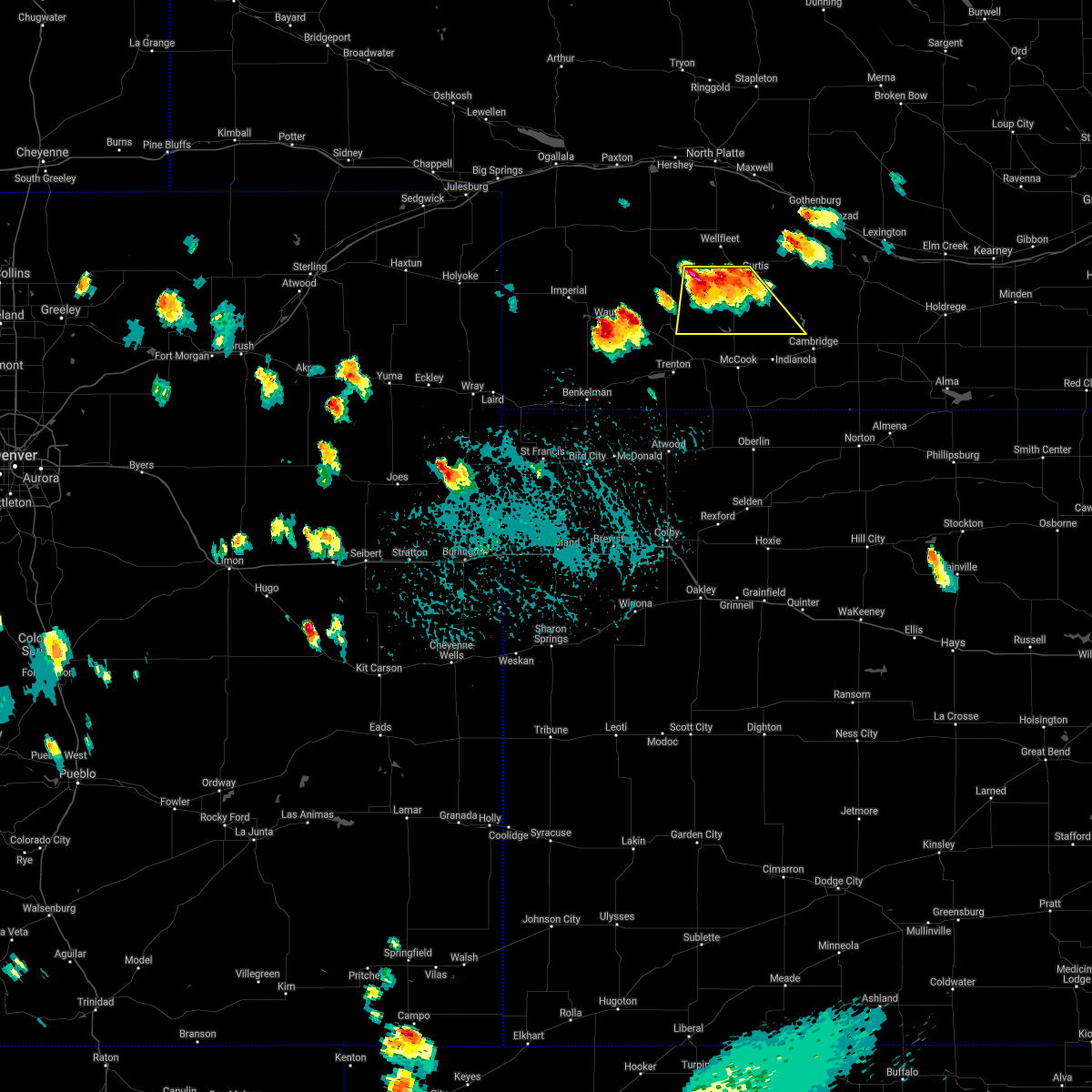 At 310 pm cdt, severe thunderstorms were located along a line extending from curtis to 8 miles northeast of hayes center, moving south at 15 mph (radar indicated). Hazards include ping pong ball size hail. People and animals outdoors will be injured. Expect damage to roofs, siding, windows, and vehicles. At 310 pm cdt, severe thunderstorms were located along a line extending from curtis to 8 miles northeast of hayes center, moving south at 15 mph (radar indicated). Hazards include ping pong ball size hail. People and animals outdoors will be injured. Expect damage to roofs, siding, windows, and vehicles.
|
| 7/29/2020 10:23 PM CDT |
 At 1023 pm cdt, severe thunderstorms were located along a line extending from 6 miles north of cozad to near wellfleet, moving southeast at 40 mph (radar indicated). Hazards include 60 mph wind gusts and quarter size hail. Hail damage to vehicles is expected. Expect wind damage to roofs, siding, and trees. At 1023 pm cdt, severe thunderstorms were located along a line extending from 6 miles north of cozad to near wellfleet, moving southeast at 40 mph (radar indicated). Hazards include 60 mph wind gusts and quarter size hail. Hail damage to vehicles is expected. Expect wind damage to roofs, siding, and trees.
|
| 7/20/2020 7:44 PM CDT |
 At 744 pm cdt/644 pm mdt/, severe thunderstorms were located along a line extending from 8 miles west of curtis to near hayes center to 6 miles north of wauneta, moving southeast at 35 mph (trained weather spotters). Hazards include golf ball size hail and 70 mph wind gusts. People and animals outdoors will be injured. expect hail damage to roofs, siding, windows, and vehicles. expect considerable tree damage. wind damage is also likely to mobile homes, roofs, and outbuildings. locations impacted include, curtis, hayes center, wauneta, wellfleet, stockville, maywood, hamlet, quick, hansen memorial reserve state wildlife management area, willow view campground, freedom, hayes center state wildlife management area, marengo, bluegill haven campground, red willow reservoir state recreation area and dancing leaf earth lodge. This includes highway 83 between mile markers 27 and 62. At 744 pm cdt/644 pm mdt/, severe thunderstorms were located along a line extending from 8 miles west of curtis to near hayes center to 6 miles north of wauneta, moving southeast at 35 mph (trained weather spotters). Hazards include golf ball size hail and 70 mph wind gusts. People and animals outdoors will be injured. expect hail damage to roofs, siding, windows, and vehicles. expect considerable tree damage. wind damage is also likely to mobile homes, roofs, and outbuildings. locations impacted include, curtis, hayes center, wauneta, wellfleet, stockville, maywood, hamlet, quick, hansen memorial reserve state wildlife management area, willow view campground, freedom, hayes center state wildlife management area, marengo, bluegill haven campground, red willow reservoir state recreation area and dancing leaf earth lodge. This includes highway 83 between mile markers 27 and 62.
|
| 7/20/2020 7:29 PM CDT |
 At 729 pm cdt/629 pm mdt/, severe thunderstorms were located along a line extending from near wellfleet to 10 miles northwest of hayes center to 13 miles north of wauneta, moving southeast at 35 mph (trained weather spotters). Hazards include golf ball size hail and 70 mph wind gusts. People and animals outdoors will be injured. expect hail damage to roofs, siding, windows, and vehicles. expect considerable tree damage. Wind damage is also likely to mobile homes, roofs, and outbuildings. At 729 pm cdt/629 pm mdt/, severe thunderstorms were located along a line extending from near wellfleet to 10 miles northwest of hayes center to 13 miles north of wauneta, moving southeast at 35 mph (trained weather spotters). Hazards include golf ball size hail and 70 mph wind gusts. People and animals outdoors will be injured. expect hail damage to roofs, siding, windows, and vehicles. expect considerable tree damage. Wind damage is also likely to mobile homes, roofs, and outbuildings.
|
| 7/13/2020 9:30 PM CDT |
 At 929 pm cdt, severe thunderstorms were located along a line extending from 7 miles north of gothenburg to near willow island to 6 miles east of stockville, moving east at 35 mph (radar indicated). Hazards include 70 mph wind gusts and nickel size hail. Expect considerable tree damage. damage is likely to mobile homes, roofs, and outbuildings. locations impacted include, curtis, brady, eustis, maxwell, moorefield, stockville, medicine creek reservoir state recreation area, jeffrey canyon state wildlife management area, orafino, freedom and dancing leaf earth lodge. this includes the following highways, interstate 80 in nebraska between mile markers 191 and 207. Highway 83 between mile markers 28 and 29. At 929 pm cdt, severe thunderstorms were located along a line extending from 7 miles north of gothenburg to near willow island to 6 miles east of stockville, moving east at 35 mph (radar indicated). Hazards include 70 mph wind gusts and nickel size hail. Expect considerable tree damage. damage is likely to mobile homes, roofs, and outbuildings. locations impacted include, curtis, brady, eustis, maxwell, moorefield, stockville, medicine creek reservoir state recreation area, jeffrey canyon state wildlife management area, orafino, freedom and dancing leaf earth lodge. this includes the following highways, interstate 80 in nebraska between mile markers 191 and 207. Highway 83 between mile markers 28 and 29.
|
| 7/13/2020 9:05 PM CDT | Storm damage reported in lincoln county NE, 8.9 miles S of Curtis, NE |
| 7/13/2020 9:05 PM CDT |
 At 905 pm cdt, severe thunderstorms were located along a line extending from near brady to 7 miles north of moorefield to 7 miles west of stockville, moving east at 35 mph (radar indicated). Hazards include 70 mph wind gusts and nickel size hail. Expect considerable tree damage. Damage is likely to mobile homes, roofs, and outbuildings. At 905 pm cdt, severe thunderstorms were located along a line extending from near brady to 7 miles north of moorefield to 7 miles west of stockville, moving east at 35 mph (radar indicated). Hazards include 70 mph wind gusts and nickel size hail. Expect considerable tree damage. Damage is likely to mobile homes, roofs, and outbuildings.
|
| 7/13/2020 8:48 PM CDT |
 At 848 pm cdt, severe thunderstorms were located along a line extending from 7 miles southwest of maxwell to 7 miles east of wellfleet to 13 miles southwest of curtis, moving east at 50 mph (radar indicated). Hazards include 70 mph wind gusts and nickel size hail. Expect considerable tree damage. damage is likely to mobile homes, roofs, and outbuildings. locations impacted include, curtis, hayes center, brady, wellfleet, moorefield, stockville, lake maloney state recreation area, maywood, quick, cottonwood canyon state wildlife management area, hansen memorial reserve state wildlife management area, jeffrey canyon state wildlife management area, willow view campground, freedom, hayes center state wildlife management area, marengo, bluegill haven campground, red willow reservoir state recreation area, somerset and dancing leaf earth lodge. this includes the following highways, interstate 80 in nebraska between mile markers 193 and 202. Highway 83 between mile markers 27 and 76. At 848 pm cdt, severe thunderstorms were located along a line extending from 7 miles southwest of maxwell to 7 miles east of wellfleet to 13 miles southwest of curtis, moving east at 50 mph (radar indicated). Hazards include 70 mph wind gusts and nickel size hail. Expect considerable tree damage. damage is likely to mobile homes, roofs, and outbuildings. locations impacted include, curtis, hayes center, brady, wellfleet, moorefield, stockville, lake maloney state recreation area, maywood, quick, cottonwood canyon state wildlife management area, hansen memorial reserve state wildlife management area, jeffrey canyon state wildlife management area, willow view campground, freedom, hayes center state wildlife management area, marengo, bluegill haven campground, red willow reservoir state recreation area, somerset and dancing leaf earth lodge. this includes the following highways, interstate 80 in nebraska between mile markers 193 and 202. Highway 83 between mile markers 27 and 76.
|
| 7/13/2020 8:26 PM CDT |
 At 826 pm cdt, severe thunderstorms were located along a line extending from near wallace to 12 miles south of dickens to hayes center, moving east at 35 mph (radar indicated). Hazards include 70 mph wind gusts and nickel size hail. Expect considerable tree damage. Damage is likely to mobile homes, roofs, and outbuildings. At 826 pm cdt, severe thunderstorms were located along a line extending from near wallace to 12 miles south of dickens to hayes center, moving east at 35 mph (radar indicated). Hazards include 70 mph wind gusts and nickel size hail. Expect considerable tree damage. Damage is likely to mobile homes, roofs, and outbuildings.
|
| 7/8/2020 9:16 PM CDT |
 At 915 pm cdt, severe thunderstorms were located along a line extending from 11 miles south of brady to near curtis to 8 miles north of culbertson, moving southeast at 40 mph (radar indicated). Hazards include 70 mph wind gusts. Expect considerable tree damage. damage is likely to mobile homes, roofs, and outbuildings. these severe storms will be near, curtis around 920 pm cdt. moorefield and stockville around 930 pm cdt. medicine creek reservoir state recreation area around 950 pm cdt. eustis around 955 pm cdt. other locations impacted by these severe thunderstorms include quick, cottonwood canyon state wildlife management area, hansen memorial reserve state wildlife management area, jeffrey canyon state wildlife management area, willow view campground, freedom, hayes center state wildlife management area, maywood, orafino and bluegill haven campground. this includes the following highways, interstate 80 in nebraska between mile markers 186 and 207. Highway 83 between mile markers 27 and 73. At 915 pm cdt, severe thunderstorms were located along a line extending from 11 miles south of brady to near curtis to 8 miles north of culbertson, moving southeast at 40 mph (radar indicated). Hazards include 70 mph wind gusts. Expect considerable tree damage. damage is likely to mobile homes, roofs, and outbuildings. these severe storms will be near, curtis around 920 pm cdt. moorefield and stockville around 930 pm cdt. medicine creek reservoir state recreation area around 950 pm cdt. eustis around 955 pm cdt. other locations impacted by these severe thunderstorms include quick, cottonwood canyon state wildlife management area, hansen memorial reserve state wildlife management area, jeffrey canyon state wildlife management area, willow view campground, freedom, hayes center state wildlife management area, maywood, orafino and bluegill haven campground. this includes the following highways, interstate 80 in nebraska between mile markers 186 and 207. Highway 83 between mile markers 27 and 73.
|
| 7/8/2020 8:54 PM CDT |
 At 854 pm cdt, severe thunderstorms were located along a line extending from 7 miles southeast of lake maloney state recreation area to near wellfleet to near hayes center, moving southeast at 40 mph (radar indicated). Hazards include 70 mph wind gusts and nickel size hail. Expect considerable tree damage. damage is likely to mobile homes, roofs, and outbuildings. severe thunderstorms will be near, curtis around 915 pm cdt. moorefield and stockville around 930 pm cdt. eustis and medicine creek reservoir state recreation area around 945 pm cdt. other locations impacted by these severe thunderstorms include quick, cottonwood canyon state wildlife management area, hansen memorial reserve state wildlife management area, jeffrey canyon state wildlife management area, willow view campground, freedom, hayes center state wildlife management area, maywood, orafino and bluegill haven campground. this includes the following highways, interstate 80 in nebraska between mile markers 186 and 207. Highway 83 between mile markers 27 and 73. At 854 pm cdt, severe thunderstorms were located along a line extending from 7 miles southeast of lake maloney state recreation area to near wellfleet to near hayes center, moving southeast at 40 mph (radar indicated). Hazards include 70 mph wind gusts and nickel size hail. Expect considerable tree damage. damage is likely to mobile homes, roofs, and outbuildings. severe thunderstorms will be near, curtis around 915 pm cdt. moorefield and stockville around 930 pm cdt. eustis and medicine creek reservoir state recreation area around 945 pm cdt. other locations impacted by these severe thunderstorms include quick, cottonwood canyon state wildlife management area, hansen memorial reserve state wildlife management area, jeffrey canyon state wildlife management area, willow view campground, freedom, hayes center state wildlife management area, maywood, orafino and bluegill haven campground. this includes the following highways, interstate 80 in nebraska between mile markers 186 and 207. Highway 83 between mile markers 27 and 73.
|
| 7/2/2020 7:55 PM CDT |
 The severe thunderstorm warning for frontier and southeastern lincoln counties will expire at 800 pm cdt, the storm which prompted the warning has weakened below severe limits, and no longer poses an immediate threat to life or property. therefore, the warning will be allowed to expire. however heavy rain is still possible with this thunderstorm. a severe thunderstorm watch remains in effect until 1000 pm cdt for southwestern nebraska. The severe thunderstorm warning for frontier and southeastern lincoln counties will expire at 800 pm cdt, the storm which prompted the warning has weakened below severe limits, and no longer poses an immediate threat to life or property. therefore, the warning will be allowed to expire. however heavy rain is still possible with this thunderstorm. a severe thunderstorm watch remains in effect until 1000 pm cdt for southwestern nebraska.
|
| 7/2/2020 7:21 PM CDT |
 At 721 pm cdt, a severe thunderstorm was located 8 miles south of curtis, moving east at 25 mph (radar indicated). Hazards include 70 mph wind gusts and quarter size hail. Hail damage to vehicles is expected. expect considerable tree damage. wind damage is also likely to mobile homes, roofs, and outbuildings. locations impacted include, curtis, eustis, wellfleet, moorefield, stockville, medicine creek reservoir state recreation area, maywood, quick, hansen memorial reserve state wildlife management area, willow view campground, freedom, orafino, bluegill haven campground, vroman, red willow reservoir state recreation area and dancing leaf earth lodge. this includes the following highways, interstate 80 in nebraska between mile markers 204 and 207. Highway 83 between mile markers 27 and 60. At 721 pm cdt, a severe thunderstorm was located 8 miles south of curtis, moving east at 25 mph (radar indicated). Hazards include 70 mph wind gusts and quarter size hail. Hail damage to vehicles is expected. expect considerable tree damage. wind damage is also likely to mobile homes, roofs, and outbuildings. locations impacted include, curtis, eustis, wellfleet, moorefield, stockville, medicine creek reservoir state recreation area, maywood, quick, hansen memorial reserve state wildlife management area, willow view campground, freedom, orafino, bluegill haven campground, vroman, red willow reservoir state recreation area and dancing leaf earth lodge. this includes the following highways, interstate 80 in nebraska between mile markers 204 and 207. Highway 83 between mile markers 27 and 60.
|
| 7/2/2020 6:55 PM CDT |
 At 654 pm cdt, a severe thunderstorm was located 14 miles southwest of curtis, moving east at 30 mph (radar indicated). Hazards include 70 mph wind gusts and quarter size hail. Hail damage to vehicles is expected. expect considerable tree damage. Wind damage is also likely to mobile homes, roofs, and outbuildings. At 654 pm cdt, a severe thunderstorm was located 14 miles southwest of curtis, moving east at 30 mph (radar indicated). Hazards include 70 mph wind gusts and quarter size hail. Hail damage to vehicles is expected. expect considerable tree damage. Wind damage is also likely to mobile homes, roofs, and outbuildings.
|
| 6/20/2020 5:50 PM CDT |
 At 549 pm cdt, a severe thunderstorm was located near wellfleet, or 15 miles west of curtis, moving east at 15 mph (radar indicated). Hazards include ping pong ball size hail and 60 mph wind gusts. People and animals outdoors will be injured. expect hail damage to roofs, siding, windows, and vehicles. Expect wind damage to roofs, siding, and trees. At 549 pm cdt, a severe thunderstorm was located near wellfleet, or 15 miles west of curtis, moving east at 15 mph (radar indicated). Hazards include ping pong ball size hail and 60 mph wind gusts. People and animals outdoors will be injured. expect hail damage to roofs, siding, windows, and vehicles. Expect wind damage to roofs, siding, and trees.
|
| 6/4/2020 7:22 PM CDT |
 The severe thunderstorm warning for frontier and southeastern lincoln counties will expire at 730 pm cdt, the storms which prompted the warning have weakened below severe limits, and have exited the warned area. therefore, the warning will be allowed to expire. however gusty winds are still possible with these thunderstorms. The severe thunderstorm warning for frontier and southeastern lincoln counties will expire at 730 pm cdt, the storms which prompted the warning have weakened below severe limits, and have exited the warned area. therefore, the warning will be allowed to expire. however gusty winds are still possible with these thunderstorms.
|
| 6/4/2020 6:57 PM CDT |
 At 656 pm cdt, severe thunderstorms were located along a line extending from moorefield to 8 miles northwest of mccook, moving east at 35 mph (radar indicated). Hazards include 70 mph wind gusts. Expect considerable tree damage. damage is likely to mobile homes, roofs, and outbuildings. locations impacted include, curtis, eustis, moorefield, stockville, medicine creek reservoir state recreation area, maywood, quick, hansen memorial reserve state wildlife management area, willow view campground, freedom, orafino, bluegill haven campground, red willow reservoir state recreation area and dancing leaf earth lodge. This includes highway 83 between mile markers 28 and 48. At 656 pm cdt, severe thunderstorms were located along a line extending from moorefield to 8 miles northwest of mccook, moving east at 35 mph (radar indicated). Hazards include 70 mph wind gusts. Expect considerable tree damage. damage is likely to mobile homes, roofs, and outbuildings. locations impacted include, curtis, eustis, moorefield, stockville, medicine creek reservoir state recreation area, maywood, quick, hansen memorial reserve state wildlife management area, willow view campground, freedom, orafino, bluegill haven campground, red willow reservoir state recreation area and dancing leaf earth lodge. This includes highway 83 between mile markers 28 and 48.
|
| 6/4/2020 6:23 PM CDT |
 At 623 pm cdt, severe thunderstorms were located along a line extending from wellfleet to near palisade, moving east at 35 mph (radar indicated). Hazards include 70 mph wind gusts and a blinding cloud of dust. Expect considerable tree damage. Damage is likely to mobile homes, roofs, and outbuildings. At 623 pm cdt, severe thunderstorms were located along a line extending from wellfleet to near palisade, moving east at 35 mph (radar indicated). Hazards include 70 mph wind gusts and a blinding cloud of dust. Expect considerable tree damage. Damage is likely to mobile homes, roofs, and outbuildings.
|
| 6/3/2020 7:55 PM CDT | Storm damage reported in frontier county NE, 9.2 miles NW of Curtis, NE |
| 6/3/2020 7:45 PM CDT |
 At 744 pm cdt, a severe thunderstorm was located near stockville, or 15 miles southeast of curtis, moving east at 40 mph (trained weather spotters). Hazards include 70 mph wind gusts and quarter size hail. Hail damage to vehicles is expected. expect considerable tree damage. wind damage is also likely to mobile homes, roofs, and outbuildings. locations impacted include, curtis, eustis, moorefield, stockville, medicine creek reservoir state recreation area, maywood, quick, willow view campground, freedom, orafino, bluegill haven campground, red willow reservoir state recreation area and dancing leaf earth lodge. This includes highway 83 between mile markers 27 and 51. At 744 pm cdt, a severe thunderstorm was located near stockville, or 15 miles southeast of curtis, moving east at 40 mph (trained weather spotters). Hazards include 70 mph wind gusts and quarter size hail. Hail damage to vehicles is expected. expect considerable tree damage. wind damage is also likely to mobile homes, roofs, and outbuildings. locations impacted include, curtis, eustis, moorefield, stockville, medicine creek reservoir state recreation area, maywood, quick, willow view campground, freedom, orafino, bluegill haven campground, red willow reservoir state recreation area and dancing leaf earth lodge. This includes highway 83 between mile markers 27 and 51.
|
| 6/3/2020 7:41 PM CDT |
 At 740 pm cdt, a severe thunderstorm was located near stockville, or 12 miles southeast of curtis, moving east at 60 mph (radar indicated). Hazards include 60 mph wind gusts and half dollar size hail. Hail damage to vehicles is expected. expect wind damage to roofs, siding, and trees. locations impacted include, curtis, eustis, moorefield, stockville, medicine creek reservoir state recreation area, maywood, quick, willow view campground, freedom, orafino, bluegill haven campground, red willow reservoir state recreation area and dancing leaf earth lodge. This includes highway 83 between mile markers 27 and 51. At 740 pm cdt, a severe thunderstorm was located near stockville, or 12 miles southeast of curtis, moving east at 60 mph (radar indicated). Hazards include 60 mph wind gusts and half dollar size hail. Hail damage to vehicles is expected. expect wind damage to roofs, siding, and trees. locations impacted include, curtis, eustis, moorefield, stockville, medicine creek reservoir state recreation area, maywood, quick, willow view campground, freedom, orafino, bluegill haven campground, red willow reservoir state recreation area and dancing leaf earth lodge. This includes highway 83 between mile markers 27 and 51.
|
| 6/3/2020 7:21 PM CDT |
 At 720 pm cdt, a severe thunderstorm was located 13 miles southwest of curtis, moving east at 40 mph (radar indicated). Hazards include 60 mph wind gusts and half dollar size hail. Hail damage to vehicles is expected. Expect wind damage to roofs, siding, and trees. At 720 pm cdt, a severe thunderstorm was located 13 miles southwest of curtis, moving east at 40 mph (radar indicated). Hazards include 60 mph wind gusts and half dollar size hail. Hail damage to vehicles is expected. Expect wind damage to roofs, siding, and trees.
|
| 9/30/2019 8:24 PM CDT |
 At 824 pm cdt, a severe thunderstorm was located over curtis, moving northeast at 30 mph (radar indicated). Hazards include ping pong ball size hail and 60 mph wind gusts. People and animals outdoors will be injured. expect hail damage to roofs, siding, windows, and vehicles. Expect wind damage to roofs, siding, and trees. At 824 pm cdt, a severe thunderstorm was located over curtis, moving northeast at 30 mph (radar indicated). Hazards include ping pong ball size hail and 60 mph wind gusts. People and animals outdoors will be injured. expect hail damage to roofs, siding, windows, and vehicles. Expect wind damage to roofs, siding, and trees.
|
| 9/19/2019 7:13 PM CDT |
 At 713 pm cdt, a severe thunderstorm was located near curtis, moving north at 15 mph (radar indicated). Hazards include 60 mph wind gusts and quarter size hail. Hail damage to vehicles is expected. expect wind damage to roofs, siding, and trees. locations impacted include, curtis, wellfleet, moorefield, stockville, dickens, maywood, hansen memorial reserve state wildlife management area, jeffrey canyon state wildlife management area, hayes center state wildlife management area, marengo, vroman, somerset and dancing leaf earth lodge. this includes the following highways, interstate 80 in nebraska between mile markers 204 and 207. Highway 83 between mile markers 33 and 69. At 713 pm cdt, a severe thunderstorm was located near curtis, moving north at 15 mph (radar indicated). Hazards include 60 mph wind gusts and quarter size hail. Hail damage to vehicles is expected. expect wind damage to roofs, siding, and trees. locations impacted include, curtis, wellfleet, moorefield, stockville, dickens, maywood, hansen memorial reserve state wildlife management area, jeffrey canyon state wildlife management area, hayes center state wildlife management area, marengo, vroman, somerset and dancing leaf earth lodge. this includes the following highways, interstate 80 in nebraska between mile markers 204 and 207. Highway 83 between mile markers 33 and 69.
|
| 9/19/2019 6:54 PM CDT |
 The national weather service in north platte has issued a * severe thunderstorm warning for. northwestern frontier county in southwestern nebraska. southern lincoln county in southwestern nebraska. northeastern hayes county in southwestern nebraska. Until 745 pm cdt. The national weather service in north platte has issued a * severe thunderstorm warning for. northwestern frontier county in southwestern nebraska. southern lincoln county in southwestern nebraska. northeastern hayes county in southwestern nebraska. Until 745 pm cdt.
|
| 9/19/2019 6:37 PM CDT |
 At 637 pm cdt, a severe thunderstorm was located near moorefield, or near curtis, moving north at 20 mph (radar indicated). Hazards include 60 mph wind gusts and quarter size hail. Hail damage to vehicles is expected. expect wind damage to roofs, siding, and trees. Locations impacted include, curtis, moorefield, stockville, maywood, hansen memorial reserve state wildlife management area, orafino and dancing leaf earth lodge. At 637 pm cdt, a severe thunderstorm was located near moorefield, or near curtis, moving north at 20 mph (radar indicated). Hazards include 60 mph wind gusts and quarter size hail. Hail damage to vehicles is expected. expect wind damage to roofs, siding, and trees. Locations impacted include, curtis, moorefield, stockville, maywood, hansen memorial reserve state wildlife management area, orafino and dancing leaf earth lodge.
|
| 9/19/2019 6:09 PM CDT |
 The national weather service in north platte has issued a * severe thunderstorm warning for. central frontier county in southwestern nebraska. southeastern lincoln county in southwestern nebraska. until 700 pm cdt. At 609 pm cdt, a severe thunderstorm was located near curtis,. The national weather service in north platte has issued a * severe thunderstorm warning for. central frontier county in southwestern nebraska. southeastern lincoln county in southwestern nebraska. until 700 pm cdt. At 609 pm cdt, a severe thunderstorm was located near curtis,.
|
| 9/19/2019 5:56 PM CDT |
 At 556 pm cdt, a severe thunderstorm was located near stockville, or 11 miles east of curtis, moving north at 20 mph (public). Hazards include golf ball size hail and 60 mph wind gusts. People and animals outdoors will be injured. expect hail damage to roofs, siding, windows, and vehicles. expect wind damage to roofs, siding, and trees. Locations impacted include, curtis, moorefield, stockville, orafino, freedom and dancing leaf earth lodge. At 556 pm cdt, a severe thunderstorm was located near stockville, or 11 miles east of curtis, moving north at 20 mph (public). Hazards include golf ball size hail and 60 mph wind gusts. People and animals outdoors will be injured. expect hail damage to roofs, siding, windows, and vehicles. expect wind damage to roofs, siding, and trees. Locations impacted include, curtis, moorefield, stockville, orafino, freedom and dancing leaf earth lodge.
|
| 9/19/2019 5:41 PM CDT |
 At 540 pm cdt, a severe thunderstorm was located near stockville, or 14 miles southeast of curtis, moving north at 20 mph (public). Hazards include 60 mph wind gusts and quarter size hail. Hail damage to vehicles is expected. expect wind damage to roofs, siding, and trees. Locations impacted include, curtis, moorefield, stockville, medicine creek reservoir state recreation area, orafino, freedom and dancing leaf earth lodge. At 540 pm cdt, a severe thunderstorm was located near stockville, or 14 miles southeast of curtis, moving north at 20 mph (public). Hazards include 60 mph wind gusts and quarter size hail. Hail damage to vehicles is expected. expect wind damage to roofs, siding, and trees. Locations impacted include, curtis, moorefield, stockville, medicine creek reservoir state recreation area, orafino, freedom and dancing leaf earth lodge.
|
| 9/19/2019 5:26 PM CDT |
 At 525 pm cdt, a severe thunderstorm was located near medicine creek reservoir state recreation area, or 18 miles southeast of curtis, moving north at 20 mph (radar indicated). Hazards include 60 mph wind gusts and quarter size hail. Hail damage to vehicles is expected. Expect wind damage to roofs, siding, and trees. At 525 pm cdt, a severe thunderstorm was located near medicine creek reservoir state recreation area, or 18 miles southeast of curtis, moving north at 20 mph (radar indicated). Hazards include 60 mph wind gusts and quarter size hail. Hail damage to vehicles is expected. Expect wind damage to roofs, siding, and trees.
|
| 9/11/2019 10:36 PM CDT |
 At 1036 pm cdt, severe thunderstorms were located along a line extending from near north platte airport to 8 miles south of maxwell to near curtis to 11 miles north of culbertson, moving east at 55 mph (radar indicated). Hazards include 70 mph wind gusts and penny size hail. Expect considerable tree damage. Damage is likely to mobile homes, roofs, and outbuildings. At 1036 pm cdt, severe thunderstorms were located along a line extending from near north platte airport to 8 miles south of maxwell to near curtis to 11 miles north of culbertson, moving east at 55 mph (radar indicated). Hazards include 70 mph wind gusts and penny size hail. Expect considerable tree damage. Damage is likely to mobile homes, roofs, and outbuildings.
|
| 8/8/2019 5:56 PM CDT |
 The severe thunderstorm warning for western frontier and southeastern lincoln counties will expire at 600 pm cdt, the storm which prompted the warning has weakened below severe limits, and no longer poses an immediate threat to life or property. therefore, the warning will be allowed to expire. however gusty winds and heavy rain are still possible with this thunderstorm. The severe thunderstorm warning for western frontier and southeastern lincoln counties will expire at 600 pm cdt, the storm which prompted the warning has weakened below severe limits, and no longer poses an immediate threat to life or property. therefore, the warning will be allowed to expire. however gusty winds and heavy rain are still possible with this thunderstorm.
|
| 8/8/2019 5:41 PM CDT |
 At 541 pm cdt, a severe thunderstorm was located over curtis, moving south at 10 mph (radar indicated). Hazards include 60 mph wind gusts and penny size hail. Expect damage to roofs, siding, and trees. locations impacted include, curtis, moorefield, stockville, maywood, hansen memorial reserve state wildlife management area and dancing leaf earth lodge. This includes highway 83 between mile markers 44 and 48. At 541 pm cdt, a severe thunderstorm was located over curtis, moving south at 10 mph (radar indicated). Hazards include 60 mph wind gusts and penny size hail. Expect damage to roofs, siding, and trees. locations impacted include, curtis, moorefield, stockville, maywood, hansen memorial reserve state wildlife management area and dancing leaf earth lodge. This includes highway 83 between mile markers 44 and 48.
|
| 8/8/2019 5:14 PM CDT |
 At 513 pm cdt, a severe thunderstorm was located near wellfleet, or 10 miles northwest of curtis, moving southeast at 30 mph (radar indicated). Hazards include 60 mph wind gusts and penny size hail. expect damage to roofs, siding, and trees At 513 pm cdt, a severe thunderstorm was located near wellfleet, or 10 miles northwest of curtis, moving southeast at 30 mph (radar indicated). Hazards include 60 mph wind gusts and penny size hail. expect damage to roofs, siding, and trees
|
| 7/12/2019 10:34 PM CDT |
 At 1032 pm cdt, severe thunderstorms were located along a line extending from near tryon to 12 miles south of ringgold to near north platte airport to near wellfleet, moving east at 30 mph (radar indicated). Hazards include 70 mph wind gusts and penny size hail. Expect considerable tree damage. Damage is likely to mobile homes, roofs, and outbuildings. At 1032 pm cdt, severe thunderstorms were located along a line extending from near tryon to 12 miles south of ringgold to near north platte airport to near wellfleet, moving east at 30 mph (radar indicated). Hazards include 70 mph wind gusts and penny size hail. Expect considerable tree damage. Damage is likely to mobile homes, roofs, and outbuildings.
|
| 7/7/2019 2:54 AM CDT |
 The severe thunderstorm warning for western frontier, lincoln and hayes counties will expire at 300 am cdt, the storms which prompted the warning have weakened below severe limits, and no longer pose an immediate threat to life or property. therefore, the warning will be allowed to expire. however gusty winds and heavy rain are still possible with these thunderstorms. a severe thunderstorm watch remains in effect until 500 am cdt for southwestern nebraska. The severe thunderstorm warning for western frontier, lincoln and hayes counties will expire at 300 am cdt, the storms which prompted the warning have weakened below severe limits, and no longer pose an immediate threat to life or property. therefore, the warning will be allowed to expire. however gusty winds and heavy rain are still possible with these thunderstorms. a severe thunderstorm watch remains in effect until 500 am cdt for southwestern nebraska.
|
| 7/7/2019 2:30 AM CDT |
 At 229 am cdt, severe thunderstorms were located along a line extending from 6 miles north of north platte to near hayes center to near wauneta, moving southeast at 35 mph (radar indicated). Hazards include 60 mph wind gusts and penny size hail. Expect damage to roofs, siding, and trees. locations impacted include, north platte, curtis, hayes center, sutherland, hershey, brady, wallace, maxwell, wellfleet, dickens, lake maloney, maywood, hamlet, o`fallons, willow view campground and red willow reservoir. this includes the following highways, highway 97 between mile markers 1 and 9. interstate 80 in nebraska between mile markers 160 and 202. Highway 83 between mile markers 27 and 93. At 229 am cdt, severe thunderstorms were located along a line extending from 6 miles north of north platte to near hayes center to near wauneta, moving southeast at 35 mph (radar indicated). Hazards include 60 mph wind gusts and penny size hail. Expect damage to roofs, siding, and trees. locations impacted include, north platte, curtis, hayes center, sutherland, hershey, brady, wallace, maxwell, wellfleet, dickens, lake maloney, maywood, hamlet, o`fallons, willow view campground and red willow reservoir. this includes the following highways, highway 97 between mile markers 1 and 9. interstate 80 in nebraska between mile markers 160 and 202. Highway 83 between mile markers 27 and 93.
|
| 7/7/2019 2:05 AM CDT |
 At 204 am cdt/104 am mdt/, severe thunderstorms were located along a line extending from 12 miles north of hershey to 12 miles south of wallace to near imperial, moving southeast at 35 mph (radar indicated). Hazards include 60 mph wind gusts and penny size hail. expect damage to roofs, siding, and trees At 204 am cdt/104 am mdt/, severe thunderstorms were located along a line extending from 12 miles north of hershey to 12 miles south of wallace to near imperial, moving southeast at 35 mph (radar indicated). Hazards include 60 mph wind gusts and penny size hail. expect damage to roofs, siding, and trees
|
| 7/5/2019 3:20 AM CDT |
 At 319 am cdt, severe thunderstorms were located along a line extending from near sargent to near curtis, moving northeast at 30 mph (radar indicated). Hazards include 60 mph wind gusts and quarter size hail. Hail damage to vehicles is expected. expect wind damage to roofs, siding, and trees. locations impacted include, broken bow, curtis, callaway, sargent, ansley, brady, merna, oconto, comstock, stockville, weissert, maywood, westerville, lillian, lodi. this includes the following highways, highway 183 between mile markers 89 and 120. highway 2 between mile markers 265 and 295. highway 92 between mile markers 268 and 273. interstate 80 in nebraska between mile markers 198 and 207. Highway 83 between mile markers 40 and 54. At 319 am cdt, severe thunderstorms were located along a line extending from near sargent to near curtis, moving northeast at 30 mph (radar indicated). Hazards include 60 mph wind gusts and quarter size hail. Hail damage to vehicles is expected. expect wind damage to roofs, siding, and trees. locations impacted include, broken bow, curtis, callaway, sargent, ansley, brady, merna, oconto, comstock, stockville, weissert, maywood, westerville, lillian, lodi. this includes the following highways, highway 183 between mile markers 89 and 120. highway 2 between mile markers 265 and 295. highway 92 between mile markers 268 and 273. interstate 80 in nebraska between mile markers 198 and 207. Highway 83 between mile markers 40 and 54.
|
| 7/5/2019 2:44 AM CDT |
 At 243 am cdt, severe thunderstorms were located along a line extending from merna to 8 miles east of hayes center, moving east at 35 mph (radar indicated). Hazards include 60 mph wind gusts and quarter size hail. Hail damage to vehicles is expected. Expect wind damage to roofs, siding, and trees. At 243 am cdt, severe thunderstorms were located along a line extending from merna to 8 miles east of hayes center, moving east at 35 mph (radar indicated). Hazards include 60 mph wind gusts and quarter size hail. Hail damage to vehicles is expected. Expect wind damage to roofs, siding, and trees.
|
| 6/8/2019 6:52 PM CDT |
 At 652 pm cdt, severe thunderstorms were located along a line extending from 7 miles northeast of cozad to near eustis to near stockville to 10 miles southeast of hayes center, moving southeast at 30 mph (radar indicated). Hazards include 60 mph wind gusts and half dollar size hail. Hail damage to vehicles is expected. expect wind damage to roofs, siding, and trees. locations impacted include, curtis, hayes center, brady, eustis, wellfleet, moorefield, stockville, maywood, quick, cottonwood canyon state wildlife management area, etna, hansen memorial reserve state wildlife management area, jeffrey canyon state wildlife management area, hayes center state wildlife management area, marengo, vroman, somerset and dancing leaf earth lodge. this includes the following highways, interstate 80 in nebraska between mile markers 193 and 207. Highway 83 between mile markers 30 and 66. At 652 pm cdt, severe thunderstorms were located along a line extending from 7 miles northeast of cozad to near eustis to near stockville to 10 miles southeast of hayes center, moving southeast at 30 mph (radar indicated). Hazards include 60 mph wind gusts and half dollar size hail. Hail damage to vehicles is expected. expect wind damage to roofs, siding, and trees. locations impacted include, curtis, hayes center, brady, eustis, wellfleet, moorefield, stockville, maywood, quick, cottonwood canyon state wildlife management area, etna, hansen memorial reserve state wildlife management area, jeffrey canyon state wildlife management area, hayes center state wildlife management area, marengo, vroman, somerset and dancing leaf earth lodge. this includes the following highways, interstate 80 in nebraska between mile markers 193 and 207. Highway 83 between mile markers 30 and 66.
|
| 6/8/2019 6:13 PM CDT |
 At 613 pm cdt, severe thunderstorms were located along a line extending from 12 miles southwest of callaway to near brady to near wellfleet to 10 miles south of dickens, moving southeast at 30 mph (radar indicated). Hazards include 60 mph wind gusts and half dollar size hail. Hail damage to vehicles is expected. Expect wind damage to roofs, siding, and trees. At 613 pm cdt, severe thunderstorms were located along a line extending from 12 miles southwest of callaway to near brady to near wellfleet to 10 miles south of dickens, moving southeast at 30 mph (radar indicated). Hazards include 60 mph wind gusts and half dollar size hail. Hail damage to vehicles is expected. Expect wind damage to roofs, siding, and trees.
|
| 6/4/2019 9:25 PM CDT |
 At 924 pm cdt, a severe thunderstorm was located over wellfleet, or 14 miles northwest of curtis, moving southeast at 30 mph (radar indicated). Hazards include 60 mph wind gusts and quarter size hail. Hail damage to vehicles is expected. expect wind damage to roofs, siding, and trees. locations impacted include, curtis, wellfleet, moorefield, maywood and hansen memorial reserve state wildlife management area. This includes highway 83 between mile markers 45 and 67. At 924 pm cdt, a severe thunderstorm was located over wellfleet, or 14 miles northwest of curtis, moving southeast at 30 mph (radar indicated). Hazards include 60 mph wind gusts and quarter size hail. Hail damage to vehicles is expected. expect wind damage to roofs, siding, and trees. locations impacted include, curtis, wellfleet, moorefield, maywood and hansen memorial reserve state wildlife management area. This includes highway 83 between mile markers 45 and 67.
|
| 6/4/2019 8:57 PM CDT |
 At 857 pm cdt, a severe thunderstorm was located near dickens, or 21 miles south of north platte, moving southeast at 35 mph (radar indicated). Hazards include 60 mph wind gusts and quarter size hail. Hail damage to vehicles is expected. Expect wind damage to roofs, siding, and trees. At 857 pm cdt, a severe thunderstorm was located near dickens, or 21 miles south of north platte, moving southeast at 35 mph (radar indicated). Hazards include 60 mph wind gusts and quarter size hail. Hail damage to vehicles is expected. Expect wind damage to roofs, siding, and trees.
|
| 6/3/2019 10:52 PM CDT |
 At 1033 pm cdt, severe thunderstorms were located along a line extending from near moorefield to near stockville to near medicine creek reservoir state recreation area, moving east at 60 mph (radar indicated). Hazards include 60 mph wind gusts. Expect damage to roofs, siding, and trees. locations impacted include, curtis, eustis, moorefield, stockville, medicine creek reservoir state recreation area, maywood, orafino, freedom and dancing leaf earth lodge. This includes highway 83 between mile markers 41 and 49. At 1033 pm cdt, severe thunderstorms were located along a line extending from near moorefield to near stockville to near medicine creek reservoir state recreation area, moving east at 60 mph (radar indicated). Hazards include 60 mph wind gusts. Expect damage to roofs, siding, and trees. locations impacted include, curtis, eustis, moorefield, stockville, medicine creek reservoir state recreation area, maywood, orafino, freedom and dancing leaf earth lodge. This includes highway 83 between mile markers 41 and 49.
|
| 6/3/2019 10:34 PM CDT |
 At 1033 pm cdt, severe thunderstorms were located along a line extending from near moorefield to near stockville to near medicine creek reservoir state recreation area, moving east at 60 mph (radar indicated). Hazards include 60 mph wind gusts. Expect damage to roofs, siding, and trees. locations impacted include, curtis, eustis, moorefield, stockville, medicine creek reservoir state recreation area, maywood, orafino, freedom and dancing leaf earth lodge. This includes highway 83 between mile markers 41 and 49. At 1033 pm cdt, severe thunderstorms were located along a line extending from near moorefield to near stockville to near medicine creek reservoir state recreation area, moving east at 60 mph (radar indicated). Hazards include 60 mph wind gusts. Expect damage to roofs, siding, and trees. locations impacted include, curtis, eustis, moorefield, stockville, medicine creek reservoir state recreation area, maywood, orafino, freedom and dancing leaf earth lodge. This includes highway 83 between mile markers 41 and 49.
|
| 6/3/2019 10:10 PM CDT |
 At 1010 pm cdt, severe thunderstorms were located along a line extending from 6 miles southwest of wellfleet to 13 miles southwest of curtis to 11 miles north of mccook, moving east at 40 mph (radar indicated). Hazards include 60 mph wind gusts and penny size hail. expect damage to roofs, siding, and trees At 1010 pm cdt, severe thunderstorms were located along a line extending from 6 miles southwest of wellfleet to 13 miles southwest of curtis to 11 miles north of mccook, moving east at 40 mph (radar indicated). Hazards include 60 mph wind gusts and penny size hail. expect damage to roofs, siding, and trees
|
| 6/3/2019 9:51 PM CDT |
 At 950 pm cdt, a severe thunderstorm was located 14 miles east of hayes center, moving east at 45 mph (radar indicated). Hazards include 60 mph wind gusts and penny size hail. Expect damage to roofs, siding, and trees. this severe storm will be near, curtis around 1010 pm cdt. stockville around 1015 pm cdt. other locations impacted by this severe thunderstorm include quick, marengo, maywood, hansen memorial reserve state wildlife management area, bluegill haven campground, willow view campground, freedom, hayes center state wildlife management area, red willow reservoir state recreation area and dancing leaf earth lodge. This includes highway 83 between mile markers 27 and 59. At 950 pm cdt, a severe thunderstorm was located 14 miles east of hayes center, moving east at 45 mph (radar indicated). Hazards include 60 mph wind gusts and penny size hail. Expect damage to roofs, siding, and trees. this severe storm will be near, curtis around 1010 pm cdt. stockville around 1015 pm cdt. other locations impacted by this severe thunderstorm include quick, marengo, maywood, hansen memorial reserve state wildlife management area, bluegill haven campground, willow view campground, freedom, hayes center state wildlife management area, red willow reservoir state recreation area and dancing leaf earth lodge. This includes highway 83 between mile markers 27 and 59.
|
| 6/3/2019 9:30 PM CDT |
 At 930 pm cdt, a severe thunderstorm was located over hayes center, moving east at 40 mph (radar indicated). Hazards include 60 mph wind gusts and quarter size hail. Hail damage to vehicles is expected. Expect wind damage to roofs, siding, and trees. At 930 pm cdt, a severe thunderstorm was located over hayes center, moving east at 40 mph (radar indicated). Hazards include 60 mph wind gusts and quarter size hail. Hail damage to vehicles is expected. Expect wind damage to roofs, siding, and trees.
|
| 5/27/2019 11:20 PM CDT |
 At 1120 pm cdt, a severe thunderstorm was located near curtis, moving east at 50 mph (radar indicated). Hazards include ping pong ball size hail and 60 mph wind gusts. People and animals outdoors will be injured. expect hail damage to roofs, siding, windows, and vehicles. Expect wind damage to roofs, siding, and trees. At 1120 pm cdt, a severe thunderstorm was located near curtis, moving east at 50 mph (radar indicated). Hazards include ping pong ball size hail and 60 mph wind gusts. People and animals outdoors will be injured. expect hail damage to roofs, siding, windows, and vehicles. Expect wind damage to roofs, siding, and trees.
|
| 5/27/2019 10:42 PM CDT |
 At 1042 pm cdt, a severe thunderstorm was located over hayes center, moving east at 45 mph (radar indicated). Hazards include 60 mph wind gusts and half dollar size hail. Hail damage to vehicles is expected. Expect wind damage to roofs, siding, and trees. At 1042 pm cdt, a severe thunderstorm was located over hayes center, moving east at 45 mph (radar indicated). Hazards include 60 mph wind gusts and half dollar size hail. Hail damage to vehicles is expected. Expect wind damage to roofs, siding, and trees.
|
| 5/17/2019 7:41 PM CDT | Baseball sized hail reported 9.2 miles NW of Curtis, NE, report via mping |
| 5/17/2019 7:00 PM CDT |
 At 700 pm cdt, a confirmed tornado was located near stockville, or 10 miles east of curtis, moving northeast at 25 mph (radar confirmed tornado). Hazards include damaging tornado and two inch hail. Flying debris will be dangerous to those caught without shelter. mobile homes will be damaged or destroyed. damage to roofs, windows, and vehicles will occur. tree damage is likely. this tornadic thunderstorm will remain over mainly rural areas of central frontier county, including the following locations, quick, freedom and dancing leaf earth lodge. This includes highway 83 between mile markers 32 and 36. At 700 pm cdt, a confirmed tornado was located near stockville, or 10 miles east of curtis, moving northeast at 25 mph (radar confirmed tornado). Hazards include damaging tornado and two inch hail. Flying debris will be dangerous to those caught without shelter. mobile homes will be damaged or destroyed. damage to roofs, windows, and vehicles will occur. tree damage is likely. this tornadic thunderstorm will remain over mainly rural areas of central frontier county, including the following locations, quick, freedom and dancing leaf earth lodge. This includes highway 83 between mile markers 32 and 36.
|
| 5/17/2019 6:43 PM CDT | Baseball sized hail reported 9.2 miles NW of Curtis, NE, report via mping. time based on radar. |
| 5/17/2019 6:41 PM CDT |
 At 641 pm cdt, a severe thunderstorm capable of producing a tornado was located over stockville, or 9 miles southeast of curtis, moving northeast at 25 mph (radar indicated rotation). Hazards include tornado and hail up to two inches in diameter. Flying debris will be dangerous to those caught without shelter. mobile homes will be damaged or destroyed. damage to roofs, windows, and vehicles will occur. tree damage is likely. this dangerous storm will be near, moorefield around 705 pm cdt. other locations impacted by this tornadic thunderstorm include quick, freedom and dancing leaf earth lodge. This includes highway 83 between mile markers 32 and 36. At 641 pm cdt, a severe thunderstorm capable of producing a tornado was located over stockville, or 9 miles southeast of curtis, moving northeast at 25 mph (radar indicated rotation). Hazards include tornado and hail up to two inches in diameter. Flying debris will be dangerous to those caught without shelter. mobile homes will be damaged or destroyed. damage to roofs, windows, and vehicles will occur. tree damage is likely. this dangerous storm will be near, moorefield around 705 pm cdt. other locations impacted by this tornadic thunderstorm include quick, freedom and dancing leaf earth lodge. This includes highway 83 between mile markers 32 and 36.
|
| 5/17/2019 6:30 PM CDT |
 At 617 pm cdt, a severe thunderstorm capable of producing a tornado was located 13 miles southwest of stockville, or 14 miles north of mccook, moving northeast at 45 mph (radar indicated rotation). Hazards include tornado and tennis ball size hail. Flying debris will be dangerous to those caught without shelter. mobile homes will be damaged or destroyed. damage to roofs, windows, and vehicles will occur. tree damage is likely. this dangerous storm will be near, stockville around 635 pm cdt. curtis around 640 pm cdt. other locations impacted by this tornadic thunderstorm include quick, bluegill haven campground, maywood, willow view campground, red willow reservoir state recreation area and dancing leaf earth lodge. This includes highway 83 between mile markers 27 and 49. At 617 pm cdt, a severe thunderstorm capable of producing a tornado was located 13 miles southwest of stockville, or 14 miles north of mccook, moving northeast at 45 mph (radar indicated rotation). Hazards include tornado and tennis ball size hail. Flying debris will be dangerous to those caught without shelter. mobile homes will be damaged or destroyed. damage to roofs, windows, and vehicles will occur. tree damage is likely. this dangerous storm will be near, stockville around 635 pm cdt. curtis around 640 pm cdt. other locations impacted by this tornadic thunderstorm include quick, bluegill haven campground, maywood, willow view campground, red willow reservoir state recreation area and dancing leaf earth lodge. This includes highway 83 between mile markers 27 and 49.
|
| 5/17/2019 6:17 PM CDT |
 At 617 pm cdt, a severe thunderstorm capable of producing a tornado was located 13 miles southwest of stockville, or 14 miles north of mccook, moving northeast at 45 mph (radar indicated rotation). Hazards include tornado and tennis ball size hail. Flying debris will be dangerous to those caught without shelter. mobile homes will be damaged or destroyed. damage to roofs, windows, and vehicles will occur. tree damage is likely. this dangerous storm will be near, stockville around 635 pm cdt. curtis around 640 pm cdt. other locations impacted by this tornadic thunderstorm include quick, bluegill haven campground, maywood, willow view campground, red willow reservoir state recreation area and dancing leaf earth lodge. This includes highway 83 between mile markers 27 and 49. At 617 pm cdt, a severe thunderstorm capable of producing a tornado was located 13 miles southwest of stockville, or 14 miles north of mccook, moving northeast at 45 mph (radar indicated rotation). Hazards include tornado and tennis ball size hail. Flying debris will be dangerous to those caught without shelter. mobile homes will be damaged or destroyed. damage to roofs, windows, and vehicles will occur. tree damage is likely. this dangerous storm will be near, stockville around 635 pm cdt. curtis around 640 pm cdt. other locations impacted by this tornadic thunderstorm include quick, bluegill haven campground, maywood, willow view campground, red willow reservoir state recreation area and dancing leaf earth lodge. This includes highway 83 between mile markers 27 and 49.
|
| 5/17/2019 6:03 PM CDT |
 At 602 pm cdt, a confirmed tornado was located 9 miles northeast of culbertson, or 9 miles northwest of mccook, moving north at 45 mph (weather spotters confirmed tornado). Hazards include damaging tornado and tennis ball size hail. Flying debris will be dangerous to those caught without shelter. mobile homes will be damaged or destroyed. damage to roofs, windows, and vehicles will occur. tree damage is likely. the tornado will be near, curtis around 635 pm cdt. other locations impacted by this tornadic thunderstorm include quick, bluegill haven campground, maywood, willow view campground, red willow reservoir state recreation area and dancing leaf earth lodge. This includes highway 83 between mile markers 27 and 49. At 602 pm cdt, a confirmed tornado was located 9 miles northeast of culbertson, or 9 miles northwest of mccook, moving north at 45 mph (weather spotters confirmed tornado). Hazards include damaging tornado and tennis ball size hail. Flying debris will be dangerous to those caught without shelter. mobile homes will be damaged or destroyed. damage to roofs, windows, and vehicles will occur. tree damage is likely. the tornado will be near, curtis around 635 pm cdt. other locations impacted by this tornadic thunderstorm include quick, bluegill haven campground, maywood, willow view campground, red willow reservoir state recreation area and dancing leaf earth lodge. This includes highway 83 between mile markers 27 and 49.
|
| 7/25/2018 2:32 PM CDT | Ping Pong Ball sized hail reported 7.1 miles N of Curtis, NE, delayed report |
| 7/25/2018 2:28 PM CDT | Golf Ball sized hail reported 0.4 miles WNW of Curtis, NE |
| 7/25/2018 2:22 PM CDT |
 At 222 pm cdt, a severe thunderstorm was located near curtis, moving southeast at 20 mph (radar indicated). Hazards include 60 mph wind gusts and quarter size hail. Hail damage to vehicles is expected. Expect wind damage to roofs, siding, and trees. At 222 pm cdt, a severe thunderstorm was located near curtis, moving southeast at 20 mph (radar indicated). Hazards include 60 mph wind gusts and quarter size hail. Hail damage to vehicles is expected. Expect wind damage to roofs, siding, and trees.
|
| 7/25/2018 1:29 PM CDT | Quarter sized hail reported 12.7 miles N of Curtis, NE |
| 6/19/2018 8:51 PM CDT | No known damage at this tim in frontier county NE, 14 miles N of Curtis, NE |
| 5/11/2018 1:01 AM CDT |
 At 101 am cdt, severe thunderstorms were located along a line extending from 8 miles northeast of wellfleet to near curtis to near moorefield, moving east at 30 mph (radar indicated). Hazards include quarter size hail. Damage to vehicles is expected. locations impacted include, curtis, brady, wellfleet, moorefield, maywood, cottonwood canyon state wildlife management area, hansen memorial reserve state wildlife management area and jeffrey canyon state wildlife management area. this includes the following highways, interstate 80 in nebraska between mile markers 191 and 201. Highway 83 between mile markers 47 and 72. At 101 am cdt, severe thunderstorms were located along a line extending from 8 miles northeast of wellfleet to near curtis to near moorefield, moving east at 30 mph (radar indicated). Hazards include quarter size hail. Damage to vehicles is expected. locations impacted include, curtis, brady, wellfleet, moorefield, maywood, cottonwood canyon state wildlife management area, hansen memorial reserve state wildlife management area and jeffrey canyon state wildlife management area. this includes the following highways, interstate 80 in nebraska between mile markers 191 and 201. Highway 83 between mile markers 47 and 72.
|
| 5/11/2018 12:41 AM CDT |
 At 1241 am cdt, severe thunderstorms were located along a line extending from 8 miles south of lake maloney state recreation area to wellfleet to curtis, moving east at 30 mph (radar indicated). Hazards include quarter size hail. damage to vehicles is expected At 1241 am cdt, severe thunderstorms were located along a line extending from 8 miles south of lake maloney state recreation area to wellfleet to curtis, moving east at 30 mph (radar indicated). Hazards include quarter size hail. damage to vehicles is expected
|
| 5/10/2018 11:25 PM CDT |
 At 1124 pm cdt, severe thunderstorms were located along a line extending from 6 miles southeast of ravenna to near elm creek, moving east at 45 mph (radar indicated). Hazards include 70 mph wind gusts. Expect considerable tree damage. Damage is likely to mobile homes, roofs, and outbuildings. At 1124 pm cdt, severe thunderstorms were located along a line extending from 6 miles southeast of ravenna to near elm creek, moving east at 45 mph (radar indicated). Hazards include 70 mph wind gusts. Expect considerable tree damage. Damage is likely to mobile homes, roofs, and outbuildings.
|
| 10/1/2017 8:11 PM CDT |
 At 811 pm cdt, severe thunderstorms were located along a line extending from 9 miles east of moorefield to 7 miles southwest of curtis, moving east at 30 mph (trained weather spotters). Hazards include golf ball size hail and 60 mph wind gusts. People and animals outdoors will be injured. expect hail damage to roofs, siding, windows, and vehicles. expect wind damage to roofs, siding, and trees. locations impacted include, curtis, eustis, moorefield, stockville and dancing leaf earth lodge. A tornado watch remains in effect until 1100 pm cdt for southwestern nebraska. At 811 pm cdt, severe thunderstorms were located along a line extending from 9 miles east of moorefield to 7 miles southwest of curtis, moving east at 30 mph (trained weather spotters). Hazards include golf ball size hail and 60 mph wind gusts. People and animals outdoors will be injured. expect hail damage to roofs, siding, windows, and vehicles. expect wind damage to roofs, siding, and trees. locations impacted include, curtis, eustis, moorefield, stockville and dancing leaf earth lodge. A tornado watch remains in effect until 1100 pm cdt for southwestern nebraska.
|
| 10/1/2017 7:57 PM CDT |
 At 757 pm cdt, severe thunderstorms were located along a line extending from 10 miles southwest of gothenburg to near curtis, moving northeast at 40 mph (radar indicated). Hazards include ping pong ball size hail and 60 mph wind gusts. People and animals outdoors will be injured. expect hail damage to roofs, siding, windows, and vehicles. expect wind damage to roofs, siding, and trees. locations impacted include, curtis, eustis, moorefield, stockville, maywood, hansen memorial reserve state wildlife management area, vroman and dancing leaf earth lodge. this includes interstate 80 in nebraska between mile markers 204 and 207. A tornado watch remains in effect until 1100 pm cdt for southwestern nebraska. At 757 pm cdt, severe thunderstorms were located along a line extending from 10 miles southwest of gothenburg to near curtis, moving northeast at 40 mph (radar indicated). Hazards include ping pong ball size hail and 60 mph wind gusts. People and animals outdoors will be injured. expect hail damage to roofs, siding, windows, and vehicles. expect wind damage to roofs, siding, and trees. locations impacted include, curtis, eustis, moorefield, stockville, maywood, hansen memorial reserve state wildlife management area, vroman and dancing leaf earth lodge. this includes interstate 80 in nebraska between mile markers 204 and 207. A tornado watch remains in effect until 1100 pm cdt for southwestern nebraska.
|
| 10/1/2017 7:50 PM CDT | Half Dollar sized hail reported 0.4 miles WNW of Curtis, NE |
| 10/1/2017 7:50 PM CDT | Golf Ball sized hail reported 0.4 miles WNW of Curtis, NE, ping pong to golf ball size hail lasted 5 minutes... then quarter size hail lasted another 5 minutes. |
| 10/1/2017 7:40 PM CDT |
 At 740 pm cdt, severe thunderstorms were located along a line extending from near maxwell to moorefield to 11 miles west of curtis, moving northeast at 30 mph (radar indicated). Hazards include ping pong ball size hail and 60 mph wind gusts. People and animals outdoors will be injured. expect hail damage to roofs, siding, windows, and vehicles. Expect wind damage to roofs, siding, and trees. At 740 pm cdt, severe thunderstorms were located along a line extending from near maxwell to moorefield to 11 miles west of curtis, moving northeast at 30 mph (radar indicated). Hazards include ping pong ball size hail and 60 mph wind gusts. People and animals outdoors will be injured. expect hail damage to roofs, siding, windows, and vehicles. Expect wind damage to roofs, siding, and trees.
|
| 10/1/2017 7:30 PM CDT |
 At 730 pm cdt, severe thunderstorms were located along a line extending from near north platte airport to near maxwell to curtis, moving northeast at 20 mph (radar indicated). Hazards include ping pong ball size hail and 60 mph wind gusts. People and animals outdoors will be injured. expect hail damage to roofs, siding, windows, and vehicles. expect wind damage to roofs, siding, and trees. locations impacted include, north platte, curtis, brady, maxwell, wellfleet, moorefield, stockville, lake maloney state recreation area, north platte airport, keith, maywood, cottonwood canyon state wildlife management area, hansen memorial reserve state wildlife management area, jeffrey canyon state wildlife management area and dancing leaf earth lodge. this includes the following highways, highway 97 between mile markers 1 and 4. interstate 80 in nebraska between mile markers 174 and 205. highway 83 between mile markers 33 and 102. A tornado watch remains in effect until 1100 pm cdt for southwestern nebraska. At 730 pm cdt, severe thunderstorms were located along a line extending from near north platte airport to near maxwell to curtis, moving northeast at 20 mph (radar indicated). Hazards include ping pong ball size hail and 60 mph wind gusts. People and animals outdoors will be injured. expect hail damage to roofs, siding, windows, and vehicles. expect wind damage to roofs, siding, and trees. locations impacted include, north platte, curtis, brady, maxwell, wellfleet, moorefield, stockville, lake maloney state recreation area, north platte airport, keith, maywood, cottonwood canyon state wildlife management area, hansen memorial reserve state wildlife management area, jeffrey canyon state wildlife management area and dancing leaf earth lodge. this includes the following highways, highway 97 between mile markers 1 and 4. interstate 80 in nebraska between mile markers 174 and 205. highway 83 between mile markers 33 and 102. A tornado watch remains in effect until 1100 pm cdt for southwestern nebraska.
|
| 10/1/2017 7:16 PM CDT | Quarter sized hail reported 0.4 miles WNW of Curtis, NE, dime to quarter size hail. |
| 10/1/2017 6:56 PM CDT |
 At 656 pm cdt, severe thunderstorms were located along a line extending from 6 miles southeast of sutherland reservoir state recreation area to near wellfleet to 10 miles west of curtis, moving northeast at 40 mph (radar indicated). Hazards include ping pong ball size hail and 60 mph wind gusts. People and animals outdoors will be injured. expect hail damage to roofs, siding, windows, and vehicles. Expect wind damage to roofs, siding, and trees. At 656 pm cdt, severe thunderstorms were located along a line extending from 6 miles southeast of sutherland reservoir state recreation area to near wellfleet to 10 miles west of curtis, moving northeast at 40 mph (radar indicated). Hazards include ping pong ball size hail and 60 mph wind gusts. People and animals outdoors will be injured. expect hail damage to roofs, siding, windows, and vehicles. Expect wind damage to roofs, siding, and trees.
|
| 7/2/2017 9:20 PM CDT |
 At 920 pm cdt, severe thunderstorms were located along a line extending from near medicine creek reservoir state recreation area to 12 miles north of holbrook to eustis, moving southeast at 35 mph (radar indicated). Hazards include ping pong ball size hail and 60 mph wind gusts. People and animals outdoors will be injured. expect hail damage to roofs, siding, windows, and vehicles. expect wind damage to roofs, siding, and trees. Locations impacted include, curtis, eustis, stockville, medicine creek reservoir state recreation area, quick, orafino, bluegill haven campground, willow view campground, freedom, red willow reservoir state recreation area and dancing leaf earth lodge. At 920 pm cdt, severe thunderstorms were located along a line extending from near medicine creek reservoir state recreation area to 12 miles north of holbrook to eustis, moving southeast at 35 mph (radar indicated). Hazards include ping pong ball size hail and 60 mph wind gusts. People and animals outdoors will be injured. expect hail damage to roofs, siding, windows, and vehicles. expect wind damage to roofs, siding, and trees. Locations impacted include, curtis, eustis, stockville, medicine creek reservoir state recreation area, quick, orafino, bluegill haven campground, willow view campground, freedom, red willow reservoir state recreation area and dancing leaf earth lodge.
|
| 7/2/2017 8:59 PM CDT |
 The national weather service in north platte has issued a * severe thunderstorm warning for. frontier county in southwestern nebraska. Until 945 pm cdt * at 859 pm cdt, severe thunderstorms were located along a line extending from 11 miles south of wellfleet to 6 miles southwest of. The national weather service in north platte has issued a * severe thunderstorm warning for. frontier county in southwestern nebraska. Until 945 pm cdt * at 859 pm cdt, severe thunderstorms were located along a line extending from 11 miles south of wellfleet to 6 miles southwest of.
|
| 7/2/2017 8:45 PM CDT |
 At 845 pm cdt, severe thunderstorms were located along a line extending from 7 miles south of wellfleet to near curtis to eustis, moving south at 30 mph (radar indicated). Hazards include 60 mph wind gusts and quarter size hail. Hail damage to vehicles is expected. expect wind damage to roofs, siding, and trees. Locations impacted include, curtis, eustis, moorefield, stockville, maywood, orafino and dancing leaf earth lodge. At 845 pm cdt, severe thunderstorms were located along a line extending from 7 miles south of wellfleet to near curtis to eustis, moving south at 30 mph (radar indicated). Hazards include 60 mph wind gusts and quarter size hail. Hail damage to vehicles is expected. expect wind damage to roofs, siding, and trees. Locations impacted include, curtis, eustis, moorefield, stockville, maywood, orafino and dancing leaf earth lodge.
|
| 7/2/2017 8:22 PM CDT |
 The national weather service in north platte has issued a * severe thunderstorm warning for. frontier county in southwestern nebraska. Until 900 pm cdt * at 822 pm cdt, severe thunderstorms were located along a line extending from near wellfleet to 6 miles northwest of moorefield to. The national weather service in north platte has issued a * severe thunderstorm warning for. frontier county in southwestern nebraska. Until 900 pm cdt * at 822 pm cdt, severe thunderstorms were located along a line extending from near wellfleet to 6 miles northwest of moorefield to.
|
| 4/9/2017 4:48 PM CDT |
 At 447 pm cdt, severe thunderstorms were located along a line extending from near moorefield to near medicine creek reservoir state recreation area, moving east at 40 mph (trained weather spotters). Hazards include 60 mph wind gusts and penny size hail. Expect damage to roofs, siding, and trees. Locations impacted include, curtis, eustis, moorefield, stockville, medicine creek reservoir state recreation area, maywood, hansen memorial reserve state wildlife management area, orafino, freedom and dancing leaf earth lodge. At 447 pm cdt, severe thunderstorms were located along a line extending from near moorefield to near medicine creek reservoir state recreation area, moving east at 40 mph (trained weather spotters). Hazards include 60 mph wind gusts and penny size hail. Expect damage to roofs, siding, and trees. Locations impacted include, curtis, eustis, moorefield, stockville, medicine creek reservoir state recreation area, maywood, hansen memorial reserve state wildlife management area, orafino, freedom and dancing leaf earth lodge.
|
| 4/9/2017 4:32 PM CDT |
 At 431 pm cdt, severe thunderstorms were located along a line extending from 6 miles west of curtis to 8 miles west of medicine creek reservoir state recreation area, moving east at 75 mph (trained weather spotters). Hazards include 60 mph wind gusts and penny size hail. expect damage to roofs, siding, and trees At 431 pm cdt, severe thunderstorms were located along a line extending from 6 miles west of curtis to 8 miles west of medicine creek reservoir state recreation area, moving east at 75 mph (trained weather spotters). Hazards include 60 mph wind gusts and penny size hail. expect damage to roofs, siding, and trees
|
| 9/15/2016 9:10 PM CDT |
 The severe thunderstorm warning for frontier county will expire at 915 pm cdt, the storm which prompted the warning has weakened below severe limits, and have exited the warned area. therefore the warning will be allowed to expire. a severe thunderstorm watch remains in effect until 100 am cdt for southwestern nebraska. to report severe weather, contact your nearest law enforcement agency. they will relay your report to the national weather service north platte. The severe thunderstorm warning for frontier county will expire at 915 pm cdt, the storm which prompted the warning has weakened below severe limits, and have exited the warned area. therefore the warning will be allowed to expire. a severe thunderstorm watch remains in effect until 100 am cdt for southwestern nebraska. to report severe weather, contact your nearest law enforcement agency. they will relay your report to the national weather service north platte.
|
| 9/15/2016 8:49 PM CDT |
 At 849 pm cdt, a severe thunderstorm was located near stockville, or 15 miles southeast of curtis, moving east at 40 mph (radar indicated). Hazards include quarter size hail. Damage to vehicles is expected. Locations impacted include, curtis, stockville, medicine creek reservoir state recreation area, bluegill haven campground, dancing leaf earth lodge, freedom, orafino and quick. At 849 pm cdt, a severe thunderstorm was located near stockville, or 15 miles southeast of curtis, moving east at 40 mph (radar indicated). Hazards include quarter size hail. Damage to vehicles is expected. Locations impacted include, curtis, stockville, medicine creek reservoir state recreation area, bluegill haven campground, dancing leaf earth lodge, freedom, orafino and quick.
|
| 9/15/2016 8:30 PM CDT |
 At 830 pm cdt, a severe thunderstorm was located 8 miles southwest of curtis, moving east at 25 mph (radar indicated). Hazards include quarter size hail. Damage to vehicles is expected. Locations impacted include, curtis, stockville, medicine creek reservoir state recreation area, bluegill haven campground, dancing leaf earth lodge, freedom, orafino and quick. At 830 pm cdt, a severe thunderstorm was located 8 miles southwest of curtis, moving east at 25 mph (radar indicated). Hazards include quarter size hail. Damage to vehicles is expected. Locations impacted include, curtis, stockville, medicine creek reservoir state recreation area, bluegill haven campground, dancing leaf earth lodge, freedom, orafino and quick.
|
| 9/15/2016 8:14 PM CDT |
 At 814 pm cdt, a severe thunderstorm was located 13 miles southwest of curtis, moving east at 25 mph (radar indicated). Hazards include half dollar size hail. damage to vehicles is expected At 814 pm cdt, a severe thunderstorm was located 13 miles southwest of curtis, moving east at 25 mph (radar indicated). Hazards include half dollar size hail. damage to vehicles is expected
|
| 9/5/2016 9:06 PM CDT |
 The severe thunderstorm warning for northwestern frontier county will expire at 915 pm cdt, the storms which prompted the warning have moved out of the area. therefore the warning will be allowed to expire. a severe thunderstorm watch remains in effect until 300 am cdt for southwestern nebraska. remember, a severe thunderstorm warning still remains in effect for northeast frontier county. The severe thunderstorm warning for northwestern frontier county will expire at 915 pm cdt, the storms which prompted the warning have moved out of the area. therefore the warning will be allowed to expire. a severe thunderstorm watch remains in effect until 300 am cdt for southwestern nebraska. remember, a severe thunderstorm warning still remains in effect for northeast frontier county.
|
| 9/5/2016 8:42 PM CDT |
 At 841 pm cdt, severe thunderstorms were located along a broken line extending from 8 miles southeast of wellfleet to near stockville, moving northeast at 25 mph (radar indicated). Hazards include golf ball size hail and 60 mph wind gusts. People and animals outdoors will be injured. expect hail damage to roofs, siding, windows, and vehicles. expect wind damage to roofs, siding, and trees. Locations impacted include, curtis, moorefield, stockville, maywood and dancing leaf earth lodge. At 841 pm cdt, severe thunderstorms were located along a broken line extending from 8 miles southeast of wellfleet to near stockville, moving northeast at 25 mph (radar indicated). Hazards include golf ball size hail and 60 mph wind gusts. People and animals outdoors will be injured. expect hail damage to roofs, siding, windows, and vehicles. expect wind damage to roofs, siding, and trees. Locations impacted include, curtis, moorefield, stockville, maywood and dancing leaf earth lodge.
|
| 9/5/2016 8:27 PM CDT |
 At 827 pm cdt, a severe thunderstorm was located near curtis, moving northeast at 30 mph (radar indicated). Hazards include golf ball size hail and 60 mph wind gusts. People and animals outdoors will be injured. expect hail damage to roofs, siding, windows, and vehicles. Expect wind damage to roofs, siding, and trees. At 827 pm cdt, a severe thunderstorm was located near curtis, moving northeast at 30 mph (radar indicated). Hazards include golf ball size hail and 60 mph wind gusts. People and animals outdoors will be injured. expect hail damage to roofs, siding, windows, and vehicles. Expect wind damage to roofs, siding, and trees.
|
| 9/5/2016 8:22 PM CDT |
 At 821 pm cdt, a severe thunderstorm was located 8 miles southwest of curtis, moving northeast at 35 mph (radar indicated). Hazards include two inch hail and 60 mph wind gusts. People and animals outdoors will be injured. expect hail damage to roofs, siding, windows, and vehicles. expect wind damage to roofs, siding, and trees. Locations impacted include, curtis, maywood and quick. At 821 pm cdt, a severe thunderstorm was located 8 miles southwest of curtis, moving northeast at 35 mph (radar indicated). Hazards include two inch hail and 60 mph wind gusts. People and animals outdoors will be injured. expect hail damage to roofs, siding, windows, and vehicles. expect wind damage to roofs, siding, and trees. Locations impacted include, curtis, maywood and quick.
|
| 9/5/2016 8:15 PM CDT |
 At 814 pm cdt, a severe thunderstorm was located 14 miles southwest of curtis, moving northeast at 30 mph (radar indicated). Hazards include two inch hail and 60 mph wind gusts. People and animals outdoors will be injured. expect hail damage to roofs, siding, windows, and vehicles. expect wind damage to roofs, siding, and trees. Locations impacted include, curtis, maywood and quick. At 814 pm cdt, a severe thunderstorm was located 14 miles southwest of curtis, moving northeast at 30 mph (radar indicated). Hazards include two inch hail and 60 mph wind gusts. People and animals outdoors will be injured. expect hail damage to roofs, siding, windows, and vehicles. expect wind damage to roofs, siding, and trees. Locations impacted include, curtis, maywood and quick.
|
| 9/5/2016 8:06 PM CDT |
 At 805 pm cdt, a severe thunderstorm was located 14 miles east of hayes center, moving northeast at 30 mph (radar indicated). Hazards include golf ball size hail and 60 mph wind gusts. People and animals outdoors will be injured. expect hail damage to roofs, siding, windows, and vehicles. expect wind damage to roofs, siding, and trees. Locations impacted include, curtis, maywood, bluegill haven campground and quick. At 805 pm cdt, a severe thunderstorm was located 14 miles east of hayes center, moving northeast at 30 mph (radar indicated). Hazards include golf ball size hail and 60 mph wind gusts. People and animals outdoors will be injured. expect hail damage to roofs, siding, windows, and vehicles. expect wind damage to roofs, siding, and trees. Locations impacted include, curtis, maywood, bluegill haven campground and quick.
|
| 9/5/2016 7:49 PM CDT |
 At 748 pm cdt, a severe thunderstorm was located 9 miles southeast of hayes center, moving northeast at 30 mph (radar indicated). Hazards include golf ball size hail and 60 mph wind gusts. People and animals outdoors will be injured. expect hail damage to roofs, siding, windows, and vehicles. expect wind damage to roofs, siding, and trees. Locations impacted include, curtis, maywood, willow view campground, bluegill haven campground, quick and red willow reservoir state recreation area. At 748 pm cdt, a severe thunderstorm was located 9 miles southeast of hayes center, moving northeast at 30 mph (radar indicated). Hazards include golf ball size hail and 60 mph wind gusts. People and animals outdoors will be injured. expect hail damage to roofs, siding, windows, and vehicles. expect wind damage to roofs, siding, and trees. Locations impacted include, curtis, maywood, willow view campground, bluegill haven campground, quick and red willow reservoir state recreation area.
|
| 9/5/2016 7:43 PM CDT |
 At 743 pm cdt, a severe thunderstorm was located 13 miles north of culbertson, or 14 miles southeast of hayes center, moving northeast at 30 mph (radar indicated). Hazards include 60 mph wind gusts and half dollar size hail. Hail damage to vehicles is expected. Expect wind damage to roofs, siding, and trees. At 743 pm cdt, a severe thunderstorm was located 13 miles north of culbertson, or 14 miles southeast of hayes center, moving northeast at 30 mph (radar indicated). Hazards include 60 mph wind gusts and half dollar size hail. Hail damage to vehicles is expected. Expect wind damage to roofs, siding, and trees.
|
| 9/5/2016 7:04 PM CDT |
 At 703 pm cdt, a severe thunderstorm was located near curtis, moving northeast at 35 mph (radar indicated). Hazards include 60 mph wind gusts and quarter size hail. Hail damage to vehicles is expected. expect wind damage to roofs, siding, and trees. Locations impacted include, curtis and maywood. At 703 pm cdt, a severe thunderstorm was located near curtis, moving northeast at 35 mph (radar indicated). Hazards include 60 mph wind gusts and quarter size hail. Hail damage to vehicles is expected. expect wind damage to roofs, siding, and trees. Locations impacted include, curtis and maywood.
|
| 9/5/2016 6:56 PM CDT |
 At 656 pm cdt, a severe thunderstorm was located 9 miles southwest of curtis, moving north at 30 mph (radar indicated). Hazards include 60 mph wind gusts and quarter size hail. Hail damage to vehicles is expected. expect wind damage to roofs, siding, and trees. Locations impacted include, curtis, maywood, willow view campground, bluegill haven campground, quick and red willow reservoir state recreation area. At 656 pm cdt, a severe thunderstorm was located 9 miles southwest of curtis, moving north at 30 mph (radar indicated). Hazards include 60 mph wind gusts and quarter size hail. Hail damage to vehicles is expected. expect wind damage to roofs, siding, and trees. Locations impacted include, curtis, maywood, willow view campground, bluegill haven campground, quick and red willow reservoir state recreation area.
|
| 9/5/2016 6:55 PM CDT | Quarter sized hail reported 10.1 miles NNE of Curtis, NE, hail ranged from pea to quarter size. strong winds moved metal patio furniture around |
| 9/5/2016 6:45 PM CDT |
 At 645 pm cdt, a severe thunderstorm was located 15 miles southwest of curtis, moving north at 30 mph (radar indicated). Hazards include golf ball size hail and 60 mph wind gusts. People and animals outdoors will be injured. expect hail damage to roofs, siding, windows, and vehicles. expect wind damage to roofs, siding, and trees. Locations impacted include, curtis, maywood, willow view campground, bluegill haven campground, quick and red willow reservoir state recreation area. At 645 pm cdt, a severe thunderstorm was located 15 miles southwest of curtis, moving north at 30 mph (radar indicated). Hazards include golf ball size hail and 60 mph wind gusts. People and animals outdoors will be injured. expect hail damage to roofs, siding, windows, and vehicles. expect wind damage to roofs, siding, and trees. Locations impacted include, curtis, maywood, willow view campground, bluegill haven campground, quick and red willow reservoir state recreation area.
|
| 9/5/2016 6:35 PM CDT |
 At 634 pm cdt, a severe thunderstorm was located 11 miles northeast of culbertson, or 12 miles north of mccook, moving north at 30 mph (radar indicated). Hazards include 60 mph wind gusts and quarter size hail. Hail damage to vehicles is expected. Expect wind damage to roofs, siding, and trees. At 634 pm cdt, a severe thunderstorm was located 11 miles northeast of culbertson, or 12 miles north of mccook, moving north at 30 mph (radar indicated). Hazards include 60 mph wind gusts and quarter size hail. Hail damage to vehicles is expected. Expect wind damage to roofs, siding, and trees.
|
| 8/12/2016 12:49 AM CDT |
 At 1248 am cdt, severe thunderstorms were located along a line extending from 10 miles northeast of maxwell to 8 miles south of brady to 8 miles southwest of curtis, moving southeast at 45 mph (radar indicated). Hazards include 70 mph wind gusts and penny size hail. Expect considerable tree damage. damage is likely to mobile homes, roofs, and outbuildings. locations impacted include, north platte, curtis, brady, maxwell, wellfleet, moorefield, stockville, lake maloney state recreation area, north platte airport, maywood, somerset, hansen memorial reserve state wildlife management area, marengo, etna, hayes center state wildlife management area, orafino, jeffrey canyon state wildlife management area, vroman, dancing leaf earth lodge and cottonwood canyon state wildlife management area. this includes the following highways, interstate 80 in nebraska between mile markers 178 and 207. Highway 83 between mile markers 37 and 81, and between mile markers 90 and 102. At 1248 am cdt, severe thunderstorms were located along a line extending from 10 miles northeast of maxwell to 8 miles south of brady to 8 miles southwest of curtis, moving southeast at 45 mph (radar indicated). Hazards include 70 mph wind gusts and penny size hail. Expect considerable tree damage. damage is likely to mobile homes, roofs, and outbuildings. locations impacted include, north platte, curtis, brady, maxwell, wellfleet, moorefield, stockville, lake maloney state recreation area, north platte airport, maywood, somerset, hansen memorial reserve state wildlife management area, marengo, etna, hayes center state wildlife management area, orafino, jeffrey canyon state wildlife management area, vroman, dancing leaf earth lodge and cottonwood canyon state wildlife management area. this includes the following highways, interstate 80 in nebraska between mile markers 178 and 207. Highway 83 between mile markers 37 and 81, and between mile markers 90 and 102.
|
| 8/12/2016 12:29 AM CDT |
 At 1229 am cdt, severe thunderstorms were located along a line extending from 9 miles north of north platte airport to 8 miles south of maxwell to 13 miles south of wellfleet, moving southeast at 35 mph (radar indicated). Hazards include 70 mph wind gusts and penny size hail. Expect considerable tree damage. Damage is likely to mobile homes, roofs, and outbuildings. At 1229 am cdt, severe thunderstorms were located along a line extending from 9 miles north of north platte airport to 8 miles south of maxwell to 13 miles south of wellfleet, moving southeast at 35 mph (radar indicated). Hazards include 70 mph wind gusts and penny size hail. Expect considerable tree damage. Damage is likely to mobile homes, roofs, and outbuildings.
|
| 6/28/2016 10:55 PM CDT |
 The severe thunderstorm warning for hayes, southeastern chase, northwestern frontier and southeastern lincoln counties will expire at 1100 pm cdt/1000 pm mdt/, the storms which prompted the warning have weakened below severe limits, and have exited the warned area. therefore the warning will be allowed to expire. however gusty winds and heavy rain are still possible with these thunderstorms. a severe thunderstorm watch remains in effect until 400 am cdt/300 am mdt/ for southwestern nebraska. The severe thunderstorm warning for hayes, southeastern chase, northwestern frontier and southeastern lincoln counties will expire at 1100 pm cdt/1000 pm mdt/, the storms which prompted the warning have weakened below severe limits, and have exited the warned area. therefore the warning will be allowed to expire. however gusty winds and heavy rain are still possible with these thunderstorms. a severe thunderstorm watch remains in effect until 400 am cdt/300 am mdt/ for southwestern nebraska.
|
| 6/28/2016 10:33 PM CDT |
 At 1032 pm cdt/932 pm mdt/, severe thunderstorms were located along a line extending from 9 miles north of moorefield to 13 miles east of hayes center to 7 miles west of palisade, moving east at 70 mph (radar indicated). Hazards include 70 mph wind gusts and penny size hail. Expect considerable tree damage. damage is likely to mobile homes, roofs, and outbuildings. locations impacted include, curtis, hayes center, wauneta, brady, wellfleet, moorefield, maywood, hamlet, hansen memorial reserve state wildlife management area, marengo, hayes center state wildlife management area, jeffrey canyon state wildlife management area, vroman and cottonwood canyon state wildlife management area. this includes the following highways, interstate 80 in nebraska between mile markers 197 and 208. Highway 83 between mile markers 34 and 66. At 1032 pm cdt/932 pm mdt/, severe thunderstorms were located along a line extending from 9 miles north of moorefield to 13 miles east of hayes center to 7 miles west of palisade, moving east at 70 mph (radar indicated). Hazards include 70 mph wind gusts and penny size hail. Expect considerable tree damage. damage is likely to mobile homes, roofs, and outbuildings. locations impacted include, curtis, hayes center, wauneta, brady, wellfleet, moorefield, maywood, hamlet, hansen memorial reserve state wildlife management area, marengo, hayes center state wildlife management area, jeffrey canyon state wildlife management area, vroman and cottonwood canyon state wildlife management area. this includes the following highways, interstate 80 in nebraska between mile markers 197 and 208. Highway 83 between mile markers 34 and 66.
|
| 6/28/2016 10:00 PM CDT |
 At 1000 pm cdt/900 pm mdt/, severe thunderstorms were located along a line extending from near dickens to 11 miles north of wauneta to 9 miles southwest of champion, moving east at 65 mph (radar indicated). Hazards include 70 mph wind gusts and penny size hail. Expect considerable tree damage. damage is likely to mobile homes, roofs, and outbuildings. locations impacted include, imperial, curtis, hayes center, wauneta, brady, wallace, wellfleet, moorefield, dickens, champion, enders, enders reservoir state recreation area, crete, maywood, hamlet, somerset, marengo, grainton, jeffrey canyon state wildlife management area and area a campground. this includes the following highways, highway 61 between mile markers 25 and 48. interstate 80 in nebraska between mile markers 195 and 208. Highway 83 between mile markers 33 and 75. At 1000 pm cdt/900 pm mdt/, severe thunderstorms were located along a line extending from near dickens to 11 miles north of wauneta to 9 miles southwest of champion, moving east at 65 mph (radar indicated). Hazards include 70 mph wind gusts and penny size hail. Expect considerable tree damage. damage is likely to mobile homes, roofs, and outbuildings. locations impacted include, imperial, curtis, hayes center, wauneta, brady, wallace, wellfleet, moorefield, dickens, champion, enders, enders reservoir state recreation area, crete, maywood, hamlet, somerset, marengo, grainton, jeffrey canyon state wildlife management area and area a campground. this includes the following highways, highway 61 between mile markers 25 and 48. interstate 80 in nebraska between mile markers 195 and 208. Highway 83 between mile markers 33 and 75.
|
| 6/28/2016 9:56 PM CDT |
 At 956 pm cdt/856 pm mdt/, severe thunderstorms were located along a line extending from near dickens to 13 miles north of wauneta to 9 miles southwest of champion, moving southeast at 65 mph (radar indicated). Hazards include 60 mph wind gusts and penny size hail. Expect damage to roofs. siding. And trees. At 956 pm cdt/856 pm mdt/, severe thunderstorms were located along a line extending from near dickens to 13 miles north of wauneta to 9 miles southwest of champion, moving southeast at 65 mph (radar indicated). Hazards include 60 mph wind gusts and penny size hail. Expect damage to roofs. siding. And trees.
|
| 5/26/2016 10:55 PM CDT | At 1054 pm cdt, a severe thunderstorm was located near moorefield, and moving north at 35 mph (radar indicated). Hazards include 60 mph wind gusts and penny size hail. Expect damage to roofs. siding. and trees. locations impacted include, curtis, wellfleet, moorefield, stockville, maywood, hansen memorial reserve state wildlife management area and dancing leaf earth lodge. This includes highway 83 between mile markers 37 and 64. |
| 5/26/2016 10:24 PM CDT |
 At 1023 pm cdt, a severe thunderstorm was located near curtis, moving north at 30 mph (radar indicated). Hazards include 70 mph wind gusts and penny size hail. Expect considerable tree damage. Damage is likely to mobile homes, roofs, and outbuildings. At 1023 pm cdt, a severe thunderstorm was located near curtis, moving north at 30 mph (radar indicated). Hazards include 70 mph wind gusts and penny size hail. Expect considerable tree damage. Damage is likely to mobile homes, roofs, and outbuildings.
|
| 5/26/2016 8:32 PM CDT |
 At 832 pm cdt, a severe thunderstorm was located over stockville, or 9 miles southeast of curtis, moving northeast at 25 mph (radar indicated). Hazards include 60 mph wind gusts and quarter size hail. Hail damage to vehicles is expected. expect wind damage to roofs, siding, and trees. this severe storm will be near, moorefield around 845 pm cdt. other locations impacted by this severe thunderstorm include dancing leaf earth lodge, maywood and freedom. This includes highway 83 between mile markers 40 and 51. At 832 pm cdt, a severe thunderstorm was located over stockville, or 9 miles southeast of curtis, moving northeast at 25 mph (radar indicated). Hazards include 60 mph wind gusts and quarter size hail. Hail damage to vehicles is expected. expect wind damage to roofs, siding, and trees. this severe storm will be near, moorefield around 845 pm cdt. other locations impacted by this severe thunderstorm include dancing leaf earth lodge, maywood and freedom. This includes highway 83 between mile markers 40 and 51.
|
| 5/26/2016 8:07 PM CDT |
 At 806 pm cdt, a severe thunderstorm was located 10 miles southwest of stockville, or 15 miles northeast of mccook, moving northeast at 25 mph (radar indicated). Hazards include ping pong ball size hail and 60 mph wind gusts. People and animals outdoors will be injured. expect hail damage to roofs, siding, windows, and vehicles. expect wind damage to roofs, siding, and trees. this severe storm will be near, stockville around 830 pm cdt. other locations impacted by this severe thunderstorm include bluegill haven campground, dancing leaf earth lodge, maywood, red willow reservoir state recreation area, willow view campground, freedom and quick. This includes highway 83 between mile markers 27 and 51. At 806 pm cdt, a severe thunderstorm was located 10 miles southwest of stockville, or 15 miles northeast of mccook, moving northeast at 25 mph (radar indicated). Hazards include ping pong ball size hail and 60 mph wind gusts. People and animals outdoors will be injured. expect hail damage to roofs, siding, windows, and vehicles. expect wind damage to roofs, siding, and trees. this severe storm will be near, stockville around 830 pm cdt. other locations impacted by this severe thunderstorm include bluegill haven campground, dancing leaf earth lodge, maywood, red willow reservoir state recreation area, willow view campground, freedom and quick. This includes highway 83 between mile markers 27 and 51.
|
| 5/26/2016 7:56 PM CDT |
 At 756 pm cdt, a severe thunderstorm was located 11 miles north of mccook, moving north at 25 mph (radar indicated). Hazards include 60 mph wind gusts and quarter size hail. Hail damage to vehicles is expected. expect wind damage to roofs, siding, and trees. this severe thunderstorm will be near, stockville around 830 pm cdt. curtis around 835 pm cdt. moorefield around 845 pm cdt. other locations impacted by this severe thunderstorm include bluegill haven campground, dancing leaf earth lodge, maywood, red willow reservoir state recreation area, willow view campground, freedom and quick. This includes highway 83 between mile markers 27 and 51. At 756 pm cdt, a severe thunderstorm was located 11 miles north of mccook, moving north at 25 mph (radar indicated). Hazards include 60 mph wind gusts and quarter size hail. Hail damage to vehicles is expected. expect wind damage to roofs, siding, and trees. this severe thunderstorm will be near, stockville around 830 pm cdt. curtis around 835 pm cdt. moorefield around 845 pm cdt. other locations impacted by this severe thunderstorm include bluegill haven campground, dancing leaf earth lodge, maywood, red willow reservoir state recreation area, willow view campground, freedom and quick. This includes highway 83 between mile markers 27 and 51.
|
| 5/25/2016 8:09 PM CDT |
 At 809 pm cdt, a severe thunderstorm was located 7 miles southwest of curtis, moving east at 30 mph (radar indicated). Hazards include 60 mph wind gusts and quarter size hail. Hail damage to vehicles is expected. Expect wind damage to roofs, siding, and trees. At 809 pm cdt, a severe thunderstorm was located 7 miles southwest of curtis, moving east at 30 mph (radar indicated). Hazards include 60 mph wind gusts and quarter size hail. Hail damage to vehicles is expected. Expect wind damage to roofs, siding, and trees.
|
| 5/8/2016 8:10 PM CDT |
 The tornado warning for northern frontier county will expire at 815 pm cdt, the storm which prompted the warning has weakened below severe limits, and no longer appears capable of producing a tornado. therefore the warning will be allowed to expire. however small hail is still possible with this thunderstorm. a severe thunderstorm watch remains in effect until midnight cdt for southwestern nebraska. to report severe weather, contact your nearest law enforcement agency. they will relay your report to the national weather service north platte. The tornado warning for northern frontier county will expire at 815 pm cdt, the storm which prompted the warning has weakened below severe limits, and no longer appears capable of producing a tornado. therefore the warning will be allowed to expire. however small hail is still possible with this thunderstorm. a severe thunderstorm watch remains in effect until midnight cdt for southwestern nebraska. to report severe weather, contact your nearest law enforcement agency. they will relay your report to the national weather service north platte.
|
| 5/8/2016 7:55 PM CDT |
 At 755 pm cdt, a severe thunderstorm capable of producing a tornado was located 7 miles southeast of moorefield, or 12 miles east of curtis, moving north at 15 mph (radar indicated rotation). Hazards include tornado and quarter size hail. Expect damage to mobile homes. roofs. and vehicles. This tornadic thunderstorm will remain over mainly rural areas of northern frontier county, including the following locations: dancing leaf earth lodge. At 755 pm cdt, a severe thunderstorm capable of producing a tornado was located 7 miles southeast of moorefield, or 12 miles east of curtis, moving north at 15 mph (radar indicated rotation). Hazards include tornado and quarter size hail. Expect damage to mobile homes. roofs. and vehicles. This tornadic thunderstorm will remain over mainly rural areas of northern frontier county, including the following locations: dancing leaf earth lodge.
|
| 5/8/2016 7:44 PM CDT |
 At 743 pm cdt, a severe thunderstorm capable of producing a tornado was located near stockville, or 8 miles southeast of curtis, moving northwest at 20 mph (radar indicated rotation). Hazards include tornado and quarter size hail. Expect damage to mobile homes. roofs. and vehicles. this dangerous storm will be near, curtis and moorefield around 805 pm cdt. other locations impacted by this tornadic thunderstorm include willow view campground, freedom, bluegill haven campground, dancing leaf earth lodge, quick and red willow reservoir state recreation area. This includes highway 83 between mile markers 28 and 36. At 743 pm cdt, a severe thunderstorm capable of producing a tornado was located near stockville, or 8 miles southeast of curtis, moving northwest at 20 mph (radar indicated rotation). Hazards include tornado and quarter size hail. Expect damage to mobile homes. roofs. and vehicles. this dangerous storm will be near, curtis and moorefield around 805 pm cdt. other locations impacted by this tornadic thunderstorm include willow view campground, freedom, bluegill haven campground, dancing leaf earth lodge, quick and red willow reservoir state recreation area. This includes highway 83 between mile markers 28 and 36.
|
| 5/8/2016 7:29 PM CDT |
 At 728 pm cdt, a severe thunderstorm capable of producing a tornado was located near stockville, or 12 miles southeast of curtis, moving northwest at 25 mph (weather spotters reported funnel cloud). Hazards include tornado and quarter size hail. Expect damage to mobile homes. roofs. and vehicles. this dangerous storm will be near, stockville around 740 pm cdt. moorefield around 800 pm cdt. curtis around 805 pm cdt. Other locations impacted by this tornadic thunderstorm include willow view campground, freedom, bluegill haven campground, dancing leaf earth lodge, quick and red willow reservoir state recreation area. At 728 pm cdt, a severe thunderstorm capable of producing a tornado was located near stockville, or 12 miles southeast of curtis, moving northwest at 25 mph (weather spotters reported funnel cloud). Hazards include tornado and quarter size hail. Expect damage to mobile homes. roofs. and vehicles. this dangerous storm will be near, stockville around 740 pm cdt. moorefield around 800 pm cdt. curtis around 805 pm cdt. Other locations impacted by this tornadic thunderstorm include willow view campground, freedom, bluegill haven campground, dancing leaf earth lodge, quick and red willow reservoir state recreation area.
|
| 8/13/2015 10:01 PM CDT |
 At 959 pm cdt, severe thunderstorms were located along a line extending from 8 miles northwest of eustis to 9 miles east of stockville to 7 miles south of curtis, moving southeast at 45 mph (radar indicated). Hazards include 60 mph wind gusts and quarter size hail. Hail damage to vehicles is expected. expect wind damage to roofs, siding and trees. this includes highway 83 between mile markers 41 and 49. Locations impacted include, medicine creek reservoir state recreation area, curtis, maywood, dancing leaf earth lodge, eustis, freedom, orafino and stockville. At 959 pm cdt, severe thunderstorms were located along a line extending from 8 miles northwest of eustis to 9 miles east of stockville to 7 miles south of curtis, moving southeast at 45 mph (radar indicated). Hazards include 60 mph wind gusts and quarter size hail. Hail damage to vehicles is expected. expect wind damage to roofs, siding and trees. this includes highway 83 between mile markers 41 and 49. Locations impacted include, medicine creek reservoir state recreation area, curtis, maywood, dancing leaf earth lodge, eustis, freedom, orafino and stockville.
|
| 8/13/2015 10:00 PM CDT | In addition to the strong winds... nickel size hail was fallin in frontier county NE, 5.7 miles N of Curtis, NE |
| 8/13/2015 9:44 PM CDT |
 At 943 pm cdt, severe thunderstorms were located along a line extending from near gothenburg to near moorefield to 7 miles west of curtis, moving southeast at 30 mph (radar indicated). Hazards include 60 mph wind gusts and quarter size hail. Hail damage to vehicles is expected. expect wind damage to roofs, siding and trees. this includes highway 83 between mile markers 41 and 55. Locations impacted include, curtis, medicine creek reservoir state recreation area, hansen memorial reserve state wildlife management area, eustis, dancing leaf earth lodge, maywood, freedom, orafino, stockville and moorefield. At 943 pm cdt, severe thunderstorms were located along a line extending from near gothenburg to near moorefield to 7 miles west of curtis, moving southeast at 30 mph (radar indicated). Hazards include 60 mph wind gusts and quarter size hail. Hail damage to vehicles is expected. expect wind damage to roofs, siding and trees. this includes highway 83 between mile markers 41 and 55. Locations impacted include, curtis, medicine creek reservoir state recreation area, hansen memorial reserve state wildlife management area, eustis, dancing leaf earth lodge, maywood, freedom, orafino, stockville and moorefield.
|
| 8/13/2015 9:20 PM CDT |
 At 919 pm cdt, severe thunderstorms were located along a line extending from near gothenburg to 7 miles north of moorefield to near wellfleet, moving southeast at 30 mph (radar indicated). Hazards include 60 mph wind gusts and quarter size hail. Hail damage to vehicles is expected. Expect wind damage to roofs, siding and trees. At 919 pm cdt, severe thunderstorms were located along a line extending from near gothenburg to 7 miles north of moorefield to near wellfleet, moving southeast at 30 mph (radar indicated). Hazards include 60 mph wind gusts and quarter size hail. Hail damage to vehicles is expected. Expect wind damage to roofs, siding and trees.
|
| 7/23/2015 7:51 PM CDT | Ping Pong Ball sized hail reported 15.6 miles NNE of Curtis, NE, hail occurred at red willow reservoir. |
| 7/23/2015 7:51 PM CDT | Golf Ball sized hail reported 15.6 miles NNE of Curtis, NE, hail occurred at red willow reservoir. |
| 7/23/2015 7:01 PM CDT | Golf Ball sized hail reported 15.6 miles NNE of Curtis, NE, hail occurred at red willow reservoir |
| 7/10/2015 8:20 PM CDT |
 At 817 pm cdt, a severe thunderstorm was located 2 miles southwest of curtis, and moving east at 10 mph (radar indicated). Hazards include golf ball size hail and 60 mph wind gusts. People and animals outdoors will be injured. expect hail damage to roofs, siding, windows and vehicles. expect wind damage to roofs, siding and trees. the severe thunderstorm will be near, curtis around 830 pm cdt. moorefield around 845 pm cdt. other locations in the warning include dancing leaf earth lodge. This includes highway 83 between mile markers 37 and 45. At 817 pm cdt, a severe thunderstorm was located 2 miles southwest of curtis, and moving east at 10 mph (radar indicated). Hazards include golf ball size hail and 60 mph wind gusts. People and animals outdoors will be injured. expect hail damage to roofs, siding, windows and vehicles. expect wind damage to roofs, siding and trees. the severe thunderstorm will be near, curtis around 830 pm cdt. moorefield around 845 pm cdt. other locations in the warning include dancing leaf earth lodge. This includes highway 83 between mile markers 37 and 45.
|
| 7/10/2015 8:05 PM CDT |
 At 802 pm cdt, a severe thunderstorm was located 4 miles southwest of curtis, and moving east at 15 mph (radar indicated). Hazards include 60 mph wind gusts and quarter size hail. Hail damage to vehicles is expected. expect wind damage to roofs, siding and trees. the severe thunderstorm will be near, curtis around 820 pm cdt. moorefield around 845 pm cdt. This includes highway 83 between mile markers 38 and 45. At 802 pm cdt, a severe thunderstorm was located 4 miles southwest of curtis, and moving east at 15 mph (radar indicated). Hazards include 60 mph wind gusts and quarter size hail. Hail damage to vehicles is expected. expect wind damage to roofs, siding and trees. the severe thunderstorm will be near, curtis around 820 pm cdt. moorefield around 845 pm cdt. This includes highway 83 between mile markers 38 and 45.
|
| 7/10/2015 7:33 PM CDT | Quarter sized hail reported 7.7 miles NNW of Curtis, NE, also estimated winds at 40 to 50 mph. |
| 7/10/2015 7:26 PM CDT | Half Dollar sized hail reported 9.9 miles N of Curtis, NE |
| 7/10/2015 7:08 PM CDT |
 At 705 pm cdt, a severe thunderstorm was located 8 miles west of stockville, and moving northeast at 20 mph (radar indicated). Hazards include 60 mph wind gusts and quarter size hail. Hail damage to vehicles is expected. expect wind damage to roofs, siding and trees. the severe thunderstorm will be near, curtis around 725 pm cdt. stockville around 730 pm cdt. Other locations in the warning include dancing leaf earth lodge. At 705 pm cdt, a severe thunderstorm was located 8 miles west of stockville, and moving northeast at 20 mph (radar indicated). Hazards include 60 mph wind gusts and quarter size hail. Hail damage to vehicles is expected. expect wind damage to roofs, siding and trees. the severe thunderstorm will be near, curtis around 725 pm cdt. stockville around 730 pm cdt. Other locations in the warning include dancing leaf earth lodge.
|
| 7/10/2015 6:47 PM CDT |
 At 645 pm cdt, severe thunderstorms were located along a line extending from 6 miles southwest of curtis to 5 miles southwest of stockville, and moving east at 10 mph (radar indicated). Hazards include 60 mph wind gusts and quarter size hail. Hail damage to vehicles is expected. expect wind damage to roofs, siding and trees. severe thunderstorms will be near, curtis around 705 pm cdt. stockville around 715 pm cdt. medicine creek reservoir state recreation area around 725 pm cdt. Other locations in the warning include freedom, dancing leaf earth lodge and orafino. At 645 pm cdt, severe thunderstorms were located along a line extending from 6 miles southwest of curtis to 5 miles southwest of stockville, and moving east at 10 mph (radar indicated). Hazards include 60 mph wind gusts and quarter size hail. Hail damage to vehicles is expected. expect wind damage to roofs, siding and trees. severe thunderstorms will be near, curtis around 705 pm cdt. stockville around 715 pm cdt. medicine creek reservoir state recreation area around 725 pm cdt. Other locations in the warning include freedom, dancing leaf earth lodge and orafino.
|
| 7/10/2015 6:25 PM CDT | Quarter sized hail reported 10.1 miles NNE of Curtis, NE |
| 7/10/2015 6:08 PM CDT |
 At 606 pm cdt, a severe thunderstorm was located 9 miles south of maywood, and moving northeast at 15 mph (radar indicated). Hazards include 60 mph wind gusts and quarter size hail. Hail damage to vehicles is expected. expect wind damage to roofs, siding and trees. the severe thunderstorm will be near, maywood around 635 pm cdt. curtis around 645 pm cdt. This includes highway 83 between mile markers 30 and 50. At 606 pm cdt, a severe thunderstorm was located 9 miles south of maywood, and moving northeast at 15 mph (radar indicated). Hazards include 60 mph wind gusts and quarter size hail. Hail damage to vehicles is expected. expect wind damage to roofs, siding and trees. the severe thunderstorm will be near, maywood around 635 pm cdt. curtis around 645 pm cdt. This includes highway 83 between mile markers 30 and 50.
|
| 7/10/2015 5:55 PM CDT |
 At 552 pm cdt, a severe thunderstorm was located 10 miles southwest of maywood, and moving north at 15 mph (radar indicated). Hazards include 60 mph wind gusts and quarter size hail. Hail damage to vehicles is expected. expect wind damage to roofs, siding and trees. the severe thunderstorm will be near, maywood and curtis around 635 pm cdt. This includes highway 83 between mile markers 30 and 50. At 552 pm cdt, a severe thunderstorm was located 10 miles southwest of maywood, and moving north at 15 mph (radar indicated). Hazards include 60 mph wind gusts and quarter size hail. Hail damage to vehicles is expected. expect wind damage to roofs, siding and trees. the severe thunderstorm will be near, maywood and curtis around 635 pm cdt. This includes highway 83 between mile markers 30 and 50.
|
| 6/21/2015 9:11 AM CDT |
 At 909 am cdt, a severe thunderstorm was located 10 miles northwest of red willow reservoir state recreation area, and moving southeast at 40 mph (radar indicated). Hazards include tennis ball size hail and 60 mph wind gusts. People and animals outdoors will be injured. expect hail damage to roofs, siding, windows and vehicles. expect wind damage to roofs, siding and trees. locations impacted include, stockville, dancing leaf earth lodge and quick. This includes highway 83 between mile markers 31 and 49. At 909 am cdt, a severe thunderstorm was located 10 miles northwest of red willow reservoir state recreation area, and moving southeast at 40 mph (radar indicated). Hazards include tennis ball size hail and 60 mph wind gusts. People and animals outdoors will be injured. expect hail damage to roofs, siding, windows and vehicles. expect wind damage to roofs, siding and trees. locations impacted include, stockville, dancing leaf earth lodge and quick. This includes highway 83 between mile markers 31 and 49.
|
| 6/21/2015 8:52 AM CDT |
 At 850 am cdt, a severe thunderstorm was located 7 miles southwest of wellfleet, and moving southeast at 40 mph (radar indicated). Hazards include tennis ball size hail and 60 mph wind gusts. People and animals outdoors will be injured. expect hail damage to roofs, siding, windows and vehicles. expect wind damage to roofs, siding and trees. locations impacted include, curtis, maywood, stockville, hansen memorial reserve state wildlife management area, quick and dancing leaf earth lodge. This includes highway 83 between mile markers 31 and 71. At 850 am cdt, a severe thunderstorm was located 7 miles southwest of wellfleet, and moving southeast at 40 mph (radar indicated). Hazards include tennis ball size hail and 60 mph wind gusts. People and animals outdoors will be injured. expect hail damage to roofs, siding, windows and vehicles. expect wind damage to roofs, siding and trees. locations impacted include, curtis, maywood, stockville, hansen memorial reserve state wildlife management area, quick and dancing leaf earth lodge. This includes highway 83 between mile markers 31 and 71.
|
| 6/21/2015 8:39 AM CDT |
 At 836 am cdt, a severe thunderstorm was located near dickens, and moving southeast at 40 mph. this is a very dangerous storm (radar indicated). Hazards include baseball size hail and 60 mph wind gusts. People and animals outdoors will be severely injured. Expect shattered windows, extensive damage to roofs, siding and vehicles. At 836 am cdt, a severe thunderstorm was located near dickens, and moving southeast at 40 mph. this is a very dangerous storm (radar indicated). Hazards include baseball size hail and 60 mph wind gusts. People and animals outdoors will be severely injured. Expect shattered windows, extensive damage to roofs, siding and vehicles.
|
| 6/16/2015 9:58 PM CDT |
 At 956 pm cdt, a severe thunderstorm was located 9 miles southwest of wellfleet, and moving southeast at 20 mph (radar indicated). Hazards include 60 mph wind gusts and quarter size hail. Hail damage to vehicles is expected. Expect wind damage to roofs, siding and trees. At 956 pm cdt, a severe thunderstorm was located 9 miles southwest of wellfleet, and moving southeast at 20 mph (radar indicated). Hazards include 60 mph wind gusts and quarter size hail. Hail damage to vehicles is expected. Expect wind damage to roofs, siding and trees.
|
| 5/16/2015 6:45 PM CDT | Quarter sized hail reported 4.9 miles NE of Curtis, NE |
| 5/16/2015 6:35 PM CDT | At 631 pm cdt, a severe thunderstorm was located 4 miles southeast curtis, and moving northeast at 15 mph (radar indicated). Hazards include 60 mph wind gusts and quarter size hail. Hail damage to vehicles is expected. expect wind damage to roofs, siding and trees. locations impacted include, curtis, moorefield and hansen memorial reserve state wildlife management area. this includes highway 83 between mile markers 36 and 48. 1. 00in. |
| 5/16/2015 6:18 PM CDT | At 616 pm cdt, a severe thunderstorm was located 6 miles south of curtis, and moving north at 15 mph (radar indicated). Hazards include 60 mph wind gusts and quarter size hail. Hail damage to vehicles is expected. expect wind damage to roofs, siding and trees. the severe thunderstorm will be near, curtis around 640 pm cdt. maywood around 645 pm cdt. other locations in the warning include hansen memorial reserve state wildlife management area. this includes highway 83 between mile markers 36 and 48. 1. 00in. |
| 6/27/2014 7:34 PM CDT | Storm damage reported in frontier county NE, 0.4 miles WNW of Curtis, NE |
| 6/20/2014 7:29 PM CDT | Quarter sized hail reported 6.2 miles ENE of Curtis, NE |
| 6/20/2014 7:25 PM CDT | Overturned irrigation pivo in frontier county NE, 11.9 miles NNE of Curtis, NE |
| 5/29/2013 1:12 PM CDT | Quarter sized hail reported 0.4 miles WNW of Curtis, NE, hail lasted for ten minutes. |
| 5/25/2013 7:25 PM CDT | Golf Ball sized hail reported 4 miles S of Curtis, NE |
| 1/1/0001 12:00 AM | Golf Ball sized hail reported 6.3 miles NW of Curtis, NE, time of report was estimated. |
| 1/1/0001 12:00 AM | Golf Ball sized hail reported 5.3 miles SW of Curtis, NE |
Hail Maps for Curtis, NE
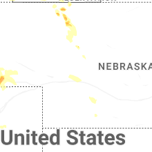


Connect with Interactive Hail Maps