

Hail Map for Tuesday, August 26, 2014

Number of Impacted Households on 8/26/2014
0
Impacted by 1" or Larger Hail
0
Impacted by 1.75" or Larger Hail
0
Impacted by 2.5" or Larger Hail
Square Miles of Populated Area Impacted on 8/26/2014
0
Impacted by 1" or Larger Hail
0
Impacted by 1.75" or Larger Hail
0
Impacted by 2.5" or Larger Hail


Cities Most Affected by Hail Storms of 8/26/2014
| Hail Size | Demographics of Zip Codes Affected | ||||||
|---|---|---|---|---|---|---|---|
| City | Count | Average | Largest | Pop Density | House Value | Income | Age |
| El Dorado Springs, MO | 2 | 1.75 | 1.75 | 31 | $53k | $25.0k | 43.6 |
| Pine Ridge, SD | 2 | 1.75 | 1.75 | 0 | $21k | $20.8k | 23.5 |
Hail and Wind Damage Spotted on 8/26/2014
Filter by Report Type:Hail ReportsWind Reports
States Impacted
Indiana, Illinois, Michigan, Arizona, Missouri, Ohio, Texas, Kansas, Nebraska, South DakotaIndiana
| Local Time | Report Details |
|---|---|
| 8:21 AM CDT | Multiple trees down on 500 s in la porte county IN, 54.1 miles ESE of Chicago, IL |
| 8:34 AM CDT | Large tree limb down onto deck in la porte county IN, 56.3 miles ESE of Chicago, IL |
| 3:06 PM EDT | Large tree limbs down in americus. time estimate in tippecanoe county IN, 58.8 miles NW of Indianapolis, IN |
| 3:16 PM EDT | Tree fell on powerline causing the power to go out. time is estimate in tippecanoe county IN, 58.5 miles NW of Indianapolis, IN |
| 3:26 PM EDT | Tree fell on shop building. time estimate in carroll county IN, 62.5 miles NNW of Indianapolis, IN |
| 5:50 PM EDT | Couple of trees downed by high wind. power out between margaret and davis roa in vigo county IN, 53.2 miles E of Mattoon, IL |
Illinois
| Local Time | Report Details |
|---|---|
| 9:24 AM CDT | Trees down at barry rd and kishwaukee. wires also down on kishwaukee street and richmond stree in winnebago county IL, 60.5 miles SSE of Madison, WI |
| 9:36 AM CDT | Tree and power line damag in boone county IL, 63 miles SSE of Madison, WI |
| 9:40 AM CDT | Tree on a house on 18th av in winnebago county IL, 60.5 miles SSE of Madison, WI |
| 9:51 AM CDT | Storm damage reported in mchenry county IL, 55.8 miles WNW of Chicago, IL |
| 10:36 AM CDT | Half Dollar sized hail reported near Minooka, IL, 45 miles SW of Chicago, IL, reported on industrial drive. |
| 10:37 AM CDT | Brief surge of strong winds. reported on industrial driv in grundy county IL, 45 miles SW of Chicago, IL |
| 5:00 PM CDT | Storm damage reported in edgar county IL, 30.3 miles ENE of Mattoon, IL |
| 5:00 PM CDT | Quarter sized hail reported near Brocton, IL, 30.3 miles ENE of Mattoon, IL, nickel to quarter size hail |
| 5:04 PM CDT | Quarter sized hail reported near Brocton, IL, 28.9 miles NE of Mattoon, IL |
| 5:07 PM CDT | Numerous tree limbs down and corn flattene in edgar county IL, 28.9 miles ENE of Mattoon, IL |
| 7:25 PM CDT | Quarter sized hail reported near Argenta, IL, 42.3 miles NNW of Mattoon, IL, quarter size hail near route 48 and argenta. |
| 8:11 PM CDT | Quarter sized hail reported near Stonington, IL, 44.8 miles WNW of Mattoon, IL |
| 9:00 PM CDT | Storm damage reported in sangamon county IL, 64.8 miles W of Mattoon, IL |
Michigan
| Local Time | Report Details |
|---|---|
| 1:20 PM EDT | South haven glerl sit in van buren county MI, 49.9 miles SW of Grand Rapids, MI |
| 2:47 PM EDT | Tree limbs of 2 inch diameter and greater reported dow in eaton county MI, 59.6 miles ESE of Grand Rapids, MI |
| 3:25 PM EDT | Storm damage reported in ingham county MI, 42.3 miles WSW of Flint, MI |
| 4:20 PM EDT | Estimated at i-94 and state street in washtenaw county MI, 50.5 miles S of Flint, MI |
| 4:34 PM EDT | Storm damage reported in wayne county MI, 48.5 miles SSE of Flint, MI |
| 4:37 PM EDT | 2 inch tree limbs downed at west chicago and farmington roads in wayne county MI, 47.7 miles SSE of Flint, MI |
| 4:40 PM EDT | Tree limb the size of a car down near cherry hill and wayne rd. time estimated from rada in wayne county MI, 50.2 miles SSE of Flint, MI |
| 4:46 PM EDT | 2 foot diameter tree down. warren rd and outer drive are in wayne county MI, 47.4 miles SSE of Flint, MI |
| 4:54 PM EDT | 8 inch diameter trees down at 9 mile and greenfield roads. also pea sized hai in oakland county MI, 45.4 miles SSE of Flint, MI |
| 5:09 PM EDT | 6.5 inch diameter tree downed at davis and 8th in wayne county MI, 60.8 miles SSE of Flint, MI |
| 5:10 PM EDT | Metal fence and gate was partially blown over and power lines were blown dow in wayne county MI, 51.6 miles SE of Flint, MI |
| 5:14 PM EDT | 30 inch diameter trees downed in wayne county MI, 56.1 miles SE of Flint, MI |
| 5:15 PM EDT | A large tree limb fell onto a power line on carol ave. several tree limbs down throughout the neighborhood. estimated wind speed near 70 mp in macomb county MI, 49.1 miles SE of Flint, MI |
| 5:22 PM EDT | Front door blown off of a rite aid store at 15 and gratiot. time estimated from rada in macomb county MI, 50.6 miles SE of Flint, MI |
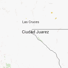
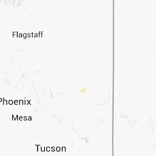
Arizona
| Local Time | Report Details |
|---|---|
| 12:15 PM MST | A trained spotter driving along highway 93 southeast of wikieup estimated a 65 mph gust from a thunderstorm. he had to pull over and stop because his car was being blow in mohave county AZ, 47.9 miles E of Lake Havasu City, AZ |
Missouri
| Local Time | Report Details |
|---|---|
| 3:50 PM CDT | Tree reported down across road on highway b and falcon r in laclede county MO, 49.1 miles NE of Springfield, MO |
| 4:10 PM CDT | Tree reported down across road near highway oo and eisenhower r in laclede county MO, 38.6 miles NE of Springfield, MO |
| 7:04 PM CDT | Golf Ball sized hail reported near El Dorado Springs, MO, 61.2 miles NW of Springfield, MO, report relayed by vernon county ema. hail observed on west side of town. |
| 7:06 PM CDT | Half Dollar sized hail reported near El Dorado Springs, MO, 61.2 miles NW of Springfield, MO |
| 7:07 PM CDT | Ping Pong Ball sized hail reported near El Dorado Springs, MO, 61.2 miles NW of Springfield, MO |
| 7:10 PM CDT | Golf Ball sized hail reported near El Dorado Springs, MO, 62 miles NW of Springfield, MO, some windows reported broken. report relayed by nws employee. |
Ohio
| Local Time | Report Details |
|---|---|
| 4:52 PM EDT | One tree was downed in rockford due to strong wind in mercer county OH, 35.5 miles SE of Fort Wayne, IN |
| 5:02 PM EDT | A large tree was blown down near the intersection of us routes 33 and 12 in mercer county OH, 40 miles SE of Fort Wayne, IN |
Texas
| Local Time | Report Details |
|---|---|
| 4:35 PM CDT | Outflow boundry at the austin executive airport measured 62 miles an hou in travis county TX, 50.3 miles S of Killeen, TX |
| 6:46 PM CDT | Several trees blown over near holbrook road and loop 41 in bexar county TX, 6.9 miles NE of San Antonio, TX |
Kansas
| Local Time | Report Details |
|---|---|
| 5:43 PM CDT | Semi tractor trailor blown over on i-70 near mile post 33 in wabaunsee county KS, 21.8 miles ESE of Manhattan, KS |
| 7:55 PM CDT | Metal roof blown off large barn at 126 highway and 160th street. some damage also done to roofs of smaller out buildings. a few trees blown down in same area. some meta in crawford county KS, 44.4 miles ESE of Chanute, KS |
Nebraska
| Local Time | Report Details |
|---|---|
| 5:45 PM MDT | Quarter sized hail reported near Scottsbluff, NE, 2.7 miles SE of Scottsbluff, NE, along hiway 26. |
| 6:45 PM MDT | Quarter sized hail reported near Chadron, NE, 85.5 miles SSE of Rapid City, SD, quite a bit of smaller marbel size hail as well. |
| 6:54 PM MDT | Quarter sized hail reported near Gordon, NE, 84.2 miles W of Valentine, NE, quite a bit of smaller marbel size hail as well. |
South Dakota
| Local Time | Report Details |
|---|---|
| 6:55 PM MDT | Golf Ball sized hail reported near Pine Ridge, SD, 80.6 miles SSE of Rapid City, SD |
| 6:58 PM MDT | Golf Ball sized hail reported near Pine Ridge, SD, 80 miles SSE of Rapid City, SD, 30-40 mph winds |
| 7:25 PM MDT | Quarter sized hail reported near Porcupine, SD, 77.2 miles SE of Rapid City, SD |
| 7:45 PM MDT | Porcupine raws in shannon county SD, 73.7 miles SE of Rapid City, SD |
| 8:20 PM MDT | Quarter sized hail reported near Pine Ridge, SD, 81.3 miles SSE of Rapid City, SD, estimated 50 mph winds |
| 8:20 PM MDT | Storm damage reported in shannon county SD, 81.1 miles SSE of Rapid City, SD |
| 8:24 PM MDT | Storm damage reported in shannon county SD, 80.9 miles SSE of Rapid City, SD |
| 8:25 PM MDT | 0.30 of an inch of rain in 10 minutes in jackson county SD, 78.7 miles SE of Rapid City, SD |
Connect with Interactive Hail Maps