

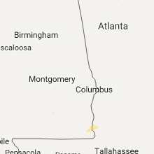
Hail Map for Wednesday, August 3, 2016

Number of Impacted Households on 8/3/2016
0
Impacted by 1" or Larger Hail
0
Impacted by 1.75" or Larger Hail
0
Impacted by 2.5" or Larger Hail
Square Miles of Populated Area Impacted on 8/3/2016
0
Impacted by 1" or Larger Hail
0
Impacted by 1.75" or Larger Hail
0
Impacted by 2.5" or Larger Hail


Cities Most Affected by Hail Storms of 8/3/2016
| Hail Size | Demographics of Zip Codes Affected | ||||||
|---|---|---|---|---|---|---|---|
| City | Count | Average | Largest | Pop Density | House Value | Income | Age |
| Bisbee, ND | 1 | 2.75 | 2.75 | 1 | $17k | $33.1k | 53.6 |
| Rugby, ND | 1 | 2.50 | 2.50 | 6 | $66k | $27.2k | 47.0 |
| Cando, ND | 1 | 2.00 | 2.00 | 3 | $53k | $33.6k | 50.1 |
| Mylo, ND | 1 | 1.75 | 1.75 | 1 | $10k | $24.4k | 46.7 |
| Bottineau, ND | 1 | 1.75 | 1.75 | 12 | $55k | $30.5k | 48.1 |
Hail and Wind Damage Spotted on 8/3/2016
Filter by Report Type:Hail ReportsWind Reports
States Impacted
Tennessee, Wisconsin, Kentucky, Alabama, North Dakota, Arkansas, Arizona, Missouri, Nebraska, South Dakota, Georgia, MinnesotaTennessee
| Local Time | Report Details |
|---|---|
| 1:55 PM CDT | Wkrn-tv reported one tree down in clarksville in montgomery county TN, 41.8 miles NW of Nashville, TN |
| 3:40 PM CDT | Small tree blown down onto front porch of home on belgium drive at belgium court in hermitage in davidson county TN, 10.2 miles ENE of Nashville, TN |
Wisconsin
| Local Time | Report Details |
|---|---|
| 2:02 PM CDT | Several large limbs and a few trees down. south and east of west allis. probable wet microburst. time estimated from rada in milwaukee county WI, 70.9 miles E of Madison, WI |
| 2:30 PM CDT | Large limbs and some trees down east and northeast of greendale. wet microburst. time estimated from rada in milwaukee county WI, 71.9 miles E of Madison, WI |
Kentucky
| Local Time | Report Details |
|---|---|
| 2:15 PM CDT | Tree down over road near christian county line. water over several road in todd county KY, 59.2 miles NNW of Nashville, TN |
Alabama
| Local Time | Report Details |
|---|---|
| 3:30 PM CDT | One tree down along county road 2 near highway 2 in lauderdale county AL, 8.4 miles N of Florence, AL |
North Dakota
| Local Time | Report Details |
|---|---|
| 4:01 PM CDT | Half Dollar sized hail reported near Rugby, ND, 54.8 miles E of Minot, ND, hail falling at time of call. . |
| 4:18 PM CDT | Golf Ball sized hail reported near Bottineau, ND, 66.5 miles NE of Minot, ND, passed on via broadcast media. |
| 4:21 PM CDT | Tennis Ball sized hail reported near Rugby, ND, 54.8 miles WNW of Devils Lake, ND, . |
| 5:10 PM CDT | Quarter sized hail reported near Rolette, ND, 62.6 miles NW of Devils Lake, ND, . |
| 5:50 PM CDT | Golf Ball sized hail reported near Mylo, ND, 50.2 miles NW of Devils Lake, ND, . the duration of the hail event was 40 minutes. |
| 5:50 PM CDT | . the duration of the tstm wnd gst event was 40 minute in rolette county ND, 50.2 miles NW of Devils Lake, ND |
| 5:55 PM CDT | Transformer lines and power poles down. time estimate in towner county ND, 45.6 miles NW of Devils Lake, ND |
| 6:00 PM CDT | Storm damage reported in rolette county ND, 50.2 miles NW of Devils Lake, ND |
| 6:10 PM CDT | Quarter sized hail reported near Mylo, ND, 50.2 miles NW of Devils Lake, ND, hail ongoing at time of report. |
| 6:23 PM CDT | Power lines down and lower pole snapped along hwy 281... 1 to 2 miles north of intersection with hwy 66. video and reports posted via social medi in towner county ND, 42.1 miles NNW of Devils Lake, ND |
| 6:45 PM CDT | Baseball sized hail reported near Bisbee, ND, 45.6 miles NW of Devils Lake, ND, large hail along highway 66. |
| 6:55 PM CDT | Measured by mobile equipmen in towner county ND, 34.1 miles NNW of Devils Lake, ND |
| 7:15 PM CDT | Peak wind measured at the hampden raws station. time estimated based on rada in cavalier county ND, 30.8 miles NNE of Devils Lake, ND |
| 7:20 PM CDT | Peak wind measured at the hampden raws station. time estimated based on rada in cavalier county ND, 30.8 miles NNE of Devils Lake, ND |
| 7:23 PM CDT | Quarter sized hail reported near Cando, ND, 30.5 miles NNW of Devils Lake, ND, quarter sized hail and additional heavy rain. |
| 7:26 PM CDT | Ping Pong Ball sized hail reported near Cando, ND, 30.5 miles NNW of Devils Lake, ND, report and photo posted via social media. |
| 7:33 PM CDT | Peak wind measured at a personal weather statio in cavalier county ND, 50.5 miles NNE of Devils Lake, ND |
| 7:38 PM CDT | Quarter sized hail reported near Langdon, ND, 50 miles NNE of Devils Lake, ND, quarter sized hail and small with heavy rain |
| 7:38 PM CDT | Quarter sized hail reported near Maddock, ND, 28.5 miles W of Devils Lake, ND, quarter sized hail and smaller with heavy rain |
| 7:40 PM CDT | Hen Egg sized hail reported near Cando, ND, 27.7 miles NW of Devils Lake, ND, report and photo posted via social media. |
| 10:28 PM CDT | Peak wind measured at the grand forks international airpor in grand forks county ND, 75.7 miles NNW of Fargo, ND |
| 10:42 PM CDT | Peak wind measured at the gfaf in grand forks county ND, 69.3 miles E of Devils Lake, ND |
| 11:42 PM CDT | Frederick rwi in brown county SD, 33.3 miles N of Aberdeen, SD |
| 12:01 AM CDT | Est wind gust from spotternetwork.org in sargent county ND, 61.5 miles SW of Fargo, ND |
Arkansas
| Local Time | Report Details |
|---|---|
| 5:01 PM CDT | Quarter sized hail reported near Jacksonville, AR, 9.6 miles NNE of Little Rock, AR, trained spotter reported dime to quarter size hail falling. |
Arizona
| Local Time | Report Details |
|---|---|
| 3:15 PM MST | Police reported storm damage of at least 6 downed power poles and 2 brick fences with several trees knocked over. time estimated based on radar. in pinal county AZ, 42.2 miles SSE of Phoenix, AZ |
Missouri
| Local Time | Report Details |
|---|---|
| 5:45 PM CDT | 1-2 inch diameter tree limbs down northeast of phillipsburg. time estimated by radar in laclede county MO, 41.1 miles NE of Springfield, MO |
| 6:30 PM CDT | Multiple reports of trees blown down in and around the mountain grove area in wright county MO, 53 miles SW of Salem, MO |
| 7:40 PM CDT | Tree down partially blocking us highway 160 near the community of many springs in oregon county MO, 68.9 miles SSE of Salem, MO |
| 8:00 PM CDT | 1-2 inch diameter tree limbs down in gainesville. also several reports of estimated 60 mph wind gusts in ozark county MO, 63.6 miles SE of Springfield, MO |
Nebraska
| Local Time | Report Details |
|---|---|
| 5:06 PM MDT | Storm damage reported in dawes county NE, 75 miles NNE of Scottsbluff, NE |
South Dakota
| Local Time | Report Details |
|---|---|
| 5:09 PM MDT | Storm damage reported in oglala lakota county SD, 66.3 miles SSE of Rapid City, SD |
| 5:41 PM MDT | Time estimated from radar in oglala lakota county SD, 72.8 miles SE of Rapid City, SD |
| 6:10 PM MDT | Storm damage reported in jackson county SD, 63.9 miles E of Rapid City, SD |
| 7:08 PM MDT | Storm damage reported in jackson county SD, 49.4 miles SW of Pierre, SD |
| 7:12 PM MDT | Storm damage reported in haakon county SD, 44 miles WSW of Pierre, SD |
| 8:20 PM CDT | No apparent damage noticed at time of cal in jones county SD, 42.7 miles SW of Pierre, SD |
| 7:50 PM MDT | Hayes rwi in stanley county SD, 20.8 miles W of Pierre, SD |
| 9:08 PM CDT | Pierre mesone in hughes county SD, 1 miles E of Pierre, SD |
| 12:10 AM CDT | Small trees blown down. report relayed by brown county e in brown county SD, 36.6 miles NNE of Aberdeen, SD |
| 2:50 AM CDT | Mesonet station danforth 5 e /rhus2/ time estimated based on rada in hand county SD, 78.8 miles E of Pierre, SD |
| 2:59 AM CDT | Gann valley rwi in buffalo county SD, 70.4 miles ESE of Pierre, SD |
Georgia
| Local Time | Report Details |
|---|---|
| 8:44 PM EDT | Report of trees down on n. main street in early county GA, 74.2 miles NNW of Tallahassee, FL |
Minnesota
| Local Time | Report Details |
|---|---|
| 2:26 AM CDT | Roof blown off building...estimated 70mp in wadena county MN, 51 miles SSW of Bemidji, MN |
| 3:02 AM CDT | More than 12 large white pines and poplars snapped off or toppled. power lines down. some trees on power line in cass county MN, 70.9 miles SSE of Bemidji, MN |
| 3:06 AM CDT | Personal weather station on northeast gull lak in crow wing county MN, 73.9 miles SSE of Bemidji, MN |
| 3:09 AM CDT | Numerous trees reported down in the area of state highway 371 and nashway rd. multiple roads blocked and trees down on power line in crow wing county MN, 74.7 miles SSE of Bemidji, MN |
| 3:10 AM CDT | Trees down blocking sunset valley rd north of cr-13. time estimated from rada in crow wing county MN, 73.1 miles SSE of Bemidji, MN |
| 3:12 AM CDT | Several trees down...and some large branches...across the eastern side of brainerd...including near the brainerd mal in crow wing county MN, 83.7 miles SSE of Bemidji, MN |
| 3:19 AM CDT | One large and several small trees down in breezy point. time estimated from rada in crow wing county MN, 67.9 miles SSE of Bemidji, MN |
| 3:22 AM CDT | At brainerd international airpor in crow wing county MN, 82.2 miles SSE of Bemidji, MN |
| 4:31 AM CDT | At duluth international airpor in st. louis county MN, 6.3 miles NW of Duluth, MN |
| 4:36 AM CDT | Large tree down. time estimated based on rada in st. louis county MN, 3.7 miles NNE of Duluth, MN |
Connect with Interactive Hail Maps