

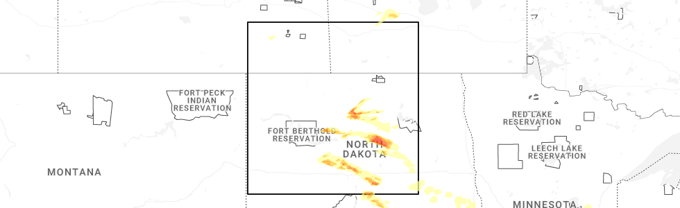
Hail Map for Maddock, ND
The Maddock, ND area has had 7 reports of on-the-ground hail by trained spotters, and has been under severe weather warnings 14 times during the past 12 months. Doppler radar has detected hail at or near Maddock, ND on 36 occasions, including 3 occasions during the past year.
| Name: | Maddock, ND |
| Where Located: | 32.7 miles WSW of Devils Lake, ND |
| Map: | Google Map for Maddock, ND |
| Population: | 382 |
| Housing Units: | 253 |
| More Info: | Search Google for Maddock, ND |
1
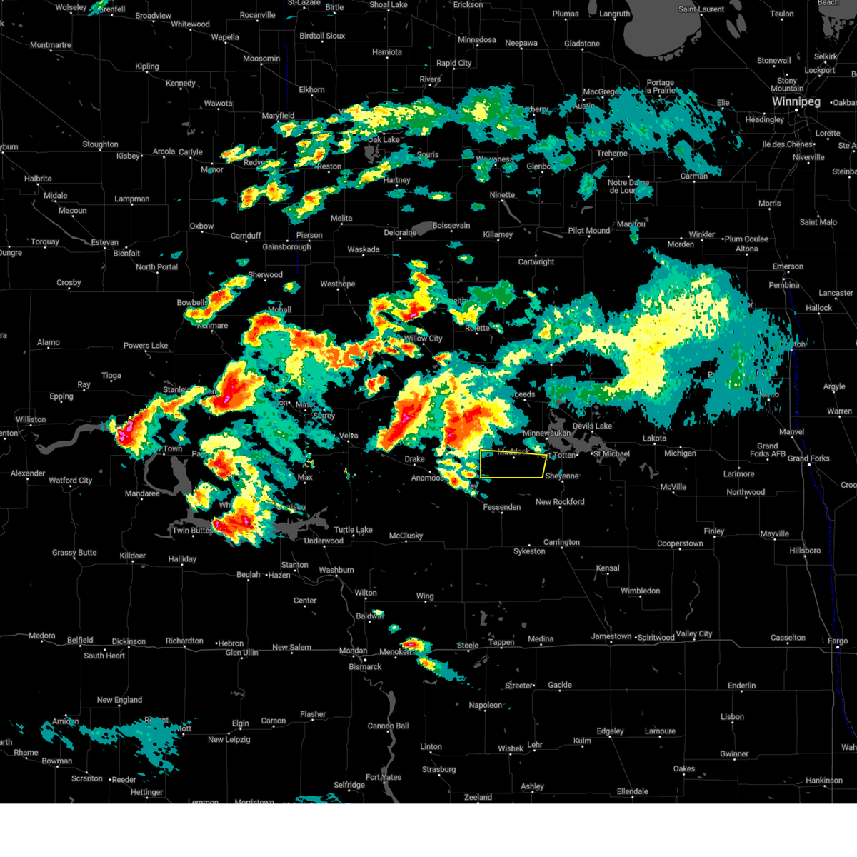
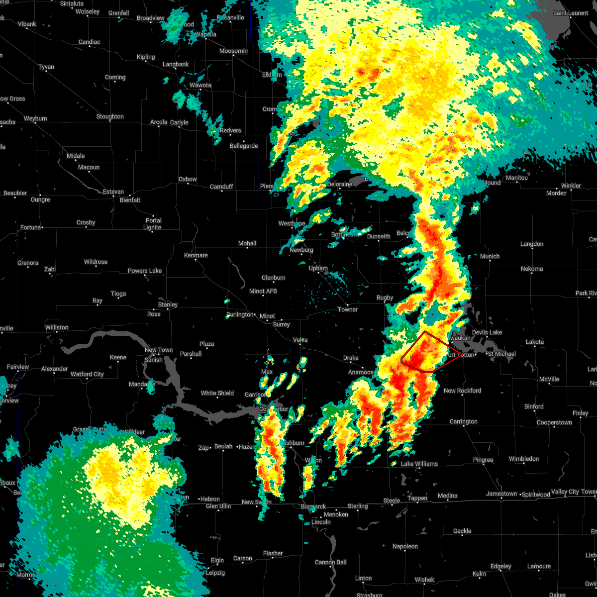
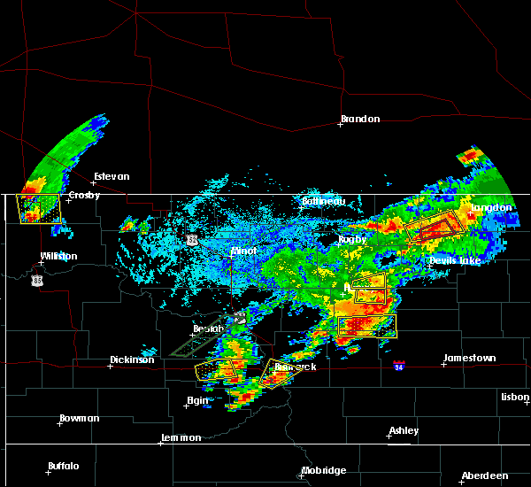
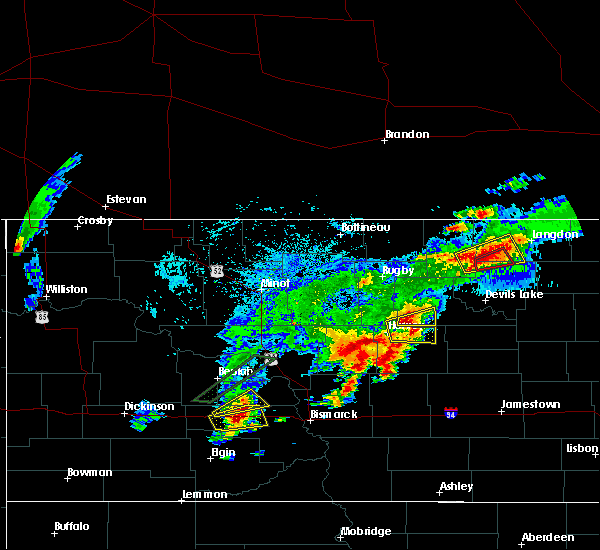
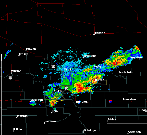
The Top Recent Hail Date for Maddock, ND is Friday, June 27, 2025 (15th out of 36)
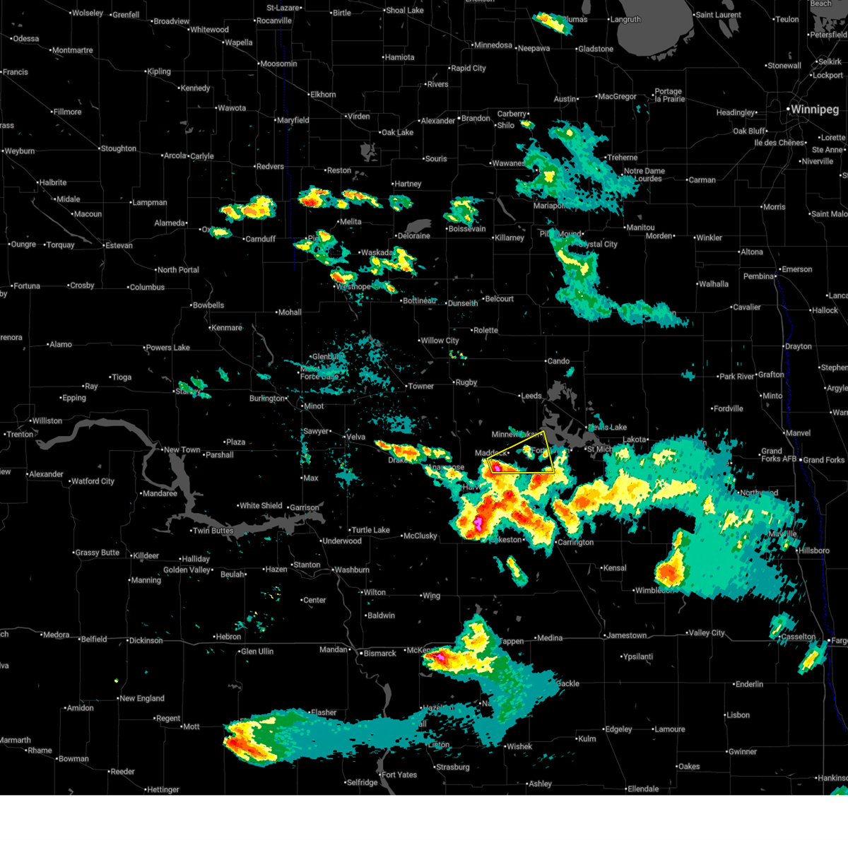
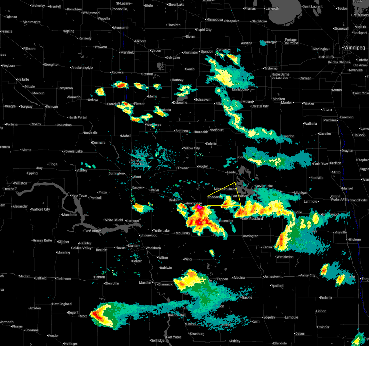
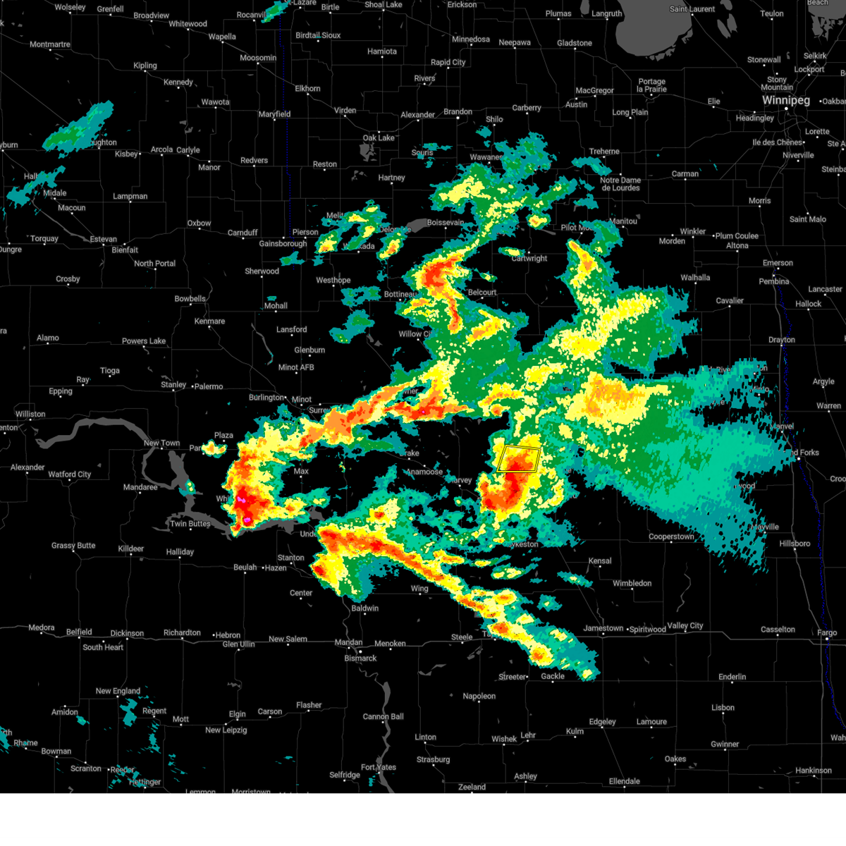
Hail and Wind Damage Spotted near Maddock, ND
| Date / Time | Report Details |
|---|---|
| 6/19/2025 9:29 PM CDT |
 At 929 pm cdt, a severe thunderstorm was located near maddock, or 20 miles northeast of harvey, moving east at 50 mph (radar indicated). Hazards include 60 mph wind gusts and quarter size hail. Hail damage to vehicles is expected. expect wind damage to roofs, siding, and trees. Locations impacted include, maddock, minnewaukan, oberon, and flora. At 929 pm cdt, a severe thunderstorm was located near maddock, or 20 miles northeast of harvey, moving east at 50 mph (radar indicated). Hazards include 60 mph wind gusts and quarter size hail. Hail damage to vehicles is expected. expect wind damage to roofs, siding, and trees. Locations impacted include, maddock, minnewaukan, oberon, and flora.
|
| 6/19/2025 9:10 PM CDT |
 Svrfgf the national weather service in grand forks has issued a * severe thunderstorm warning for, southwestern benson county in northeastern north dakota, * until 1000 pm cdt. * at 909 pm cdt, a severe thunderstorm was located over selz, or near harvey, moving east at 45 mph (radar indicated). Hazards include 60 mph wind gusts and quarter size hail. Hail damage to vehicles is expected. Expect wind damage to roofs, siding, and trees. Svrfgf the national weather service in grand forks has issued a * severe thunderstorm warning for, southwestern benson county in northeastern north dakota, * until 1000 pm cdt. * at 909 pm cdt, a severe thunderstorm was located over selz, or near harvey, moving east at 45 mph (radar indicated). Hazards include 60 mph wind gusts and quarter size hail. Hail damage to vehicles is expected. Expect wind damage to roofs, siding, and trees.
|
| 9/16/2024 10:15 PM CDT |
 The storm which prompted the warning has weakened below severe limits, and has exited the warned area. therefore, the warning has been allowed to expire. however, gusty winds and heavy rain are still possible with this thunderstorm. a severe thunderstorm watch remains in effect until midnight cdt for northeastern north dakota. The storm which prompted the warning has weakened below severe limits, and has exited the warned area. therefore, the warning has been allowed to expire. however, gusty winds and heavy rain are still possible with this thunderstorm. a severe thunderstorm watch remains in effect until midnight cdt for northeastern north dakota.
|
| 9/16/2024 9:21 PM CDT |
 Svrfgf the national weather service in grand forks has issued a * severe thunderstorm warning for, western benson county in northeastern north dakota, * until 1015 pm cdt. * at 921 pm cdt, a severe thunderstorm was located 9 miles southeast of orrin, or 17 miles north of harvey, moving northeast at 30 mph (radar indicated). Hazards include ping pong ball size hail and 60 mph wind gusts. People and animals outdoors will be injured. expect hail damage to roofs, siding, windows, and vehicles. Expect wind damage to roofs, siding, and trees. Svrfgf the national weather service in grand forks has issued a * severe thunderstorm warning for, western benson county in northeastern north dakota, * until 1015 pm cdt. * at 921 pm cdt, a severe thunderstorm was located 9 miles southeast of orrin, or 17 miles north of harvey, moving northeast at 30 mph (radar indicated). Hazards include ping pong ball size hail and 60 mph wind gusts. People and animals outdoors will be injured. expect hail damage to roofs, siding, windows, and vehicles. Expect wind damage to roofs, siding, and trees.
|
| 9/16/2024 3:26 AM CDT |
 Svrfgf the national weather service in grand forks has issued a * severe thunderstorm warning for, northwestern benson county in northeastern north dakota, west central ramsey county in northeastern north dakota, * until 430 am cdt. * at 326 am cdt, a severe thunderstorm was located 8 miles west of esmond, or 17 miles north of harvey, moving northeast at 35 mph (radar indicated). Hazards include golf ball size hail and 60 mph wind gusts. People and animals outdoors will be injured. expect hail damage to roofs, siding, windows, and vehicles. Expect wind damage to roofs, siding, and trees. Svrfgf the national weather service in grand forks has issued a * severe thunderstorm warning for, northwestern benson county in northeastern north dakota, west central ramsey county in northeastern north dakota, * until 430 am cdt. * at 326 am cdt, a severe thunderstorm was located 8 miles west of esmond, or 17 miles north of harvey, moving northeast at 35 mph (radar indicated). Hazards include golf ball size hail and 60 mph wind gusts. People and animals outdoors will be injured. expect hail damage to roofs, siding, windows, and vehicles. Expect wind damage to roofs, siding, and trees.
|
| 7/22/2024 8:06 PM CDT |
 The storm which prompted the warning has weakened below severe limits, and no longer poses an immediate threat to life or property. therefore, the warning will be allowed to expire. however, small hail is still possible with this thunderstorm. The storm which prompted the warning has weakened below severe limits, and no longer poses an immediate threat to life or property. therefore, the warning will be allowed to expire. however, small hail is still possible with this thunderstorm.
|
| 7/22/2024 7:37 PM CDT |
 Svrfgf the national weather service in grand forks has issued a * severe thunderstorm warning for, southwestern benson county in northeastern north dakota, * until 815 pm cdt. * at 736 pm cdt, a severe thunderstorm was located over baker, or 22 miles southeast of rugby, moving southwest at 15 mph (radar indicated). Hazards include 60 mph wind gusts and quarter size hail. Hail damage to vehicles is expected. Expect wind damage to roofs, siding, and trees. Svrfgf the national weather service in grand forks has issued a * severe thunderstorm warning for, southwestern benson county in northeastern north dakota, * until 815 pm cdt. * at 736 pm cdt, a severe thunderstorm was located over baker, or 22 miles southeast of rugby, moving southwest at 15 mph (radar indicated). Hazards include 60 mph wind gusts and quarter size hail. Hail damage to vehicles is expected. Expect wind damage to roofs, siding, and trees.
|
| 7/14/2024 11:52 PM CDT |
 At 1152 pm cdt, a severe thunderstorm was located near bremen, or 27 miles north of carrington, moving southeast at 30 mph (radar indicated). Hazards include 60 mph wind gusts and quarter size hail. Hail damage to vehicles is expected. expect wind damage to roofs, siding, and trees. Locations impacted include, maddock and flora. At 1152 pm cdt, a severe thunderstorm was located near bremen, or 27 miles north of carrington, moving southeast at 30 mph (radar indicated). Hazards include 60 mph wind gusts and quarter size hail. Hail damage to vehicles is expected. expect wind damage to roofs, siding, and trees. Locations impacted include, maddock and flora.
|
| 7/14/2024 11:26 PM CDT |
 Svrfgf the national weather service in grand forks has issued a * severe thunderstorm warning for, southwestern benson county in northeastern north dakota, * until midnight cdt. * at 1125 pm cdt, a severe thunderstorm was located near maddock, or 19 miles northeast of harvey, moving southeast at 30 mph (radar indicated). Hazards include 60 mph wind gusts and quarter size hail. Hail damage to vehicles is expected. Expect wind damage to roofs, siding, and trees. Svrfgf the national weather service in grand forks has issued a * severe thunderstorm warning for, southwestern benson county in northeastern north dakota, * until midnight cdt. * at 1125 pm cdt, a severe thunderstorm was located near maddock, or 19 miles northeast of harvey, moving southeast at 30 mph (radar indicated). Hazards include 60 mph wind gusts and quarter size hail. Hail damage to vehicles is expected. Expect wind damage to roofs, siding, and trees.
|
| 7/14/2024 11:05 PM CDT |
 At 1105 pm cdt, a severe thunderstorm was located near esmond, or 16 miles northeast of harvey, moving southeast at 20 mph (radar indicated). Hazards include 60 mph wind gusts and quarter size hail. Hail damage to vehicles is expected. expect wind damage to roofs, siding, and trees. Locations impacted include, maddock, esmond, and flora. At 1105 pm cdt, a severe thunderstorm was located near esmond, or 16 miles northeast of harvey, moving southeast at 20 mph (radar indicated). Hazards include 60 mph wind gusts and quarter size hail. Hail damage to vehicles is expected. expect wind damage to roofs, siding, and trees. Locations impacted include, maddock, esmond, and flora.
|
| 7/14/2024 10:37 PM CDT |
 Svrfgf the national weather service in grand forks has issued a * severe thunderstorm warning for, southwestern benson county in northeastern north dakota, * until 1130 pm cdt. * at 1036 pm cdt, a severe thunderstorm was located 8 miles south of silva, or 19 miles north of harvey, moving east at 25 mph (radar indicated). Hazards include 60 mph wind gusts and quarter size hail. Hail damage to vehicles is expected. Expect wind damage to roofs, siding, and trees. Svrfgf the national weather service in grand forks has issued a * severe thunderstorm warning for, southwestern benson county in northeastern north dakota, * until 1130 pm cdt. * at 1036 pm cdt, a severe thunderstorm was located 8 miles south of silva, or 19 miles north of harvey, moving east at 25 mph (radar indicated). Hazards include 60 mph wind gusts and quarter size hail. Hail damage to vehicles is expected. Expect wind damage to roofs, siding, and trees.
|
| 7/12/2024 9:55 PM CDT |
 The storms which prompted the warning have weakened below severe limits, and no longer pose an immediate threat to life or property. therefore, the warning will be allowed to expire. however, gusty winds are still possible with these thunderstorms. to report severe weather, contact your nearest law enforcement agency. they will relay your report to the national weather service grand forks. The storms which prompted the warning have weakened below severe limits, and no longer pose an immediate threat to life or property. therefore, the warning will be allowed to expire. however, gusty winds are still possible with these thunderstorms. to report severe weather, contact your nearest law enforcement agency. they will relay your report to the national weather service grand forks.
|
| 7/12/2024 9:43 PM CDT |
 At 943 pm cdt, severe thunderstorms were located along a line extending from 6 miles southeast of wolford to 6 miles north of flora to near hamberg, moving east at 35 mph (radar indicated). Hazards include 60 mph wind gusts and nickel size hail. Expect damage to roofs, siding, and trees. Locations impacted include, leeds, maddock, harlow, brinsmade, knox, york, and flora. At 943 pm cdt, severe thunderstorms were located along a line extending from 6 miles southeast of wolford to 6 miles north of flora to near hamberg, moving east at 35 mph (radar indicated). Hazards include 60 mph wind gusts and nickel size hail. Expect damage to roofs, siding, and trees. Locations impacted include, leeds, maddock, harlow, brinsmade, knox, york, and flora.
|
| 7/12/2024 8:54 PM CDT |
 Svrfgf the national weather service in grand forks has issued a * severe thunderstorm warning for, benson county in northeastern north dakota, southwestern towner county in northeastern north dakota, * until 1000 pm cdt. * at 853 pm cdt, severe thunderstorms were located along a line extending from near rugby to near orrin to near martin to sheyenne lake, moving east at 25 mph (radar indicated). Hazards include 60 mph wind gusts and quarter size hail. Hail damage to vehicles is expected. Expect wind damage to roofs, siding, and trees. Svrfgf the national weather service in grand forks has issued a * severe thunderstorm warning for, benson county in northeastern north dakota, southwestern towner county in northeastern north dakota, * until 1000 pm cdt. * at 853 pm cdt, severe thunderstorms were located along a line extending from near rugby to near orrin to near martin to sheyenne lake, moving east at 25 mph (radar indicated). Hazards include 60 mph wind gusts and quarter size hail. Hail damage to vehicles is expected. Expect wind damage to roofs, siding, and trees.
|
| 6/16/2024 2:50 AM CDT |
 The storms which prompted the warning have weakened below severe limits, and no longer pose an immediate threat to life or property. therefore, the warning will be allowed to expire. however, gusty winds are still possible with these thunderstorms. a severe thunderstorm watch remains in effect until 600 am cdt for northeastern north dakota. The storms which prompted the warning have weakened below severe limits, and no longer pose an immediate threat to life or property. therefore, the warning will be allowed to expire. however, gusty winds are still possible with these thunderstorms. a severe thunderstorm watch remains in effect until 600 am cdt for northeastern north dakota.
|
| 6/16/2024 2:12 AM CDT |
 Svrfgf the national weather service in grand forks has issued a * severe thunderstorm warning for, benson county in northeastern north dakota, towner county in northeastern north dakota, western cavalier county in northeastern north dakota, western ramsey county in northeastern north dakota, * until 300 am cdt. * at 212 am cdt, severe thunderstorms were located along a line extending from 12 miles north of sarles to near heimdal, moving east at 35 mph (radar indicated). Hazards include 60 mph wind gusts and quarter size hail. Hail damage to vehicles is expected. Expect wind damage to roofs, siding, and trees. Svrfgf the national weather service in grand forks has issued a * severe thunderstorm warning for, benson county in northeastern north dakota, towner county in northeastern north dakota, western cavalier county in northeastern north dakota, western ramsey county in northeastern north dakota, * until 300 am cdt. * at 212 am cdt, severe thunderstorms were located along a line extending from 12 miles north of sarles to near heimdal, moving east at 35 mph (radar indicated). Hazards include 60 mph wind gusts and quarter size hail. Hail damage to vehicles is expected. Expect wind damage to roofs, siding, and trees.
|
| 9/5/2023 12:07 AM CDT |
 The severe thunderstorm warning for benson, southwestern ramsey and eddy counties will expire at 1215 am cdt, the severe winds which prompted the warning have diminished. therefore, the warning will be allowed to expire. sub-severe gusty winds may continue. a severe thunderstorm watch remains in effect until 300 am cdt for northeastern north dakota. The severe thunderstorm warning for benson, southwestern ramsey and eddy counties will expire at 1215 am cdt, the severe winds which prompted the warning have diminished. therefore, the warning will be allowed to expire. sub-severe gusty winds may continue. a severe thunderstorm watch remains in effect until 300 am cdt for northeastern north dakota.
|
| 9/4/2023 11:47 PM CDT |
 At 1146 pm cdt, a severe thunderstorm has produced severe winds near devils lake area, moving north at 45 mph. gusty winds are following severe thunderstorm activity and are producing gusts up to 60 mph. this will continue for at least the next 45 minutes (radar indicated). Hazards include 60 mph wind gusts. expect damage to roofs, siding, and trees At 1146 pm cdt, a severe thunderstorm has produced severe winds near devils lake area, moving north at 45 mph. gusty winds are following severe thunderstorm activity and are producing gusts up to 60 mph. this will continue for at least the next 45 minutes (radar indicated). Hazards include 60 mph wind gusts. expect damage to roofs, siding, and trees
|
| 9/4/2023 11:27 PM CDT |
 At 1126 pm cdt, severe thunderstorms were located along a line extending from near brinsmade to lawton to 7 miles northwest of luverne, moving northeast at 20 mph (radar indicated). Hazards include 60 mph wind gusts and penny size hail. Expect damage to roofs, siding, and trees. Locations impacted include, devils lake, new rockford, cando, cooperstown, camp grafton, lakota and lakewood park. At 1126 pm cdt, severe thunderstorms were located along a line extending from near brinsmade to lawton to 7 miles northwest of luverne, moving northeast at 20 mph (radar indicated). Hazards include 60 mph wind gusts and penny size hail. Expect damage to roofs, siding, and trees. Locations impacted include, devils lake, new rockford, cando, cooperstown, camp grafton, lakota and lakewood park.
|
| 9/4/2023 10:58 PM CDT |
 At 1058 pm cdt, severe thunderstorms were located along a line extending from esmond to 7 miles northeast of devils lake to near wimbledon, moving northeast at 55 mph (radar indicated). Hazards include 60 mph wind gusts and penny size hail. expect damage to roofs, siding, and trees At 1058 pm cdt, severe thunderstorms were located along a line extending from esmond to 7 miles northeast of devils lake to near wimbledon, moving northeast at 55 mph (radar indicated). Hazards include 60 mph wind gusts and penny size hail. expect damage to roofs, siding, and trees
|
| 9/4/2023 10:01 PM CDT |
 At 1000 pm cdt, severe thunderstorms were located along a line extending from 10 miles south of harvey to near sykeston to near cleveland, moving northeast at 45 mph (radar indicated). Hazards include 60 mph wind gusts and penny size hail. expect damage to roofs, siding, and trees At 1000 pm cdt, severe thunderstorms were located along a line extending from 10 miles south of harvey to near sykeston to near cleveland, moving northeast at 45 mph (radar indicated). Hazards include 60 mph wind gusts and penny size hail. expect damage to roofs, siding, and trees
|
| 5/10/2023 8:20 PM CDT |
 The severe thunderstorm warning for southwestern benson county will expire at 830 pm cdt, the storm which prompted the warning has weakened below severe limits, and no longer poses an immediate threat to life or property. therefore, the warning will be allowed to expire. however small hail is still possible with this thunderstorm. The severe thunderstorm warning for southwestern benson county will expire at 830 pm cdt, the storm which prompted the warning has weakened below severe limits, and no longer poses an immediate threat to life or property. therefore, the warning will be allowed to expire. however small hail is still possible with this thunderstorm.
|
| 5/10/2023 8:14 PM CDT |
 At 813 pm cdt, a severe thunderstorm was located near maddock, or 34 miles west of devils lake, moving northeast at 25 mph (radar indicated). Hazards include quarter size hail. Damage to vehicles is expected. locations impacted include, maddock, esmond and harlow. hail threat, radar indicated max hail size, 1. 00 in wind threat, radar indicated max wind gust, <50 mph. At 813 pm cdt, a severe thunderstorm was located near maddock, or 34 miles west of devils lake, moving northeast at 25 mph (radar indicated). Hazards include quarter size hail. Damage to vehicles is expected. locations impacted include, maddock, esmond and harlow. hail threat, radar indicated max hail size, 1. 00 in wind threat, radar indicated max wind gust, <50 mph.
|
| 5/10/2023 7:48 PM CDT |
 At 747 pm cdt, a severe thunderstorm was located near esmond, or 39 miles west of devils lake, moving northeast at 25 mph (radar indicated). Hazards include quarter size hail. damage to vehicles is expected At 747 pm cdt, a severe thunderstorm was located near esmond, or 39 miles west of devils lake, moving northeast at 25 mph (radar indicated). Hazards include quarter size hail. damage to vehicles is expected
|
| 7/22/2022 10:45 PM CDT | Ndawn reports 62 mph gust at 10 meter in benson county ND, 1.8 miles S of Maddock, ND |
| 7/22/2022 10:33 PM CDT |
 At 1033 pm cdt, a severe thunderstorm was located 8 miles west of esmond, or 50 miles west of devils lake, moving east at 45 mph (radar indicated). Hazards include 70 mph wind gusts and ping pong ball size hail. People and animals outdoors will be injured. expect hail damage to roofs, siding, windows, and vehicles. expect considerable tree damage. wind damage is also likely to mobile homes, roofs, and outbuildings. this severe thunderstorm will be near, esmond around 1045 pm cdt. other locations in the path of this severe thunderstorm include maddock, flora and oberon. thunderstorm damage threat, considerable hail threat, radar indicated max hail size, 1. 50 in wind threat, radar indicated max wind gust, 70 mph. At 1033 pm cdt, a severe thunderstorm was located 8 miles west of esmond, or 50 miles west of devils lake, moving east at 45 mph (radar indicated). Hazards include 70 mph wind gusts and ping pong ball size hail. People and animals outdoors will be injured. expect hail damage to roofs, siding, windows, and vehicles. expect considerable tree damage. wind damage is also likely to mobile homes, roofs, and outbuildings. this severe thunderstorm will be near, esmond around 1045 pm cdt. other locations in the path of this severe thunderstorm include maddock, flora and oberon. thunderstorm damage threat, considerable hail threat, radar indicated max hail size, 1. 50 in wind threat, radar indicated max wind gust, 70 mph.
|
| 6/20/2022 3:24 AM CDT |
 At 323 am cdt, a severe thunderstorm was located near maddock, or 28 miles west of devils lake, moving northeast at 50 mph. wind gust near maddock measured 58 mph (radar indicated). Hazards include 60 mph wind gusts. Expect damage to roofs, siding, and trees. this severe thunderstorm will be near, minnewaukan around 335 am cdt. brinsmade around 340 am cdt. other locations in the path of this severe thunderstorm include churchs ferry, penn, maza and garske. hail threat, radar indicated max hail size, <. 75 in wind threat, radar indicated max wind gust, 60 mph. At 323 am cdt, a severe thunderstorm was located near maddock, or 28 miles west of devils lake, moving northeast at 50 mph. wind gust near maddock measured 58 mph (radar indicated). Hazards include 60 mph wind gusts. Expect damage to roofs, siding, and trees. this severe thunderstorm will be near, minnewaukan around 335 am cdt. brinsmade around 340 am cdt. other locations in the path of this severe thunderstorm include churchs ferry, penn, maza and garske. hail threat, radar indicated max hail size, <. 75 in wind threat, radar indicated max wind gust, 60 mph.
|
| 6/20/2022 3:20 AM CDT | Ndawn site near maddock measured 10 meter wind gust of 58 mp in benson county ND, 1.8 miles S of Maddock, ND |
| 6/13/2022 10:52 PM CDT |
 At 1052 pm cdt, a severe thunderstorm capable of producing a tornado was located near flora, or 27 miles southwest of devils lake, moving east at 35 mph (radar indicated rotation). Hazards include tornado. Flying debris will be dangerous to those caught without shelter. mobile homes will be damaged or destroyed. damage to roofs, windows, and vehicles will occur. tree damage is likely. this dangerous storm will be near, oberon around 1105 pm cdt. sheyenne around 1110 pm cdt. Other locations in the path of this tornadic thunderstorm include fort totten, tokio, st michael and spirit lake nation. At 1052 pm cdt, a severe thunderstorm capable of producing a tornado was located near flora, or 27 miles southwest of devils lake, moving east at 35 mph (radar indicated rotation). Hazards include tornado. Flying debris will be dangerous to those caught without shelter. mobile homes will be damaged or destroyed. damage to roofs, windows, and vehicles will occur. tree damage is likely. this dangerous storm will be near, oberon around 1105 pm cdt. sheyenne around 1110 pm cdt. Other locations in the path of this tornadic thunderstorm include fort totten, tokio, st michael and spirit lake nation.
|
| 6/13/2022 10:37 PM CDT |
 At 1037 pm cdt, a severe thunderstorm capable of producing a tornado was located near maddock, or 34 miles southwest of devils lake, moving northeast at 35 mph (radar indicated rotation). Hazards include tornado and ping pong ball size hail. Flying debris will be dangerous to those caught without shelter. mobile homes will be damaged or destroyed. damage to roofs, windows, and vehicles will occur. tree damage is likely. this dangerous storm will be near, maddock around 1040 pm cdt. Flora around 1050 pm cdt. At 1037 pm cdt, a severe thunderstorm capable of producing a tornado was located near maddock, or 34 miles southwest of devils lake, moving northeast at 35 mph (radar indicated rotation). Hazards include tornado and ping pong ball size hail. Flying debris will be dangerous to those caught without shelter. mobile homes will be damaged or destroyed. damage to roofs, windows, and vehicles will occur. tree damage is likely. this dangerous storm will be near, maddock around 1040 pm cdt. Flora around 1050 pm cdt.
|
| 6/13/2022 10:15 PM CDT |
 At 1015 pm cdt, a severe thunderstorm was located over selz, or 48 miles west of devils lake, moving east at 35 mph (radar indicated). Hazards include golf ball size hail and 60 mph wind gusts. People and animals outdoors will be injured. expect hail damage to roofs, siding, windows, and vehicles. Expect wind damage to roofs, siding, and trees. At 1015 pm cdt, a severe thunderstorm was located over selz, or 48 miles west of devils lake, moving east at 35 mph (radar indicated). Hazards include golf ball size hail and 60 mph wind gusts. People and animals outdoors will be injured. expect hail damage to roofs, siding, windows, and vehicles. Expect wind damage to roofs, siding, and trees.
|
| 8/22/2021 4:55 PM CDT |
 The severe thunderstorm warning for benson county will expire at 500 pm cdt, the storm which prompted the warning has weakened below severe limits, and no longer poses an immediate threat to life or property. therefore, the warning will be allowed to expire. however gusty winds are still possible with this thunderstorm. a severe thunderstorm watch remains in effect until 900 pm cdt for northeastern north dakota. The severe thunderstorm warning for benson county will expire at 500 pm cdt, the storm which prompted the warning has weakened below severe limits, and no longer poses an immediate threat to life or property. therefore, the warning will be allowed to expire. however gusty winds are still possible with this thunderstorm. a severe thunderstorm watch remains in effect until 900 pm cdt for northeastern north dakota.
|
| 8/22/2021 4:40 PM CDT |
 At 440 pm cdt, a severe thunderstorm was located near maddock, or 35 miles west of devils lake, moving northeast at 50 mph (radar indicated). Hazards include 60 mph wind gusts and quarter size hail. Hail damage to vehicles is expected. expect wind damage to roofs, siding, and trees. Locations impacted include, leeds, maddock, fort totten, minnewaukan, oberon, harlow and brinsmade. At 440 pm cdt, a severe thunderstorm was located near maddock, or 35 miles west of devils lake, moving northeast at 50 mph (radar indicated). Hazards include 60 mph wind gusts and quarter size hail. Hail damage to vehicles is expected. expect wind damage to roofs, siding, and trees. Locations impacted include, leeds, maddock, fort totten, minnewaukan, oberon, harlow and brinsmade.
|
| 8/22/2021 4:19 PM CDT |
 At 418 pm cdt, a severe thunderstorm was located over harvey, or 52 miles southwest of devils lake, moving northeast at 50 mph (radar indicated). Hazards include 60 mph wind gusts and quarter size hail. Hail damage to vehicles is expected. Expect wind damage to roofs, siding, and trees. At 418 pm cdt, a severe thunderstorm was located over harvey, or 52 miles southwest of devils lake, moving northeast at 50 mph (radar indicated). Hazards include 60 mph wind gusts and quarter size hail. Hail damage to vehicles is expected. Expect wind damage to roofs, siding, and trees.
|
| 8/9/2021 6:20 PM CDT |
 The severe thunderstorm warning for southwestern benson county will expire at 630 pm cdt, the storm which prompted the warning has moved out of the area. therefore, the warning will be allowed to expire. a severe thunderstorm watch remains in effect until 1100 pm cdt for northeastern north dakota. remember, a severe thunderstorm warning still remains in effect for southeast benson county. The severe thunderstorm warning for southwestern benson county will expire at 630 pm cdt, the storm which prompted the warning has moved out of the area. therefore, the warning will be allowed to expire. a severe thunderstorm watch remains in effect until 1100 pm cdt for northeastern north dakota. remember, a severe thunderstorm warning still remains in effect for southeast benson county.
|
| 8/9/2021 5:58 PM CDT |
 At 558 pm cdt, a severe thunderstorm was located near bremen, or 31 miles southwest of devils lake, moving northeast at 40 mph (radar indicated). Hazards include ping pong ball size hail and 60 mph wind gusts. People and animals outdoors will be injured. expect hail damage to roofs, siding, windows, and vehicles. expect wind damage to roofs, siding, and trees. locations impacted include, maddock and esmond. hail threat, radar indicated max hail size, 1. 50 in wind threat, radar indicated max wind gust, 60 mph. At 558 pm cdt, a severe thunderstorm was located near bremen, or 31 miles southwest of devils lake, moving northeast at 40 mph (radar indicated). Hazards include ping pong ball size hail and 60 mph wind gusts. People and animals outdoors will be injured. expect hail damage to roofs, siding, windows, and vehicles. expect wind damage to roofs, siding, and trees. locations impacted include, maddock and esmond. hail threat, radar indicated max hail size, 1. 50 in wind threat, radar indicated max wind gust, 60 mph.
|
| 8/9/2021 5:38 PM CDT |
 At 537 pm cdt, a severe thunderstorm was located near heimdal, or 44 miles southwest of devils lake, moving northeast at 40 mph (radar indicated). Hazards include 70 mph wind gusts and ping pong ball size hail. People and animals outdoors will be injured. expect hail damage to roofs, siding, windows, and vehicles. expect considerable tree damage. Wind damage is also likely to mobile homes, roofs, and outbuildings. At 537 pm cdt, a severe thunderstorm was located near heimdal, or 44 miles southwest of devils lake, moving northeast at 40 mph (radar indicated). Hazards include 70 mph wind gusts and ping pong ball size hail. People and animals outdoors will be injured. expect hail damage to roofs, siding, windows, and vehicles. expect considerable tree damage. Wind damage is also likely to mobile homes, roofs, and outbuildings.
|
| 6/6/2021 2:18 AM CDT | Via ndaw in benson county ND, 1.8 miles S of Maddock, ND |
| 6/6/2021 2:15 AM CDT | Ndaw in benson county ND, 1.8 miles S of Maddock, ND |
| 6/6/2021 1:55 AM CDT |
 At 155 am cdt, severe thunderstorms were located along a line extending from near shell valley to hurdsfield, moving east at 40 mph (radar indicated). Hazards include 60 mph wind gusts and quarter size hail. Hail damage to vehicles is expected. Expect wind damage to roofs, siding, and trees. At 155 am cdt, severe thunderstorms were located along a line extending from near shell valley to hurdsfield, moving east at 40 mph (radar indicated). Hazards include 60 mph wind gusts and quarter size hail. Hail damage to vehicles is expected. Expect wind damage to roofs, siding, and trees.
|
| 9/2/2020 7:10 PM CDT |
 At 709 pm cdt, severe thunderstorms were located along a line extending from near maddock to 10 miles south of goodrich, moving east at 60 mph (radar indicated). Hazards include 70 mph wind gusts. Expect considerable tree damage. Damage is likely to mobile homes, roofs, and outbuildings. At 709 pm cdt, severe thunderstorms were located along a line extending from near maddock to 10 miles south of goodrich, moving east at 60 mph (radar indicated). Hazards include 70 mph wind gusts. Expect considerable tree damage. Damage is likely to mobile homes, roofs, and outbuildings.
|
| 8/9/2020 6:53 AM CDT |
 The severe thunderstorm warning for benson and west central ramsey counties will expire at 700 am cdt, the storm which prompted the warning has weakened below severe limits, and no longer pose an immediate threat to life or property. therefore, the warning will be allowed to expire. however small hail is still possible with this thunderstorm. The severe thunderstorm warning for benson and west central ramsey counties will expire at 700 am cdt, the storm which prompted the warning has weakened below severe limits, and no longer pose an immediate threat to life or property. therefore, the warning will be allowed to expire. however small hail is still possible with this thunderstorm.
|
| 8/9/2020 6:25 AM CDT |
 At 624 am cdt, a severe thunderstorm was located over esmond, or 42 miles west of devils lake, moving east at 35 mph (radar indicated). Hazards include 60 mph wind gusts and half dollar size hail. Hail damage to vehicles is expected. expect wind damage to roofs, siding, and trees. this severe storm will be near, baker around 635 am cdt. harlow and maddock around 645 am cdt. brinsmade around 655 am cdt. minnewaukan around 700 am cdt. Grahams island state park around 715 am cdt. At 624 am cdt, a severe thunderstorm was located over esmond, or 42 miles west of devils lake, moving east at 35 mph (radar indicated). Hazards include 60 mph wind gusts and half dollar size hail. Hail damage to vehicles is expected. expect wind damage to roofs, siding, and trees. this severe storm will be near, baker around 635 am cdt. harlow and maddock around 645 am cdt. brinsmade around 655 am cdt. minnewaukan around 700 am cdt. Grahams island state park around 715 am cdt.
|
| 8/9/2020 6:01 AM CDT |
 The national weather service in grand forks has issued a * severe thunderstorm warning for. benson county in northeastern north dakota. west central ramsey county in northeastern north dakota. until 700 am cdt. At 601 am cdt, a severe thunderstorm was located over balta, or 51. The national weather service in grand forks has issued a * severe thunderstorm warning for. benson county in northeastern north dakota. west central ramsey county in northeastern north dakota. until 700 am cdt. At 601 am cdt, a severe thunderstorm was located over balta, or 51.
|
| 7/17/2020 3:21 PM CDT |
 At 320 pm cdt, a severe thunderstorm was located near silva, or 49 miles west of devils lake, moving east at 55 mph (radar indicated). Hazards include 70 mph wind gusts and quarter size hail. Hail damage to vehicles is expected. expect considerable tree damage. wind damage is also likely to mobile homes, roofs, and outbuildings. this severe thunderstorm will be near, fillmore around 325 pm cdt. esmond around 330 pm cdt. baker around 335 pm cdt. harlow around 340 pm cdt. Brinsmade around 350 pm cdt. At 320 pm cdt, a severe thunderstorm was located near silva, or 49 miles west of devils lake, moving east at 55 mph (radar indicated). Hazards include 70 mph wind gusts and quarter size hail. Hail damage to vehicles is expected. expect considerable tree damage. wind damage is also likely to mobile homes, roofs, and outbuildings. this severe thunderstorm will be near, fillmore around 325 pm cdt. esmond around 330 pm cdt. baker around 335 pm cdt. harlow around 340 pm cdt. Brinsmade around 350 pm cdt.
|
| 7/8/2020 1:12 AM CDT |
 At 112 am cdt, severe thunderstorms were located along a line extending from 6 miles northeast of york to near warwick, moving northeast at 45 mph (radar indicated). Hazards include 60 mph wind gusts. Expect damage to roofs, siding, and trees. these severe storms will be near, warwick around 115 am cdt. hamar around 120 am cdt. Tolna and maza around 125 am cdt. At 112 am cdt, severe thunderstorms were located along a line extending from 6 miles northeast of york to near warwick, moving northeast at 45 mph (radar indicated). Hazards include 60 mph wind gusts. Expect damage to roofs, siding, and trees. these severe storms will be near, warwick around 115 am cdt. hamar around 120 am cdt. Tolna and maza around 125 am cdt.
|
| 7/8/2020 1:10 AM CDT | Ndawn site 2n maddock in benson county ND, 1.8 miles S of Maddock, ND |
| 7/8/2020 12:44 AM CDT |
 At 1242 am cdt, severe thunderstorms were located along a line extending from near balta to near barlow, moving northeast at 45 mph (radar indicated). Hazards include 60 mph wind gusts and penny size hail. Expect damage to roofs, siding, and trees. severe thunderstorms will be near, new rockford around 1250 am cdt. brantford around 1255 am cdt. knox around 100 am cdt. york around 105 am cdt. Leeds around 110 am cdt. At 1242 am cdt, severe thunderstorms were located along a line extending from near balta to near barlow, moving northeast at 45 mph (radar indicated). Hazards include 60 mph wind gusts and penny size hail. Expect damage to roofs, siding, and trees. severe thunderstorms will be near, new rockford around 1250 am cdt. brantford around 1255 am cdt. knox around 100 am cdt. york around 105 am cdt. Leeds around 110 am cdt.
|
| 6/30/2020 5:28 PM CDT |
 The severe thunderstorm warning for western benson county will expire at 530 pm cdt, the storm which prompted the warning has weakened below severe limits, and no longer pose an immediate threat to life or property. therefore, the warning will be allowed to expire. however small hail, gusty winds and heavy rain are still possible with this thunderstorm. The severe thunderstorm warning for western benson county will expire at 530 pm cdt, the storm which prompted the warning has weakened below severe limits, and no longer pose an immediate threat to life or property. therefore, the warning will be allowed to expire. however small hail, gusty winds and heavy rain are still possible with this thunderstorm.
|
| 6/30/2020 5:10 PM CDT |
 At 510 pm cdt, a severe thunderstorm was located near leeds, or 28 miles west of devils lake, moving northeast at 30 mph (radar indicated). Hazards include 60 mph wind gusts and quarter size hail. Hail damage to vehicles is expected. expect wind damage to roofs, siding, and trees. This severe storm will be near, leeds around 520 pm cdt. At 510 pm cdt, a severe thunderstorm was located near leeds, or 28 miles west of devils lake, moving northeast at 30 mph (radar indicated). Hazards include 60 mph wind gusts and quarter size hail. Hail damage to vehicles is expected. expect wind damage to roofs, siding, and trees. This severe storm will be near, leeds around 520 pm cdt.
|
| 6/30/2020 4:28 PM CDT |
 At 428 pm cdt, a severe thunderstorm was located near esmond, or 37 miles west of devils lake, moving northeast at 30 mph (radar indicated). Hazards include 70 mph wind gusts and ping pong ball size hail. People and animals outdoors will be injured. expect hail damage to roofs, siding, windows, and vehicles. expect considerable tree damage. wind damage is also likely to mobile homes, roofs, and outbuildings. this severe thunderstorm will be near, maddock around 435 pm cdt. baker around 450 pm cdt. harlow around 500 pm cdt. brinsmade around 510 pm cdt. York around 515 pm cdt. At 428 pm cdt, a severe thunderstorm was located near esmond, or 37 miles west of devils lake, moving northeast at 30 mph (radar indicated). Hazards include 70 mph wind gusts and ping pong ball size hail. People and animals outdoors will be injured. expect hail damage to roofs, siding, windows, and vehicles. expect considerable tree damage. wind damage is also likely to mobile homes, roofs, and outbuildings. this severe thunderstorm will be near, maddock around 435 pm cdt. baker around 450 pm cdt. harlow around 500 pm cdt. brinsmade around 510 pm cdt. York around 515 pm cdt.
|
| 6/30/2020 4:17 PM CDT |
 At 417 pm cdt, a severe thunderstorm capable of producing a tornado was located near wellsburg, or 41 miles southwest of devils lake, moving northeast at 20 mph (radar indicated rotation). Hazards include tornado and ping pong ball size hail. expect damage to mobile homes, roofs, and vehicles At 417 pm cdt, a severe thunderstorm capable of producing a tornado was located near wellsburg, or 41 miles southwest of devils lake, moving northeast at 20 mph (radar indicated rotation). Hazards include tornado and ping pong ball size hail. expect damage to mobile homes, roofs, and vehicles
|
| 6/30/2020 3:55 PM CDT |
 At 354 pm cdt, a severe thunderstorm was located near esmond, or 40 miles west of devils lake, moving north at 35 mph (radar indicated). Hazards include 70 mph wind gusts and ping pong ball size hail. People and animals outdoors will be injured. expect hail damage to roofs, siding, windows, and vehicles. expect considerable tree damage. wind damage is also likely to mobile homes, roofs, and outbuildings. this severe storm will be near, esmond around 400 pm cdt. baker, harlow and fillmore around 420 pm cdt. York, knox and leeds around 440 pm cdt. At 354 pm cdt, a severe thunderstorm was located near esmond, or 40 miles west of devils lake, moving north at 35 mph (radar indicated). Hazards include 70 mph wind gusts and ping pong ball size hail. People and animals outdoors will be injured. expect hail damage to roofs, siding, windows, and vehicles. expect considerable tree damage. wind damage is also likely to mobile homes, roofs, and outbuildings. this severe storm will be near, esmond around 400 pm cdt. baker, harlow and fillmore around 420 pm cdt. York, knox and leeds around 440 pm cdt.
|
| 6/30/2020 3:36 PM CDT |
 At 336 pm cdt, a severe thunderstorm was located over wellsburg, or 46 miles southwest of devils lake, moving north at 35 mph (radar indicated). Hazards include 60 mph wind gusts and quarter size hail. Hail damage to vehicles is expected. expect wind damage to roofs, siding, and trees. this severe thunderstorm will be near, esmond around 405 pm cdt. baker, harlow and fillmore around 420 pm cdt. York around 430 pm cdt. At 336 pm cdt, a severe thunderstorm was located over wellsburg, or 46 miles southwest of devils lake, moving north at 35 mph (radar indicated). Hazards include 60 mph wind gusts and quarter size hail. Hail damage to vehicles is expected. expect wind damage to roofs, siding, and trees. this severe thunderstorm will be near, esmond around 405 pm cdt. baker, harlow and fillmore around 420 pm cdt. York around 430 pm cdt.
|
| 9/20/2019 5:53 PM CDT |
 The severe thunderstorm warning for western benson, southwestern towner and west central ramsey counties will expire at 600 pm cdt, the storm which prompted the warning has weakened below severe limits, and no longer pose an immediate threat to life or property. therefore, the warning will be allowed to expire. a severe thunderstorm watch remains in effect until 1000 pm cdt for northeastern north dakota. to report severe weather, contact your nearest law enforcement agency. they will relay your report to the national weather service grand forks. The severe thunderstorm warning for western benson, southwestern towner and west central ramsey counties will expire at 600 pm cdt, the storm which prompted the warning has weakened below severe limits, and no longer pose an immediate threat to life or property. therefore, the warning will be allowed to expire. a severe thunderstorm watch remains in effect until 1000 pm cdt for northeastern north dakota. to report severe weather, contact your nearest law enforcement agency. they will relay your report to the national weather service grand forks.
|
| 9/20/2019 5:32 PM CDT |
 At 532 pm cdt, a severe thunderstorm was located over harlow, or 27 miles west of devils lake, moving north at 25 mph (radar indicated). Hazards include 60 mph wind gusts and quarter size hail. Hail damage to vehicles is expected. expect wind damage to roofs, siding, and trees. Locations impacted include, leeds, maddock, minnewaukan, harlow, brinsmade, flora and churchs ferry. At 532 pm cdt, a severe thunderstorm was located over harlow, or 27 miles west of devils lake, moving north at 25 mph (radar indicated). Hazards include 60 mph wind gusts and quarter size hail. Hail damage to vehicles is expected. expect wind damage to roofs, siding, and trees. Locations impacted include, leeds, maddock, minnewaukan, harlow, brinsmade, flora and churchs ferry.
|
| 9/20/2019 5:17 PM CDT | Quarter sized hail reported 1.8 miles S of Maddock, ND, webcam video from an ndawn site showing hail of dimes to quarters posted on social media |
| 9/20/2019 5:04 PM CDT |
 At 503 pm cdt, a severe thunderstorm was located over maddock, or 30 miles west of devils lake, moving north at 25 mph (radar indicated). Hazards include 60 mph wind gusts and quarter size hail. Hail damage to vehicles is expected. expect wind damage to roofs, siding, and trees. this severe thunderstorm will be near, harlow around 535 pm cdt. brinsmade around 540 pm cdt. Leeds around 600 pm cdt. At 503 pm cdt, a severe thunderstorm was located over maddock, or 30 miles west of devils lake, moving north at 25 mph (radar indicated). Hazards include 60 mph wind gusts and quarter size hail. Hail damage to vehicles is expected. expect wind damage to roofs, siding, and trees. this severe thunderstorm will be near, harlow around 535 pm cdt. brinsmade around 540 pm cdt. Leeds around 600 pm cdt.
|
| 7/8/2019 4:54 PM CDT |
 The severe thunderstorm warning for southwestern benson county will expire at 500 pm cdt, the storm which prompted the warning has weakened below severe limits, and no longer pose an immediate threat to life or property. therefore, the warning will be allowed to expire. a severe thunderstorm watch remains in effect until 900 pm cdt for northeastern north dakota. The severe thunderstorm warning for southwestern benson county will expire at 500 pm cdt, the storm which prompted the warning has weakened below severe limits, and no longer pose an immediate threat to life or property. therefore, the warning will be allowed to expire. a severe thunderstorm watch remains in effect until 900 pm cdt for northeastern north dakota.
|
| 7/8/2019 4:28 PM CDT |
 At 428 pm cdt, a severe thunderstorm was located near wellsburg, or 41 miles west of devils lake, moving northeast at 30 mph (radar indicated). Hazards include 60 mph wind gusts and half dollar size hail. Hail damage to vehicles is expected. expect wind damage to roofs, siding, and trees. Locations impacted include, maddock and flora. At 428 pm cdt, a severe thunderstorm was located near wellsburg, or 41 miles west of devils lake, moving northeast at 30 mph (radar indicated). Hazards include 60 mph wind gusts and half dollar size hail. Hail damage to vehicles is expected. expect wind damage to roofs, siding, and trees. Locations impacted include, maddock and flora.
|
| 7/8/2019 4:07 PM CDT |
 At 407 pm cdt, a severe thunderstorm was located over selz, or 50 miles west of devils lake, moving northeast at 25 mph (radar indicated). Hazards include 60 mph wind gusts and half dollar size hail. Hail damage to vehicles is expected. Expect wind damage to roofs, siding, and trees. At 407 pm cdt, a severe thunderstorm was located over selz, or 50 miles west of devils lake, moving northeast at 25 mph (radar indicated). Hazards include 60 mph wind gusts and half dollar size hail. Hail damage to vehicles is expected. Expect wind damage to roofs, siding, and trees.
|
| 6/29/2019 8:32 AM CDT |
 At 831 am cdt, severe thunderstorms were located along a line extending from near arndt to near maza to near maddock, moving east at 30 mph (radar indicated). Hazards include 60 mph wind gusts and quarter size hail. Hail damage to vehicles is expected. expect wind damage to roofs, siding, and trees. these severe storms will be near, egeland around 845 am cdt. garske around 850 am cdt. webster around 855 am cdt. Calio and oberon around 900 am cdt. At 831 am cdt, severe thunderstorms were located along a line extending from near arndt to near maza to near maddock, moving east at 30 mph (radar indicated). Hazards include 60 mph wind gusts and quarter size hail. Hail damage to vehicles is expected. expect wind damage to roofs, siding, and trees. these severe storms will be near, egeland around 845 am cdt. garske around 850 am cdt. webster around 855 am cdt. Calio and oberon around 900 am cdt.
|
| 6/29/2019 8:07 AM CDT |
 At 806 am cdt, severe thunderstorms were located along a line extending from near perth to near maza to 6 miles south of esmond, moving east at 30 mph (radar indicated). Hazards include 60 mph wind gusts and quarter size hail. Hail damage to vehicles is expected. expect wind damage to roofs, siding, and trees. severe thunderstorms will be near, cando around 815 am cdt. maza, rocklake and churchs ferry around 820 am cdt. maddock and arndt around 830 am cdt. egeland and flora around 840 am cdt. Webster and garske around 850 am cdt. At 806 am cdt, severe thunderstorms were located along a line extending from near perth to near maza to 6 miles south of esmond, moving east at 30 mph (radar indicated). Hazards include 60 mph wind gusts and quarter size hail. Hail damage to vehicles is expected. expect wind damage to roofs, siding, and trees. severe thunderstorms will be near, cando around 815 am cdt. maza, rocklake and churchs ferry around 820 am cdt. maddock and arndt around 830 am cdt. egeland and flora around 840 am cdt. Webster and garske around 850 am cdt.
|
| 6/29/2019 7:50 AM CDT |
 At 750 am cdt, severe thunderstorms were located along a line extending from near rolla to 10 miles northeast of york to 7 miles north of selz, moving east at 40 mph (radar indicated). Hazards include 60 mph wind gusts and quarter size hail. Hail damage to vehicles is expected. expect wind damage to roofs, siding, and trees. these severe storms will be near, perth around 755 am cdt. amourdale around 800 am cdt. maza and cando around 805 am cdt. rocklake around 810 am cdt. Maddock and flora around 815 am cdt. At 750 am cdt, severe thunderstorms were located along a line extending from near rolla to 10 miles northeast of york to 7 miles north of selz, moving east at 40 mph (radar indicated). Hazards include 60 mph wind gusts and quarter size hail. Hail damage to vehicles is expected. expect wind damage to roofs, siding, and trees. these severe storms will be near, perth around 755 am cdt. amourdale around 800 am cdt. maza and cando around 805 am cdt. rocklake around 810 am cdt. Maddock and flora around 815 am cdt.
|
| 6/29/2019 7:18 AM CDT |
 At 717 am cdt, severe thunderstorms were located along a line extending from near shell valley to near pleasant lake to orrin, moving east at 45 mph (radar indicated). Hazards include 70 mph wind gusts and quarter size hail. Hail damage to vehicles is expected. expect considerable tree damage. wind damage is also likely to mobile homes, roofs, and outbuildings. severe thunderstorms will be near, pleasant lake around 725 am cdt. knox around 730 am cdt. york around 740 am cdt. esmond, leeds and perth around 745 am cdt. Bisbee, brinsmade and rocklake around 755 am cdt. At 717 am cdt, severe thunderstorms were located along a line extending from near shell valley to near pleasant lake to orrin, moving east at 45 mph (radar indicated). Hazards include 70 mph wind gusts and quarter size hail. Hail damage to vehicles is expected. expect considerable tree damage. wind damage is also likely to mobile homes, roofs, and outbuildings. severe thunderstorms will be near, pleasant lake around 725 am cdt. knox around 730 am cdt. york around 740 am cdt. esmond, leeds and perth around 745 am cdt. Bisbee, brinsmade and rocklake around 755 am cdt.
|
| 8/26/2018 8:46 PM CDT |
 At 845 pm cdt, severe thunderstorms were located along a line extending from near hannah to bremen, moving east at 60 mph (radar indicated). Hazards include 60 mph wind gusts and quarter size hail. Hail damage to vehicles is expected. Expect wind damage to roofs, siding, and trees. At 845 pm cdt, severe thunderstorms were located along a line extending from near hannah to bremen, moving east at 60 mph (radar indicated). Hazards include 60 mph wind gusts and quarter size hail. Hail damage to vehicles is expected. Expect wind damage to roofs, siding, and trees.
|
| 7/8/2018 3:18 AM CDT |
 At 317 am cdt, severe thunderstorms were located along a line extending from near selz to 6 miles northeast of cathay to near melville, moving northeast at 55 mph. these are very dangerous storms (radar and surface observation indicated). Hazards include 80 mph wind gusts and penny size hail. Flying debris will be dangerous to those caught without shelter. mobile homes will be heavily damaged. expect considerable damage to roofs, windows, and vehicles. extensive tree damage and power outages are likely. severe thunderstorms will be near, new rockford around 325 am cdt. maddock around 335 am cdt. flora around 340 am cdt. warwick and tokio around 345 am cdt. Minnewaukan, hamar and mose around 350 am cdt. At 317 am cdt, severe thunderstorms were located along a line extending from near selz to 6 miles northeast of cathay to near melville, moving northeast at 55 mph. these are very dangerous storms (radar and surface observation indicated). Hazards include 80 mph wind gusts and penny size hail. Flying debris will be dangerous to those caught without shelter. mobile homes will be heavily damaged. expect considerable damage to roofs, windows, and vehicles. extensive tree damage and power outages are likely. severe thunderstorms will be near, new rockford around 325 am cdt. maddock around 335 am cdt. flora around 340 am cdt. warwick and tokio around 345 am cdt. Minnewaukan, hamar and mose around 350 am cdt.
|
| 7/4/2018 2:00 AM CDT |
 At 159 am cdt, severe thunderstorms were located along a line extending from near esmond to carrington, moving northeast at 50 mph (radar indicated). Hazards include 60 mph wind gusts and nickel size hail. Expect damage to roofs, siding, and trees. severe thunderstorms will be near, brantford and baker around 215 am cdt. harlow around 220 am cdt. leeds and brinsmade around 230 am cdt. Churchs ferry and hamar around 240 am cdt. At 159 am cdt, severe thunderstorms were located along a line extending from near esmond to carrington, moving northeast at 50 mph (radar indicated). Hazards include 60 mph wind gusts and nickel size hail. Expect damage to roofs, siding, and trees. severe thunderstorms will be near, brantford and baker around 215 am cdt. harlow around 220 am cdt. leeds and brinsmade around 230 am cdt. Churchs ferry and hamar around 240 am cdt.
|
| 6/29/2018 2:19 AM CDT |
 At 218 am cdt, severe thunderstorms were located along a line extending from near esmond to near maddock to near flora, moving northeast at 45 mph (radar indicated). Hazards include 70 mph wind gusts and penny size hail. Expect considerable tree damage. damage is likely to mobile homes, roofs, and outbuildings. these severe storms will be near, flora and maddock around 220 am cdt. baker around 230 am cdt. harlow around 235 am cdt. minnewaukan around 240 am cdt. Brinsmade, leeds and penn around 245 am cdt. At 218 am cdt, severe thunderstorms were located along a line extending from near esmond to near maddock to near flora, moving northeast at 45 mph (radar indicated). Hazards include 70 mph wind gusts and penny size hail. Expect considerable tree damage. damage is likely to mobile homes, roofs, and outbuildings. these severe storms will be near, flora and maddock around 220 am cdt. baker around 230 am cdt. harlow around 235 am cdt. minnewaukan around 240 am cdt. Brinsmade, leeds and penn around 245 am cdt.
|
| 6/29/2018 1:48 AM CDT |
 At 147 am cdt, severe thunderstorms were located along a line extending from near shell valley to near pleasant lake to 7 miles northeast of anamoose, moving east at 30 mph (radar indicated). Hazards include 60 mph wind gusts and penny size hail. Expect damage to roofs, siding, and trees. severe thunderstorms will be near, pleasant lake around 150 am cdt. knox around 200 am cdt. york around 215 am cdt. esmond around 220 am cdt. Leeds around 225 am cdt. At 147 am cdt, severe thunderstorms were located along a line extending from near shell valley to near pleasant lake to 7 miles northeast of anamoose, moving east at 30 mph (radar indicated). Hazards include 60 mph wind gusts and penny size hail. Expect damage to roofs, siding, and trees. severe thunderstorms will be near, pleasant lake around 150 am cdt. knox around 200 am cdt. york around 215 am cdt. esmond around 220 am cdt. Leeds around 225 am cdt.
|
| 6/14/2018 11:11 PM CDT |
 At 1110 pm cdt, a severe thunderstorm was located near fillmore, or 44 miles west of devils lake, moving east at 40 mph (radar indicated). Hazards include 60 mph wind gusts and nickel size hail. Expect damage to roofs, siding, and trees. this severe thunderstorm will be near, esmond around 1115 pm cdt. baker around 1125 pm cdt. harlow around 1130 pm cdt. brinsmade around 1145 pm cdt. minnewaukan around 1150 pm cdt. A tornado watch remains in effect until 200 am cdt for northeastern north dakota. At 1110 pm cdt, a severe thunderstorm was located near fillmore, or 44 miles west of devils lake, moving east at 40 mph (radar indicated). Hazards include 60 mph wind gusts and nickel size hail. Expect damage to roofs, siding, and trees. this severe thunderstorm will be near, esmond around 1115 pm cdt. baker around 1125 pm cdt. harlow around 1130 pm cdt. brinsmade around 1145 pm cdt. minnewaukan around 1150 pm cdt. A tornado watch remains in effect until 200 am cdt for northeastern north dakota.
|
| 9/19/2017 7:39 PM CDT |
 The severe thunderstorm warning for western benson, southwestern towner and west central ramsey counties will expire at 745 pm cdt, the storm which prompted the warning has weakened below severe limits, and no longer pose an immediate threat to life or property. therefore the warning will be allowed to expire. however small hail and gusty winds are still possible with this thunderstorm. a tornado watch remains in effect until midnight cdt for northeastern north dakota. The severe thunderstorm warning for western benson, southwestern towner and west central ramsey counties will expire at 745 pm cdt, the storm which prompted the warning has weakened below severe limits, and no longer pose an immediate threat to life or property. therefore the warning will be allowed to expire. however small hail and gusty winds are still possible with this thunderstorm. a tornado watch remains in effect until midnight cdt for northeastern north dakota.
|
| 9/19/2017 7:11 PM CDT |
 At 711 pm cdt, a severe thunderstorm was located over baker, or 33 miles west of devils lake, moving northeast at 40 mph (radar indicated). Hazards include 60 mph wind gusts and quarter size hail. Hail damage to vehicles is expected. expect wind damage to roofs, siding, and trees. this severe storm will be near, leeds and york around 725 pm cdt. A tornado watch remains in effect until midnight cdt for northeastern north dakota. At 711 pm cdt, a severe thunderstorm was located over baker, or 33 miles west of devils lake, moving northeast at 40 mph (radar indicated). Hazards include 60 mph wind gusts and quarter size hail. Hail damage to vehicles is expected. expect wind damage to roofs, siding, and trees. this severe storm will be near, leeds and york around 725 pm cdt. A tornado watch remains in effect until midnight cdt for northeastern north dakota.
|
| 9/19/2017 6:47 PM CDT |
 At 647 pm cdt, a severe thunderstorm was located over esmond, or 42 miles west of devils lake, moving north at 50 mph (radar indicated). Hazards include 60 mph wind gusts and quarter size hail. Hail damage to vehicles is expected. expect wind damage to roofs, siding, and trees. this severe thunderstorm will be near, baker and fillmore around 700 pm cdt. harlow around 705 pm cdt. leeds, york and knox around 715 pm cdt. A tornado watch remains in effect until midnight cdt for northeastern north dakota. At 647 pm cdt, a severe thunderstorm was located over esmond, or 42 miles west of devils lake, moving north at 50 mph (radar indicated). Hazards include 60 mph wind gusts and quarter size hail. Hail damage to vehicles is expected. expect wind damage to roofs, siding, and trees. this severe thunderstorm will be near, baker and fillmore around 700 pm cdt. harlow around 705 pm cdt. leeds, york and knox around 715 pm cdt. A tornado watch remains in effect until midnight cdt for northeastern north dakota.
|
| 7/21/2017 10:49 PM CDT |
 At 1048 pm cdt, a severe thunderstorm capable of producing a tornado was located near silva, or 46 miles southeast of bottineau, moving southeast at 25 mph (radar indicated rotation). Hazards include tornado and ping pong ball size hail. Expect damage to mobile homes, roofs, and vehicles. this dangerous storm will be near, fillmore around 1055 pm cdt. esmond and baker around 1105 pm cdt. maddock around 1120 pm cdt. Flora around 1125 pm cdt. At 1048 pm cdt, a severe thunderstorm capable of producing a tornado was located near silva, or 46 miles southeast of bottineau, moving southeast at 25 mph (radar indicated rotation). Hazards include tornado and ping pong ball size hail. Expect damage to mobile homes, roofs, and vehicles. this dangerous storm will be near, fillmore around 1055 pm cdt. esmond and baker around 1105 pm cdt. maddock around 1120 pm cdt. Flora around 1125 pm cdt.
|
| 6/2/2017 5:19 PM CDT |
 At 517 pm cdt, a severe thunderstorm was located near maddock, or 32 miles southwest of devils lake, moving east at 20 mph (public reported 1 inch hail 9 miles southwest of maddock at 455 pm cdt). Hazards include 60 mph wind gusts and quarter size hail. Hail damage to vehicles is expected. expect wind damage to roofs, siding, and trees. this severe storm will be near, flora around 535 pm cdt. Oberon around 545 pm cdt. At 517 pm cdt, a severe thunderstorm was located near maddock, or 32 miles southwest of devils lake, moving east at 20 mph (public reported 1 inch hail 9 miles southwest of maddock at 455 pm cdt). Hazards include 60 mph wind gusts and quarter size hail. Hail damage to vehicles is expected. expect wind damage to roofs, siding, and trees. this severe storm will be near, flora around 535 pm cdt. Oberon around 545 pm cdt.
|
| 6/2/2017 4:48 PM CDT |
 At 447 pm cdt, a severe thunderstorm was located near wellsburg, or 40 miles southwest of devils lake, moving east at 20 mph (radar indicated). Hazards include 60 mph wind gusts and quarter size hail. Hail damage to vehicles is expected. expect wind damage to roofs, siding, and trees. this severe thunderstorm will be near, maddock around 520 pm cdt. flora around 530 pm cdt. Oberon around 545 pm cdt. At 447 pm cdt, a severe thunderstorm was located near wellsburg, or 40 miles southwest of devils lake, moving east at 20 mph (radar indicated). Hazards include 60 mph wind gusts and quarter size hail. Hail damage to vehicles is expected. expect wind damage to roofs, siding, and trees. this severe thunderstorm will be near, maddock around 520 pm cdt. flora around 530 pm cdt. Oberon around 545 pm cdt.
|
| 9/4/2016 6:41 AM CDT |
 The severe thunderstorm warning for west central ramsey and western benson counties will expire at 645 am cdt, the storm which prompted the warning has moved out of the area. therefore, the warning will be allowed to expire. however small hail and gusty winds are still possible with this thunderstorm. The severe thunderstorm warning for west central ramsey and western benson counties will expire at 645 am cdt, the storm which prompted the warning has moved out of the area. therefore, the warning will be allowed to expire. however small hail and gusty winds are still possible with this thunderstorm.
|
| 9/4/2016 5:38 AM CDT |
 At 538 am cdt, a severe thunderstorm was located over maddock, or 33 miles west of devils lake, moving northeast at 30 mph (radar indicated). Hazards include quarter size hail. Damage to vehicles is expected. this severe thunderstorm will be near, maddock around 540 am cdt. flora around 545 am cdt. minnewaukan around 610 am cdt. brinsmade around 615 am cdt. Penn and churchs ferry around 635 am cdt. At 538 am cdt, a severe thunderstorm was located over maddock, or 33 miles west of devils lake, moving northeast at 30 mph (radar indicated). Hazards include quarter size hail. Damage to vehicles is expected. this severe thunderstorm will be near, maddock around 540 am cdt. flora around 545 am cdt. minnewaukan around 610 am cdt. brinsmade around 615 am cdt. Penn and churchs ferry around 635 am cdt.
|
| 8/3/2016 7:38 PM CDT | Quarter sized hail reported 7.8 miles SSW of Maddock, ND, quarter sized hail and smaller with heavy rain |
| 8/3/2016 7:38 PM CDT |
 At 737 pm cdt, a severe thunderstorm was located near minnewaukan, or 21 miles west of devils lake, moving east at 45 mph (radar indicated). Hazards include ping pong ball size hail and 60 mph wind gusts. People and animals outdoors will be injured. expect hail damage to roofs, siding, windows, and vehicles. expect wind damage to roofs, siding, and trees. this severe thunderstorm will be near, minnewaukan around 740 pm cdt. fort totten around 755 pm cdt. devils lake, lakewood park and camp grafton around 800 pm cdt. crary around 810 pm cdt. southam around 815 pm cdt. A tornado watch remains in effect until 1100 pm cdt for northeastern north dakota. At 737 pm cdt, a severe thunderstorm was located near minnewaukan, or 21 miles west of devils lake, moving east at 45 mph (radar indicated). Hazards include ping pong ball size hail and 60 mph wind gusts. People and animals outdoors will be injured. expect hail damage to roofs, siding, windows, and vehicles. expect wind damage to roofs, siding, and trees. this severe thunderstorm will be near, minnewaukan around 740 pm cdt. fort totten around 755 pm cdt. devils lake, lakewood park and camp grafton around 800 pm cdt. crary around 810 pm cdt. southam around 815 pm cdt. A tornado watch remains in effect until 1100 pm cdt for northeastern north dakota.
|
| 7/20/2016 9:36 PM CDT |
 At 935 pm cdt, a severe thunderstorm was located near warwick, or 19 miles south of devils lake, moving east at 30 mph (radar indicated). Hazards include 70 mph wind gusts and ping pong ball size hail. People and animals outdoors will be injured. expect hail damage to roofs, siding, windows, and vehicles. expect considerable tree damage. wind damage is also likely to mobile homes, roofs, and outbuildings. this severe storm will be near, warwick around 945 pm cdt. hamar around 1000 pm cdt. tolna around 1015 pm cdt. A tornado watch remains in effect until 1100 pm cdt for northeastern north dakota. At 935 pm cdt, a severe thunderstorm was located near warwick, or 19 miles south of devils lake, moving east at 30 mph (radar indicated). Hazards include 70 mph wind gusts and ping pong ball size hail. People and animals outdoors will be injured. expect hail damage to roofs, siding, windows, and vehicles. expect considerable tree damage. wind damage is also likely to mobile homes, roofs, and outbuildings. this severe storm will be near, warwick around 945 pm cdt. hamar around 1000 pm cdt. tolna around 1015 pm cdt. A tornado watch remains in effect until 1100 pm cdt for northeastern north dakota.
|
| 7/20/2016 9:11 PM CDT |
 At 910 pm cdt, a severe thunderstorm was located near oberon, or 25 miles southwest of devils lake, moving east at 35 mph (radar indicated). Hazards include 70 mph wind gusts and quarter size hail. Hail damage to vehicles is expected. expect considerable tree damage. wind damage is also likely to mobile homes, roofs, and outbuildings. this severe thunderstorm will be near, sheyenne around 925 pm cdt. mose around 1015 pm cdt. A tornado watch remains in effect until 1100 pm cdt for northeastern north dakota. At 910 pm cdt, a severe thunderstorm was located near oberon, or 25 miles southwest of devils lake, moving east at 35 mph (radar indicated). Hazards include 70 mph wind gusts and quarter size hail. Hail damage to vehicles is expected. expect considerable tree damage. wind damage is also likely to mobile homes, roofs, and outbuildings. this severe thunderstorm will be near, sheyenne around 925 pm cdt. mose around 1015 pm cdt. A tornado watch remains in effect until 1100 pm cdt for northeastern north dakota.
|
| 7/20/2016 8:31 PM CDT |
 At 830 pm cdt, a severe thunderstorm was located near minnewaukan, or 17 miles west of devils lake, moving east at 90 mph (radar indicated). Hazards include 70 mph wind gusts and nickel size hail. Expect considerable tree damage. damage is likely to mobile homes, roofs, and outbuildings. this severe storm will be near, penn around 835 pm cdt. lakewood park and camp grafton around 840 pm cdt. A tornado watch remains in effect until 1100 pm cdt for northeastern north dakota. At 830 pm cdt, a severe thunderstorm was located near minnewaukan, or 17 miles west of devils lake, moving east at 90 mph (radar indicated). Hazards include 70 mph wind gusts and nickel size hail. Expect considerable tree damage. damage is likely to mobile homes, roofs, and outbuildings. this severe storm will be near, penn around 835 pm cdt. lakewood park and camp grafton around 840 pm cdt. A tornado watch remains in effect until 1100 pm cdt for northeastern north dakota.
|
| 7/20/2016 7:56 PM CDT |
 At 756 pm cdt, a severe thunderstorm was located over fillmore, or 42 miles west of devils lake, moving east at 55 mph (radar indicated). Hazards include 70 mph wind gusts and nickel size hail. Expect considerable tree damage. damage is likely to mobile homes, roofs, and outbuildings. this severe thunderstorm will be near, baker around 805 pm cdt. harlow around 810 pm cdt. brinsmade around 820 pm cdt. minnewaukan around 825 pm cdt. penn around 830 pm cdt. A tornado watch remains in effect until 1100 pm cdt for northeastern north dakota. At 756 pm cdt, a severe thunderstorm was located over fillmore, or 42 miles west of devils lake, moving east at 55 mph (radar indicated). Hazards include 70 mph wind gusts and nickel size hail. Expect considerable tree damage. damage is likely to mobile homes, roofs, and outbuildings. this severe thunderstorm will be near, baker around 805 pm cdt. harlow around 810 pm cdt. brinsmade around 820 pm cdt. minnewaukan around 825 pm cdt. penn around 830 pm cdt. A tornado watch remains in effect until 1100 pm cdt for northeastern north dakota.
|
| 7/10/2016 10:43 PM CDT |
 At 1042 pm cdt, severe thunderstorms were located along a line extending from near maddock to 6 miles southwest of carrington, moving east at 40 mph (radar indicated). Hazards include 60 mph wind gusts and quarter size hail. Hail damage to vehicles is expected. expect wind damage to roofs, siding, and trees. severe thunderstorms will be near, flora around 1100 pm cdt. minnewaukan and oberon around 1110 pm cdt. fort totten around 1125 pm cdt. devils lake, lakewood park and camp grafton around 1135 pm cdt. Crary around 1145 pm cdt. At 1042 pm cdt, severe thunderstorms were located along a line extending from near maddock to 6 miles southwest of carrington, moving east at 40 mph (radar indicated). Hazards include 60 mph wind gusts and quarter size hail. Hail damage to vehicles is expected. expect wind damage to roofs, siding, and trees. severe thunderstorms will be near, flora around 1100 pm cdt. minnewaukan and oberon around 1110 pm cdt. fort totten around 1125 pm cdt. devils lake, lakewood park and camp grafton around 1135 pm cdt. Crary around 1145 pm cdt.
|
| 7/9/2016 3:11 PM CDT |
 At 310 pm cdt, a severe thunderstorm was located near baker, or 37 miles west of devils lake, moving northeast at 30 mph (radar indicated). Hazards include quarter size hail. Damage to vehicles is expected. this severe thunderstorm will be near, baker around 320 pm cdt. harlow around 330 pm cdt. york and brinsmade around 340 pm cdt. leeds around 345 pm cdt. Churchs ferry around 400 pm cdt. At 310 pm cdt, a severe thunderstorm was located near baker, or 37 miles west of devils lake, moving northeast at 30 mph (radar indicated). Hazards include quarter size hail. Damage to vehicles is expected. this severe thunderstorm will be near, baker around 320 pm cdt. harlow around 330 pm cdt. york and brinsmade around 340 pm cdt. leeds around 345 pm cdt. Churchs ferry around 400 pm cdt.
|
| 7/9/2016 3:08 PM CDT |
 At 307 pm cdt, a severe thunderstorm was located near flora, or 31 miles southwest of devils lake, moving northeast at 30 mph (radar indicated). Hazards include quarter size hail. Damage to vehicles is expected. this severe thunderstorm will be near, flora around 315 pm cdt. oberon around 330 pm cdt. minnewaukan around 335 pm cdt. fort totten around 350 pm cdt. Lakewood park, camp grafton and st michael around 400 pm cdt. At 307 pm cdt, a severe thunderstorm was located near flora, or 31 miles southwest of devils lake, moving northeast at 30 mph (radar indicated). Hazards include quarter size hail. Damage to vehicles is expected. this severe thunderstorm will be near, flora around 315 pm cdt. oberon around 330 pm cdt. minnewaukan around 335 pm cdt. fort totten around 350 pm cdt. Lakewood park, camp grafton and st michael around 400 pm cdt.
|
| 7/5/2016 8:00 PM CDT | Quarter sized hail reported 9.6 miles NNW of Maddock, ND, hailed for roughly 2 to 3 minutes |
| 6/19/2016 3:23 AM CDT |
 At 322 am cdt, severe thunderstorms were located along a line extending from 9 miles northeast of barton to near rugby to near balta, moving east at 55 mph (radar indicated). Hazards include 60 mph wind gusts and half dollar size hail. Hail damage to vehicles is expected. expect wind damage to roofs, siding, and trees. severe thunderstorms will be near, pleasant lake around 330 am cdt. fillmore around 335 am cdt. baker around 345 am cdt. harlow, york and perth around 350 am cdt. Bisbee, leeds and considine around 355 am cdt. At 322 am cdt, severe thunderstorms were located along a line extending from 9 miles northeast of barton to near rugby to near balta, moving east at 55 mph (radar indicated). Hazards include 60 mph wind gusts and half dollar size hail. Hail damage to vehicles is expected. expect wind damage to roofs, siding, and trees. severe thunderstorms will be near, pleasant lake around 330 am cdt. fillmore around 335 am cdt. baker around 345 am cdt. harlow, york and perth around 350 am cdt. Bisbee, leeds and considine around 355 am cdt.
|
| 6/17/2016 6:11 AM CDT | At 610 am cdt, a severe thunderstorm was located near oberon, or 26 miles southwest of devils lake, moving northeast at 25 mph (radar indicated). Hazards include ping pong ball size hail and 60 mph wind gusts. People and animals outdoors will be injured. expect hail damage to roofs, siding, windows, and vehicles. expect wind damage to roofs, siding, and trees. this severe storm will be near, oberon and sheyenne around 625 am cdt. fort totten around 650 am cdt. Camp grafton, lakewood park and st michael around 700 am cdt. |
| 6/17/2016 5:56 AM CDT | At 555 am cdt, a severe thunderstorm was located near hamberg, or 33 miles southwest of devils lake, moving northeast at 25 mph (radar indicated). Hazards include 60 mph wind gusts and quarter size hail. Hail damage to vehicles is expected. expect wind damage to roofs, siding, and trees. this severe thunderstorm will be near, flora around 610 am cdt. oberon and sheyenne around 625 am cdt. fort totten around 650 am cdt. Camp grafton, lakewood park and st michael around 700 am cdt. |
| 6/12/2016 1:40 AM CDT |
 At 139 am cdt, severe thunderstorms were located along a line extending from knox to 7 miles west of minnewaukan, moving northeast at 25 mph (radar indicated). Hazards include ping pong ball size hail and 60 mph wind gusts. People and animals outdoors will be injured. expect hail damage to roofs, siding, windows, and vehicles. expect wind damage to roofs, siding, and trees. these severe storms will be near, knox, pleasant lake and york around 145 am cdt. harlow around 150 am cdt. Brinsmade around 200 am cdt. At 139 am cdt, severe thunderstorms were located along a line extending from knox to 7 miles west of minnewaukan, moving northeast at 25 mph (radar indicated). Hazards include ping pong ball size hail and 60 mph wind gusts. People and animals outdoors will be injured. expect hail damage to roofs, siding, windows, and vehicles. expect wind damage to roofs, siding, and trees. these severe storms will be near, knox, pleasant lake and york around 145 am cdt. harlow around 150 am cdt. Brinsmade around 200 am cdt.
|
| 6/12/2016 1:18 AM CDT |
 At 117 am cdt, a severe thunderstorm was located near baker, or 35 miles west of devils lake, moving northeast at 40 mph (radar indicated). Hazards include ping pong ball size hail and 60 mph wind gusts. People and animals outdoors will be injured. expect hail damage to roofs, siding, windows, and vehicles. expect wind damage to roofs, siding, and trees. this severe thunderstorm will be near, baker and harlow around 125 am cdt. leeds and york around 140 am cdt. Cando and considine around 210 am cdt. At 117 am cdt, a severe thunderstorm was located near baker, or 35 miles west of devils lake, moving northeast at 40 mph (radar indicated). Hazards include ping pong ball size hail and 60 mph wind gusts. People and animals outdoors will be injured. expect hail damage to roofs, siding, windows, and vehicles. expect wind damage to roofs, siding, and trees. this severe thunderstorm will be near, baker and harlow around 125 am cdt. leeds and york around 140 am cdt. Cando and considine around 210 am cdt.
|
| 6/10/2016 1:55 AM CDT |
 At 154 am cdt, severe thunderstorms were located along a line extending from near churchs ferry to 6 miles southwest of carrington, moving east at 45 mph (radar indicated). Hazards include 60 mph wind gusts. Expect damage to roofs. siding. and trees. these severe storms will be near, penn around 200 am cdt. webster around 205 am cdt. Garske around 210 am cdt. At 154 am cdt, severe thunderstorms were located along a line extending from near churchs ferry to 6 miles southwest of carrington, moving east at 45 mph (radar indicated). Hazards include 60 mph wind gusts. Expect damage to roofs. siding. and trees. these severe storms will be near, penn around 200 am cdt. webster around 205 am cdt. Garske around 210 am cdt.
|
| 6/10/2016 1:29 AM CDT |
 At 128 am cdt, severe thunderstorms were located along a line extending from near york to 6 miles south of bowdon, moving east at 45 mph (radar indicated). Hazards include 60 mph wind gusts. Expect damage to roofs. siding. and trees. severe thunderstorms will be near, york around 130 am cdt. leeds around 140 am cdt. brinsmade around 145 am cdt. churchs ferry around 150 am cdt. Penn around 155 am cdt. At 128 am cdt, severe thunderstorms were located along a line extending from near york to 6 miles south of bowdon, moving east at 45 mph (radar indicated). Hazards include 60 mph wind gusts. Expect damage to roofs. siding. and trees. severe thunderstorms will be near, york around 130 am cdt. leeds around 140 am cdt. brinsmade around 145 am cdt. churchs ferry around 150 am cdt. Penn around 155 am cdt.
|
| 6/10/2016 12:26 AM CDT |
 At 1225 am cdt, a severe thunderstorm was located near harlow, or 31 miles west of devils lake, moving southeast at 40 mph (public). Hazards include 70 mph wind gusts. Expect considerable tree damage. damage is likely to mobile homes, roofs, and outbuildings. This severe storm will be near, brinsmade around 1240 am cdt. At 1225 am cdt, a severe thunderstorm was located near harlow, or 31 miles west of devils lake, moving southeast at 40 mph (public). Hazards include 70 mph wind gusts. Expect considerable tree damage. damage is likely to mobile homes, roofs, and outbuildings. This severe storm will be near, brinsmade around 1240 am cdt.
|
| 6/10/2016 12:04 AM CDT |
 At 1203 am cdt, a severe thunderstorm was located near pleasant lake, or 45 miles southeast of bottineau, moving southeast at 40 mph (public. at rugby a 70 mph wind gust was reported out in front of the thunderstorm). Hazards include 70 mph wind gusts. Expect considerable tree damage. damage is likely to mobile homes, roofs, and outbuildings. this severe thunderstorm will be near, knox and fillmore around 1210 am cdt. york and baker around 1220 am cdt. leeds and harlow around 1230 am cdt. Brinsmade around 1240 am cdt. At 1203 am cdt, a severe thunderstorm was located near pleasant lake, or 45 miles southeast of bottineau, moving southeast at 40 mph (public. at rugby a 70 mph wind gust was reported out in front of the thunderstorm). Hazards include 70 mph wind gusts. Expect considerable tree damage. damage is likely to mobile homes, roofs, and outbuildings. this severe thunderstorm will be near, knox and fillmore around 1210 am cdt. york and baker around 1220 am cdt. leeds and harlow around 1230 am cdt. Brinsmade around 1240 am cdt.
|
| 5/22/2016 11:17 PM CDT |
 At 1116 pm cdt, a severe thunderstorm was located near selz, or 47 miles west of devils lake, moving east at 55 mph (radar indicated). Hazards include 60 mph wind gusts and penny size hail. Expect damage to roofs. siding. and trees. this severe thunderstorm will be near, maddock around 1135 pm cdt. flora around 1140 pm cdt. oberon and sheyenne around 1150 pm cdt. fort totten around 1200 am cdt. Camp grafton and st michael around 1205 am cdt. At 1116 pm cdt, a severe thunderstorm was located near selz, or 47 miles west of devils lake, moving east at 55 mph (radar indicated). Hazards include 60 mph wind gusts and penny size hail. Expect damage to roofs. siding. and trees. this severe thunderstorm will be near, maddock around 1135 pm cdt. flora around 1140 pm cdt. oberon and sheyenne around 1150 pm cdt. fort totten around 1200 am cdt. Camp grafton and st michael around 1205 am cdt.
|
| 7/23/2015 9:09 PM CDT |
 At 908 pm cdt, severe thunderstorms were located along a line extending from near leeds to near flora, moving east at 40 mph (radar indicated). Hazards include 60 mph wind gusts and quarter size hail. Hail damage to vehicles is expected. expect wind damage to roofs, siding and trees. These severe storms will be near, oberon around 925 pm cdt. At 908 pm cdt, severe thunderstorms were located along a line extending from near leeds to near flora, moving east at 40 mph (radar indicated). Hazards include 60 mph wind gusts and quarter size hail. Hail damage to vehicles is expected. expect wind damage to roofs, siding and trees. These severe storms will be near, oberon around 925 pm cdt.
|
| 7/23/2015 8:38 PM CDT |
 At 837 pm cdt, severe thunderstorms were located along a line extending from near fillmore to near wellsburg, moving east at 30 mph (radar indicated). Hazards include 60 mph wind gusts and quarter size hail. Hail damage to vehicles is expected. expect wind damage to roofs, siding and trees. severe thunderstorms will be near, fillmore around 840 pm cdt. maddock and knox around 900 pm cdt. york and flora around 910 pm cdt. leeds around 920 pm cdt. Oberon around 930 pm cdt. At 837 pm cdt, severe thunderstorms were located along a line extending from near fillmore to near wellsburg, moving east at 30 mph (radar indicated). Hazards include 60 mph wind gusts and quarter size hail. Hail damage to vehicles is expected. expect wind damage to roofs, siding and trees. severe thunderstorms will be near, fillmore around 840 pm cdt. maddock and knox around 900 pm cdt. york and flora around 910 pm cdt. leeds around 920 pm cdt. Oberon around 930 pm cdt.
|
| 7/12/2015 8:28 PM CDT |
 At 828 pm cdt, severe thunderstorms were located along a line extending from near leeds to 6 miles north of heimdal, moving east at 40 mph (radar indicated). Hazards include 70 mph wind gusts and quarter size hail. Hail damage to vehicles is expected. expect considerable tree damage. wind damage is also likely to mobile homes, roofs and outbuildings. these severe storms will be near, leeds around 830 pm cdt. flora around 840 pm cdt. churchs ferry around 845 pm cdt. Oberon and penn around 855 pm cdt. At 828 pm cdt, severe thunderstorms were located along a line extending from near leeds to 6 miles north of heimdal, moving east at 40 mph (radar indicated). Hazards include 70 mph wind gusts and quarter size hail. Hail damage to vehicles is expected. expect considerable tree damage. wind damage is also likely to mobile homes, roofs and outbuildings. these severe storms will be near, leeds around 830 pm cdt. flora around 840 pm cdt. churchs ferry around 845 pm cdt. Oberon and penn around 855 pm cdt.
|
| 7/12/2015 8:05 PM CDT |
 At 805 pm cdt, severe thunderstorms were located along a line extending from near pleasant lake to near wellsburg, moving east at 30 mph (radar indicated). Hazards include 70 mph wind gusts and quarter size hail. Hail damage to vehicles is expected. expect considerable tree damage. wind damage is also likely to mobile homes, roofs and outbuildings. severe thunderstorms will be near, knox around 820 pm cdt. york around 830 pm cdt. leeds around 840 pm cdt. brinsmade around 855 pm cdt. Churchs ferry and penn around 900 pm cdt. At 805 pm cdt, severe thunderstorms were located along a line extending from near pleasant lake to near wellsburg, moving east at 30 mph (radar indicated). Hazards include 70 mph wind gusts and quarter size hail. Hail damage to vehicles is expected. expect considerable tree damage. wind damage is also likely to mobile homes, roofs and outbuildings. severe thunderstorms will be near, knox around 820 pm cdt. york around 830 pm cdt. leeds around 840 pm cdt. brinsmade around 855 pm cdt. Churchs ferry and penn around 900 pm cdt.
|
| 7/11/2015 11:51 PM CDT |
 The severe thunderstorm warning for west central ramsey, western benson and south central towner counties will expire at 1200 am cdt, the storm which prompted the warning has weakened below severe limits, and no longer pose an immediate threat to life or property. therefore the warning will be allowed to expire. however heavy rain is still possible with this thunderstorm. a severe thunderstorm watch remains in effect until 100 am cdt for northeastern north dakota. The severe thunderstorm warning for west central ramsey, western benson and south central towner counties will expire at 1200 am cdt, the storm which prompted the warning has weakened below severe limits, and no longer pose an immediate threat to life or property. therefore the warning will be allowed to expire. however heavy rain is still possible with this thunderstorm. a severe thunderstorm watch remains in effect until 100 am cdt for northeastern north dakota.
|
| 7/11/2015 11:01 PM CDT |
 At 1101 pm cdt, a severe thunderstorm was located near harlow, or 27 miles southeast of rugby, moving northeast at 15 mph (trained weather spotters). Hazards include quarter size hail. Damage to vehicles is expected. this severe thunderstorm will be near, harlow around 1110 pm cdt. brinsmade around 1135 pm cdt. leeds around 1150 pm cdt. Churchs ferry around 1200 am cdt. At 1101 pm cdt, a severe thunderstorm was located near harlow, or 27 miles southeast of rugby, moving northeast at 15 mph (trained weather spotters). Hazards include quarter size hail. Damage to vehicles is expected. this severe thunderstorm will be near, harlow around 1110 pm cdt. brinsmade around 1135 pm cdt. leeds around 1150 pm cdt. Churchs ferry around 1200 am cdt.
|
| 8/17/2014 7:20 PM CDT | Half Dollar sized hail reported 6.2 miles NE of Maddock, ND |
| 1/1/0001 12:00 AM | Large tree branch down in benson county ND, 0.3 miles NNE of Maddock, ND |
| 1/1/0001 12:00 AM | Quarter sized hail reported 7.9 miles NNE of Maddock, ND, dime to quarter sized hail driven by very strong winds produced widespread crop damage near the wells county line. |
| 1/1/0001 12:00 AM | Quarter sized hail reported 10.1 miles NE of Maddock, ND, numerous nickel to quarter sized hail fail from 840 to 845 pm cdt. |
| 1/1/0001 12:00 AM | Quarter sized hail reported 8.1 miles NE of Maddock, ND, numerous nickel to quarter sized hail fail from 840 to 845 pm cdt. |
Hail Maps for Maddock, ND


Connect with Interactive Hail Maps