

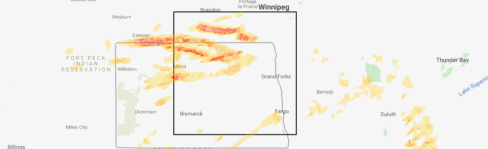
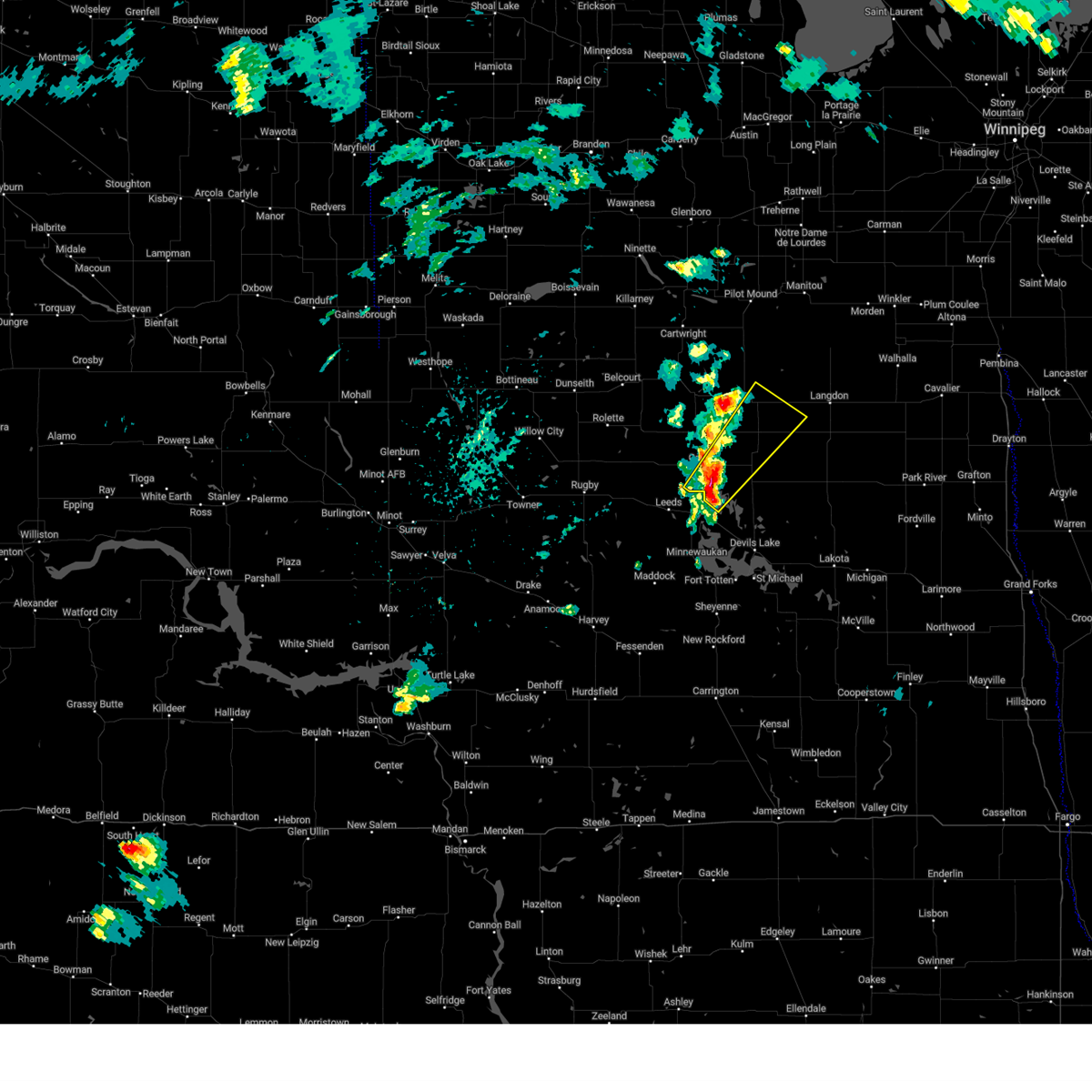
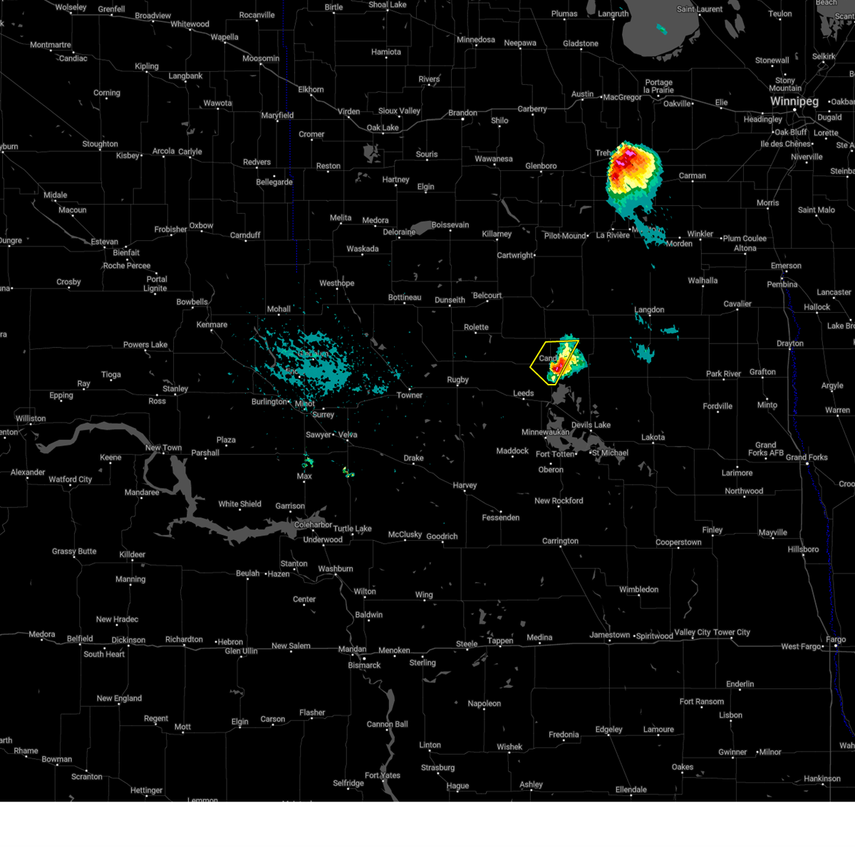
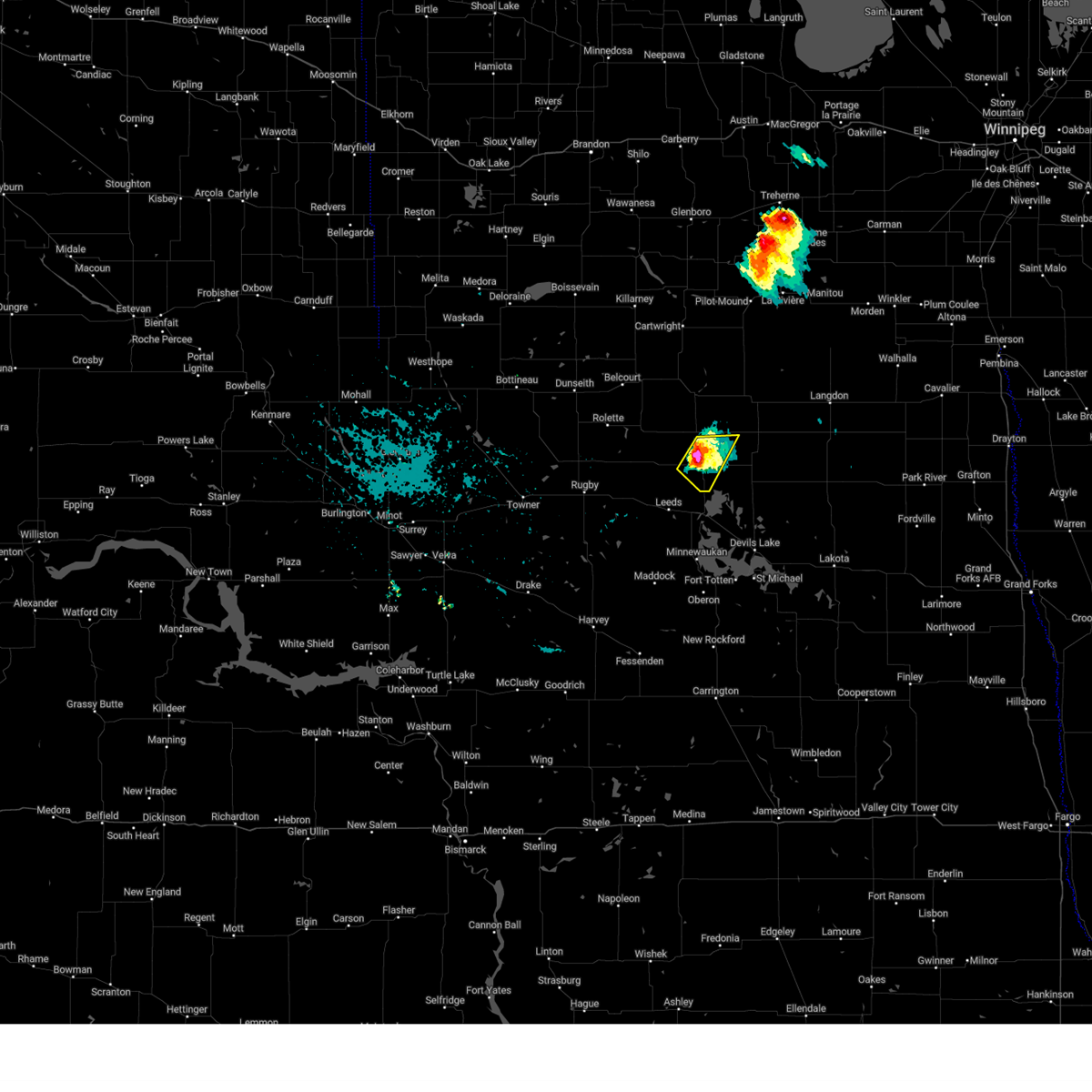
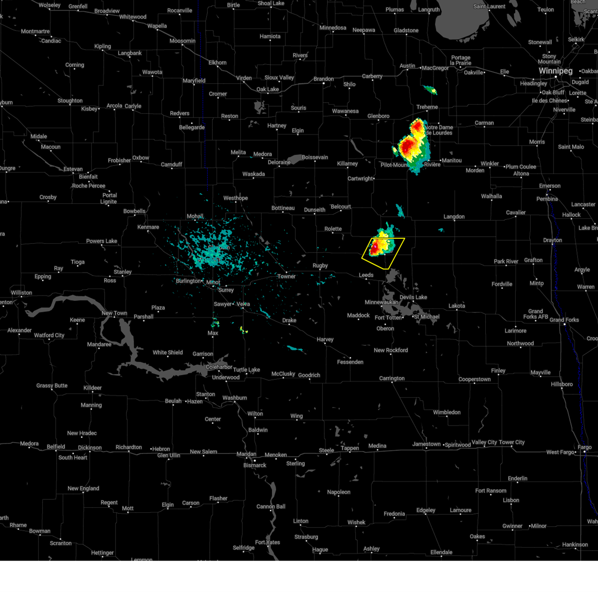
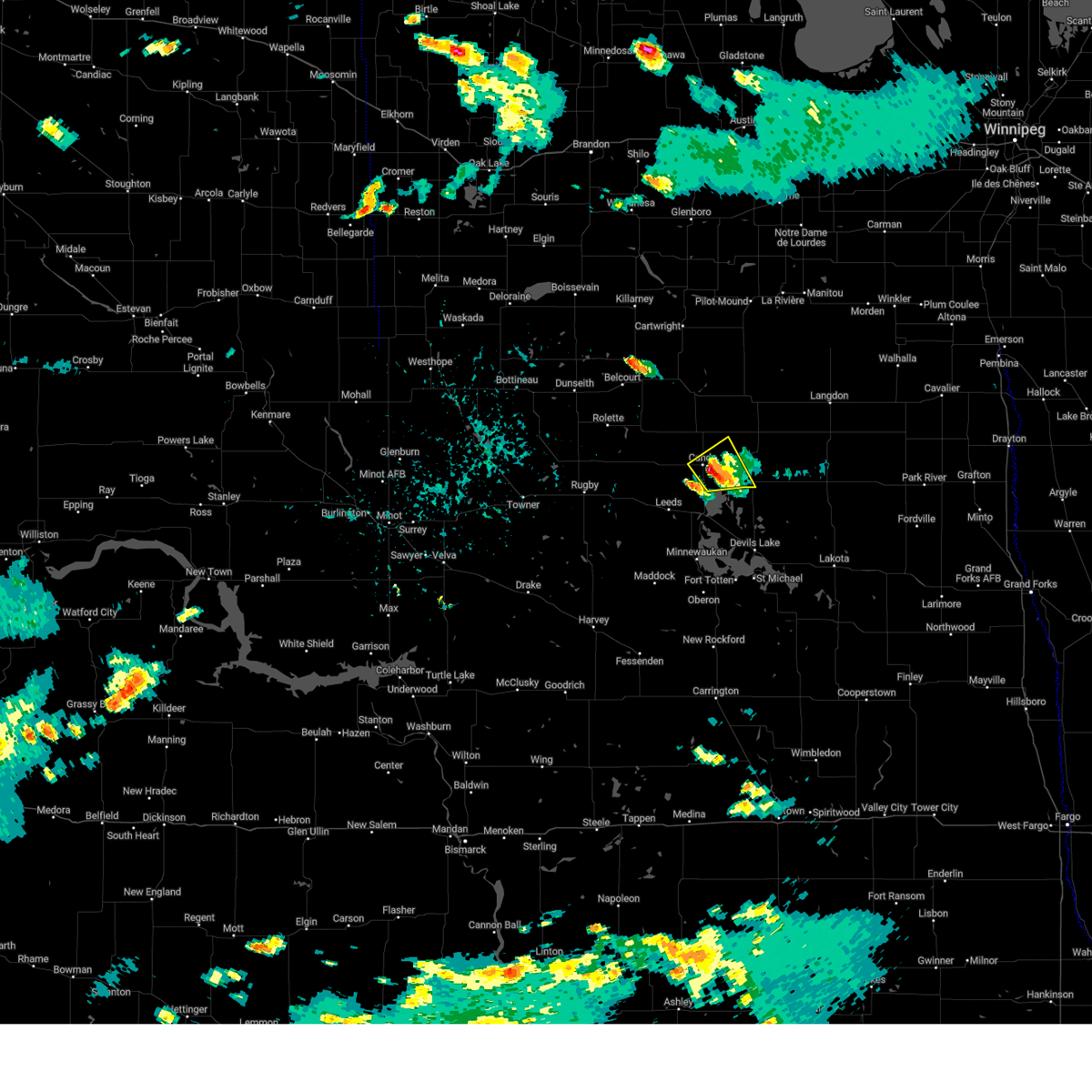
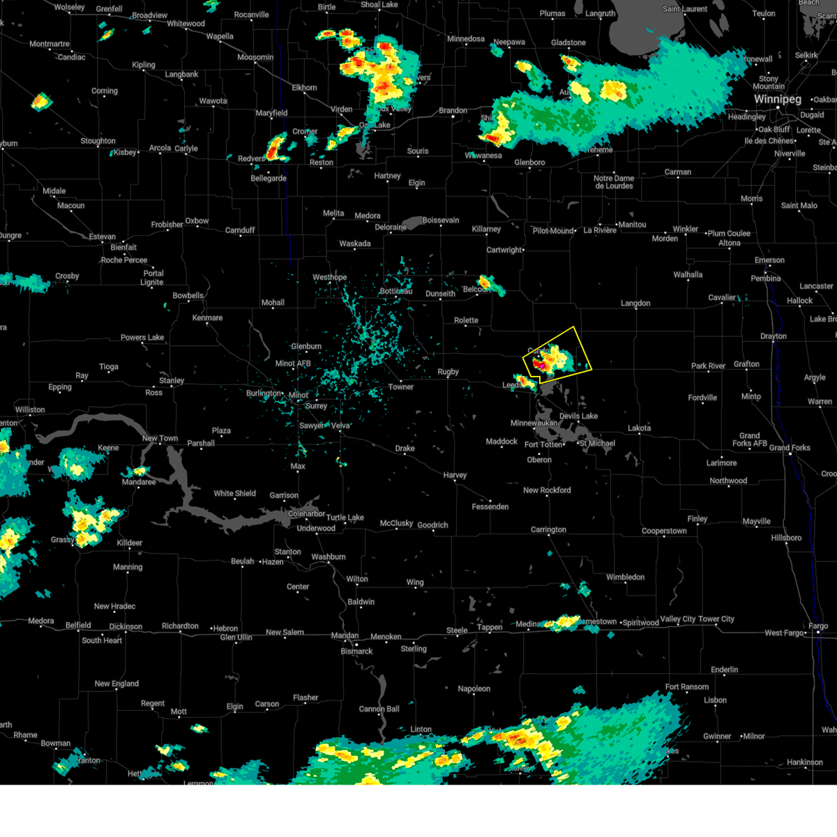
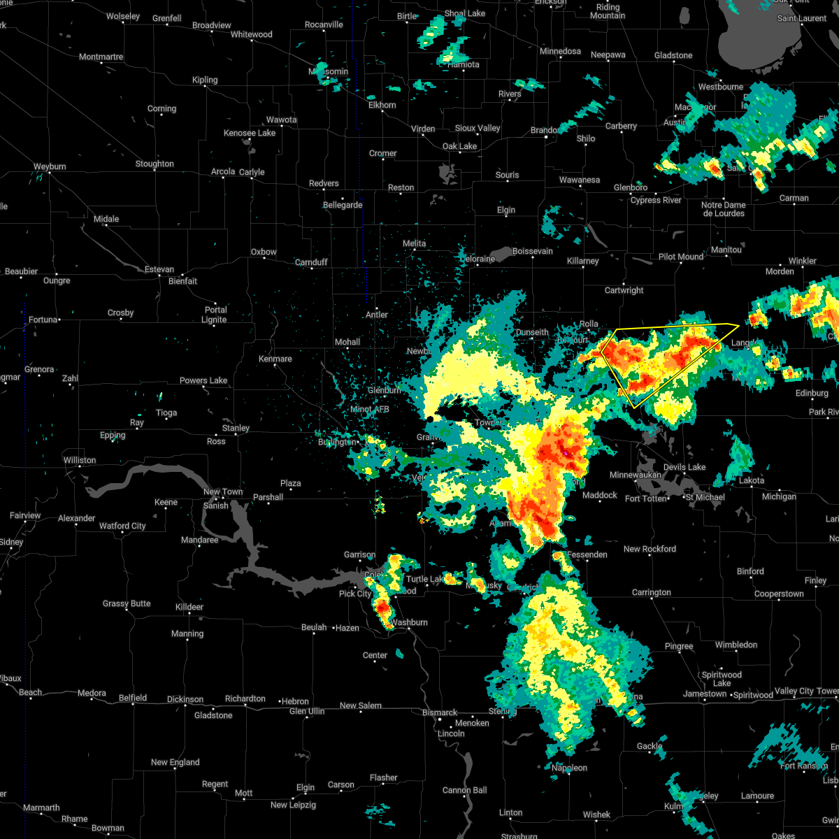
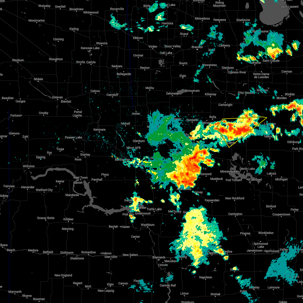
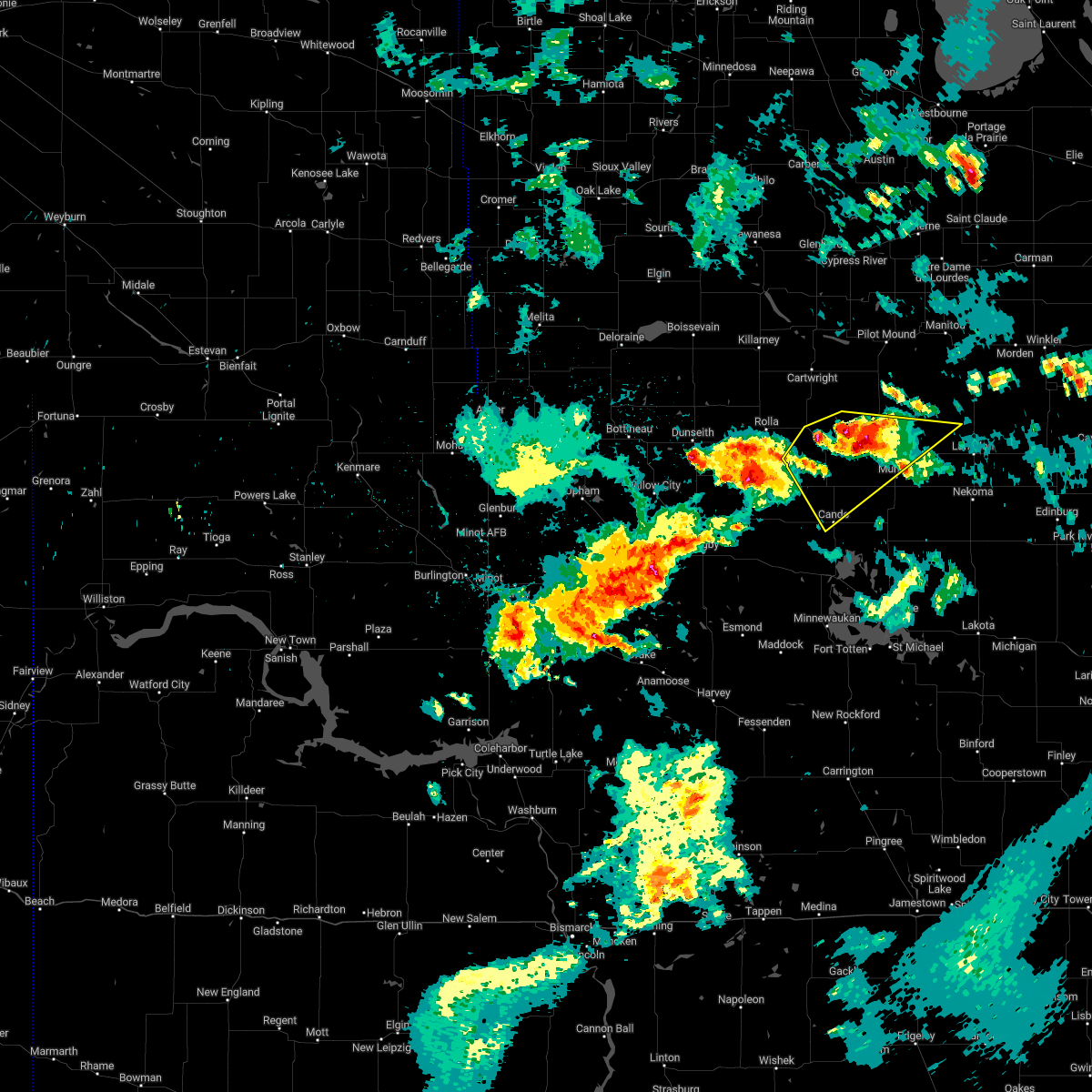
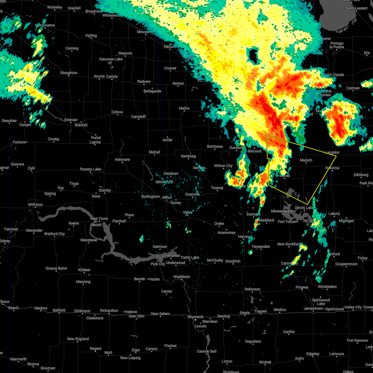
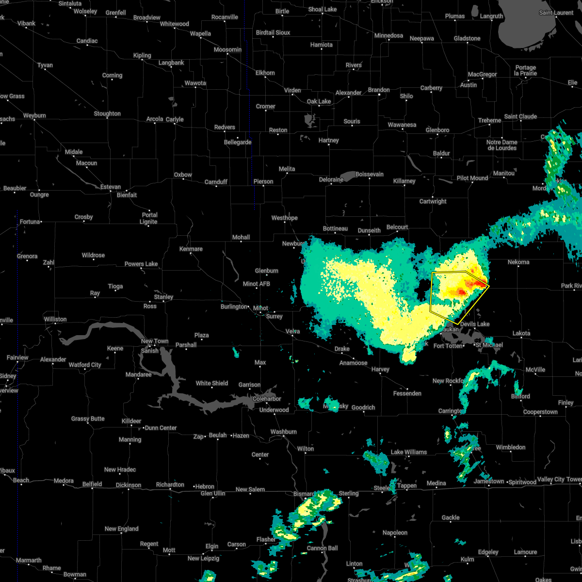
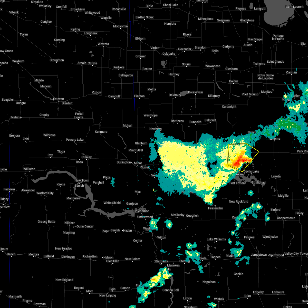
Hail Map for Cando, ND
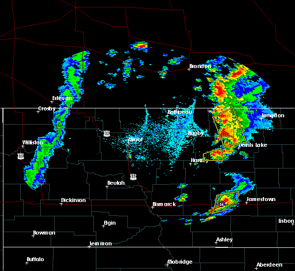
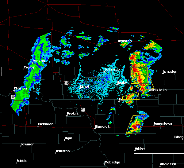
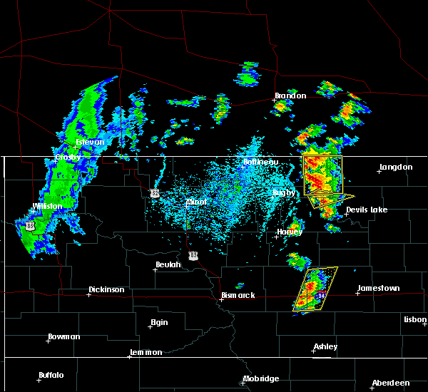
The Cando, ND area has had 9 reports of on-the-ground hail by trained spotters, and has been under severe weather warnings 2 times during the past 12 months. Doppler radar has detected hail at or near Cando, ND on 38 occasions.
| Name: | Cando, ND |
| Where Located: | 30.5 miles NNW of Devils Lake, ND |
| Map: | Google Map for Cando, ND |
| Population: | 1115 |
| Housing Units: | 701 |
| More Info: | Search Google for Cando, ND |
5
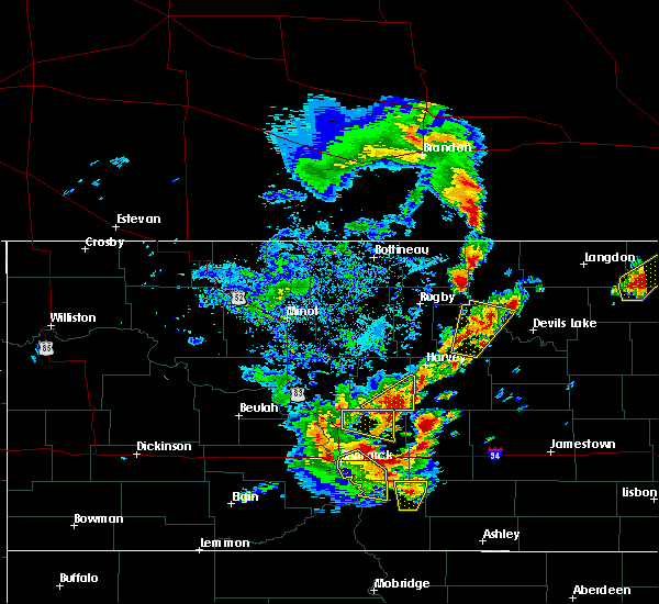
The Top Recent Hail Date for Cando, ND is Thursday, June 14, 2018 (1st out of 38)
Hail and Wind Damage Spotted near Cando, ND
| Date / Time | Report Details |
|---|---|
| 9/16/2024 6:09 AM CDT |
 the severe thunderstorm warning has been cancelled and is no longer in effect the severe thunderstorm warning has been cancelled and is no longer in effect
|
| 9/16/2024 5:31 AM CDT |
 Svrfgf the national weather service in grand forks has issued a * severe thunderstorm warning for, north central benson county in northeastern north dakota, southern towner county in northeastern north dakota, northwestern ramsey county in northeastern north dakota, * until 630 am cdt. * at 531 am cdt, a severe thunderstorm was located near churchs ferry, or 22 miles northwest of devils lake, moving northeast at 25 mph (radar indicated). Hazards include ping pong ball size hail and 60 mph wind gusts. People and animals outdoors will be injured. expect hail damage to roofs, siding, windows, and vehicles. Expect wind damage to roofs, siding, and trees. Svrfgf the national weather service in grand forks has issued a * severe thunderstorm warning for, north central benson county in northeastern north dakota, southern towner county in northeastern north dakota, northwestern ramsey county in northeastern north dakota, * until 630 am cdt. * at 531 am cdt, a severe thunderstorm was located near churchs ferry, or 22 miles northwest of devils lake, moving northeast at 25 mph (radar indicated). Hazards include ping pong ball size hail and 60 mph wind gusts. People and animals outdoors will be injured. expect hail damage to roofs, siding, windows, and vehicles. Expect wind damage to roofs, siding, and trees.
|
| 6/16/2024 2:50 AM CDT |
 The storms which prompted the warning have weakened below severe limits, and no longer pose an immediate threat to life or property. therefore, the warning will be allowed to expire. however, gusty winds are still possible with these thunderstorms. a severe thunderstorm watch remains in effect until 600 am cdt for northeastern north dakota. The storms which prompted the warning have weakened below severe limits, and no longer pose an immediate threat to life or property. therefore, the warning will be allowed to expire. however, gusty winds are still possible with these thunderstorms. a severe thunderstorm watch remains in effect until 600 am cdt for northeastern north dakota.
|
| 6/16/2024 2:12 AM CDT |
 Svrfgf the national weather service in grand forks has issued a * severe thunderstorm warning for, benson county in northeastern north dakota, towner county in northeastern north dakota, western cavalier county in northeastern north dakota, western ramsey county in northeastern north dakota, * until 300 am cdt. * at 212 am cdt, severe thunderstorms were located along a line extending from 12 miles north of sarles to near heimdal, moving east at 35 mph (radar indicated). Hazards include 60 mph wind gusts and quarter size hail. Hail damage to vehicles is expected. Expect wind damage to roofs, siding, and trees. Svrfgf the national weather service in grand forks has issued a * severe thunderstorm warning for, benson county in northeastern north dakota, towner county in northeastern north dakota, western cavalier county in northeastern north dakota, western ramsey county in northeastern north dakota, * until 300 am cdt. * at 212 am cdt, severe thunderstorms were located along a line extending from 12 miles north of sarles to near heimdal, moving east at 35 mph (radar indicated). Hazards include 60 mph wind gusts and quarter size hail. Hail damage to vehicles is expected. Expect wind damage to roofs, siding, and trees.
|
| 6/16/2024 1:49 AM CDT |
 At 149 am cdt, severe thunderstorms were located along a line extending from 25 miles north of hansboro to rocklake to near esmond, moving east at 55 mph (radar indicated). Hazards include 60 mph wind gusts and penny size hail. Expect damage to roofs, siding, and trees. Locations impacted include, cando, leeds, minnewaukan, munich, bisbee, starkweather, and rocklake. At 149 am cdt, severe thunderstorms were located along a line extending from 25 miles north of hansboro to rocklake to near esmond, moving east at 55 mph (radar indicated). Hazards include 60 mph wind gusts and penny size hail. Expect damage to roofs, siding, and trees. Locations impacted include, cando, leeds, minnewaukan, munich, bisbee, starkweather, and rocklake.
|
| 6/16/2024 1:23 AM CDT |
 Svrfgf the national weather service in grand forks has issued a * severe thunderstorm warning for, benson county in northeastern north dakota, towner county in northeastern north dakota, western cavalier county in northeastern north dakota, western ramsey county in northeastern north dakota, * until 215 am cdt. * at 123 am cdt, severe thunderstorms were located along a line extending from 21 miles northeast of international peace garden to 6 miles northeast of rolette to 6 miles southwest of orrin, moving northeast at 60 mph (radar indicated). Hazards include 60 mph wind gusts and penny size hail. expect damage to roofs, siding, and trees Svrfgf the national weather service in grand forks has issued a * severe thunderstorm warning for, benson county in northeastern north dakota, towner county in northeastern north dakota, western cavalier county in northeastern north dakota, western ramsey county in northeastern north dakota, * until 215 am cdt. * at 123 am cdt, severe thunderstorms were located along a line extending from 21 miles northeast of international peace garden to 6 miles northeast of rolette to 6 miles southwest of orrin, moving northeast at 60 mph (radar indicated). Hazards include 60 mph wind gusts and penny size hail. expect damage to roofs, siding, and trees
|
| 6/15/2024 5:53 PM CDT |
 At 552 pm cdt, a severe thunderstorm was located over munich, or 21 miles west of langdon, moving northeast at 45 mph (radar indicated). Hazards include 60 mph wind gusts and quarter size hail. Hail damage to vehicles is expected. expect wind damage to roofs, siding, and trees. Locations impacted include, cando, munich, starkweather, clyde, alsen, egeland, and calio. At 552 pm cdt, a severe thunderstorm was located over munich, or 21 miles west of langdon, moving northeast at 45 mph (radar indicated). Hazards include 60 mph wind gusts and quarter size hail. Hail damage to vehicles is expected. expect wind damage to roofs, siding, and trees. Locations impacted include, cando, munich, starkweather, clyde, alsen, egeland, and calio.
|
| 6/15/2024 5:27 PM CDT |
 Svrfgf the national weather service in grand forks has issued a * severe thunderstorm warning for, southeastern towner county in northeastern north dakota, southwestern cavalier county in northeastern north dakota, northwestern ramsey county in northeastern north dakota, * until 615 pm cdt. * at 526 pm cdt, a severe thunderstorm was located near cando, or 25 miles northwest of devils lake, moving northeast at 45 mph (radar indicated). Hazards include 60 mph wind gusts and quarter size hail. Hail damage to vehicles is expected. Expect wind damage to roofs, siding, and trees. Svrfgf the national weather service in grand forks has issued a * severe thunderstorm warning for, southeastern towner county in northeastern north dakota, southwestern cavalier county in northeastern north dakota, northwestern ramsey county in northeastern north dakota, * until 615 pm cdt. * at 526 pm cdt, a severe thunderstorm was located near cando, or 25 miles northwest of devils lake, moving northeast at 45 mph (radar indicated). Hazards include 60 mph wind gusts and quarter size hail. Hail damage to vehicles is expected. Expect wind damage to roofs, siding, and trees.
|
| 9/4/2023 11:27 PM CDT |
 At 1126 pm cdt, severe thunderstorms were located along a line extending from near brinsmade to lawton to 7 miles northwest of luverne, moving northeast at 20 mph (radar indicated). Hazards include 60 mph wind gusts and penny size hail. Expect damage to roofs, siding, and trees. Locations impacted include, devils lake, new rockford, cando, cooperstown, camp grafton, lakota and lakewood park. At 1126 pm cdt, severe thunderstorms were located along a line extending from near brinsmade to lawton to 7 miles northwest of luverne, moving northeast at 20 mph (radar indicated). Hazards include 60 mph wind gusts and penny size hail. Expect damage to roofs, siding, and trees. Locations impacted include, devils lake, new rockford, cando, cooperstown, camp grafton, lakota and lakewood park.
|
| 9/4/2023 10:58 PM CDT |
 At 1058 pm cdt, severe thunderstorms were located along a line extending from esmond to 7 miles northeast of devils lake to near wimbledon, moving northeast at 55 mph (radar indicated). Hazards include 60 mph wind gusts and penny size hail. expect damage to roofs, siding, and trees At 1058 pm cdt, severe thunderstorms were located along a line extending from esmond to 7 miles northeast of devils lake to near wimbledon, moving northeast at 55 mph (radar indicated). Hazards include 60 mph wind gusts and penny size hail. expect damage to roofs, siding, and trees
|
| 7/2/2023 8:06 PM CDT |
 The severe thunderstorm warning for southeastern towner county will expire at 815 pm cdt, the storm which prompted the warning has weakened below severe limits, and no longer poses an immediate threat to life or property. therefore, the warning will be allowed to expire. however small hail is still possible with this thunderstorm. The severe thunderstorm warning for southeastern towner county will expire at 815 pm cdt, the storm which prompted the warning has weakened below severe limits, and no longer poses an immediate threat to life or property. therefore, the warning will be allowed to expire. however small hail is still possible with this thunderstorm.
|
| 7/2/2023 7:49 PM CDT |
 At 749 pm cdt, a severe thunderstorm was located over cando, or 31 miles northwest of devils lake, moving east at 15 mph (radar indicated). Hazards include 60 mph wind gusts and quarter size hail. Hail damage to vehicles is expected. expect wind damage to roofs, siding, and trees. locations impacted include, cando, considine and maza. hail threat, radar indicated max hail size, 1. 00 in wind threat, radar indicated max wind gust, 60 mph. At 749 pm cdt, a severe thunderstorm was located over cando, or 31 miles northwest of devils lake, moving east at 15 mph (radar indicated). Hazards include 60 mph wind gusts and quarter size hail. Hail damage to vehicles is expected. expect wind damage to roofs, siding, and trees. locations impacted include, cando, considine and maza. hail threat, radar indicated max hail size, 1. 00 in wind threat, radar indicated max wind gust, 60 mph.
|
| 7/2/2023 7:36 PM CDT |
 At 736 pm cdt, a severe thunderstorm was located near considine, or 34 miles northwest of devils lake, moving east at 15 mph (radar indicated). Hazards include 60 mph wind gusts and quarter size hail. Hail damage to vehicles is expected. Expect wind damage to roofs, siding, and trees. At 736 pm cdt, a severe thunderstorm was located near considine, or 34 miles northwest of devils lake, moving east at 15 mph (radar indicated). Hazards include 60 mph wind gusts and quarter size hail. Hail damage to vehicles is expected. Expect wind damage to roofs, siding, and trees.
|
| 6/27/2023 6:25 PM CDT |
 At 624 pm cdt, a severe thunderstorm was located over mainly rural areas of southeast towner county, moving northeast at 10 mph (radar indicated). Hazards include 60 mph wind gusts and quarter size hail. Hail damage to vehicles is expected. expect wind damage to roofs, siding, and trees. locations impacted include, cando and maza. hail threat, radar indicated max hail size, 1. 00 in wind threat, radar indicated max wind gust, 60 mph. At 624 pm cdt, a severe thunderstorm was located over mainly rural areas of southeast towner county, moving northeast at 10 mph (radar indicated). Hazards include 60 mph wind gusts and quarter size hail. Hail damage to vehicles is expected. expect wind damage to roofs, siding, and trees. locations impacted include, cando and maza. hail threat, radar indicated max hail size, 1. 00 in wind threat, radar indicated max wind gust, 60 mph.
|
| 6/27/2023 6:15 PM CDT | Quarter sized hail reported 2 miles NW of Cando, ND, public reports quarter sized hail... mixed in with smaller stones. brief duration. |
| 6/27/2023 6:05 PM CDT |
 At 604 pm cdt, a severe thunderstorm was located near maza, or 27 miles northwest of devils lake, moving northeast at 15 mph (radar indicated). Hazards include 60 mph wind gusts and half dollar size hail. Hail damage to vehicles is expected. Expect wind damage to roofs, siding, and trees. At 604 pm cdt, a severe thunderstorm was located near maza, or 27 miles northwest of devils lake, moving northeast at 15 mph (radar indicated). Hazards include 60 mph wind gusts and half dollar size hail. Hail damage to vehicles is expected. Expect wind damage to roofs, siding, and trees.
|
| 8/18/2022 2:05 AM CDT |
 The severe thunderstorm warning for central towner and west central cavalier counties will expire at 215 am cdt, the storms which prompted the warning have weakened below severe limits, and no longer pose an immediate threat to life or property. therefore, the warning will be allowed to expire. however gusty winds are still possible with these thunderstorms. The severe thunderstorm warning for central towner and west central cavalier counties will expire at 215 am cdt, the storms which prompted the warning have weakened below severe limits, and no longer pose an immediate threat to life or property. therefore, the warning will be allowed to expire. however gusty winds are still possible with these thunderstorms.
|
| 8/18/2022 1:42 AM CDT |
 At 142 am cdt, severe thunderstorms were located along a line extending from near clyde to bisbee, moving east at 10 mph (radar indicated). Hazards include 60 mph wind gusts and quarter size hail. Hail damage to vehicles is expected. expect wind damage to roofs, siding, and trees. locations impacted include, clyde, calvin and egeland. hail threat, radar indicated max hail size, 1. 00 in wind threat, radar indicated max wind gust, 60 mph. At 142 am cdt, severe thunderstorms were located along a line extending from near clyde to bisbee, moving east at 10 mph (radar indicated). Hazards include 60 mph wind gusts and quarter size hail. Hail damage to vehicles is expected. expect wind damage to roofs, siding, and trees. locations impacted include, clyde, calvin and egeland. hail threat, radar indicated max hail size, 1. 00 in wind threat, radar indicated max wind gust, 60 mph.
|
| 8/18/2022 1:12 AM CDT |
 At 111 am cdt, severe thunderstorms were located along a line extending from calvin to agate, moving southeast at 10 mph (radar indicated). Hazards include ping pong ball size hail and 60 mph wind gusts. People and animals outdoors will be injured. expect hail damage to roofs, siding, windows, and vehicles. expect wind damage to roofs, siding, and trees. severe thunderstorms will be near, calvin around 115 am cdt. clyde around 130 am cdt. other locations in the path of these severe thunderstorms include considine, arndt and cando. hail threat, radar indicated max hail size, 1. 50 in wind threat, radar indicated max wind gust, 60 mph. At 111 am cdt, severe thunderstorms were located along a line extending from calvin to agate, moving southeast at 10 mph (radar indicated). Hazards include ping pong ball size hail and 60 mph wind gusts. People and animals outdoors will be injured. expect hail damage to roofs, siding, windows, and vehicles. expect wind damage to roofs, siding, and trees. severe thunderstorms will be near, calvin around 115 am cdt. clyde around 130 am cdt. other locations in the path of these severe thunderstorms include considine, arndt and cando. hail threat, radar indicated max hail size, 1. 50 in wind threat, radar indicated max wind gust, 60 mph.
|
| 7/22/2022 11:16 PM CDT |
 At 1112 pm cdt, severe thunderstorms were located along a line extending from olga to spirit lake nation, moving southeast at 55 mph. at 1104 pm cdt, a 60 mph wind gust was reported near webster (radar indicated). Hazards include 70 mph wind gusts and ping pong ball size hail. People and animals outdoors will be injured. expect hail damage to roofs, siding, windows, and vehicles. expect considerable tree damage. wind damage is also likely to mobile homes, roofs, and outbuildings. these severe storms will be near, olga around 1115 pm cdt. concrete and tokio around 1120 pm cdt. other locations in the path of these severe thunderstorms include mountain, akra, backoo, warwick, hensel, hamar and crystal. thunderstorm damage threat, considerable hail threat, radar indicated max hail size, 1. 50 in wind threat, observed max wind gust, 70 mph. At 1112 pm cdt, severe thunderstorms were located along a line extending from olga to spirit lake nation, moving southeast at 55 mph. at 1104 pm cdt, a 60 mph wind gust was reported near webster (radar indicated). Hazards include 70 mph wind gusts and ping pong ball size hail. People and animals outdoors will be injured. expect hail damage to roofs, siding, windows, and vehicles. expect considerable tree damage. wind damage is also likely to mobile homes, roofs, and outbuildings. these severe storms will be near, olga around 1115 pm cdt. concrete and tokio around 1120 pm cdt. other locations in the path of these severe thunderstorms include mountain, akra, backoo, warwick, hensel, hamar and crystal. thunderstorm damage threat, considerable hail threat, radar indicated max hail size, 1. 50 in wind threat, observed max wind gust, 70 mph.
|
| 7/22/2022 11:03 PM CDT |
 At 1102 pm cdt, severe thunderstorms were located along a line extending from near vang to oberon, moving southeast at 55 mph. at 1100 pm cdt, a mesonet reported a 62 mph wind gust near maddock (radar indicated). Hazards include 70 mph wind gusts and quarter size hail. Hail damage to vehicles is expected. expect considerable tree damage. wind damage is also likely to mobile homes, roofs, and outbuildings. severe thunderstorms will be near, vang around 1105 pm cdt. olga and fort totten around 1110 pm cdt. concrete and tokio around 1120 pm cdt. other locations in the path of these severe thunderstorms include mountain, akra and warwick. thunderstorm damage threat, considerable hail threat, radar indicated max hail size, 1. 00 in wind threat, observed max wind gust, 70 mph. At 1102 pm cdt, severe thunderstorms were located along a line extending from near vang to oberon, moving southeast at 55 mph. at 1100 pm cdt, a mesonet reported a 62 mph wind gust near maddock (radar indicated). Hazards include 70 mph wind gusts and quarter size hail. Hail damage to vehicles is expected. expect considerable tree damage. wind damage is also likely to mobile homes, roofs, and outbuildings. severe thunderstorms will be near, vang around 1105 pm cdt. olga and fort totten around 1110 pm cdt. concrete and tokio around 1120 pm cdt. other locations in the path of these severe thunderstorms include mountain, akra and warwick. thunderstorm damage threat, considerable hail threat, radar indicated max hail size, 1. 00 in wind threat, observed max wind gust, 70 mph.
|
| 7/22/2022 10:30 PM CDT |
 At 1030 pm cdt, severe thunderstorms were located along a line extending from near perth to 7 miles north of leeds to near fillmore, moving east at 45 mph. at 1025 pm cdt, a 68 mph wind gust was reported near wolford (radar indicated). Hazards include 70 mph wind gusts and quarter size hail. Hail damage to vehicles is expected. expect considerable tree damage. wind damage is also likely to mobile homes, roofs, and outbuildings. Locations impacted include, maza, rocklake, churchs ferry, brinsmade, egeland, garske, webster, clyde, penn and calio. At 1030 pm cdt, severe thunderstorms were located along a line extending from near perth to 7 miles north of leeds to near fillmore, moving east at 45 mph. at 1025 pm cdt, a 68 mph wind gust was reported near wolford (radar indicated). Hazards include 70 mph wind gusts and quarter size hail. Hail damage to vehicles is expected. expect considerable tree damage. wind damage is also likely to mobile homes, roofs, and outbuildings. Locations impacted include, maza, rocklake, churchs ferry, brinsmade, egeland, garske, webster, clyde, penn and calio.
|
| 7/22/2022 10:19 PM CDT |
 At 1018 pm cdt, severe thunderstorms were located along a line extending from near rolla to 7 miles northeast of knox to 6 miles northwest of fillmore, moving east at 45 mph (radar indicated). Hazards include 60 mph wind gusts and quarter size hail. Hail damage to vehicles is expected. expect wind damage to roofs, siding, and trees. severe thunderstorms will be near, leeds around 1030 pm cdt. baker, perth and york around 1035 pm cdt. other locations in the path of these severe thunderstorms include harlow, maza, rocklake, churchs ferry, brinsmade and egeland. hail threat, radar indicated max hail size, 1. 00 in wind threat, radar indicated max wind gust, 60 mph. At 1018 pm cdt, severe thunderstorms were located along a line extending from near rolla to 7 miles northeast of knox to 6 miles northwest of fillmore, moving east at 45 mph (radar indicated). Hazards include 60 mph wind gusts and quarter size hail. Hail damage to vehicles is expected. expect wind damage to roofs, siding, and trees. severe thunderstorms will be near, leeds around 1030 pm cdt. baker, perth and york around 1035 pm cdt. other locations in the path of these severe thunderstorms include harlow, maza, rocklake, churchs ferry, brinsmade and egeland. hail threat, radar indicated max hail size, 1. 00 in wind threat, radar indicated max wind gust, 60 mph.
|
| 7/19/2022 4:15 AM CDT | Awos station k9d7 cando ap n in towner county ND, 1.4 miles ENE of Cando, ND |
| 7/19/2022 4:09 AM CDT |
 At 408 am cdt, a severe thunderstorm was located over arndt, or 38 miles west of langdon, moving east at 55 mph (radar indicated). Hazards include 70 mph wind gusts and quarter size hail. Hail damage to vehicles is expected. expect considerable tree damage. wind damage is also likely to mobile homes, roofs, and outbuildings. locations impacted include, egeland, calio, munich, alsen, hampden and derrick. thunderstorm damage threat, considerable hail threat, radar indicated max hail size, 1. 00 in wind threat, radar indicated max wind gust, 70 mph. At 408 am cdt, a severe thunderstorm was located over arndt, or 38 miles west of langdon, moving east at 55 mph (radar indicated). Hazards include 70 mph wind gusts and quarter size hail. Hail damage to vehicles is expected. expect considerable tree damage. wind damage is also likely to mobile homes, roofs, and outbuildings. locations impacted include, egeland, calio, munich, alsen, hampden and derrick. thunderstorm damage threat, considerable hail threat, radar indicated max hail size, 1. 00 in wind threat, radar indicated max wind gust, 70 mph.
|
| 7/19/2022 3:48 AM CDT |
 At 347 am cdt, a severe thunderstorm was located near rolla, or 56 miles northwest of devils lake, moving east at 55 mph (radar indicated). Hazards include 60 mph wind gusts and quarter size hail. Hail damage to vehicles is expected. expect wind damage to roofs, siding, and trees. this severe thunderstorm will be near, perth around 355 am cdt. bisbee around 400 am cdt. rocklake around 405 am cdt. other locations in the path of this severe thunderstorm include arndt and egeland. hail threat, radar indicated max hail size, 1. 00 in wind threat, radar indicated max wind gust, 60 mph. At 347 am cdt, a severe thunderstorm was located near rolla, or 56 miles northwest of devils lake, moving east at 55 mph (radar indicated). Hazards include 60 mph wind gusts and quarter size hail. Hail damage to vehicles is expected. expect wind damage to roofs, siding, and trees. this severe thunderstorm will be near, perth around 355 am cdt. bisbee around 400 am cdt. rocklake around 405 am cdt. other locations in the path of this severe thunderstorm include arndt and egeland. hail threat, radar indicated max hail size, 1. 00 in wind threat, radar indicated max wind gust, 60 mph.
|
| 6/20/2022 4:12 AM CDT |
 The severe thunderstorm warning for north central benson, southeastern towner and northwestern ramsey counties will expire at 415 am cdt, the storm which prompted the warning has weakened below severe limits, and has exited the warned area. therefore, the warning will be allowed to expire. however gusty winds are still possible with this thunderstorm. The severe thunderstorm warning for north central benson, southeastern towner and northwestern ramsey counties will expire at 415 am cdt, the storm which prompted the warning has weakened below severe limits, and has exited the warned area. therefore, the warning will be allowed to expire. however gusty winds are still possible with this thunderstorm.
|
| 6/20/2022 3:55 AM CDT |
 At 354 am cdt, a severe thunderstorm was located near churchs ferry, or 18 miles northwest of devils lake, moving northeast at 50 mph (radar indicated). Hazards include 60 mph wind gusts. Expect damage to roofs, siding, and trees. locations impacted include, garske and starkweather. hail threat, radar indicated max hail size, <. 75 in wind threat, radar indicated max wind gust, 60 mph. At 354 am cdt, a severe thunderstorm was located near churchs ferry, or 18 miles northwest of devils lake, moving northeast at 50 mph (radar indicated). Hazards include 60 mph wind gusts. Expect damage to roofs, siding, and trees. locations impacted include, garske and starkweather. hail threat, radar indicated max hail size, <. 75 in wind threat, radar indicated max wind gust, 60 mph.
|
| 6/20/2022 3:24 AM CDT |
 At 323 am cdt, a severe thunderstorm was located near maddock, or 28 miles west of devils lake, moving northeast at 50 mph. wind gust near maddock measured 58 mph (radar indicated). Hazards include 60 mph wind gusts. Expect damage to roofs, siding, and trees. this severe thunderstorm will be near, minnewaukan around 335 am cdt. brinsmade around 340 am cdt. other locations in the path of this severe thunderstorm include churchs ferry, penn, maza and garske. hail threat, radar indicated max hail size, <. 75 in wind threat, radar indicated max wind gust, 60 mph. At 323 am cdt, a severe thunderstorm was located near maddock, or 28 miles west of devils lake, moving northeast at 50 mph. wind gust near maddock measured 58 mph (radar indicated). Hazards include 60 mph wind gusts. Expect damage to roofs, siding, and trees. this severe thunderstorm will be near, minnewaukan around 335 am cdt. brinsmade around 340 am cdt. other locations in the path of this severe thunderstorm include churchs ferry, penn, maza and garske. hail threat, radar indicated max hail size, <. 75 in wind threat, radar indicated max wind gust, 60 mph.
|
| 6/13/2022 10:51 PM CDT |
 At 1051 pm cdt, severe thunderstorms were located along a line extending from near egeland to near churchs ferry, moving east at 35 mph (radar indicated). Hazards include 70 mph wind gusts and quarter size hail. Hail damage to vehicles is expected. expect considerable tree damage. wind damage is also likely to mobile homes, roofs, and outbuildings. severe thunderstorms will be near, calio around 1105 pm cdt. webster, garske and clyde around 1110 pm cdt. Other locations in the path of these severe thunderstorms include munich, alsen and loma. At 1051 pm cdt, severe thunderstorms were located along a line extending from near egeland to near churchs ferry, moving east at 35 mph (radar indicated). Hazards include 70 mph wind gusts and quarter size hail. Hail damage to vehicles is expected. expect considerable tree damage. wind damage is also likely to mobile homes, roofs, and outbuildings. severe thunderstorms will be near, calio around 1105 pm cdt. webster, garske and clyde around 1110 pm cdt. Other locations in the path of these severe thunderstorms include munich, alsen and loma.
|
| 8/9/2021 7:45 PM CDT |
 At 745 pm cdt, a severe thunderstorm was located near dresden, or near langdon, moving northeast at 45 mph (radar indicated). Hazards include 60 mph wind gusts and half dollar size hail. Hail damage to vehicles is expected. expect wind damage to roofs, siding, and trees. Locations impacted include, langdon. At 745 pm cdt, a severe thunderstorm was located near dresden, or near langdon, moving northeast at 45 mph (radar indicated). Hazards include 60 mph wind gusts and half dollar size hail. Hail damage to vehicles is expected. expect wind damage to roofs, siding, and trees. Locations impacted include, langdon.
|
| 8/9/2021 7:04 PM CDT |
 At 704 pm cdt, a severe thunderstorm was located 7 miles west of starkweather, or 25 miles north of devils lake, moving northeast at 50 mph (radar indicated). Hazards include 60 mph wind gusts and quarter size hail. Hail damage to vehicles is expected. expect wind damage to roofs, siding, and trees. this severe thunderstorm will be near, starkweather around 710 pm cdt. calio around 720 pm cdt. Other locations in the path of this severe thunderstorm include alsen, munich, hampden, loma, dresden and langdon. At 704 pm cdt, a severe thunderstorm was located 7 miles west of starkweather, or 25 miles north of devils lake, moving northeast at 50 mph (radar indicated). Hazards include 60 mph wind gusts and quarter size hail. Hail damage to vehicles is expected. expect wind damage to roofs, siding, and trees. this severe thunderstorm will be near, starkweather around 710 pm cdt. calio around 720 pm cdt. Other locations in the path of this severe thunderstorm include alsen, munich, hampden, loma, dresden and langdon.
|
| 8/9/2021 6:37 PM CDT |
 At 637 pm cdt, a severe thunderstorm was located over cando, or 30 miles northwest of devils lake, moving northeast at 40 mph (radar indicated). Hazards include 60 mph wind gusts and quarter size hail. Hail damage to vehicles is expected. expect wind damage to roofs, siding, and trees. locations impacted include, cando, munich, bisbee, clyde, alsen, egeland and calio. hail threat, radar indicated max hail size, 1. 00 in wind threat, radar indicated max wind gust, 60 mph. At 637 pm cdt, a severe thunderstorm was located over cando, or 30 miles northwest of devils lake, moving northeast at 40 mph (radar indicated). Hazards include 60 mph wind gusts and quarter size hail. Hail damage to vehicles is expected. expect wind damage to roofs, siding, and trees. locations impacted include, cando, munich, bisbee, clyde, alsen, egeland and calio. hail threat, radar indicated max hail size, 1. 00 in wind threat, radar indicated max wind gust, 60 mph.
|
| 8/9/2021 6:25 PM CDT | Quarter sized hail reported 8.1 miles E of Cando, ND, dime to quarter sized hail reported across southeastern zion township. nearly covered the ground. |
| 8/9/2021 6:12 PM CDT |
 At 611 pm cdt, a severe thunderstorm was located 9 miles northeast of york, or 34 miles northwest of devils lake, moving northeast at 30 mph (radar indicated). Hazards include 60 mph wind gusts and quarter size hail. Hail damage to vehicles is expected. Expect wind damage to roofs, siding, and trees. At 611 pm cdt, a severe thunderstorm was located 9 miles northeast of york, or 34 miles northwest of devils lake, moving northeast at 30 mph (radar indicated). Hazards include 60 mph wind gusts and quarter size hail. Hail damage to vehicles is expected. Expect wind damage to roofs, siding, and trees.
|
| 7/19/2021 7:09 PM CDT |
 At 708 pm cdt, a severe thunderstorm was located over considine, or 15 miles northwest of cando, moving southeast at 40 mph. this storm produced 67 mph wind gust at 649 pm at the ndawn sensor 7 miles east of perth (radar indicated). Hazards include 60 mph wind gusts and quarter size hail. Hail damage to vehicles is expected. expect wind damage to roofs, siding, and trees. Locations impacted include, considine, cando, maza, churchs ferry and penn. At 708 pm cdt, a severe thunderstorm was located over considine, or 15 miles northwest of cando, moving southeast at 40 mph. this storm produced 67 mph wind gust at 649 pm at the ndawn sensor 7 miles east of perth (radar indicated). Hazards include 60 mph wind gusts and quarter size hail. Hail damage to vehicles is expected. expect wind damage to roofs, siding, and trees. Locations impacted include, considine, cando, maza, churchs ferry and penn.
|
| 7/19/2021 6:44 PM CDT |
 At 643 pm cdt, a severe thunderstorm was located over perth, or 51 miles west of langdon, moving southeast at 45 mph (radar indicated). Hazards include ping pong ball size hail and 60 mph wind gusts. People and animals outdoors will be injured. expect hail damage to roofs, siding, windows, and vehicles. expect wind damage to roofs, siding, and trees. this severe thunderstorm will be near, perth around 645 pm cdt. bisbee around 655 pm cdt. cando around 715 pm cdt. Other locations in the path of this severe thunderstorm include considine and cando. At 643 pm cdt, a severe thunderstorm was located over perth, or 51 miles west of langdon, moving southeast at 45 mph (radar indicated). Hazards include ping pong ball size hail and 60 mph wind gusts. People and animals outdoors will be injured. expect hail damage to roofs, siding, windows, and vehicles. expect wind damage to roofs, siding, and trees. this severe thunderstorm will be near, perth around 645 pm cdt. bisbee around 655 pm cdt. cando around 715 pm cdt. Other locations in the path of this severe thunderstorm include considine and cando.
|
| 6/6/2021 2:44 AM CDT |
 At 242 am cdt, severe thunderstorms were located along a line extending from 7 miles east of hansboro to near barlow, moving east at 45 mph (at 2:18 am cdt, 65 mph wind gust was reported at 2 n maddock at the ndawn mesonet). Hazards include 60 mph wind gusts and quarter size hail. Hail damage to vehicles is expected. expect wind damage to roofs, siding, and trees. Locations impacted include, devils lake, new rockford, cando, camp grafton, lakewood park, leeds and fort totten. At 242 am cdt, severe thunderstorms were located along a line extending from 7 miles east of hansboro to near barlow, moving east at 45 mph (at 2:18 am cdt, 65 mph wind gust was reported at 2 n maddock at the ndawn mesonet). Hazards include 60 mph wind gusts and quarter size hail. Hail damage to vehicles is expected. expect wind damage to roofs, siding, and trees. Locations impacted include, devils lake, new rockford, cando, camp grafton, lakewood park, leeds and fort totten.
|
| 6/6/2021 2:35 AM CDT | Awos station k9d7 cando ap n in towner county ND, 1.4 miles ENE of Cando, ND |
| 6/6/2021 1:55 AM CDT |
 At 155 am cdt, severe thunderstorms were located along a line extending from near shell valley to hurdsfield, moving east at 40 mph (radar indicated). Hazards include 60 mph wind gusts and quarter size hail. Hail damage to vehicles is expected. Expect wind damage to roofs, siding, and trees. At 155 am cdt, severe thunderstorms were located along a line extending from near shell valley to hurdsfield, moving east at 40 mph (radar indicated). Hazards include 60 mph wind gusts and quarter size hail. Hail damage to vehicles is expected. Expect wind damage to roofs, siding, and trees.
|
| 7/17/2020 3:14 PM CDT |
 At 314 pm cdt, severe thunderstorms were located along a line extending from near dresden to near leeds, moving east at 45 mph (radar indicated). Hazards include 70 mph wind gusts and quarter size hail. Hail damage to vehicles is expected. expect considerable tree damage. wind damage is also likely to mobile homes, roofs, and outbuildings. these severe storms will be near, dresden around 320 pm cdt. langdon and maza around 325 pm cdt. penn around 335 pm cdt. osnabrock around 340 pm cdt. Webster and garske around 345 pm cdt. At 314 pm cdt, severe thunderstorms were located along a line extending from near dresden to near leeds, moving east at 45 mph (radar indicated). Hazards include 70 mph wind gusts and quarter size hail. Hail damage to vehicles is expected. expect considerable tree damage. wind damage is also likely to mobile homes, roofs, and outbuildings. these severe storms will be near, dresden around 320 pm cdt. langdon and maza around 325 pm cdt. penn around 335 pm cdt. osnabrock around 340 pm cdt. Webster and garske around 345 pm cdt.
|
| 7/17/2020 2:56 PM CDT |
 At 256 pm cdt, severe thunderstorms were located along a line extending from near clyde to near knox, moving east at 45 mph (radar indicated). Hazards include 70 mph wind gusts and quarter size hail. Hail damage to vehicles is expected. expect considerable tree damage. wind damage is also likely to mobile homes, roofs, and outbuildings. severe thunderstorms will be near, clyde around 300 pm cdt. dresden around 320 pm cdt. churchs ferry, langdon and maza around 325 pm cdt. penn around 335 pm cdt. Osnabrock around 340 pm cdt. At 256 pm cdt, severe thunderstorms were located along a line extending from near clyde to near knox, moving east at 45 mph (radar indicated). Hazards include 70 mph wind gusts and quarter size hail. Hail damage to vehicles is expected. expect considerable tree damage. wind damage is also likely to mobile homes, roofs, and outbuildings. severe thunderstorms will be near, clyde around 300 pm cdt. dresden around 320 pm cdt. churchs ferry, langdon and maza around 325 pm cdt. penn around 335 pm cdt. Osnabrock around 340 pm cdt.
|
| 7/17/2020 2:45 PM CDT |
 At 245 pm cdt, a severe thunderstorm was located 7 miles southeast of wolford, or 39 miles northwest of devils lake, moving east at 55 mph. this is a very dangerous storm (radar indicated). Hazards include 80 mph wind gusts and quarter size hail. Flying debris will be dangerous to those caught without shelter. mobile homes will be heavily damaged. expect considerable damage to roofs, windows, and vehicles. extensive tree damage and power outages are likely. this severe storm will be near, cando and maza around 305 pm cdt. starkweather and garske around 320 pm cdt. hampden around 330 pm cdt. derrick around 335 pm cdt. Edmore around 340 pm cdt. At 245 pm cdt, a severe thunderstorm was located 7 miles southeast of wolford, or 39 miles northwest of devils lake, moving east at 55 mph. this is a very dangerous storm (radar indicated). Hazards include 80 mph wind gusts and quarter size hail. Flying debris will be dangerous to those caught without shelter. mobile homes will be heavily damaged. expect considerable damage to roofs, windows, and vehicles. extensive tree damage and power outages are likely. this severe storm will be near, cando and maza around 305 pm cdt. starkweather and garske around 320 pm cdt. hampden around 330 pm cdt. derrick around 335 pm cdt. Edmore around 340 pm cdt.
|
| 7/17/2020 2:22 PM CDT |
 At 222 pm cdt, a severe thunderstorm was located near rugby, or 58 miles northwest of devils lake, moving east at 55 mph. this is a very dangerous storm (radar indicated). Hazards include 80 mph wind gusts and quarter size hail. Flying debris will be dangerous to those caught without shelter. mobile homes will be heavily damaged. expect considerable damage to roofs, windows, and vehicles. extensive tree damage and power outages are likely. this severe thunderstorm will be near, pleasant lake around 235 pm cdt. knox around 240 pm cdt. cando and maza around 305 pm cdt. Starkweather and garske around 315 pm cdt. At 222 pm cdt, a severe thunderstorm was located near rugby, or 58 miles northwest of devils lake, moving east at 55 mph. this is a very dangerous storm (radar indicated). Hazards include 80 mph wind gusts and quarter size hail. Flying debris will be dangerous to those caught without shelter. mobile homes will be heavily damaged. expect considerable damage to roofs, windows, and vehicles. extensive tree damage and power outages are likely. this severe thunderstorm will be near, pleasant lake around 235 pm cdt. knox around 240 pm cdt. cando and maza around 305 pm cdt. Starkweather and garske around 315 pm cdt.
|
| 7/13/2020 11:32 AM CDT |
 At 1132 am cdt, a severe thunderstorm was located over calio, or 27 miles west of langdon, moving northeast at 40 mph (radar indicated). Hazards include 60 mph wind gusts and half dollar size hail. Hail damage to vehicles is expected. expect wind damage to roofs, siding, and trees. Locations impacted include, cando, munich, starkweather, hampden, clyde, alsen and egeland. At 1132 am cdt, a severe thunderstorm was located over calio, or 27 miles west of langdon, moving northeast at 40 mph (radar indicated). Hazards include 60 mph wind gusts and half dollar size hail. Hail damage to vehicles is expected. expect wind damage to roofs, siding, and trees. Locations impacted include, cando, munich, starkweather, hampden, clyde, alsen and egeland.
|
| 7/13/2020 11:05 AM CDT |
 At 1105 am cdt, a severe thunderstorm was located over maza, or 26 miles northwest of devils lake, moving northeast at 40 mph (radar indicated). Hazards include 60 mph wind gusts and half dollar size hail. Hail damage to vehicles is expected. Expect wind damage to roofs, siding, and trees. At 1105 am cdt, a severe thunderstorm was located over maza, or 26 miles northwest of devils lake, moving northeast at 40 mph (radar indicated). Hazards include 60 mph wind gusts and half dollar size hail. Hail damage to vehicles is expected. Expect wind damage to roofs, siding, and trees.
|
| 7/8/2020 1:52 AM CDT |
 At 152 am cdt, severe thunderstorms were located along a line extending from near garske to near st michael, moving east at 45 mph (radar indicated). Hazards include 70 mph wind gusts. Expect considerable tree damage. damage is likely to mobile homes, roofs, and outbuildings. these severe storms will be near, webster around 155 am cdt. garske and tokio around 200 am cdt. crary around 210 am cdt. doyon and derrick around 220 am cdt. Bartlett and edmore around 225 am cdt. At 152 am cdt, severe thunderstorms were located along a line extending from near garske to near st michael, moving east at 45 mph (radar indicated). Hazards include 70 mph wind gusts. Expect considerable tree damage. damage is likely to mobile homes, roofs, and outbuildings. these severe storms will be near, webster around 155 am cdt. garske and tokio around 200 am cdt. crary around 210 am cdt. doyon and derrick around 220 am cdt. Bartlett and edmore around 225 am cdt.
|
| 7/8/2020 1:33 AM CDT |
 At 133 am cdt, severe thunderstorms were located along a line extending from near churchs ferry to oberon, moving east at 45 mph (radar indicated). Hazards include 70 mph wind gusts. Expect considerable tree damage. damage is likely to mobile homes, roofs, and outbuildings. severe thunderstorms will be near, churchs ferry and maza around 135 am cdt. penn around 140 am cdt. fort totten and grahams island state park around 145 am cdt. st michael, garske and webster around 155 am cdt. Crary around 210 am cdt. At 133 am cdt, severe thunderstorms were located along a line extending from near churchs ferry to oberon, moving east at 45 mph (radar indicated). Hazards include 70 mph wind gusts. Expect considerable tree damage. damage is likely to mobile homes, roofs, and outbuildings. severe thunderstorms will be near, churchs ferry and maza around 135 am cdt. penn around 140 am cdt. fort totten and grahams island state park around 145 am cdt. st michael, garske and webster around 155 am cdt. Crary around 210 am cdt.
|
| 9/20/2019 5:28 PM CDT |
 At 527 pm cdt, a severe thunderstorm was located near maza, or 19 miles northwest of devils lake, moving northeast at 35 mph (radar indicated). Hazards include 60 mph wind gusts and quarter size hail. Hail damage to vehicles is expected. expect wind damage to roofs, siding, and trees. this severe thunderstorm will be near, calio around 605 pm cdt. munich around 610 pm cdt. Clyde around 615 pm cdt. At 527 pm cdt, a severe thunderstorm was located near maza, or 19 miles northwest of devils lake, moving northeast at 35 mph (radar indicated). Hazards include 60 mph wind gusts and quarter size hail. Hail damage to vehicles is expected. expect wind damage to roofs, siding, and trees. this severe thunderstorm will be near, calio around 605 pm cdt. munich around 610 pm cdt. Clyde around 615 pm cdt.
|
| 7/8/2019 3:46 PM CDT |
 At 346 pm cdt, a severe thunderstorm was located near egeland, or 31 miles north of devils lake, moving northeast at 20 mph (radar indicated). Hazards include 60 mph wind gusts and quarter size hail. Hail damage to vehicles is expected. expect wind damage to roofs, siding, and trees. Locations impacted include, cando, munich, alsen, egeland and calio. At 346 pm cdt, a severe thunderstorm was located near egeland, or 31 miles north of devils lake, moving northeast at 20 mph (radar indicated). Hazards include 60 mph wind gusts and quarter size hail. Hail damage to vehicles is expected. expect wind damage to roofs, siding, and trees. Locations impacted include, cando, munich, alsen, egeland and calio.
|
| 7/8/2019 3:22 PM CDT |
 At 322 pm cdt, a severe thunderstorm was located near egeland, or 33 miles north of devils lake, moving northeast at 15 mph (radar indicated). Hazards include 60 mph wind gusts and quarter size hail. Hail damage to vehicles is expected. Expect wind damage to roofs, siding, and trees. At 322 pm cdt, a severe thunderstorm was located near egeland, or 33 miles north of devils lake, moving northeast at 15 mph (radar indicated). Hazards include 60 mph wind gusts and quarter size hail. Hail damage to vehicles is expected. Expect wind damage to roofs, siding, and trees.
|
| 6/29/2019 8:32 AM CDT |
 At 831 am cdt, severe thunderstorms were located along a line extending from near arndt to near maza to near maddock, moving east at 30 mph (radar indicated). Hazards include 60 mph wind gusts and quarter size hail. Hail damage to vehicles is expected. expect wind damage to roofs, siding, and trees. these severe storms will be near, egeland around 845 am cdt. garske around 850 am cdt. webster around 855 am cdt. Calio and oberon around 900 am cdt. At 831 am cdt, severe thunderstorms were located along a line extending from near arndt to near maza to near maddock, moving east at 30 mph (radar indicated). Hazards include 60 mph wind gusts and quarter size hail. Hail damage to vehicles is expected. expect wind damage to roofs, siding, and trees. these severe storms will be near, egeland around 845 am cdt. garske around 850 am cdt. webster around 855 am cdt. Calio and oberon around 900 am cdt.
|
| 6/29/2019 8:07 AM CDT |
 At 806 am cdt, severe thunderstorms were located along a line extending from near perth to near maza to 6 miles south of esmond, moving east at 30 mph (radar indicated). Hazards include 60 mph wind gusts and quarter size hail. Hail damage to vehicles is expected. expect wind damage to roofs, siding, and trees. severe thunderstorms will be near, cando around 815 am cdt. maza, rocklake and churchs ferry around 820 am cdt. maddock and arndt around 830 am cdt. egeland and flora around 840 am cdt. Webster and garske around 850 am cdt. At 806 am cdt, severe thunderstorms were located along a line extending from near perth to near maza to 6 miles south of esmond, moving east at 30 mph (radar indicated). Hazards include 60 mph wind gusts and quarter size hail. Hail damage to vehicles is expected. expect wind damage to roofs, siding, and trees. severe thunderstorms will be near, cando around 815 am cdt. maza, rocklake and churchs ferry around 820 am cdt. maddock and arndt around 830 am cdt. egeland and flora around 840 am cdt. Webster and garske around 850 am cdt.
|
| 6/29/2019 7:50 AM CDT |
 At 750 am cdt, severe thunderstorms were located along a line extending from near rolla to 10 miles northeast of york to 7 miles north of selz, moving east at 40 mph (radar indicated). Hazards include 60 mph wind gusts and quarter size hail. Hail damage to vehicles is expected. expect wind damage to roofs, siding, and trees. these severe storms will be near, perth around 755 am cdt. amourdale around 800 am cdt. maza and cando around 805 am cdt. rocklake around 810 am cdt. Maddock and flora around 815 am cdt. At 750 am cdt, severe thunderstorms were located along a line extending from near rolla to 10 miles northeast of york to 7 miles north of selz, moving east at 40 mph (radar indicated). Hazards include 60 mph wind gusts and quarter size hail. Hail damage to vehicles is expected. expect wind damage to roofs, siding, and trees. these severe storms will be near, perth around 755 am cdt. amourdale around 800 am cdt. maza and cando around 805 am cdt. rocklake around 810 am cdt. Maddock and flora around 815 am cdt.
|
| 6/29/2019 7:18 AM CDT |
 At 717 am cdt, severe thunderstorms were located along a line extending from near shell valley to near pleasant lake to orrin, moving east at 45 mph (radar indicated). Hazards include 70 mph wind gusts and quarter size hail. Hail damage to vehicles is expected. expect considerable tree damage. wind damage is also likely to mobile homes, roofs, and outbuildings. severe thunderstorms will be near, pleasant lake around 725 am cdt. knox around 730 am cdt. york around 740 am cdt. esmond, leeds and perth around 745 am cdt. Bisbee, brinsmade and rocklake around 755 am cdt. At 717 am cdt, severe thunderstorms were located along a line extending from near shell valley to near pleasant lake to orrin, moving east at 45 mph (radar indicated). Hazards include 70 mph wind gusts and quarter size hail. Hail damage to vehicles is expected. expect considerable tree damage. wind damage is also likely to mobile homes, roofs, and outbuildings. severe thunderstorms will be near, pleasant lake around 725 am cdt. knox around 730 am cdt. york around 740 am cdt. esmond, leeds and perth around 745 am cdt. Bisbee, brinsmade and rocklake around 755 am cdt.
|
| 9/6/2018 3:54 PM CDT |
 The severe thunderstorm warning for northwestern benson, southern towner and western ramsey counties will expire at 400 pm cdt, the storm which prompted the warning has weakened below severe limits, and no longer pose an immediate threat to life or property. therefore, the warning will be allowed to expire. however small hail is still possible with this thunderstorm. The severe thunderstorm warning for northwestern benson, southern towner and western ramsey counties will expire at 400 pm cdt, the storm which prompted the warning has weakened below severe limits, and no longer pose an immediate threat to life or property. therefore, the warning will be allowed to expire. however small hail is still possible with this thunderstorm.
|
| 9/6/2018 3:23 PM CDT |
 At 323 pm cdt, a severe thunderstorm was located near wolford, or 44 miles northwest of devils lake, moving east at 30 mph (radar indicated). Hazards include quarter size hail. Damage to vehicles is expected. this severe storm will be near, knox around 325 pm cdt. Cando, maza and considine around 400 pm cdt. At 323 pm cdt, a severe thunderstorm was located near wolford, or 44 miles northwest of devils lake, moving east at 30 mph (radar indicated). Hazards include quarter size hail. Damage to vehicles is expected. this severe storm will be near, knox around 325 pm cdt. Cando, maza and considine around 400 pm cdt.
|
| 9/6/2018 2:57 PM CDT |
 At 257 pm cdt, a severe thunderstorm was located near pleasant lake, or 47 miles northwest of devils lake, moving east at 30 mph (radar indicated). Hazards include quarter size hail. Damage to vehicles is expected. this severe thunderstorm will be near, knox around 305 pm cdt. york around 320 pm cdt. leeds around 330 pm cdt. Maza and cando around 355 pm cdt. At 257 pm cdt, a severe thunderstorm was located near pleasant lake, or 47 miles northwest of devils lake, moving east at 30 mph (radar indicated). Hazards include quarter size hail. Damage to vehicles is expected. this severe thunderstorm will be near, knox around 305 pm cdt. york around 320 pm cdt. leeds around 330 pm cdt. Maza and cando around 355 pm cdt.
|
| 8/26/2018 8:46 PM CDT |
 At 845 pm cdt, severe thunderstorms were located along a line extending from near hannah to bremen, moving east at 60 mph (radar indicated). Hazards include 60 mph wind gusts and quarter size hail. Hail damage to vehicles is expected. Expect wind damage to roofs, siding, and trees. At 845 pm cdt, severe thunderstorms were located along a line extending from near hannah to bremen, moving east at 60 mph (radar indicated). Hazards include 60 mph wind gusts and quarter size hail. Hail damage to vehicles is expected. Expect wind damage to roofs, siding, and trees.
|
| 7/4/2018 3:01 AM CDT |
 At 301 am cdt, severe thunderstorms were located along a line extending from near starkweather to near mapes, moving northeast at 50 mph (radar indicated). Hazards include 60 mph wind gusts and nickel size hail. Expect damage to roofs, siding, and trees. these severe storms will be near, mapes and michigan around 305 am cdt. whitman around 310 am cdt. hampden around 315 am cdt. alsen and dahlen around 320 am cdt. Loma, lankin and fordville around 325 am cdt. At 301 am cdt, severe thunderstorms were located along a line extending from near starkweather to near mapes, moving northeast at 50 mph (radar indicated). Hazards include 60 mph wind gusts and nickel size hail. Expect damage to roofs, siding, and trees. these severe storms will be near, mapes and michigan around 305 am cdt. whitman around 310 am cdt. hampden around 315 am cdt. alsen and dahlen around 320 am cdt. Loma, lankin and fordville around 325 am cdt.
|
| 7/4/2018 2:37 AM CDT |
 At 236 am cdt, severe thunderstorms were located along a line extending from near churchs ferry to near hamar, moving northeast at 50 mph (radar indicated). Hazards include 60 mph wind gusts and nickel size hail. Expect damage to roofs, siding, and trees. severe thunderstorms will be near, doyon around 245 am cdt. bartlett around 250 am cdt. lakota and garske around 255 am cdt. starkweather, mapes and michigan around 300 am cdt. Whitman around 310 am cdt. At 236 am cdt, severe thunderstorms were located along a line extending from near churchs ferry to near hamar, moving northeast at 50 mph (radar indicated). Hazards include 60 mph wind gusts and nickel size hail. Expect damage to roofs, siding, and trees. severe thunderstorms will be near, doyon around 245 am cdt. bartlett around 250 am cdt. lakota and garske around 255 am cdt. starkweather, mapes and michigan around 300 am cdt. Whitman around 310 am cdt.
|
| 6/29/2018 3:04 AM CDT |
 At 304 am cdt, severe thunderstorms were located along a line extending from near leeds to near penn to near crary, moving northeast at 45 mph (radar indicated). Hazards include 60 mph wind gusts and penny size hail. Expect damage to roofs, siding, and trees. these severe storms will be near, webster around 315 am cdt. southam, maza and garske around 320 am cdt. Cando around 325 am cdt. At 304 am cdt, severe thunderstorms were located along a line extending from near leeds to near penn to near crary, moving northeast at 45 mph (radar indicated). Hazards include 60 mph wind gusts and penny size hail. Expect damage to roofs, siding, and trees. these severe storms will be near, webster around 315 am cdt. southam, maza and garske around 320 am cdt. Cando around 325 am cdt.
|
| 6/29/2018 2:55 AM CDT | Awos measured wind gust to 58 mp in towner county ND, 1 miles NE of Cando, ND |
| 6/29/2018 2:45 AM CDT |
 At 244 am cdt, severe thunderstorms were located along a line extending from near fillmore to near brinsmade to near grahams island state park, moving northeast at 30 mph (radar indicated). Hazards include 60 mph wind gusts and penny size hail. Expect damage to roofs, siding, and trees. severe thunderstorms will be near, fort totten around 250 am cdt. grahams island state park and brinsmade around 255 am cdt. lakewood park, camp grafton and york around 305 am cdt. churchs ferry, devils lake and penn around 310 am cdt. Maza around 320 am cdt. At 244 am cdt, severe thunderstorms were located along a line extending from near fillmore to near brinsmade to near grahams island state park, moving northeast at 30 mph (radar indicated). Hazards include 60 mph wind gusts and penny size hail. Expect damage to roofs, siding, and trees. severe thunderstorms will be near, fort totten around 250 am cdt. grahams island state park and brinsmade around 255 am cdt. lakewood park, camp grafton and york around 305 am cdt. churchs ferry, devils lake and penn around 310 am cdt. Maza around 320 am cdt.
|
| 6/29/2018 2:19 AM CDT |
 At 218 am cdt, severe thunderstorms were located along a line extending from near esmond to near maddock to near flora, moving northeast at 45 mph (radar indicated). Hazards include 70 mph wind gusts and penny size hail. Expect considerable tree damage. damage is likely to mobile homes, roofs, and outbuildings. these severe storms will be near, flora and maddock around 220 am cdt. baker around 230 am cdt. harlow around 235 am cdt. minnewaukan around 240 am cdt. Brinsmade, leeds and penn around 245 am cdt. At 218 am cdt, severe thunderstorms were located along a line extending from near esmond to near maddock to near flora, moving northeast at 45 mph (radar indicated). Hazards include 70 mph wind gusts and penny size hail. Expect considerable tree damage. damage is likely to mobile homes, roofs, and outbuildings. these severe storms will be near, flora and maddock around 220 am cdt. baker around 230 am cdt. harlow around 235 am cdt. minnewaukan around 240 am cdt. Brinsmade, leeds and penn around 245 am cdt.
|
| 6/29/2018 1:48 AM CDT |
 At 147 am cdt, severe thunderstorms were located along a line extending from near shell valley to near pleasant lake to 7 miles northeast of anamoose, moving east at 30 mph (radar indicated). Hazards include 60 mph wind gusts and penny size hail. Expect damage to roofs, siding, and trees. severe thunderstorms will be near, pleasant lake around 150 am cdt. knox around 200 am cdt. york around 215 am cdt. esmond around 220 am cdt. Leeds around 225 am cdt. At 147 am cdt, severe thunderstorms were located along a line extending from near shell valley to near pleasant lake to 7 miles northeast of anamoose, moving east at 30 mph (radar indicated). Hazards include 60 mph wind gusts and penny size hail. Expect damage to roofs, siding, and trees. severe thunderstorms will be near, pleasant lake around 150 am cdt. knox around 200 am cdt. york around 215 am cdt. esmond around 220 am cdt. Leeds around 225 am cdt.
|
| 6/14/2018 10:29 PM CDT |
 At 1028 pm cdt, a severe thunderstorm was located over cando, or 30 miles northwest of devils lake, moving east at 25 mph (radar indicated). Hazards include ping pong ball size hail and 60 mph wind gusts. People and animals outdoors will be injured. expect hail damage to roofs, siding, windows, and vehicles. expect wind damage to roofs, siding, and trees. this severe thunderstorm will be near, cando and maza around 1035 pm cdt. starkweather and garske around 1110 pm cdt. A tornado watch remains in effect until 200 am cdt for northeastern north dakota. At 1028 pm cdt, a severe thunderstorm was located over cando, or 30 miles northwest of devils lake, moving east at 25 mph (radar indicated). Hazards include ping pong ball size hail and 60 mph wind gusts. People and animals outdoors will be injured. expect hail damage to roofs, siding, windows, and vehicles. expect wind damage to roofs, siding, and trees. this severe thunderstorm will be near, cando and maza around 1035 pm cdt. starkweather and garske around 1110 pm cdt. A tornado watch remains in effect until 200 am cdt for northeastern north dakota.
|
| 6/14/2018 10:24 PM CDT |
 At 1024 pm cdt, a severe thunderstorm was located over cando, or 31 miles northwest of devils lake, moving east at 30 mph (radar indicated). Hazards include 60 mph wind gusts and quarter size hail. Hail damage to vehicles is expected. expect wind damage to roofs, siding, and trees. this severe storm will be near, cando around 1025 pm cdt. maza around 1030 pm cdt. A tornado watch remains in effect until 200 am cdt for northeastern north dakota. At 1024 pm cdt, a severe thunderstorm was located over cando, or 31 miles northwest of devils lake, moving east at 30 mph (radar indicated). Hazards include 60 mph wind gusts and quarter size hail. Hail damage to vehicles is expected. expect wind damage to roofs, siding, and trees. this severe storm will be near, cando around 1025 pm cdt. maza around 1030 pm cdt. A tornado watch remains in effect until 200 am cdt for northeastern north dakota.
|
| 6/14/2018 10:23 PM CDT | Golf Ball sized hail reported 5 miles ESE of Cando, ND, a few ping pong ball to golf ball sized hail in very heavy rain. time estimated based on radar. |
| 6/14/2018 9:51 PM CDT |
 At 951 pm cdt, a severe thunderstorm was located near wolford, or 42 miles northwest of devils lake, moving east at 25 mph (radar indicated). Hazards include 60 mph wind gusts and quarter size hail. Hail damage to vehicles is expected. expect wind damage to roofs, siding, and trees. this severe thunderstorm will be near, considine around 1020 pm cdt. cando and maza around 1030 pm cdt. A tornado watch remains in effect until 200 am cdt for northeastern north dakota. At 951 pm cdt, a severe thunderstorm was located near wolford, or 42 miles northwest of devils lake, moving east at 25 mph (radar indicated). Hazards include 60 mph wind gusts and quarter size hail. Hail damage to vehicles is expected. expect wind damage to roofs, siding, and trees. this severe thunderstorm will be near, considine around 1020 pm cdt. cando and maza around 1030 pm cdt. A tornado watch remains in effect until 200 am cdt for northeastern north dakota.
|
| 6/14/2018 5:20 PM CDT |
 At 520 pm cdt, a severe thunderstorm was located near egeland, or 35 miles west of langdon, moving east at 30 mph (radar indicated). Hazards include 60 mph wind gusts and half dollar size hail. Hail damage to vehicles is expected. expect wind damage to roofs, siding, and trees. this severe storm will be near, calio around 535 pm cdt. Munich and clyde around 545 pm cdt. At 520 pm cdt, a severe thunderstorm was located near egeland, or 35 miles west of langdon, moving east at 30 mph (radar indicated). Hazards include 60 mph wind gusts and half dollar size hail. Hail damage to vehicles is expected. expect wind damage to roofs, siding, and trees. this severe storm will be near, calio around 535 pm cdt. Munich and clyde around 545 pm cdt.
|
| 6/14/2018 4:57 PM CDT |
 At 457 pm cdt, a severe thunderstorm was located over bisbee, or 42 miles northwest of devils lake, moving east at 30 mph (radar indicated). Hazards include tennis ball size hail and 60 mph wind gusts. People and animals outdoors will be injured. expect hail damage to roofs, siding, windows, and vehicles. expect wind damage to roofs, siding, and trees. this severe thunderstorm will be near, considine around 505 pm cdt. arndt around 510 pm cdt. egeland around 520 pm cdt. calio around 535 pm cdt. Munich and clyde around 545 pm cdt. At 457 pm cdt, a severe thunderstorm was located over bisbee, or 42 miles northwest of devils lake, moving east at 30 mph (radar indicated). Hazards include tennis ball size hail and 60 mph wind gusts. People and animals outdoors will be injured. expect hail damage to roofs, siding, windows, and vehicles. expect wind damage to roofs, siding, and trees. this severe thunderstorm will be near, considine around 505 pm cdt. arndt around 510 pm cdt. egeland around 520 pm cdt. calio around 535 pm cdt. Munich and clyde around 545 pm cdt.
|
| 6/14/2018 4:54 PM CDT |
 At 453 pm cdt, a severe thunderstorm was located near calvin, or 29 miles west of langdon, moving northeast at 45 mph (public. golf ball size hail was reported 9 miles south of rolette at 410 pm cdt). Hazards include tennis ball size hail and 60 mph wind gusts. People and animals outdoors will be injured. expect hail damage to roofs, siding, windows, and vehicles. expect wind damage to roofs, siding, and trees. This severe storm will be near, clyde and calvin around 500 pm cdt. At 453 pm cdt, a severe thunderstorm was located near calvin, or 29 miles west of langdon, moving northeast at 45 mph (public. golf ball size hail was reported 9 miles south of rolette at 410 pm cdt). Hazards include tennis ball size hail and 60 mph wind gusts. People and animals outdoors will be injured. expect hail damage to roofs, siding, windows, and vehicles. expect wind damage to roofs, siding, and trees. This severe storm will be near, clyde and calvin around 500 pm cdt.
|
| 6/14/2018 4:17 PM CDT |
 At 417 pm cdt, a severe thunderstorm was located over mylo, or 42 miles east of bottineau, moving northeast at 45 mph (public). Hazards include golf ball size hail and 60 mph wind gusts. People and animals outdoors will be injured. expect hail damage to roofs, siding, windows, and vehicles. expect wind damage to roofs, siding, and trees. this severe thunderstorm will be near, bisbee and perth around 425 pm cdt. arndt around 435 pm cdt. rocklake around 440 pm cdt. Clyde and calvin around 500 pm cdt. At 417 pm cdt, a severe thunderstorm was located over mylo, or 42 miles east of bottineau, moving northeast at 45 mph (public). Hazards include golf ball size hail and 60 mph wind gusts. People and animals outdoors will be injured. expect hail damage to roofs, siding, windows, and vehicles. expect wind damage to roofs, siding, and trees. this severe thunderstorm will be near, bisbee and perth around 425 pm cdt. arndt around 435 pm cdt. rocklake around 440 pm cdt. Clyde and calvin around 500 pm cdt.
|
| 9/19/2017 7:39 PM CDT |
 The severe thunderstorm warning for western benson, southwestern towner and west central ramsey counties will expire at 745 pm cdt, the storm which prompted the warning has weakened below severe limits, and no longer pose an immediate threat to life or property. therefore the warning will be allowed to expire. however small hail and gusty winds are still possible with this thunderstorm. a tornado watch remains in effect until midnight cdt for northeastern north dakota. The severe thunderstorm warning for western benson, southwestern towner and west central ramsey counties will expire at 745 pm cdt, the storm which prompted the warning has weakened below severe limits, and no longer pose an immediate threat to life or property. therefore the warning will be allowed to expire. however small hail and gusty winds are still possible with this thunderstorm. a tornado watch remains in effect until midnight cdt for northeastern north dakota.
|
| 9/19/2017 7:11 PM CDT |
 At 711 pm cdt, a severe thunderstorm was located over baker, or 33 miles west of devils lake, moving northeast at 40 mph (radar indicated). Hazards include 60 mph wind gusts and quarter size hail. Hail damage to vehicles is expected. expect wind damage to roofs, siding, and trees. this severe storm will be near, leeds and york around 725 pm cdt. A tornado watch remains in effect until midnight cdt for northeastern north dakota. At 711 pm cdt, a severe thunderstorm was located over baker, or 33 miles west of devils lake, moving northeast at 40 mph (radar indicated). Hazards include 60 mph wind gusts and quarter size hail. Hail damage to vehicles is expected. expect wind damage to roofs, siding, and trees. this severe storm will be near, leeds and york around 725 pm cdt. A tornado watch remains in effect until midnight cdt for northeastern north dakota.
|
| 9/19/2017 6:47 PM CDT |
 At 647 pm cdt, a severe thunderstorm was located over esmond, or 42 miles west of devils lake, moving north at 50 mph (radar indicated). Hazards include 60 mph wind gusts and quarter size hail. Hail damage to vehicles is expected. expect wind damage to roofs, siding, and trees. this severe thunderstorm will be near, baker and fillmore around 700 pm cdt. harlow around 705 pm cdt. leeds, york and knox around 715 pm cdt. A tornado watch remains in effect until midnight cdt for northeastern north dakota. At 647 pm cdt, a severe thunderstorm was located over esmond, or 42 miles west of devils lake, moving north at 50 mph (radar indicated). Hazards include 60 mph wind gusts and quarter size hail. Hail damage to vehicles is expected. expect wind damage to roofs, siding, and trees. this severe thunderstorm will be near, baker and fillmore around 700 pm cdt. harlow around 705 pm cdt. leeds, york and knox around 715 pm cdt. A tornado watch remains in effect until midnight cdt for northeastern north dakota.
|
| 7/29/2017 7:01 PM CDT |
 At 700 pm cdt, a severe thunderstorm was located over considine, or 33 miles northwest of devils lake, moving east at 15 mph (public). Hazards include 60 mph wind gusts and quarter size hail. Hail damage to vehicles is expected. expect wind damage to roofs, siding, and trees. This severe storm will be near, cando around 710 pm cdt. At 700 pm cdt, a severe thunderstorm was located over considine, or 33 miles northwest of devils lake, moving east at 15 mph (public). Hazards include 60 mph wind gusts and quarter size hail. Hail damage to vehicles is expected. expect wind damage to roofs, siding, and trees. This severe storm will be near, cando around 710 pm cdt.
|
| 7/29/2017 6:50 PM CDT | Quarter sized hail reported 6.9 miles ESE of Cando, ND |
| 7/29/2017 6:38 PM CDT |
 At 637 pm cdt, a severe thunderstorm was located near bisbee, or 39 miles northwest of devils lake, moving east at 15 mph (radar indicated). Hazards include 60 mph wind gusts and quarter size hail. Hail damage to vehicles is expected. expect wind damage to roofs, siding, and trees. this severe thunderstorm will be near, considine and arndt around 655 pm cdt. Cando around 710 pm cdt. At 637 pm cdt, a severe thunderstorm was located near bisbee, or 39 miles northwest of devils lake, moving east at 15 mph (radar indicated). Hazards include 60 mph wind gusts and quarter size hail. Hail damage to vehicles is expected. expect wind damage to roofs, siding, and trees. this severe thunderstorm will be near, considine and arndt around 655 pm cdt. Cando around 710 pm cdt.
|
| 6/2/2017 5:40 PM CDT |
 At 539 pm cdt, severe thunderstorms were located along a line extending from 21 miles north of hansboro to near egeland, moving northeast at 25 mph. at 515 pm cdt quarter sized hail was reported near penn (radar indicated). Hazards include 60 mph wind gusts and quarter size hail. Hail damage to vehicles is expected. expect wind damage to roofs, siding, and trees. These severe storms will be near, calvin and sarles around 600 pm cdt. At 539 pm cdt, severe thunderstorms were located along a line extending from 21 miles north of hansboro to near egeland, moving northeast at 25 mph. at 515 pm cdt quarter sized hail was reported near penn (radar indicated). Hazards include 60 mph wind gusts and quarter size hail. Hail damage to vehicles is expected. expect wind damage to roofs, siding, and trees. These severe storms will be near, calvin and sarles around 600 pm cdt.
|
| 6/2/2017 5:35 PM CDT | Half Dollar sized hail reported 4.9 miles NE of Cando, ND, nickel to half dollar sized hail and very heavy rain. hail covered the ground. |
| 6/2/2017 5:03 PM CDT |
 At 503 pm cdt, severe thunderstorms were located along a line extending from near hansboro to near cando, moving north at 30 mph (radar indicated). Hazards include 60 mph wind gusts and quarter size hail. Hail damage to vehicles is expected. expect wind damage to roofs, siding, and trees. severe thunderstorms will be near, hansboro around 505 pm cdt. arndt around 525 pm cdt. egeland around 530 pm cdt. rocklake around 550 pm cdt. Calvin and sarles around 600 pm cdt. At 503 pm cdt, severe thunderstorms were located along a line extending from near hansboro to near cando, moving north at 30 mph (radar indicated). Hazards include 60 mph wind gusts and quarter size hail. Hail damage to vehicles is expected. expect wind damage to roofs, siding, and trees. severe thunderstorms will be near, hansboro around 505 pm cdt. arndt around 525 pm cdt. egeland around 530 pm cdt. rocklake around 550 pm cdt. Calvin and sarles around 600 pm cdt.
|
| 6/2/2017 4:43 PM CDT |
 At 442 pm cdt, severe thunderstorms were located along a line extending from 6 miles northeast of hansboro to near cando, moving northeast at 15 mph (radar indicated). Hazards include 60 mph wind gusts and half dollar size hail. Hail damage to vehicles is expected. expect wind damage to roofs, siding, and trees. These severe thunderstorms will remain over mainly rural areas of towner, western cavalier and northwestern ramsey counties. At 442 pm cdt, severe thunderstorms were located along a line extending from 6 miles northeast of hansboro to near cando, moving northeast at 15 mph (radar indicated). Hazards include 60 mph wind gusts and half dollar size hail. Hail damage to vehicles is expected. expect wind damage to roofs, siding, and trees. These severe thunderstorms will remain over mainly rural areas of towner, western cavalier and northwestern ramsey counties.
|
| 6/2/2017 4:15 PM CDT |
 At 414 pm cdt, severe thunderstorms were located along a line extending from hansboro to 8 miles north of leeds, moving northeast at 15 mph (radar indicated). Hazards include 60 mph wind gusts and half dollar size hail. Hail damage to vehicles is expected. expect wind damage to roofs, siding, and trees. severe thunderstorms will be near, hansboro and amourdale around 420 pm cdt. considine around 455 pm cdt. Cando around 500 pm cdt. At 414 pm cdt, severe thunderstorms were located along a line extending from hansboro to 8 miles north of leeds, moving northeast at 15 mph (radar indicated). Hazards include 60 mph wind gusts and half dollar size hail. Hail damage to vehicles is expected. expect wind damage to roofs, siding, and trees. severe thunderstorms will be near, hansboro and amourdale around 420 pm cdt. considine around 455 pm cdt. Cando around 500 pm cdt.
|
| 8/3/2016 7:40 PM CDT | Hen Egg sized hail reported 7.9 miles NNE of Cando, ND, report and photo posted via social media. |
| 8/3/2016 7:29 PM CDT |
 At 729 pm cdt, severe thunderstorms were located along a line extending from 6 miles southwest of alsen to brinsmade, moving east at 25 mph (radar indicated). Hazards include golf ball size hail and 60 mph wind gusts. People and animals outdoors will be injured. expect hail damage to roofs, siding, windows, and vehicles. expect wind damage to roofs, siding, and trees. severe thunderstorms will be near, hampden around 750 pm cdt. penn around 755 pm cdt. derrick around 800 pm cdt. devils lake and nekoma around 815 pm cdt. A tornado watch remains in effect until 1100 pm cdt for northeastern north dakota. At 729 pm cdt, severe thunderstorms were located along a line extending from 6 miles southwest of alsen to brinsmade, moving east at 25 mph (radar indicated). Hazards include golf ball size hail and 60 mph wind gusts. People and animals outdoors will be injured. expect hail damage to roofs, siding, windows, and vehicles. expect wind damage to roofs, siding, and trees. severe thunderstorms will be near, hampden around 750 pm cdt. penn around 755 pm cdt. derrick around 800 pm cdt. devils lake and nekoma around 815 pm cdt. A tornado watch remains in effect until 1100 pm cdt for northeastern north dakota.
|
| 8/3/2016 7:26 PM CDT | Ping Pong Ball sized hail reported 0.2 miles SW of Cando, ND, report and photo posted via social media. |
| 8/3/2016 7:23 PM CDT | Quarter sized hail reported 0.2 miles SW of Cando, ND, quarter sized hail and additional heavy rain. |
| 8/3/2016 6:57 PM CDT |
 At 656 pm cdt, severe thunderstorms were located along a line extending from arndt to near york, moving east at 25 mph (radar indicated). Hazards include two inch hail and 60 mph wind gusts. People and animals outdoors will be injured. expect hail damage to roofs, siding, windows, and vehicles. expect wind damage to roofs, siding, and trees. these severe storms will be near, arndt and considine around 700 pm cdt. egeland around 715 pm cdt. calio, churchs ferry and maza around 730 pm cdt. A tornado watch remains in effect until 1100 pm cdt for northeastern north dakota. At 656 pm cdt, severe thunderstorms were located along a line extending from arndt to near york, moving east at 25 mph (radar indicated). Hazards include two inch hail and 60 mph wind gusts. People and animals outdoors will be injured. expect hail damage to roofs, siding, windows, and vehicles. expect wind damage to roofs, siding, and trees. these severe storms will be near, arndt and considine around 700 pm cdt. egeland around 715 pm cdt. calio, churchs ferry and maza around 730 pm cdt. A tornado watch remains in effect until 1100 pm cdt for northeastern north dakota.
|
| 8/3/2016 6:55 PM CDT | Measured by mobile equipmen in towner county ND, 4.3 miles S of Cando, ND |
| 8/3/2016 6:48 PM CDT |
 At 647 pm cdt, a severe thunderstorm was located over bisbee, or 41 miles northwest of devils lake, moving east at 25 mph (radar indicated). Hazards include two inch hail and 60 mph wind gusts. People and animals outdoors will be injured. expect hail damage to roofs, siding, windows, and vehicles. expect wind damage to roofs, siding, and trees. this severe thunderstorm will be near, considine around 700 pm cdt. arndt around 705 pm cdt. egeland around 720 pm cdt. calio around 730 pm cdt. A tornado watch remains in effect until 1100 pm cdt for northeastern north dakota. At 647 pm cdt, a severe thunderstorm was located over bisbee, or 41 miles northwest of devils lake, moving east at 25 mph (radar indicated). Hazards include two inch hail and 60 mph wind gusts. People and animals outdoors will be injured. expect hail damage to roofs, siding, windows, and vehicles. expect wind damage to roofs, siding, and trees. this severe thunderstorm will be near, considine around 700 pm cdt. arndt around 705 pm cdt. egeland around 720 pm cdt. calio around 730 pm cdt. A tornado watch remains in effect until 1100 pm cdt for northeastern north dakota.
|
| 8/3/2016 5:17 PM CDT |
 At 516 pm cdt, severe thunderstorms were located along a line extending from 6 miles north of shell valley to 7 miles south of agate, moving northeast at 25 mph (radar indicated). Hazards include ping pong ball size hail and 60 mph wind gusts. People and animals outdoors will be injured. expect hail damage to roofs, siding, windows, and vehicles. expect wind damage to roofs, siding, and trees. severe thunderstorms will be near, bisbee and considine around 535 pm cdt. arndt around 545 pm cdt. egeland around 555 pm cdt. calio around 610 pm cdt. munich and clyde around 615 pm cdt. A tornado watch remains in effect until 1100 pm cdt for northeastern north dakota. At 516 pm cdt, severe thunderstorms were located along a line extending from 6 miles north of shell valley to 7 miles south of agate, moving northeast at 25 mph (radar indicated). Hazards include ping pong ball size hail and 60 mph wind gusts. People and animals outdoors will be injured. expect hail damage to roofs, siding, windows, and vehicles. expect wind damage to roofs, siding, and trees. severe thunderstorms will be near, bisbee and considine around 535 pm cdt. arndt around 545 pm cdt. egeland around 555 pm cdt. calio around 610 pm cdt. munich and clyde around 615 pm cdt. A tornado watch remains in effect until 1100 pm cdt for northeastern north dakota.
|
| 7/9/2016 4:11 PM CDT |
 At 411 pm cdt, a severe thunderstorm was located near maza, or 20 miles northwest of devils lake, moving northeast at 30 mph (law enforcement). Hazards include golf ball size hail. People and animals outdoors will be injured. expect damage to roofs, siding, windows, and vehicles. this severe thunderstorm will be near, garske around 435 pm cdt. starkweather around 440 pm cdt. hampden around 500 pm cdt. Derrick around 505 pm cdt. At 411 pm cdt, a severe thunderstorm was located near maza, or 20 miles northwest of devils lake, moving northeast at 30 mph (law enforcement). Hazards include golf ball size hail. People and animals outdoors will be injured. expect damage to roofs, siding, windows, and vehicles. this severe thunderstorm will be near, garske around 435 pm cdt. starkweather around 440 pm cdt. hampden around 500 pm cdt. Derrick around 505 pm cdt.
|
| 7/9/2016 4:03 PM CDT |
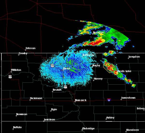 At 403 pm cdt, a severe thunderstorm was located over cando, or 27 miles northwest of devils lake, moving northeast at 30 mph (radar indicated). Hazards include ping pong ball size hail. People and animals outdoors will be injured. expect damage to roofs, siding, windows, and vehicles. This severe thunderstorm will remain over mainly rural areas of west central ramsey, north central benson and southwestern towner counties. At 403 pm cdt, a severe thunderstorm was located over cando, or 27 miles northwest of devils lake, moving northeast at 30 mph (radar indicated). Hazards include ping pong ball size hail. People and animals outdoors will be injured. expect damage to roofs, siding, windows, and vehicles. This severe thunderstorm will remain over mainly rural areas of west central ramsey, north central benson and southwestern towner counties.
|
| 7/9/2016 3:50 PM CDT |
 At 350 pm cdt, a severe thunderstorm was located near leeds, or 32 miles northwest of devils lake, moving northeast at 30 mph (radar indicated). Hazards include ping pong ball size hail. People and animals outdoors will be injured. expect damage to roofs, siding, windows, and vehicles. this severe storm will be near, maza around 405 pm cdt. Cando and considine around 415 pm cdt. At 350 pm cdt, a severe thunderstorm was located near leeds, or 32 miles northwest of devils lake, moving northeast at 30 mph (radar indicated). Hazards include ping pong ball size hail. People and animals outdoors will be injured. expect damage to roofs, siding, windows, and vehicles. this severe storm will be near, maza around 405 pm cdt. Cando and considine around 415 pm cdt.
|
| 7/9/2016 3:32 PM CDT |
 At 331 pm cdt, a severe thunderstorm was located over york, or 34 miles west of devils lake, moving northeast at 30 mph (spotters reported quarter sized hail 10 miles north of esmond at 314 pm). Hazards include quarter size hail. Damage to vehicles is expected. this severe storm will be near, leeds around 340 pm cdt. maza around 355 pm cdt. Cando and considine around 400 pm cdt. At 331 pm cdt, a severe thunderstorm was located over york, or 34 miles west of devils lake, moving northeast at 30 mph (spotters reported quarter sized hail 10 miles north of esmond at 314 pm). Hazards include quarter size hail. Damage to vehicles is expected. this severe storm will be near, leeds around 340 pm cdt. maza around 355 pm cdt. Cando and considine around 400 pm cdt.
|
| 7/9/2016 3:11 PM CDT |
 At 310 pm cdt, a severe thunderstorm was located near baker, or 37 miles west of devils lake, moving northeast at 30 mph (radar indicated). Hazards include quarter size hail. Damage to vehicles is expected. this severe thunderstorm will be near, baker around 320 pm cdt. harlow around 330 pm cdt. york and brinsmade around 340 pm cdt. leeds around 345 pm cdt. Churchs ferry around 400 pm cdt. At 310 pm cdt, a severe thunderstorm was located near baker, or 37 miles west of devils lake, moving northeast at 30 mph (radar indicated). Hazards include quarter size hail. Damage to vehicles is expected. this severe thunderstorm will be near, baker around 320 pm cdt. harlow around 330 pm cdt. york and brinsmade around 340 pm cdt. leeds around 345 pm cdt. Churchs ferry around 400 pm cdt.
|
| 6/19/2016 3:57 AM CDT |
 At 357 am cdt, severe thunderstorms were located along a line extending from near arndt to cando to near brinsmade, moving east at 65 mph (radar indicated). Hazards include 60 mph wind gusts and half dollar size hail. Hail damage to vehicles is expected. expect wind damage to roofs, siding, and trees. these severe storms will be near, cando and arndt around 400 am cdt. egeland and churchs ferry around 405 am cdt. starkweather and penn around 410 am cdt. munich and calio around 415 am cdt. Webster and garske around 420 am cdt. At 357 am cdt, severe thunderstorms were located along a line extending from near arndt to cando to near brinsmade, moving east at 65 mph (radar indicated). Hazards include 60 mph wind gusts and half dollar size hail. Hail damage to vehicles is expected. expect wind damage to roofs, siding, and trees. these severe storms will be near, cando and arndt around 400 am cdt. egeland and churchs ferry around 405 am cdt. starkweather and penn around 410 am cdt. munich and calio around 415 am cdt. Webster and garske around 420 am cdt.
|
| 6/19/2016 3:23 AM CDT |
 At 322 am cdt, severe thunderstorms were located along a line extending from 9 miles northeast of barton to near rugby to near balta, moving east at 55 mph (radar indicated). Hazards include 60 mph wind gusts and half dollar size hail. Hail damage to vehicles is expected. expect wind damage to roofs, siding, and trees. severe thunderstorms will be near, pleasant lake around 330 am cdt. fillmore around 335 am cdt. baker around 345 am cdt. harlow, york and perth around 350 am cdt. Bisbee, leeds and considine around 355 am cdt. At 322 am cdt, severe thunderstorms were located along a line extending from 9 miles northeast of barton to near rugby to near balta, moving east at 55 mph (radar indicated). Hazards include 60 mph wind gusts and half dollar size hail. Hail damage to vehicles is expected. expect wind damage to roofs, siding, and trees. severe thunderstorms will be near, pleasant lake around 330 am cdt. fillmore around 335 am cdt. baker around 345 am cdt. harlow, york and perth around 350 am cdt. Bisbee, leeds and considine around 355 am cdt.
|
| 6/12/2016 1:40 AM CDT |
 At 139 am cdt, severe thunderstorms were located along a line extending from knox to 7 miles west of minnewaukan, moving northeast at 25 mph (radar indicated). Hazards include ping pong ball size hail and 60 mph wind gusts. People and animals outdoors will be injured. expect hail damage to roofs, siding, windows, and vehicles. expect wind damage to roofs, siding, and trees. these severe storms will be near, knox, pleasant lake and york around 145 am cdt. harlow around 150 am cdt. Brinsmade around 200 am cdt. At 139 am cdt, severe thunderstorms were located along a line extending from knox to 7 miles west of minnewaukan, moving northeast at 25 mph (radar indicated). Hazards include ping pong ball size hail and 60 mph wind gusts. People and animals outdoors will be injured. expect hail damage to roofs, siding, windows, and vehicles. expect wind damage to roofs, siding, and trees. these severe storms will be near, knox, pleasant lake and york around 145 am cdt. harlow around 150 am cdt. Brinsmade around 200 am cdt.
|
| 6/12/2016 1:18 AM CDT |
 At 117 am cdt, a severe thunderstorm was located near baker, or 35 miles west of devils lake, moving northeast at 40 mph (radar indicated). Hazards include ping pong ball size hail and 60 mph wind gusts. People and animals outdoors will be injured. expect hail damage to roofs, siding, windows, and vehicles. expect wind damage to roofs, siding, and trees. this severe thunderstorm will be near, baker and harlow around 125 am cdt. leeds and york around 140 am cdt. Cando and considine around 210 am cdt. At 117 am cdt, a severe thunderstorm was located near baker, or 35 miles west of devils lake, moving northeast at 40 mph (radar indicated). Hazards include ping pong ball size hail and 60 mph wind gusts. People and animals outdoors will be injured. expect hail damage to roofs, siding, windows, and vehicles. expect wind damage to roofs, siding, and trees. this severe thunderstorm will be near, baker and harlow around 125 am cdt. leeds and york around 140 am cdt. Cando and considine around 210 am cdt.
|
| 6/10/2016 12:26 AM CDT |
 At 1225 am cdt, a severe thunderstorm was located near harlow, or 31 miles west of devils lake, moving southeast at 40 mph (public). Hazards include 70 mph wind gusts. Expect considerable tree damage. damage is likely to mobile homes, roofs, and outbuildings. This severe storm will be near, brinsmade around 1240 am cdt. At 1225 am cdt, a severe thunderstorm was located near harlow, or 31 miles west of devils lake, moving southeast at 40 mph (public). Hazards include 70 mph wind gusts. Expect considerable tree damage. damage is likely to mobile homes, roofs, and outbuildings. This severe storm will be near, brinsmade around 1240 am cdt.
|
| 6/10/2016 12:04 AM CDT |
 At 1203 am cdt, a severe thunderstorm was located near pleasant lake, or 45 miles southeast of bottineau, moving southeast at 40 mph (public. at rugby a 70 mph wind gust was reported out in front of the thunderstorm). Hazards include 70 mph wind gusts. Expect considerable tree damage. damage is likely to mobile homes, roofs, and outbuildings. this severe thunderstorm will be near, knox and fillmore around 1210 am cdt. york and baker around 1220 am cdt. leeds and harlow around 1230 am cdt. Brinsmade around 1240 am cdt. At 1203 am cdt, a severe thunderstorm was located near pleasant lake, or 45 miles southeast of bottineau, moving southeast at 40 mph (public. at rugby a 70 mph wind gust was reported out in front of the thunderstorm). Hazards include 70 mph wind gusts. Expect considerable tree damage. damage is likely to mobile homes, roofs, and outbuildings. this severe thunderstorm will be near, knox and fillmore around 1210 am cdt. york and baker around 1220 am cdt. leeds and harlow around 1230 am cdt. Brinsmade around 1240 am cdt.
|
| 7/23/2015 9:23 PM CDT |
 At 921 pm cdt, severe thunderstorms were located along a line extending from egeland to near maza to near brinsmade to 7 miles southwest of oberon, moving east at 35 mph (radar indicated). Hazards include 60 mph wind gusts and penny size hail. Expect damage to roofs. siding and trees. severe thunderstorms will be near, oberon and penn around 930 pm cdt. calio around 935 pm cdt. munich and starkweather around 940 pm cdt. lakewood park, garske and webster around 945 pm cdt. Devils lake and camp grafton around 950 pm cdt. At 921 pm cdt, severe thunderstorms were located along a line extending from egeland to near maza to near brinsmade to 7 miles southwest of oberon, moving east at 35 mph (radar indicated). Hazards include 60 mph wind gusts and penny size hail. Expect damage to roofs. siding and trees. severe thunderstorms will be near, oberon and penn around 930 pm cdt. calio around 935 pm cdt. munich and starkweather around 940 pm cdt. lakewood park, garske and webster around 945 pm cdt. Devils lake and camp grafton around 950 pm cdt.
|
| 7/23/2015 8:35 PM CDT | Quarter sized hail reported 0.8 miles NW of Cando, ND, a few hail stones up to an inch in size. |
| 7/23/2015 8:25 PM CDT |
 At 824 pm cdt, severe thunderstorms were located along a line extending from near arndt to near maza, moving east at 15 mph (radar indicated). Hazards include 60 mph wind gusts and quarter size hail. Hail damage to vehicles is expected. expect wind damage to roofs, siding and trees. severe thunderstorms will be near, cando around 830 pm cdt. maza around 835 pm cdt. egeland around 845 pm cdt. calio and clyde around 915 pm cdt. Starkweather around 920 pm cdt. At 824 pm cdt, severe thunderstorms were located along a line extending from near arndt to near maza, moving east at 15 mph (radar indicated). Hazards include 60 mph wind gusts and quarter size hail. Hail damage to vehicles is expected. expect wind damage to roofs, siding and trees. severe thunderstorms will be near, cando around 830 pm cdt. maza around 835 pm cdt. egeland around 845 pm cdt. calio and clyde around 915 pm cdt. Starkweather around 920 pm cdt.
|
| 7/23/2015 8:07 PM CDT |
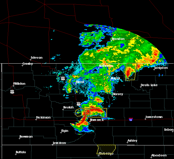 At 806 pm cdt, severe thunderstorms were located along a line extending from near rocklake to 6 miles northwest of maza, moving east at 20 mph (radar indicated). Hazards include ping pong ball size hail and 60 mph wind gusts. People and animals outdoors will be injured. expect hail damage to roofs, siding, windows and vehicles. expect wind damage to roofs, siding and trees. these severe storms will be near, rocklake around 810 pm cdt. maza and considine around 820 pm cdt. Cando around 825 pm cdt. At 806 pm cdt, severe thunderstorms were located along a line extending from near rocklake to 6 miles northwest of maza, moving east at 20 mph (radar indicated). Hazards include ping pong ball size hail and 60 mph wind gusts. People and animals outdoors will be injured. expect hail damage to roofs, siding, windows and vehicles. expect wind damage to roofs, siding and trees. these severe storms will be near, rocklake around 810 pm cdt. maza and considine around 820 pm cdt. Cando around 825 pm cdt.
|
| 7/23/2015 7:57 PM CDT |
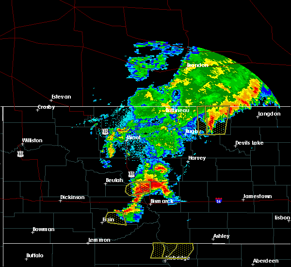 At 755 pm cdt, severe thunderstorms were located along a line extending from near perth to 8 miles north of leeds, moving southeast at 20 mph (radar indicated). Hazards include 60 mph wind gusts and quarter size hail. Hail damage to vehicles is expected. expect wind damage to roofs, siding and trees. these severe storms will be near, rocklake around 805 pm cdt. arndt around 820 pm cdt. maza around 825 pm cdt. Egeland around 830 pm cdt. At 755 pm cdt, severe thunderstorms were located along a line extending from near perth to 8 miles north of leeds, moving southeast at 20 mph (radar indicated). Hazards include 60 mph wind gusts and quarter size hail. Hail damage to vehicles is expected. expect wind damage to roofs, siding and trees. these severe storms will be near, rocklake around 805 pm cdt. arndt around 820 pm cdt. maza around 825 pm cdt. Egeland around 830 pm cdt.
|
| 7/23/2015 7:25 PM CDT |
 At 724 pm cdt, severe thunderstorms were located along a line extending from near hansboro to wolford, moving east at 20 mph (radar indicated). Hazards include 60 mph wind gusts and quarter size hail. Hail damage to vehicles is expected. expect wind damage to roofs, siding and trees. severe thunderstorms will be near, hansboro and amourdale around 735 pm cdt. bisbee around 810 pm cdt. considine around 820 pm cdt. cando around 825 pm cdt. Arndt and egeland around 830 pm cdt. At 724 pm cdt, severe thunderstorms were located along a line extending from near hansboro to wolford, moving east at 20 mph (radar indicated). Hazards include 60 mph wind gusts and quarter size hail. Hail damage to vehicles is expected. expect wind damage to roofs, siding and trees. severe thunderstorms will be near, hansboro and amourdale around 735 pm cdt. bisbee around 810 pm cdt. considine around 820 pm cdt. cando around 825 pm cdt. Arndt and egeland around 830 pm cdt.
|
| 6/23/2013 1:30 AM CDT | Tree branches up to 6 inches in diameter felled...time estimate in towner county ND, 6.8 miles N of Cando, ND |
| 1/1/0001 12:00 AM | Large tree hit house in towner county ND, 0.2 miles SW of Cando, ND |
Hail Maps for Cando, ND


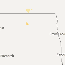


Connect with Interactive Hail Maps