

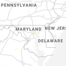
Hail Map for Tuesday, August 31, 2021

Number of Impacted Households on 8/31/2021
0
Impacted by 1" or Larger Hail
0
Impacted by 1.75" or Larger Hail
0
Impacted by 2.5" or Larger Hail
Square Miles of Populated Area Impacted on 8/31/2021
0
Impacted by 1" or Larger Hail
0
Impacted by 1.75" or Larger Hail
0
Impacted by 2.5" or Larger Hail


Cities Most Affected by Hail Storms of 8/31/2021
| Hail Size | Demographics of Zip Codes Affected | ||||||
|---|---|---|---|---|---|---|---|
| City | Count | Average | Largest | Pop Density | House Value | Income | Age |
Hail and Wind Damage Spotted on 8/31/2021
Filter by Report Type:Hail ReportsWind Reports
States Impacted
Florida, Nebraska, Georgia, South Carolina, North Carolina, Tennessee, Virginia, California, Utah, MissouriFlorida
| Local Time | Report Details |
|---|---|
| 7:02 AM CDT | Estimated wind gusts near 60 mp in walton county FL, 21.4 miles ESE of Miramar Beach, FL |
| 9:32 AM CDT | Tree down on sr-20. time estimated by rada in walton county FL, 20.5 miles ENE of Miramar Beach, FL |
| 10:33 AM CDT | Gulf coast state college weatherste in bay county FL, 39.8 miles ESE of Miramar Beach, FL |
| 1:31 PM EDT | Tree down into powerlines. time estimated by rada in wakulla county FL, 18.7 miles SSW of Tallahassee, FL |
Nebraska
| Local Time | Report Details |
|---|---|
| 7:11 AM CDT | Storm damage reported in jefferson county NE, 80.7 miles NNW of Manhattan, KS |
| 7:15 AM CDT | Delayed entr in otoe county NE, 45.1 miles S of Omaha, NE |
| 7:52 AM CDT | Delayed entr in richardson county NE, 81 miles NE of Manhattan, KS |
Georgia
| Local Time | Report Details |
|---|---|
| 12:35 PM EDT | Tree down on powerline just north of valdosta state universit in lowndes county GA, 52.2 miles SSW of Douglas, GA |
| 12:45 PM EDT | Report of a tree down on hwy 76 in berrien county GA, 26 miles SW of Douglas, GA |
| 1:10 PM EDT | Two trees downed along hwy 68 s... one at deep cut rd and one at hurst rd in washington county GA, 65.8 miles SW of Augusta, GA |
| 1:10 PM EDT | Tree downed on the 800 block of dixon grove rd in washington county GA, 66.3 miles SW of Augusta, GA |
| 1:15 PM EDT | Tree downed at hwy 15 s and old savannah rd in washington county GA, 62.3 miles SW of Augusta, GA |
| 1:20 PM EDT | Tree downed at deepstep rd and pleasant grove rd in telfair county GA, 35.6 miles N of Douglas, GA |
| 1:23 PM EDT | Tree downed on the 1400 block of n indian trail rd in washington county GA, 67.3 miles WSW of Augusta, GA |
| 1:27 PM EDT | Tree downed on the 700 block of bussell rd in washington county GA, 57.1 miles WSW of Augusta, GA |
| 1:27 PM EDT | Tree downed at sun hill grange rd and new rd in washington county GA, 53.8 miles SW of Augusta, GA |
| 2:29 PM EDT | Columbia county sheriff office reported trees down at louisville and grant road. time estimated by rada in columbia county GA, 17.6 miles W of Augusta, GA |
| 2:30 PM EDT | Public report... via social media... of a tree down on fermoy lane... along with estimated wind gusts of 60 mph. time estimate in columbia county GA, 15.3 miles W of Augusta, GA |
| 2:35 PM EDT | Trees were reported down at 5500 thomson hwy. time estimate in lincoln county GA, 31.7 miles WNW of Augusta, GA |
| 3:55 PM EDT | Broadcast media relayed a picture showing damage to a metal roof of a commercial building near the intersection of w 37th and montgomery st. time was estimated via rada in chatham county GA, 1.5 miles SSW of Savannah, GA |
South Carolina
| Local Time | Report Details |
|---|---|
| 2:45 PM EDT | Trees down at forrest dr and breckenridge ln. time estimate in mccormick county SC, 21.3 miles NW of Augusta, GA |
| 2:45 PM EDT | Trees down at hwy 28 and hopewell church rd. time estimate in mccormick county SC, 12.7 miles NW of Augusta, GA |
| 2:55 PM EDT | Trees down at 284 old augusta rd near plum branch. time estimate in mccormick county SC, 30.1 miles NNW of Augusta, GA |
| 2:58 PM EDT | Mccormick co dispatch reported 3 trees down at gettys rd and hwy 81... between mccormick and mt carmel. time estimate in mccormick county SC, 41.9 miles NW of Augusta, GA |
| 3:10 PM EDT | Tree down on buncombe st in edgefield. time estimate in edgefield county SC, 22.3 miles N of Augusta, GA |
| 3:20 PM EDT | 911 call center reported sign blown down on deadfall rd w in greenwood county SC, 46.7 miles SSE of Greenville, SC |
| 3:22 PM EDT | 911 call center reported trees down along highway 70 in greenwood county SC, 50.4 miles N of Augusta, GA |
| 3:41 PM EDT | Tree down near spruce street and cedar street in clinton in laurens county SC, 48.4 miles ESE of Greenville, SC |
| 3:41 PM EDT | Roof off home on amber hill circle spur north of lake greenwood in laurens county SC, 53.1 miles SE of Greenville, SC |
| 3:49 PM EDT | Tree down in roadway on jonella street and e farley avenue in laurens county SC, 42.3 miles SE of Greenville, SC |
| 3:49 PM EDT | Tree down in roadway at sunset park ext and anderson drive in laurens county SC, 39.2 miles SE of Greenville, SC |
| 4:00 PM EDT | Tree down in roadway at winding hollow road and greenpond road in laurens county SC, 27 miles ESE of Greenville, SC |
| 4:05 PM EDT | Tree down in roadway at knighton chapel road and old plantation road in laurens county SC, 28.7 miles ESE of Greenville, SC |
| 4:19 PM EDT | A 911 call center reported a tree on a power line near the intersection of sunrise and drain rd. time was estimated via radar dat in colleton county SC, 43.9 miles W of Charleston, SC |
| 4:20 PM EDT | Downed power lines off i-85 near mm 66. causing traffic delay in spartanburg county SC, 31.1 miles ENE of Greenville, SC |
| 4:25 PM EDT | Tree down near intersection of berry farm rd. and williford r in union county SC, 57.7 miles SW of Charlotte, NC |
| 4:28 PM EDT | Tree down at hudson st and georgia st. tree also down on whitney r in spartanburg county SC, 39.2 miles E of Greenville, SC |
| 4:32 PM EDT | Tree down at sc hwy 357 and mountain view circl in spartanburg county SC, 28.2 miles ENE of Greenville, SC |
| 4:43 PM EDT | Tree down on n granard s in cherokee county SC, 47 miles WSW of Charlotte, NC |
| 4:43 PM EDT | Trees down on love springs r in cherokee county SC, 49.1 miles ENE of Greenville, SC |
| 4:48 PM EDT | Trees down along macedonia rd in cherokee county SC, 49.3 miles ENE of Greenville, SC |
| 4:53 PM EDT | Tree down on a house on n mountain s in cherokee county SC, 38.6 miles W of Charlotte, NC |
| 5:10 PM EDT | Emergency manager reported damage to a power pole on the 8000 block of green pond hwy. time was estimated via radar dat in colleton county SC, 45.5 miles SW of Charleston, SC |
North Carolina
| Local Time | Report Details |
|---|---|
| 4:50 PM EDT | Trees down on i-26 at mm 62... lane blocked in polk county NC, 33.8 miles NNE of Greenville, SC |
| 4:58 PM EDT | Trees down on wires on painter r in rutherford county NC, 50.2 miles ENE of Greenville, SC |
| 4:59 PM EDT | Tree down on wires on henry jenkins r in rutherford county NC, 53.1 miles ENE of Greenville, SC |
| 5:05 PM EDT | Trees down in roadway on darlington road south of brooks lak in rutherford county NC, 54 miles NE of Greenville, SC |
| 5:06 PM EDT | Tree down on power lines on textile ave in spindal in rutherford county NC, 52.7 miles NE of Greenville, SC |
| 5:06 PM EDT | Tree down on nebraska st. in spindal in rutherford county NC, 52.2 miles NE of Greenville, SC |
| 5:07 PM EDT | Tree down on rock r in rutherford county NC, 54.2 miles NE of Greenville, SC |
| 5:11 PM EDT | Tree down on power line at bills creek rd and cedar creek r in rutherford county NC, 52.1 miles NNE of Greenville, SC |
| 5:14 PM EDT | Tree down on tightrun loop r in rutherford county NC, 57.1 miles NNE of Greenville, SC |
| 5:15 PM EDT | Tree down at hinton creek rd and john stroud r in rutherford county NC, 51.1 miles WNW of Charlotte, NC |
| 5:16 PM EDT | Tree down on state hwy 226 in rutherford county NC, 60.1 miles WNW of Charlotte, NC |
| 5:26 PM EDT | Trees down on mud cut road in glenwoo in mcdowell county NC, 62.1 miles NNE of Greenville, SC |
| 5:30 PM EDT | Trees down at robinson road and north main street in mario in mcdowell county NC, 63.2 miles S of Bristol, TN |
| 5:35 PM EDT | Trees down near lake james in marion. reported 68mph wind gus in mcdowell county NC, 59.5 miles SSE of Bristol, TN |
| 5:45 PM EDT | 911 call center reported tree down on lytle dr in burke county NC, 63.4 miles WNW of Charlotte, NC |
| 5:50 PM EDT | Multiple trees down near bethel park... on bethel roa in burke county NC, 58.5 miles NW of Charlotte, NC |
| 5:55 PM EDT | Tree down on sierra court in gamewell community of caldwell count in caldwell county NC, 59.8 miles SE of Bristol, TN |
| 6:32 PM EDT | Tree down on bamboo road. time estimated from rada in watauga county NC, 43.9 miles SE of Bristol, TN |
| 6:36 PM EDT | Tree down in the 8700 block of nc highway 321. time estimated from rada in watauga county NC, 29.4 miles SE of Bristol, TN |
| 6:41 PM EDT | Tree down along blue ridge parkway near milepost 281. time estimated from rada in watauga county NC, 44 miles SE of Bristol, TN |
Tennessee
| Local Time | Report Details |
|---|---|
| 4:50 PM EDT | Reports of trees and powerlines down across rhea count in rhea county TN, 42.5 miles NNE of Chattanooga, TN |
Virginia
| Local Time | Report Details |
|---|---|
| 7:05 PM EDT | Tree down onto a car on main street near the cellar restaurant. time estimated from rada in montgomery county VA, 26.6 miles W of Roanoke, VA |
| 7:17 PM EDT | Large tree limb down on happy hollow road. time estimated from rada in montgomery county VA, 24.8 miles W of Roanoke, VA |
| 7:18 PM EDT | Tree down partially blocking catawba road. time estimated from rada in montgomery county VA, 22.6 miles W of Roanoke, VA |
| 8:14 PM EDT | Tree down near intersection of roanoke and jefferson street... partially blocking the roadway. time estimated from rada in montgomery county VA, 26 miles W of Roanoke, VA |
California
| Local Time | Report Details |
|---|---|
| 4:53 PM PDT | Corrects previous tstm wnd dmg report from 1 ssw wiest. power pole down and blocking traffic. time estimated from rada in imperial county CA, 53.9 miles WNW of Yuma, AZ |
| 6:11 PM PDT | Power pole down and blocking traffi in imperial county CA, 53.9 miles WNW of Yuma, AZ |
| 6:30 PM PDT | ***delayed report*** power lines down along with approximately 20 power poles down or leaning over along evan hewes highway near forrester road. time estimated from rad in imperial county CA, 58.5 miles W of Yuma, AZ |
| 6:36 PM PDT | Corrects previous tstm wnd gst report from 1 sse thousand palms. tree fell on vehicle. winds at thousand palms were 26 mph gusting to 43 mph at the tim in riverside county CA, 21.7 miles S of Yucca Valley, CA |
| 7:00 PM PDT | Huge tree blocking the stree in riverside county CA, 43.2 miles SSE of Yucca Valley, CA |
Utah
| Local Time | Report Details |
|---|---|
| 7:20 PM MDT | Utwdl sensor in tooele county UT, 47.9 miles W of Salt Lake City, UT |
Missouri
| Local Time | Report Details |
|---|---|
| 9:05 PM CDT | Tree down at highway 21 and highway 4 in washington county MO, 49.6 miles ENE of Salem, MO |
| 9:05 PM CDT | Power line knocked over along highway 2 in washington county MO, 48.8 miles ENE of Salem, MO |
| 9:07 PM CDT | Also... very heavy rainfal in washington county MO, 49.5 miles ENE of Salem, MO |
| 9:23 PM CDT | Tree down at highway 8 and germani in st. francois county MO, 51.6 miles ENE of Salem, MO |
| 9:26 PM CDT | Emergency manager reported 50-60 estimated winds. some siding from a neighbor was blown into their yar in st. francois county MO, 53.8 miles ENE of Salem, MO |
| 9:28 PM CDT | Tree down along nursing home road and scout camp roa in washington county MO, 49.8 miles ENE of Salem, MO |
| 9:30 PM CDT | Tree down at highway 32 and county road 4 in iron county MO, 39.5 miles E of Salem, MO |
| 9:33 PM CDT | Tree down over highway 32 and old irondale roa in st. francois county MO, 52.6 miles ENE of Salem, MO |
Connect with Interactive Hail Maps