

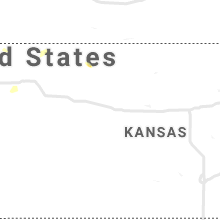
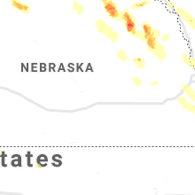
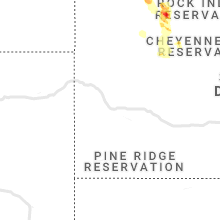
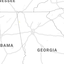
Hail Map for Monday, August 30, 2021

Number of Impacted Households on 8/30/2021
0
Impacted by 1" or Larger Hail
0
Impacted by 1.75" or Larger Hail
0
Impacted by 2.5" or Larger Hail
Square Miles of Populated Area Impacted on 8/30/2021
0
Impacted by 1" or Larger Hail
0
Impacted by 1.75" or Larger Hail
0
Impacted by 2.5" or Larger Hail


Cities Most Affected by Hail Storms of 8/30/2021
| Hail Size | Demographics of Zip Codes Affected | ||||||
|---|---|---|---|---|---|---|---|
| City | Count | Average | Largest | Pop Density | House Value | Income | Age |
| Mott, ND | 2 | 3.00 | 3.00 | 2 | $29k | $28.8k | 51.1 |
| Meadow, SD | 2 | 2.25 | 2.75 | 0 | $31k | $19.7k | 43.8 |
| Flasher, ND | 2 | 1.88 | 2.00 | 2 | $38k | $24.7k | 45.8 |
| Faith, SD | 2 | 1.88 | 2.00 | 0 | $41k | $23.9k | 39.4 |
| Lemmon, SD | 2 | 1.88 | 2.00 | 2 | $85k | $28.6k | 50.7 |
| New Salem, ND | 2 | 1.88 | 2.00 | 3 | $52k | $30.0k | 46.7 |
| Regent, ND | 1 | 2.75 | 2.75 | 1 | $20k | $30.5k | 49.3 |
| Hettinger, ND | 1 | 2.75 | 2.75 | 2 | $42k | $29.8k | 49.3 |
| Hartington, NE | 1 | 1.75 | 1.75 | 11 | $62k | $35.3k | 41.3 |
| Verdigre, NE | 1 | 1.75 | 1.75 | 4 | $40k | $24.6k | 50.7 |
| Hill City, SD | 1 | 1.75 | 1.75 | 3 | $97k | $36.2k | 47.3 |
| Beresford, SD | 1 | 1.75 | 1.75 | 16 | $78k | $34.6k | 41.4 |
| Stanton, NE | 1 | 1.75 | 1.75 | 8 | $64k | $35.0k | 42.1 |
Hail and Wind Damage Spotted on 8/30/2021
Filter by Report Type:Hail ReportsWind Reports
States Impacted
Kentucky, Iowa, North Dakota, Virginia, Mississippi, Maryland, South Dakota, Georgia, Nebraska, Montana, California, KansasKentucky
| Local Time | Report Details |
|---|---|
| 9:50 AM EDT | Tree reported down on sycamore and 7th. time estimated from rada in carroll county KY, 46.8 miles SW of Cincinnati, OH |
| 1:00 PM EDT | Roof damage to a home... including bricks from the chimney and shingles. some of the bricks damaged the roof and created a hole. several trees down in the immediate are in scott county KY, 47.7 miles NNW of Irvine, KY |
Iowa
| Local Time | Report Details |
|---|---|
| 11:58 AM CDT | Storm damage reported in polk county IA, 4.7 miles SSW of Des Moines, IA |
| 7:06 PM CDT | Quarter sized hail reported near Hawarden, IA, 39.6 miles SSE of Sioux Falls, SD, picture via social media. |
| 10:30 PM CDT | Quarter sized hail reported near Vail, IA, 40.6 miles S of Storm Lake, IA, estimated 50 to 60 mph wind also. |
| 11:04 PM CDT | Measured by personal weather statio in audubon county IA, 57.3 miles NE of Omaha, NE |
| 11:22 PM CDT | Measured on personal instrument by trained spotte in dallas county IA, 22.9 miles NW of Des Moines, IA |
| 11:42 PM CDT | Nws employee reports wind gusts near 60 mph in polk city. branches dow in polk county IA, 14.4 miles NNW of Des Moines, IA |
| 11:51 PM CDT | Large tree down across the road. time estimated from koax rada in polk county IA, 2.4 miles WNW of Des Moines, IA |
| 11:53 PM CDT | Estimated 60 to 65 mph win in dallas county IA, 11.1 miles W of Des Moines, IA |
| 11:57 PM CDT | Tree down... wires down. time estimated from koax rada in polk county IA, 2.1 miles S of Des Moines, IA |
| 11:58 PM CDT | Corrects previous tstm wnd gst report from des moines int airport (dsm) for incorrect tim in polk county IA, 4.7 miles SSW of Des Moines, IA |
| 12:02 AM CDT | 12 to 14 inch diameter tree limb down. time estimated from koax rada in adair county IA, 37 miles W of Des Moines, IA |
| 12:17 AM CDT | Wires down near 55th and universit in polk county IA, 3.9 miles W of Des Moines, IA |
North Dakota
| Local Time | Report Details |
|---|---|
| 12:14 PM CDT | Ping Pong Ball sized hail reported near Hazen, ND, 45.8 miles WNW of Bismarck, ND, relayed through social media. time estimated from radar. |
| 12:30 PM MDT | Ping Pong Ball sized hail reported near Hazen, ND, 54.9 miles NW of Bismarck, ND, on highway 200 between beulah and hazen. relayed through broadcast media. |
| 2:11 PM CDT | Golf Ball sized hail reported near New Salem, ND, 27.1 miles W of Bismarck, ND |
| 2:24 PM CDT | Quarter sized hail reported near New Salem, ND, 23.1 miles W of Bismarck, ND, also estimated 50 mph winds. |
| 4:18 PM CDT | Quarter sized hail reported near Glen Ullin, ND, 49.4 miles W of Bismarck, ND, report from mping: quarter (1.00 in.). |
| 3:51 PM MDT | Hen Egg sized hail reported near Flasher, ND, 28.6 miles WSW of Bismarck, ND, report from mping: hen egg (2.00 in.). |
| 4:55 PM CDT | Hen Egg sized hail reported near New Salem, ND, 26.1 miles WSW of Bismarck, ND, photo relayed through social media. |
| 4:11 PM MDT | Baseball sized hail reported near Regent, ND, 85.8 miles WSW of Bismarck, ND, hail ongoing for 15 minutes at the time of the call. no wind. 0.60 inches of rain. |
| 5:34 PM CDT | Golf Ball sized hail reported near Flasher, ND, 30.1 miles SW of Bismarck, ND, photo relayed through broadcast media. time estimated from radar. |
| 4:53 PM MDT | Tea Cup sized hail reported near Mott, ND, 81.4 miles WSW of Bismarck, ND, time estimated from radar. photos relayed through broadcast media. |
| 5:56 PM CDT | Social media report of semi blown over on highway 21 east of flasher at 556 pm cdt. incident verified by dispatch. location estimated based on radar data at time of rep in morton county ND, 29.4 miles SSW of Bismarck, ND |
| 4:59 PM MDT | Tea Cup sized hail reported near Mott, ND, 86.5 miles WSW of Bismarck, ND, photo relayed through social media... including smashed windshield of car. time estimated from radar but report included very large hail along highway 8 between hetting |
| 6:15 PM MDT | Baseball sized hail reported near Hettinger, ND, 99.3 miles SW of Bismarck, ND, hail ranging in size from marble to baseball fell from 600 to 615 pm mdt. report relayed by emergency management. |
Virginia
| Local Time | Report Details |
|---|---|
| 2:33 PM EDT | Tree down on grindstone road at north river roa in augusta county VA, 55.4 miles SE of Elkins, WV |
| 2:41 PM EDT | Tree and wires down on nazarene church road near jason lan in rockingham county VA, 54 miles SE of Elkins, WV |
| 2:56 PM EDT | Multiple reports of trees and wires down in mt. solo in augusta county VA, 57.4 miles SE of Elkins, WV |
| 3:50 PM EDT | Tree down on old bust head road near oliver lan in fauquier county VA, 70.3 miles WSW of Baltimore, MD |
| 3:55 PM EDT | Tree down on riley lane near lake driv in fauquier county VA, 69.5 miles WSW of Baltimore, MD |
| 4:09 PM EDT | Tree down on a house in the 1500 block of bittersweet lan in prince william county VA, 63.7 miles SW of Baltimore, MD |
| 4:59 PM EDT | Tree down onto the shoulder of southbound i-95 at mile marker 148. in prince william county VA, 66.9 miles SW of Baltimore, MD |
| 5:35 PM EDT | 3-inch tree limbs and power poles broken on union mills rd... 1 e of n boston road. time is radar estimate in fluvanna county VA, 47 miles NW of Richmond, VA |
| 5:57 PM EDT | Storm damage reported in anz536 county VA, 65.2 miles NNE of Richmond, VA |
| 6:30 PM EDT | Numerous trees down across central goochland county. lots of power outages across the are in goochland county VA, 17.5 miles NW of Richmond, VA |
| 7:10 PM EDT | Numerous trees down around otterdale and brandermil in chesterfield county VA, 6.3 miles SW of Richmond, VA |
| 7:10 PM EDT | Trees down along wilson r in dinwiddie county VA, 27.8 miles SSW of Richmond, VA |
| 7:11 PM EDT | Numerous trees down around mosele in chesterfield county VA, 7 miles SSW of Richmond, VA |
| 7:15 PM EDT | Trees down in the vicinity of duval r in chesterfield county VA, 7.2 miles SW of Richmond, VA |
| 7:15 PM EDT | Tree downed on old fox trail at millridge pkw in chesterfield county VA, 5.1 miles S of Richmond, VA |
| 7:16 PM EDT | Trees down along heritage woods rd. all lanes close in chesterfield county VA, 5.8 miles S of Richmond, VA |
| 7:23 PM EDT | Several trees down along poplar fork road. time estimated by rada in henry county VA, 45.7 miles SSE of Roanoke, VA |
| 7:24 PM EDT | Trees down along winterfield r in chesterfield county VA, 0.7 miles NW of Richmond, VA |
| 7:30 PM EDT | Trees down along adkins rd in the vicinity n wagstaff circle. lanes close in chesterfield county VA, 4.6 miles ESE of Richmond, VA |
| 7:36 PM EDT | Numerous trees down near hull st and walmsley r in chesterfield county VA, 6.3 miles ESE of Richmond, VA |
| 7:54 PM EDT | Trees down along portions of jefferson davis highwa in chesterfield county VA, 17.4 miles SE of Richmond, VA |
| 7:57 PM EDT | One tree down blocking part of kentuck roa in pittsylvania county VA, 55.6 miles SE of Roanoke, VA |
| 8:18 PM EDT | Trees down along robin rd. south bound lanes close in prince george county VA, 34.7 miles SE of Richmond, VA |
| 8:20 PM EDT | Trees down along loving union rd and surrounding portions of southern prince georg in prince george county VA, 35.7 miles SE of Richmond, VA |
| 8:45 PM EDT | Tree down at claibornetown road at dry bread r in brunswick county VA, 58.3 miles S of Richmond, VA |
| 8:57 PM EDT | Tree down on power line in city of emporia county VA, 55.8 miles S of Richmond, VA |
| 9:06 PM EDT | Mesonet station xtsl tangier sound ligh in accomack county VA, 61.2 miles SW of Ocean City, MD |
| 9:30 PM EDT | Trees down across portions of southampton count in southampton county VA, 56.7 miles W of Virginia Beach, VA |
| 9:35 PM EDT | Via social media. trees downed at buckley road and us-14 clayton hw in mathews county VA, 50.9 miles NNW of Virginia Beach, VA |
Mississippi
| Local Time | Report Details |
|---|---|
| 3:30 PM CDT | Flooding reported on front st and 14th s in lauderdale county MS, 75.9 miles S of Starkville, MS |
Maryland
| Local Time | Report Details |
|---|---|
| 5:08 PM EDT | Some trees down in chestertown. time estimated from rada in kent county MD, 29.5 miles E of Baltimore, MD |
| 5:10 PM EDT | Trees down in the kingstown area. time estimated from rada in queen anne's county MD, 30.5 miles E of Baltimore, MD |
| 6:12 PM EDT | Tree down on budds creek road near davis roa in st. marys county MD, 64.1 miles SSW of Baltimore, MD |
| 7:06 PM EDT | Storm damage reported in anz537 county MD, 75 miles NE of Richmond, VA |
| 7:31 PM EDT | Tree down on elizabeth driv in st. marys county MD, 70.6 miles W of Ocean City, MD |
South Dakota
| Local Time | Report Details |
|---|---|
| 3:10 PM MDT | Quarter sized hail reported near Rapid City, SD, 17.8 miles WNW of Rapid City, SD |
| 3:30 PM MDT | Quarter sized hail reported near Rapid City, SD, 14.4 miles W of Rapid City, SD |
| 4:41 PM CDT | Quarter sized hail reported near Mitchell, SD, 69.4 miles W of Sioux Falls, SD, quarter sized hail and heavy rain. |
| 5:03 PM CDT | Quarter sized hail reported near Ethan, SD, 64.2 miles W of Sioux Falls, SD, lots of variable sized hail and heavy rain... with biggest stones as big as quarters. |
| 4:14 PM MDT | Ping Pong Ball sized hail reported near Hill City, SD, 20.3 miles WSW of Rapid City, SD, lasted 4 minutes |
| 5:18 PM CDT | Half Dollar sized hail reported near Freeman, SD, 45.2 miles WSW of Sioux Falls, SD, picture via social media. time estimated via radar... location estimated via general location on social media. |
| 4:25 PM MDT | Ping Pong Ball sized hail reported near Hill City, SD, 19 miles WSW of Rapid City, SD |
| 4:25 PM MDT | Golf Ball sized hail reported near Hill City, SD, 19 miles WSW of Rapid City, SD |
| 5:38 PM CDT | Half Dollar sized hail reported near Emery, SD, 48.7 miles W of Sioux Falls, SD, hail up to the size of half dollars... and very little rainfall. |
| 4:40 PM MDT | Hen Egg sized hail reported near Lemmon, SD, 105.1 miles SW of Bismarck, ND, lasted about 10 minutes |
| 5:48 PM CDT | Quarter sized hail reported near Emery, SD, 47.2 miles W of Sioux Falls, SD |
| 5:15 PM MDT | Baseball sized hail reported near Meadow, SD, 108.3 miles SW of Bismarck, ND |
| 5:35 PM MDT | Quarter sized hail reported near Fairburn, SD, 32.1 miles S of Rapid City, SD |
| 5:40 PM MDT | Storm damage reported in perkins county SD, 107.4 miles NNE of Rapid City, SD |
| 5:55 PM MDT | Golf Ball sized hail reported near Meadow, SD, 105.1 miles NNE of Rapid City, SD |
| 6:05 PM MDT | Quarter sized hail reported near Fairburn, SD, 34 miles S of Rapid City, SD |
| 7:32 PM CDT | Golf Ball sized hail reported near Beresford, SD, 38.4 miles S of Sioux Falls, SD |
| 6:35 PM MDT | Golf Ball sized hail reported near Lemmon, SD, 102 miles SW of Bismarck, ND |
| 6:35 PM MDT | Quarter sized hail reported near Lemmon, SD, 102 miles SW of Bismarck, ND |
| 6:47 PM MDT | Storm damage reported in meade county SD, 88.7 miles NE of Rapid City, SD |
| 6:55 PM MDT | Hen Egg sized hail reported near Faith, SD, 88.4 miles NE of Rapid City, SD |
| 7:56 PM CDT | Quarter sized hail reported near Bridgewater, SD, 39.6 miles W of Sioux Falls, SD, mostly pea sized hail... but a few quarter sized stones... and heavy rain. |
| 7:58 PM CDT | Quarter sized hail reported near Bridgewater, SD, 39.6 miles W of Sioux Falls, SD, corrects previous hail report from 6 s bridgewater. mostly pea sized hail... but a few quarter sized stones... and heavy rain. |
| 8:00 PM MDT | Golf Ball sized hail reported near Faith, SD, 79.5 miles WNW of Pierre, SD |
| 8:40 PM MDT | Quarter sized hail reported near Howes, SD, 58.6 miles ENE of Rapid City, SD |
| 8:50 PM MDT | Quarter sized hail reported near Dupree, SD, 83 miles NW of Pierre, SD, marble with a few quarter size hail. |
| 11:25 PM MDT | Storm damage reported in haakon county SD, 44 miles WSW of Pierre, SD |
| 11:40 PM MDT | Storm damage reported in jackson county SD, 49.4 miles SW of Pierre, SD |
| 12:35 AM MDT | Storm damage reported in jackson county SD, 49.4 miles SW of Pierre, SD |
| 12:45 AM MDT | Storm damage reported in jackson county SD, 49.4 miles SW of Pierre, SD |
| 1:50 AM CDT | Storm damage reported in todd county SD, 15.8 miles N of Valentine, NE |
Georgia
| Local Time | Report Details |
|---|---|
| 5:48 PM EDT | Tree downed onto power lines at legion rd and newport dr in gilmer county GA, 51.5 miles ESE of Chattanooga, TN |
| 5:51 PM EDT | Tree downed onto power lines on jones rd in gilmer county GA, 61.2 miles ESE of Chattanooga, TN |
| 6:00 PM EDT | Tree downed on cherry log st in gilmer county GA, 55.7 miles ESE of Chattanooga, TN |
Nebraska
| Local Time | Report Details |
|---|---|
| 5:00 PM MDT | Delayed report of several large tree branches down ranging from 2 to 12 inches in diameter. also reported at least 5 windows broke out of vehicles due to blowing gravel in dundy county NE, 51.9 miles NNW of Colby, KS |
| 9:50 PM CDT | Quarter sized hail reported near Crookston, NE, 10.8 miles WNW of Valentine, NE, delayed report. time estimated by radar. |
| 10:37 PM CDT | Quarter sized hail reported near Carroll, NE, 75.7 miles E of Oneill, NE, trained spotter reported 1 inch hail. |
| 10:50 PM CDT | Quarter sized hail reported near Osmond, NE, 54.6 miles E of Oneill, NE, public estimated quarter sized hail falling in osmond. |
| 10:58 PM CDT | Half Dollar sized hail reported near Osmond, NE, 54.6 miles E of Oneill, NE, report from mping: half dollar (1.25 in.). |
| 11:03 PM CDT | Quarter sized hail reported near Winside, NE, 78.1 miles ESE of Oneill, NE, quarter sized hail. |
| 11:15 PM CDT | Golf Ball sized hail reported near Hartington, NE, 62.5 miles SSW of Sioux Falls, SD |
| 11:42 PM CDT | Quarter sized hail reported near Pilger, NE, 79.7 miles NW of Omaha, NE |
| 11:45 PM CDT | Golf Ball sized hail reported near Verdigre, NE, 32.6 miles ENE of Oneill, NE, trained spotter reported golf ball sized hail in verdigre. |
| 11:45 PM CDT | Golf Ball sized hail reported near Stanton, NE, 79.7 miles ESE of Oneill, NE, emergency manager reported golf ball size hail. |
| 12:17 AM CDT | 8 foot diameter tree blown down... which took out a utility pole and power lin in stanton county NE, 76 miles WNW of Omaha, NE |
| 12:30 AM CDT | Power also ou in washington county NE, 21.9 miles NNW of Omaha, NE |
| 12:40 AM CDT | Quarter sized hail reported near Norfolk, NE, 66 miles ESE of Oneill, NE, trained spotter sent in a picture of quarter size hail in hadar. |
| 12:43 AM CDT | Quarter sized hail reported near Snyder, NE, 53.5 miles NW of Omaha, NE, report from mping: quarter (1.00 in.). |
| 1:07 AM CDT | Trained spotter estimated peak wind gust of 70 to 80 mp in dodge county NE, 31.9 miles WNW of Omaha, NE |
| 1:33 AM CDT | Storm damage reported in douglas county NE, 22.7 miles W of Omaha, NE |
| 1:35 AM CDT | Peak wind gust of 58 mph was measured at the offic in douglas county NE, 22.7 miles W of Omaha, NE |
| 1:45 AM CDT | Storm damage reported in douglas county NE, 16.7 miles WSW of Omaha, NE |
| 2:10 AM CDT | Emergency manager relayed report of peak wind gusts near 60 mph in louisvill in cass county NE, 21.3 miles SSW of Omaha, NE |
Montana
| Local Time | Report Details |
|---|---|
| 5:16 PM MDT | Gust came from convective clouds with no lightning observed. ktfx/kblx radars showed only 20 to 25 dbz echoe in gallatin county MT, 9.8 miles NW of Bozeman, MT |
California
| Local Time | Report Details |
|---|---|
| 5:50 PM PDT | Old woman mountain site pg163 in california gusted to 71 mph at 1750 due to nearby thunderstorm in san bernardino county CA, 49.9 miles W of Lake Havasu City, AZ |
Kansas
| Local Time | Report Details |
|---|---|
| 8:54 PM CDT | Wunderground stationkkscolby28 reported a 64 mph wind gus in thomas county KS, 13.2 miles SSW of Colby, KS |
Connect with Interactive Hail Maps