

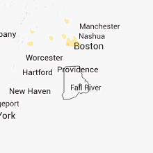
Hail Map for Saturday, August 4, 2012

Number of Impacted Households on 8/4/2012
0
Impacted by 1" or Larger Hail
0
Impacted by 1.75" or Larger Hail
0
Impacted by 2.5" or Larger Hail
Square Miles of Populated Area Impacted on 8/4/2012
0
Impacted by 1" or Larger Hail
0
Impacted by 1.75" or Larger Hail
0
Impacted by 2.5" or Larger Hail


Cities Most Affected by Hail Storms of 8/4/2012
| Hail Size | Demographics of Zip Codes Affected | ||||||
|---|---|---|---|---|---|---|---|
| City | Count | Average | Largest | Pop Density | House Value | Income | Age |
Hail and Wind Damage Spotted on 8/4/2012
Filter by Report Type:Hail ReportsWind Reports
States Impacted
Pennsylvania, Iowa, New Jersey, Delaware, Indiana, Illinois, Vermont, Tennessee, New Hampshire, Massachusetts, Michigan, Oklahoma, Kansas, Ohio, New York, Missouri, Mississippi, ArkansasPennsylvania
| Local Time | Report Details |
|---|---|
| 12:45 PM EDT | Large limbs dow in york county PA, 55.3 miles NNW of Baltimore, MD |
| 1:45 PM EDT | Trees and wires down in abington tw in montgomery county PA, 71.4 miles SW of Brooklyn, NY |
| 2:00 PM EDT | Trees and wires down in horsham tw in montgomery county PA, 70.9 miles WSW of Brooklyn, NY |
| 2:10 PM EDT | Multiple large tree branches down along maple ave in horsham. also... fence blown over along route 61 in montgomery county PA, 69.7 miles WSW of Brooklyn, NY |
| 2:13 PM EDT | Half Dollar sized hail reported near Dillsburg, PA, 60.8 miles NNW of Baltimore, MD, half dollar size hail reported. |
| 2:20 PM EDT | Branches dow in york county PA, 45.6 miles NNW of Baltimore, MD |
| 2:30 PM EDT | Several trees down on utility lines in cumberland county PA, 56.7 miles SE of State College, PA |
| 2:50 PM EDT | Tree down blocking route 304 at zimmerman road in union county PA, 46 miles E of State College, PA |
| 3:08 PM EDT | Numerous reports of trees and wires down in the city of yor in york county PA, 46.6 miles N of Baltimore, MD |
| 3:20 PM EDT | Large tree across railroad tracks in northumberland county PA, 60.9 miles WSW of Scranton, PA |
| 3:20 PM EDT | Large treedown on boyce road in northumberland county PA, 60.9 miles WSW of Scranton, PA |
| 3:25 PM EDT | Tree down on red lane in mahoning township in montour county PA, 58.4 miles WSW of Scranton, PA |
| 3:35 PM EDT | Trees and wires dow in northampton county PA, 54.8 miles SSE of Scranton, PA |
Iowa
| Local Time | Report Details |
|---|---|
| 12:25 PM CDT | Spotter estimated sustained 40 gust 60-70 mp in benton county IA, 14.2 miles WSW of Cedar Rapids, IA |
| 12:25 PM CDT | Trees down and windows blown out of a residence. a grain bin is also reported down. delayed repor in johnson county IA, 28.2 miles S of Cedar Rapids, IA |
| 12:28 PM CDT | Winds estimated at 60 to 65 mph with heavy rain with visibility of a quarter of a mile or les in benton county IA, 14.2 miles WSW of Cedar Rapids, IA |
| 12:35 PM CDT | Storm damage reported in johnson county IA, 18.8 miles SSE of Cedar Rapids, IA |
| 12:35 PM CDT | 3 inch diameter tree branch down on home. numerous smaller branches dow in johnson county IA, 18.8 miles SSE of Cedar Rapids, IA |
| 12:36 PM CDT | A trained spotter reported estimated wind gusts of 50 to 60 mp in johnson county IA, 21 miles SSE of Cedar Rapids, IA |
| 12:38 PM CDT | Storm damage reported in linn county IA, 7.1 miles SSW of Cedar Rapids, IA |
| 12:38 PM CDT | Measured from aso in linn county IA, 7.1 miles SSW of Cedar Rapids, IA |
| 12:40 PM CDT | A trained spotter estimated winds of 50 to 60 mp in linn county IA, 1.9 miles SSE of Cedar Rapids, IA |
| 12:47 PM CDT | Storm damage reported in linn county IA, 1.9 miles SSE of Cedar Rapids, IA |
| 12:47 PM CDT | A trained spotter estimated thunderstorm winds of 06 to 65 mp in linn county IA, 4.6 miles NNE of Cedar Rapids, IA |
| 12:47 PM CDT | Storm damage reported in linn county IA, 7.1 miles SSW of Cedar Rapids, IA |
| 12:47 PM CDT | A trained spotter estimated winds of 70 to 75 mp in linn county IA, 1.9 miles SSE of Cedar Rapids, IA |
| 12:48 PM CDT | Estimated 60 to 65 mp in johnson county IA, 15.2 miles S of Cedar Rapids, IA |
| 12:48 PM CDT | Estimated winds of 60 to 70 mph. heavy rain is reducing visibilit in linn county IA, 7.9 miles SSE of Cedar Rapids, IA |
| 12:48 PM CDT | A trained spotter reported 3 to 4 inch diameter tree limbs down. estimated wind gusts of 70 to 75 mp in linn county IA, 1.4 miles SW of Cedar Rapids, IA |
| 12:48 PM CDT | Aluminum flag pole snapped and several trees damage in johnson county IA, 15.2 miles S of Cedar Rapids, IA |
| 12:55 PM CDT | Spotter report of 12 inch tree town. report was delaye in linn county IA, 0.8 miles ESE of Cedar Rapids, IA |
| 1:12 PM CDT | A 5 inch tree limb down. report was delaye in clinton county IA, 60 miles E of Cedar Rapids, IA |
| 1:14 PM CDT | Storm damage reported in cedar county IA, 41.2 miles ESE of Cedar Rapids, IA |
| 1:14 PM CDT | Report via espotte in cedar county IA, 32.6 miles ESE of Cedar Rapids, IA |
| 1:16 PM CDT | Estimated 60 to 70 mph winds. relayed by delaware county sheriffs offic in delaware county IA, 29.9 miles NNE of Cedar Rapids, IA |
| 1:17 PM CDT | Report via espotter in cedar county IA, 31.5 miles ESE of Cedar Rapids, IA |
| 1:20 PM CDT | Time estimated in clinton county IA, 44.2 miles ESE of Cedar Rapids, IA |
| 1:35 PM CDT | Fruit tree downed in clinton county IA, 69.5 miles E of Cedar Rapids, IA |
| 1:54 PM CDT | Storm damage reported in scott county IA, 62.5 miles ESE of Cedar Rapids, IA |
| 2:01 PM CDT | A trained spotter reported an 18 to 24 inch tree down across north 3rd street in the city of clinto in clinton county IA, 75 miles E of Cedar Rapids, IA |
| 2:06 PM CDT | E50 mph winds producing small tree limbs down in clinton county IA, 76.6 miles E of Cedar Rapids, IA |
| 2:55 PM CDT | Numerous up to 3 inch diameter limbs down in linn county IA, 1.9 miles SSE of Cedar Rapids, IA |
| 3:46 PM CDT | At middle road and in scott county IA, 68 miles ESE of Cedar Rapids, IA |
New Jersey
| Local Time | Report Details |
|---|---|
| 1:30 PM EDT | Trees and wires down in cherry hil in camden county NJ, 76 miles SW of Brooklyn, NY |
| 1:30 PM EDT | Trees and wires down in pennsauke in camden county NJ, 75.8 miles SW of Brooklyn, NY |
| 1:35 PM EDT | Wires down in cinnaminso in burlington county NJ, 71.2 miles SW of Brooklyn, NY |
| 1:41 PM EDT | Wires down in maple shad in burlington county NJ, 73.6 miles SW of Brooklyn, NY |
Delaware
| Local Time | Report Details |
|---|---|
| 2:23 PM EDT | Wires down along deer run road in townsen in new castle county DE, 49.7 miles E of Baltimore, MD |
Indiana
| Local Time | Report Details |
|---|---|
| 2:25 PM EDT | Measured at eagle creek aso in marion county IN, 10.3 miles NW of Indianapolis, IN |
| 3:05 PM EDT | One healty tree down across the road and partially onto a pick -up truck. tree is about 50 feet tall and 16 to 18 inches in diameter. location appro in marion county IN, 12.5 miles NE of Indianapolis, IN |
| 4:23 PM CDT | Storm damage reported in lake county IN, 24.8 miles SE of Chicago, IL |
| 4:38 PM CDT | Quarter sized hail reported near Knox, IN, 69.8 miles SE of Chicago, IL |
| 4:44 PM CDT | Ridge and cline in lake county IN, 27.4 miles SSE of Chicago, IL |
| 4:53 PM CDT | Storm damage reported in porter county IN, 41.1 miles SE of Chicago, IL |
| 4:57 PM CDT | Power lines down along us 421 near wanatah and hail slightly larger than quarters also reporte in la porte county IN, 49.2 miles SE of Chicago, IL |
| 4:57 PM CDT | Half Dollar sized hail reported near Wanatah, IN, 49.2 miles SE of Chicago, IL, power lines down along us 421 near wanatah and hail slightly larger than quarters also reported. |
| 4:58 PM CDT | Quarter sized hail reported near Knox, IN, 71.5 miles SE of Chicago, IL |
| 6:03 PM EDT | Storm damage reported in st. joseph county IN, 69.5 miles E of Chicago, IL |
| 5:10 PM CDT | 2 large trees dow in la porte county IN, 50.8 miles ESE of Chicago, IL |
| 5:20 PM CDT | Trees and power lines dow in la porte county IN, 54.3 miles ESE of Chicago, IL |
| 5:23 PM CDT | Intersection of rt 30 and burr. at 14 inch diameter tree which was 25 feet tall fell on house next to i in lake county IN, 28.8 miles SSE of Chicago, IL |
| 6:35 PM EDT | Trees down throughout the county. tree down across us31 south of 30. lines down in culver which started a fir in marshall county IN, 65.7 miles WNW of Fort Wayne, IN |
| 6:38 PM EDT | Storm damage reported in st. joseph county IN, 68.3 miles NW of Fort Wayne, IN |
| 6:38 PM EDT | Estimated 60 to 70 mph winds. time estimated from rada in st. joseph county IN, 68.2 miles E of Chicago, IL |
| 6:43 PM EDT | Corn flattene in st. joseph county IN, 65.4 miles NW of Fort Wayne, IN |
| 6:48 PM EDT | Large branches down near county road in elkhart county IN, 63.9 miles NW of Fort Wayne, IN |
| 6:50 PM EDT | Storm damage reported in elkhart county IN, 61.2 miles NW of Fort Wayne, IN |
| 5:50 PM CDT | A small tree reported dow in la porte county IN, 49.2 miles ESE of Chicago, IL |
| 7:01 PM EDT | Numerous trees down in warsaw...winona lake....and across northern portions of the county in kosciusko county IN, 40.8 miles WNW of Fort Wayne, IN |
| 7:13 PM EDT | Estimated 65 mph winds at national weather service offic in kosciusko county IN, 37 miles WNW of Fort Wayne, IN |
| 7:20 PM EDT | Tree downed on a home in tipto in tipton county IN, 35.9 miles N of Indianapolis, IN |
| 7:45 PM EDT | Tree down near county road 115n and route 2 in huntington county IN, 32.2 miles WSW of Fort Wayne, IN |
| 7:47 PM EDT | Large tree down on mckeever road. time estimated from rada in huntington county IN, 30.1 miles WSW of Fort Wayne, IN |
| 7:50 PM EDT | 2 outbuildings damaged... one destroyed. moderate damage to a hom in tipton county IN, 35.4 miles N of Indianapolis, IN |
| 7:50 PM EDT | Tree limbs downed and tree downed in roadway at county roads 400 north and 525 eas in hancock county IN, 24.5 miles ENE of Indianapolis, IN |
| 7:52 PM EDT | Trees and power lines down on rangeline road and 500 n in huntington county IN, 25.1 miles WSW of Fort Wayne, IN |
| 7:55 PM EDT | Quarter sized hail reported near Marion, IN, 46.2 miles SW of Fort Wayne, IN, along with winds in excess of 50 mph |
| 7:57 PM EDT | Storm damage reported in grant county IN, 49.6 miles SW of Fort Wayne, IN |
| 8:00 PM EDT | Measured at the intersection of maplecrest and interstate 469 in allen county IN, 6.2 miles NNE of Fort Wayne, IN |
| 8:00 PM EDT | Maple tree snapped off eight feet above ground. nearby trees also sustained tree limb damag in delaware county IN, 53 miles SSW of Fort Wayne, IN |
| 8:00 PM EDT | Quarter sized hail reported near Parker City, IN, 58.3 miles ENE of Indianapolis, IN, estimated size of nickle to quarter |
| 8:02 PM EDT | Storm damage reported in randolph county IN, 58.3 miles ENE of Indianapolis, IN |
| 8:08 PM EDT | Large tree down near wayne street and 2nd. time estimated from radar in huntington county IN, 32.3 miles SSW of Fort Wayne, IN |
| 8:10 PM EDT | Large tree down across road near rockford. large limbs down on 450 e and 100 n in wells county IN, 24.4 miles SSW of Fort Wayne, IN |
| 8:10 PM EDT | Trees downed near kennar in henry county IN, 39.4 miles ENE of Indianapolis, IN |
| 8:29 PM EDT | Tree limbs and power lines down in portland and pennville in jay county IN, 45 miles S of Fort Wayne, IN |
| 8:29 PM EDT | Large tree branches reported dow in adams county IN, 17.4 miles SSE of Fort Wayne, IN |
| 5:05 AM EDT | Large tree down blocking roadway. time estimated from radar. late repor in putnam county IN, 31.4 miles W of Indianapolis, IN |
| 5:15 AM EDT | Outbuilding damage in boone county IN, 25.9 miles NW of Indianapolis, IN |
| 5:42 AM EDT | One tree down and another partially dow in morgan county IN, 12.7 miles SW of Indianapolis, IN |
| 5:45 AM EDT | Numerous trees down between 46th and 49th street and college and keystone. much of the area also without powe in marion county IN, 7.2 miles N of Indianapolis, IN |
| 5:45 AM EDT | Power outages in noblesville are in hamilton county IN, 21.2 miles NNE of Indianapolis, IN |
| 6:35 AM EDT | Trees downed near spiceland rd and cr400 in henry county IN, 41.1 miles E of Indianapolis, IN |
| 6:38 AM EDT | Tree down on plum street. time estimate in wayne county IN, 53.6 miles E of Indianapolis, IN |
| 6:55 AM EDT | Tree down on college corner road near west grove road. time estimate in wayne county IN, 56.8 miles NNW of Cincinnati, OH |
| 7:00 AM EDT | Tree reported down on i-70 east near mm 153. time estimate in wayne county IN, 56 miles NNW of Cincinnati, OH |
Illinois
| Local Time | Report Details |
|---|---|
| 1:57 PM CDT | Tree limbs down approximaely 3 inches in diameter along with very heavy rai in whiteside county IL, 76.1 miles E of Cedar Rapids, IA |
| 2:05 PM CDT | Delayed report via espotter in whiteside county IL, 80.7 miles E of Cedar Rapids, IA |
| 2:09 PM CDT | Estimated 60-70 mph in whiteside county IL, 84.5 miles E of Cedar Rapids, IA |
| 2:10 PM CDT | Several large tree branches also dow in whiteside county IL, 81.6 miles NNW of Peoria, IL |
| 2:14 PM CDT | Three foot tree diamater tree was blown down...power was also out in toulon in stark county IL, 30.9 miles NNW of Peoria, IL |
| 2:15 PM CDT | Huge oak tree went down in front of me. numerous large branches down estimated 4-6 inch diameter. estimated sustained winds 60 with gust over 70 mph. via espotte in whiteside county IL, 80.9 miles NNW of Peoria, IL |
| 2:25 PM CDT | Storm damage reported in stephenson county IL, 55.4 miles SSW of Madison, WI |
| 2:25 PM CDT | E40 to 60 mph winds with a report of two buildings down at the fairgrounds in carroll county IL, 79.4 miles SSW of Madison, WI |
| 2:25 PM CDT | Few large diameter tree branches down. minor street flooding. 1.53 inches of rain so fa in whiteside county IL, 76.6 miles N of Peoria, IL |
| 2:25 PM CDT | Few large diameter tree branches down. minor street flooding. 1.53 inches of rain so far. via espotter in whiteside county IL, 76.6 miles N of Peoria, IL |
| 2:30 PM CDT | Braches 6-8 inches in diameter down. 0.88 inches of rai in ogle county IL, 76.1 miles S of Madison, WI |
| 2:40 PM CDT | Quarter sized hail reported near Dixon, IL, 80.1 miles N of Peoria, IL, 173 il rt 2 |
| 2:45 PM CDT | Report of power lines down across carroll county in carroll county IL, 78 miles SSW of Madison, WI |
| 2:49 PM CDT | Storm damage reported in stephenson county IL, 55.3 miles SSW of Madison, WI |
| 2:50 PM CDT | Numerous trees and powerlines downed. time estimated per rada in ogle county IL, 73.4 miles S of Madison, WI |
| 2:56 PM CDT | Large tree downed. time estimated per rada in la salle county IL, 53.4 miles NE of Peoria, IL |
| 2:57 PM CDT | Chicago ave closed due to an estimated 1 to 1.5 foot diameter size tree down accross roa in stephenson county IL, 55.4 miles SSW of Madison, WI |
| 3:08 PM CDT | Storm damage reported in winnebago county IL, 60.3 miles SSE of Madison, WI |
| 3:11 PM CDT | Large treen downed along il highway 71 near the small town of norway. time estimated per rada in la salle county IL, 60.2 miles WSW of Chicago, IL |
| 3:14 PM CDT | Trees down and trees on houses in grundy county IL, 54.4 miles SW of Chicago, IL |
| 3:15 PM CDT | Relayed via facebook in de kalb county IL, 62.3 miles W of Chicago, IL |
| 3:15 PM CDT | Several large trees downed across the southern part of kendall county. time estimated per rada in kendall county IL, 52 miles WSW of Chicago, IL |
| 3:15 PM CDT | 600 freemont avenue. 26 inch diameter tree fell on house. one other tree split in hal in grundy county IL, 54.4 miles SW of Chicago, IL |
| 3:26 PM CDT | 6-7 inches diameter down in ogle county IL, 76.1 miles S of Madison, WI |
| 3:27 PM CDT | Also heavy rain in grundy county IL, 59.6 miles SW of Chicago, IL |
| 3:30 PM CDT | Several large pine trees snapped. caton farm road between rt 47 and ashley in kane county IL, 34.8 miles WSW of Chicago, IL |
| 3:31 PM CDT | Storm damage reported in kane county IL, 34.8 miles WSW of Chicago, IL |
| 3:35 PM CDT | 14 inch maple tree fell on garage in kane county IL, 34.8 miles WSW of Chicago, IL |
| 3:48 PM CDT | Storm damage reported in will county IL, 30.9 miles SW of Chicago, IL |
| 3:49 PM CDT | Storm damage reported in kane county IL, 35.5 miles WNW of Chicago, IL |
| 3:52 PM CDT | Storm damage reported in dupage county IL, 31.9 miles W of Chicago, IL |
| 3:52 PM CDT | Relayed from k7sc in mchenry county IL, 45.1 miles WNW of Chicago, IL |
| 3:56 PM CDT | Several power poles blown over nearly to ground /not snapped/ harlem rd 1 mi s of manhattan-monee rd. time based on rada in will county IL, 33.1 miles SSW of Chicago, IL |
| 4:00 PM CDT | Quarter sized hail reported near Hoffman Estates, IL, 28.8 miles WNW of Chicago, IL, at algonquin and roselle |
| 4:05 PM CDT | At intersection of algonquin and barrington rd in cook county IL, 30.2 miles WNW of Chicago, IL |
| 4:06 PM CDT | At the amphitheatre in cook county IL, 23.3 miles SSW of Chicago, IL |
| 4:15 PM CDT | At i-57 and in cook county IL, 26.4 miles SSW of Chicago, IL |
| 4:20 PM CDT | Storm damage reported in cook county IL, 12.3 miles SW of Chicago, IL |
| 4:29 PM CDT | Numerous large trees snapped and uprooted. time estimated per rada in cook county IL, 4 miles NNW of Chicago, IL |
| 4:30 PM CDT | Power lines down in will county IL, 36.9 miles S of Chicago, IL |
| 4:40 PM CDT | Storm damage reported in lmz741 county IL, 4.1 miles NE of Chicago, IL |
| 4:40 PM CDT | Minor flooding around cicero ave and 85t in cook county IL, 10.8 miles SSW of Chicago, IL |
| 11:26 PM CDT | Several limbs and power lines blown dow in randolph county IL, 41.9 miles SSE of Saint Louis, MO |
| 11:35 PM CDT | High winds snapped power pole... and blew large limb off an oak tree. delayed report in randolph county IL, 36 miles SSE of Saint Louis, MO |
| 11:55 PM CDT | Tree limbs down in town...some on power lines causing power outages. some limbs on car in jackson county IL, 34.1 miles NNE of Cape Girardeau, MO |
Vermont
| Local Time | Report Details |
|---|---|
| 3:48 PM EDT | Two 8 to 10 diameter trees blown over in rutland county VT, 67 miles NE of Schenectady, NY |
| 3:48 PM EDT | Two 8 to 10 inch diameter trees blown over in rutland county VT, 67 miles NE of Schenectady, NY |
| 4:05 PM EDT | Quarter sized hail reported near North Clarendon, VT, 67.1 miles S of Burlington, VT, sizes varying from dimes to a quarter |
Tennessee
| Local Time | Report Details |
|---|---|
| 2:52 PM CDT | One tree snapped and several tree limbs blown down along maple hill road north of carver lane in wilson county TN, 25.1 miles ENE of Nashville, TN |
New Hampshire
| Local Time | Report Details |
|---|---|
| 4:35 PM EDT | Trees down on patette hill road and tibbets hill road in northern portion of goffstown. time approximat in hillsborough county NH, 80.8 miles WSW of Portland, ME |
Massachusetts
| Local Time | Report Details |
|---|---|
| 5:57 PM EDT | Two trees down on wire in worcester county MA, 55.3 miles NNW of Providence, RI |
Michigan
| Local Time | Report Details |
|---|---|
| 6:33 PM EDT | 6 inch to 1 foot tree limbs and trees down. also hail the size of ping pong ball in berrien county MI, 71.3 miles E of Chicago, IL |
| 6:33 PM EDT | Ping Pong Ball sized hail reported near Niles, MI, 71.3 miles E of Chicago, IL, 6 inch to 1 foot tree limbs and trees down. also hail the size of ping pong balls. |
| 6:38 PM EDT | Large tree branch down. time estimated from rada in berrien county MI, 58.7 miles E of Chicago, IL |
| 6:52 PM EDT | Four trees down. time estimated from rada in cass county MI, 71.4 miles NW of Fort Wayne, IN |
Oklahoma
| Local Time | Report Details |
|---|---|
| 5:38 PM CDT | Fence blown down. round hay bales apparently thrown from one field to anothe in nowata county OK, 53.3 miles NE of Tulsa, OK |
| 5:47 PM CDT | Tree blown down onto a hous in ottawa county OK, 68 miles SE of Chanute, KS |
| 6:04 PM CDT | Roof and barn damage near highway 10. power poles broke in nowata county OK, 57 miles NNE of Tulsa, OK |
| 6:15 PM CDT | Tree damage. large limbs broke in craig county OK, 54.7 miles S of Chanute, KS |
| 7:00 PM CDT | Large branches and power lines dow in delaware county OK, 76.4 miles ENE of Tulsa, OK |
| 8:43 PM CDT | Storm damage reported in tulsa county OK, 4.3 miles ESE of Tulsa, OK |
| 9:00 PM CDT | Large tree limbs blown broken in ottawa county OK, 72.3 miles SSE of Chanute, KS |
Kansas
| Local Time | Report Details |
|---|---|
| 5:50 PM CDT | Emergency management reports power polls down approximately 1 mile west of crestline on us-16 in cherokee county KS, 53.6 miles SE of Chanute, KS |
| 6:01 PM CDT | 15 to 25 power poles were downed from 2 miles west of crestline to crestlin in cherokee county KS, 52.7 miles SE of Chanute, KS |
Ohio
| Local Time | Report Details |
|---|---|
| 7:00 PM EDT | Several trees down. tree down on mulbury stree in allen county OH, 46.6 miles ESE of Fort Wayne, IN |
| 8:06 PM EDT | Downed trees and power poles countywid in wood county OH, 88.4 miles ENE of Fort Wayne, IN |
| 8:24 PM EDT | Storm damage reported in ottawa county OH, 74.7 miles W of Cleveland, OH |
| 8:42 PM EDT | Numerous tree limbs down. report relayed to nws by emergency manage in van wert county OH, 25.3 miles SE of Fort Wayne, IN |
| 8:44 PM EDT | Storm damage reported in van wert county OH, 19.8 miles ESE of Fort Wayne, IN |
| 9:05 PM EDT | Two barns destroyed in mercer county OH, 34.4 miles SSE of Fort Wayne, IN |
| 9:10 PM EDT | Power lines down and numerous tree limbs down across the count in henry county OH, 55 miles ENE of Fort Wayne, IN |
| 9:40 PM EDT | Large tree uprooted and fell on a hous in lucas county OH, 82.7 miles ENE of Fort Wayne, IN |
| 9:42 PM EDT | Large tree down on lakewood in allen county OH, 56.7 miles ESE of Fort Wayne, IN |
| 9:45 PM EDT | Large tree branch dow in lucas county OH, 81.4 miles ENE of Fort Wayne, IN |
| 10:00 PM EDT | Storm damage reported in lucas county OH, 88.7 miles ENE of Fort Wayne, IN |
| 10:00 PM EDT | Telephone poles dow in lucas county OH, 81.4 miles ENE of Fort Wayne, IN |
| 10:05 PM EDT | Telephone poles dow in lucas county OH, 81.4 miles ENE of Fort Wayne, IN |
| 11:00 PM EDT | Trees down in fairpar in marion county OH, 45.2 miles N of Columbus, OH |
| 11:45 PM EDT | Trees down in the city and outskirt in ashland county OH, 54.7 miles SW of Cleveland, OH |
| 6:45 AM EDT | A tree fell and took down a power pole and hit the corner of a house. time estimate in auglaize county OH, 67.4 miles NW of Columbus, OH |
| 6:50 AM EDT | One tree down at indian lake state park. time estimate in logan county OH, 60.7 miles NW of Columbus, OH |
New York
| Local Time | Report Details |
|---|---|
| 7:00 PM EDT | Tree limbs and wires down in newfane in niagara county NY, 26.1 miles NNE of Buffalo, NY |
| 7:40 PM EDT | Trees down on ide road near coomer in newfane in niagara county NY, 26.1 miles NNE of Buffalo, NY |
Missouri
| Local Time | Report Details |
|---|---|
| 6:02 PM CDT | Nickel size hail and estimated wind gust of 58 mph was reported with this stor in douglas county MO, 28 miles ESE of Springfield, MO |
| 6:12 PM CDT | Law enforcement reports numerous power lines down and power outages around the cit in jasper county MO, 66.4 miles SE of Chanute, KS |
| 6:12 PM CDT | Law enforcement reports several power lines and trees down around the city with power outage in newton county MO, 67.2 miles W of Springfield, MO |
| 6:30 PM CDT | Tree down over power line in douglas county MO, 39.2 miles ESE of Springfield, MO |
| 6:35 PM CDT | Power poles down in the city of jasper. poles across highway 71 causing traffic to back u in jasper county MO, 56.3 miles W of Springfield, MO |
| 6:35 PM CDT | Roof off bank. fire dept. had doors blown in. trees on house in jasper county MO, 56.3 miles W of Springfield, MO |
| 6:55 PM CDT | Storm damage reported in greene county MO, 11.6 miles NNW of Springfield, MO |
| 7:05 PM CDT | Quarter sized hail reported near Miller, MO, 30.2 miles W of Springfield, MO |
| 7:15 PM CDT | Several trees and power lines dow in dade county MO, 31.1 miles WNW of Springfield, MO |
| 7:25 PM CDT | Storm damage reported in greene county MO, 18 miles WNW of Springfield, MO |
| 7:25 PM CDT | Tree blown down across highway 16 in greene county MO, 17.6 miles WNW of Springfield, MO |
| 7:25 PM CDT | Trees down up to 14 inches in diamete in lawrence county MO, 20.5 miles W of Springfield, MO |
| 7:28 PM CDT | Storm damage reported in greene county MO, 17.6 miles WNW of Springfield, MO |
| 7:32 PM CDT | Storm damage reported in phelps county MO, 23.6 miles NNW of Salem, MO |
| 7:34 PM CDT | Large tree down blocking hwy 125. report via espotte in taney county MO, 39 miles SE of Springfield, MO |
| 7:45 PM CDT | Large tree branches blown dow in dade county MO, 24.3 miles WNW of Springfield, MO |
| 7:50 PM CDT | Flatbed trailer blown 20 yds at the ozark empire fair ground in greene county MO, 1.5 miles N of Springfield, MO |
| 7:51 PM CDT | Tree limbs dow in texas county MO, 31.5 miles SW of Salem, MO |
| 7:55 PM CDT | *** 1 inj *** numerous trees down with one home damaged near goodnight hollow and round mountain road in taney county MO, 30.4 miles S of Springfield, MO |
| 7:58 PM CDT | Storm damage reported in polk county MO, 22.9 miles N of Springfield, MO |
| 7:58 PM CDT | Signal light down on the north side of the cit in greene county MO, 0.6 miles S of Springfield, MO |
| 8:01 PM CDT | Public reports 60 mph wind gusts and trees down in polk county MO, 22.9 miles N of Springfield, MO |
| 8:05 PM CDT | Large tree blown down on golf course off chestnut expresswa in greene county MO, 4.9 miles W of Springfield, MO |
| 8:08 PM CDT | Storm damage reported in dallas county MO, 19 miles NNE of Springfield, MO |
| 8:12 PM CDT | Storm spotter estimated wind gust up to 70 mph on the northwest side of town near i-44 and kearney in greene county MO, 3.3 miles WNW of Springfield, MO |
| 8:30 PM CDT | Few trees down along highway in polk county MO, 17.4 miles N of Springfield, MO |
| 8:40 PM CDT | Two large trees dow in lawrence county MO, 30.1 miles WSW of Springfield, MO |
| 8:40 PM CDT | Tree down in greene county MO, 10.4 miles ENE of Springfield, MO |
| 8:40 PM CDT | Several large tree branches and power lines blown dow in ozark county MO, 66.9 miles ESE of Springfield, MO |
| 8:40 PM CDT | Several large trees dow in lawrence county MO, 28.9 miles WSW of Springfield, MO |
| 8:45 PM CDT | Large tree blown dow in christian county MO, 14.3 miles SSE of Springfield, MO |
| 8:52 PM CDT | Power line down across road on cope dr. near state highway in wright county MO, 46.5 miles ENE of Springfield, MO |
| 8:55 PM CDT | Nickel hail als in maries county MO, 44.4 miles NNW of Salem, MO |
| 8:56 PM CDT | 60 mph wind gusts and penny size hail in christian county MO, 19.3 miles S of Springfield, MO |
| 9:04 PM CDT | A large tree was blown down. this tree fell on a house...causing significant damage to the hous in christian county MO, 19.3 miles S of Springfield, MO |
| 9:05 PM CDT | Large branches blown down at city par in phelps county MO, 25.1 miles NNW of Salem, MO |
| 9:06 PM CDT | Storm damage reported in greene county MO, 12.1 miles WSW of Springfield, MO |
| 9:21 PM CDT | Severe thunderstorm wind gusts downed several tree in christian county MO, 27.6 miles SE of Springfield, MO |
| 9:38 PM CDT | 60 to 70 mph wind gust about 4 miles south of new have in franklin county MO, 56.7 miles W of Saint Louis, MO |
| 9:47 PM CDT | *** 2 inj *** trees and power lines blown down around town. two people sustained minor injuries from flying debris in the parking lot at the washington town and country in franklin county MO, 44.2 miles W of Saint Louis, MO |
| 9:47 PM CDT | Top of large maple tree snapped off by high wind in franklin county MO, 44.2 miles W of Saint Louis, MO |
| 9:50 PM CDT | One and one half foot diameter tree uprooted in warren county MO, 42.6 miles W of Saint Louis, MO |
| 10:00 PM CDT | Heavy rain fell over the past hou in franklin county MO, 38.4 miles WSW of Saint Louis, MO |
| 10:10 PM CDT | Trees down in franklin county MO, 38.4 miles WSW of Saint Louis, MO |
| 10:12 PM CDT | Several trees blown dow in franklin county MO, 31.5 miles WSW of Saint Louis, MO |
| 10:25 PM CDT | Storm damage reported in st. louis county MO, 16.4 miles WNW of Saint Louis, MO |
| 10:25 PM CDT | 3-6 inch diameter tree limbs blown down in st. louis county MO, 20.6 miles W of Saint Louis, MO |
| 10:33 PM CDT | Sheriff deputy reported 60 to 70 mph wind gusts south of lanagan. said that the wind gusts nearly blew him off the roadwa in mcdonald county MO, 77.4 miles SW of Springfield, MO |
| 10:35 PM CDT | Sheriff deputy estimated 60 mph wind gusts north of pinevill in mcdonald county MO, 73.9 miles SW of Springfield, MO |
| 10:35 PM CDT | Severe thundertorm wind gusts downed large tree limb in mcdonald county MO, 73.9 miles SW of Springfield, MO |
| 10:39 PM CDT | Several trees blown dow in jefferson county MO, 22.8 miles WSW of Saint Louis, MO |
| 12:24 AM CDT | Storm damage reported in greene county MO, 12.1 miles WSW of Springfield, MO |
Mississippi
| Local Time | Report Details |
|---|---|
| 6:51 PM CDT | Reports of tree down on liberty church road and power outages on wickware roa in newton county MS, 62.7 miles E of Jackson, MS |
| 7:00 PM CDT | Reports of a powerline down due to fallen tree in newto in newton county MS, 59.7 miles E of Jackson, MS |
Arkansas
| Local Time | Report Details |
|---|---|
| 9:00 PM CDT | Trees down in the are in benton county AR, 75.6 miles N of Fort Smith, AR |
| 9:10 PM CDT | Tree blown into house. power lines downed. many trees damaged by win in benton county AR, 72.9 miles N of Fort Smith, AR |
| 9:15 PM CDT | Relayed measurement from a wind instrument on cooper elementary school on highway 71 in bella vist in benton county AR, 72.9 miles N of Fort Smith, AR |
| 9:28 PM CDT | Many trees damaged by wind. power lines downed. roof damage to some home in benton county AR, 69.3 miles SW of Springfield, MO |
| 9:30 PM CDT | Storm damage reported in benton county AR, 69.8 miles N of Fort Smith, AR |
| 9:32 PM CDT | Shingle damage to a hom in benton county AR, 70.5 miles SW of Springfield, MO |
| 9:32 PM CDT | Trees and power lines downed at bella vista and sulphur springs. hwy 59 closed due to fallen tree in benton county AR, 75.6 miles N of Fort Smith, AR |
| 9:32 PM CDT | Trees downed on hwy 59 closed at sulphure springs...several power lines down in bella vist in benton county AR, 75.6 miles N of Fort Smith, AR |
| 9:35 PM CDT | Multiple tree limbs down in and around pea ridg in benton county AR, 69.3 miles SW of Springfield, MO |
Connect with Interactive Hail Maps