

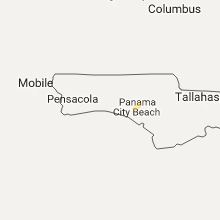
Hail Map for Monday, December 5, 2016

Number of Impacted Households on 12/5/2016
0
Impacted by 1" or Larger Hail
0
Impacted by 1.75" or Larger Hail
0
Impacted by 2.5" or Larger Hail
Square Miles of Populated Area Impacted on 12/5/2016
0
Impacted by 1" or Larger Hail
0
Impacted by 1.75" or Larger Hail
0
Impacted by 2.5" or Larger Hail
Cities Most Affected by Hail Storms of 12/5/2016
| Hail Size | Demographics of Zip Codes Affected | ||||||
|---|---|---|---|---|---|---|---|
| City | Count | Average | Largest | Pop Density | House Value | Income | Age |
Hail and Wind Damage Spotted on 12/5/2016
Filter by Report Type:Hail ReportsWind Reports
Louisiana
| Local Time | Report Details |
|---|---|
| 11:45 AM CST | Multiple trees and downed power lines. relayed from ascension parish sheriffs offic in ascension county LA, 51.1 miles WNW of New Orleans, LA |
| 12:00 PM CST | Report of trees down in port vincen in livingston county LA, 48.7 miles WNW of New Orleans, LA |
| 12:23 PM CST | Report of trees and power lines down on wadesboro road near pontchatula. time estimated from rada in tangipahoa county LA, 40.5 miles NW of New Orleans, LA |
| 12:30 PM CST | Small trees down with some branches greater than 6 inches in diameter down. a few shingles ripped off homes. wind gust measured with handheld anemometer of 52mp in tangipahoa county LA, 41.4 miles NNW of New Orleans, LA |
Florida
| Local Time | Report Details |
|---|---|
| 1:00 AM CST | Fence around residence damaged and childrens playhouse tossed in strong winds. time estimated from rada in santa rosa county FL, 38.8 miles W of Miramar Beach, FL |
Connect with Interactive Hail Maps