

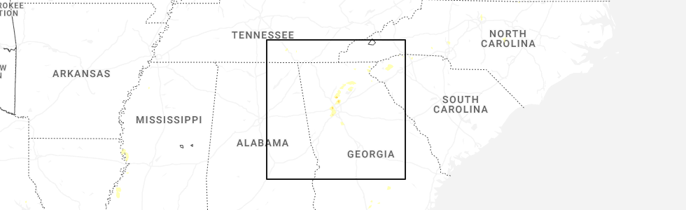
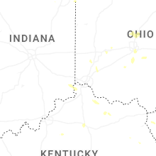
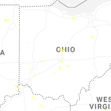
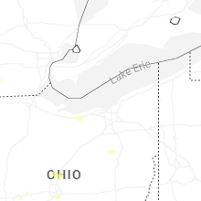
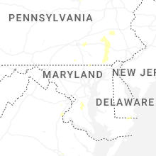
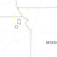
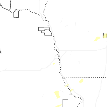
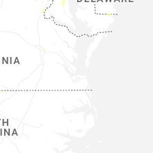
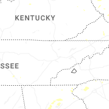
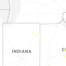
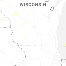
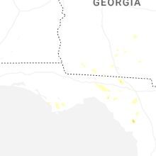
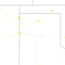
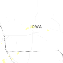
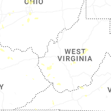
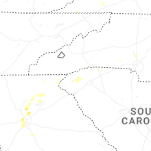
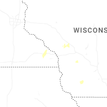
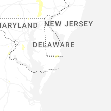
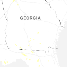
Hail Map for Thursday, June 26, 2025
Number of Impacted Households on 6/26/2025
0
Impacted by 1" or Larger Hail
0
Impacted by 1.75" or Larger Hail
0
Impacted by 2.5" or Larger Hail
Square Miles of Populated Area Impacted on 6/26/2025
0
Impacted by 1" or Larger Hail
0
Impacted by 1.75" or Larger Hail
0
Impacted by 2.5" or Larger Hail

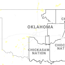


Cities Most Affected by Hail Storms of 6/26/2025
| Hail Size | Demographics of Zip Codes Affected | ||||||
|---|---|---|---|---|---|---|---|
| City | Count | Average | Largest | Pop Density | House Value | Income | Age |
Hail and Wind Damage Spotted on 6/26/2025
Filter by Report Type:Hail ReportsWind Reports
States Impacted
Virginia, Kentucky, Michigan, Indiana, Minnesota, North Carolina, Ohio, Georgia, West Virginia, Pennsylvania, Iowa, Maryland, South Carolina, Florida, Kansas, Montana, MissouriVirginia
| Local Time | Report Details |
|---|---|
| 12:31 PM EDT | Several trees dow in scott county VA, 25.2 miles W of Bristol, TN |
| 12:57 PM EDT | Two trees dow in lee county VA, 50.9 miles W of Bristol, TN |
| 2:20 PM EDT | Multiple trees dow in washington county VA, 23.8 miles NE of Bristol, TN |
| 3:32 PM EDT | Tree down blocking both lanes of mary hunter driv in henry county VA, 36.1 miles S of Roanoke, VA |
| 3:59 PM EDT | Tree down blocking odell roa in henry county VA, 47.6 miles S of Roanoke, VA |
| 4:35 PM EDT | Multiple trees and power lines down in the vicinity of dill rd and us36 in henrico county VA, 14.5 miles ENE of Richmond, VA |
| 4:35 PM EDT | Tree downed onto a line at cold harbor rd at i-29 in hanover county VA, 17.3 miles ENE of Richmond, VA |
| 4:39 PM EDT | Tree down near intersection of old liberty drive and mount olivet roa in henry county VA, 42.8 miles S of Roanoke, VA |
| 4:57 PM EDT | Tree down blocking intersection of meadwood trail and tanyard roa in henry county VA, 42.9 miles S of Roanoke, VA |
| 4:59 PM EDT | Huge tree down along reserve blv in city of galax county VA, 69.5 miles SW of Roanoke, VA |
| 5:09 PM EDT | Tree blown down across anderson mill roa in pittsylvania county VA, 33.9 miles SE of Roanoke, VA |
| 6:35 PM EDT | Trees down in shenandoah national park north of big meadow in madison county VA, 81.7 miles ESE of Elkins, WV |
Kentucky
| Local Time | Report Details |
|---|---|
| 1:25 PM EDT | Downed tree on a home along radio hill road in manchester. time estimated via radar. report came from social media and was relayed to us via slac in clay county KY, 39.6 miles SSE of Irvine, KY |
| 3:00 PM EDT | Report of multiple trees... powerlines... and a utility pole down around goshen lane. time estimated from rada in oldham county KY, 30.6 miles NNE of Louisville, KY |
| 4:29 PM EDT | Downed trees in the 1100 block of left fork little paint road. time estimated via rada in floyd county KY, 63.3 miles E of Irvine, KY |
| 4:44 PM EDT | Trees reported down along north central avenue behind the wendys in prestonsburg. time estimated via rada in floyd county KY, 65.5 miles E of Irvine, KY |
| 4:49 PM EDT | Trees reported down in the 500 block of ky-1428 east of prestonsburg. time estimated via rada in floyd county KY, 68.8 miles E of Irvine, KY |
| 5:19 PM EDT | Tree on car in fairdale - report through medi in jefferson county KY, 8.8 miles NNW of Louisville, KY |
| 5:24 PM EDT | Ksdf asos measured 58 mph at 524 pm ed in jefferson county KY, 13.3 miles N of Louisville, KY |
| 5:25 PM EDT | Power lines down near palatka rd and southdale r in jefferson county KY, 11.7 miles NNW of Louisville, KY |
| 5:26 PM EDT | Power lines down - report from medi in jefferson county KY, 16.2 miles N of Louisville, KY |
| 5:26 PM EDT | Power out near intersection of southside drive and strawberry lane - media reporte in jefferson county KY, 12.1 miles N of Louisville, KY |
| 5:26 PM EDT | Tree in roadway near baker lan in jefferson county KY, 10.9 miles NNW of Louisville, KY |
| 5:31 PM EDT | Corrects previous tstm wnd gst report from 1 n louisville int'l airport. wind gusts of 50 kts reported at sdf international airpor in jefferson county KY, 13.3 miles N of Louisville, KY |
| 5:44 PM EDT | Wind gusts of 50 kts reported at sdf international airpor in jefferson county KY, 13.3 miles N of Louisville, KY |
| 10:06 PM UTC | Tree down on roadway near intersection of mason headley rd and versailles r in fayette county KY, 39.2 miles NW of Irvine, KY |
| 10:29 PM UTC | Trees down on newcut r in jefferson county KY, 13 miles NNW of Louisville, KY |
Michigan
| Local Time | Report Details |
|---|---|
| 1:36 PM EDT | Report of a downed powerline in monroe county MI, 78.1 miles S of Flint, MI |
| 1:36 PM EDT | Emergency manager reported trees/limbs downed near the town of moscow on milnes road in hillsdale county in michigan due to thunderstorm winds. time is radar estimate in hillsdale county MI, 71 miles NNE of Fort Wayne, IN |
Indiana
| Local Time | Report Details |
|---|---|
| 1:47 PM EDT | Pictures showing barn destroyed on county road 800 north. time estimated from rada in ripley county IN, 45.8 miles W of Cincinnati, OH |
| 3:53 PM EDT | Asos station kgsh goshe in elkhart county IN, 47.3 miles NW of Fort Wayne, IN |
| 4:50 PM EDT | Reports of trees and large branches down in churubusc in whitley county IN, 15.7 miles NW of Fort Wayne, IN |
Minnesota
| Local Time | Report Details |
|---|---|
| 1:20 PM CDT | Downed trees and powerlines... possible tornado damage. time estimated from rada in freeborn county MN, 33.6 miles NNW of Mason City, IA |
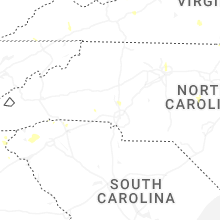
North Carolina
| Local Time | Report Details |
|---|---|
| 2:25 PM EDT | Tree down and blocking zion hill r in mcdowell county NC, 63.9 miles NNE of Greenville, SC |
| 3:09 PM EDT | Corrects previous tstm wnd dmg report from 2 se benham. large tree blown down on home damaging part of it. 6 to 8 trees dow in wilkes county NC, 73 miles N of Charlotte, NC |
| 3:09 PM EDT | Photos from emergency manager showed crops flattened and trees snapped in one direction along and near the intersection of cool springs church rd and preacher field r in wilkes county NC, 73.7 miles N of Charlotte, NC |
| 3:18 PM EDT | Trees down along taylor stree in yadkin county NC, 63.4 miles N of Charlotte, NC |
| 9:45 PM UTC | Tree down on air harbor rd.... between quail ridge dr. and bass chapel r in guilford county NC, 70.9 miles WNW of Raleigh, NC |
| 9:45 PM UTC | Tree down at 4200 bell orchard d in guilford county NC, 69.1 miles WNW of Raleigh, NC |
| 9:45 PM UTC | Tree down at 4490 baylor s in guilford county NC, 69.6 miles WNW of Raleigh, NC |
Ohio
| Local Time | Report Details |
|---|---|
| 2:32 PM EDT | Broadcast media relayed reports of thunderstorm wind damage of a barn with the doors blown off and a silo now leaning off of the concrete pad near the town of delta in in fulton county OH, 68 miles NE of Fort Wayne, IN |
| 2:32 PM EDT | Trained spotter reports thunderstorm wind damage in the form of 3 semi trucks blown over on the ohio turnpike near county road 5-2 near the town of delta in fulton coun in fulton county OH, 69 miles ENE of Fort Wayne, IN |
| 2:33 PM EDT | South bound lanes of us-23 blocked by large tree and other downed branches. time estimated from rada in pickaway county OH, 14 miles S of Columbus, OH |
| 2:54 PM EDT | 10 inch tree branch down near east main st. and eastmoor blvd in bexley. time estimated from radar dat in franklin county OH, 4.4 miles E of Columbus, OH |
Georgia
| Local Time | Report Details |
|---|---|
| 2:50 PM EDT | County communications reported trees and powerlines downed. time estimated from rada in stephens county GA, 44.1 miles WSW of Greenville, SC |
| 3:20 PM EDT | Lowndes county dispatch reported trees down onto powerlines along gornto road. timing estimated by rada in lowndes county GA, 52.2 miles SSW of Douglas, GA |
| 3:33 PM EDT | Tree down at east lake dr and antioch campground r in hall county GA, 50.8 miles NE of Atlanta, GA |
| 4:08 PM EDT | Tree down on gaines mill rd near shady lane driv in hall county GA, 51.1 miles NE of Atlanta, GA |
| 5:05 PM EDT | Quarter sized hail reported near Atlanta, GA, 16.1 miles N of Atlanta, GA, report from mping: quarter (1.00 in.). |
| 5:18 PM EDT | Measured 60.2 mph wind gust with rooftop anemomete in cook county GA, 39.9 miles WSW of Douglas, GA |
West Virginia
| Local Time | Report Details |
|---|---|
| 3:04 PM EDT | Tree reported down into powerlines on n washington stree in morgan county WV, 82.5 miles SSW of State College, PA |
| 3:04 PM EDT | Multiple trees reported down along cold run valley road near cacapon roa in morgan county WV, 83.4 miles SSW of State College, PA |
| 10:43 PM UTC | Three trees down in the davy are in mcdowell county WV, 60 miles S of Charleston, WV |
Pennsylvania
| Local Time | Report Details |
|---|---|
| 3:09 PM EDT | Corrects previous tstm wnd dmg report from 1 se new castle. tree down on wires at east lutton street and cunningham avenu in lawrence county PA, 42.1 miles NNW of Pittsburgh, PA |
| 3:09 PM EDT | Wires reported down along centertown roa in mercer county PA, 51.9 miles N of Pittsburgh, PA |
| 3:38 PM EDT | Tree down near squaw run road and ellwood roa in lawrence county PA, 34.7 miles NNW of Pittsburgh, PA |
| 3:38 PM EDT | Tree down on wires at east lutton street and cunningham avenu in lawrence county PA, 42.1 miles NNW of Pittsburgh, PA |
| 3:43 PM EDT | Wires down along bridge stree in lawrence county PA, 33.5 miles NNW of Pittsburgh, PA |
| 3:50 PM EDT | Tree down blocking lane on 6500 block of pa 14 in northumberland county PA, 53.7 miles E of State College, PA |
| 4:40 PM EDT | Wires down. time estimated from rada in berks county PA, 64.2 miles S of Scranton, PA |
| 4:50 PM EDT | Multiple trees uprooted. time estimated from rada in berks county PA, 66 miles S of Scranton, PA |
| 5:00 PM EDT | Roofing material removed from a barn. time estimated from rada in berks county PA, 64.3 miles S of Scranton, PA |
| 5:00 PM EDT | Power poles blown down. time estimated from rada in berks county PA, 64.3 miles S of Scranton, PA |
| 9:00 PM UTC | Multiple trees snapped and uprooted. time estimated from rada in berks county PA, 66.8 miles S of Scranton, PA |
| 5:15 PM EDT | Tree and wires down on packing house rd near pigeon hill r in york county PA, 43.3 miles NNW of Baltimore, MD |
| 5:30 PM EDT | Tree limbs down along 40th st in lawrencevill in allegheny county PA, 2.5 miles NE of Pittsburgh, PA |
| 9:55 PM UTC | Trees down on zion road. time estimated from rada in berks county PA, 75.8 miles NNE of Baltimore, MD |
Iowa
| Local Time | Report Details |
|---|---|
| 2:15 PM CDT | Branches... trees... and powerlines down. according to alden fire departmen in hardin county IA, 44.9 miles SSW of Mason City, IA |
| 4:20 PM CDT | From personal weather statio in madison county IA, 13.1 miles SW of Des Moines, IA |
Maryland
| Local Time | Report Details |
|---|---|
| 3:30 PM EDT | Tree downed at intersection of campbelltown road and pitts rd. time is radar-estimate in worcester county MD, 9.5 miles WNW of Ocean City, MD |
South Carolina
| Local Time | Report Details |
|---|---|
| 4:19 PM EDT | Powerlines down on roadwa in greenville county SC, 18.1 miles ENE of Greenville, SC |
| 4:45 PM EDT | At least 15 trees down along and south of hwy 183 east of six mil in pickens county SC, 11.4 miles W of Greenville, SC |
| 4:49 PM EDT | Powerlines down on roadway and power pole on fir in pickens county SC, 13.1 miles W of Greenville, SC |
| 4:54 PM EDT | Powerlines down on roadwa in pickens county SC, 11.5 miles W of Greenville, SC |
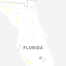
Florida
| Local Time | Report Details |
|---|---|
| 3:25 PM CDT | Utility company reported downed trees and power poles and lines in gulf county. timing approximated by radar and location by the utility company outage ma in gulf county FL, 61.2 miles WSW of Tallahassee, FL |
| 9:52 PM UTC | Small tree down with two reports of wires down nearby as wel in taylor county FL, 48.7 miles ESE of Tallahassee, FL |
Kansas
| Local Time | Report Details |
|---|---|
| 4:18 PM CDT | Storm damage reported in leavenworth county KS, 31.6 miles NW of Kansas City, MO |
| 4:41 PM CDT | Large tree broke in half at k92 and lecompto in leavenworth county KS, 33.4 miles WNW of Kansas City, MO |
| 4:41 PM CDT | Tree down with 3 branches approximately 24 tall and approximately 1 wid in leavenworth county KS, 24.7 miles NW of Kansas City, MO |
Montana
| Local Time | Report Details |
|---|---|
| 3:45 PM MDT | Quarter sized hail reported near Larslan, MT, 31.6 miles NNE of Glasgow, MT, hail up to the size of quarters in addition to heavy rain. |
| 3:57 PM MDT | Ping Pong Ball sized hail reported near Scobey, MT, 70.1 miles NE of Glasgow, MT, public report with photo via facebook. |
Missouri
| Local Time | Report Details |
|---|---|
| 5:05 PM CDT | Mci aso in platte county MO, 15.7 miles NNW of Kansas City, MO |
Connect with Interactive Hail Maps