

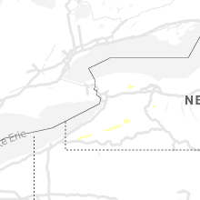
Hail Map for Wednesday, July 29, 2020

Number of Impacted Households on 7/29/2020
0
Impacted by 1" or Larger Hail
0
Impacted by 1.75" or Larger Hail
0
Impacted by 2.5" or Larger Hail
Square Miles of Populated Area Impacted on 7/29/2020
0
Impacted by 1" or Larger Hail
0
Impacted by 1.75" or Larger Hail
0
Impacted by 2.5" or Larger Hail


Cities Most Affected by Hail Storms of 7/29/2020
| Hail Size | Demographics of Zip Codes Affected | ||||||
|---|---|---|---|---|---|---|---|
| City | Count | Average | Largest | Pop Density | House Value | Income | Age |
Hail and Wind Damage Spotted on 7/29/2020
Filter by Report Type:Hail ReportsWind Reports
New York
| Local Time | Report Details |
|---|---|
| 1:03 PM EDT | Trees and wires dow in yates county NY, 51.8 miles WSW of Syracuse, NY |
| 1:14 PM EDT | Wires down near brown street and south avenu in yates county NY, 53.5 miles WSW of Syracuse, NY |
| 1:28 PM EDT | Wires down between county route 139 and parish roa in seneca county NY, 41.9 miles SW of Syracuse, NY |
| 1:55 PM EDT | Tree and wire fell on house along state route 39 in chautauqua county NY, 55.5 miles SSW of Buffalo, NY |
| 2:01 PM EDT | Tree and wires dow in chautauqua county NY, 47.4 miles SSW of Buffalo, NY |
| 2:16 PM EDT | Large tree with wires dow in chautauqua county NY, 42.6 miles SSW of Buffalo, NY |
| 2:57 PM EDT | Trees down on power lines in cattaraugus county NY, 35.1 miles SE of Buffalo, NY |
| 3:10 PM EDT | Trees and power lines down on route 39 in wyoming county NY, 37.5 miles SE of Buffalo, NY |
| 3:14 PM EDT | Trees down in wyoming county NY, 37.8 miles SE of Buffalo, NY |
| 3:30 PM EDT | Trees and powerlines down in wyoming county NY, 47.9 miles ESE of Buffalo, NY |
| 3:52 PM EDT | Trees and powerlines down in livingston county NY, 62 miles E of Buffalo, NY |
| 3:55 PM EDT | Trees and powerlines down in livingston county NY, 61.5 miles E of Buffalo, NY |
| 4:17 PM EDT | Large tree down on a parked car on sandy beach dr in ontario county NY, 57.4 miles WSW of Syracuse, NY |
| 4:20 PM EDT | Several trees and powerlines down in the city of canandaigua in ontario county NY, 58.5 miles W of Syracuse, NY |
| 4:28 PM EDT | Large tree limbs and wires down near the intersection of route 245 and 247 in ontario county NY, 57 miles WSW of Syracuse, NY |
| 4:31 PM EDT | Trees and wires down near friend road and comstock roa in yates county NY, 58.9 miles WSW of Syracuse, NY |
| 4:40 PM EDT | Large tree down on powerlines on route 31 in wayne county NY, 53.8 miles W of Syracuse, NY |
| 4:42 PM EDT | Tree down on parked car on baycliff dr in monroe county NY, 68.6 miles ENE of Buffalo, NY |
| 4:43 PM EDT | Large tree down on a home on druid hill park in irondequoit in monroe county NY, 70.3 miles ENE of Buffalo, NY |
| 4:44 PM EDT | Muliple trees down just north of exit 42 off of i-9 in ontario county NY, 42.6 miles W of Syracuse, NY |
| 4:50 PM EDT | Radar estimated time. tree down on west town line roa in seneca county NY, 37.6 miles WSW of Syracuse, NY |
| 4:55 PM EDT | Trees and wires down along miller road as per county dispatch feed. car hit tree but drove away. no known injurie in seneca county NY, 38.4 miles WSW of Syracuse, NY |
| 5:07 PM EDT | Large tree down on hard point rd in cayuga county NY, 26.1 miles W of Syracuse, NY |
| 5:52 PM EDT | Trees and wires down in genesee county NY, 28.2 miles ENE of Buffalo, NY |
| 5:55 PM EDT | Trees and wires down in genesee county NY, 33.1 miles ENE of Buffalo, NY |
| 6:15 PM EDT | Large tree uprooted along oak orchard rd near elba in genesee county NY, 38.4 miles ENE of Buffalo, NY |
| 6:42 PM EDT | Numerous trees down in genesee county NY, 33.1 miles ENE of Buffalo, NY |
| 6:46 PM EDT | Several powerlines down in monroe county NY, 54.4 miles E of Buffalo, NY |
| 6:50 PM EDT | Large tree down across union st in monroe county NY, 55.8 miles E of Buffalo, NY |
| 6:52 PM EDT | Two trees down on quaker rd near river rd in monroe county NY, 57.9 miles E of Buffalo, NY |
| 6:52 PM EDT | Large tree down across south rd near scottsville in monroe county NY, 57.2 miles E of Buffalo, NY |
Kansas
| Local Time | Report Details |
|---|---|
| 4:20 PM CDT | Quarter sized hail reported near Scott City, KS, 46.8 miles S of Colby, KS, pea to quarter size hail reported. |
| 5:30 PM CDT | Quarter sized hail reported near Scott City, KS, 35.9 miles N of Garden City, KS |
| 6:45 PM CDT | Storm damage reported in finney county KS, 9 miles S of Garden City, KS |
| 6:58 PM CDT | Asos station kgck garden cit in finney county KS, 9 miles ESE of Garden City, KS |
| 7:23 PM CDT | Awos station khys hays regional airport awos sit in ellis county KS, 3.7 miles ESE of Hays, KS |
| 7:50 PM CDT | Social media report of 60 mph wind gust in meade county KS, 52.4 miles SE of Garden City, KS |
| 8:04 PM CDT | Awos station knrn norto in norton county KS, 68.6 miles ENE of Colby, KS |
| 8:16 PM CDT | Small tree limbs dow in sedgwick county KS, 10.7 miles N of Wichita, KS |
| 8:16 PM CDT | Small tree limbs dow in sedgwick county KS, 10.7 miles N of Wichita, KS |
| 8:51 PM CDT | Measured 59 mph at colwich fir in sedgwick county KS, 12.9 miles WNW of Wichita, KS |
| 8:55 PM CDT | Estimate in sedgwick county KS, 12.9 miles WNW of Wichita, KS |
| 9:44 PM CDT | Measured on the khut aso in reno county KS, 41 miles NW of Wichita, KS |
| 10:09 PM CDT | Delayed report. home weather statio in sedgwick county KS, 11.8 miles W of Wichita, KS |
| 11:16 PM CDT | Storm damage reported in sheridan county KS, 25.9 miles ENE of Colby, KS |
| 10:50 PM MDT | Mesonet station k5coo coolidg in hamilton county KS, 62.2 miles W of Garden City, KS |
| 10:55 PM MDT | Awos station k3k3 syracus in hamilton county KS, 47.9 miles W of Garden City, KS |
| 11:05 PM MDT | Mesonet station k5coo coolidg in hamilton county KS, 62.2 miles W of Garden City, KS |
| 11:08 PM MDT | From faceboo in hamilton county KS, 47.9 miles W of Garden City, KS |
| 12:35 AM CDT | Storm damage reported in graham county KS, 42.2 miles NNW of Hays, KS |
| 12:52 AM CDT | Storm damage reported in phillips county KS, 60 miles N of Hays, KS |
| 1:19 AM CDT | Corrects previous tstm wnd gst report from 9 nne codell as a mesonet repor in rooks county KS, 32.4 miles NNE of Hays, KS |
| 1:39 AM CDT | Storm damage reported in osborne county KS, 44.4 miles NE of Hays, KS |
| 1:40 AM CDT | Storm damage reported in osborne county KS, 44.4 miles NE of Hays, KS |
| 2:05 AM CDT | Storm damage reported in russell county KS, 45.7 miles E of Hays, KS |
Florida
| Local Time | Report Details |
|---|---|
| 5:36 PM EDT | Peak gust of 59 mph at asos station kpgd - punta gord in charlotte county FL, 53.3 miles SE of Bradenton, FL |
Colorado
| Local Time | Report Details |
|---|---|
| 4:05 PM MDT | A couple tree limbs (estimated about 6-8 inches in diameter) down currently blocking p road just west of 15 roa in mesa county CO, 16.6 miles NW of Grand Junction, CO |
| 4:26 PM MDT | Asos station kgjt grand junction rgnl a in mesa county CO, 4.3 miles NNE of Grand Junction, CO |
| 5:15 PM MDT | Awos station kajz blake field airport... delt in delta county CO, 33.2 miles SE of Grand Junction, CO |
| 6:36 PM MDT | Corrects previous tstm wnd gst report from 1 nnw akro in washington county CO, 26.7 miles W of Yuma, CO |
| 6:42 PM MDT | Storm damage reported in washington county CO, 26.7 miles W of Yuma, CO |
New Mexico
| Local Time | Report Details |
|---|---|
| 5:18 PM MDT | Krtn aso in colfax county NM, 63.6 miles ENE of Taos, NM |
Nebraska
| Local Time | Report Details |
|---|---|
| 6:38 PM CDT | Ping Pong Ball sized hail reported near Beaver City, NE, 82.9 miles NE of Colby, KS, hail up to at least ping pong ball size on east side of town. vast majority was smaller in town. |
| 7:00 PM CDT | Numerous tree limbs reported down due to straight line winds (diameter unknown). pea to dime size hail also reporte in red willow county NE, 65 miles SSE of North Platte, NE |
| 9:30 PM CDT | Measured 58 mph wind gus in custer county NE, 37.5 miles ENE of North Platte, NE |
Oklahoma
| Local Time | Report Details |
|---|---|
| 10:25 PM CDT | Storm damage reported in woods county OK, 42.3 miles ENE of Woodward, OK |
| 4:28 AM CDT | Measured by a personal weather station in alfalfa county OK, 69.9 miles E of Woodward, OK |
| 4:41 AM CDT | Storm damage reported in garfield county OK, 67.1 miles NNW of Oklahoma City, OK |
| 4:45 AM CDT | Tree damage and power lines down in eni in garfield county OK, 67.6 miles NNW of Oklahoma City, OK |
| 4:45 AM CDT | A tree fell onto a house on the north side of eni in garfield county OK, 70.2 miles NNW of Oklahoma City, OK |
Massachusetts
| Local Time | Report Details |
|---|---|
| 11:47 PM EDT | Tree down near lyman and newton st in hampshire county MA, 66.6 miles WNW of Providence, RI |
| 11:47 PM EDT | Large trees down on east st at sherwood d in hampshire county MA, 62.8 miles WNW of Providence, RI |
| 11:48 PM EDT | Tree down on new ludlow rd in hampshire county MA, 64.2 miles WNW of Providence, RI |
| 11:50 PM EDT | Two trees down on south street in hampshire county MA, 63.7 miles WNW of Providence, RI |
Connect with Interactive Hail Maps