

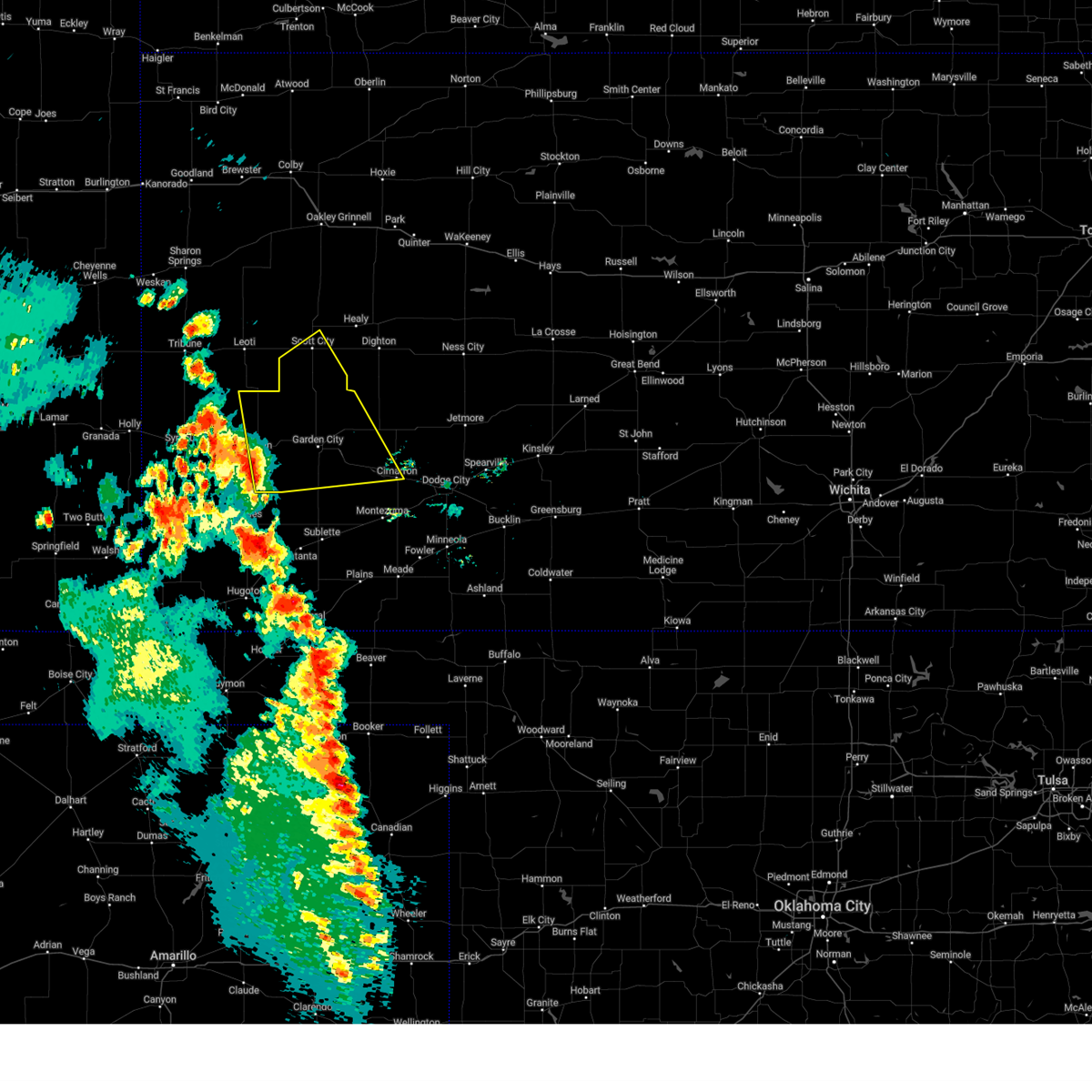
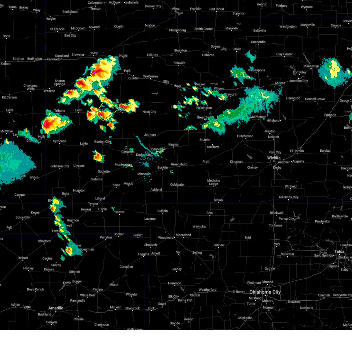
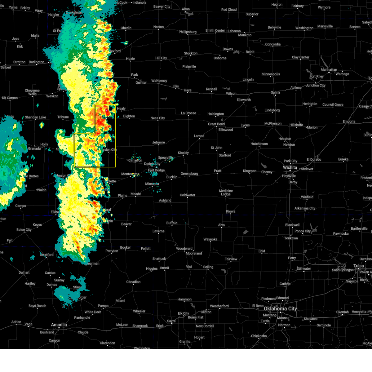
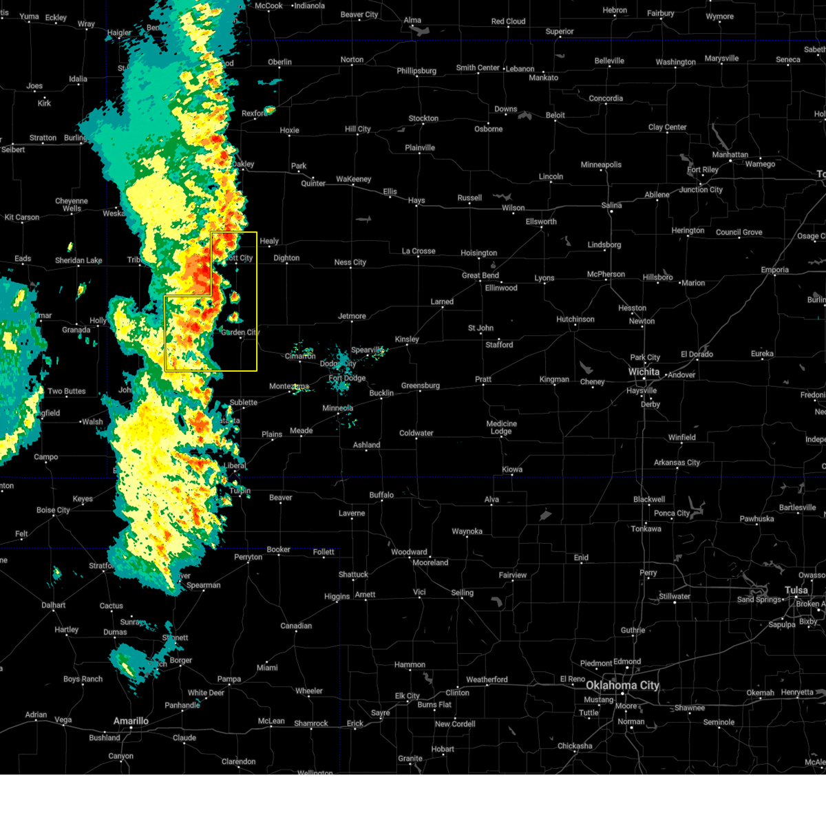
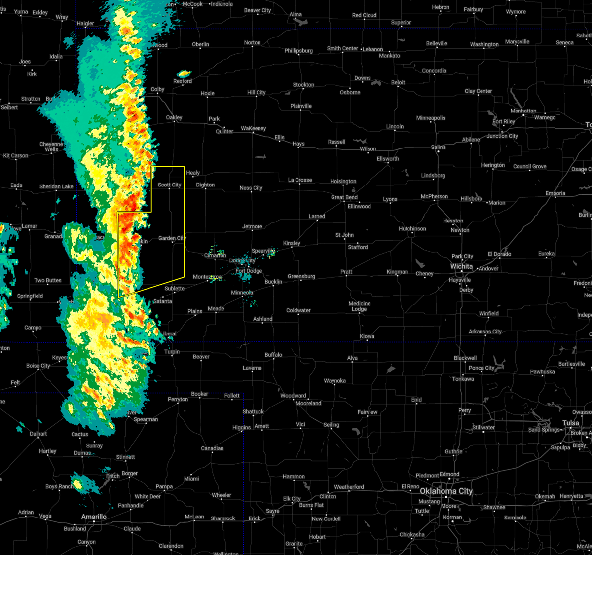
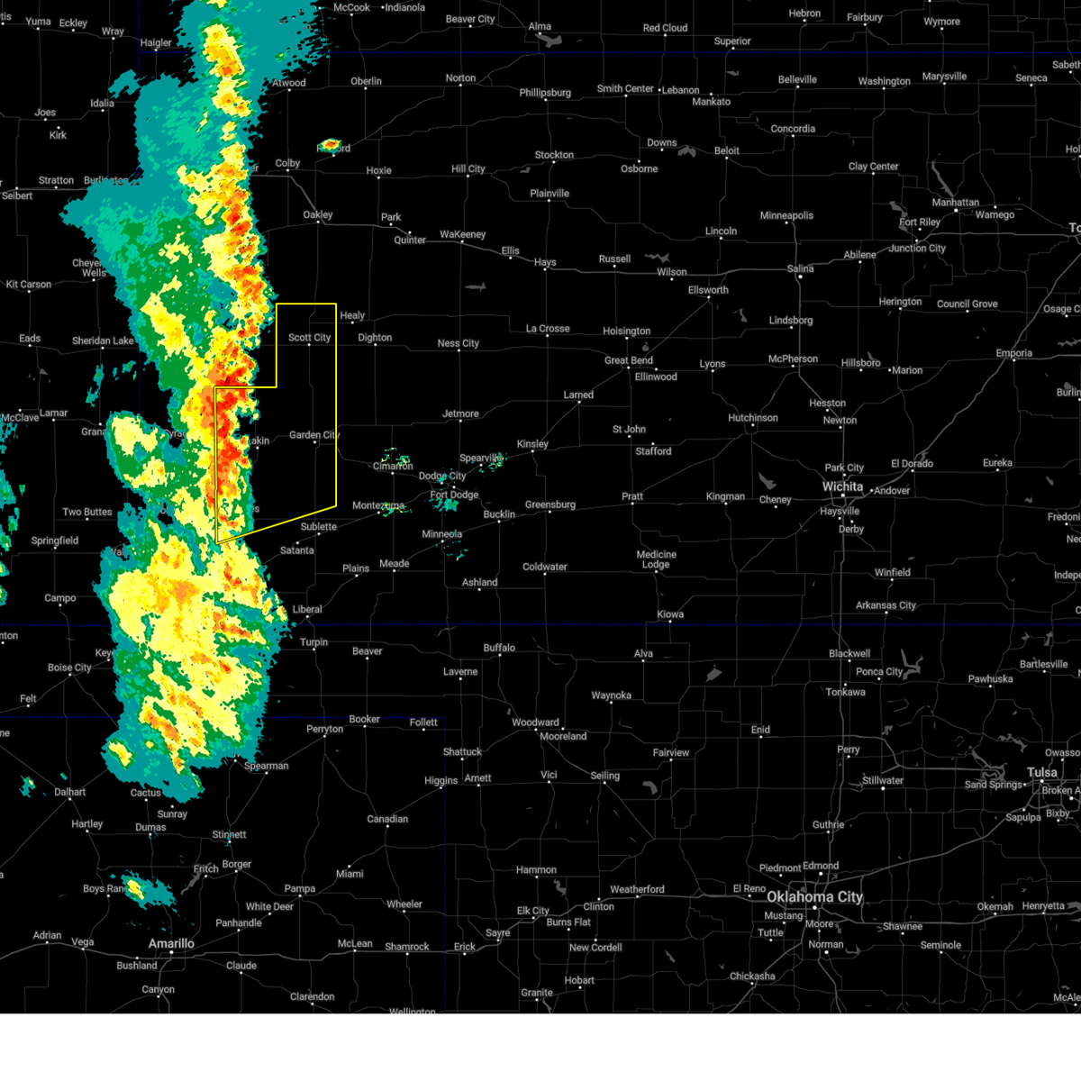
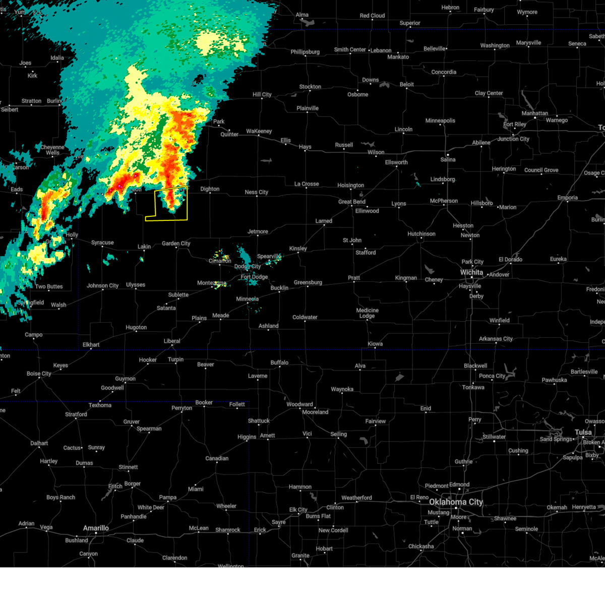
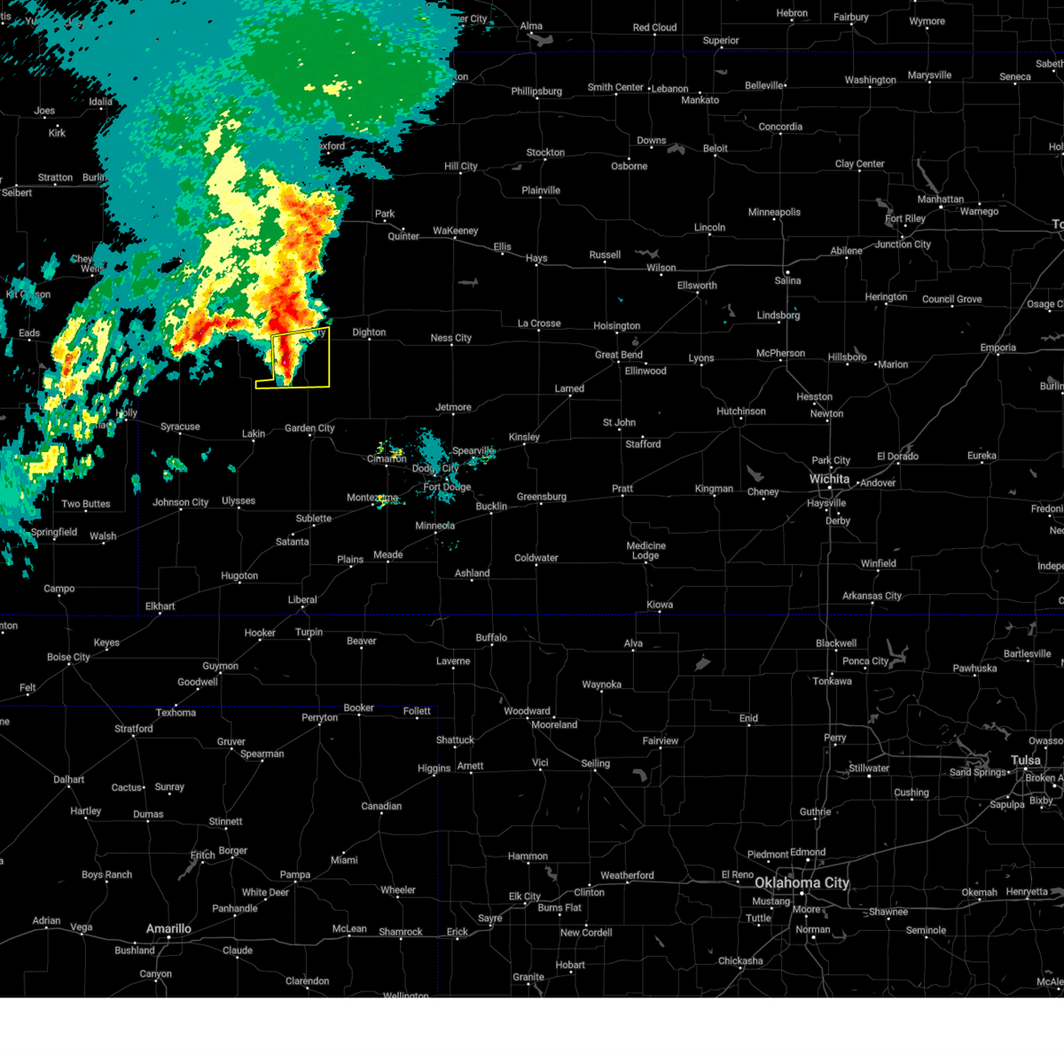
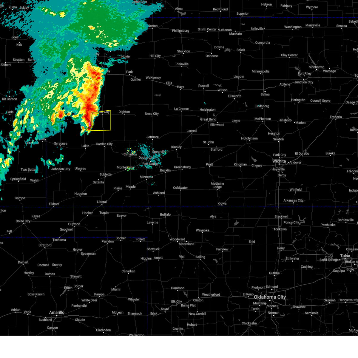
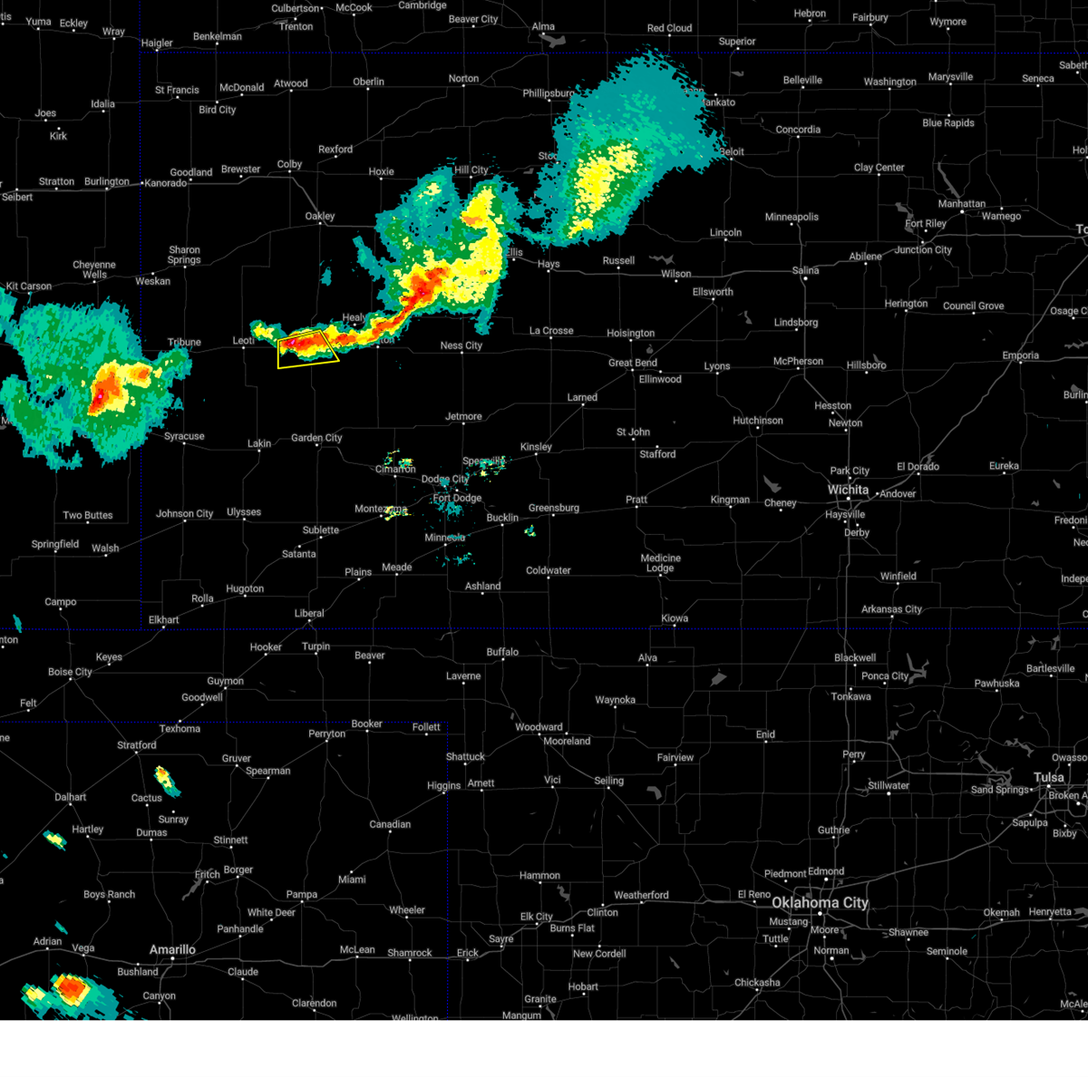
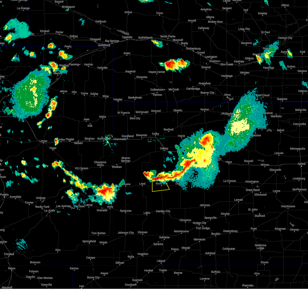
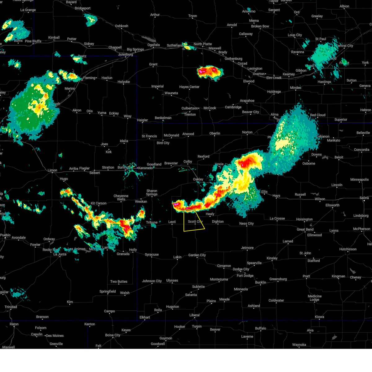
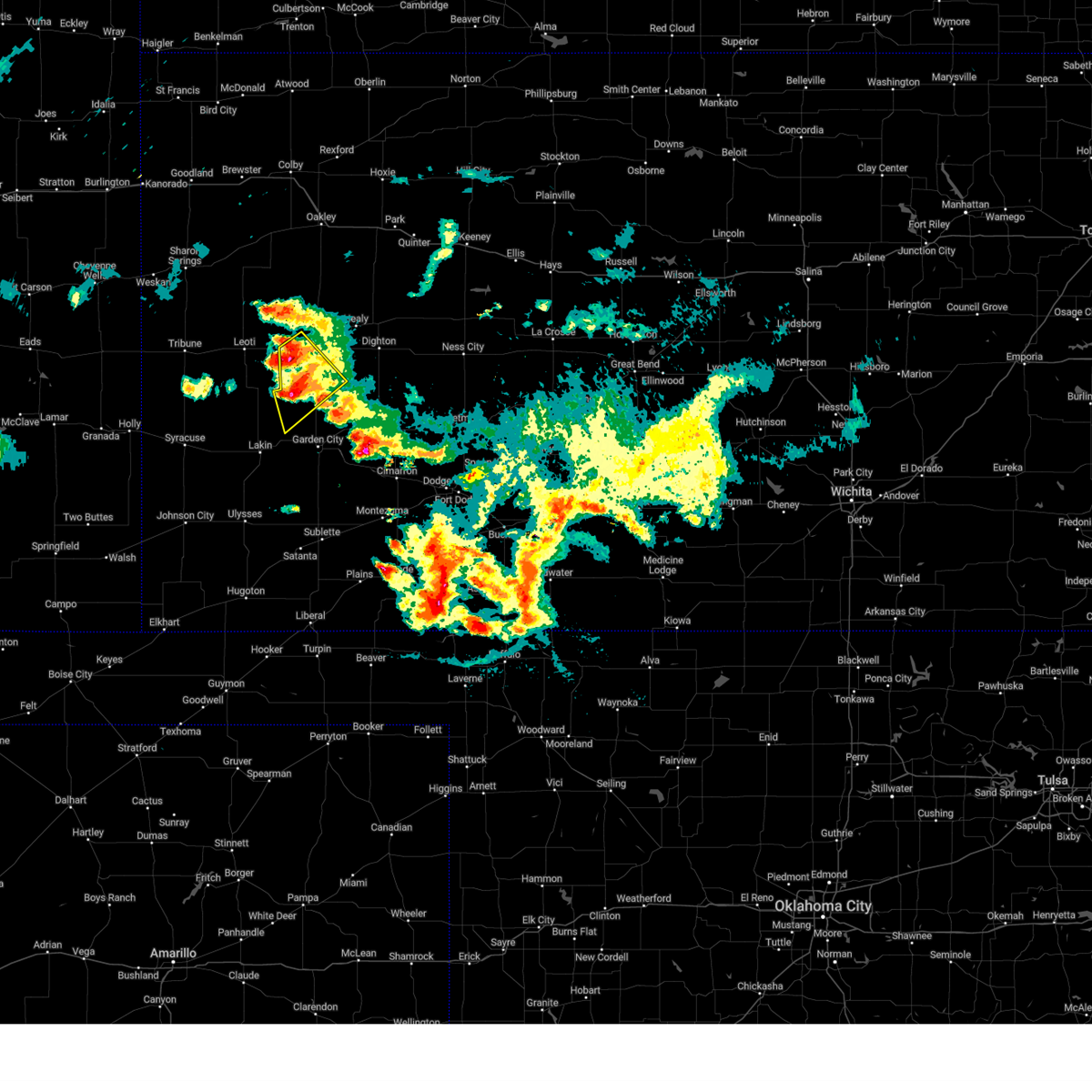
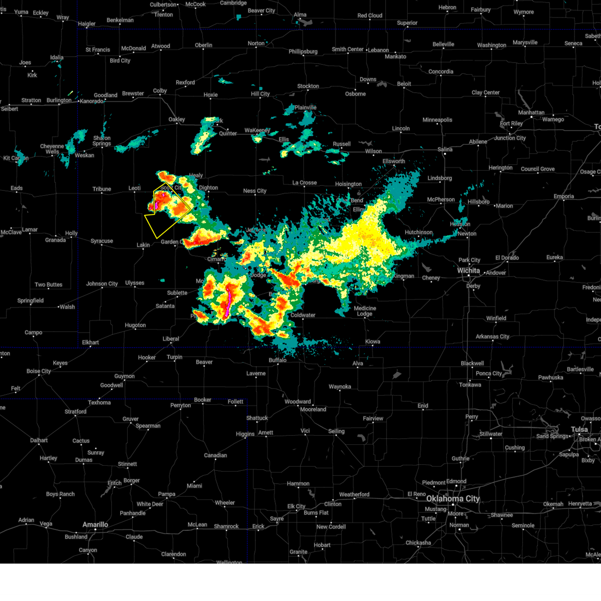
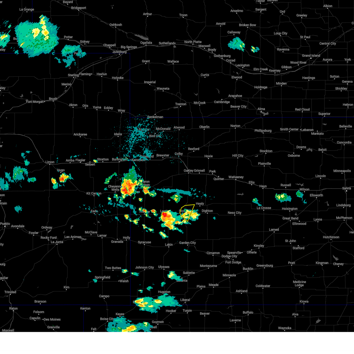
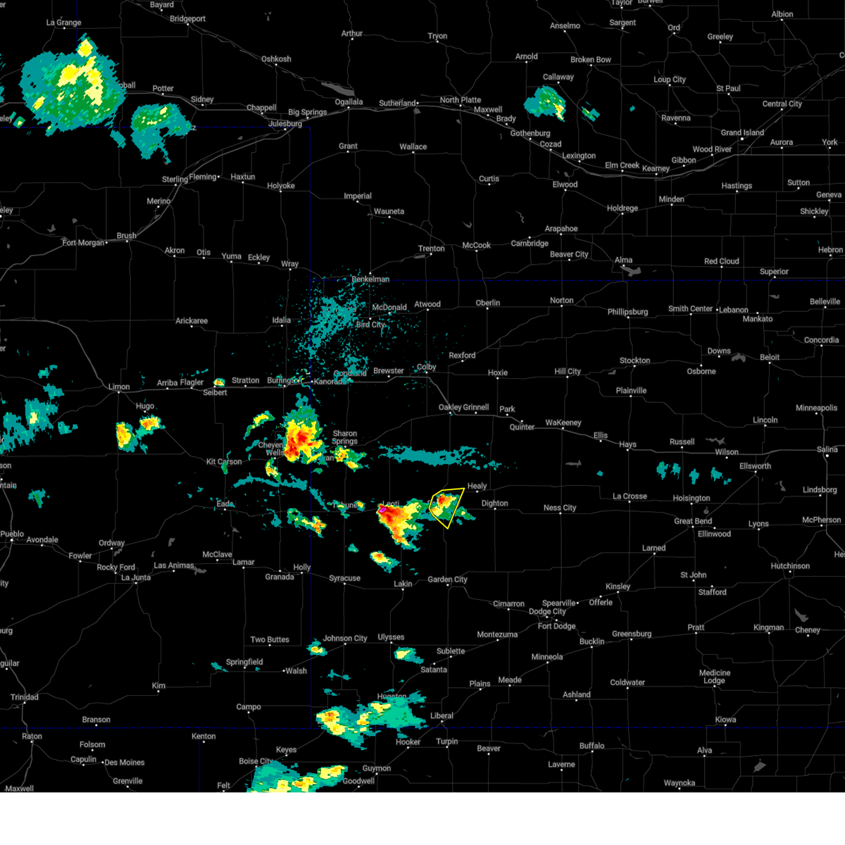
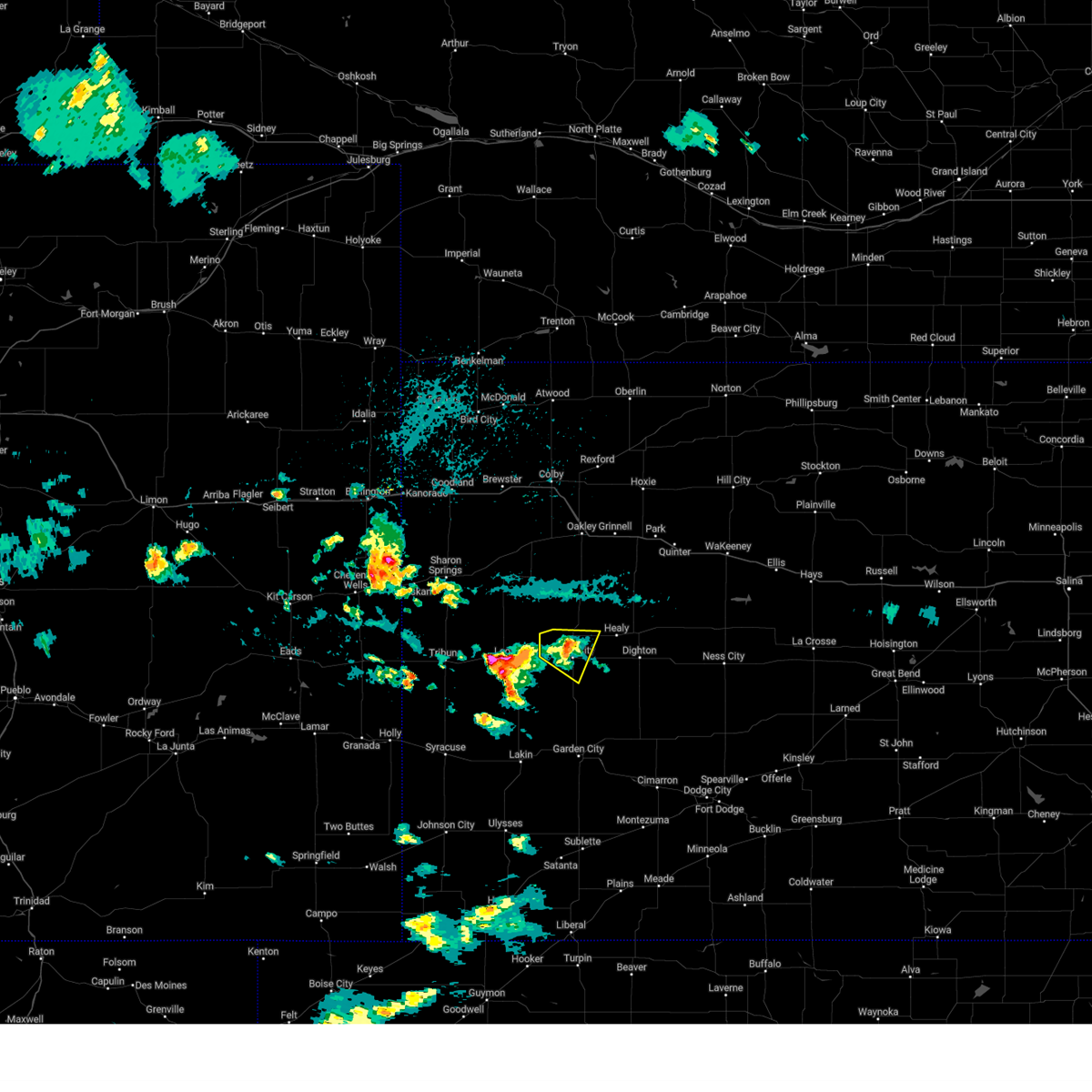
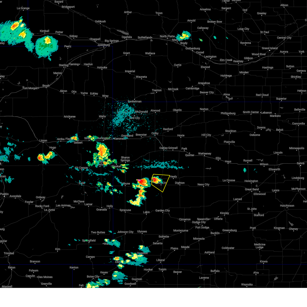
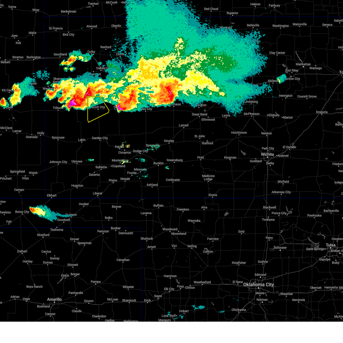
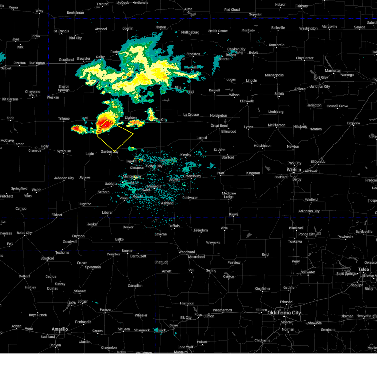
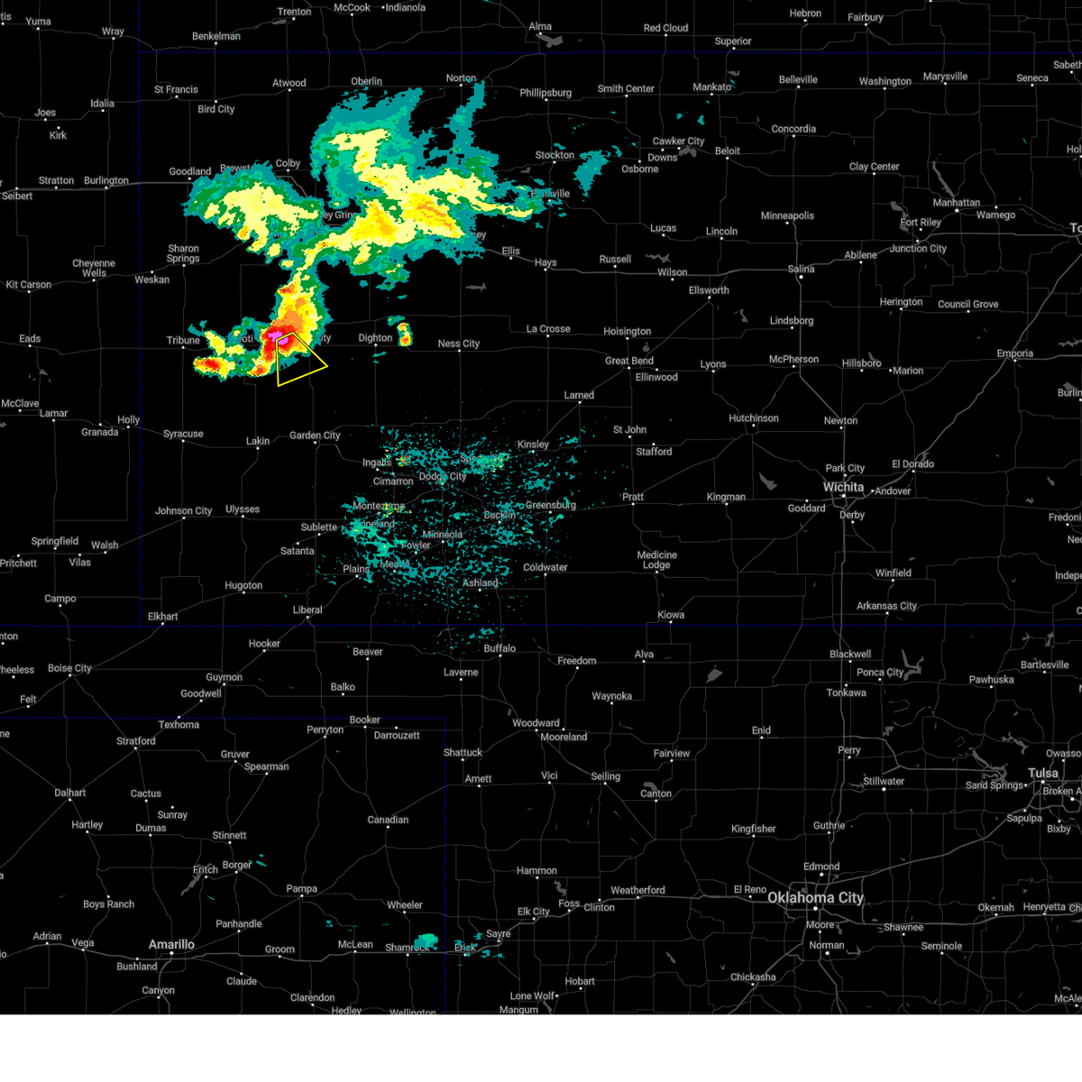
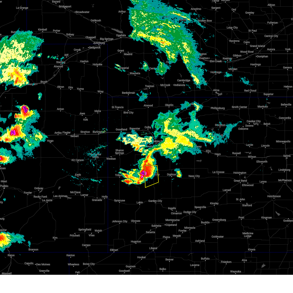
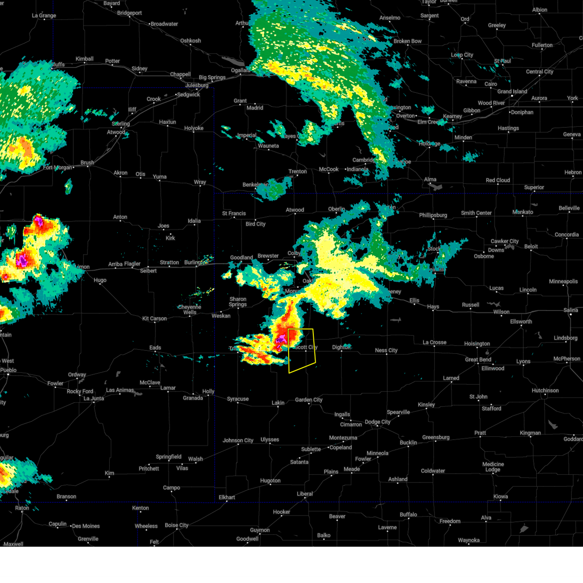
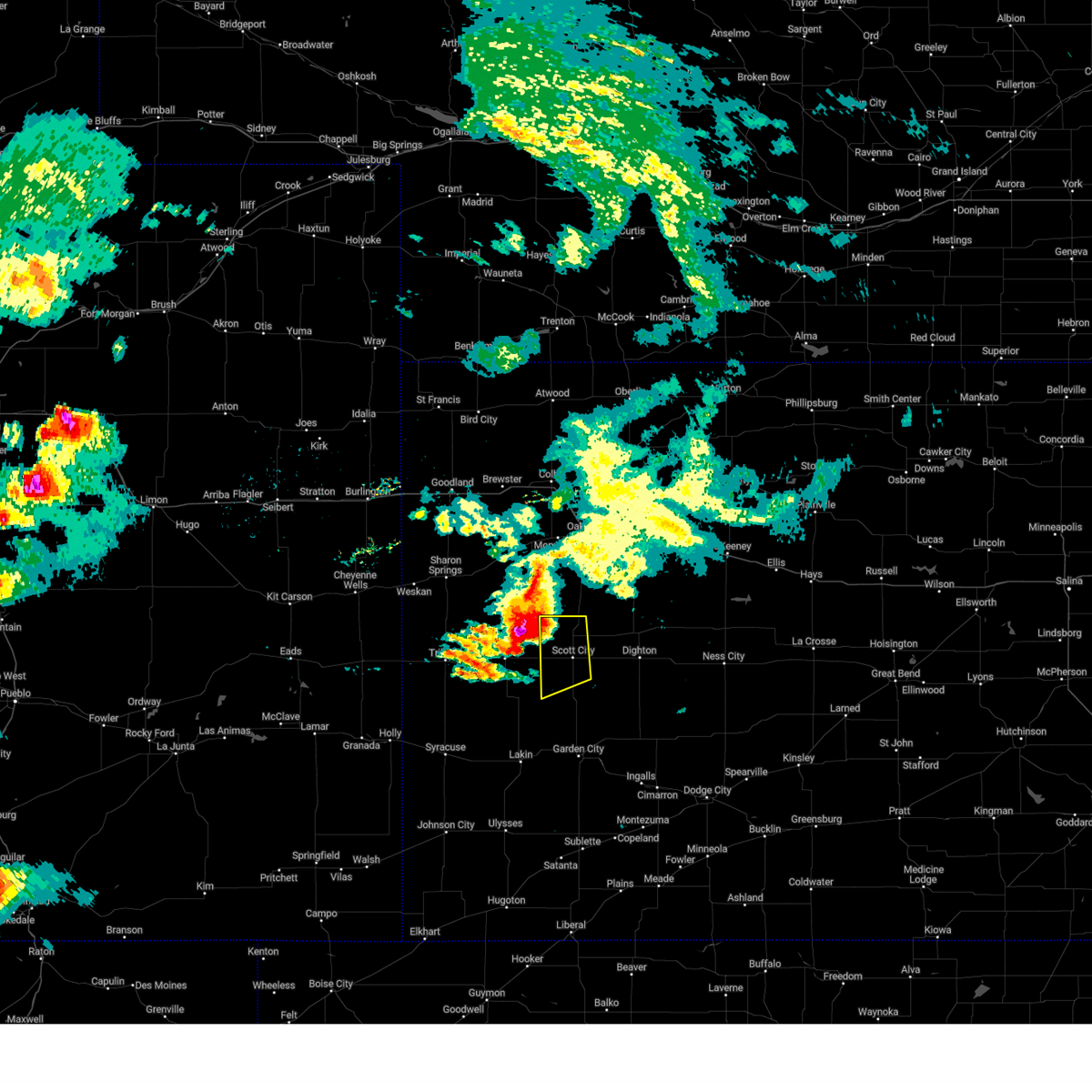
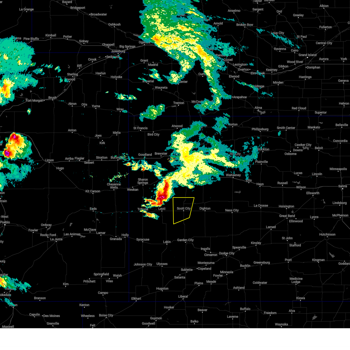
Hail Map for Scott City, KS
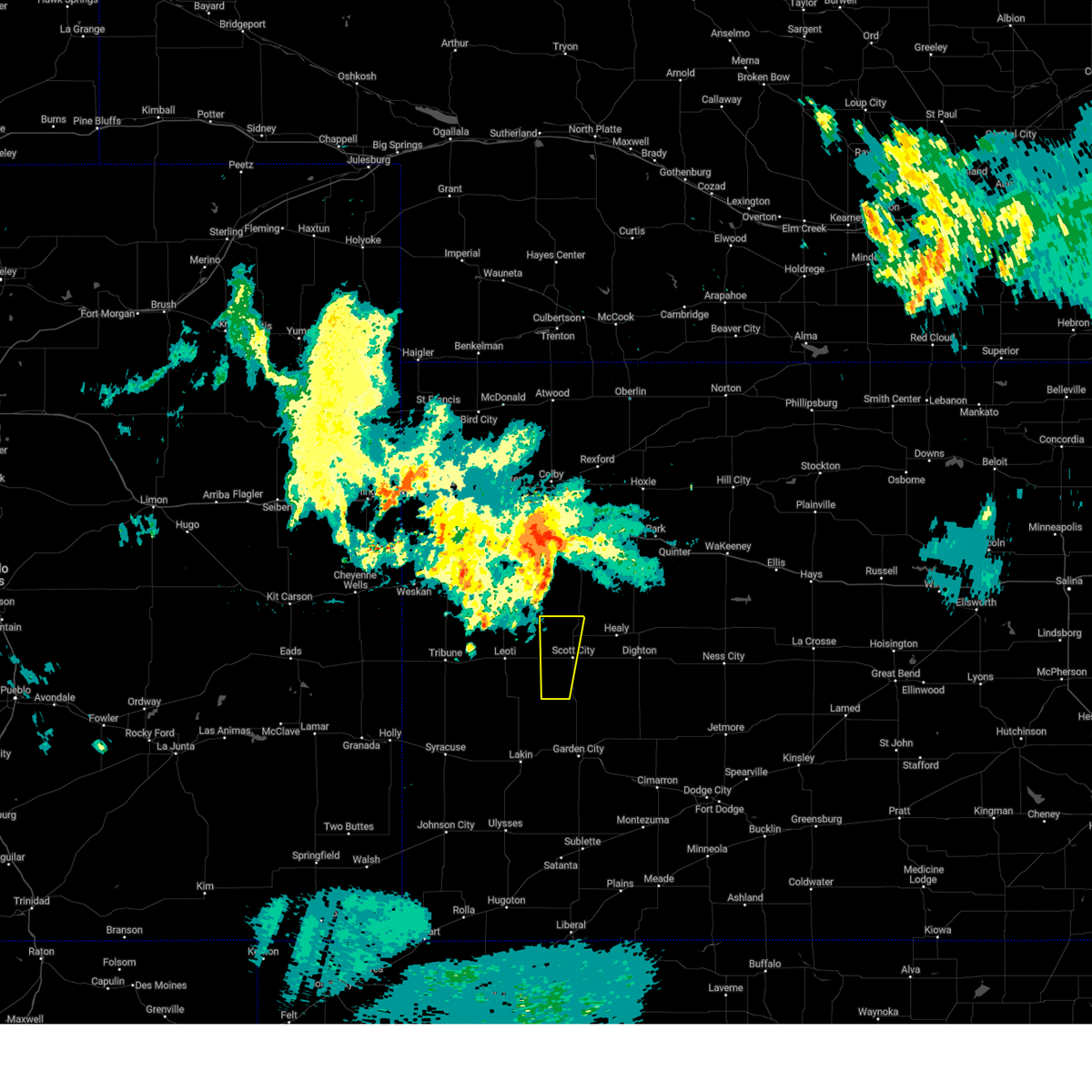
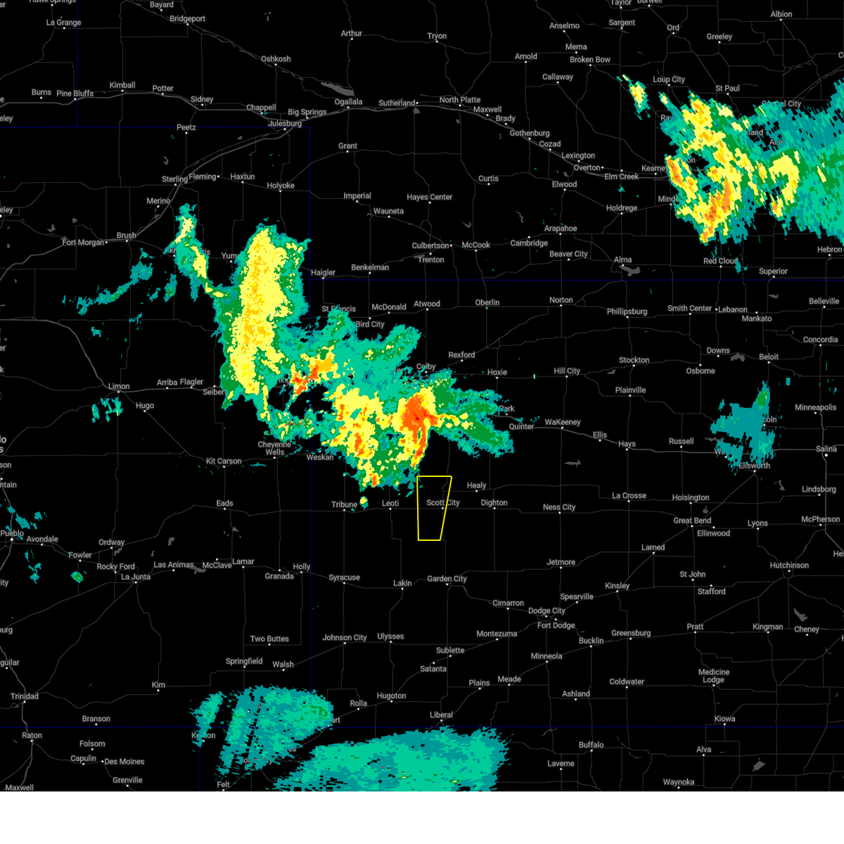
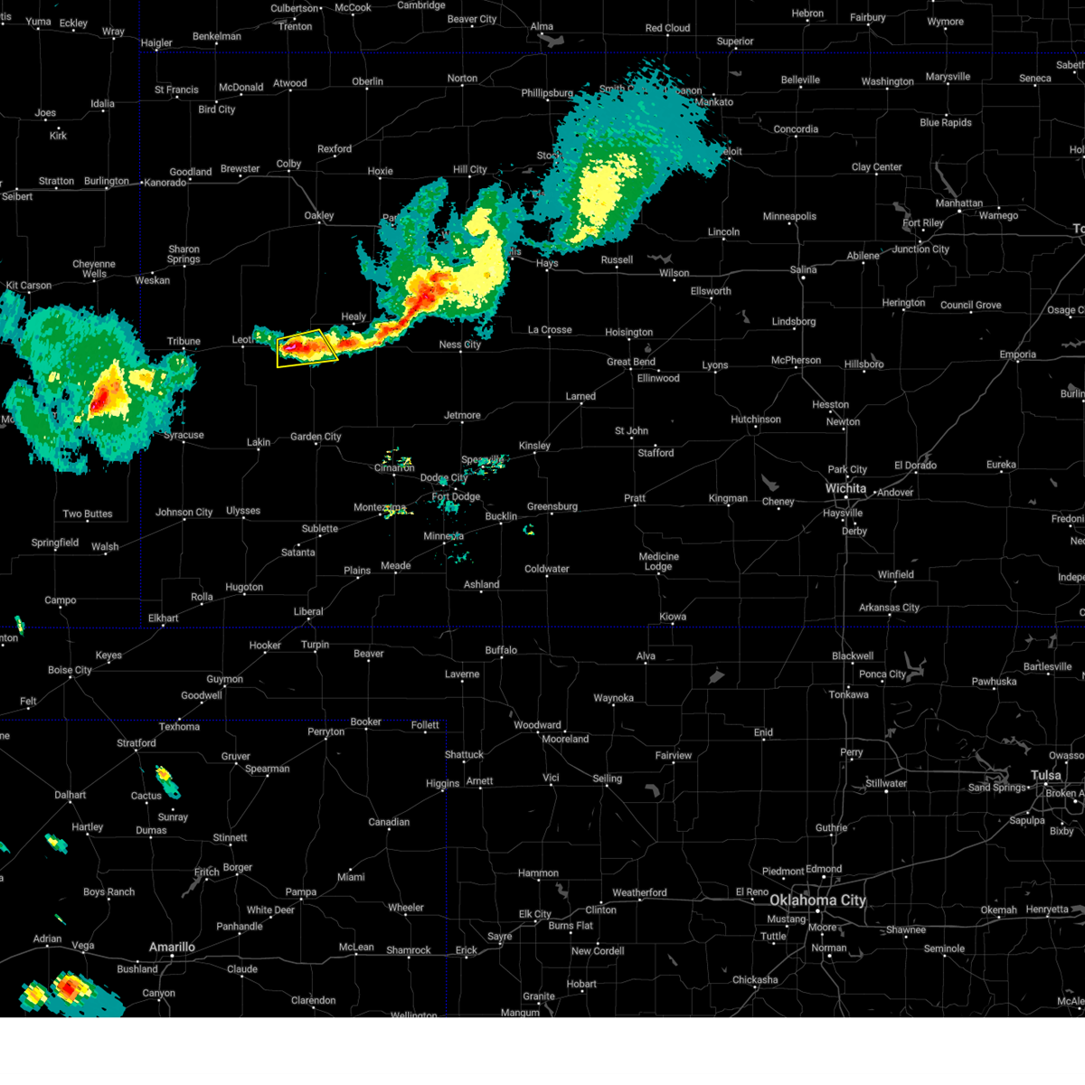
The Scott City, KS area has had 104 reports of on-the-ground hail by trained spotters, and has been under severe weather warnings 34 times during the past 12 months. Doppler radar has detected hail at or near Scott City, KS on 103 occasions, including 10 occasions during the past year.
| Name: | Scott City, KS |
| Where Located: | 35.2 miles N of Garden City, KS |
| Map: | Google Map for Scott City, KS |
| Population: | 3816 |
| Housing Units: | 1710 |
| More Info: | Search Google for Scott City, KS |
2
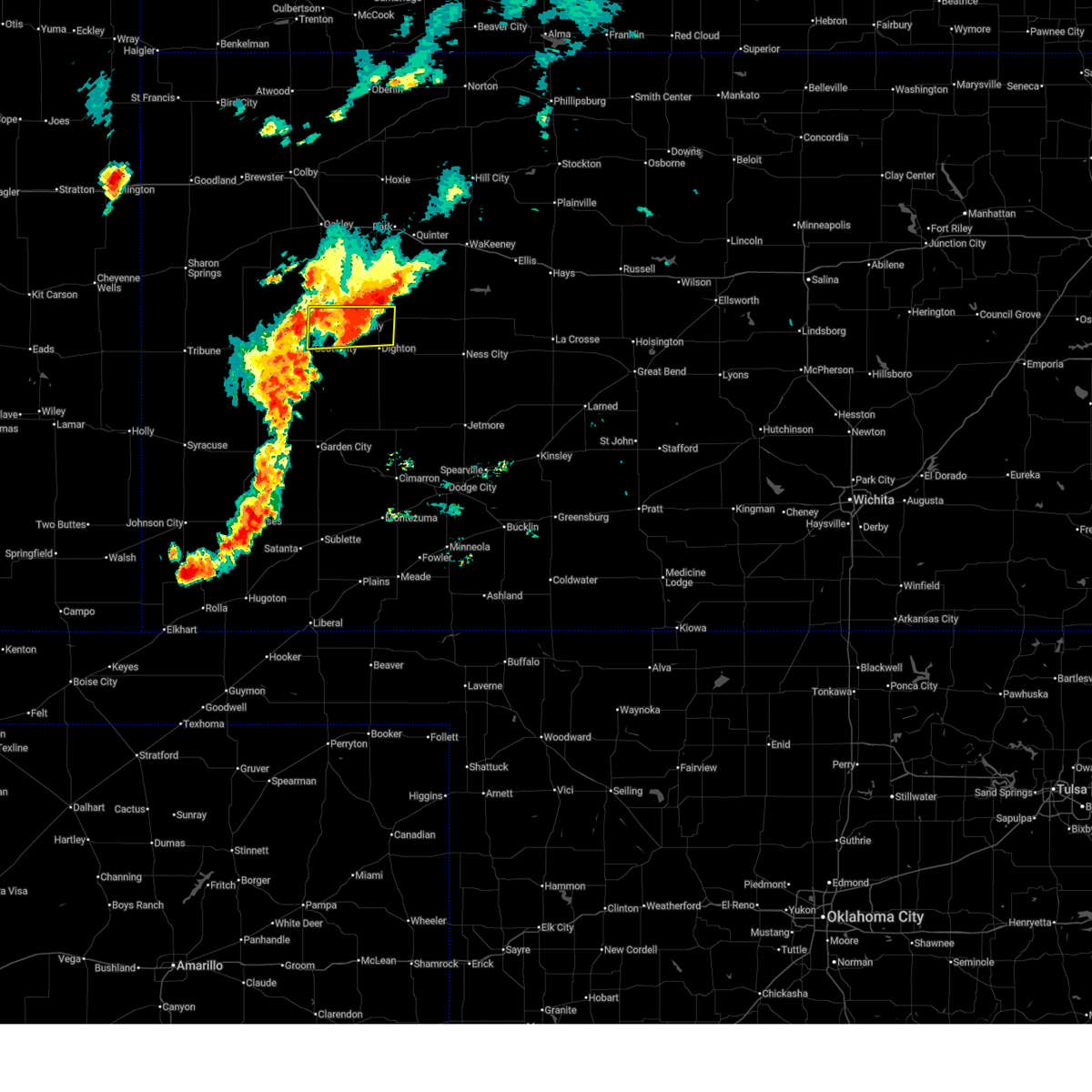
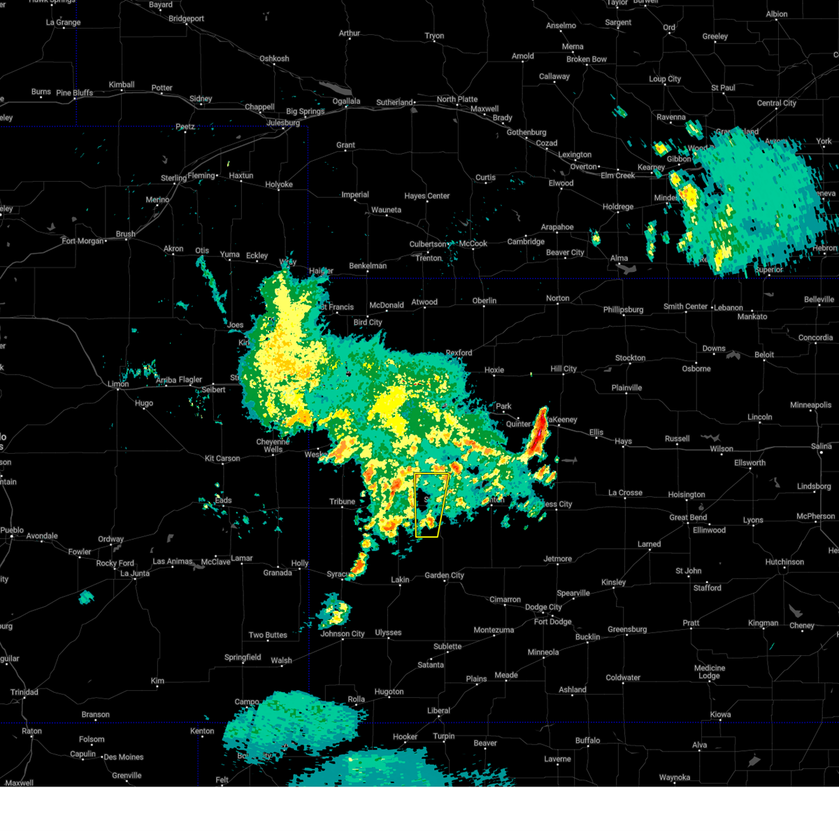
The Top Recent Hail Date for Scott City, KS is Wednesday, April 23, 2025 (2nd out of 103)

Hail and Wind Damage Spotted near Scott City, KS
| Date / Time | Report Details |
|---|---|
| 7/10/2025 8:27 PM CDT |
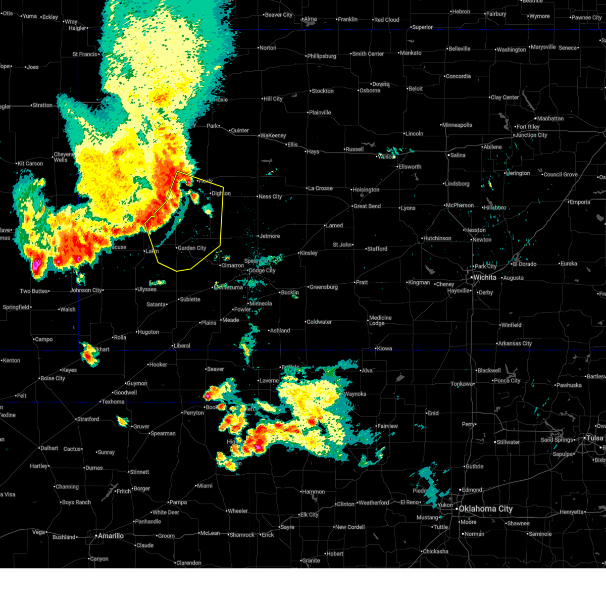
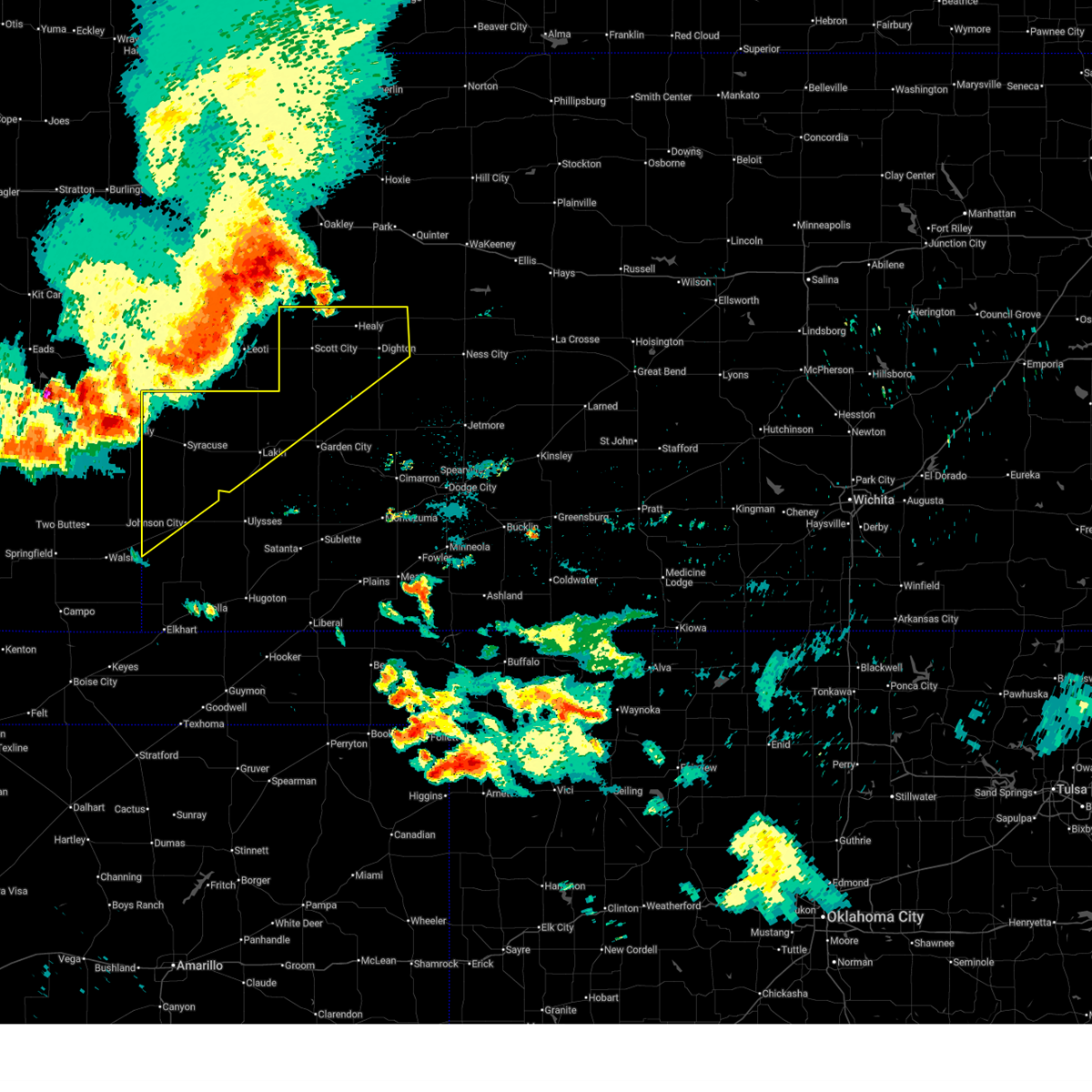
 Svrddc the national weather service in dodge city has issued a * severe thunderstorm warning for, scott county in west central kansas, ness county in west central kansas, lane county in west central kansas, * until 915 pm cdt. * at 826 pm cdt, severe thunderstorms were located along a line extending from near healy to near friend, moving east at 80 mph (radar indicated). Hazards include 60 mph wind gusts. Expect damage to roofs, siding, and trees. severe thunderstorms will be near, healy, shields, grigston, and amy around 830 pm cdt. dighton and pendennis around 835 pm cdt. utica and alamota around 840 pm cdt. beeler around 845 pm cdt. Other locations in the path of these severe thunderstorms include ransom, arnold, ness city, brownell and bazine. Svrddc the national weather service in dodge city has issued a * severe thunderstorm warning for, scott county in west central kansas, ness county in west central kansas, lane county in west central kansas, * until 915 pm cdt. * at 826 pm cdt, severe thunderstorms were located along a line extending from near healy to near friend, moving east at 80 mph (radar indicated). Hazards include 60 mph wind gusts. Expect damage to roofs, siding, and trees. severe thunderstorms will be near, healy, shields, grigston, and amy around 830 pm cdt. dighton and pendennis around 835 pm cdt. utica and alamota around 840 pm cdt. beeler around 845 pm cdt. Other locations in the path of these severe thunderstorms include ransom, arnold, ness city, brownell and bazine.
|
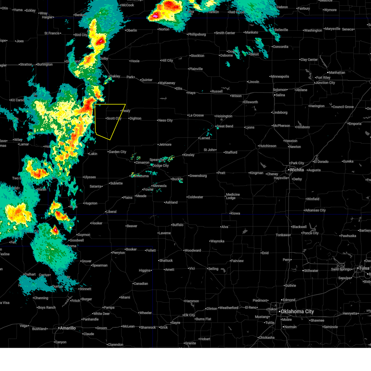
| 7/10/2025 8:01 PM CDT | Storm damage reported in scott county KS, 7.7 miles N of Scott City, KS |
| 7/10/2025 7:38 PM CDT |
 Svrddc the national weather service in dodge city has issued a * severe thunderstorm warning for, northwestern finney county in southwestern kansas, scott county in west central kansas, northwestern lane county in west central kansas, * until 830 pm cdt. * at 738 pm cdt, severe thunderstorms were located along a line extending from 11 miles south of russell springs to 16 miles south of leoti, moving east at 45 mph (radar indicated). Hazards include 60 mph wind gusts. Expect damage to roofs, siding, and trees. severe thunderstorms will be near, modoc around 750 pm cdt. scott state lake around 755 pm cdt. Other locations in the path of these severe thunderstorms include scott city, shallow water, friend, manning, grigston and healy. Svrddc the national weather service in dodge city has issued a * severe thunderstorm warning for, northwestern finney county in southwestern kansas, scott county in west central kansas, northwestern lane county in west central kansas, * until 830 pm cdt. * at 738 pm cdt, severe thunderstorms were located along a line extending from 11 miles south of russell springs to 16 miles south of leoti, moving east at 45 mph (radar indicated). Hazards include 60 mph wind gusts. Expect damage to roofs, siding, and trees. severe thunderstorms will be near, modoc around 750 pm cdt. scott state lake around 755 pm cdt. Other locations in the path of these severe thunderstorms include scott city, shallow water, friend, manning, grigston and healy.
|
| 7/10/2025 3:05 PM CDT | Quarter sized hail reported 14.9 miles NNE of Scott City, KS |
| 7/7/2025 12:38 AM CDT |
 Svrddc the national weather service in dodge city has issued a * severe thunderstorm warning for, northeastern kearny county in southwestern kansas, finney county in southwestern kansas, scott county in west central kansas, lane county in west central kansas, northwestern gray county in southwestern kansas, * until 145 am cdt. * at 1238 am cdt, severe thunderstorms were located along a line extending from 7 miles northwest of shields to near friend to near deerfield, moving southeast at 35 mph (radar indicated). Hazards include 70 mph wind gusts and penny size hail. Expect considerable tree damage. damage is likely to mobile homes, roofs, and outbuildings. severe thunderstorms will be near, garden city, holcomb, and amy around 1245 am cdt. dighton around 1250 am cdt. Other locations in the path of these severe thunderstorms include plymell, pierceville and charleston. Svrddc the national weather service in dodge city has issued a * severe thunderstorm warning for, northeastern kearny county in southwestern kansas, finney county in southwestern kansas, scott county in west central kansas, lane county in west central kansas, northwestern gray county in southwestern kansas, * until 145 am cdt. * at 1238 am cdt, severe thunderstorms were located along a line extending from 7 miles northwest of shields to near friend to near deerfield, moving southeast at 35 mph (radar indicated). Hazards include 70 mph wind gusts and penny size hail. Expect considerable tree damage. damage is likely to mobile homes, roofs, and outbuildings. severe thunderstorms will be near, garden city, holcomb, and amy around 1245 am cdt. dighton around 1250 am cdt. Other locations in the path of these severe thunderstorms include plymell, pierceville and charleston.
|
| 7/7/2025 12:35 AM CDT | Storm damage reported in scott county KS, 7.7 miles N of Scott City, KS |
| 7/6/2025 11:51 PM CDT |
 Svrddc the national weather service in dodge city has issued a * severe thunderstorm warning for, hamilton county in southwestern kansas, kearny county in southwestern kansas, northwestern finney county in southwestern kansas, scott county in west central kansas, lane county in west central kansas, northwestern stanton county in southwestern kansas, * until 1245 am cdt/1145 pm mdt/. * at 1150 pm cdt/1050 pm mdt/, severe thunderstorms were located along a line extending from 8 miles south of monument to 10 miles northeast of hartman, moving southeast at 55 mph (radar indicated). Hazards include 60 mph wind gusts. expect damage to roofs, siding, and trees Svrddc the national weather service in dodge city has issued a * severe thunderstorm warning for, hamilton county in southwestern kansas, kearny county in southwestern kansas, northwestern finney county in southwestern kansas, scott county in west central kansas, lane county in west central kansas, northwestern stanton county in southwestern kansas, * until 1245 am cdt/1145 pm mdt/. * at 1150 pm cdt/1050 pm mdt/, severe thunderstorms were located along a line extending from 8 miles south of monument to 10 miles northeast of hartman, moving southeast at 55 mph (radar indicated). Hazards include 60 mph wind gusts. expect damage to roofs, siding, and trees
|
| 7/4/2025 8:57 PM CDT |
 At 857 pm cdt, a severe thunderstorm was located very near healy, moving east at 20 mph (radar indicated). Hazards include 60 mph wind gusts and quarter size hail. Hail damage to vehicles is expected. expect wind damage to roofs, siding, and trees. This severe storm will be near, healy around 900 pm cdt. At 857 pm cdt, a severe thunderstorm was located very near healy, moving east at 20 mph (radar indicated). Hazards include 60 mph wind gusts and quarter size hail. Hail damage to vehicles is expected. expect wind damage to roofs, siding, and trees. This severe storm will be near, healy around 900 pm cdt.
|
| 7/4/2025 8:43 PM CDT |
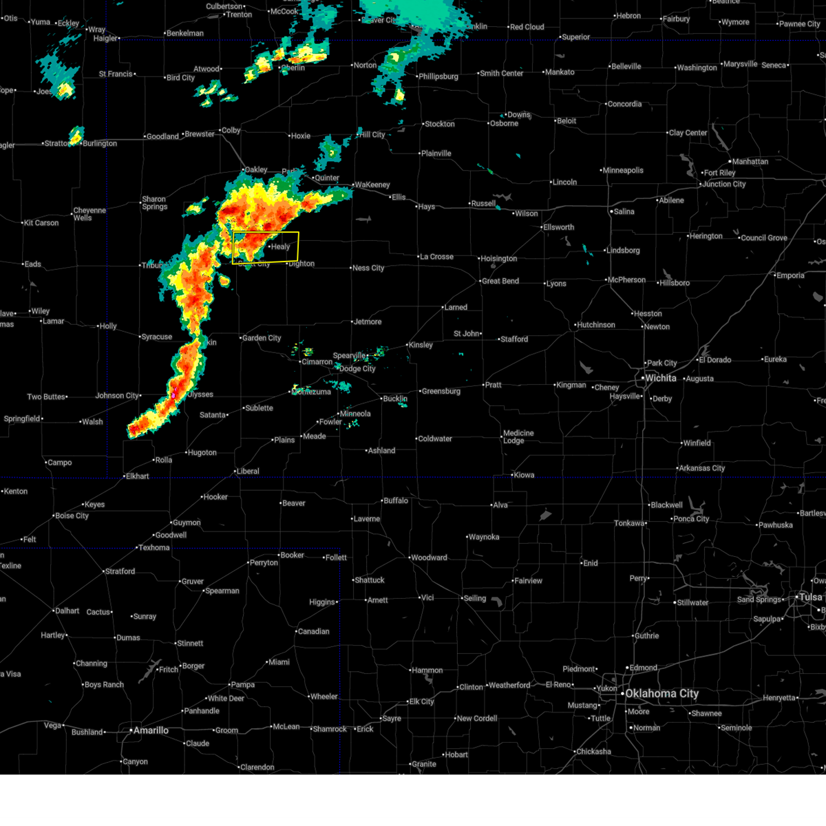 Svrddc the national weather service in dodge city has issued a * severe thunderstorm warning for, northeastern scott county in west central kansas, northwestern lane county in west central kansas, * until 930 pm cdt. * at 843 pm cdt, a severe thunderstorm was located 7 miles northwest of healy, moving east at 15 mph (radar indicated). Hazards include 60 mph wind gusts and quarter size hail. Hail damage to vehicles is expected. expect wind damage to roofs, siding, and trees. This severe thunderstorm will be near, healy around 855 pm cdt. Svrddc the national weather service in dodge city has issued a * severe thunderstorm warning for, northeastern scott county in west central kansas, northwestern lane county in west central kansas, * until 930 pm cdt. * at 843 pm cdt, a severe thunderstorm was located 7 miles northwest of healy, moving east at 15 mph (radar indicated). Hazards include 60 mph wind gusts and quarter size hail. Hail damage to vehicles is expected. expect wind damage to roofs, siding, and trees. This severe thunderstorm will be near, healy around 855 pm cdt.
|
| 6/2/2025 6:46 PM CDT |
 The storms which prompted the warning have weakened below severe limits, and no longer pose an immediate threat to life or property. therefore, the warning has been allowed to expire. however, gusty winds are still possible with these thunderstorms. a severe thunderstorm watch remains in effect until 1000 pm cdt for southwestern and west central kansas. The storms which prompted the warning have weakened below severe limits, and no longer pose an immediate threat to life or property. therefore, the warning has been allowed to expire. however, gusty winds are still possible with these thunderstorms. a severe thunderstorm watch remains in effect until 1000 pm cdt for southwestern and west central kansas.
|
| 6/2/2025 6:34 PM CDT | At 631 pm cdt, severe thunderstorms were located along a line extending from 7 miles west of friend to 9 miles south of pierceville, moving northeast at 45 mph (private weather station. at 622 pm, a 59 mph wind gust was recorded at a private weather station in holcomb). Hazards include 60 mph wind gusts. Expect damage to roofs, siding, and trees. Locations impacted include, garden city, scott city, cimarron, holcomb, pierceville, ingalls, charleston, friend, shallow water, and plymell. |
| 6/2/2025 6:34 PM CDT | the severe thunderstorm warning has been cancelled and is no longer in effect |
| 6/2/2025 6:19 PM CDT |
 At 619 pm cdt, severe thunderstorms were located along a line extending from 11 miles north of deerfield to 8 miles southeast of plymell, moving northeast at 35 mph (radar indicated). Hazards include 60 mph wind gusts. Expect damage to roofs, siding, and trees. Locations impacted include, garden city, pierceville, friend, charleston and shallow water. At 619 pm cdt, severe thunderstorms were located along a line extending from 11 miles north of deerfield to 8 miles southeast of plymell, moving northeast at 35 mph (radar indicated). Hazards include 60 mph wind gusts. Expect damage to roofs, siding, and trees. Locations impacted include, garden city, pierceville, friend, charleston and shallow water.
|
| 6/2/2025 5:51 PM CDT |
 Svrddc the national weather service in dodge city has issued a * severe thunderstorm warning for, eastern kearny county in southwestern kansas, finney county in southwestern kansas, southern scott county in west central kansas, northern gray county in southwestern kansas, * until 645 pm cdt. * at 551 pm cdt, severe thunderstorms were located along a line extending from 11 miles northwest of deerfield to near satanta, moving northeast at 45 mph (radar indicated). Hazards include 70 mph wind gusts and penny size hail. Expect considerable tree damage. damage is likely to mobile homes, roofs, and outbuildings. severe thunderstorms will be near, deerfield around 555 pm cdt. holcomb around 600 pm cdt. plymell around 605 pm cdt. garden city around 610 pm cdt. Other locations in the path of these severe thunderstorms include friend, shallow water, pierceville, scott city and charleston. Svrddc the national weather service in dodge city has issued a * severe thunderstorm warning for, eastern kearny county in southwestern kansas, finney county in southwestern kansas, southern scott county in west central kansas, northern gray county in southwestern kansas, * until 645 pm cdt. * at 551 pm cdt, severe thunderstorms were located along a line extending from 11 miles northwest of deerfield to near satanta, moving northeast at 45 mph (radar indicated). Hazards include 70 mph wind gusts and penny size hail. Expect considerable tree damage. damage is likely to mobile homes, roofs, and outbuildings. severe thunderstorms will be near, deerfield around 555 pm cdt. holcomb around 600 pm cdt. plymell around 605 pm cdt. garden city around 610 pm cdt. Other locations in the path of these severe thunderstorms include friend, shallow water, pierceville, scott city and charleston.
|
| 5/19/2025 5:54 PM CDT | Report was from the ellis feeders observation statio in scott county KS, 2 miles SW of Scott City, KS |
| 5/18/2025 6:16 PM CDT | Quarter sized hail reported 18.8 miles S of Scott City, KS, social media report (with video) of quarter sized hail near elkrader at 5:16 pm mdt. |
| 5/18/2025 6:15 PM CDT |
 the severe thunderstorm warning has been cancelled and is no longer in effect the severe thunderstorm warning has been cancelled and is no longer in effect
|
| 5/18/2025 5:47 PM CDT | At 546 pm cdt, a severe thunderstorm was located near modoc, moving northeast at 30 mph (radar indicated). Hazards include golf ball size hail. People and animals outdoors will be injured. expect damage to roofs, siding, windows, and vehicles. This severe storm will be near, scott state lake around 600 pm cdt. |
| 5/18/2025 5:45 PM CDT | Torddc the national weather service in dodge city has issued a * tornado warning for, northwestern scott county in west central kansas, * until 630 pm cdt. * at 545 pm cdt, a confirmed tornado was located very near modoc, moving northeast at 35 mph (public confirmed tornado). Hazards include damaging tornado and hail up to two inches in diameter. Flying debris will be dangerous to those caught without shelter. mobile homes will be damaged or destroyed. damage to roofs, windows, and vehicles will occur. tree damage is likely. The tornado will be near, scott state lake around 605 pm cdt. |
| 5/18/2025 5:40 PM CDT | Svrddc the national weather service in dodge city has issued a * severe thunderstorm warning for, northern scott county in west central kansas, northwestern lane county in west central kansas, * until 630 pm cdt. * at 540 pm cdt, a severe thunderstorm was located very near modoc, moving northeast at 30 mph (radar indicated). Hazards include golf ball size hail. People and animals outdoors will be injured. expect damage to roofs, siding, windows, and vehicles. This severe thunderstorm will be near, scott state lake around 600 pm cdt. |
| 5/18/2025 5:34 PM CDT | Grapefruit sized hail reported 13.5 miles SSE of Scott City, KS, photo sent in by emergency manager... public report. |
| 5/18/2025 5:31 PM CDT | Golf Ball sized hail reported 13.5 miles SSE of Scott City, KS |
| 4/23/2025 6:11 PM CDT | Quarter sized hail reported 10.5 miles SW of Scott City, KS |
| 4/23/2025 5:08 PM CDT | Golf Ball sized hail reported 0.2 miles ESE of Scott City, KS, report from mping: golf ball (1.75 in.). |
| 4/23/2025 5:08 PM CDT |
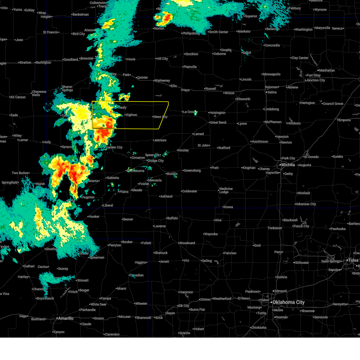
 At 508 pm cdt, a severe thunderstorm was located very near scott city, moving northeast at 15 mph (radar indicated). Hazards include tennis ball size hail. People and animals outdoors will be injured. expect damage to roofs, siding, windows, and vehicles. This severe thunderstorm will remain over mainly rural areas of northeastern scott and west central lane counties. At 508 pm cdt, a severe thunderstorm was located very near scott city, moving northeast at 15 mph (radar indicated). Hazards include tennis ball size hail. People and animals outdoors will be injured. expect damage to roofs, siding, windows, and vehicles. This severe thunderstorm will remain over mainly rural areas of northeastern scott and west central lane counties.
|
| 4/23/2025 5:05 PM CDT | Hen Egg sized hail reported 0.2 miles ESE of Scott City, KS |
| 4/23/2025 5:01 PM CDT |
 At 501 pm cdt, a severe thunderstorm was located very near scott city, moving northeast at 15 mph (radar indicated). Hazards include tennis ball size hail. People and animals outdoors will be injured. expect damage to roofs, siding, windows, and vehicles. This severe storm will be near, scott city around 505 pm cdt. At 501 pm cdt, a severe thunderstorm was located very near scott city, moving northeast at 15 mph (radar indicated). Hazards include tennis ball size hail. People and animals outdoors will be injured. expect damage to roofs, siding, windows, and vehicles. This severe storm will be near, scott city around 505 pm cdt.
|
| 4/23/2025 5:00 PM CDT | Hen Egg sized hail reported 0.2 miles ESE of Scott City, KS, just over 2 inches. |
| 4/23/2025 4:56 PM CDT | Half Dollar sized hail reported 2 miles N of Scott City, KS, off-duty nws employee reported half-dollar sized hail 2 miles south of scott city. |
| 4/23/2025 4:56 PM CDT |
 At 456 pm cdt, a severe thunderstorm was located very near scott city, moving northeast at 15 mph (radar indicated). Hazards include two inch hail. People and animals outdoors will be injured. expect damage to roofs, siding, windows, and vehicles. This severe storm will be near, scott city around 500 pm cdt. At 456 pm cdt, a severe thunderstorm was located very near scott city, moving northeast at 15 mph (radar indicated). Hazards include two inch hail. People and animals outdoors will be injured. expect damage to roofs, siding, windows, and vehicles. This severe storm will be near, scott city around 500 pm cdt.
|
| 4/23/2025 4:52 PM CDT | Quarter sized hail reported 0.2 miles ESE of Scott City, KS, picture of quarter-sized hail sent to us via slack from county emergency manager. |
| 4/23/2025 4:52 PM CDT |
 Svrddc the national weather service in dodge city has issued a * severe thunderstorm warning for, eastern scott county in west central kansas, west central lane county in west central kansas, * until 530 pm cdt. * at 452 pm cdt, a severe thunderstorm was located near scott city, moving northeast at 15 mph (radar indicated). Hazards include quarter size hail. Damage to vehicles is expected. This severe thunderstorm will be near, scott city around 455 pm cdt. Svrddc the national weather service in dodge city has issued a * severe thunderstorm warning for, eastern scott county in west central kansas, west central lane county in west central kansas, * until 530 pm cdt. * at 452 pm cdt, a severe thunderstorm was located near scott city, moving northeast at 15 mph (radar indicated). Hazards include quarter size hail. Damage to vehicles is expected. This severe thunderstorm will be near, scott city around 455 pm cdt.
|
| 9/17/2024 8:55 PM CDT |
 The storms which prompted the warning have weakened below severe limits, and no longer pose an immediate threat to life or property. therefore, the warning will be allowed to expire. however, gusty winds are still possible with these thunderstorms. a severe thunderstorm watch remains in effect until 1100 pm cdt for southwestern and west central kansas. The storms which prompted the warning have weakened below severe limits, and no longer pose an immediate threat to life or property. therefore, the warning will be allowed to expire. however, gusty winds are still possible with these thunderstorms. a severe thunderstorm watch remains in effect until 1100 pm cdt for southwestern and west central kansas.
|
| 9/17/2024 8:41 PM CDT |
 the severe thunderstorm warning has been cancelled and is no longer in effect the severe thunderstorm warning has been cancelled and is no longer in effect
|
| 9/17/2024 8:41 PM CDT |
 At 840 pm cdt, severe thunderstorms were located along a line extending from near leoti to near hickok, moving northeast at 45 mph (radar indicated). Hazards include 70 mph wind gusts. Expect considerable tree damage. damage is likely to mobile homes, roofs, and outbuildings. these severe storms will be near, deerfield around 845 pm cdt. Other locations in the path of these severe thunderstorms include holcomb, modoc, garden city, plymell and friend. At 840 pm cdt, severe thunderstorms were located along a line extending from near leoti to near hickok, moving northeast at 45 mph (radar indicated). Hazards include 70 mph wind gusts. Expect considerable tree damage. damage is likely to mobile homes, roofs, and outbuildings. these severe storms will be near, deerfield around 845 pm cdt. Other locations in the path of these severe thunderstorms include holcomb, modoc, garden city, plymell and friend.
|
| 9/17/2024 8:26 PM CDT |
 At 825 pm cdt, severe thunderstorms were located along a line extending from near leoti to near hickok, moving northeast at 45 mph (radar indicated). Hazards include 70 mph wind gusts. Expect considerable tree damage. damage is likely to mobile homes, roofs, and outbuildings. these severe storms will be near, lakin and hickok around 830 pm cdt. deerfield around 840 pm cdt. Other locations in the path of these severe thunderstorms include holcomb. At 825 pm cdt, severe thunderstorms were located along a line extending from near leoti to near hickok, moving northeast at 45 mph (radar indicated). Hazards include 70 mph wind gusts. Expect considerable tree damage. damage is likely to mobile homes, roofs, and outbuildings. these severe storms will be near, lakin and hickok around 830 pm cdt. deerfield around 840 pm cdt. Other locations in the path of these severe thunderstorms include holcomb.
|
| 9/17/2024 8:21 PM CDT |
 Svrddc the national weather service in dodge city has issued a * severe thunderstorm warning for, kearny county in southwestern kansas, western finney county in southwestern kansas, scott county in west central kansas, grant county in southwestern kansas, northern haskell county in southwestern kansas, * until 900 pm cdt. * at 820 pm cdt, severe thunderstorms were located along a line extending from 6 miles southwest of leoti to near hickok, moving northeast at 45 mph (radar indicated). Hazards include 60 mph wind gusts. Expect damage to roofs, siding, and trees. severe thunderstorms will be near, lakin and hickok around 825 pm cdt. deerfield around 835 pm cdt. Other locations in the path of these severe thunderstorms include holcomb and modoc. Svrddc the national weather service in dodge city has issued a * severe thunderstorm warning for, kearny county in southwestern kansas, western finney county in southwestern kansas, scott county in west central kansas, grant county in southwestern kansas, northern haskell county in southwestern kansas, * until 900 pm cdt. * at 820 pm cdt, severe thunderstorms were located along a line extending from 6 miles southwest of leoti to near hickok, moving northeast at 45 mph (radar indicated). Hazards include 60 mph wind gusts. Expect damage to roofs, siding, and trees. severe thunderstorms will be near, lakin and hickok around 825 pm cdt. deerfield around 835 pm cdt. Other locations in the path of these severe thunderstorms include holcomb and modoc.
|
| 8/22/2024 10:42 PM CDT |
 the severe thunderstorm warning has been cancelled and is no longer in effect the severe thunderstorm warning has been cancelled and is no longer in effect
|
| 8/22/2024 10:28 PM CDT |
 At 1028 pm cdt, a severe thunderstorm was located near shallow water, moving east at 25 mph (radar indicated). Hazards include 60 mph wind gusts and quarter size hail. Hail damage to vehicles is expected. expect wind damage to roofs, siding, and trees. Locations impacted include, scott city, shallow water, friend, and modoc. At 1028 pm cdt, a severe thunderstorm was located near shallow water, moving east at 25 mph (radar indicated). Hazards include 60 mph wind gusts and quarter size hail. Hail damage to vehicles is expected. expect wind damage to roofs, siding, and trees. Locations impacted include, scott city, shallow water, friend, and modoc.
|
| 8/22/2024 10:12 PM CDT |
 Svrddc the national weather service in dodge city has issued a * severe thunderstorm warning for, northeastern kearny county in southwestern kansas, northwestern finney county in southwestern kansas, southern scott county in west central kansas, * until 1100 pm cdt. * at 1011 pm cdt, a severe thunderstorm was located 12 miles southwest of modoc, moving east at 20 mph (radar indicated). Hazards include 60 mph wind gusts and quarter size hail. Hail damage to vehicles is expected. Expect wind damage to roofs, siding, and trees. Svrddc the national weather service in dodge city has issued a * severe thunderstorm warning for, northeastern kearny county in southwestern kansas, northwestern finney county in southwestern kansas, southern scott county in west central kansas, * until 1100 pm cdt. * at 1011 pm cdt, a severe thunderstorm was located 12 miles southwest of modoc, moving east at 20 mph (radar indicated). Hazards include 60 mph wind gusts and quarter size hail. Hail damage to vehicles is expected. Expect wind damage to roofs, siding, and trees.
|
| 8/16/2024 10:03 AM CDT | Ping Pong Ball sized hail reported 10.6 miles WSW of Scott City, KS |
| 8/16/2024 9:29 AM CDT | Golf Ball sized hail reported 8.3 miles S of Scott City, KS |
| 7/20/2024 12:35 AM CDT |
 The storms which prompted the warning have weakened below severe limits, and no longer pose an immediate threat to life or property. therefore, the warning will be allowed to expire. however, gusty winds are still possible with these thunderstorms. The storms which prompted the warning have weakened below severe limits, and no longer pose an immediate threat to life or property. therefore, the warning will be allowed to expire. however, gusty winds are still possible with these thunderstorms.
|
| 7/19/2024 11:58 PM CDT |
 Svrddc the national weather service in dodge city has issued a * severe thunderstorm warning for, western scott county in west central kansas, * until 1245 am cdt. * at 1157 pm cdt, severe thunderstorms were located along a line extending from 7 miles east of russell springs to 10 miles west of scott state lake to 8 miles north of leoti, moving south at 40 mph (radar indicated). Hazards include 60 mph wind gusts. Expect damage to roofs, siding, and trees. severe thunderstorms will be near, modoc and scott state lake around 1215 am cdt. Other locations in the path of these severe thunderstorms include scott city. Svrddc the national weather service in dodge city has issued a * severe thunderstorm warning for, western scott county in west central kansas, * until 1245 am cdt. * at 1157 pm cdt, severe thunderstorms were located along a line extending from 7 miles east of russell springs to 10 miles west of scott state lake to 8 miles north of leoti, moving south at 40 mph (radar indicated). Hazards include 60 mph wind gusts. Expect damage to roofs, siding, and trees. severe thunderstorms will be near, modoc and scott state lake around 1215 am cdt. Other locations in the path of these severe thunderstorms include scott city.
|
| 7/19/2024 11:56 PM CDT |
 Svrddc the national weather service in dodge city has issued a * severe thunderstorm warning for, western scott county in west central kansas, * until 1245 am cdt. * at 1156 pm cdt, severe thunderstorms were located along a line extending from 8 miles east of russell springs to 10 miles west of scott state lake to 8 miles north of leoti, moving south at 40 mph (radar indicated). Hazards include two inch hail and 60 mph wind gusts. People and animals outdoors will be injured. expect hail damage to roofs, siding, windows, and vehicles. expect wind damage to roofs, siding, and trees. severe thunderstorms will be near, modoc and scott state lake around 1215 am cdt. Other locations in the path of these severe thunderstorms include scott city and shallow water. Svrddc the national weather service in dodge city has issued a * severe thunderstorm warning for, western scott county in west central kansas, * until 1245 am cdt. * at 1156 pm cdt, severe thunderstorms were located along a line extending from 8 miles east of russell springs to 10 miles west of scott state lake to 8 miles north of leoti, moving south at 40 mph (radar indicated). Hazards include two inch hail and 60 mph wind gusts. People and animals outdoors will be injured. expect hail damage to roofs, siding, windows, and vehicles. expect wind damage to roofs, siding, and trees. severe thunderstorms will be near, modoc and scott state lake around 1215 am cdt. Other locations in the path of these severe thunderstorms include scott city and shallow water.
|
| 7/19/2024 6:43 PM CDT |
 The storm which prompted the warning has weakened below severe limits, and no longer poses an immediate threat to life or property. therefore, the warning will be allowed to expire. however, gusty winds and heavy rain are still possible with this thunderstorm. a severe thunderstorm watch remains in effect until 1000 pm cdt for west central kansas. The storm which prompted the warning has weakened below severe limits, and no longer poses an immediate threat to life or property. therefore, the warning will be allowed to expire. however, gusty winds and heavy rain are still possible with this thunderstorm. a severe thunderstorm watch remains in effect until 1000 pm cdt for west central kansas.
|
| 7/19/2024 6:36 PM CDT |
 At 636 pm cdt, a severe thunderstorm was located near scott city, moving south at 30 mph (radar indicated). Hazards include 60 mph wind gusts and quarter size hail. Hail damage to vehicles is expected. expect wind damage to roofs, siding, and trees. Locations impacted include, scott city and modoc. At 636 pm cdt, a severe thunderstorm was located near scott city, moving south at 30 mph (radar indicated). Hazards include 60 mph wind gusts and quarter size hail. Hail damage to vehicles is expected. expect wind damage to roofs, siding, and trees. Locations impacted include, scott city and modoc.
|
| 7/19/2024 6:16 PM CDT |
 At 615 pm cdt, severe thunderstorms were located along a line extending from near scott state lake to 6 miles northwest of modoc, moving south at 25 mph (radar indicated). Hazards include 60 mph wind gusts and quarter size hail. Hail damage to vehicles is expected. expect wind damage to roofs, siding, and trees. Locations impacted include, scott city and modoc. At 615 pm cdt, severe thunderstorms were located along a line extending from near scott state lake to 6 miles northwest of modoc, moving south at 25 mph (radar indicated). Hazards include 60 mph wind gusts and quarter size hail. Hail damage to vehicles is expected. expect wind damage to roofs, siding, and trees. Locations impacted include, scott city and modoc.
|
| 7/19/2024 5:57 PM CDT |
 Svrddc the national weather service in dodge city has issued a * severe thunderstorm warning for, scott county in west central kansas, * until 645 pm cdt. * at 556 pm cdt, a severe thunderstorm was located 7 miles west of scott state lake, moving south at 25 mph (radar indicated). Hazards include 60 mph wind gusts and quarter size hail. Hail damage to vehicles is expected. Expect wind damage to roofs, siding, and trees. Svrddc the national weather service in dodge city has issued a * severe thunderstorm warning for, scott county in west central kansas, * until 645 pm cdt. * at 556 pm cdt, a severe thunderstorm was located 7 miles west of scott state lake, moving south at 25 mph (radar indicated). Hazards include 60 mph wind gusts and quarter size hail. Hail damage to vehicles is expected. Expect wind damage to roofs, siding, and trees.
|
| 7/16/2024 9:22 PM CDT | Utility poles down and wires down between rodeo and taos rads near highway in scott county KS, 10.8 miles SW of Scott City, KS |
| 7/6/2024 11:25 PM CDT |
 At 1125 pm cdt, a severe thunderstorm was located near friend, moving southeast at 15 mph (radar indicated). Hazards include ping pong ball size hail and 60 mph wind gusts. People and animals outdoors will be injured. expect hail damage to roofs, siding, windows, and vehicles. expect wind damage to roofs, siding, and trees. Locations impacted include, scott city, shallow water, friend, and modoc. At 1125 pm cdt, a severe thunderstorm was located near friend, moving southeast at 15 mph (radar indicated). Hazards include ping pong ball size hail and 60 mph wind gusts. People and animals outdoors will be injured. expect hail damage to roofs, siding, windows, and vehicles. expect wind damage to roofs, siding, and trees. Locations impacted include, scott city, shallow water, friend, and modoc.
|
| 7/6/2024 10:54 PM CDT |
 Svrddc the national weather service in dodge city has issued a * severe thunderstorm warning for, northeastern kearny county in southwestern kansas, northwestern finney county in southwestern kansas, southern scott county in west central kansas, * until midnight cdt. * at 1053 pm cdt, a severe thunderstorm was located 8 miles south of modoc, moving southeast at 15 mph (radar indicated). Hazards include ping pong ball size hail and 60 mph wind gusts. People and animals outdoors will be injured. expect hail damage to roofs, siding, windows, and vehicles. Expect wind damage to roofs, siding, and trees. Svrddc the national weather service in dodge city has issued a * severe thunderstorm warning for, northeastern kearny county in southwestern kansas, northwestern finney county in southwestern kansas, southern scott county in west central kansas, * until midnight cdt. * at 1053 pm cdt, a severe thunderstorm was located 8 miles south of modoc, moving southeast at 15 mph (radar indicated). Hazards include ping pong ball size hail and 60 mph wind gusts. People and animals outdoors will be injured. expect hail damage to roofs, siding, windows, and vehicles. Expect wind damage to roofs, siding, and trees.
|
| 7/6/2024 8:03 PM CDT |
 Svrddc the national weather service in dodge city has issued a * severe thunderstorm warning for, north central finney county in southwestern kansas, southeastern scott county in west central kansas, southern lane county in west central kansas, * until 845 pm cdt. * at 802 pm cdt, a severe thunderstorm was located 7 miles east of shallow water, moving southeast at 25 mph (radar indicated). Hazards include ping pong ball size hail and 60 mph wind gusts. People and animals outdoors will be injured. expect hail damage to roofs, siding, windows, and vehicles. expect wind damage to roofs, siding, and trees. This severe thunderstorm will remain over mainly rural areas of north central finney, southeastern scott and southern lane counties. Svrddc the national weather service in dodge city has issued a * severe thunderstorm warning for, north central finney county in southwestern kansas, southeastern scott county in west central kansas, southern lane county in west central kansas, * until 845 pm cdt. * at 802 pm cdt, a severe thunderstorm was located 7 miles east of shallow water, moving southeast at 25 mph (radar indicated). Hazards include ping pong ball size hail and 60 mph wind gusts. People and animals outdoors will be injured. expect hail damage to roofs, siding, windows, and vehicles. expect wind damage to roofs, siding, and trees. This severe thunderstorm will remain over mainly rural areas of north central finney, southeastern scott and southern lane counties.
|
| 7/6/2024 7:49 PM CDT |
 At 749 pm cdt, a severe thunderstorm was located 9 miles south of amy, moving southeast at 25 mph (radar indicated). Hazards include 60 mph wind gusts and quarter size hail. Hail damage to vehicles is expected. expect wind damage to roofs, siding, and trees. Locations impacted include, scott city, amy, and grigston. At 749 pm cdt, a severe thunderstorm was located 9 miles south of amy, moving southeast at 25 mph (radar indicated). Hazards include 60 mph wind gusts and quarter size hail. Hail damage to vehicles is expected. expect wind damage to roofs, siding, and trees. Locations impacted include, scott city, amy, and grigston.
|
| 7/6/2024 7:23 PM CDT | Ping Pong Ball sized hail reported 0.7 miles NNE of Scott City, KS |
| 7/6/2024 7:16 PM CDT |
 Svrddc the national weather service in dodge city has issued a * severe thunderstorm warning for, southeastern scott county in west central kansas, west central lane county in west central kansas, * until 800 pm cdt. * at 715 pm cdt, a severe thunderstorm was located near scott city, moving southeast at 25 mph (radar indicated). Hazards include 60 mph wind gusts and quarter size hail. Hail damage to vehicles is expected. expect wind damage to roofs, siding, and trees. This severe thunderstorm will remain over mainly rural areas of southeastern scott and west central lane counties. Svrddc the national weather service in dodge city has issued a * severe thunderstorm warning for, southeastern scott county in west central kansas, west central lane county in west central kansas, * until 800 pm cdt. * at 715 pm cdt, a severe thunderstorm was located near scott city, moving southeast at 25 mph (radar indicated). Hazards include 60 mph wind gusts and quarter size hail. Hail damage to vehicles is expected. expect wind damage to roofs, siding, and trees. This severe thunderstorm will remain over mainly rural areas of southeastern scott and west central lane counties.
|
| 7/6/2024 6:55 PM CDT | Quarter sized hail reported 0.2 miles ESE of Scott City, KS |
| 7/6/2024 6:30 PM CDT |
 Svrddc the national weather service in dodge city has issued a * severe thunderstorm warning for, southern scott county in west central kansas, ness county in west central kansas, lane county in west central kansas, * until 700 pm cdt. * at 630 pm cdt, severe thunderstorms were located along a line extending from near bazine to near grigston, moving southeast at 40 mph (radar indicated). Hazards include 60 mph wind gusts and nickel size hail. Expect damage to roofs, siding, and trees. Severe thunderstorms will be near, ness city, bazine, alamota, and beeler around 635 pm cdt. Svrddc the national weather service in dodge city has issued a * severe thunderstorm warning for, southern scott county in west central kansas, ness county in west central kansas, lane county in west central kansas, * until 700 pm cdt. * at 630 pm cdt, severe thunderstorms were located along a line extending from near bazine to near grigston, moving southeast at 40 mph (radar indicated). Hazards include 60 mph wind gusts and nickel size hail. Expect damage to roofs, siding, and trees. Severe thunderstorms will be near, ness city, bazine, alamota, and beeler around 635 pm cdt.
|
| 7/6/2024 5:34 PM CDT |
 Svrddc the national weather service in dodge city has issued a * severe thunderstorm warning for, eastern scott county in west central kansas, ness county in west central kansas, southern trego county in west central kansas, lane county in west central kansas, * until 630 pm cdt. * at 533 pm cdt, severe thunderstorms were located along a line extending from near scott state lake to 6 miles north of beeler, moving southeast at 40 mph. these are destructive storms (radar indicated). Hazards include 80 mph wind gusts and golf ball size hail. Flying debris will be dangerous to those caught without shelter. mobile homes will be heavily damaged. expect considerable damage to roofs, windows, and vehicles. extensive tree damage and power outages are likely. severe thunderstorms will be near, dighton, alamota, manning, and beeler around 540 pm cdt. Grigston and amy around 545 pm cdt. Svrddc the national weather service in dodge city has issued a * severe thunderstorm warning for, eastern scott county in west central kansas, ness county in west central kansas, southern trego county in west central kansas, lane county in west central kansas, * until 630 pm cdt. * at 533 pm cdt, severe thunderstorms were located along a line extending from near scott state lake to 6 miles north of beeler, moving southeast at 40 mph. these are destructive storms (radar indicated). Hazards include 80 mph wind gusts and golf ball size hail. Flying debris will be dangerous to those caught without shelter. mobile homes will be heavily damaged. expect considerable damage to roofs, windows, and vehicles. extensive tree damage and power outages are likely. severe thunderstorms will be near, dighton, alamota, manning, and beeler around 540 pm cdt. Grigston and amy around 545 pm cdt.
|
| 7/6/2024 5:00 PM CDT | Corrects previous tstm wnd dmg report from 1 nne the monument rocks. reported via social media. numerous cottonwood... elm... and cedar trees down on the property. all in gove county KS, 22.2 miles SSW of Scott City, KS |
| 6/29/2024 12:20 AM CDT | Quarter sized hail reported 13.9 miles S of Scott City, KS |
| 6/14/2024 7:54 PM CDT |
 At 754 pm cdt, a severe thunderstorm was located near scott city, moving east at 30 mph (radar indicated). Hazards include 70 mph wind gusts and ping pong ball size hail. People and animals outdoors will be injured. expect hail damage to roofs, siding, windows, and vehicles. expect considerable tree damage. wind damage is also likely to mobile homes, roofs, and outbuildings. this severe storm will be near, grigston around 800 pm cdt. Other locations in the path of this severe thunderstorm include amy and dighton. At 754 pm cdt, a severe thunderstorm was located near scott city, moving east at 30 mph (radar indicated). Hazards include 70 mph wind gusts and ping pong ball size hail. People and animals outdoors will be injured. expect hail damage to roofs, siding, windows, and vehicles. expect considerable tree damage. wind damage is also likely to mobile homes, roofs, and outbuildings. this severe storm will be near, grigston around 800 pm cdt. Other locations in the path of this severe thunderstorm include amy and dighton.
|
| 6/14/2024 7:43 PM CDT |
 Svrddc the national weather service in dodge city has issued a * severe thunderstorm warning for, scott county in west central kansas, western lane county in west central kansas, * until 830 pm cdt. * at 742 pm cdt, a severe thunderstorm was located near scott city, moving east at 35 mph (radar indicated). Hazards include 60 mph wind gusts and quarter size hail. Hail damage to vehicles is expected. expect wind damage to roofs, siding, and trees. this severe thunderstorm will be near, scott city around 750 pm cdt. grigston around 755 pm cdt. Other locations in the path of this severe thunderstorm include amy. Svrddc the national weather service in dodge city has issued a * severe thunderstorm warning for, scott county in west central kansas, western lane county in west central kansas, * until 830 pm cdt. * at 742 pm cdt, a severe thunderstorm was located near scott city, moving east at 35 mph (radar indicated). Hazards include 60 mph wind gusts and quarter size hail. Hail damage to vehicles is expected. expect wind damage to roofs, siding, and trees. this severe thunderstorm will be near, scott city around 750 pm cdt. grigston around 755 pm cdt. Other locations in the path of this severe thunderstorm include amy.
|
| 6/13/2024 6:10 PM CDT | Mesonet station k5sct 1 ese scott state lak in scott county KS, 13.9 miles S of Scott City, KS |
| 6/13/2024 4:09 PM CDT |
 the severe thunderstorm warning has been cancelled and is no longer in effect the severe thunderstorm warning has been cancelled and is no longer in effect
|
| 6/13/2024 3:59 PM CDT |
 At 358 pm cdt, a severe thunderstorm was located near scott city, moving southeast at 15 mph (radar indicated). Hazards include 60 mph wind gusts. Expect damage to roofs, siding, and trees. Locations impacted include, scott city. At 358 pm cdt, a severe thunderstorm was located near scott city, moving southeast at 15 mph (radar indicated). Hazards include 60 mph wind gusts. Expect damage to roofs, siding, and trees. Locations impacted include, scott city.
|
| 6/13/2024 3:50 PM CDT |
 At 350 pm cdt, a severe thunderstorm was located near scott city, moving southeast at 20 mph (radar indicated). Hazards include 60 mph wind gusts. Expect damage to roofs, siding, and trees. Locations impacted include, scott city and modoc. At 350 pm cdt, a severe thunderstorm was located near scott city, moving southeast at 20 mph (radar indicated). Hazards include 60 mph wind gusts. Expect damage to roofs, siding, and trees. Locations impacted include, scott city and modoc.
|
| 6/13/2024 3:35 PM CDT |
 Svrddc the national weather service in dodge city has issued a * severe thunderstorm warning for, scott county in west central kansas, * until 430 pm cdt. * at 335 pm cdt, a severe thunderstorm was located near modoc, moving southeast at 15 mph (radar indicated). Hazards include 60 mph wind gusts. expect damage to roofs, siding, and trees Svrddc the national weather service in dodge city has issued a * severe thunderstorm warning for, scott county in west central kansas, * until 430 pm cdt. * at 335 pm cdt, a severe thunderstorm was located near modoc, moving southeast at 15 mph (radar indicated). Hazards include 60 mph wind gusts. expect damage to roofs, siding, and trees
|
| 6/8/2024 10:07 PM CDT |
 Svrddc the national weather service in dodge city has issued a * severe thunderstorm warning for, northern finney county in southwestern kansas, southern scott county in west central kansas, lane county in west central kansas, * until 1045 pm cdt. * at 1007 pm cdt, severe thunderstorms were located along a line extending from near amy to 6 miles southeast of grigston to near friend, moving southeast at 20 mph (radar indicated). Hazards include 70 mph wind gusts and quarter size hail. Hail damage to vehicles is expected. expect considerable tree damage. wind damage is also likely to mobile homes, roofs, and outbuildings. severe thunderstorms will be near, friend and amy around 1010 pm cdt. Dighton around 1015 pm cdt. Svrddc the national weather service in dodge city has issued a * severe thunderstorm warning for, northern finney county in southwestern kansas, southern scott county in west central kansas, lane county in west central kansas, * until 1045 pm cdt. * at 1007 pm cdt, severe thunderstorms were located along a line extending from near amy to 6 miles southeast of grigston to near friend, moving southeast at 20 mph (radar indicated). Hazards include 70 mph wind gusts and quarter size hail. Hail damage to vehicles is expected. expect considerable tree damage. wind damage is also likely to mobile homes, roofs, and outbuildings. severe thunderstorms will be near, friend and amy around 1010 pm cdt. Dighton around 1015 pm cdt.
|
| 6/8/2024 9:55 PM CDT | Storm damage reported in scott county KS, 1.4 miles W of Scott City, KS |
| 6/8/2024 9:55 PM CDT |
 At 955 pm cdt, a severe thunderstorm was located near modoc, moving southeast at 30 mph (radar indicated). Hazards include 70 mph wind gusts and penny size hail. Expect considerable tree damage. damage is likely to mobile homes, roofs, and outbuildings. Locations impacted include, shallow water. At 955 pm cdt, a severe thunderstorm was located near modoc, moving southeast at 30 mph (radar indicated). Hazards include 70 mph wind gusts and penny size hail. Expect considerable tree damage. damage is likely to mobile homes, roofs, and outbuildings. Locations impacted include, shallow water.
|
| 6/8/2024 9:40 PM CDT |
 Svrddc the national weather service in dodge city has issued a * severe thunderstorm warning for, northeastern kearny county in southwestern kansas, northwestern finney county in southwestern kansas, central scott county in west central kansas, * until 1015 pm cdt. * at 939 pm cdt, a severe thunderstorm was located near modoc, moving southeast at 20 mph (radar indicated). Hazards include 70 mph wind gusts and penny size hail. Expect considerable tree damage. damage is likely to mobile homes, roofs, and outbuildings. This severe thunderstorm will be near, modoc around 945 pm cdt. Svrddc the national weather service in dodge city has issued a * severe thunderstorm warning for, northeastern kearny county in southwestern kansas, northwestern finney county in southwestern kansas, central scott county in west central kansas, * until 1015 pm cdt. * at 939 pm cdt, a severe thunderstorm was located near modoc, moving southeast at 20 mph (radar indicated). Hazards include 70 mph wind gusts and penny size hail. Expect considerable tree damage. damage is likely to mobile homes, roofs, and outbuildings. This severe thunderstorm will be near, modoc around 945 pm cdt.
|
| 6/8/2024 9:38 PM CDT | Golf Ball sized hail reported 4.9 miles S of Scott City, KS |
| 6/2/2024 3:40 AM CDT | Half Dollar sized hail reported 6.3 miles S of Scott City, KS, report from social media with picture. |
| 6/2/2024 3:14 AM CDT |
 Svrddc the national weather service in dodge city has issued a * severe thunderstorm warning for, northern scott county in west central kansas, northwestern lane county in west central kansas, * until 400 am cdt. * at 313 am cdt, a severe thunderstorm was located near manning, moving northeast at 20 mph (radar indicated). Hazards include quarter size hail. Damage to vehicles is expected. this severe thunderstorm will be near, manning around 320 am cdt. other locations in the path of this severe thunderstorm include healy. This warning replaces and extends the previous warning issued for scott county. Svrddc the national weather service in dodge city has issued a * severe thunderstorm warning for, northern scott county in west central kansas, northwestern lane county in west central kansas, * until 400 am cdt. * at 313 am cdt, a severe thunderstorm was located near manning, moving northeast at 20 mph (radar indicated). Hazards include quarter size hail. Damage to vehicles is expected. this severe thunderstorm will be near, manning around 320 am cdt. other locations in the path of this severe thunderstorm include healy. This warning replaces and extends the previous warning issued for scott county.
|
| 6/2/2024 2:55 AM CDT | Quarter sized hail reported 0.2 miles ESE of Scott City, KS |
| 6/2/2024 2:48 AM CDT |
 At 246 am cdt, a severe thunderstorm was located very near scott city, moving northeast at 30 mph (radar indicated). Hazards include quarter size hail. Damage to vehicles is expected. this severe storm will be near, scott city around 250 am cdt. Other locations in the path of this severe thunderstorm include manning. At 246 am cdt, a severe thunderstorm was located very near scott city, moving northeast at 30 mph (radar indicated). Hazards include quarter size hail. Damage to vehicles is expected. this severe storm will be near, scott city around 250 am cdt. Other locations in the path of this severe thunderstorm include manning.
|
| 6/2/2024 2:32 AM CDT |
 Svrddc the national weather service in dodge city has issued a * severe thunderstorm warning for, central scott county in west central kansas, * until 315 am cdt. * at 231 am cdt, a severe thunderstorm was located near modoc, moving northeast at 15 mph (radar indicated). Hazards include quarter size hail. Damage to vehicles is expected. This severe thunderstorm will be near, scott city around 240 am cdt. Svrddc the national weather service in dodge city has issued a * severe thunderstorm warning for, central scott county in west central kansas, * until 315 am cdt. * at 231 am cdt, a severe thunderstorm was located near modoc, moving northeast at 15 mph (radar indicated). Hazards include quarter size hail. Damage to vehicles is expected. This severe thunderstorm will be near, scott city around 240 am cdt.
|
| 5/19/2024 2:03 AM CDT |
 At 202 am cdt, a severe thunderstorm was located near grigston, moving northeast at 35 mph (radar indicated). Hazards include 60 mph wind gusts and quarter size hail. Hail damage to vehicles is expected. expect wind damage to roofs, siding, and trees. Locations impacted include, dighton, grigston, healy, scott state lake, manning, amy, and shields. At 202 am cdt, a severe thunderstorm was located near grigston, moving northeast at 35 mph (radar indicated). Hazards include 60 mph wind gusts and quarter size hail. Hail damage to vehicles is expected. expect wind damage to roofs, siding, and trees. Locations impacted include, dighton, grigston, healy, scott state lake, manning, amy, and shields.
|
| 5/19/2024 1:46 AM CDT |
 Svrddc the national weather service in dodge city has issued a * severe thunderstorm warning for, scott county in west central kansas, lane county in west central kansas, * until 245 am cdt. * at 145 am cdt, a severe thunderstorm was located very near shallow water, moving northeast at 35 mph (radar indicated). Hazards include 60 mph wind gusts and quarter size hail. Hail damage to vehicles is expected. Expect wind damage to roofs, siding, and trees. Svrddc the national weather service in dodge city has issued a * severe thunderstorm warning for, scott county in west central kansas, lane county in west central kansas, * until 245 am cdt. * at 145 am cdt, a severe thunderstorm was located very near shallow water, moving northeast at 35 mph (radar indicated). Hazards include 60 mph wind gusts and quarter size hail. Hail damage to vehicles is expected. Expect wind damage to roofs, siding, and trees.
|
| 5/3/2024 9:23 PM CDT |
 the severe thunderstorm warning has been cancelled and is no longer in effect the severe thunderstorm warning has been cancelled and is no longer in effect
|
| 5/3/2024 9:14 PM CDT |
 At 914 pm cdt, a severe thunderstorm was located near scott city, moving east at 15 mph (radar indicated). Hazards include 60 mph wind gusts and quarter size hail. Hail damage to vehicles is expected. expect wind damage to roofs, siding, and trees. Locations impacted include, scott city and manning. At 914 pm cdt, a severe thunderstorm was located near scott city, moving east at 15 mph (radar indicated). Hazards include 60 mph wind gusts and quarter size hail. Hail damage to vehicles is expected. expect wind damage to roofs, siding, and trees. Locations impacted include, scott city and manning.
|
| 5/3/2024 8:53 PM CDT |
 Svrddc the national weather service in dodge city has issued a * severe thunderstorm warning for, northern scott county in west central kansas, northwestern lane county in west central kansas, * until 945 pm cdt. * at 853 pm cdt, a severe thunderstorm was located near modoc, moving northeast at 15 mph (radar indicated). Hazards include ping pong ball size hail and 60 mph wind gusts. People and animals outdoors will be injured. expect hail damage to roofs, siding, windows, and vehicles. expect wind damage to roofs, siding, and trees. This severe thunderstorm will be near, scott city around 905 pm cdt. Svrddc the national weather service in dodge city has issued a * severe thunderstorm warning for, northern scott county in west central kansas, northwestern lane county in west central kansas, * until 945 pm cdt. * at 853 pm cdt, a severe thunderstorm was located near modoc, moving northeast at 15 mph (radar indicated). Hazards include ping pong ball size hail and 60 mph wind gusts. People and animals outdoors will be injured. expect hail damage to roofs, siding, windows, and vehicles. expect wind damage to roofs, siding, and trees. This severe thunderstorm will be near, scott city around 905 pm cdt.
|
| 5/3/2024 8:42 PM CDT | Quarter sized hail reported 14.5 miles N of Scott City, KS |
| 5/1/2024 6:45 PM CDT | Quarter sized hail reported 21.4 miles SSW of Scott City, KS, facebook picture of several hailstones matching the size of a quarter. |
| 9/10/2023 5:34 PM CDT |
 At 534 pm cdt, a severe thunderstorm was located near scott city, moving east at 25 mph (radar indicated). Hazards include 60 mph wind gusts and quarter size hail. Hail damage to vehicles is expected. expect wind damage to roofs, siding, and trees. locations impacted include, scott city, dighton, shallow water, manning, grigston and amy. hail threat, radar indicated max hail size, 1. 00 in wind threat, radar indicated max wind gust, 60 mph. At 534 pm cdt, a severe thunderstorm was located near scott city, moving east at 25 mph (radar indicated). Hazards include 60 mph wind gusts and quarter size hail. Hail damage to vehicles is expected. expect wind damage to roofs, siding, and trees. locations impacted include, scott city, dighton, shallow water, manning, grigston and amy. hail threat, radar indicated max hail size, 1. 00 in wind threat, radar indicated max wind gust, 60 mph.
|
| 9/10/2023 5:27 PM CDT | Ping Pong Ball sized hail reported 0.2 miles ESE of Scott City, KS |
| 9/10/2023 5:25 PM CDT |
 At 525 pm cdt, a severe thunderstorm was located very near scott city, moving east at 30 mph (radar indicated). Hazards include 60 mph wind gusts and quarter size hail. Hail damage to vehicles is expected. expect wind damage to roofs, siding, and trees. locations impacted include, scott city, dighton, shallow water, manning, grigston and amy. hail threat, radar indicated max hail size, 1. 00 in wind threat, radar indicated max wind gust, 60 mph. At 525 pm cdt, a severe thunderstorm was located very near scott city, moving east at 30 mph (radar indicated). Hazards include 60 mph wind gusts and quarter size hail. Hail damage to vehicles is expected. expect wind damage to roofs, siding, and trees. locations impacted include, scott city, dighton, shallow water, manning, grigston and amy. hail threat, radar indicated max hail size, 1. 00 in wind threat, radar indicated max wind gust, 60 mph.
|
| 9/10/2023 5:15 PM CDT |
 At 514 pm cdt, a severe thunderstorm was located near modoc, moving east at 25 mph (radar indicated). Hazards include 60 mph wind gusts and quarter size hail. Hail damage to vehicles is expected. Expect wind damage to roofs, siding, and trees. At 514 pm cdt, a severe thunderstorm was located near modoc, moving east at 25 mph (radar indicated). Hazards include 60 mph wind gusts and quarter size hail. Hail damage to vehicles is expected. Expect wind damage to roofs, siding, and trees.
|
| 8/7/2023 9:57 PM CDT |
 At 957 pm cdt, a severe thunderstorm was located near shallow water, moving southeast at 35 mph (radar indicated). Hazards include golf ball size hail and 70 mph wind gusts. People and animals outdoors will be injured. expect hail damage to roofs, siding, windows, and vehicles. expect considerable tree damage. wind damage is also likely to mobile homes, roofs, and outbuildings. locations impacted include, friend. thunderstorm damage threat, considerable hail threat, radar indicated max hail size, 1. 75 in wind threat, radar indicated max wind gust, 70 mph. At 957 pm cdt, a severe thunderstorm was located near shallow water, moving southeast at 35 mph (radar indicated). Hazards include golf ball size hail and 70 mph wind gusts. People and animals outdoors will be injured. expect hail damage to roofs, siding, windows, and vehicles. expect considerable tree damage. wind damage is also likely to mobile homes, roofs, and outbuildings. locations impacted include, friend. thunderstorm damage threat, considerable hail threat, radar indicated max hail size, 1. 75 in wind threat, radar indicated max wind gust, 70 mph.
|
| 8/7/2023 9:43 PM CDT |
 The severe thunderstorm warning for central scott county will expire at 945 pm cdt, the storm which prompted the warning has moved out of the area. therefore, the warning will be allowed to expire. a severe thunderstorm watch remains in effect until 100 am cdt for west central kansas. remember, a severe thunderstorm warning still remains in effect for scott, lane, and finney counties until 1030 pm cdt. The severe thunderstorm warning for central scott county will expire at 945 pm cdt, the storm which prompted the warning has moved out of the area. therefore, the warning will be allowed to expire. a severe thunderstorm watch remains in effect until 100 am cdt for west central kansas. remember, a severe thunderstorm warning still remains in effect for scott, lane, and finney counties until 1030 pm cdt.
|
| 8/7/2023 9:42 PM CDT |
 At 942 pm cdt, a severe thunderstorm was located near modoc, moving southeast at 35 mph (radar indicated). Hazards include golf ball size hail and 60 mph wind gusts. People and animals outdoors will be injured. expect hail damage to roofs, siding, windows, and vehicles. expect wind damage to roofs, siding, and trees. this severe thunderstorm will be near, shallow water around 955 pm cdt. other locations in the path of this severe thunderstorm include friend. thunderstorm damage threat, considerable hail threat, radar indicated max hail size, 1. 75 in wind threat, radar indicated max wind gust, 60 mph. At 942 pm cdt, a severe thunderstorm was located near modoc, moving southeast at 35 mph (radar indicated). Hazards include golf ball size hail and 60 mph wind gusts. People and animals outdoors will be injured. expect hail damage to roofs, siding, windows, and vehicles. expect wind damage to roofs, siding, and trees. this severe thunderstorm will be near, shallow water around 955 pm cdt. other locations in the path of this severe thunderstorm include friend. thunderstorm damage threat, considerable hail threat, radar indicated max hail size, 1. 75 in wind threat, radar indicated max wind gust, 60 mph.
|
| 8/7/2023 9:34 PM CDT |
 At 934 pm cdt, a severe thunderstorm was located near scott city, moving southeast at 35 mph (radar indicated). Hazards include ping pong ball size hail and 60 mph wind gusts. People and animals outdoors will be injured. expect hail damage to roofs, siding, windows, and vehicles. expect wind damage to roofs, siding, and trees. locations impacted include, scott city, shallow water, grigston and modoc. hail threat, radar indicated max hail size, 1. 50 in wind threat, radar indicated max wind gust, 60 mph. At 934 pm cdt, a severe thunderstorm was located near scott city, moving southeast at 35 mph (radar indicated). Hazards include ping pong ball size hail and 60 mph wind gusts. People and animals outdoors will be injured. expect hail damage to roofs, siding, windows, and vehicles. expect wind damage to roofs, siding, and trees. locations impacted include, scott city, shallow water, grigston and modoc. hail threat, radar indicated max hail size, 1. 50 in wind threat, radar indicated max wind gust, 60 mph.
|
| 8/7/2023 9:12 PM CDT |
 At 912 pm cdt, a severe thunderstorm was located 7 miles north of modoc, moving southeast at 35 mph (radar indicated). Hazards include ping pong ball size hail and 60 mph wind gusts. People and animals outdoors will be injured. expect hail damage to roofs, siding, windows, and vehicles. expect wind damage to roofs, siding, and trees. locations impacted include, scott city, shallow water, grigston, scott state lake and modoc. hail threat, radar indicated max hail size, 1. 50 in wind threat, radar indicated max wind gust, 60 mph. At 912 pm cdt, a severe thunderstorm was located 7 miles north of modoc, moving southeast at 35 mph (radar indicated). Hazards include ping pong ball size hail and 60 mph wind gusts. People and animals outdoors will be injured. expect hail damage to roofs, siding, windows, and vehicles. expect wind damage to roofs, siding, and trees. locations impacted include, scott city, shallow water, grigston, scott state lake and modoc. hail threat, radar indicated max hail size, 1. 50 in wind threat, radar indicated max wind gust, 60 mph.
|
| 8/7/2023 8:58 PM CDT |
 At 858 pm cdt, a severe thunderstorm was located 10 miles west of scott state lake, moving southeast at 35 mph (radar indicated). Hazards include ping pong ball size hail and 60 mph wind gusts. People and animals outdoors will be injured. expect hail damage to roofs, siding, windows, and vehicles. Expect wind damage to roofs, siding, and trees. At 858 pm cdt, a severe thunderstorm was located 10 miles west of scott state lake, moving southeast at 35 mph (radar indicated). Hazards include ping pong ball size hail and 60 mph wind gusts. People and animals outdoors will be injured. expect hail damage to roofs, siding, windows, and vehicles. Expect wind damage to roofs, siding, and trees.
|
| 7/22/2023 10:16 PM CDT |
 At 1016 pm cdt, a severe thunderstorm was located very near manning, moving south at 35 mph (radar indicated). Hazards include ping pong ball size hail and 60 mph wind gusts. People and animals outdoors will be injured. expect hail damage to roofs, siding, windows, and vehicles. expect wind damage to roofs, siding, and trees. locations impacted include, grigston and amy. hail threat, radar indicated max hail size, 1. 50 in wind threat, radar indicated max wind gust, 60 mph. At 1016 pm cdt, a severe thunderstorm was located very near manning, moving south at 35 mph (radar indicated). Hazards include ping pong ball size hail and 60 mph wind gusts. People and animals outdoors will be injured. expect hail damage to roofs, siding, windows, and vehicles. expect wind damage to roofs, siding, and trees. locations impacted include, grigston and amy. hail threat, radar indicated max hail size, 1. 50 in wind threat, radar indicated max wind gust, 60 mph.
|
| 7/22/2023 9:56 PM CDT |
 At 956 pm cdt, a severe thunderstorm was located 10 miles east of scott state lake, moving south at 40 mph (radar indicated). Hazards include 60 mph wind gusts and half dollar size hail. Hail damage to vehicles is expected. expect wind damage to roofs, siding, and trees. this severe thunderstorm will be near, healy around 1010 pm cdt. manning around 1015 pm cdt. other locations in the path of this severe thunderstorm include grigston and amy. hail threat, radar indicated max hail size, 1. 25 in wind threat, radar indicated max wind gust, 60 mph. At 956 pm cdt, a severe thunderstorm was located 10 miles east of scott state lake, moving south at 40 mph (radar indicated). Hazards include 60 mph wind gusts and half dollar size hail. Hail damage to vehicles is expected. expect wind damage to roofs, siding, and trees. this severe thunderstorm will be near, healy around 1010 pm cdt. manning around 1015 pm cdt. other locations in the path of this severe thunderstorm include grigston and amy. hail threat, radar indicated max hail size, 1. 25 in wind threat, radar indicated max wind gust, 60 mph.
|
| 7/20/2023 4:10 PM CDT | A dozen power poles down around the intersection of kansas rd and finney scott rd due to possible tornad in finney county KS, 14.5 miles N of Scott City, KS |
| 7/20/2023 4:06 PM CDT |
 At 406 pm cdt, a severe thunderstorm was located very near shallow water, moving southeast at 30 mph (radar indicated). Hazards include two inch hail and 70 mph wind gusts. People and animals outdoors will be injured. expect hail damage to roofs, siding, windows, and vehicles. expect considerable tree damage. wind damage is also likely to mobile homes, roofs, and outbuildings. This severe storm will be near, friend around 410 pm cdt. At 406 pm cdt, a severe thunderstorm was located very near shallow water, moving southeast at 30 mph (radar indicated). Hazards include two inch hail and 70 mph wind gusts. People and animals outdoors will be injured. expect hail damage to roofs, siding, windows, and vehicles. expect considerable tree damage. wind damage is also likely to mobile homes, roofs, and outbuildings. This severe storm will be near, friend around 410 pm cdt.
|
| 7/20/2023 3:52 PM CDT |
 At 352 pm cdt, a severe thunderstorm was located near modoc, moving southeast at 30 mph (radar indicated). Hazards include two inch hail and 70 mph wind gusts. People and animals outdoors will be injured. expect hail damage to roofs, siding, windows, and vehicles. expect considerable tree damage. wind damage is also likely to mobile homes, roofs, and outbuildings. this severe thunderstorm will be near, shallow water around 405 pm cdt. other locations in the path of this severe thunderstorm include friend. thunderstorm damage threat, considerable hail threat, radar indicated max hail size, 2. 00 in wind threat, radar indicated max wind gust, 70 mph. At 352 pm cdt, a severe thunderstorm was located near modoc, moving southeast at 30 mph (radar indicated). Hazards include two inch hail and 70 mph wind gusts. People and animals outdoors will be injured. expect hail damage to roofs, siding, windows, and vehicles. expect considerable tree damage. wind damage is also likely to mobile homes, roofs, and outbuildings. this severe thunderstorm will be near, shallow water around 405 pm cdt. other locations in the path of this severe thunderstorm include friend. thunderstorm damage threat, considerable hail threat, radar indicated max hail size, 2. 00 in wind threat, radar indicated max wind gust, 70 mph.
|
| 7/20/2023 3:49 PM CDT |
 At 349 pm cdt, a severe thunderstorm was located near scott city, moving southeast at 30 mph (radar indicated). Hazards include two inch hail and 70 mph wind gusts. People and animals outdoors will be injured. expect hail damage to roofs, siding, windows, and vehicles. expect considerable tree damage. wind damage is also likely to mobile homes, roofs, and outbuildings. locations impacted include, shallow water and modoc. thunderstorm damage threat, considerable hail threat, radar indicated max hail size, 2. 00 in wind threat, radar indicated max wind gust, 70 mph. At 349 pm cdt, a severe thunderstorm was located near scott city, moving southeast at 30 mph (radar indicated). Hazards include two inch hail and 70 mph wind gusts. People and animals outdoors will be injured. expect hail damage to roofs, siding, windows, and vehicles. expect considerable tree damage. wind damage is also likely to mobile homes, roofs, and outbuildings. locations impacted include, shallow water and modoc. thunderstorm damage threat, considerable hail threat, radar indicated max hail size, 2. 00 in wind threat, radar indicated max wind gust, 70 mph.
|
| 7/20/2023 3:43 PM CDT | Tennis Ball sized hail reported 11.8 miles E of Scott City, KS |
| 7/20/2023 3:39 PM CDT |
 At 339 pm cdt, a severe thunderstorm was located very near modoc, moving southeast at 40 mph. this is a destructive storm for modoc (radar indicated). Hazards include baseball size hail and 70 mph wind gusts. People and animals outdoors will be severely injured. expect shattered windows, extensive damage to roofs, siding, and vehicles. locations impacted include, scott city, shallow water, scott state lake and modoc. thunderstorm damage threat, destructive hail threat, radar indicated max hail size, 2. 75 in wind threat, radar indicated max wind gust, 70 mph. At 339 pm cdt, a severe thunderstorm was located very near modoc, moving southeast at 40 mph. this is a destructive storm for modoc (radar indicated). Hazards include baseball size hail and 70 mph wind gusts. People and animals outdoors will be severely injured. expect shattered windows, extensive damage to roofs, siding, and vehicles. locations impacted include, scott city, shallow water, scott state lake and modoc. thunderstorm damage threat, destructive hail threat, radar indicated max hail size, 2. 75 in wind threat, radar indicated max wind gust, 70 mph.
|
| 7/20/2023 3:34 PM CDT |
 At 333 pm cdt, a severe thunderstorm was located 7 miles north of modoc, moving southeast at 30 mph. this is a destructive storm for modoc (radar indicated). Hazards include baseball size hail and 70 mph wind gusts. People and animals outdoors will be severely injured. expect shattered windows, extensive damage to roofs, siding, and vehicles. locations impacted include, scott city, shallow water, scott state lake and modoc. thunderstorm damage threat, destructive hail threat, radar indicated max hail size, 2. 75 in wind threat, radar indicated max wind gust, 70 mph. At 333 pm cdt, a severe thunderstorm was located 7 miles north of modoc, moving southeast at 30 mph. this is a destructive storm for modoc (radar indicated). Hazards include baseball size hail and 70 mph wind gusts. People and animals outdoors will be severely injured. expect shattered windows, extensive damage to roofs, siding, and vehicles. locations impacted include, scott city, shallow water, scott state lake and modoc. thunderstorm damage threat, destructive hail threat, radar indicated max hail size, 2. 75 in wind threat, radar indicated max wind gust, 70 mph.
|
| 7/20/2023 3:27 PM CDT |
 At 327 pm cdt, a severe thunderstorm was located 9 miles northwest of modoc, moving southeast at 30 mph (radar indicated). Hazards include two inch hail and 70 mph wind gusts. People and animals outdoors will be injured. expect hail damage to roofs, siding, windows, and vehicles. expect considerable tree damage. wind damage is also likely to mobile homes, roofs, and outbuildings. locations impacted include, scott city, shallow water, scott state lake and modoc. thunderstorm damage threat, considerable hail threat, radar indicated max hail size, 2. 00 in wind threat, radar indicated max wind gust, 70 mph. At 327 pm cdt, a severe thunderstorm was located 9 miles northwest of modoc, moving southeast at 30 mph (radar indicated). Hazards include two inch hail and 70 mph wind gusts. People and animals outdoors will be injured. expect hail damage to roofs, siding, windows, and vehicles. expect considerable tree damage. wind damage is also likely to mobile homes, roofs, and outbuildings. locations impacted include, scott city, shallow water, scott state lake and modoc. thunderstorm damage threat, considerable hail threat, radar indicated max hail size, 2. 00 in wind threat, radar indicated max wind gust, 70 mph.
|
| 7/20/2023 3:14 PM CDT |
 At 314 pm cdt, a severe thunderstorm was located 13 miles northeast of leoti, moving southeast at 30 mph (radar indicated). Hazards include 70 mph wind gusts and ping pong ball size hail. People and animals outdoors will be injured. expect hail damage to roofs, siding, windows, and vehicles. expect considerable tree damage. Wind damage is also likely to mobile homes, roofs, and outbuildings. At 314 pm cdt, a severe thunderstorm was located 13 miles northeast of leoti, moving southeast at 30 mph (radar indicated). Hazards include 70 mph wind gusts and ping pong ball size hail. People and animals outdoors will be injured. expect hail damage to roofs, siding, windows, and vehicles. expect considerable tree damage. Wind damage is also likely to mobile homes, roofs, and outbuildings.
|
| 7/19/2023 9:40 PM CDT |
 At 940 pm cdt, severe thunderstorms were located along a line extending from 8 miles east of gove to 7 miles southwest of scott state lake, moving southeast at 15 mph (radar indicated). Hazards include 60 mph wind gusts and quarter size hail. Hail damage to vehicles is expected. expect wind damage to roofs, siding, and trees. locations impacted include, scott city, utica, grigston, healy, scott state lake, manning, pendennis and shields. hail threat, radar indicated max hail size, 1. 00 in wind threat, radar indicated max wind gust, 60 mph. At 940 pm cdt, severe thunderstorms were located along a line extending from 8 miles east of gove to 7 miles southwest of scott state lake, moving southeast at 15 mph (radar indicated). Hazards include 60 mph wind gusts and quarter size hail. Hail damage to vehicles is expected. expect wind damage to roofs, siding, and trees. locations impacted include, scott city, utica, grigston, healy, scott state lake, manning, pendennis and shields. hail threat, radar indicated max hail size, 1. 00 in wind threat, radar indicated max wind gust, 60 mph.
|
| 7/19/2023 9:31 PM CDT |
 At 931 pm cdt, severe thunderstorms were located along a line extending from 6 miles east of gove to 8 miles west of scott state lake, moving southeast at 15 mph (radar indicated). Hazards include 60 mph wind gusts and quarter size hail. Hail damage to vehicles is expected. Expect wind damage to roofs, siding, and trees. At 931 pm cdt, severe thunderstorms were located along a line extending from 6 miles east of gove to 8 miles west of scott state lake, moving southeast at 15 mph (radar indicated). Hazards include 60 mph wind gusts and quarter size hail. Hail damage to vehicles is expected. Expect wind damage to roofs, siding, and trees.
|
| 7/8/2023 8:30 PM CDT |
 At 830 pm cdt, a severe thunderstorm was located very near manning, moving southeast at 40 mph (radar indicated). Hazards include 60 mph wind gusts and quarter size hail. Hail damage to vehicles is expected. expect wind damage to roofs, siding, and trees. locations impacted include, amy. hail threat, radar indicated max hail size, 1. 00 in wind threat, radar indicated max wind gust, 60 mph. At 830 pm cdt, a severe thunderstorm was located very near manning, moving southeast at 40 mph (radar indicated). Hazards include 60 mph wind gusts and quarter size hail. Hail damage to vehicles is expected. expect wind damage to roofs, siding, and trees. locations impacted include, amy. hail threat, radar indicated max hail size, 1. 00 in wind threat, radar indicated max wind gust, 60 mph.
|
| 7/8/2023 8:25 PM CDT | Storm damage reported in scott county KS, 13.9 miles S of Scott City, KS |
| 7/8/2023 8:12 PM CDT |
 At 812 pm cdt, a severe thunderstorm was located near scott state lake, moving southeast at 40 mph (radar indicated). Hazards include 60 mph wind gusts and quarter size hail. Hail damage to vehicles is expected. expect wind damage to roofs, siding, and trees. this severe thunderstorm will be near, manning and healy around 830 pm cdt. other locations in the path of this severe thunderstorm include grigston and amy. hail threat, radar indicated max hail size, 1. 00 in wind threat, radar indicated max wind gust, 60 mph. At 812 pm cdt, a severe thunderstorm was located near scott state lake, moving southeast at 40 mph (radar indicated). Hazards include 60 mph wind gusts and quarter size hail. Hail damage to vehicles is expected. expect wind damage to roofs, siding, and trees. this severe thunderstorm will be near, manning and healy around 830 pm cdt. other locations in the path of this severe thunderstorm include grigston and amy. hail threat, radar indicated max hail size, 1. 00 in wind threat, radar indicated max wind gust, 60 mph.
|
| 7/4/2023 7:21 PM CDT |
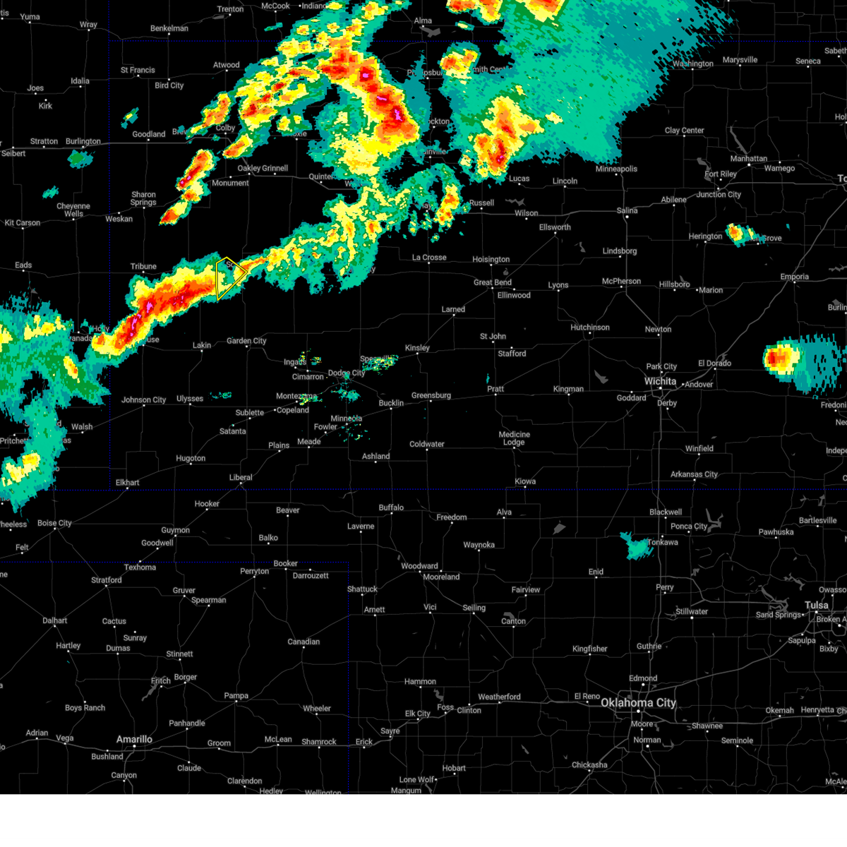 The severe thunderstorm warning for southwestern scott county will expire at 730 pm cdt, the severe thunderstorm which prompted the warning has moved out of the warned area. therefore, the warning will be allowed to expire. a severe thunderstorm watch remains in effect until midnight cdt for west central kansas. The severe thunderstorm warning for southwestern scott county will expire at 730 pm cdt, the severe thunderstorm which prompted the warning has moved out of the warned area. therefore, the warning will be allowed to expire. a severe thunderstorm watch remains in effect until midnight cdt for west central kansas.
|
| 7/4/2023 6:55 PM CDT |
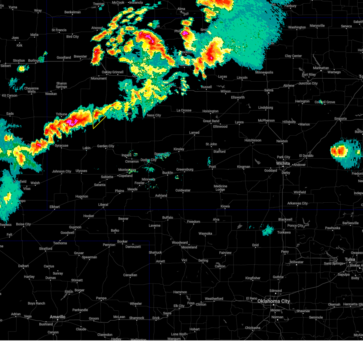 At 655 pm cdt, a severe thunderstorm was located near modoc, moving southeast at 25 mph (radar indicated). Hazards include 60 mph wind gusts and quarter size hail. Hail damage to vehicles is expected. expect wind damage to roofs, siding, and trees. locations impacted include, scott city and modoc. hail threat, radar indicated max hail size, 1. 00 in wind threat, radar indicated max wind gust, 60 mph. At 655 pm cdt, a severe thunderstorm was located near modoc, moving southeast at 25 mph (radar indicated). Hazards include 60 mph wind gusts and quarter size hail. Hail damage to vehicles is expected. expect wind damage to roofs, siding, and trees. locations impacted include, scott city and modoc. hail threat, radar indicated max hail size, 1. 00 in wind threat, radar indicated max wind gust, 60 mph.
|
| 7/4/2023 6:31 PM CDT |
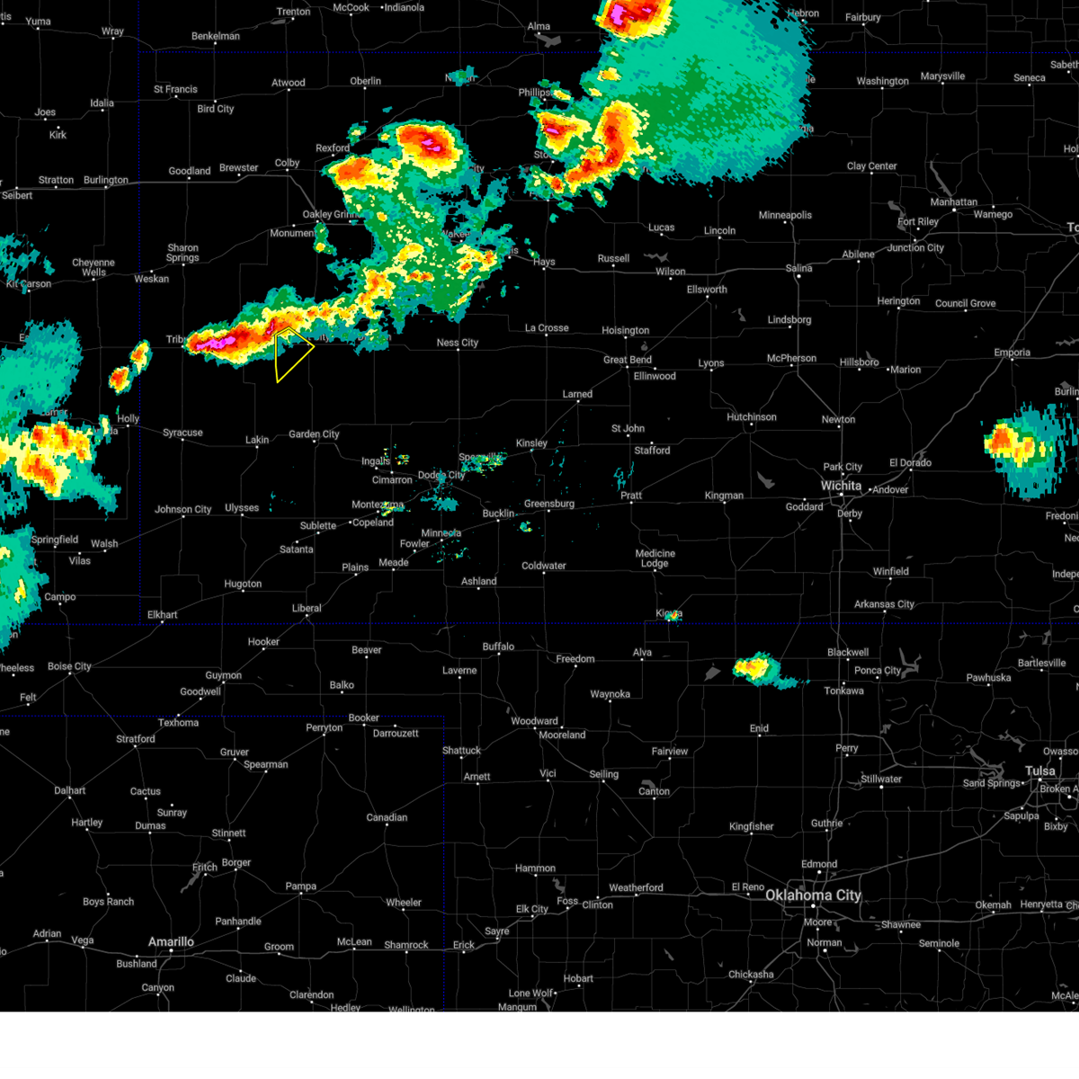 At 630 pm cdt, a severe thunderstorm was located near modoc, moving southeast at 15 mph (radar indicated). Hazards include 60 mph wind gusts and quarter size hail. Hail damage to vehicles is expected. Expect wind damage to roofs, siding, and trees. At 630 pm cdt, a severe thunderstorm was located near modoc, moving southeast at 15 mph (radar indicated). Hazards include 60 mph wind gusts and quarter size hail. Hail damage to vehicles is expected. Expect wind damage to roofs, siding, and trees.
|
| 6/10/2023 11:42 PM CDT |
 The severe thunderstorm warning for eastern hamilton, kearny, northern finney, scott, northwestern ness and lane counties will expire at 1145 pm cdt/1045 pm mdt/, the storms which prompted the warning have weakened below severe limits, and no longer pose an immediate threat to life or property. therefore, the warning will be allowed to expire. The severe thunderstorm warning for eastern hamilton, kearny, northern finney, scott, northwestern ness and lane counties will expire at 1145 pm cdt/1045 pm mdt/, the storms which prompted the warning have weakened below severe limits, and no longer pose an immediate threat to life or property. therefore, the warning will be allowed to expire.
|
| 6/10/2023 11:16 PM CDT |
 At 1116 pm cdt/1016 pm mdt/, severe thunderstorms were located along a line extending from 11 miles south of gove to near grigston to 16 miles northeast of syracuse, moving southeast at 50 mph (radar indicated). Hazards include 60 mph wind gusts. Expect damage to roofs, siding, and trees. locations impacted include, amy, grigston, manning, pendennis, shields, utica, kendall, lakin and beeler. hail threat, radar indicated max hail size, <. 75 in wind threat, radar indicated max wind gust, 60 mph. At 1116 pm cdt/1016 pm mdt/, severe thunderstorms were located along a line extending from 11 miles south of gove to near grigston to 16 miles northeast of syracuse, moving southeast at 50 mph (radar indicated). Hazards include 60 mph wind gusts. Expect damage to roofs, siding, and trees. locations impacted include, amy, grigston, manning, pendennis, shields, utica, kendall, lakin and beeler. hail threat, radar indicated max hail size, <. 75 in wind threat, radar indicated max wind gust, 60 mph.
|
| 6/10/2023 10:53 PM CDT |
 At 1053 pm cdt/953 pm mdt/, severe thunderstorms were located along a line extending from 8 miles south of grinnell to near scott state lake to near horace, moving southeast at 50 mph (radar indicated). Hazards include 60 mph wind gusts. Expect damage to roofs, siding, and trees. severe thunderstorms will be near, scott state lake around 1100 pm cdt. manning around 1110 pm cdt. other locations in the path of these severe thunderstorms include grigston, amy, pendennis, shields, utica, kendall, lakin and beeler. hail threat, radar indicated max hail size, <. 75 in wind threat, radar indicated max wind gust, 60 mph. At 1053 pm cdt/953 pm mdt/, severe thunderstorms were located along a line extending from 8 miles south of grinnell to near scott state lake to near horace, moving southeast at 50 mph (radar indicated). Hazards include 60 mph wind gusts. Expect damage to roofs, siding, and trees. severe thunderstorms will be near, scott state lake around 1100 pm cdt. manning around 1110 pm cdt. other locations in the path of these severe thunderstorms include grigston, amy, pendennis, shields, utica, kendall, lakin and beeler. hail threat, radar indicated max hail size, <. 75 in wind threat, radar indicated max wind gust, 60 mph.
|
| 5/30/2023 8:32 PM CDT |
 At 832 pm cdt, severe thunderstorms were located along a line extending from near pendennis to 9 miles south of amy to near holcomb, moving southeast at 40 mph (radar indicated). Hazards include 70 mph wind gusts and quarter size hail. Hail damage to vehicles is expected. expect considerable tree damage. wind damage is also likely to mobile homes, roofs, and outbuildings. these severe storms will be near, holcomb around 840 pm cdt. garden city around 845 pm cdt. other locations in the path of these severe thunderstorms include alamota, plymell and beeler. thunderstorm damage threat, considerable hail threat, radar indicated max hail size, 1. 00 in wind threat, radar indicated max wind gust, 70 mph. At 832 pm cdt, severe thunderstorms were located along a line extending from near pendennis to 9 miles south of amy to near holcomb, moving southeast at 40 mph (radar indicated). Hazards include 70 mph wind gusts and quarter size hail. Hail damage to vehicles is expected. expect considerable tree damage. wind damage is also likely to mobile homes, roofs, and outbuildings. these severe storms will be near, holcomb around 840 pm cdt. garden city around 845 pm cdt. other locations in the path of these severe thunderstorms include alamota, plymell and beeler. thunderstorm damage threat, considerable hail threat, radar indicated max hail size, 1. 00 in wind threat, radar indicated max wind gust, 70 mph.
|
| 5/30/2023 8:30 PM CDT | Mesonet station dw2812 scott cit in scott county KS, 9.5 miles W of Scott City, KS |
| 5/30/2023 8:26 PM CDT | Reported 55 to 70 mph wind in scott county KS, 1.9 miles W of Scott City, KS |
| 5/30/2023 8:26 PM CDT | Quarter sized hail reported 1.9 miles W of Scott City, KS |
| 5/30/2023 8:25 PM CDT |
 At 825 pm cdt, severe thunderstorms were located along a line extending from near pendennis to near manning to near holcomb, moving southeast at 30 mph (radar indicated). Hazards include 70 mph wind gusts and quarter size hail. Hail damage to vehicles is expected. expect considerable tree damage. wind damage is also likely to mobile homes, roofs, and outbuildings. severe thunderstorms will be near, holcomb around 840 pm cdt. garden city around 845 pm cdt. other locations in the path of these severe thunderstorms include amy, alamota, beeler and plymell. thunderstorm damage threat, considerable hail threat, radar indicated max hail size, 1. 00 in wind threat, radar indicated max wind gust, 70 mph. At 825 pm cdt, severe thunderstorms were located along a line extending from near pendennis to near manning to near holcomb, moving southeast at 30 mph (radar indicated). Hazards include 70 mph wind gusts and quarter size hail. Hail damage to vehicles is expected. expect considerable tree damage. wind damage is also likely to mobile homes, roofs, and outbuildings. severe thunderstorms will be near, holcomb around 840 pm cdt. garden city around 845 pm cdt. other locations in the path of these severe thunderstorms include amy, alamota, beeler and plymell. thunderstorm damage threat, considerable hail threat, radar indicated max hail size, 1. 00 in wind threat, radar indicated max wind gust, 70 mph.
|
| 5/30/2023 8:20 PM CDT | Mesonet station ew9720 scott cit in scott county KS, 6 miles SE of Scott City, KS |
| 5/30/2023 8:15 PM CDT | Awos station ktqk scott cit in scott county KS, 1.5 miles WNW of Scott City, KS |
| 5/9/2023 7:06 AM CDT |
 The severe thunderstorm warning for northeastern scott and northwestern lane counties will expire at 715 am cdt, the storm which prompted the warning has weakened below severe limits, and has exited the warned area. therefore, the warning will be allowed to expire. however gusty winds are still possible with this thunderstorm. a severe thunderstorm watch remains in effect until noon cdt for west central kansas. The severe thunderstorm warning for northeastern scott and northwestern lane counties will expire at 715 am cdt, the storm which prompted the warning has weakened below severe limits, and has exited the warned area. therefore, the warning will be allowed to expire. however gusty winds are still possible with this thunderstorm. a severe thunderstorm watch remains in effect until noon cdt for west central kansas.
|
| 5/9/2023 6:48 AM CDT |
 At 647 am cdt, a severe thunderstorm was located near manning, moving northeast at 30 mph (radar indicated). Hazards include 60 mph wind gusts and half dollar size hail. Hail damage to vehicles is expected. expect wind damage to roofs, siding, and trees. this severe storm will be near, healy around 655 am cdt. hail threat, radar indicated max hail size, 1. 25 in wind threat, radar indicated max wind gust, 60 mph. At 647 am cdt, a severe thunderstorm was located near manning, moving northeast at 30 mph (radar indicated). Hazards include 60 mph wind gusts and half dollar size hail. Hail damage to vehicles is expected. expect wind damage to roofs, siding, and trees. this severe storm will be near, healy around 655 am cdt. hail threat, radar indicated max hail size, 1. 25 in wind threat, radar indicated max wind gust, 60 mph.
|
| 5/9/2023 6:37 AM CDT |
 At 636 am cdt, a severe thunderstorm was located near manning, moving northeast at 30 mph (radar indicated). Hazards include ping pong ball size hail and 60 mph wind gusts. People and animals outdoors will be injured. expect hail damage to roofs, siding, windows, and vehicles. expect wind damage to roofs, siding, and trees. this severe storm will be near, manning around 640 am cdt. other locations in the path of this severe thunderstorm include healy. hail threat, radar indicated max hail size, 1. 50 in wind threat, radar indicated max wind gust, 60 mph. At 636 am cdt, a severe thunderstorm was located near manning, moving northeast at 30 mph (radar indicated). Hazards include ping pong ball size hail and 60 mph wind gusts. People and animals outdoors will be injured. expect hail damage to roofs, siding, windows, and vehicles. expect wind damage to roofs, siding, and trees. this severe storm will be near, manning around 640 am cdt. other locations in the path of this severe thunderstorm include healy. hail threat, radar indicated max hail size, 1. 50 in wind threat, radar indicated max wind gust, 60 mph.
|
| 5/9/2023 6:28 AM CDT |
 At 627 am cdt, a severe thunderstorm was located very near scott city, moving northeast at 30 mph (radar indicated). Hazards include quarter size hail. Damage to vehicles is expected. this severe thunderstorm will be near, grigston around 635 am cdt. manning around 645 am cdt. other locations in the path of this severe thunderstorm include healy. hail threat, radar indicated max hail size, 1. 00 in wind threat, radar indicated max wind gust, <50 mph. At 627 am cdt, a severe thunderstorm was located very near scott city, moving northeast at 30 mph (radar indicated). Hazards include quarter size hail. Damage to vehicles is expected. this severe thunderstorm will be near, grigston around 635 am cdt. manning around 645 am cdt. other locations in the path of this severe thunderstorm include healy. hail threat, radar indicated max hail size, 1. 00 in wind threat, radar indicated max wind gust, <50 mph.
|
| 4/13/2023 7:40 PM CDT | Mesonet station ew9720 scott cit in scott county KS, 6 miles SE of Scott City, KS |
| 9/2/2022 8:11 PM CDT |
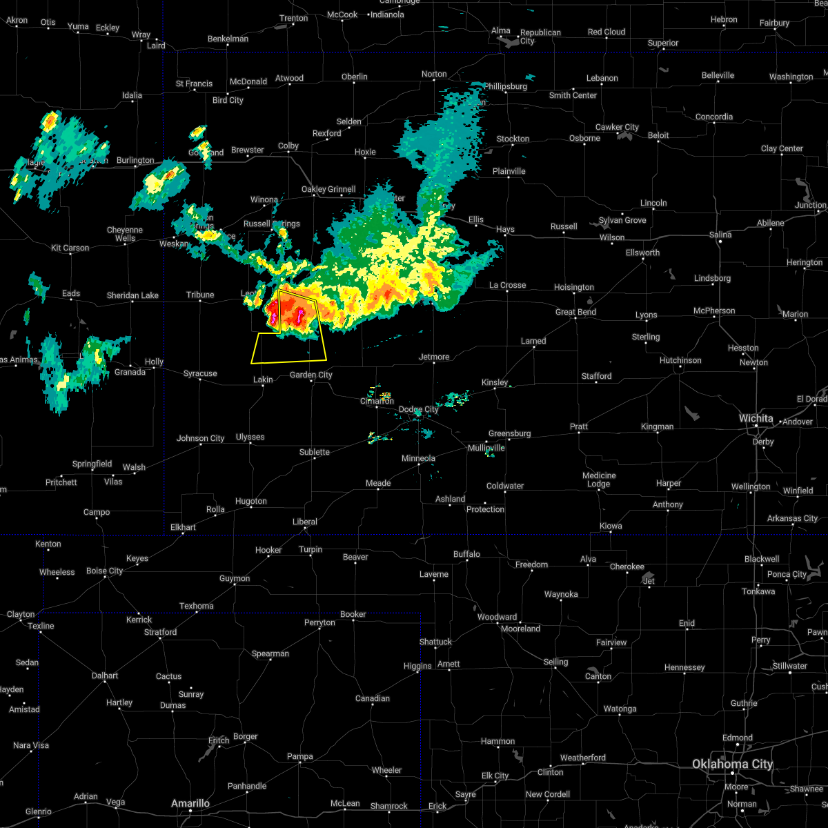 At 811 pm cdt, a severe thunderstorm was located near shallow water, moving south at 25 mph (radar indicated). Hazards include 60 mph wind gusts and penny size hail. Expect damage to roofs, siding, and trees. locations impacted include, scott city, shallow water, friend and modoc. hail threat, radar indicated max hail size, 0. 75 in wind threat, radar indicated max wind gust, 60 mph. At 811 pm cdt, a severe thunderstorm was located near shallow water, moving south at 25 mph (radar indicated). Hazards include 60 mph wind gusts and penny size hail. Expect damage to roofs, siding, and trees. locations impacted include, scott city, shallow water, friend and modoc. hail threat, radar indicated max hail size, 0. 75 in wind threat, radar indicated max wind gust, 60 mph.
|
| 9/2/2022 7:56 PM CDT |
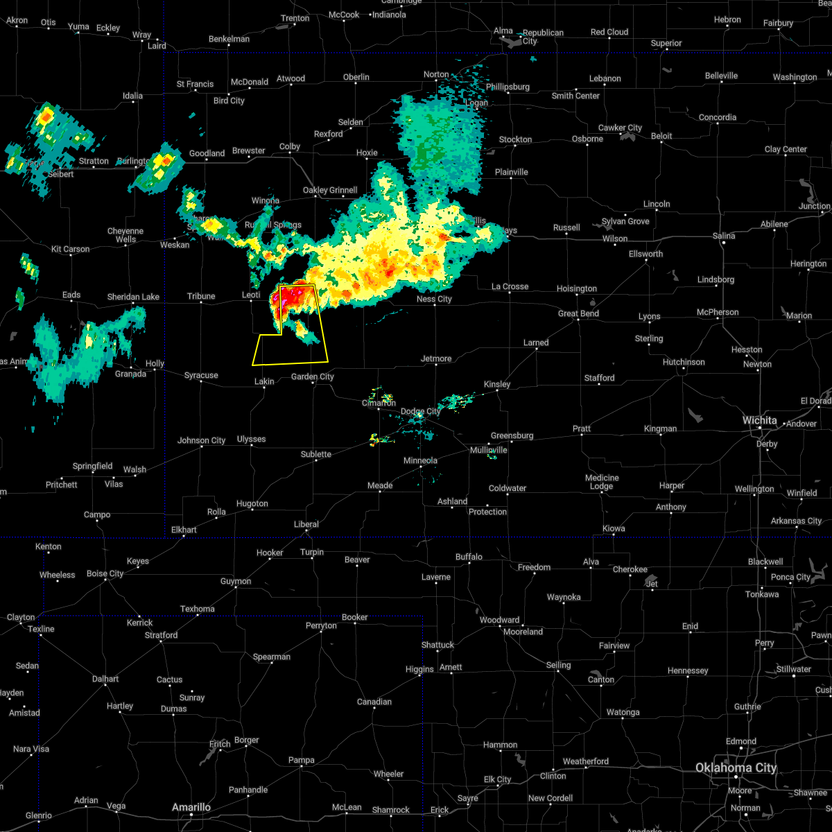 At 755 pm cdt, a severe thunderstorm was located near modoc, moving south at 25 mph (radar indicated). Hazards include 60 mph wind gusts and quarter size hail. Hail damage to vehicles is expected. expect wind damage to roofs, siding, and trees. this severe thunderstorm will remain over mainly rural areas of northeastern kearny, northwestern finney and southwestern scott counties. this new warning for replaces the previous warning for northern finney and scott county. hail threat, radar indicated max hail size, 1. 00 in wind threat, radar indicated max wind gust, 60 mph. At 755 pm cdt, a severe thunderstorm was located near modoc, moving south at 25 mph (radar indicated). Hazards include 60 mph wind gusts and quarter size hail. Hail damage to vehicles is expected. expect wind damage to roofs, siding, and trees. this severe thunderstorm will remain over mainly rural areas of northeastern kearny, northwestern finney and southwestern scott counties. this new warning for replaces the previous warning for northern finney and scott county. hail threat, radar indicated max hail size, 1. 00 in wind threat, radar indicated max wind gust, 60 mph.
|
| 9/2/2022 7:48 PM CDT |
 At 747 pm cdt, the leading edge of severe thunderstorms were located along a line extending from alamota to 9 miles south of grigston to 8 miles south of modoc, moving south at 45 mph (radar indicated). Hazards include 60 mph wind gusts and penny size hail. Expect damage to roofs, siding, and trees. these severe thunderstorms will remain over mainly rural areas of northern finney, scott and lane counties. hail threat, radar indicated max hail size, 0. 75 in wind threat, radar indicated max wind gust, 60 mph. At 747 pm cdt, the leading edge of severe thunderstorms were located along a line extending from alamota to 9 miles south of grigston to 8 miles south of modoc, moving south at 45 mph (radar indicated). Hazards include 60 mph wind gusts and penny size hail. Expect damage to roofs, siding, and trees. these severe thunderstorms will remain over mainly rural areas of northern finney, scott and lane counties. hail threat, radar indicated max hail size, 0. 75 in wind threat, radar indicated max wind gust, 60 mph.
|
| 9/2/2022 7:23 PM CDT |
 At 722 pm cdt, the wind shift gust front ahead of severe thunderstorms was located along a line extending from near shields to near modoc, moving south at 50 mph (radar indicated). Hazards include 60 mph wind gusts and penny size hail. Expect damage to roofs, siding, and trees. severe thunderstorms will be near, shields around 725 pm cdt. scott city and dighton around 730 pm cdt. shallow water around 740 pm cdt. other locations in the path of these severe thunderstorms include friend. hail threat, radar indicated max hail size, 0. 75 in wind threat, radar indicated max wind gust, 60 mph. At 722 pm cdt, the wind shift gust front ahead of severe thunderstorms was located along a line extending from near shields to near modoc, moving south at 50 mph (radar indicated). Hazards include 60 mph wind gusts and penny size hail. Expect damage to roofs, siding, and trees. severe thunderstorms will be near, shields around 725 pm cdt. scott city and dighton around 730 pm cdt. shallow water around 740 pm cdt. other locations in the path of these severe thunderstorms include friend. hail threat, radar indicated max hail size, 0. 75 in wind threat, radar indicated max wind gust, 60 mph.
|
| 6/12/2022 9:08 PM CDT |
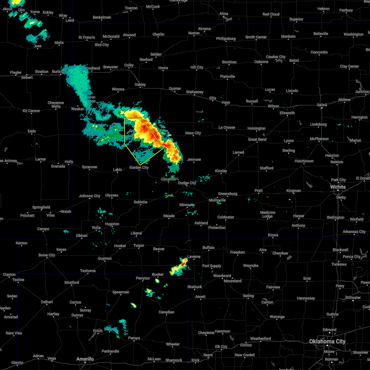 The severe thunderstorm warning for northwestern finney, scott and southwestern lane counties will expire at 915 pm cdt, the storms which prompted the warning are moving out of the warned area. therefore, the warning will be allowed to expire. a severe thunderstorm watch remains in effect until midnight cdt for southwestern and west central kansas. The severe thunderstorm warning for northwestern finney, scott and southwestern lane counties will expire at 915 pm cdt, the storms which prompted the warning are moving out of the warned area. therefore, the warning will be allowed to expire. a severe thunderstorm watch remains in effect until midnight cdt for southwestern and west central kansas.
|
| 6/12/2022 8:32 PM CDT | Truck and camper blown over just south of the scott finney county line. relayed by scott county sheriffs offic in finney county KS, 15.2 miles N of Scott City, KS |
| 6/12/2022 8:26 PM CDT |
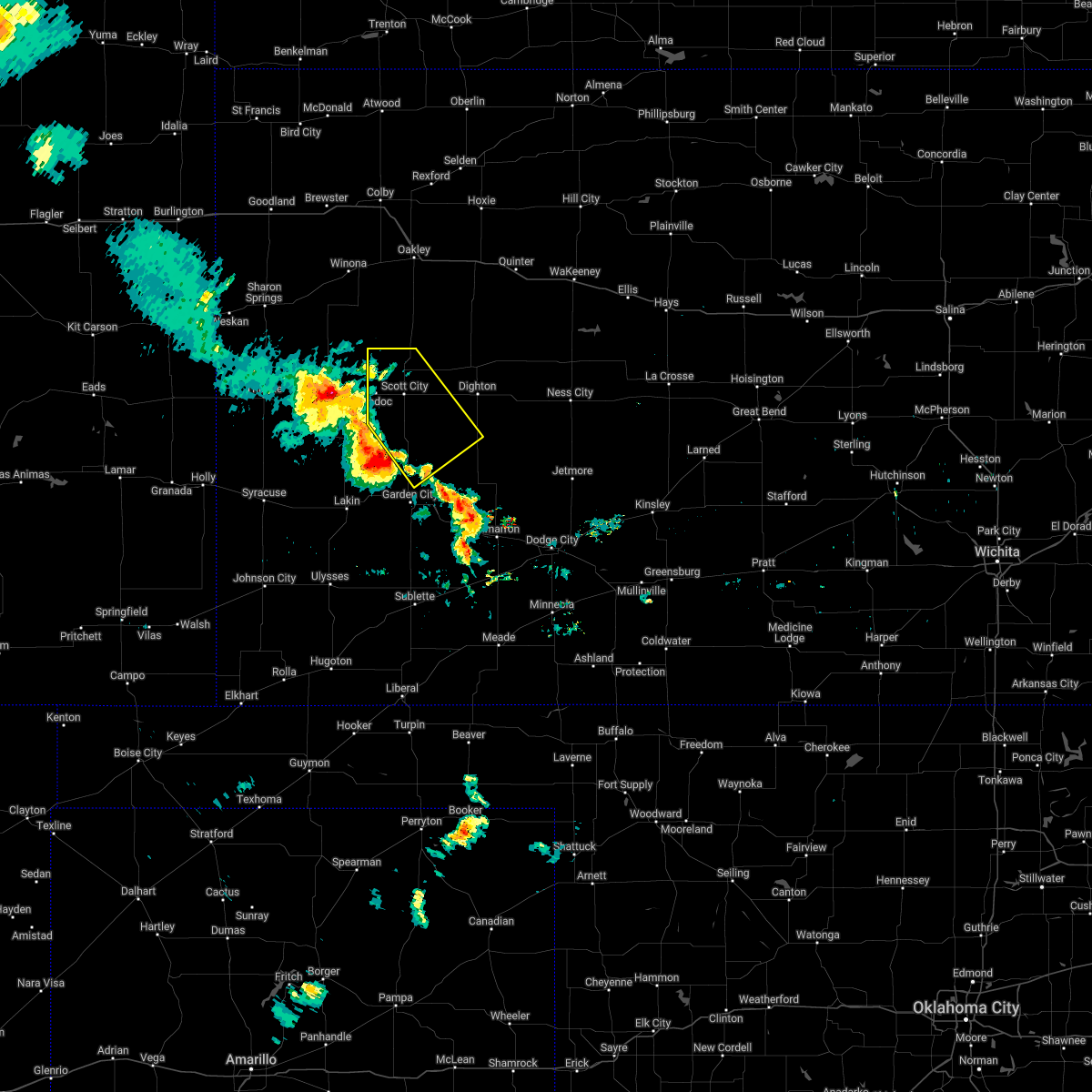 At 826 pm cdt, severe thunderstorms were located along a line extending from 6 miles west of modoc to 6 miles northeast of garden city, moving northeast at 30 mph (radar indicated). Hazards include 70 mph wind gusts and half dollar size hail. Hail damage to vehicles is expected. expect considerable tree damage. wind damage is also likely to mobile homes, roofs, and outbuildings. severe thunderstorms will be near, modoc around 835 pm cdt. other locations in the path of these severe thunderstorms include scott state lake. thunderstorm damage threat, considerable hail threat, radar indicated max hail size, 1. 25 in wind threat, radar indicated max wind gust, 70 mph. At 826 pm cdt, severe thunderstorms were located along a line extending from 6 miles west of modoc to 6 miles northeast of garden city, moving northeast at 30 mph (radar indicated). Hazards include 70 mph wind gusts and half dollar size hail. Hail damage to vehicles is expected. expect considerable tree damage. wind damage is also likely to mobile homes, roofs, and outbuildings. severe thunderstorms will be near, modoc around 835 pm cdt. other locations in the path of these severe thunderstorms include scott state lake. thunderstorm damage threat, considerable hail threat, radar indicated max hail size, 1. 25 in wind threat, radar indicated max wind gust, 70 mph.
|
| 5/18/2022 8:24 PM CDT |
 At 823 pm cdt, a severe thunderstorm was located 15 miles southeast of leoti, moving southeast at 30 mph (radar indicated). Hazards include 70 mph wind gusts and quarter size hail. Hail damage to vehicles is expected. expect considerable tree damage. Wind damage is also likely to mobile homes, roofs, and outbuildings. At 823 pm cdt, a severe thunderstorm was located 15 miles southeast of leoti, moving southeast at 30 mph (radar indicated). Hazards include 70 mph wind gusts and quarter size hail. Hail damage to vehicles is expected. expect considerable tree damage. Wind damage is also likely to mobile homes, roofs, and outbuildings.
|
| 4/29/2022 5:35 PM CDT | Mesonet station k5sct 1 ese scott state lak in scott county KS, 13.9 miles S of Scott City, KS |
| 4/23/2022 1:31 AM CDT |
 At 131 am cdt, severe thunderstorms were located along a line extending from 11 miles northeast of hoxie to 14 miles west of friend, moving northeast at 55 mph (radar indicated). Hazards include 60 mph wind gusts. Expect damage to roofs, siding, and trees. locations impacted include, scott city, dighton, grigston, healy, friend, scott state lake, modoc, shallow water, manning, amy and shields. hail threat, radar indicated max hail size, <. 75 in wind threat, radar indicated max wind gust, 60 mph. At 131 am cdt, severe thunderstorms were located along a line extending from 11 miles northeast of hoxie to 14 miles west of friend, moving northeast at 55 mph (radar indicated). Hazards include 60 mph wind gusts. Expect damage to roofs, siding, and trees. locations impacted include, scott city, dighton, grigston, healy, friend, scott state lake, modoc, shallow water, manning, amy and shields. hail threat, radar indicated max hail size, <. 75 in wind threat, radar indicated max wind gust, 60 mph.
|
| 4/23/2022 12:59 AM CDT |
 At 1258 am cdt/1158 pm mdt/, severe thunderstorms were located along a line extending from 6 miles south of menlo to 7 miles northwest of kendall, moving northeast at 55 mph (radar indicated). Hazards include 60 mph wind gusts and quarter size hail. Hail damage to vehicles is expected. Expect wind damage to roofs, siding, and trees. At 1258 am cdt/1158 pm mdt/, severe thunderstorms were located along a line extending from 6 miles south of menlo to 7 miles northwest of kendall, moving northeast at 55 mph (radar indicated). Hazards include 60 mph wind gusts and quarter size hail. Hail damage to vehicles is expected. Expect wind damage to roofs, siding, and trees.
|
| 4/23/2022 12:50 AM CDT | Mesonet station k5sct 1 ese scott state lak in scott county KS, 13.9 miles S of Scott City, KS |
| 4/22/2022 9:07 PM CDT |
 At 907 pm cdt, a severe thunderstorm was located near scott city, moving north at 45 mph (radar indicated). Hazards include 60 mph wind gusts and quarter size hail. Hail damage to vehicles is expected. expect wind damage to roofs, siding, and trees. this severe thunderstorm will remain over mainly rural areas of northeastern scott county. hail threat, radar indicated max hail size, 1. 00 in wind threat, radar indicated max wind gust, 60 mph. At 907 pm cdt, a severe thunderstorm was located near scott city, moving north at 45 mph (radar indicated). Hazards include 60 mph wind gusts and quarter size hail. Hail damage to vehicles is expected. expect wind damage to roofs, siding, and trees. this severe thunderstorm will remain over mainly rural areas of northeastern scott county. hail threat, radar indicated max hail size, 1. 00 in wind threat, radar indicated max wind gust, 60 mph.
|
| 4/22/2022 9:01 PM CDT | Reported at scott city municipal airpor in scott county KS, 0.8 miles W of Scott City, KS |
| 4/22/2022 8:44 PM CDT |
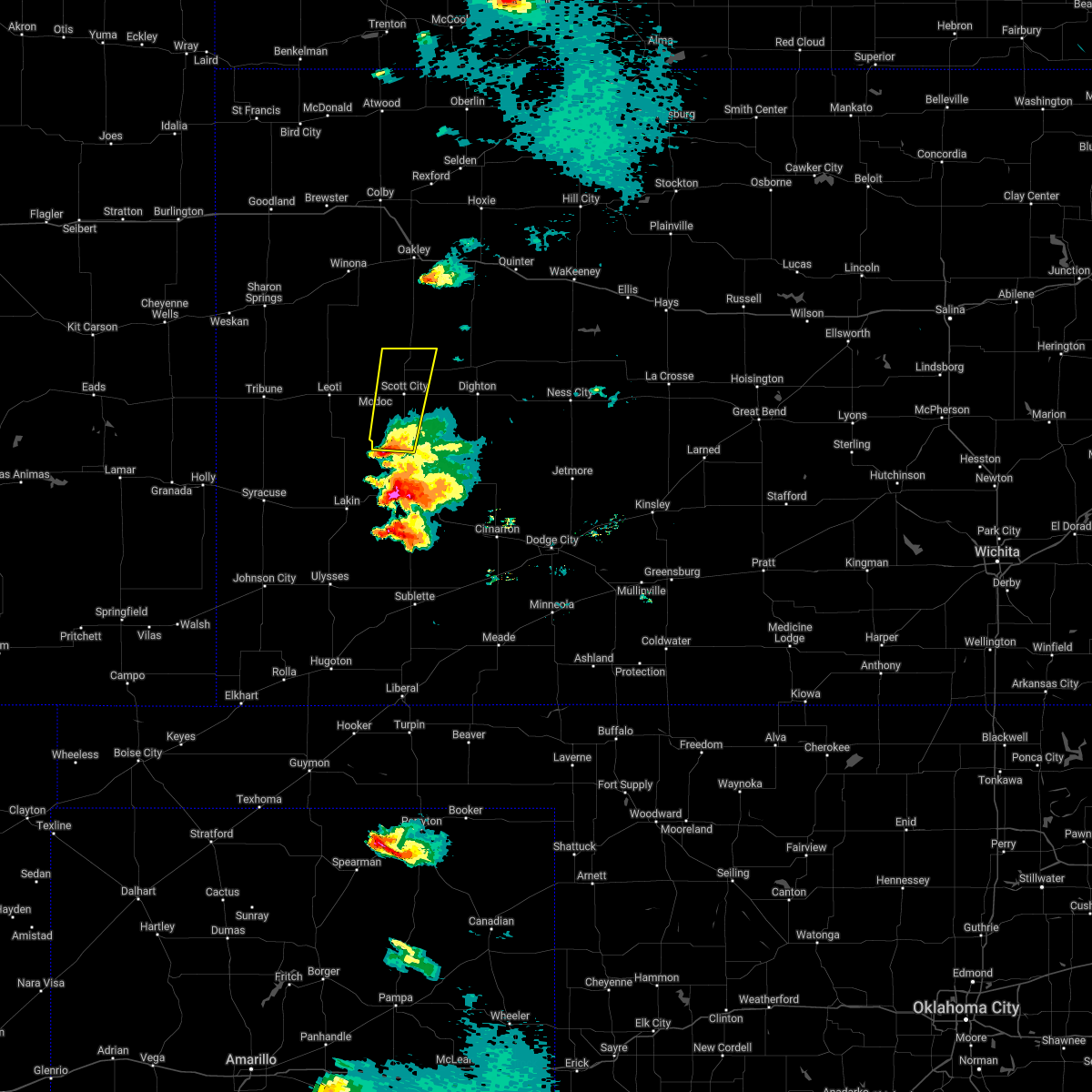 At 844 pm cdt, a severe thunderstorm was located near friend, moving north at 40 mph (radar indicated). Hazards include 60 mph wind gusts and half dollar size hail. Hail damage to vehicles is expected. expect wind damage to roofs, siding, and trees. this severe thunderstorm will be near, shallow water around 855 pm cdt. other locations in the path of this severe thunderstorm include modoc, scott city and scott state lake. hail threat, radar indicated max hail size, 1. 25 in wind threat, radar indicated max wind gust, 60 mph. At 844 pm cdt, a severe thunderstorm was located near friend, moving north at 40 mph (radar indicated). Hazards include 60 mph wind gusts and half dollar size hail. Hail damage to vehicles is expected. expect wind damage to roofs, siding, and trees. this severe thunderstorm will be near, shallow water around 855 pm cdt. other locations in the path of this severe thunderstorm include modoc, scott city and scott state lake. hail threat, radar indicated max hail size, 1. 25 in wind threat, radar indicated max wind gust, 60 mph.
|
| 4/22/2022 7:54 PM CDT |
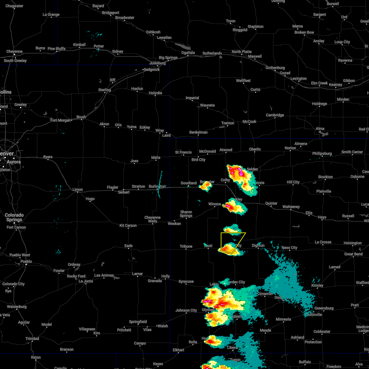 At 754 pm cdt, a severe thunderstorm was located near modoc, moving northeast at 50 mph (radar indicated). Hazards include 60 mph wind gusts and quarter size hail. Hail damage to vehicles is expected. expect wind damage to roofs, siding, and trees. locations impacted include, scott state lake. hail threat, radar indicated max hail size, 1. 00 in wind threat, radar indicated max wind gust, 60 mph. At 754 pm cdt, a severe thunderstorm was located near modoc, moving northeast at 50 mph (radar indicated). Hazards include 60 mph wind gusts and quarter size hail. Hail damage to vehicles is expected. expect wind damage to roofs, siding, and trees. locations impacted include, scott state lake. hail threat, radar indicated max hail size, 1. 00 in wind threat, radar indicated max wind gust, 60 mph.
|
| 4/22/2022 7:41 PM CDT |
 At 741 pm cdt, a severe thunderstorm was located 8 miles south of modoc, moving northeast at 45 mph (radar indicated). Hazards include 60 mph wind gusts and half dollar size hail. Hail damage to vehicles is expected. expect wind damage to roofs, siding, and trees. this severe thunderstorm will be near, modoc around 750 pm cdt. scott city around 800 pm cdt. other locations in the path of this severe thunderstorm include scott state lake. hail threat, radar indicated max hail size, 1. 25 in wind threat, radar indicated max wind gust, 60 mph. At 741 pm cdt, a severe thunderstorm was located 8 miles south of modoc, moving northeast at 45 mph (radar indicated). Hazards include 60 mph wind gusts and half dollar size hail. Hail damage to vehicles is expected. expect wind damage to roofs, siding, and trees. this severe thunderstorm will be near, modoc around 750 pm cdt. scott city around 800 pm cdt. other locations in the path of this severe thunderstorm include scott state lake. hail threat, radar indicated max hail size, 1. 25 in wind threat, radar indicated max wind gust, 60 mph.
|
| 3/4/2022 10:15 PM CST | Awos station ktqk scott cit in scott county KS, 1.5 miles WNW of Scott City, KS |
| 10/12/2021 9:15 PM CDT |
 At 914 pm cdt, severe thunderstorms were located along a line extending from 12 miles north of healy to 9 miles southeast of friend, moving northeast at 55 mph (radar indicated). Hazards include 60 mph wind gusts and penny size hail. Expect damage to roofs, siding, and trees. These severe thunderstorms will remain over mainly rural areas of northern finney, scott and lane counties. At 914 pm cdt, severe thunderstorms were located along a line extending from 12 miles north of healy to 9 miles southeast of friend, moving northeast at 55 mph (radar indicated). Hazards include 60 mph wind gusts and penny size hail. Expect damage to roofs, siding, and trees. These severe thunderstorms will remain over mainly rural areas of northern finney, scott and lane counties.
|
| 10/12/2021 8:35 PM CDT |
 At 835 pm cdt, severe thunderstorms were located along a line extending from 11 miles west of scott state lake to near modoc to 14 miles southeast of leoti, moving northeast at 55 mph (radar indicated). Hazards include 60 mph wind gusts and quarter size hail. Hail damage to vehicles is expected. expect wind damage to roofs, siding, and trees. severe thunderstorms will be near, scott state lake around 850 pm cdt. Other locations in the path of these severe thunderstorms include scott city and manning. At 835 pm cdt, severe thunderstorms were located along a line extending from 11 miles west of scott state lake to near modoc to 14 miles southeast of leoti, moving northeast at 55 mph (radar indicated). Hazards include 60 mph wind gusts and quarter size hail. Hail damage to vehicles is expected. expect wind damage to roofs, siding, and trees. severe thunderstorms will be near, scott state lake around 850 pm cdt. Other locations in the path of these severe thunderstorms include scott city and manning.
|
| 8/7/2021 5:19 PM CDT | Hen Egg sized hail reported 14.6 miles N of Scott City, KS |
| 8/7/2021 5:19 PM CDT | Storm damage reported in scott county KS, 14.6 miles N of Scott City, KS |
| 7/10/2021 12:05 AM CDT |
 The severe thunderstorm warning for northeastern kearny, northwestern finney, southern scott and southwestern lane counties will expire at 1215 am cdt, the storms which prompted the warning have weakened below severe limits, and no longer pose an immediate threat to life or property. therefore, the warning will be allowed to expire. however gusty winds are still possible with these thunderstorms. a severe thunderstorm watch remains in effect until 200 am cdt for southwestern and west central kansas. The severe thunderstorm warning for northeastern kearny, northwestern finney, southern scott and southwestern lane counties will expire at 1215 am cdt, the storms which prompted the warning have weakened below severe limits, and no longer pose an immediate threat to life or property. therefore, the warning will be allowed to expire. however gusty winds are still possible with these thunderstorms. a severe thunderstorm watch remains in effect until 200 am cdt for southwestern and west central kansas.
|
| 7/9/2021 11:43 PM CDT |
 At 1143 pm cdt, severe thunderstorms were located along a line extending from near alamota to 7 miles east of friend to 13 miles north of deerfield, moving southeast at 25 mph (radar indicated). Hazards include 60 mph wind gusts. Expect damage to roofs, siding, and trees. These severe thunderstorms will remain over mainly rural areas of northeastern kearny, northwestern finney, southern scott and southwestern lane counties. At 1143 pm cdt, severe thunderstorms were located along a line extending from near alamota to 7 miles east of friend to 13 miles north of deerfield, moving southeast at 25 mph (radar indicated). Hazards include 60 mph wind gusts. Expect damage to roofs, siding, and trees. These severe thunderstorms will remain over mainly rural areas of northeastern kearny, northwestern finney, southern scott and southwestern lane counties.
|
| 7/9/2021 11:20 PM CDT | Mesonet station k5sct 1 ese scott state lak in scott county KS, 13.9 miles S of Scott City, KS |
| 7/9/2021 11:18 PM CDT |
 At 1118 pm cdt, severe thunderstorms were located along a line extending from near healy to near scott city to 13 miles south of leoti, moving southeast at 35 mph (radar indicated). Hazards include 60 mph wind gusts. Expect damage to roofs, siding, and trees. severe thunderstorms will be near, healy, shallow water and manning around 1130 pm cdt. Other locations in the path of these severe thunderstorms include amy, friend and dighton. At 1118 pm cdt, severe thunderstorms were located along a line extending from near healy to near scott city to 13 miles south of leoti, moving southeast at 35 mph (radar indicated). Hazards include 60 mph wind gusts. Expect damage to roofs, siding, and trees. severe thunderstorms will be near, healy, shallow water and manning around 1130 pm cdt. Other locations in the path of these severe thunderstorms include amy, friend and dighton.
|
| 7/4/2021 7:01 PM CDT |
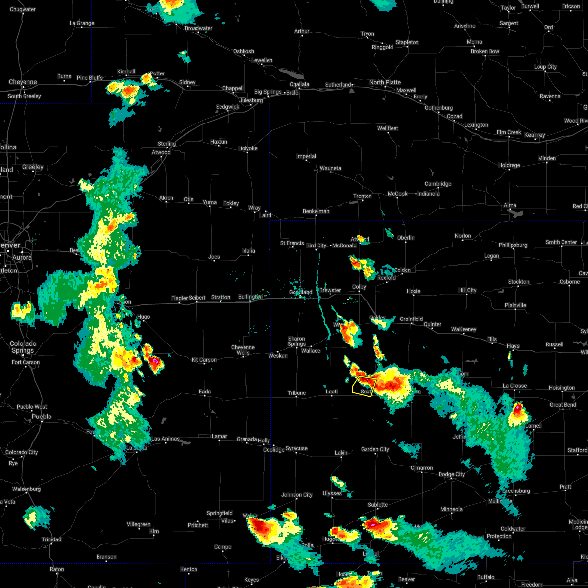 At 701 pm cdt, a severe thunderstorm was located near scott state lake, moving south at 10 mph (radar indicated). Hazards include 70 mph wind gusts and ping pong ball size hail. People and animals outdoors will be injured. expect hail damage to roofs, siding, windows, and vehicles. expect considerable tree damage. wind damage is also likely to mobile homes, roofs, and outbuildings. Locations impacted include, scott city. At 701 pm cdt, a severe thunderstorm was located near scott state lake, moving south at 10 mph (radar indicated). Hazards include 70 mph wind gusts and ping pong ball size hail. People and animals outdoors will be injured. expect hail damage to roofs, siding, windows, and vehicles. expect considerable tree damage. wind damage is also likely to mobile homes, roofs, and outbuildings. Locations impacted include, scott city.
|
| 7/4/2021 6:35 PM CDT |
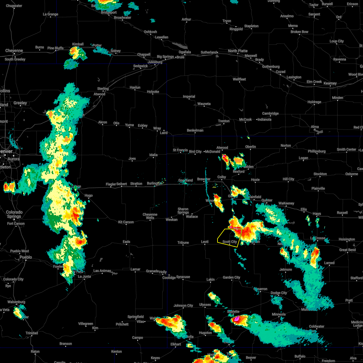 At 635 pm cdt, a severe thunderstorm was located near scott state lake, moving south at 10 mph (radar indicated). Hazards include 70 mph wind gusts and ping pong ball size hail. People and animals outdoors will be injured. expect hail damage to roofs, siding, windows, and vehicles. expect considerable tree damage. wind damage is also likely to mobile homes, roofs, and outbuildings. this severe thunderstorm will be near, scott state lake around 640 pm cdt. Other locations in the path of this severe thunderstorm include scott city. At 635 pm cdt, a severe thunderstorm was located near scott state lake, moving south at 10 mph (radar indicated). Hazards include 70 mph wind gusts and ping pong ball size hail. People and animals outdoors will be injured. expect hail damage to roofs, siding, windows, and vehicles. expect considerable tree damage. wind damage is also likely to mobile homes, roofs, and outbuildings. this severe thunderstorm will be near, scott state lake around 640 pm cdt. Other locations in the path of this severe thunderstorm include scott city.
|
| 6/24/2021 10:04 PM CDT |
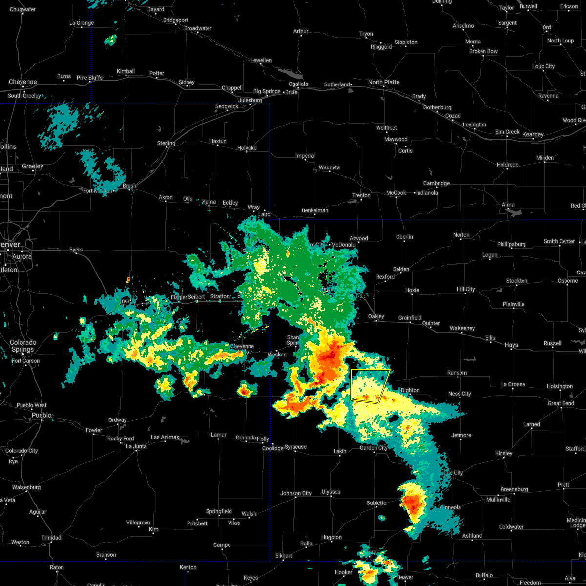 At 1004 pm cdt, severe thunderstorms were located along a line extending from near russell springs to near leoti, moving east at 30 mph (radar indicated). Hazards include 70 mph wind gusts and nickel size hail. Expect considerable tree damage. Damage is likely to mobile homes, roofs, and outbuildings. At 1004 pm cdt, severe thunderstorms were located along a line extending from near russell springs to near leoti, moving east at 30 mph (radar indicated). Hazards include 70 mph wind gusts and nickel size hail. Expect considerable tree damage. Damage is likely to mobile homes, roofs, and outbuildings.
|
| 5/24/2021 5:13 PM CDT | Estimated 50-60 mph winds with pea size hail and lots of rain. also reported water in the creeks are risin in logan county KS, 18.6 miles SSE of Scott City, KS |
| 5/14/2021 9:58 PM CDT |
 At 958 pm cdt, severe thunderstorms were located along a line extending from 7 miles south of arnold to 13 miles south of beeler to 9 miles north of garden city, moving southeast at 35 mph (radar indicated). Hazards include 70 mph wind gusts and quarter size hail. Hail damage to vehicles is expected. expect considerable tree damage. wind damage is also likely to mobile homes, roofs, and outbuildings. These severe thunderstorms will remain over mainly rural areas of northeastern finney, western ness, southern scott, northwestern hodgeman and lane counties. At 958 pm cdt, severe thunderstorms were located along a line extending from 7 miles south of arnold to 13 miles south of beeler to 9 miles north of garden city, moving southeast at 35 mph (radar indicated). Hazards include 70 mph wind gusts and quarter size hail. Hail damage to vehicles is expected. expect considerable tree damage. wind damage is also likely to mobile homes, roofs, and outbuildings. These severe thunderstorms will remain over mainly rural areas of northeastern finney, western ness, southern scott, northwestern hodgeman and lane counties.
|
| 5/14/2021 9:43 PM CDT |
 The national weather service in dodge city has issued a * severe thunderstorm warning for. northern finney county in southwestern kansas. western ness county in west central kansas. scott county in west central kansas. Northwestern hodgeman county in southwestern kansas. The national weather service in dodge city has issued a * severe thunderstorm warning for. northern finney county in southwestern kansas. western ness county in west central kansas. scott county in west central kansas. Northwestern hodgeman county in southwestern kansas.
|
| 5/14/2021 9:32 PM CDT |
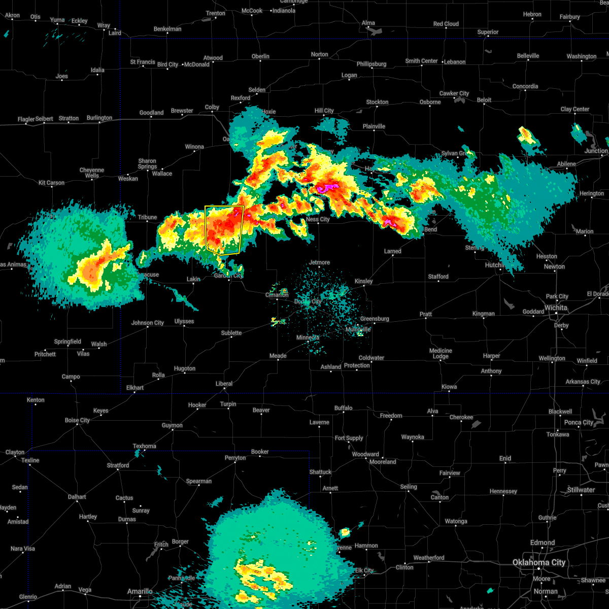 At 932 pm cdt, severe thunderstorms were located along a line extending from near friend to near holcomb to near lakin, moving southeast at 30 mph (radar indicated). Hazards include 60 mph wind gusts and quarter size hail. Hail damage to vehicles is expected. expect wind damage to roofs, siding, and trees. Locations impacted include, scott city, shallow water, manning, friend and modoc. At 932 pm cdt, severe thunderstorms were located along a line extending from near friend to near holcomb to near lakin, moving southeast at 30 mph (radar indicated). Hazards include 60 mph wind gusts and quarter size hail. Hail damage to vehicles is expected. expect wind damage to roofs, siding, and trees. Locations impacted include, scott city, shallow water, manning, friend and modoc.
|
| 5/14/2021 9:02 PM CDT |
 At 901 pm cdt, severe thunderstorms were located along a line extending from near modoc to 10 miles west of friend to 8 miles north of lakin, moving east at 25 mph (radar indicated). Hazards include 60 mph wind gusts and quarter size hail. Hail damage to vehicles is expected. Expect wind damage to roofs, siding, and trees. At 901 pm cdt, severe thunderstorms were located along a line extending from near modoc to 10 miles west of friend to 8 miles north of lakin, moving east at 25 mph (radar indicated). Hazards include 60 mph wind gusts and quarter size hail. Hail damage to vehicles is expected. Expect wind damage to roofs, siding, and trees.
|
| 5/13/2021 10:39 PM CDT |
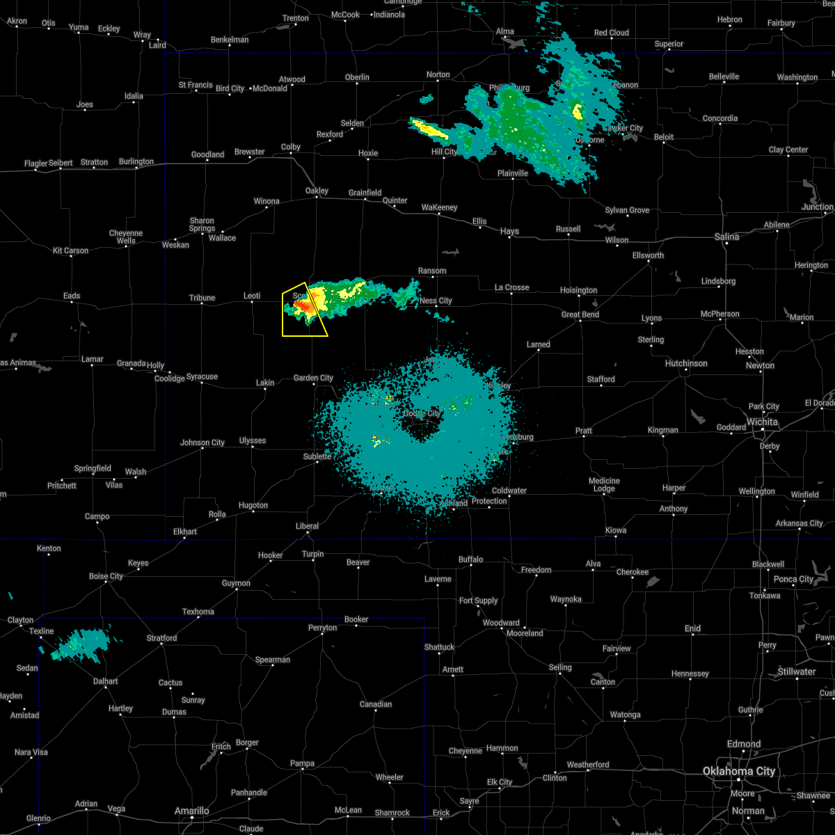 The severe thunderstorm warning for southwestern scott county will expire at 1045 pm cdt, the storm which prompted the warning has weakened below severe limits, and no longer poses an immediate threat to life or property. therefore, the warning will be allowed to expire. to report severe weather, contact your nearest law enforcement agency. they will relay your report to the national weather service dodge city. The severe thunderstorm warning for southwestern scott county will expire at 1045 pm cdt, the storm which prompted the warning has weakened below severe limits, and no longer poses an immediate threat to life or property. therefore, the warning will be allowed to expire. to report severe weather, contact your nearest law enforcement agency. they will relay your report to the national weather service dodge city.
|
| 5/13/2021 10:29 PM CDT |
 At 949 pm cdt, a severe thunderstorm was located 10 miles west of scott state lake, moving southeast at 30 mph (radar indicated). Hazards include quarter size hail. damage to vehicles is expected At 949 pm cdt, a severe thunderstorm was located 10 miles west of scott state lake, moving southeast at 30 mph (radar indicated). Hazards include quarter size hail. damage to vehicles is expected
|
| 5/13/2021 9:50 PM CDT |
 At 949 pm cdt, a severe thunderstorm was located 10 miles west of scott state lake, moving southeast at 30 mph (radar indicated). Hazards include quarter size hail. damage to vehicles is expected At 949 pm cdt, a severe thunderstorm was located 10 miles west of scott state lake, moving southeast at 30 mph (radar indicated). Hazards include quarter size hail. damage to vehicles is expected
|
| 5/2/2021 8:56 PM CDT |
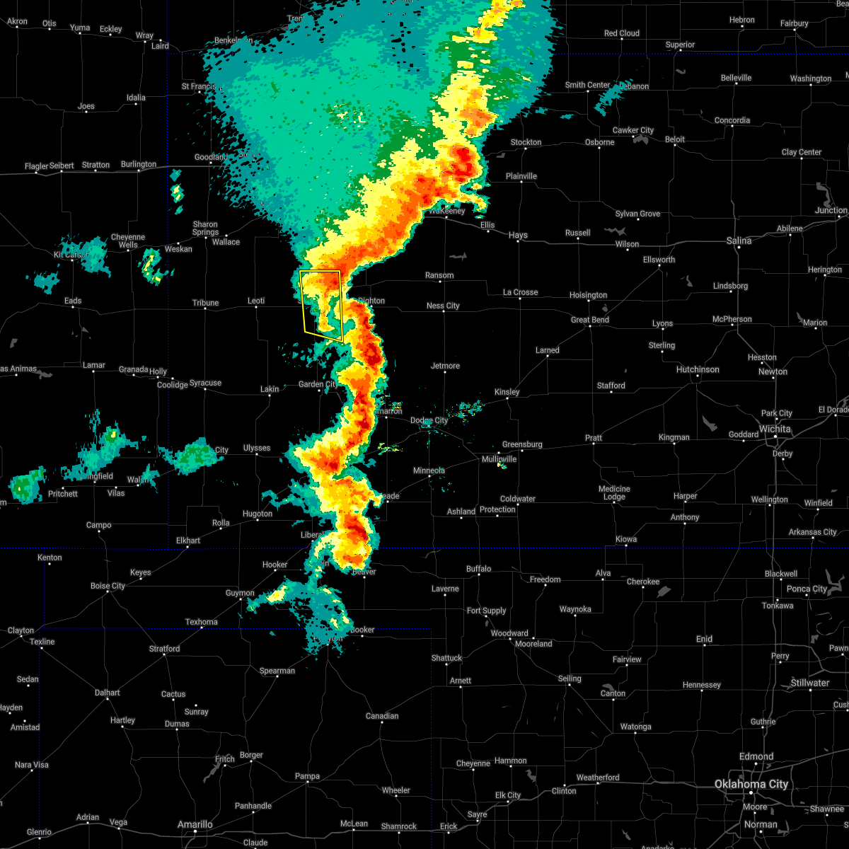 The severe thunderstorm warning for scott county will expire at 900 pm cdt, the storms which prompted the warning have weakened below severe limits, and no longer pose an immediate threat to life or property. therefore, the warning will be allowed to expire. however gusty winds are still possible with these thunderstorms. a severe thunderstorm watch remains in effect until midnight cdt for west central kansas. The severe thunderstorm warning for scott county will expire at 900 pm cdt, the storms which prompted the warning have weakened below severe limits, and no longer pose an immediate threat to life or property. therefore, the warning will be allowed to expire. however gusty winds are still possible with these thunderstorms. a severe thunderstorm watch remains in effect until midnight cdt for west central kansas.
|
| 5/2/2021 8:46 PM CDT |
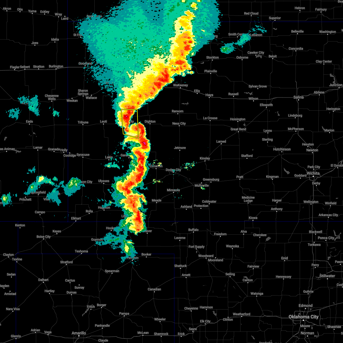 At 845 pm cdt, severe thunderstorms were located along a line extending from 6 miles north of scott state lake to near shallow water, moving east at 15 mph (radar indicated). Hazards include 60 mph wind gusts and nickel size hail. Expect damage to roofs, siding, and trees. Locations impacted include, scott city, shallow water, grigston, manning and scott state lake. At 845 pm cdt, severe thunderstorms were located along a line extending from 6 miles north of scott state lake to near shallow water, moving east at 15 mph (radar indicated). Hazards include 60 mph wind gusts and nickel size hail. Expect damage to roofs, siding, and trees. Locations impacted include, scott city, shallow water, grigston, manning and scott state lake.
|
| 5/2/2021 8:08 PM CDT |
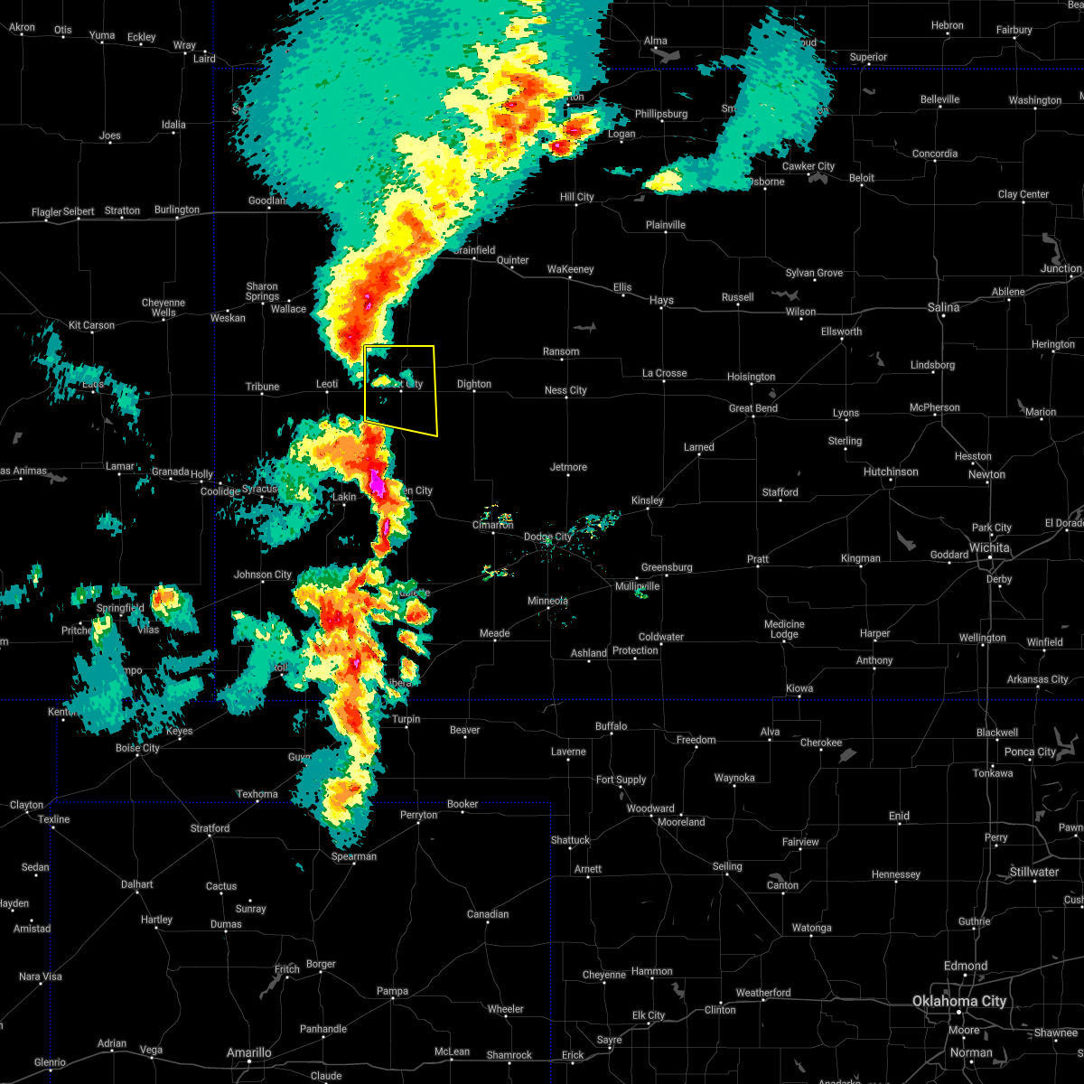 At 806 pm cdt, severe thunderstorms were located along a line extending from 11 miles south of russell springs to 10 miles west of shallow water, moving east at 15 mph (radar indicated). Hazards include 70 mph wind gusts and quarter size hail. Hail damage to vehicles is expected. expect considerable tree damage. Wind damage is also likely to mobile homes, roofs, and outbuildings. At 806 pm cdt, severe thunderstorms were located along a line extending from 11 miles south of russell springs to 10 miles west of shallow water, moving east at 15 mph (radar indicated). Hazards include 70 mph wind gusts and quarter size hail. Hail damage to vehicles is expected. expect considerable tree damage. Wind damage is also likely to mobile homes, roofs, and outbuildings.
|
| 3/13/2021 1:26 PM CST |
 At 126 pm cst, a severe thunderstorm was located very near grigston, moving northeast at 55 mph (radar indicated). Hazards include 60 mph wind gusts and quarter size hail. Hail damage to vehicles is expected. expect wind damage to roofs, siding, and trees. Locations impacted include, scott city, dighton, grigston, healy, scott state lake, manning, pendennis, amy and shields. At 126 pm cst, a severe thunderstorm was located very near grigston, moving northeast at 55 mph (radar indicated). Hazards include 60 mph wind gusts and quarter size hail. Hail damage to vehicles is expected. expect wind damage to roofs, siding, and trees. Locations impacted include, scott city, dighton, grigston, healy, scott state lake, manning, pendennis, amy and shields.
|
| 3/13/2021 1:09 PM CST |
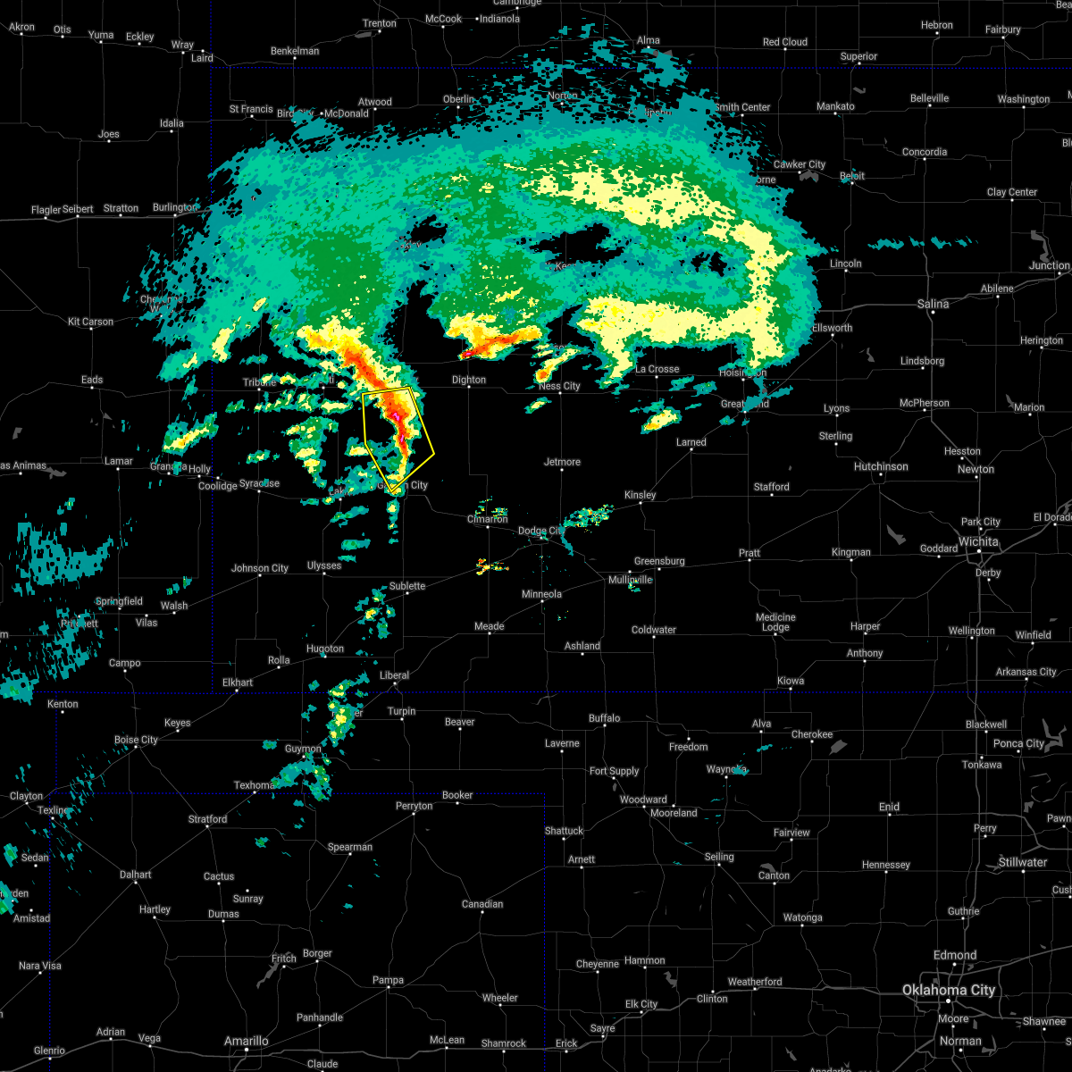 The severe thunderstorm warning for northwestern finney and southern scott counties will expire at 115 pm cst, the storm which prompted the warning has moved out of the area. therefore, the warning will be allowed to expire. however small hail, gusty winds and heavy rain are still possible with this thunderstorm. The severe thunderstorm warning for northwestern finney and southern scott counties will expire at 115 pm cst, the storm which prompted the warning has moved out of the area. therefore, the warning will be allowed to expire. however small hail, gusty winds and heavy rain are still possible with this thunderstorm.
|
| 3/13/2021 1:08 PM CST |
 At 108 pm cst, a severe thunderstorm was located near friend, moving northeast at 55 mph (radar indicated). Hazards include 60 mph wind gusts and quarter size hail. Hail damage to vehicles is expected. Expect wind damage to roofs, siding, and trees. At 108 pm cst, a severe thunderstorm was located near friend, moving northeast at 55 mph (radar indicated). Hazards include 60 mph wind gusts and quarter size hail. Hail damage to vehicles is expected. Expect wind damage to roofs, siding, and trees.
|
| 3/13/2021 12:59 PM CST |
 At 1258 pm cst, a severe thunderstorm was located near shallow water, moving northeast at 60 mph (radar indicated). Hazards include 60 mph wind gusts and quarter size hail. Hail damage to vehicles is expected. expect wind damage to roofs, siding, and trees. Locations impacted include, scott city, friend and shallow water. At 1258 pm cst, a severe thunderstorm was located near shallow water, moving northeast at 60 mph (radar indicated). Hazards include 60 mph wind gusts and quarter size hail. Hail damage to vehicles is expected. expect wind damage to roofs, siding, and trees. Locations impacted include, scott city, friend and shallow water.
|
| 3/13/2021 12:44 PM CST |
 At 1244 pm cst, a severe thunderstorm was located 10 miles north of holcomb, moving northeast at 60 mph (radar indicated). Hazards include 60 mph wind gusts and quarter size hail. Hail damage to vehicles is expected. expect wind damage to roofs, siding, and trees. Locations impacted include, scott city, holcomb, deerfield, shallow water and friend. At 1244 pm cst, a severe thunderstorm was located 10 miles north of holcomb, moving northeast at 60 mph (radar indicated). Hazards include 60 mph wind gusts and quarter size hail. Hail damage to vehicles is expected. expect wind damage to roofs, siding, and trees. Locations impacted include, scott city, holcomb, deerfield, shallow water and friend.
|
| 3/13/2021 12:26 PM CST |
 At 1226 pm cst, a severe thunderstorm was located near lakin, moving northeast at 60 mph (radar indicated). Hazards include 60 mph wind gusts and quarter size hail. Hail damage to vehicles is expected. Expect wind damage to roofs, siding, and trees. At 1226 pm cst, a severe thunderstorm was located near lakin, moving northeast at 60 mph (radar indicated). Hazards include 60 mph wind gusts and quarter size hail. Hail damage to vehicles is expected. Expect wind damage to roofs, siding, and trees.
|
| 8/16/2020 8:40 PM CDT |
 At 840 pm cdt, a severe thunderstorm was located near modoc, moving southeast at 30 mph (radar indicated). Hazards include 60 mph wind gusts and penny size hail. expect damage to roofs, siding, and trees At 840 pm cdt, a severe thunderstorm was located near modoc, moving southeast at 30 mph (radar indicated). Hazards include 60 mph wind gusts and penny size hail. expect damage to roofs, siding, and trees
|
| 8/10/2020 4:41 PM CDT | Storm damage reported in finney county KS, 14.5 miles N of Scott City, KS |
| 7/29/2020 5:34 PM CDT |
 At 532 pm cdt, a severe thunderstorm was located near scott city, moving south at 15 mph (radar indicated and emergency manager report. at 530 pm cdt quarter size hail was reported 4 miles east of modoc). Hazards include ping pong ball size hail and 60 mph wind gusts. People and animals outdoors will be injured. expect hail damage to roofs, siding, windows, and vehicles. expect wind damage to roofs, siding, and trees. Locations impacted include, scott city and modoc. At 532 pm cdt, a severe thunderstorm was located near scott city, moving south at 15 mph (radar indicated and emergency manager report. at 530 pm cdt quarter size hail was reported 4 miles east of modoc). Hazards include ping pong ball size hail and 60 mph wind gusts. People and animals outdoors will be injured. expect hail damage to roofs, siding, windows, and vehicles. expect wind damage to roofs, siding, and trees. Locations impacted include, scott city and modoc.
|
| 7/29/2020 5:30 PM CDT | Quarter sized hail reported 5.1 miles E of Scott City, KS |
| 7/29/2020 5:18 PM CDT |
 At 518 pm cdt, a severe thunderstorm was located near modoc, moving south at 15 mph (radar indicated). Hazards include ping pong ball size hail and 60 mph wind gusts. People and animals outdoors will be injured. expect hail damage to roofs, siding, windows, and vehicles. expect wind damage to roofs, siding, and trees. Locations impacted include, scott city and modoc. At 518 pm cdt, a severe thunderstorm was located near modoc, moving south at 15 mph (radar indicated). Hazards include ping pong ball size hail and 60 mph wind gusts. People and animals outdoors will be injured. expect hail damage to roofs, siding, windows, and vehicles. expect wind damage to roofs, siding, and trees. Locations impacted include, scott city and modoc.
|
| 7/29/2020 4:57 PM CDT |
 At 457 pm cdt, a severe thunderstorm was located 8 miles northeast of modoc, moving southeast at 10 mph (radar indicated). Hazards include 60 mph wind gusts and half dollar size hail. Hail damage to vehicles is expected. Expect wind damage to roofs, siding, and trees. At 457 pm cdt, a severe thunderstorm was located 8 miles northeast of modoc, moving southeast at 10 mph (radar indicated). Hazards include 60 mph wind gusts and half dollar size hail. Hail damage to vehicles is expected. Expect wind damage to roofs, siding, and trees.
|
| 7/29/2020 4:35 PM CDT |
 At 434 pm cdt, a severe thunderstorm was located 7 miles west of scott state lake, moving southeast at 15 mph (radar indicated and public reported. at 420 pm cdt, quarter size hail was reported 14 miles south southeast of russell springs). Hazards include golf ball size hail and 60 mph wind gusts. People and animals outdoors will be injured. expect hail damage to roofs, siding, windows, and vehicles. expect wind damage to roofs, siding, and trees. Locations impacted include, scott city and modoc. At 434 pm cdt, a severe thunderstorm was located 7 miles west of scott state lake, moving southeast at 15 mph (radar indicated and public reported. at 420 pm cdt, quarter size hail was reported 14 miles south southeast of russell springs). Hazards include golf ball size hail and 60 mph wind gusts. People and animals outdoors will be injured. expect hail damage to roofs, siding, windows, and vehicles. expect wind damage to roofs, siding, and trees. Locations impacted include, scott city and modoc.
|
| 7/29/2020 4:20 PM CDT | Quarter sized hail reported 19.7 miles SSE of Scott City, KS, pea to quarter size hail reported. |
| 7/29/2020 4:11 PM CDT |
 At 411 pm cdt, a severe thunderstorm was located 10 miles west of scott state lake, moving southeast at 20 mph (radar indicated). Hazards include ping pong ball size hail. People and animals outdoors will be injured. Expect damage to roofs, siding, windows, and vehicles. At 411 pm cdt, a severe thunderstorm was located 10 miles west of scott state lake, moving southeast at 20 mph (radar indicated). Hazards include ping pong ball size hail. People and animals outdoors will be injured. Expect damage to roofs, siding, windows, and vehicles.
|
| 7/2/2020 6:16 PM CDT | Golf Ball sized hail reported 9.2 miles SW of Scott City, KS |
| 7/2/2020 6:05 PM CDT | Golf Ball sized hail reported 8.9 miles SW of Scott City, KS, time estimated based on radar. |
| 7/2/2020 5:44 PM CDT | Quarter sized hail reported 7.1 miles SW of Scott City, KS |
| 7/2/2020 5:30 PM CDT | Quarter sized hail reported 13.3 miles SSW of Scott City, KS |
| 7/2/2020 5:07 PM CDT |
 At 507 pm cdt, a severe thunderstorm was located near manning, moving north at 15 mph (radar indicated). Hazards include 60 mph wind gusts and half dollar size hail. Hail damage to vehicles is expected. Expect wind damage to roofs, siding, and trees. At 507 pm cdt, a severe thunderstorm was located near manning, moving north at 15 mph (radar indicated). Hazards include 60 mph wind gusts and half dollar size hail. Hail damage to vehicles is expected. Expect wind damage to roofs, siding, and trees.
|
| 7/2/2020 5:03 PM CDT |
 At 503 pm cdt, a severe thunderstorm was located near modoc, moving north at 15 mph (radar indicated). Hazards include 60 mph wind gusts and half dollar size hail. Hail damage to vehicles is expected. Expect wind damage to roofs, siding, and trees. At 503 pm cdt, a severe thunderstorm was located near modoc, moving north at 15 mph (radar indicated). Hazards include 60 mph wind gusts and half dollar size hail. Hail damage to vehicles is expected. Expect wind damage to roofs, siding, and trees.
|
| 6/27/2020 12:56 AM CDT |
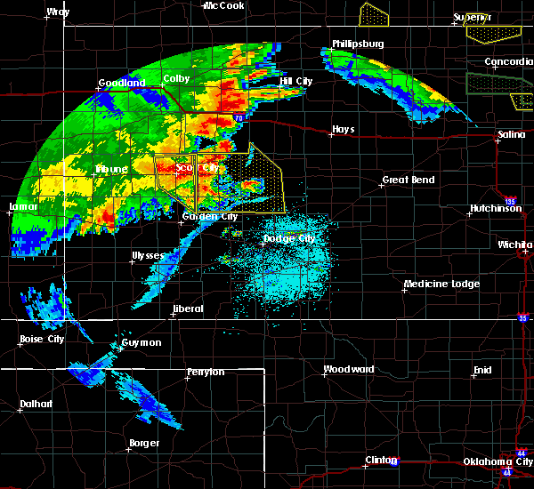 The severe thunderstorm warning for north central finney and scott counties will expire at 100 am cdt, the storms which prompted the warning have weakened below severe limits, and no longer pose an immediate threat to life or property. therefore, the warning will be allowed to expire. however gusty winds and heavy rain are still possible with these thunderstorms. a severe thunderstorm watch remains in effect until 400 am cdt for southwestern and west central kansas. The severe thunderstorm warning for north central finney and scott counties will expire at 100 am cdt, the storms which prompted the warning have weakened below severe limits, and no longer pose an immediate threat to life or property. therefore, the warning will be allowed to expire. however gusty winds and heavy rain are still possible with these thunderstorms. a severe thunderstorm watch remains in effect until 400 am cdt for southwestern and west central kansas.
|
| 6/27/2020 12:45 AM CDT | Mesonet station as692 scott cit in scott county KS, 1 miles NE of Scott City, KS |
| 6/27/2020 12:45 AM CDT |
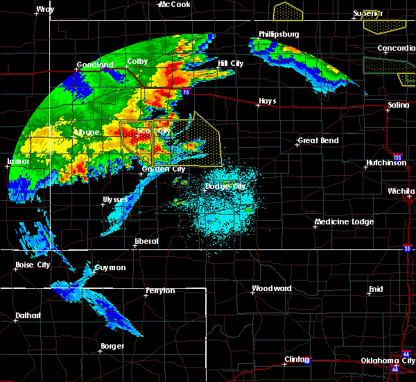 At 1245 am cdt, severe thunderstorms were located along a line extending from 7 miles north of scott city to 11 miles east of friend, moving east at 35 mph (radar indicated). Hazards include 60 mph wind gusts and nickel size hail. Expect damage to roofs, siding, and trees. Locations impacted include, scott city, shallow water, grigston, manning, friend and modoc. At 1245 am cdt, severe thunderstorms were located along a line extending from 7 miles north of scott city to 11 miles east of friend, moving east at 35 mph (radar indicated). Hazards include 60 mph wind gusts and nickel size hail. Expect damage to roofs, siding, and trees. Locations impacted include, scott city, shallow water, grigston, manning, friend and modoc.
|
| 6/27/2020 12:32 AM CDT |
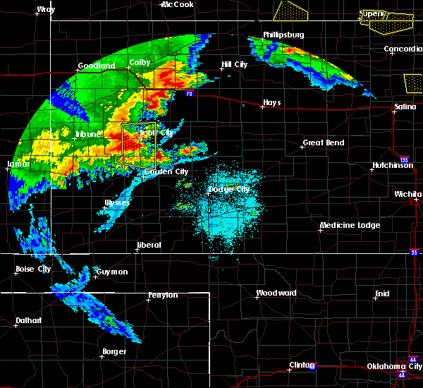 At 1232 am cdt, severe thunderstorms were located along a line extending from 6 miles north of modoc to near friend, moving east at 40 mph (radar indicated). Hazards include 60 mph wind gusts and nickel size hail. Expect damage to roofs, siding, and trees. Locations impacted include, scott city, shallow water, grigston, manning, friend and modoc. At 1232 am cdt, severe thunderstorms were located along a line extending from 6 miles north of modoc to near friend, moving east at 40 mph (radar indicated). Hazards include 60 mph wind gusts and nickel size hail. Expect damage to roofs, siding, and trees. Locations impacted include, scott city, shallow water, grigston, manning, friend and modoc.
|
| 6/27/2020 12:12 AM CDT |
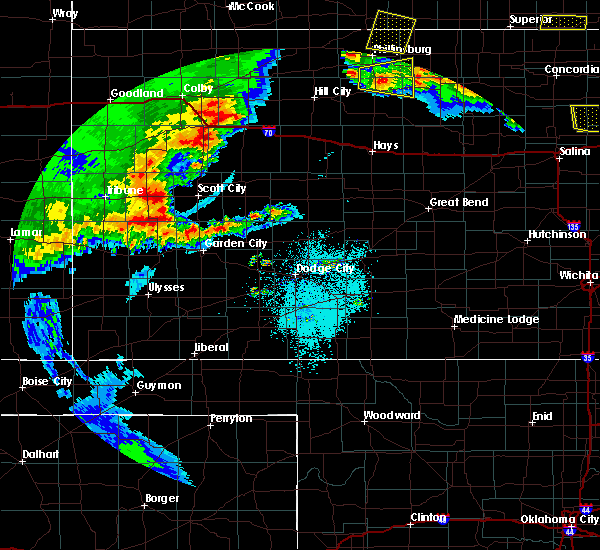 At 1212 am cdt, severe thunderstorms were located along a line extending from 13 miles north of modoc to 14 miles north of deerfield, moving east at 35 mph (radar indicated). Hazards include 60 mph wind gusts and quarter size hail. Hail damage to vehicles is expected. Expect wind damage to roofs, siding, and trees. At 1212 am cdt, severe thunderstorms were located along a line extending from 13 miles north of modoc to 14 miles north of deerfield, moving east at 35 mph (radar indicated). Hazards include 60 mph wind gusts and quarter size hail. Hail damage to vehicles is expected. Expect wind damage to roofs, siding, and trees.
|
| 6/21/2020 4:31 PM CDT |
 At 431 pm cdt, severe thunderstorms were located along a line extending from 12 miles south of ness city to 6 miles north of charleston, moving southeast at 45 mph (radar indicated). Hazards include tennis ball size hail and 70 mph wind gusts. People and animals outdoors will be injured. expect hail damage to roofs, siding, windows, and vehicles. expect considerable tree damage. wind damage is also likely to mobile homes, roofs, and outbuildings. Locations impacted include, garden city, scott city, holcomb, ness city, dighton, jetmore, ransom, hanston, utica, alamota, grigston, shallow water, manning, beeler, pendennis, amy, arnold, healy, friend and kalvesta. At 431 pm cdt, severe thunderstorms were located along a line extending from 12 miles south of ness city to 6 miles north of charleston, moving southeast at 45 mph (radar indicated). Hazards include tennis ball size hail and 70 mph wind gusts. People and animals outdoors will be injured. expect hail damage to roofs, siding, windows, and vehicles. expect considerable tree damage. wind damage is also likely to mobile homes, roofs, and outbuildings. Locations impacted include, garden city, scott city, holcomb, ness city, dighton, jetmore, ransom, hanston, utica, alamota, grigston, shallow water, manning, beeler, pendennis, amy, arnold, healy, friend and kalvesta.
|
| 6/21/2020 4:14 PM CDT |
 At 414 pm cdt, severe thunderstorms were located along a line extending from 7 miles west of ness city to 16 miles east of friend, moving southeast at 40 mph (radar indicated). Hazards include tennis ball size hail and 70 mph wind gusts. People and animals outdoors will be injured. expect hail damage to roofs, siding, windows, and vehicles. expect considerable tree damage. Wind damage is also likely to mobile homes, roofs, and outbuildings. At 414 pm cdt, severe thunderstorms were located along a line extending from 7 miles west of ness city to 16 miles east of friend, moving southeast at 40 mph (radar indicated). Hazards include tennis ball size hail and 70 mph wind gusts. People and animals outdoors will be injured. expect hail damage to roofs, siding, windows, and vehicles. expect considerable tree damage. Wind damage is also likely to mobile homes, roofs, and outbuildings.
|
| 6/21/2020 3:58 PM CDT |
 At 356 pm cdt, severe thunderstorms were located along a line extending from near arnold to near shallow water, moving east at 30 mph (radar indicated. at 335 pm...a wind gust of 64 mph was reported at the scott city airport). Hazards include two inch hail and 60 mph wind gusts. People and animals outdoors will be injured. expect hail damage to roofs, siding, windows, and vehicles. expect wind damage to roofs, siding, and trees. Locations impacted include, scott city, wakeeney, dighton, ransom, utica, collyer, alamota, grigston, scott state lake, modoc, shallow water, manning, pendennis, amy, arnold, healy, shields, voda and trego center. At 356 pm cdt, severe thunderstorms were located along a line extending from near arnold to near shallow water, moving east at 30 mph (radar indicated. at 335 pm...a wind gust of 64 mph was reported at the scott city airport). Hazards include two inch hail and 60 mph wind gusts. People and animals outdoors will be injured. expect hail damage to roofs, siding, windows, and vehicles. expect wind damage to roofs, siding, and trees. Locations impacted include, scott city, wakeeney, dighton, ransom, utica, collyer, alamota, grigston, scott state lake, modoc, shallow water, manning, pendennis, amy, arnold, healy, shields, voda and trego center.
|
| 6/21/2020 3:41 PM CDT |
 At 341 pm cdt, severe thunderstorms were located along a line extending from near utica to 6 miles west of shallow water, moving east at 30 mph (radar indicated). Hazards include two inch hail and 60 mph wind gusts. People and animals outdoors will be injured. expect hail damage to roofs, siding, windows, and vehicles. expect wind damage to roofs, siding, and trees. Locations impacted include, scott city, wakeeney, dighton, ransom, utica, collyer, alamota, grigston, scott state lake, modoc, shallow water, manning, pendennis, amy, arnold, healy, shields, voda and trego center. At 341 pm cdt, severe thunderstorms were located along a line extending from near utica to 6 miles west of shallow water, moving east at 30 mph (radar indicated). Hazards include two inch hail and 60 mph wind gusts. People and animals outdoors will be injured. expect hail damage to roofs, siding, windows, and vehicles. expect wind damage to roofs, siding, and trees. Locations impacted include, scott city, wakeeney, dighton, ransom, utica, collyer, alamota, grigston, scott state lake, modoc, shallow water, manning, pendennis, amy, arnold, healy, shields, voda and trego center.
|
| 6/21/2020 3:35 PM CDT | Awos station ktqk scott cit in scott county KS, 1.5 miles WNW of Scott City, KS |
| 6/21/2020 3:15 PM CDT | Mesonet station k5sct 1 ese scott state lak in scott county KS, 13.9 miles S of Scott City, KS |
| 6/21/2020 3:14 PM CDT |
 At 314 pm cdt, severe thunderstorms were located along a line extending from 9 miles north of pendennis to near modoc, moving east at 35 mph (radar indicated). Hazards include two inch hail and 60 mph wind gusts. People and animals outdoors will be injured. expect hail damage to roofs, siding, windows, and vehicles. Expect wind damage to roofs, siding, and trees. At 314 pm cdt, severe thunderstorms were located along a line extending from 9 miles north of pendennis to near modoc, moving east at 35 mph (radar indicated). Hazards include two inch hail and 60 mph wind gusts. People and animals outdoors will be injured. expect hail damage to roofs, siding, windows, and vehicles. Expect wind damage to roofs, siding, and trees.
|
| 6/21/2020 3:07 PM CDT |
 At 237 pm cdt, severe thunderstorms were located along a line extending from 12 miles northeast of scott state lake to 7 miles northeast of leoti, moving southeast at 20 mph (radar indicated). Hazards include 60 mph wind gusts and quarter size hail. Hail damage to vehicles is expected. Expect wind damage to roofs, siding, and trees. At 237 pm cdt, severe thunderstorms were located along a line extending from 12 miles northeast of scott state lake to 7 miles northeast of leoti, moving southeast at 20 mph (radar indicated). Hazards include 60 mph wind gusts and quarter size hail. Hail damage to vehicles is expected. Expect wind damage to roofs, siding, and trees.
|
| 6/21/2020 2:37 PM CDT |
 At 237 pm cdt, severe thunderstorms were located along a line extending from 12 miles northeast of scott state lake to 7 miles northeast of leoti, moving southeast at 20 mph (radar indicated). Hazards include 60 mph wind gusts and quarter size hail. Hail damage to vehicles is expected. Expect wind damage to roofs, siding, and trees. At 237 pm cdt, severe thunderstorms were located along a line extending from 12 miles northeast of scott state lake to 7 miles northeast of leoti, moving southeast at 20 mph (radar indicated). Hazards include 60 mph wind gusts and quarter size hail. Hail damage to vehicles is expected. Expect wind damage to roofs, siding, and trees.
|
| 6/3/2020 7:47 PM CDT | Quarter sized hail reported 11.7 miles NE of Scott City, KS |
| 4/22/2020 6:20 PM CDT | Estimated 60-70 mph wind gust in scott county KS, 9.1 miles ENE of Scott City, KS |
| 4/22/2020 6:17 PM CDT |
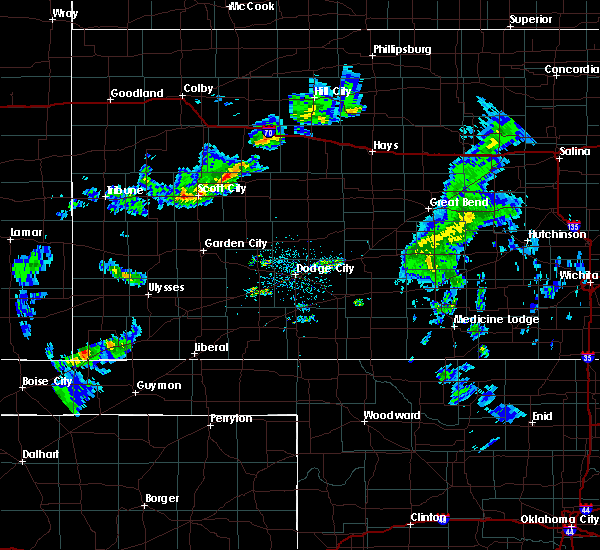 At 616 pm cdt, a severe thunderstorm was located near shallow water, moving south at 40 mph (radar indicated). Hazards include 70 mph wind gusts and penny size hail. Expect considerable tree damage. Damage is likely to mobile homes, roofs, and outbuildings. At 616 pm cdt, a severe thunderstorm was located near shallow water, moving south at 40 mph (radar indicated). Hazards include 70 mph wind gusts and penny size hail. Expect considerable tree damage. Damage is likely to mobile homes, roofs, and outbuildings.
|
| 4/22/2020 6:13 PM CDT | Power poles blown dow in scott county KS, 9.5 miles E of Scott City, KS |
| 8/24/2019 9:25 PM CDT | Golf Ball sized hail reported 10.9 miles NW of Scott City, KS |
| 8/24/2019 9:20 PM CDT | Quarter sized hail reported 17.6 miles NW of Scott City, KS, time was estimated from radar. |
| 8/24/2019 8:55 PM CDT | Golf Ball sized hail reported 13.5 miles NE of Scott City, KS |
| 8/17/2019 12:40 AM CDT |
 The severe thunderstorm warning for northwestern finney and scott counties will expire at 1245 am cdt, the storms which prompted the warning have moved out of the area. therefore, the warning will be allowed to expire. however gusty winds are still possible with these thunderstorms. a severe thunderstorm watch remains in effect until 700 am cdt for west central kansas. The severe thunderstorm warning for northwestern finney and scott counties will expire at 1245 am cdt, the storms which prompted the warning have moved out of the area. therefore, the warning will be allowed to expire. however gusty winds are still possible with these thunderstorms. a severe thunderstorm watch remains in effect until 700 am cdt for west central kansas.
|
| 8/17/2019 12:05 AM CDT |
 At 1205 am cdt, severe thunderstorms were located along a line extending from 6 miles northwest of scott state lake to 8 miles north of holcomb, moving northeast at 25 mph (radar indicated). Hazards include 70 mph wind gusts and quarter size hail. Hail damage to vehicles is expected. expect considerable tree damage. wind damage is also likely to mobile homes, roofs, and outbuildings. Locations impacted include, scott city, grigston, friend, scott state lake, modoc, shallow water and manning. At 1205 am cdt, severe thunderstorms were located along a line extending from 6 miles northwest of scott state lake to 8 miles north of holcomb, moving northeast at 25 mph (radar indicated). Hazards include 70 mph wind gusts and quarter size hail. Hail damage to vehicles is expected. expect considerable tree damage. wind damage is also likely to mobile homes, roofs, and outbuildings. Locations impacted include, scott city, grigston, friend, scott state lake, modoc, shallow water and manning.
|
| 8/16/2019 11:52 PM CDT |
 The national weather service in dodge city has issued a * severe thunderstorm warning for. northeastern kearny county in southwestern kansas. northwestern finney county in southwestern kansas. scott county in west central kansas. Until 1245 am cdt. The national weather service in dodge city has issued a * severe thunderstorm warning for. northeastern kearny county in southwestern kansas. northwestern finney county in southwestern kansas. scott county in west central kansas. Until 1245 am cdt.
|
| 8/13/2019 7:31 PM CDT |
 At 731 pm cdt, severe thunderstorms were located along a line extending from 12 miles north of jetmore to 7 miles west of kalvesta to 10 miles southwest of friend, moving south at 50 mph. these are very dangerous storms (radar indicated). Hazards include 80 mph wind gusts and golf ball size hail. Flying debris will be dangerous to those caught without shelter. mobile homes will be heavily damaged. expect considerable damage to roofs, windows, and vehicles. extensive tree damage and power outages are likely. Locations impacted include, garden city, scott city, holcomb, dighton, jetmore, pierceville, ingalls, alamota, charleston, grigston, shallow water, beeler, amy, friend, kalvesta and modoc. At 731 pm cdt, severe thunderstorms were located along a line extending from 12 miles north of jetmore to 7 miles west of kalvesta to 10 miles southwest of friend, moving south at 50 mph. these are very dangerous storms (radar indicated). Hazards include 80 mph wind gusts and golf ball size hail. Flying debris will be dangerous to those caught without shelter. mobile homes will be heavily damaged. expect considerable damage to roofs, windows, and vehicles. extensive tree damage and power outages are likely. Locations impacted include, garden city, scott city, holcomb, dighton, jetmore, pierceville, ingalls, alamota, charleston, grigston, shallow water, beeler, amy, friend, kalvesta and modoc.
|
| 8/13/2019 7:04 PM CDT |
 The national weather service in dodge city has issued a * severe thunderstorm warning for. finney county in southwestern kansas. western ness county in west central kansas. southern scott county in west central kansas. Western hodgeman county in southwestern kansas. The national weather service in dodge city has issued a * severe thunderstorm warning for. finney county in southwestern kansas. western ness county in west central kansas. southern scott county in west central kansas. Western hodgeman county in southwestern kansas.
|
| 8/13/2019 6:52 PM CDT |
 At 651 pm cdt, severe thunderstorms were located along a line extending from near utica to 6 miles west of modoc, moving south at 40 mph. these are very dangerous storms (radar indicated). Hazards include 80 mph wind gusts and half dollar size hail. Flying debris will be dangerous to those caught without shelter. mobile homes will be heavily damaged. expect considerable damage to roofs, windows, and vehicles. extensive tree damage and power outages are likely. Locations impacted include, scott city, dighton, alamota, grigston, healy, scott state lake, modoc, shallow water, manning, pendennis, amy and shields. At 651 pm cdt, severe thunderstorms were located along a line extending from near utica to 6 miles west of modoc, moving south at 40 mph. these are very dangerous storms (radar indicated). Hazards include 80 mph wind gusts and half dollar size hail. Flying debris will be dangerous to those caught without shelter. mobile homes will be heavily damaged. expect considerable damage to roofs, windows, and vehicles. extensive tree damage and power outages are likely. Locations impacted include, scott city, dighton, alamota, grigston, healy, scott state lake, modoc, shallow water, manning, pendennis, amy and shields.
|
| 8/13/2019 6:24 PM CDT |
 At 623 pm cdt, severe thunderstorms were located along a line extending from near collyer to 15 miles north of leoti, moving south at 40 mph. these are very dangerous storms (radar indicated). Hazards include 80 mph wind gusts and half dollar size hail. Flying debris will be dangerous to those caught without shelter. mobile homes will be heavily damaged. expect considerable damage to roofs, windows, and vehicles. Extensive tree damage and power outages are likely. At 623 pm cdt, severe thunderstorms were located along a line extending from near collyer to 15 miles north of leoti, moving south at 40 mph. these are very dangerous storms (radar indicated). Hazards include 80 mph wind gusts and half dollar size hail. Flying debris will be dangerous to those caught without shelter. mobile homes will be heavily damaged. expect considerable damage to roofs, windows, and vehicles. Extensive tree damage and power outages are likely.
|
| 7/17/2019 9:25 PM CDT |
 At 825 pm cdt, severe thunderstorms were located along a line extending from 12 miles northwest of modoc to 17 miles south of leoti to near kendall, moving east at 25 mph (radar indicated). Hazards include 60 mph wind gusts. expect damage to roofs, siding, and trees At 825 pm cdt, severe thunderstorms were located along a line extending from 12 miles northwest of modoc to 17 miles south of leoti to near kendall, moving east at 25 mph (radar indicated). Hazards include 60 mph wind gusts. expect damage to roofs, siding, and trees
|
| 7/17/2019 8:26 PM CDT |
 At 825 pm cdt, severe thunderstorms were located along a line extending from 12 miles northwest of modoc to 17 miles south of leoti to near kendall, moving east at 25 mph (radar indicated). Hazards include 60 mph wind gusts. expect damage to roofs, siding, and trees At 825 pm cdt, severe thunderstorms were located along a line extending from 12 miles northwest of modoc to 17 miles south of leoti to near kendall, moving east at 25 mph (radar indicated). Hazards include 60 mph wind gusts. expect damage to roofs, siding, and trees
|
| 6/14/2019 7:44 PM CDT |
 At 744 pm cdt, severe thunderstorms were located along a line extending from near scott state lake to near shallow water to 12 miles west of friend, moving east at 35 mph (radar indicated). Hazards include 70 mph wind gusts and penny size hail. Expect considerable tree damage. Damage is likely to mobile homes, roofs, and outbuildings. At 744 pm cdt, severe thunderstorms were located along a line extending from near scott state lake to near shallow water to 12 miles west of friend, moving east at 35 mph (radar indicated). Hazards include 70 mph wind gusts and penny size hail. Expect considerable tree damage. Damage is likely to mobile homes, roofs, and outbuildings.
|
| 6/14/2019 7:33 PM CDT | Mobile mesonet readin in scott county KS, 3.4 miles N of Scott City, KS |
| 6/14/2019 7:23 PM CDT |
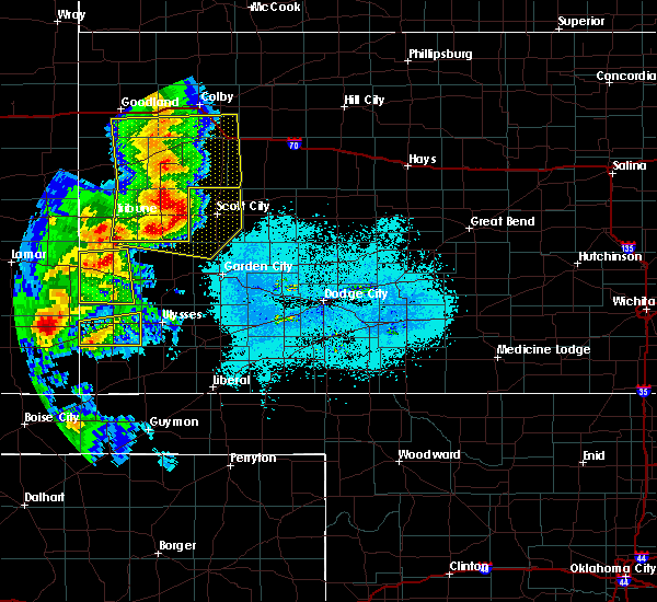 At 722 pm cdt, severe thunderstorms were located along a line extending from 6 miles northwest of scott state lake to 6 miles southeast of modoc to 17 miles west of friend, moving east at 40 mph (radar indicated). Hazards include 70 mph wind gusts and quarter size hail. Hail damage to vehicles is expected. expect considerable tree damage. wind damage is also likely to mobile homes, roofs, and outbuildings. Locations impacted include, scott city, grigston, friend, scott state lake, modoc, shallow water and manning. At 722 pm cdt, severe thunderstorms were located along a line extending from 6 miles northwest of scott state lake to 6 miles southeast of modoc to 17 miles west of friend, moving east at 40 mph (radar indicated). Hazards include 70 mph wind gusts and quarter size hail. Hail damage to vehicles is expected. expect considerable tree damage. wind damage is also likely to mobile homes, roofs, and outbuildings. Locations impacted include, scott city, grigston, friend, scott state lake, modoc, shallow water and manning.
|
| 6/14/2019 6:59 PM CDT |
 At 658 pm cdt/558 pm mdt/, severe thunderstorms were located along a line extending from 13 miles southwest of russell springs to near leoti to 18 miles southeast of tribune, moving east at 40 mph (radar indicated). Hazards include 70 mph wind gusts and half dollar size hail. Hail damage to vehicles is expected. expect considerable tree damage. Wind damage is also likely to mobile homes, roofs, and outbuildings. At 658 pm cdt/558 pm mdt/, severe thunderstorms were located along a line extending from 13 miles southwest of russell springs to near leoti to 18 miles southeast of tribune, moving east at 40 mph (radar indicated). Hazards include 70 mph wind gusts and half dollar size hail. Hail damage to vehicles is expected. expect considerable tree damage. Wind damage is also likely to mobile homes, roofs, and outbuildings.
|
| 6/9/2019 12:20 AM CDT | Mesonet station dw2812 scott cit in scott county KS, 9.5 miles W of Scott City, KS |
| 6/9/2019 12:07 AM CDT |
 At 1206 am cdt, a severe thunderstorm was located near manning, moving east at 30 mph (radar indicated). Hazards include 70 mph wind gusts and half dollar size hail. Hail damage to vehicles is expected. expect considerable tree damage. Wind damage is also likely to mobile homes, roofs, and outbuildings. At 1206 am cdt, a severe thunderstorm was located near manning, moving east at 30 mph (radar indicated). Hazards include 70 mph wind gusts and half dollar size hail. Hail damage to vehicles is expected. expect considerable tree damage. Wind damage is also likely to mobile homes, roofs, and outbuildings.
|
| 6/8/2019 11:59 PM CDT |
 At 1159 pm cdt, a severe thunderstorm was located near manning, moving east at 40 mph (radar indicated). Hazards include 70 mph wind gusts and half dollar size hail. Hail damage to vehicles is expected. expect considerable tree damage. wind damage is also likely to mobile homes, roofs, and outbuildings. Locations impacted include, scott city, dighton, grigston, healy, scott state lake, modoc, manning, pendennis, amy and shields. At 1159 pm cdt, a severe thunderstorm was located near manning, moving east at 40 mph (radar indicated). Hazards include 70 mph wind gusts and half dollar size hail. Hail damage to vehicles is expected. expect considerable tree damage. wind damage is also likely to mobile homes, roofs, and outbuildings. Locations impacted include, scott city, dighton, grigston, healy, scott state lake, modoc, manning, pendennis, amy and shields.
|
| 6/8/2019 11:43 PM CDT |
 At 1142 pm cdt, severe thunderstorms were located along a line extending from 9 miles northwest of healy to near modoc, moving southeast at 55 mph. these are very dangerous storms (radar indicated). Hazards include 80 mph wind gusts and ping pong ball size hail. Flying debris will be dangerous to those caught without shelter. mobile homes will be heavily damaged. expect considerable damage to roofs, windows, and vehicles. extensive tree damage and power outages are likely. Locations impacted include, scott city, dighton, grigston, healy, friend, scott state lake, modoc, shallow water, manning, pendennis, amy and shields. At 1142 pm cdt, severe thunderstorms were located along a line extending from 9 miles northwest of healy to near modoc, moving southeast at 55 mph. these are very dangerous storms (radar indicated). Hazards include 80 mph wind gusts and ping pong ball size hail. Flying debris will be dangerous to those caught without shelter. mobile homes will be heavily damaged. expect considerable damage to roofs, windows, and vehicles. extensive tree damage and power outages are likely. Locations impacted include, scott city, dighton, grigston, healy, friend, scott state lake, modoc, shallow water, manning, pendennis, amy and shields.
|
| 6/8/2019 11:29 PM CDT |
 The national weather service in dodge city has issued a * severe thunderstorm warning for. northwestern finney county in southwestern kansas. scott county in west central kansas. lane county in west central kansas. Until 1215 am cdt. The national weather service in dodge city has issued a * severe thunderstorm warning for. northwestern finney county in southwestern kansas. scott county in west central kansas. lane county in west central kansas. Until 1215 am cdt.
|
| 5/28/2019 4:40 PM CDT | Hen Egg sized hail reported 11.5 miles SW of Scott City, KS, scott county em reported hail size up to 2.25 inches in diameter on k-4... 8 miles east of hwy 83. |
| 5/28/2019 4:35 PM CDT | Ping Pong Ball sized hail reported 10.1 miles SW of Scott City, KS, scott county em reported quarter size hail and more copious as previous reports with some minor damage 6 miles east of hwy 83 on hwy k-4. |
| 5/28/2019 4:30 PM CDT | Ping Pong Ball sized hail reported 9.3 miles SSW of Scott City, KS, scott county em reported ping pong size hail on hwy k-4... 4 miles east of hwy 83. |
| 5/28/2019 4:20 PM CDT | Ping Pong Ball sized hail reported 4.2 miles S of Scott City, KS, ping pong ball size hail reported by scott county em at hwy 83 and road 190. |
| 5/28/2019 4:12 PM CDT |
 At 412 pm cdt, a severe thunderstorm was located near scott city, moving northeast at 30 mph (radar indicated). Hazards include golf ball size hail and 60 mph wind gusts. People and animals outdoors will be injured. expect hail damage to roofs, siding, windows, and vehicles. Expect wind damage to roofs, siding, and trees. At 412 pm cdt, a severe thunderstorm was located near scott city, moving northeast at 30 mph (radar indicated). Hazards include golf ball size hail and 60 mph wind gusts. People and animals outdoors will be injured. expect hail damage to roofs, siding, windows, and vehicles. Expect wind damage to roofs, siding, and trees.
|
| 4/21/2019 5:31 PM CDT |
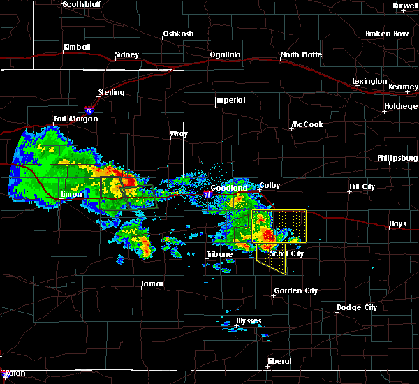 At 529 pm cdt, severe thunderstorms were located along a line extending from 18 miles east of russell springs to near scott state lake to near modoc, moving east at 30 mph (public. at 524 pm, quarter size hail was reported west- southwest of scott state lake). Hazards include 70 mph wind gusts and quarter size hail. Hail damage to vehicles is expected. expect considerable tree damage. wind damage is also likely to mobile homes, roofs, and outbuildings. Locations impacted include, scott city, grigston, manning, scott state lake and modoc. At 529 pm cdt, severe thunderstorms were located along a line extending from 18 miles east of russell springs to near scott state lake to near modoc, moving east at 30 mph (public. at 524 pm, quarter size hail was reported west- southwest of scott state lake). Hazards include 70 mph wind gusts and quarter size hail. Hail damage to vehicles is expected. expect considerable tree damage. wind damage is also likely to mobile homes, roofs, and outbuildings. Locations impacted include, scott city, grigston, manning, scott state lake and modoc.
|
| 4/21/2019 5:24 PM CDT | Quarter sized hail reported 13.1 miles SSE of Scott City, KS |
| 4/21/2019 5:20 PM CDT |
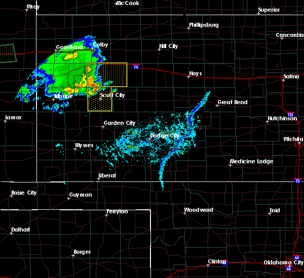 At 520 pm cdt, severe thunderstorms were located along a line extending from 6 miles southeast of russell springs to 9 miles west of scott state lake to 8 miles northeast of leoti, moving east at 30 mph (radar indicated). Hazards include 60 mph wind gusts and penny size hail. Expect damage to roofs, siding, and trees. Locations impacted include, scott city, shallow water, grigston, manning, scott state lake and modoc. At 520 pm cdt, severe thunderstorms were located along a line extending from 6 miles southeast of russell springs to 9 miles west of scott state lake to 8 miles northeast of leoti, moving east at 30 mph (radar indicated). Hazards include 60 mph wind gusts and penny size hail. Expect damage to roofs, siding, and trees. Locations impacted include, scott city, shallow water, grigston, manning, scott state lake and modoc.
|
| 4/21/2019 5:05 PM CDT |
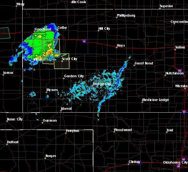 At 505 pm cdt, severe thunderstorms were located along a line extending from near russell springs to 16 miles northwest of modoc to 6 miles northwest of leoti, moving east at 35 mph (radar indicated). Hazards include 70 mph wind gusts and penny size hail. Expect considerable tree damage. Damage is likely to mobile homes, roofs, and outbuildings. At 505 pm cdt, severe thunderstorms were located along a line extending from near russell springs to 16 miles northwest of modoc to 6 miles northwest of leoti, moving east at 35 mph (radar indicated). Hazards include 70 mph wind gusts and penny size hail. Expect considerable tree damage. Damage is likely to mobile homes, roofs, and outbuildings.
|
| 8/31/2018 8:57 PM CDT | Quarter sized hail reported 13.1 miles SSE of Scott City, KS |
| 8/31/2018 8:49 PM CDT | Storm damage reported in scott county KS, 9.8 miles SSE of Scott City, KS |
| 7/25/2018 7:25 PM CDT |
 At 725 pm cdt, a severe thunderstorm was located very near manning, moving south at 15 mph (radar indicated). Hazards include golf ball size hail and 60 mph wind gusts. People and animals outdoors will be injured. expect hail damage to roofs, siding, windows, and vehicles. expect wind damage to roofs, siding, and trees. Locations impacted include, scott city, dighton, grigston, manning, healy and amy. At 725 pm cdt, a severe thunderstorm was located very near manning, moving south at 15 mph (radar indicated). Hazards include golf ball size hail and 60 mph wind gusts. People and animals outdoors will be injured. expect hail damage to roofs, siding, windows, and vehicles. expect wind damage to roofs, siding, and trees. Locations impacted include, scott city, dighton, grigston, manning, healy and amy.
|
| 7/25/2018 7:11 PM CDT | Storm damage reported in scott county KS, 14.3 miles SW of Scott City, KS |
| 7/25/2018 7:09 PM CDT |
 At 708 pm cdt, a severe thunderstorm was located 3 miles north of manning, moving south at 15 mph. this replaces the previous warning for scott and lane counties (radar indicated). Hazards include ping pong ball size hail and 60 mph wind gusts. People and animals outdoors will be injured. expect hail damage to roofs, siding, windows, and vehicles. Expect wind damage to roofs, siding, and trees. At 708 pm cdt, a severe thunderstorm was located 3 miles north of manning, moving south at 15 mph. this replaces the previous warning for scott and lane counties (radar indicated). Hazards include ping pong ball size hail and 60 mph wind gusts. People and animals outdoors will be injured. expect hail damage to roofs, siding, windows, and vehicles. Expect wind damage to roofs, siding, and trees.
|
| 6/29/2018 9:50 PM CDT |
 At 949 pm cdt, severe thunderstorms were located along a line extending from grigston to 7 miles southeast of friend, moving northeast at 45 mph (radar indicated). Hazards include 60 mph wind gusts and nickel size hail. Expect damage to roofs, siding, and trees. Locations impacted include, garden city, scott city, holcomb, dighton, alamota, grigston and scott state lake. At 949 pm cdt, severe thunderstorms were located along a line extending from grigston to 7 miles southeast of friend, moving northeast at 45 mph (radar indicated). Hazards include 60 mph wind gusts and nickel size hail. Expect damage to roofs, siding, and trees. Locations impacted include, garden city, scott city, holcomb, dighton, alamota, grigston and scott state lake.
|
| 6/29/2018 9:29 PM CDT |
 At 929 pm cdt, severe thunderstorms were located along a line extending from 4 miles north of manning to 5 miles northeast of holcomb, moving east at 45 mph (radar indicated). Hazards include 60 mph wind gusts and quarter size hail. Hail damage to vehicles is expected. Expect wind damage to roofs, siding, and trees. At 929 pm cdt, severe thunderstorms were located along a line extending from 4 miles north of manning to 5 miles northeast of holcomb, moving east at 45 mph (radar indicated). Hazards include 60 mph wind gusts and quarter size hail. Hail damage to vehicles is expected. Expect wind damage to roofs, siding, and trees.
|
| 6/29/2018 8:50 PM CDT |
 At 850 pm cdt, severe thunderstorms were located along a line extending from 4 miles southeast of leoti to 8 miles northeast of kendall, moving east at 30 mph (radar indicated). Hazards include 60 mph wind gusts and quarter size hail. Hail damage to vehicles is expected. Expect wind damage to roofs, siding, and trees. At 850 pm cdt, severe thunderstorms were located along a line extending from 4 miles southeast of leoti to 8 miles northeast of kendall, moving east at 30 mph (radar indicated). Hazards include 60 mph wind gusts and quarter size hail. Hail damage to vehicles is expected. Expect wind damage to roofs, siding, and trees.
|
| 6/23/2018 9:22 PM CDT |
 At 921 pm cdt/821 pm mdt/, severe thunderstorms were located along a line extending from near healy to 9 miles north of deerfield to near kendall, moving southeast at 15 mph (radar indicated). Hazards include 60 mph wind gusts and quarter size hail. Hail damage to vehicles is expected. expect wind damage to roofs, siding, and trees. Locations impacted include, garden city, scott city, lakin, holcomb, syracuse, dighton, deerfield, coolidge, kendall, grigston, shallow water, manning, pendennis, amy, plymell, healy, friend and shields. At 921 pm cdt/821 pm mdt/, severe thunderstorms were located along a line extending from near healy to 9 miles north of deerfield to near kendall, moving southeast at 15 mph (radar indicated). Hazards include 60 mph wind gusts and quarter size hail. Hail damage to vehicles is expected. expect wind damage to roofs, siding, and trees. Locations impacted include, garden city, scott city, lakin, holcomb, syracuse, dighton, deerfield, coolidge, kendall, grigston, shallow water, manning, pendennis, amy, plymell, healy, friend and shields.
|
| 6/23/2018 9:05 PM CDT |
 At 903 pm cdt/803 pm mdt/, severe thunderstorms were located along a line extending from 5 miles northwest of healy to 14 miles north of deerfield to 6 miles northwest of kendall, moving southeast at 25 mph. this warning replaces the previous warning for scott county (radar indicated). Hazards include 60 mph wind gusts and quarter size hail. Hail damage to vehicles is expected. Expect wind damage to roofs, siding, and trees. At 903 pm cdt/803 pm mdt/, severe thunderstorms were located along a line extending from 5 miles northwest of healy to 14 miles north of deerfield to 6 miles northwest of kendall, moving southeast at 25 mph. this warning replaces the previous warning for scott county (radar indicated). Hazards include 60 mph wind gusts and quarter size hail. Hail damage to vehicles is expected. Expect wind damage to roofs, siding, and trees.
|
| 6/23/2018 8:53 PM CDT |
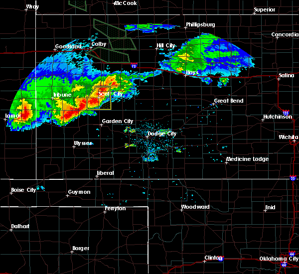 At 852 pm cdt, a severe thunderstorm was located 3 miles northeast of shallow water, moving southeast at 30 mph (radar indicated). Hazards include 60 mph wind gusts and quarter size hail. Hail damage to vehicles is expected. expect wind damage to roofs, siding, and trees. Locations impacted include, scott city, shallow water, grigston, manning, scott state lake and modoc. At 852 pm cdt, a severe thunderstorm was located 3 miles northeast of shallow water, moving southeast at 30 mph (radar indicated). Hazards include 60 mph wind gusts and quarter size hail. Hail damage to vehicles is expected. expect wind damage to roofs, siding, and trees. Locations impacted include, scott city, shallow water, grigston, manning, scott state lake and modoc.
|
| 6/23/2018 8:41 PM CDT |
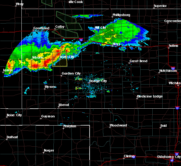 The national weather service in dodge city has issued a * severe thunderstorm warning for. scott county in west central kansas. until 930 pm cdt. At 841 pm cdt, a severe thunderstorm was located near scott city, moving southeast at 30 mph. The national weather service in dodge city has issued a * severe thunderstorm warning for. scott county in west central kansas. until 930 pm cdt. At 841 pm cdt, a severe thunderstorm was located near scott city, moving southeast at 30 mph.
|
| 6/22/2018 5:50 PM CDT | Storm damage reported in scott county KS, 11.2 miles W of Scott City, KS |
| 6/22/2018 5:23 PM CDT |
 At 523 pm cdt, a severe thunderstorm was located 4 miles west of scott city, moving east at 55 mph (radar indicated). Hazards include 70 mph wind gusts and half dollar size hail. Hail damage to vehicles is expected. expect considerable tree damage. wind damage is also likely to mobile homes, roofs, and outbuildings. Locations impacted include, scott city, dighton, alamota, grigston, healy, friend, scott state lake, modoc, shallow water, manning and amy. At 523 pm cdt, a severe thunderstorm was located 4 miles west of scott city, moving east at 55 mph (radar indicated). Hazards include 70 mph wind gusts and half dollar size hail. Hail damage to vehicles is expected. expect considerable tree damage. wind damage is also likely to mobile homes, roofs, and outbuildings. Locations impacted include, scott city, dighton, alamota, grigston, healy, friend, scott state lake, modoc, shallow water, manning and amy.
|
| 6/22/2018 5:08 PM CDT |
 At 508 pm cdt, a severe thunderstorm was located 5 miles northeast of leoti, moving east at 50 mph (radar indicated). Hazards include 70 mph wind gusts and half dollar size hail. Hail damage to vehicles is expected. expect considerable tree damage. Wind damage is also likely to mobile homes, roofs, and outbuildings. At 508 pm cdt, a severe thunderstorm was located 5 miles northeast of leoti, moving east at 50 mph (radar indicated). Hazards include 70 mph wind gusts and half dollar size hail. Hail damage to vehicles is expected. expect considerable tree damage. Wind damage is also likely to mobile homes, roofs, and outbuildings.
|
| 6/19/2018 9:25 PM CDT |
 At 924 pm cdt, the leading edge of severe thunderstorms were located along a line extending from 5 miles north of shields to 15 miles southeast of friend to 2 miles southeast of lakin, moving southeast at 55 mph (radar indicated and measured winds from automated weather stations). Hazards include 70 mph wind gusts and penny size hail. Expect considerable tree damage. Damage is likely to mobile homes, roofs, and outbuildings. At 924 pm cdt, the leading edge of severe thunderstorms were located along a line extending from 5 miles north of shields to 15 miles southeast of friend to 2 miles southeast of lakin, moving southeast at 55 mph (radar indicated and measured winds from automated weather stations). Hazards include 70 mph wind gusts and penny size hail. Expect considerable tree damage. Damage is likely to mobile homes, roofs, and outbuildings.
|
| 6/19/2018 9:15 PM CDT | Large tree blown over at golf course in scott county KS, 0.8 miles SSW of Scott City, KS |
| 6/19/2018 9:12 PM CDT |
 At 911 pm cdt/811 pm mdt/, severe thunderstorms were located along a line extending from 9 miles north of healy to 7 miles southwest of friend to 16 miles south of coolidge, moving south at 40 mph (radar indicated and observed by automated weather station). Hazards include 70 mph wind gusts and penny size hail. Expect considerable tree damage. damage is likely to mobile homes, roofs, and outbuildings. locations impacted include, garden city, scott city, lakin, holcomb, syracuse, dighton, deerfield, pierceville, coolidge, alamota, kendall, grigston, scott state lake, modoc, shallow water, manning, pendennis, amy, plymell and healy. At 902 pm, a 64 mph wind gust was measured at scott city airport. At 911 pm cdt/811 pm mdt/, severe thunderstorms were located along a line extending from 9 miles north of healy to 7 miles southwest of friend to 16 miles south of coolidge, moving south at 40 mph (radar indicated and observed by automated weather station). Hazards include 70 mph wind gusts and penny size hail. Expect considerable tree damage. damage is likely to mobile homes, roofs, and outbuildings. locations impacted include, garden city, scott city, lakin, holcomb, syracuse, dighton, deerfield, pierceville, coolidge, alamota, kendall, grigston, scott state lake, modoc, shallow water, manning, pendennis, amy, plymell and healy. At 902 pm, a 64 mph wind gust was measured at scott city airport.
|
| 6/19/2018 9:03 PM CDT |
 At 902 pm cdt/802 pm mdt/, the leading edge of severe thunderstorms were located along a line extending from 11 miles southwest of gove to 7 miles west of friend to 11 miles south of holly, moving south at 40 mph (radar indicated). Hazards include 60 mph wind gusts and nickel size hail. Expect damage to roofs, siding, and trees. Locations impacted include, garden city, scott city, lakin, holcomb, syracuse, dighton, deerfield, pierceville, coolidge, alamota, kendall, grigston, scott state lake, modoc, shallow water, manning, pendennis, amy, plymell and healy. At 902 pm cdt/802 pm mdt/, the leading edge of severe thunderstorms were located along a line extending from 11 miles southwest of gove to 7 miles west of friend to 11 miles south of holly, moving south at 40 mph (radar indicated). Hazards include 60 mph wind gusts and nickel size hail. Expect damage to roofs, siding, and trees. Locations impacted include, garden city, scott city, lakin, holcomb, syracuse, dighton, deerfield, pierceville, coolidge, alamota, kendall, grigston, scott state lake, modoc, shallow water, manning, pendennis, amy, plymell and healy.
|
| 6/19/2018 9:02 PM CDT | Storm damage reported in scott county KS, 1.4 miles W of Scott City, KS |
| 6/19/2018 8:36 PM CDT |
 At 836 pm cdt/736 pm mdt/, severe thunderstorms were located along a line extending from 6 miles southwest of gove to near modoc to 6 miles north of coolidge, moving south at 45 mph (radar indicated). Hazards include 60 mph wind gusts and quarter size hail. Hail damage to vehicles is expected. Expect wind damage to roofs, siding, and trees. At 836 pm cdt/736 pm mdt/, severe thunderstorms were located along a line extending from 6 miles southwest of gove to near modoc to 6 miles north of coolidge, moving south at 45 mph (radar indicated). Hazards include 60 mph wind gusts and quarter size hail. Hail damage to vehicles is expected. Expect wind damage to roofs, siding, and trees.
|
| 6/19/2018 5:57 PM CDT |
 At 556 pm cdt, another severe thunderstorm was located very near scott city, moving northeast at 25 mph (radar indicated). Hazards include 70 mph wind gusts and ping pong ball size hail. People and animals outdoors will be injured. expect hail damage to roofs, siding, windows, and vehicles. expect considerable tree damage. Wind damage is also likely to mobile homes, roofs, and outbuildings. At 556 pm cdt, another severe thunderstorm was located very near scott city, moving northeast at 25 mph (radar indicated). Hazards include 70 mph wind gusts and ping pong ball size hail. People and animals outdoors will be injured. expect hail damage to roofs, siding, windows, and vehicles. expect considerable tree damage. Wind damage is also likely to mobile homes, roofs, and outbuildings.
|
| 6/19/2018 5:47 PM CDT |
 At 525 pm cdt, a severe thunderstorm was located 4 miles south of grigston, moving east at 10 mph. other severe thunderstorms producing large hail and torrential rainfall were occurring across much of scott county (radar indicated). Hazards include two inch hail and 70 mph wind gusts. People and animals outdoors will be injured. expect hail damage to roofs, siding, windows, and vehicles. expect considerable tree damage. wind damage is also likely to mobile homes, roofs, and outbuildings. Locations impacted include, scott city, dighton, grigston, healy, scott state lake, modoc, shallow water, manning and amy. At 525 pm cdt, a severe thunderstorm was located 4 miles south of grigston, moving east at 10 mph. other severe thunderstorms producing large hail and torrential rainfall were occurring across much of scott county (radar indicated). Hazards include two inch hail and 70 mph wind gusts. People and animals outdoors will be injured. expect hail damage to roofs, siding, windows, and vehicles. expect considerable tree damage. wind damage is also likely to mobile homes, roofs, and outbuildings. Locations impacted include, scott city, dighton, grigston, healy, scott state lake, modoc, shallow water, manning and amy.
|
| 6/19/2018 5:27 PM CDT |
 At 525 pm cdt, a severe thunderstorm was located 4 miles south of grigston, moving east at 10 mph. other severe thunderstorms producing large hail and torrential rainfall were occurring across much of scott county (radar indicated). Hazards include two inch hail and 70 mph wind gusts. People and animals outdoors will be injured. expect hail damage to roofs, siding, windows, and vehicles. expect considerable tree damage. wind damage is also likely to mobile homes, roofs, and outbuildings. Locations impacted include, scott city, dighton, grigston, healy, scott state lake, modoc, shallow water, manning and amy. At 525 pm cdt, a severe thunderstorm was located 4 miles south of grigston, moving east at 10 mph. other severe thunderstorms producing large hail and torrential rainfall were occurring across much of scott county (radar indicated). Hazards include two inch hail and 70 mph wind gusts. People and animals outdoors will be injured. expect hail damage to roofs, siding, windows, and vehicles. expect considerable tree damage. wind damage is also likely to mobile homes, roofs, and outbuildings. Locations impacted include, scott city, dighton, grigston, healy, scott state lake, modoc, shallow water, manning and amy.
|
| 6/19/2018 5:06 PM CDT |
 At 504 pm cdt, a severe thunderstorm was located 6 miles southeast of scott city, moving east at 15 mph. another severe thunderstorm located 8 miles west of scott city was moving northeast at 20 mph (radar indicated). Hazards include two inch hail and 70 mph wind gusts. People and animals outdoors will be injured. expect hail damage to roofs, siding, windows, and vehicles. expect considerable tree damage. Wind damage is also likely to mobile homes, roofs, and outbuildings. At 504 pm cdt, a severe thunderstorm was located 6 miles southeast of scott city, moving east at 15 mph. another severe thunderstorm located 8 miles west of scott city was moving northeast at 20 mph (radar indicated). Hazards include two inch hail and 70 mph wind gusts. People and animals outdoors will be injured. expect hail damage to roofs, siding, windows, and vehicles. expect considerable tree damage. Wind damage is also likely to mobile homes, roofs, and outbuildings.
|
| 6/19/2018 4:46 PM CDT |
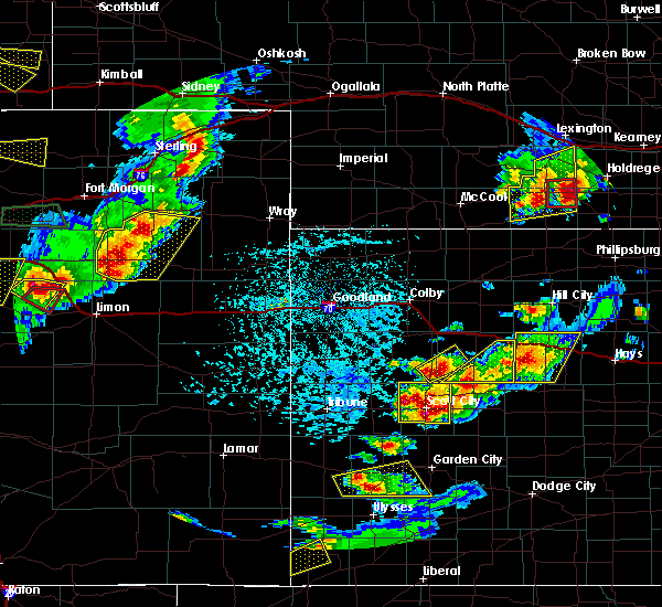 At 432 pm cdt, a severe thunderstorm was located very near scott city, moving northeast at 15 mph. this storm continued to back build just southwest of scott city and moving into the city (radar indicated). Hazards include 70 mph wind gusts and ping pong ball size hail. People and animals outdoors will be injured. expect hail damage to roofs, siding, windows, and vehicles. expect considerable tree damage. wind damage is also likely to mobile homes, roofs, and outbuildings. Locations impacted include, scott city, grigston, manning, scott state lake and modoc. At 432 pm cdt, a severe thunderstorm was located very near scott city, moving northeast at 15 mph. this storm continued to back build just southwest of scott city and moving into the city (radar indicated). Hazards include 70 mph wind gusts and ping pong ball size hail. People and animals outdoors will be injured. expect hail damage to roofs, siding, windows, and vehicles. expect considerable tree damage. wind damage is also likely to mobile homes, roofs, and outbuildings. Locations impacted include, scott city, grigston, manning, scott state lake and modoc.
|
| 6/19/2018 4:35 PM CDT | Hen Egg sized hail reported 5.1 miles E of Scott City, KS, image from social media & matched with radar. several stones at least 2 inches. 5 miles west of scott city at hwy 96 and grant road. |
| 6/19/2018 4:33 PM CDT | Quarter sized hail reported 1 miles NE of Scott City, KS |
| 6/19/2018 4:33 PM CDT |
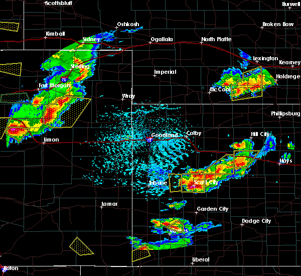 At 432 pm cdt, a severe thunderstorm was located very near scott city, moving northeast at 15 mph. this storm continued to back build just southwest of scott city and moving into the city (radar indicated). Hazards include 70 mph wind gusts and ping pong ball size hail. People and animals outdoors will be injured. expect hail damage to roofs, siding, windows, and vehicles. expect considerable tree damage. wind damage is also likely to mobile homes, roofs, and outbuildings. Locations impacted include, scott city, grigston, manning, scott state lake and modoc. At 432 pm cdt, a severe thunderstorm was located very near scott city, moving northeast at 15 mph. this storm continued to back build just southwest of scott city and moving into the city (radar indicated). Hazards include 70 mph wind gusts and ping pong ball size hail. People and animals outdoors will be injured. expect hail damage to roofs, siding, windows, and vehicles. expect considerable tree damage. wind damage is also likely to mobile homes, roofs, and outbuildings. Locations impacted include, scott city, grigston, manning, scott state lake and modoc.
|
| 6/19/2018 4:22 PM CDT |
 At 422 pm cdt, a severe thunderstorm was located near scott city, moving southwest at 10 mph (radar indicated). Hazards include 70 mph wind gusts and quarter size hail. Hail damage to vehicles is expected. expect considerable tree damage. wind damage is also likely to mobile homes, roofs, and outbuildings. Locations impacted include, scott city, grigston, manning and scott state lake. At 422 pm cdt, a severe thunderstorm was located near scott city, moving southwest at 10 mph (radar indicated). Hazards include 70 mph wind gusts and quarter size hail. Hail damage to vehicles is expected. expect considerable tree damage. wind damage is also likely to mobile homes, roofs, and outbuildings. Locations impacted include, scott city, grigston, manning and scott state lake.
|
| 6/19/2018 4:08 PM CDT |
 The national weather service in dodge city has issued a * severe thunderstorm warning for. scott county in west central kansas. until 515 pm cdt. At 407 pm cdt, a severe thunderstorm was located very near scott city, moving northeast at 15 mph. The national weather service in dodge city has issued a * severe thunderstorm warning for. scott county in west central kansas. until 515 pm cdt. At 407 pm cdt, a severe thunderstorm was located very near scott city, moving northeast at 15 mph.
|
| 6/19/2018 4:00 PM CDT | Quarter sized hail reported 0.7 miles NNE of Scott City, KS |
| 6/19/2018 3:48 PM CDT |
 At 347 pm cdt, a severe thunderstorm was located near scott city, moving north at 10 mph (radar indicated). Hazards include two inch hail and 70 mph wind gusts. People and animals outdoors will be injured. expect hail damage to roofs, siding, windows, and vehicles. expect considerable tree damage. wind damage is also likely to mobile homes, roofs, and outbuildings. Locations impacted include, scott city, grigston, healy, scott state lake, shallow water, manning, amy and shields. At 347 pm cdt, a severe thunderstorm was located near scott city, moving north at 10 mph (radar indicated). Hazards include two inch hail and 70 mph wind gusts. People and animals outdoors will be injured. expect hail damage to roofs, siding, windows, and vehicles. expect considerable tree damage. wind damage is also likely to mobile homes, roofs, and outbuildings. Locations impacted include, scott city, grigston, healy, scott state lake, shallow water, manning, amy and shields.
|
| 6/19/2018 3:37 PM CDT |
 At 336 pm cdt, a severe thunderstorm was located near shallow water, moving northeast at 15 mph. another severe thunderstorm was located 5 miles north of healy, also moving northeast at 15 mph (radar indicated). Hazards include ping pong ball size hail and 60 mph wind gusts. People and animals outdoors will be injured. expect hail damage to roofs, siding, windows, and vehicles. Expect wind damage to roofs, siding, and trees. At 336 pm cdt, a severe thunderstorm was located near shallow water, moving northeast at 15 mph. another severe thunderstorm was located 5 miles north of healy, also moving northeast at 15 mph (radar indicated). Hazards include ping pong ball size hail and 60 mph wind gusts. People and animals outdoors will be injured. expect hail damage to roofs, siding, windows, and vehicles. Expect wind damage to roofs, siding, and trees.
|
| 5/28/2018 6:58 PM CDT | Quarter sized hail reported 6.8 miles W of Scott City, KS |
| 5/28/2018 6:56 PM CDT |
 The severe thunderstorm warning for northwestern finney, southeastern scott and southwestern lane counties will expire at 700 pm cdt, the storm which prompted the warning has moved out of the area. therefore the warning will be allowed to expire. however small hail, gusty winds and heavy rain are still possible with this thunderstorm. a tornado watch remains in effect until 1000 pm cdt for west central kansas. a severe thunderstorm watch remains in effect until 1000 pm cdt for southwestern kansas. The severe thunderstorm warning for northwestern finney, southeastern scott and southwestern lane counties will expire at 700 pm cdt, the storm which prompted the warning has moved out of the area. therefore the warning will be allowed to expire. however small hail, gusty winds and heavy rain are still possible with this thunderstorm. a tornado watch remains in effect until 1000 pm cdt for west central kansas. a severe thunderstorm watch remains in effect until 1000 pm cdt for southwestern kansas.
|
| 5/28/2018 6:55 PM CDT |
 At 655 pm cdt, severe thunderstorms were located along a line extending from 7 miles west of trego center to 4 miles southeast of grigston, moving northeast at 55 mph (radar indicated). Hazards include 60 mph wind gusts and quarter size hail. Hail damage to vehicles is expected. Expect wind damage to roofs, siding, and trees. At 655 pm cdt, severe thunderstorms were located along a line extending from 7 miles west of trego center to 4 miles southeast of grigston, moving northeast at 55 mph (radar indicated). Hazards include 60 mph wind gusts and quarter size hail. Hail damage to vehicles is expected. Expect wind damage to roofs, siding, and trees.
|
| 5/28/2018 6:27 PM CDT |
 At 627 pm cdt, a severe thunderstorm was located 5 miles southeast of friend, moving north at 30 mph (radar indicated). Hazards include 60 mph wind gusts and quarter size hail. Hail damage to vehicles is expected. expect wind damage to roofs, siding, and trees. locations impacted include, scott city, shallow water, grigston, friend and amy. A tornado watch remains in effect until 1000 pm cdt for west central kansas. At 627 pm cdt, a severe thunderstorm was located 5 miles southeast of friend, moving north at 30 mph (radar indicated). Hazards include 60 mph wind gusts and quarter size hail. Hail damage to vehicles is expected. expect wind damage to roofs, siding, and trees. locations impacted include, scott city, shallow water, grigston, friend and amy. A tornado watch remains in effect until 1000 pm cdt for west central kansas.
|
| 5/28/2018 6:14 PM CDT |
 At 613 pm cdt, a severe thunderstorm was located 7 miles north of garden city, moving north at 40 mph. another severe thunderstorm was located 2 miles southeast of friend, moving north at 40 mph (radar indicated). Hazards include 60 mph wind gusts and half dollar size hail. Hail damage to vehicles is expected. expect wind damage to roofs, siding, and trees. locations impacted include, garden city, scott city, shallow water, grigston, friend and amy. A tornado watch remains in effect until 1000 pm cdt for west central kansas. At 613 pm cdt, a severe thunderstorm was located 7 miles north of garden city, moving north at 40 mph. another severe thunderstorm was located 2 miles southeast of friend, moving north at 40 mph (radar indicated). Hazards include 60 mph wind gusts and half dollar size hail. Hail damage to vehicles is expected. expect wind damage to roofs, siding, and trees. locations impacted include, garden city, scott city, shallow water, grigston, friend and amy. A tornado watch remains in effect until 1000 pm cdt for west central kansas.
|
| 5/28/2018 6:07 PM CDT |
 The national weather service in dodge city has issued a * severe thunderstorm warning for. northwestern finney county in southwestern kansas. southeastern scott county in west central kansas. southwestern lane county in west central kansas. Until 700 pm cdt. The national weather service in dodge city has issued a * severe thunderstorm warning for. northwestern finney county in southwestern kansas. southeastern scott county in west central kansas. southwestern lane county in west central kansas. Until 700 pm cdt.
|
| 5/28/2018 5:55 PM CDT | Half Dollar sized hail reported 4.6 miles W of Scott City, KS |
| 5/18/2018 9:12 PM CDT |
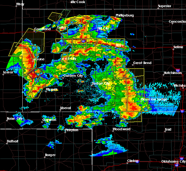 A severe thunderstorm warning remains in effect until 945 pm cdt for northeastern scott county. at 911 pm cdt, a severe thunderstorm was located 4 miles west of manning, moving northeast at 35 mph. hazard. 60 mph wind gusts and quarter size hail. source. Radar indicated. A severe thunderstorm warning remains in effect until 945 pm cdt for northeastern scott county. at 911 pm cdt, a severe thunderstorm was located 4 miles west of manning, moving northeast at 35 mph. hazard. 60 mph wind gusts and quarter size hail. source. Radar indicated.
|
| 5/18/2018 8:58 PM CDT |
 The severe thunderstorm warning for north central finney, eastern scott and western lane counties will expire at 900 pm cdt, the severe thunderstorm which prompted the warning has moved out of the warned area. therefore, the warning will be allowed to expire. another severe thunderstorm warning is in effect for storms to the west. a severe thunderstorm watch remains in effect until 1100 pm cdt for southwestern and west central kansas. The severe thunderstorm warning for north central finney, eastern scott and western lane counties will expire at 900 pm cdt, the severe thunderstorm which prompted the warning has moved out of the warned area. therefore, the warning will be allowed to expire. another severe thunderstorm warning is in effect for storms to the west. a severe thunderstorm watch remains in effect until 1100 pm cdt for southwestern and west central kansas.
|
| 5/18/2018 8:48 PM CDT |
 At 848 pm cdt, a severe thunderstorm was located near friend, moving north at 30 mph (radar indicated). Hazards include 60 mph wind gusts and half dollar size hail. Hail damage to vehicles is expected. Expect wind damage to roofs, siding, and trees. At 848 pm cdt, a severe thunderstorm was located near friend, moving north at 30 mph (radar indicated). Hazards include 60 mph wind gusts and half dollar size hail. Hail damage to vehicles is expected. Expect wind damage to roofs, siding, and trees.
|
| 5/18/2018 8:37 PM CDT | Quarter sized hail reported 15.3 miles N of Scott City, KS |
| 5/18/2018 8:37 PM CDT | 55 to 65 mph wind in finney county KS, 15.3 miles N of Scott City, KS |
| 5/18/2018 8:21 PM CDT |
 At 821 pm cdt, a severe thunderstorm was located 4 miles southeast of modoc, moving north at 35 mph (radar indicated). Hazards include 60 mph wind gusts and quarter size hail. Hail damage to vehicles is expected. expect wind damage to roofs, siding, and trees. Locations impacted include, garden city, scott city, holcomb, shallow water and friend. At 821 pm cdt, a severe thunderstorm was located 4 miles southeast of modoc, moving north at 35 mph (radar indicated). Hazards include 60 mph wind gusts and quarter size hail. Hail damage to vehicles is expected. expect wind damage to roofs, siding, and trees. Locations impacted include, garden city, scott city, holcomb, shallow water and friend.
|
| 5/18/2018 8:09 PM CDT |
 At 808 pm cdt, a severe thunderstorm was located 5 miles east of shallow water, moving northeast at 5 mph. another severe thunderstorm was located 7 miles north of grigston moving north at 20 mph. this storm has a history of ping pong sized hail (radar indicated). Hazards include golf ball size hail and 70 mph wind gusts. People and animals outdoors will be injured. expect hail damage to roofs, siding, windows, and vehicles. expect considerable tree damage. Wind damage is also likely to mobile homes, roofs, and outbuildings. At 808 pm cdt, a severe thunderstorm was located 5 miles east of shallow water, moving northeast at 5 mph. another severe thunderstorm was located 7 miles north of grigston moving north at 20 mph. this storm has a history of ping pong sized hail (radar indicated). Hazards include golf ball size hail and 70 mph wind gusts. People and animals outdoors will be injured. expect hail damage to roofs, siding, windows, and vehicles. expect considerable tree damage. Wind damage is also likely to mobile homes, roofs, and outbuildings.
|
| 5/18/2018 8:05 PM CDT |
 At 805 pm cdt, a severe thunderstorm was located 7 miles east of shallow water, moving northeast at 5 mph (radar indicated). Hazards include golf ball size hail and 70 mph wind gusts. People and animals outdoors will be injured. expect hail damage to roofs, siding, windows, and vehicles. expect considerable tree damage. wind damage is also likely to mobile homes, roofs, and outbuildings. Locations impacted include, scott city, grigston, manning, healy, amy and scott state lake. At 805 pm cdt, a severe thunderstorm was located 7 miles east of shallow water, moving northeast at 5 mph (radar indicated). Hazards include golf ball size hail and 70 mph wind gusts. People and animals outdoors will be injured. expect hail damage to roofs, siding, windows, and vehicles. expect considerable tree damage. wind damage is also likely to mobile homes, roofs, and outbuildings. Locations impacted include, scott city, grigston, manning, healy, amy and scott state lake.
|
| 5/18/2018 8:00 PM CDT | Quarter sized hail reported 10.1 miles W of Scott City, KS |
| 5/18/2018 7:57 PM CDT |
 At 728 pm cdt, a severe thunderstorm was located 8 miles southeast of shallow water, moving north at 35 mph (radar indicated). Hazards include golf ball size hail and 60 mph wind gusts. People and animals outdoors will be injured. expect hail damage to roofs, siding, windows, and vehicles. Expect wind damage to roofs, siding, and trees. At 728 pm cdt, a severe thunderstorm was located 8 miles southeast of shallow water, moving north at 35 mph (radar indicated). Hazards include golf ball size hail and 60 mph wind gusts. People and animals outdoors will be injured. expect hail damage to roofs, siding, windows, and vehicles. Expect wind damage to roofs, siding, and trees.
|
| 5/18/2018 7:40 PM CDT |
 At 739 pm cdt, a severe thunderstorm was located 7 miles northwest of holcomb, moving north at 35 mph. a second severe storm was located 5 miles southwest of modoc moving north at 35 mph (radar indicated). Hazards include 70 mph wind gusts and ping pong ball size hail. People and animals outdoors will be injured. expect hail damage to roofs, siding, windows, and vehicles. expect considerable tree damage. Wind damage is also likely to mobile homes, roofs, and outbuildings. At 739 pm cdt, a severe thunderstorm was located 7 miles northwest of holcomb, moving north at 35 mph. a second severe storm was located 5 miles southwest of modoc moving north at 35 mph (radar indicated). Hazards include 70 mph wind gusts and ping pong ball size hail. People and animals outdoors will be injured. expect hail damage to roofs, siding, windows, and vehicles. expect considerable tree damage. Wind damage is also likely to mobile homes, roofs, and outbuildings.
|
| 5/18/2018 7:28 PM CDT |
 At 728 pm cdt, a severe thunderstorm was located 8 miles southeast of shallow water, moving north at 35 mph (radar indicated). Hazards include golf ball size hail and 60 mph wind gusts. People and animals outdoors will be injured. expect hail damage to roofs, siding, windows, and vehicles. Expect wind damage to roofs, siding, and trees. At 728 pm cdt, a severe thunderstorm was located 8 miles southeast of shallow water, moving north at 35 mph (radar indicated). Hazards include golf ball size hail and 60 mph wind gusts. People and animals outdoors will be injured. expect hail damage to roofs, siding, windows, and vehicles. Expect wind damage to roofs, siding, and trees.
|
| 5/14/2018 8:48 PM CDT | Tennis Ball sized hail reported 11.7 miles W of Scott City, KS, public reported while on road. |
| 5/14/2018 8:45 PM CDT | Ping Pong Ball sized hail reported 6.3 miles S of Scott City, KS, scott city em report. |
| 5/14/2018 8:42 PM CDT | Golf Ball sized hail reported 10.2 miles W of Scott City, KS, scott city reported on chat. |
| 5/14/2018 8:42 PM CDT | Baseball sized hail reported 10.2 miles W of Scott City, KS, scott city reported on chat. |
| 5/14/2018 8:37 PM CDT |
 At 836 pm cdt, a severe thunderstorm was located 3 miles southwest of manning, moving east at 45 mph. this is a very dangerous storm (radar indicated). Hazards include 90 mph wind gusts and tennis ball size hail. You are in a life-threatening situation. flying debris may be deadly to those caught without shelter. mobile homes will be heavily damaged or destroyed. homes and businesses will have substantial roof and window damage. expect extensive tree damage and power outages. Locations impacted include, scott city, grigston, manning and scott state lake. At 836 pm cdt, a severe thunderstorm was located 3 miles southwest of manning, moving east at 45 mph. this is a very dangerous storm (radar indicated). Hazards include 90 mph wind gusts and tennis ball size hail. You are in a life-threatening situation. flying debris may be deadly to those caught without shelter. mobile homes will be heavily damaged or destroyed. homes and businesses will have substantial roof and window damage. expect extensive tree damage and power outages. Locations impacted include, scott city, grigston, manning and scott state lake.
|
| 5/14/2018 8:35 PM CDT | Golf Ball sized hail reported 9.2 miles SW of Scott City, KS, golf ball sized hail. |
| 5/14/2018 8:30 PM CDT | Hen Egg sized hail reported 6.9 miles SSW of Scott City, KS, 2 inch sized hail. |
| 5/14/2018 8:30 PM CDT | Hen Egg sized hail reported 15.3 miles SE of Scott City, KS, picture on twitter. |
| 5/14/2018 8:23 PM CDT |
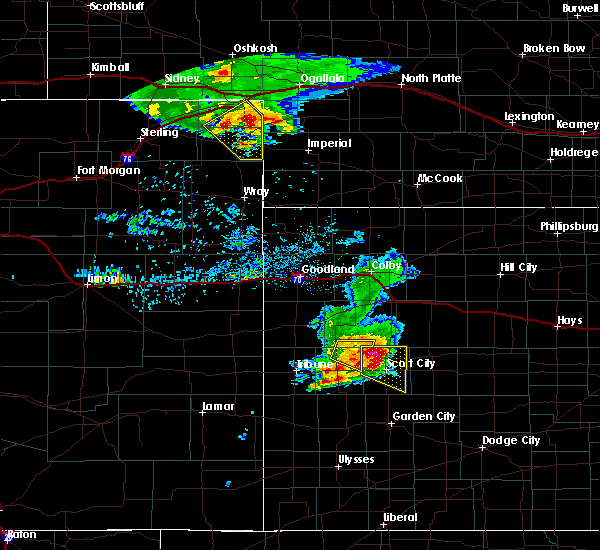 At 822 pm cdt, a severe thunderstorm was located 5 miles northwest of scott city, moving east at 45 mph. this is a very dangerous storm (radar indicated). Hazards include 90 mph wind gusts and baseball size hail. You are in a life-threatening situation. flying debris may be deadly to those caught without shelter. mobile homes will be heavily damaged or destroyed. homes and businesses will have substantial roof and window damage. expect extensive tree damage and power outages. Locations impacted include, scott city, shallow water, grigston, manning, scott state lake and modoc. At 822 pm cdt, a severe thunderstorm was located 5 miles northwest of scott city, moving east at 45 mph. this is a very dangerous storm (radar indicated). Hazards include 90 mph wind gusts and baseball size hail. You are in a life-threatening situation. flying debris may be deadly to those caught without shelter. mobile homes will be heavily damaged or destroyed. homes and businesses will have substantial roof and window damage. expect extensive tree damage and power outages. Locations impacted include, scott city, shallow water, grigston, manning, scott state lake and modoc.
|
| 5/14/2018 7:55 PM CDT |
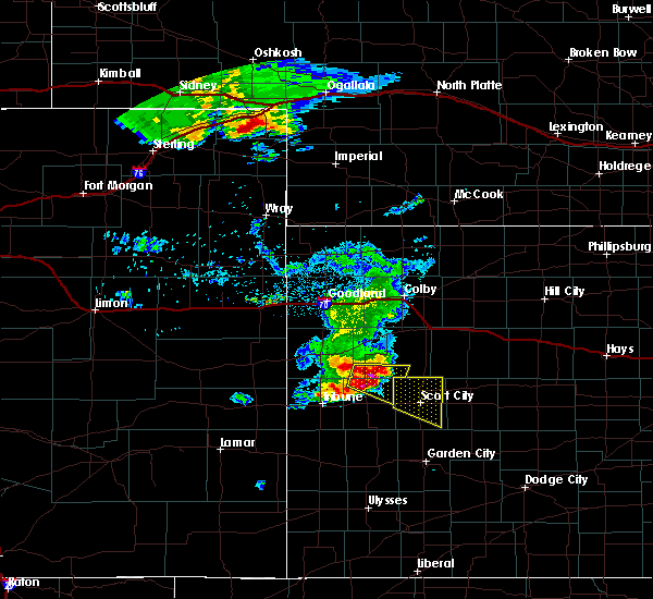 At 754 pm cdt, a severe thunderstorm was located 11 miles north of leoti, moving east at 40 mph. this is a very dangerous storm (radar indicated). Hazards include 80 mph wind gusts and tennis ball size hail. Flying debris will be dangerous to those caught without shelter. mobile homes will be heavily damaged. expect considerable damage to roofs, windows, and vehicles. Extensive tree damage and power outages are likely. At 754 pm cdt, a severe thunderstorm was located 11 miles north of leoti, moving east at 40 mph. this is a very dangerous storm (radar indicated). Hazards include 80 mph wind gusts and tennis ball size hail. Flying debris will be dangerous to those caught without shelter. mobile homes will be heavily damaged. expect considerable damage to roofs, windows, and vehicles. Extensive tree damage and power outages are likely.
|
| 10/2/2017 6:58 PM CDT | Ping Pong Ball sized hail reported 15.6 miles SE of Scott City, KS |
| 9/24/2017 6:45 PM CDT | Dime size hail also occurred at this locatio in scott county KS, 9.5 miles W of Scott City, KS |
| 9/24/2017 6:44 PM CDT | Quarter sized hail reported 9.8 miles NW of Scott City, KS, reported most marble with some quarter sized hail. |
| 9/24/2017 6:44 PM CDT | Measured 68 mph with a home anemomete in scott county KS, 9.8 miles NW of Scott City, KS |
| 8/17/2017 10:13 PM CDT |
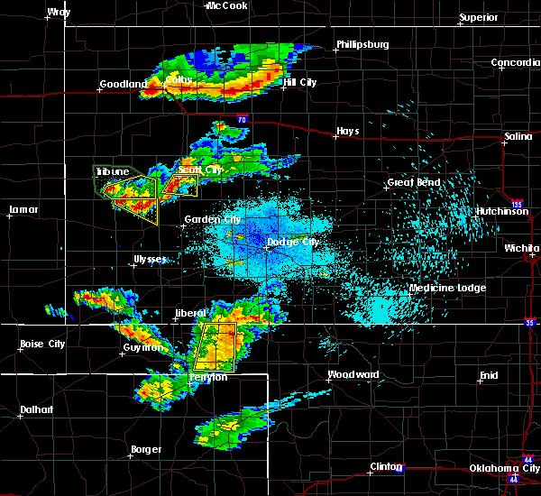 At 1012 pm cdt, a severe thunderstorm was located very near shallow water, or 7 miles south of scott city, moving east at 20 mph (radar indicated). Hazards include 60 mph wind gusts. Expect damage to roofs, siding, and trees. Locations impacted include, scott city, grigston, shallow water and the tractor elevator. At 1012 pm cdt, a severe thunderstorm was located very near shallow water, or 7 miles south of scott city, moving east at 20 mph (radar indicated). Hazards include 60 mph wind gusts. Expect damage to roofs, siding, and trees. Locations impacted include, scott city, grigston, shallow water and the tractor elevator.
|
| 8/17/2017 9:47 PM CDT |
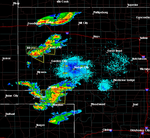 At 947 pm cdt, a severe thunderstorm was located very near modoc, or 8 miles west of scott city, moving east at 20 mph (radar indicated). Hazards include 60 mph wind gusts and penny size hail. expect damage to roofs, siding, and trees At 947 pm cdt, a severe thunderstorm was located very near modoc, or 8 miles west of scott city, moving east at 20 mph (radar indicated). Hazards include 60 mph wind gusts and penny size hail. expect damage to roofs, siding, and trees
|
| 8/10/2017 3:35 PM CDT |
 At 334 pm cdt, a severe thunderstorm was located 3 miles south of scott state lake, or 10 miles north of scott city, moving southeast at 25 mph (radar indicated). Hazards include 60 mph wind gusts and quarter size hail. Hail damage to vehicles is expected. expect wind damage to roofs, siding, and trees. Locations impacted include, scott city, grigston, pence, manning, scott state lake and the tractor elevator. At 334 pm cdt, a severe thunderstorm was located 3 miles south of scott state lake, or 10 miles north of scott city, moving southeast at 25 mph (radar indicated). Hazards include 60 mph wind gusts and quarter size hail. Hail damage to vehicles is expected. expect wind damage to roofs, siding, and trees. Locations impacted include, scott city, grigston, pence, manning, scott state lake and the tractor elevator.
|
| 8/10/2017 3:15 PM CDT |
 At 314 pm cdt, a severe thunderstorm was located 5 miles northwest of scott state lake, or 18 miles north of scott city, moving southeast at 25 mph (radar indicated). Hazards include up to ping pong ball size hail and 60 mph wind gusts. People and animals outdoors will be injured. expect hail damage to roofs, siding, windows, and vehicles. Expect wind damage to roofs, siding, and trees. At 314 pm cdt, a severe thunderstorm was located 5 miles northwest of scott state lake, or 18 miles north of scott city, moving southeast at 25 mph (radar indicated). Hazards include up to ping pong ball size hail and 60 mph wind gusts. People and animals outdoors will be injured. expect hail damage to roofs, siding, windows, and vehicles. Expect wind damage to roofs, siding, and trees.
|
| 7/3/2017 10:15 PM CDT |
 At 1014 pm cdt, a severe thunderstorm was located near scott city, moving southeast at 45 mph (radar indicated). Hazards include 60 mph wind gusts and nickel size hail. Expect damage to roofs, siding, and trees. Locations impacted include, scott city, healy, modoc, grigston, shallow water, pence, friend, manning, scott state lake, the tractor elevator and the tennis elevator. At 1014 pm cdt, a severe thunderstorm was located near scott city, moving southeast at 45 mph (radar indicated). Hazards include 60 mph wind gusts and nickel size hail. Expect damage to roofs, siding, and trees. Locations impacted include, scott city, healy, modoc, grigston, shallow water, pence, friend, manning, scott state lake, the tractor elevator and the tennis elevator.
|
| 7/3/2017 9:48 PM CDT |
 At 947 pm cdt, a severe thunderstorm was located 8 miles northwest of modoc, or 9 miles northeast of leoti, moving southeast at 40 mph (radar indicated). Hazards include 60 mph wind gusts and quarter size hail. Hail damage to vehicles is expected. Expect wind damage to roofs, siding, and trees. At 947 pm cdt, a severe thunderstorm was located 8 miles northwest of modoc, or 9 miles northeast of leoti, moving southeast at 40 mph (radar indicated). Hazards include 60 mph wind gusts and quarter size hail. Hail damage to vehicles is expected. Expect wind damage to roofs, siding, and trees.
|
| 6/26/2017 7:36 PM CDT | Tea Cup sized hail reported 10.1 miles SSE of Scott City, KS |
| 6/26/2017 7:27 PM CDT | Ping Pong Ball sized hail reported 13.2 miles S of Scott City, KS |
| 6/22/2017 8:41 PM CDT |
 At 841 pm cdt, a severe thunderstorm was located 4 miles west of grigston, or 6 miles east of scott city, moving east at 25 mph (radar indicated). Hazards include 60 mph wind gusts and quarter size hail. Hail damage to vehicles is expected. expect wind damage to roofs, siding, and trees. Locations impacted include, scott city, dighton, healy, alamota, shields, grigston, pendennis, shallow water, amy, friend, manning, scott state lake, the tractor elevator, finney state lake and the tennis elevator. At 841 pm cdt, a severe thunderstorm was located 4 miles west of grigston, or 6 miles east of scott city, moving east at 25 mph (radar indicated). Hazards include 60 mph wind gusts and quarter size hail. Hail damage to vehicles is expected. expect wind damage to roofs, siding, and trees. Locations impacted include, scott city, dighton, healy, alamota, shields, grigston, pendennis, shallow water, amy, friend, manning, scott state lake, the tractor elevator, finney state lake and the tennis elevator.
|
| 6/22/2017 8:16 PM CDT |
 At 816 pm cdt, a severe thunderstorm was located near scott city, moving east at 35 mph (radar indicated). Hazards include 60 mph wind gusts and quarter size hail. Hail damage to vehicles is expected. Expect wind damage to roofs, siding, and trees. At 816 pm cdt, a severe thunderstorm was located near scott city, moving east at 35 mph (radar indicated). Hazards include 60 mph wind gusts and quarter size hail. Hail damage to vehicles is expected. Expect wind damage to roofs, siding, and trees.
|
| 6/20/2017 5:17 PM CDT |
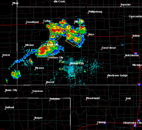 At 515 pm cdt, a severe thunderstorm was located 6 miles southeast of modoc, or 7 miles southwest of scott city, moving south at 10 mph. another severe thunderstorm was located very near the kearny, finney, scott county line about 15 miles west of friend (radar indicated). Hazards include two inch hail and 60 mph wind gusts. People and animals outdoors will be injured. expect hail damage to roofs, siding, windows, and vehicles. Expect wind damage to roofs, siding, and trees. At 515 pm cdt, a severe thunderstorm was located 6 miles southeast of modoc, or 7 miles southwest of scott city, moving south at 10 mph. another severe thunderstorm was located very near the kearny, finney, scott county line about 15 miles west of friend (radar indicated). Hazards include two inch hail and 60 mph wind gusts. People and animals outdoors will be injured. expect hail damage to roofs, siding, windows, and vehicles. Expect wind damage to roofs, siding, and trees.
|
| 6/20/2017 5:14 PM CDT | Quarter sized hail reported 2.7 miles N of Scott City, KS |
| 6/20/2017 5:09 PM CDT |
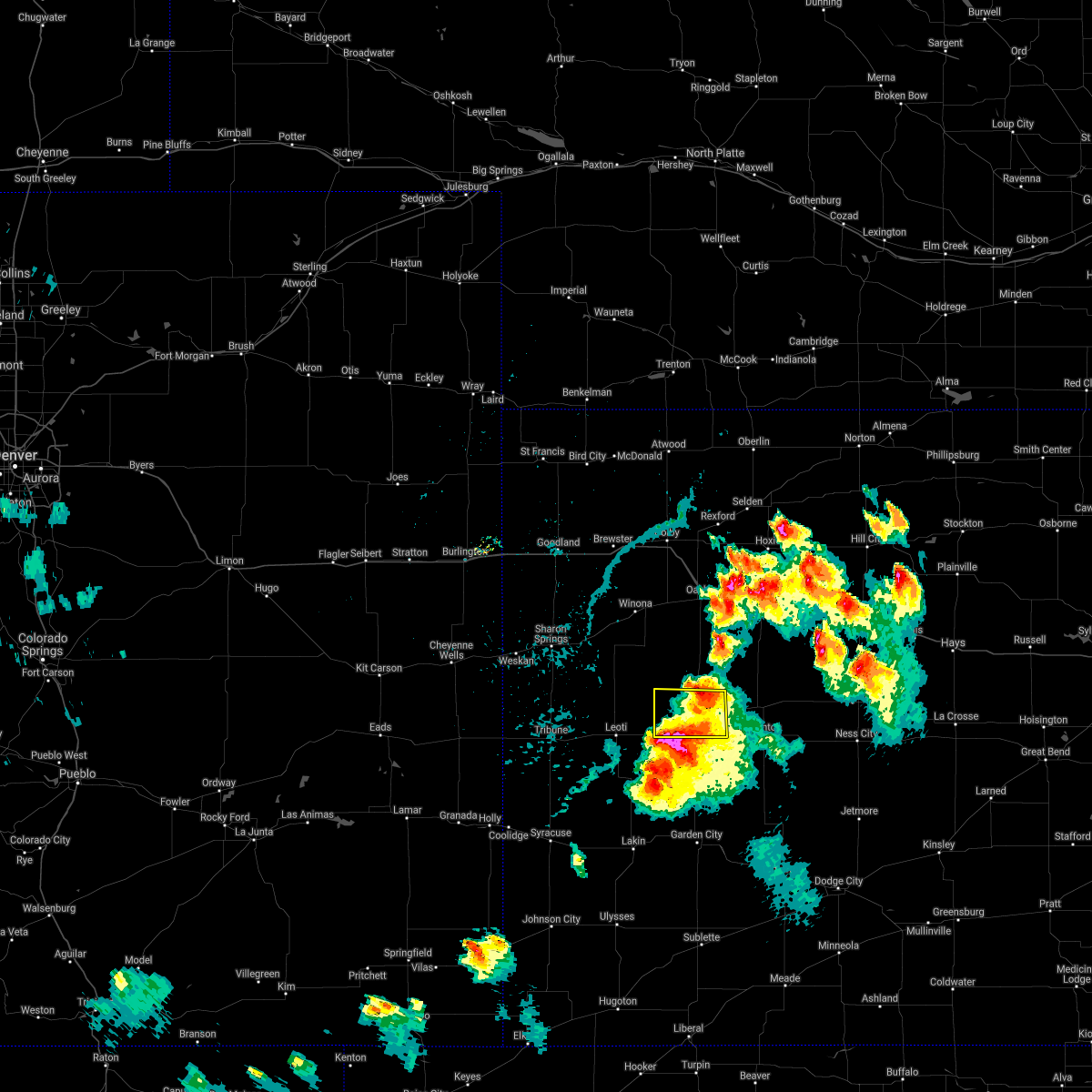 The severe thunderstorm warning for northern scott county will expire at 515 pm cdt, the severe thunderstorm which prompted the warning has weakened therefore, the warning will be allowed to expire. however small hail, gusty winds and heavy rain are still possible with this thunderstorm. a severe thunderstorm watch remains in effect until 900 pm cdt for west central kansas. The severe thunderstorm warning for northern scott county will expire at 515 pm cdt, the severe thunderstorm which prompted the warning has weakened therefore, the warning will be allowed to expire. however small hail, gusty winds and heavy rain are still possible with this thunderstorm. a severe thunderstorm watch remains in effect until 900 pm cdt for west central kansas.
|
| 6/20/2017 4:46 PM CDT |
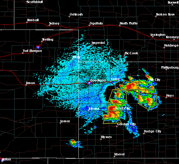 At 446 pm cdt, a severe thunderstorm was located 3 miles north of scott state lake, or 17 miles north of scott city, moving southeast at 15 mph (radar indicated). Hazards include golf ball size hail and 70 mph wind gusts. People and animals outdoors will be injured. expect hail damage to roofs, siding, windows, and vehicles. expect considerable tree damage. wind damage is also likely to mobile homes, roofs, and outbuildings. Locations impacted include, scott city, modoc, grigston, pence, manning, scott state lake and the tractor elevator. At 446 pm cdt, a severe thunderstorm was located 3 miles north of scott state lake, or 17 miles north of scott city, moving southeast at 15 mph (radar indicated). Hazards include golf ball size hail and 70 mph wind gusts. People and animals outdoors will be injured. expect hail damage to roofs, siding, windows, and vehicles. expect considerable tree damage. wind damage is also likely to mobile homes, roofs, and outbuildings. Locations impacted include, scott city, modoc, grigston, pence, manning, scott state lake and the tractor elevator.
|
| 6/20/2017 4:31 PM CDT | Tennis Ball sized hail reported 13.9 miles SE of Scott City, KS |
| 6/20/2017 4:19 PM CDT |
 The national weather service in dodge city has issued a * severe thunderstorm warning for. northern scott county in west central kansas. Until 515 pm cdt * at 419 pm cdt, a new severe thunderstorm was located 3 miles southwest of pence, or 15 miles northwest of scott city,. The national weather service in dodge city has issued a * severe thunderstorm warning for. northern scott county in west central kansas. Until 515 pm cdt * at 419 pm cdt, a new severe thunderstorm was located 3 miles southwest of pence, or 15 miles northwest of scott city,.
|
| 6/20/2017 4:10 PM CDT | Quarter sized hail reported 16.5 miles SE of Scott City, KS, hail lasted about 15 min and sized ranged from nickel to quarter. delayed report... timing based on radar. |
| 6/20/2017 3:50 PM CDT | Golf Ball sized hail reported 0.2 miles ESE of Scott City, KS, mostly ping pong size hail with some golf ball. |
| 6/20/2017 3:47 PM CDT | Half Dollar sized hail reported 0.8 miles SSE of Scott City, KS |
| 6/20/2017 3:43 PM CDT |
 At 342 pm cdt, a severe thunderstorm was located over scott city, moving southeast at 15 mph (radar indicated). Hazards include two inch hail and 70 mph wind gusts. People and animals outdoors will be injured. expect hail damage to roofs, siding, windows, and vehicles. expect considerable tree damage. wind damage is also likely to mobile homes, roofs, and outbuildings. locations impacted include, scott city, grigston, shallow water and the tractor elevator. Golfball or larger hail was reported in scott city at 340 pm!. At 342 pm cdt, a severe thunderstorm was located over scott city, moving southeast at 15 mph (radar indicated). Hazards include two inch hail and 70 mph wind gusts. People and animals outdoors will be injured. expect hail damage to roofs, siding, windows, and vehicles. expect considerable tree damage. wind damage is also likely to mobile homes, roofs, and outbuildings. locations impacted include, scott city, grigston, shallow water and the tractor elevator. Golfball or larger hail was reported in scott city at 340 pm!.
|
| 6/20/2017 3:42 PM CDT | Quarter sized hail reported 1.6 miles WSW of Scott City, KS |
| 6/20/2017 3:41 PM CDT | Golf Ball sized hail reported 0.2 miles ESE of Scott City, KS, golf ball hail in scott city and getting larger. |
| 6/20/2017 3:36 PM CDT | Quarter sized hail reported 4.6 miles SSE of Scott City, KS |
| 6/20/2017 3:30 PM CDT | Hen Egg sized hail reported 2.4 miles E of Scott City, KS, delayed report from social media photo. |
| 6/20/2017 3:25 PM CDT |
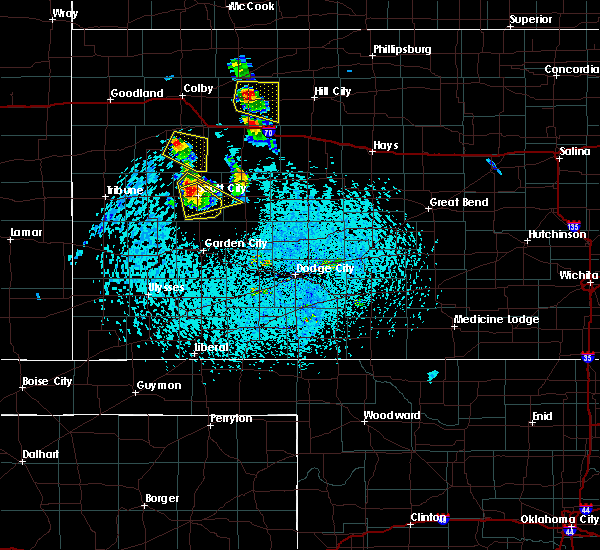 At 324 pm cdt, a severe thunderstorm was located 3 miles northwest of scott city, moving southeast at 15 mph (radar indicated). Hazards include two inch hail and 70 mph wind gusts. People and animals outdoors will be injured. expect hail damage to roofs, siding, windows, and vehicles. expect considerable tree damage. Wind damage is also likely to mobile homes, roofs, and outbuildings. At 324 pm cdt, a severe thunderstorm was located 3 miles northwest of scott city, moving southeast at 15 mph (radar indicated). Hazards include two inch hail and 70 mph wind gusts. People and animals outdoors will be injured. expect hail damage to roofs, siding, windows, and vehicles. expect considerable tree damage. Wind damage is also likely to mobile homes, roofs, and outbuildings.
|
| 6/20/2017 3:21 PM CDT | Ping Pong Ball sized hail reported 6.6 miles SE of Scott City, KS |
| 6/20/2017 3:06 PM CDT |
 At 304 pm cdt, a severe thunderstorm was located 6 miles northwest of scott city, moving southeast at 20 mph (radar indicated). Hazards include two inch hail and 70 mph wind gusts. People and animals outdoors will be injured. expect hail damage to roofs, siding, windows, and vehicles. expect considerable tree damage. wind damage is also likely to mobile homes, roofs, and outbuildings. locations impacted include, scott city, grigston, shallow water, amy, manning and the tractor elevator. At 300 pm, ping pong ball size hail was reported 6 miles west southwest of scott state lake. At 304 pm cdt, a severe thunderstorm was located 6 miles northwest of scott city, moving southeast at 20 mph (radar indicated). Hazards include two inch hail and 70 mph wind gusts. People and animals outdoors will be injured. expect hail damage to roofs, siding, windows, and vehicles. expect considerable tree damage. wind damage is also likely to mobile homes, roofs, and outbuildings. locations impacted include, scott city, grigston, shallow water, amy, manning and the tractor elevator. At 300 pm, ping pong ball size hail was reported 6 miles west southwest of scott state lake.
|
| 6/20/2017 3:02 PM CDT | Hen Egg sized hail reported 12.7 miles SSE of Scott City, KS, ping pong to hen egg sized hail. |
| 6/20/2017 2:58 PM CDT |
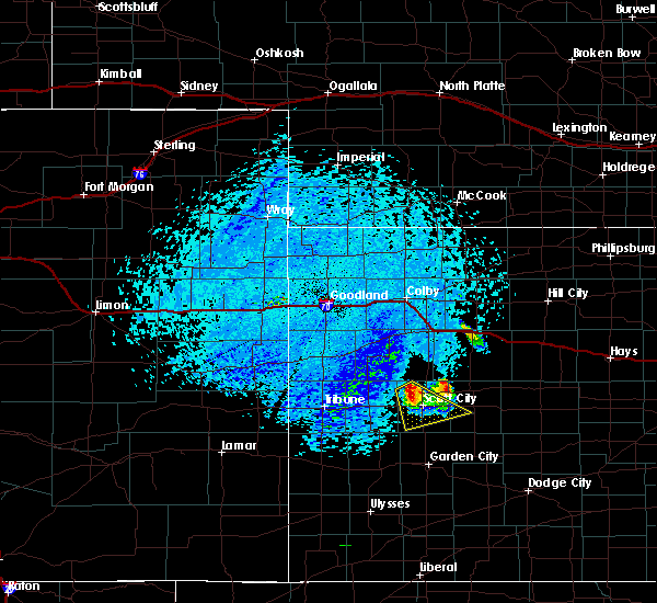 At 258 pm cdt, a severe thunderstorm was located 7 miles southeast of pence, or 7 miles northwest of scott city, moving southeast at 20 mph (radar indicated). Hazards include 60 mph wind gusts and quarter size hail. Hail damage to vehicles is expected. expect wind damage to roofs, siding, and trees. Locations impacted include, scott city, modoc, grigston, shallow water, amy, manning and the tractor elevator. At 258 pm cdt, a severe thunderstorm was located 7 miles southeast of pence, or 7 miles northwest of scott city, moving southeast at 20 mph (radar indicated). Hazards include 60 mph wind gusts and quarter size hail. Hail damage to vehicles is expected. expect wind damage to roofs, siding, and trees. Locations impacted include, scott city, modoc, grigston, shallow water, amy, manning and the tractor elevator.
|
| 6/20/2017 2:33 PM CDT |
 At 233 pm cdt, a severe thunderstorm was located 3 miles southeast of pence, or 11 miles northwest of scott city, moving southeast at 30 mph (radar indicated). Hazards include 60 mph wind gusts and quarter size hail. Hail damage to vehicles is expected. Expect wind damage to roofs, siding, and trees. At 233 pm cdt, a severe thunderstorm was located 3 miles southeast of pence, or 11 miles northwest of scott city, moving southeast at 30 mph (radar indicated). Hazards include 60 mph wind gusts and quarter size hail. Hail damage to vehicles is expected. Expect wind damage to roofs, siding, and trees.
|
| 6/6/2017 5:21 PM CDT |
 The severe thunderstorm warning for northern scott and northwestern lane counties will expire at 530 pm cdt, the severe thunderstorm which prompted the warning has weakened. moved out of the warned area. therefore, the warning will be allowed to expire. The severe thunderstorm warning for northern scott and northwestern lane counties will expire at 530 pm cdt, the severe thunderstorm which prompted the warning has weakened. moved out of the warned area. therefore, the warning will be allowed to expire.
|
| 6/6/2017 5:09 PM CDT |
 At 509 pm cdt, a severe thunderstorm was located 5 miles south of scott state lake, or 8 miles north of scott city, moving southeast at 15 mph (radar indicated). Hazards include 60 mph wind gusts and half dollar size hail. Hail damage to vehicles is expected. expect wind damage to roofs, siding, and trees. Locations impacted include, scott city, healy, modoc, grigston, amy, manning, scott state lake and the tractor elevator. At 509 pm cdt, a severe thunderstorm was located 5 miles south of scott state lake, or 8 miles north of scott city, moving southeast at 15 mph (radar indicated). Hazards include 60 mph wind gusts and half dollar size hail. Hail damage to vehicles is expected. expect wind damage to roofs, siding, and trees. Locations impacted include, scott city, healy, modoc, grigston, amy, manning, scott state lake and the tractor elevator.
|
| 6/6/2017 4:45 PM CDT |
 At 445 pm cdt, a severe thunderstorm was located 4 miles east of pence, or 12 miles northwest of scott city, moving east at 15 mph (radar indicated). Hazards include 60 mph wind gusts and half dollar size hail. Hail damage to vehicles is expected. Expect wind damage to roofs, siding, and trees. At 445 pm cdt, a severe thunderstorm was located 4 miles east of pence, or 12 miles northwest of scott city, moving east at 15 mph (radar indicated). Hazards include 60 mph wind gusts and half dollar size hail. Hail damage to vehicles is expected. Expect wind damage to roofs, siding, and trees.
|
| 5/16/2017 5:36 PM CDT |
 The severe thunderstorm warning for scott and western lane counties will expire at 545 pm cdt, the severe thunderstorm which prompted the warning has weakened and moved out of the warned area. therefore, the warning will be allowed to expire. however small hail and gusty winds are still possible with this thunderstorm. a tornado watch remains in effect until 1000 pm cdt for west central kansas. The severe thunderstorm warning for scott and western lane counties will expire at 545 pm cdt, the severe thunderstorm which prompted the warning has weakened and moved out of the warned area. therefore, the warning will be allowed to expire. however small hail and gusty winds are still possible with this thunderstorm. a tornado watch remains in effect until 1000 pm cdt for west central kansas.
|
| 5/16/2017 5:10 PM CDT |
 At 510 pm cdt, a severe thunderstorm was located 3 miles northeast of shallow water, or 4 miles southeast of scott city, moving north at 40 mph (radar indicated). Hazards include golf ball size hail and 60 mph wind gusts. People and animals outdoors will be injured. expect hail damage to roofs, siding, windows, and vehicles. expect wind damage to roofs, siding, and trees. locations impacted include, scott city, healy, grigston, shallow water, amy, manning, scott state lake and the tractor elevator. A tornado watch remains in effect until 1000 pm cdt for west central kansas. At 510 pm cdt, a severe thunderstorm was located 3 miles northeast of shallow water, or 4 miles southeast of scott city, moving north at 40 mph (radar indicated). Hazards include golf ball size hail and 60 mph wind gusts. People and animals outdoors will be injured. expect hail damage to roofs, siding, windows, and vehicles. expect wind damage to roofs, siding, and trees. locations impacted include, scott city, healy, grigston, shallow water, amy, manning, scott state lake and the tractor elevator. A tornado watch remains in effect until 1000 pm cdt for west central kansas.
|
| 5/16/2017 4:53 PM CDT |
 At 452 pm cdt, a severe thunderstorm was located near friend, or 16 miles south of scott city, moving north at 40 mph. this is a very dangerous storm (radar indicated). Hazards include baseball size hail. People and animals outdoors will be severely injured. Expect shattered windows, extensive damage to roofs, siding, and vehicles. At 452 pm cdt, a severe thunderstorm was located near friend, or 16 miles south of scott city, moving north at 40 mph. this is a very dangerous storm (radar indicated). Hazards include baseball size hail. People and animals outdoors will be severely injured. Expect shattered windows, extensive damage to roofs, siding, and vehicles.
|
| 5/15/2017 9:14 PM CDT | Storm damage reported in scott county KS, 1.4 miles W of Scott City, KS |
| 5/15/2017 8:18 PM CDT | Delayed report. reports of a microburst just west of lake scot in scott county KS, 13.6 miles SSE of Scott City, KS |
| 5/15/2017 8:14 PM CDT | Tennis Ball sized hail reported 13.7 miles SE of Scott City, KS |
| 5/10/2017 10:57 PM CDT |
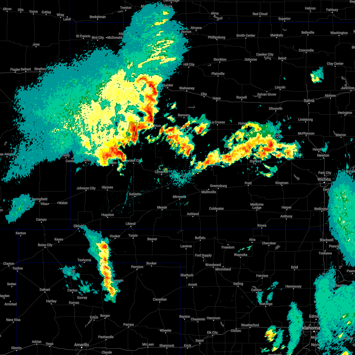 The severe thunderstorm warning for central scott county will expire at 1100 pm cdt, the severe thunderstorm which prompted the warning has weakened below severe limits therefore, the warning will be allowed to expire. heavy rain and small hail will continue southeast of scott city over the next 30 minutes. The severe thunderstorm warning for central scott county will expire at 1100 pm cdt, the severe thunderstorm which prompted the warning has weakened below severe limits therefore, the warning will be allowed to expire. heavy rain and small hail will continue southeast of scott city over the next 30 minutes.
|
| 5/10/2017 10:49 PM CDT |
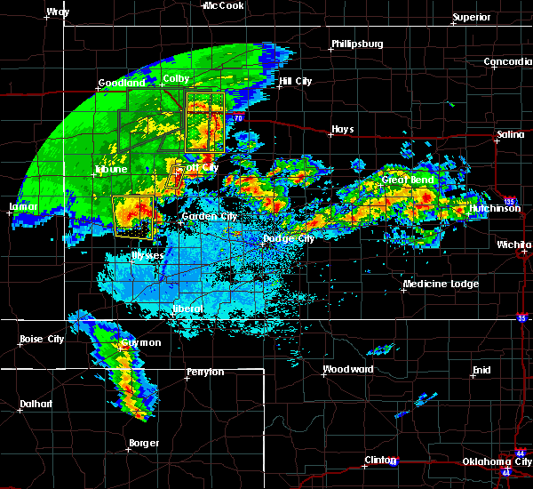 At 1049 pm cdt, a severe thunderstorm was located near scott city, moving east at 10 mph (radar indicated). Hazards include quarter size hail. Damage to vehicles is expected. Locations impacted include, scott city, shallow water and the tractor elevator. At 1049 pm cdt, a severe thunderstorm was located near scott city, moving east at 10 mph (radar indicated). Hazards include quarter size hail. Damage to vehicles is expected. Locations impacted include, scott city, shallow water and the tractor elevator.
|
| 5/10/2017 10:43 PM CDT |
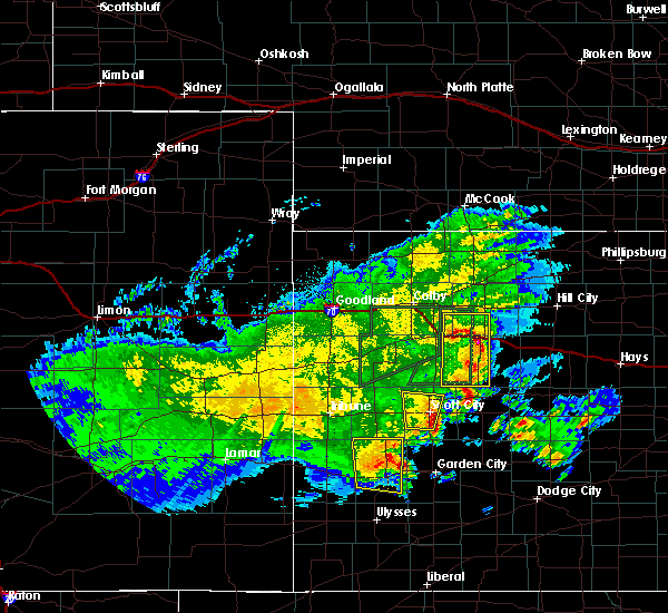 At 1043 pm cdt, a severe thunderstorm was located 3 miles south of scott city, moving east at 10 mph (radar indicated). Hazards include 60 mph wind gusts and quarter size hail. Hail damage to vehicles is expected. expect wind damage to roofs, siding, and trees. Locations impacted include, scott city, modoc, shallow water and the tractor elevator. At 1043 pm cdt, a severe thunderstorm was located 3 miles south of scott city, moving east at 10 mph (radar indicated). Hazards include 60 mph wind gusts and quarter size hail. Hail damage to vehicles is expected. expect wind damage to roofs, siding, and trees. Locations impacted include, scott city, modoc, shallow water and the tractor elevator.
|
| 5/10/2017 10:29 PM CDT |
 At 1029 pm cdt, a severe thunderstorm was located 4 miles southwest of scott city, moving north at 10 mph (radar indicated). Hazards include 60 mph wind gusts and quarter size hail. Hail damage to vehicles is expected. expect wind damage to roofs, siding, and trees. Locations impacted include, scott city, modoc, shallow water and the tractor elevator. At 1029 pm cdt, a severe thunderstorm was located 4 miles southwest of scott city, moving north at 10 mph (radar indicated). Hazards include 60 mph wind gusts and quarter size hail. Hail damage to vehicles is expected. expect wind damage to roofs, siding, and trees. Locations impacted include, scott city, modoc, shallow water and the tractor elevator.
|
| 5/10/2017 10:16 PM CDT |
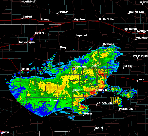 At 1016 pm cdt, a severe thunderstorm was located 4 miles northwest of shallow water, or 5 miles southwest of scott city, moving north at 20 mph (radar indicated). Hazards include ping pong ball size hail and 60 mph wind gusts. People and animals outdoors will be injured. expect hail damage to roofs, siding, windows, and vehicles. Expect wind damage to roofs, siding, and trees. At 1016 pm cdt, a severe thunderstorm was located 4 miles northwest of shallow water, or 5 miles southwest of scott city, moving north at 20 mph (radar indicated). Hazards include ping pong ball size hail and 60 mph wind gusts. People and animals outdoors will be injured. expect hail damage to roofs, siding, windows, and vehicles. Expect wind damage to roofs, siding, and trees.
|
| 4/27/2017 9:26 PM CDT |
 At 926 pm cdt, a severe thunderstorm was located 5 miles southeast of scott state lake, or 10 miles north of scott city, moving east at 25 mph (radar indicated). Hazards include 60 mph wind gusts. Expect damage to roofs, siding, and trees. Locations impacted include, scott city, manning, scott state lake and the tractor elevator. At 926 pm cdt, a severe thunderstorm was located 5 miles southeast of scott state lake, or 10 miles north of scott city, moving east at 25 mph (radar indicated). Hazards include 60 mph wind gusts. Expect damage to roofs, siding, and trees. Locations impacted include, scott city, manning, scott state lake and the tractor elevator.
|
| 4/27/2017 9:10 PM CDT |
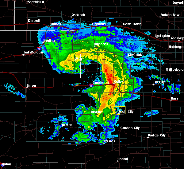 At 910 pm cdt, a severe thunderstorm was located 6 miles southwest of scott state lake, or 8 miles northwest of scott city, moving east at 25 mph (radar indicated). Hazards include 60 mph wind gusts. expect damage to roofs, siding, and trees At 910 pm cdt, a severe thunderstorm was located 6 miles southwest of scott state lake, or 8 miles northwest of scott city, moving east at 25 mph (radar indicated). Hazards include 60 mph wind gusts. expect damage to roofs, siding, and trees
|
| 4/12/2017 6:01 PM CDT |
 At 601 pm cdt, severe thunderstorms were located along a line extending from 6 miles southwest of grigston to 2 miles southeast of arnold, moving east at 20 mph (radar indicated). Hazards include 60 mph wind gusts and quarter size hail. Hail damage to vehicles is expected. Expect wind damage to roofs, siding, and trees. At 601 pm cdt, severe thunderstorms were located along a line extending from 6 miles southwest of grigston to 2 miles southeast of arnold, moving east at 20 mph (radar indicated). Hazards include 60 mph wind gusts and quarter size hail. Hail damage to vehicles is expected. Expect wind damage to roofs, siding, and trees.
|
| 3/23/2017 5:18 PM CDT | Quarter sized hail reported 10.1 miles WNW of Scott City, KS, nickel to quarter-sized hail covered the ground. |
| 3/23/2017 5:08 PM CDT |
 At 507 pm cdt, a severe thunderstorm was located 5 miles southeast of friend, or 17 miles north of garden city, moving northeast at 50 mph (radar indicated). Hazards include 60 mph wind gusts and up to half dollar size hail. Hail damage to vehicles is expected. Expect wind damage to roofs, siding, and trees. At 507 pm cdt, a severe thunderstorm was located 5 miles southeast of friend, or 17 miles north of garden city, moving northeast at 50 mph (radar indicated). Hazards include 60 mph wind gusts and up to half dollar size hail. Hail damage to vehicles is expected. Expect wind damage to roofs, siding, and trees.
|
| 7/27/2016 6:00 PM CDT | Ping Pong Ball sized hail reported 15.3 miles SSW of Scott City, KS, hail was mostly grape size or smaller. |
| 7/15/2016 4:15 PM CDT |
 At 415 pm cdt, a severe thunderstorm was located near scott city, moving southeast at 20 mph (radar indicated). Hazards include 60 mph wind gusts and up to half dollar size hail. Hail damage to vehicles is expected. Expect wind damage to roofs, siding, and trees. At 415 pm cdt, a severe thunderstorm was located near scott city, moving southeast at 20 mph (radar indicated). Hazards include 60 mph wind gusts and up to half dollar size hail. Hail damage to vehicles is expected. Expect wind damage to roofs, siding, and trees.
|
| 6/27/2016 6:34 PM CDT |
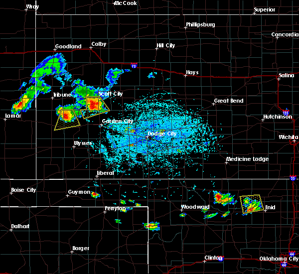 At 633 pm cdt, a severe thunderstorm was located 6 miles west of shallow water, moving south at 20 mph (radar indicated). Hazards include up to ping pong ball size hail and 60 mph wind gusts. People and animals outdoors will be injured. expect hail damage to roofs, siding, windows and vehicles. expect wind damage to roofs, siding and trees. Locations impacted include, scott city, modoc, friend and shallow water. At 633 pm cdt, a severe thunderstorm was located 6 miles west of shallow water, moving south at 20 mph (radar indicated). Hazards include up to ping pong ball size hail and 60 mph wind gusts. People and animals outdoors will be injured. expect hail damage to roofs, siding, windows and vehicles. expect wind damage to roofs, siding and trees. Locations impacted include, scott city, modoc, friend and shallow water.
|
| 6/27/2016 6:27 PM CDT |
 At 627 pm cdt, a severe thunderstorm was located 6 miles west of shallow water, moving south at 20 mph (radar indicated). Hazards include 60 mph wind gusts and quarter size hail. Hail damage to vehicles is expected. expect wind damage to roofs, siding and trees. Locations impacted include, scott city, modoc, friend and shallow water. At 627 pm cdt, a severe thunderstorm was located 6 miles west of shallow water, moving south at 20 mph (radar indicated). Hazards include 60 mph wind gusts and quarter size hail. Hail damage to vehicles is expected. expect wind damage to roofs, siding and trees. Locations impacted include, scott city, modoc, friend and shallow water.
|
| 6/27/2016 6:17 PM CDT |
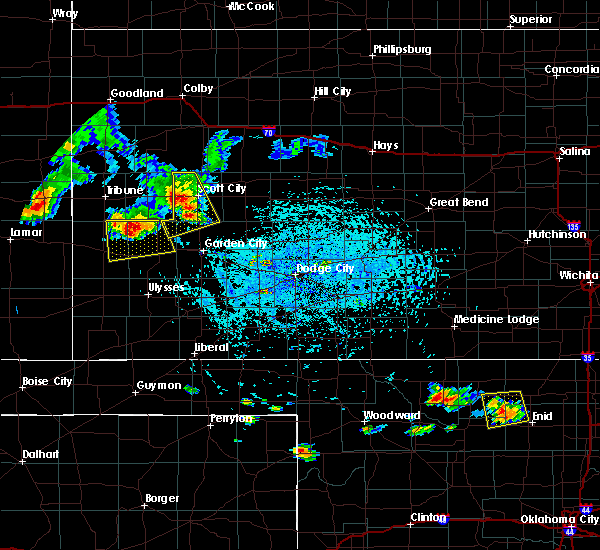 At 617 pm cdt, a severe thunderstorm was located 4 miles south of modoc, moving southeast at 20 mph (radar indicated). Hazards include ping pong ball size hail and 60 mph wind gusts. People and animals outdoors will be injured. expect hail damage to roofs, siding, windows and vehicles. expect wind damage to roofs, siding and trees. Locations impacted include, scott city, scott state lake, modoc, friend and shallow water. At 617 pm cdt, a severe thunderstorm was located 4 miles south of modoc, moving southeast at 20 mph (radar indicated). Hazards include ping pong ball size hail and 60 mph wind gusts. People and animals outdoors will be injured. expect hail damage to roofs, siding, windows and vehicles. expect wind damage to roofs, siding and trees. Locations impacted include, scott city, scott state lake, modoc, friend and shallow water.
|
| 6/27/2016 5:52 PM CDT |
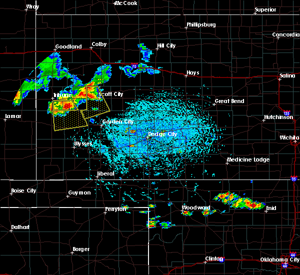 At 552 pm cdt, a severe thunderstorm was located very near modoc, moving south at 20 mph (radar indicated). Hazards include up to golf ball size hail and 60 mph wind gusts. People and animals outdoors will be injured. expect hail damage to roofs, siding, windows and vehicles. Expect wind damage to roofs, siding and trees. At 552 pm cdt, a severe thunderstorm was located very near modoc, moving south at 20 mph (radar indicated). Hazards include up to golf ball size hail and 60 mph wind gusts. People and animals outdoors will be injured. expect hail damage to roofs, siding, windows and vehicles. Expect wind damage to roofs, siding and trees.
|
| 6/9/2016 6:12 PM CDT |
 At 611 pm cdt, a severe thunderstorm was located 5 miles southwest of grigston, moving northeast at 15 mph (radar indicated). Hazards include ping pong ball size hail and 60 mph wind gusts. People and animals outdoors will be injured. expect hail damage to roofs, siding, windows and vehicles. Expect wind damage to roofs, siding and trees. At 611 pm cdt, a severe thunderstorm was located 5 miles southwest of grigston, moving northeast at 15 mph (radar indicated). Hazards include ping pong ball size hail and 60 mph wind gusts. People and animals outdoors will be injured. expect hail damage to roofs, siding, windows and vehicles. Expect wind damage to roofs, siding and trees.
|
| 5/29/2016 3:39 PM CDT |
 The severe thunderstorm warning for northern scott county will expire at 345 pm cdt, the severe thunderstorm which prompted the warning has weakened. therefore the warning will be allowed to expire. The severe thunderstorm warning for northern scott county will expire at 345 pm cdt, the severe thunderstorm which prompted the warning has weakened. therefore the warning will be allowed to expire.
|
| 5/29/2016 3:31 PM CDT |
 At 330 pm cdt, a severe thunderstorm was located 6 miles south of scott state lake, moving northeast at 20 mph (radar indicated). Hazards include ping pong ball size hail and 60 mph wind gusts. People and animals outdoors will be injured. expect hail damage to roofs, siding, windows and vehicles. expect wind damage to roofs, siding and trees. Locations impacted include, scott city, scott state lake and manning. At 330 pm cdt, a severe thunderstorm was located 6 miles south of scott state lake, moving northeast at 20 mph (radar indicated). Hazards include ping pong ball size hail and 60 mph wind gusts. People and animals outdoors will be injured. expect hail damage to roofs, siding, windows and vehicles. expect wind damage to roofs, siding and trees. Locations impacted include, scott city, scott state lake and manning.
|
| 5/29/2016 3:24 PM CDT |
 At 323 pm cdt, a severe thunderstorm was located 7 miles northwest of scott city, moving northeast at 15 mph (radar indicated). Hazards include 60 mph wind gusts and half dollar size hail. Hail damage to vehicles is expected. expect wind damage to roofs, siding and trees. Locations impacted include, scott city, scott state lake and manning. At 323 pm cdt, a severe thunderstorm was located 7 miles northwest of scott city, moving northeast at 15 mph (radar indicated). Hazards include 60 mph wind gusts and half dollar size hail. Hail damage to vehicles is expected. expect wind damage to roofs, siding and trees. Locations impacted include, scott city, scott state lake and manning.
|
| 5/29/2016 3:15 PM CDT | Ping Pong Ball sized hail reported 5.3 miles ESE of Scott City, KS |
| 5/29/2016 3:11 PM CDT |
 At 311 pm cdt, a severe thunderstorm was located 5 miles northeast of modoc, moving north at 10 mph (radar indicated). Hazards include 60 mph wind gusts and half dollar size hail. Hail damage to vehicles is expected. expect wind damage to roofs, siding and trees. Locations impacted include, scott city, scott state lake, healy and manning. At 311 pm cdt, a severe thunderstorm was located 5 miles northeast of modoc, moving north at 10 mph (radar indicated). Hazards include 60 mph wind gusts and half dollar size hail. Hail damage to vehicles is expected. expect wind damage to roofs, siding and trees. Locations impacted include, scott city, scott state lake, healy and manning.
|
| 5/29/2016 2:56 PM CDT |
 At 255 pm cdt, a severe thunderstorm was located 4 miles northeast of modoc, moving northeast at 20 mph (radar indicated). Hazards include 60 mph wind gusts and half dollar size hail. Hail damage to vehicles is expected. Expect wind damage to roofs, siding and trees. At 255 pm cdt, a severe thunderstorm was located 4 miles northeast of modoc, moving northeast at 20 mph (radar indicated). Hazards include 60 mph wind gusts and half dollar size hail. Hail damage to vehicles is expected. Expect wind damage to roofs, siding and trees.
|
| 5/27/2016 5:27 PM CDT | The tornado warning for central scott county will expire at 530 pm cdt, the storm which prompted the warning has weakened below severe limits, and no longer appears capable of producing a tornado. therefore the warning will be allowed to expire. |
| 5/27/2016 5:12 PM CDT |
 At 512 pm cdt, a severe thunderstorm capable of producing a tornado was located near scott city, moving west at 15 mph (radar indicated rotation). Hazards include tornado and half dollar size hail. Flying debris will be dangerous to those caught without shelter. mobile homes will be damaged or destroyed. damage to roofs, windows and vehicles will occur. tree damage is likely. Locations impacted include, scott city. At 512 pm cdt, a severe thunderstorm capable of producing a tornado was located near scott city, moving west at 15 mph (radar indicated rotation). Hazards include tornado and half dollar size hail. Flying debris will be dangerous to those caught without shelter. mobile homes will be damaged or destroyed. damage to roofs, windows and vehicles will occur. tree damage is likely. Locations impacted include, scott city.
|
| 5/27/2016 5:06 PM CDT |
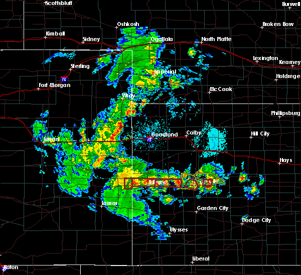 At 506 pm cdt, a severe thunderstorm capable of producing a tornado was located very near scott city, moving northwest at 20 mph (radar indicated rotation). Hazards include tornado and half dollar size hail. Flying debris will be dangerous to those caught without shelter. mobile homes will be damaged or destroyed. damage to roofs, windows and vehicles will occur. tree damage is likely. Locations impacted include, scott city. At 506 pm cdt, a severe thunderstorm capable of producing a tornado was located very near scott city, moving northwest at 20 mph (radar indicated rotation). Hazards include tornado and half dollar size hail. Flying debris will be dangerous to those caught without shelter. mobile homes will be damaged or destroyed. damage to roofs, windows and vehicles will occur. tree damage is likely. Locations impacted include, scott city.
|
| 5/27/2016 4:54 PM CDT |
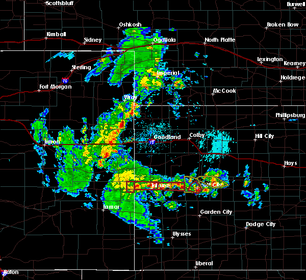 At 454 pm cdt, a severe thunderstorm capable of producing a tornado was located near scott city, moving northwest at 15 mph (radar indicated rotation). Hazards include tornado and ping pong ball size hail. Flying debris will be dangerous to those caught without shelter. mobile homes will be damaged or destroyed. damage to roofs, windows and vehicles will occur. Tree damage is likely. At 454 pm cdt, a severe thunderstorm capable of producing a tornado was located near scott city, moving northwest at 15 mph (radar indicated rotation). Hazards include tornado and ping pong ball size hail. Flying debris will be dangerous to those caught without shelter. mobile homes will be damaged or destroyed. damage to roofs, windows and vehicles will occur. Tree damage is likely.
|
| 5/27/2016 4:48 PM CDT |
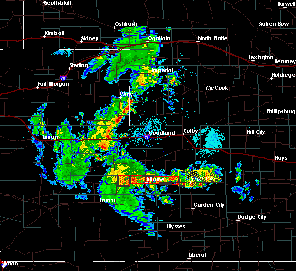 At 448 pm cdt, a severe thunderstorm was located very near scott city, moving northwest at 10 mph (radar indicated). Hazards include 60 mph wind gusts and half dollar size hail. Hail damage to vehicles is expected. expect wind damage to roofs, siding and trees. Locations impacted include, scott city and modoc. At 448 pm cdt, a severe thunderstorm was located very near scott city, moving northwest at 10 mph (radar indicated). Hazards include 60 mph wind gusts and half dollar size hail. Hail damage to vehicles is expected. expect wind damage to roofs, siding and trees. Locations impacted include, scott city and modoc.
|
| 5/27/2016 4:36 PM CDT |
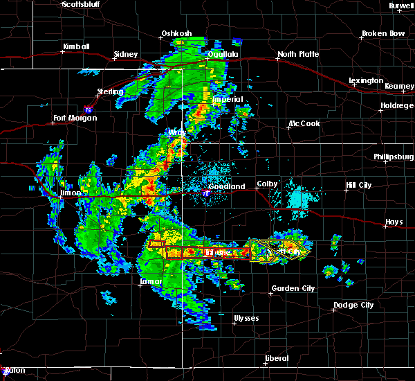 At 436 pm cdt, a severe thunderstorm was located 3 miles southeast of scott city, moving northwest at 20 mph (radar indicated). Hazards include 60 mph wind gusts and half dollar size hail. Hail damage to vehicles is expected. Expect wind damage to roofs, siding and trees. At 436 pm cdt, a severe thunderstorm was located 3 miles southeast of scott city, moving northwest at 20 mph (radar indicated). Hazards include 60 mph wind gusts and half dollar size hail. Hail damage to vehicles is expected. Expect wind damage to roofs, siding and trees.
|
| 5/24/2016 4:11 PM CDT |
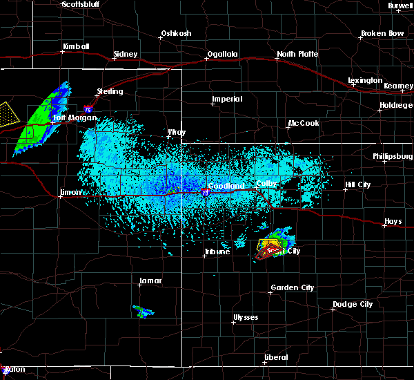 The tornado warning for central scott county will expire at 430 pm cdt, the storm which prompted the warning has moved out of the area. therefore the warning will be allowed to expire. however small. The tornado warning for central scott county will expire at 430 pm cdt, the storm which prompted the warning has moved out of the area. therefore the warning will be allowed to expire. however small.
|
| 5/24/2016 4:09 PM CDT |
 At 425 pm cdt, a severe thunderstorm was located 5 miles south of scott state lake, moving northeast at 20 mph. this is a very dangerous storm (radar indicated). Hazards include three inch hail and 60 mph wind gusts. People and animals outdoors will be severely injured. expect shattered windows, extensive damage to roofs, siding and vehicles. locations impacted include, scott state lake. A tornado watch remains in effect until midnight cdt for west central kansas. At 425 pm cdt, a severe thunderstorm was located 5 miles south of scott state lake, moving northeast at 20 mph. this is a very dangerous storm (radar indicated). Hazards include three inch hail and 60 mph wind gusts. People and animals outdoors will be severely injured. expect shattered windows, extensive damage to roofs, siding and vehicles. locations impacted include, scott state lake. A tornado watch remains in effect until midnight cdt for west central kansas.
|
| 5/22/2016 10:33 PM CDT |
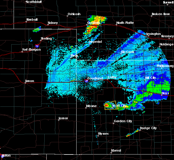 At 1033 pm cdt, a severe thunderstorm was located 3 miles northwest of modoc, moving east at 10 mph (radar indicated). Hazards include ping pong ball size hail and 60 mph wind gusts. People and animals outdoors will be injured. expect hail damage to roofs, siding, windows and vehicles. Expect wind damage to roofs, siding and trees. At 1033 pm cdt, a severe thunderstorm was located 3 miles northwest of modoc, moving east at 10 mph (radar indicated). Hazards include ping pong ball size hail and 60 mph wind gusts. People and animals outdoors will be injured. expect hail damage to roofs, siding, windows and vehicles. Expect wind damage to roofs, siding and trees.
|
| 5/22/2016 9:41 PM CDT |
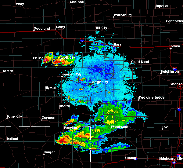 At 941 pm cdt, a severe thunderstorm was located 6 miles south of modoc, moving east at 15 mph (radar indicated). Hazards include ping pong ball size hail and 60 mph wind gusts. People and animals outdoors will be injured. expect hail damage to roofs, siding, windows and vehicles. Expect wind damage to roofs, siding and trees. At 941 pm cdt, a severe thunderstorm was located 6 miles south of modoc, moving east at 15 mph (radar indicated). Hazards include ping pong ball size hail and 60 mph wind gusts. People and animals outdoors will be injured. expect hail damage to roofs, siding, windows and vehicles. Expect wind damage to roofs, siding and trees.
|
| 5/8/2016 4:17 PM CDT |
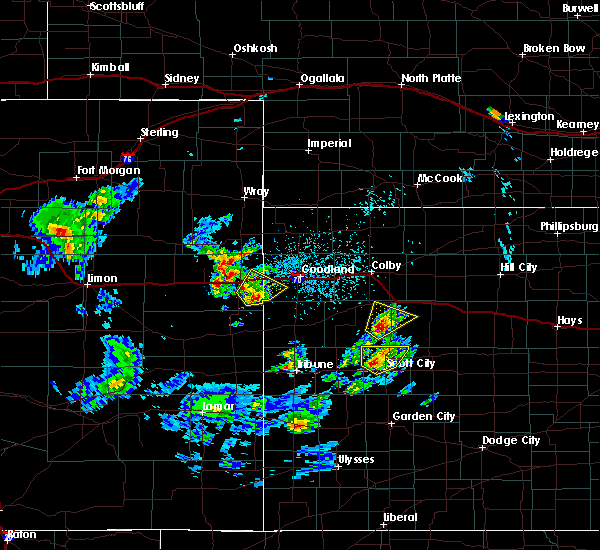 At 417 pm cdt, a severe thunderstorm was located 6 miles northeast of modoc, moving northeast at 35 mph (radar indicated). Hazards include ping pong ball size hail and 60 mph wind gusts. People and animals outdoors will be injured. expect hail damage to roofs, siding, windows and vehicles. Expect wind damage to roofs, siding and trees. At 417 pm cdt, a severe thunderstorm was located 6 miles northeast of modoc, moving northeast at 35 mph (radar indicated). Hazards include ping pong ball size hail and 60 mph wind gusts. People and animals outdoors will be injured. expect hail damage to roofs, siding, windows and vehicles. Expect wind damage to roofs, siding and trees.
|
| 5/7/2016 7:26 PM CDT |
 At 726 pm cdt, a severe thunderstorm was located 5 miles east of shallow water, moving northeast at 40 mph (radar indicated). Hazards include half dollar size hail. Damage to vehicles is expected. Locations impacted include, scott city, shallow water, grigston and manning. At 726 pm cdt, a severe thunderstorm was located 5 miles east of shallow water, moving northeast at 40 mph (radar indicated). Hazards include half dollar size hail. Damage to vehicles is expected. Locations impacted include, scott city, shallow water, grigston and manning.
|
| 5/7/2016 7:19 PM CDT |
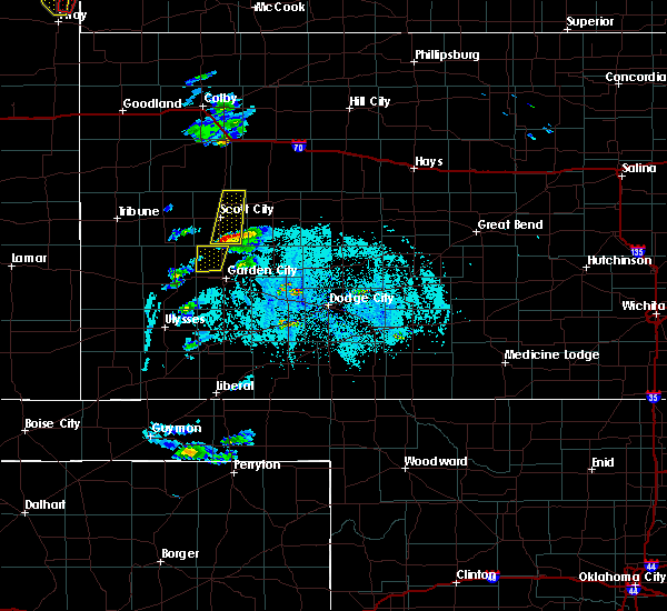 At 719 pm cdt, a severe thunderstorm was located 3 miles northeast of friend, moving north at 45 mph (radar indicated). Hazards include quarter size hail. damage to vehicles is expected At 719 pm cdt, a severe thunderstorm was located 3 miles northeast of friend, moving north at 45 mph (radar indicated). Hazards include quarter size hail. damage to vehicles is expected
|
| 11/16/2015 7:54 PM CST |
 The severe thunderstorm warning for northwestern finney, southeastern kearny, central scott, northwestern lane and north central grant counties will expire at 800 pm cst, the line of storms which prompted the warning have weakened below severe limits, and no longer pose an immediate threat to life or property. therefore the warning will be allowed to expire. however gusty winds are still possible with these thunderstorms. a tornado watch remains in effect until 900 pm cst for southwestern kansas. The severe thunderstorm warning for northwestern finney, southeastern kearny, central scott, northwestern lane and north central grant counties will expire at 800 pm cst, the line of storms which prompted the warning have weakened below severe limits, and no longer pose an immediate threat to life or property. therefore the warning will be allowed to expire. however gusty winds are still possible with these thunderstorms. a tornado watch remains in effect until 900 pm cst for southwestern kansas.
|
| 11/16/2015 7:41 PM CST |
 At 741 pm cst, severe thunderstorms were located along a line extending from 3 miles west of friend to 8 miles south of big bow, moving south at 55 mph (radar indicated). Hazards include 60 mph wind gusts and quarter size hail. Hail damage to vehicles is expected. expect wind damage to roofs, siding and trees. locations impacted include, scott city, lakin, deerfield, shallow water, manning, healy, friend and grigston. A tornado watch remains in effect until 900 pm cst for southwestern kansas. At 741 pm cst, severe thunderstorms were located along a line extending from 3 miles west of friend to 8 miles south of big bow, moving south at 55 mph (radar indicated). Hazards include 60 mph wind gusts and quarter size hail. Hail damage to vehicles is expected. expect wind damage to roofs, siding and trees. locations impacted include, scott city, lakin, deerfield, shallow water, manning, healy, friend and grigston. A tornado watch remains in effect until 900 pm cst for southwestern kansas.
|
| 11/16/2015 7:24 PM CST |
 At 723 pm cst, severe thunderstorms were located along a line extending from near scott city to 6 miles northwest of ulysses, moving northeast at 40 mph (radar indicated). Hazards include 60 mph wind gusts and quarter size hail. Hail damage to vehicles is expected. expect wind damage to roofs, siding and trees. locations impacted include, scott city, lakin, deerfield, modoc, shallow water, manning, healy, scott state lake, friend and grigston. A tornado watch remains in effect until 900 pm cst for southwestern kansas. At 723 pm cst, severe thunderstorms were located along a line extending from near scott city to 6 miles northwest of ulysses, moving northeast at 40 mph (radar indicated). Hazards include 60 mph wind gusts and quarter size hail. Hail damage to vehicles is expected. expect wind damage to roofs, siding and trees. locations impacted include, scott city, lakin, deerfield, modoc, shallow water, manning, healy, scott state lake, friend and grigston. A tornado watch remains in effect until 900 pm cst for southwestern kansas.
|
| 11/16/2015 7:13 PM CST |
 At 713 pm cst/613 pm mst/, severe thunderstorms were located along a line extending from 7 miles southwest of scott state lake to 12 miles north of ulysses, moving northeast at 40 mph (radar indicated). Hazards include 60 mph wind gusts and quarter size hail. Hail damage to vehicles is expected. expect wind damage to roofs, siding and trees. locations impacted include, scott city, lakin, deerfield, kendall, modoc, shallow water, manning, healy, scott state lake, friend and grigston. A tornado watch remains in effect until 900 pm cst/800 pm mst/ for southwestern kansas. At 713 pm cst/613 pm mst/, severe thunderstorms were located along a line extending from 7 miles southwest of scott state lake to 12 miles north of ulysses, moving northeast at 40 mph (radar indicated). Hazards include 60 mph wind gusts and quarter size hail. Hail damage to vehicles is expected. expect wind damage to roofs, siding and trees. locations impacted include, scott city, lakin, deerfield, kendall, modoc, shallow water, manning, healy, scott state lake, friend and grigston. A tornado watch remains in effect until 900 pm cst/800 pm mst/ for southwestern kansas.
|
| 11/16/2015 6:56 PM CST |
 At 655 pm cst/555 pm mst/, severe thunderstorms were located along a line extending from 7 miles southwest of grinnell to 6 miles northeast of kendall, moving northeast at 40 mph (radar indicated). Hazards include 60 mph wind gusts and quarter size hail. Hail damage to vehicles is expected. Expect wind damage to roofs, siding and trees. At 655 pm cst/555 pm mst/, severe thunderstorms were located along a line extending from 7 miles southwest of grinnell to 6 miles northeast of kendall, moving northeast at 40 mph (radar indicated). Hazards include 60 mph wind gusts and quarter size hail. Hail damage to vehicles is expected. Expect wind damage to roofs, siding and trees.
|
| 11/16/2015 6:36 PM CST |
 At 635 pm cst, severe thunderstorms were located along a line extending from 5 miles north of scott state lake to 5 miles southeast of lydia, moving northeast at 45 mph (radar indicated). Hazards include 60 mph wind gusts and quarter size hail. Hail damage to vehicles is expected. expect wind damage to roofs, siding and trees. locations impacted include, scott city, scott state lake and modoc. a tornado watch remains in effect until 900 pm cst for west central kansas. Time, mot, loc 0035z 031deg 115kt 3876 10091 3822 10123. At 635 pm cst, severe thunderstorms were located along a line extending from 5 miles north of scott state lake to 5 miles southeast of lydia, moving northeast at 45 mph (radar indicated). Hazards include 60 mph wind gusts and quarter size hail. Hail damage to vehicles is expected. expect wind damage to roofs, siding and trees. locations impacted include, scott city, scott state lake and modoc. a tornado watch remains in effect until 900 pm cst for west central kansas. Time, mot, loc 0035z 031deg 115kt 3876 10091 3822 10123.
|
| 11/16/2015 5:59 PM CST |
 At 559 pm cst, severe thunderstorms were located along a line extending from 9 miles west of scott state lake to 5 miles north of lakin, moving northeast at 40 mph (radar indicated). Hazards include 60 mph wind gusts and half dollar size hail. Hail damage to vehicles is expected. Expect wind damage to roofs, siding and trees. At 559 pm cst, severe thunderstorms were located along a line extending from 9 miles west of scott state lake to 5 miles north of lakin, moving northeast at 40 mph (radar indicated). Hazards include 60 mph wind gusts and half dollar size hail. Hail damage to vehicles is expected. Expect wind damage to roofs, siding and trees.
|
| 11/16/2015 5:54 PM CST |
 At 554 pm cst, a severe thunderstorm was located near grigston, moving northeast at 35 mph (radar indicated). Hazards include 60 mph wind gusts and quarter size hail. Hail damage to vehicles is expected. Expect wind damage to roofs, siding and trees. At 554 pm cst, a severe thunderstorm was located near grigston, moving northeast at 35 mph (radar indicated). Hazards include 60 mph wind gusts and quarter size hail. Hail damage to vehicles is expected. Expect wind damage to roofs, siding and trees.
|
| 11/16/2015 4:17 PM CST | Quarter sized hail reported 6.6 miles SE of Scott City, KS |
| 11/16/2015 3:57 PM CST |
 At 356 pm cst, a severe thunderstorm was located 8 miles south of modoc, moving northeast at 60 mph (radar indicated). Hazards include 60 mph wind gusts and half dollar size hail. Hail damage to vehicles is expected. Expect wind damage to roofs, siding and trees. At 356 pm cst, a severe thunderstorm was located 8 miles south of modoc, moving northeast at 60 mph (radar indicated). Hazards include 60 mph wind gusts and half dollar size hail. Hail damage to vehicles is expected. Expect wind damage to roofs, siding and trees.
|
| 7/26/2015 10:36 PM CDT |
 The severe thunderstorm warning for northern finney, lane and southeastern scott counties will expire at 1045 pm cdt, the storm which prompted the warning has weakened below severe limits, and no longer pose an immediate threat to life or property. therefore the warning will be allowed to expire. however gusty winds are still possible with this thunderstorm. The severe thunderstorm warning for northern finney, lane and southeastern scott counties will expire at 1045 pm cdt, the storm which prompted the warning has weakened below severe limits, and no longer pose an immediate threat to life or property. therefore the warning will be allowed to expire. however gusty winds are still possible with this thunderstorm.
|
| 7/26/2015 10:07 PM CDT |
 At 1006 pm cdt, a severe thunderstorm was located 13 miles south of dighton, moving southeast at 50 mph (radar indicated). Hazards include 70 mph wind gusts and penny size hail. Expect considerable tree damage. damage is likely to mobile homes, roofs and outbuildings. Locations impacted include, scott city, dighton, alamota, amy, shallow water, friend, grigston and manning. At 1006 pm cdt, a severe thunderstorm was located 13 miles south of dighton, moving southeast at 50 mph (radar indicated). Hazards include 70 mph wind gusts and penny size hail. Expect considerable tree damage. damage is likely to mobile homes, roofs and outbuildings. Locations impacted include, scott city, dighton, alamota, amy, shallow water, friend, grigston and manning.
|
| 7/26/2015 9:47 PM CDT |
 At 947 pm cdt, a severe thunderstorm was located 3 miles south of shallow water, moving east at 35 mph (radar indicated). Hazards include 70 mph wind gusts and penny size hail. Expect considerable tree damage. Damage is likely to mobile homes, roofs and outbuildings. At 947 pm cdt, a severe thunderstorm was located 3 miles south of shallow water, moving east at 35 mph (radar indicated). Hazards include 70 mph wind gusts and penny size hail. Expect considerable tree damage. Damage is likely to mobile homes, roofs and outbuildings.
|
| 7/19/2015 10:10 PM CDT |
 The severe thunderstorm warning for north central finney, lane and scott counties will expire at 1015 pm cdt, a new severe thunderstorm warning was issued for eastern scott county, which is in effect until 1100 pm. gusty winds to 55 mph can still be expected across the remainder of scott county, north central finney county, and lane county. The severe thunderstorm warning for north central finney, lane and scott counties will expire at 1015 pm cdt, a new severe thunderstorm warning was issued for eastern scott county, which is in effect until 1100 pm. gusty winds to 55 mph can still be expected across the remainder of scott county, north central finney county, and lane county.
|
| 7/19/2015 9:47 PM CDT | Storm damage reported in scott county KS, 15.7 miles NNW of Scott City, KS |
| 7/19/2015 9:15 PM CDT |
 At 915 pm cdt, severe thunderstorms were located along a line extending from 3 miles southeast of modoc to 3 miles east of shallow water to 4 miles southeast of friend, moving northeast at 45 mph (radar indicated). Hazards include 70 mph wind gusts and nickel size hail. Expect considerable tree damage. Damage is likely to mobile homes, roofs and outbuildings. At 915 pm cdt, severe thunderstorms were located along a line extending from 3 miles southeast of modoc to 3 miles east of shallow water to 4 miles southeast of friend, moving northeast at 45 mph (radar indicated). Hazards include 70 mph wind gusts and nickel size hail. Expect considerable tree damage. Damage is likely to mobile homes, roofs and outbuildings.
|
| 7/19/2015 2:09 AM CDT |
 The severe thunderstorm warning for northwestern lane and scott counties will expire at 215 am cdt, the severe thunderstorm which prompted the warning has weakened. therefore the warning will be allowed to expire. however small. The severe thunderstorm warning for northwestern lane and scott counties will expire at 215 am cdt, the severe thunderstorm which prompted the warning has weakened. therefore the warning will be allowed to expire. however small.
|
| 7/19/2015 1:40 AM CDT |
 At 140 am cdt, a severe thunderstorm was located 5 miles west of manning, moving east at 15 mph (radar indicated). Hazards include 60 mph wind gusts and penny size hail. Expect damage to roofs. siding and trees. Locations impacted include, scott city, scott state lake, modoc, grigston, manning and healy. At 140 am cdt, a severe thunderstorm was located 5 miles west of manning, moving east at 15 mph (radar indicated). Hazards include 60 mph wind gusts and penny size hail. Expect damage to roofs. siding and trees. Locations impacted include, scott city, scott state lake, modoc, grigston, manning and healy.
|
| 7/19/2015 1:09 AM CDT |
 At 109 am cdt, a severe thunderstorm was located 7 miles northeast of modoc, moving east at 35 mph (radar indicated). Hazards include 60 mph wind gusts and penny size hail. Expect damage to roofs. Siding and trees. At 109 am cdt, a severe thunderstorm was located 7 miles northeast of modoc, moving east at 35 mph (radar indicated). Hazards include 60 mph wind gusts and penny size hail. Expect damage to roofs. Siding and trees.
|
| 7/14/2015 11:14 PM CDT |
 At 1113 pm cdt, a severe thunderstorm was located 3 miles south of scott city, moving northeast at 30 mph (radar indicated). Hazards include 60 mph wind gusts and quarter size hail. Hail damage to vehicles is expected. Expect wind damage to roofs, siding and trees. At 1113 pm cdt, a severe thunderstorm was located 3 miles south of scott city, moving northeast at 30 mph (radar indicated). Hazards include 60 mph wind gusts and quarter size hail. Hail damage to vehicles is expected. Expect wind damage to roofs, siding and trees.
|
| 6/26/2015 1:22 AM CDT |
 At 121 am cdt /1221 am mdt/, a severe thunderstorm was located 9 miles west of friend, moving southeast at 30 mph (radar indicated). Hazards include 70 mph wind gusts and quarter size hail. Hail damage to vehicles is expected. expect considerable tree damage. wind damage is also likely to mobile homes, roofs and outbuildings. Locations impacted include, scott city, scott state lake, modoc, friend and shallow water. At 121 am cdt /1221 am mdt/, a severe thunderstorm was located 9 miles west of friend, moving southeast at 30 mph (radar indicated). Hazards include 70 mph wind gusts and quarter size hail. Hail damage to vehicles is expected. expect considerable tree damage. wind damage is also likely to mobile homes, roofs and outbuildings. Locations impacted include, scott city, scott state lake, modoc, friend and shallow water.
|
| 6/26/2015 1:05 AM CDT |
 At 104 am cdt /1204 am mdt/, a severe thunderstorm was located 3 miles southwest of modoc, moving southeast at 30 mph (radar indicated). Hazards include 70 mph wind gusts and quarter size hail. Hail damage to vehicles is expected. expect considerable tree damage. Wind damage is also likely to mobile homes, roofs and outbuildings. At 104 am cdt /1204 am mdt/, a severe thunderstorm was located 3 miles southwest of modoc, moving southeast at 30 mph (radar indicated). Hazards include 70 mph wind gusts and quarter size hail. Hail damage to vehicles is expected. expect considerable tree damage. Wind damage is also likely to mobile homes, roofs and outbuildings.
|
| 5/28/2015 5:30 PM CDT | At 529 pm cdt, a severe thunderstorm was located 5 miles east of shallow water, moving east at 15 mph (radar indicated). Hazards include 60 mph wind gusts and quarter size hail. Hail damage to vehicles is expected. expect wind damage to roofs, siding and trees. Locations impacted include, scott city, friend, shallow water, grigston, manning and healy. |
| 5/28/2015 5:21 PM CDT | Storm damage reported in scott county KS, 10.1 miles WNW of Scott City, KS |
| 5/28/2015 5:20 PM CDT | Measured wind gust report relayed by the lane county dispatc in scott county KS, 9.2 miles NW of Scott City, KS |
| 5/28/2015 5:13 PM CDT | The severe thunderstorm warning for scott county will expire at 515 pm cdt, the storm which prompted the warning has moved out of the area. therefore the warning will be allowed to expire. however small. |
| 5/28/2015 5:12 PM CDT | At 512 pm cdt, a severe thunderstorm was located near shallow water, moving east at 15 mph (radar indicated). Hazards include 60 mph wind gusts and quarter size hail. Hail damage to vehicles is expected. Expect wind damage to roofs, siding and trees. |
| 5/28/2015 5:10 PM CDT | Quarter sized hail reported 13.9 miles NE of Scott City, KS |
| 5/28/2015 4:47 PM CDT | At 447 pm cdt, a severe thunderstorm was located 6 miles south of modoc, moving east at 30 mph (radar indicated). Hazards include ping pong ball size hail and 60 mph wind gusts. People and animals outdoors will be injured. expect hail damage to roofs, siding, windows and vehicles. expect wind damage to roofs, siding and trees. Locations impacted include, scott city, modoc and shallow water. |
| 5/28/2015 4:28 PM CDT | At 428 pm cdt, a severe thunderstorm was located 6 miles south of marienthal, moving east at 30 mph (radar indicated). Hazards include ping pong ball size hail and 60 mph wind gusts. People and animals outdoors will be injured. expect hail damage to roofs, siding, windows and vehicles. Expect wind damage to roofs, siding and trees. |
| 5/27/2015 6:27 PM CDT | At 627 pm cdt, a severe thunderstorm was located 6 miles south of modoc, moving east at 20 mph (radar indicated). Hazards include two inch hail and 60 mph wind gusts. People and animals outdoors will be injured. expect hail damage to roofs, siding, windows and vehicles. Expect wind damage to roofs, siding and trees. |
| 5/27/2015 6:06 PM CDT | At 606 pm cdt, a severe thunderstorm was located 5 miles southeast of scott city, moving east at 15 mph (radar indicated). Hazards include golf ball size hail. People and animals outdoors will be injured. Expect damage to roofs, siding, windows and vehicles. |
| 5/27/2015 3:26 PM CDT | The severe thunderstorm warning for northwestern finney and scott counties will expire at 330 pm cdt, the storm which prompted the warning has weakened below severe limits, and no longer pose an immediate threat to life or property. therefore the warning will be allowed to expire. however small. |
| 5/27/2015 3:03 PM CDT | At 302 pm cdt, a severe thunderstorm was located 3 miles south of shallow water, moving northeast at 15 mph (radar indicated). Hazards include 60 mph wind gusts and half dollar size hail. Hail damage to vehicles is expected. expect wind damage to roofs, siding and trees. locations impacted include, scott city, modoc, friend, shallow water, grigston and manning. A tornado watch remains in effect until 1000 pm cdt for southwestern kansas. |
| 5/27/2015 2:58 PM CDT | Quarter sized hail reported 15.1 miles N of Scott City, KS |
| 5/27/2015 2:42 PM CDT | At 242 pm cdt, a severe thunderstorm was located 3 miles southwest of friend, moving north at 30 mph (radar indicated). Hazards include 60 mph wind gusts and half dollar size hail. Hail damage to vehicles is expected. Expect wind damage to roofs, siding and trees. |
| 4/24/2015 6:23 PM CDT | The severe thunderstorm warning for southern scott county will expire at 630 pm cdt, the storm which prompted the warning has weakened below severe limits, and no longer pose an immediate threat to life or property. therefore the warning will be allowed to expire. however small. |
| 4/24/2015 5:44 PM CDT | At 544 pm cdt, a severe thunderstorm was located 4 miles northwest of shallow water, moving east at 15 mph (radar indicated). Hazards include 60 mph wind gusts and quarter size hail. Hail damage to vehicles is expected. Expect wind damage to roofs, siding and trees. |
| 4/2/2015 8:20 PM CST | Storm damage reported in scott county KS, 9.5 miles W of Scott City, KS |
| 4/2/2015 9:03 PM CDT | A severe thunderstorm warning remains in effect until 945 pm cdt for northwestern lane and scott counties. at 902 pm cdt. a severe thunderstorm was located near scott state lake. moving east at 45 mph. hazard. 60 mph wind gusts and quarter size hail. source. Radar indicated. |
| 4/2/2015 8:00 PM CST | The wind was just ahead of the thunderstor in scott county KS, 3.5 miles E of Scott City, KS |
| 4/2/2015 8:49 PM CDT | The national weather service in dodge city has issued a * severe thunderstorm warning for. northwestern lane county in west central kansas. scott county in west central kansas. until 945 pm cdt * at 848 pm cdt. A severe thunderstorm was located 7 miles north of. |
| 9/9/2014 8:07 PM CDT | 10 inch tree limbs down from strong thunderstorm wind in scott county KS, 9.7 miles NW of Scott City, KS |
| 8/22/2014 5:20 PM CDT | Storm damage reported in scott county KS, 0.2 miles ESE of Scott City, KS |
| 8/22/2014 4:55 PM CDT | Storm damage reported in finney county KS, 15.8 miles N of Scott City, KS |
| 8/22/2014 4:50 PM CDT | The gust was measured from a davis weather instrument in scott county KS, 14.4 miles N of Scott City, KS |
| 7/21/2014 7:23 PM CDT | Ping Pong Ball sized hail reported 8.2 miles N of Scott City, KS |
| 7/21/2014 7:23 PM CDT | The report was estimated 60 to 70 mph gus in scott county KS, 8.2 miles N of Scott City, KS |
| 6/27/2014 10:45 PM CDT | A cattle truck was blown into the ditch. location is approximat in scott county KS, 5.5 miles N of Scott City, KS |
| 6/22/2014 7:25 PM CDT | Golf Ball sized hail reported 12.7 miles NNE of Scott City, KS |
| 6/11/2014 8:30 PM CDT | Storm damage reported in scott county KS, 0.2 miles ESE of Scott City, KS |
| 6/1/2014 4:35 PM CDT | Quarter sized hail reported 12.8 miles SSE of Scott City, KS |
| 7/31/2013 3:40 PM CDT | Quarter sized hail reported 7.5 miles N of Scott City, KS |
| 7/31/2013 3:26 PM CDT | Quarter sized hail reported 0.2 miles ESE of Scott City, KS |
| 7/31/2013 3:12 PM CDT | Quarter sized hail reported 4.2 miles S of Scott City, KS, quarter sized hail and 50 to 60 mph winds |
| 7/10/2013 8:05 PM CDT | Hen Egg sized hail reported 9.7 miles SW of Scott City, KS |
| 7/10/2013 7:58 PM CDT | Quarter sized hail reported 15.8 miles SSW of Scott City, KS |
| 7/10/2013 7:55 PM CDT | Quarter sized hail reported 14.8 miles SW of Scott City, KS, most of the hail was nickel-size. |
| 6/7/2013 5:42 PM CDT | Quarter sized hail reported 9.8 miles NW of Scott City, KS |
| 5/29/2013 7:10 PM CDT | Quarter sized hail reported 10.9 miles WSW of Scott City, KS, very heavy rain also was reported. |
| 5/29/2013 3:50 PM CDT | Hen Egg sized hail reported 5.3 miles ESE of Scott City, KS |
| 5/29/2013 3:30 PM CDT | Ping Pong Ball sized hail reported 11.7 miles NE of Scott City, KS, the hail varied from pea size to ping pong size. |
| 5/29/2013 2:54 PM CDT | Quarter sized hail reported 6.6 miles SE of Scott City, KS |
| 5/8/2013 6:53 PM CDT | Storm damage reported in scott county KS, 3.5 miles E of Scott City, KS |
| 6/14/2012 7:20 PM CDT | Quarter sized hail reported 16 miles SE of Scott City, KS |
| 6/14/2012 7:18 PM CDT | Quarter sized hail reported 16 miles SE of Scott City, KS |
| 5/30/2012 6:27 PM CDT | Golf Ball sized hail reported 12.5 miles S of Scott City, KS |
| 5/30/2012 6:15 PM CDT | Half Dollar sized hail reported 10.5 miles SE of Scott City, KS |
| 10/7/2011 9:15 PM CDT | Quarter sized hail reported 11.7 miles NE of Scott City, KS |
| 1/1/0001 12:00 AM | Storm damage reported in scott county KS, 9.5 miles W of Scott City, KS |
| 10/7/2011 6:40 PM CDT | Quarter sized hail reported 15.1 miles N of Scott City, KS |
| 1/1/0001 12:00 AM | Hen Egg sized hail reported 0.2 miles ESE of Scott City, KS |
| 1/1/0001 12:00 AM | Golf Ball sized hail reported 0.2 miles ESE of Scott City, KS |
| 1/1/0001 12:00 AM | Golf Ball sized hail reported 0.2 miles ESE of Scott City, KS, a mix of quarters and a few golf ball size hail. |
| 1/1/0001 12:00 AM | Quarter sized hail reported 0.2 miles ESE of Scott City, KS |
| 1/1/0001 12:00 AM | Half Dollar sized hail reported 0.2 miles ESE of Scott City, KS |
| 1/1/0001 12:00 AM | A wind gust of 65 mph was reported by a davis weather instrument one mile of west of scott cit in scott county KS, 1.3 miles E of Scott City, KS |
| 1/1/0001 12:00 AM | Storm damage reported in scott county KS, 0.2 miles ESE of Scott City, KS |
| 1/1/0001 12:00 AM | Storm damage reported in scott county KS, 0.2 miles ESE of Scott City, KS |
| 1/1/0001 12:00 AM | Storm damage reported in scott county KS, 0.2 miles ESE of Scott City, KS |
| 1/1/0001 12:00 AM | Quarter sized hail reported 10.5 miles SW of Scott City, KS |
| 1/1/0001 12:00 AM | Ping Pong Ball sized hail reported 13.9 miles S of Scott City, KS, hail covered the ground. |
| 1/1/0001 12:00 AM | Quarter sized hail reported 15.1 miles NNE of Scott City, KS, hail lasted 20 minutes. |
Hail Maps for Scott City, KS

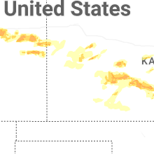
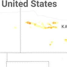
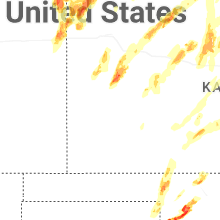
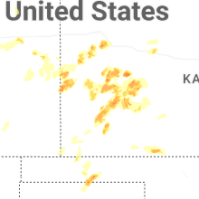


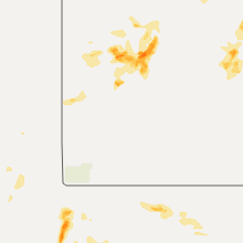


Connect with Interactive Hail Maps